Jeff Mitchell's Blog, page 11
December 15, 2022
Hike the Eiger/Log Slide Loop-Pine Creek Gorge
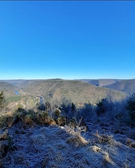 Bull Run Vista, Pine Creek Gorge, Tiadaghton State Forest
Length: Approx. 3.5 miles
Parking: At the Tiadaghton State Forest district headquarters, 41.314481, -77.384649. Do not park along Lower Pine Bottom Road as there is no space.
Highlights: Beautiful view, old quarries, ledges, mountain laurel, historic log slide.
Issues: The climb is steep in sections.
Level of Challenge: Moderate to difficult
Trail conditions: Trails were in good condition.
Blazes: Lower Pine Trail is red, remainder of trails are yellow.
Description: The Pine Creek Gorge in the Tiadaghton State Forest is home to many hiking trails and this is one that should be on your list. Park at the forest headquarters which has its own views and wildflower meadows. If the building is open, be sure to check it out to see the displays and a balcony with a green roof and more views.
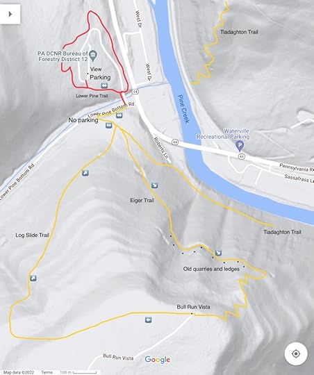
The red Lower Pine Trail begins at the end of the parking area and descends in a pine forest. Reach Lower Pine Bottom Run with a small cascade and hike the edge of the giant arched concrete culvert. Reach Lower Pine Bottom Road and turn right. Hike up the road a short distance. Turn left at a trail sign, which calls the Eiger Trail the “Quadfather”, you’ll soon see why. Hike behind a cabin and reach the beginning of the loop, continue on the Eiger Trail as it follows an old grade through laurel. The grade steepens as it climbs the flank of the mountain. Begin to pass old quarries and ledges.
The trail eases as it follows the grade along the steep slope of the mountain. I liked this part as the trail offered such forgiving tread across steep terrain. The forested slopes just fall away. Reach a large quarry and more ledges. The ledges continue before the trail begins a series of well built switchbacks up through the laurel.
Finally, the trail levels off at the top and you soon reach Bull Run Vista, an impressive view of the Pine Creek Gorge. The vast plateau is incised with many gorges and glens. Pine Creek is about 1,200 feet below.
Now begin the Log Slide Trail through mountain laurel. This trail would be beautiful in late June when the laurel blooms. The trail then begins its descent on an old log slide, which is somewhat gradual. Hike through groves of hemlocks with moss. Pass an old stone retaining wall for the slide. Reach the end of the loop and retrace your steps. The Log Slide Trail is easier than Eiger, but both are worth hiking.
More photos:
View this post on InstagramA post shared by Jeff Mitchell-Outdoors Author (@hiking_mitch)
View this post on InstagramA post shared by Jeff Mitchell-Outdoors Author (@hiking_mitch)
View this post on InstagramA post shared by Jeff Mitchell-Outdoors Author (@hiking_mitch)
View this post on InstagramA post shared by Jeff Mitchell-Outdoors Author (@hiking_mitch)
December 13, 2022
Hike to Gamble Run Falls and Vista-Tiadaghton State Forest
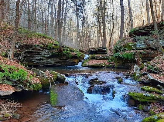 Gamble Run Falls
Length: Approx. 6-7 miles in total to the falls and vista.
Blazes: Mid State Trail is orange, Gamble Run Trail is red.
Parking: Small lot at 41.242016, -77.334424.
Trail conditions: Good. Trails are well blazed and easy to follow.
Highlights: Cascades, small falls, pools, streamside hiking, hemlocks, vista, beautiful gorges.
Issues: Hike up to the vista is steep and rugged.
Level of challenge: Easy to difficult
Description: I really enjoyed this hike and look forward to returning. It is yet another gem in the Pine Creek Gorge region. This is an out and back hike to both the falls and vista. Part of this hike follows the Mid State Trail (MST) the longest trail in the state and a part of the Great Eastern Trail, which goes from Alabama to New York.
From the parking area, hike up and around the meadow with some nice views on the Gamble Run Trail. Expect wildflowers in summer. This meadow really reminded me of the Appalachian Trail in Virginia during my thruhike this year. Drop down and follow an old grade. At first it is well above the creek, but it gradually comes closer. Along the way, the MST joins. Gamble Run nears the trail and it is adorned with cascades and pools of clear water. There is moss, ferns and hemlocks. The cascading water accompanies the trail as you gradually hike up.
Reach Schultz Fork where the MST turns right and begins the climb. Here, Gamble Run has a beautiful slide and deep pool. This is a gorgeous spot. Continue on the red Gamble Run Trail into the scenic gorge. The cascades, ferns, and moss provide the scenery. Up ahead you’ll notice a large ledge with a deep pool; the creek slides through a narrow chasm. This is Gamble Run Falls. Not more than ten feet tall, it is quite beautiful as the water has sculpted the bedrock. While the Gamble Run Trail continues, turn around here and return to the MST at Schultz Fork.
Now begins the climb into this rugged gorge. Schultz Fork is seasonal, but has a variety of beautiful cascades and small waterfalls when flowing. Seeing and hearing the water eases the climb. The trail steepens and moves from the creek. Reach the heart of the rugged gorge where two branches meet and a cliff looms on the other side. The MST turns left and makes a final climb; if the trees are bare, the rugged gorge spreads before you.
The MST makes a sharp right turn. Here, look for faded blue blazes on the left. Follow this trail a few hundred feet through the laurel and reach beautiful Gamble Run Vista (or Schultz Fork Vista) from a ledge. Overlook the deep gorges and tiers of ridges with no signs of development or traffic. It is a glorious window into the wilderness and well worth the climb to see a view most hikers probably miss. This is an ideal sunrise vista. Hidden gems like this vista make hiking so rewarding and underscore the beauty of the MST. From here, retrace your steps to the parking area.
Cascades, falls, pools, moss, ferns, hemlocks, meadows, and a wilderness vista, what more do you want on a hike?
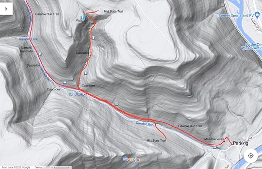 This map is for general directional purposes only, it is not a GPS track.
More photos:
View this post on InstagramA post shared by Jeff Mitchell-Outdoors Author (@hiking_mitch)
View this post on InstagramA post shared by Jeff Mitchell-Outdoors Author (@hiking_mitch)
View this post on InstagramA post shared by Jeff Mitchell-Outdoors Author (@hiking_mitch)
View this post on InstagramA post shared by Jeff Mitchell-Outdoors Author (@hiking_mitch)
December 11, 2022
Backpacking the Red Run/Mosquito Creek Loop-Quehanna Wild Area
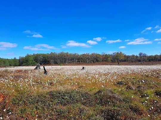 Cottongrass superbloom in late September. Quehanna Wild Area.
Length: About 17 miles.
Parking: Large parking area at Beaver Run Dam, 41.261312, -78.257948.
Blazes: Quehanna Trail is orange, other trails are yellow. South of Quehanna Highway, Red Run Trail might be red (can’t remember!)
Level of Challenge: Easy to moderate
Highlights: Isolation, cascades, beautiful streams, diverse forests, large rocks, views, vast meadows, beaver dams, chance to see elk, good camping.
Issues: Stinging nettle in a few places, particularly Porcupine Draft, wet and muddy areas, creek crossings in high water. Need to navigate a variety of trails. Many trail junctures have signs.
Description: I love the Quehanna Wild Area. It is one of my favorite places to backpack and hike with its views, streams, meadows and isolation. Its web of trails offers so many route options and it provides great scenery without punishing terrain. Go there, you won’t regret it.
This is a great loop for an overnight backpack or a long dayhike for those looking for a challenge. This description begins from the Beaver Run Dam parking area and is clockwise. Follow the yellow trail on the east end of the parking area, pass a meadow and cross the Quehanna Highway. Reach a great vista and descend; watch for a left hand turn at the forest clearing, it is easy to go straight. Descend to Paige Run, a gorgeous creek with cascades, giant boulders, hemlocks and rhododendrons. Cross the creek and make a short climb. Turn left onto the Teaberry Connector with meadows and then turn right onto the East Cross Connector (ECC) as it meanders through laurel and hardwoods. Reach a forest road and follow it to the right.
Turn right onto the Quehanna Trail (QT) as it descends into the steep gorge of Porcupine Draft, which is notorious for nettle in summer. Yet, the gorge is scenic with some large boulders and nice cascades. Turn right onto Red Run Road and follow it. The QT crosses Red Run over a bridge. The scenery is beautiful. Hike up near the creek with hemlocks and rhododendron. You will also see some campsites. The trail veers up Sanders Draft, a highlight with its large cascades and pools. It is beautiful. Enjoy this section.
At the top is a nice campsite. Turn right onto the yellow Sanders Trail. This section is blazed sufficiently, but you must pay attention to turns as there are other interconnecting trails. I enjoyed the forest isolation of this section and the beautiful hemlocks. There are wet areas. Cross a powerline and enjoy more scenic woods dotted with hemlocks. Reach a meadow and a pipeline swath, which can serve as a campsite. The stars are amazing.
Continue as the trail threads along meadows and streams. Enter a pine forest and pass another campsite. Reach Lincoln Road and a small trailhead. Turn right and then left onto the connector trail to the Quehanna Highway. Now follow the Red Run Trail as it explores a large hardwood forest with ferns everywhere, an amazing sight in autumn. Turn right onto the Ralph Seeley Trail. I loved this trail with its assortment of meadows, streams and hemlocks. Turn left onto the ECC and hike along Meeker Run with a great campsite under hemlocks. There are some cascades just off the trail.
Turn right, leave the ECC, and climb to beautiful Crawford Vista as it overlooks the Mosquito Creek gorge. Make a sharp left onto the Mosquito Creek Trail, which can be easy miss. Descend to Mosquito Creek with a campsite and hike along the creek, following the Bridge Trail. There are rapids and giant boulders across the creek. Climb and cross the vast meadows. If hiking in September, look off to your right for the superbloom of cottongrass, there are plains of white.
Return to the ECC and turn left, crossing more meadows and views while hiking above Beaver Run. This area resembles Dolly Sods in West Virginia. Cross Beaver Run over a bridge (a beaver dam downstream has started to flood the bridge, so expect wet feet). Follow the ECC across meadows and woodlands. Reach the dam of the Beaver Dam impoundment and turn right across the dam, leaving the ECC. Enjoy the views over the water. Pick up a road and follow it back to the parking area.
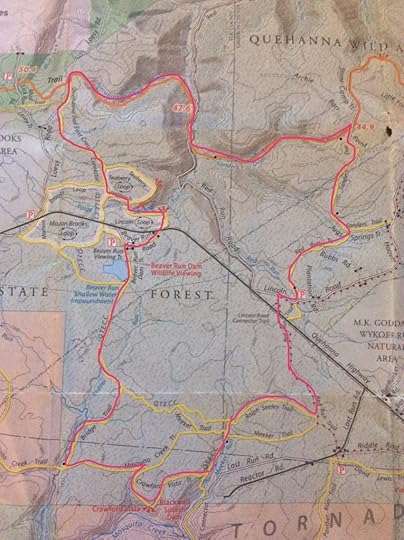 Route is the pink/red line. Description is clockwise from the Beaver Run Dam parking area. Black dots are campsites. Blue dots are cascades.
More photos:
View this post on InstagramA post shared by Jeff Mitchell-Outdoors Author (@hiking_mitch)
View this post on InstagramA post shared by Jeff Mitchell-Outdoors Author (@hiking_mitch)
View this post on InstagramA post shared by Jeff Mitchell-Outdoors Author (@hiking_mitch)
View this post on InstagramA post shared by Jeff Mitchell-Outdoors Author (@hiking_mitch)
View this post on InstagramA post shared by Jeff Mitchell-Outdoors Author (@hiking_mitch)
View this post on InstagramA post shared by Jeff Mitchell-Outdoors Author (@hiking_mitch)
View this post on InstagramA post shared by Jeff Mitchell-Outdoors Author (@hiking_mitch)
View this post on InstagramA post shared by Jeff Mitchell-Outdoors Author (@hiking_mitch)
View this post on InstagramA post shared by Jeff Mitchell-Outdoors Author (@hiking_mitch)
View this post on InstagramA post shared by Jeff Mitchell-Outdoors Author (@hiking_mitch)
December 8, 2022
Backpack the Hammersley Wild Area Loop-Susquehannock State Forest
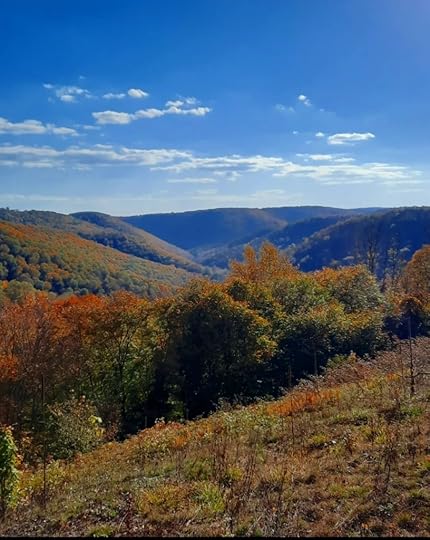 View of Hammersley Canyon from the off trail section. Hammersley Wild Area.
Length: Approx. 16 miles
Parking: Small trailhead at 41.572694, -77.847969 (Twin Sisters Trailhead). The roads were in good shape if driving from Cross Fork.
Blazes: STS is orange, Twin Sisters Trail is yellow, with orange blazes. There is an off trail section.
Trail conditions: Fairly good. STS is in decent condition, Twin Sisters Trail was pretty easy to follow.
Highlights: Isolation, meadows, views, small cascades, streamside hiking, great campsites, Hammersley Pool, vistas. Lots of ferns.
Issues: Off trail section is steep, stream crossings, crossing Hammersley Fork in high water would be dangerous.
Level of challenge: Moderate to difficult
Description: The Hammersley Wild Area is one of the premier wilderness areas in Pennsylvania, covering over 30,000 acres and surrounded by vast state forests. The famed Susquehannock Trail System (STS), an 85 mile loop, traverses the wild area and there are many yellow blazed side trails. By combining the STS and Twin Sisters Trail you can make a loop the explores the beauty of the Hammersley.
To complete this loop, most people use the pipeline swath to the north. But if you are more adventurous and want a more scenic route, I recommend the off trail route as shown on the map. It is a ridgewalk with meadows and great views, but it does get steep as you near the bottom.
From the parking area, head south on the Twin Sisters Trail, it is blazed yellow but there are also orange blazes. It is a scenic trail with hemlocks, large hardwoods, and gradually climbs a ridge. It follows an old grade as it hugs the side of the mountain. You will soon reach the Twin Sisters Vista, aka Hammersley Meadows, large meadows formed by wildfires. These meadows offer superb views.
This is also where the off trail section begins. Simply descend right, or west, along the northern edge of the meadows. Watch for brush or pickers, you may want to stay along the forest line. Soon, fine views begin to unfold from meadows of the Hammersley Canyon. It is a beautiful ridge walk. Pick your way down to Twin Sisters Hollow Run as best you can; it gets steep but there are no ledges or scrambling. The rock underfoot can be loose. Reach the bottom, cross Hammersley Fork, ascend the bank and reach the STS. This off trail trek is shorter and more scenic than the pipeline, it also affords you an opportunity to see the meadows twice on this hike. However, it is also more challenging than the pipeline.
Follow the STS as it accompanies Hammersley Fork; the trail usually stays on a bank above the creek. Cross side streams that often have campsites. Meadows are often along the Hammersley Fork, the forests are mostly hardwoods. Cross the Hammersley Fork without a bridge, expect wet feet; this is dangerous in high water. The trail climbs steeply above the fork and then gradually descends. Cross Dry Hollow with small cascades and reach Hammersley Pool and some campsites. This is a beautiful spot with a bedrock pool of clear water and a cascade.
Continue on the STS as it stays above the creek; there is one superb campsite you can see below the trail. Descend to another gorgeous spot, where Elkhorn Hollow and the Hammersley Fork meet. There is great camping under hemlocks with cascades. I think this campsite may be nicer than the Hammersley Pool.
The STS climbs up Elkhorn Hollow, a beautiful wooded gorge. It levels at the top with mountain laurel. Reach the Twin Sisters Trail and turn left. This is an easy, rolling trail with vast areas of ferns and some hemlocks. Most of the forest is hardwoods. The ferns are stunning in the autumn. Years ago, the Twin Sisters Trail was a little hard to follow, but it was much better established on this hike.
Reach the meadows. While off trail, I recommend exploring the south meadow; it has excellent views. There is a campsite between the two meadows. The trail crosses the north meadow where there are pickers and more views. You can go off trail to the right to the top of the north meadow for more awesome views. The views here are unique with tiers of rolling ridges and deep hollows. Both meadows are ideal for sunsets. Complete the loop where you began your off trail hike and retrace your steps back to your car.
The Hammersley is a special sanctuary of the Alleghenies and northern Appalachians.
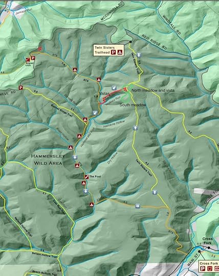 This map is for general directional purposes and is not a GPS track. Red is off trail.
More photos:
View this post on InstagramA post shared by Jeff Mitchell-Outdoors Author (@hiking_mitch)
View this post on InstagramA post shared by Jeff Mitchell-Outdoors Author (@hiking_mitch)
View this post on InstagramA post shared by Jeff Mitchell-Outdoors Author (@hiking_mitch)
View this post on InstagramA post shared by Jeff Mitchell-Outdoors Author (@hiking_mitch)
View this post on InstagramA post shared by Jeff Mitchell-Outdoors Author (@hiking_mitch)
View this post on InstagramA post shared by Jeff Mitchell-Outdoors Author (@hiking_mitch)
Hike the Ott Fork Trail-Tiadaghton State Forest
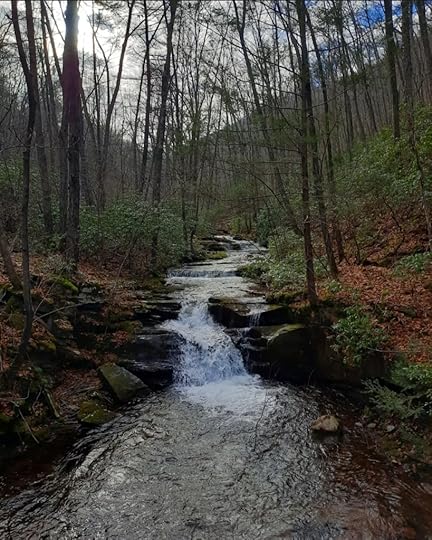 Waterfall on Ott Fork
Length: 3 miles, one way
Blazes: None, but the trail is well established and easy to follow
Parking: Pull off parking is at 41.318569, -77.413760
Highlights: Waterfall, cascades, hemlock forests, streamside hiking
Issues: Several stream crossings
Level of challenge: Easy
Description: The Pine Creek Gorge is a hiking wonderland with a vast array of trails. It is also a trail running destination. The hike along Ott Fork is beautiful as it follows a creek with its cascades and hemlock forests. This trail is also along the Eastern States 100, one of the premier trail races in the country.
From the parking area, just follow the old grade as it enters the gorge of Ott Fork. You will soon see some waterfalls and cascades, no more than ten feet tall, but still very scenic. These are the tallest falls on the trail. Continue upstream with some stream crossings and an old bridge abutment. Cascades dot Ott Fork. Mountain laurel and some rhododendron adorn the forest.
As you hike, hemlocks become more common with moss. Some of the trees are somewhat large. Ott Fork babbles off to the right. Pass a juncture with the Pine Hollow Trail. Continue along Ott Fork until the trail ends at a dirt road. Retrace your steps.
This is an easy and enjoyable hike that feels isolated. Ott Fork is a gem worth visiting. While in the area, visit Mountain Top Provisions for a meal.
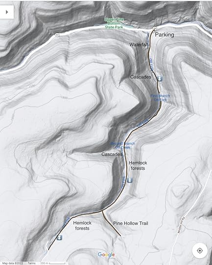 This map is for general directional purposes only and is not a GPS track.
View this post on InstagramA post shared by Jeff Mitchell-Outdoors Author (@hiking_mitch)
December 6, 2022
Exploring the Somer Brook Gorge-SGL 57
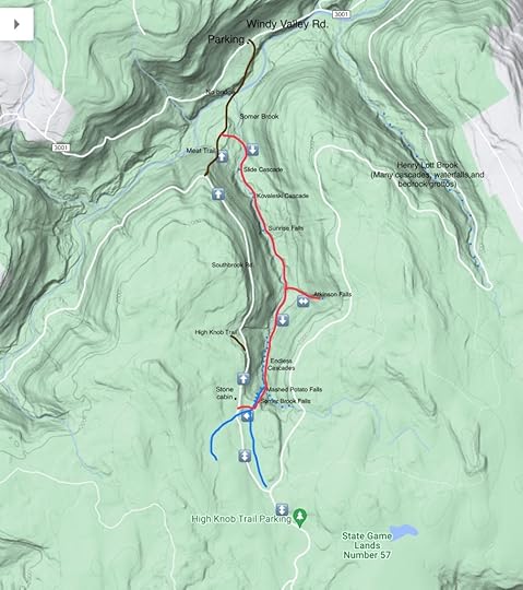 This map is for general directional purposes, it is not a gps track. Red is off trail. Brown is a trail, but blazes and tread may be faint.
 SGL 57 is one of the crown jewels in the Mid Atlantic. Somer Brook is just one of its many beautiful streams. I’ve been to Somer Brook many times, exploring different sections, but I have never hiked the entire gorge. I finally did, and it was incredible. A true waterfall and cascade wonder in an isolated, wilderness setting.
A few things about this hike- there is no trail along Somer Brook, just follow it upstream. You will have to cross the creek many times, so expect wet feet. Do not attempt in high water, as Somer Brook becomes a ferocious whitewater torrent. It is best to park at the “High Knob Trail parking area” as shown on Google maps. But this is only accessible during hunting season. The road is in decent shape, but a vehicle with some clearance is recommended. There is year-round access from Windy Valley/Bellasylva Road via the Swinging Bridge or Meat Trails. However, you must cross Mehoopany Creek without a bridge. If Somer Brook is high, you do not want to even consider crossing Mehoopany Creek. This description begins from the “High Knob Trail parking area”. This hike is roughly 9-10 miles in length. It is challenging, incredibly beautiful, and should only be attempted by experienced hikers. It’s a good idea to bring a friend.
From the parking area, walk around the gate and head north on the road. Enter a stunning red spruce forest with moss. Turn left on the next road, this is Southbrook Road and cross a small stream. Leave the red spruce and cross another creek; you will be completing the loop here. Pass the stone cabin and continue on the road, passing the High Knob Trail to the left. To the right is the deep gorge of Somer Brook; you will likely be able to hear the waterfalls and cascades.
Where the road makes a left turn, look for a sign for the Meat Trail, take it as it descends. There may be some old blazes. A treadway should identify the trail. As you reach the bottom, leave the Meat Trail to the right. The off trail section begins. Hike to Somer Brook and follow it upstream, crossing as necessary. There are areas of brush along the trail, but you can bypass. The first feature is a slide cascade. Continue on the west side, or right side, of the brook. Reach Kovaleski Cascade, an impressive spot with a giant, angled boulder. Now stay on the left side of the creek since the right has a steep cliff. Reach beautiful Sunrise Falls and its deep pool.
I typically stayed on the left side until I reached a side stream. If flowing, take it to Atkinson Falls, a fifteen foot falls with large boulders in a beautiful glen. If flowing well, there are countless boulder cascades above the falls. Return to Somer Brook and continue upstream.
You will soon reach one of my favorite spots, the Endless Cascades. This place is incredible. For hundreds of feet, the creek cascades and tumbles over a gauntlet of large, mossy boulders. Water falls in every direction and angle. You are surrounded by it. There are deep pools and bedrock slides. A highlight is a wide twin falls that fans out into a grotto with trickling springs.
The Endless Cascades continue until you turn the corner and reach where the two branches of Somer Brook meet. This is a gorgeous place with huge boulders, grottos, and pools. If the trees are bare, you can see towering Somer Brook Falls, an incredible sight. Take the branch to the right and see Mashed Potato Falls, so called because of its appearance when frozen. Reach the base of Somer Brook Falls as it tumbles down a steep glen. This falls is roughly 80 feet high in total. Hike above the falls to the left, or east. At the top are some more cascades in a beautiful spruce and moss forest.
When another creek joins from the right, follow it back to Southbrook Road. Retrace your steps back to your car. You won’t soon forget this hike.
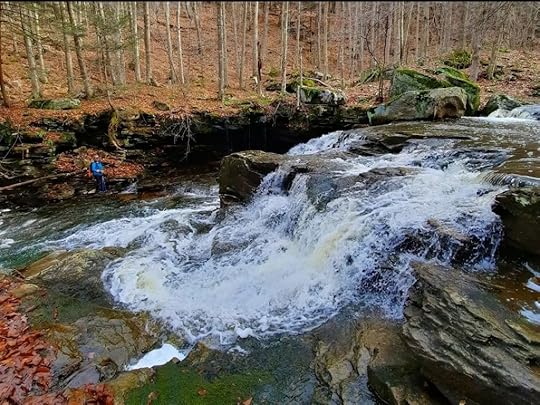 The largest falls within the Endless Cascades.
Photos and videos:
View this post on InstagramA post shared by Jeff Mitchell-Outdoors Author (@hiking_mitch)
View this post on InstagramA post shared by Jeff Mitchell-Outdoors Author (@hiking_mitch)
View this post on InstagramA post shared by Jeff Mitchell-Outdoors Author (@hiking_mitch)
View this post on InstagramA post shared by Jeff Mitchell-Outdoors Author (@hiking_mitch)
View this post on InstagramA post shared by Jeff Mitchell-Outdoors Author (@hiking_mitch)
View this post on InstagramA post shared by Jeff Mitchell-Outdoors Author (@hiking_mitch)
Hike the Big Rocks-Sproul State Forest
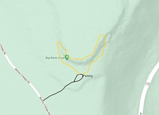
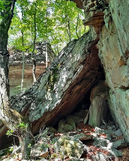
This short hike explores large boulders and cliffs in the beautiful Sproul State Forest. The trail is blazed yellow, was well maintained when I hiked it, and is a loop not more than a half mile long. It is an ideal trail for kids.
The trail is on a side road off of Barney Ridge Road, about a mile from PA 144. The dirt road is narrow, but in good shape. The side road to the trail is a little rockier, but a car can handle it. Park at 41.253144, -77.785947.
I hiked the trail counterclockwise. The trail passes massive boulders and climbs between some cliffs. It then follows the top of the cliffs, with a partial view. The trail then makes a rocky descent and meanders among some more gigantic boulders. It is worth going off the trail to experience the rocks. The trail completes the loop at the parking area.
More photos and video:
View this post on InstagramA post shared by Jeff Mitchell-Outdoors Author (@hiking_mitch)
February 16, 2022
Hike to Stairway Lake and Falls-Stairway Wild Area (Delaware State Forest)
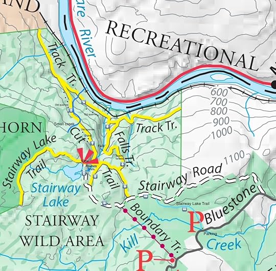
The Stairway Wild Area is a place worth exploring with waterfalls, a lake, view, and extensive, abandoned bluestone quarries. Our route was about seven miles long and this hike is moderate to challenging. I think it is one of the more interesting hikes in the Poconos. Also some trail junctures have signs and the trails a blazed fairly well, although some of the lesser hiked trails are likely overgrown in summer.
Due to the trail layout, our route was little convoluted, but I enjoyed and would recommend it. We began at the parking area for the Stairway Lake Trail. The Boundary Trail may be shorter and it appeared to have a parking area as well, but was missing a sign.
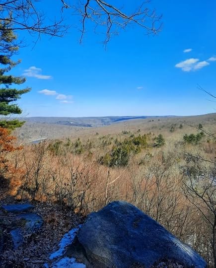
We hiked the blue blazed Stairway Lake Trail through hardwoods with a large wetland off to our left. The trail was level and rolling, and easy to follow. The blue blazes are bit faded and I wouldn’t be surprised if they are repainted yellow in the future. Reach an old forest road and turn left. Notice the yellow blazes. Follow this old road and pass two yellow trails to the right. You will use both on this hike. The old road reaches some large ledges and climbs gradually. Reach sublime Stairway Lake, a truly scenic place. The lake is undeveloped and was formed by a small dam. A small peninsula juts out into it. On the trail, walk out to a fine view looking down to the Delaware River and into New York. There is also a campsite. This must be an incredible place to camp.
Retrace your steps down the hill and turn left onto the next yellow trail under hemlocks. The trail bends right, but to see Stairway Falls, you will need to go off trail to your left. Drop down to see the falls. It’s an odd falls, as it tumbles down a series of ledges with good height. But the flow seems dispersed over the ledges and the stream is small. It’s a nice feature but do not expect to be wowed, unless there is high water, or it is winter.
The yellow trail curves down, joins the Cut Trail. Turn left and descend. Cross Stairway Run along an old forest road. Large cliffs rise to your left. The gorge is to your right. The trail levels and then descends gradually with hemlock and rhododendron. Signs of the old bluestone quarries become more frequent, with ledges and piles of rock. Look for a small pond to the left of the trail.
A small stream joins the trail and the descent continues with more old quarries. Reach the bottom and make a sharp right, it is easy to continue straight. The ledges and old quarries continue. Barberry also joins the trail and there are dead hemlocks. A railroad is below you to the left. Hike along old quarries and piles of rock. There are also some small stone ruins. Soon, boulders and ledges appear along the trail.
The trail descends to Stairway Run and crosses it, but it is easier to just use the railroad. Now climb up the gorge of Stairway Run with ledges and hemlocks. Look for a cascading waterfall just off trail to the right; it is about fifty feet total. The trail then winds into beautiful hemlock and pine forests. The trail levels and reaches a juncture with a sign, and the front of an old, rusting Ford. Turn left. The trail is level with more ruins and another old, rusting vehicle off to your left. Reach the old forest road you walked in on and turn left. Retrace your steps back to the parking area.
When is the best time to hike here? I think it might be winter. Stairway Falls transforms into incredible ice flows. It is really worth seeing. The many ledges along this hike often feature ice flows and draperies.
Parking is at approximately 41.404461, -74.775261.
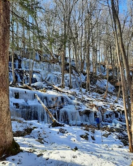 Stairway Falls in winter
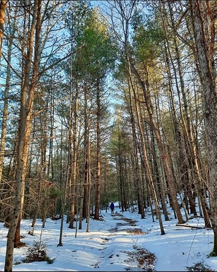
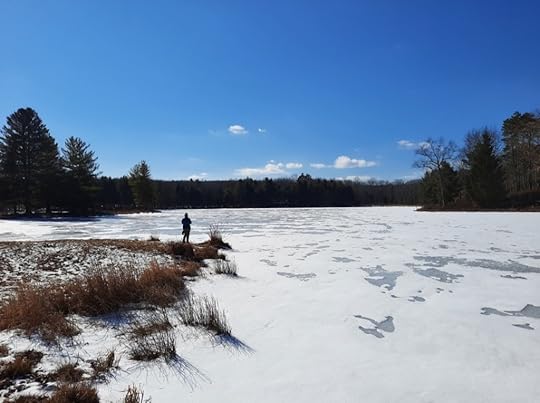 Stairway Lake
More photos and videos:
https://www.instagram.com/p/CaA-1ltv3ok/?utm_source=ig_web_copy_linkhttps://www.instagram.com/p/CaBL6mLtKNp/?utm_source=ig_web_copy_linkhttps://www.instagram.com/p/CaBNQ8INMMk/?utm_source=ig_web_copy_linkHike the Smith’s Knob and Painter Run Loop-Loyalsock State Forest
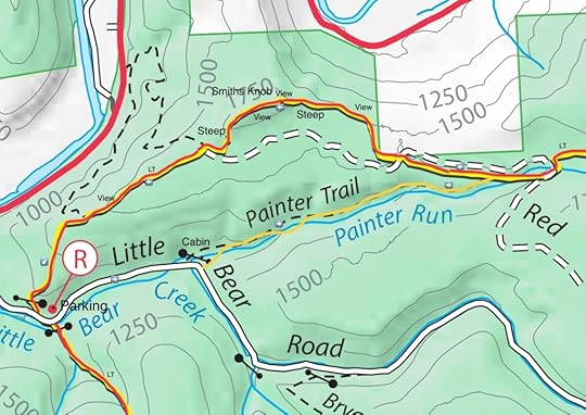
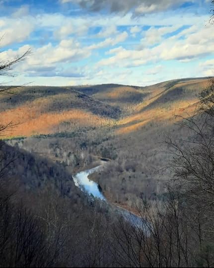
This is a classic dayhike loop in the Loyalsock State Forest featuring several great vistas, Smith’s Knob, and beautiful streamside hiking along Painter Run. This loop is about six miles long and is challenging.
From the parking area, hike up Little Bear Road for about three quarters of a mile. Turn left onto the yellow blazed Painter Run Trail and hike behind a cabin. Follow the trail into the woods and along scenic Painter Run. Hike up along the run with many cascades and mossy rocks. In summer there are wildflowers. Cross the creek a few times by hopping on rocks. The surrounding forest is a mixture of hemlock and hardwoods. It is a gradual climb along the run and very scenic. At the top, make a sharp left onto the Loyalsock Trail (LT).
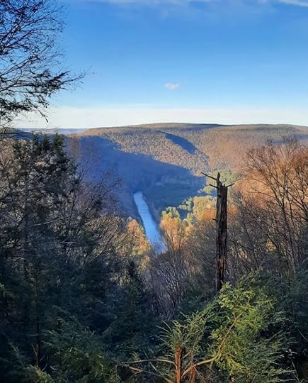
The rest of the hike follows the LT. Hike across the plateau with laurel and pine, going on and then off a logging road. The forest is scenic and the hiking is rolling. Reach the edge of the plateau and begin to climb. Pass a great view of the Loyalsock Creek far below. The climb steepens with rock ledges as you climb the flank of Smith’s Knob. Reach the top with a campsite and an awesome view looking east as PA 87 cuts a straight line through the forest. Spend some time here. Sunrises here are amazing.
Continue along the ridge and pass a view to the south. A steep descent follows with loose rock, be careful. Level terrain follows as the trail follows an old woods road, pass a side trail to the right. There is laurel and hemlock along the trail. Reach another great view of the Loyalsock Creek. Begin a long descent that steepens. Enjoy the beautiful forests with an understory of striped maple. Return to the parking area and your car.
Parking is at 41.356282, -76.859839.
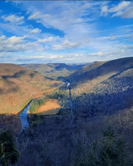
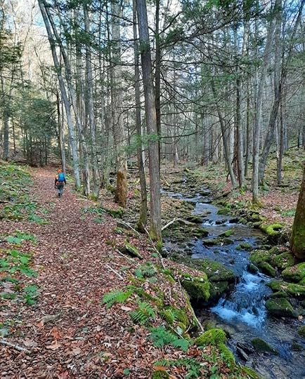 Painter Run
More photos and videos:
https://www.instagram.com/p/CXHfF0_P0bu/?utm_source=ig_web_copy_linkhttps://www.instagram.com/p/CXFLAyfAmbG/?utm_source=ig_web_copy_linkhttps://www.instagram.com/p/CXFFWh1Poep/?utm_source=ig_web_copy_linkFebruary 14, 2022
Hike the Cornelia & Florence Bridge Nature Preserve
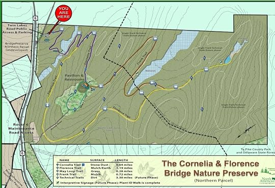
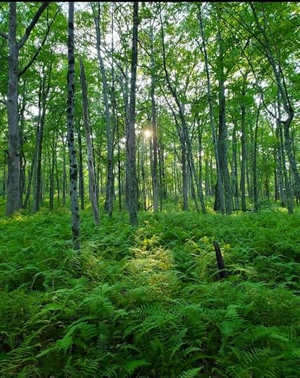
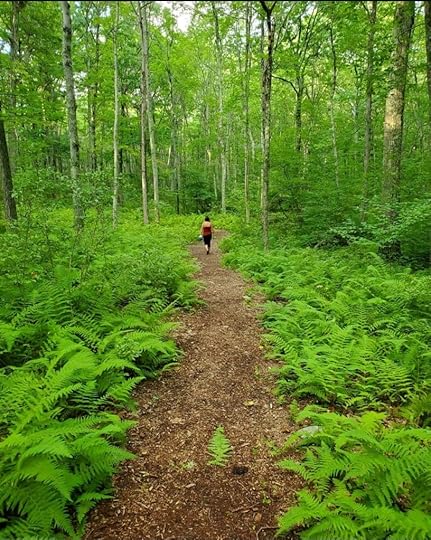
The Bridge Preserve is a great place for an easier hike with rolling and level terrain, winding trails, and good scenery. Many of the trails are wide and trail junctures have signs. The forests are mostly hardwoods with glades of ferns and some laurel.
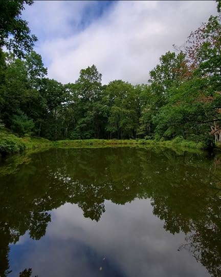
From the parking area we hiked down the Cornelia Trail and crossed a stream or wetland. Then we turned right onto the Florence Trail as it gradually climbed a hill and went behind some houses. The trail left the houses and went deeper into the woods. We continued on to the pond, a quiet, serene place with a small pond set in the woods. We retraced our steps to the juncture with the Frank Trail.
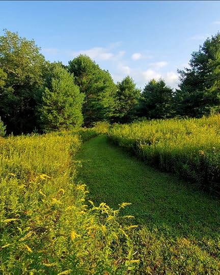
The Frank Trail meandered through beautiful woods with big hardwoods and lots of ferns. We gradually climbed a hill and reached a large meadow with a pavilion and many pine trees. We completed the loop with the Cornelia Trail and retraced our steps back to the parking area.
Our route was about three miles long, was fairly easy, and would be good for kids or older hikers. Parking is at 41.359105, -74.888367.
More photos:
View this post on InstagramA post shared by Jeff Mitchell-Outdoors Author (@hiking_mitch)
View this post on InstagramA post shared by Jeff Mitchell-Outdoors Author (@hiking_mitch)
Jeff Mitchell's Blog
- Jeff Mitchell's profile
- 3 followers


