Jeff Mitchell's Blog, page 7
January 23, 2024
Hike the Waterfall Loop in SGL 36
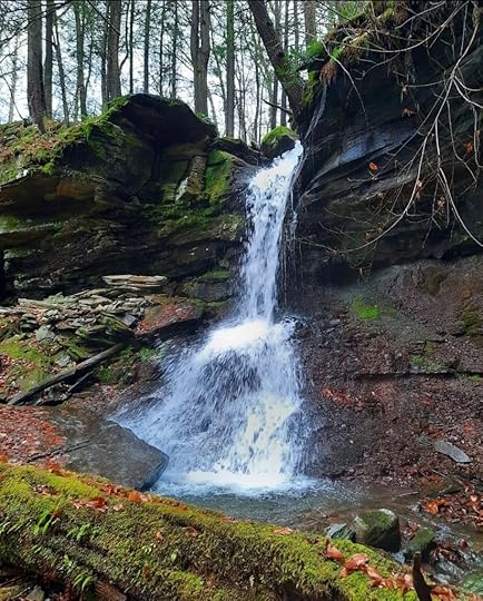 Waterfall in Joel’s Glen, a beautiful place.
Length: Approx. 10 to 11 miles.
Difficulty: Challenging. Extensive off trail hiking required, mostly following creeks.
Trail conditions: No trails are marked or blazed. A game commission road nearly divides the loop.
Parking: A lot is along Cahill Road. 41.606055, -76.583956.
Highlights: Many waterfalls and cascades. Views, rapids, and pools along Schrader Creek. Isolation.
Description: Schrader Creek valley is a best kept secret in PA, and this hike confirms that. While SGL 36 has long been known for its waterfalls, it turns out there are even more. This section of SGL 36 is isolated, and the creeks don’t appear to even have names.
I named the features on this hike or found names online. I do not expect these names to stick. I named them to make it easier to describe the loop. It is tough to write a description when everything is simply “falls”, “creek”, or “view”.
You should be an experienced hiker to do this loop. You should be comfortable with off trail navigation. The terrain isn’t very hard. In truth, neither is the navigation for the most part, it simply follows creeks. Thankfully, the forests are mostly open. The one problem area is from Sibling Falls back to the PGC road. That will be discussed later.
From the parking area, follow the PGC road. After about a mile, notice a creek off to the left. This is Cahill Run. Go off the road and hike the creek. Cahill Falls soon comes into view, a cascading falls with a large ledge. Follow the creek downstream to see a side stream falls, a slide, and a pool. The forest is open. Reach Slide Step Falls and then a favorite, Green Grotto Falls. I love Green Grotto Falls. Neither exceeds 15 feet, but they are scenic.
East Cahill Run joins and just downstream is Hemlock Cascade, a gorgeous boulder cascade with a pool. The boulders a large. A serene spot.
Now veer right or east and hike above Schrader Creek. There are some old grades you can use, or you can climb to the PGC road. The hike along Schrader Creek is scenic with a view of the creek and a beautiful ledge rapids and deep pool. An old railroad grade helps with navigation. Of course, you can bypass Schrader Creek and head to Joel’s Glen.
The glen is a highlight. I made the mistake of hiking into it from the bottom, just above Schrader Creek. It is very steep and not recommended. Instead, use old grades and hike above the glen, cross Overton Run, and descend from the east. The glen is surrounded by cliffs with a falls over 20 feet tall. There are tall hemlocks. The setting is gorgeous. Be careful descending into the glen, there are ledges and drop offs. After seeing the glen, you can always choose to turn around here, taking the PGC road back instead of climbing to Sibling Falls.
Now follow an old grade as it ascends the mountain, another follows Overton Run, but you will run into private land. The grade climbs the plateau and levels. Pass a side stream, to the left is a slide cascade. Continue climbing. There are falls along the border with private land. At the top is another highlight, Sibling Falls. A twin falls in a cove of ledges, a beautiful spot. Just below is Silver Birch Falls.
Now is the tricky part, getting to the PGC road. The problem is there is a logged area with thick saplings. I think the best way is to stay close to the game lands boundary and intersect with the road. Follow the road back to the car.
The closest access to this loop is across Schrader Creek, from Schrader Creek Road. However, you must cross the creek, which is large. Plus, if these falls are flowing well, Schrader Creek would be too dangerous to cross. Cahill and Overton Runs probably dry or are a trickle in summer. Enjoy this beautiful place.
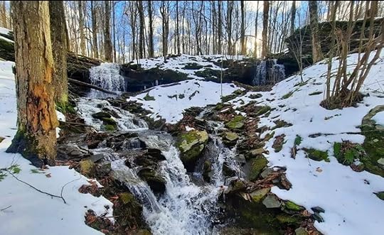 Sibling Falls
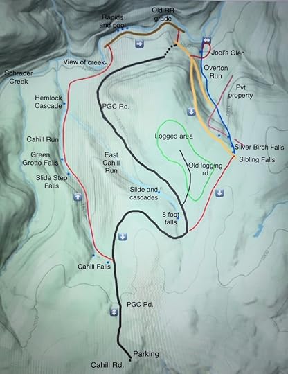 Red is off trail. Blue dots are falls or cascades. The PGC road fades out as it nears Schrader Creek, hence the dots. This map is not a GPS route, it is for general directional purposes only.
View this post on InstagramA post shared by Jeff Mitchell-Outdoors Author (@hiking_mitch)
View this post on InstagramA post shared by Jeff Mitchell-Outdoors Author (@hiking_mitch)
View this post on InstagramA post shared by Jeff Mitchell-Outdoors Author (@hiking_mitch)
View this post on InstagramA post shared by Jeff Mitchell-Outdoors Author (@hiking_mitch)
View this post on InstagramA post shared by Jeff Mitchell-Outdoors Author (@hiking_mitch)
View this post on InstagramA post shared by Jeff Mitchell-Outdoors Author (@hiking_mitch)
View this post on InstagramA post shared by Jeff Mitchell-Outdoors Author (@hiking_mitch)
View this post on InstagramA post shared by Jeff Mitchell-Outdoors Author (@hiking_mitch)
January 2, 2024
Gear Review: Durston Kakwa 40 Backpack
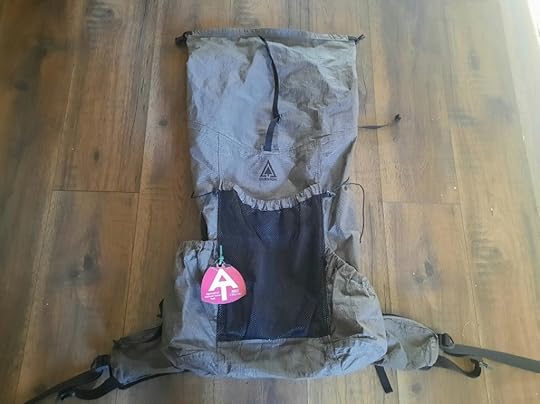 My Durston Kakwa 40 backpack
Specs: Can be found on Durston’s website.
Unbiased: I paid for this pack. I received no incentive for this review.
Experience with the pack: I have extensive experience with this pack. I thruhiked the Colorado Trail (486 miles) and Susquehannock Trail (84 miles) with this pack. I also hiked 18 miles of the Thunder Swamp Trail with this pack.
Construction: The pack is very well made without any tears, rips, or seams coming undone. It is a solid pack. I never hiked off trail with it, but it did encounter brush, branches, and sliding on rocks.
Weight: I have a large, which is 28.2 ounces in weight. This is a lightweight backpack, especially one with a frame. For comparison, a large Gossamer Gear G4-20, a frameless pack, is 26 ounces.
Load carrying: Fantastic. It’s remarkable a pack this light can carry weight so well. It directs weight right to my hips. When my pack was in the low to mid 20-pound weight range, it felt weightless at times. This pack has a rigid and strong frame. The pack is narrower at the bottom and widens at the top. I found this design moved with my body better and prevented the bottom from becoming overstuffed or bulging with gear, throwing off my balance or causing back pain.
Comfort: Very good. I never had any redness, abrasions, or chaffing on my skin from this pack. The shoulder straps and hip belt are not overstuffed with foam; what is there is sufficient. Besides normal aches and pains that come with backpacking, I never had any that I could attribute to the pack. There is no back ventilation, but I sweated the same as packs that had back ventilation. My belt buckle usually stayed in place, but I would have to adjust or tighten it a couple times a day.
Volume: I am not an ultralight backpacker. This pack always had enough volume for me. The only gear I kept on the outside was my foam sleeping pad. The two hip belt pockets are large enough for snacks, a phone, or other small items.
Water resistance: The pack is not waterproof. I do not feel a waterproof pack is necessary. I did hike in the rain without a rain cover. Sometimes, it was completely dry inside. Other times, there was a thin film of moisture. It was never waterlogged. I always used a waterproof bag liner. My gear always stayed dry. I did not encounter water collecting in the side pockets, which has been a complaint.
Water access: No one wants to take off their pack to get a drink. This pack has ideal water access with two mesh shoulder strap pockets that can hold smaller bottles, and I could access my water with one hand in the shorter side pocket.
Price: this pack is very reasonably priced for what you get and compared to similar packs.
Complaints: No pack is perfect, and there are a few areas of improvement. These might be corrected in future versions.
The mesh pocket is not large enough. It doesn’t have much stretch and fills in with the gear inside the pack. This has been a common complaint and will likely be corrected.
The taller side pocket is a bit too rigid, particularly for storing gear. Most backpackers keep their water bottles in the side pockets. The Kakwa 40 has two mesh shoulder strap pockets where I keep my water bottles for drinking while hiking. I then keep my filter and larger bottle in the shorter side pocket. This leaves the taller side pocket as an ideal place to store gear. It can but is a bit rigid for that purpose. The taller side pocket also has a zipper pouch facing the front where maps or other small items could be stored. I never used it, and if I did, it would decrease the volume of the taller side pocket. I didn’t find it necessary.
The side pockets do not have drain holes, which can collect water. I did not encounter that happening. Again, this might be corrected in the future.
Would I recommend? Absolutely. This is a remarkable pack for the quality, comfort, and price. It handles weight very well, particularly for a pack so light. It is simple and durable. I look forward to using it on many future hikes.
December 26, 2023
Hike Miller Mountain-Pinchot State Forest
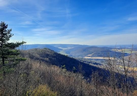 Looking up Sugar Hollow from the cabin view.
Length: 7 miles, loop alone is about 6 miles.
Parking: There is no official parking lot at this time. There is pull off parking in a grass field across from the trailer (41.508507, -75.966173) or pull off parking near the old Jurista Farm (41.509793, -75.969907). Do not enter any buildings. This hike is near Tunkhannock, PA.
Highlights: Great views, fields, meadows, wildflowers from late spring to early fall. Small waterfalls a short distance off trail.
Difficulty: This is a challenging hike with significant climbing. There is no scrambling. There are steep slopes. This hike climbs over 1,300 vertical feet.
Trail conditions: This hike has no blazes or signs, but it follows obvious old jeep and atv trails. Navigation is fairly easy.
Issues: Be prepared for sun exposure in summer. Some meadows may become overgrown.
Direction of this description: Counterclockwise from the old Jurista Farm. This way gives you a longer and more gradual ascent, though the descent will be steeper. This way is also easier for navigation for those unfamiliar with the property, that is why it is described in that direction.
Best direction: I think clockwise is the best. The climb up is steeper, but to hike down the pipeline swath as the views unfold before you is special.
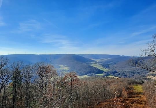
Description: Miller Mountain is poised to become a premier hiking destination in the future. It has the distinction of being the tallest undeveloped stand-alone mountain in the state. It rises over 1,600 vertical feet above the Susquehanna River. It is no wonder that it once was slated to become a ski resort.
The mountain was state forest until the 1980s. It was then swapped for land in Pine Creek so it could become a ski resort. Those plans fell apart. The mountain was sold to a private landowner. It has finally returned to state forest land for the public to enjoy. Williams Pipeline provided a large portion of funding to buy the mountain. The Conservation Fund arranged the sale, provided the remaining funds, which was reimbursed by the state. Thank you to Williams and the Conservation Fund.
A formal trail system is hoped for the future with blazes and signs. It will take time to develop that. We hope to develop trails to the other scenic features of the mountain which include more views, gorges, creeks, waterfalls, meadows, and rock formations. It is an exceptional property. In time, the mountain can become a tourist destination for hikers and trail runners. We will need volunteers to make this happen.
This description is very brief due to the pictured descriptions below. This description begins from the old Jurista Farm. Follow the jeep road through the fields and walk around the gate. The road is obvious. Begin the climb, cross the pipeline swath. Continue climbing. Cross the swath and follow it, enjoy the views. Hike to the Cabin view and continue up the swath. We hiked to the ridge and east views, or you can stay on the loop.
The pipeline swath creates an extensive ridge and mountain top meadow that adds interest to the hike. I reminded me of the mountain top meadows on the Appalachian Trail in North Carolina, Tennessee, and Virginia. The wildflowers must be incredible in summer.
On the loop, cross the swath and descend on an atv trail to Tunkhannock view and then follow an obvious old grade down the mountain. Avoid any paths from the left or right. Just follow this grade straight-ish down the mountain. It is the most established, and at times rutted, route. The slope steepens. Reach a meadow, you can walk up the creek a short ways to small waterfalls. Continue down, walk around the blue gate. Turn left onto Jurista Road and walk back to your car.
This hike doesn’t actually go to the summit of the mountain (there are no views at the summit), that will be described in another hike.
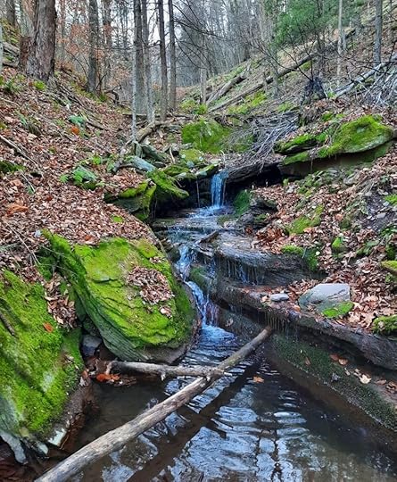 Small waterfalls just off the loop
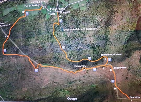 This map is not a GPS route, it is for general directional purposes only.
Pictured description (letters reference to the above map):
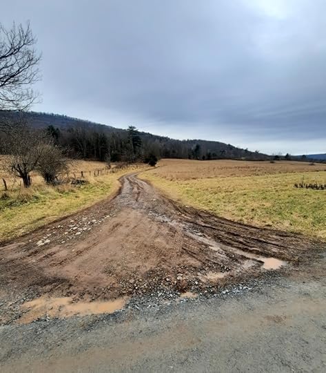 A. Follow this jeep road across the fields, old Jurista Farm is nearby.
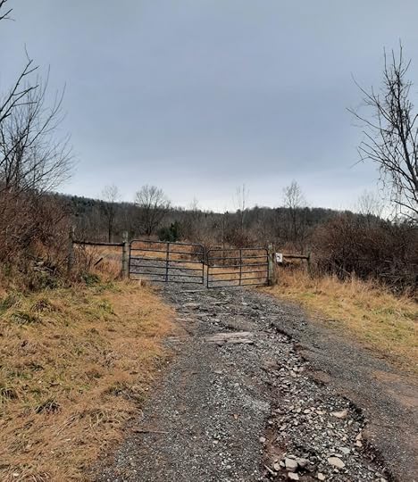 B. Hike around this gate, continue up the jeep road.
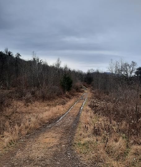 The jeep road is obvious.
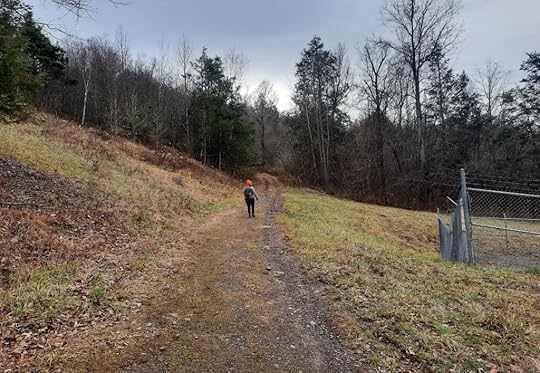 C. Cross the pipeline swath at a valve. There is a view here too.
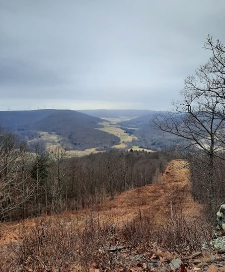 D. Great view from pipeline swath.
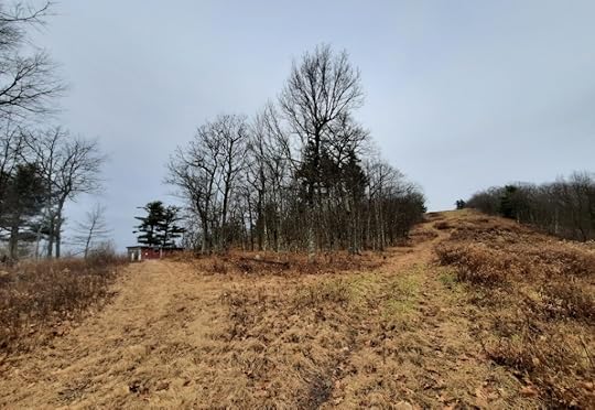 E. Turn left to cabin view. Then continue right up the swath.
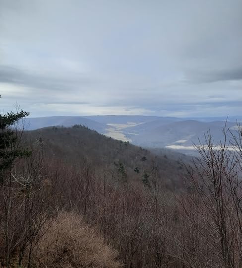 E. Cabin view.
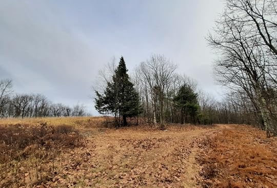 F. Turn left to continue on the loop to Tunkhannock view. Turn right to ridge and east views.
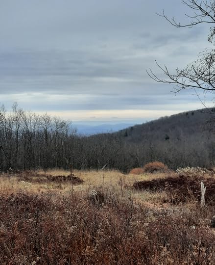 G. Ridge view
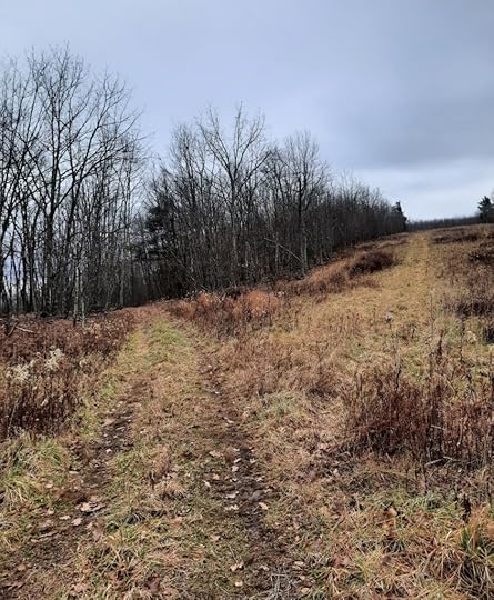 H. Turn left or straight to East view. If you want to go to the summit, go right.
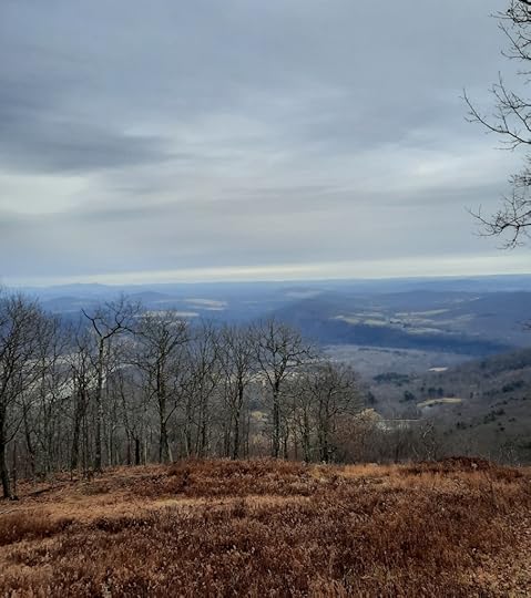 I. East view. Elk Mountain can be seen in the distance. Turn around here.
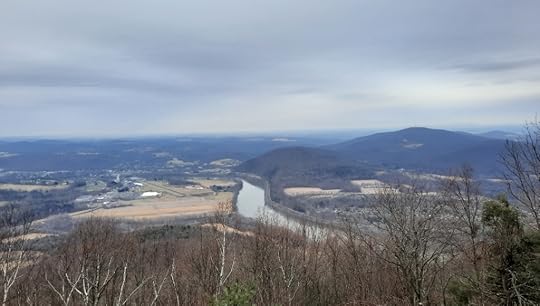 J. Tunkhannock view
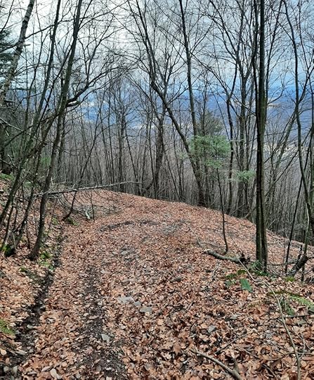 K. The atv trail curves right, go left and continue down the mountain.
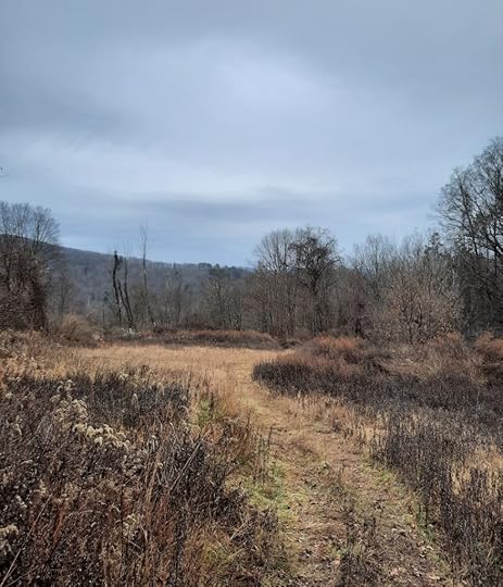 L. Cross this meadow. A creek is to the right. You can go upstream to see small waterfalls.
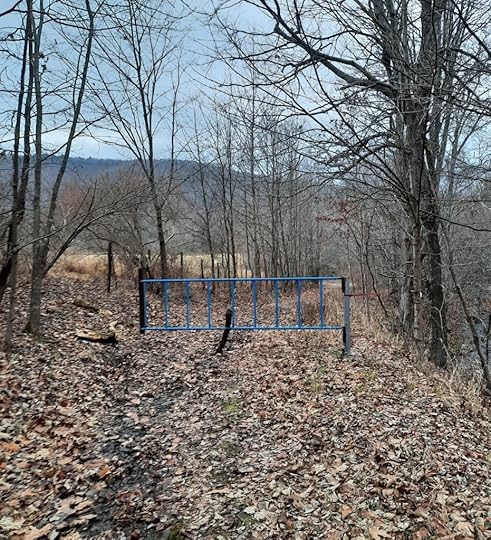 M. Walk around the blue gate. Walk down to the road.
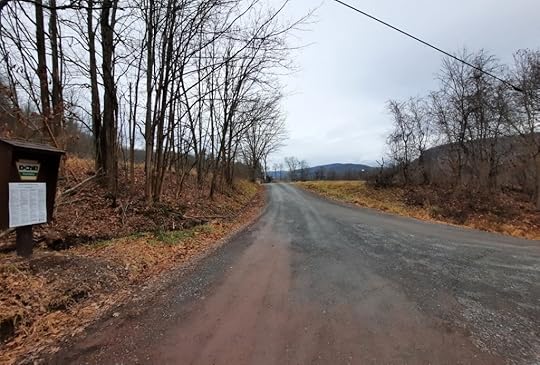 Turn left on the road to walk back to your car.
December 21, 2023
Hike to Mokoma Falls and the Elklick Run Waterfalls
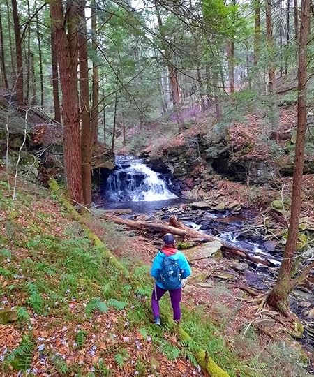 Mokoma Falls, SGL 13
Length: 5 to 6.5 miles depending on route taken, ours was 6.5.
Difficulty: Moderate. Stream crossings, steep slopes, no significant climbs. There is flood damage along the creek that drains Dutchman Swamp.
Trail conditions: There is a well marked white blazed trail on the Elklick Wilderness Preserve. The rest of the hike is off trail or follows a gravel road. Other than the preserve, no trails are marked or signed. This hike involves creek side hiking. Off trail navigation required.
Highlights: Several beautiful waterfalls, impressive hemlock and moss forest, glen, narrow gorge.
Parking: Small gravel lot at 41.419024, -76.480881.
Description: This hike has incredible scenery and should be on the list of any hiker who doesn’t mind off trail hiking. There are scenic waterfalls, gorges, glens, and beautiful hemlock forests. And because much of the hike follows creeks, the off trail navigation isn’t very difficult. Mokoma Falls was previously described on this blog, but this hike is far superior and makes the falls much closer to reach.
From the parking area, hike the white trail into the Elklick Wilderness owned by the Mokoma Conservancy. Reach the start of the loop and turn right. These white trails are nice with forest scenery, a meadow, and small streams. At the southeast corner of the loop, leave it and hike to the pipeline swath. Cross it and enter SGL 13. Hike off trail in a south east direction and enter a stunning hemlock and moss forest. It is truly beautiful. Reach a creek and follow downstream, Cross the creek and follow a grade on the south side of it. You will see a gorgeous glen with hemlocks, cascades, and a seven foot double falls.
Hike above Mokoma Falls, which is not even fifteen feet tall. The setting is stunning with towering hemlocks. Follow the creek downstream and reach another creek, turn left and go upstream. The flood damage is apparent. There is space to hike on the north side of the creek, but you will need to cross and follow an old grade on the south side. There are many cascades and old stone retaining walls. The gorge narrows with ledges. It is scenic despite the flood damage.
The first falls on this creek comes into view, about seven feet in a bedrock grotto. Above is another falls, a slide with a deep pool and small sidestreams with their own small waterfalls, a gorgeous spot. Continue upstream. Reach a 12 foot falls with a bedrock slide and above is the tallest falls, a beautiful, broad falls over twenty feet tall. More cascades and slides are above. This gorge of waterfalls is absolutely beautiful.
Here, you can retrace your steps back to the car, or head north off trail to the game commission road and hike that out back to your car (Alt. Route on map).
We continued upstream to Dutchmans Swamp, there were no more falls. It became apparent why there was flood damage. The large beaver dam at the swamp blew out. What was once a pond is now a huge meadow. I’m sure this is an ideal place for rare plants and flowers in summer. We hiked north, followed a deer fence around a logged area and hiked out via the game commission road. We crossed the pipeline swath and followed the white trail back to the car.
Sullivan County has so much natural beauty. Enjoy this amazing hike.
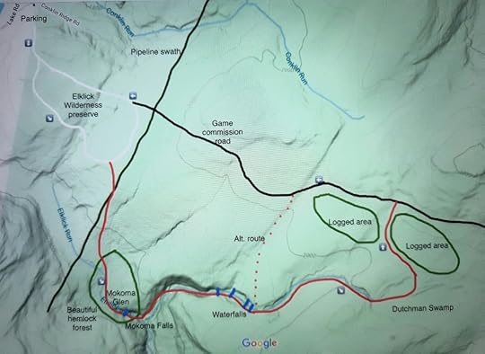 Red is off trail. White is a white blazed trail. This map is for general directional purposes only, it is not a GPS track.
View this post on InstagramA post shared by Jeff Mitchell-Outdoors Author (@hiking_mitch)
View this post on InstagramA post shared by Jeff Mitchell-Outdoors Author (@hiking_mitch)
View this post on InstagramA post shared by Jeff Mitchell-Outdoors Author (@hiking_mitch)
View this post on InstagramA post shared by Jeff Mitchell-Outdoors Author (@hiking_mitch)
View this post on InstagramA post shared by Jeff Mitchell-Outdoors Author (@hiking_mitch)
View this post on InstagramA post shared by Jeff Mitchell-Outdoors Author (@hiking_mitch)
View this post on InstagramA post shared by Jeff Mitchell-Outdoors Author (@hiking_mitch)
December 7, 2023
Hike the Butternut and High Rock Loop-Worlds End State Park
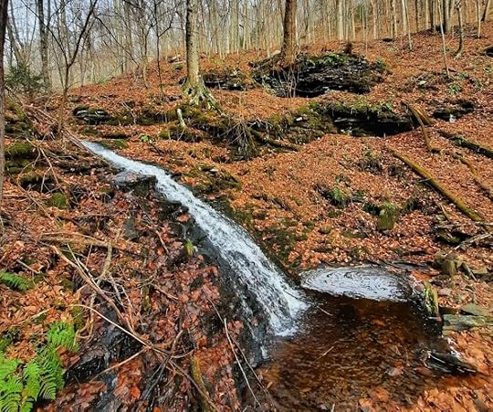 Waterfall on High Rock Run near the Flynn Trail
Length: About a five mile loop
Parking: 41.470381, -76.578854. More space is available at the park office.
Difficulty: Moderate but the climb to High Rock is steep and rocky, as is parts of the Butternut Trail.
Highlights: Views, large rocks, waterfalls. The waterfalls are on small creeks and can be a trickle in dry weather.
Trail conditions: Trails are well blazed and established.
Description: This loop has it all, views, waterfalls, and large rocks. It explores a section of the state park that is a little less used. Worlds End is an incredible park for dayhiking with a vast network of scenic trails and many route options.
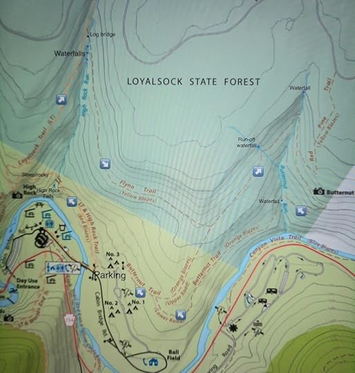
This loop is described clockwise. From the parking area, follow the Loyalsock (LT) and High Rock Trails to the left. Climb gradually and descend to High Rock Run and a footbridge. High Rock Falls is below, but it is hard to get a view of it. Begin the steep, rocky climb to High Rock with large ledges and hemlocks. Reach the beautiful view at High Rock as it overlooks the park.
Continue on the LT as it climbs more gradually above the gorge of High Rock Run. Reach the yellow Flynn Trail and turn right on it. Cross a unique, thick log bridge. A series of scenic waterfalls are downstream. The Flynn Trail is easy as it gradually descends on an old forest road. Reach the orange Butternut Trail and turn left.
This trail gradually ascends. If hiking after a heavy rain, you might pass a seasonal run off waterfall on the left. Reach the rocky glen of Butternut Run. A falls is above the creek, in a cove of ledges. The trail narrows and is rocky. Climb and reach Butternut View, a nice vista that looks down the Loyalsock Creek. Now begin a series of switchbacks along ledges, it is steep and rocky. Cross Butternut Run and hike above a waterfall. The trail traverses a steep, rocky slope above the Loyalsock Creek with large boulders. Pick up a road and veer left on it. Descend to a camping area, and then descend back to your car.
View this post on InstagramA post shared by Jeff Mitchell-Outdoors Author (@hiking_mitch)
View this post on InstagramA post shared by Jeff Mitchell-Outdoors Author (@hiking_mitch)
View this post on InstagramA post shared by Jeff Mitchell-Outdoors Author (@hiking_mitch)
December 3, 2023
Hike to Salvatore Falls
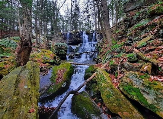 Salvatore Falls
Length: less than a half mile, one way.
Difficulty: Easy, but getting to the base of the falls is steeper and more rugged.
Parking: Game commission lot is at 41.254947, -75.753324.
Trail conditions: No blazes or signs, the hike simply follows the gated road. You may see some faint trails to the bottom of the falls.
Highlights: A surprisingly large and beautiful falls.
Description: This hike is ideal for those who can’t hike long distances and want to see a waterfall. The hike on the road is easy, but to get to the bottom of the falls, it is steeper and more rugged.
The hike is near Bald Mountain Road and the Mill Creek Reservoir in SGL 91. I initially thought the falls was called Bald Mountain Falls.
To start, simply follow the road. Descend gradually. Reach a creek and cross it. The falls are off to your left. Now turn left, off the road, and hike down under hemlocks. Reach the top of the falls. Work your way to the bottom where Salvatore Falls reveals its true beauty as it tumbles from a wide ledge. There is a small cave behind the falls. Giant boulders with crowns of ferns are below the falls. This is a gorgeous setting. The falls might be a total of 30 feet over all of its drops. This falls might also create an ice cave in winter. Return the way you came.
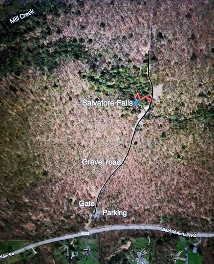 Red, to the bottom of the falls, is off trail.
View this post on InstagramA post shared by Jeff Mitchell-Outdoors Author (@hiking_mitch)
View this post on InstagramA post shared by Jeff Mitchell-Outdoors Author (@hiking_mitch)
View this post on InstagramA post shared by Jeff Mitchell-Outdoors Author (@hiking_mitch)
Explore Wilkes-Barre and Penobscot Mountains
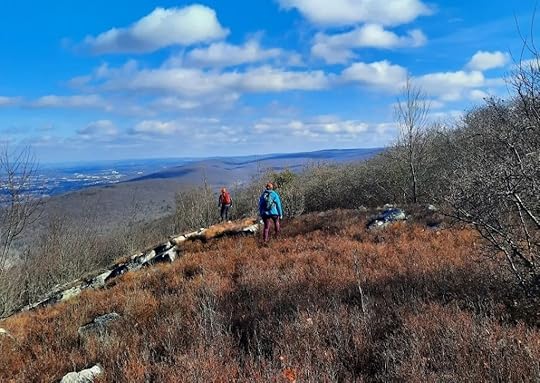 Incredible views from the exposed ridge of Penobscot Mountain
Length: The route we took was 8.5 miles. Length is variable depending on where you park.
Difficulty: Moderate to difficult.
Parking: Year round parking is at 41.177869, -75.885482. During hunting season the gate is open and you can drive closer to the hike, there are many small pull offs. The road was in decent shape, but rocky in places, so a vehicle with some clearance is recommended. We parked about a mile in.
Trail conditions: No blazes or signs. Bushwhacking required. There are old roads, several mountain bike trails, and atv trails that you will encounter.
Highlights: Excellent views from an exposed ridge, bogs, wetlands, ponds, giant rocks, ledges, overhangs, with more great views. A small creek with waterfalls and cascades.
Description: This hike again reveals all the fine scenery surrounding Wilkes-Barre and Scranton. Within a few miles of Wilkes-Barre, you will explore a realm with great scenic beauty. This hike is within SGL 207.
We first hiked west on the game commission road and climbed the “ridge of views”, off trail. At the top were superb views, some near 180 degrees. I could see from Ricketts Glen to Elk Mountain. It was remarkable. The “summit meadow” was impressive. This ridge is Penobscot Mountain. We hiked back down to the road.
We then took the jeep road down. This area has many intersecting grades, roads, and trails. Some are shown on mapping apps like Gaia. We crossed the creek at the bottom and hiked off trail up Wilkes-Barre Mountain. We encountered giant rocks and little valleys with wetlands. We headed northeast to two impressive ridges with more massive rocks, groves of pitch pine, overhangs, and bogs. The views over the Wyoming Valley were gorgeous. Bald Mountain rose in the distance. We explored the top and bottom of both ridges. The giant overhangs were a highlight.
We followed an atv trail back to the creek we crossed. Now we hiked up a small creek. There were some nice falls and slides at the bottom, but nothing too big. The falls weren’t impressive, but worth seeing. They need a good rain to flow. We hiked up to the game commission road and returned to the car.
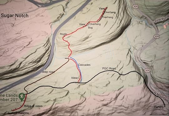
This map is for general directional purposes only and is not a GPS route. Red is off trail. Map does not show the many unmarked atv and mountain bike trails. Black dots are giant rocks or views.
View this post on InstagramA post shared by Jeff Mitchell-Outdoors Author (@hiking_mitch)
View this post on InstagramA post shared by Jeff Mitchell-Outdoors Author (@hiking_mitch)
View this post on InstagramA post shared by Jeff Mitchell-Outdoors Author (@hiking_mitch)
November 9, 2023
Ricketts Glen Rock Wonderland
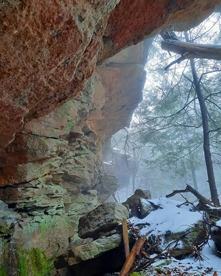 Incredible rock formations in Ricketts Glen
Length: If you hike the entire escarpment from PA 487 to the trail near the cabins, it is around three to four miles, one way.
Terrain: this hike is off trail. There isn’t a lot of elevation gain or loss, but it is rocky with brush in places.
Highlights: impressive rock outcrops, overhangs, recess caves, and chasms. Old growth hemlock forests. Ruins of a dam. Off trail waterfall.
Parking: Lake Rose parking lot is an ideal place to park. 41.329923, -76.291010. You can also shuttle cars between the two ends.
Description: Ricketts Glen is an amazing state park and is famous for its waterfalls along the Falls Trail. However, it offers so much more if you’re willing to explore. There are off trail vistas and waterfalls. And the park has impressive rock outcrops and formations.
I explored this area over several hikes. It basically follows the escarpment north, or above, the Old Beaver Dam Road and Highland Trails. In many places, the features of this hike are very close to these trails.
I did not encounter a lot of thick brush while exploring, though I did have to push through saplings in places. The forests are often open, and very beautiful, with moss, ferns, and giant hemlocks.
You can choose your own route, there is a lot to see. My favorite spots are what I call Tannin Falls, a scenic off trail falls, 12-15 feet tall, in a grotto of ferns and hemlocks. I also loved the outlet of Lake Rose. There were incredible old growth hemlocks and some boulder caves. The ruins of the dam were also interesting.
“Large ledges and cliffs” on the map are a must see, a stunning escarpment of cliffs and ledges with rock overhangs. There are also impressive rocks near the Midway Crevasse.
The recess cave at the east end is incredible and a highlight of the hike.
Enjoy this beautiful, hidden world.
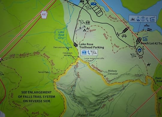 Black dots are rock outcrops. Purple dots are particularly scenic outcrops. Green dots are old growth hemlock.
View this post on InstagramA post shared by Jeff Mitchell-Outdoors Author (@hiking_mitch)
View this post on InstagramA post shared by Jeff Mitchell-Outdoors Author (@hiking_mitch)
View this post on InstagramA post shared by Jeff Mitchell-Outdoors Author (@hiking_mitch)
View this post on InstagramA post shared by Jeff Mitchell-Outdoors Author (@hiking_mitch)
View this post on InstagramA post shared by Jeff Mitchell-Outdoors Author (@hiking_mitch)
View this post on InstagramA post shared by Jeff Mitchell-Outdoors Author (@hiking_mitch)
View this post on InstagramA post shared by Jeff Mitchell-Outdoors Author (@hiking_mitch)
View this post on InstagramA post shared by Jeff Mitchell-Outdoors Author (@hiking_mitch)
View this post on InstagramA post shared by Jeff Mitchell-Outdoors Author (@hiking_mitch)
View this post on InstagramA post shared by Jeff Mitchell-Outdoors Author (@hiking_mitch)
View this post on InstagramA post shared by Jeff Mitchell-Outdoors Author (@hiking_mitch)
View this post on InstagramA post shared by Jeff Mitchell-Outdoors Author (@hiking_mitch)
View this post on InstagramA post shared by Jeff Mitchell-Outdoors Author (@hiking_mitch)
View this post on InstagramA post shared by Jeff Mitchell-Outdoors Author (@hiking_mitch)
November 2, 2023
The Big 32- America’s Other Long Distance Hiking Trails
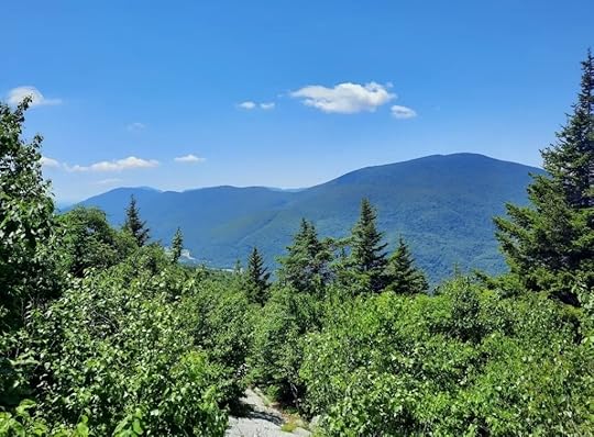 Long Trail, Vermont
There are a lot of long-distance hiking trails besides the famous Triple Crown of the Appalachian, Pacific Crest, and Continental Divide Trails. Many hikers simply do not have the time, resources, or ability to hike the Triple Crown trails.
Introducing the Big 32.
This remarkable list of hiking trails can cater to almost any long-distance hiker, offering an incredible diversity of scenery, habitats, ecosystems, and communities. These trails are ideal for those looking for a more manageable thruhike, or section hike. Furthermore, many of these trails can use the extra footsteps.
Keep in mind, these trails are very different from each other. Some may be well maintained, others are not. Some are wilderness treks, others explore the suburbs or farmlands. Some trails involve a lot of roadwalking, others have little. It is important you learn as much as possible about each trail before starting your hike.
The criteria for this list is simple:
Length must be from 100-600 miles along a single trail system.Trail must be continuous although it is understood occasional trail closures will occur. Trails that are actively being built, but are not yet continuous, are included and noted as honorable mention.Roadwalking (meaning roads open to public motorized vehicular traffic) cannot generally exceed a third of the trail.The trails must be primarily intended for hiking and backpacking, although multi-use is permitted.There must be sufficient opportunities for overnight camping. In other words, backpacking must be possible on the trail.Overlapping trail systems may be permitted.Trails are included, not routes, which generally involve extensive off trail hiking.If I missed a trail, or mistakenly included a trail, please let me know. The order of trails have no meaning, they are identified from east to west. Trail lengths are approximate.
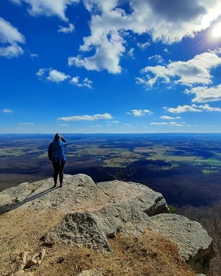 Tuscarora Trail
Eastern 18
Cohos Trail. 170 miles. New Hampshire.Long Trail. 272 miles. Vermont.New England Trail. 235 miles. Connecticut, Massachusetts.Northville-Placid Trail. 135 miles. New York.Long Path. 358 miles. New Jersey, New York.Finger Lakes Trail. 580 miles. New York.Horse Shoe Trail. 140 miles. Pennsylvania.Mason Dixon Trail. 200 miles. Pennsylvania, Maryland, Delaware.Mid State Trail. 327 miles. Pennsylvania.Baker Trail. 134 miles. Pennsylvania.Tuscarora Trail. 250 miles. Virginia, West Virgnia, Maryland, Pennsylvania.Allegheny Trail. 311 miles. West Virginia.Cumberland Trail. 300 miles. Tennessee. (Honorable mention, not yet complete)Bartram Trail. 115 miles. North Carolina, Georgia.Benton MacKaye Trail. 300 miles. Georgia, Tennessee, North Carolina.Pinhoti Trail. 330 miles. Alabama, Georgia.Pine Mountain State Scenic Trail. 120 miles. Kentucky. (Honorable mention, not yet complete)Sheltowee Trace Trail. 319 miles. Kentucky, Tennessee.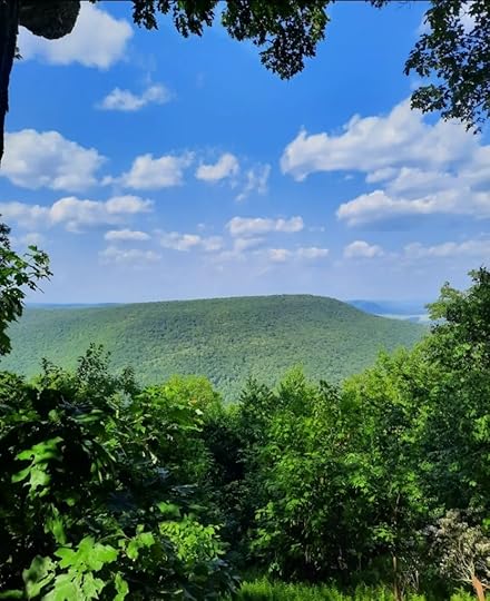 Mid State Trail, Pennsylvania
Central 7
River to River Trail. 160 miles. Illinois.Ozark Highlands Trail. 218 miles. Arkansas.Ozark Trail. 230 miles. Missouri.Ouachita Trail. 223 miles. Arkansas, Oklahoma.Superior Hiking Trail. 310 miles. Minnesota.Maah Daah Hey Trail. 144 miles. North Dakota.Centennial Trail. 124 miles. South Dakota.Western 7
Colorado Trail. 486 miles. Colorado.Uinta Highline Trail. 104 miles. Utah.Tahoe Rim Trail. 170 miles. California, Nevada.Blue Mountains Trail. 530 miles. Oregon.Oregon Coast Trail. 362 miles. Oregon.Bigfoot Trail. 360 miles. California, Oregon.John Muir Trail. 211 miles. California.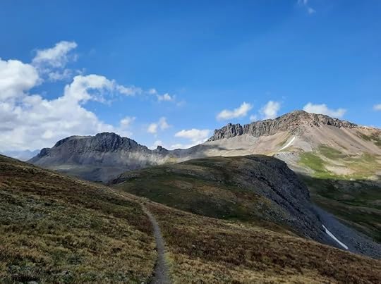 Colorado Trail
October 23, 2023
Backpacking the Thunder Swamp Trail-Delaware State Forest
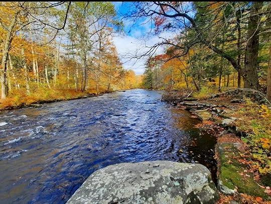 Bushkill Creek
Length: The loop described is 19 miles. The entire trail system is about 45 miles.
Blazes: Orange. Side trails are yellow.
Parking: The main trailhead is along PA 402, located at 41.147592, -75.080363.
Terrain: The trail is fairly easy with hilly and rolling terrain. There are no big climbs or descents. The trail passes near several swamps. The trail is often rocky.
Trail conditions: The trail is generally well blazed and established. Most trail junctures have signs. Most stream crossings have bridges. Sections of the trail can be brushy. We did encounter a short, wet area on the north side of the loop, just west of PA 402.
Highlights: Waterfall and cascades of Red Rock Run. Old low dam crossing at Thunder Swamp. Bushkill Creek. Views of wetlands. Footbridges.
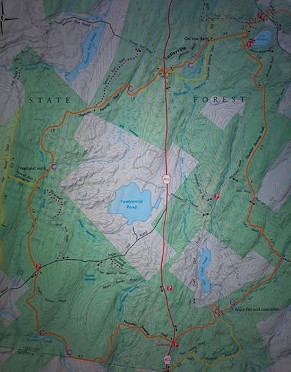
Camping: Sites tend to be small. The largest sites are on the west side of the loop, along Spruce Run and Bushkill Creek. Campsites are marked with a purple C on the map below. There are no shelters. This is a good trail for hammock camping.
Best time to go: Best colors are in mid to late October.
Maintained by: Keystone Trails Association, Pocono Outdoors Club
Maps: Are for free, and available online, through the Delaware State Forest.
Description: The Thunder Swamp Trail (TST) is an extensive trail system, but this description covers the main loop, which is also the most popular for backpackers. The terrain is rolling and fairly easy, although rocky. I enjoyed the many creeks and swamps. Saw Creek, Red Rock Run, Spruce Run, and especially Bushkill Creek are beautiful. There are also nice views of the swamp on Spruce Run. Forests are mostly hardwoods with understories of brush and blueberry bushes. There are some areas of pine, hemlock, and spruce. There are occasional ledges and boulders, but they are not gigantic in size. This trail is ideal for beginning backpackers and is perfect for a weekend overnight trip. Due to the swamps, the TST can be very buggy in hot, humid weather. The TST is rarely overcrowded.
View this post on InstagramA post shared by Jeff Mitchell-Outdoors Author (@hiking_mitch)
View this post on InstagramA post shared by Jeff Mitchell-Outdoors Author (@hiking_mitch)
View this post on InstagramA post shared by Jeff Mitchell-Outdoors Author (@hiking_mitch)
View this post on InstagramA post shared by Jeff Mitchell-Outdoors Author (@hiking_mitch)
View this post on InstagramA post shared by Jeff Mitchell-Outdoors Author (@hiking_mitch)
Jeff Mitchell's Blog
- Jeff Mitchell's profile
- 3 followers


