Hike to Gamble Run Falls and Vista-Tiadaghton State Forest
 Gamble Run Falls
Length: Approx. 6-7 miles in total to the falls and vista.
Blazes: Mid State Trail is orange, Gamble Run Trail is red.
Parking: Small lot at 41.242016, -77.334424.
Trail conditions: Good. Trails are well blazed and easy to follow.
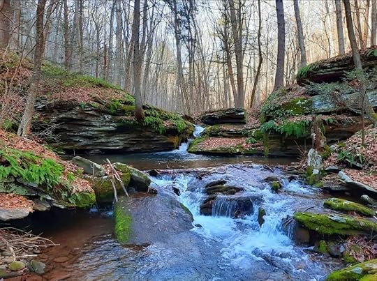
Highlights: Cascades, small falls, pools, streamside hiking, hemlocks, vista, beautiful gorges.
Issues: Hike up to the vista is steep and rugged.
Level of challenge: Easy to difficult
Description: I really enjoyed this hike and look forward to returning. It is yet another gem in the Pine Creek Gorge region. This is an out and back hike to both the falls and vista. Part of this hike follows the Mid State Trail (MST) the longest trail in the state and a part of the Great Eastern Trail, which goes from Alabama to New York.
From the parking area, hike up and around the meadow with some nice views on the Gamble Run Trail. Expect wildflowers in summer. This meadow really reminded me of the Appalachian Trail in Virginia during my thruhike this year. Drop down and follow an old grade. At first it is well above the creek, but it gradually comes closer. Along the way, the MST joins. Gamble Run nears the trail and it is adorned with cascades and pools of clear water. There is moss, ferns and hemlocks. The cascading water accompanies the trail as you gradually hike up.
Reach Schultz Fork where the MST turns right and begins the climb. Here, Gamble Run has a beautiful slide and deep pool. This is a gorgeous spot. Continue on the red Gamble Run Trail into the scenic gorge. The cascades, ferns, and moss provide the scenery. Up ahead you’ll notice a large ledge with a deep pool; the creek slides through a narrow chasm. This is Gamble Run Falls. Not more than ten feet tall, it is quite beautiful as the water has sculpted the bedrock. While the Gamble Run Trail continues, turn around here and return to the MST at Schultz Fork.
Now begins the climb into this rugged gorge. Schultz Fork is seasonal, but has a variety of beautiful cascades and small waterfalls when flowing. Seeing and hearing the water eases the climb. The trail steepens and moves from the creek. Reach the heart of the rugged gorge where two branches meet and a cliff looms on the other side. The MST turns left and makes a final climb; if the trees are bare, the rugged gorge spreads before you.
The MST makes a sharp right turn. Here, look for faded blue blazes on the left. Follow this trail a few hundred feet through the laurel and reach beautiful Gamble Run Vista (or Schultz Fork Vista) from a ledge. Overlook the deep gorges and tiers of ridges with no signs of development or traffic. It is a glorious window into the wilderness and well worth the climb to see a view most hikers probably miss. This is an ideal sunrise vista. Hidden gems like this vista make hiking so rewarding and underscore the beauty of the MST. From here, retrace your steps to the parking area.
Cascades, falls, pools, moss, ferns, hemlocks, meadows, and a wilderness vista, what more do you want on a hike?
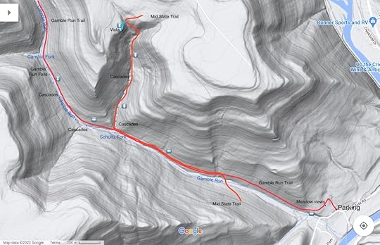
 This map is for general directional purposes only, it is not a GPS track.
More photos:
View this post on InstagramA post shared by Jeff Mitchell-Outdoors Author (@hiking_mitch)
View this post on InstagramA post shared by Jeff Mitchell-Outdoors Author (@hiking_mitch)
View this post on InstagramA post shared by Jeff Mitchell-Outdoors Author (@hiking_mitch)
View this post on InstagramA post shared by Jeff Mitchell-Outdoors Author (@hiking_mitch)
Jeff Mitchell's Blog
- Jeff Mitchell's profile
- 3 followers


