
Max Carmichael's Blog, page 9
January 22, 2024
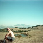
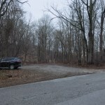
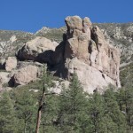
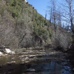
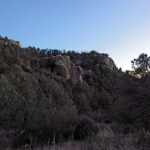
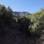
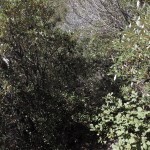
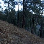
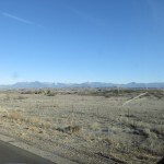
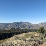
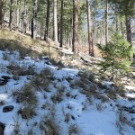
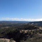
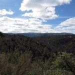
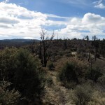
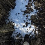
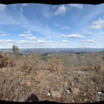
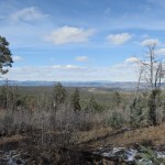
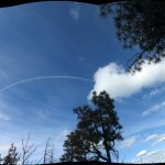
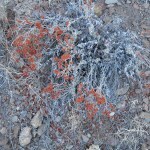
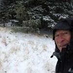
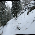
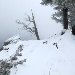
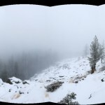
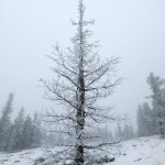
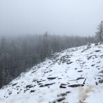
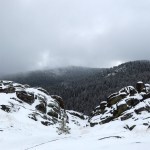
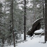
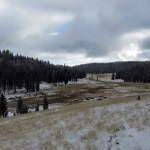
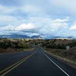
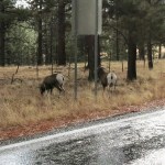
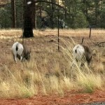
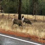
Mud Day
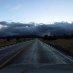
I could tell from the clouds on Saturday that we were going to get rain Sunday. But I hike in the rain all the time and it’s never been a problem around here.
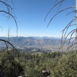
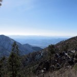
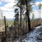
My problem was, as usual, deciding on a hike. I’d gone three weeks without hiking, in darkest Indiana under heavy cloud cover, and most of our local hikes involve a canyon – I wanted something exposed, with a view to remind me I was back in the West.
I was tempted to make a long drive into Arizona, spending the night over there. But the options there weren’t much better and would involve more complications. In the end, I used up an hour and a half trying to decide, then leaving late, headed north to a new area I’ve been studying on the map.
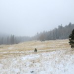
With the late departure, it would be a shorter hike than usual, but at least I could do some scouting for a later return. On the way, I spotted a blue heron standing in the Gila River – I assumed that was a good omen.
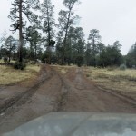
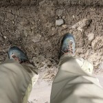
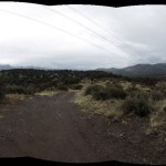
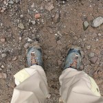
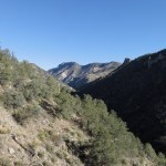
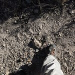
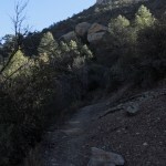
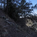
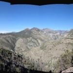
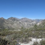
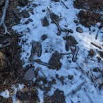
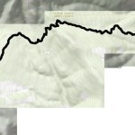
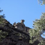
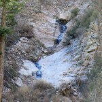
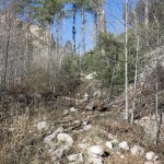
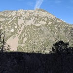
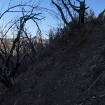
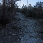
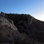
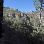
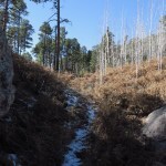
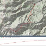
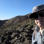
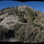
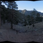
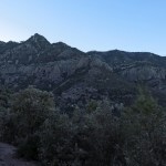
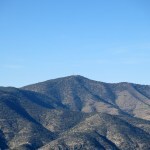
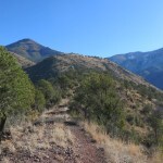
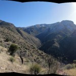
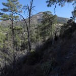
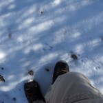
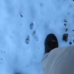
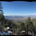
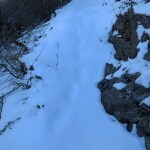
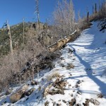
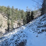
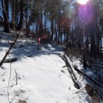
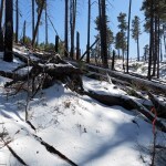
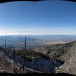
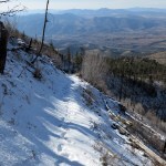
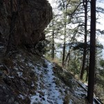
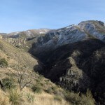
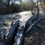
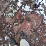
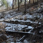
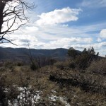
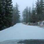
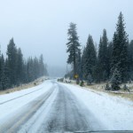
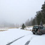
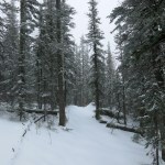
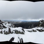
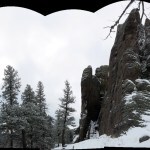
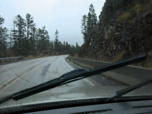
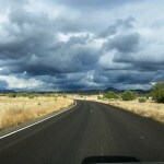
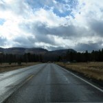
The trail I wanted to try is a long traverse west across the foot of a 9,000 foot mountain, with branches along the way. The turnoff is an hour and a half from town. It’d been raining on and off all the way, and the long forest road to the trailhead turned out to consist of mud, snow, and ice. I’d never really tried this vehicle in serious mud before. The road set out climbing a shallow ridge where, despite being in low-range 4wd, I immediately started sliding around. I only made it about a half mile before approaching a deeply washed out section where I was almost certain to get stuck. When I got out of the vehicle to scout, my boots sank an inch into the muck.
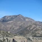
There was another option on my list, a six-mile ascent of a 9,800 foot peak. I knew I wouldn’t have time to reach the top, but again, I could do some scouting. It required driving east through the tiny county seat, a hotbed of the anti-government Sagebrush Rebellion. I had thought about spending the night there, if the town’s one motel actually existed. Google Satellite View showed a vacant lot at the address, but the place had a website and ample online reviews.
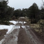
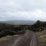
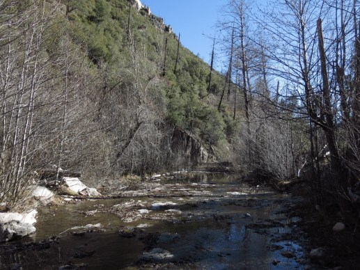
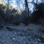
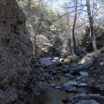
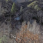
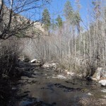
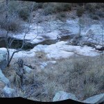
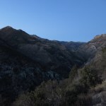
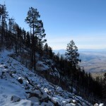
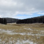
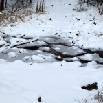
The motel was indeed there. And past the town, I found the turnoff to the next trailhead, a long and winding dirt road. It wasn’t too bad at first, but after a few miles it climbed to the rim of the canyon of the Tularosa River – which I knew it had to ford at the bottom – and I could see the descent involved more mud, snow, and ice. I definitely didn’t want to start down and find myself unable to drive back up. This day was turning into a real bust.
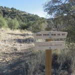
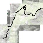
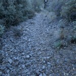
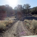
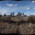
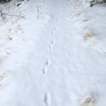
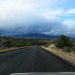
But on the way north to the first trail, I’d passed one of those little “hiker” signs that I’d never noticed before, about ten miles south of my destination. I checked the national forest map I carry in my pack, and found there was indeed a numbered trail there, heading west into the Blue Wilderness. This trail is not shown anywhere online – it only appears on the official printed map.
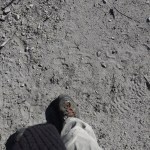
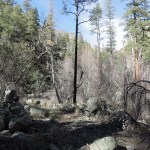
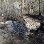
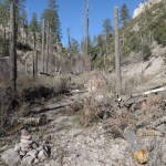
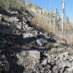
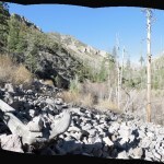
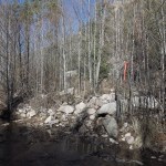
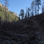
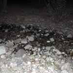
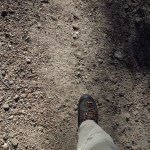
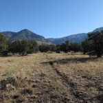
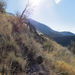
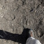
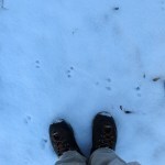
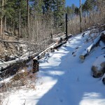
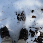
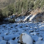
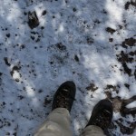
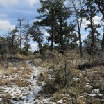
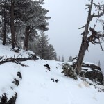
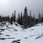
I drove another half hour back south and easily found the turnoff. The map showed a dirt road heading west less than a mile to the trailhead, but what I found was the deepest, softest mud yet. Still, after all that driving I was determined to walk, so I parked just off the highway, and began trudging west, immediately picking up several pounds of mud under my boots.
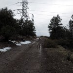
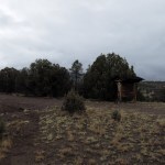
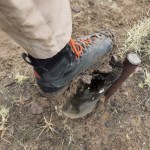
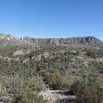
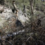
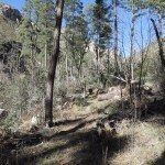
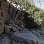
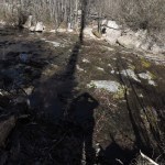
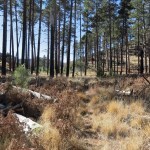
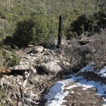
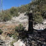
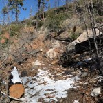
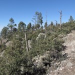
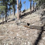
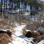
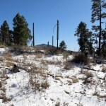
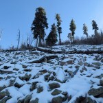
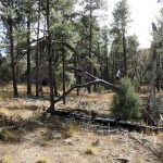
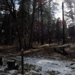
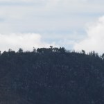
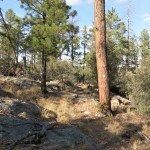
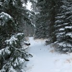
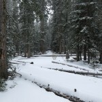
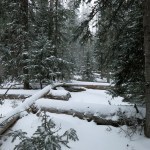
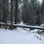
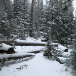
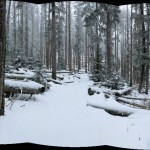
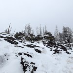
As bad as it was on this road, the mud was even worse when I tried to walk off the road, where it was uncompacted. The road climbed up a little peak to two transmission towers, part of the powerlines that bring our electricity from the coal-fired plants up north. Past the peak, the road enters the wilderness area, continuing downhill to the trailhead. I was surprised to find an old wooden kiosk, but I wasn’t surprised to find a family of mice living in the box where trailhead logs are stored.
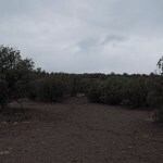
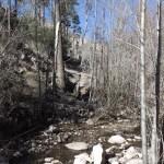
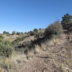
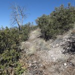
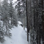
It’d been drizzling on and off. I’d only gone about 3/4 of a mile, and each boot was carrying a big pad of mud like a brown snowshoe. Past the kiosk, I started up the trail proper, but it was even worse than the road. I made it a few hundred yards up another slope, then realized this was pointless. It was forecast to rain all day and this could only get worse. And both road and trail had been heavily trampled by cattle, despite federal wilderness designation.
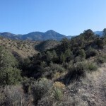
On the way back I saw headlights approaching and stepped aside for a late-model Toyota pickup. I waved but couldn’t see inside – they’d had all the windows tinted, even in front. Where were they going? The powerline is the wilderness boundary – the road is closed past it. Maybe they wanted to camp under the transmission towers – there’s a great view – but they’d be camping in mud.

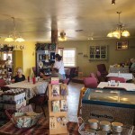
So much for hiking. It was close to 1 pm, and I’d had nothing but snacks, so I was hungry. There’s a roadside cafe about ten miles north that’s seldom open, but I’d noticed the parking lot was full earlier, so I headed north again.
I was able to get chorizo and eggs, served by a lady with a European accent and a teenage Black boy, and by the time I was finished it was almost check-in time for the mysterious motel in the right-wing county seat. I now knew that the geology in this area is unlike any of the other areas where I hike – the ground is some sort of fine clay that becomes unwalkable when wet – but I wanted to return in dry weather, and it’s far enough that I would need a place to stay overnight. So I might as well try the motel.
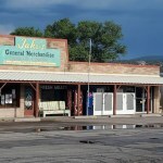
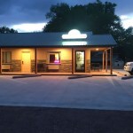
I turned out to be the only guest. Everything looked new, which explains the vacant lot on Google Satellite View. I needed yogurt for breakfast, which led me to the discovery that the “General Merchandise” at the crossroads is really a supermarket crammed into a small building. Of course – it serves an entire county that’s remote and sparsely populated but huge.
After settling into my motel room, I realized this was just what I needed. At home, I’m surrounded by work to do and problems to solve. Maybe this is why I like motel rooms so much. For a minute there, I imagined myself just living in motel rooms for the rest of my life. The phone rang and messages arrived – needy people, demanding my attention – but I ignored them. And the next day, it was hard to leave.


January 19, 2024
Working Out – A Lifelong Journey
 1976-1977: Rebounding in the Gym
I was an undersize child – the smallest or second-smallest boy in my class – and weaker than the other boys and many of the girls. They called me Tiny Tim and taunted, chased, bullied and beat me. In junior high our physical education teacher was an ex-Marine drill sergeant who marched us around the neighborhood in tight formation and encouraged the strong kids to pick on the weak ones like me.
I grew about six inches in high school, and found the companionship of other unpopular outsiders. But when I fell in love at the end of my senior year, my girlfriend’s father, a respected math professor and former basketball star, forbade her to see me, calling me a “spineless jellyfish” who wasn’t fit to date his daughter since I hadn’t excelled in sports.
So we hid our relationship from him all through college, until she dumped me six years later for her much older boss. My best friend in grad school encouraged me to start working out, so I headed over to Stanford’s tiny, antiquated weight room, where one of the first people I saw was my ex’s new fiance. Still, I managed to put on over 15 pounds of muscle mass before finishing my master’s and rejecting the career I’d prepared for.
My most vivid memory from that gym is of the tall, slender man from India, a rock climber, who did fingertip pullups on the door frame. I, on the other hand, was building muscle to compensate for the loss of self-esteem in being suddenly abandoned by someone my life had revolved around for six years. But it’s never that simple. I was challenging and learning about my body in many other ways then, after growing up repressed and inhibited – building muscle was just one of those learning opportunities.
 1988-1993: Growing Into the Role
Bohemians don’t work out. I was no longer weak, but I was comfortable enough in my body after grad school that I went for more than a decade without trying to make it any stronger. It was the drummer in my band, my close friend Mike, who finally said I didn’t have enough presence to be a bandleader, and should hit the gym to bulk up.
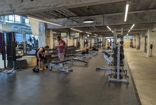
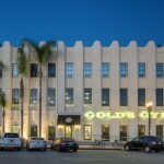
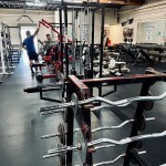
He became my fitness coach, getting me started at his gym, Gold’s on Oakland’s Grand Avenue, near beautiful Lake Merritt. Gold’s was a bodybuilder’s gym, and from the beginning I enjoyed their intensity and sometimes flamboyant personalities. Ordinary fitness buffs are often afraid they won’t be welcome at bodybuilder gyms, but it’s just the opposite. Everyone who puts in the effort is respected.
The impetus for this effort was my friend’s belief that bigger muscles would inspire my bandmates and appeal to our audience, but again, it’s never that simple. Building muscle feels good, and in moderation, looks good – and looks are important to visual artists. I quickly came to love my new body, and wanted to see how much better I could make it.


Mike taught me to warm up, to stretch, and to spend hours per session. He inspired me to eat healthier – he blended and guzzled fresh carrot-beet juice daily and got me started eating brown rice. He was also taking a choline supplement, a stimulant a lot of athletes were using at the time, and had settled into a routine of 3-4 hour workouts twice a week, plus running on the beach at Alameda.
I discovered right away that there are always people who seem to live in the gym – bodybuilders included. They work hard on their reps, but between sets they socialize as if they have all the time in the world. I occasionally talk to strangers, but mostly I’m the quiet, intense guy who just wants to do the work.
I took the choline, but I had no interest in cardio. I just wanted to see how big I could make my muscles, and I started wearing skimpy tank tops and tight shorts from boutiques in San Francisco’s Castro District. When we played the I-Beam, a famous club in the city, the bartender sneered and called me a fag.
This was when I met the love of my life, an aspiring musician and aerobics instructor. I attended one of her classes, and the students congratulated her on how buff her boyfriend was.


 1993-1997: Working Out Homeless
But at the same time, my obsession with the desert was consuming me. I ended up leaving the girl in Oakland and moving to my desert land, where I did pullups on the beams of the old miner’s shelter I was living in, deep in the wilderness, with one long workout per week at the new Gold’s Gym in Victorville during my 80-mile trips to town for supplies.
Then I ran out of money, the long-distance girlfriend dumped me, and I became homeless and increasingly in debt for most of the next four years. Shortly before breaking up, she’d remarked on how flat her new man’s chest was compared to mine, and I realized that a muscular lover is not that important to most women. But I never stopped working out, and I got used to random sessions in whatever gym I happened to be near at the time.
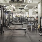
I moved to Los Angeles in 1995 and joined Gold’s Hollywood, the home gym for Fabio, Hulk Hogan, and my favorite TV personality, Huell Howser. Jody Foster was sweating on a stationary bike when I entered one day.
Gold’s Hollywood was probably where I reached my peak muscle mass, more than 20 pounds over my base weight. I’ve always enjoyed the hardest exercises the most, and at that time I was saving wide grip pullups for last because they were so damn hard. I’ll never forget how good I felt when I touched the floor at the end of the last set.
 1997-2001: Climbing the Dotcom Boom
I returned to the Bay Area at the start of the Dotcom Boom, inventing a new career and paying off my debt. I was living in Pacifica, but Gold’s had opened a fancy new gym South of Market near where I was working in San Francisco, so I joined that for a while. Then I started my own business, working from home at first, and joined the Pacifica Athletic Center, in a former supermarket near the beach. This was another bodybuilding gym – they had a power-lifting contest, the perennial winner of which was Bill Armstrong. I loved living in Pacifica and that really felt like my first “home” gym.
Fitness addicts know that as long as you’re working out, you’re in pain somewhere. Until late 1999 I’d just had muscle strains. But suddenly my back felt like I was being sliced in half at the waist – my lumbar disks were starting to collapse. From then on, my focus would no longer be on building my body, but rather on avoiding injury while remaining able to do the things that make my life worth living.

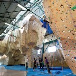
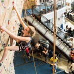
After opening an office in North Beach, I ended up with a new hippie girlfriend, who shunned gyms and fitness as yuppie affectations. Since I refused to stop working out, she suggested we join a climbing gym together, and since she lived and worked in Berkeley, we joined the Berkeley Ironworks, in an old factory near the Bay. And since climbing gyms also typically have weights and machines, I could also keep pumping iron.
My close friend Carson had started working out and mountain biking with me years earlier, and now he started climbing too. We sometimes climbed together at his gym, Mission Cliffs in the city. I’d mostly worked out alone since the early days with Mike, but a partner was always welcome, especially since you could get a beer and burrito together afterwards.
I’d tried to maintain my gym schedule while traveling before, but during the Dotcom Boom, when I had lengthy engagements in Chicago and Portland, I began to take advantage of hotel fitness centers.
 2002-2005: Working Out Busted
As the Boom collapsed, my last relationship fizzled out. I moved to the desert and stayed in an old ranch house where I invented strength-training exercises using rocks and parts of the building. I was still into indoor climbing and found a gym in Vegas where I could boulder on occasional shopping trips.
I visited a close friend in Los Angeles who took me to the Hollywood YMCA, where I started doing a new exercise I’d seen someone else doing, the halo. I was doing it with 45 pound plates then – now I can only do 25! On another visit, I climbed at a gym in Culver City where the desk clerk broke into my locker, stole my credit card, and used it to buy gas and groceries before I could get it canceled.
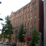
The tech industry work eventually started coming back to me, and I got a series of contracts in the Seattle area. First, I lived on Capitol Hill and worked out at the old Downtown YMCA, a maze-like, multi-story brick building. Then I stayed at an extended-stay place in Bellevue – a really interesting time when I harvested wild blackberries for breakfast among the tents of the homeless in an urban pocket forest, and went on runs in the foggy dawn through the affluent suburb to a distant park that combined a farm and wetland. There, my gym was a generic urban fitness center I can barely remember.
And whenever I returned home, I bouldered alone or climbed with Carson at the Bay Area climbing gyms.

 2006-2015: Moving and Losing
I’d been trying to escape the city for years, and when I could tell the work was going to keep coming, and clients would pay me to travel, I made one more scouting trip, and found my place in New Mexico. There was a fitness center only a few blocks away, and it would become the longest gym membership I’ve ever had – but unfortunately I have no pictures to share. Suffice to say it’s very low-key, and the regulars were people I interacted with regularly in the community – one of many advantages to this small town.
But shortly after moving I began my longest-lasting contract, in San Diego, and started commuting regularly by air, at first via Tucson, a three-hour drive. At first I would drive to Tucson, fly to San Diego, work a day, fly back, and drive home during the night, to save money. After the money accumulated and the travel got old, I began staying over at Tucson and working out at my favorite hotel there, which has a bigger-than-usual fitness center.
Eventually, I was established enough that I could arrange longer stays and connecting flights from our local airport. I found a favorite hotel in San Diego – they had a minimal fitness center but I only needed it for one session at intervals of two weeks to two months, between which I worked out at home.
That contract sent me all over the continent, from the south to the east to Canada and the northwest, and on every trip I found a gym or fitness center. The one I remember best was a neighborhood gym on the near west side of Grand Rapids, apparently closed now.


And at least once a year I flew back to Indianapolis to visit family, where I’d join my mom at the YMCA. Originally we worked out at the Athenaeum, the ornate old “German House” where my mom was a donor and I had special privileges. But then they opened the ultra-modern CityWay facility south of downtown, and we just had to go there, despite the hardship of getting me in as a guest. I could make both work – CityWay was new and shiny, but had the downside of a more bourgeois clientele.
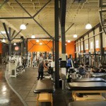
The San Diego work was completed, and I had a short hiatus, running out of money again before resuming in Palo Alto in 2012. There, the client wanted me onsite, and AirBnB was a new thing, so I found myself living first in Pacifica, where I rejoined the Pacifica Athletic Center almost a decade later, in its new digs in a strip mall. Later I settled near Stanford, working out on my alumni pass at the new Arrillaga Athletic Center. I always worked out early before hitting the office, and I was the old guy surrounded by students, so my workouts were always efficient, helped by the clean, well-maintained equipment.
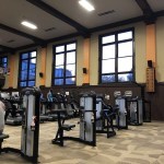


 2015-Present: Fighting Back
My right hip had lost all its cartilage by 2007, and by 2014 I was unable to hike, so I had it resurfaced in 2015, and that began a long ordeal of serial joint conditions and arduous rehab, during which I still tried to work out as much as possible. I’d terminated my tech industry career so I was working out and getting rehab at the same facility – my home gym. And then COVID hit, and my house caught fire.
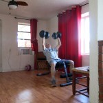
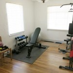
I bought a really cheap weight bench and adjustable dumbbells at Walmart at the start of COVID, and after the fire I cleaned those and set them up in my temporary place at the edge of town. I bought resistance bands I could attach to door hinges for back and shoulder work. Six months later I was kicked out of that place, and I set up the bench and weights at the side of the weird front room in the inconveniently subdivided old house I moved into next.
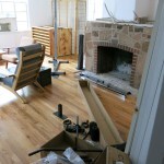
Finally my house was repaired enough for me to camp there, and I moved my meager fitness gear into the small dining room, which had been my music studio before the fire. For a year and a half I’d had to stash the fitness gear in a corner, moving it out to use and back when I was done. Now I could leave it set up in its own dedicated area.
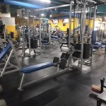
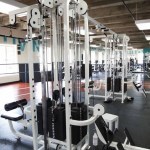
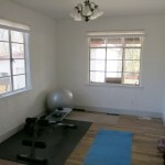
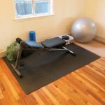
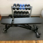
I missed going to the gym, but it just didn’t feel safe yet, and I’d found that when working out at home, I could multi-task. So I began accumulating the gear I’d been missing the most. Floor mats so I could handle the dumbbells without damaging the refinished wood floors. A cable pulldown machine because the door-mounted resistance bands had turned out to be useless. Dipping bars, fixed-weight dumbbells, and a storage rack. And finally, a near-gym-quality adjustable bench. It seems to be all I’ll ever need, and it was accumulated gradually, after research to find mid-price options of sufficient quality, so the cost impact was low.
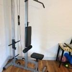
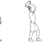
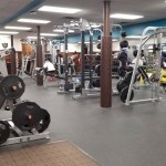
My workout has continually evolved, while sometimes returning full circle to old favorites. During recovery from injuries or joint conditions, workouts become rehab sessions, and after I recover, some rehab exercises become part of my weekly routine. With a lower back condition, I prioritize the core, starting with a core warmup before a lengthy stretching series, then into upper and lower body strengthening. Some of my long-time favorites are wide grip pullups/pulldowns, dips, dumbbell pullovers, and the halo. Besides my lower back, the biggest recurring problem is rotator cuff tears in both shoulders. Since I live alone, the lengthy incapacitation of surgery wasn’t an option, and physical therapy made the problem worse, but on my own, I’ve cobbled together exercises that mostly enable the surrounding muscles to compensate for both injuries.
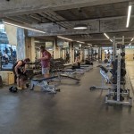
I’ve worked out at between 50 and 100 different gyms and fitness centers all over North America. But on my last trip to Indianapolis, I used a gym for the first time since COVID, a huge new bouldering gym in a former factory. Since my foot condition prevents climbing, I only used the weight room, but it felt like coming home.
For the traveler, every gym is a space station, like Denny’s used to be on my routine drives between San Francisco and Los Angeles during the punk years. The same familiar, useful stuff – timeless, unchanging, comforting, a refuge along the way where you can do what you need to do to stay strong. You’re an outsider – anonymous, a secret agent – but there’s always people-watching and the opportunity to interact with strangers, and those interactions are eased by the universal language of gyms. Man buns seem to be the thing now in Indiana – Hoosiers are always at least a decade behind the coasts. And I was surprised to see patrons going barefoot throughout – traditional gyms consider that both dangerous and unsanitary.

January 1, 2024
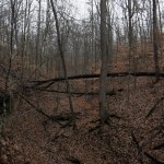
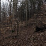
Dead of Winter
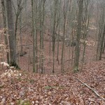
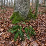
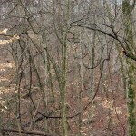
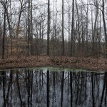
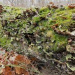
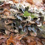
The Eastern Deciduous Forest is where I grew up. I formed a whole mythology out of it in early childhood. The radical swing of its seasons seemed to amplify the emotional rollercoaster of my adolescence, from the tantalizing fertility of summer to the Calvinist repression of winter.
On every visit to Indiana I hike this forest. Coming from a land of towering mountains with forever views in a roadless wilderness as big as some states, this tiny patch of second-and-third-growth habitat covering modest ridges and hollows only frustrates me and makes me long for the West. And that’s even worse in the monotony of winter, when the entire ecosystem is resting or decomposing to the base nutrients that will fuel spring’s renewal.
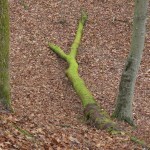
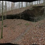
It was a dark day, the temperature hovering just above freezing. I was the first on this popular trail in the morning, but after a couple hours I was passed by a male trail runner. We’d had several rains in the past week, so the carpet of leaves covering the trail was especially slippery and hid the roots that crisscross the ground. It was hard enough for me to keep from slipping or tripping – I couldn’t imagine running in these conditions.
I passed a handfull of other hikers throughout the day, and on the highest ridge – only 300 vertical feet above the deepest hollow – I passed a young guy setting up camp under a lean-to, only a few yards off the trail, then noticed another farther off in the forest. It had started to snow lightly. The guy under the lean-to conjured romantic images of mountain men on the frontier, but he’d only walked a mile from his vehicle and climbed less than 300 vertical feet, you could still hear cars passing occasionally on the road he’d driven, and there were farms and more paved roads within the next mile.
December 18, 2023
The Longest Day
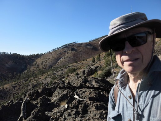
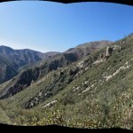
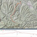
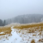
Trying to regain the capacity to do long, deep wilderness hikes with massive elevation gain, I thought I was ready for one of my favorites, on the west side of our local mountains. It involves steep grades that are brutal on the feet, so I’d avoided it for the past seven months, but I hoped I was ready now.
The sky was clear and the temperature in town was expected to reach the mid-60s. The hike involves crossings of two major creeks, but the drainages are on the south side of the mountains, we hadn’t had any precip in weeks, and I figured flows would be low.
I was surprised to find a new restroom installed at the remote trailhead. As I’d learned on my last visit, there’s a dirt airstrip a short walk away. It serves no purpose other than as a destination for aviation hobbyists, who like to fly into remote strips like this simply so, like birders, they can check them off their life lists. Fly in, fly out.
Anyway, they’d built a pristine new restroom at this trailhead that doesn’t need one, for their private convenience.
The traverse down into the first canyon gets full sun, so I was shedding layers all the way, until I reached the shade of the bottom, where the temperature immediately dropped 30 degrees. It was so cold down there my nose and face were in pain – probably another symptom of Raynaud’s syndrome – so I stepped up my pace.
The climb up the switchbacks on the opposite side soon warmed me up. I’d seen one footprint on the descent, but like most visitors here, other recent hikers had stuck to the canyon bottom, and the trail out of the first canyon had only been used by animals since the last work party, probably last spring.
My energy and wind seemed pretty good, but it still took me two hours to climb the two miles and 1,400 vertical feet to the west end of the rolling plateau, at a 13 percent average grade. It struck me that my old familiar trails are harder now, after months of foot trouble, than they were last spring. And last spring, they were harder than they were a year earlier, before my near-fatal illness. It seems that my loss of capacity is permanent.
After that sobering realization, the “walk in the park” north-eastward across the rolling plateau, toward the dramatic talus-draped wall of Lookout Mountain, cheered me up, and I covered that mile-and-a-half, including another steep climb in loose rock, in only 45 minutes.
The 1,200 foot descent from the saddle at the east end of the plateau, to the creek at the bottom, takes place mostly in shade and involves a steady 19 percent grade, in loose rock, for a little over a mile. Whereas most people find going downhill on loose rock more daunting than ascending, I’ve been downclimbing on this kind of surface for years and it doesn’t trigger my foot condition like going uphill.
Lunchtime had arrived, and I was holding an open bag of homemade trail mix at one point while hiking downhill and trying to do something with my other hand. A dozen or so nuts and sesame sticks tumbled out on the ground, but I still had plenty left, so I kept walking for half a dozen steps before catching myself. You’re deep in the wilderness, dude – waste not, want not. So I turned back and carefully picked every single nut and stick out from among the rocks.
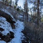
It’s always a relief to reach the parklike ponderosa forest on the lower slope, where the surface immediately changes from loose rock to packed dirt and pine needles.
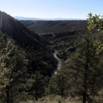
Sometimes I cross the big creek and traverse the opposite slope toward a third canyon. But my research had suggested that two miles of the upstream trail had been cleared since my last visits, so I wanted to try that today. But it’d taken me 3-1/2 hours to reach the creek, and I only had a total of 8 hours to finish the hike by sunset. Two miles upstream would take me at least another hour, getting me back to the vehicle in the dark. But carrying a headlamp, I wasn’t worried, and I really needed to check out the newly cleared trail, which could take me that much deeper into wilderness.
The upstream trail is another slow stretch, traversing a steep slope between ten and fifty feet above the creek, up and down and in and out of side drainages, around tree trunks and boulders, the forest blocking most of your view. I crossed the creek a few times, scrambled over some blowdown, passed the beautiful bedrock soaking pools I’d discovered a couple of years ago, and finally reached the debris flow where the trail had ended before.
Sure enough, there was now tread leading down the vertical bank and up the debris flow. I knew this was unsustainable – it’d be completely obliterated in the next big flood – but this is the future of trails in the new fire regime.
I had entered a stretch of canyon that had been devastated by the 2012 wildfire and subsequent flooding and erosion. The trail crew had done a huge amount of work here, but unlike trail work I’d seen in other more popular national forests, this was quick and dirty. Tread had been hacked up banks of loose dirt that would wash out in a heavy storm, and brush had been cleared across floodplains that would fill with debris in a wet monsoon. Still, it was new trail so I kept going.
After passing a huge pool, I finally reached a place where the creek ran wide over flat bedrock for 150 feet. I’d used up another hour and a half and really needed to turn back. But I saw a pink ribbon upstream, so I picked my way across, and saw that the trail continued on the other side.
It’d taken me five hours to get this far, and it would take me almost that much time to return. I’d never stayed out this long since I started doing these wilderness explorations, and I knew I’d end up hiking over an hour in the dark – but it’d be on familiar trail, with a headlamp.
On the way back down the canyon, while scrambling over all that flood debris, I managed to fall and slam the ball of my left foot against the point of a sharp rock – which is something I can never allow myself to do, because that’s where the inflammation is always latent. There I was, seven miles back in the wilderness, facing a 1,200 foot climb on loose rock at a 19 percent grade, and I might’ve set my recovery back six years, to when the condition first became acute.
But all I could do was keep going. I could still take short steps, thanks to my stiff winter boots. And when I reached the bottom of that killer grade, I forced myself to climb super-slow, with little mincing steps to minimize the flexing of my foot and the pressure on the ball. I’d never tried that before, and it worked – despite the grade, I could climb continuously, indefinitely, without stopping for breath – something I’d never been able to do before.
It took me an hour and a half to climb a little over a mile up that brutal grade.
The sun was still peeking over the plateau in the west, but I had a mile and a half of plateau to cross, followed by two miles of steep descent on loose rock, and the final climb of more than a mile out of the first canyon. I was trying to avoid rushing, trying to take short steps to protect my foot, but the sun was setting, I was running out of water, and I still had many difficult miles to cover.
The sun set as I descended from the plateau. My night vision is pretty good and I was able to see well enough to reach the steep switchbacks into the first canyon, but less than halfway down I was stumbling too much and strapped on my headlamp.
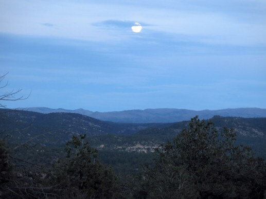
It’d been full dark for a half hour by the time I reached the first creek. I was still stumbling a lot, because with a headlamp there’s no shadows or contrast and you still have a hard time seeing the rocks in the trail. But I was still forcing myself to go slow, and that helped keep my spirits from sinking. That and the moon and the stars.
I’d seen the crescent moon overhead while back in the second canyon, and now it was setting toward the western wall of this first canyon. A bright red star hung high over the opposite wall, and as I climbed out of the canyon, I could see Orion rising in the east.
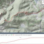
When I reach the trailhead, the Milky Way arched over the northern sky, Cassiopeia glittering at the crest. I’d gone fifteen miles and climbed a total of 4,100 feet, it’d taken me almost ten hours, and I didn’t think my body was up for this any more.
I’d brought my new noise-cancelling headphones to try them out – they’d worked amazingly well on the drive up. And now, wearing them again on the long, bumpy dirt road down the mesa, I had a revelation.
I heard every detail of music I’d been missing over professional studio speakers at home. But more than that, I was happy! A drive on a bad road after dark that has always been nerve-wracking was now peaceful. I was suddenly aware of the aural abuse I’d been subjecting myself to for years. I’d always believed that the rough ride was one of the major drawbacks of this vehicle – I needed to either find a solution for it, or find a different vehicle. But now I knew – it isn’t the rough ride, it’s the noise! From highway to 4wd road, the interior of this vehicle fills with an increasing cacophony of engine noise, road noise, wind noise, squeaks, rattles, and bangs.
And I now knew that I’m hypersensitive to noise. Noise makes me tense, anxious, and ultimately angry. It’s a disorder recognized medically as misophonia, and I’ve been suffering from it for years. It began with my neighbor’s barking dog. After two years of that, I went on a road trip in my new vehicle, accompanying a friend, and ended up having unexplained fits of anger so bad that we had to split up, and I sought therapy afterward. There, it was the dog followed by the vehicle noise that did me in.
Now that I’m facing regular air travel again, the noise of airports and airplanes is yet another trigger. But finally, I have a solution. And that night, driving home in the dark, I felt like a huge weight had been lifted from my shoulders.
December 11, 2023
Too Much Work?
After the relative success of last weekend’s big climb on an unfamiliar trail, I decided to drive over the state line this weekend to re-do a slightly longer big climb that I hadn’t done for over a year. Unfortunately, in multiple instances of wishful thinking, I mistakenly assumed I was back in top shape after more than a year of setbacks, and I forgot how challenging the hike actually is and what limited time you have to complete it once you drive over there.
It was 21 degrees out when I left home, and I packed my gaiters, expecting both creek crossings and patches of deep snow.
Approaching the mountains I was surprised not to see snow on the crest. The temperature at the trailhead, a couple hundred feet lower than home, was still in the mid-20s – colder than I remember in this location – and my uncovered nose quickly got cold, so I hurried through the shady spots. The creeks were lower than I’d ever seen, so the gaiters would just be dead weight.
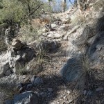
The first three-mile segment of trail climbs 2,000 feet, with the first mile and a half at a steady 15 percent grade, from oak scrub to ponderosa pine forest. From there it traverses a shaded north slope to the junction with the upper trail. I always forget how hard a climb this is.
I’d seen a couple of footprints on the initial climb, but most people just do the first mile or so, and I was the first hiker on the traverse in many months.
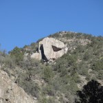
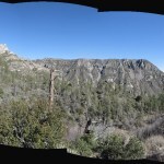
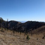
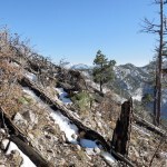
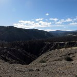
The first payoff of this hike is when you cross into the next watershed, a big east-trending canyon whose head is on the crest of the range. Much of the forest was destroyed in the 2011 wildfire, and at this time of year the rocky, treeless slopes are dominated by ferns in their fall color, rust-red.
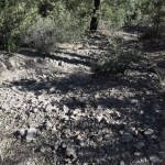
What follows is a traverse that climbs 1,300 feet in another three miles – which doesn’t sound like much, but the trail hasn’t been cleared in many years, the footing consists almost completely of loose, sharp rocks, and our wet year of 2022 resulted in erosion of tread and overgrowth of woody shrubs that block the trail in many places. There was no sign that any other hikers had tried this trail in the past year.
I found this traverse so difficult that I had to stop repeatedly to catch my breath, and in the last mile I realized I wouldn’t reach my destination, and began feeling like I’d made a mistake in coming. This trail climbs to a barren saddle, and from there continues across the head of the canyon to its junction with the crest trail. I’d forgotten that it originally took me three tries, simply to reach the barren saddle, and then another couple of tries to reach the junction, which offers a view into yet another big canyon.
You have to be in killer shape to reach that junction quickly enough so you can return down the trail before the cafe closes, and I was not in killer shape now. The six miles to the saddle had taken me almost 4-1/2 hours, and continuing to the junction would force me to hurry down that treacherous loose rock, almost certainly missing my deadline.
On the way down, I gradually became aware that I’d been so distracted throughout this hike – thinking only of my problems at home – I’d barely even been aware of my surroundings. Normally I love the views here, and I had noticed four redtail hawks working the canyon and a young whitetail buck crossing the saddle, but overall, this was the first hike I could remember that I simply hadn’t enjoyed.
To compound my discontent, I developed a leg cramp on the way down, so bad that for about fifteen minutes, I was screaming whenever I tried to move. This was the third hike in a row where I’d developed a cramp, despite drinking plenty of water and adding electrolytes. I’ve been bringing 3-1/2 liters since cold weather started – that was more than enough in the past – but this year I find I’m running out of water before trail’s end, and getting these terrible cramps.
By the time I reached the pine park – the halfway point – my neck, shoulders, hip, knees, and ankles were all aching. I didn’t know if it was due to lack of conditioning, or simply natural aging. My whole routine for the past five years has been oriented toward longer, higher-elevation-gain wilderness hikes. And whenever I find myself losing capacity, I wonder if the loss will be irreversible this time.
On the way down, instead of enjoying the hike, all I could think of was dining in a restaurant and spending the night away from the problems that are crushing me at home. But despite giving up on my original destination, I still ended up cutting the return too close – the cafe was closing so I had to get my burrito and beer to go.
December 4, 2023
Destroyer of Knees

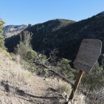
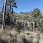
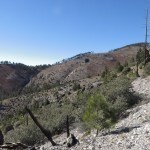
For the past three months, foot trouble had prevented me from doing the high-elevation-gain hikes I crave. But after last Sunday’s successful test, I felt I was ready to up my game. I scanned my eight-page list of hikes but couldn’t find anything exciting within an hour of town – until it struck me that the brutal trail that’d defeated me during our summer heat wave might’ve been cleared during this fall’s season of trail work.
Back then, I’d only been able to hike about three miles of the five-and-a-half miles to a high saddle and major junction. This is a fairly obscure hike I’ve been craving since I recently discovered it on the map, but it’d been a low priority for trail crews, and twelve years of post-fire erosion and regrowth had mostly blocked it and obliterated the old tread, especially in the upper part that traverses steep slopes.
It took me a while to track down reports of recent trail work, but I finally learned that an additional two miles of the trail had been cleared in October. Now the only potential obstacle was runoff – we’d had two storms in the past two weeks, and the high-clearance forest road to the trailhead crosses a creek draining the biggest and highest watershed on the west side of the range. Even if I could cross it early in the morning, by late afternoon it might be a raging flood.
I decided not to take the chance, and instead turn off the highway earlier for a closer, much less interesting hike I’d done many times before and wasn’t excited about today. But all the smaller creeks crossed by the highway on the way up turned out to be dry, so in the event, I kept driving, and when I got to the big creek crossing, it was bone dry – it normally flows underground at this point, and not even the highest afternoon temperatures on previous days had melted enough snow to flood it. Yay!
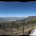
The first snowfall in these mountains had been two weeks ago, during my road trip to Arizona. And the second had been during the past few days. The temperature in town was just below freezing when I left home, the sky was blue to the horizon in all directions, and as I drove north I could see the snow line on the mountains lay at about 8,000 feet.
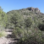
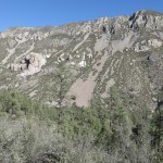
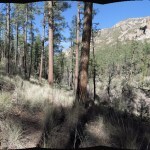
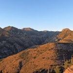
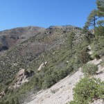
But the climb to the top of the long ridge is steep enough that I shed my storm shell, knit cap, and lined gloves on the way. And as I remembered, the climb up the ridge toward the foot of the mountains, mostly exposed through sparse scrub and open pinyon-juniper-oak woodland, is one of the steepest sustained climbs in our region. But I was motivated to see the newly cleared trail ahead. What attracted me to this trail on the map is that it doesn’t mess around – it climbs directly from the lowest to the highest elevations of this most dramatic western side of the range, crossing watersheds at the end, promising spectacular views both west and east.
In the dirt of the ridgetop trail, I found the hoofprints of the equestrian trail crew, two or three bootprints, and tracks I at first thought were from cattle, but soon realized were a bull elk and one or more cows. Like I’ve found elsewhere, they’d used this man-made trail as a quick and easy path to the crest.
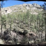
The moment of truth came when the previously cleared ridgetop trail entered a maze of deadfall and regrowth near the foot of a steep, rocky upper slope. This is where I’d wasted the better part of an hour unsuccessfully trying to find a route last summer. And sure enough, deadfall logs had been cut, a wide swath of brush had been cleared, and a path lined with loose rock led up the mountain.
Trail workers had cleared a winding path across a couple of steep drainages that had been filled with post-fire debris flows and dense brush, and I knew that path would be washed out again in the next heavy rain. But for now, it led me almost a half mile north across the western slope of the rocky peak above, which temporarily hid the higher peaks from sight. It wasn’t until later, looking up from below, that I discovered the canyon below the long ridge is blocked on the other side of this peak by a sheer rock wall that extends from side to side like a high dam, with only a narrow slot for the creek to drain through. This, and the rock bluffs surrounding the lower peak, is why the trail had to be routed far to the north.
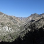
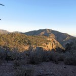
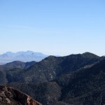
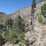
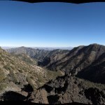
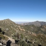
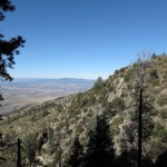
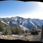
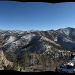
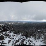
But eventually, the trail took me around a corner into a drainage that would lead, via many switchbacks, back toward the crest. This drainage is in shadow all winter, so the snow from both storms still covered the trail. I’d already climbed 2,500 vertical feet and had amazing views west, across the valley of the San Francisco River, to the rim of the alpine plateau I’d visited on my Arizona trip, and even to the now-snow-covered range ninety miles to the southwest that I’d last climbed in mid-September. This is what excites me about these crest hikes, climbing through a view that encompasses a vast landscape I’ve explored on foot and gotten to know up close as well as from far away.
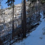
The trail climbed steeply up this first drainage and reached a broad saddle where there had been a big blowdown – dozens of mature ponderosa pines snapped off at the base or uprooted, all toppling eastward. But the trail snaked its way through them, logs cut by the trail crew where necessary.
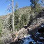
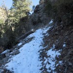
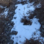
Past the blowdown saddle at 8,000 feet, the snow cover became continuous – at first an inch deep, then two. The trail switchbacked up into another steep, north-trending drainage, even darker than before, where snow had accumulated from four to five inches deep, and I was daunted to see the continuation of my trail towering above, cutting clearly through burn scar and talus slope. I’d forgotten to bring my storm pants and gaiters, and snow was soaking into the cuffs of my canvas pants.
It was here, in the deeper snow, that I discovered one previous hiker, a bigger man, had hiked this far in the past two weeks, between snowfalls, because his tracks had been filled in by last week’s storm but were still faintly visible. But his tracks ended at the last talus slope, which I had to cross very carefully because the snow hid the deep cracks between rocks. And past that, in an eroded gully, the rebuilt tread ended.
This is a situation I’ve learned from several different mountain ranges and national forests – initially, trail crews scout far ahead, flagging a route, and even doing cursory clearing of brush and cutting of smaller logs. Then during a formal work party, they return with more people and gear to clear everything and rebuild tread, but only up to a shorter distance. A hiker can continue beyond the rebuilt trail, as long as you can find the pink ribbons, which can be far apart and hard to see.
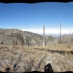
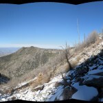
Beyond that gully, the route switchbacked and traversed a sunny, snow-free slope up a shallower drainage, then, on a short stretch of surviving, snow-covered tread partly blocked by deadfall logs, ascended what appeared to be the last slope to the crest. At this point I was beside myself with anticipation of a never-before-seen view.
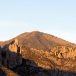
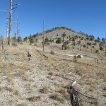
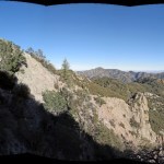
Pink ribbons led me into a thicket on the crest, where I found myself with a view across the head of the canyon I’d started out in today, nearly five miles and 4,000 vertical feet below. I could see the peak whose shoulder I’ve climbed many times on one of my other favorite hikes, but I couldn’t seen the interior summit crest of the range, which is what I’d been hoping for.
East of the thicket I stood in lay a steep, rocky, trackless slope covered with stubby scrub oak and deadfall. I could see another pink ribbon in the distance, and it appeared that by traversing that slope for a few hundred yards, I might round another corner and get a view toward the heart of the range.
There was no trail left, but I found the fresh prints of the elk, so I just followed them from ribbon to ribbon. They led to a rock outcrop which was almost too good to be true: it was like a viewing platform for the highest peaks of the range, laid out before me in their fire-scoured, snow-blanketed majesty.
About three hundred feet below I glimpsed another red ribbon, in the saddle which led to the trail junction. And at my feet were piles of elk scat, which was so fresh – still moist – they had to have been there earlier today. Due to the steep grade and the snow, it had taken me more than four hours to go five miles. But this was already one of my favorite hikes.
In fact, with a nearly fifteen percent average grade, this is the steepest major trail in any of the mountain ranges in my region. That became painfully clear on the descent, when I struggled to walk slow enough to protect my foot and knees.
But in stretches where the grade decreased, I was able to study the view to the west, trying to identify peaks I’d climbed or driven past. The landscape was all laid out for me, but much of it remained a puzzle until later, when I could study a large-scale topo map.
The final traverse of the newly cleared trail took place in the full light of the setting sun, and I had to stop to take off my sweater and thermal bottoms. In the process of taking off my snow-soaked pants, I got my socks wet and had to change into the spare pair I always carry. I’d developed a sharp pain in my right knee and wondered how bad it would get – I still had over 2,000 vertical feet to descend.
The answer is, pretty bad. Halfway down the long ridge I strapped on the knee brace – my heavy pack is permanently loaded with first aid and other emergency gear for situations like this. That ridge always seems to go on forever, but with the brace, I was able to reach the vehicle about fifteen minutes after the sun sank behind the western horizon of the river valley. Ending hikes in pain is a fact of life now, but in this case, I guess it was worth it.
November 27, 2023
Close, But No Cigar
My problem foot had turned out okay after last Sunday’s hike – probably because I was wearing the stiffer winter boots – but I still wanted to work my way gradually up to longer and steeper walks. So this Sunday I was looking for something more than 12 miles but with less than 2,500 feet of elevation gain, and no prolonged steep grades. That’s a big ask around here – all the level ground within an hour of town is private land, hence all the nearby trails climb mountains.
There was really only one option – the boring north-south segment of the national trail I’d done twice before. I was still hoping to link it with the segment I hike from the opposite direction, but wasn’t optimistic – it would involve more than 20 miles out and back. No way would I accomplish that today.
Especially when I discovered my driver’s side door lock had frozen overnight. I had to let myself in the passenger side, then clamber over the center console and shift lever in my big winter boots, start the vehicle and run the heater for 20 minutes before the lock would operate. And while waiting, clamber back out and scrape frost off the windows.
Then on the drive, I had so much on my mind that I passed the turnoff and drove up into the eastern mountains for another 10 miles until I realized my mistake. After turning around, I finally reached the trailhead 45 minutes later than usual.
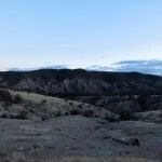
The climb to the ridgetop was scenic as usual. The sky was mostly clear, with bands of clouds hanging over the horizon, and although the temperature was in the 20s, the climb generated a lot of heat and I kept shedding layers.
Once you reach the ridgetop, it’s just a trudge through forest, with occasional boring views, about 7 miles to a little-used forest road. Birds were active, but I only recognized jays, flickers, quail, and juncos. I did find smallish bear tracks in snow that had fallen the day before.
I was giving myself 8 hours, and I reached the forest road with an hour to spare. And my foot seemed to be doing okay, so I would continue and see how close I could get to linking the two segments of trail.
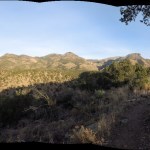
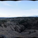
Past the road, the trail began climbing steadily. I knew from the topo map that it was approaching a ridge that curved around the watershed of a creek – the other side being the segment I’d hiked from the opposite direction. Eventually I reached the ridgetop, and was rewarded with an unexpected 180 degree view, from the 9,000 foot high point of the range I was in, to 9,300 foot Black Mountain, 55 miles north, and the 10,200 foot crest of the eastern range, 35 miles east. My time was up, but despite not closing the chain, I’d reached a worthy destination. I figured I’d gone more than 8 miles, and felt pretty damn good.
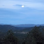
But as usual, the descent of that long ridge seemed endless, and before the halfway point my entire lower body was aching. About three miles from the trailhead I encountered a couple about my age, with a dog, just starting up the trail. The sun was setting, and they were only carrying day packs, so I asked how far they planned to go. “We’ll turn around soon,” the man said. “We’re just trying to work off that Thanksgiving dinner.”
I was able to reach the vehicle before full dark without using my headlamp, but I worried about them. The lower half mile of the trail is like a maze. A full moon was rising but only sporadically penetrated the tall ponderosa pines.
November 21, 2023
Escape to Winter, Part 2
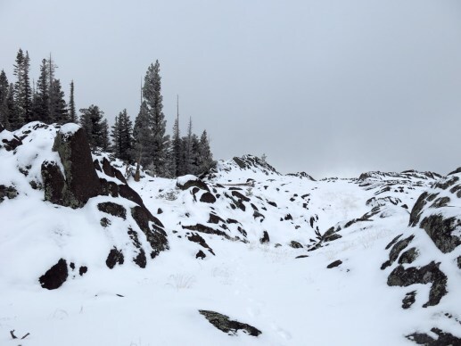
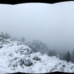
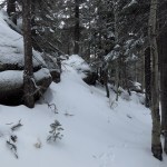
I woke up Monday to dense fog and a dusting of snow here at 8,400′. The temperature was 27 and forecast to reach 37. I hadn’t hiked yesterday – in fact, I hadn’t had a good hike in three weeks, partly because my foot condition had returned after five years pain-free. Despite the weather, I was determined to get out into this spectacular alpine landscape.
I knew there’d be more snow at higher elevations – my favorite hike reaches 11,200′. The highway to the trailhead is closed in winter, and the shortcut from town to the highway is a steep and narrow dirt road. I decided to do a lower-elevation canyon hike I’d started once but never finished.
But I packed my winter gear, and shortly after leaving the motel, I saw the turnoff for the dirt shortcut, and swerved into it. I’d never hiked in these mountains in snow before, so I just had to try it!
I found an untracked inch of snow on the dirt road, up to 9,000′, where the highway had 2 inches. Snow was falling lightly, and the direction I was going had been plowed earlier. I was in 4wd and braked to test the traction before continuing.
When I reached the trailhead parking lot, it was untracked, but as I pulled on my pack and insulated Goretex gloves and started off, I heard an engine. It was the snowplow, returning to clear the highway in the opposite direction.
The trailhead is 9,400′, so I knew the temperature had to be in the low 20s. The only tracks in this fresh snow were from animals – elk, fox, cottontail, squirrel, something smaller.
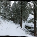
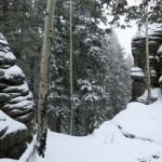
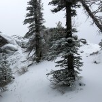
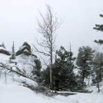
The first mile and a half skirts the long meadows and bogs that cover the level ground on this volcanic plateau, passing in and out of small stands of spruce-fir forest. This was the first time I could remember seeing the meadows in their winter colors.
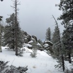
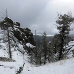
The first couple of miles of this trail see a lot of traffic in warmer weather, and I stumbled a lot because the snow hid irregularities like rocks, erosional ruts, and footprints in frozen mud. It would be even worse in deeper snow at higher elevations. My goal was at least to reach the spectacular viewpoint on the ridgetop. I was moving slow and making a lot of stops to enjoy a landscape renewed by snow.
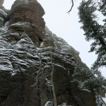
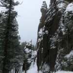
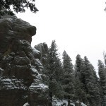
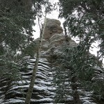
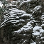
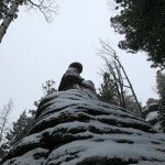
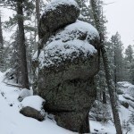
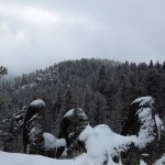
When I reached the last clear stretch before entering the main forest, I could see what the snow was doing to the rock formations. I was in for a real treat!
The trail climbs about 3/4 mile through magical old-growth alpine forest before reaching the cliffs. Almost every aspen I passed had someone’s initials in its bark, but in this snow, silence, and solitude I was truly a pioneer.
Many of these photos appear to be black-and-white – but they were all taken in color!
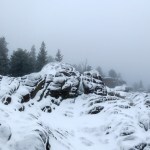
At the foot of the cliffs, the trail switches back to traverse to the ridgetop. This is one of the most spectacular stretches of forest I’ve ever found, and as with everything else, the snow made it new.
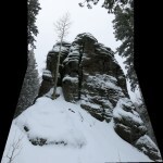
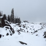
I knew the overlook would be socked in with fog, but who cared? The snow up here at 10,200′ ranged from 3-5 inches deep, easily walkable without needing my gaiters. But the undulating bedrock surfaces had been smoothed over by snow, so I had to take special care in climbing to the edge of the cliff.
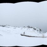
Having made it this far, I wanted to at least reach the second mass of exposed rock, about a mile farther up the ridge. That turned out to be a slow mile, with traverses of steep slopes where I could easily lose my footing and slide hundreds of feet down the mountain.
After arriving, I was especially wary of crossing this outcrop, since the route is unclear and the footing precarious even when clear of snow. But I carefully made it across, and with most of the day left, decided to keep going.
Past that last outcrop, it’s all alpine forest to the crest of the mountain. I would just keep going until I figured it was time to turn back.
But shortly after entering the forest I came to blowdown across the trail. I knew some of it had been there on my last visit, two years ago in August, and at first it was easy to step over. But I ran into more, and much worse, ahead. To avoid sliding off snow-covered logs, I ended up having to make long zigzagging detours.
After bypassing dozens of these fallen logs, I finally reached the edge of a burn scar. My time was almost up, and the burn scar would allow me to log a GPS waypoint so I would know how far I’d gone.
I hadn’t reached the crest, but I knew I’d gone almost five miles. In snow, that’s worth 50% more! And what a place! I can think of few places that would be as magical in snow.
The fog was lifting, so when I reached the viewpoint I could see past the cloud cover to the center of the plateau, with a sliver of blue sky.
I was wearing my winter boots, which offer maximum support. But on the way down, I could tell I’d done more damage to my foot. Only time will tell if I’ll be able to resume hiking this winter.

When I checked the map back in the room, I found I’d reached 10,600′. And by morning the weather had cleared, so while taking the long way home east across the plateau, I stopped for a view of the mountain I’d partially climbed.
November 19, 2023
Escape to Winter, Part 1
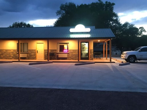
Suffering from burnout, I needed to get away from the problems that surround me at home. My favorite mountain getaway over in Arizona would be cold, but as a result, the cheap motel would have vacancies. I could hike in the daytime, and in the evenings I could get restaurant meals – something I never get at home since we lost all our decent restaurants during COVID. Normally the only time I eat out is during my semi-annual visits with family back east.
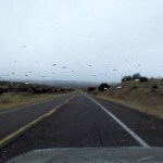
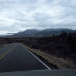
The weather up there was forecast to be dry. But as I drove north the sky was full of towering cumulus clouds, past the halfway point it got positively threatening, and I hit rain in the high passes. It was cold enough that I switched into 4wd to keep from spinning off into a cliff or a canyon.
By the time I reached the motel, it was almost full dark and the office was closed. My room was unlocked, but when I opened the door a heavy wave of artificial fragrance poured out. Entering, I sniffed the bed, but it smelled fine. The odor simply filled the air, and I couldn’t tell where it was coming from. It was too cold to air out the room, so I drove to the restaurant for dinner – which included one of the best malbecs I’ve ever had.
When I returned, my allergies were triggered by the odor, and I discovered I’d forgotten my antihistamine and nasal spray – something I can’t remember ever doing before. I faced a night of no relief in this very remote place.
Adding insult to injury, I soon had a headache, and the normally complete and peaceful silence was disturbed by a rhythmic screeching noise, like an unoiled pump. I couldn’t figure out where that was coming from, either. I was exhausted enough to fall asleep, but I woke a few hours later and spent the rest of the night tossing and turning.
In the morning, the sky was perfectly blue and everything outside was covered in a thick layer of frost. I walked over to the office and found they open an hour later in winter. In the meantime, I would drive the 20 minutes to the nearest supermarket for antihistamine.
But by the time I got dressed for the drive, the sky was completely covered by low clouds and it was snowing!
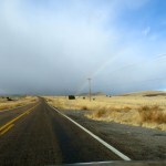
The drive wasn’t wasted, though. I was rewarded with multiple rainbows and sightings of the bighorn sheep that were introduced here decades ago, frequenting the shallow canyons that wind through this volcanic alpine plateau.
When I returned to the motel office I met the new owners. The couple looked and sounded like urban hipsters in their late 40s or early 50s, and I guessed they’d seen this place on visits from Phoenix over the years, and decided to relocate and invest in a modest resort, planning to renovate and increase the rates for more profit.
In any event, they seemed shocked when I told them the fragrance was a problem. They said they’d installed devices in all the rooms that emit fragrance continually. I know I’m not the only person bothered by artificial fragrance – every supermarket carries fragrance-free and hypoallergenic products – but we seem to be an aberration in Arizona. They were anxious to help, though – they said I could simply search the electrical outlets to find the device, unplug it and air out the room. They said the screeching sound was probably the well pump, in a shed outside the motel, and I suggested it might need lubricating.
Getaway to Early Winter
Suffering from burnout, I needed to get away from the problems that surround me at home. My favorite mountain getaway over in Arizona would be cold, but as a result, the cheap motel would have vacancies. I could hike in the daytime, and in the evenings I could get restaurant meals – something I never get at home since we lost all our decent restaurants during COVID. Normally the only time I eat out is during my semi-annual visits with family back east.
The weather up there was forecast to be dry. But as I drove north the sky was full of towering cumulus clouds, past the halfway point it got positively threatening, and I hit rain in the high passes. It was cold enough that I switched into 4wd to keep from spinning off into a cliff or a canyon.
By the time I reached the motel, it was almost full dark and the office was closed. My room was unlocked, but when I opened the door a heavy wave of artificial fragrance poured out. Entering, I sniffed the bed, but it smelled fine. The odor simply filled the air, and I couldn’t tell where it was coming from. It was too cold to air out the room, so I drove to the restaurant for dinner – which included one of the best malbecs I’ve ever had.
When I returned, my allergies were triggered by the odor, and I discovered I’d forgotten my antihistamine and nasal spray – something I can’t remember ever doing before. I faced a night of no relief in this very remote place.
Adding insult to injury, I soon had a headache, and the normally complete and peaceful silence was disturbed by a rhythmic screeching noise, like an unoiled pump. I couldn’t figure out where that was coming from, either. I was exhausted enough to fall asleep, but I woke a few hours later and spent the rest of the night tossing and turning.
In the morning, the sky was perfectly blue and everything outside was covered in a thick layer of frost. I walked over to the office and found they open an hour later in winter. In the meantime, I would drive the 20 minutes to the nearest supermarket for antihistamine.
But by the time I got dressed for the drive, the sky was completely covered by low clouds and it was snowing!
The drive wasn’t wasted, though. I was rewarded with multiple rainbows and sightings of the bighorn sheep that were introduced here decades ago, frequenting the shallow canyons that wind through this volcanic alpine plateau.
When I returned to the motel office I met the new owners. The couple looked and sounded like urban hipsters in their late 40s or early 50s, and I guessed they’d seen this place on visits from Phoenix over the years, and decided to relocate and invest in a modest resort, planning to renovate and increase the rates for more profit.
In any event, they seemed shocked when I told them the fragrance was a problem. They said they’d installed devices in all the rooms that emit fragrance continually. I know I’m not the only person bothered by artificial fragrance – every supermarket carries fragrance-free and hypoallergenic products – but we seem to be an aberration in Arizona. They were anxious to help, though – they said I could simply search the electrical outlets to find the device, unplug it and air out the room. They said the screeching sound was probably the well pump, in a shed outside the motel, and I suggested it might need lubricating.


