
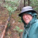
Max Carmichael's Blog, page 7
July 4, 2024
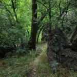
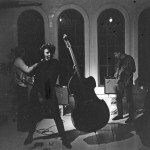
Katie’s Orphans
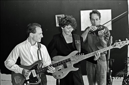
Preparing for Katie’s memorial ceremony in the desert, I found a folder of lyrics she’d left with me when we were partners in Terra Incognita, in San Francisco in the 1980s. Some of them she’d written before we met in 1984, and some after.
She depended on me to set her lyrics to music, but we never worked on these together, so now that she’s gone, they’re her orphans. My mission is to turn them into the songs they deserve.
The COVID pandemic began a four-year hiatus from the arts, a troubling time for most and almost fatal for me. So I’m rusty, and I have to fit creative work into brief intervals between the toil of surviving and caring for loved ones. But I wanted to share these lo-fi recordings of works in progress with our community, because who knows if I’ll ever have time to polish them for mass consumption?
I started composing most of them with the electric bass – Katie’s instrument, but also more and more my instrument of choice. The lyrics would suggest a rhythm, a melody would arise from singing over it, and the result was always surprising. But singing them myself is awkward, because they’re a woman’s songs and they should feature a female voice.
These first four came together quickly and easily – probably because I’d opened myself to her memory and her spirit. I had to revise a few lines here and there so they would work better with the music – that turned out to be the hardest part.
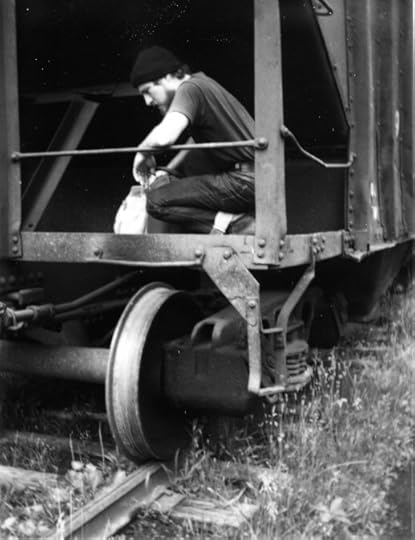
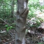
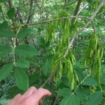
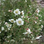
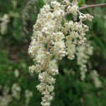
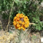
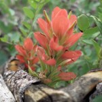
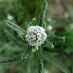
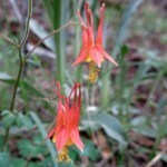
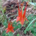
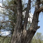
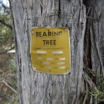
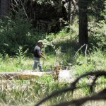
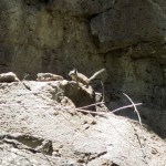
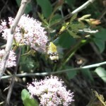
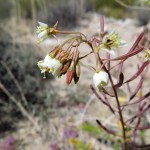
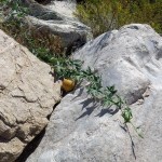
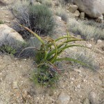
The drawing for “Stampede” and the photo for “I Wish You Were Awake” are by Katie.
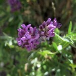
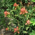
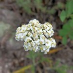
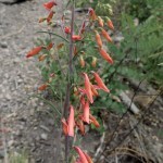
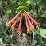
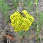
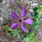
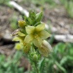
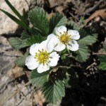
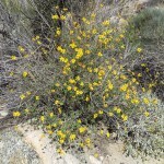
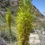
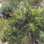
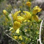
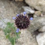
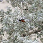
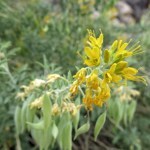
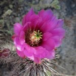
Indian Paintbrush
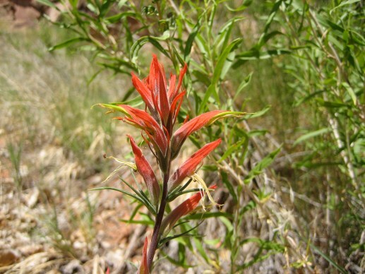
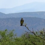
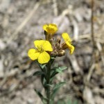
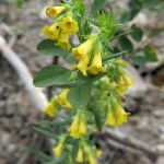
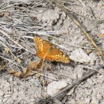
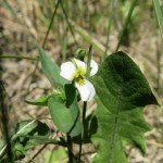
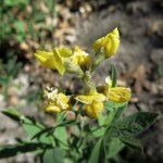
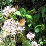
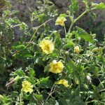
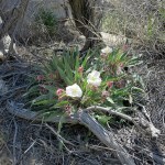
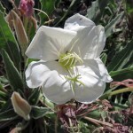
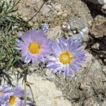
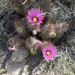
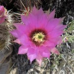
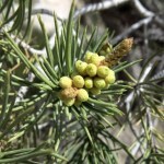
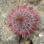
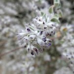
Indian paintbrush is one of the most common wildflowers of the American West. Katie wrote this about our shared experience of falling in love with the desert and yearning for its mysteries. She seemed to be unconsciously channeling the spirits of the people who lived there before us, who also made songs about their journeys through the desert and the mysterious things they encountered along the way. Katie was the only friend who loved the desert as much as I did, so I’m especially sorry that I didn’t help her with this one while she was alive.
https://maxcarmichael.com/blog/wp-content/uploads/2024/07/Indian-Paintbrush.mp3Runaway Train
Katie’s family moved several times, but finally ended up in North Dakota where she finished high school and “ran away” from home. Before I met her, I used to catch and ride freight trains all over the country, so I can attest that she captured the experience perfectly in these lyrics. And they also carry a hint of the next song.
https://maxcarmichael.com/blog/wp-content/uploads/2024/07/Runaway-Train.mp3Stampede
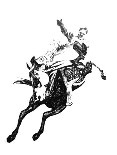
This is Katie writing about the condition that ultimately killed her, using her lifelong love of horses as a metaphor. I knew this would be a challenge, and I dreaded it, but I had to try.
https://maxcarmichael.com/blog/wp-content/uploads/2024/07/Stampede.mp3I Wish You Were Awake
She scrawled this on a piece of scrap paper, early one morning while we were camping somewhere on the northern California coast.
https://maxcarmichael.com/blog/wp-content/uploads/2024/07/I-Wish-You-Were-Awake.mp3


July 1, 2024
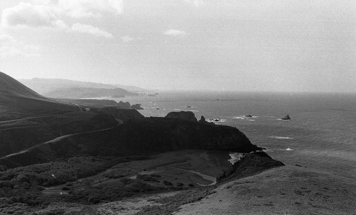
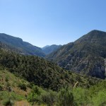
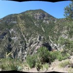
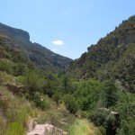
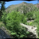
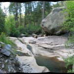
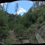
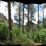
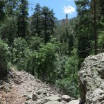
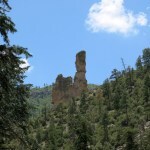
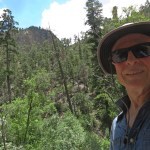
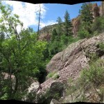
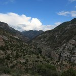
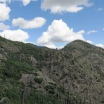
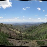
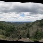
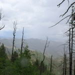
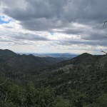
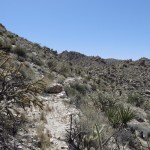
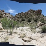
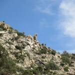
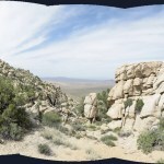
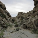
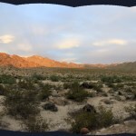
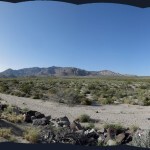
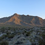
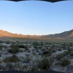
Thunder Canyon
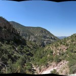
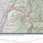
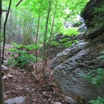
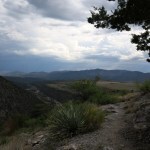
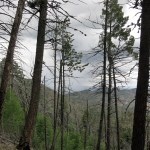
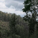
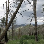
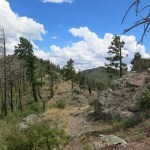
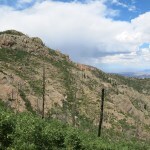
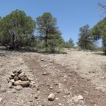
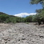
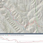
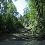
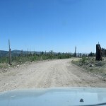
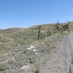
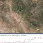
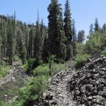
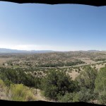
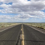
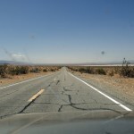
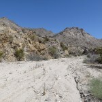
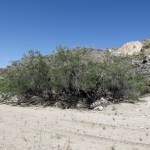
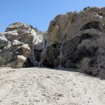
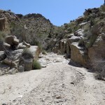
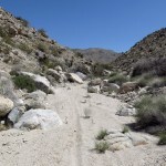
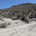
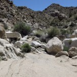
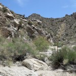
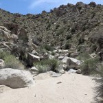
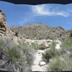
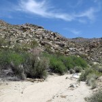
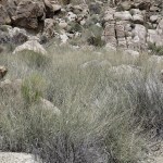
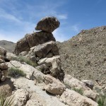
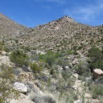
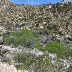
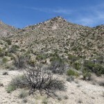
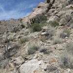
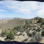
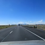
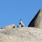
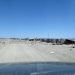
Today’s hike would be another experiment with knee pain, so I was looking for something with gentle grades. But it was forecast to be a hot day, and the only way to mitigate the heat is to hike a shady canyon or a high-elevation crest. All the canyon hikes involve steep grades, and most of the crest hikes involve a long drive. I’d initially decided to bite the bullet and do the boring crest hike near town, but on a last-minute impulse I headed west instead, to take the “short” trail down into the big, spectacular west-side canyon, hoping to explore the newly-opened tributary that had intrigued me on my last visit, in February.
I was so anxious to explore a new trail that I conveniently forgot that this route involves dozens of steep grades, with big rocks to climb over, all of which would be hell on my knee.
Plus, it’s lower-elevation – below 6,000 feet, lower and hence hotter than home, and mostly exposed. My heart sank when I got out at the trailhead – it was already sweltering at 9:30 am, with not a cloud anywhere in the sky.
I hoped for monsoon storms in the afternoon, but until then I would just be sweating through my clothes.
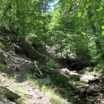
Since I wasn’t wearing a knee brace, it was all about using my left leg to raise or lower myself at every step so I could avoid bending and putting weight on the right knee. I was really strict about that, so I went slow, and it worked. But it meant my left leg was being overworked from the beginning, and it took longer to reach the shade of the canyon bottom.
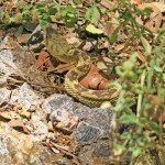
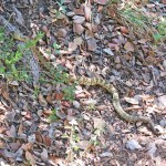
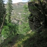
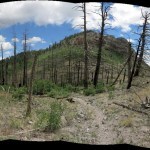
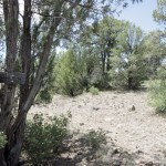
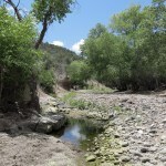
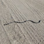
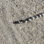
Once past the big side canyon, it got even harder – I’d completely forgotten how steep and rugged this trail is. I was thinking how this was perfect snake weather, and sure enough, encountered a medium-sized rattler as soon as I reached the canyon bottom.
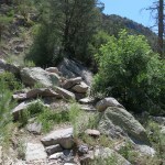
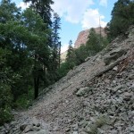
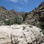
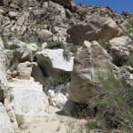
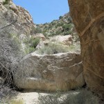
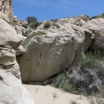
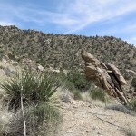
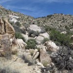
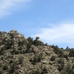
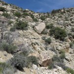
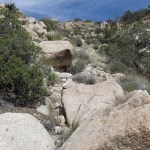
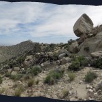
This is one of those canyons that’s full of house-sized boulders – fallen down from the cliffs above – so the trail constantly has to climb steeply around them, sometimes with points where you need to make bouldering moves, which was hard on both my knee and my shoulders, which are in much worse shape. It ended up taking me three hours to reach the creek crossing that marks the junction with the tributary canyon – a hike of little more than three miles.
On the way, I spotted a single tiny cloud, far up the canyon, and prayed for more.
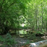
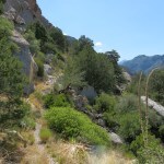
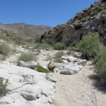
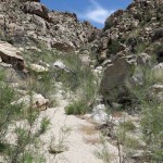
Whereas the creek had been flooded by snowmelt in February, now it was shallow enough to stagger across on barely submerged rocks in my waterproof boots. On the far side, there was no sign that anyone else had been this way since a crew had cleared the trail nine months ago. It made sense – the winter flood had blocked the crossing until late spring.
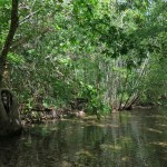
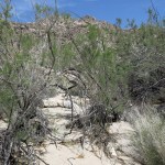
I was really excited to be exploring a new canyon! It turned out to be a narrower version of the main canyon – full of house-sized boulders and choked with dense riparian vegetation.
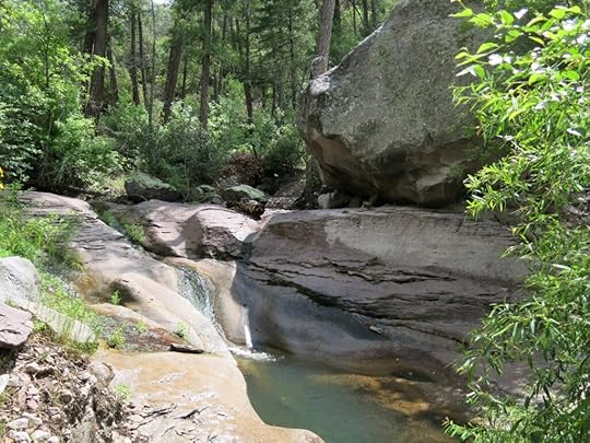
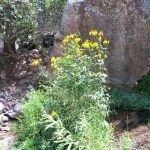
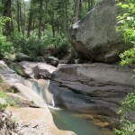
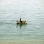
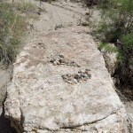
But struggling up and down those steep grades, working to protect my knee, ended up being worth it when I reached the “swimming hole”! This is only the second bedrock pool I’ve found in six years of exploring our local wilderness. Unfortunately the rock pool was lined with algae from the recent dry season – hopefully that would get scoured out in the next monsoon flood – so although I was literally dripping with sweat I wasn’t anxious to take a dip here. But it was a beautiful spot.
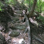
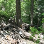
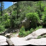
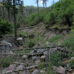
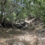
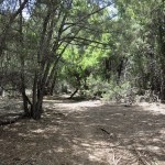
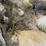
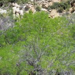
Past the swimming hole the trail entered a stretch of canyon that had been filled with debris from catastrophic post-wildfire floods, then filled in by thickets of riparian trees – primarily ash and alder. Here, the trail had little tread per se, being mostly just a vague route over the debris, further challenging my knee and shoulders as I often had to reach out for balance. And those thickets made for claustrophobia.
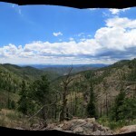
This canyon drains parts of the crest – 4,000 feet above where I was today – that I’ve hiked many times from other directions. So I was hoping today’s hike would add to my knowledge of the range. But too often my view of the slopes above was blocked by dense riparian vegetation.
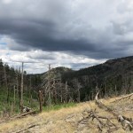
Storm clouds had been building overhead, and I was getting some shade now, but it remained hot down there.
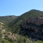
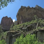
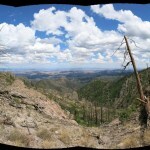
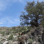
I entered a narrows with a sheer 1,000-foot-tall cliff on my right, and here, the trail finally climbed out of the canyon bottom and traversed the left slope through mixed-conifer forest. I’d reached my turn-around time, but through gaps in the forest ahead I thought I could see more light, possibly the end of the dark narrows and a wide place in the canyon. I wanted some sort of milestone to mark the end of my hike, but that dark, towering cliff on my right never seemed to end.
Finally I reached an open talus slope and decided to turn back. But my GPS device failed to find a satellite – the cliffs were blocking the sky – so I decided to keep going, and a quarter mile later the canyon began to emerge from the shadow of the cliff, and I was able to connect with a satellite and record my location.
Trying to protect the knee, I hadn’t been able to go as far as I’d hoped. I need to do something about all three of my bad joints – hiking like this is just not sustainable.
Lightning was now striking nearby, and one thunderclap was so loud it shook the whole canyon. Soon it began raining in earnest, and I took shelter under a spreading oak to pull on my poncho. Despite being in a narrow, steep canyon, there’s no danger of flash flood in storms like this – the cells are just too small and short-lived. As usual, this one lasted about twenty minutes.

Back at the big creek crossing, I was still hot and sweat-soaked, so I stripped down, rinsed my hat and shirt, and laid down in the creek. This in itself was really difficult and painful, because it required bending the bad knee and straining the bad shoulders, but it was bliss to lie in that cold water and rinse off the sweat.
Wearing the wet hat and shirt on the way back kept me from overheating, but all the steep grades, up and down, over and over again around those house-sized boulders, wore me out to the point where I almost doubted that I could make it. Those mini-grades amount to hundreds of vertical feet in a mile of distance, but none of them register in the GPS routes because GPS averages at longer intervals.
I was also running low on drinking water, and had to stop twice with bad cramps. The fact is, we just don’t have easy trails – all of our trails are too challenging for someone with my joint problems.
But with a final Clif bar and judicious use of my water and electrolytes, I made it back to the vehicle. It had taken me 7-1/2 hours to walk ten miles. Walking slowly and carefully had minimized the damage to my knee, but my shoulders were aching from being triggered several times. I could see a broad, heavy storm darkening the sky southwards toward town.
I’d left a liter of water on ice in the vehicle, and I used that to hydrate before hitting the road. But within ten minutes of driving I developed cramps so bad I had to pull over, get out, and stagger around for fifteen minutes until they finally began to subside. And sure enough, I drove into the storm farther south – some of the heaviest rain I’ve ever driven through.
June 24, 2024
Return to the Crest
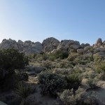
I was fed up with this knee problem. I’d gotten used to my shoulders being in constant pain for five months, and after seven weeks of trying rest, ice, and compression, the knee wasn’t getting better either. So why not just go ahead and hike through the pain? I had plenty of pain meds left, might as well use them.
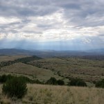
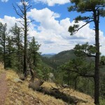
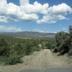
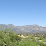
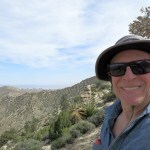
Sunday was forecast to be another hot day, and clear. I needed to find either a shaded canyon hike or a crest hike where elevation and breezes might keep me cool. Despite swearing never to drive that dangerous road again, I decided to tackle the crest hike in the east, where the road would take me to 8,200 feet and I would have the option of climbing an additional 1,500 to 2,000 feet higher depending on how bad the pain got. Like almost all my Sunday hikes, this one runs mostly inside the wilderness area.
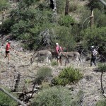
As I should’ve expected, monsoon clouds were forming over the range, so it was actually cool when I got up there. I strapped on my compression brace, tighter than ever, in an attempt to mask the knee pain. I had to pee really bad, but as soon as I got out of sight and unzipped, I heard voices. I thought I was the only one who used this Forest Service road to access the trail, but when I turned, I saw a man and two women, youngish, dressed in what looked like cycling gear, leading two donkeys up the road.
“You caught me takin’ a piss! What are you doing with those donkeys?”
“Training ’em to race.”
I laughed. “Where do you race donkeys?”
“Mining towns, in Colorado, Arizona, New Mexico.”
I was shaking my head. “Never heard of that.” One of the donkeys came over and nudged me, and I stroked its head and neck.
“He’s looking for carrots!” the youngest woman said.
Donkeys and burros are the same species, but it’s customary to call the domesticated variety donkeys and the feral ones burros. These were pale, as opposed to the brown feral burros I’m familiar with in the desert. At home, later, I looked up donkey racing and discovered that “pack burro racing” is indeed a thing – their trainers run through town with the animals on a leash. It’s another one of these ridiculous Anglo hobbies that accompany mining history and tourism. Thank god we don’t have it in my home town.
I expected to go slow to protect my knee, so I told them to go ahead. But they kept stopping and I kept catching up. Finally after a mile they said they were turning back and I should pass them. I recommended they go a few hundred yards farther for a spectacular view, but that was clearly of no interest to them. Privately, I wondered how walking a mile could possibly be adequate training for racing. Their whole vibe was a little weird, like they weren’t really comfortable around strangers.
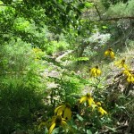
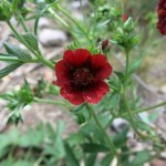
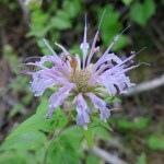
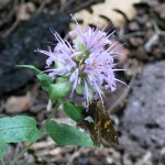
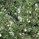
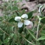
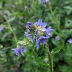
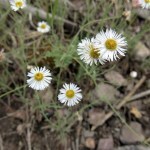
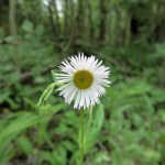
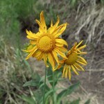
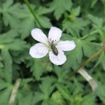
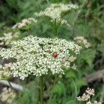
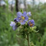
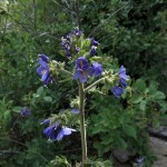
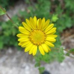
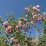
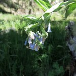
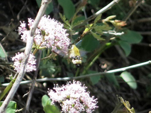
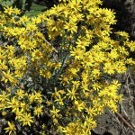
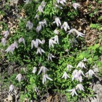
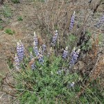
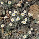
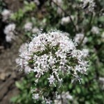
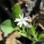
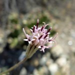
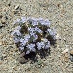
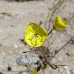
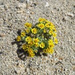
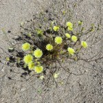
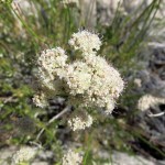
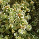
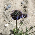
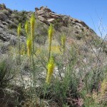
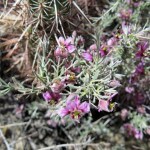
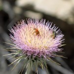
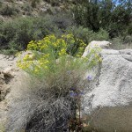
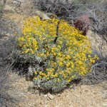
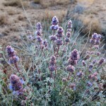
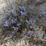
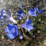
I’d forgotten how amazing the flowers are here at this time of year – both perennials and annuals. They were mostly small flowers, and some quite unobtrusive, so I became obsessed with finding and photographing them all. It was actually good for my knee because I had to keep stopping for pictures.
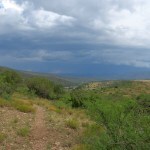
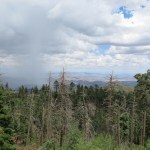
By the time I reached the saddle where the trail switches from the east side to the west side, dark storm clouds were massing to the northwest, and I realized, happily, that I would likely get rain.

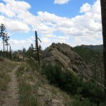
The next saddle was my first milestone, because I’d originally planned to turn back here, or if my knee was doing well, to take the bypass around the peak for some more mileage without the elevation gain. I definitely hadn’t planned on climbing the peak.
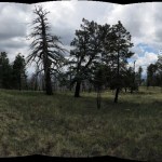
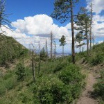
But I now realized that it isn’t elevation that’s hard on the knees, it’s the grade – the steepness. No part of this trail is nearly as steep as the trail I’d mistakenly tried a few days ago. So I decided to continue to the peak, which has grassy meadows and a remnant of old-growth fir forest that barely survived recent wildfires.
It was really dark by the time I got up there. I found fresh bear scat on the trail and heard a crashing sound in the forest below – either a limb or snag falling, or a bear tearing bark off to reach larvae.
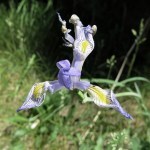
At the peak, I decided to continue to the lower meadows on the back side, hoping to find wild iris. There had been a lot, but they’d all gone to seed.
Just as I started down, the rain caught me, and quickly became heavy enough to require my poncho. But as usual it lasted less than half an hour, and afterward, the whole landscape seemed to glow.
My knee was in bad shape, and I still had more than four miles to go, so I popped a pill.
Not only was the descent hard on my knee, taking close-ups of flowers and pollinators required contortions that triggered pain in my shoulders. My mother has been dealing with this for ten or fifteen years – she was too old for surgery – and she’s just learned not to raise or put any weight on that arm. That might be an option if both my shoulders weren’t equally bad.
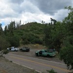
Approaching the parking area in the saddle, I found Forest Service trucks and trailers surrounding my little vehicle. It turned out to be six or eight firefighters from northern California, called down for the wildfires east of here. They were just hanging out up here where it’s cool.
We discussed climate change and lookout towers. I mentioned how most of the old towers had been abandoned. “Yeah,” said their leader disgustedly, “They’re all gonna be replaced by cameras.”
“They’ll probably use AI,” I replied, and they all rolled their eyes. These young outdoorsmen clearly saw the downside of progress, and were not likely to be filling their homes with robots or joining Elon Musk in the Mars colony.
I drove through rain, and when I reached town I found the streets flooded, in the exact places where the city had spent millions recently to improve drainage. We’d clearly had a significant deluge, our first of the season, but the Apple weather app showed low current humidity and zero precip for the past 24 hours.
June 21, 2024
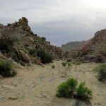
Canyon of the Bulls
For over twenty years I faithfully performed a personal ritual on the winter and summer solstices, inspired by the sweat lodge ceremony at the end of my 1990 field course in aboriginal skills. Then, health issues and family obligations began to interfere.
But I still try to be mindful of the solstices, wherever I happen to be, whatever else I have to do on those days and nights.
This year, I had a commitment the night before, preventing me from rising before dawn and traveling to a place where I could observe the sunrise. After a long hiatus from hiking, I’d found a hinged knee brace in my closet from an injury many years ago, and wanted to see if it would enable me to start hiking again. I really wanted to get out in the wilderness, but all of our nearby wilderness areas are mountainous, and I needed to minimize the elevation gain on this trial run.
I finally decided to try a secret trail over near the Arizona border. I’d discovered this trail on the Forest Service’s website last year, while looking up another trail in the same area. The secret trail is shown nowhere else, and when I tried to retrieve the Forest Service map on this solstice eve, I discovered that they’ve removed the map feature from their website. The only map I could find that shows this trail is in an obscure internal Forest Service study that I dug up online in PDF form.
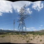
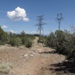
The trail starts at a pair of electric power transmission towers, in a remote, unpopulated spot a mile off a lonely highway. Despite being omitted from public maps, it has an old trailhead kiosk, literally on the wilderness boundary. But this is a relatively small wilderness area, so remote and obscure that even the published parts of it see very little visitation.
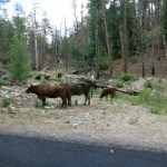
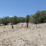
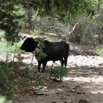
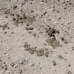
Except for cattle. I’d first checked out the trailhead last winter during a rainstorm, and discovered that because the trail is a secret, the only current users are cattle – which should theoretically not even be in a wilderness area.
Not far past the kiosk is a fence and a gate – I guess it keeps the cattle in the wilderness from mixing with the cattle outside.
And in all fairness, the habitat inside the wilderness area looks really healthy.
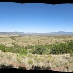
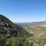
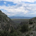
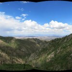
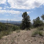
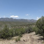
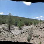
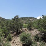
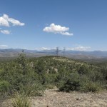
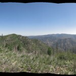
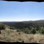
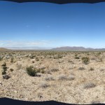
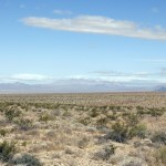
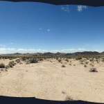
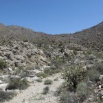
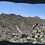
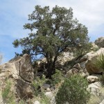
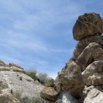
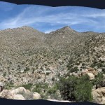
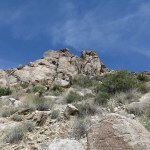
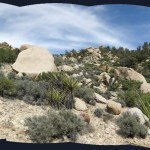
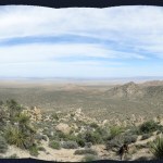
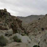
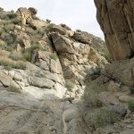
The transmission towers stand on a low peak with a view west over the entire wilderness area, which encompasses an expanse of mid-elevation ridges and canyons ending at a high mountain on the state line. The canyon bottoms dip as low as 5,500 feet, and the ridges rise to 8,000 feet on the west side.
Big cumulus clouds were forming and shifting around in the blue sky, high winds were forecast, and I expected the temperature in the canyon bottoms to approach 90 in late afternoon. The hard-to-find map shows the trail leading over a series of ridges, down and up and finally down into a northwest-trending canyon, where it follows the canyon bottom for a couple miles before joining a much longer trail. I was dreading the heat and was hoping the canyon bottom would feature a canopy of shade trees.
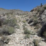
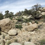
By the time I reached the far side of the ridges and could glimpse the canyon I was heading for, it appeared that the knee brace was useless. The secret trail turned out to be in really good shape – because of heavy cattle use over the years – but the grades were steep and rocky and I had to take short steps to protect my knee.
Cattle sign was actually pretty sparse, and thankfully at least a month old.
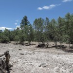
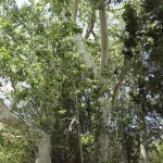
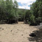
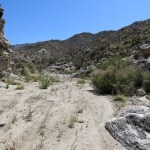
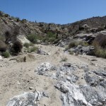
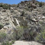
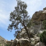
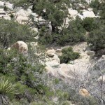
Finally I reached the canyon bottom, where I was surprised to find both big sycamores and a few big ponderosa pines, which are normally found at much higher elevations. But the canyon bottom turned out to be wide and sandy, with virtually no shade.
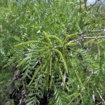
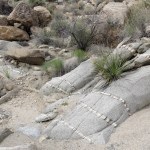
Despite being kept a secret by the Forest Service, the trail was well marked with big cairns. As the canyon twisted back and forth like a snake, the trail crossed and recrossed the wide dry wash, keeping mostly up on the bank in the sandy floodplain. It was bright and hot in that canyon, but the farther I went, the more the floodplain filled in with trees – oaks, willows, walnuts, two species of junipers, pinyon pine, sycamores, and a few ponderosas – so I eventually got some patches of shade.
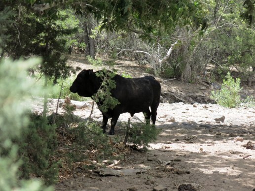
Farther down, some pools of stagnant water remained in the creekbed. And on the now-shady floodplain, I finally emerged in a clearing, noticed a crude wire fence at my right, and turned to see an old log corral tucked back in a dense grove of trees. And when I turned forward again and walked across the clearing to study where the trail led from here, I saw the bull.
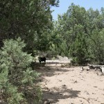
He almost looked like a brahma, but was probably some kind of Angus, and was hornless like most of the bulls in this region. Standing in the shade below trees at the edge of the bank, he was staring at me, so I started talking to him. After a while he turned away and resumed grazing. What to do?
The last bull I’d seen had let me walk past him, but that was in an area with frequent campers and hikers. This bull had probably seldom, if ever, seen humans. The canyon is really wide at this point – another big canyon joins it from the west, so I couldn’t easily detour to my left. I decided to try climbing the right slope and traversing above the bull, because there was a wall of dense vegetation between him and that slope.
Bad idea. I made an effort to be really quiet, but he either heard or saw me through the trees, and began bellowing angrily, again and again, while crashing directly up through the forest toward me.
I immediately turned around and began traversing back across the slope, hoping to get the fence and corral between me and him. The bellowing and crashing stopped, but dense vegetation still separated us, and he could’ve been crossing the clearing toward me, so I kept escaping as quickly and quietly as I could, re-entering the riparian forest upstream from the corral. It was like an obstacle course, but I was motivated.
About a half mile up the canyon, as I was rejoining the trail on the bank above the big dry wash, a terrifying, angry noise exploded out of the canopy on the other side. It was much louder than the first bull and sounded like some legendary monster out of the time of the gods in a Greek myth. It had to be another bull, but I’d never heard anything like it. I couldn’t see him, but he must’ve seen me.
The only thing I could do was keep fleeing up the canyon and hope that would satisfy the invisible monster. I skipped the crossings and stuck to my side, and before I knew it I was at the base of the ascending trail.
Now it was sweltering, there was no shade, my knee was hurting, and the trail was really steep. So I took it slow, with short steps and frequent stops, and as I climbed, the wind blew stronger – that was the only thing that saved me. Somehow I made it back to the peak with the transmission towers.
I guess this is payback for failing to perform the solstice ritual…
June 17, 2024
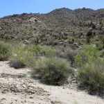
Far From Anywhere
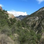
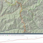
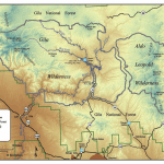
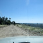
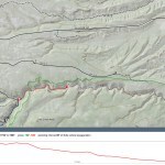
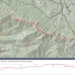
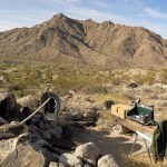
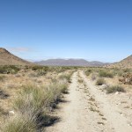
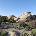
The paired wilderness areas north of my hometown, the first established in the U. S., encompass almost 1,200 square miles of mountainous terrain. After I moved here 18 years ago, it was another 12 years before I found the time to begin exploring them on foot.
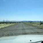
There’s a challenging dirt road, closed in winter, that runs north between them, but apart from that, this vast block of wilderness creates a roadless barrier between us and the rest of the state. I’ve long been curious about the north end of the wilderness, but until now I’d never ventured up there, because it requires a three-hour drive around the perimeter, most of that on rough dirt roads.
But with travel and joint pain forcing me to give up hiking since early May, I was going stir crazy. It’s been hot here, and I found myself longing for the cool shade of our high-elevation mixed-conifer forests. I could find that near home, but the highest point I can drive to is up on that northern edge of the wilderness – the legendary road, also closed in winter, that traverses the entire northern edge.
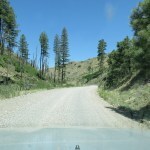
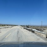
I’d driven up there from the west a few times to hike the crest trail, but past the trailhead, the road continues into terrain I’d never seen, terrain that’s got to be among the most remote in the lower 48 states. Although it’s crisscrossed with dirt forest roads and ranch roads, there are no paved roads anywhere near it. It’s a two-hour drive on rough dirt tracks from the nearest paved road or cell phone signal. It’s a three-and-a-half hour drive from the nearest small towns, and a five-hour drive from the nearest city.
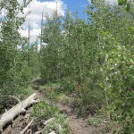
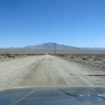
The mountains rise to almost 11,000 feet, and the lowest points, the canyon bottoms, are nearly 7,000 feet in elevation. Once I reached the end of the paved road in the tiny ghost town, I entered the cool forest of pines, firs, spruce and aspen, and began climbing over 2,000 vertical feet on a rocky and deeply eroded dirt road that in many places was only wide enough for one vehicle. For the rest of the day, I would approach every blind curve not knowing whether a big truck would come barreling around it toward me, and if we didn’t collide, one or the other of us would have to yield and back up to the nearest wide spot.
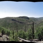
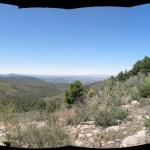
The road tops out at 9,000 feet and begins traversing the north slope of the high mountains, winding in and out of deep drainages, with a long view to your left across a 3,000-foot-deep canyon to another big mountain in the north. I needed a break from the dangerous driving so I turned off as soon as I reached the traverse.
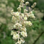
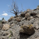
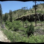
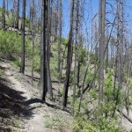
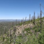
These slopes burned patchily but at high intensity in the 2012 mega-wildfire. My turnout remained forested, but a dirt track led upward into the burn scar, to a small cleared plateau which had probably been used to land firefighting choppers, and I hiked up there, about a third of a mile, to get a view north. This scar had filled in with dense New Mexico locust, which was in bloom.
Not a cloud in the sky as far as the eye could see, but a thin haze hung in the canyons and lowlands. Breezy and cool up here, but the day was obviously going to be warm.
That high traverse is only a little over five miles long, but takes about twenty minutes to drive. I soon came upon a Ford Escort – you can’t drive a car up here, but city SUVs will just about handle it. The little SUV was backing toward me, so I waited to see what he was up to. He pulled to the left for some reason and let me past – a retired couple out sightseeing.
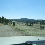
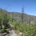
I passed the trailhead that was the farthest I’d driven before. From now on, everything felt more and more remote. I encountered a couple of widely-separated trucks, but the traverse has plenty of wide spots for passing. In and out of dark forest, locust-choked burn scars, and black volcanic talus slopes. Finally I reached the end of the traverse and descended onto a long, narrow east-trending ridge, with a steep dropoff at my right to the deep canyon of a major creek. From studying maps, I knew the road would eventually descend to the creek, where there would be a campground.
The landscape ahead of me to the east was rolling terrain, averaging 8,000 feet, burn scars and grassland punctuated in places by higher forested mountains with gentle slopes. It reminded me somewhat of my beloved White Mountains of eastern Arizona, although nowhere near as spectacular. The best thing about this area was its remoteness.
The heights had been dry, like most of our region for the past three months. So it was a relief to see the creek running through dense willows and lush grasses beneath tall pines and firs. However, the road soon turned away and entered the harshest burn scar I’d ever seen in this region. Apparently the soil and its seed bank had been scorched and sterilized, so as far as the eye could see the low slopes were lined with nothing but dry grasses and annuals beneath the snags of burned tree trunks.
After climbing to a plateau at 8,000 feet, the road stretched out due east, almost perfectly straight for seven miles. I passed a little Jeep SUV, and came upon a big truck with a huge fifth-wheel trailer, parked in the road, which was fortunately wide enough to pass. A beautiful young girl wearing hippie garb sat on an ATV in front of the truck, and I waved as I slowed to pass.
A mile farther, nearing the end of the plateau, I came upon a Forest Service truck that stopped next to me. The driver said to be careful because a truck was broken down up ahead. He said the RV I’d passed was part of the same group, waiting for help. It was Sunday and I figured the nearest operating tow service would be four or five hours away.
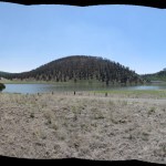
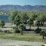
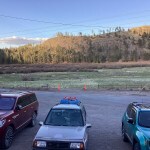
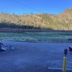
I passed the disabled truck and descended into a shallow, grassy valley where the road turned south, and spotted a little lake below forested hills at the far end.
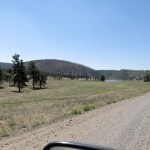
This was the reservoir of a creek that been dammed – maybe for ranching originally, but now for recreation. The road had been skirting the northern boundary of the wilderness the whole way, and the reservoir lay at the center of the northern boundary. It was hard to imagine a more remote place, but it looked well-maintained.
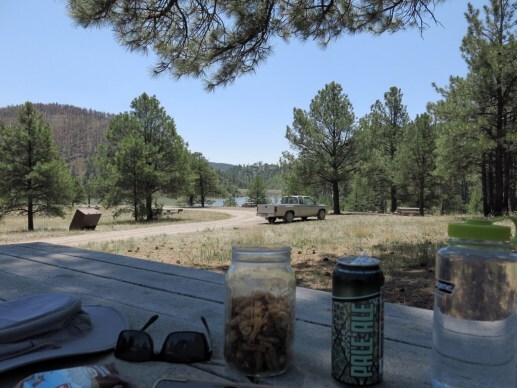
It’d taken me four hours to get here, and by chance it was noon. The big parking lot was empty, and I could see only two or three vehicles in the campground that sprawled back in the forested hills above the lake. I drove up to a scattering of unoccupied picnic tables overlooking the lake and found one in the shade where I started on the snacks I’d brought, and made the unusual decision to have a daytime beer.
Sitting there with that idyllic scene laid out before me, featuring ponderosa pine, the west’s iconic tree, I couldn’t help thinking of my dad. He’d love this place, once all the chores were done and he could relax. So many of us – Calvinists, WASPs, northern Europeans – both benefit and suffer from the compulsion to put work before pleasure, and the beer was helping me self-medicate.
Too much of the day remained for me to even consider driving home, and I wanted to try an easy hike. But this area was too exposed for such a cloudless day. I decided to drive back to the creek crossing and check out a trailhead I’d passed on the way here.
I pulled into the small dirt lot at the trailhead alongside a big truck, and a short man jumped out holding an even shorter fishing rod. “You fishin’?” he asked with a smile. I said no but wished him luck.
The trail entered the big trees where a smaller tributary joined the main creek. I saw the fisherman scrambling over rocks and stopping to cast a fly on a long line upstream. I’d never seen such a short rod used for fly casting.
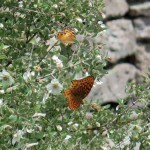
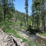
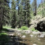
The narrow valley was beautiful, lined with dark volcanic bluffs, the trail winding through shady groves and sunny meadows, the creek always near, murmuring over rocks. Birds and butterflies were everywhere – swallowtails, woodpeckers, flickers, bluebirds. I made it more than a mile and a half – my knee complaining every time I had to step over a log or boulder – finally emerging into a wide, shady “pine park” where the creek flowed wide and shallow and I watched native trout hatchlings shimmy their way upstream.
On the hike, I’d felt a lot of pent-up energy rising to the surface – my body really missed being put to work. I felt like I could’ve walked all day, but would’ve ended up in serious pain. Still, I was happy, and temporarily at peace, just being there.
As I mentioned before, the traverse along the crest is pretty nerve-wracking, never knowing when or what you’re going to meet coming around those blind turns. But I was plenty calmed down. I did encounter one truck that was coming faster than was safe, but I had enough space to pull over and wait for him to react. I actually ended up passing the sightseeing retirees again toward the end of the traverse.
The descent to the ghost town is the most dangerous part, because it includes really long blind, narrow stretches where backing up safely would be almost impossible. But I made it to the bottom without meeting anyone, only to reach the abandoned cabin – the most remote of all the cabins in the forest above the ghost town – to find a truck pulled over and people standing in the road.
I stopped next to them, and a tall man introduced himself as the new owner of the abandoned cabin. A young girl leaned out the driver’s window of the truck, and another man squatted outside, sharpening a chainsaw. They all seemed really excited. Having a cabin in the forest like that would feel like a dream come true until the next wildfire and the ensuing flash floods tearing down the canyon, destroying your access if not the cabin itself.
From there, it was a short drive to the paved road and the ghost town, the next scary stretch of twisting one-lane descending to the mesa, and finally rejoining the lonely north-south highway. I could more or less take the highway home on autopilot, until when approaching the gate of our biggest ranch, I spotted what looked like a small mammal ahead in the middle of my lane.
I was going 65 but had enough road left to carefully slow down. The thing wasn’t moving, but when I was close enough to focus on it, it looked exactly like a porcupine, facing me with all its quills erect. Porcupines supposedly live around here, but I’d never seen one. This one wasn’t yielding right of way, but another vehicle was coming fast behind me, and I suddenly realized that what looked exactly like a porcupine was actually the top of a narrow-leaf yucca that had rolled onto the highway! So I swerved around it and stepped on the gas.
By the time I returned home, I had driven over 200 miles, ascending and descending nearly 20,000 feet of accumulated elevation. And I’d still only driven about a third of the way around the perimeter of our wilderness!
May 20, 2024
Two Steps Back
I hadn’t hiked in two weeks, since my epic hike in the desert did some sort of damage to my right knee. Despite daily icing, it was recovering very slowly, and I couldn’t figure out what was wrong. So I decided to try it out on a nearby trail with moderate distance and elevation.
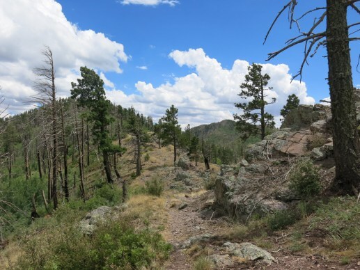
This is a ridge trail that climbs the east end and follows the ridge west for 6-1/4 miles to an abandoned stock pond, at an average elevation of 8,400 feet. Much of the forest had burned in June 2020, and I’d hiked the full length afterward, in September of that year. But by the following September, regrowth of annuals and shrubs had made the trail virtually impassable.
Because it’s close to town, I figured it would be a high priority for the new trail crews, and I was right. It had been cleared last October, but since it traverses the steep north slope, it accumulates and holds deep snow, and the lack of tracks showed that I was the first hiker on this trail since the snow finally melted a month ago. A bear had preceded me, probably late yesterday.
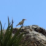
The temperature started out in the 60s and climbed into the 80s by afternoon. The flowers and pollinators were outstanding, and I was surrounded by birdsong the whole way, but could seldom find the singers. I did spot a brown creeper but it was moving too fast to photograph.
I didn’t really expect to make it all the way. My knee seemed to be doing okay but as usual there were too many steep sections. There’s a rock outcrop with a nice view about a mile from the pond, and that’s where I turned around, strapping on my knee brace for the return.
With my knee stiffened by the brace it was much harder to walk, and the pressure of the brace meant I couldn’t tell how my knee was doing. I found out when I got back to the vehicle – not well. I’ve been lucky with my knees in the past, but those days are probably over.
May 19, 2024
Desert Ceremonial: Part Four
 Day Seven: Singers
I was on the reservation to see my friend, and to rest up. In my mind it was the natural place, and he was the natural person, to visit after performing that ceremony in his tribe’s territory.
Before we started breakfast, he gave me a miniature gourd rattle, a symbol of my role in the ceremony, a role he’s performed himself. He spoke of the difficulty of learning the ancient ceremonial dialect, part of his legacy as a hereditary chief. We share a passion for the desert’s past, so over breakfast, we discussed prehistory and talked about our families. He said young people in the tribe want me to lead them to remote sites I’ve discovered, so we should start planning a return visit.
Then I arranged to stay another night, he went off to help his son, and I spent most of the day in bed.
 Day Eight: Saddles
It was time to head home, and today would be the hardest part – the five-hour gauntlet of the interstate highway, competing with those giant tractor-trailer rigs in my little rattletrap. The dangerous wind had returned – when I first stepped outside in the morning, I was almost blown over.
The drive was nerve-wracking as usual, but it got better at the end, after I finally left the interstate for a lonely two-lane across the high plateau, and eventually reached the little alpine valley where I would dine at my favorite rural restaurant and sleep in the rustic fisherman’s motel. The drive home from the desert is just too far to tackle in one day, and I’d decided this would be the best way to divide it up, before crossing the multiple mountain ranges and high passes between here and home.
During the drive, I was starting to process the trip, and the ceremony. It had resurrected feelings buried for a generation, reopened wounds that had never healed. I’d been forced to bare my heart and soul like never before. Katie’s family had praised and thanked me, but I was feeling depleted, inadequate, guilty. Someone who had spent decades failing those who deserved his best. I longed for the comfort of loved ones, someone to share my turmoil and help me find clarity. But after briefly becoming one with the group at the cave, I was now more alone than ever.
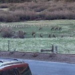
And in the evening, there I was, being served a delicious meal while the resident elk herd shared grazing outside the window with a large band of mule deer. My body was sore all over from last Saturday’s epic hike, from driving 1,500 miles, from the emotional drain of the ceremony. My knee in particular was so bad I could barely handle a few stair steps at a time.
 Day Nine: Pilgrimages
From there, it was only three hours to home, on another lonely, winding road through a series of mountain ranges. The shape of the trip was becoming clear, if not its meaning.
It had been a triple pilgrimage, triggered by the ceremony at its center. Going to the cave, I had to visit my land nearby, and make that hike to the crest – the divide between east and west. And after the ceremony, I had to visit my friend, elder of the people who had established that ceremony in that place for generations before us. As the singer of the old songs, he’d set the example for me when I sang for our group. I’d anticipated none of this in advance – I had to discover it out there, one day at a time.
What a path to find myself on! Never have I felt so much like an exile, an eternal explorer, infinitely far from my birthplace and my ancestors, irretrievably lost in an abandoned wilderness.
 Children
I arrived home late in the week and spent the next few days icing my joints, resting, and editing my photos. And in the process, I finally discovered a meaning and a purpose for our ceremony.
To some extent, most of us expect to live on in the memories of others. People who seek fame and influence expect to be remembered by their colleagues and followers. Parents expect to live on in the memories of their children. I don’t know about other artists, but for me – otherwise childless – my creative works are my children.
As I learned in the desert, Katie will live on in the memories of her nieces and nephews. But for the rest of us, her legacy, her only children, are the creative works I’ve been able to preserve. Sharing and establishing those works will remain my responsibility and my inspiration for the rest of my life.
Recent struggles and traumas have discouraged me and set me back in my own work, but these memories of Katie should inspire me to recover from the setbacks and renew both our legacies. In the words of a song I wrote when I first met her, I’ll be “building for future generations”.
May 16, 2024
Desert Ceremonial: Part Three
Now we approach the main event of this ceremonial trip to the desert, which I’ve been hinting at obliquely, because it was too immediate, too painful, and there were others involved whose privacy I need to honor.
Remember this is only my version – others will differ. Why do I share such personal stories? Is it even appropriate? For me at least, sharing and hearing your responses helps me process these difficult experiences.
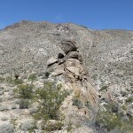
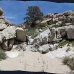
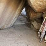
Forty years ago I began exploring, discovering, and falling in love with the desert with Katie, a fellow artist, musician, and writer. A mutual friend had shared his discovery of a magical place, a small basin lined with boulders and surrounded by cliffs, and my partner and I turned a boulder pile there into a home away from home – The Cave. Katie was the one who first found artifacts from the indigenous people who once camped all over that area. Those sparked our curiosity, inspired our art and music, and set me on the path I’ve followed ever since, as I broke away from my colonial Old World legacy to become a student of indigenous cultures. All in all, we explored the desert Southwest together for eight years.
At our home in the city, she was my bandmate and songwriting partner. We were ambitious, we worked hard, we competed. We were leaders in a fast-evolving, unstable community facing one crisis after another. Neither of us set limits to what we wanted to accomplish – as our music gained followers and admirers, we both continued to write and make art, and Katie experimented with new genres and media, learning to reproduce prehistoric pottery and rock writing, building assemblages from materials found in the desert.
She was a force of nature, challenging everyone around her. She changed the way I live, making me braver, more confident, more proactive. She could’ve coined the Nike motto, “just do it”.
But her dark side included anger and violence, and in the midst of all that ambition, all that work, all that turmoil, our relationship fell apart. We tried to remain friends, making trips to the desert together in the new decade, but Katie began to struggle with inner demons that drove me away and eventually destroyed her.
By the time they did, I hadn’t seen or spoken to her for 24 years. None of her many old friends and admirers had, and few even knew where she was. Her surviving family chose me to lead a memorial ceremony at our cave in the desert, believing that our time together there had been the happiest period of her life. And as the date approached, I was forced to revisit the trove of her creative work that survived in my personal archives, and to review the experiences we shared in the desert.
I discovered a file of song lyrics Katie had written before and during our time together, and decided to try putting them to music. It went well, and in the process I awakened to the nature and significance of her talent, and came to see her and her work in a new light.
Together, we’d been too competitive, and I was too insecure. Katie lacked the experience to set her own lyrics to music, and as time went by, I’d resented the competition and refused to help her. Now, too late, I realized that while I was writing from my head, she’d been writing from her heart, her eyes, her ears, her nose, her skin. Her lyrics lacked the irony, the sophisticated vocabulary and clever turns of phrase admired by critics and hipsters – they seemed simple or even juvenile, but that’s because they were economical. They clearly and honestly evoked the strong feelings of childhood and youth and the sensory experiences of engaging with our beloved desert. I realized, too late, that she’d been the only lover who’d ever truly shared my passion for the desert and its native cultures, the only fellow artist who like me had found her greatest inspiration in the magic of the desert. And I realized, too late, the talent that we’d lost, and that she’d never been rewarded for.
Climbing the steep trail
Indian summer
Following ancient feet
Up to the hunting grounds
Where are the mountain sheep?
I keep looking around
Writing on the rocks
Said I would find them here
After we broke up, Katie continued working on music and art for only a few more years. Her demons took over, and as she lurched back and forth across the country trying to find work or shelter, she lost all her old music, art, and writing. My archives preserve the only significant holdings of her creative legacy, so before heading out to the desert, I turned them into digital files and printed scrapbooks to share with her family at the ceremony.
Day Five: ReunionI usually hate to leave my land, but after yesterday’s hike I felt ready. Driving out the mouth of the big wash onto the alluvial fan, I got a signal, reached Katie’s family, and made a plan to meet them at their rental in town. I had a long drive ahead – I decided to avoid the washed-out, abandoned highway and take back roads for about 45 miles to the next highway. Those roads would be maintained, but were sure to be heavily washboarded. They drop 2,000 feet in elevation and cross much starker habitat.
The backroads gave me views of other beautiful, remote ranges. But my lightweight vehicle’s MacPherson struts made driving that washboard an ordeal. And as I approached town after three hours of stressful driving, I discovered where all the wind from the forecast had ended up. The entire valley was beset by towering dust storms, including the house my friends had rented. We hadn’t seen each other in decades, they had adult kids who hadn’t been born back then, and we spent hours catching up as the dust swirled and blasted around their compound. I used their wifi to book a room at a nearby chain hotel where I could get points. The place was rundown, but I was still exhausted from yesterday’s hike, and slept well anyway.
 Day Six: Ceremony
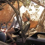
Yesterday’s wind and dust storm had vanished by morning. I’d assumed we would drive and hike to the cave, do what we needed to do, and leave. But in the morning, it became clear that they intended to spend the entire day out there. So I led them all in a caravan across the desert. As I said, I had no plan, but I’d brought ingredients.
We parked and loaded our packs for the day. I’d briefed them in advance on the dangers of the desert: sunburn, dehydration, cactus spines and catclaw thorns. Now I told them the hardly believable story of how I’d first discovered and fallen in love with this beautiful place – the start of the greatest love affair of my life, and the only one that has lasted.
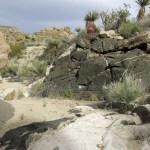
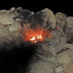
I led them to the Cave, past fanciful boulders and flowering cacti, and they each took a look inside, and assured me that they now understood why it’d been so important to Katie. Then I led them over to the larger rockshelter nearby where we could assemble in shade for the rest of the day.
My artist friends and I had originally fallen in love with the desert partly because in this place it had largely belied its nature as a harsh wasteland. Although it could get cold in the winter and on occasion the wind would drive us away, in general it was a really comfortable place to camp out. And that’s what we found today. It was warm enough that we could shift back and forth between sun and shade, from the intimacy of the big cave to the spacious view of the ledge in back. I’d worried that we might be spotted from the road and interrupted by authorities, maybe even forced to leave. But traffic was unusually light; few stopped and no one seemed to notice us.
I always prefer to enable a group to lead itself through consensus, and that’s what I tried to do here. I began by sharing my gifts, starting with the scrapbooks I’d spent the past week preparing. Throughout the day, they all studied them carefully. A childhood friend had brought sage bundles and set one burning. And I set up a boombox playing tracks of Katie’s music, so we were surrounded by her voice and her bass lines for the next two hours.
We made lunch, and part of the group moved out back for some sun.
After a while, one of the women asked if we could regroup to share our stories of Katie, so we gathered in a circle in a corner of the big cave. I was asked to begin, and I tried to tell the story of my time with Katie. We were all overcome as I described how I’d failed her – how the world had failed her, had never found a way to handle her talent, her brilliance that had destroyed her in the end. Then her younger sister struggled to express how much she’d loved and admired Katie – like Katie herself, the feelings we were bringing out were too hot to handle.
I was especially moved to hear how the younger generation had only seen Katie’s positive side – the loss was greater for them, to discover her work after they’d lost her forever. How strange that while she’d lived a long life, we were only honoring such a short period of it, saying that was the best. Had the rest of her life really been wasted? Apparently not for her nieces and nephews. So sad, so seemingly pointless that we were only celebrating her now, after she was gone. I was feeling worse and worse, guiltier and guiltier, that I hadn’t been able to help her, to save her.
The sharing of stories devastated and depleted all of us, and we were rising to disperse when Katie’s younger brother asked me for some songs. Of course, I’d brought my guitar – as leader, I was basically on call for this group all day – but I wasn’t sure I could do it.
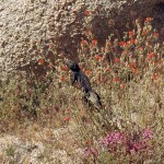
I stumbled through the two songs of Katie’s that I’d put to music in the weeks before. The first was the song in which she shared the experience of discovering the desert and its cultures. By the chorus of the second song, the one she’d addressed to me personally, I was breaking down, and that’s how I finished. And then we all moved out back, into the sun. One of the other elders had brought a boombox with a mellow playlist, and as we talked, we became aware of a big male chuckwalla, the largest lizard in the desert, perched on the tall boulder pile fifty feet away.
He made his way down toward us, and clambered into a flowering shrub where he began eating the blooms – they’re vegetarians, but I’d never actually watched one doing that. They’re usually shy, but some of our young ones approached within eight feet, and he ignored them. Then he moved even closer to our group, seemingly to observe us. As the young people said, “This is his home – we’re just passing through. He feels safe here.”
The sun was sinking toward the western cliffs. We’d spent seven hours out there together. Again, one of the women came and asked me to lead them in the final phase. So we packed up again and walked over to what would now be known as Katie’s Cave.
The women surrounded me outside the Cave and we conferred and agreed on the details. Then they followed me inside and formed an arc around the sister and me, who would perform the ritual. At this point, we were all overwhelmed.
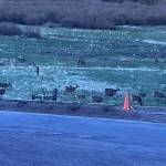
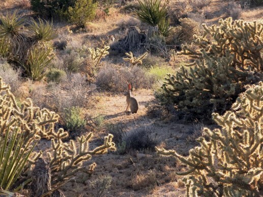
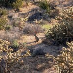
And afterword, we hugged, and kissed, and thanked each other. A solitary jackrabbit sat on its haunches nearby, watching us.
We hiked back across the desert to our vehicles, and said our goodbyes.
I called ahead to the reservation, and my friend arranged a room at the tribal rate. It took almost three hours to drive there, and I hadn’t eaten since lunch. The restaurant was closed, but the staff, generous as ever, hauled a microwave and silverware to my room so I could warm up a frozen dinner from their freezer.
While eating, I looked something up online. After the ceremony, I’d recovered a vague memory of a similar ritual held prehistorically by this tribe. Based on the ethnographic record, it sounded much like the ceremony we’d invented on the spot. The place, and its memory of the ancestors, had surely guided us.
What to do with my grief, my guilt? That would be the work of the following days and weeks.
Next: Part Four
May 14, 2024
Desert Ceremonial: Part Two
 Day Four: Hike
Today was forecast to be hot, and despite the high wind forecast, the air was still and already warm in camp as I started the day. Tomorrow I needed to make contact with the folks who were traveling to the ceremony, and that would mean driving outside the mountains for a cell signal. But today was my free day, and I planned to hike.
Unfortunately, the flies and gnats were just as bad as last night.
Where should I go? On my last visit, almost 18 months ago, I’d done all the iconic hikes. There was one canyon I’d been wanting explore, but the mouth of it was almost three miles away across gently undulating open desert with no chance of shade.
I finally decided to head up our main canyon, with the tentative goal of reaching its head on the crest, with a view east. I’d tried that once, 32 years ago, but had been stymied by a confusing maze of stone fins and pinnacles.
For the first mile and a half, my gaze was rooted to the sand of the big wash, where I was delighted at the bloom of wildflowers and puzzled by the vehicle tracks of trespassers during recent months. A big truck, some kind of UTV or ATV, and two or three dirt bikes. These people treat the whole desert as their God-given playground and can’t be bothered to walk anywhere; they consider it a failure if they have to get off their butts.
Before the trip, a friend had suggested I might find a decent bloom around the cave, but the flowers here in my home range were far more spectacular – and this was not even close to the best bloom I’d seen here. And that’s just the flowers – the rocks in this range are also more diverse and beautiful than those elsewhere in the desert. It’s wilder, richer, and more forbidding than other ranges I know.
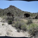
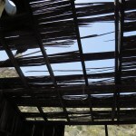
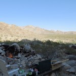
Past the dry waterfall, I was approaching the old miner’s cabin, which used to be maintained by a family of gun nuts from Huntington Beach. The truck had to turn back early, but the dirt bikers and ATV rider drove up the banks to avoid boulders in the wash, trampling vegetation, until they reached the base of the old, deeply eroded road to the cabin. And that turned out to be just too rugged for them.
Fortunately the cabin is falling apart, the junk around it slowly rusting away.
Having reached the cabin, I remembered that an old, now-impassable road climbs behind it to mine works and a roofless drystone cabin farther up the canyon. I went a short way up that and discovered a developed mule trail with stone retaining walls branching off, appearing to lead into the next canyon south. This is a canyon I backpacked into and partially explored more than thirty years ago, but I remember nothing of its upper reaches. It’s hidden from below, which makes it doubly intriguing, so I made a snap decision to follow the old trail.
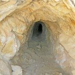
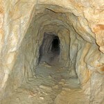
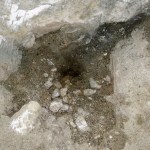
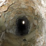
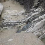
It was blocked in several places by big chollas, but it eventually led to a saddle overlooking the hidden canyon, and from there down into a side gully, where I stumbled upon a mine, almost completely hidden behind a thicket of catclaw acacia.
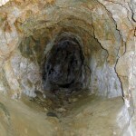
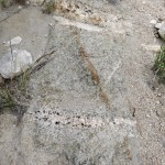
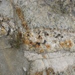
It turned out to be an unusually long tunnel for this range. It went almost straight back for more than 150 feet, and another man had explored it recently – I could tell because he’d broken a living branch of catclaw to reach it. Any tracks in this protected environment would last forever, and his were the only human tracks before I arrived.
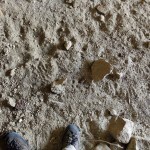
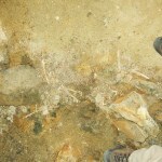
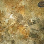
I dug out and turned on my headlamp, and nearing the back, found bones, and then parts of animal skeletons – a spinal column, a collapsed rib cage, and what appeared to be a couple of skulls. And at the very end was a patch of damp mud.
The old trail had washed out around the mine entrance, but I could see some sort of manmade ledge farther down the gully toward the hidden canyon, so I climbed over the washout and kept going. A bend of the hidden canyon lay below me, and I thought I could discern a continuation of the trail across the slope above the bend, so I used that to reach a narrow stretch of canyon upstream. This canyon is exceptionally beautiful and decorated with spectacular rock, but it’s also full of long-established invasive tamarisk, in apparent equilibrium with native riparian vegetation.
Including honey mesquite! This is one of only two canyons in the range where I’ve found big stands, probably cultivated prehistorically by Native Americans. The other mesquite canyon also has spectacular rocks. I’d made the right choice in detouring over here.
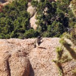
I was amused to encounter a shrike who stood on a yucca blade only ten feet away from me, making continuous agitated calls while holding an insect in its beak.
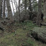
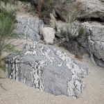
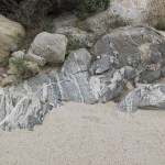
I began encountering what would turn out to be a series of natural rock dams across the canyon bottom, some requiring technical bouldering moves to climb over. And suddenly I found myself at a fork in the canyon, where two branches of seemingly equal size converged. One featured a towering cliff and a narrows that looked potentially impassable, so that’s the one I tried.
I was able to get through the narrows, climbing more natural rock dams, and the canyon just kept getting more spectacular, until suddenly I spotted a pinyon pine ahead! This range is low enough that pines only survive on protected slopes at its highest elevations, so my heart always soars when I come to these trees that were so important to native people.
There were only a few in this stretch of canyon, but they beckoned me onward.
I next emerged into a basin where more drainages converged, and far above, I could see what appeared to be the crest, dotted with more pines. I wasn’t sure which route to take from here, so I climbed a rock formation a hundred feet or so above the wash, where I could get a panoramic view.
The main drainage came steeply down from a saddle that seemed to be on the crest, but I couldn’t tell if it would overlook the east side of the range or only the main canyon to my north. Also, the slopes of that drainage were really rocky and potentially hard to traverse. To the right was a slope that featured stretches of grassy ground, potentially easier to traverse, until the route vanished over a divide into a side drainage that seemed to lead to a higher saddle. I was sure that route would lead to the true crest, so that’s the one I would try.
To get there, I had to proceed up the main wash. But above it on the left was a sort of ramp that looked easier going, and after climbing it I discovered another big stand of mesquite. The mesquite here was really thriving – in fact all the vegetation here seemed to be doing better than that around the cave farther north.
Dropping back into the wash farther upstream, I reached a stretch of rugged ground congested with boulders, thorns, and cactus that took some getting through before reaching the grassy slope I hoped to take to the crest. This required a steep climb, but there were parts that almost hinted at a trail, and dramatic rock formations both near and far as landmarks to memorize for my return.
Wind had been rising as I climbed. The forecast finally seemed to materialize.
Up and up I climbed, over the divide into the next drainage. And there I began to find cairns. I believe these to be remnants of the old Sierra Club peakbagger group, and I dismantle them wherever it’s convenient – this is supposed to be a wilderness, not a recreational area. Still, it surprised me to find them in this obscure, hidden canyon that I hadn’t even explored until 35 years after first arriving. It suggests that even fewer Anglos know these mountains now than then, which has got to be a good thing.
Back and forth I meandered to avoid obstacles in the new drainage, steadily approaching what I really hoped would be the crest. As is typical, there were lots of fallen skeletons of big pinyon pine strewn across the slopes here.
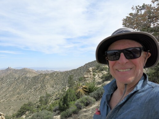
Hours had passed since my planned turn-around time. The wind was howling as I reached a saddle on the crest, but I was ecstatic. I’d only been on this central stretch of crest once before, over 30 years ago, and never at this spot. I made my way higher and farther south to get a view of the iconic rock formations along the southern crest. Clouds were massing along with the wind and the temperature was dropping, which was fine with me.
I hated to turn back – I wanted to stay up there forever! That’s the way it always is. But the longer I waited, the colder my shower would be in camp that evening.
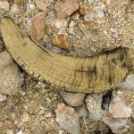
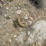
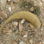
I had no trouble retracing my route down. And as usual, I paid more attention to the ground, finding a couple of old ram’s horns from mountain sheep, and a mushroom under a tiny nurse shrub.
It was when I reached the hidden canyon that I became entranced by the exotic rocks. The sky had grown overcast and mostly dark, and the wind bore directly down the canyon from the northeast. But in the lower stretch the sun came out again for a while.
The wind was so strong now, I was sure my tarp had blown away and been ripped to shreds in a catclaw. I’d forgotten to pack it away before leaving camp, and the little rocks I use to anchor the edges were surely inadequate. I feared I wouldn’t be able to sleep in that wind and would have to leave the mountains during the night.
But miraculously, my tarp was intact, and the wind died shortly after I finished my shower. The flies and gnats never returned, and I enjoyed a delicious dinner and a peaceful last night in my sacred mountains.
Since I’ve known these mountains by hiking them extensively for 35 years, I guessed that today’s hike only covered between 7 and 8 miles out and back, and when I plotted it on my mapping platform a week later, it turned out a bit under 8, with a little under 2,200 feet of accumulated elevation gain. But including many stops, it took 8-1/2 hours to complete.
It interests me to compare this with the hikes I do back home, which are all to some degree preparation for hiking in the desert. Two weeks earlier I’d hiked 18-1/2 miles near home in the same amount of time, with almost 60 percent more elevation gain, on maintained trails. The hardest hike I do near home, more than 16 miles out-and-back with over 5,000 feet of elevation gain, only takes a half hour longer.
Though much shorter, with much less elevation gain, today’s hike in my desert mountains felt harder than either of those, and as I discovered during the next week, it took a more serious toll on my body than any hike I’ve ever done near home – even the bushwhacks in severe weather. It was also more dangerous, but interestingly, I never stumbled or fell, which happens regularly on those hikes near home.
Numbers aside, it felt like one of the best ever, one I won’t forget. I wondered how much longer I’d be able to do this.
Next: Part Three
May 12, 2024
Desert Ceremonial: Part One
This is the story of a road trip I made to the desert, to visit people I love and places that are sacred to me. Nine months ago I had been asked to lead a ceremony there, and that was the main purpose of the trip.
During the intervening months I faced challenges and crises that repeatedly brought me to the brink of a mental and emotional breakdown, struggling daily with the cumulative effects of both recent and past traumas, and since January I’d been in almost constant pain. Nevertheless, I began planning weeks before the trip, preparing music I would try to play, songs I would try to sing, stories I would try to tell.
All my preparations were speculative; I had no idea what would work, or even what people would want. I wasted a lot of time on things I ultimately realized were off-target. Despite being the designated leader, I had no plan for how the ceremony would unfold. Maybe nothing I had prepared would be used.
The last week before I left was a whirlwind of activity, finishing the gifts I hoped to share with the group, packing and struggling to finalize my schedule.
Day One: DepartureOn the day of departure, I still didn’t know how long I’d be gone, where I would be on most days, or when I’d get back home. I hoped to camp, so I loaded my 4wd vehicle with all the usual desert survival gear.
It’s a two-day drive, crossing seven or eight mountain ranges, the highest pass over 8,500 feet. The first stint was a six-hour drive, the last part on the interstate. I’m spoiled to live in a remote small town, and any amount of traffic makes me boil over with stress, so as usual I was a wreck when I reached my first destination.
For the ceremony, I really wanted one item I hadn’t been able to find, and didn’t have time to order, at home. The town at the end of the six-hour drive was where I expected to find it, but after that grueling drive, I ran the nightmare gauntlet of traffic jams and construction sites for three hours, checking five different stores all over town, only to realize it simply wasn’t available here. My only remaining recourse was the sole big box store in the next town, two-and-a-half hours west and half the size of this town.
I’d booked an affordable room in a new boutique hotel. It turned out to be popular with affluent, age-inappropriate couples from Los Angeles and arrogant, wizened tourists from back east. The only saving grace was the cassette boombox in the room, with interesting tapes custom-curated by the owners.
 Day Two: Arrival
This was to be my last internet access before the desert, and feeling the pressure, I tried to make last-minute arrangements without committing to specifics. I checked out, and did my grocery shopping for the desert, because what we have at home is limited and I like to treat myself on these rare occasions.
Then I drove across the high plateau and descended to the desert. My luck was turning – the next town had exactly what I needed at a discount price, and I enjoyed lunch at my favorite Mexican dinner house. And I thought to fill my solar shower and strap it to the top of the vehicle so I could clean up in camp before going to bed that night.
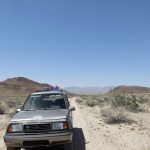
My little 27-year-old 4wd vehicle is punishing to drive in any conditions, with its tall profile and big windows creating a greenhouse effect, its extremely heavy clutch requiring me to stand up in the driver’s seat to depress the pedal at every gear change or stop, and its light weight combined with stiff suspension that make driving a road with any imperfections like riding a jackhammer. But it’s also been having shifting problems for years, which may portend a transmission failure. The mechanical clutch had supposedly been replaced just before I bought it, and it soon became almost impossible to shift into first gear or reverse. I eventually discovered that adjusting the clutch cable would solve the problem, but only temporarily – it had to be readjusted every six months. And in hot weather it got much worse.
So before the trip I’d adjusted it in advance, but sure enough, when I reached the warmer weather of the desert it required up to 40 pounds of one-armed force on the shift lever to change gears, and sometimes the engine had to be shut off before I could shift. I had no time to stop and adjust it now, so I just suffered through it for the next week, relentlessly punishing my already torn rotator cuffs.
I’d brought plenty of water and firewood from home, so all that was left was to fill up with gas. Gas gets progressively more expensive on the way to the desert, from $3.50 to $7.00 per gallon, so I topped up my tank incrementally at each of the last three opportunities.
And at last, I was back in the land I love, the land I can only visit at long intervals.
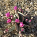
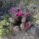
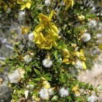
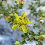
Tomorrow, I’d been hoping to do some clean-up at the cave where the ceremony would take place. But I arrived in mid-afternoon, so I was able to get a head start. A friend had suggested the wildflowers might be good now, but all I found was beavertail and hedgehog cactus in bloom. I’d been warned of juniper mortality, and sure enough, I found many had died recently.
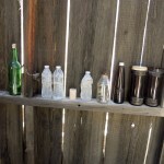
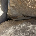
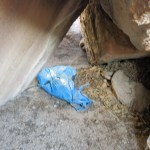
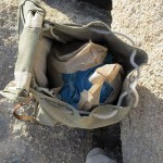
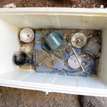
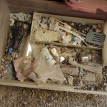
We’d never left valuable gear in the cave, and the cheap stuff that had accumulated over decades had been attacked by weather and woodrats.
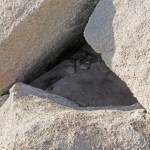
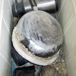
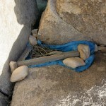
I spent a couple hours assembling a load to carry out this first night. It was melancholy work, the end of an era lasting more than four decades, many items laden with memories of a loved one.
The sun was setting, and I was lucky to find a campsite nearby. I had just enough time before dark to lay out my bedding, shower, and warm up a can of chili.
The campsite lay along a deeply eroded dirt road that continued for another mile back to the foot of cliffs, and after eating, in full dark with no moon, I began walking down the road. I love night hikes in the desert; the ground is pale and even starlight is enough to go by. As far as I could tell, I was alone from horizon to horizon, and the night was still.
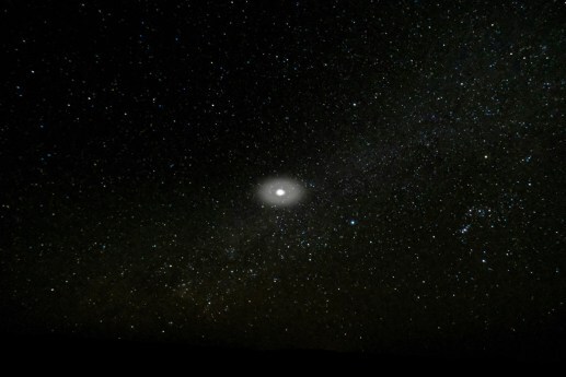
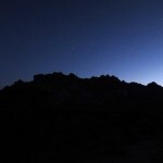
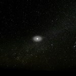
Near the end of the road, surrounded by the low, rounded silhouettes of dark junipers and pale boulders, I happened to glance north, and saw a hazy light in the sky, moving slowly from north to south, without making a noise. I couldn’t tell how high it was, but all round it, the stars were crystal clear and sharply defined. I could clearly see the tiny lights of jets crossing east to west behind it, but this light was much larger, and surrounded by an elliptical haze – an aura. Since the sky around it was clear, it was like the light was generating and illuminating its own haze – some sort of gas or vapor.
When I first saw it, it was about 60 degrees up in the northern sky, and about 15 degrees west of Polaris, the north star. It was moving north-south like a satellite, but slowly. For five minutes I watched it climb steadily, unchanging, through 30 degrees of arc. When it reached the zenith, directly overhead, it slowly faded out and disappeared over about 10 seconds. It completely vanished, with the stars uncovered in the space where it had been.
I call it the Aura. I welcome logical explanations – please just don’t mention UFOs.
 Day Three: Work
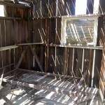
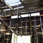
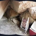
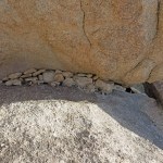
The temperature in my camp unexpectedly dropped to 40 degrees that night, and even wearing thermal tops and bottoms, I was too cold in my summer sleeping bag. But next morning, a friend living nearby offered her dumpster for the stuff I’d hauled out of the cave, and I was able to return for another load.
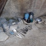
Tramping out to the cave one more time, I sorted and packed up the really junky stuff, leaving our old cooking utensils neatly arranged around the hearth. Then I raked the sticks and cactus spines away from the floor so my companions could enjoy the cave when they arrived in a few days.
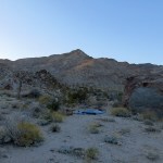
After disposing of the junk and trash and making lunch at my friend’s place, I drove over to my land in a much more remote mountain range for a couple days and nights of hiking and camping. The roads have gotten worse and worse over the years, which is a good thing, reducing both visitation and vandalism. It had been almost a year and a half since I’d been there last. High winds were forecast for the next two days, which worried me – it’s almost impossible to sleep outside in a high wind.
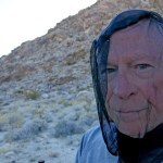
Our campsite, sometimes subject to vandalism, was in good shape. The air was still, and I was swarmed by flies and gnats as I set up camp. They had no interest in standing water or my open mug of beer – what they seemed obsessed with was my exposed skin, perhaps for the salts. They got so bad that I had to pull on my head net. I wondered if the invasive feral burros were responsible – they’ve only arrived here within the past five years. I tried to play guitar, but the flies and gnats crawled all over my hands as I played.
It was inconvenient eating and drinking with the head net, but I was in my sacred place, so I couldn’t complain. I could almost feel it starting to heal me, already. The flies and gnats disappeared at 7:30 – I assume it was getting too cool for them – and I had a wonderful night’s sleep.
Next: Part Two


