Max Carmichael's Blog, page 11
August 21, 2023
Heat Wave Helping Wildlife?
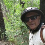
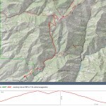
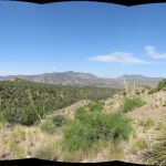
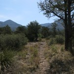
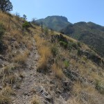
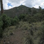
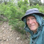
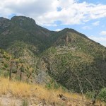
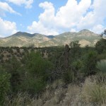
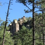
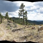
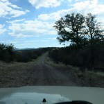
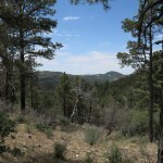
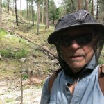
My twice-weekly hiking routine had been disrupted since April, and the Southwest heat wave had mostly prevented me from hiking for a month and a half – the last serious hike was during a brief cool-off a month ago.
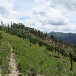
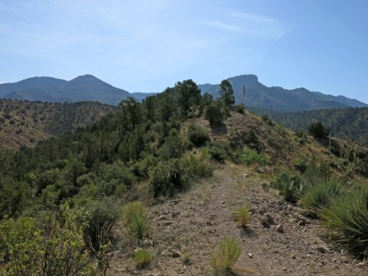
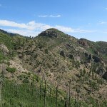
An old friend had taken her life last week, and no hike was going to overcome the melancholy, but the forecast showed the heat wave fading during the next couple of weeks. I re-checked the online trip reports for my old favorite crest hike on the west side, that had been blocked by a massive blowdown in March, and found one from a lady who’d hiked through there at the end of May, mentioning only a few trees down. So with no expectations, I decided to give it a try. It’s a challenging hike and I knew I’d lost a lot of conditioning, and depending on the weather, solar heating might be intense on the exposed crest. But the day was forecast to be windy – that might help.
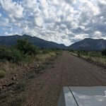
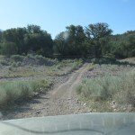
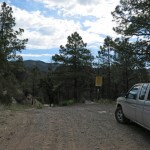
As I approached the trailhead, I was glad to see a cloud bank over the mountains – wondering how long it would last?
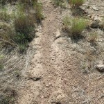
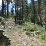
Unsurprisingly, there were few entries in the trailhead log during the past two hot months, and the farthest anyone had gone was the spring at 4-1/2 miles. But one hiker thanked the Forest Service for trail work, which was encouraging.
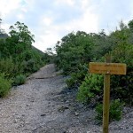
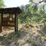
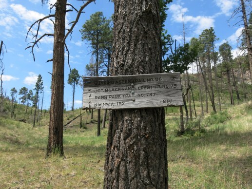
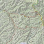
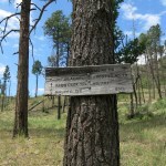
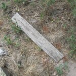
And a few yards up the trail there was a new wooden sign, to replace the metal “Warning: Trail Not Maintained” sign that’s been there since the 2012 wildfire. This permanent-looking sign announced the trail is unmaintained past Camp Creek Saddle. That suggested two possibilities: first, that the eight miles to the saddle might actually be cleared now, and second, that the remaining twelve miles to the crest trail have been permanently abandoned.
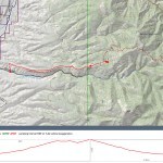
I was excited about the first possibility. Despite being in poor shape, if the trail was clear I was determined to make it to the saddle, a 16-mile round trip with over 5,000′ of elevation gain. I would do it if even if it meant coming back in the dark.
The second possibility was depressing, since this is the last potentially maintainable link in the vast network that used to enable backpackers to traverse the crest of the range.
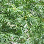
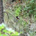
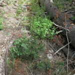
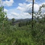
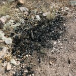
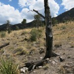
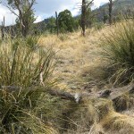
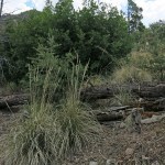
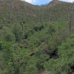
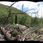
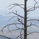
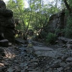
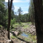
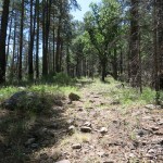
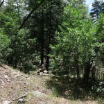
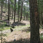
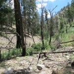
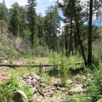
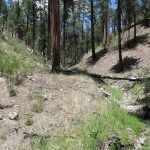
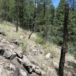
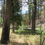
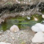
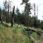
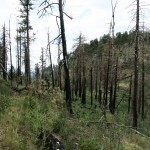
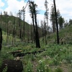
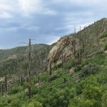
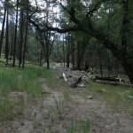
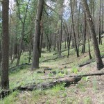
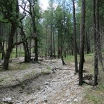
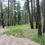
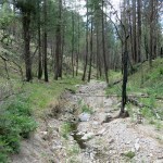
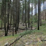
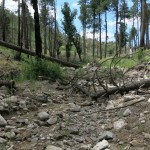
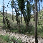
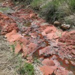
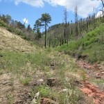
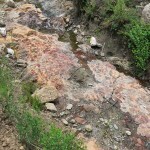
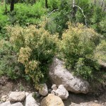
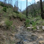
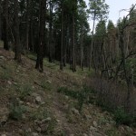
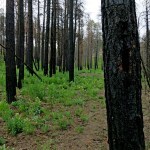
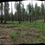
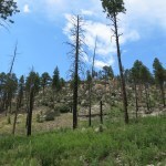
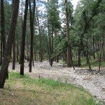
Unsurprisingly, again, the creek was dry when I reached the canyon bottom, but vegetation was lush in the old burn scar due to our wet winter. And even without running water, I encountered a painted redstart as soon as I left the burn scar and entered the riparian canopy.
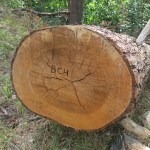
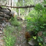
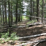
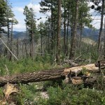
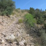
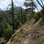
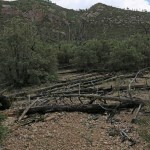
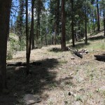
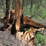
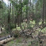
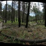
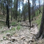
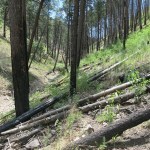
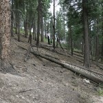
Then, two miles into the hike where the blowdown had started, I found that the dozens of big logs across the trail had indeed been cut, probably in May after I called the ranger station to report it.
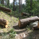
The work had been done by the equestrians, and I was grateful, but it still bothered me that they were using this to promote their own agenda, going so far as to brand one of the cut logs with their acronym.
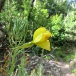
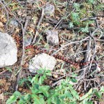
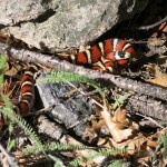
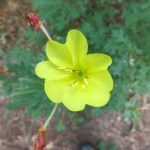
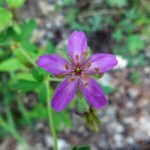
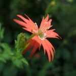
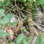
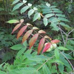
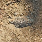
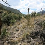
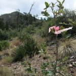
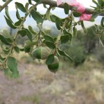
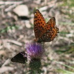
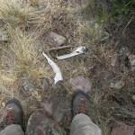
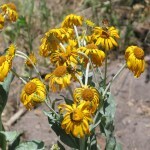
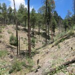
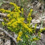
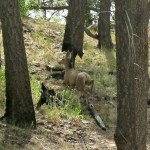
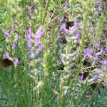
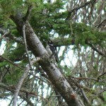
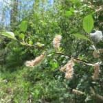
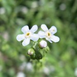
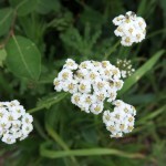
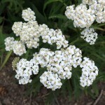
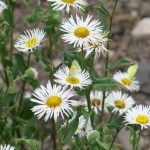
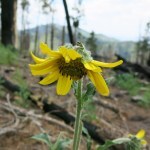
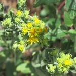
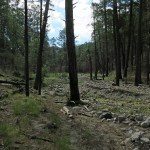
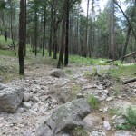
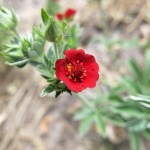
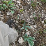
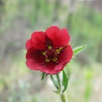
Normally, at this time of year, there would be thunderstorms with rain and hail and lots of wildflowers and fungi. In this drought I found only a few flowers and no fresh fungi. Buy the wildlife seemed to be thriving – in rapid succession I came upon an Arizona/Sonoran Mountain Kingsnake, a whitetail deer buck, a Downy Woodpecker, and a rattlesnake.
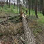
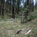
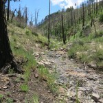
Panting with effort as the grade got steeper, I made it to the bottom of the switchbacks and found that the big tree across the trail there had indeed been cut. But that’s where the equestrians’ trail maintenance had ended.
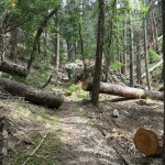
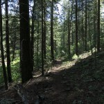
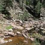
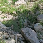
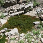
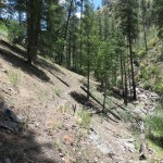
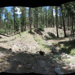
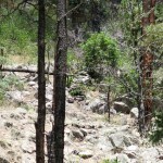
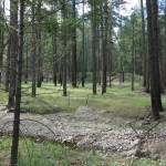
Quite a bit of new blowdown slowed me down on the switchbacks, and the wind increased as I trudged upward, exceeding 40 mph in more exposed sites. But clouds still drifted across the sun, and both the wind and the shade really helped. I even felt a chill when under a particularly dark cloud, but as soon as the sun returned it felt like the mid-80s again. The spring at 9,100 feet was still flowing, and I wondered if I would run out of water trying to reach the distant saddle. Nice to know fresh water was available here.
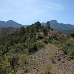
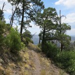
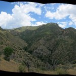
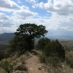
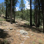
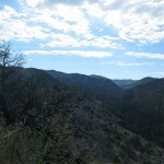
Finally I rounded the corner of the last long switchback and the crest was in sight. I hadn’t seen human tracks anywhere on this trail, and I figured I might be the only person to make it up here since last fall.
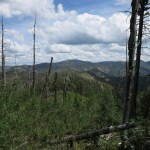
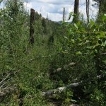
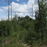
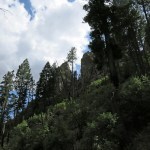
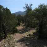
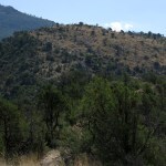
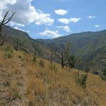
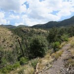
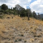
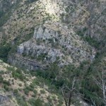
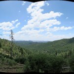
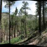
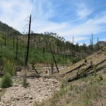
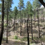
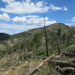
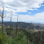
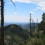
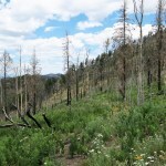
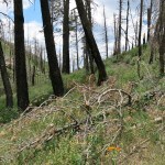
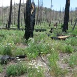
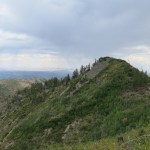
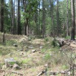
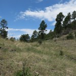
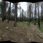
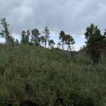
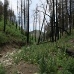
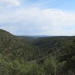
I crossed the 9,500′ saddle on the shoulder of the peak and headed down the trail on the back side, through the burn scar dense with regrowth of aspen and locust. The wind was coming from the south, and when I reached the first small stand of intact forest a big limb snapped off and fell a couple yards to my right. I stopped, then figured I’d be safer in the midst of the forest, so I kept going. But then another limb snapped off and fell a few yards to my left. I was pretty sure the wind here was exceeding 50 mph, so I was paying a lot of attention to the canopy.
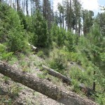
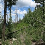
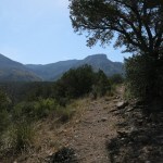
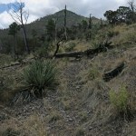
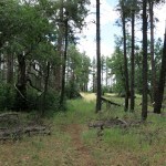
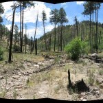
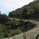
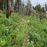
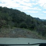
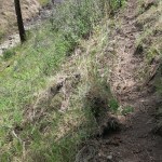
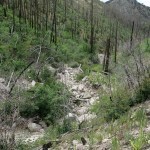
https://maxcarmichael.com/blog/wp-content/uploads/2023/08/Wind.mp4As usual, the trail down the back side, leading to a long ridge and eventually Camp Creek Saddle, was an obstacle course of thorny locust and blowdown. Virtually no trail work has been done here for at least five years. The burn was patchy, and small stands of alpine mixed-conifer forest alternate with jungles of regrowth. I’d fought my way to the distant saddle almost exactly two years ago, but I knew I wasn’t up for that today. I was just trying to make it to a tiny saddle, the first low point in the ridge, where there was a stand of forest on the south side where I could stop and rest.
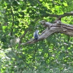
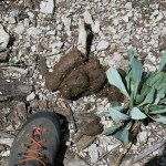
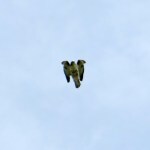
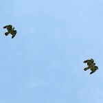
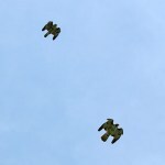
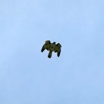
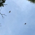
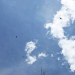
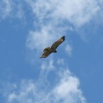
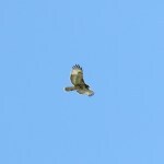
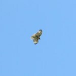
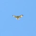
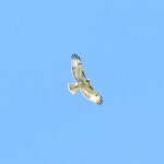
But about halfway down I came upon a pile of really fresh bear scat, and started making a lot more noise. Then I saw the first hawk, circling around the little peak above my destination saddle, and heard it screech. Soon it was joined by another, and they poised together in the face of the wind and were joined by a third. The wind was fierce but they kept trying to hold a formation together, right over my head. They stuck around for ten or fifteen minutes before drifting away together.
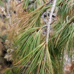
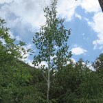
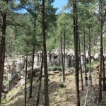
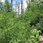
I had a nice rest in the shade of the forest, while staying vigilant on the wind in the canopy. I was deep enough I felt somewhat protected. I also noticed a pine that wasn’t ponderosa – you have to be really focused to tell the difference, and it’s common to just assume the only conifers in this habitat are ponderosa and doug fir.
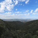
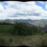
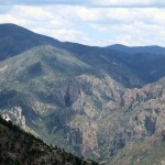
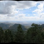
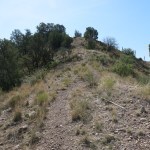
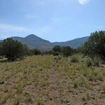
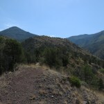
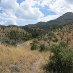
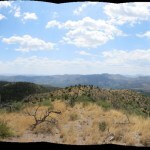
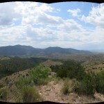
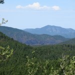
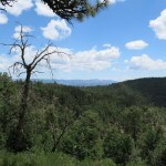
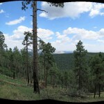
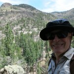
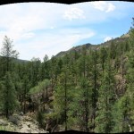
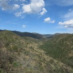
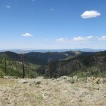
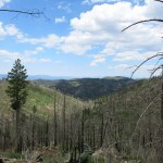
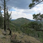
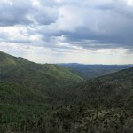
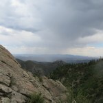
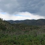
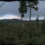
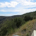
Finally I made my back up through the jungle, to the shoulder of the high peak where I climbed to the little rocky overlook. I knew the wind would be at its worst here, but I always love the view, over the heart of the range on the east and the open country to the west.
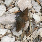
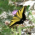
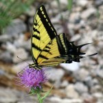
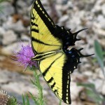
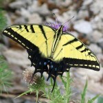
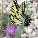
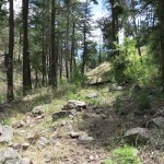
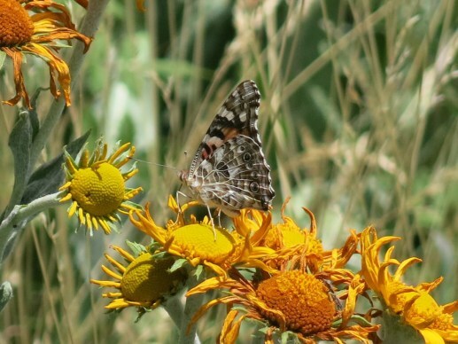
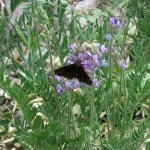
When I finally reached the long switchbacks down from the crest and got some relief from the wind, I was lucky to encounter a solitary swallowtail butterfly. And I stopped to examine a small pine that had blown down across the trail recently enough that some needles were green. I figured it was the same species as the trees I’d seen on the crest – probably a Southwestern White Pine, which must be fairly common here if you know to look for them.
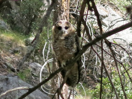
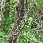
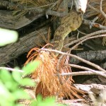
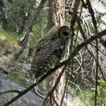
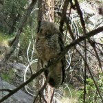
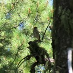
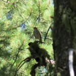
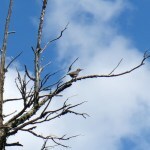
Steller’s jays had been harrassing me all day, but partway down the trail in the canyon bottom I sensed something rising in the corner of my eye, and noticed a shadowy form settling on a low branch, only 30-40 feet away. It was an owl! A small one, only about 12-14 inches head to tail, but when I got home and looked it up, I found it was almost certainly a rare Mexican Spotted Owl, probably a young one. It just sat there and watched me, obviously curious, until I finally had to go.
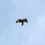
Shortly after that, I heard a screech overhead, and the hawks returned, swooping low through the canopy this time. I’ve seen young migrating eagles behaving like this, traveling in flocks and showing off their acrobatic skills. What a day for wildlife! I began to wonder if the heat wave and corresponding absence of humans has allowed wildlife to flourish more in these habitats. Despite the displacement of indigenous peoples, wilderness designation is valuable if only to keep us civilized people under control – we just can’t be trusted not to destroy nature.


July 31, 2023
Sunburn Ridge
For the past week, our forecast had predicted the afternoon high to dip below 90, beginning this weekend. So I was looking forward to more hiking options – I wouldn’t be limited to the now-mostly-impassable trails above 9,000 feet.
But the ranges over in Arizona would still be too hot, and as I studied my list, I realized the remaining local trails were either too exposed or spent most of their time at elevations where temps could still exceed 90. I was about to give up when, a half hour before departure time, I remembered the trail I’d tried to reach a few months ago, only to be turned back by a road flooded with snowmelt. Snowmelt! Those were the days.
I’d forgotten to add this trail to my list. It climbs out of a narrow canyon to a ridge that it follows to the 9,000 foot crest, where after five and a half miles it connects with a two-and-a-half mile southbound trail to the 9,800 foot peak I pass on one of my old favorite hikes. Of course, it crosses the burn scar of our 2012 mega-wildfire, but the first three miles had been cleared last fall, and the rest was scheduled to be cleared this fall. So maybe there were enough clues left for me to be able to puzzle out. If I could reach that southern peak – unlikely in this heat – it would be a 16 mile round-trip with 5,700 feet of elevation gain.
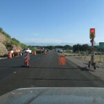
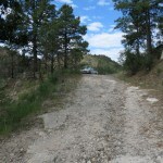
Deciding at the last minute, I got a late start. And amazingly, although it was Sunday, a road crew was busy at the halfway point on the highway north, delaying me another fifteen minutes. I had plenty of time to recall how this has long had one of the best road surfaces in our region. But the creek crossing, a raging flood a few months ago, was now bone dry. The trailhead logbook had been removed, but a rocky section of the road requires high clearance so I figured this trail sees few visitors.
Choosing this trail had involved some denial and wishful thinking. The trailhead lies at 5,100 feet, almost a thousand feet lower than my home, so today’s high was likely to reach 95 there. And most of the climb up the long ridge would be exposed, through scrub and open pinyon-juniper-oak woodland. It’s a continuous climb from the trailhead, and at an average 14 percent grade, it would be the steepest trail I know of anywhere. I’ve done steeper bushwhacks, but trails are generally routed with gentler grades. I was surprised, but also pleased – this is the kind of trail I like, and the steeper the ascent, the more rewarding the descent.
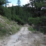
The trail begins by climbing two hundred vertical feet out of the narrow canyon to the top of the ridge, which is near the lower edge of a dissected alluvial bench. This bench forms a broad, gently sloping skirt below the western wall of the range. Parallel streams dissect it, either into flat-topped mesas or long, narrow ridges like this one.
The sky was clear, the air was still, I was totally exposed and sweating like a pig as I labored upwards, wondering when I would either get too hot and turn back, or reach the shade of a ponderosa forest above 7,000 feet. The ridgeline consists of a series of little peaks or humps, each of which the trail climbed over at between 20 and 30 percent grades. And from these, the 9,000 foot peaks and ridges above beckoned.
Reading the trail, I soon confirmed no one else had been up this trail besides cattle, probably not since the trail work last September. The cattle sign was really old, but the trail was in great shape, and while suffering in the heat, I looked forward to an easy descent later.
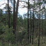
Eventually I left the totally exposed scrub zone behind and began passing between pinyon pines and junipers where I could step off occasionally into some momentary shade. Radiant heat was my nemesis – it felt like the low 90s on the exposed trail, and the mid-70s when I stepped into the shade. Finally I surmounted the steepest grade yet, traversing a prominent hill, and came to a saddle with a big cairn.
Past the saddle was another steep hill, and traversing the north slope of that I encountered my first ponderosa pines. But then the cleared trail ended at a shallow slope covered with bunchgrass and strewn with charred deadfall.
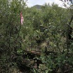
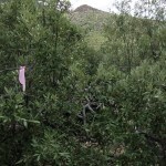
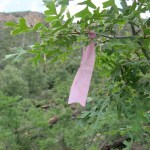
After some scouting, I found some pink ribbons that had been hidden by charred snags falling after last year’s trail work, and eventually picked up a faint trail on the high side of the clearing. The trail crew had continued up the ridge, cutting some brush but leaving the deadfall, and soon I came to oak thickets where the old tread had been completely obliterated by the erosion of post-fire sheet flows.
Miraculously, I was still able to find an occasional pink ribbon that beckoned me forward. Most of these ribbons were in the midst of thickets, so you couldn’t see them until you pushed your way in. Some of them led to impenetrable blowdown that I had to back out and circumvent.
Finally I reached the last ribbon. Beyond it was what looked like the ghost of the old trail, but it was completely blocked by low shrubs and deadfall for as far as I could see.
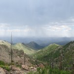
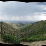
I turned back, descending a hundred yards or so through the maze of scrub oak. It was still early, storm clouds were forming over the crest and providing occasional shade, along with breezes, that cooled me off. I still had plenty of energy and wanted to keep going, but the slopes above were getting steeper and rockier, and without a route, I would soon be lost and blocked by a rock wall or boulder pile.
I kept checking the topo maps I’d brought, but the landscape I could see from this thicket seemed nothing like the topography shown on the maps. I began to suspect the trail workers had deviated from the original route.
There was an opening in the maze that led south over the ridge. I explored that for a couple hundred yards, but was no wiser for it. I turned back and hiked back up to the last ribbon. I’d pushed through thickets before, so I chastised myself and began forcing my way up the trace that I thought might be the old trail. After climbing over a bunch of deadfall, I reached a point where the “trail” became a deeply eroded drainage, ending in a wall of shrubs that was just too dense for me.
So I gave up and, with difficulty, found my way back down through the maze. But I wasn’t happy, and when I reached the point at the lower edge of the oak thicket where the trail crew had stopped clearing brush, I stopped again and started feeling guilty about not trying harder.
So for a second time, I turned back, re-climbing the two hundred vertical feet and fighting my way back through that quarter mile of maze. Along the way, I picked up bits of pink ribbon I found lying on the ground, so I could add my own ribbons past the last ones tied by the trail crew, to guide my return.
I’d seen quite a few birds, but nothing unusual. Flocks of ravens were circling, vultures rocked on thermals, and finally I saw a big raptor hunting among the peaks far above. When a hawk appeared to give the bigger bird scale, I realized it had to be an eagle. It hunted up there for quite a while but was too far for a picture.
This time, I climbed a deeply eroded slope crisscrossed by deadfall, above the thicket that blocked the gully where I’d stopped before. I climbed to the base of the steep slope above. I saw two peaks above me, where my map showed a level ridge. They looked to be at least a thousand feet higher, and I assumed one was the named peak on the map. The slope ahead of me looked impassable, and I had no idea where the old route went, or if I was even close to it. This was as far as I would get.
On the way down, I untied my ribbons so as not to mislead anyone. I became convinced the trail crew had deviated and was hacking a new route up this ridge, one which was likely doomed. I’d captured some GPS waypoints with my messaging device and at home, would compare them with the trail shown on the maps to see how far off they’d gone. I planned to notify USFS as well as the equestrian trail crew.
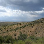
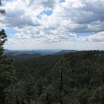
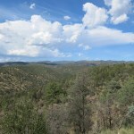
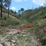
But in the meantime, the clouds were dispersing and a fierce heat was radiating off the trail onto my face. I figured the ground, which was gravel and hard-packed dirt, had stored and accumulated heat throughout this record heat wave. It was like walking across the crust of an active lava flow, so I descended the steep, treacherous surface as fast as was safe. My only consolation was the broad vista ahead, from the valley 3,000 feet below me to the series of blue mountain ranges on the far side, ending on the horizon at the barely visible Mogollon Rim.
Finally I reached a point where I could turn around and get a view of the crest I’d been climbing toward. Now I saw that the landmark peak and most of the crest had been hidden from me when I was in that oak maze. And when I got home and checked my GPS waypoints, I learned I’d covered much less ground than expected – 7 miles in 6-1/2 hours. I’d been on the right trail until that last pink ribbon – from there, the trail turns 90 degrees left and begins winding its way up toward the hidden peak, far north of where I’d gone. I’d gotten stuck below slopes that hid the upper landscape, so there was no way I could’ve found a route on my own, let alone reconnecting with the old trail.
In the canyon bottom, even though I’d parked it facing west with the reflective sunshade over the windshield, my vehicle was like a pizza oven. I opened all the doors and left the AC on high for a while, but even so the sweat was pouring off me as I drove out to the highway.
It was after 5 on a Sunday, but the road crew was still at work, resurfacing a highway that didn’t need it. The national bureaucracy and infrastructure most of us believe we need is actually a juggernaut of habitat destruction and waste. But people cling to the evil they know, imagining the only alternative is chaos and suffering.
July 24, 2023
When 90 Degrees Is Cool
Our daily high temperature was forecast to drop from 98 to 90 this weekend – a significant cool-down from the past three weeks. But the humidity remained high, and I still needed high elevations and shade for my Sunday hike.
And after last Sunday’s routefinding and bushwhacking, I wanted an easy trail. The mountains in Arizona were still too hot, so there was really no choice – I had to do the crest hike near town that I’d already done only two months ago.
There’d been a brief storm yesterday, the canyon was dripping with dew, and the flies were out in force. I was sweating heavily from the humidity even before the air warmed up. I found lots of tracks from yesterday on the canyon bottom stretch of this popular trail, but as usual they dropped off in the first couple of miles before the climb to the crest. The only tracks that preceded me on the climb were from a mountain bike sometime in the past weeks.
I wound my way up through the mixed-conifer forest on the south side of the 9,000 foot peak, and just below the crest noticed an older couple sitting in the shade fifteen or twenty feet above the trail. We exchanged pleasantries about the cooler weather and the beautiful day, and I pointed out we were lucky the wildfire that cleared forest from the north side had left this side intact.
The woman immediately launched into a lecture about fire suppression and the importance of fire in the ecosystem. I smiled, letting her finish, then I said that for years, my hikes in this and other national forests had been amateur studies in fire ecology. I said one thing I’d learned is that hiking trails like this are unsustainable in wildfire habitat. The man said “Yeah, they’re actually abandoning a lot of trails!”
“Yep, habitat will just have to recover without us,” I added.
“And that’s a good thing!” the woman maintained, sternly and emphatically. “Nature is better without humans!”
I smiled again. Here they were enjoying a day in nature, and she was resenting it.
I asked them where they’d hiked from. Like others I’ve met recently here, they’d driven all the way up the fire lookout road to the crest, and hiked less than a mile to this spot. They’d actually spent the night there on the road, battered by yesterday’s storm, and would drive the twenty miles back to town today.
The man asked me where I was hiking from, and after I’d told him said “That’s a big hike! How far do you go from here?”
I told him about the shallow basin with old-growth conifers and a grassy meadow three miles farther out the crest. “Wow!” he said.
“Yeah, eighteen miles out and back, but on an easy trail, which is what I need at this point.” I told them about the bushwhack I’d done last week, when it took me seven hours to cover seven miles. I recommended hikes over in Arizona where trails were better maintained, but got the impression they were only interested in van camping and short walks near town.
The remaining three miles went smoothly, but I was hot, sweaty, and plagued by flies even on the crest. Such a relief to reach the shallow basin and collapse on a bed of pine needles in the shade.
Flowers were more subdued here than on previous hikes – many had already gone to fruit. But the pollinators were still busy. I was really feeling the heat on the way back, stopping to drink my still-cold water in every patch of shade.

The big milestone on the return is the saddle below the peak. At that point you’ve done twelve miles, and what remains is all downhill. I was wearing my best boots and my feet were doing better than on other recent hikes. And bigger clouds were forming, so I had intervals of darkness and cooler air in addition to the shade of the forest. The flies continued, worse in some parts of the forest than others, seemingly without rhyme or reason. But my head net allows me to ignore them.
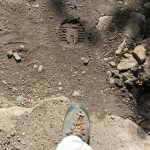
On the final descent into the canyon I began seeing tracks of people who’d walked a few miles in while I was hiking on the crest. My left heel was acting up. I stopped to stretch, but was still limping intermittently on the last two miles in the canyon bottom, where I found more footprints and hoofprints of horses.
And when I got home, I discovered my whole lower body was covered with a rash that burned like fire in some places. So ironic that what keeps my heart, lungs, and mind healthy is causing skin problems, at the same time as trails become less accessible.
July 17, 2023
Puzzle in a Hot Canyon
Thanks to the wonders of technology, everyone with their face glued to a screen knows the Southwest is experiencing a dangerous heat wave. Unfortunately, my regular high-elevation hot-weather hikes have become impractical due to forest loss, blowdown, regrowth, or flood damage – all except for the one I did last weekend. The temperature in town was forecast to reach 98, and without a storm to cool things off, I could expect temperatures in the mountains to reach the high 80s. I was almost ready to give up on this Sunday’s hike.
But I’ve done serious hikes in the desert in the high 90s – I’d feel like a real wimp if I let this heat wave whip me. I kept thinking about the beautiful, shady mixed-conifer forest at the start of the abandoned-trail hike I’d done two weeks ago. Another equally-abandoned canyon trail started from there, and even if it turned out to be a dud, at least I’d be in nature, and ten degrees less hot than at home.
There was absolutely no information available online – even before the mega-wildfires, this had apparently been an unpopular trail. Like its companion trail, it had been subjected to two wildfires in a decade, and I could expect deadfall, blowdown, deep washouts, boulder-strewn debris flows, logjams, and thickets of thorny locust. But I found the post-fire remediation map from last year’s fire, and it seemed there might be slightly less severe burn in this canyon, and hence more shade during a heat wave. On the map, it reaches the 9,000 foot crest in only five miles – if I was lucky, I might find significantly cooler weather up there.
I was driving my little 4wd this time, so I could make it down the steep, deeply-eroded, incredibly rocky approach road onto the 7,200 foot floodplain to park in the shade of the old-growth. There was a flood warning sign, but the catastrophic post-fire flooding had already occurred last fall, and I figured enough regrowth had occurred in the meantime to forestall anything like that now. A storm would actually be really welcome today, to cool things off.
I’d gotten a late start, and it was already too hot in the sun when I got out of the vehicle. The creek had shrunken to an occasional algae-choked trickle, but my friends the flies were still there, swarming my head net. I climbed across the debris flows, deep washouts, deadfall and blowdown of the old forest road to the junction of two canyons where I’d started the previous hike. Today’s hike would continue up what was left of the road – mostly nice and shady.
The Forest Service map shows this road ending after about another mile, where it climbs the right bank of the creek and the old trail begins, climbing about 200 feet up a slope to bypass a rocky narrows in the canyon. On the ground, the road had mostly been obliterated by catastrophic flooding and regrowth, but I was able to read and follow its traces, finally arriving at an overgrown clearing on the right bank.
Straight ahead was a little erosional gully that might be the remains of the trail, and when I pushed through shrubs on the easier left bank of the gully, I sensed the vaguest indication of an old cleared corridor climbing the slope. I climbed a hundred feet or so up a rounded shoulder, repeatedly checking the topo maps I’d brought. They were the highest resolution I could get, but still omitted most of the actual topography I was seeing on the ground, so I had a really hard time figuring out where I was.
But before the shoulder merged with the higher slope, in a place where there was no other surviving evidence of a trail, I suddenly came upon a big cairn. The map shows the trail making a left turn two hundred feet above the canyon bottom, and a cairn often indicates a turn or crossing point, but when I looked left, a little thicket blocked my way. So I continued up the slope, imagining I was following the ghost of a trail.
Just before the shoulder merged with the main slope, I did come to some kind of trail that approached a steep gully. But I couldn’t see its continuation on the opposite slope, so I kept climbing. It was now impossible to judge how high I was above the canyon bottom, and the map just wasn’t detailed enough. I climbed another fifty feet or so, before giving up and heading down the gully. There was no sign of a trail anywhere, so I just began laboriously sidehilling across the very steep slope in loose dirt.
Eventually I emerged high above the main canyon again, and came upon a path that was so nice I assumed it had to be the remains of the old hiking trail, now used only by game. The map showed it leading back down to the creek after a quarter mile, but suddenly it ended in a dense thicket of thorny locust. I spent another twenty minutes or so scouting for a route through, above, or below, finally giving up and heading straight down the slope toward the canyon bottom. That’s where I found another cairn, hidden behind a big blowdown log, and looking back saw the old hiking trail leading up the slope far below where I’d been hiking. Talk about trial and error – I’d used up almost an hour routefinding in only a half mile of terrain.
The canyon bottom was fairly narrow here, alternating between surviving sections of floodplain where there were faint game trails, and washed out sections where I had to walk in the creekbed. But within another quarter mile I came to another cairn, pointing to an overgrown corridor up the floodplain. I was really encouraged – I hadn’t found anything like this near the start of that other canyon hike.
It was still hot in the sun, without a whisper of wind, but there was enough surviving forest to offer intermittent shade. What remnants of trail I found were overgrown and only maintained by game, but I continued to find cairns every hundred yards or so – until I came to a badly burned basin where side canyons came in from left and right. This basin was filled with debris, including logjams I had to make long detours around.
The map shows a point where major side canyons come in from left and right, with the trail making a sharp left into one of them. But I didn’t think I’d gone far enough. There was nothing to do but laboriously climb through the long debris field. And once past it, I did see another cairn, all by itself out in the middle of the boulder pile.
From there, I found a route up the left bank, and re-entering forest, soon came to a steep side drainage where I spotted another cairn, high on the slope to my left. And below it, the faint trail I was following ended.
The map shows the trail climbing the left bank of this side canyon, but the cairn beckoned me up the right bank. There was so little evidence of a trail up there I had to imagine it, but the canyon turned out to be so narrow that I figured I couldn’t go wrong.
After the late start and all the routefinding and bushwhacking, I was running out of time. But this climb up a side canyon was the beginning of the ascent to the crest, so I was excited to keep going. And although I seldom had a clear trail to follow, I kept finding cairns – much better than the previous hike in this area.
After about a quarter mile, I came to the convergence of several side drainages, some of which didn’t show up on the map. There were two little cairns in the convergence, but they didn’t indicate which way to go. I guessed that my route should go up a little shoulder and began climbing it, through an open forest where I had to detour around a lot of deadfall. There was no evidence of a trail, but squinting up the slope I finally spotted another big cairn.
A second cairn above this one led me around a rocky narrows in the next drainage. I even found an old, sun-bleached ribbon tied to a burned snag. This whole hike was like successfully solving a puzzle, using familiar clues in an unfamiliar landscape. I’d wasted a lot of time on unsuccessful forays, but if I ever wanted to come back, I now knew enough to avoid those.
I came to another stopping point, where a big gully came down from the right, with a very steep and rocky slope on the opposite side and impassable thicket on my side. I was out of time, but studying the opposite slope closely, I thought I could see a couple of cairns way up there. I zoomed in with the camera so I could confirm them later.
Returning, when I reached sunny stretches in the main canyon I figured it had to be in the high 80s. So I took it easy, drank lots of water and used my electrolyte supplements.
A few big cumulus clouds had formed and drifted over at times, but unfortunately no storms. I’d started the day with two trays worth of ice cubes in my uninsulated water reservoir, and the water was still blissfully cold eight hours later. Even so, I was repeatedly paralyzed by bad leg cramps, and my foot was hurting even in my best hiking boots. A worrying development since last winter.
The county road that leads to this trail may be the rockiest in our entire region. There’s a little signpost along the scary traverse out of the canyon, commemorating a guy who drove off and bounced down hundreds of vertical feet, probably ending in a fireball, in 1980.
It’s not so bad in my pickup truck with its leaf springs, but in the stiffly-sprung little Sidekick it feels and sounds like World War Three. So I had to take much of the 8 miles at less than 10 mph, and it was a huge relief to reach the paved highway.
Checking the map at home, I found I’d made it to within a mile and a third of the 9,000 foot crest. Now I’m familiar with the route, if I start the day on time I can probably go all the way. But as I’ve found elsewhere, the route on the ground deviates significantly from routes, including GPS, shown in mapping databases. So there are no guarantees.
I’d gone 7.15 miles out and back, with little over 1,100 feet of elevation gain, in seven hours. A pretty pathetic pace and a far too easy hike by my usual standards. But not bad for a hike in a heat wave when people are probably dropping dead elsewhere in the Southwest.
July 10, 2023
Day of the Pollinators
We’re having the kind of weather we have if the monsoon doesn’t start on time – highs in the mid-90s in town. In the past, it would drop into the 60s overnight, I’d run the swamp cooler to fill the house with that cool air, and the interior would never get above the mid-70s.
Now, it’s only dropping to the low 70s overnight. It’s too humid inside for the swamp cooler to work. The interior of my house gets up to 90 in the evening and never drops below 80. On today’s hike, I was really looking forward to getting above 8,000 feet.
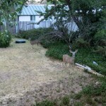
But first, I had to chase these deer out of my backyard, where they threaten my apple and pear trees.
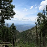
When I reached the pass at 8,200 feet, it was clear, sunny, still, and hot. The Rio Grande Valley to the east lay under heat haze. This is the old familiar trail that follows the crest to a 10,000 foot peak in 5-1/2 miles; I sweated during the long traverses and relished a light breeze when crossing saddles. Finally, after about three miles, I reached the relief of the shaded mixed-conifer forest.
I’d been missing birds on recent hikes. Sure, I’d always see jays, ravens, and vultures. But this has always been the best place to see birds, and today there were a lot of different kinds active on the crest, from flocks of bushtits in the understory to woodpeckers squabbling over tree trunks in the canopy.
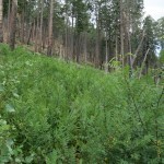
After I crossed over the peak and started down through the alpine meadows of the back side, through the burn scar of last year’s mega-wildfire, I began encountering the pollinators. They seemed to be loving this hot, still weather, they were swarming tiny, dull-looking flowers we’d normally ignore, and in the windless quiet the buzzing of the bees could be heard from far away.
No one had been down the crest trail past the peak since my last hike here in October of last year. The trail, which had been cleared last year, was now almost completely obliterated, from post-fire erosion, blowdown, and overgrowth. I was only able to follow it because I know it so well.
As usual, I was hoping to continue the full nine miles to the junction saddle, but I was stopped at seven miles by blowdown in a spot where I knew the overgrowth would keep getting worse.
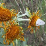


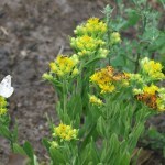


I was okay with turning back at this point; even truncated, this would be my most challenging hike since the first week of May, with 14 miles round-trip and over 3,200 feet of elevation gain. And I was mesmerized by the swarm of bees on a shrubby, dull-green annual that surrounded me on this hillside stopping point.
So I started paying more attention to flowers and pollinators, and all the way back up to the peak, I kept stopping to watch them at work. I literally had to tear myself away from each little patch of flowers along the trail.
Some of these photos are like those puzzle pictures that challenge you to find all the hidden objects. Can you find all the pollinators?


I’d been praying for rain all day, and storm clouds had gradually been gathering, finally producing thunder, breezes, cooler temps, and a few drops here and there. It was perfectly timed to keep me cool on the last three miles of exposed crest.
I drove through some heavy rain on the way home, and my house cooled down a few degrees more overnight. Hopefully we’ll get more monsoon weather this week!
July 7, 2023
Changes in the Heartland
My visits with family in Indianapolis are always emotional rollercoasters. We grew up in the farming country south of there, and visiting always reconnects me, not just with family baggage, but with those childhood roots, and the memories flood back, both bad and good.
I’ve seen a lot of changes over the years, I saw a lot of the city on this trip, and I had a lot of time to think about what I’d seen. My observations should resonate with anyone who’s spent time in other old Rust Belt cities, like Baltimore, Buffalo, Pittsburgh, Cleveland, Columbus, Detroit, Cincinnati, Chicago, Milwaukee, St Louis, and Kansas City.
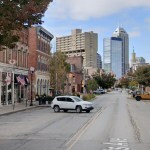
Aging in ExileI never got to know our state capital until my mom and stepdad relocated there in the mid-1990s. First renting a studio in an old factory building alongside other artists and small entrepreneurs, they then bought a renovated Victorian carriage house in an old inner-city neighborhood that was becoming a cosmopolitan mecca. They opened the first fine art photography gallery in the state, and became prominent members of both the art scene and the small business community, meeting regularly for happy hour at the neighborhood dive bar where young artists served drinks as small business people unwound after work. Contrary to the state’s media image as a racist redneck backwater, their community was politically progressive and every bit as diverse in gender and race as my West Coast milieus.
The closing of the gallery, widowhood, COVID, and the aging process have exiled my mom from that community. She misses her old friends but, like me in my remote small town, seems reconciled to isolation. Her home is her memory palace – on the walls of every room, she can see work made by her, the internationally-known artists she studied with, and the local people who were once her friends.


 Single-Family Homes
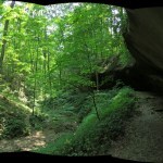
At home I’m blessed with mountains ranging from 5,000 to nearly 11,000 feet, supporting over 5,000 square miles of national forest and over 1,200 square miles of designated wilderness. The wilderness in my backyard is three times as big as the county that surrounds Indianapolis. So forgive me if I start to lose my mind in the congested cities and plowed cropfields of central Indiana. The closest undeveloped area is over an hour from my mom’s house, a state forest featuring a sandstone rockshelter and hills up to 250 feet tall (!), and I always drive down there for a day hike. On this trip, with a drive lengthened by freeway construction that seems to have been going on for at least a decade, I only had time for an 8 mile walk through the lush hardwood forest.
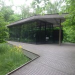
The grounds of the art museum include a nature preserve with a lake and a loop trail that I always walk – a little sanctuary in the city where I can get away from the noise, traffic, and stress.
But after that, I just walked the streets around my mom’s house, almost every morning.
All of these old industrial cities feature the opposite poles of old money and a rooted but increasingly desperate blue-collar working class. The old-money mansions line a narrow corridor northwards from downtown, while the shabby, soot-stained single-family homes of blue collar neighborhoods form a ring around the city elsewhere, and it seems that at least one house on each block is abandoned and boarded up. The conservative middle class and those with children mostly live in the distant suburbs, while more cosmopolitan and childless professionals choose gentrified inner-city enclaves like my mom’s neighborhood, again in single-family homes on streets shaded by giant hardwood trees.
Rainbow Flags and StrollersThe focus of Mom’s neighborhood has always been the commercial street to the south, so at first I instinctively headed north through residential neighborhoods to avoid traffic. But my way was soon blocked.
After the industrial collapse of the 1970s, the city eventually recovered into a state of constant reconstruction. Despite attempts to create “greenways” and more walkable neighborhoods, the massive freeways surrounding downtown and spreading outward keep getting bigger, noisier, and dirtier – hence the soot from vehicle tires falling on everyone from rich to poor. As the home of the Indy 500, the “Racing Capital of the World”, it’s a driving culture, with drivers conditioned to treat freeways and streets alike as race tracks, unconsciously reckless and mostly oblivious to pedestrians, yielding an ever-increasing rate of traffic fatalities.
Enduring the hammering din of overhead traffic through a dark, filthy underpass, I meandered northward through a preserved historic enclave where stately three-story Victorians set back in big lawns share shaded streets with generic postmodern townhomes. As a Westerner raised on visions of organic Midcentury design and enlightened by indigenous lifeways, I find both traditional Euro-American and postmodern architectures repugnant. But every yard is lovingly landscaped, every lawn manicured by dark-skinned gardeners, many of whom were working as I passed. And to counterbalance the state’s right-wing reputation, every other property bears rainbow flags and posters promoting diversity and tolerance.

The farther north I went, the less ostentatious the homes, and the more I encountered nannies, and occasionally young parents, pushing babies in strollers.
Postmodern Apartments and Cobblestone StreetsMidway through the Old Northside, I passed a cheap-looking high-density development that was under construction twenty years ago. It must’ve been designated for low-income residents, because it’s already turning into a little slum amidst all the spotless middle-class properties, graffiti spreading across its courtyard walls and trash filling interior corridors.
In the following week I explored south, where, twenty-some years ago, a few disused multistory factories were converted to “lofts” – not the DIY artists’ lofts I knew in coastal cities in the 1980s, but upscale condos for affluent young professionals. Lowrise commercial buildings in this area have since been rapidly replaced by postmodern apartment complexes for the millenials who’ve been attracted to most of these Rust Belt cities by emerging tech jobs. Here, the big employer is Salesforce. It’s hard for me to imagine young people who would aspire to a career surveilling and manipulating consumers, but apparently schools are churning them out by the millions.
I could only walk a few more blocks south before I ran into light industry, but just before that I encountered the tiny, quaint enclave of Lockerbie, with a cobblestone street and the brick Victorian home of James Whitcomb Riley, the “Hoosier Poet” and a literary pop star at the turn of the Twentieth Century. Alongside more sophisticated fare, I was raised on his homely works – “Little Orphan Annie” and “When the Frost is on the Punkin” – which can still evoke our shared roots.
Sponsorship CityNext, I headed west on the Cultural Trail, a work of landscape architecture partly designed by my mom’s former friends and neighbors who have spearheaded the city’s ambitious greenway corridors. Like sidewalks, all these corridors are used primarily by riders rather than pedestrians – cyclists, riders of e-bikes or e-scooters – so people who walk need constant vigilance to avoid getting run down. Cities are getting more and more dangerous for pedestrians – cyclists and riders of e-bikes and e-scooters almost universally disobey laws prohibiting them from sidewalks, and laws go unenforced. Cyclists at least have the excuse that sharing the streets with cars and trucks is suicidal.
Wheeled transportation is necessary because despite gentrification, cities like this have evolved away from walkability. In New York and San Francisco, you’re never more than a few minutes’ walk from a bodega or corner store, and most neighborhoods still have hardware stores. Corner stores and neighborhood groceries are long gone from Indianapolis; my mom’s supermarket and pharmacy are each a mile away in opposite directions.
On my five-mile round-trip across downtown to the historic canal with its ducks and geese and the big river with its rim of flood debris, I was reminded that like the professional sports it’s crazy about, this is Sponsorship City. It seems that every public building, monument, sidewalk, stairway, wall, and overpass is permanently engraved with the names of rich white sponsors.
Several of my friends, like the designers of the Cultural Trail, have accepted philanthropy as an integral part of their institutional careers, but I find it deeply troubling that poor people face constant reminders that their environment belongs to the rich. Philanthropy, sponsorship, and the private naming of the public environment are just more examples of our obscene wealth disparity and the fundamental injustice and unfairness of our society.
With its early auto industry, Indianapolis was a major destination in the Great Migration of Black folks from south to north, hence its reputation as a breeding ground for jazz sax players. Its population is now half nonwhite and 30% Black, but you’d never know it from the sponsors’ names inscribed in the urban landscape.
My mom’s neighborhood has changed dramatically with high-density development and the influx of thousands of young office workers. Most of my friends in West Coast cities live in single-family-home residential neighborhoods which haven’t changed visibly since they moved there decades ago. I suppose one reason Indianapolis has changed so much is that the economy was so depressed for so long, and when it began to recover, inner-city neighborhoods were in ruin, but the old low-density pattern was no longer profitable for developers.
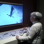
Digital ExperiencesFor decades, the city’s art museum, a few miles north of my mom’s neighborhood in a park on the banks of the river, was my refuge. Many works in the permanent collection moved or inspired me, they occasionally hosted impressive temporary shows, and there were a couple of contemplative contemporary installations that could always calm my troubled soul. But as usual, I was apparently in the minority. They were losing membership, attendance, and revenue, and like most urban museums, they’ve transformed the entire vast property, first to prioritize entertainment over art, and now to “add wokeness” to their collection. The art museum is now just one component of a sprawling family recreation complex.
I was shocked and saddened when they replaced an entire floor, a third of the exhibition space containing all the contemporary works I loved, with the kind of generic “immersive digital experience” that’s become popular with Instagrammers everywhere. Whereas the old galleries offered hundreds of eclectic works by hundreds of diverse artists, the digital experiences feature a single old white artist – household names like Van Gogh or Monet. At the same time, they closed the small but excellent Japanese art gallery and the Renaissance and Medieval European galleries. The latter eventually reopened featuring yet another immersive digital experience.
 Museum of Curation
The other European galleries have been replaced with a big roomful of works by a local Black collective, and a series of smaller rooms where a more limited selection of European and American works are surrounded by curatorial content to educate the viewer on their historical and colonial contexts such as slavery, imperialist looting, urban redlining, etc. Since my last visit, this curatorial content had been enhanced by another underrepresented, marginalized collective including LGBTQ artists and scholars as well as people of color.
For example, the museum has long featured paintings of Black folks by Black artists. To these, the collective has added detailed commentary on the injustices endured by the artists and subjects, sometimes in the form of additional paintings or poems of their own.

The net result of all these reforms is that most of the art formerly on display has been moved to storage and replaced by curatorial content – including wall-sized panels of explanatory text and dubious “interactive” experiences where visitors are encouraged to document their reactions to what is now more curation than art. The few works of art returned to the galleries have been selected to address curatorial themes, rather than based on their value as art, resulting in what should really now be called a museum of curation.
One-Sided DialogI was sympathetic with the new collectives and found their work competent and sometimes poignant. But the museum’s new curators, by selecting work from the collection on the basis of themes they’ve learned in academia, have relegated the collection’s most mysterious and challenging art to storage in favor of the didactic – work that can easily and instantly be explained to the undereducated viewer.
As a precocious white artist growing up with the privileges of my race, I was inspired to make mysterious work that challenges the viewer, rather than being primarily representational or decorative. But even purely representational or decorative work can raise questions. Instead of leaving the viewer to ask those questions – because they may be entrenched in a biased worldview – the curatorial content both asks the questions and provides answers for the viewer. It’s a false, static, one-sided dialog.
The viewer may end up being educated, but the original art tends to recede into the background as its mystery is explained. And what I consider the most important functions of art in society – to challenge and inspire – are sometimes lost in the process. The curators are unintentionally foregrounding their egos and careers, and the previously marginalized commentators are colonizing the galleries, but with reactionary rather than original work.
Who Knows Where It Will Lead?As I was studying one of these “enhanced” exhibits, an elderly white docent came over and asked for my reaction to the new galleries. I briefly told her where I was coming from and how I’d followed the reforms over the years, put off at first but now understanding the direction they were taking. She nodded with a broad smile. “Don’t you just love it!” she enthused.
“It’s a start, but who knows where it will lead? Once they’ve started in this direction, the museum could turn into something completely different,” I replied. She seemed shocked and perplexed.
What I meant was that as an art museum, it represents a century and a half of selective collecting by rich white folks. The very idea of an art museum is a European institution which has been a tool of imperialism and colonialism for hundreds of years. For me as an underrepresented, marginalized white artist, the museum’s collection was a place of inspiration and solace. The biased and looted collection can’t simply be reformed to provide a similar experience for underrepresented minorities – it will have to be replaced by a completely different type of institution. All we can do is wait and see what that will be like.
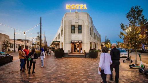
Consumer PlaygroundToward the end of my visit, I finally, reluctantly entered the massive new mixed-use real estate development near my mom’s home. They started by transforming a former low-rise art-deco factory – a soft-drink bottling plant – into a complex combining hotel, restaurants and food court, shopping, office space, and recreation. In rapid succession, they’ve added a cutting-edge virtual reality arcade, a taller office building housing a high-end restaurant and multiplex movie theater, and are now completing a high-rise apartment building. Having preserved the retro facades of the factory, they’ve appealed to both fashion-conscious millennials and nostalgic boomers. The complex has become a consumer playground, with a captive market of young people drawn by tech jobs to the thousands of new apartments that have turned this formerly quiet, single-family neighborhood into one of the most congested parts of the city.
This is exactly the kind of culture I and my artist colleagues were rebelling against in the late 1970s and early 1980s – the shallow consumer culture, partying amid the apparent collapse of the larger society, that inspired punk rock and transgressive performance art. It’s interesting to contrast this yuppie mecca with the new galleries at the art museum. I’m always mystified when women aspire to soul-killing jobs invented by men, when gays and lesbians aspire to destructive institutions – like marriage or the military – that have caused so much suffering among heterosexuals, and when people of color aspire to colonial institutions, like galleries and museums, developed by European imperialists.
Proud HoosiersIndianapolis is just the capital city for the state, which mainly consists of crop fields and small farm towns. Growing up in one of those, my friends and I had Black classmates and were shocked when one of those, a teenage girl, was stabbed to death in a nearby town which had been the national headquarters of the KKK. As rebellious young artists, my best friend and I couldn’t wait to get away from this backward place where there were no opportunities for us, but when we reached the West Coast we discovered our small-town Midwest origins – and especially the Hoosier state of Indiana – gave us a sort of awe-shucks authenticity the coastal people envied. So for decades, we bragged about being Hoosiers from the Heartland. After all, Abe Lincoln himself spent his boyhood and youth in our home state.
Then by the end of the 90s, politics had polarized everyone and everything, and our homeland emerged as a horrific backwater of racism and general intolerance. We had to rebrand ourselves as proud urbanites and Westerners, rejecting and suppressing our shameful redneck roots.
But now, our Hoosier friends are proud of the lives and freedoms they’ve been able to carve out in the midst of this state that’s condemned by the distant coasts. I’m proud of them, and especially of my heroic family as they struggle to survive, isolated in the midst of massive changes, the outcome of which no one can predict.
July 3, 2023
Another Abandoned Trail
I’d waited six weeks to be able to do a real hike – probably the longest hiatus ever. Sure, I’d walked over 50 miles during that interlude, but mostly on level terrain in the Midwest and the canyons of Utah. For my return to serious hiking, I didn’t want to overdo it at first, but I also wanted something interesting.
Since last winter, I’d been trying to find a way to the crest of the northern part of the long north-south mountain range east of here. I’d avoided that area in past years because the west side of the range consists of dozens of long east-west ridges divided by deep, narrow canyons. It’s anomalous topography; most ranges in the West are block-faulted (tilted), with a steep face on one side and a gentle rise on the other. The west side of this range is elevated and almost level, more like a high tableland cut over time by myriad parallel streams.
The canyons are generally too narrow to support roads, but a few of the east-west ridges are relatively flat on top – finger-like mesas – and dirt forest roads have been graded up these, occasionally all the way to the 10,000 foot crest. Hence most of the west side – the only side accessible to me – was left out of the wilderness area, and is still grazed by cattle.
The plus side of these roads is that theoretically, they offer access to high-elevation trails. But this range has also been deforested by two successive mega-wildfires, and I’m discovering, hike by hike, that the trails I hoped to follow to the crest have mostly been obliterated by erosion, deadfall, shrubby regrowth, and general disuse. Their remoteness has always made them less popular, hence they’ve been omitted from recent trail work. Like most trails in this new fire regime, they’re listed as “Open” on the Forest Service trail guide, but they’re essentially abandoned and increasingly impassable.
Today’s goal was an area near the high point of the range, where one of these “mesa” roads leads to the junction of two creeks, with trails leading up each of them to the crest trail, so that I could potentially do a loop, ascending one canyon, hiking a little over a mile on the crest trail, then descending the other canyon. It would be a total of 13 miles and 2,700 feet of elevation gain – an easy day hike by the numbers. But I had no idea what condition I would find the road or the trails in, and unusually, there was no recent information online. The last trip report dated from 2011, before the first big wildfire.
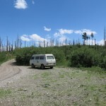
I’d tried to take this road in early April, but it starts with a river crossing that had been flooded then from snowmelt. Today I found the channel only about six inches deep, but past the crossing, the road becomes surprisingly rough and rocky as it climbs steeply to the mesa. My 4wd Sidekick needs work so I was driving my little 2wd truck, and I was really worried about how it would do on this unfamiliar road.
About 8 miles up the gently rolling mesa, the road begins traversing steeply down into the narrow canyon on its right, and here’s where the drive became really exciting. It’s a narrow high-clearance section over jagged bedrock – with a virtually sheer drop-off, hundreds of feet to the canyon bottom, at right – and the farther down I went, the more worried I was about my little truck being able to climb back out of it. Finally I reached the fork that led down to the creek, and a hundred feet down that I came to a steep section of white clay with deep erosional ruts I knew the truck couldn’t handle. But when I tried to back up the shallower slope to the landing at the fork, I immediately lost traction – the driving wheels are in the back while most of the weight is in the front.
I’ve been in this situation many times, and after blowing tires repeatedly on rough roads, I recently installed all-terrain tires, so with a little tricky maneuvering I managed to get back to the landing, where I parked, shouldered my backpack, and set out walking down the steep forest road.
I’d awakened this morning with a profound sense of impending doom, something that occurs regularly as part of my anxiety syndrome, and worrying about my truck and the road put me in a pretty black mood, but I expected the hike to cure that. I wasn’t sure of the elevation here – probably in the low 7,000s – but I was surrounded with beautiful, intact alpine mixed-conifer forest. I’d packed for weather in the 90s, but here and now it was in the high 60s and often shaded by drifting, partial cloud cover.
However, I’d been immediately swarmed by little flies when I first got out of the vehicle, and before I’d walked a hundred yards I had to dig out my head net. It was going to be one of those days.
The road wound down through the forest onto the floodplain of an intermittent stream, where it got sandy and passed the ruins of a cabin and corral. Shortly after that, I came to a five-foot-deep sheer washout. Nobody was driving past that anymore.
After scrambling over a long debris field and rejoining another section of the old road, I came to the junction of the two creeks. What was left of the old road continued up the left branch, so I began searching for the trail that led up the right branch. I’d read that there was a trail sign here, but there was nothing remaining of it or the trail – apparently victims of catastrophic post-fire flooding.
Exploring along the left creek, I eventually noticed a shallow dip in its bank, with a matching vague dip in the opposite bank. I crossed and headed up the far bank, where I found no trail, but continuing across a meadow, noticed the slightest sign of an old road cresting a rise, overgrown and littered with boulders. This beginning would set the tone for the rest of my hike.
This narrow side canyon had mostly intact forest in its lower part, but it had experienced serious flooding and erosion. Instead of a trail, I found remnants of an old road, most of which had been washed out, so that my hike alternated between stretches of climbing over and around deadfall on a gentle slope, and picking my way across debris flows and logjams in the creekbed. I found signs of cattle but they looked to be about a decade old. The creek was almost completely dry, but flies continued to swarm me.
It was slow going, and I soon gave up any hope of the 13-mile loop. I was looking for the first milestone, where the canyon would veer left and another “trail” would head straight over a low saddle. On the way, the slope at my right became a burn scar. I finally reached the left turn in the canyon, and saw the low saddle ahead, but I was bushwhacking at this point – I could see no trails anywhere. Then, squinting through charred snags in the canyon bottom, I thought I noticed a wooden sign on a dead tree trunk.
Like the abandoned cabins I occasionally find, this trail sign with no trails was a poignant reminder of how temporary our so-called “Anthropocene” really is. Everything we build is a future ruin.
A little more scouting revealed the scattered remains of a sign for the trail up the canyon. But before proceeding, I wanted to climb to the low saddle, hoping for a view into the next watershed. So I started bushwhacking up the drainage. It was a short climb, and in the saddle I found an actual trail and a cairn on the edge of the burn scar. This trail descends about five miles to a valley filled with spectacular white rock pinnacles I hiked to a few years ago.
Returning from the saddle, I found the remains of the old trail leading back down to within a hundred feet of the junction sign in the canyon bottom. It was so overgrown I hadn’t noticed it from below. Now I needed to find a way up the canyon.
The left slope was very steep and eroded, so I started bushwhacking up the right slope, where I soon found what appeared to be an old cattle trail, blocked often by deadfall. This trail, deeply pockmarked in loose dirt, climbed high above the creekbed, which was now flowing intermittently. In places, it even looked like the remains of a human trail, but I hadn’t seen human footprints anywhere all day, not even on the road.
The cattle trail descended to the creek, which was flowing over bedrock, and the intact forest ended. From here on it was all burn scar and dense regrowth, much of it thorny locust.
Rain clouds were massing over the head of the canyon as I picked my way up the creekbed, looking for more old cattle trails I could use to bypass debris piles and logjams. I often found one that would then disappear in a thicket of thorns or a mass of blowdown, but the deeply eroded creekbed had become impassable with flood debris and the right bank was too steep, so I had to keep fighting my way up the slightly more accessible left bank.
Eventually, after pushing through an especially nasty thicket of locust, I came upon what appeared to be a remnant of the old hiking trail. Now it was getting really dark, I heard thunder to the north, and before long it began raining. The old trail was often interrupted by erosion, deadfall, or blowdown, but it was still much better than fighting through thorns, and although thunder continued, the rain slackened by the time I reached a big level area at the head of the canyon.
Here, the map showed the trail veering left toward another low saddle. But the remnant of trail ended, so I simply headed off in what I thought was the right direction through low undergrowth and a maze of charred, fallen tree trunks. The level area continued for hundreds of yards. I finally saw the low saddle off to the left. The map showed the trail making a sharp right just below the saddle, then traversing the slope of the ridge that had been on my right while crossing the level area. This ridge would’ve been my route to the crest of the range, if I’d been able to make good time on an actual trail instead of routefinding and bushwhacking all day.
But at several points on this hike I’d thought to myself, this is just my kind of trail! My favorite kind of hiking is without a trail at all, but it’s hard to do that in densely vegetated habitat. A trail on the map suggests that there is a way to reach some interesting destination. And an abandoned trail makes finding that route a challenge – and potentially an adventure.
I could find no trace of the old trail anywhere below the saddle or on the slopes below the ridge. The ridge itself bore stands of intact forest but the forested slopes consisted of the earthen mounds and pits left by the roots of fallen trees, so traversing them was like walking across moguls on a ski run. I kept studying the topo map I’d brought, trying to guess where I was, but it was fairly low resolution – I was never sure exactly where I was on the slope.
Finally I reached the top of the ridge, where I faced a seemingly endless thicket of locust and ferns. It’d continued raining lightly on and off, and just as I started through the thicket the temperature dropped and thunder crashed nearby. I was on an exposed ridge in a thunderstorm, just inviting a lightning strike, but there was nothing to be done about it.
It was almost time for me to be turning back. I estimated I’d covered less than a third of the planned loop, and I hadn’t reached anything of interest that I could consider a satisfactory destination. But as the thicket got thicker, I found myself approaching some white rock outcrops, and behind them I sensed the saddle where my route would cross into the next watershed and begin its ascent to the crest.
Thunder crashing behind me, I pushed through the last of the thicket and found myself on a pretty little forested ledge surrounded by boulders, with a view of the crest in the east. I knew I was finally above 8,000 feet, but would later learn it was closer to 9,000. I’d found my destination, just in time, at the most dramatic time possible!
The storm was moving away by the time I left my little ledge and began retracing my route. After I traversed the level area below the ridge and rejoined the old trail, I found it easier to follow it and cattle trails all the way down the overgrown burn scar of the upper canyon. Easier to follow, but painful – an entire day of sidehilling in loose dirt in my more flexible dry-weather boots had been really hard on my problem foot, and I vowed yet again to add foot exercises to my weekly regimen.
The sky was clearing and the whole landscape was now so vivid I felt like I was tripping on acid.
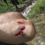
The lower canyon was a different story. Although it was wider and often had an actual floodplain, it had been so torn up by flooding that I seemed to spend most of my time climbing through debris. Finally in the worst pile of logs and boulders I lost my balance and fell, bashing my elbow on a hidden rock. It was a pretty minor cut but surprisingly produced the most blood I’ve shed in these past five years of serious hiking. Especially considering that everyone warns me not to hike alone, and a friend fell off a cliff and died while hiking solo.
My anxiety returned and increased the closer I got to my vehicle. I mentally ran through the scenarios. If the truck wouldn’t make it, could I back it down to a wide spot? Walking up the ridge looking for a signal for my phone, or walking the nine miles to the nearest cabin, some of it in the dark, to call for rescue. Doubting whether AAA would send a tow truck out that marginal road. Spending the night in the truck – since I’d recently switched vehicles, I wasn’t carrying a sleeping bag.
But thanks to the new tires, the truck made it up the road – with a lot of hard bouncing.
June 6, 2023
Birthday Trip 2023: Days Seven Through Eleven
I woke Wednesday from a blissful dream, there in my motel bed. It was time to start heading southwest toward the California desert, but after nearly a week in the hinterlands I had some chores to take care of in town: a little shopping, and washing my clothes and vehicle, which was coated with powder sand inside and out. I had a two-day drive ahead of me, following a familiar route. The next night would be spent in another cheap motel in an even smaller town, where there was a laundromat but no car wash. So this morning I decided to make use of the guest laundry here and a car wash nearby.
Afterwards, departing through the old downtown around lunchtime, I remembered there was a Greek restaurant on a block I’d just passed, so I did a quick U-turn, and there it was. So I had an unexpected giro plate to fortify me for the long drive into Nevada.
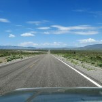
Ninety minutes south on a two-lane, where I had a choice between a 6-1/2 hour drive on back roads or a 5-1/2 hour drive with the first half on interstate. I knew the back roads would be beautiful, but the interstate would actually be pretty too, and saving an hour was worth it.
While driving, I pondered my trip planning so far. Why do I focus these trips on prehistoric rock writing and paintings? When I resumed my Utah trips in 2008, it was nostalgic, to pick up a thread Katie and I had started in the mid-80s. We used petroglyph images on our band posters, and we both made art either based on petroglyphs or inspired by them.
After 2008 I learned more about the “Fremont” culture to which much of the work is attributed. I came to admire them and my Utah trips became a way to learn more and get closer to that culture.
But the only sites I could learn about remotely – mainly online – were located near or on roads. I’d already visited all the well-known sites, so to find new sites I was forced to spend more and more time driving slowly on bad back roads, competing with other off-road vehicle traffic, and ending up in overgrazed ranchland where campsites were generally poor and I didn’t want to linger.
Throughout this trip my body had craved more hiking, but there were few if any trails or suitable terrain near the prehistoric sites. I finally realized that this “rock art” exploration is just one more complication I need to shrug off as my already overcomplicated life hurtles toward its end. Near the beginning of this trip I’d passed a high plateau with federally designated wilderness which offers a whole network of interesting hikes – that should be my focus in the future. Drive to a wilderness area with good trails, camp there, and start exploring on foot.
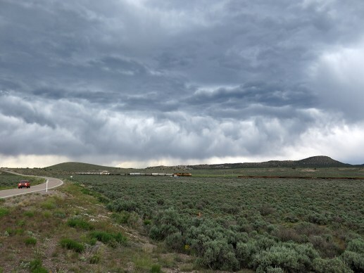
Some wet weather was developing ahead as I joined a second interstate and turned south. Finally I reached the turnoff for the back road that led west to Nevada. That’s when things in the sky really got interesting! I drove under a storm that, once I emerged on the other side, produced the most spectacular cloud formation I’ve ever seen.
In the little railroad town where I stopped for the night, I was trying out a newly restored motel that had opened since my last visit. The lady owner had a big placard on the counter with a quote from Reagan on the sanctity of gun ownership, but she was nice, and the small room had the best bed I’ve ever found in any hotel or motel anywhere – even in expensive resorts.
 [image error]
 Day Eight
My friend in California had promised a campsite for the next night, and the Nevada town has a wonderful grocery store, so I grabbed a few more things I thought I might need. There were two Harley riders about my age outside, and one asked me if I was heading out into the hills. We had a brief, friendly conversation, wished each other well, and as I was pulling away I heard him say to his companion, “That’s the kind of guy I like – he doesn’t talk your ear off when you try to be friendly.”
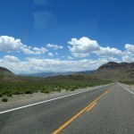
I continued south through familiar, spectacular Great Basin country, deciding to avoid the interstate again by way of Lake Mead. This is one of the world’s most spectacular landscapes – as amazing as the Grand Canyon or Yosemite, but off most people’s radar since it’s labeled with the name of a reservoir. Normally you have to pay the park entrance fee to use this “interstate bypass” route, but the toll booths were closed and I traversed it scott free.
Midway through the recreation area I realized I was probably running late. And the last part of my drive was the hottest and featured long steep grades, where my vehicle is underpowered even without the A/C on. So I had to drive at high revs in lower gear, burning gas like crazy, for the last hour and a half down the eastern edge of California, to save time while staying cool.
 [image error]
 [image error]
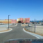
I pulled up outside our meeting place, the tribe’s new resort hotel, at exactly the same time as my friend. We had a delicious supper, then he guided me to some nearby campsites which should be secluded and pleasant.
They involved driving across a broad wash in soft sand, so I switched into 4wd. I found the first site, on the lake, but as soon as I turned off the engine and got out, I heard buzzing overhead – a drone, flying circles above me. Then it took off north, and I walked toward the water’s edge, rounding a corner in dense vegetation and revealing an old guy with a long gray beard, sitting in a folding chair next to his side-by-side. “That’s not your drone, is it?” I asked.
“Sure is,” he said, nodding. So much for this campsite.
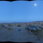
My friend’s second choice was above, on fingers of the mesa that overlooked the lake. I drove back and found a maze of off-road tracks leading up there, also in soft sand. I was afraid of getting bogged down, but the sun had set and I needed a shower, so I bounced upward, and followed a track outward to a point which would’ve made a good campsite, if it hadn’t directly overlooked the old guy with the drone.
So I turned back and drove inland, higher up the mesa, until I found a sort of hollow with enough level ground to set up camp. I laid out my tarp, pad, and sleeping bag and took a quick shower. The moon was now at three-quarters full and Venus was still up in the west, and the lights of the city across the lake twinkled like the campfires of a barbarian horde. I thought I would be okay here, but it was still hot, so I sat for a while enjoying the view.
Finally I laid down on top of my bag. Bugs started to land on me, so I got up and grabbed a flashlight. They were nothing to worry about, but they were annoying.
Then I heard some small dogs barking farther down the mesa. They got closer. And closer, until they were a hundred feet or less away. They were barking at me, but I still couldn’t see them.
I got up and found a stick. I didn’t feel comfortable lying down while surrounded by wild dogs, but I didn’t want to be driven off by them either.
Then headlights flashed out below me, and a four-seater side-by-side bounced up on the mesa, full of shouting, laughing teenagers. It was 10:30 pm, but I knew this was graduation time. The teenagers drove around me in a semi-circle, unaware I was even there, stopping and yelling at various points in the creosote brush. This was the last straw.
I packed up and drove back across the rez to the hotel. My friend had reserved a room for me the following night, but I was able to check in early, and finally got to sleep by midnight. So much for my camping trip!
 Day Nine
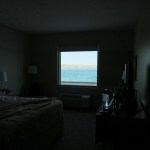
One problem with a true hotel, as opposed to a true motel, is that they don’t have fridges or microwaves in the rooms. You’re supposed to eat in the restaurant. And rooms are accessed inside, a long walk from your vehicle. I carry my breakfast stuff and the huge variety of personal care items I need every day, in several containers including a cooler, for easy access from the vehicle or in camp. When I check into a motel, I park in front of my room and it’s easy to transfer those things inside.
The tribal hotel room was really nice, but I had to make three long trips to and from my vehicle to get everything I needed to stay there. And for breakfast, I had to make the complicated journey to and from the vehicle to get and return yogurt and fruit from the cooler, since there was no place to keep it cool in the room.
The outside temperature at the lake today was forecast to reach 97, with tomorrow hitting 100. According to experts, the inside of a car can reach over 140 degrees at times like this. There were some things in my vehicle that were going to get ruined – no way around it. I had two bags of organic chips – the unopened one was turned rancid by the heat, while the other was fine. For future hot-weather trips, I should probably move some packaged foods, oils, skin creams, etc. to the cooler. And bring an extra bag to carry stuff into hotels!
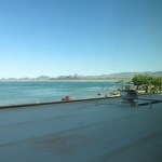
The tribal festival was scheduled to start today, but when I drove past the park there was no one there yet. My friend called later, and we met at the empty park, where he introduced me to his son and nephew. The three of us had a great afternoon visit at a shaded picnic table there on the lakeshore. My friend’s son found a devil’s claw seedpod under a palm tree, and showed me how to extract the edible seeds, like sunflower but nuttier.
 [image error]
 Day Ten
I felt like undeserving royalty staying in that fancy hotel. My friend came and picked me up the next morning for a tour around the reservation, talking about projects he’d accomplished or was planning. The festival had started and the park was packed, but when he drove in, there was a Highway Patrol SUV blocking the entrance and an ambulance flashing its lights inside. So he turned around, and we had a last lunch at the hotel.
I wanted to get an early start and make it to Flagstaff tonight, to shorten my drive home tomorrow. That meant hours on the interstate. But from Kingman east, the federal highway surface had deteriorated worse than any paved road I’ve ever driven on. There were irregular patches of pavement missing, to a depth of three or four inches, in the right lane, and everyone including big rigs was driving on the left, which was marginally better. These mega-potholes were big enough to cause an accident, to blow a tire or break your suspension! Fortunately my vehicle is rugged, but the stiff springs meant I got constantly bashed and slammed whenever I had to pull into the right lane.
It was like that all the way to Flagstaff, and beyond, the next day.
 Day Eleven
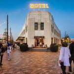
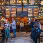
A couple more errands to run in Flagstaff, then I was on my way east again by late morning. Winslow has an old Harvey House that’s been restored and turned into a hotel, so I decided to stop there for lunch. It was a fantastic place, but mostly empty at midday on Sunday.
And Winslow, where I’ve only stopped briefly before, is full of old Route 66 motels which have been turned into small apartment complexes. Who lives there?
Mercifully, I was able to leave the interstate soon, at Holbrook, and head southeast through some of my favorite country – a high, rolling sagebrush plateau where I was able to let my thoughts wander back over the trip again.
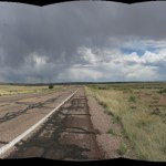
I mentioned in my canyon campsite that I relish being able to sleep outdoors. But on this trip like on most others, I had a hard time finding suitable campsites, and once settled, encountered serious problems. Heat, cold, wind, insects, intrusive strangers, their pets and devices. In the past the list included rain, snow, flies, mosquitos, and flooding. On this trip I noticed a few flies and mosquitos, but thankfully they hadn’t been a problem.
I’ve researched and considered solutions to some of those challenges but haven’t fully succeeded. One recurring problem is how to find secluded campsites for someone who sleeps on the ground. The only real solution is advance scouting, which is hard when you live a day or two’s drive away!
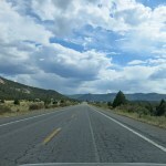
Other challenges are the distances between stops, towns, and campsites, and the condition of roads. It’s no fun to set up camp and try to cook dinner after you’ve driven six hours or more.
I’m always friendly & curious with local people, but I never stay long enough or immerse myself in local society enough to get to know the people I might need if I get in trouble. That feels insensitive, and limits the amount of local knowledge I get – for example about little-known prehistoric sites. Finding stuff online, or even in books, is really no substitute for local knowledge.
More weather was developing over the Southwest. I drove through light storms all the way, and actually drove into a dust devil west of town – it felt like the whole car was being twisted by a wrench.
Finally, a few miles from home, I was welcomed by a double rainbow, and it started raining just as I pulled in the driveway, turned off the vehicle and got out.
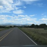
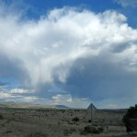
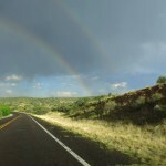
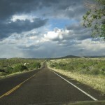
June 5, 2023
Birthday Trip 2023: Day Six
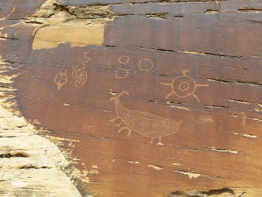
After the fiasco on the canyon rim, Day Five’s second and final campsite started out warm at sundown, but the temperature plunged throughout the night, so that I had to keep getting up and adding clothes. The one positive was my vision – I’d had bad double vision the previous night, but now I could focus well on both moon and stars. Presumably these constant changes are due to the cataracts.
It was still dark when I woke up freezing in my warm-weather bag, and turning my head eastward saw the faint light of approaching dawn. I knew I couldn’t sleep anymore, so I waited, huddled in the fetal position to conserve body heat, until the sun hit the bluffs to my west.
Then I got up, went to the vehicle and dug out the remainder of my winter clothes. All bundled up with thermal cap, hood, and gloves, I estimated it was well below 40 here at the end of May, at about 5,600 feet elevation. The sun soon reached my campsite, where I made coffee, had breakfast, and began shedding clothes.
I put on my boots and started to pack up for the drive back to the canyon rim, but immediately felt a sharp pain above the outside of my right ankle, so bad I could barely walk and had to remove the boots. These boots have extra ankle support, and I rarely but occasionally get these ankle pains that seem to represent some kind of pressure point. I normally address it with a felt pad over the ankle while hiking, and the pain disappears completely when I put on regular shoes that don’t contact the sensitive area. But this pain was higher up than usual – on the tendon that runs upward from the ankle on the outside of the calf. I wouldn’t be able to hike at all with this kind of pain!
But I changed into sneakers and drove back to the rim, hoping to find a solution once I got there.
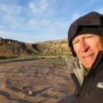
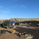
At the rim, I first tried adding a felt pad, but that didn’t help at all. Then I tried lacing the boot a couple hooks lower, but that made little difference. So I dug out my Ace bandage. wrapped that around my lower calf, shouldered my pack and started down the trail, but I only made it a hundred yards before having to turn back.
Could I hike in sneakers? Many people do, but the chronic inflammation in my left foot requires extra support. Still, I figured it was worth a try – my sneakers are “stability shoes” with supportive soles, and they have custom orthotics like my hiking boots. I limped back up to the vehicle and switched to the sneakers. But in sneakers, carrying my heavy pack with four liters of water, I only made it a few yards down the steep trail before I realized this wouldn’t work.
I had one last chance. I’d brought my waterproof winter boots in case I had to ford streams, and they have more padding and more hooks for fine-tuning the lacing. When laced all the way up, they caused the same pain, but when I laced the right one as low as possible, so the area around the ankle was free, the pain was much reduced. It still hurt, but I was damned if I would give up.
The trail follows an old road down a steep white clay slope into a network of gullies, which eventually lead to a red clay ledge, where the road ends at an old campsite on a point overlooking the canyon. This whole area is federally designated wilderness, so I’d finally reached a place where no vehicles could bother me!
From the point, you have to find your way down a very steep series of bare rock faces and narrow ledges, sometimes marked by the tracks of many other recent hikers, sometimes marked only by cairns. In places there are several parallel routes, but they all eventually converge. The rocks along the way are fantastic!
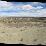
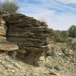
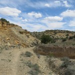
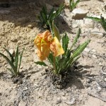
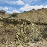
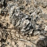
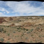
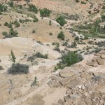
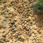
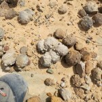
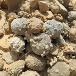
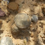
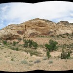
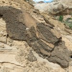
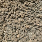
Finally I reached the canyon bottom, where the rim trail joins the canyon trail and the surface turns to soft powder sand. I’d seen from above that the canyon was flooded upstream, and now I found out why – a beaver dam!
My ankle pain had completely disappeared, and never returned! It’s got to be a nerve-related pressure point responding to contact with the ankle support built into the boot. It’s a real drag, because these boots are otherwise perfect for me.
The flowers were spectacular down here. I’d brought topo maps for the whole canyon, showing that it looped repeatedly back and forth like a snake for about ten miles northward to the river. Plus I’d brought a much less detailed map printed off the Web, showing roughly where the petroglyphs could be found, with directions. The petroglyph map and directions weren’t very detailed – which of course helps deter vandals – so I missed the first panel completely and overshot by a few hundred yards, crossing the stream a couple of times, before realizing I must’ve missed it.
Returning to the first stream crossing, I still couldn’t seen the petroglyphs from the trail, but noticed a patinated face a hundred and fifty feet above that looked promising, so I began climbing, and was eventually able to make them out.
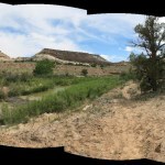
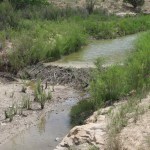
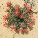
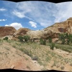
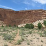
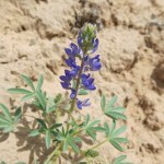
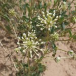
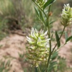
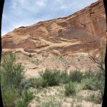
The online directions said this canyon deserves to be better known for its rock art, which is why I was here in the first place. And this series of panels turned out to be very large and complex. The only problem was weathering – most of the images had become so faint they were hard to see and almost impossible to photograph, especially in the bright light of midday.
One of my readers surprised me by erroneously assuming I haven’t been enhancing these images to make them more readable. I actually do enhance all my petroglyph and pictograph images, but primarily to make them look the way I actually saw them, since I’m almost never able to photograph them in good light, and I’m not proficient enough with cameras to adjust exposure on the spot.
So the images often end up overexposed. Fortunately I’m much more experienced with Photoshop than I am with a camera, so I add contrast and/or saturation afterward as needed to make the photos look the way I saw them. I hate the digital effects used by some rock art photographers to enhance the readability of the images; I only want them to look the way I saw them, in their natural setting.
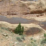

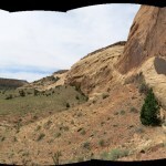
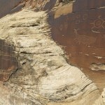
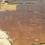
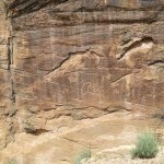
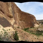
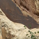
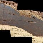
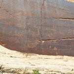
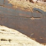
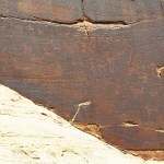
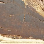
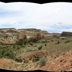
After leaving the first site I recrossed the creek, working my way around the next bend on a much-trodden trail. But when I approached the third bend and the trail began climbing, I realized that most hikers are using this canyon to access the backpacking trail to the high point of the Swell, about six miles east. The route down the canyon is less used, so there’s no single trail, just a variety of lesser-used routes through dense vegetation that often disappear or become a dead end at a cliff edge.
The next petroglyph panel was supposed to be on the north side of a “rincon”. I’d heard the word but not its meaning; when I came to a huge cove west of the stream with a prominent stone butte in the middle of it, I assumed the butte was the rincon. Getting there wasn’t easy; the stream entered a narrow, sheer-sided stone gap where it was too deep to ford. I had to find a ford upstream, then climb steep banks of loose rubble and sandstone ledges high above the stream to get around the gap. That brought me to the north side of the butte, and a slope which was covered with biological soil crust. I carefully meandered across it on old cattle trails, finding no rock faces suitable for petroglyphs.
Re-checking the directions, I discovered I was supposed to be working my way up a “plain”. I immediately saw the plain below on my right, and when I made my way down there, noticed a small patinated surface at the base of the 300-foot-tall red sandstone cliff.
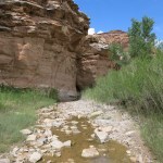

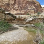
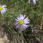
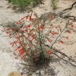
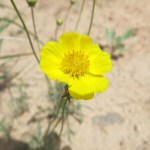
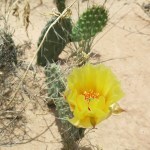

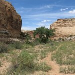
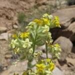
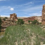

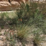
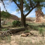
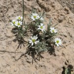
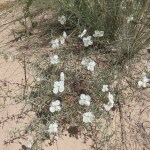
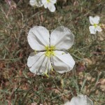
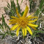
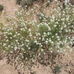
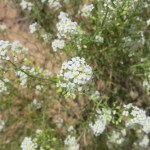
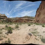
This had a single panel, featuring bison and a horned figure on horseback, but the left side had exfoliated. Another check of my notes showed that this was that last panel in the canyon, but further back in the big cove I saw cliffs that looked promising and decided to explore that way. I later learned that “rincon” means hidden valley – the whole cove was the rincon.
I did find two sheep petroglyphs back there which the author of the web page had missed. Finally I was discovering something new by myself! But that was it for today – I figured I’d only gone about three miles but it was already mid-afternoon. I didn’t want to spend another night in this area, and to keep my options open I needed to head back to the vehicle now.
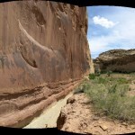
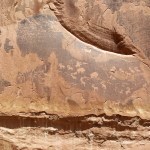
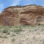
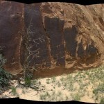
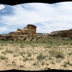
Since the directions to the second site had started from the creek below the narrow gap, I went straight down the plain to the creek, and crossed there on steppingstones. I found a trail up the opposite bank, which led to the ledge high above the gap across from where I’d climbed earlier. But the trail ended there at the edge of a cliff. The tracks showed lots of hikers had come up to this dead end – I was the latest.
I had to work my way back down, back across the creek, and through dense, trackless riparian vegetation to get up the opposite ledge and down the other side. The rest was straightforward, just returning the way I’d come.

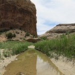
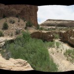
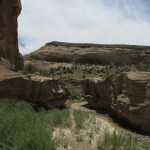
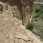
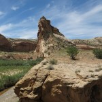
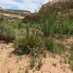
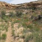
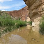
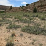
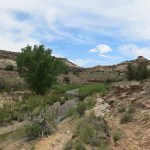
I’d been dreading the climb out of the canyon, up those tilted ledges of white sandstone under full sun, but that turned out to be the best part of the hike.
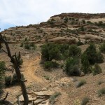
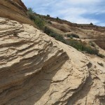
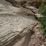
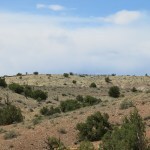
I had to drive to the highway the same way I’d come in, so I waited until then to decide where to go next. I was due in California, at the big lake on the Colorado River, in two days. That would be 7-1/2 hours from here by the interstate through Las Vegas, which was the last way I wanted to go. Since I had two days to get there I decided to drive north an hour tonight, to a small town I was familiar with that had a cheap but comfortable motel. The town had little in the way of restaurants but I had plenty to eat in my room.

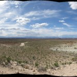

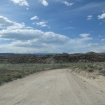
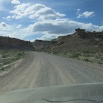
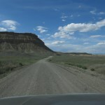
June 2, 2023
Birthday Trip 2023: Day Five
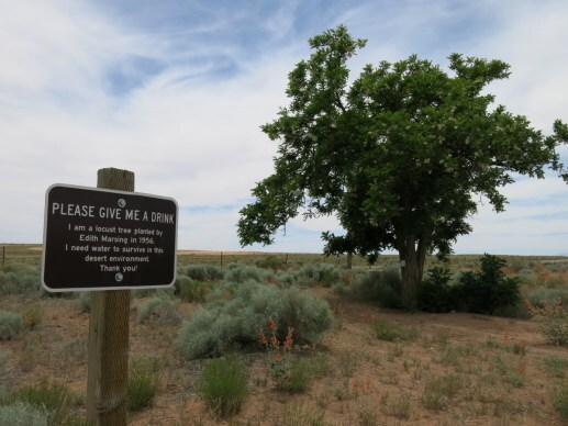
I woke well-rested in my beautiful campsite, as more UTV riders passed up and down the remote canyon in early morning. The plan for the day was to head north, stopping briefly to check out a couple of modest but better known sites near the highway before making a longer drive into unfamiliar backcountry, hoping for another good campsite in preparation for a canyon hike the next day.
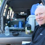
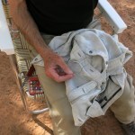
The first stop was a pictograph site located near a popular state park designed for off-roaders of all kinds. They were all naturally avoiding the pictographs and unloading their UTVs, ATVs, and dirt bikes to raise dust and sand in a roar of engines.
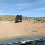
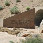
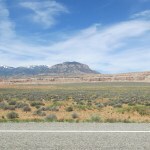
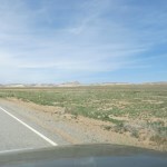
This small panel in the ancient “Barrier Canyon” style has severely decayed due to natural erosion. It was lunchtime so I made a sandwich before heading north again.
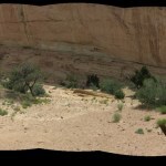
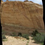
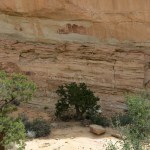
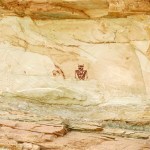
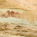
Not long after, I joined the westbound interstate for about three miles, signalling far in advance and carefully making an abrupt right turn onto a gravel road with big rigs barreling past me at 80 mph. This road leads into a spectacular narrow canyon with towering walls where I abruptly came upon a big family group of adults and kids who’d arrived on dirt bikes and UTVs and were noisily climbing around in the shade of a huge, shaded stone alcove where water oozed out of the base of the cliff in a profusion of ferns. There was one kid tottering around in bike helmet and full body armor who couldn’t have been older than three.
It turned out that this was not the pictograph site, so I parked and walked a short distance to the next bend, where I saw a pictograph panel under a smaller overhang, at the base of a tall sunlit cliff. All these publicized sites had fences to prevent vehicle access, but the fences had trails leading behind them for a closer look on foot.
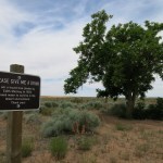
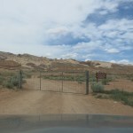
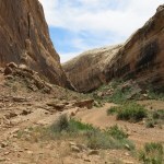
This site was called the Black Dragon, but I couldn’t see what the name referred to. Maybe it was farther down the canyon and I missed it? Still, these paintings in the heart of the Barrier Canyon “stylistic region” were done in a completely different, seemingly abstract style – much more like what we have in the Mojave. In any event there were too many people there today – other vehicles passed me several times.
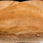
I rejoined the interstate and headed west across the “Swell”, past constantly changing canyons and formations, and finally down the other side, where I took an unfamiliar shortcut on my way north. There were high snow-draped mountains in the western distance, and this road started by following one of the creeks that drain that range, all of which are raging torrents now, gray with sediment.
The back road I wanted led east from a small farming town – I stopped there for gas and motor oil to top up my engine. Here I found the core of the UTV culture that’s taking over the rural west. The extra-wide streets had been repurposed for UTVs, speed limits were set to 25 and UTVs had the right of way, so if you wanted to drive through town, you had to creep behind them as the drivers waved to each other and defiantly ignored you. They kept their cars and trucks parked at home, reserved for highway driving.
I’d printed complicated directions on backcountry roads to the edge of the remote canyon which “should be better known for its high quality petroglyph panels”. These directions led me past heavily irrigated alfalfa fields, grazing cattle, and dilapidated or outright ruined Mormon farmhouses – the poorest I’d ever seen. The gravel road climbed a plateau, then descended through a maze of gray canyons, eventually emerging onto a red clay plateau to a crossroads. All along the way, big roadside clearings were occupied by parked pickup trucks with empty UTV trailers, and at one point I met a group of teenagers on dirt bikes.
I came to a Y junction and took the left branch, which had been rained on and driven while the clay was wet, leaving deep crisscrossing ruts in a rock-hard surface which went on for a couple of miles.
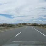
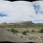
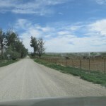
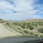
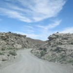
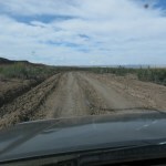
Cattle were grazing along the clay road, fifteen miles from any ranch. I came to another Y and climbed another plateau, finally reaching a wooden fence and the rim of the 600 foot deep canyon.
I followed the rim, on a fairly rough and hazardous clay and bedrock road, to the trailhead, and past, where campsites had been promised. There turned out to be only one, totally exposed on the very rim of the canyon. I unpacked and set up my shower bag to warm in the sun. A wind came up, and got steadily stronger, becoming a full gale across the rim.
As an experiment, I tried spreading and anchoring my tarp, but even with a continuous line of heavy rocks it still ballooned out in the middle. I tried to warm up leftovers for dinner, but had to enclose my stove in the back of the vehicle and wait over a half hour for the pot to warm in the crazy wind.
I had about 20 minutes of sunlight left when I finally gave up, after two hours in this ridiculous campsite. I drove six miles back on the road and found another site on an exposed ledge below bluffs. This site had no wind, and I quickly took a cool shower just as the sun set. Tomorrow I would drive back to the canyon rim and hike down into it looking for more petroglyphs.