Max Carmichael's Blog, page 5
March 3, 2025
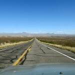
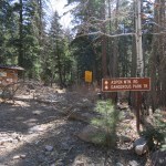
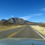
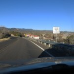
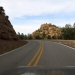
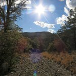
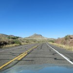
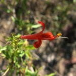
Road Test
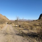
Another trip back east meant it had been two and a half weeks since my last hike. Doc and I had agreed on a three-month rehab program for my knee, starting with 2-mile hikes and gradually working up. I’d done this before, and it’s not easy – two-mile walks don’t justify driving into the mountains, but it’s hard to get excited about walking around town.
Especially on Sunday, the day of my big wilderness hikes.
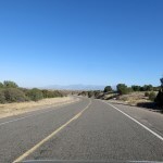
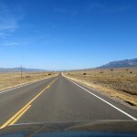
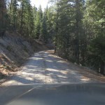
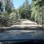
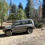
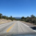
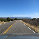
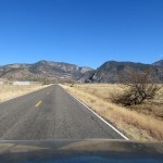
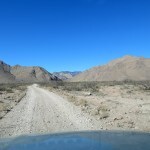
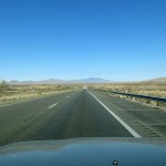
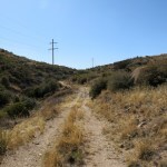
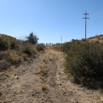
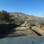
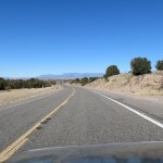
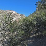
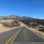
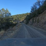
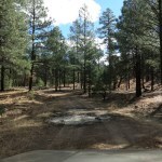
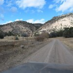
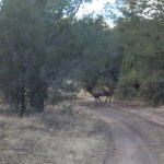
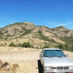
This weekend, I had a second goal – a thorough road test of the upgraded suspension and much bigger tires on my Sidekick. So I was looking for a short hike accessed by a road trip combining as many different conditions as possible, while minimizing the risk of hitting a deer and wiping out my investment.
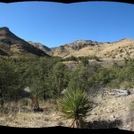
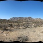
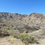
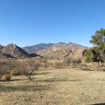
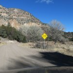
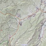
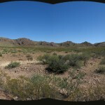
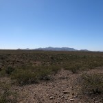
Northwest turned out to be the only viable direction, toward the remote, rugged, little-known area I’ve been trying to explore during the past year. Since a two-mile hike lasts only an hour, and the round-trip drive was likely to take four, I needed a lunch plan, and the northwest trip offered three options, only two of which I’d tried already.
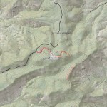
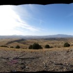
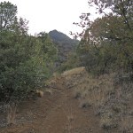
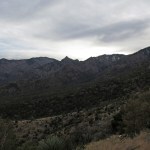
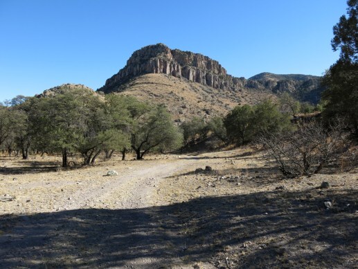
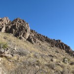
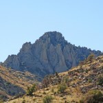
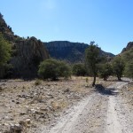
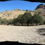
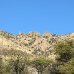
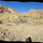
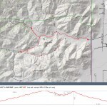
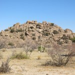
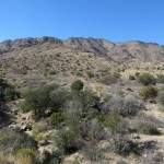
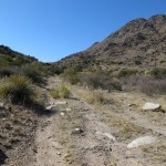
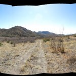
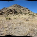
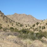
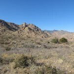
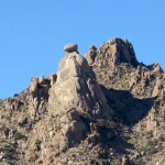
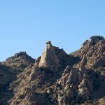
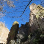
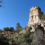
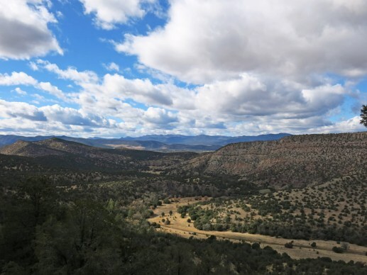
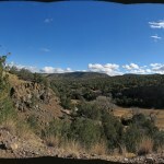
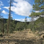
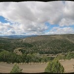
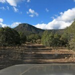
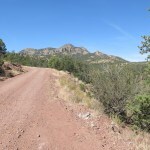
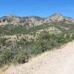
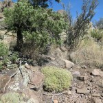
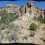
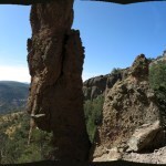
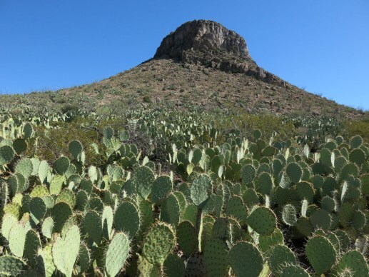
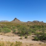
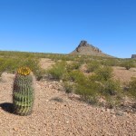
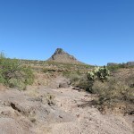
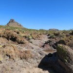
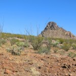
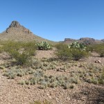
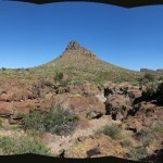
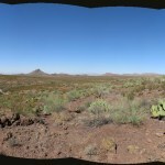
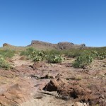
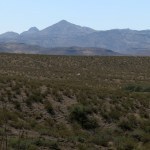
I compiled a list of eight short hikes along that route, most of which used the first mile of much longer wilderness trails I’d hiked many times before. The last and farthest hike depended on an abandoned trail that might or might not be passable, over and around a remote mountain I’d been obsessing over for years. It’s the high point of a small range rising amid terrain so rugged the peak tends to get lost and ignored by outsiders driving the highway across its shoulder. Surrounding peaks get in the way so it’s hard to even see the summit of this range from afar.
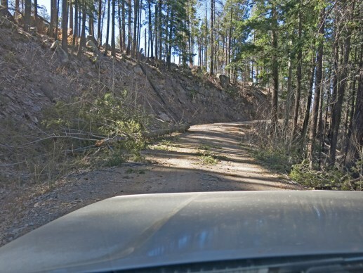
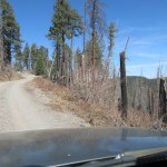
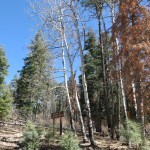
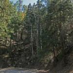
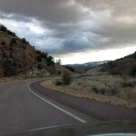
I’d driven the steep, rocky forest road, which climbs to within 200 vertical feet of the 8,970 foot summit, and I’d fallen in love with the views and the dark, spooky forest of firs and aspens that lines its deep, narrow canyons, where trees often fall and block the road for days or weeks. I assumed the road would normally be closed in winter, but this winter had been the driest in memory so I didn’t expect snow.
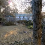
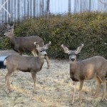
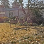
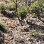
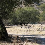
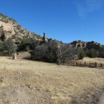
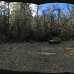
When I got up to start breakfast, I saw three deer in my backyard – two does and a yearling. By the time I headed out with my gear, they’d made themselves at home in a patch of sunlight. Better here than on the road, I figured.
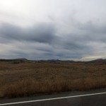
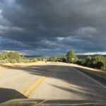
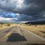
Yet another sunny day with clear skies and a high forecast in the 60s.
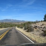
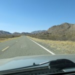
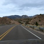
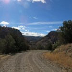
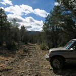
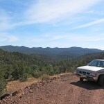
There are dozens of options for a short hike – one main reason I’d picked this trip was because it combined high-speed highway, twisty mountain road, and rocky backcountry road to give the new suspension a workout. It adds a 2-1/2 inch lift, which was immediately noticeable in a number of ways: wind noise, buffeting in a cross-wind, loss of power on grades. I had to work the steering wheel more than before. But I soon got used to most of those changes, and had brought my headphones to cancel the noise.
Stock, this vehicle comes with excellent handling, so even with the modifications it still handles quite well. And my initial impressions about loss of power were disproved later in the day. The ultimate test will be the long, steep grade on I-40 west of Flagstaff.
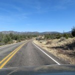
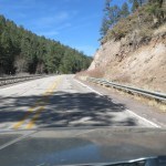
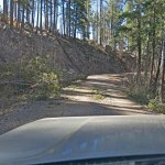
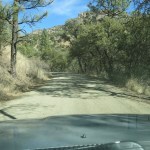
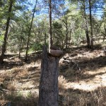
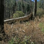
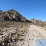
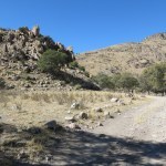
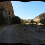
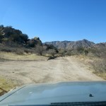
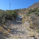
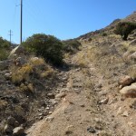
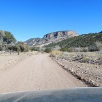
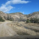
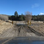
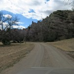
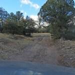
The forest road to the summit did turn out to be open, but as usual, six or eight trees had recently fallen across it, then had been pushed or dragged to the side by other travelers. Since it’s regularly maintained, the road’s never been a challenge for the Sidekick, but the upgrades give me confidence that was always lacking before.
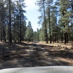
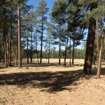
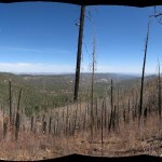
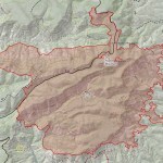
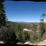
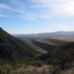
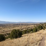
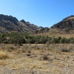
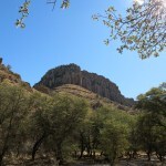
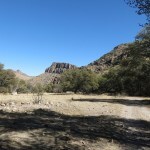
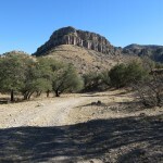
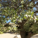
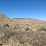
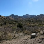
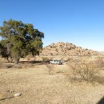
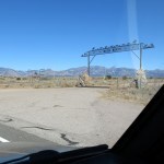
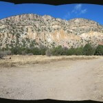
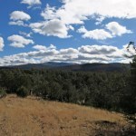
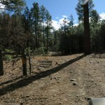
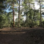
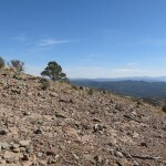
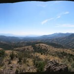
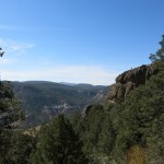
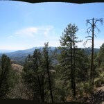
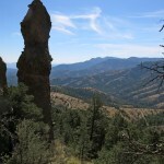
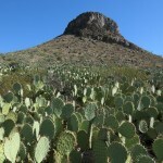
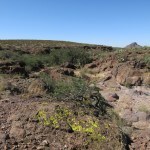
One of many neat features of this range is its sprawling summit plateau at 8,600 feet, with parklike ponderosa forest, grassy meadows, and not a single man-made structure apart from the old trailhead kiosk. This may be one of the least-developed mountain ranges in the U.S.
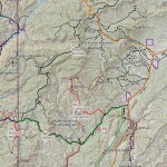
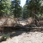
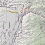
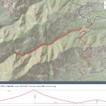
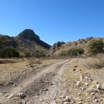
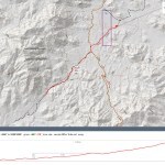
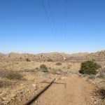
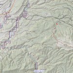
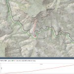
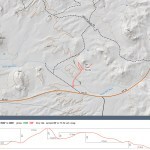
The map shows the hiking trail following an abandoned road that dead-ends just east of the summit, and from there, following a long ridge south toward a remote trail junction I’d bushwhacked to a few years ago. None of the trails in this area are maintained, and this trail is shown as a dotted line, meaning it may no longer even exist. I figured if it wasn’t passable I’d drive back south to one of the other options.
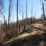
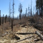
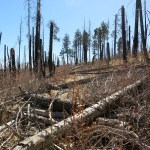
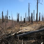
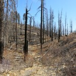
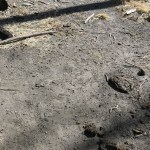
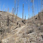
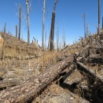
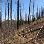
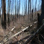
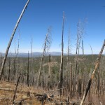
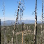
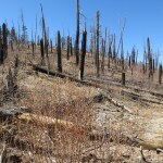
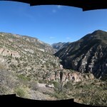
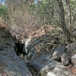
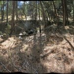
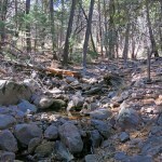
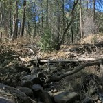
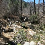
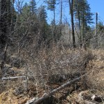
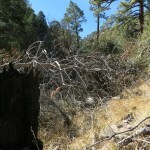
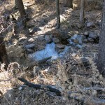
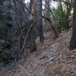
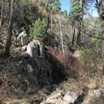
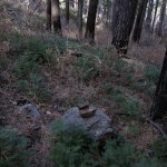
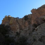
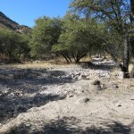
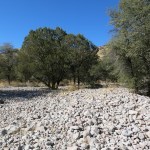
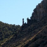
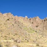
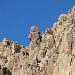
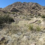
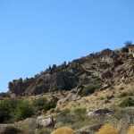
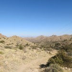
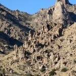
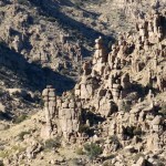
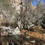
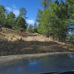
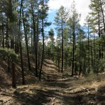
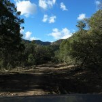
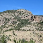
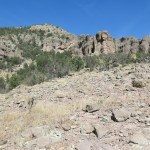
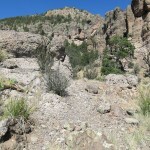
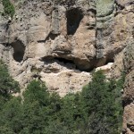
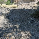
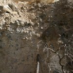
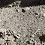
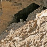
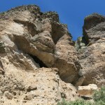
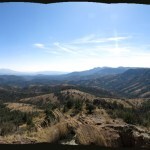
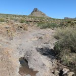
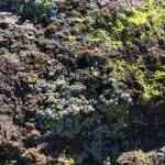
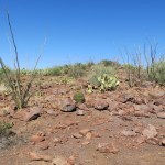
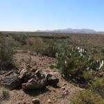
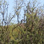
What I found was one of the worst burn scars I’ve ever seen. I hadn’t noticed it from the forest road, or the highway below, because firefighters defended the corridors, and lower peaks block a view of this summit ridge. The fire occurred in 2018 and was limited to the summit ridges and plateau of this tiny range, but it burned as intensely as any I’d found in our region.
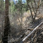
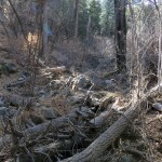
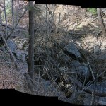
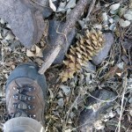
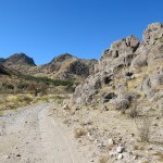
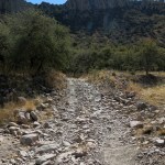
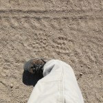
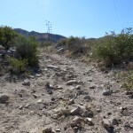
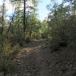
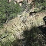
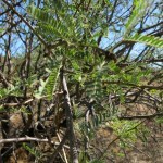
Deadfall, blowdown, and thorny regrowth blocked the trail almost continuously, and in several cases had to be detoured around. I was only able to fight my way through because enough tread remained for cattle to follow – there was no evidence of other hikers going this way since the fire, and the cattle had become my trailblazers.
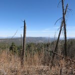
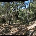
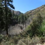
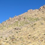
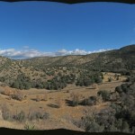
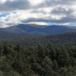
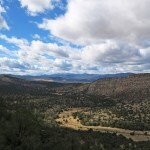
After an hour and a half, when faced with yet another solid thicket of thorns, I gave up. One thing I love about this range is its steep slopes, dropping abruptly to canyon bottoms two thousand feet below, so if you can see through the trees you get spectacular views. The burn scar did give me good views to north and south, but if I wanted to hike this trail farther someday, I would need a machete.
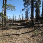
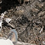
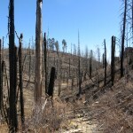
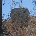
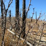
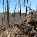
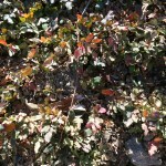
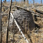
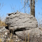
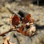
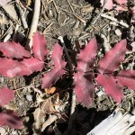
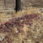
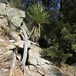
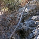
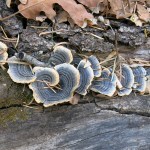
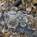
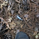
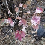
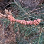
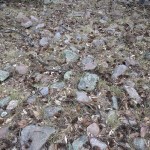
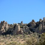
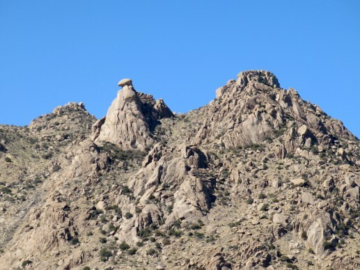
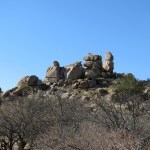
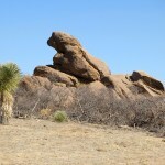
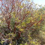
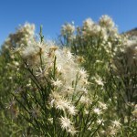
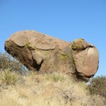
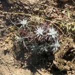
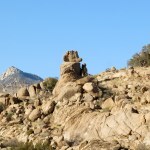
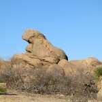
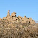
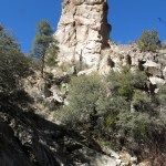
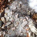
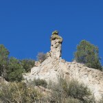
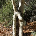
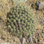
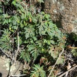
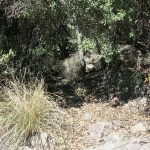
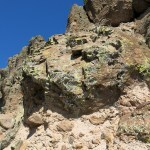
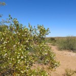
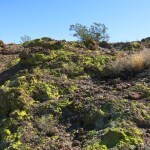
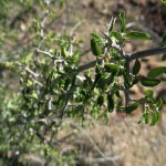
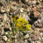
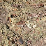
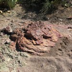
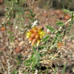
As usual, on the way back to the trailhead I paid more attention to details of habitat. I was particularly impressed by the color range of a native ground cover with holly-like leaves. I’d surely seen it before, but in this winter burn scar it was the most colorful thing in the landscape. And although this range doesn’t have much exposed rock, the loss of trees had revealed strange, isolated, stratified dolmen-like outcrops.
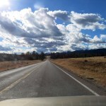
It ended up taking me over two hours to hike a mile and a half, and it was time for lunch, in the village a half hour down the highway. The three eateries that are open Sundays close at 2 pm, 3 pm, and 7 pm, and I’d never arrived early enough to try the first – which turned out to be the best. This is the historic heart of anti-government and pro-Trump sentiment, but the cafe was playing 60s psychedelic music, and when I was the last diner left at closing time, the bearded chef, his hair in long braided pigtails, brought out a slice of cheesecake “on the house”. First time I’d had one of my favorite desserts in years, maybe decades.
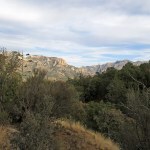
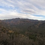
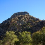
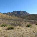
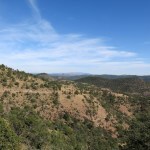
Since I still had a hour or more left for hiking, my plan was to do one of the partial hikes on my list on the way south. On the way back from the village, I spotted the burned ridge I’d hiked in the morning, peeking from behind intervening mountains – the first time I’d ever been able to identify this range from a distance in this dense, confusing mountain landscape.
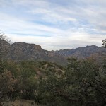
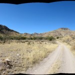
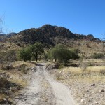
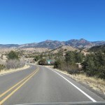
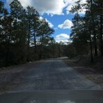
The trail I’d picked for the afternoon hike is well-maintained, and one of the most spectacular in our region. The first stretch climbs above a vast grassy mesa, one of our most distinctive landscape features.
Combined with the morning bushwhack, the day’s hikes ended up totaling three and a half miles, and I could tell my knee would be complaining that night. My body and soul crave the mileage and elevation, so this two-mile thing is going to be hard to stick to.
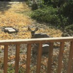
When I got home just after sunset, one doe and her fawn were still in my backyard, so I chased them out, and they crossed the wide street to my neighbor’s small front yard, surrounded by a hedge. These seem to be strictly urban deer now – a whole new breed, comfortable around people, thriving on pavement, surrounded by city traffic, more than a mile from undeveloped habitat. Dystopia is no longer a fantasy of the future.


February 14, 2025
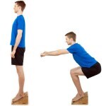
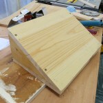
Slant Board for Patellar Tendinitis
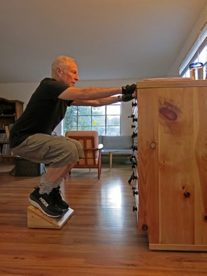
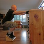
Throughout the past year, as I kept researching my apparent knee condition online, I found the same advice over and over: do eccentric squats on a slant board. In an eccentric squat, you first squat slowly with most of your weight on the injured knee, then shift weight to the opposite knee to rise slowly back to a standing position.
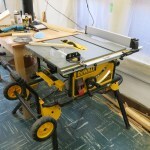
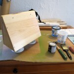
The slant board used in physical therapy facilities is typically super-simple, as in the illustration below. But an online search reveals dozens of mainly adjustable options, with quality products starting at $70.
$70 for something I could easily make in my workshop using scrap lumber? I think not.
 Woodworking
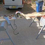
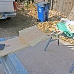
I had a length of pine one-by-twelve that would be easier to work with and make a nicer item than plywood. I hadn’t used my table saw in a couple years, so I was stoked. Happily, this wee project ended up using all my basic power tools, and mild weather allowed me to use the concrete slab right outside for sawing and sanding that would generate sawdust. I spent about four hours designing, cutting, and gluing the pieces together.


 Sanding and Finishing
Even for a small piece like this, sanding is time consuming. I’d originally figured it would only take a few hours to throw something together that would be usable. But then I realized I’d need some kind of anti-slip covering, which meant the wood would have to be finished, which meant it would have to be sanded. Hence the relatively high prices for commercial products.
Finishing with polyurethane took an additional couple of days due to drying time between coats.
 Final Assembly
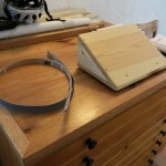
As the slant board got closer to being used, I realized I needed some specialized items: rubber feet that would prevent it from sliding on my hardwood floor, and some kind of non-slip covering for the slanted surface. The feet were easy to find at Ace, as was this non-slip adhesive-backed tape, which was somewhat tricky to apply neatly.


 Use
UseAfter only two weeks of use, I can already feel the results in knee strength and pain-free downhill hiking. This little project may well be the key to reversing nine months of damage to my knee!
February 10, 2025
The Epic of the Icefall
This one’s for those of you who are tired of hearing about my knee…and for those, including me, who’ve been wondering if I’m ever going to do another spectacular hike. In fact, the last spectacular hike I did was the one that damaged my knee, in early May of 2024.
I deliberated far too long over where to go this Sunday. I was still deliberating on Sunday morning, when purely by chance I re-read the description of a trail in the mountain range I hiked last Sunday, a trail I’d always assumed would be boring.
In the middle of a paragraph describing the beginning of the trail, the author of the online guide mentions that if you leave the trail at the first creek crossing and bushwhack two miles up the side canyon, you might be able to reach a waterfall. He added, “Note that it can be quite a rugged off-trail hike to get to the waterfall, especially after flooding has rearranged the area significantly and brought a lot of debris into the canyon.”
In this dry winter I didn’t expect there to be much, if any, flow over the falls. But this hike seemed the best idea I’d had yet.
I’d been planning on doing the smart thing – an easy hike on a well-maintained trail with moderate distance and elevation gain to keep my knee pain under control until I see the doc in a couple weeks. But there are so few easy hikes around here that result in entertaining stories and pictures! A canyon bushwhack would probably be really hard on my knee, but it would force me to go slow, and I imagined I could turn back if it got too gnarly.
It was forecast to be yet another unseasonably warm day, reaching the mid-70s at the foot of the mountains. On the highway south, two young whitetail bucks darted out in front of me, and I just managed to drive between them and the rest of the herd, which I glimpsed in the rearview mirror crossing behind me in a long line. It was pure luck that I didn’t hit one head-on like I did in 2022, resulting in $3,000 worth of damage to my Sidekick, which was virtually totaled. Of course I’m driving my pickup now, which has a steel grille, but this little incident reminded me why I should not drive the Sidekick until the armored bumper arrives in May.
Fifteen minutes later I was driving down out of the mountains into the big basin and saw the range of my destination spread out along the horizon, some 50 miles away. By then, I was constantly coming up with ideas for the new song I’m working on, capturing them while driving as video notes on my camera. I have a theory that road trips in basin-and-range landscapes are best for stimulating creativity – whereas big, sprawling mountain ranges like the Rockies or the Alps tower over us, vast basins scattered with smaller, widely separated ranges free the mind and imagination to wander endlessly.
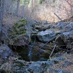
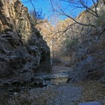
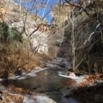
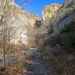
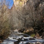
The trailhead, at just over 6,200 feet, lies in dense oak woodland along the winding, rocky road that leads over the crest of the range. It’s not a popular trail and I left my little truck alone in the small clearing just off the road. It only took me a few minutes to reach the creek, which to my surprise was flowing and clear. I realized this canyon gets a lot of shade in winter; there must still be snow melting up on the crest.
I’d gotten a late start and it was already in the mid-60s here, so I was comfortable in my long-sleeved shirt. Initially, I found the oak forest free of undergrowth but lined with embedded rocks, and for a short distance I could follow a vague trail that appeared to have been used mostly by the occasional enterprising bull. I also noticed partial tracks of another recent hiker that I continued to find farther upstream, until the going became too rough for my predecessor.
I was spending most of my time on the north bank of the creek and shooting pictures toward the southern glare, so for the first time, I started experimenting with the exposure dial, hoping to lighten the dark areas in Photoshop later while avoiding washed out areas now.
I was surprised to come upon an old wickiup frame above the creek with a stone campfire windbreak, apparently built long ago by someone experimenting with the old ways. It’s great other civilized people are doing this, but when it’s only a one-time thing, we should return the site to its natural state instead of leaving ruins like this.
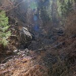
The forested lower canyon widened out, big ponderosa pines appeared, and the cattle trail led away from the creek. I entered patches of burn scar, and expanses of exposed rock where algae was choking the creek.
From here on, deadfall, flood debris, and thickets of thorny locust and other shrubs made the canyon bottom and neighboring slopes increasingly difficult, slow, and often painful to navigate. I looked for cattle trails, but they always led upslope away from the creek. The creek itself was becoming so choked with debris that following it was often impossible.
The ridges above were getting taller, the canyon darker, and tall firs began to join the pines in the canyon bottom. Under their shade, I was encouraged to see dense stands of fir seedlings that had clearly sprouted within the past year or two. I found minimal cairns left long ago by some hiker – hardly necessary, since you couldn’t get lost in this narrow canyon with increasingly steep sides.
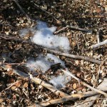
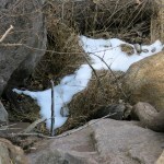
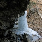
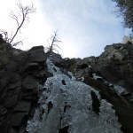
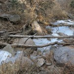
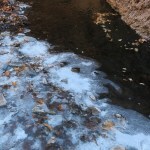
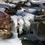
And despite the warm weather, in one shady stretch the creek was frozen solid!
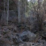
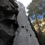
As the canyon narrowed, the ridges above literally towered above me so that I was in shade much of time, and big firs – many of them three feet in diameter – began to outnumber the pines. The creekbed was dry for long stretches but always reappeared farther up. My toil up the canyon became truly epic – the creekbed was almost everywhere jammed with fallen logs, there was no floodplain, and the steep slopes to each side consisted of loose rock – talus – sometimes exposed, and sometimes covered by dense thickets of thorny locust and stiff-branched scrub oak. I stumbled often and fell many times, but was always able to catch myself without injury.
Climbing above thickets on the north bank, I ended up high in a hell of talus and scrub, climbing up a rock-lined ravine that actually required bouldering moves. In the end, I forced my way through stiff brush, and half-sliding down half-buried talus to the creek, I realized it had taken me a half hour to go only 50 horizontal feet. The whole time, I was trying not to think about how hard it would be going back.
Staying near the creek now, I clambered over sharp boulders and fought my way through more deadfall and thickets, past more snow patches and frozen creek. Suddenly, I realized I was surrounded by white aspen seedlings, standing like ghosts in the deep shadow of the crest above. I love aspens, but I hadn’t expected to reach their habitat on this hike – from my glance at the topo map that morning I figured I would only be climbing a thousand feet or so above the oak zone.
The air temperature in the shadows was now below 60, but I was working so hard I still didn’t need a sweater. Would I ever make it to the waterfall?
The sky, impossibly far above and mostly hidden by cliffs or canopy, now appeared white beneath a thin cloud layer, and the canyon bottom became even darker, with only occasional rays of sunlight penetrating. I was forced to climb higher above the creek, and kept peering ahead through the big firs for an end to my quest.
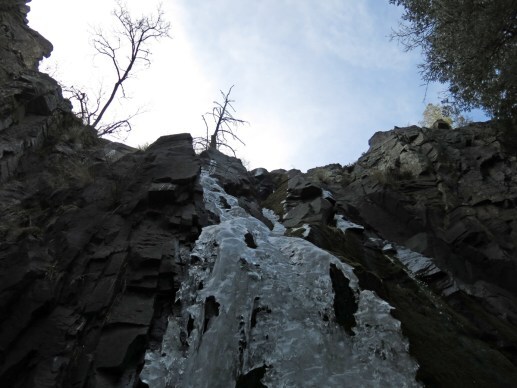
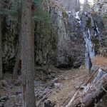
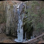
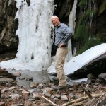
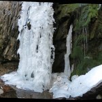
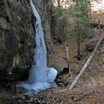
Suddenly, through a gap in the black tree trunks, far in the distance I spotted scraps of brilliant white. I approached slowly and carefully across the steep talus, made slippery by a layer of fir needles, until a frozen waterfall, fifty feet tall, began to reveal itself, gradually as if to increase the suspense, around a bend in the canyon wall.
I’ll warn you the pictures don’t do it justice. Maybe I was more appreciative after the ordeal I’d endured to get there – to me, it was one of the most spectacular places I’ve ever hiked to, and made all the suffering worthwhile. We’re all jaded by lifelong exposure to photos and video of the so-called wonders of the world, including waterfalls hundreds of feet tall or wide. I probably could’ve taken better pictures, but the space I had was cramped, the dark cliff totally dominated it, and the contrast between white sky and shadowed waterfall made photography a challenge that overwhelmed my limited skills.
And I was finally getting chilly!
I lingered in this cold, dark, beautiful place long enough to log a waypoint with my GPS message device. I was surprised to be able to connect with a satellite, down in that dark canyon. But when I checked the coordinates against the topo map back home, I found the satellite had recorded my location one third of a mile off – the cliffs and solid canopy of firs had apparently deflected and/or reflected the signal more than I would think possible. GPS users, be forwarned!
On the way back down, I tried to find better routes, sticking to the creek as closely as possible. The slopes above may appear more attractive but can quickly lead you astray. And eventually, I found more cairns and remnants of old trail blazed by other hikers – evidence I’d missed on the way up.
Those remnants of trail still led me astray as I approached the trailhead. And a sharp branch finally tore a big hole in my hiking pants. More than any bushwhack I’ve ever done, this truly was an obstacle course requiring full concentration at all times, where I never had the luxury of reflection or daydreaming.
It’d taken me more than four hours to bushwhack the four miles up that canyon and back. But when I reached the original trail at its modest creek crossing, I figured I still had an hour left. My knee would surely hate me for it, but I was so elated at reaching the waterfall that I continued up the trail. The online guide had claimed that in less than a mile you would reach a ridgetop with awesome views. Even walking slowly to protect my knee, I figured I could do that, and return, in an hour.
It was an often steep but smooth and well-maintained dirt trail, and it seemed to climb on forever. But after winding out and back into deep ravines amid dense oak forest, with the sun setting behind the crest, I finally reached the awesome views. But the sun had completely set by then, and the landscape was too dark to photograph well.
And I realized I would now have to hurry back down the trail, to reach the cafe before closing. When I plotted my route at home later, I found I’d only gone 5.6 miles total, but gained an accumulated 2,141 vertical feet – far more than was wise with this knee injury.
Nothing that lots of pain meds can’t fix – temporarily, at least. I hope you enjoy the epic even a fraction as much as I enjoyed the hike!
February 3, 2025
Sun, Dust, and Cattle
This Sunday was forecast to be unseasonably warm, reaching 70 degrees at home. Still looking to test my newly medicated knee on a mid-distance hike with elevation gain between 1,000 and 2,000 feet, I had my heart set on a trail west of here to a little 7,500′ peak that had been recommended for its views. But I’m trying to get pictures of rocks for my mother, and when I dug up some pics from that hike online, I could see it was all forest and no rocks.
So despite the warm weather I resigned myself to hiking lower elevation areas along the Arizona border, where rocks abound. I wanted to avoid livestock if possible, and the maps showed a trail through a wilderness study area, up an exposed, rocky canyon that had intrigued me, from a distance, for years.
But when I reached the turnoff to the access road, I found it closed, with a locked gate, guarding a small settlement of what appeared to be scruffy retirees and desert rats. I guess remoteness explains why they get away with closing access to a trail on public land.
Of course I always expect things like this when exploring new areas. My backup plan was to check out a canyon on the east side of the sky island mountain range, popular with birders, that I’d hiked so many times before. Most of my hikes had focused on the high central area, accessed via the northeast basin. One of those previous hikes had reached and traversed the head of this eastern canyon, which was enough to make me curious about the trail up the canyon below, accessed via a forest road entering the east side of the range
It’s a long canyon. My mapping platform shows the access road ending 5-1/2 miles in, with the trail continuing 6-1/2 miles to the saddle I’d reached before. But the old Forest Service map shows the access road continuing another 4 miles to the wilderness boundary, where the trail proper begins. Who to believe?
The most complete and up-to-date trail guide for this range says the access road was destroyed in the catastrophic floods after the 2011 mega-wildfire and is “not passable by vehicle for a number of miles”, and the trail up the canyon to the saddle I’d reached from the other side has “not been maintained for a very long time and conditions are poor to nonexistent”. I assumed today would be a repeat of my explorations in a similarly described canyon northwest of here, where the road had been apocalyptically washed out for miles and I had a very difficult scramble to even reach the trail – something my knee definitely wasn’t ready for today.
But I was in the vicinity and it would only take a half hour to check this out, after which I could drive to the interior basin to re-do an easy but forested trail there.
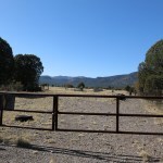
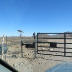
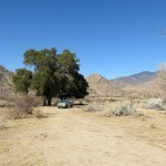
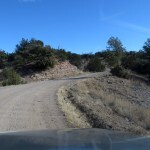
What I found was a rough ranch road that led to a corral and water tank at the mouth of the canyon. After closing the gate behind me, I was only able to drive a few hundred yards before hitting the sandy crossing of a big wash where my 2wd truck would surely bog down, so I parked in a clearing, loaded up, and starting hiking the road. At 1,400 feet lower than home, it was already warm enough that I had to unbutton my shirt.
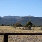
This turned out to be a very wide canyon between rocky ridges, with a broad floodplain. The floodplain was lined partly with grasses and annuals, and partly with open oak woodland that became dense as it extended occasionally up gently slanting cuts through the rocky ridge on the south side.
A few hundred yards beyond the wash crossing, I found two pickups parked beside the road, one with a Wyoming plate. Not knowing what to expect, I have to admit it was a little reassuring to know other hikers were up ahead – instead of, for example, gun nuts on ATVs.
The road was dusty, and walking it under full sunlight quickly became a trudge – not the hike I’d wanted for today. But this was a pretty canyon I felt like I needed to explore, and as usual I wasn’t paying enough attention to distances on the map. I was hoping I would reach the end of the road in an hour or so and still be able to enjoy some roadless hiking in a wild canyon beyond.
I had my eye out for cattle and soon spotted a bull resting under an oak on the opposite slope. And a quarter mile later where the road wound through oak forest, I came upon another bull, standing just off the road. He was watching me but didn’t seem concerned, so I continued past. Maybe this canyon sees enough recreational use that the bulls are more accustomed to strangers than in the more remote areas I usually target.
The road crossed the wash again, near groves of big oaks that featured really pretty campsites. So far, the road had been easily passable by high-clearance 4wd vehicles, and I was thinking this would be a great place to camp – just outside of bear habitat, but with access to the higher mountains.
I went through another gate and back across the wash, and soon met the other hikers – a party of six, three couples roughly my age, all birders with field glasses hanging on their chests. They were engaged in conversation and barely acknowledged me as we passed.
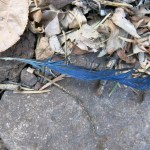
I saw some bluebirds crossing from oak to oak, and spooked a whitetail doe that ran up the south slope.
A little ways farther up the road I came to a huge water tank about 50 feet in diameter with a solar pump. There had been plastic pipe running beside the road all the way, feeding occasional small water troughs, and it continued past here. This was by far the biggest ranch operation I’d seen in this range – my earlier thought of camping was fading fast.
The canyon narrowed, the road began making tighter turns, and I came to a right-angle bend, the forested intersection with a side canyon on the right, where a rocky side road branched off. I continued on the main road and found that the birders had turned back here. But I continued upcanyon for more than a mile, to another crossing where the road climbed a steep bank and the rancher had built a long drystone retaining wall hoping to control erosion. Here, a side road climbed steeply left into oak forest where I could see a freestanding fireplace and chimney and hiked up to investigate.
The map showed this to be the start of a trail up a small peak, but all I could find were meandering cattle trails. There was no cabin foundation around the fireplace, but the chimney showed a fringe of rusted flashing from a metal roof. Hard to say what happened here.
Back on the main road, after another quarter mile I heard mooing and spotted a herd of cattle ahead in an oak grove south of the road. I could see a corral ahead, and standing in front of it facing me down, another bull. A bull’s first duty is to protect his cows, so I turned back in disgust.
I knew I hadn’t gone more than three miles yet, so the best thing I could do now would be to go back and explore that road up the side canyon.
After returning a mile-and-a-half around the big bend, I found the side road was only rocky for a short distance, then became another dirt road up a floodplain. I could see the side canyon opened out and became relatively vast. But while stopping to pee, I heard a dog bark, and looking back, saw a mountain biker stopping under oaks at the entrance to the side road. His dog ran up to meet me, and the biker passed me shortly after, again roughly my age. I realized to my chagrin that, rather than a wild canyon devastated by catastrophic floods and abandoned by hikers, this was actually a combination working ranch and recreation park for retirees.
But in less than a half mile the road disappeared under a debris flow of white rocks from the historic floods. I couldn’t find where the biker had gone, but I continued working my way upstream across the rocks, until I got really frustrated by the oaks in the canyon bottom blocking my view of the landscape. So I carefully climbed the east slope to a high bench with an expansive view. And the first thing I saw was another herd of cattle, facing me from the corresponding bench across a deep ravine. This was clearly their habitat, not mine.
But it was a really pretty canyon, like a vast inner world hidden from the outside of the range.
I hadn’t gotten much elevation today, but I’d walked almost nine miles, and my knee was complaining despite the meds. During the past week I’d tried alternating oral Celebrex and Voltaren gel. The Voltaren failed to ease my pain, and its complicated application is completely incompatible with hiking or camping.
Environmentalists and conservationists have long accepted that responsible ranching is better for habitat and wildlife than urban sprawl. I don’t know how responsible the ranchers are where I hike, but I’m learning that hiking in this rangeland is complicated. I’ve hiked in remote, forested rangeland where cattle graze where they please and seldom if ever see a human, and that’s where I’ve found the most pristine habitat and encountered the most aggressive bulls. I’ve hiked in remote, heavily overgrazed grass-and-scrubland where the livestock likewise rarely see a human and are inclined to be defensive. And I’ve hiked in places like today’s canyon, where ranching and recreation peacefully coexist, but which are much less interesting to me.
Normally when I make the minimum hour-and-a-half drive to this range, I hike until evening, enjoy dinner at the cafe, and spend the night in the motel. But today’s walk returned me to the truck a little after 4pm, so I just drove home and saved some money. I will soon spend it on an overnight bag anyway, since my old one is decomposing into toxic microplastics.
January 27, 2025
Miracle Among the Rocks
After my return from back east with increasingly crippling knee pain, my doctor had prescribed something that sounded familiar. Later, after looking it up, I realized it was an anti-inflammatory (NSAID) he’d ordered for my hip pain back in 2008, when I’d tried every NSAID on the market, and every one had caused stomach cramps so bad I had to reject them all, adding that entire class of medicines to my growing list of drug allergies.
But in desperation, I took a dose Saturday after breakfast, and then, immediately after taking it, discovered it’s taboo for patients allergic to the antibiotic sulfa. I’ve always been told I almost died of anaphylactic shock after being given sulfa at age 2.
To my considerable relief, I didn’t die. I didn’t develop stomach cramps, and three hours after taking the drug, my knee pain disappeared completely for the first time since early May 2024.
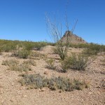
Okay, I thought. Let’s put it to the test. There’s a small mountain range over in Arizona that I’ve wanted to explore for five years. It lies directly across a lonely highway from the much bigger and much taller mountain range I’ve climbed dozens of times. It lies within the same national forest, but it’s neither federal wilderness nor wilderness study area, and as far as I could tell it’s all cattle range.
The map shows no hiking trails, but the mountains, rising from 4,600 to 6,900 feet in elevation, are traversed by a sparse network of dirt roads, only a few of which seemed to be maintained. Virtually no information about this little range is available online – hours from the nearest city, it seems to be ignored by hikers, mountain bikers, campers, and recreationists in general.
Recalling my history of conflicts with livestock, you might assume I would join the crowd and likewise ignore this unpopular rangeland. But the northern part of the range has one irresistible attraction: it looks very similar to my spiritual home, those sacred mountains in the Mojave Desert. It virtually screams “DROP ACID AND HIKE ME!”
So on Sunday morning, after taking a second dose of the new drug, I packed for an overnight trip across the state line, where for the first time since last August, I would try to hike more than a mile. My optimistic plan was to walk one of the abandoned roads from an interior basin up to a pass where I could survey the possibility of someday climbing to the crest. As usual in a situation like this, I really had no idea what to expect. I might run into an aggressive bull, or a locked gate with a No Trespassing sign, or a sandy road my truck couldn’t handle. My knee might betray me. In those eventualities, there were other less interesting options nearby.
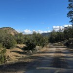
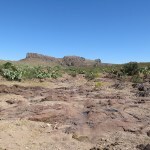
It was another day without clouds, temperatures forecast to reach the 50s. Under full sun it would feel much warmer, if not for the steady west wind I found to be blowing all day. The ranch road in was very well-maintained, but my eyes were constantly drawn to the fantastic rock formations it twisted between, and I stopped every hundred yards or so for pictures. It was all even better than I’d expected – after cresting a low rise, you wind down into a hidden basin surrounded by low hills to the south and spectacular mountains, cliffs, and pinnacles in the west and north.
The ranch house lay just out of sight at the north end of the basin, but the road I wanted turned off south. The basin is dotted with huge spreading trees which I was surprised to identify as Emory oaks – we have much smaller ones around home – and in less than a quarter mile the road turned bad and I pulled off to park in a clearing near several of these majestic trees. At the edge of that lovely basin, in this landscape dominated by stone in endless organic forms, I was already in heaven and I hadn’t even started hiking.
The map shows a powerline following the road, and once there, I realized it’s actually the opposite – the road I planned to hike is the powerline utility road. It’s a minor powerline serving a ranch on the west side of the range, so since the powerline was laid, the road hasn’t been maintained, and coming from the east, I didn’t see any vehicle tracks until I approached the pass much later.
My knee seemed fine, and I didn’t anticipate any sustained grades to threaten it, but on every single decline, I practiced a duckwalk I’d found in a YouTube video by a physical therapist that was recommended to relieve knee pain. I did that all day, on what was probably a hundred or more short descents.
Cattle had used the road, but only rarely, and the most recent cowpies were a couple weeks old. I spotted a herd lounging a half mile north near a corral and water tank. Another hike I’d considered follows a dirt road that branches south, offering a possible route to the summit of the range. But when I reached that branch, I could see that the southern part of the range doesn’t feature those spectacular rock formations, so I kept going on my powerline road, forcing myself to move at a leisurely pace and take shorter steps than my body seemed to want to.
Up and down across side drainages, the road gradually took me higher above the basin, yielding better and better views. I found the fairly recent track of a single hiker who must’ve been about my size. I came upon modest ranch infrastructure, and mused enviously that this must be one of the prettiest ranches in all Arizona.
Eventually I could see the powerline heading up to the pass, the hills closed in at each side, and I began to wonder if my knee would really hold out that far. The past six months had been hell in so many ways. Taking care of my mother had distracted me some from the pain and the inability to hike, but my soul had been grieving, and I’d often wondered if I’d ever be able to hike again. At times, my future seemed utterly hopeless.
In this basin dominated by oaks, I came upon the occasional juniper and was surprised to encounter small manzanitas. Back home, manzanita only seems to grow above 8,000 feet, but here – and in another range to the south – at similar latitudes, I’ve found it between 5,000 and 6,000 feet. Why the difference?
After more than two miles, my knee still seemed fine – another surprise, since for months, every time I’d walked a mile, I’d ended up in severe pain. The road became steeper and more deeply eroded as it climbed to the pass, but I kept moving carefully upward, admiring the steep, rocky slope on my right, behind which the northern crest was hidden, about a thousand feet higher.
That wind was howling down from the pass, and no matter how tightly I cinched my hat, it still blew off from time to time. But now I was sure I was going to make it, and since one of my favorite experiences is to crest a pass for the first time and see over into the next watershed, discovering completely new territory, I was really stoked. I’d been eyeballing possible routes to the crest on the east side, ever since beginning my hike, and now I would learn whether a better route exists on the west side, taking off from this road.
Wow! That wind was just blasting through! The west side of the pass descends at a much gentler grade, with the less interesting southern mountains on your left, but on your right, there’s more spectacular rock, and what appears to be a straightforward route upward to the crest.
It was no place to linger in this wind, but I began to believe I might return someday.
Of course, the trail back threatened to be much harder on my knee, since it was mostly downhill. But I kept carefully duckwalking down every incline, and it seemed to work. The low angle light from the western sun made everything in the landscape stand out now – my reward for the climb to the pass. And gradually, I realized I was experiencing a miracle – just as my mother has recently been able to stand up and walk after being confined to a wheelchair since September, I was now hiking miles without pain for the first time since early May.
I don’t buy the old myth, perpetuated by Western pundits from Aristotle to the new age self-help gurus of the 80s, that human life should be a quest for individual happiness. Happiness – a steady state of comfort and carefree living – has always been a meaningless concept to me. My curiosity drives me to take the kind of chances that result in moments of joy – like this day of pain-free hiking through a beautiful landscape – between long stretches of hard work and suffering. Giving up the extremes in favor of the safe and predictable seems like a poor trade-off.
My lower legs were now aching – anti-inflammatories do nothing for lactic acid. Charting my route later, at home, I would find I’d hiked over seven miles with an elevation gain of 1,000 feet. I can’t really describe how ecstatic I was by the time I reached the truck. In all those seven miles the only litter I’d seen was a single smashed beverage can. Without that, it would’ve been too perfect.
Driving out between the rock formations, I passed a late-model utility vehicle parked below some boulders and pinnacles, and realized this area is even more spectacular than the most famous bouldering destination in California, yet the online silence suggests it’s either undiscovered or ignored. Let’s hope it stays that way.
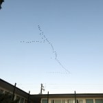
I’d reserved a room in my new favorite motel south of the range. And after a burrito and a peaceful night reminiscing about my hike, I emerged before dawn to find thousands of sandhill cranes flying directly overhead, moving north from the small lakes that dot the valley to the south. The parade lasted for at least 90 minutes – another miracle to top off yesterday’s.


January 23, 2025
Icy Creek
First hike since October. Knee still hurting, worst than ever. Hoping to get a shot in about a month. Meanwhile planning to hike through it, trying various hacks.
Back in my mountains after 7 weeks in purgatory, praise the lord. Missing my mom, this one’s for her. Emotionally numb, in denial. Lonely.
Headed north to revisit a spectacular canyon, 500 feet lower than home. Temps hovering around freezing, clear sky, a dusting of snow on north slopes above 8,000 feet. Unusual number of small hawks swooping along the road.
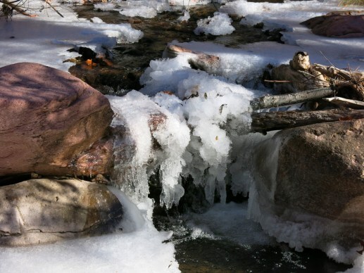
Creek lined with lovely, thick ice from recent temps in teens. Much more water than I expected, runoff from sun on snow and ice higher up. Fall color lingering on fallen sycamore leaves. Magical place.
Tricky creek crossings on icy rocks between frigid pools a foot deep. Trying out trekking poles in hopes they’ll help my knee – they help in creek crossings but are awkward on this rocky trail and useless and in the way in many places.
Much earlier than expected, after maybe a half mile, I reach a crossing I can’t do without getting my feet and legs soaked.

Heading back, I can tell my knee’s going to hurt bad tonight.
November 29, 2024
Farewell to the Mountains
I found myself alone again on Thanksgiving. Last year I was lucky enough to be invited over by neighbors. But it’s been eight years since I was able to spend the holiday with family, and 16 years since I was last invited to spend it with friends. So despite many memories of convivial Thanksgivings in the past, it’s become a lonely day I no longer look forward to.
But I’d been shut up in the house, sick, for the past ten days, and I just had to get away. In a few days, I expected to be moving back east, for weeks or even months. Saying goodbye to my beloved wild mountains, to live in a place that’s flat as far as the eye can see, in the midst of a vast city surrounded by plowed fields.
So I headed north, hoping to find access to a couple of hikes I’ve been dreaming about. I can no longer hike, and travel means I can’t recover from my knee injury, but at least I can dream.
The next couple of days were forecast to be cool and cloudy, and clouds gathered and dissipated above me as I drove north.
The first hike I wanted to check out climbs a 9,800 foot peak 14 miles east of the village where I was staying. This is one of many peaks of roughly 10,000 foot elevation that rise at random from the very remote high country at the north end of our national forest. This peak features a fire lookout accessible from the north via a long and winding dirt road, but the ascent via trail, from the west, would total 15.4 miles out-and-back, with 4,000 feet of elevation gain. If I ever recover from my knee injury, that would be perfect.
I’d tried to reach the trailhead last winter, but was stopped by an icy road. The backcountry dirt road, serving remote ranches, descends into a broad sandy wash, then climbs steeply over a low saddle forested with juniper and pinyon. Today the surfaces were dry and cold, and on the other side of the saddle, I discovered a spectacular new world.
This new world is the canyon of a tiny river with a romantic name. The map had made me curious, but the reality exceeded expectations. This turned out to be one of the prettiest river canyons in our area – adding to the myriad reasons why I love living where I do. Even after 18 years, I can still drive a couple hours and be surprised, and I’ve only scratched the surface.
After continuing up the canyon and across the river, the road climbs more than a thousand feet up the opposite side, to a beautiful plateau forested with ponderosa pine. Driving up the plateau, I got occasional glimpses through the trees of the mountain above with its dusting of snow. This is a classic conical mountain with ridges and canyons fanning out on all sides. Eventually the road dropped into a shallow canyon that separated the plateau from the slopes of the mountain. According to my map, I would soon hit a side road leading to the trailhead.
The side road I found had a barbed wire gate made with tree branches and was clearly seldom used. The map gives this trail a number, and an online search leads to a Forest Service trailhead page, but there’s absolutely no other information online, which is what I prefer. Closing the gate behind me, I drove across a steep slope into a narrow canyon under big ponderosas, reaching the next turnoff in a few hundred yards. This led up a steep grade on a very rough and rocky track. The track continued over the crest of a ridge, but I parked at the top, figuring the trailhead was only a few hundred yards farther.
I was wrong. I ended up walking almost a half mile down into a canyon in near-freezing temperatures, wearing only a light sweater, while still trying to get over my lingering cold. The road was so rocky it was questionable if I could have driven it, and I never did reach the trailhead. The walk out and back, less than a mile, hurt my knee so bad that I would have trouble standing, sitting, or using stairs for days. But at least I got a feel for the country – as wild as I’ve ever seen.
That river canyon was definitely the highlight of my morning exploration, and the clouds and shadows made it even more beautiful on the drive back. I will return!

After lunch in my room, I set out to find another trail I’d been unable to reach last winter – this time, about ten miles west of the village. This is a trail that forms the top bar of a “T”, with another trail I hiked a couple years ago coming up from the south to form the stem. That earlier hike was 15.5 miles out-and-back, and the stem of the T had been abandoned for so long it became my greatest routefinding challenge ever.
But the landscape around the remote junction had been really pretty, so I’d always dreamed about hiking the bar of the T. It’s an east-to-west traverse across the southern slope of another 9,800 foot peak that has dense fir-and-aspen forest on top. The trail starts at 6,600 feet in the east and ends at 8,000 feet on the peak road in the west, traversing 11.2 miles with almost 5,000 feet of elevation gain in the process, so it’s a little too far for an out-and-back day hike.
But today’s challenge turned out to be the approach road. This is a dirt road that gets very muddy after any precipitation. There are actually two parallel roads that start at the same place on the highway, separate, then rejoin 3 miles later. I took the left-hand road that climbs a low ridge, figuring I might return on the other road. The left-hand road turned out to be one of the two gnarliest back roads I’ve ever driven in this area, at the very limit of what my 4wd Sidekick can currently handle. Big trucks had driven it in the mud, digging holes up to a foot deep, and the rocky part really had me worried since my tires are nearly bald.
On my way up the ridge, I spooked a half dozen deer, then immediately after that, 8 or 10 elk crossed in the opposite direction, and finally, another half dozen deer crossed back, farther ahead. It was like one of those documentaries about the Serengeti!
But I made it to the trailhead, such as it was (no sign or kiosk), and now I know it’s reachable. It just takes forever to get there – 45 minutes to go 4.5 miles on that dirt road.
The old road continued past the clearing where I parked, but had been thoroughly washed out. I climbed across the washout and continued on the old road, a few hundred yards to where the trail proper starts. I still want to hike it some day.
I can’t overemphasize how remote this country is. It’s all cattle country, but it shows how much natural beauty and ecological diversity can survive when the cattle outnumber the human visitors. That’s why I ended up in this area instead of other places I looked at, like the Eastern Sierra, Flagstaff, Prescott, or Santa Fe. Wild habitat is far more important to me than urban amenities, but I seem to have found the best mix of both available anywhere in the Southwestern U.S.
I tried the other road on the way back, and barely made it. At the halfway point, the other road plunges down the bank of a 20-foot-deep creekbed, which would definitely wash out in our monsoon. Just as I prepared to drive down that bank, a big redtail hawk launched off a branch at my right and flew left down the creekbed carrying an adult Abert’s squirrel suspended from its claws. Second time I’ve come upon a hawk carrying a squirrel.
And on the drive back to the village, the sky created the perfect ending for my day of exploration!
November 28, 2024
Protected: Katie & Max: New Work
This content is password protected. To view it please enter your password below:
Password:
October 28, 2024
Vista Home or Desperate Lookout?
I drove two-and-a-quarter hours to the most spectacular viewpoint in our region, and climbed a rocky slope to a prehistoric site. My knee was already hurting from a hike three days earlier, and today’s adventure would add insult to injury. But these are desperate times.
Yet again, we had clear skies and the afternoon high in town was forecast to be at least 80. I’d wanted to explore places at lower elevation but they were forecast to reach 90 – at the end of October! Today’s destination is over 7,000 feet and the temps should be mild.
The drive north used to be one of the loneliest roads in the U.S., but in the past year it’s become some sort of mysterious commuter artery. From where to where, I have no idea, but this morning, most of the southbound vehicles were giant RVs. Tomorrow was forecast to be the last day of our fall heat wave, and it’s as if all the snowbirds decided to head south at the same time.
Finally, I reached the turnoff for the backcountry road west, and left the crowd behind. The single-lane dirt road traverses a maze of ridges and canyons between 6,000 and 6,500 feet, forested with ponderosa pine and Gamble oak, up and down around hairpin turns. RVs, fifth-wheelers, and pickups with camper shells were sporadically tucked away under the pines, and I passed at least one group of camo-clad hunters setting up camp.
The final climb to the high saddle is world-class, emerging from the rolling basin to a south-facing slope with forever views. Parking at the top, I had a chat with a retired couple from the village an hour south. I said this is an undiscovered gem, and they replied “Not anymore!”
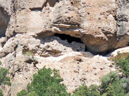
As they drove off, I set out on my short hike up to the bluffs. I expected it to be less than half a mile, but the slope gets increasingly steeper and the ground is covered with big sharp rocks. This cliff dwelling is actually marked on Google Maps, but the person who recorded it only viewed it from afar with binoculars. From the road, it looks inaccessible, perched in an alcove way up in a sheer cliff. But you never know until you try.
Picking my way through those rocks was even harder than I expected. But cattle had been all over this area, and I followed their tracks where I could, walking slowly and carefully to protect my knee. At several points I had to climb steep sheets of exposed bedrock, lined with loose rocks that were constantly rolling out from under me. I was ascending an outlying shoulder with a deepening ravine at my left, and I could see that when I reached the foot of the actual bluffs I would need to traverse left up the steep side of the ravine toward the cliff dwelling.
Finally I emerged on a ledge below the bluffs with a 180-degree view of the eastern, southern, and western landscape.
The ledge lies at 7,500 feet and the ravine at my left hosts tall ponderosas and a dense understory of shrubs and grasses hiding bigger and sharper rocks – basically a vegetated talus slope. I had to traverse this upward at the foot of the bluffs – more slow going – but found occasional segments of a narrow trail. I’d entertained fantasies of being the first modern human to explore this site, and still hadn’t seen any footprints.
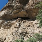
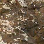
Finally I emerged from the scrub at the foot of the cliff, with the crumbling wall of the prehistoric structure about twenty feet above me, behind an overhang. The cliff curved outward at right, where a partial, primitive rope ladder was suspended, a dozen feet above the ground. I walked closer and saw it was made from nylon rope.
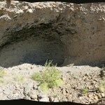
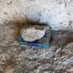
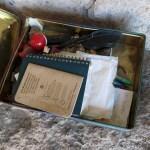
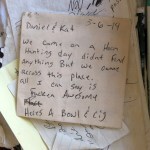
Pushing my way through more brush around the crumbling foot of the bluff, I discovered there was no way up the cliff. The prehistoric structure is inaccessible until someone finds a way to extend or replace that rope ladder. But below the hanging ladder is a small alcove with a sandy floor covered with recent footprints, and at the back of the alcove I found a tin box full of notes from previous visitors, as recent as six days ago. So much for my romantic fantasy.
When I first explored cliff dwellings in Utah 35 years ago, they seemed so exotic, and their locations so beautiful, that I didn’t really question why they’d been built or what life might’ve been like for their residents. It took decades of hard lessons for me to realize these were last-ditch hideouts for desperate people living in constant fear of attack – the prehistoric equivalent of today’s doomsday preppers. They were likely only inhabited briefly during times of known threat.
The wall above me had been incredibly hard to build, and has tiny windows that would be perfect for shooting arrows through. Unless there’s a spring inside the alcove – highly unlikely – whoever was using the shelter would have to traverse down a mile and 900 vertical feet to the nearest seasonal stream for water, and carry their supplies back up that difficult slope. To me, this appeared to be a lookout, from which scouts could scan a vast area of strategic terrain on a route between fertile river valleys in the east and west.
Now came the hard part – the descent of that difficult slope on my already hurting knee. When I reached the ledge below the bluffs, I saw another man approaching, and we exchanged waves as I moved to the side to get a better panorama.
Farther down, descending one of those stone sheets lined with loose rock, I finally stumbled and had a “soft” fall that hurt nothing but my already injured knee. Served me right – I would just end up taking more pain pills and enduring a slower recovery.
Late lunch in the tiny county seat to the north was so mediocre that despite my hunger, I couldn’t finish it. And the drive home on that previously lonely road was made stressful by an endless series of city people in Japanese sedans, tailgating me, imagining themselves race drivers on the tight, steep curves. Where did they come from, and where were they all going?
October 21, 2024
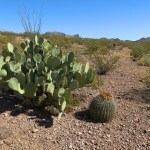
Prickly Pear Heaven
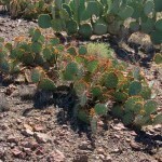
Until my knee gave out on me, I never had trouble finding big hikes that would produce interesting Dispatches! But now, I’m limited to canyon walks or traverses of level basins surrounded by spectacular peaks or rock formations – most of which are across the border in Arizona. This Sunday, I wanted to explore a beautiful area of buttes and bluffs that I’ve driven by many times. It’s all unprotected cattle country, but I’d seldom seen cattle there. Access was a big question – the map shows a few dirt roads crossing it, but I had no idea whether my low-clearance 2wd pickup would handle them.
The road I was hoping to use turned out to be long-abandoned and blocked by catastrophic washouts and rockslides, but a few miles past it I found a rocky ranch road that the truck could just barely handle.
The two-lane highway skirts the edge of the shallow basin, and the ranch road took me down to where a dead-end side track branched off. I drove that only a short distance lower into the basin – searching for the abandoned road had used up almost a half hour and I really wanted to get out and start walking.
After yesterday’s winter-like storm, today’s sky was crystal clear, the air was still, and the temperature at this elevation – around 4,000 feet – was forecast to be in the 70s all day. Much warmer than it should be for this time of year.
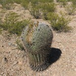
I set out for the nearest butte, across rolling desert terrain cut by shallow arroyos, featuring big honey mesquites alongside big catclaw acacias, with an understory of junipers, creosote bush, barrel cactus, prickly pear, ocotillo, palo verde, and various shrubs. A diverse paradise for lovers of desert vegetation. As with other areas I’ve explored nearby, the arroyos here often expose bedrock, and although the ground was already bone dry, yesterday’s storm had left hundreds of small tinajas – water pockets – in that bedrock.

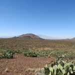
The dry wash I was following turned away from the butte, so I climbed a shallow rise into the next watershed, and found a picturesque little box canyon at the foot of the butte. Crossing the head of that, I traversed the shoulders of the butte northward to get a view of the northern part of the basin. Big prickly pears surround the butte, creating an obstacle course that was sometimes almost impassable, but it was all so pretty I didn’t mind. My only regret was the lack of clouds – I’ve passed this area when cloud cover made it look more epic than it is – almost like Monument Valley in Utah.
Eventually I turned back. I needed a little more mileage, so when I reached the head of the box canyon I turned upstream. This proved to be a good choice – the arroyo led me over more spectacular bedrock formations and into the eastern part of the basin below more rugged rock bluffs. I saw a phainopepla and flushed a covey of quail and several ground squirrels.
I’d seen dry cowpies and cattle tracks that were probably a few weeks old, but thankfully no bulls! The basin was shallow enough that if there had been cattle here, I would’ve seen them from far away.
By the time I returned to the truck I’d gone less than two-and-a-half miles, and my knee seemed to be doing okay. I’d been careful to stop and stretch several times, walking slowly and mindfully on the gentle descents.
My next destination was the restaurant in the village I’d passed on my way here. It was packed with local ranch families, but thankfully they have one small table by the door, which just seemed to be waiting for me. I ordered enchiladas and turned to see if there was anyone I could talk to, but they were all immersed in Sunday gossip. These are rural Trump voters – but not the hillbilly types, unemployed and addicted to opioids, that the media seem to love. These hardworking country people were in their best Western wear for church, the men wearing different shades of cowboy hats.
Locals came and went, nodding and smiling at me as they passed. As I was finishing up, a stooped man walking with a cane, who couldn’t have been much older than me, turned on his way out and said “Have a wonderful day, young man!” I don’t hear that much anymore!
Unfortunately by the time I got home my knee was hurting more than at any time since the pain started, last May. At this point, I’ve spent nearly six months icing, elevating, compressing, resting, and doing recommended exercises and stretches. And now, with frequent travel back east, it’s impossible to maintain a rehab routine. Guess I’ll just have to be content with sightseeing instead of hiking, and look for other ways to reduce my stress.