Max Carmichael's Blog, page 3
July 28, 2025
Hard Driving
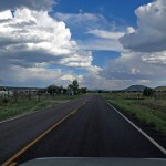
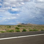
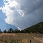
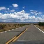
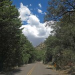
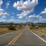
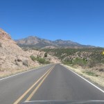
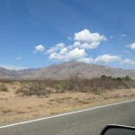
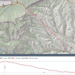
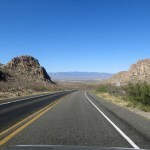
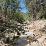
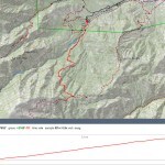
Rain and mild temperatures were forecast for next week, but this weekend was due to be hot. There was one last high-elevation refuge from the heat that I hadn’t tried this summer – partly because the drive is so hard I’d sworn never to do it again.
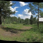
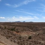
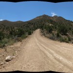
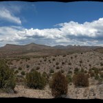
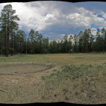
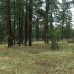
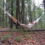
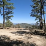
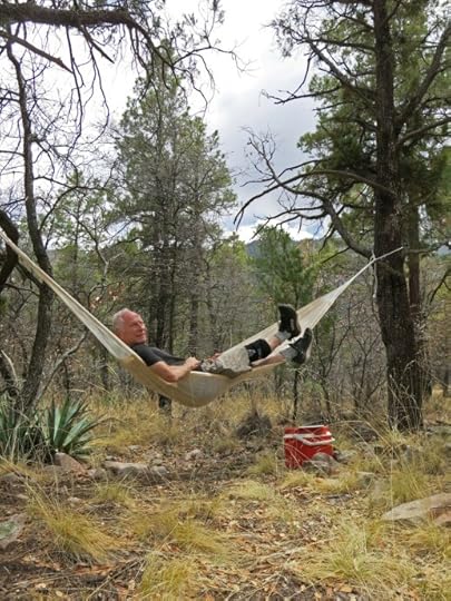
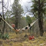
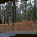
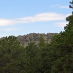
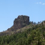
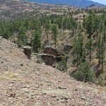
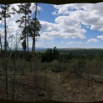
It starts by fording the river – usually flooded after a season of good precipitation – at an elevation of 6,300 feet, and ends at an old cabin used by the Forest Service on the crest of the range at just over 9,500 feet. The cabin sits among pines, Douglas-firs, and aspens above a grassy meadow, so I imagined stringing my hammock and enjoying a cool breeze as monsoon clouds sailed above.
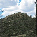
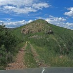
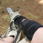
Previously, I’d parked further down and walked the last 3 miles of the road. The trail to the 10,165 foot peak begins near the cabin, and I’d wanted a longer hike to the peak. Not happening with this knee immobilizer.
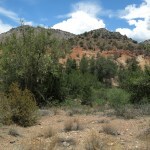
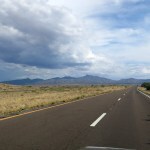
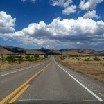
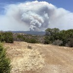
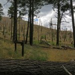
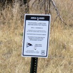
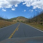
I’ve been so preoccupied, I forgot that this year’s wildfire had reached and crossed the highway near the turnoff. As I approached, I began seeing isolated pines with brown needles and wondered if it was fire or drought. At the turnoff, the forest on one side of the highway had been killed by hot surface fire but not burned.
Part of me regretted not being able to explore this changed habitat I knew so well before. But I was on a different mission.
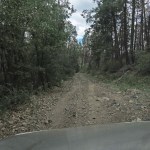
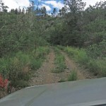
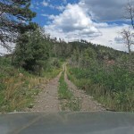
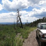
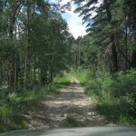
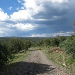
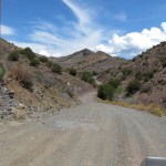
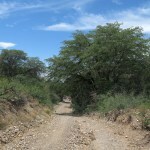
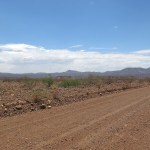
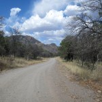
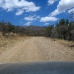
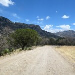
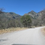
The river was dry, but there was flash flood debris on the highway and all around. It will take a lot more than sporadic cloudbursts to keep the river flowing. On the dirt road, past the cabins in the foothills, I pulled over to deflate my tires. The first time I drove this road I hadn’t thought of that and nearly had a nervous breakdown from the hammering suspension.
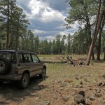
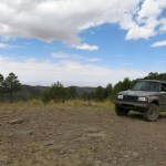
And now I had my fancy new lifted suspension, so I came with no fear of banging and scraping the undercarriage, and wouldn’t have to slow and stress over finding the best line over the bedrock.
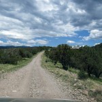
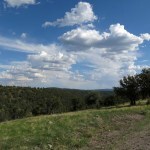
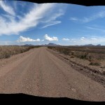
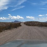
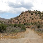
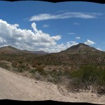
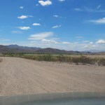
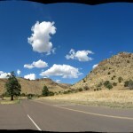
But that part starts eight miles in and 1,300 feet higher. For now, I could enjoy the gravel surface winding up to the mesa, and the long straights on top, and the lower tire pressure made even the rocky grades relatively comfortable.
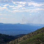
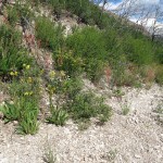
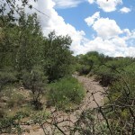
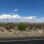
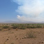
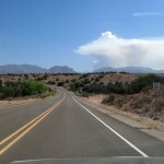
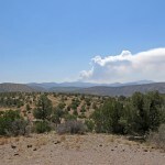
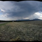
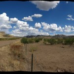
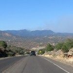
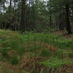
I always tell people our habitat turns to Ireland in a good monsoon, and I was surprised to find it had already done that in these foothills. I was also surprised to see a smoke column indicating active burning in a wildfire that started almost three weeks ago in roadless and virtually inaccessible mountains northwest of town – despite sporadic rains ever since.
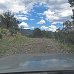
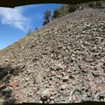
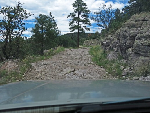
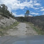
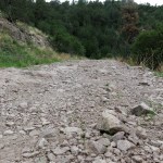
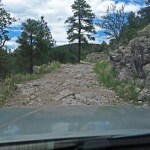
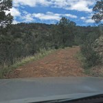
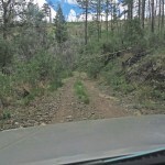
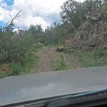
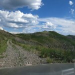
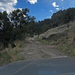
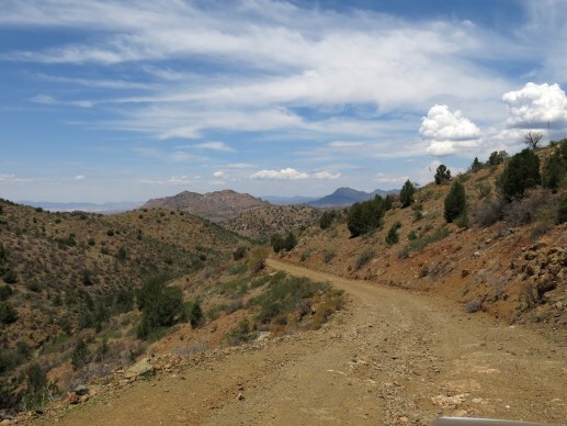
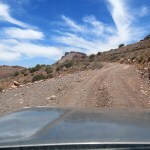
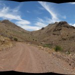
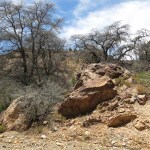
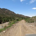
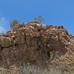
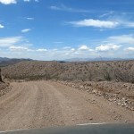
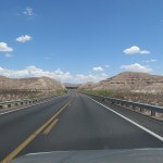
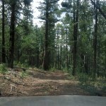
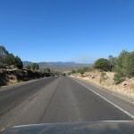
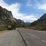
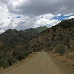
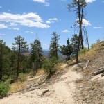
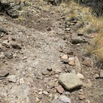
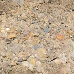
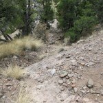
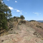
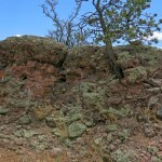
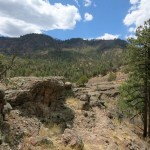
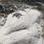
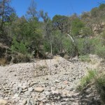
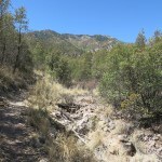
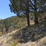
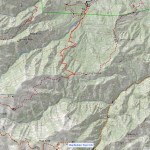
Eight miles back, the road crosses a saddle, changes from gravel to bedrock, and begins traversing down into a canyon. The bedrock is rough and sharp and the edge of the road drops off hundreds of feet into the canyon bottom. Partway down is a little sign memorializing two guys who drove off.
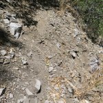
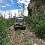
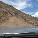
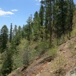
That stretch, which you only survive by driving at walking speed, descends less than a mile and a couple hundred vertical feet. And beyond is where the main trial begins: the eight-mile ascent of 2,100 vertical feet, much of it on bedrock.
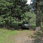
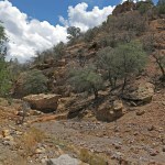
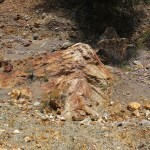
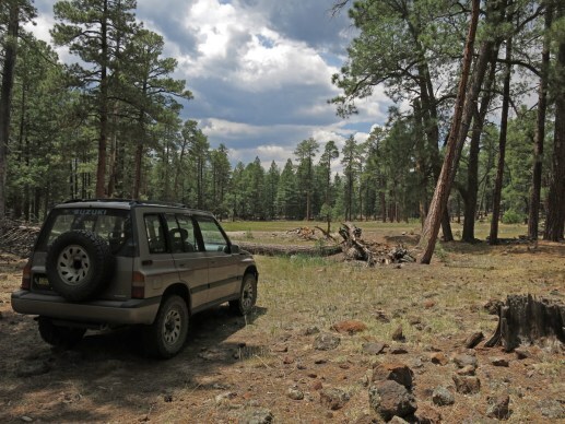
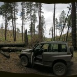
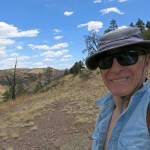
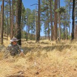
Apparently my memory is incapable of storing and accurately reproducing just how difficult this road is. Because despite driving most of it twice before, I couldn’t believe how bad it was – walking pace only, less than 5 mph, climbing over ledges and rocking back and forth over long series of boulders. I spent much of the drive stopping, getting out, and trying to capture how bad it was in photos. The air outside was definitely cooling with elevation, but the high roofline and big windows make my vehicle like a greenhouse. I had to run the A/C, and every time I got out, I felt like I was being grilled alive by the heat coming off the engine compartment.
The Sidekick did great – as far as I can tell. It’s finally fulfilling its potential as an off-road vehicle. Unlike before, I wasn’t worried or stressed at all. But with all those stops, the clock was ticking and I realized that if I made it to the end, I would just have to turn around and drive back down. No hammock, no gentle breeze, no admiring the cloud formations. And that little engine, laboring to keep the A/C going, would ironically have me drenched with sweat by the time I got there.
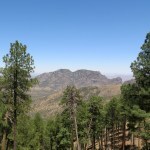
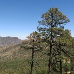
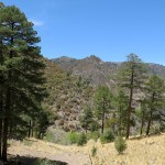
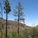
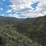
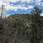
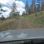
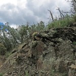
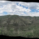
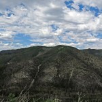
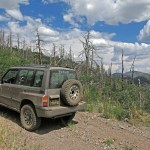
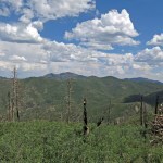
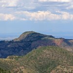
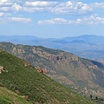
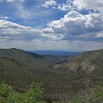
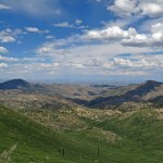
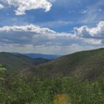
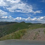
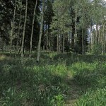
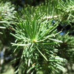
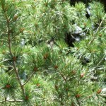
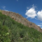
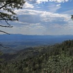
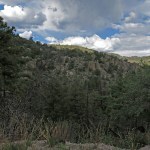
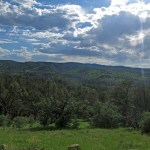
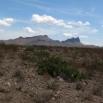
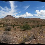
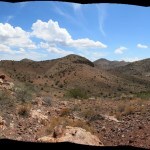
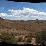
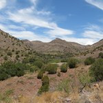
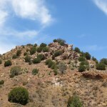
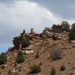
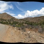
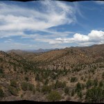
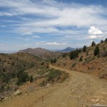
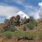
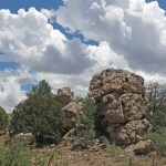
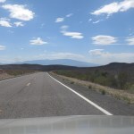
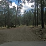
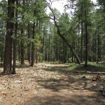
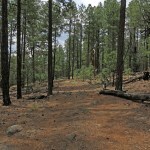
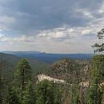
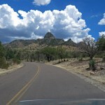
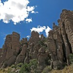
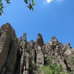
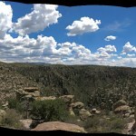
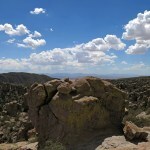
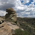
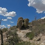
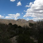
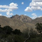
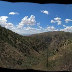
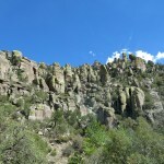
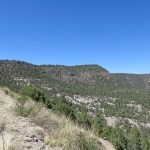
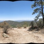
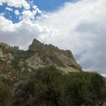
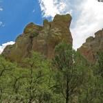
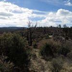
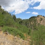
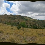
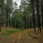
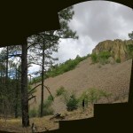
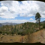
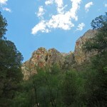
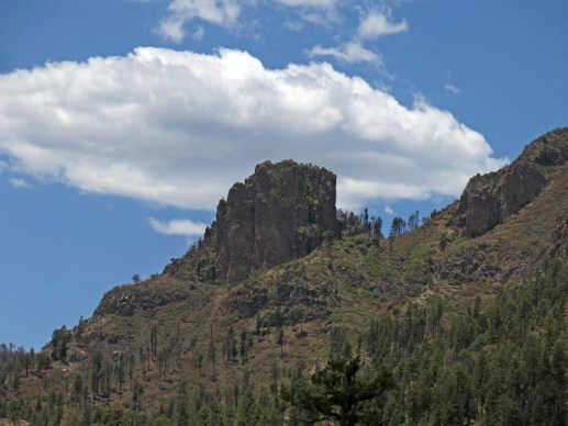
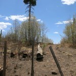
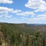
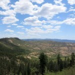
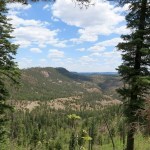
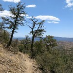
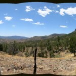
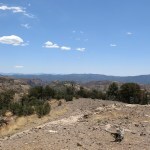
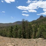
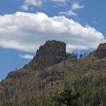
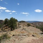
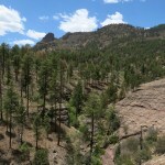
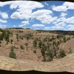
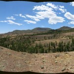
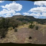
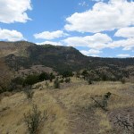
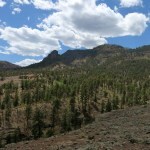
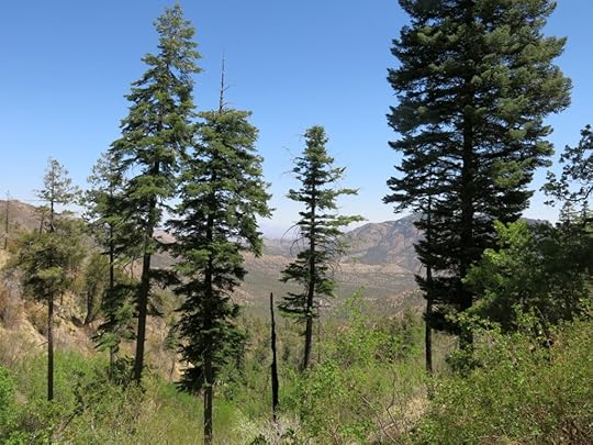
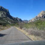
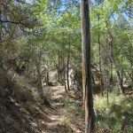
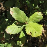
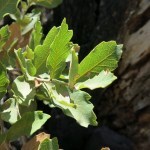
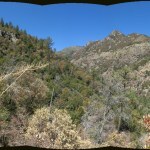
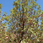
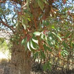
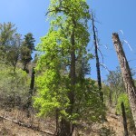
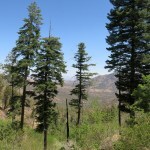
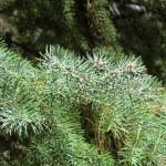
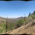
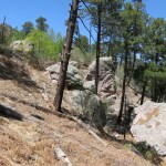
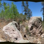
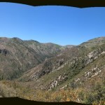
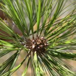
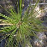
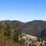
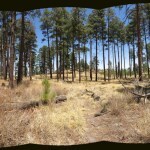
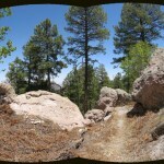
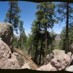
You climb through and above a spectacular landscape, with seemingly impossible slopes and rock outcrops jutting among the tall pines, like something out of a classical Chinese painting. Pinyon pine coexist with Gambel oak and ponderosa pine almost up to the 9,000 foot level, where the spruce-fir-aspen forest begins.
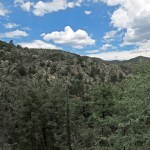
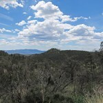
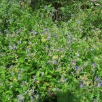
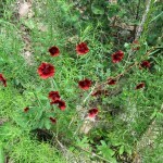
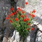
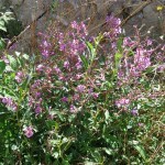
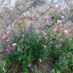
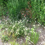
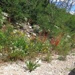
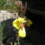
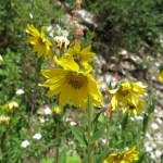
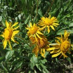
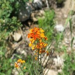
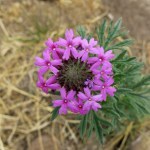
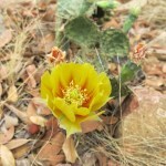
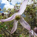
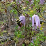
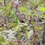
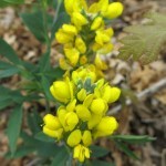
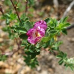
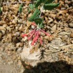
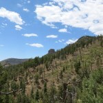
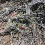
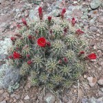
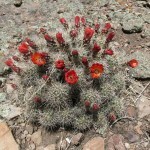
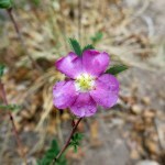
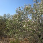
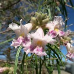
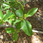
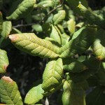
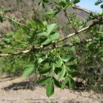
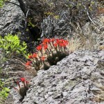
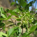
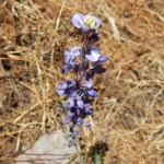
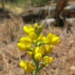
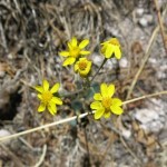
Above 9,000 feet, you skirt the edge of the burn scar from the massive 2013 Silver Fire – resulting in spectacular views of a different kind. And here, the bloom began, with some flowers I can’t remember seeing anywhere else.
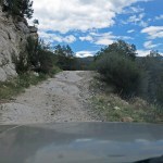
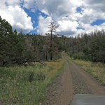
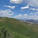
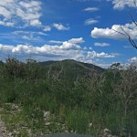
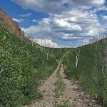
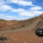
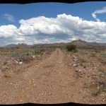
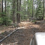
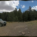
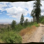
The road mostly levels out and leaves the solid bedrock surface behind, becoming a seldom-used, overgrown two-track on a rock-and-gravel mix which allowed me to speed up to 15 mph, in short stretches, for the first time in over an hour – although still with a lot of bouncing. And then I would reach a fallen tree, or boulder, and have to skirt around it.
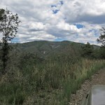
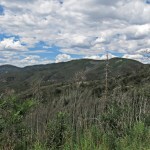
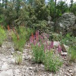
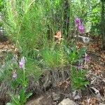
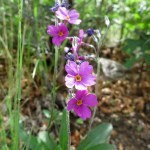
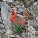
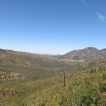
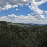
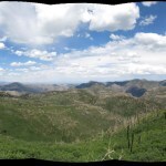
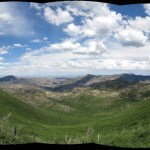
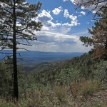
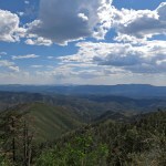
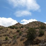
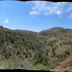
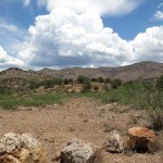
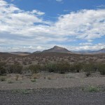
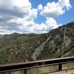
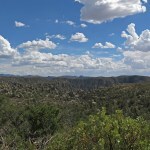
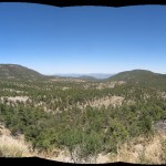
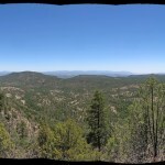
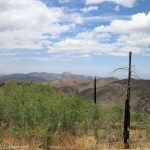
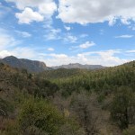
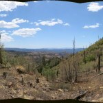
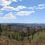
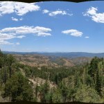
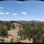
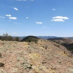
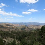
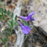
I drove past the farthest point I’d reached before, and traversed the divide of the range from west to east, getting spectacular views over the eastern watershed, with its rock fins, vast bowls lined with virulent, impassable post-fire locust regrowth, and undulating cloud shadows. And more roadside flowers, so more stops and more engine roasting.
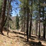
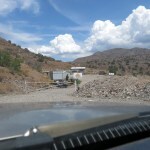
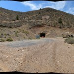
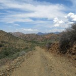
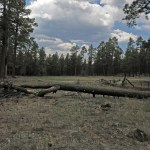
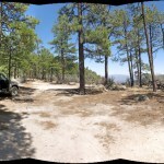
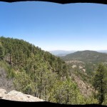
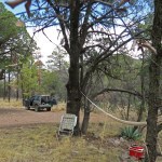
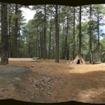
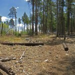
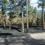
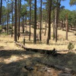
The last stretch is a rollercoaster along the fire-stripped and regrown crest to the small old-growth forest around the cabin, saved from the wildfire.
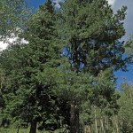
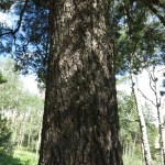
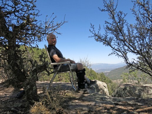
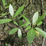
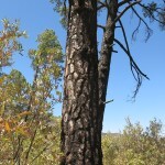
Having recently begun learning our mountain trees, I was pleased to recognize an old high-elevation pine twinned with an apparently same-age doug fir next to the cabin, offering a shady spot for my vehicle. Over 90 in town at 6,000 feet, it was in the high 70s here. Perfect campsite if I’d been prepared for bears and didn’t have work tomorrow.

It was already an hour later than I’d hoped to turn back. Yes, I could drive faster downhill, but although I made fewer stops, with a different view now I couldn’t resist taking more pics.
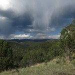
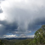
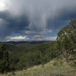
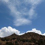
The steep descent on bedrock was easier, and again, devoid of the scraping, banging, and stress me and the vehicle had suffered previously. I’d hoped for rain, and had snagged a few drops on the windshield, but I had to settle for cloud formations.
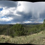
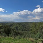
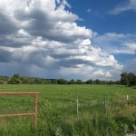
When I reached the mesa, the emerald green of the grassy slopes again waylaid me, and turning back toward the crest, I saw hallucinatory rain clouds. How lucky we are to live here!
By the time I got home, I’d spent five and a half hours, mostly driving – 104 miles out-and-back. I was glad I did it while hoping never to do it again. But how could you go wrong in a place and at a time like this?


July 21, 2025
Hidden Treasure
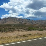
For months, I’d been studying topo maps of mid-elevation mountains straddling our border with Arizona. One of my most memorable hikes had ascended a dramatic rock spire at the edge of that range. I approach it from the south, where it begins in low hills beside our famous river. Trending north, these hills get higher and rockier, peaking at 6,555 feet. Then, with no topographical interruption, the mountains get a new name, continuing north, gaining another 500 feet in peak elevation, until the mountainous area spreads and eventually acquires two or three other names.
The southern part is all cattle range and can only be accessed by long gravel roads up a vast alluvial bench lined with creosote bush. The maps show that the mountains themselves were mined extensively in the past, resulting in a bewildering maze of mine roads and 4wd tracks. Where the southern mountains transition into the higher northern mountains, there’s a small wilderness area containing a box canyon with cliffs nearly a thousand feet tall. This area is so far off the radar of hikers and outdoor enthusiasts that the only info I could find online was from the 2009 trip report of a prolific hiker from Phoenix, more than 200 miles away. His photos were spectacular.
But he didn’t provide clear directions on how to get there. My mapping platform suggests that you can drive over the range from south to north, but doesn’t show any side roads leading to the box canyon. Older topo maps show 4wd tracks approaching the mouth of the canyon from two directions, but I suspected all those old roads and tracks, built decades ago for now-abandoned mines, would be sketchy at best. There was only one way to find out.
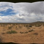
The high temp at home was forecast to be in the mid-80s, but in monsoon season clouds or even rain can cool things off quickly. Not knowing the quality of those roads, I had some concern about clay turning to deep, sticky mud. The ranch road up the alluvial bench leaves the paved highway at an elevation of 3,700 feet, where the high would approach 100 degrees, but the road across the mountains tops out closer to 6,000 feet, where afternoon temps should be comfortable, and hopefully I would find a shady spot to hang out.
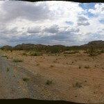
The road up the bench was well-graded and the gravel fine enough that I didn’t even have to deflate my tires, until it entered the foothills and became rockier.
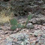
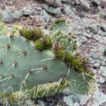
The line of outlying peaks, all of which I dream of climbing, features spires of solid rock at their crests, and with the growing monsoon clouds behind them they looked even taller and more dramatic. The slopes here are dotted with small junipers and honey mesquite. The road got rockier, and I deflated my tires for a softer ride, but I was surprised to find that the surface remained well-maintained and wide enough for two vehicles in most places, looking more like one of those touristy “backcountry scenic drives”.
As I approached a blind rise, a 2-person UTV suddenly shot over the rise toward me, going so fast it almost left the ground, then corrected at the last minute to miss me by inches. I waved to the driver and passenger, but they had their hands full avoiding a wreck. That turned out to be the only other vehicle I passed in two hours of traversing the range.
The views got better the farther I went. After winding past the first line of rocky peaks, I entered an area of interior basins lined with colorful rock and lusher vegetation. The washes hosted coyote willows and even small stands of narrowleaf cottonwoods. I could see a lone ranch back up the nicest-looking side canyon. You could see the potential for washouts whenever the road crossed a wash, but, again to my surprise, the county was clearly maintaining this as an essential right of way.
Based on the topo map, I’d expected to have difficulty sorting out a maze of roads, but on the ground, there was only one through road showing the lion’s share of vehicle tracks, with only an occasional little-used side road. And the main road eventually began climbing toward the peak, where I encountered a shocking spread of mining facilities, installations, equipment, ruins, and debris from several generations going back to the nineteenth century, and apparently still in use.
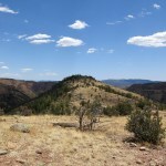
Past here is where the next named mountain range began. The north slope of the peak was lined with pinyon pine, the mountains ahead were both higher and more forested, and the views even more spectacular. I had stumbled upon hidden treasure, a beautiful, unexpected, remote landscape almost in my backyard.
Beside precipitous drop-offs, the road descended steeply from the peak into a hidden valley lined with rocky ridges, with monsoon clouds still building to the east and south.
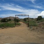
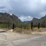
At the bottom of that hidden valley, a lush basin appeared on my right, stretching back to the base of the taller mountains. I passed a ranch road blocked by a tall, fancy gate, then the road plunged across a wide, deep wash, with the ruins of another ranch on the opposite bank.
The road continued north on the bank of that big wash, which hosted a canopy of tall sycamores and narrowleaf cottonwoods. Rounding the foot of an outlying ridge, I came to another ranch road blocked by a gate with an even fancier and more unlikely arch. I began to suspect the hidden area had actually been discovered and colonized by rich folks, but when I looked it up later, I learned this is a Buddhist retreat center. And according to the old topo maps, it’s also the route to the box canyon – now privatized by monks?
Throughout this stretch of road, I had been expecting to find a turnoff for the box canyon, and I had stopped repeatedly to study my topo maps, but they only left me more confused. On the entire drive, I hadn’t found anyplace shady to pull over and hang out, so all I could do was keep going. It was such beautiful country, I could hardly complain.
Eventually the road left the mountains and began crossing the alluvial bench back toward the river valley, upstream of where it had started. I returned to the Mormon farming village and had a late enchilada lunch, then decided to continue east to spend the night in the railroad town on the interstate.
The next phase of the drive took me past more favorite high-desert hiking areas, down into the low-desert river basin at under 3,000 feet, and finally back up through foothills of the tallest sky island, to arrive at 4,200 feet in the railroad town. A big loop, a lot of driving on a hot day, but rewarding. I feel like I’ve still only scratched the surface of those hidden mountains, and will be back for more.
July 13, 2025
Dream Mesa
So far, our monsoon has brought more lightning than rain – starting new fires, including a big one at the north edge of the wilderness.
I wanted to explore the little-known mountain range, a couple hours north, that I’ve become obsessed with. But the smoke from the fire, blowing west, monopolized my attention on the way up.
By the time I’d finished lunch in the village, the northern sky was darkened by a storm cloud.
At the turnoff in the high pass, I checked my tire pressure and found that warm weather had added ten pounds, so I deflated them to 18 psi for the drive up the rocky road to the forested crest. That made the ride much more pleasant.
At the crest, there’s a fork leading west across the mesa. Since it’s forested, I’d never been able to visualize the landscape, which ranges between 8,200 and 8,700 feet elevation. The topo map showed something called “Dave Lee Lake” just off the road, less than a half mile from the junction. But I’d checked the satellite view at home, and the “lake” appeared to be a typically-dry stock pond.
The storm clouds alternating with patches of blue sky turned this forested mesa into a dreamlike landscape. The high was forecast to reach 90 at 6,000 feet, but here, almost 3,000 feet higher, it was in the 70s. And as on previous visits, I had this small mountain range all to myself.
The road began to climb, as I kept watching for the lake to my left. There appeared to be an opening in the trees down there, so I turned back and followed a meandering track through the forest, past several empty campsites, until a broad meadow appeared ahead, blocked by a fallen tree trunk. The lake turned out to be a natural alpine meadow – one of many on the crest of this range – which would’ve originally featured a vernal pool, but had been dammed at some point to create a stock pond.
Despite the low dam and dry pond lined with cracked mud, it was a magical place, especially under those brooding clouds. I couldn’t believe I had it to myself on a weekend afternoon, only a couple miles off the highway.
I could’ve hung out there, but I’d only scratched the surface of this mesa and wanted to follow the road farther west. Many of the trees bore red blazes or ribbons, apparently part of a Forest Service survey, but other than that, I saw no traces of other visitors. The farther I went, the more tracks I found branching off into the forest. The north slope was dark and dense with Douglas fir. I followed what seemed to be the main track for a couple miles, driving down, up, and around, glimpsing what appeared to be a vast canyon off to the west. I still couldn’t get a sense of the landscape, but these branching, meandering forest tracks could become really confusing. The tracks became rougher and rougher, with deep pools of muddy water I preferred to bypass, and eventually I turned back.
On the north slope among the firs, I’d passed a turnoff to what I assumed was more empty campsites. But when I returned and tried it, I found another track, overgrown and seemingly abandoned, leading steeply down through the forest. I drove down it, and eventually came out in a saddle. From there, the road climbed steeply up onto a ridge, but there were big boulders embedded in the slope, so I stopped and got out to lurch up there in my knee brace and scout the way forward. The track clearly continued out the ridge, but my time was running out. I decided to return to the turnoff and hang out there in the shade.
I strung my hammock between a couple of firs and laid there listening to the wind in the trees – the only sound up here on this mesa, 45 minutes from the nearest human settlement, an hour from the nearest town, six hours from the nearest city. The wind pushes into the forest, the trees dance with the wind.
It took me more than fifteen years to discover this place, two hours from my home. Despite the old dam, I’d seen no sign of cattle anywhere on the mesa. Old topo maps show that despite the maze of forest tracks, most of the mesa is roadless, including the entire western half leading down to the river. There are no hiking trails, but in the parklike forest, devoid of undergrowth, you could hike all over without running into any sign of human life.
Along the forest road and backcountry tracks, there are dozens of beautiful, secluded campsites with fire rings, informal and unmarked. But in a half dozen trips over the past few years, I’ve never seen anyone camping here. It’s like a dream come true, but there are dangers – trees often fall across these forest roads and tracks, so it’s possible to get blocked or even trapped.
From the drive back, I could see it was raining over our high mountains, and presumably over the big wildfire. But I only got a few drops along the way.
July 7, 2025
Rocks in the Clouds
Two months ago I visited this national monument to hike. Today I came just to drive around and look, and hopefully find someplace in the shade to string my hammock. Our monsoon started early, a couple of weeks ago, but as the old timers predict, a monsoon that starts early is likely to fizzle out. So we’re back to scattered, teasing clouds and hot days.
The high was forecast to be 90 at home, and the monument ranges from nearly a thousand feet lower to nearly a thousand feet higher. In my experience, public lands include lots of informal places to pull off the road and hang out, and the official map shows three picnic areas at the monument’s highest elevations, where I would surely find trees and shade.
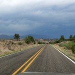
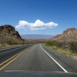
The paved highway to the monument sees only sparse traffic, is laid out like a rollercoaster, and is minimally maintained, so that if you drive at the posted speed limit of 65 mph, you’re likely to be pitched off violently by one of many crudely patched potholes. Fine with me – helps to keep the riffraff out of this beautiful landscape.
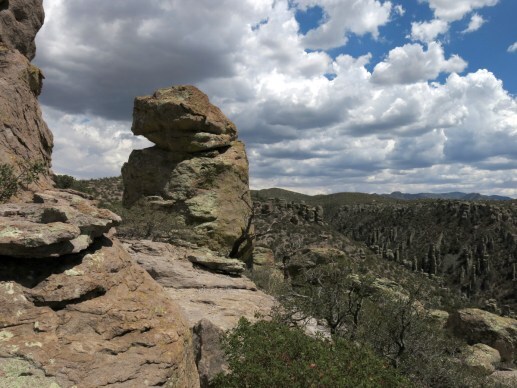
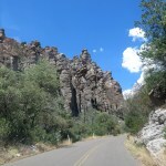
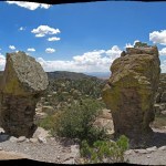
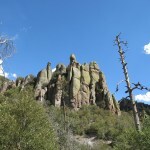
As before, the gatehouse at the monument’s entrance was unoccupied, so admission was free. This is one of the smaller holdings in the National Park Service empire, encompassing two short canyons lined with a bewildering, seemingly infinite profusion of rock cliffs and towers. From the old stone Visitor Center at the confluence of the canyons, the narrow paved road leads up the northern canyon under some of the most spectacular rock formations on earth.
Surprisingly, there are only three or four widely-separated turnoffs, each is only big enough for one vehicle, and all are overhung by sycamores or Arizona cypress, so none of them offers a view of the rock formations. But I did enjoy the familiar dark, somber quality of dense, pure cypress stands in the upper canyon.
After less than three miles of this, the road suddenly crosses into the next watershed, and begins climbing to the crest through an old, high-intensity burn scar with expansive views east – which you can’t really enjoy because there’s a sheer drop-off and no places to pull off the road.
And suddenly you’re at the monument’s 6,900-foot crest – which itself tops out 3,000 feet below the crest of the range, which you can barely glimpse, five miles away to the south. From here, a small network of crest roads leads to the three picnic areas. Each features a single picnic table, surrounded by parking for up to twenty vehicles. Strange.
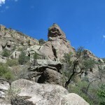
There are wind-stunted trees, but virtually no level ground. No one was using the single picnic tables, but I could find no secluded place to string my hammock. I stopped first at the famous canyon overlook, but there were no immediate views – you had to hike down a trail. People would drive up, park, get out, glance around in frustration, get back in, and drive away.
Wearing my knee immobilizer, I carefully lowered myself down a series of rock ledges to get a view over the big southern canyon and its maze of rock formations. It was even more pleasant up here than I’d expected – barely 80 degrees and breezy – and the clouds were glorious. That plus the relative solitude made up for the monumental effort of clambering around with one leg rigid.
From there, I drove to the other two picnic sites, both empty. Beautiful up here, and with elaborate hiking trails constructed with monumental effort by the long-lost Civilian Conservation Corps. Trails that were empty on this summer weekend. And no place for me to hang out.
As I drove back down the northern canyon, passing no other traffic, I realized I’d seen only about a dozen visiting vehicles during the two hours I’d been inside the monument. Sure, it was a hot summer day – peak season is probably spring and fall. But even stranger, I’d seen no park staff – not even a single official vehicle. Everything within the monument boundaries was spotlessly clean and well-maintained – where was the staff on this weekend day?
A now-unfathomable level of effort was put into building recreational facilities here, nearly a century ago. It remains a spectacular place for short hikes on high-traffic trails, if that’s your thing. But it’s no place for a picnic, and there’s only one small campground in the canyon bottom. Maybe the lack of places to hang out reduces the need for staffing and maintenance.
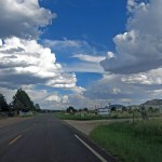
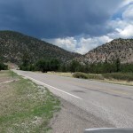
On the drive back to town, clouds all over the landscape were trying to become storms, and mostly failing. I did get a few drops on the windshield once.
June 22, 2025
Vacation From Wildfire
Yes, I realize that on the national and global scale, the news is terrifying. But in remote southwest New Mexico, we have worries that may never make the national, let alone the global, news – and we hope to keep it that way.
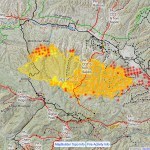
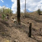
During the nineteen years I’ve lived here, we’ve had three large wildfires in the mountains just north of town, which rise to 9,000 feet in elevation and are covered with mixed conifer forest dominated by ponderosa pine and Douglas-fir. Strangely, the fires have been separated by exactly five years: in 2015, 2020, and now 2025. Each fire has started within fifteen miles of my home, growing to consume habitat I hike regularly, destroying places that are special to me.
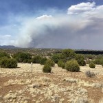
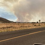
But the fire that started just over a week ago has become by far the biggest – and in fact, the most dangerous in the entire country at this time. Firefighters and equipment have been moved in from all over the U.S. Thousands of people have been evacuated from nearby rural communities. In town, we’ve watched the apocalyptic smoke column towering above our skyline, the helicopters and jet tankers shuttling back and forth from the Forest Service fire station at our county airport. Our phones have buzzed with evacuation alerts, and the latest evacuation zone was created only two miles from my mom’s assisted living facility. The fire’s most active front is burning toward town in fire-adapted forest that has never burned within historic times, and is currently the driest vegetation in the U.S.
Calling my mom’s privately-owned facility to ask about their evacuation plan, I was told by the owner that they don’t have one – families are responsible for moving their loved ones to safety. Slowed by my knee-immobilizer brace, I made a rough inventory of valuables in my house, and shifted empty boxes up from the basement to carry irreplaceable documents and artwork.
With the “incident team” growing to over 1,400 people, the fire still showed zero containment after the first week. But on Friday, they finally claimed 11 percent containment, and the incident commander said that they’d bulldozed lines around the entire perimeter and were planning to restore power and begin allowing some of the evacuated back to their homes. They described a huge effort to protect structures throughout the vast area, and continued to claim that no structures had been damaged.
Friday afternoon, I drove my mom to the edge of town to see the smoke column. I figured, and hoped, that she might never have the chance to see something like this again. I wouldn’t have considered showing it to her a few weeks earlier, but her chronic anxiety has subsided, and she appreciated the opportunity to experience this awesome vision of nature’s power.
Throughout the week, I followed the fire’s advance online – hour by hour – via several apps, discussed it with neighbors, and attended community meetings. By the following weekend, the danger was reduced, but the fire was now burning through some of my favorite places, destroying more of our last remaining old-growth alpine habitat. I was a wreck.
There was a place northwest of town where I’d always wanted to picnic or camp, a ledge in ponderosa forest atop a ridge a thousand feet tall, overlooking the north end of our wilderness. I’d just learned that a brew pub had recently opened in the village nearby. Unlike the two existing restaurants, it stayed open Sunday evenings, and I wanted to check it out.
I arrived at noon and was the third customer. The owner, a big bearded guy, latched on to me and told me his story. I was shocked to discover he had ten beers on tap, but only one was an ale. Every other craft beer joint – and I’ve been in hundreds – carries half ales and half lagers. His explanation was that he’s burnt out on ales, and doesn’t care what the customers want.
But it got worse. He said his menu consists of Italian dishes – rather than pub favorites or Mexican food (which the village lacks and needs). Not because he’s Italian, but because nobody else here serves Italian food. Such is colonial culture on Turtle Island.
I had a salad, it was bland, and with no ales on offer, I won’t be returning.
My destination is a short drive up a dirt forest road from a pass on a remote stretch of highway – there’s no signage, and even after studying the map you’d never know it was there. With a high of 85 in town, up there at 8,300 feet it was in the 70s and breezy.

I unfolded my camp chair in a patch of shade on the rim and drank ice water out of my mini-cooler for a couple of hours, enjoying the expansive view and the occasional butterfly.
On the drive back, I mentally compared the pub owner with a motel owner in an alpine resort an hour further northwest. She runs scent diffusers in all the rooms, despite visitor complaints, because she likes the smell and doesn’t care what customers want. This is what you get off the beaten path – eccentrically selfish business owners.
I wasn’t looking forward to the return to town, where I would get the day’s first view of the current fire. It’s burning down an outlying finger of the crest of the range, about nine miles from the center of town now and still approaching. The forest ahead of it is what I was describing earlier – unburned in historical memory, and drier than anyplace else in the U.S. It’s also roadless, so it can only be fought with air drops, which are only marginally effective.
We’re expecting monsoon rain this week, but thunderstorms include outflow winds which could push the fire in new directions.
June 15, 2025
Slice of Rural Life
Since 2020, when we lost our local restaurants to COVID, I’ve been preparing all my meals at home. Imagine that, you city folks. Imagine being single and actually preparing every damn meal, every day. Yes, I can do it, and do it healthy. But although I now walk with one knee immobilized, and can’t hike, doc says I can still drive. So I try to get away on Sundays to someplace with both wild nature and a decent restaurant. One restaurant meal a week, prepared by somebody other than me, seems like a huge luxury.
This Sunday I learned that a cafe I like over in Arizona would close on Monday for lengthy renovation. It was forecast to be our hottest day yet, the air conditioning in my 30-year-old Japanese vehicle struggles to keep up, and the destination is lower elevation and would be hotter than home. But I was desperate, and driving our lonely highways helps clear my mind.
When I arrived, setting my watch back an hour, I discovered that all the indoor seating was taken – for the first time ever – so I had to sit outside, where it was nearing 100 degrees and a sycamore offered only spotty shade.
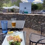
But they had a special brunch menu, and I ordered grilled trout with scrambled eggs and a regional IPA, at about half the price you’d pay in the city. The Canadian Grand Prix was just starting – a guilty pleasure – and I followed it on my iPad via the cafe’s sluggish wifi. Still hungry and wanting to hang out till the end of the race, I next ordered pancakes and an espresso.
Expecting the heat, I’d brought my old Yucatan hammock, and after the extended brunch, I drove up the canyon, nearly empty of tourists during summer, to a secret place, tucked away on a dead-end forest road too rocky for cars. I strung up the hammock in the sometime shade of a cloud and spent a couple hours reading, sweating, and drinking ice water I’d prepared at home and carried in my ancient mini-cooler.
Most of the southeast corner of Arizona lacks cell phone coverage, but as I drove away from the mountains, I began to get text messages on my flip phone from our electric utility. An outage had begun at my address at 2 pm and power was initially predicted to be restored after 5, possibly before my return. I wondered if I would lose the precious leftovers I had stored in the freezer. The closer I got to home, the more texts I received, delaying the resumption of service. No problem – I’m always prepared for camping, and I had canned chili and soup I could warm up on the old gas range without opening the fridge.
I was more concerned about the wildfire. It had started Friday in habitat I hike regularly, fifteen miles north of home, and by this morning it had grown over 12,000 acres, with zero containment. Nearing town, I could see the smoke obscuring most of the range just north of town.
Two blocks from my house, I passed the utility crews, blocking a side street with crane trucks and repairmen hard at work atop two power poles. Confirming my power was still out, I walked next door to check on my older neighbor.
In homage to Cormac McCarthy’s epic Western novel Blood Meridian, I call my neighbor The Judge – he retired a few years ago from a popular judicial career in the state of Texas. Similar to McCarthy’s judge, my neighbor is a large, nearly bald man, but the only other shared characteristic is his encyclopedic knowledge and storytelling acumen. In fact, people like my neighbor have shown me where McCarthy got many of the characters in his Western novels. Rural Texas and New Mexico really are full of eccentric, erudite, and interminable storytellers.
The Judge’s house was hotter than mine, and as we sweated and discussed the power outage, he recalled an episode featuring his former El Paso neighbor, a recent immigrant from Mexico. At home one hot summer day, the power had gone out, and with air conditioning disabled, everyone in the neighborhood escaped outdoors with cans of cold beer while crews worked to replace a blown transformer.
As soon as power was restored, the neighbor’s house began to pop and crackle, with lights flashing on and off, and the new transformer was quickly fried. It turned out the neighbor had hired an electrician from across the river in Juarez, and none of his house had been wired in compliance with the North American electrical code.
The El Paso neighbor was partners with his brother in a chain of botanicas north of the border. The brother, profiting from the superstitions of his fellow immigrants, became rich enough to buy a big ranch in Mexico and stock it with exotic wildlife from Africa.
The brother bred horses as food for his African cats, and one day, he drove out on the range, forgetting there was a leg of horsemeat in the back seat of his convertible. A lion smelled it, tore through the car’s soft top, and proceeded to eat the hacendado.
The Judge assured me he initially deemed this a tall tale, but was surprised to confirm it later on Wikipedia. Anyone wondering what inspired the cheetah scene in McCarthy’s movie The Counselor might likewise be surprised to learn that the truth is both stranger and more satisfying than Cormac’s fiction.
I returned next door to shower off the day’s sweat, but before turning on the water, I heard my fridge powering on – electricity had been restored. After my modem completed its lengthy startup procedure, I checked the satellite data on CalTopo, and saw that the fire had reached the eastern highway, with a hot spot on the far side. This would give it access to the vast Black Range, which had already lost most of its forest in two mega-wildfires since I moved here. Old burn scars can provide plenty of fuel for new fires.
Who Needs TV?
Since 2020, when we lost our local restaurants to COVID, I’ve been preparing all my meals at home. Imagine that, you city folks. Imagine being single and actually preparing every damn meal, every day. Yes, I can do it, and do it healthy. But although I now walk with one knee immobilized, and can’t hike, doc says I can still drive. So I try to get away on Sundays to someplace with both wild nature and a decent restaurant. One restaurant meal a week, prepared by somebody other than me, seems like a huge luxury.
This Sunday I learned that a cafe I like over in Arizona would close on Monday for lengthy renovation. It was forecast to be our hottest day yet, the air conditioning in my 30-year-old Japanese vehicle struggles to keep up, and the destination is lower elevation and would be hotter than home. But I was desperate, and driving our lonely highways helps clear my mind.
When I arrived, setting my watch back an hour, I discovered the indoor seating was all occupied – for the first time ever – so I had to sit outside, where it was nearing 100 degrees and a sycamore offered only spotty shade.
But they had a special brunch menu, and I ordered grilled trout with scrambled eggs and a regional IPA, at about half the price you’d pay in the city. The Canadian Grand Prix was just starting – a guilty pleasure – and I followed it on my iPad via the cafe’s sluggish wifi. Still hungry and wanting to hang out till the end of the race, I next ordered pancakes and an espresso.
Expecting the heat, I’d brought my old Yucatan hammock, and after my extended brunch, I drove up the canyon, nearly empty of tourists during summer, to a secret place, tucked away on a dead-end forest road too rocky for cars. I strung up the hammock in the sometime shade of a cloud and spent a couple hours reading, sweating, and drinking ice water I’d prepared at home and carried in my cheap, ancient mini-cooler (all my appliances are bottom-of-the-line vintage and the fridge has no icemaker).
Most of the southeast corner of Arizona lacks cell phone coverage, but as I drove away from the mountains, I began to get text messages on my flip phone from our electric utility. An outage had begun at my address at 2 pm and power was initially predicted to be restored after 5, possibly before my return. I wondered if I would lose the precious self-prepared leftovers I had stored in the freezer. The closer I got to home, the more texts I received, delaying the resumption of service. No problem – I’m always prepared for camping, and I had canned chili and soup I could warm up on the old gas range without opening the fridge.
I was more concerned about the wildfire. It had started Friday in habitat I hike regularly, fifteen miles north of home, and by this morning it had grown over 12,000 acres, with zero containment. Nearing town, I could see the smoke obscuring most of the range just north of town.
Two blocks from my house, I passed the utility crews, blocking a side street with crane trucks and repairmen hard at work atop two power poles. Confirming my power was still out, I walked next door to check on my older neighbor.
In homage to Cormac McCarthy’s epic Western novel Blood Meridian, I call my neighbor The Judge – he retired a few years ago from a popular judicial career in the state of Texas. Similar to McCarthy’s judge, my neighbor is a large, nearly bald man, but the only other shared characteristic is his encyclopedic knowledge and storytelling acumen. In fact, people like my neighbor have shown me where McCarthy got many of the characters in his Western novels. Rural Texas and New Mexico really are full of eccentric, erudite, and interminable storytellers.
The Judge’s house was hotter than mine, and as we sweated and discussed the power outage, he recalled an episode featuring his former El Paso neighbor, a recent immigrant from Mexico. At home one hot summer day, the power had gone out, and with air conditioning disabled, everyone in the neighborhood escaped outdoors with cans of cold beer while crews worked to replace a blown transformer.
As soon as power was restored, the neighbor’s house began to pop and crackle, with lights flashing on and off, and the new transformer was quickly fried. It turned out the neighbor had hired an electrician from across the river in Juarez, and none of his house had been wired in compliance with the North American electrical code.
The neighbor was partners with his brother in a chain of botanicas north of border. The brother, capitalizing on the superstitions of his countrymen and women, became rich enough to buy a big ranch in Mexico and stock it with exotic wildlife from Africa.
The brother bred horses as food for his big African cats, and one day, he drove out on the range with a horse’s haunch in the back seat of his convertible. A lion smelled it, tore through the car’s soft top, and proceeded to eat the hacendado.
The Judge assured me he initially considered this a tall tale, but was able to confirm it later on Wikipedia.
I returned next door to shower off the day’s sweat, but before turning on the water, I heard my fridge powering on – electricity had been restored. After my modem completed its lengthy startup procedure, I checked the satellite data on CalTopo, and saw that the fire had reached the eastern highway, with spotting on the far side. This would give it access to the vast Black Range, which had already lost most of its forest in two mega-wildfires since I moved here. Old burn scars provide plenty of fuel for new fires.
June 1, 2025
Immobilized
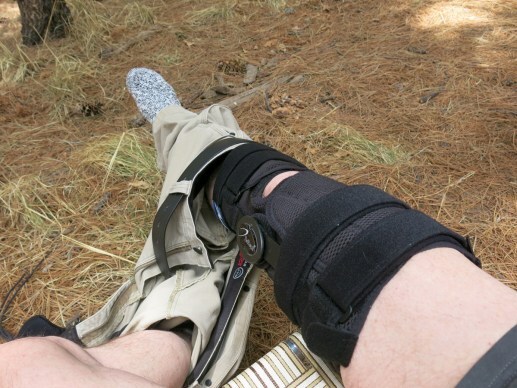
Turns out my knee problem was misdiagnosed, last summer, as merely inflammation – a closer look at the MRI shows an actual tear in the tendon that’s never been allowed to heal. My only chance of healing is to wear a knee immobilizer brace for at least three months, and give up hiking for six months.
I already gave up hiking for six months, from fall through winter, while I was traveling. But wearing this brace is going to be harder. I’m still partly in denial, partly in shock. I don’t even want to imagine what it’s going to be like.
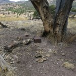
I asked the doc what about driving, and he said I could take it off, since driving mostly uses the ankles. So I did another road trip, over to the magical “pine park” in the sky that I discovered last summer. This is a lush meadow right below the 9,000 foot crest of the range, accessed via a very rocky track, surrounded by tall pines and Doug-fir. It’s a dark place at the foot of a dramatic peak, and I hadn’t really explored it last summer. I guessed there had been a campground below the meadow that was abandoned after the big wildfire in 2011. I’d seen rough tracks leading from the meadow down into the darkness of the forest, but those tracks looked too sketchy for my vehicle at the time.
Now, with my lifted suspension, I started following one of the tracks down into the darkness, and immediately came upon some cast-concrete picnic tables and the foundations of cabins. The farther I went, the more of these I glimpsed through the trees, farther down the dark slope. Apparently, before the campground, there had been something like a scout camp up here, with a dozen or so cabins.
There turned out to be a network of dirt tracks winding among the tall conifers, leading to more and more campsites. Two or three had been used in recent years, but none had been used much, because the vast majority of campers here use trailers, and there’s no way you could get a camping trailer down to the park now. Some of the campsites had been buried under deadfall. It felt like I’d stumbled upon the ruins of a lost civilization of campers – both spooky and idyllic.
At the farthest end of the old campground, I found myself driving up a rise, and came to a dead end in a little clearing on a knoll. I had a spectacular view of the west side of the crest, darkening under a rain cloud that was moving up from the south. As I was taking photos, sparse raindrops began to fall.

I’m only now discovering how rugged the west side of this range is. It gets few visitors compared to the more easily accessible east side. There’s an old network of trails, but they’re all abandoned and blocked by deadfall and regrowth. Of course, that makes the whole area really attractive to me – if I’m ever able to hike again.
Above the tall trees, I’d glimpsed the south slope of the peak above the park – rimrock at the top and a broad talus slope below – but to get a full view of it I needed to pull on the brace and carefully traverse a grassy slope over deadfall and embedded rocks. I almost lost my balance a couple times, but it was worth it.
Unable to hike, I still need to get out into nature. So expect a lot of road trips for the rest of the year.
The rain was just a brief tease, as usual this time of year. But the clouds on the way back down from the crest remained spectacular.
I had a burrito in the cafe as usual, and on the way back, stopped in the pass guarded by granite cliffs and boulders.
May 27, 2025
Back Country
On the eve of my birthday, driving north to some old favorite country I hadn’t seen in almost two years. Alpine habitat that would be cooler now that our weather at home is finally seasonably hot. An escape from problems at home.
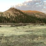
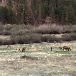
Needing a hike, planning another steep descent – this time into the remote, rugged, lonely country around a small river, a region that keeps drawing me. Passed roadside javelinas in their usual spot, a lone yearling doe on the shoulder, then in the high country of tall ponderosa, dark Doug-fir, grassy meadows and bright aspen, two dozen cow elk grazing in a likewise familiar roadside place. When you inhabit a wild landscape for almost a generation, you’re gifted with wisdom in the form of nature’s patterns.
Finding the trailhead unoccupied and the trailhead log unused since last fall, I set out on a trail invisible under a layer of pine needles. Woodpeckers cried and darted through the trees ahead. In openings in the pines the dirt of the trail showed the bootprints of one recent hiker, bigger than me, wearing fairly new boots. The trail climbed in and out of the burn scar of the 2011 megafire, gaining 400 vertical feet to a saddle where I suddenly crossed to the watershed of the remote river.

The sky had been cloudless during the drive north, but here in the mountains scattered clouds were forming. The other hiker’s tracks stopped at the saddle, so my trail was virgin ahead. Birdsong provided my soundtrack as I traversed down from 8,500 feet on a steep, rocky trail, first flushing a swallowtail butterfly out of the brush, then coming upon bigger and bigger patches of wildflowers and more pollinators. In a drought, the higher elevations always host pockets of fertility.
It was windy over here and I had to cinch my hat down – the dropoff was precipitous. At a patch of bare white bedrock, I saw a little saddle below me and realized I was at the head of the ridge the trail would descend. Descending it through forest that began to host pinyon and alligator juniper, I got my first views of the long, narrow ridge below – named for a horse, it did look like a horse’s back, ending in neck and head.
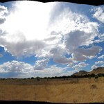
During the descent, I’d had a higher ridge, in shadow, at my right, but suddenly I reached a point where I could see past it, southwestward, to a towering, distinctive rock formation. And trying to get pictures of it with clouds in the background, I rediscovered clouds, which had been missing from my desperately dry region since last summer.
Clouds are the source of rain – not El Nino or the other global meteorological phenomena favored by scientists and TV weather people. Clouds are sacred beings we ignore at our peril. Here, their shade cooled me after stretches of exposure to sunlight.
And reaching the more level lower part of the ridge, I was continuously exposed, crossing big exposures of the fractured bedrock – volcanic comglomerate – I’d seen recently, east of this broad, rumpled valley. Here I found abundant but old sign of cattle, horses, and elk. And hazardous footing on occasional slopes of loose rock.
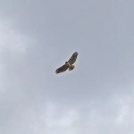
The bare rock ridge narrowed to just a few yards at a low saddle. Climbing past it, I noticed smaller birds – ravens? – harrying a hawk ahead. I’d stopped a lot and was worried about reaching my lodging for the night before closing time, so I stopped short of where I’d planned to turn back. Just at the base of the rise that formed the top of the horse’s head. I didn’t mind stopping – this had been a spectacular hike in spectacular weather. It’d taken me two hours and fifteen minutes to go just under three miles, downhill.
I spent even more time in the shade on the way back, and the wind was rising, too. I wasn’t looking forward to the ascent, but it turned out to be fine, taking less time than the descent.
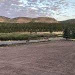
I’d reserved a room within the burn area of a large wildfire that had only been controlled within the past week, so I was anxious to see the damage. They’d stopped it precisely at the highway, and from what I could see it appeared to be a low-intensity surface fire.
Both elk and mule deer were out in the riparian meadows that evening. I wondered what had happened to the bighorn sheep whose habitat is totally within the burn area – presumably they’d sheltered in the river canyon, below its walls of sheer basalt.
May 19, 2025
Sky Island Trees
Gradually increasing my distance and elevation, the challenge was finding a hike with the right combination, plus a destination that made it interesting. For this Sunday, I picked a steep hike to a “pine park” – a shallow, grassy basin in the sky surrounded by tall ponderosa pines. This destination had the added bonus of a short extension into the next watershed, overlooking a spectacular canyon.
It’s a two-hour drive, and along the way, I found the desert willows were blooming beside the big arroyos.
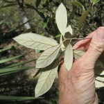
Over the years, I’ve gradually become more sensitive to species differences in the trees I hike past, and curious about their names. I’d picked up a field guide to trees a few weeks ago, and brought it along. It turns out I didn’t have the time to stop and identify trees along the trail, so I photographed their identifying features, and made the identifications from the photos later, at home.
Dangerous winds had been forecast all over the region, and my hat blew off as soon as I got out of the vehicle. The trail begins in a sycamore-shaded canyon bottom, bores through a long tunnel of scrub, then climbs steep switchbacks on loose rocks past alligator junipers and various oaks and pines.
At the base of a talus slope. the switchbacks end and the trail begins a steep traverse across the upper slopes of the watershed, through mixed conifer forest that now includes Douglas-fir. Eventually it joins another trail that leads through giant boulders to the pine park. Considering how parched the land is now, I was surprised to find wildflowers at the entrance to the park, in a narrow corridor lined with aspen seedlings.
I continued into the next watershed for the big view. Wind was howling through, so this lofty perch was no place to linger.
I rested in the relatively protected pine park for a half hour or so. But I was hungry, the hike was taking longer than expected due to the steep climb, and my lunch was waiting at the cafe below.
On the way up, I’d been surprised to see no tracks – either of humans or animals – on this well-known trail. But I had seen horse sign from last year, and on the way down, I noticed how the horses had damaged the trail, destroying tread on traverses of steep slopes.