Max Carmichael's Blog, page 19
March 19, 2022
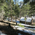
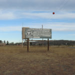
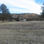
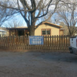
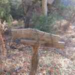
Protected: Casita Electrical Wiring: Workshop
This content is password protected. To view it please enter your password below:
Password:


Protected: Casita Renovation
This content is password protected. To view it please enter your password below:
Password:
March 14, 2022
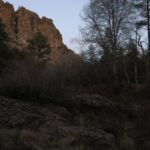
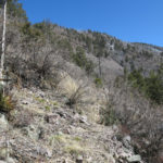
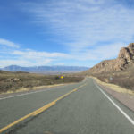
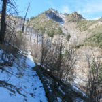
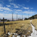
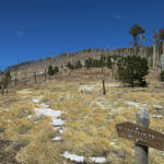
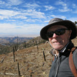
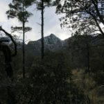
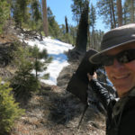
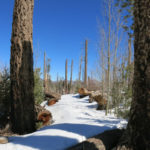
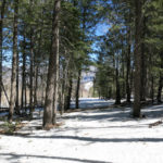
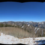
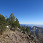
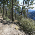
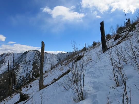
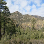
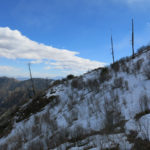
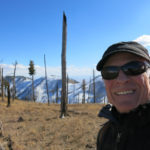
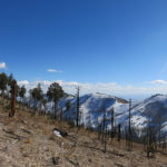
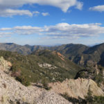
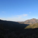
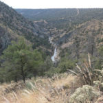
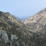
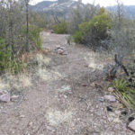
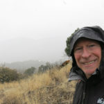
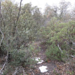
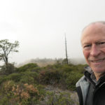
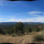
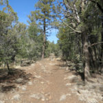
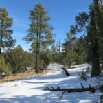
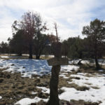
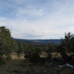
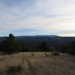
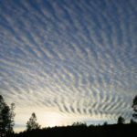
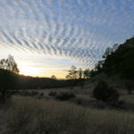
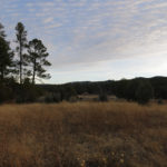
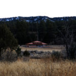
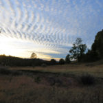
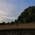
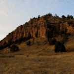
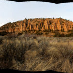
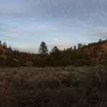
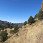
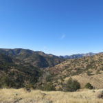
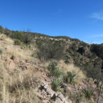
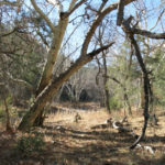
Sometimes a Pleasant Hike
Apologies to my loyal followers for the long hiatus between hiking Dispatches! No surprises – life’s been a little challenging lately, and an earlier attempt to resume my hiking routine was kind of a bust.
This Sunday morning, the time change confused me, because I rely on my iPad’s alarm to wake me, and the iPad was set on Phoenix time from a flight I made months ago. The time change makes New Mexico an hour later than Arizona, so I was sure I’d lost an hour of hiking until a mile or so up the trail when I realized the sun – and my body – was still on the old time, and despite what my watch said, I had a full 8 hours to do a serious hike.
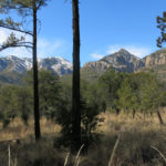
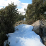
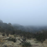
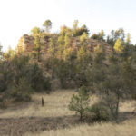
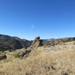
The hike I’d chosen was actually my third choice for the day, because I’d done it before and it had ended inconclusively, short of a ridge top, at a logjam of wildfire deadfall. But the important thing, after a hiking hiatus, was that it gained me plenty of elevation. It was a real workout.
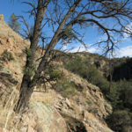
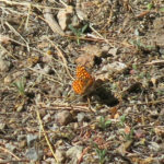
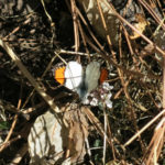
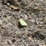
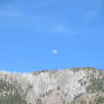
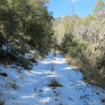
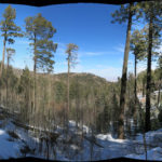
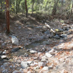
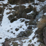
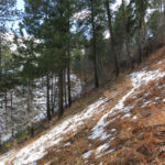
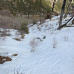
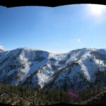
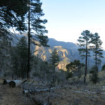
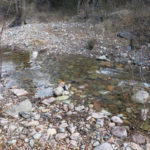
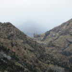
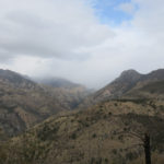
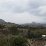
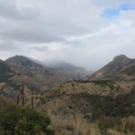
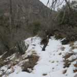
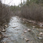
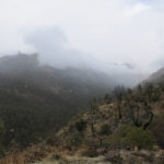
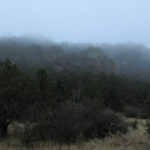
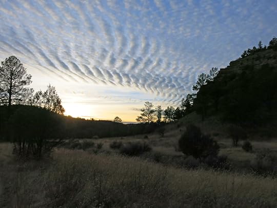
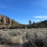
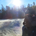
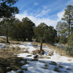
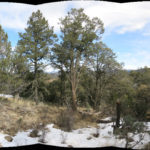
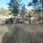
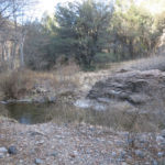
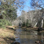
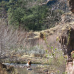
The day started just below freezing but temperatures were expected in the 50s by afternoon, under clear skies. The creek in the canyon bottom was running strong from continuing snowmelt. Small butterflies were everywhere.
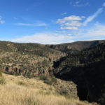
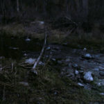
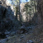
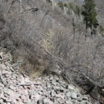
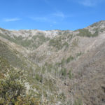
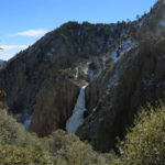
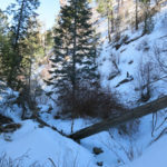
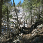
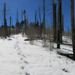
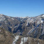
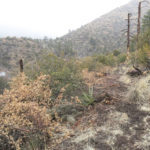
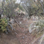
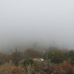
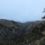
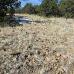
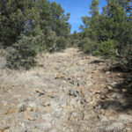
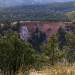
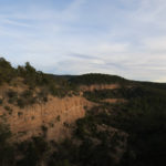
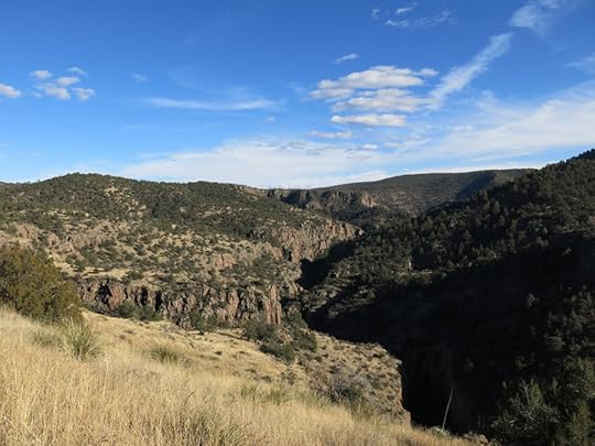
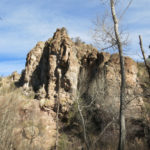
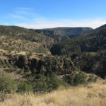
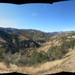
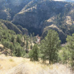
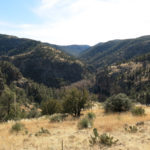
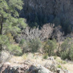
This is the canyon whose middle stretch is choked with debris flows and deadfall, twisting between sheer bluffs and giant boulders that require constant detours. The trailhead logbook featured a recent entry from a couple who’d continued over into the next canyon, to the remote creek junction I’d bushwhacked to last year. They’d done it as an overnight and complained about the bad trail condition – I’d done it as a day hike.
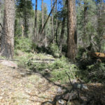
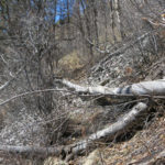
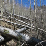
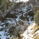
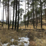
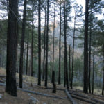
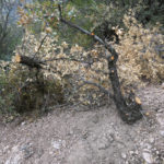
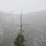
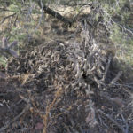
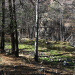
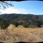
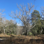
One thing that surprised me in the canyon was the large number of seemingly healthy firs and alders which had fallen recently. I don’t think of a narrow canyon with sheer walls as supporting the kind of wind that could bring healthy trees down, but it’s hard to imagine a hidden disease that would weaken such different species, and drought shouldn’t be an issue in this well-watered canyon.

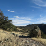
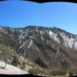
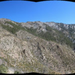
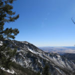
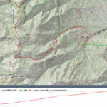
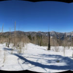
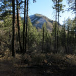
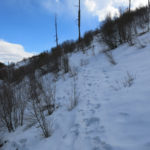
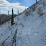
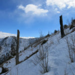
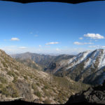
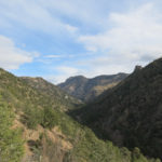
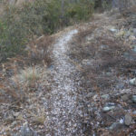
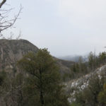
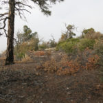
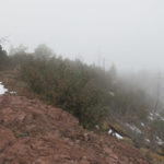
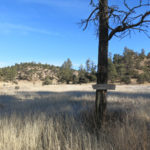
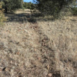
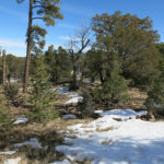
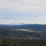
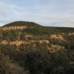
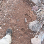
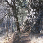
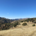
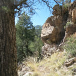
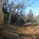
The trail traverses steeply out of the canyon to a pass where the trail into the next canyon begins. But from there, I continue up and across the west wall of the first canyon, snaking around massive rock outcrops and following a scarcely visible but well-remembered route which is now only maintained by elk. In fact, elk love this trail so much their scat and tracks were all over it. There was no sign of human use since my last visit here – this route is generally believed impassable.
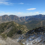
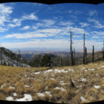
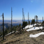
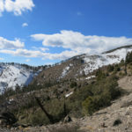
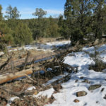
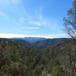
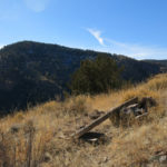
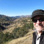
Like before, I was able to follow the elk trail all the way to the deadfall logjam near the ridge top. Whereas my first visit had been frustrating – the top is tantalizingly close – this time I was just glad to be back hiking and reaching my highest elevation since last summer – 9,750′.
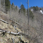
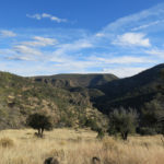
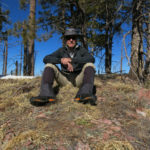
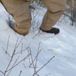
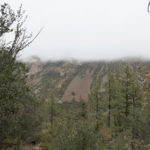
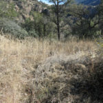
I’d tweaked my back, which remains on the edge of severe pain, climbing over a big log in the trail, so the first thing I was looking for on the way down was a clear, level spot to stretch. It took me nearly a mile to reach that, because the upper trail traverses and switchbacks across steep and rough ground, including talus slopes. Finally stretching on a grassy saddle high in the sky, in the warmth of the sun, felt wonderful.
I reached the vehicle exactly 8 hours after starting. No adventures, and at this point that’s a good thing!
February 23, 2022
Protected: Trail Work & Conditions in SW NM & SE AZ
This content is password protected. To view it please enter your password below:
Password:
February 21, 2022
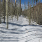
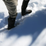
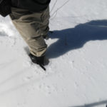
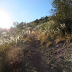
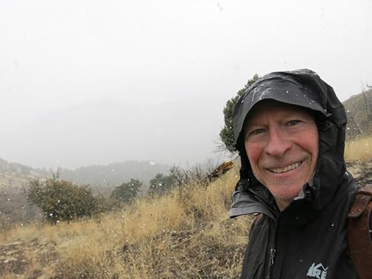
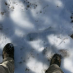
Shadows in the Snow
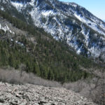
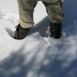
Still excited about my new boots and gaiters, I was looking for more snow this Sunday. If you’re only wearing boots, there’s definitely a limit to the depth of snow you can move through. I’ve skied and snowshoed over snow in the Sierra Nevada that was fifteen feet deep. But historically, my part of the Southwest has never seen the snow depths people a little farther north have to deal with. And with climate change, our annual accumulation at the highest elevations now seems to be two feet or less. Knee deep is bearable for short distances.
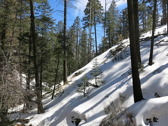
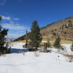
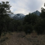
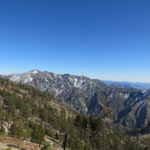
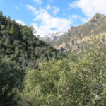
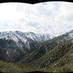
Before getting the new gear, I’d been avoiding one of my favorite trails in winter, because it goes through the bottom of a narrow, shady canyon that collects deep snow, stays cold, and holds snow and ice from winter into spring. From that canyon bottom, the trail climbs to the 9,300′ crest, where I was hoping to continue up a 9,700′ peak, depending on how much snow I found. This would be a revelation – for the past three years I’d completely given up on those elevations in the winter.
The range I was headed for averages a thousand feet lower than our mountains at home, and based on the forecast I expected temperatures into the seventies on sunny stretches of the hike. In fact, I wondered how much snow would even be left this long after the New Year’s storm, even with the light snowfall we had during the past week. Most people outside our region would be surprised simply to see snowy mountains 40 miles from the Mexican border – unaware that the mountains of Mexico itself get plenty of snow.
Approaching from the northeast, I could still see snow on north slopes above 8,000′. I had the choice of driving up the rough 4WD road to the trailhead, or walking it, and I chose to walk in order to prolong my hike with more distance and elevation. What I wasn’t sure about was being able to reach the peak in the time I had – on my last visit I’d remarked at how strangely long it takes to reach the crest, probably because parts of the climb are really steep, and the passage through the shady canyon is just plain slow.
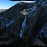
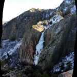
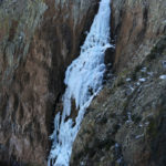
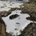
In my first view of the upper slopes I was excited to see that the waterfall was still frozen. Snow was patchy below, as expected – I was surprised to find patches even below 6,000′. And even before the waterfall, at 7,800′, I faced long traverses in calf-deep snow.
Last week’s storm had dropped a couple of inches here, so there were clear tracks of a couple who had hiked to the waterfall overlook with two dogs, probably two or three days ago. Beyond that, the trail switchbacks across a vertiginous slope to reach the saddle at the mouth of the hanging canyon. I put on my gaiters before proceeding. That slope bore knee-deep snow with the much older tracks of a single male hiker. He had cut corners in a couple of places where the slope was just too steep to be safe with this much snow.
I’d taken off my sweater shortly after starting the hike, and made it this far in just my shirt. Considering how much snow there was on this steep north slope, I was surprised to see the first butterfly of the season.
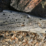
From the saddle, the trail traverses at a gentle grade across a forested, mostly snow-free south-facing slope down into the hanging canyon that feeds the waterfall. Just before reaching the deep snow of the canyon bottom, I saw the first lizard of 2022 dashing under rocks beside the trail.
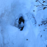
As expected, the snow in the canyon bottom was up to two feet deep, but I could hear the creek running underneath it. I pulled my sweater back on. It was impossible to tell where was solid ground and where was running water, but I’d been here enough to generally remember – until at one step my boot sank more than knee deep.
I mostly followed the tracks of the hiker who’d preceded me weeks ago. His tracks had been smoothed over by last week’s dusting, but I could tell he was using trekking poles, especially to traverse the steepest, least stable slopes. I wondered how far he’d gone.
As expected, it seemed to take forever to get through that canyon bottom, but it was a beautiful place to be stuck in.
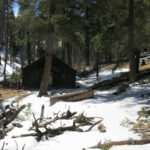
The other hiker’s tracks continued up through the old-growth forest with its patchy snow and past the Forest Service cabin below the crest. But the tracks ended just before the trail junction at the crest. A howling wind comes over that saddle – it’s always crisscrossed with recent blowdown – and the snow at the junction was both knee-deep and trackless, although it had melted and refrozen enough to have a hard crust.
It was late enough now that I knew I wouldn’t make it to the peak. But I had enough time to go another mile at least, so I proceeded north toward the saddle below the peak, where the snow appeared patchy – I could see the trail in the opposite direction traversed more deep snow.
It was an easy, fairly level trail until about a third of a mile before the saddle, when I again entered deep snow.
The wind at the saddle, which faces southwest, was fierce! I gazed wistfully at the peak above – it was only a half mile and a few hundred vertical feet away, but if I took the time to climb it I would probably miss the burrito and beer at the cafe and end up starving as well as tired on the two-hour drive home.
I definitely enjoyed the return hike more than the climb up! I was torn between rushing and taking it easy, but mostly I took it easy and enjoyed the beautiful snowy canyon and the exquisite frozen waterfall.
In fact, despite a slower than usual pace, I reached the vehicle 45 minutes before closing time, allowing me to obey the speed limit on the narrow, winding road out of the mountains. It wasn’t until after dinner, on my way up the lonely highway toward the interstate, that I fell prey to a sheriff’s deputy hiding on the dark roadside. I had to endure 15 minutes of apocalyptically flashing lights to find out he was only giving me a warning.
February 14, 2022
Field Test
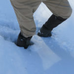
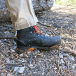
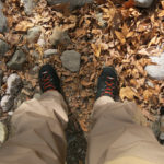
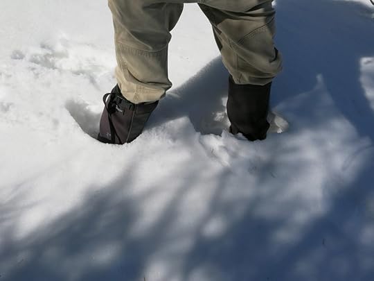 After solving part of my wet feet problem with a pair of waterproof boots, I finally had to take the next step and get gaiters. This is a no brainer for people in the Cascades or northern Rockies, but hard to swallow for someone living near the Mexican border!
The fact is, I’ve been researching gaiters – along with snowshoes – for years, ever since I started hiking the high mountains year-round. In my less ambitious earlier years, I simply turned back when the snow got too deep. But it’s not just snow that gets my feet wet – even a heavy dew during our summer monsoon can soak my pants and wick through my socks all the way to my toes.
Even with waterproof pants, the act of walking forces snow up between the pants and the boots to get the socks wet. Gaiters are the only solution. Having to accumulate so much gear drives me crazy – it accelerates the cycle of consumption and it all has to be cleaned and maintained regularly. But there’s no way I’m going to abandon those mountain hikes just because of weather. A big reason why I hike is to experience, and learn from, habitats and ecosystems in all conditions.
The snowshoe option remains off the table. It would be relevant for hiking fresh powder during or right after a storm, but most of my snow hiking comes later and involves a lot of elevation change, transitioning repeatedly between snow and bare ground. Most of the snow I encounter is patchy – covering trail distances from a few yards to a hundred, and either wet or frozen. It doesn’t make sense to carry snowshoes that I’d have to keep putting on and taking off a half dozen or more times per hike.
More and more, I’m turning to hunting suppliers for well-made outdoor gear. I still respect REI for being a co-op, but they simply don’t stock the best quality gear in many categories. After years of research I ordered a pair from Stone Glacier, a high end supplier in Montana that produces fancy seasonal catalogs similar to Patagonia featuring full-color stories on conservation.
The hike I chose to test them on is one of my old favorites, the trail which took me into our local wilderness for the very first time, three years ago. In many return visits I’d learned that the 9,500′ saddle at the high point of the trail accumulates knee-deep snow by January. I was hoping the gaiters would allow me to get past the deep snow and proceed down the other side for another two miles to a distant trail junction at a dramatic rock outcrop.
But the first thing I found is that the notorious backcountry horsemen had mutilated this trail too – their recent work has butchered all my favorite nearby trails. Most of my pictures from today’s hike document the damage, but I won’t bore you with any of those.
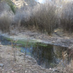
Nature had more dramatic changes in store at the bottom of the canyon: more birds than I’ve encountered yet this winter, and an explosion of flies and gnats, which doesn’t bode well for our warm seasons. The day had started below freezing as usual, but midafternoon temperatures were forecast to approach 70, and the creek was already stranded with vibrant algae.
Another hiker I will call Bigfoot, along with his big-footed dog, had preceded me to the saddle. They’d been turned back by the knee-deep snow, but I wasn’t. I ended up grudgingly post-holing for another quarter mile, expecting to emerge from the deep stuff farther down the back side. But I was forgetting that the back side is a steep north slope, shaded in winter, holding snow until late spring. I couldn’t stomach any more post-holing.
On the way back to the saddle I stopped in a short bare stretch of trail to check inside the gaiters. Snow had driven up inside them and was packed against my pant cuffs all the way to the top of my boots, so I had to fine-tune the fit. Fortunately they’re adjustable enough that I was able to minimize the leakage going back. They did make my lower legs feel significantly hotter, but it was worth the trade-off to stay dry in the snow.
I’ve had cheap gaiters in the past – these are the real thing, tough and well-thought-out.
Despite all the habitat damage by the horsemen, and having to cut my hike short, I was feeling pretty good about the day as I started down from the crest. Unfortunately after the first half mile I developed severe pain in my left ankle. Damn, it seems I just can’t finish a hike anymore without ending up in pain! I couldn’t even figure out what was causing it – something about the fit of the new boots had triggered either inflammation or nerve pain around the back of my inside ankle bone, and walking downhill became unbearable. I tried lacing the boots lower, but that had no effect at all. I wedged a bandanna/handkerchief between the boot and the ankle, and that helped but kept working its way out. Finally I found an adhesive-backed felt pad in my pack that I applied directly over the ankle bone, and that enabled me to slowly limp the five miles and 3,700 vertical feet back down to the vehicle.
In the end I concluded that I’d simply tied the boots too tight on the way up. With their stiff soles, I’d felt my heels slipping on the steep climb, and kept lacing them tighter and tighter, which ultimately must’ve tweaked my ankle bone.
During the slow descent past vegetation hacked by the horsemen, I again pondered the irony of our “wilderness areas”. Aldo Leopold’s invention is popularly viewed as preserves of raw nature protected from human interference. But just like the Anasazi country of the Colorado Plateau or the Indian mounds of the Ohio and Mississippi Valleys, these wilderness areas are actually cultural landscapes of our European legacy, with abundant colonial artifacts like mines, fences, corrals, and developed springs, modern trails maintained for the enjoyment of privileged white people, and wildlife wearing the radio collars of colonial scientists.
January 31, 2022
Floating in a Void
After last week’s scary experience with wet hands and feet in near-freezing conditions, I finally broke down and got a pair of waterproof mountaineering boots. I guess I was in denial all those years, believing like most people that I shouldn’t need waterproof boots in the arid Southwest, and after all those decades of hiking in the desert, convinced that all I really needed was breathable boots to keep my feet from overheating in the summer.
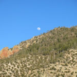
So for this Sunday’s hike, I was looking for some deep snow to test the new boots. For the first time since our New Year’s Day snowstorm and my misconceived snow hike with the UTVs, I actually wanted a trail that ventured above 8,000′.
But we’d been having an unusually cold winter, so that New Year’s Day snow was mostly still up there. The high-elevation trails near home would require me to spend most of the day slogging through knee-deep snow. That made me think of the trail over in the “range of canyons” that climbed a steep north slope to a clearing at 8,000′, then spent over 3 miles traversing an exposed south-facing slope to finally connect with the crest trail at 9,300′. Snow on that south-facing slope would’ve melted by now, so it was one of the few ways I could reach 9,000′ in winter, but I knew that when the trail cut back into side drainages it would have to traverse short sections of north-facing slope that remained in shadow, preserving isolated patches of deep snow a hundred yards or more wide.
Those patches should give my boots a test, while the overall distance and elevation gain should help “break in” the new boots, which are the stiffest I’ve ever worn. After last week’s wet pants and freezing legs, I would also wear my “upland hunting” pants, which are both waterproof and thorn-resistant. The cuffs adjust to fit tightly around the boots like gaiters, so I should be fully prepared for deep snow.
Approaching the mountains from the northeast, I could see there was still plenty of snow around the crest.
With all that snow up above, I was surprised to find the first creek crossing dry, and where it was still running a little farther up, the level was unusually low. Apparently low temperatures persisted here, too, so the snow that remained on shaded slopes up above was keeping frozen and releasing its moisture slowly, a good thing for the habitat.
The new boots were so stiff it felt like walking in ski boots at first. I kept tightening them to keep the heels from slipping and raising blisters. This is what most hiking boots used to be like – you had to rub oil or wax into them to limber them up, and spend days or weeks breaking them in. My feet were starting to hurt before I even reached the halfway point in the high “park”.
Long before that I passed a friendly retired couple from Wyoming, the only other hikers I saw that day.
Past the “pine park” I turned the corner into the big canyon and began traversing the burn scar, parallel to the spectacular snow-draped slopes of the opposite side. Partly cloudy conditions had been forecast, and I was hoping I might even get some weather. But the alternating sun and shadow during the climb meant that I had to keep stopping to shed or add layers to keep from overheating or chilling.
When I reached the patches of snow on north-facing cutbacks, I found they were covered with frozen crust – something I should’ve anticipated this long after a storm. So instead of testing the water-resistance of the new boots, they became a scary test of my ability to kick footholds on steep, smooth slopes where a slip would’ve sent me sliding a hundred feet or more down toward rock outcrops or standing snags in the gullies. My feet were now really sore and side-hilling in the new boots made me grit my teeth. It took me 20 minutes to cross the first 100-yard patch.
But after safely crossing the two biggest patches, I realized it was doable and focused on what was ahead. In previous years, it had taken me three tries to reach the crest on this trail – the traverse had seemed really daunting. Today I’d gotten a late start, so my time was limited, but I was determined to reach the crest. And despite the many stops and the slow snow crossings, my pace on dry trail was good and I thought I could do it.
Wind increased the higher I got, and whenever clouds came over, the wind chill became brutal. In shadows between shrubs over 9,000′, I encountered tiny surviving patches of snow 2 feet deep, showing just how much snow that New Year’s storm had really dumped here. I finally made it to the “bleak saddle” at 9,300′, but only by assuming that a trail that took me over 4 hours to ascend could be descended in less than 3 hours. As usual, I wanted to get back to the vehicle in time to catch a burrito and beer at the cafe before its 6pm closing time. I’d done this hike 5 or 6 times before, so my guess was based on experience. I prefer trails like this that involve hard work early in the day and reward you with an easier hike on the return.
I was able to literally run down much of the trail on the way back – it’s very rocky, but there are stretches of steep fine gravel that beg to be taken quickly. When I reached the pine park, I could tell I was cutting it close and had just enough time to finish the hike and drive to the cafe, if I maintained my pace on the next section.
The boots were still stiff, but I was developing a little more feel for them. My feet were hurting a lot, so I loosened the laces on the last, steepest descent, and found that helped. The last half of the trail was mostly shaded so I had to pull all my layers back on to keep warm. And then my left hamstring began cramping, from crossing patches of icy snow. It was all I could do to avoid the cramp taking over and paralyzing me with pain.
Still, I managed to reach the vehicle with just enough time to reach the cafe before closing. There was only one other table occupied, by a couple in their late 70s, probably birders. That burrito and beer were as good as usual and convinced me to get a room for the night. All clean from a very hot shower, lying in a strange bed, I tried to imagine the canyon, ridges, peaks, and rock formations outside my room. But with the heat turned off, the room was absolutely silent and darker than any place I could remember sleeping in, and I felt like I was literally nowhere, floating in a void.
January 24, 2022
Raynaud’s Camera
Distractions at home have been preventing me from reaching my weekly target levels of hiking, and last Sunday’s hike, on an unfamiliar trail near the heart of the wilderness, didn’t provide the elevation gain I needed. So this Sunday I was looking for something that was still relatively low-elevation – to avoid deep snow – but with a lot more elevation gain. I decided to revisit my favorite trail over on the west side. It’s a hard trail, but if I could make it far enough, it would yield over 4,000′ of gain.
The day’s forecast was partly cloudy, with no precipitation, and a high in town of 46 degrees – a little colder than we’ve been having recently. The rest of the week was forecast to be clear – sadly for our drought, no rain or snow on the horizon.
Those partial clouds were moving over from the southeast as I started down the trailhead into the canyon of the first creek. And surprisingly, I could see some serious snow clouds several miles to the south.
Given the forecast, I’d dressed for cold but not for rain or snow. And given our mild winter so far, I’d forgotten the lifelong lesson that weather in mountains is unpredictable. But the sky over the canyon ahead was still mostly clear.
What worried me more, initially, was the roar of the creek. I wondered what the crossing would be like. When I got all the way down the rocky trail, I was able to find a couple sticks and some partly-submerged stepping stones that managed to keep the icy water off the uppers of my boots.
The first thing I found heading up the steep, shaded trail on the other side was a dusting of sleet, apparently from last night. And as I climbed the 1,400′ slope to the peak of the rolling plateau, I could see snow clouds moving over the head of the canyon and dropping snow that gradually hid the high ridges beyond. I was still hoping the weather would avoid me, but I figured I was now in for an unusually cold hike.
The next thing I found, as I approached the peak, was another swath of vegetation butchered by the backcountry horsemen in the name of trail clearing. Since this trail had already been cleared by previous volunteers and was in good shape the last time I’d been here, I could now see that what they were doing was selecting cleared trails and widening them into wilderness super highways.
As I started across the rolling plateau that fills the divide between two major creeks, I could see snow clouds and falling snow hiding peaks and ridges all over the mountains, from north to south. And I saw how the backcountry horsemen had left, in many places, a nearly continous berm of slash piles beside the trail that would act as fuel for future wildfires, channeling fire along trail corridors, allowing it to move freely for long distances through the mountains.
Particularly sad was how they targeted beargrass and yucca, beautiful native plants that apparently scratch their horses’ legs – so they chop them to the ground wherever they can, far back from the trail.
When I finally reached the last saddle above the canyon of the next creek, cloud cover was complete, but I’d still only encountered very sparse flurries. The initial hike led through some 6″-8″ snow drifted in the narrow drainage at the head of the descent, which began dampening my boots, which I’d learned were not waterproof. But my feet were still keeping warm. I eventually moved out of the snow-covered drainage onto the steep, seemingly interminable, rocky switchbacks that led more than a thousand vertical feet down to the tall ponderosa forest of the creek’s tall banks.
The horsemen hadn’t worked the switchbacks – there was already a broad clear corridor in that stretch of trail – but they’d clear-cut the dense creekside willows at the crossing. Unfortunately, with the creek swollen from snowmelt, there were no stepping stones for hikers at the crossing, and I had to work my way up the remaining willow thicket about a hundred feet to find a crossing point.
I still had an hour before I had to turn back, and I assumed, from their note on the trail log, that the horsemen had cleared the stretch of trail up the other side of the canyon. This was the only stretch that previously had some hard to follow stretches that slowed me down a little. Maybe I could get farther now – maybe even make it to the third creek?
But as I started up the trail, which alternated between dense bunchgrasses, steep rocky slopes, and thickets of oak and mountain mahogany, large flakes of snow began to shower down in earnest. I kept pushing and found, again, broad corridors where the horsemen had clear-cut living shrubs and piled them alongside the trail. They hadn’t improved navigability for hikers at all, and they continued to target yucca and beargrass, ignoring deadfall in favor of killing living plants.
My time was up when I reached the saddle above the next creek. No matter, I was content to turn back because I knew my elevation total for the day would be good.
The snow gradually ended as I worked my way back toward the second creek, but now I had a new problem. The snow had melted on all the bunchgrass in the trail, and my heavy canvas pants were getting soaked. I had lightweight thermal bottoms in my pack, but the temperature was still only a little above freezing, and I hated to stop and take the wet boots and pants off to put them on.
My feet were now wet inside the boots, and I knew that eventually I’d have to change into the spare pair of wool socks in my pack. Fortunately my hands stayed dry and warm inside my wool glove liners. I made it back down to the creek, bushwhacked to my crossing point, crossed easily, and headed up the endless switchbacks on the other side of the canyon, hoping the climb would generate enough body heat to keep my extremities warm, maybe even enough to dry out my heavily soaked pants a little.
That climb is normally the hardest part of this trail, but a positive mental attitude made it manageable until I reached the narrow, congested, snow-drifted drainage near the top. It was snowing again, my wet legs were freezing, and my wet toes were starting to burn, so I stopped in the snow of a level stretch of trail in the dense riparian forest. I laid out my thin plastic tarp across the snow as a changing area and began to undress from the waist down. My camera was in its holster on my belt, so I moved it to the pocket of my shell jacket. I had to take off my gloves to untie the double-tied boot laces, and by the time I’d finished working with the wet laces, my fingers were burning with cold – always a scary thing, because it takes so long to warm them up again, and I was not sure I could even do that in these damp, near-freezing conditions.
But there in the dark, snowy forest, with fumbling fingers I managed to get my pants off, pull on the thermal bottoms and wool socks, force my legs back into the soaked pants and my now dry-socked feet back into the soaked boots, and double-tie the boots yet again.
I immediately pulled the glove liners back on, and with difficulty yanked my heavy Goretex ski gloves on top. Packing the wet tarp in a plastic bag I bring for emergencies, I continued up through the deep snow of the narrow drainage, flexing my burning fingers and toes constantly to improve circulation and maybe return some heat into them.
My toes warmed up fairly quickly, but I had to keep flexing my burning fingers continuously for another 45 minutes as I climbed to the saddle, dropped hundreds of feet into the next hollow, and again climbed hundreds of feet up the next rise of the plateau, where I was surrounded by a dense cloud that hid the surrouding forest, canyons, and mountains, with snow falling continuously.
All but one of my fingers had finally warmed up, with feeling returning so I could use them normally, when I reached a stretch where the horsemen had left a slash pile right on the trail. I figured I would get another picture of it, and discovered my camera was gone. Christ! What was happening to me? Was I losing my mind, or was I under some sort of curse?
I was sure I’d taken it out of the holster when I’d stopped to change, putting it in my jacket pocket. I was sure I’d scanned the ground around the trail after changing and shouldering my pack to leave that spot, to make sure I hadn’t left anything. I thought I remembered seeing nothing there that I’d left behind. I even checked my pack, but the camera wasn’t there.
The jacket pocket was recessed enough that I couldn’t imagine the camera falling out by itself, unless I’d taken a big fall, which I hadn’t. I’d simply lost my camera – this camera that I’d bought last summer, after weeks of searching, to replace the identical model which I’d dropped so many times it’d stopped working. I’d been developing a new protocol to protect the new camera, getting the holster for warmer conditions, training myself to use the wrist strap whenever I took it out to carry, moving it to the jacket pocket when the weather got cold. As much as I hated giving it up, I thought I could probably buy yet another replacement. Going back to find it, after suffering so much from the cold, having to climb all those hundreds of feet again on some of the worst stretches of trail, seemed inconceivable. And the extra time spent retracing my steps would mean finishing the last mile or two of the hike back to the vehicle in the dark – maybe even having to recross the creek in the dark. So I continued on the winding trail across the long brushy rise.
It was only a hundred yards farther that I realized I hadn’t only lost my camera – I’d lost the photos I’d taken so far that day. That was the last straw. Damn it, I would just have to go back and try to find that camera.
The thermal bottoms and wool socks had done the trick – although still wet, my legs and toes were now warm enough, as long as I kept moving. The middle finger on my right hand still had no feeling, but by the time I reached the bottom of the deep hollow, after an hour of continually flexing my fingers, feeling finally returned to that finger and all was copacetic.
Crossing that hollow, I suddenly remembered that the thin wrist strap of my camera usually hung out of the jacket pocket, and occasionally caught on passing branches. Whenever that happened, I would feel it – it would usually bring me to a stop until I disengaged the strap from the branch. But maybe I hadn’t left the camera in the snow of that drainage – maybe a branch had pulled it out of the pocket somehow, without me noticing?
The climb out of that hollow to the last saddle is the hardest part of this trail to follow – blocked often by major deadfall, deeply eroded, with many informal, unmarked detours. Heading up it, I remembered a steep passage where the old trail is completely blocked with a fallen dead tree with all its branches intact. When you’re ascending, the way around it – through a steep, narrow gap in vegetation – is fairly clear. But descending from above, you always end up on the old trail and have to clamber through the limbs of the fallen tree to reach the detour. That would be the logical place for a branch to grab my camera.
When I reached that spot, 2/3 of the way up to the saddle, I first saw the fallen tree blocking the old trail on my left. Then I peered into the shadows of the narrow detour, where I saw my camera, hanging against a rock, suspended from an almost impossibly delicate branch.
The glass display had been scratched in several places, and the edges of the metal body had been nicked from swinging against the rocks as it was pulled out of my pocket, but the camera still turned on. The display itself now had a jagged black line of missing pixels down the left side, but otherwise it functioned normally. And best of all, I didn’t have to continue climbing to the saddle and down through the snow of the other side.
I resumed the hike with fresh energy. My new camera protocol had been an experiment, and now I had information that would help me improve it. The camera was still just a tool – like my car, my computer, my power saw. It wasn’t the purpose of my adventures – it was just something to help document those adventures. I would never mold my behavior significantly around it – I just had to take reasonable care of it.
One thing that makes this my favorite trail is the views from the rolling plateau. The snow had finally stopped, but as I recrossed it, the entire landscape round me was hidden under clouds. Storm clouds had spread across the west and I could barely tell where the sun was in its descent to the horizon.
Hidden though it might be, the sun was clearly setting by the time I started down the switchbacks into the first canyon. There was just enough light left to cross the creek, and then on the final ascent to the trailhead on the mesa, I tested my night vision as long as I could, finally strapping on my headlamp for the last extra-rocky stretch.
The road down the red clay surface of the mesa, which had been frozen in the morning, had turned to wet cement during the day, and raised a deafening splatter against the underside of my vehicle. I switched into 4wd low to avoid sliding off. And my fingers, on the steering wheel, became numb yet again.
This is something that’s been happening occasionally, for as long as I can remember. There’s nothing I can do about it, but it gradually fades away over a half hour or so. After the scary incident on the hike, I began wondering if the occasional numbness could be related to the sensation I feel when my fingers or toes get cold. Other people say their extremities get numb, but mine burn as if they were on fire. It’s really scary – I’m always convinced I’ll get frostbite and lose my fingers – and I have to work really hard to get rid of it.
So I looked it up when I got home, and discovered, after all these years, that I have an authentic medical condition called Raynaud’s disease, or syndrome, or phenomenon. It’s rare and the cause is unknown to science. It simply means that the blood vessels in your extremities contract in response to cold or stress, cutting off the blood supply and causing numbness or pain. There are no effective treatments – you just need to try to avoid stress and cold temperatures. As if!
January 17, 2022
The Rocks, My Teachers
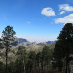
After last Sunday’s tantalizing views over a hidden canyon, this Sunday’s hike was the second choice in my short list of nearby, lower-elevation winter hikes. From a trailhead only a few miles east of the previous hike, the topo map showed this one climbing north from the valley of the same creek, at a little over 6,000′, to a large branching plateau near 8,000′. According to the map, the trail spent several miles up there meandering across the plateau, then dropped down its north slope into the canyon of another creek. I didn’t expect it to be a spectacular hike – the most I hoped for was some new views, decent mileage and accumulated elevation gain, and maybe an interesting canyon at the far end.
That was a big maybe, because it would be almost 9 miles from end to end, and I would only be able to hike the entire distance if the trail turned out to be in good condition, on a surface that allowed me to maintain my preferred rapid pace. As usual I was being optimistic – in the back of my mind was my previous experience that all uplands in the heart of the wilderness were covered with the dreaded volcanic cobbles.
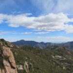
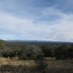
The day was forecast to be partly cloudy with typical midwinter temperatures at 6,000′ – high twenties in the morning to mid-fifties in the afternoon. But the sky was almost completely clear as I left home. Google Maps claimed the direct route through the mountains is 15 minutes shorter than the roundabout route at lower elevation, so that’s the way I went. Google Maps failed miserably – the direct route was actually 15 minutes longer than the roundabout route, which I used to return in the evening. But it gave me a fine panoramic view over the southern edge of the wilderness.
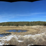
Despite a total lack of wind, it felt pretty damn cold at the trailhead, which faced a low wall of crenelated cliffs across a meadow lined with frosted chamisa – the floodplain of the upper creek, which was dry in this stretch. By the time the trail led me back into a narrow tributary valley and the wilderness boundary, I’d had to dig a wool scarf out of my pack and wrap it around my face.
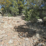
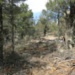
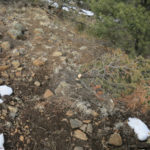
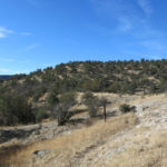
But I quickly warmed up, and began shedding outerwear, on the climb to the plateau. The first part of the climb, along the rim of an interior basin to my right, revealed occasional views of sheer cliffs of soft, partly compacted volcanic tuff. But it also revealed the dreaded volcanic cobbles, as bad as I’d encountered anywhere. And the trail, while not really steep, proceeded at a grade that could only be described as relentless, straight up an outlying ridge of the plateau, through open pinyon-juniper-oak forest that allowed only frustratingly partial views of the surrounding landscape. The forest cover meant that I could never see more than 100′ ahead of me, and always hoped I would reach the top of the plateau after another 100′ of climbing, only to face yet another 100′ of climbing.

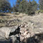
After about 3 miles of climbing, I reached the top of the plateau, and the first of a series of reasons why this trail even existed – an abandoned corral, followed by an abandoned stock pond. The trail had been accompanied by an abandoned barbed wire fence for the past couple of miles, and I was to see that fence for the rest of the hike. Not my favorite wilderness experience.
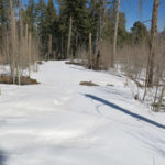
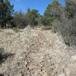
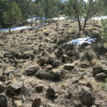
From there, the trail proceeded across the gently rolling plateau, in and out of small stands of tall ponderosa pine and through long patches of snow up to 10″ deep, the ground lined with the difficult volcanic cobbles everywhere except for small patches of mud.
I was looking for the junction with a shorter trail that came in from the west. That junction would be 5.3 miles in from my trailhead, leaving less than 4 miles to the far end at the distant creek. But it was such slow walking that I was pretty sure I wouldn’t make it to the end. It seemed to take forever just to reach the junction.
What awaited me at the junction was not encouraging. Nobody else had hiked this trail since our snowfall 3 weeks ago, but shortly before reaching the junction I found boot tracks in the snow, and at the junction itself somebody had built a campfire in the trail literally at the foot of the trail sign. Like the on-trail campfire I’d found a few months ago, this one had trash on top of the coals – a sardine can, a melted plastic wrapper, and some crumpled foil.
I remember back in the Dotcom Boom when my idealistic young colleagues proclaimed “information wants to be free!” This is the result of that. People who haven’t been brought up in backpacking culture watch YouTube videos and learn about places and trails on social media, and anyone can buy the gear at Walmart or REI. But information without ethics is inevitably abusive and destructive. Freedom erodes accountability and hence responsibility, and the technologies which my colleagues hoped would liberate people instead became addictive and exploitative, leading to genocide and other societal abuses while turning a tiny minority of white men into billionaires.
Continuing past the junction, I passed the second abandoned corral and stock pond. Before the wilderness was established, this had been a rancher’s trail – and visually, it still was.
It’d taken me so long to reach the junction, there was no way I was going to reach trail’s end at the next creek. But I had about 45 minutes left before I had to turn back, so I continued on the main trail. That was when I began to encounter more work by the backcountry horsemen. Whoever is doing this recent trail “maintenance” seems to be in love with their chainsaw. They’re clear-cutting a corridor between 10 and 15 feet wide – much wider than someone on horseback should need – and leaving unsightly slash piles along the trail.
Maybe I’m encountering stuff like this because I’m hiking trails that are really better suited to equestrians. They don’t actually have to walk on the volcanic cobbles – they spend the entire day sitting on their horses’ backs, while the animals have to deal with the rocky ground, and with four feet, they probably find it easier than humans.
But the Forest Service doesn’t designate trails for hikers vs. equestrians – all trails are supposed to be mixed-use. And all upland trails in the Gila have this kind of surface – maybe that’s why horse-packing outfits are so popular here.
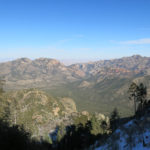
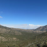
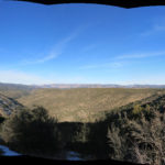
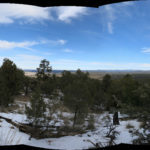
Lined with hacked-off limbs and sawed-off young trees, the trail continued out a northern branch of the plateau for another mile, before the path of destruction ended. I found myself in a patch of deep snow on the north rim of the plateau, with a view north over the main part of the wilderness, a view I’d never had before. Parts of it were even more rugged than I’d expected.
From there, the tread became almost invisible as I worked my way down a series of short switchbacks through dense pinyon-juniper-oak forest into the canyon of the unfamiliar creek. I soon ran out of time and had to turn back.
Now I had more than 7 miles of that terrible rocky surface to cross on the way back. I’d intentionally given myself enough time so I didn’t feel rushed, but since I’d sworn to approach those volcanic cobbles with a positive attitude, I decided to make a concerted effort to tackle them on their own terms – to figure out a way to walk that incredibly challenging ground with grace.
There was only one way to do it. I had to banish all urgency, and give the task all the time it required. But even more importantly, I had to clear my mind, stop thinking, and focus all my attention, not on the trail ahead, but on the ground directly in front of my feet – the length of my shortest stride, which on ground like this is 2 feet or less. At each step, I had to pinpoint and decide on exactly where to put each foot, before even lifting that foot off the ground.
I thought I’d done that before, but I learned that I actually hadn’t. Goal-oriented, highly motivated, brimming with energy, I’d always been scanning 6 to 10 feet ahead for major obstacles, assuming I could ignore lesser obstacles. That way of walking worked on every other kind of surface, but not on these volcanic rocks. Hence I’d always been twisting my ankles or stumbling on this kind of surface, cursing all the way.
Why had it been so hard for me to focus and concentrate? I recalled losing my sunglasses last week – and only a few days ago, buying a new furnace filter, setting it on the roof of my car while I unlocked the door, driving away and only realizing a half hour later, at home, that the new filter was lying along the roadside somewhere, miles away, battered and broken. This kind of thing has happened to me over and over again during the past few years, and why? Because trauma and frustration have left me in a perpetual state of distraction – always worried about problems I have to solve, always anxious about what will go wrong next – never present, never fully aware of my surroundings. Always distracted and literally absent-minded.
Gurus speak of mindfulness, but what I needed was a state of mindlessness. It was only when faced with these rocks that required me to stop thinking and focus on the ground before my feet, that I was able to banish that distraction and enter a state of mindless grace. And after a while, it began working. I found I no longer resented these rocks. I found I enjoyed the challenge. I felt I was getting good at it, I was mastering the rocks – and since that was a form of thinking, a form of distraction, that’s when I began to stumble again.
I had now learned my second lesson: humility and submission. We don’t master nature – she will always be our master. Wisdom comes when we submit to nature.
These rocks, that for years I believed to be my enemies, had become my teachers.
Of course, this kind of extreme focus and concentration has to be put in context like everything else. While doing it, you lose all consciousness of your broader surroundings. Gurus speak of becoming more present, but when taken to an extreme like this, you’re actually oblivious to your surroundings. You can’t see vegetation or wildlife, and you have no idea where you are in the landscape. To see anything except the ground at your feet, you have to come to a full stop. I wondered how the Apaches could hunt in this kind of habitat. You’d have to pick your vantage points, and the routes between them, and stop frequently along the way. There’d be no running to chase down a deer, like in that expensive, award-winning Hollywood production Last of the Mohicans.
Hiking became quite literally a form of meditation. Walking with more grace and more peacefulness the farther I went, I finally reached the southern end of the plateau and began descending, just as the sun was lowering to the long ridge north of town. It lit up the soft cliffs surrounding the interior basin, and there was just enough last light to briefly gild the rim of the side valley before I emerged into the chamisa.
I hoped I would remember the day’s lessons.
January 10, 2022
Best Hike Ever!
Just kidding – not really the best hike ever, but with plenty of redeeming value. I finally realized I need a major attitude adjustment. I’ve been complaining way too much, and I need to start reacting to setbacks, hardship, crisis, and maybe even trauma as exciting opportunities.
This was the hike I’d planned to do last Sunday – top of my short list of lower-elevation winter hikes – but had been prevented by a snow-blocked highway. This time I took the long way around, to avoid the higher elevations, but unnecessarily as it turned out, since the direct route had been fully plowed in the past week.
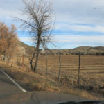
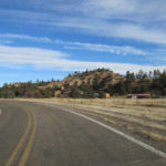
I’m glad I took the longer route, though, since I’ve been avoiding that area since I moved here, and I’d completely forgotten how interesting it is. It’s a real slice of the Old West that is near my home but otherwise fairly remote, scenic, and off the tourist radar. The highway runs north up the upper floodplain of one of our two local rivers, then over a low divide into the smaller valley of a creek, which has been dammed to create a small lake for fishing and recreation.
Finding the trailhead and actually following this trail was going to be a gamble. According to the maps, it starts near where the highway crosses the creek downstream of the dam, enters the wilderness boundary and climbs high up the north slope above the creek. Once up there, it contours around a series of high shoulders to a point near the mouth of the creek, where it drops back down to the creek and follows it a short distance to where it flows into the wild river. The backcountry horsemen claim to have cleared it of logs and brush last spring.
Some sources said the initial access went through private land, where it could be blocked. The latest crowd-sourced maps showed it starting on the highway, but the latest online trip log, from Thanksgiving, simply said “This trail is not accessible any more.” But I’ve learned to take anonymous online information with a big grain of salt. If I found and could follow the trail, it would be my first venture on trails in the heart of the wilderness, and my first encounter with the river in its wildest stretch.
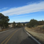
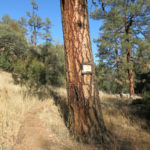
When I reached the short stretch of highway where the trail was supposed to begin, the only manmade thing I could see from my passing vehicle was a small, ancient, blank, unpainted plywood signboard nearly buried in high weeds 20 feet off the road. Beyond that I found a turnout, parked, and optimistically shouldered my pack. The creek trended west below a high south slope, so it would mostly be shaded from the low winter sun. The temperature now was well below freezing, so I dressed warmly but expected the temperature to reach the 50s in the afternoon.
I walked back the road to where I’d seen the old signboard, and noticed a faint, narrow track through the weeds, leading down onto the floodplain. I’d found the trailhead, but I knew it had to cross the creek in order to climb the north slope – would it really turn out to be “not accessible any more”?
One reason I’ve avoided trails in the heart of the wilderness is that most are canyon hikes involving from 50 to 100 river crossings. Hikers can only use these trails in warm weather, when they wear water shoes, gaiters, and shorts. My foot condition makes this impractical – they don’t make water shoes that are reinforced and accommodate prescription orthotics. My experience of canyon hikes had been limited to creeks which are major tributaries to the rivers, and in every case there had been stepping stones or logs allowing me to cross without too much anxiety around getting my boots wet or my feet frostbit.
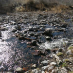
I didn’t expect the trail in this creek bottom to be any different, nor did I expect it to be a bigger creek than those I’d dealt with elsewhere. And my reading of the maps had indicated there would only be one or two crossings before the trail left the floodplain. Hence my surprise when the first crossing was wide and deep and with no stones or logs.
It took me 5-10 minutes to find a place downstream with a couple of barely submerged rocks, and a couple of dead willows I could use as walking sticks. It was touch and go, but I made it across. I left the sticks beside the trail so I could use them on my return.
In the end, there were 9 crossings in a mile and a half, and as creeks do, it got wider and wider the farther down I went. I was losing a lot of time at these crossings, so I used the first sticks I found, usually rotten and awkwardly formed, and hoping this would be the last crossing, at each crossing I stopped and found new sticks, and left them on the far side for return use. I began to feel I was trapped down here in the freezing shade with this ever-widening creek – maybe the trail had been changed since the maps were made, and it never climbed out of the canyon?
The only recent prints I found in the snow or frozen mud of the trail were from horses and dogs – I figured that’s why there were no stepping stones or logs at crossings – equestrians don’t need them. So this must be primarily an equestrian trail. Eventually it left the creek and began to climb up an even darker side drainage, getting rockier as it climbed, with the awkward volcanic cobbles.
From my cursory reading of maps and trail descriptions I expected this to be slightly over 6 miles one-way. My destination, the mouth of the creek, was only 650′ lower than the trailhead. In climbing the north slope, the trail never gets higher than 500′ above the creek, but because it has to zigzag back and forth into deep side drainages, dropping and climbing hundreds of feet each time, the accumulated elevation gain is almost 3,500′. That made it a good candidate for me, although I’d always rather get that elevation climbing a peak.
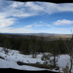
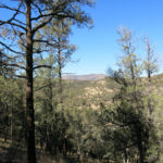
When I reached the first shoulder, I wasn’t rewarded with much of a view. The peaks and ridges around me were all low, rounded, and uniformly forested. I’d passed rock outcrops and low cliffs on the way, but there wasn’t much of that visible from above. The next shoulder was much the same, and I was getting tired of all the up and down with apparently little reward.
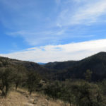
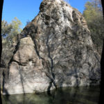
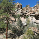
While climbing over those shoulders, the trail had been trending away from the creek and its canyon. It wasn’t until the third shoulder that I regained a view over the canyon and into a significantly new landscape. To the northwest, peeking from behind the next shoulder, I glimpsed a much higher peak that I figured had to be Granny Mountain, one of the few higher peaks in the heart of the wilderness (the really high peaks are all at the western edge). Then, as I traversed down and across to yet another shoulder, a dramatic section of canyon opened on my left, to the south. The canyon wall here was composed of black rock cliffs that narrowed to an impressive slot canyon, where I could hear the creek roaring. The walls were so sheer and close together that you couldn’t see into the canyon from above.
Most of these shoulders featured broad grassy meadows, and when I found an abandoned wilderness sign, I reflected on the real vs. official histories of places like this. These meadows may have resulted from active management of habitat by indigenous people, to increase diversity and productivity. Whereas the myth of wilderness teaches environmentalists that white Anglo heroes like John Muir and Aldo Leopold saved these areas from destruction by removing the indigenous inhabitants.
The reality is that indigenous people inhabited this wilderness sustainably for thousands of years. Then whites invaded and began destroying it, and instead of abandoning our destructive way of life, we’ve pursued it even more aggressively across most of the planet, while forbidding sustainable use of tiny preserves like this. And we congratulate ourselves on the “progress” achieved by our white male heroes.
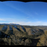
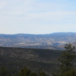
Down and up onto the next shoulder – the fourth so far – and I had yet another view, into a much broader new landscape that led to the high peaks I was familiar with in the far west. I could now see the gray deciduous forest down in the mouth of the creek, still far ahead, but even up here I felt like I’d penetrated deep in the wilderness.
I was getting pretty discouraged, because according to my original estimate of distance, I should’ve reached the creek mouth already. And I hadn’t anticipated so many intervening shoulders – so many ups, downs, and arounds, so many times shedding layers in the sun and pulling my sweater and gloves back on in the chilly shade. Now there was yet another high shoulder to get over before the trail began dropping toward the creek. The last thing I wanted to do was have to make those precarious stream crossings in the dark on the way back, but I was running out of time. Still, now that the mouth of the creek was almost in sight, how could I turn back?
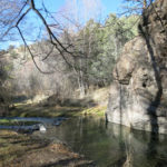
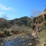
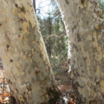
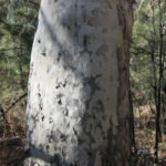
And when I finally got within view of the riparian forest, from the final switchbacks dropping into the canyon, I could see it was largely made up of beautiful, venerable sycamores – one of my favorite trees.
Of course when I reached the floodplain, the first thing I encountered was another crossing point, with a creek that was now 20 feet wide. It took me longer than usual to find two sticks, 40 feet up the bank and 60 feet off the trail, but with quite a bit of anxiety I made it across. It would be no picnic hiking all the way back in wet boots and temperatures dropping to freezing again.
I passed an old junction with another trail coming in from the south, and another difficult creek crossing below cliffs. And eventually I saw the river junction up ahead in brilliant afternoon sunlight. But just before it was the biggest and gnarliest crossing of all – a rapids, with big loose rocks that were just too precarious to use as stepping stones. I’d brought the last pair of sticks with me, and spent a few minutes trying scout a route, but the flow was strong here, and it was just too dangerous. At least I’d seen the river, and that would have to be enough for now. It was time to hurry back.
That was when I realized I’d lost my expensive sunglasses, yet again. Somewhere up on the trail into the canyon, I remembered hanging them from the open neck of my sweater. They could’ve fallen off anywhere in the past mile.
I returned up the mostly shaded trail, scanning the ground carefully. I recrossed the creek at a sunny spot and trudged up the floodplain to the shady crossing before the climb out of the canyon. The banks were littered with limbs, which made it harder to search. I thought maybe the sunglasses had worked loose while I was seeking and breaking limbs on the far side, to use as walking sticks. So I crossed over and searched the bank, working my way back into the forest where I remembered finding sticks. I began scanning a clearing under a big sycamore, and amazingly, there they were, almost perfectly camouflaged in leaf litter dappled with shade.
The return hike was even more grueling, but I kept reminding myself that it’d been a great day, and all the hardship just made it a better adventure. If I had to cross the creek in the dark, so be it – it would make a better story!
I did come to hate those interminable shoulders, and it was pretty dark by the time I finally reached the creek again. And the first thing I discovered was that another hiker had followed me partway, and on their return, had selfishly used nearly all the sticks I’d so carefully saved, discarding them out of my reach on the opposite side. So now I had to find new sticks, and this time I picked ones I could carry with me and re-use. By the time I reached the last crossing, it was headlamp dark, the water level had risen to submerge my former stepping stones, and I could no longer see submerged rocks. So I found a spot where I could use a little midstream shoal and try to jump the far channel. The jump didn’t quite make it, and I did get my boot wet, but I grabbed a branch to haul myself up the bank, and I knew the vehicle was now within reach.
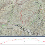
It was full dark when I got there. It’d taken me 8-1/2 hours – I knew it had to be farther than 12 miles round-trip. When I got home and plotted the route, I found it was closer to 15.