
Max Carmichael's Blog, page 22
June 28, 2021
Over the Top
As we shared the heat wave covering so much of the West, most of my hiking options had dwindled. But our monsoon seemed ready to break. Rain was forecast over much of the region for most of the next week, beginning Sunday, my weekend hiking day. Even if it didn’t rain, surely clouds would form in the afternoon, bringing shade and much cooler temperatures.
My favorite trails in our nearby mountains were still closed by the now-dying wildfire, so I was anxious to return to the range over in Arizona with lots of exposed rock pinnacles, cliffs, caves, and waterfalls.
When I hike, I always carry a bird’s-eye-view of the landscape in my mind’s eye. You can get an overhead perspective on terrain simply by climbing to the highest peak in the vicinity, but of course I also study maps in order to pick a trail. The visitor center in the Arizona range also has an amazing large-scale relief map made by hand out of layers of wood, the size of a pool table, that you can walk around to view from all directions.
With north at the top and south at the bottom, the crest of the range is L-shaped, with a dozen major ridges and canyon systems reaching outward from the L in all directions. The upper right angle of the L encloses the inner canyons and ridges, with the trails I can access coming from the northeast. I’d hiked along the crest many times now, with a view down into the eastern and western canyons, but I’d never gotten a view into the south side of the range. After last weekend’s big hike, I sat down and calculated distances for hikes that would take me into that new world. I thought I could do it in a 16-mile round trip, especially in cooling weather.
Driving a couple hours one-way to hike in Arizona makes the day complicated. Regardless of where I’m hiking, I try to get back home before dark, to warm up leftovers and have dinner around 7. Hiking within an hour of home, that means I have 9 hours to hike. Driving to Arizona, I only have 7 hours. But now, with no mask requirement and most people vaccinated, I could stop at the cafe at the entrance to the mountains, and have my favorite red chile pork burrito instead of driving home for a late dinner – as long as I could finish my hike before the cafe’s 5pm closing time.
But as soon as I drove west over the low pass into the basin at the northeast foot of the mountains, and rolled my window down, I knew the day was starting hot. When it reaches 80 by 9am at home, it will be 90 here. The sun was burning down from a clear sky, but that’s often the way it is in monsoon season. Clouds usually don’t form until the afternoon.
With my high-clearance 4wd Sidekick having clutch problems, I had to take the little truck and park it at the mouth of the access road, at about 5,800′, and walk a mile and a half up the loose rock to the trailhead, which is really hard on my foot and knee. I’d also forgotten that with the monsoon ready to break, humidity would be high so temperatures that would normally be bearable would feel a lot worse.
The 1,900′ climb to the mouth of the hanging canyon is normally a fairly easy hike, but in that muggy morning it was a miserable slog.
Creek ReliefBody and clothes drenched with sweat, I entered the hanging canyon above the dry waterfall hoping for some relief. I could see small, isolated clouds peeking out from behind the high ridges beyond. And the creek in the canyon bottom is always one of the coolest places in these mountains. Once I got down in there among the lush riparian vegetation, I found myself unconsciously slowing down and making frequent stops to take pictures.
After damaging my good camera beyond repair, I’d reverted to the old camera, which had a broken display. So now I had to use the tiny optical viewfinder, which was barely usable itself due to dust somehow getting inside it. My experience of taking photos was now sort of a reverse version of the old heavy, bulky, time-consuming 19th century view cameras. I had this tiny device that might take decent photos if I could finess it properly, but with no camera monitor, I wouldn’t find out until I got home and uploaded the images to my computer.
By the time I traversed the old-growth pine-and-fir forest out of the creekbed to the Forest Service cabin near the crest, clouds were growing over the head of the canyon, forming intermittant patches of shade in the forest. My boots were feeling loose so I stopped for lunch at the cabin and tightened them. I checked my watch and found it was taking me 50% longer than usual to hike this stretch of trail. I doubted I’d be able to reach my planned destination – the morning heat and humidity had just slowed me down too much. I would keep going, but I’d lost my enthusiasm for the day’s hike.
New WorldI’d noticed during the drive in that the whole area seemed to be devoid of people. Even the campgrounds, usually occupied by escapees from Tucson and Phoenix, had been empty. This trail to the crest was typically only used to reach the falls overlook below the hanging canyon, but the falls was dry now.
When I reached the crest trail above the cabin, with my first view west, I encountered recent boot tracks. Hikers typically drive to the 9,000′ crest at the north end of the L and hike southward along the ridgetop, because it’s much easier than the 3,300′ climb I do to get up there. The crest trail just gains and loses a couple hundred feet here and there throughout its 6 to 7 mile length.
Hiking the crest southward, I saw isolated storm clouds growing in the distance and passed through stretches of shade, and I enjoyed a little breeze, but the sun was still hot when it emerged from a cloud. Finally, traversing down across the west slope of the highest peak, I passed from the heat of post-wildfire aspen thickets into cooler fir forest, and suddenly saw a hiker approaching me up the trail ahead.
He was a tall, lanky guy with a mustache, my age or a little older, wearing a sweaty t-shirt full of holes. “You’re the first person I’ve seen all day!” he exclaimed with exhuberance, stopping to chat. We described our day’s hikes – like most people, he’d driven to the crest instead of climbing up, and had spent the day exploring side trails on a loop around the peak.
He excitedly described how on a previous hike down into the creek where I’d found relief from the heat, he’d heard something in a tree above the trail, looked up, and saw a bear resting in the canopy. The bear was just shifting in its sleep – it wasn’t aware of him watching from below. But as he hiked around the tree, the bear woke up, shinnied down the tree trunk, and bounded off through the forest.
I congratulated him on his good fortune, and we wished each other a good day and continued off in opposite directions.
I was running out of time – I already knew I would miss the cafe’s closing time, and would have to drive home in the dark for a late night dinner. I probably wouldn’t get any farther than I had in the past – the saddle south of the peak, just a tiny clearing in the forest, with no further views.
But when I reached the saddle, the trail beyond looked so easy, I just had to keep going. And it took me only a third of a mile to break out of the forest into a whole new world.
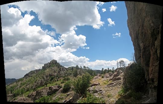
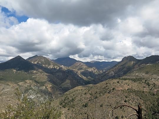
To my surprise, it was a world of rock. On my left opened a long, steep-sided canyon lined with sheer rock outcrops, and behind my left shoulder, at the canyon’s head, rose cliffs that formed the south face of the peak of the range. Straight in front of me was a distinctive rocky peak, and the trail ahead snaked through boulders that continued for some distance and studded the forested slope above at my right. Flowering shrubs and annuals decorated the crevices between boulders, and burn scars on the slopes of the canyon glowed a florid green with Gambel oak.
I hiked down through the boulders to a broad saddle below the sharp peak where I could get a panoramic view of this new canyon. Amazing how much a hike could change in such a short distance! And now clouds were coming together to form a dark mass over the range. I might even get lucky and hit some rain on the way back.
Out of TimeReturning up the trail to the crest, the race was on. Yes, I was already too late for that burrito, but I still didn’t relish driving home in the dark and eating leftovers at 9pm. My foot was feeling vulnerable again, and most of the trail was rocky and hard to maintain traction or balance on, but I did my best, traversing the crest trail and thumping down through the hanging canyon. Fortunately the clouds had cooled everything off, so heat was no longer a problem.
Hurrying down the creekbed, I suddenly came upon a little mammal rushing across a patch of sandy soil and into its burrow. About 4 inches long, fat and seemingly headless and tailless, with glossy dark brown fur, I’d never seen anything like it. Because of the hole I immediately thought gopher, but I thought they were bigger?
Drops of rain began to fall as I picked my way down the rocks of the creekbed, but they were sparse and ended as I traversed back out to the overlook above the dry falls.
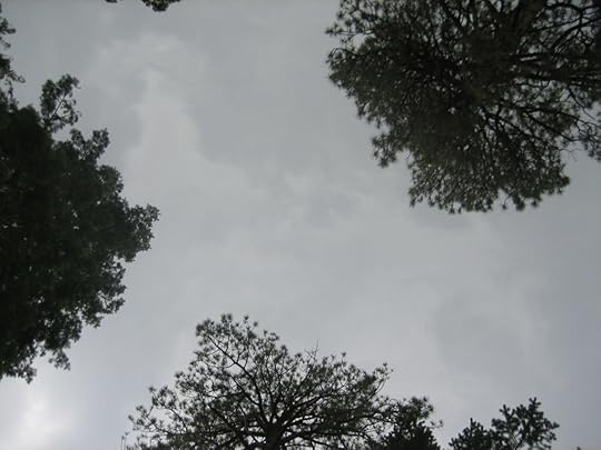
Misty MountainsThere, I faced a strange view over the interior of the range. The cliffs that circle it were obscured by white mist – a fine rain falling over a large area. The mist gradually cleared as I climbed downward thousands of feet, my body feeling sorer and sorer all the way, until finally, traversing the forest above the trailhead, a light rain resumed.
At the bottom of the switchbacks, my phone began vibrating angrily. This time, it wasn’t a text alert – it was a voice alert: Dust warning! Visibility can suddenly drop to zero! This was for drivers crossing the playa on the interstate, more than 30 miles away.
My knees were really hurting, especially the left which is often a problem, so past the trailhead, lurching down the rocky road, I had to stop and strap on my knee brace. And opening up the knee brace, I re-injured my sprained hand, which happens at least once a week now.
Windy NightI reached my little truck at 5:30 Arizona time, and unhappily reset my watch an hour later to New Mexico time, already hungry and thinking about that late dinner 2 hours up the road. Feeling exhausted, I drove slowly down the gravel road through the winding valley to the mouth of the canyon at the edge of the mountains. Lo and behold, there were still people seated at the outside patio of the cafe, and servers running back and forth. I pulled up and walked over, asking if they were still serving. “Yes, we don’t close until 6!”
Hallelujah! I got to enjoy my burrito, and a cold IPA on draft, at the end of my hike, instead of a hungry 2-hour drive. What a day!
As I was eating, a wind gust hit the patio outside, the high branches of sycamores whipping and people grabbing their napkins. And as I approached the interstate, I could see plumes of dust rising in a line across the broad valley. The interstate itself was mostly dust-free, but tractor-trailer rigs had slowed down and were struggling with a stiff crosswind. One had blown off the interstate down a slope and was surrounded with flashing emergency vehicles as a huge tow truck tried to drag it back up onto the roadway.
After sunset, I drove through another dust storm on the road to Silver City. And as I approached home, long after sunset, I could see the last light reflected in pools of rainwater beside the highway, and at intersections near my temporary rental. I was looking forward to the week ahead.


June 21, 2021
Longest Hike on the Longest Day
It was the summer solstice, the longest day of the year, the turning in the arc of the sun’s orbit. The solstices used to be sacred to me – my personal holidays, on which I tried to go somewhere elevated for my little rituals, often making a 3-day road-and-camping trip out of it. But life’s gotten progressively harder, and the past year’s been the hardest of all, with the solstices catching me unprepared.
Our heat wave continued, with a high of 99 forecast here in town, at 6,000′. I was used to hiking through the hottest weeks of summer, seeking shaded canyons and forests and the high-elevation crest trails where you could usually depend on a breeze, but this heat was a little extreme.
Miraculously, the solstice fell on a Sunday this year, and the least I could do was go for a solstice hike. I was also trying to get back on track after a month-long hiatus – a stressful month during which I’d missed my main form of stress relief – and last Sunday’s hike had been aborted due to smoke from the big wildfire in the wilderness to the north.
The problem was that all but one of our nearby high-elevation trails was closed because of the fire. And that one open trail was exposed to full sun for most of its distance. The only well-shaded trail near town was the last one I’d hiked, a month ago, so I wasn’t keen to hit it again. And the more scenic trails over the border in Arizona were lower elevation and would be ten degrees hotter – not an option at all.
As usual, when resuming after a break, I was torn between taking it easy on myself and gradually working up to my pre-break level, or challenging myself to try to compensate for the time off. The trail I was forced to take, the exposed crest trail, offered two levels of effort. I could hike over the 10,000′ peak and down the back side to the first saddle, returning for a round-trip distance of 13.5 miles and accumulated elevation gain of 3,200′. Or I could fight my way through blowdown and deadfall on the abandoned section of trail to the second saddle, for 15.5 miles and 3,500′. My current target for these Sunday hikes is 14-16 miles and 4,000′-5,000′ elevation gain, but considering the heat and the month off, I figured I’d be content with the easier option.
Hot ClimbI loaded my drinking water reservoir with ice and packed the little cooler with ice to cool an extra water bottle in the truck for the end of the day. On the drive to the pass I was surprised to find little traffic, and the shaded mountain picnic areas empty. Apparently everyone was staying home with the air conditioning on full blast.
Smoke from the distant fire had laid a low blanket of haze over southwest New Mexico, but so widely dispersed you could barely smell it. At 9am it was already hot at the 8,200′ trailhead, and the air was absolutely still. On hot days I unconsciously speed up to get past the exposed section of trail and reach the shaded part, and within a half mile of the trailhead I caught up with, and passed, a young couple and their dog. So far, I wasn’t feeling any loss of conditioning from my month off.
After another half mile I passed another couple, only a little younger than me, returning down the trail. I said they were smart to be leaving early, but the man bragged that unlike me, they’d gotten an early start this morning. Since it’s a 5-1/2 mile hike to the peak, to make it all the way they would’ve had to start their hike at 4am – so they likely hadn’t gone all the way. Those were the only people I saw all day on this popular trail.
It was such a relief to finally reach patches of forest after the first 3 miles, stepping out of the sun’s radiant heating into shade that felt 20 degrees cooler. This trail is normally one of the best for wildflowers and berries at this time of year, but the heat wave had accelerated the bloom and I’d missed most of it. One thing I hadn’t missed was butterflies – the mountainsides were swarming with them, especially the big yellow-and-black swallowtails.
Before 11:30am, still walking fast, I crossed over the peak and headed down the crest trail on the back side without stopping.
Thorny DescentTwo or three years ago I met a rare Forest Service trail crew clearing deadfall from the burned back side trail, but the successional thickets of locust and aspen are quick to overwhelm the trail. So I had a certain amount of bushwhacking to do to reach the first saddle. In fact, it was so overgrown, it was obvious that despite the trail crew’s work, no one besides me is using this crest trail anymore.
This is when I admit I had a hidden agenda. Trail work in the Southwest is typically done in April, and back in May, before my hiking hiatus, I’d checked out the latest map of cleared trails, and was surprised to see that the previously abandoned stretch of trail beyond the saddle was marked as cleared. This section is 2.5 miles long and ends at a junction of four trails in a saddle I’d reached more than a decade ago, where I’d encountered a “cinnamon bear” – a black bear with a patch of red fur.
If the trail to the junction was really clear now, I could hike it much faster. It would turn this hot day into an unprecedented marathon, but I’d get to see new ground and new perspectives on the range, and what was usually an anticlimactic, incomplete hike would finally get a real destination.
The Hard PartI wasn’t too surprised when I reached the first saddle and discovered that the next section of trail hadn’t been cleared after all. The Forest Service map turned out to be in error. The initial hundred yards was still blocked by a big blowdown of old-growth ponderosa pine trees that had to be laboriously climbed over, followed by a broad, shallow bowl filled with soil loosened and crisscrossed by giant fallen Douglas firs.
But since I’d been hiking fast, the day was still young, and my body felt great, happy to be put to work again. I made my way down through the blowdown maze, then across the bottom of the drainage onto the traverse of a steep, narrow canyon, where smaller-diameter deadfall filled in by thorny locust creates a more dense obstacle course for the next mile, up to the second saddle, which is as far as I’d ever gotten in my available time.
As on the descent from the peak, the only tracks on this section of trail were from animals. I came upon a fairly recent pile of black scat which looked like mountain lion, then a large four-toed track that didn’t look like anything familiar. The piles of black scat became regular, and I realized it was probably from a bear instead. Bear scat can take many forms depending on what they’re eating, and since unlike a lion they eat continuously, they also poop frequently.
When I reached the second saddle, it was still relatively early, and I still felt good. Clouds were forming over the mountains and I was getting periods of shade. It actually felt cooler than it had in the morning.
A stretch of daunting deadfall blocked the unexplored trail head, but I figured I could at least go a little ways and see how bad it was.
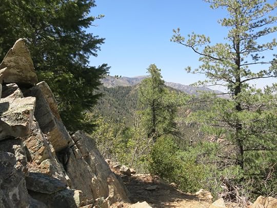
New GroundIt didn’t seem too bad. Past the initial deadfall, a good section of trail continued for a quarter mile, curving into a narrow drainage and through a tight gap between dramatic rock outcrops. Any exposed rock improves my mood, so I kept going, despite feeling a little uneasy about the return hike. I knew I’d already hiked farther than at any time in the past 30 years. How was this possible, after taking a month off?
I kept encountering stretches of thorn thickets and deadfall to fight through, but never very long. The trail snaked through an even larger and more dramatic rock outcrop, which seemed like a reward for the effort I was putting in. And I came around a bend and a new canyon opened up in front of me, which I suddenly realized must be the one with the trail junction saddle. Unbelievable! I was actually going to hike the full distance, and this would turn into one of the longest hikes I’d ever done.
Unfortunately, after turning that corner I entered a seemingly endless, straight, steep traverse hemmed in by thorny locust and Gambel oak, like an overgrown green corridor that paralleled a fairly new stretch of barbed wire fence. Not the most scenic or pleasant way to finish an out-hike, but since I’d come this far I simply had to reach that junction.
At the bottom, when I finally emerged from the thicket into the broad clearing, all those long-ago memories flooded back. It was an ugly place, but I felt a sense of miraculous accomplishment. And my body felt fine. Clouds had filled the sky and were getting darker, and I anticipated no problems on the return hike. I might even get some soothing rain!
The previous visit to this saddle had taken place three years before the fire, and I could now see how the fire had taken a bite out of the forest on the east side. On that previous hike, I’d explored a few hundred yards down into that now-destroyed old-growth fir forest, spooking a hidden flock of big birds roosting in the lower branches that created a calamatous thrashing when I approached. I’d figured it was either turkeys or band-tailed pigeons. And then I’d encountered that bear browsing in a stand of ferns as I left the saddle. A blast from a magical past.
I took off my pack and sat for a while on a log left by backpackers at a fire ring, adding some hydration supplement to my water bottle. On such a long hike in hot weather I was likely to run short of water and get leg cramps, so better safe than sorry.
Taking a FallThe hike back to the second saddle went fairly quickly, and I still loved those rock outcrops which created welcome breaks in the forest cover. With my solstice rituals interrupted it was easy to forget what day it was, but on that return hike I suddenly realized that my previous visit to that junction saddle had also occurred on the summer solstice, back in 2010. Unbelievable! I’d unconsciously returned to the same place on the same day of the year, but by a much longer and more arduous route this time.
Just past the second saddle is a really tricky maze of small-diameter deadfall that you have to slowly and cautiously clamber over and through using all four limbs. Midway through the maze my back foot got caught under a branch and the weight of my pack toppled me onto a pile of small logs with protruding dagger-like broken branches, one of which drove into my shin.
This is something I’ve always feared, and it hurt like hell, but I wear tough pants and heavy socks pulled up to my knees. No blood appeared immediately on the outside of my pants, so I just tried to ignore it, got up, and kept going.
Costly MistakeBy the time I reached the first saddle I was starting to get tired. I figured I’d gone 12 miles and still had over 6 miles to go. I laid down on pine needles and gazed at the darkening clouds overhead. Thunder was rolling from all directions, every few minutes, and I occasionally felt isolated raindrops on my face.
After ten minutes I got up, and suddenly noticed the flap over the pocket of my pack was loose. Back at the junction saddle, after taking out the hydration supplement, I’d forgotten to cinch that flap shut. My heart sank, because that pocket holds hundreds of dollars worth of stuff, including my GPS message device.
Sure enough, something was missing – my emergency bottle of prescription pain meds, recently renewed. I was sure it’d fallen out when I took that painful fall, a mile back near the second saddle. I could tell my doctor I’d lost it, but in the hysteria of our current War on Drugs, regularly encouraged by alarmist stories in both liberal and conservative media, it would put me under suspicion of abuse and put him in danger of criminal prosecution. And the highly restrictive law would probably require me to wait a couple of months before renewing anyway.
Now I was in trouble. I was already returning from a record hike, but going back to retrieve that bottle would make it the longest hike I’d ever done. And that was the hardest, most dangerous stretch of trail.
With thunder crashing all around, I retrieved a lightweight summer rain shell from my pack. I hung the pack from a branch and unfolded my rainproof poncho to cover it. Then I started back down through the maze of blowdown, deadfall, and thorny locust. I was so glad to be hiking in a long-sleeved shirt and thorn-resistant long pants, unlike most white folks who wear shorts and t-shirts on these trails. I used to be one of those, often going shirtless in hope of getting a tan, until I realized I was seriously risking cancer.
Knowing I had to do this, I’d switched into full survival mode, so my emotions were on hold, my mind and senses sharpened. Lighter without the pack, I could move faster, but was even more cautious than usual, knowing an injury now would really screw me up.
Sure enough, after fighting my way back down that narrow canyon, I found the bottle hiding under crisscrossing branches just below the trail, at the exact spot where I fell.
Challenging BypassFighting my way back up to the first saddle and shouldering my pack, I took the fairly easy decision not to climb back up the peak as usual. There’s a bypass trail that circles the southwest side of the peak, returning to the main trail about a thousand feet lower. I’d been told it had been cleared two or three years ago, but I’d explored the first third of it last year and found it still pretty overgrown, with little or no tread. It wouldn’t be easy, and it wouldn’t shorten my return hike, but it would save me the thousand foot climb.
I’d felt more light rain and heard frequent thunder during the retrieval hike, but now the storm had moved west, where I could still hear thunder far in the distance, as I picked my way through thickets and deadfall, traversing the steep flank of the peak on the bypass trail. There was so little actual tread across the steep slopes of loose dirt that at one point I put my foot down and it just dropped out from under me, and I slammed down on my side, grabbing a root to stop my slide. Air temperature had stabilized in the low 80s, and a strong wind was rising out of the west.
Home StretchThe bypass trail joins the peak trail at a long, sharp north-south saddle, and there the west wind was so fierce my hat was blowing off despite the tight chin strap. I just had to carry it. That wind would continue to get stronger, all the way back home. What a day of weather!
I could see occasional bolts of lighting in the west, and suddenly noticed a plume of smoke rising, about where the highway to town approaches the big copper mine. Would my way back home be blocked?
My joints were starting to feel a little sore, but not as badly as on much shorter hikes, during the period when I was starting to build capacity three years ago. I thought about my previous longest hike, the “survival hike” we’d been forced into in the middle of the night, at similar elevation on my aboriginal skills course in August 1990. We’d walked 18.5 miles that night, and I’d been so depleted and sore that I spent three days resting afterwards. I was 38 at the time, and had thought myself in good shape, but now I realized I hadn’t prepared myself with any cardio conditioning back then. Despite being much older, I’m in much better shape now, with much more capacity.
Highway HomeThere was almost no traffic on the highway back to town, so I wondered if I’d find the road closed by wildfire. It was eerie driving the empty road through that fierce wind. The fire turned out to be in low forested hills about a half mile north of the highway, and I only saw one emergency vehicle parked at the mouth of a dirt road with its lights flashing.
Amazingly, I arrived home feeling no more sore or exhausted than usual. My old computer and iPad are no longer capable of accessing the hiking websites with trail data, so I’ll have to walk over to the library to find out exactly how far I hiked and how much elevation I got, but I figure it had to be over 21 miles and 3,000′.
May 17, 2021
Bushwhacking Another Abandoned Trail
I’d taken the previous Sunday off after an injury and minor surgery, so today I wanted a long hike with a lot of elevation to make up. I decided to drive over to Arizona to hit one of my favorite trails in a range with a lot of exposed rock, but this time, instead of taking it to the peak, I wanted to explore an apparently abandoned trail that branched off from the crest and dropped along an outlying ridge into a distant canyon.
Air over the Southwest was very hazy today, but there wasn’t a cloud in the sky, and I expected temperatures at the trailhead, below 5,000′, to approach 90 at midday. But it would be cooler as I started out this morning, and hopefully I’d get breezes as I climbed higher.
I love this trail because of the golden granite boulders in the foothills and the white cliffs and pinnacles along the crest, but I always forget how steep it is. It climbs 3,400′ to a saddle on the ridge top in less than 5 miles – significantly steeper than the steepest trail near home. As a result, I’d never seen much sign of traffic – usually hikers went a mile or two at most before turning back. It’s a south-facing slope and most of the climb is fully exposed, so it felt much hotter than it was. I’d been missing sleep for several nights in a row so my energy was low, and unusually for me, I had to stop many times to catch my breath after the first three miles or so.
Near the top, you enter mixed-conifer forest, and the abandoned trail starts at the high saddle, in a small clearing. The only online trip report I could find from the last 10 years started at the other end, more than 6 miles away and 4,000′ lower. As I recalled, they’d given up about 3/4 of the way. But I’d be starting from the top, and on previous visits I’d glimpsed invitingly clear tread at the junction.
I hadn’t brought a map, but in my memory from the day before, the trail headed down a shallow ridgetop for a couple of miles before switchbacking down into the canyon. Setting off, I soon encountered some deadfall, but it wasn’t bad, and the good tread continued for a few hundred yards.
I was on a north slope well outside the burn areas farther west, and this forest of tall firs and Gambel oak was dense and lush with undergrowth. Instead of following a gentle ridgetop, the trail plunged down a very steep slope that was heavily eroded due to a lot of deadfall and rockfall. The good tread ended and I had to sort out a route through heavily disturbed ground showing only game tracks. But after finding a way through these stretches, I kept rejoining short sections of old trail that had built-up rock berms to protect them on the steep slope.
Eventually my route dropped into a deep side canyon with huge boulders and old-growth firs, where the trail was blocked by massive deadfall I had to climb through. In the middle of the drainage I found an old cairn, so I just kept going.
From here the trail climbed steeply. I saw dramatic rock outcrops far above and knew I’d misread the map the day before. This was nothing like what I’d expected. I almost thought I might be on the wrong trail, but I knew there were no other historical trails in this area, and I kept finding cairns, and even occasionally an old bleached ribbon on a branch. But definitely no human footprints, and no sign anyone had come this way in at least a decade.
This trail wound its way over and under rock formations that formed impassable cliffs, through what was basically a jungle of Gambel oak and thorny locust. It was all very impressive but not much fun, and there wasn’t enough wind to keep me from overheating and depleting my drinking water.
Checking my watch as I approached the bottom of yet another side drainage, I realized I’d more than used up my available time and would have to turn back.
It’s impossible to determine distances on a trail like this. It’s shown on the GPS-based, crowdsourced sites as about 6 miles end to end, but the routes plotted on those sites omit the dozens of meanders and switchbacks I encountered in my short exploration, not to mention whatever might lie beyond that. The direct distance from the junction to my turning point was about 1/2 mile, so I’m guessing I explored 3/4 mile one-way, which took me an hour in the slow conditions. Including the climb to the saddle, I achieved close to 4,000′ of accumulated elevation gain.
Now that I knew the route, the fight back to the trail junction at the saddle wasn’t too bad. And a breeze was picking up, so even though the air temperature was much higher than in the morning, it wasn’t as bad as I’d expected. Exposed on the crest in still air, it felt like 90, but in the shade of the forest it was clearly still in the 60s.
Unfortunately, on the way down I began to notice the trash. First, one of those giant plastic “big gulp” tumblers you get soft drinks in at fast food joints. I tried to reach it but it was embedded in dense brush down a steep slope of loose gravel.
About halfway down I found a spot where hikers had recently sat above the trail for a snack. They’d left orange peels and two plastic water bottles. About a mile beyond that I found another, older water bottle.
In the past I’ve very seldom had to pack out trash from other hikers – this was the most I’d ever seen, on a single remote, difficult trail that gets little use. I attribute it to Arizona – Arizonans are in general just more irresponsible than New Mexicans – and the fact that most hikers here come from Phoenix, which has a culture of irresponsibility.
I was really looking forward to the extra bottle of drinking water in my vehicle, until I found that it’d been heated to about 100 degrees. Guess I need to start bringing a cooler full of ice on these all-day hikes.
And on the interstate, I ran over a big snake that raced in front of me before I could react. That bummed me out almost all the way home.
May 3, 2021
Requiem for Andy’s Hat
The past week had been maddening, and I’d missed my midweek hike. Friday was incredibly stressful and hard on my back, and Saturday I’d barely had a chance to recover. I expected Monday to be another stressful and physically difficult day, so I needed to keep this Sunday’s hike relatively close to home.
After reviewing my options I decided to revisit the hike I’d unsuccessfully attempted 3 weeks earlier, on an abandoned trail into the head of a remote canyon system where there were supposed to be slot canyons, cascades and waterfalls. It featured a high concentration of exposed rock – cliffs and outcrops hundreds of feet tall – and some serious backcountry hikers called it the most beautiful part of the entire range.
There was a late-model Prius at the trailhead, which surprised me, because the road in is long, steep, and rocky – really hard on street tires. The trailhead log showed a party of 2 had started a five-day backpack yesterday, into the very area I was heading for.
Temperatures were in the 60s when I started out, and quickly settled into the 70s. The approach to the abandoned trail drops into the mouth of a canyon, follows it upstream for a few miles, then climbs 2,000′ to a saddle overlooking the next canyon. The modest stream was still mostly running, and the spring season was in full force, with brilliant new foliage glowing in the morning sunlight of the canyon bottom and the first riparian wildflowers opening. Unfortunately there was heavy cattle sign in the first couple of miles from the trailhead – including the biggest cowpies I’d ever seen. Then I encountered the bull. He was resting in the shade of a small meadow beside the trail, and watched me with only mild interest as I walked past.
The climb to the saddle always seems harder than I remember, varying between 15% and 30% grades. GPS on this section of trail shows 4 miles, but ignores the dozens of S-curves in the canyon, so I rate the actual distance at 5 miles – it takes longer than most 5-mile hikes I’ve done.
Finally I topped out at the saddle and could resume the unfinished business of a few weeks ago.
I watched the abandoned trail for the footprints of the backpacking party, but didn’t see any at first. Then I began to notice fresh, bright yellow plastic ribbons on trailside branches, in addition to the older, sun-bleached pink ribbons I’d followed before. These backpackers had flagged the trail themselves – hopefully they’d laid out a route I could follow beyond where the pink ribbons ended.
Now that I knew the trail, it was smooth going until I reached the “needle rock” where I’d bushwhacked off established tread 3 weeks ago. There, the new yellow ribbons followed the same route I’d taken, down and around a couple of outlying ridges, into the final side canyon that led to the bottom of the main canyon.
From my previous attempt, and a cursory glance at topo maps, I’d assumed it was an easy bushwhack down this shallow side canyon, with about 350′ of vertical drop. Boy was I wrong.
The new yellow ribbons ended and were replaced by new pink ribbons, but they didn’t mark out a trail – they just marked out a “route” – which led through thorn thickets pretty much straight down a slope that featured not only thorns but cliffs consisting of loose rock and long stretches of loose dirt at the angle of repose, finally reaching the log-and-boulder-choked gully at the low point of the side canyon – after dropping at least 300 feet and seemingly no closer to the main canyon. I knew this dangerous stretch was going to be super hard to climb on the way back, but once started I was committed.
The next stretch of descent wasn’t flagged – or at least not at first. I lost a lot of time scouting for non-existent ribbons, then tried making my way down the congested gully. That only worked for about a hundred feet. Then I had to re-enter the thorn thickets on the slope above.
Finally, nearing the bottom, I found more pink ribbons – again, with no trail, and leading directly through dense thorn thickets. Then a hundred feet above the main canyon bottom I entered dark conifer forest atop a section of cliffs and boulders that required some technical down-climbing. After that I came upon the stream, in a bend choked with logs. A cliff towered above, and I could barely see the entrance to the “slot canyon” a little ways upstream.
This stream was one of the most robust I’d ever seen in these mountains. It drains a huge area of the crest combining two main tributaries, each of which runs for 4-5 miles before reaching this junction. As in the divide hike I’d done a couple weeks ago, it felt incredibly remote, especially after that grueling hike down the side canyon, which had turned out to be twice as deep as I’d expected.
After all that hard work, I was already running about an hour later than planned. I should turn back immediately, but this place was really beautiful, especially in the dappled shade of the riparian canopy and those towering cliffs, with all that clear, cold water rushing down from the 10,000′ crest.
All the maps showed 4 trails converging here, but none of them had survived the 2012 wildfire. I tried scouting up the opposite bank but found nothing. So I started picking my way upstream using rocks as stepping-stones. Eventually I spotted a game trail on the opposite side that seemed to lead toward the “slot” canyon. I entered it – nearly as big as the main stream – and picked my way through thorn thickets and over stepping stones until I reached an overhanging cliff where I knew I’d have to turn back. I figured at this point I wouldn’t get home until dark, and would end up with a late dinner, quick shower, and bed.
But the bushwhack up the side canyon was probably the most brutal hike I’ve ever done. Overhanging brush kept pushing me back, thorns kept grabbing me, hidden branches kept tripping me, and I often slipped backward trying to climb steep slopes of loose dirt. It took me an hour and a half to go less than half a mile, and at the saddle where I rejoined the actual trail, I was essentially out of water and still had over 6 miles to go, including a climb of almost a thousand feet. I’d brought 3 liters of water as usual in warm weather, plus electrolyte supplement that was supposed to triple the hydration, and the temperature was still only in the 70s. Yikes!
Dehydrated from the climb, I had only enough water for the 2 doses of electrolytes in my pack. During the 2 miles of ascent to the divide saddle, I rationed the first dose of enhanced water, and was really thirsty by the time I reached that saddle. But at least I knew that after a mile of descending the steep trail into the next canyon, there would be a running stream.
I raced down the trail, and as soon as I reached the stream I filled my water bottle, and dug the SteriPen ultraviolet water purifier from my pack. I hadn’t used it for years, but I kept the batteries separate and they were still good. After a few minutes of stirring I had a liter of drinking water.
I drank it slowly to keep from getting sick. A mile down the trail I added the second dose of electrolytes. But I was still dehydrated. I realized that as hard as I’d had to work in that steep bushwhack, I’d end the day having needed almost 6 liters of water. Fortunately I’d brought an extra bottle in the vehicle for the drive home.
2-1/2 miles before the trailhead the cramps hit, in both thighs. I was immobilized with pain for about 5 minutes, then was able to continue stiff-legged until it mostly faded. The canyon was now dark, with only a rim of gold on the highest ridges.
I encountered the bull again, grazing only a couple feet off the trail. I tried to shoo him away but he just stared, so I walked right past him.
After another half mile the cramps hit again, just as I needed to cross a precarious washout at a narrow talus slope. Raising a leg to climb is what triggers these cramps, and that was the move I needed to cross the washout. I ended up stuck there on loose rock, with certain injury if I froze and slipped. I managed to lever myself up with my arms, but then collapsed in pain on the other side.
Finally I got moving again and gradually loosened up. I’d experienced some strong wind gusts at midday, and amazingly, I encountered three big trees that had blown down across the trail while I was hiking in and out of that other canyon: a maple, ponderosa pine, and alligator juniper. The sun was setting as I climbed out of the canyon toward the trailhead, and a large flock of swallows swooped overhead in the dusk, harvesting insects.
I reached the vehicle and drank all the water there. I figured I’d walked at least 14 miles and climbed a total of over 4,200′, which on trails would be a routine 6-7 hour hike. But because of that bushwhacking it’d taken me almost 10 hours. This was one of the hardest hikes of my entire life, and one I was not likely to try again, even as a backpack. At least until I forget how bad it was….
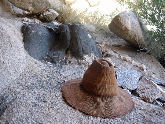
While unpacking at the vehicle, I discovered I’d lost my hat in the final climb out of the canyon to the trailhead. In recent years I’d taken to wearing a bandanna under it to protect it from sweat, but with the bandanna on it was harder to tell whether the hat was actually on my head.
That hat has been precious to me for 35 years, but I felt just about dead and there was no way I was going back. The hat was pretty much worn out anyway. I often wondered who would go first, me or the hat.
It was made in West Africa, and I inherited it in 1985 from Katie, who inherited it from her friend Andy, a filmmaker in Los Angeles. Having lost most its natural oils, it was stiff and tight, and the brim had to be moistened before wearing, in order to fit on my head. I went for years without wearing it, but kept going back to it, treasuring it more and more as I shared more history with it. Where will I find a replacement?
April 19, 2021
A Year’s Weather in a Day
Another tough choice over where to hike! Last Sunday I’d experienced an extremely painful strain of my Achilles tendon. I couldn’t use my left foot if the angle between the foot and the leg was less than 90 degrees. But in order to keep the foot at a 90 degree angle while climbing, I had to use my calf muscle and push off with the ball of my foot, which is the vulnerable part of my foot. I can do that at the beginning of a hike, but as the day wears on, the bones get inflamed and can no longer bear my weight.
I’d taken the intervening week off, resting my heel and doing gentle stretches 4 times a day. My second COVID shot was coming up – I expected to miss a hike or two afterward, and wanted to maintain my conditioning with a longer hike before. But we don’t have any long hikes that don’t involve climbing.
So in the end, I picked a hike I’d never done before – one that had been recommended to me by someone I’d hiked with in the past, someone who knew what I liked. It was a 14-mile round-trip that crossed two divides between three creeks, so it had some climbs, but I didn’t know how steep they were. It was definitely the wrong hike to pick for my heel problem, but I figured if it was too hard, I could just skip the climbs and explore at creek level.
We’d had unseasonably warm weather for a couple of weeks, but now there was an area-wide warning of a cold front that could bring thunderstorms. It was mostly focused to the east, but I always hope for weather.
The trailhead is harder to reach than most – it requires a 20-mile drive across a rolling plateau on dirt ranch roads. I’d avoided this trail in the past because it traverses a lower part of the mountains between 6,300′ and 7,300′, so I didn’t expect it to give me the elevation gain I normally seek, and I didn’t expect any spectacular views. But from a distance the terrain looked fairly rugged. Maybe it would surprise me.
The approach was fairly typical for trails on the western front: dropping from the plateau at the foot of the mountains into a deep canyon, through pinyon, juniper, and oak. It started with a “Trail Unmaintained” sign, but I’d heard that it had been mostly cleared in recent years, and the tread was good, besides consisting mostly of loose rock. Traversing farther up the canyon, I began to see cliffs and rock outcrops ahead. It was mostly sunny but cool. The cold front had cleared the air and I was feeling good and optimistic.
Past the creek, the trail began switchbacking up a very steep slope. I was conscientiously pushing off with my left foot, keeping the foot at 90 degrees, and the vulnerable ball of my foot felt fine. Taking a week off had seemingly helped. The view up the canyon kept getting better and better. This was definitely an area worth checking out – despite starting out lower, it was the most spectacular canyon I’d ever seen in these mountains!
About a thousand feet above the creek, I reached the first summit of the divide between the first and second creeks. This rolling divide is about three miles wide, and is split into several sections, each of which requires short ascents and descents. Most of it burned in the 2012 wildfire, so there are a lot of exposed, brushy sections. It looked like a long trudge, and it was. But as I moved across it, my view of the higher and more distant peaks kept changing, as did the cloud cover.
After the morning cool, the climb to the divide had been hot, and it was warm up there. I could see clouds touching the far peaks, above 10,000′, but it didn’t look like I was going to get any weather.
Straight ahead of me, in the east, was a spectacular wall of cliffs with a top like a straightedge. I knew that had to be the east wall of the canyon of the second creek. My plan was to drop into that canyon and climb the other side to the top of the divide facing the third canyon. That would give me at least 7 miles one-way, and a view into the third canyon.
I lost the trail a couple of times crossing that rolling divide, wasting up to a half hour. It meandered continually back and forth through the dense scrub, marked only by frequent cairns. Climbing over the final hump, I encountered a stretch where the “trail” consisted only of deeply eroded gullies and steep slopes of loose dirt, blocked occasionally by deadfall, and there were no cairns for a hundred yards or more. But taking my time, I figured out the route.
Finally I reached the rim of the second canyon. It was still mostly sunny and warm, and I was really stoked because of that spectacular wall of cliffs in front of me. It looked like another thousand-foot descent to the creek, and it started out so steep, it was one of those descents where once you start, you can’t stop. But my foot and heel were still feeling fine, so I started sliding down.
What seemed like hundreds of super-steep, rocky switchbacks later, I emerged in intact, parklike, fairly level ponderosa pine forest on the bank of the creek, with the cliffs dimly visible high above on the opposite slope. Screens of willows lined both sides of the creek. After pushing through the first, I stood on rocks mid-creek and looked upstream. This was an amazing canyon that stretched all the way up to the crest of the range.
This location, deep in the wilderness area, was completely hidden from the outside world. The trail I’d taken was the only route in. Another trail started here and followed the canyon all the way to the crest, but the Forest Service claimed it had been destroyed in the wildfire. I was so excited – it really felt like I’d finally penetrated into the mystery of the range. There were spectacular cliffs and rock outcrops all over this area. I was in heaven.
The trail up the east slope of this canyon was in worse shape, and I’d lost time scouting for trail across the first divide. Partway up I began finding old sun-bleached ribbons on branches, and I used those as well as sporadic cairns to find my way. Still there were sections where I had to spend time scouting, so when I had a clear trail, I moved fast.
Finally, after a mile and a half and nearly 500 vertical feet of climbing, I reached the saddle between the two creeks. It felt super remote, but as a destination it was a letdown. I’d reached my goal, but the next canyon didn’t look nearly as spectacular as the previous, and further shoulders of the outlying ridge blocked my view into it.
I was running late, so I sped back toward the second creek. Nearing the bottom of the east slope, I came upon fairly fresh mountain lion scat that I didn’t remember from the ascent. Then, after crossing the creek, I found a lion track superimposed on my own tracks, so I started looking over my shoulder.
Cloud cover had been increasing. When I got a view up the canyon, I could see precipitation veiling the crest of the range, several miles away.
The climb out of this canyon was brutal! Surprisingly, my foot and heel were still holding up, but I knew that even after reaching the top, I still had at least a thousand feet of climbing left crossing the rolling divide and climbing out of the original canyon.
About 300′ below the top there’s a little shelf with intact forest, and there I lost the trail yet again. I knew it eventually crossed a small drainage, so I just dropped into the drainage and fought my way up it, eventually reconnecting with the trail. But that lost me more time.
Cloud cover was now complete, it was raining lightly and getting cold. When I reached the top it turned to snow, so I packed away my shade hat and pulled on both my sweater and my hooded shell jacket.
After the steep, rough descent into the first depression of this long divide, the snow turned to sleet, and when I reached the next rise, it turned to heavy rain, so I had to break out my poncho. My hands were freezing – I’d put on wool glove liners, but once my hands get cold, it takes up to an hour for them to warm up again, so I was flexing them constantly to maintain feeling. I could hear thunder over the crest of the range. A year’s weather in a day!
Precipitation stopped by the time I reached the opposite end of the divide, but clouds still obscured many of the high peaks. The down climb seemed to take forever, and by the time I crossed the first creek and began the final ascent to the trailhead, my foot, heel, and calf were exhausted. That final climb, which is only a little over a mile and less than 500′ of elevation, seemed endless. I was literally cursing after about halfway. And then it began to rain again.
All in all, that was one of the hardest hikes I’ve done in this area, but also one of the most rewarding. I hope to return and explore up the second canyon, and maybe turn it into a backpacking trip. You could do a loop up this canyon, across the crest, and back down the first canyon, although much of it would probably be bushwhacking.
April 14, 2021
Fire, Part 8: Native Americans and Wildfire
All images by Max unless otherwise credited.
Previous: Americans and Wildfire
Both Sides of the TracksMy ancestors were poor Gaelic farmers in the Scottish highlands and border country who were driven from their homelands and forced to emigrate to North America. Here, we didn’t become part of the power structure that founded the United States. We remained ethnic underdogs, independent and self-reliant, no friends of government.
I grew up in small rural communities within which Blacks had their own tiny enclaves, enduring racism but studying with us in school and becoming our sports heroes. Thanks to my parents’ cosmopolitan aspirations, I was raised not to look down on other races and ethnic groups, but to admire them – my dad idolized Black musicians like Miles Davis and Charles Mingus, and my childhood soundtrack ranged from Jamaican-American singer Harry Belafonte to African superstars Miriam Makeba and Hugh Masekela.
I came of age during the Civil Rights Movement and started college at the peak of the Black Power movement. Native Americans and their legacy had been thoroughly erased from my Midwestern county, but in high school, I supported the American Indian Movement’s occupation of Alcatraz Island in San Francisco Bay, and hung a poster of Apache leader Geronimo over my bed.
The University of Chicago was an island of whiteness surrounded by one of the world’s largest and most nightmarish Black ghettos. Its Eurocentric curriculum was designed to impress students with the towering achievements of the white race, but in a gesture to accommodate the Counterculture, the U of C had scrambled to hire a few token radicals like Bill Zimmerman, co-founder of Science for the People. He taught me how racism and imperialism are justified using myths about cultural evolution and the superiority of European culture.
Zimmerman introduced me to the anthropology of indigenous cultures and the work of Thomas Kuhn, often considered the most influential philosopher of science in the 20th century. Kuhn showed that far from the objective search for truth it claims to be, science is a competitive political activity. Scientists routinely form prejudiced hypotheses, resist new ideas, and reject data which challenge their preconceived notions.
Forced to switch from the arts to science and technology, my social circle expanded to include Asians, who were accepted as “honorary white people” because they adapted easily to European values and institutions. But nowhere in those elite programs did I see a Black, Latino, or indigenous face. Those races remained in the background, working in inferior roles, safely segregated in impoverished enclaves.
After grad school at Stanford, I’d had enough of that white European bullshit. Needing cheap studio space for my art and music, I lived for decades in poor Black and mixed ethnic neighborhoods, while working day jobs with whites and Asians. I had a Mexican-American girlfriend with indigenous ancestry who became the love of my life. I had Black and Native American bandmates, roommates, and landlords, and even went to jail with them, where we all encountered racism and injustice.
I studied West African music and culture and the Native American cultures of the Great Basin and Mojave Desert, and those became the main inspirations for my art and music. I studied aboriginal survival skills to understand how indigenous people had thrived in the arid Southwest. I spent time with the desert tribe’s most celebrated traditional craftsperson and their leading environmental activist, and got involved with a coalition of tribespeople preserving natural habitats as sacred cultural spaces – something our secular society can’t do.
All that firsthand experience led me to respect and admire traditional cultures and oppressed races more than the European civilization that had conquered, enslaved, and oppressed them.
Meanwhile, my brother and father – the rocket scientist who had once worshiped Black musicians – were being turned into racists by Rush Limbaugh, Fox News, and the neo-conservative movement. And while I was living and working in poor neighborhoods and learning about other cultures firsthand, most of my friends in science and academia were gravitating more and more toward safe, clean all-white enclaves where they only encountered people of color in inferior roles, as gardeners, custodians, dishwashers in restaurants, and the like. They voted for liberal politicians, and praised diversity, while tacitly accepting inequality and segregation.
The Myth of the Noble ScientistIn 2004, two years into my research for Pictures of Knowledge, I was visiting an old friend, a professor at a large state university who conducts research and conservation on endangered species. When I tried to share what I’d learned about indigenous conservation practices, he interrupted me impatiently, citing a recent study in the popular scientific literature about a prehistoric tribe somewhere in the South Pacific that had over-exploited their resources, driven species to extinction, and experienced a population crash. “Indigenous people are NOT conservationists!” he shouted.
Later that year I joined some even older friends involved with ecological research and conservation at an elite university. Again on the topic of conservation, when I offered “In some traditional societies…” they began shouting in unison, “NOBLE SAVAGE, NOBLE SAVAGE, NOBLE SAVAGE!” I was never allowed to finish.
For more than a decade after that, whenever I raised the subject of traditional societies and indigenous practices with biologists, they were quick to interrupt, ridiculing me for “romanticizing the noble savage” and dismissing my observations before I even had a chance to articulate them. Most recently, when I tried to share anthropologists’ observations about indigenous conservation practices in an email exchange with friends in science and academia, a senior wildlife biologist immediately dismissed them: “For North America the evidence is the opposite. The myth was the noble savage.”
As mentioned above, I studied science at the University of Chicago and Stanford. I’ve helped my biologist friends collect data in the field and process it in the lab. I respect and praise their work and treasure our friendships. Why have they responded with ridicule and contempt to the very mention of the traditional cultures I’ve spent much of my life studying and experiencing firsthand? Why do they reject evidence of indigenous conservation without even examining it? And what do they mean by the “noble savage”?
This myth has had a murky history. To the extent scientists or academics are even aware of it, they attribute it to the Enlightenment-era Swiss philosopher Jean-Jacques Rousseau. But recently, in his book The Myth of the Noble Savage (University of California Press), Ter Ellingson, associate professor of anthropology at the University of Washington, has shown it to be the creation of a faction of racist anthropologists in the mid-19th century – the intellectual ancestors of today’s right-wing think tanks and reactionary academics like Harvard’s Steven Pinker.
It turns out the noble savage was actually never a popular fantasy in historical European culture. The racist academics presented the fake myth as a “straw man” which they could easily demolish – relying partly on Darwin’s new theory of natural selection – in order to condemn indigenous cultures and defend European imperialism and white superiority.
The mere repetition of the words Noble Savage sufficed to serve as a devastating weapon against any opposition to the racist agenda. The myth of the Noble Savage became a weapon in the Ethnological Society’s scientific-racist project of helping to naturalise a genocidal stance towards the “inferior” races. (Ellingson, The Myth of the Noble Savage)
In this fabricated myth, indigenous people were falsely idealized as representing an original, wild, unspoiled state of humanity, living in peaceful harmony with nature. One of the worst mistakes a white European could make was to romanticize the noble savage – succumbing to irrational fantasies, idealizing nonindustrial societies and cultures, ignoring their negative traits and failings, fabricating valse virtues and successes.
In science and academia, the noble savage became a supremely effective insult, slander, and put-down for which there was no defense. If you said anything positive about indigenous people, you were immediately accused of romanticizing the noble savage, and you automatically lost all credibility. The slur was likely to cling to you forever, branding you as “too trusting” of anything that didn’t conform to institutional orthodoxy. Evidence of indigenous failures was welcomed, while evidence of indigenous achievements was dismissed.
Of course, none of my scientist friends had ever studied this cultural history. None of them knew what the original “noble savage” meant, let alone how it was manipulated by 19th century racists. My friends had simply copied the insult from elders and peers in academia – and sadly, I’ve even found them teaching it to their children.
Nor had any of my friends ever studied the conservation practices of indigenous cultures. From the way they heard the “noble savage” slur used in their milieu, they assumed there was conclusive evidence, somewhere, that all indigenous people had abused nature. When pressed, the best evidence they could cite against indigenous conservation was a widely publicized hypothesis that Pleistocene megafauna – mammoths, mastodons, saber-toothed tigers, etc. – went extinct 8,000 years ago due to over-hunting by prehistoric humans.
As one of my friends noted, there are other isolated reports of indigenous over-harvesting. But scientists don’t cite these reports out of concern for objectivity – they cite them to discredit all indigenous people and those who seek to learn from them, and to dismiss evidence which challenges institutional racism and white superiority.
When it supports their claims, Western scientists value what Traditional Knowledge has to offer. If not, they dismiss it…when Traditional Knowledge is seen to challenge scientific “truths —then its utility is questioned or dismissed as myth. Science is promoted as objective, quantifiable, and the foundation for “real” knowledge creation or evaluation while Traditional Knowledge may be seen as anecdotal, imprecise and unfamiliar in form. (George Nicholas, Professor of Archaeology, Simon Fraser University, Smithsonian Magazine)
The racist slander of the Noble Savage has ensured that seven generations of biologists have willfully ignored indigenous knowledge about the natural systems and habitats they presume to study, knowledge they’re only now beginning to catch up with.
The Ascent of White MenThe very things I admire about my scientist friends – their love of nature and commitment to field work and conservation – have given them a limited, inaccurate view of science. They’re lucky to make a living exploring beautiful natural areas, restoring habitat and collecting data to help preserve endangered species.
But growing up amid industrial farms, coal mines, oil and gas fields, and chemical factories, with a research chemist and rocket scientist for a Dad, studying the physical sciences and engineering and working in the electronics, communications, nuclear, entertainment, and internet industries – all that has taught me firsthand how the discoveries of physicists, chemists, earth scientists, geneticists, roboticists, and computer scientists damage natural habitats, pollute our environments, and endanger humans and wildlife.
It’s ironic that, while attacking me for “romanticizing the noble savage”, my friends have consistently romanticized science.
Scientists tend to judge non-whites by European standards, reserving their respect for “civilized” high-achieving Asians, and the few Blacks, Latinos, or Native Americans who’ve become scientific researchers, college professors, published authors, or national leaders. One of the most insidious prejudices in science, and our society as a whole, is the conflation of wealth, power, and technological progress with cultural evolution. In the 19th century, Europeans saw the increasing wealth and power they were gaining, through imperial conquest and advances in science and technology, as evidence they were progressing away from primitive savagery toward civilized Enlightenment. The defenders of European imperialism who introduced the noble savage as a racist insult also helped frame the theory of the “Ascent of Man”.
To white people, human progress is proved by our ancestors’ assumed progression from Stone Age hunter-gatherers – the Noble Savage – to the metal-workers of the Bronze Age and Iron Age, to the Discovery of Agriculture in the Middle East, the Rise of Civilization, the Anthropocene, the European Enlightenment, and the rise of science. Despite our contemporary rhetoric praising diversity and tolerance, white people of European ancestry, including our most celebrated scientists, share a tacit belief in the evolution of culture from primitive to civilized, and the superiority of civilized people.
But the Ascent of Man is proving to be just another myth. There was no time when ancestral humans wandered carefree in a Garden of Eden, all their needs provided without having to work. Human culture did not take a quantum leap forward through a “Discovery of Agriculture” in the Fertile Crescent of the Middle East, launching a new geological era, the Anthropocene. Some societies – our own, and the historical examples we admire (Ancient Egypt and Greece, the Roman Republic and Empire, the Inca and Classical Maya) – are simply unable to manage their aggression. They expand, conquer, dominate, and ultimately collapse.
But many others take the path of peace and thrive by reining in aggression. Like other animal species, nonindustrial humans have always studied their habitats closely and worked with plant and animal populations in complex and sophisticated ways.
Indigenous peoples have been pigeonholed by social scientists into one of two categories, “hunter-gatherer” or “agriculturalist,” obscuring the ancient role of many indigenous peoples as wildland managers and limiting their use of and impacts on nature to the two extremes of human intervention…and it has led to a focus on domestication as the only way in which humans can influence plants and animals and shape natural environments.
Anthropology has changed significantly in the past one hundred years…but the basic elements of the nineteenth-century view of California Indians is still with us. The term “hunter-gatherer” is still used and still implies an evolutionary sequence of progress. The notion of the evolution of human cultures remains implicit in the layout of many current human ecology and anthropology textbooks and is explicit in recent anthropological journal articles that refer to this progression as “the ascent of man.” (M. Kat Anderson, Tending the Wild: Native American Knowledge and the Management of California’s Natural Resources)
Rediscovering Native TendingAt the same time those white scientists and conservationists were ridiculing and bullying me on the topic of indigenous conservation and the noble savage, University of California botanist M. Kat Anderson mustered the courage to stand up to anti-indigenous racism in the male scientific establishment. Her book Tending the Wild: Native American Knowledge and the Management of California’s Natural Resources, published in 2013, was a meticulous, comprehensively researched study of the ecological practices of dozens of tribes across dozens of widely varying natural habitats, from coasts to river valleys and interior basins, from deserts to alpine forests, from thousands of years ago into the present.
By virtue of their daily use of plants, California Indians acquired extensive and special knowledge of the life histories of plant species, and they understood how different harvesting strategies affected natural regeneration…These [indigenous] harvest and management practices, on the whole, allowed for sustainable harvest of plants over centuries, possibly thousands of years…During the course of their long history in California, Indians so exhaustively explored the plant kingdom for its uses and so thoroughly tested nature’s responses to human harvesting and tending that they discovered how to use nature in a way that provided them with a relatively secure existence while allowing for the maximum diversity of other species…When historical indigenous interactions–both harvesting strategies and resource management practices–are investigated in depth, we find that by keeping ecosystems in a modest or intermediate level of disturbance, in many senses Indians lived in ecological harmony with nature. (Anderson, Tending the Wild)
As I’ve found while researching Pictures of Knowledge, abundant evidence of indigenous conservation and sustainable resource management has long been embedded in the ethnographic literature, hidden from lay audiences and ignored by the broader scientific community. But in the wake of Anderson’s book, many similar reports on indigenous ecology have surfaced from around the world – North and South America, Asia, Australia, and Africa – confirming my insights and Anderson’s findings.
For instance, in the past two decades, archaeologists and environmental scientists working in coastal British Columbia have come to recognize evidence of mariculture—the intentional management of marine resources—that pre-dates European settlement. Over the course of thousands of years, the ancestors of the Kwakwaka’wakw and other Indigenous groups there created and maintained what have become known as “clam gardens”—rock-walled, terrace-like constructions that provide ideal habitat for butter clams and other edible shellfish…This resource management strategy reflects a sophisticated body of ecological understanding and practice that predates modern management systems by millennia.
These published research studies now prove that Indigenous communities knew about mariculture for generations—but Western scientists never asked them about it before. Once tangible remains were detected, it was clear mariculture management was in use for thousands of years. (Nicholas, Smithsonian)
These reports continued to accumulate until finally, long after the Black Lives Matter movement made racism a hot topic in white society, the predominantly white scientific, academic, and conservation establishments were forced to respond. In September 2020, Scientific American published a formal apology for its long-standing role in institutional racism. And The Conversation, a fact-based online news source supported by Boston University, the University of California, Penn State, Rutgers, Tufts, Vanderbilt, and many others, formally acknowledged the racism inherent in the environmental movement since its origins in the work of icons like John Muir.
American environmentalism’s racist roots have influenced global conservation practices. Most notably, they are embedded in longstanding prejudices against local communities and a focus on protecting pristine wildernesses. (Prakash Kashwan, editor, The Conversation)
Riches SquanderedI’ve described how I grew up amid the impressive earthworks of the prehistoric Hopewell culture. European culture is obsessed with monumental architecture – even the Black astrophysicist Neil deGrasse Tyson used drone footage of skyscrapers to illustrate the highest achievements of mankind in a pro-science TV commercial.
But I also described how, 30 years later, I was even more impressed at finding stone tools, potsherds, petroglyphs and pictographs in my beloved Mojave Desert. My long, privileged education had revealed exactly how white Europeans built cities, skyscrapers, computers, and rocket ships. And my adventurous life had exposed the cost – global, catastrophic damage to natural ecosystems and traditional human societies. But the discovery that people had thrived in the desert, making everything they needed from scratch using local natural materials, with no lasting damage to their environment – that I found truly inspiring.
When the European ancestors of modern white Americans invaded North America, they encountered indigenous societies and natural habitats which had co-existed in dynamic equilibrium for thousands of years. Native cultures spanned a diverse ecological spectrum. Some – like the tribes Kat Anderson studied in California – were able to occupy the same habitat for countless generations, practicing a resilient blend of wild harvesting and agriculture that adjusted to changes in climate and other disturbances.
Unlike European colonists and modern Americans, these ecologically-adapted indigenous societies didn’t construct “permanent” homes, cities, infrastructure, or political boundaries in habitats where fire, flood, and other cyclical disturbances could be expected. When they encountered disturbances rendering local habitats unusable – like prolonged droughts – they adapted by migrating, carrying their resilient practices to other habitats where they could put down new roots.
A few native cultures, like the Cahokians of the Mississippi Valley and the Ancestral Puebloans of the Southwest, did come to rely more exclusively on agriculture, expanding and developing social hierarchies, seeking to dominate their neighbors and develop empires. Like empires in the Old World, these native empires rose and fell and faded away in a cycle of generations. None of these North American native empires survived at the time of European invasion.
Countless historical documents show that when they first arrived, and as they invaded westward, European colonists found natural habitats of almost unfathomable productivity which were the result of thousands of years of indigenous tending.
Every day of every year for millenia, the indigenous people of California interacted with the native plants and animals that surrounded them. They…achieved an intimacy with nature unmatched by the modern-day wilderness guide, trained field botanist, or applied ecologist …In the process, they maintained, enhanced, and in part created a fertility that was eventually to be exploited by European and Asian farmers, ranchers, and entrepreneurs, who imagined themselves to have built civilization out of an unpeopled wilderness.
Coastal salt marshes were at one time much more extensive than today, forming important habitat rich in plant and animal life… Pure grasslands, including coastal prairies, valley grasslands, vernal pools, and montaine meadows, covered one-fifth of the state before 1850… Before dams and man-made levees, river boundaries surged and retreated with the seasons…Riparian woodlands, which before 1850 covered 900,000 acres in the Central Valley, teemed with animal life. (Anderson, Tending the Wild)
Artisans of WildfireThere wasn’t much of that richness left for me to see, generations later, as I made my own way westward into valleys trampled and overgrazed by cattle, deserts and coastal hills blanketed by invasive plants, mountains ravaged by mining and clear-cutting of timber. But as mentioned in previous parts of this series, I did occasionally stumble upon beautiful “parklike” stands of native Southwestern forest which can result either from “natural” fire regimes or from indigenous burning to clear undergrowth and excess fuel. And in remote, hidden corners of the desert, I was sometimes surprised by lush stands of honey mesquite, which my Indian friends told me had been planted and maintained by their ancestors – like the native water sources which their people maintain today.
The California landscapes that early explorers, settlers, and missionaries found so remarkably rich were in part shaped, and regularly renewed, by the land management practices employed by native peoples. Many of the biologically richest of California’s habitats were not climax communities at the time Euro-Americans arrived but instead were mosaics of various stages of ecological succession, or fire subclimaxes, intensified and perpetuated by seasonally scheduled burning. In a very real sense, some of the most productive and carefully managed habitats were in fact Indian artifacts. In many cases these landscapes experienced far greater degrees of managerial care and ecologically sophisticated manipulation than are found today.
It is likely that over centuries or perhaps millenia of indigenous management, certain plant communities came to require human tending and use for their continued fertility and renewal and for the maintenance of the abundance and diversity patterns needed to support human populations.
Countless studies have shown that fire has always been a primary tool in indigenous conservation, worldwide. In the forests of eastern North America, before the European invasion:
Over thousands of years, the American Indian became expert in using fire for various purposes, e.g., for hunting, to concentrate prey species in convenient areas, to encourage fruit and berry production, to keep the woods open along major corridors of travel, to fire-proof their villages, and other uses…Because of their farming and burning activities, Indians ensured that much of the eastern forests was in early successional habitats.
Indians often burned as frequently as twice a year, complementing lightning as an ignition source. Their burning extended the fire season beyond the “natural” lightning-fire season of summer. These frequent and often extensive fires, along with the wildlife foraging that fire encouraged, created and maintained open woodlands, savannahs, and prairies throughout the eastern United States.
In fact, much of the eastern forests at the time of Columbus could be regarded as a cultural artifact of Indian activities…The eastern forest at that time was a shifting mosaic of woodlands, savannahs, forests, and prairies, all in varying stages of succession. (D. H. Van Lear and R. F. Harlow, U.S. Forest Service)
In California:
Fire was the most significant, effective, efficient, and widely employed vegetation management tool of the California Indian tribes. The slow match gave them the technological capability to burn both small patches and extensive tracts of vegetation in a systematic fashion…In addition, most tribes had the ability to fell trees and large shrubs with fire for meeting cultural needs. They used this tool to create village sites and to convert riparian habitat and floodplain into farming areas in southeastern California.
Deliberate burning increased the abundance and density of edible tubers, greens, fruits, seeds, and mushrooms…enhanced feed for wildlife; controlled the insects and diseases that could damage wild foods and basketry material; increased the quantity and quality of material used for basketry and cordage; and encouraged the sprouts used for making household items, granaries, fish weirs, clothing, games, hunting and fishing traps, and weapons. It also removed dead material and promoted growth through the recycling of nutrients, decreased plant competition, and maintained specific plant community types such as coastal prairies and montane meadows.
Many wild plant populations accumulate aging parts (dead branches and shoots, leaves, cones, and seed pods) that may reduce plant vigor and productivity over time. Fires set by California Indians consumed this biomass and released some of the plant nutrients it contained.
Scientific studies have recently shown that nutrient movement can take a long time, relative to human life spans…In some ecosystems the nutrient storage compartment (e.g. the litter on the forest floor) can become a vault, locked against internal cycling…Like soil arthropods, bacteria, and fungi, fire is a mineralizing agent in forests and other vegetation types, but it works much faster than decay organisms and thus speeds up nutrient recycling and the return of sites to high productivity.
Freshwater marshes in the Central Valley of California were burned by the Wukchumni Yokuts, and in the Panamint Valley by the Timbisha Shoshone, to clear out old reeds, recycle nutrients, stimulate new plant growth, and provide open water for waterfowl…Deergrass, an important native bunchgrass for coiled basketry in central and southern California, was burned in chaparral, lower montane forests, and oak woodland plant communities by the Cahuilla, Foothill Yokuts, Kumeyaay (Diegueno), Luiseno, Sierra Miwok, and Western Mono tribes to clear away accumulated dead material and increase flower stalk yields.
Fire helped to control the pathogens and insects that would otherwise compete for the same resources used by native people…Ruby Cordero (Chukchansi Yokuts/Sierra Miwok)…recalls burning to eliminate insects that attacked shrubs that were important for basketry…Many Indian tribes in California burned in oak…woodlands and tan oak…stands to reduce insect pests that inhabit acorns and overwinter in oak leaf duff…According to Kathy Heffner…all of the tribes she interviewed in northern California (Hupa, Wailaki, Tolowa, Yurok, and Karuk) burned under the California black oaks and other oak species to destroy the insect pests…Fungi and bacteria also have the potential to decrease substantially the mast crop of oaks…Fire may have helped to curb these pathogens as well…The Luiseno in southern California burned regularly as well to destroy insect pests and diseases that damaged native food crops…
An extremely important reason for setting fires was to increase forage for wildlife…It has been shown that pruning or burning vegetation increases the forage value for certain wildlife and that the number of larger game animals increases after fire…Today elders from a number of tribes substantiate that the practice of burning is highly beneficial to wildlife. The Sierra Miwok elder Bill Franklin learned about burning from his father and grandfather: “They said the Indians used to burn in the fall–October and November. They set the fires from the bottom of the slope to decrease the snowpack, get rid of the debris so there’s no fire danger and they burned in the hunting areas so there was more food for the deer…”
Fire was also used in hunting many kinds of animals…Fire was a tool used often for driving rabbits…Many tribes captured ground squirrels, a reliable food source, by smoking them out of their burrows with the aid of a fire fan or burning them out…The larvae of wasps and yellowjackets were a delicacy eaten by many tribes, and fire was sometimes used to find them…Similarly, tribes throughout California used fire to capture grasshoppers.
In forests and woodlands, thickets of shrubs and small trees tended to accumulate over time, creating a potential wildfire hazard. Aware of the danger uncontrolled fires would pose to villages and collecting sites, California Indians regularly fired the understory in forests and woodlands “to keep the brush down” and promote the growth of wildflowers and grasses. After repeated burning, the fires were of low intensity and crown fires uncommon in many areas.
Heightened species diversity, abundance, and density have been associated with regular, intermediate-density, spatially heterogenous disturbance. Based on this relationship, it can be hypothesized that the disturbance caused by California Indians’ use of fire in a variety of ecosystems, occuring at intermediate intensities and frequencies, promoted a maximally heterogenous mosaic of vegetation types and increased species diversity. (Anderson, Tending the Wild)
In the ponderosa pine forests of the Southwest, the scene of my recent “burn scar” hikes:
In the last few decades, investigations of tribal traditions and research by historians, ethnobotanists, anthropologists, archaeologists, and ecologists have revealed a wealth of evidence implying that fires ignited by Native peoples have influenced landscape vegetation for hundreds and probably thousands of years…Intervals between fires in these forests mostly ranged from an average of only about two years in parts of northern Arizona to twenty-five or thirty years at higher elevations and moist sites, with many areas averaging between seven and fifteen years. This pattern of frequent fires was instrumental in producing and maintaining parklike ponderosa forests with big trees and open, grassy understories. Fires thinned out saplings and shrubs and killed some of the overstory trees, particularly those with a scar exposing heart rot. (Carl E. Fiedler and Stephen F. Arno, Ponderosa: People, Fire, and the West’s Most Iconic Tree)
Next: Restoring WildfireApril 12, 2021
Close But No Cigar
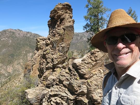
Spring had sprung – this would be my first warm-weather hike of the year, so I’d have to start carrying more water. My goal was to try a minor, apparently long-abandoned branch trail into the big canyon system in between two of my regular hikes, in hopes of exploring some spectacular rock formations.
The branch trail starts at a saddle, 4 miles and 2,000′ above the main trailhead. I’d hiked the main trail half a dozen times during the past 2 years, and seen the start of the branch trail, but avoided it because it was listed as impassable. But since then, I’d gotten used to climbing over deadfall and bushwhacking through thickets. And I’d found a website that claimed to have used it three years ago to reach some waterfalls. It was one of only two ways into that big, obviously spectacular canyon system, so it seemed worth trying.
The stream was running briskly on the approach – there was still a little snow on higher slopes – but this would probably be peak flow until the monsoon. Drought has been pretty severe, but in the canyon bottom, flowers were starting and butterflies were abundant. I distinguished at least 4 species.
About midway up the canyon I surprised a young man with a dog. He was in his early-to-mid 20s and was carrying a pack smaller than mine, but he said he’d backpacked over from the opposite side of the mountains – a journey of close to 40 miles. I wanted to ask him how he’d made it so far, carrying supplies for himself and the dog in such a small pack. But he was anxious to discourage me from going farther – he’d had to climb over the deadfall I’ve encountered in the past up on the crest. I think he assumed I was backpacking and I didn’t get a chance to correct him. We wished each other well and parted ways.
At the saddle, I crossed over into the big canyon system – a whole new unexplored world with abundant outcrops of volcanic conglomerate, ranging from white to black. I was immediately surprised to find the old trail abundantly “flagged” with pink ribbon every 50 feet or so. There was good tread, and somebody bigger than me had hiked it recently. But it hadn’t really been cleared – there was still plenty of deadfall and brush growing up in the trail itself.
Still, it was a pretty trail, crossing steep talus slopes, passing in and out of patches of forest that had survived the 2012 wildfire, yielding dramatic views of hoodoos and prominent outcrops.
After more than a mile, the pink ribbons suddenly stopped. I reached a point where deadfall obscured the tread, and the steep ground had been chewed up by elk going both up and down. I consulted the topo map I’d printed off the internet, but it wasn’t detailed enough to help.
I spent a half hour exploring in different directions until I finally found a cairn at the foot of a “needle” rock, 50 feet below the last ribbon. From there, what looked more like a game trail proceeded up canyon. But halfway to the next saddle I saw one more of the big bootprints, so I must be on the right track.
I followed switchbacks down and across the slope until I reached the next saddle, where I found another cairn. Past the cairn, what appeared to be a trail led steeply down to the left, along an outlying ridge. Slipping and sliding down that trail and climbing over a lot of deadfall, I had a view into the head of the canyon system, but the topography was complex and I couldn’t figure it out.
A couple hundred feet below the saddle, the trail was again obscured by deadfall. I spent another half hour exploring in all directions but couldn’t find a way to proceed. I checked the map again but couldn’t figure out where I was. I climbed back to the saddle, but couldn’t see anything better there. My time was up and I had to turn back.
Hindsight is wonderful. By the time I reached the main trail, I’d figured out the topography in the head of the big canyon. At that farthest saddle, where I couldn’t find a way forward, I’d been really close to my destination. If I hadn’t lost so much time scouting for tread, and if I’d done a better job of map-reading, I could’ve easily bushwhacked into the canyon bottom, where two creeks branch off into spectacular slot canyons with numerous waterfalls.
So at least I know what to do next time!
Somewhere in that trail-scouting I managed to strain my left Achilles tendon, so on the 5-plus-miles back to the truck, every uphill stretch had to be done one-legged. And all the loose rock in the trail had be negotiated very, very carefully. And if I forgot, there was severe pain.
April 5, 2021
Signs of Spring
Finally! For the past four months of winter, I’d been waiting for snow to melt so I could return to a hike I’d first done in early December. One of my new favorites, it climbs past the 400′ waterfall, through the narrow “hanging” canyon that stays cold and holds deep snow longer than anyplace else, and finally ascends one of the highest peaks in the range, gaining over 4,000′ of elevation in a round trip of more than 14 miles. From now on, after months of frustration, I’d be able to return to the longer trails with more elevation gain.
Temperatures at the base of the mountains were forecast to reach 90 degrees, and it was close to 80 when I reached the trailhead. But I could still see a lot of snow on the high north slopes of peaks and ridges above.
I was so motivated that I walked too fast up the steep grades of the first three miles, and wore myself out. As expected, I ran into foot-deep snow involving precarious traverses in stretches of the hanging canyon. There were also deep patches on the peak. But the ladybugs were already out en masse.
On the way down through the hanging canyon, I came upon the fresh track of a full-grown black bear. It had walked down the canyon some time after I’d started up.
March 29, 2021
Cave Climbing
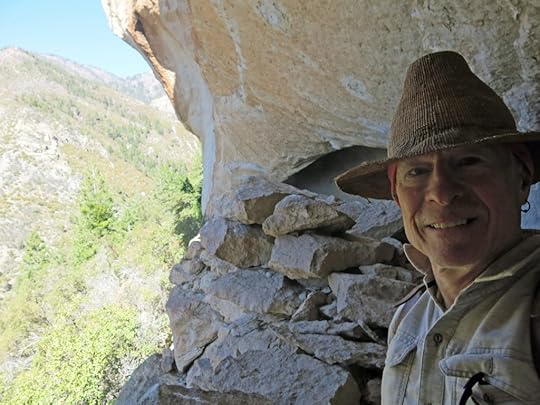
I’d had my first COVID shot on Friday, suffering only a sore arm. Online research suggested a hike on Sunday would be fine. We’d had snow, sleet, and rain in the past few days, so I was anxious to check out the 300′ waterfall I’d read about, up the canyon with the cave and arch I’d seen from a distance on my first bushwhack. I was afraid if I waited much longer, the last snow would melt and the waterfall would dry up.
It was supposed to be a six mile one-way with 2,000′ of elevation gain, which normally wouldn’t be enough to challenge me, but with my immune system off balance I should probably take it easy anyway. And I had no idea what I’d find in that canyon. There had originally been a trail, but after the 2012 wildfire it hadn’t been cleared. If it turned out to be an easy hike, I might be able to bushwhack up to the 10,000′ ridge above. It the canyon turned out to be blocked with debris and deadfall, I might not even reach the waterfall. In any event, there was the cave and the arch, halfway up. I was sure I could reach those at minimum.
The turnoff from the highway is at a ranch gate – the biggest and fanciest ranch gate in this area, with an expensive sign advertising their rodeo wins. The ranch itself is one of the biggest private properties in the state – 40,000 acres or 62.5 square miles. The road cuts straight up through the middle of it toward the mountains where they get their water, still rimmed with snow. Along the way you pass the sprawling ranch headquarters, big corrals and an auction yard, and a series of large stock ponds at different levels of the vast plateau.
Toward the head of the plateau, the gravel road joins a narrow irrigation ditch, made of four-foot pre-cast concrete sections, and enters the pinyon-juniper-oak forest. Water was flowing briskly down the ditch. The gravel road ends at the mouth of the canyon, where a dam feeds the ditch. A 4wd road leads onward into the riparian forest, but I could tell it wasn’t likely to be drivable so I parked in the clearing outside.
This riparian forest was pretty impressive – it’d mostly escaped the wildfire, and tall old-growth ponderosas shaded the floodplain. The 4wd road had been cleared in places, but was blocked by deadfall or erosion at intervals. As it crossed back and forth across the creek, I could sometimes see all-terrain tire tracks but couldn’t tell how old they were.
The creek was flowing strong, and the rocks were covered with brilliant green algae. I reached a cattle gate, beyond which the road had been completely washed out. But it continued on the other side, until eventually it became a single track trail, still in the shaded floodplain. It crossed the creek again and I came to the cabin. Unlike the other cabins I’ve encountered in these canyons, this one used absolutely no milled lumber – it was made entirely out of rough-cut native timber, with shake siding. It looks like it could fall down any minute, but from experience I know it could keep standing for decades.
Past the cabin, the trail disappears in thorny thickets with lots of deadfall. I saw the cave rock looming ahead through the trees and crossed the creek, traversing a little ways up the north slope to avoid the floodplain thickets. From where I’d first seen the cave, it looked like the best approach would be from the left side, where I might be able to skirt the bottom of the cliff all the way to the cave. But that way might just as likely be blocked by boulders. The base of the cliff was almost 400′ above me, and there were intervening gullies that might slow me down a lot. So I kept going until I was almost directly under the cave. Then I started climbing the slope, which was at least 30 degrees, alternating between grass, bare rock, and thickets.
It was slow going – I had to zigzag back and forth to avoid obstacles and maintain traction. I could see pines above and hoped for more open ground, but it was a struggle all the way up.
The cave itself was protected by a lower skirt of vertical cliffs, but I eventually saw a narrow crack through the cliffs, directly below the cave, that appeared to have trees growing out of it. I was hoping that would be my way up, but I would need a lot of luck.
Finally, forcing my way past thickets that choked the base of the cliffs, I reached the crack. It was narrow and lined with oaks, but I couldn’t see the end of it, so I just started climbing.
That crack was really an amazing formation. It got narrower toward the top, but the ground was firm so it was fairly easy climbing. Then it curved to the left and the way was blocked with boulders, with only a tiny space between them.
I found that the gap between the boulders was big enough for my body, but I had to take my pack off and push it through first. Then I was able to lever myself up through the gap, using a small branch below as a foothold.
I emerged in a small patch of gravel at the base of the final cliff that led to the cave. There was a vertical crack leading up the cliff, and on its left was a near-vertical rock surface uneven enough to provide holds. I liked the look of the cliff better than the crack, so I tried to climb it, but found the rock too crumbly.
I discovered that these rocks, which look like sandstone from a distance, are the “Gila conglomerate” – the same rock that formed the cliff dwellings north of town. After the ancient volcanism that created these mountains, this rock formed when clasts of harder country rock became embedded in the relatively soft white tuff from the eruptions – kind of like “rocky road” ice cream.
Unlike most conglomerate, it fractures along spherical planes, forming the vaulted arches and caves prehistoric people used as shelter. But it’s really unstable rock, not good for climbing.
I stood there, my spine tingling as I realized I would have to find a way up. I couldn’t get this far and turn back. But I hadn’t done a climb this dangerous in 20 years, my skills were super rusty, and all the recent disabilities had sapped my confidence and made me feel vulnerable. And I knew the climb down would be MUCH harder and scarier.
I took a deep breath and started up the crack, using it for footholds and exploring the rough rock of the cliff on my left for handholds. About half the ones I tried immediately broke off, but I kept breathing and stayed calm until I could find one that seemed solid.
Eventually the convex surface of the cliff ensured that the slope became less vertical, and I emerged onto a surface I could stand on. The cave arched above me, and at its back, the dark, raised alcove I’d seen from a distance.
I looked down and immediately saw a prehistoric corn cob! I couldn’t see any evidence of stone construction inside the arch, but the ancient Mimbrenos must’ve had a secret granary up here.
My spine was still tingling – where the rock was bare, it sloped downwards, and the inside of the arch was littered with slabs fallen from above. It was an exposed place I didn’t feel comfortable spending much time in. I saw that the raised alcove was actually open to the sky on the other side of the giant formation. I shouted and a clear echo came back.
I looked around and realized the way I’d come, through that steep, narrow crack in the cliff, was the only way up here. I’d been very lucky with my routefinding and guessing. If I’d tried to climb earlier and traverse the base of the cliffs I’d have had to backtrack a long distance on very rough ground to reach this point.
I found a relatively level spot in the sun and sat down on the bare rock for a snack and a drink of water. Then, of course, a canyon wren began calling from somewhere above. The arch returned sound so effectively it was impossible to tell where the bird was, but another responded immediately.
Facing me across the canyon and a little farther upstream was the other arch. I could see a natural stone bridge at its right, with forest underneath. I figured that could be explored another day – the scary climb to this cave was enough for now.
I was starting to feel a little queasy, probably from the strenuous climb and lingering effects of the vaccine. I was frankly not sure about the climb back down the crack, and wanted to get it over with. A fall would either kill me or injure me severely. The longer I put it off, the more likely I would just succumb to panic and freeze up.
The only option was to back down, reversing the moves I’d made coming up. I just kept breathing and took it slow, and it turned out to be not as hard as I’d expected. All the same holds worked going down, and it was over before I knew it.
I was hoping to keep hiking up the canyon, so I looked for ways to traverse that direction on the descent. But that slope was too steep and choked with scrub, so I had to go straight down, forcing my way through to the more open ponderosa forest of the floodplain.
The canyon bottom was still choked with thorns and deadfall, and there was no sign of a trail, but I found abundant elk scat and cattle sign and began following segments of game trails that led upward along the north slope. I wasn’t sure I should be climbing, but the canyon bottom just didn’t look like a viable path.
I was also starting to feel sick. I’d felt a sore throat starting, up in the cave, and now I just felt unwell – a little dizzy, a little queasy. But I kept going.
Ahead, the canyon was blocked by boulders the size of apartment buildings. It was obvious why the game trails were climbing – they had to get around the boulders. In places I came upon remnants of the original hiking trail, but these were short and scarce.
Using the game trails – one time I was grateful for the presence of cattle – I got around the boulder blockage, and the trails led back into the canyon bottom. I was now below the opposing arch.
I kept following game trails, and again they led up the slope. It was really hard going with a lot of loose ground, thickets, and deadfall. And after another mile or so, I suddenly found myself at the edge of a cliff. It was like a big bite had been taken out of the canyon side. Above the bite was dense undergrowth – to get around it I’d have to climb down into the canyon. I was feeling pretty bad, so I decided to turn back. Farther ahead I could see the canyon narrowing and curving out of sight to the north. Above in the distance was the high snowy ridge, lined with aspens, banded with talus. I could see a huge outcrop of cliffs where I figured the waterfall might be.
Working my way back down the canyon, I began to notice tall alders standing up from the floodplain. But I’d seen no sycamores – I wondered why?
Despite the many obstacles, due to my landscape memory I was able to nearly retrace my steps. When I reached the canyon bottom, below the opposing arch, I was feeling a little better. I looked up, and thought I could see a direct path up the steep slope, between boulders and deadfall. I decided to try it.
It turned out to be much steeper than the climb to the cave, in loose dirt still wet from yesterday’s rain. But I took it slow, and eventually discovered it was a much longer climb than expected. About halfway I found game trails that switchbacked, making it an easier climb. Then I reached a dense forest of oak below the arch that was tough going.
Finally I emerged from the oak thicket at the base of the arch.
This arch was shallower, longer, and deeper than the other, and north-facing so it was almost entirely in shade. I found nothing prehistoric, but because this arch was much easier to climb to, there was plenty of historical graffiti.
I climbed down the same way I’d climbed up, and resumed my retreat down the canyon.
I was feeling really good by the time I reached the vehicle. It’d turned into a warm spring day, but I’d had the sound of rushing water around me all through it, and the frequent sight of snow high above. I’d done a couple of serious climbs, one of them that I’d never forget. And on the way out, I noticed this enigmatic old adobe standing off to the side of the irrigation ditch.
March 25, 2021
Fire, Part 7: Americans and Wildfire
Liberals and conservatives now send kids to private schools presenting opposing views of world
What did you do with Prius drivers story?
Don’t ask what are they thinking It’s obvious they’re not thinking – like most, they’re just following peerp group behavior.
Or like Philippe, they’re not capable of overcoming dependencies. Can reason about what they’re doing, but smugly brag about not being able to change behavior. So it isn’t that people aren’t thinking, but that thinking doesn’t influence behavior – behavior is involuntary
Just like Guffin – smart enough to recognize not taking care of teeth, but can’t change, so he imagines implants will allow him to keep abusing
People can talk rationally while behaving irrationally
Definitely applies to social media – people can have public discourse, in which all they’re doing is talking – all talk & no action
Why is it so hard for our government to walk the talk, to do what it says it’s doing – to work with fire instead of against it? Why are wildfires getting bigger, and more destructive, reducing suburban neighborhoods and sometimes entire towns to ash, killing dozens of rural citizens, choking millions of city dwellers with dense clouds of smoke, requiring more and more massive paramilitary efforts to control?
It might help to take a fresh look at our history.
In school, we learned about the European Age of Discovery, in which brave explorers like Columbus and Magellan set out in wooden ships to cross oceans and discover new lands. We learned about the first settlement of North America by Pilgrims, English refugees fleeing religious persecution. We learned about the gradual colonization of eastern North America by the English, as part of the growing British Empire. The American Revolution, in which the colonists rejected British rule and established a democratic nation, the United States, based on the sanctity of individual freedom.
We learned that the United States began a new era of democratic nations, an era of freedom and democracy that gradually replaced the old European empires, all over the world. We were no longer English – from now on, we were Americans, a free people who had left the Old World behind. We went on to develop our own culture, with our own heroes and institutions.
I was born and started school in the upper Ohio River valley, in the foothills of the western Appalachians, surrounded by deciduous hardwood forest, where I spent most of my free time outdoors exploring nature. Our town was the first U.S. settlement west of the Appalachians, founded by George Washington’s senior offices in the wake of the American Revolution, capital of the new “Northwest Territory”.
But they’d built the town around prehistoric Indian mounds, an extensive urban complex of the vanished “Hopewell” culture. My dad gave me his collection of arrowheads found by our farming ancestors, and even before I started school I was pulling fossils out of the banks of the creek behind our house. So from earliest childhood I was not only steeped in American history, I had abundant exposure to deep time, and a passionate curiosity that came from direct personal experience, not from books or classrooms.
One of our family vacations took me to North Carolina’s Smoky Mountains, deep in the Appalachian spruce-fir forest, where I met Cherokee Indians. Another trip took me farther east to the nation’s capital, colonial landmarks like Williamsburg, and the decisive Civil War battlefield of Gettysburg.
As described in Part 1 of this series, we moved west to Indiana after I turned 8. Away from the dark, forested eastern hills, to the flat, open cropfields of the Midwest. I learned about the Indian Wars of the late 18th and early 19th centuries, after which this region was settled by my ancestors, and the forests cleared for farms and towns. I looked for Indian mounds in remnants of forest that survived beside the small, serpentine rivers, but the indigenous presence had been completely erased here.
Nevertheless everything seemed old. Many of our buildings, even new ones, copied the East Coast Colonial style, with brick walls and white columns. Government buildings echoed the neo-Classical styles from ancient Greece and Rome that were popular throughout the eastern U.S. My new hometown’s heyday had been the Victorian period of the late 19th century, so our downtown, and many of our biggest homes, consisted of brick and stone buildings in the Victorian style.
We’d been taught that we were Americans, and our country represented a dramatic break from the Old World and a fresh start in the New, but actually I was living in a European Colonial town, surrounded by a landscape that had been made to look like the English Midlands.
My formal education in ecology began under Mr. Carrigan, my high school biology teacher. He cultivated a special relationship with me, introducing me to soils, soil fauna, and pollination, encouraging my fascination with snakes, intermediaries between the surface world and the hidden, mysterious underground. I spent my last summer in that place living on an ancestral farm, falling in love with the wild forest and river that bordered it.
I started college at the University of Chicago, which was modelled on Oxford University in England. The U of C’s undergraduate curriculum was based on the Great Books of Western Civilization, so I became even more mired in our European cultural legacy. The U of C was not that unique – all of what we call higher education is European in origin, structure, and practice.
But from there I was catapulted far west, to northern California, echoing the 19th century mass migration that settled our West Coast. That move west was seminal for me – it began my cultural awakening, my growth away from the European legacy, the baggage burdening the eastern U.S., which always looks eastward to the Old World for its history and its validation. Despite my thorough indoctrination in European culture, the mentors of my youth had rebelled against the system, encouraging me to question authority and think critically, and I was more than ready to unlearn the propaganda from those many years of school and replace it with accurate knowledge about the world.
I’d known since early childhood that there was a deep, rich, non-European past underlying this entire continent, but in the West it was closer to the surface. Colonists had not transformed the landscape the way they had back east, and large populations of Native Americans survived here and there, in places like the Southwest that were exotic, beautiful, and deeply intriguing to me.
The California desert was the place that quickly captured my heart. As I described in Parts 2 and 3, I encountered natural desert habitats that at first seemed to be pristine wilderness, but turned out to be littered with ancient potsherds, fragments of stone tools, petroglyphs and pictographs that tapped into my childhood curiosity about deep time and fired my artist’s imagination. I met desert rats and field scientists and learned about prehistoric tribes, desert ecology, the history of mining and ranching, the damage to desert habitats caused by cattle grazing, military operations and motorized recreation, the spread of invasive plants, and wildfire.
I spent a lot of time in and around Las Vegas, assisting a friend with wildlife research and conservation, experiencing firsthand the uncontrolled development, growth, and consumption resulting from our society’s founding belief in personal freedom and free enterprise. The rapid destruction of natural habitat by urban and industrial sprawl, the massive solar plants consuming multiple square miles of nature every year.
I met Native Americans and heard their stories, which contradicted much of what I’d learned from Anglo archaeologists. I studied aboriginal survival skills to get a firsthand sense of how indigenous people had lived in the arid Southwest. I lived and worked on ecological preserves, learning about regional ecology and the ecosystem services provided by native habitats and wildlife. I started my Pictures of Knowledge project – titled by biologist friends – to develop a more accurate understanding of humans in nature.
I revisited Mr. Carrigan – my old high school biology teacher, now retired – and saw his eyes light up with enthusiasm as he described how he had directed an engineering effort that dredged and channelized the river bordering our old family farm, to reduce flooding of crop fields. Dozens of miles of precious riparian habitat had escaped destruction throughout seven generations of European culture, only to be wiped out virtually overnight, in the interest of commercial efficiency and profit.
I listened to a radio interview with Elizabeth Kolbert, the New Yorker staff writer and author of The Sixth Extinction. She was emerging as a national authority on climate change and species extinction, but when asked why we should care about these things, she was stumped. She couldn’t explain why humans need wild habitats and ecosystems. After an awkward silence, all she could offer was “well, um, nature is beautiful, it has spiritual value, to lose it would be a tragic loss”.
And in 2020, during the COVID-19 pandemic, after a decade of catastrophic wildfires all over the West, I encountered well-educated city dwellers from California and other affluent states, driving Priuses up 4wd roads, deep into our fire-adapted local forests, looking for remote cabins, rural properties where they could “get away from it all”.
What were they thinking? After all this talk of climate change, after all the tragic news about wildfires, why did they believe it was smart, wise, or responsible to move into fire-adapted forest, and expect the government to protect them? What’s wrong with our society, our culture, our educational system, our media, and our government that enables this degree of blindness and dysfunction?
Fouling the NestAs I described above, for me, moving west was also moving away from our European Colonial legacy. Not to forget or deny it, but to peel back the layer of “American” colonial culture superimposed on this continent, to expose the rich legacy of indigenous cultures underlying ours. To put the imported colonial culture in a broader context, to compare it to cultures that are truly native to this land.
What kind of ecological culture did Europeans bring with them to this continent – how had they treated their habitats back home?
Much of Europe had already been ecologically degraded centuries before, its wildlands deforested, mined, and overgrazed by goats, sheep, and cattle. (M. Kat Anderson, Tending the Wild)
According to Josh Davis at London’s Natural History Museum:
Centuries of farming, building and industry have made the UK one of the most nature-depleted countries in Europe. Extensive agricultural lands and road networks, in combination with other factors, have reduced the wildlife in the UK to a point hardly seen elsewhere.
A new analysis looking into how much biodiversity is left in different countries around the world has shown that the UK has some of the lowest amounts of biodiversity remaining.
Before the Industrial Revolution, forests covered much more of the UK than they do now. Large areas of wilderness were home to animals and plants which are now a rare sight, or gone completely. Red squirrels, beavers, wolves and bears were once common in the British Isles.
The advent of mass farming, factories, roads, trainlines and urban sprawl has been a death knell for wild places, and it was accelerated by the Industrial Revolution in the nineteenth century.
This was our ancestors’ cultural legacy. What did they find waiting for them in the “New World”?
Discovering a Virgin LandAround the arrival of Columbus, “it’s said that squirrels could travel from tree to tree from the Northeast to the Mississippi without ever having to touch the ground,” said Chris Roddick, chief arborist at the Brooklyn Botanic Garden in New York. “In the old growth forests in the Northeast, you had hemlock that were six or seven feet in diameter, chestnut trees 200 feet tall.”
But we all know North America wasn’t an empty wilderness. Like Europe, it was filled with people, hundreds of local and regional indigenous tribes that had interacted with nature for thousands of years. The Eastern Seaboard of what’s now the U.S. was dotted with native villages surrounded by cropfields. Centuries later, records are poor and data is sparse, but it stands to reason that instead of continuous forest, the Northeast was a mosaic of habitats cultivated in part by Native Americans. And we’re now rediscovering that one of their tools was fire.
The early European settlers found that much of the East was already being fired on a frequent basis by Indians…These settlers gradually displaced the Indians, but continued their use of fire for many of the same reasons, i.e., to clear the woods of underbrush, to expose nuts, to clear agricultural fields, etc. Frequent fires occurred over large areas of the eastern landscape into the early decades of the 20th century. (Lear and Harlow, USFS)
Lear and Harlow say settlers “displaced” the Indians, suggesting they were just gently nudged aside. That’s a fine euphemism for the genocide we know occurred, and hints at the unconscious anti-indigenous racism inherent to our culture, including science and academia. North American wasn’t settled, it was violently conquered and colonized. Native Americans were either decimated by the diseases we imported, cheated out of their habitat in unfair trade, slaughtered for their land and resources, or violently driven westward ahead of our invasion.
Reviewing the Forest Service maps I included in Part 2, comparing pre-conquest forest cover to that in the early 20th century, we can see far beyond Lear and Harlow’s observations. The European colonists didn’t just use fire to clear a few fields, so they could feed their families. They were part of a global empire with a capitalist consumer economy that would transform much of the world into corporate plantations, producing highly profitable addictive substances like tobacco, coffee, tea, sugar, rum, whiskey, and opium, alongside emerging consumer staples like cotton and palm oil.
To establish these commodity crops and plantations, European colonists employed advanced technology developed by their scientists and engineers to broadly eliminate natural habitat which had been tended by indigenous societies for millenia, across most of the U.S. east of the Mississippi.
Using steel axes, saws, shovels, chains, winches, mule teams, and eventually steam-powered and gas-powered tractors, excavators, and other heavy equipment, European colonists cleared forests, drained and filled wetlands, dammed rivers, and dug canals. Most of the eastern indigenous subsistence mosaic was replaced by plowed fields planted with commercial crops – imported from Europe or appropriated from natives – including pastures for European livestock.
That colonial exploitation began the accumulation of wealth that would eventually enable the U.S. to build a global political, military, economic, industrial, and cultural empire. But indigenous burning, and the many other forms of indigenous tending documented in recent studies, comprised ecosystem services provided by humans in cooperation with nature – nutrient cycling, soil renewal, water purification, fuel reduction, etc. In the long term, everyone – colonists, surviving natives, and wildlife – lost many of the ecosystem services provided by the original mosaic. Including climate regulation.
The very essence of the frontier experience lies in the extent of its resources, and when resources are boundless, why conserve them or even utilise them efficiently? The principal goal is to exploit them as quickly as possible, then move on. It is this frontier attitude to resource utilisation that lies at the heart of much capitalism, and which presents such a challenge to conservationists today. (Flannery, The Eternal Frontier)
Land of LibertyThe first European ventures in the Western Hemisphere were combined military, commercial, and religious expeditions – to dominate native populations, claim their land for the empire, exploit their labor and natural resources for profit, and convert them to Christianity. The first colonists in what is now the U.S. were part of these combined ventures, in what eventually became my home state of New Mexico.
But with colonial settlement, religious oppression, and commercial exploitation, European diseases and brutality began to depopulate the New World, and accounts of the richness of indigenous habitats gradually reached the “common people” back in Europe. Many Europeans, like the Pilgrims and my Scottish ancestors, suffered from the oppression of empire at home, and the first European colonists in eastern North America were refugees seeking the freedom to practice religions unpopular in Europe.
This “freedom” – rhetorically known as “liberty” – became one of the founding values of colonial society. The land-owning and business-owning classes in the colonies – minor aristocracy and the urban middle class that was becoming known in Europe as the bourgeoisie – resented taxes and other forms of imperial control imposed from Europe. The European culture they inherited was intensely individualistic and competitive, and their Judeo-Christian religious tradition had granted them dominion over nature. They eventually formed a nation – the United States – based on individual freedom, private property, and free enterprise.
As white Europeans pushed westward, replacing indigenous communal subsistence ecologies and habitat with capitalist consumer economies, cropfields and pastures, they corralled surviving native communities into less economically desirable fragments called reservations. Eventually, in the late 19th century, with most of the continent transformed, romantic activists like the Scotsman John Muir warned white citizens that surviving fragments of native habitat with “scenic” value to Europeans were in danger of being lost to settlement and commercial development.
In the words of Henry Fairfield Osborn, president of the New York Zoological Society in the early twentieth century, ‘nowhere is Nature being destroyed so rapidly as in the United States…an earthly paradise is being turned into an earthly Hades; and it is not savages or primitive men who are doing this, but men and women who boast of their civilization’. This is the sad story of the economic machine that ate the life of a continent, and it was not just animals that were fed into its maw, but people and cultures too. (Flannery, The Eternal Frontier)
These fragments of surviving habitat had provided final refuge for indigenous communities which had so far escaped European conquest; in response to white concern over the loss of “wild nature,” these indigenous refuges were confiscated and native people were driven off. This became a model for European colonial “conservation” worldwide. Indigenous people were driven off, their land was now called “public” – meaning it was for the use of white colonists – and the former indigenous refuges were now “preserved for future generations” of white colonists as National (and State) Parks and Preserves. This racist policy was eventually promoted as “America’s Best Idea”.
Managing ResourcesGifford Pinchot and a handful of his contemporaries…went to Europe to study the relatively new profession of forestry…In Europe, forestry practices were developed to reforest lands that had long ago been denuded by the large rural population to provide timber, charcoal, firewood, and pasture…Under Pinchot’s leadership, the Forest Service claimed fire control as its compelling mission…The Forest Service used zealous promotion and propaganda to build an aggressive national program for suppressing forest fires in all forests…People who suggested that fire be used or sometimes be allowed to burn were ignored or put down. (Carl E. Fiedler and Stephen F. Arno, Ponderosa: People, Fire, and the West’s Most Iconic Tree)
Not until the early 1900s were there serious efforts to exclude fire as an ecological process in eastern North America. In 1910, an outbreak of wildfires in the western United States–concentrated in Idaho and Montana, burned millions of acres, much of which was on national forests, and killed 78 firefighters…These events occurred just after the Forest Service had made fire control a top priority on the nation’s national forests and caused the public to become concerned about the sustainability of the nation’s natural resources. (Lear and Harlow, USFS)
Led by the Forest Service and the state forestry commissions, the public began to see fire as an enemy to be suppressed at all costs. An era of fire suppression began that created different environments from those that had existed for millennia, often to the detriment of many wildlife species. (Lear and Harlow, USFS)
Thus federal agencies’ policy of fire suppression emerged in collaboration with media and public opinion – just as now, sensational media stories of wildfire trigger emotional reactions and demands for political action on climate change – actions which will have unforseen consequences far in the future, beyond our leaders’ brief terms of office, beyond our own lifetimes.
Government fire suppression didn’t just apply to the parks and preserves set aside for white people. Government fire suppression furthered our founding values of free enterprise and private property, enabling private individuals and businesses to expand further into fire-adapted natural habitat.
By the 1950’s North Americans had eliminated about four-fifths of the continent’s wildlife, cut more than half its timber, all but destroyed its native cultures, dammed most of its rivers, destroyed its most productive freshwater fisheries and depleted a good proportion of its soils. (Flannery, The Eternal Frontier)
As the innovations of science and technology enabled population growth, cities, farms, and factories continued to expand and consume natural habitat, until, in the Postwar Boom of the mid-20th century, our science achieved a quantum leap in environmental destruction through the “miracle products” of chemistry like plastics, chemical fertilizers, herbicides, pesticides, and pharmaceuticals, and the nuclear radiation unleashed by physicists in medicine and electric power generation. Whereas before, urban and industrial development had consumed and replaced discrete patches of rural habitat, these new substances spread continuously through air, water, soil, and living populations, both urban and rural.
We’re all familiar with the revelations of these dangers in the early 1960s and the subsequent Environmental Movement, the establishment of the EPA, the Clean Air and Water Acts, and the Endangered Species act. But despite these brief flurries of public opinion and legislation, the chemical industry continued to churn out plastics and other pollutants, and fire suppression and individual freedom ensured that natural habitat continued to be consumed as cities, homes, and businesses moved deeper into rural land.
Getting Away From It AllEventually, in recent decades, just as science was beginning to discover the role of fire in ecosystems and government agencies were struggling to overhaul fire management policy, both scientists and agencies identified a fly in the ointment – the newly-christened wildland-urban interface, the physical boundary between nature and human dwellings and businesses.
Just as we belatedly recognized the need for wildfire to maintain natural habitat and ecosystem services, we discovered that our policy of fire suppression had made wildfire nearly impossible to restore to the system – because there were people, buildings, pets, and equipment already established there, throughout fire-adapted habitats. Private property and free enterprise are fundamental to our culture, but ecological sustainability appears nowhere in the Constitution or other founding documents, because it was not part of our European legacy.
At the same time the environmental movement was burgeoning and timber sales were being appealed, people were moving into homes and developments located in forests beyond the traditional suburbs. It became feasible to extend power and phone lines into the woods and maybe even to obtain a conventional mortgage loan. Comfortable four-wheel-drive vehicles and pickup-mounted snowplows were now available, allowing year-round access…
By the late 1980s a few million people had moved into the western forests…The new residents often resisted suggestions to thin their own forest, yet most had fire insurance and expected the rural fire department to come to their aid if a fire came near…
Television news and movies feature heroic images of brave firefighters and their impressive technology battling destructive fires…These superheroes had a record of defeated wildfires, and most forest residents felt confident that the fire department could protect them…Exurban housing in ponderosa pine forests threatens wildlands like national forests, national parks, and other preserves, because it prevents managers from using prescribed burning or allowing natural fires to burn to maintain the ecosystem. (Carl E. Fiedler and Stephen F. Arno, Ponderosa: People, Fire, and the West’s Most Iconic Tree)
Climate ChangeWhen people talk climate change, they mean ensuring the continuity of our nation, gov, inst, so that children won’t have to change way of consumer lifestyle to adapt, because gov & industry change tech, provide same prods & svcs
We’ve seen how, during the early 20th century, public opinion in our ecologically ignorant and environmentally destructive culture was manipulated by science, government, and media to demand wildfire suppression. Government propaganda promoting this policy – the Smokey Bear campaign – continued through my childhood and youth. And the unforseen consequences of this cultural manipulation, misguided public opinion, and political action accumulated for more than a century, resulting in our current wildfire crisis.
Now science and liberal media are urging us to demand political action on climate change, which is presented as the cause of all our pressing environmental problems, including destructive wildfire.
Yes, average temperatures are rising globally. Average precipitation is decreasing in many areas, and natural habitats are drying out, increasing fuel loads for wildfire. Climate change can make wildfire worse, but it’s not the root cause. Wildfire is a problem for us because our culture denies its value and its necessity. Wildfire is a creative force – our culture is what’s destructive.
Wildfires are getting bigger and more damaging because from the very beginning, European colonists unleashed a plague of livestock and invasive plants to disrupt and replace native ecosystems. European colonists deforested the Eastern U.S., dammed rivers, drained and filled wetlands, causing damage that has yet to be repaired.
Wildfires are getting bigger and more destructive because in the early 20th century, white Americans reacted to sensational news stories and urgent warnings from science and media, building a groundswell of public opinion that forced government and industry to take major short-term actions – fire suppression – with unforseen consequences unfolding far into the future. We suppressed the wildfires the forest needed, and the longer we suppressed fires, the more desperately they were needed.
Wildfires are getting bigger and more destructive because we continue to deny nature and her cycles, moving into these fire-starved forests, building homes and businesses we imagine to be “permanent”, so when they eventually burn, we suffer, and we fight back. But worst of all, wildfires are getting bigger and more destructive because we slaughtered and drove off the natives who sustainably tended fire-adapted habitats.
Climate change isn’t causing destructive wildfires – we should’ve been having frequent wildfire all along, and our culture, our entire civilized way of life, is responsible for making it worse now. Climate change is only one of many consequences of industrial civilization. And the actions we take now, in a desperate effort to save that civilization, will have far-reaching, unforseen consequences, just like the fire suppression we demanded over a century ago.
Maybe in final section – overlaps with end of part 7 – last thing we need is to mitigate or fight climate change – climate change natural process of renewal like wildfire that we need to adapt to by abandoning industrial civ, maladapted institutions, behaviors, values, embrace like indigenous the processes of cyclical renewal in nature
Small scale socieities & communities around the world capable of doing that, we’re not
Much of this may belong in final section on wildfire
Another way of stating conclusion abt what causes wildfire – we’ve developed a society over thousands of years that can’t tolerate natural cycles – civilization itself is intended to subdue nature & prevent restorative events that occur in healthy habitats & ecosystesm
Really need to highlight political economy issue – what it really means in imperialist capitalism – now it’s vague what you’re saying about business vs private nonprofits vs govt – not clarifying how things work in modern capitalist world vs how they might’ve worked long ago
Taht also applies to part 7, transition over time – although really hasn’t changed that much – in colonial days, plantations dominated worldwide – now we have rhetoric that obscurs it
FS, Alicia Edwards – developing local resilience by transition to tourism, bike racing? Industries totally dependent on national economy, importing thousands of strangers from outside, at great energy cost? All she’s doing is imitating what other uncritical peers are doing nationwide, groupthink. Give me a break
Anything to keep a failing system on life support
So to answer the questions posed at the beginning of this Dispatch, our government can’t work with fire because, contrary to our myth of progress, the past matters. The past is not over. Time is not linear. Nature renews itself in cycles. European colonists damaged and destroyed native habitats and ecosystems across the continent, and prevented the cyclical restoration of fire-adapted habitats, and all that damage is still waiting to be repaired, that lost habitat underlying ranches, farms, and cities is still waiting to be restored.
Clarify that industrial civilization isn’t just historically grounded in dysfunctional behaviors & values, but that it depends on them for its power, wealth, continued existence – why you can’t just fix consequences of it – patient is terminal
Can’t renew lost habitats because population built on toxic industrial infrastructure, depend on them. Monbiot – saying we need solar & wind to prevent human suffering. Civilization causes human suffering – decimated, oppressed, displaced indigenous because of us, it – suffering already exists, solar & wind won’t stop it. We’ve been able to ingnore because believe it redeemed by benefits of civilization we see while ignoring suffering in background. Empires & colonies of Europe raped & pillaged and murdered indigenous & habitats around world while white minorities praised benefits that accrued predominantly to them, believing their benefits redeemed destruction, now peopple who talk about mitigating climate change to prevent human suffering in denial of that
The European culture we inherited was not ecologically sustainable – did not have healthy ecological values. Anthropocentrism, competitive individualism, the capitalist economy and primacy of free enterprise that we inherited from Europe are incompatible with conservation and ecological sustainability. And everything about our society and culture in the U.S. shows that despite our vaunted Declaration of Independence and American Revolution, we remain European colonists on this land.
To replace the hundreds of regionally-adapted indigenous cultures we first encountered in North American, we’ve imposed a single European language, a uniform industrial infrastructure and a generic consumer way of life, a centralized top-down political and economic hierarchy, European-style architecture and European-style clothing. We’ve replaced the incredible diversity of native habitats and ecosystems with factory farms hosting a handful of generic, engineered and chemically-managed commodity crops like wheat, corn, soy, cotton, cattle, pigs, and chickens.
For generations, our colonial society has been conditioned by science, government, education, and media to view wildfire as a predominantly destructive force. Even now that continues, in the condensed spectacles of the news cycle, reporting live from the wildland-urban interface – the shock, the horror, the tragedy.
You think your government and industry are going to rein in climate change, control wildfire and pandemics? You think you’re gonna terraform Mars? Good luck with that, teenage fanboy.
Climate change, like wildfire, like pandemics, is part of a natural cycle that we…
Climate change, like wildfire, is part of natural cycles. We can make it worse, or we can try to work with it, adapt to it. One thing we can’t do is control it through engineering and technology.
Part 7 about past damage never repaired, Part 8 value of Natives we removed, last section to show problems never solved until damage repaired – so in Part 7, minimize that – only clues
The balance of nature, including native wildfire regimes and cycles, will not be restored until our imperial nation, our centralized hierarchical society, our European colonial culture, and our industrial civilization collapse and are replaced by locally-adapted, locally-accountable cultures of habitat.
Of course we’ve been indoctrinated and habituated so thoroughly in our way of life that this is almost impossible to accept. Many of my friends, particularly my scientist friends, have found their comfort zones in the hierarchical bureaucracies of government and academia. And we’re warned by the schools, the government, and the news media that the only alternative to civilization is anarchy, chaos, and savagery. The only alternative to democractic nations is totalitarianism, fascism, oppression and persecution.
Is this true – are there really no better alternatives to our way life, and our dysfunctional relationship with wildfire?


