
Andie LaComb's Blog, page 8
November 18, 2023
Santa Margarita River Trail Preserve Revisited
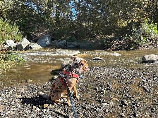
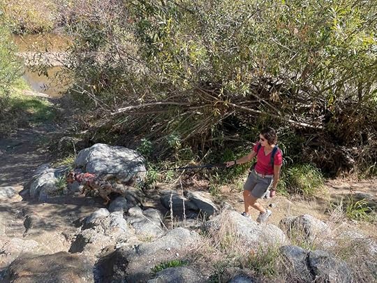
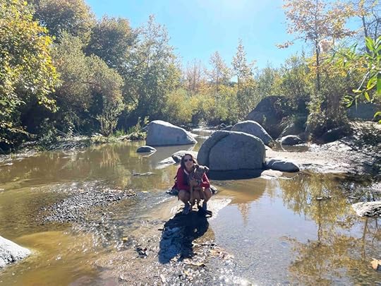
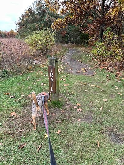
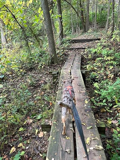
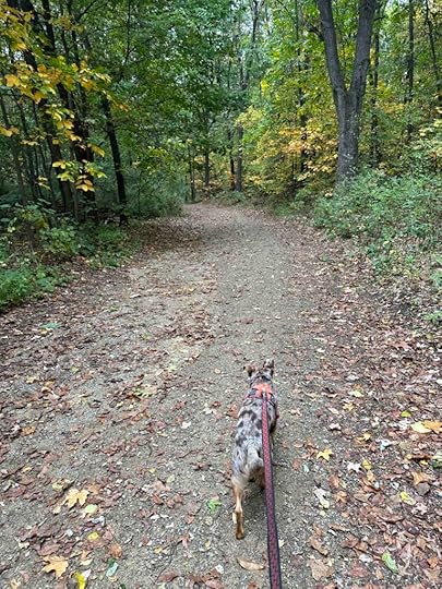
Santa Margarita River Trail Preserve is our absolute favorite spot to go hiking in San Diego county. Although it’s over an hour’s drive from where we live, it is well worth the trip. Karlie and I visited several times and today we took Sunny for her first time….and she LOVED it. And what isn’t to love? This preserve has miles of trails that lead to or overlook the river, areas where you can get down to the water, huge boulders overlooking the river, a challenging trail, and benches for taking a break. An added bonus is the big parking lot and port-o-potty at the start.
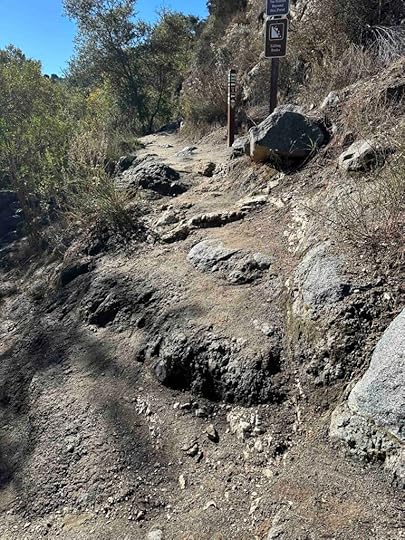
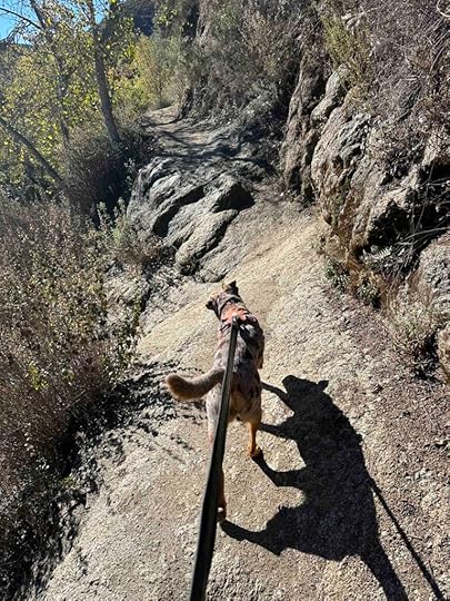
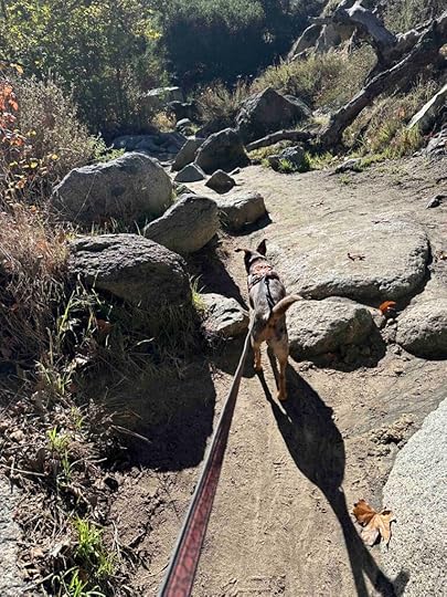
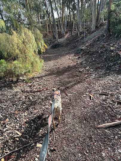
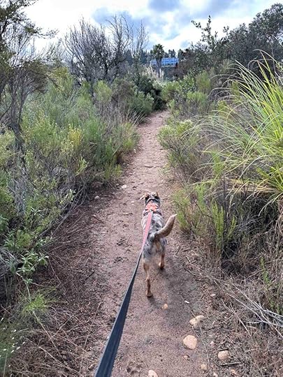
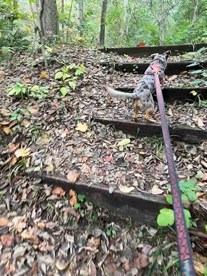
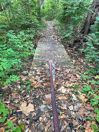
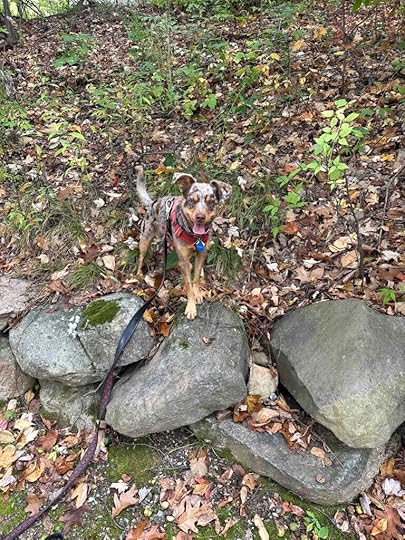
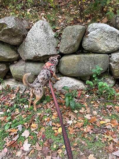
The trail starts by leading into a wooded area with the river on the left. After a short distance there are big rocks to climb over and then across a ledge. There is a lower section that parallels the ledge, but it still requires climbing over some rocks. This section is challenging for older dogs with mobility issues or people who are not steady on their feet. Sadly this is why we did not bring Karlie here on our last visit to San Diego. Sunny, however, had no trouble scrambling up the rocks and across the ledge.
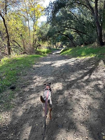
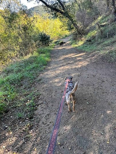
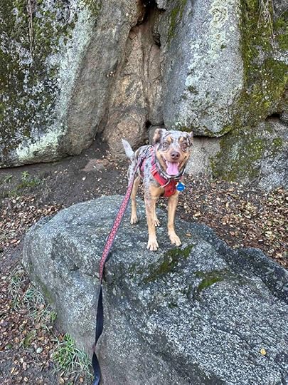
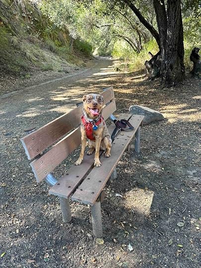
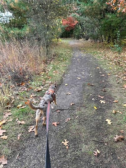
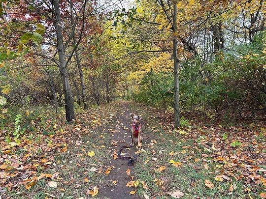
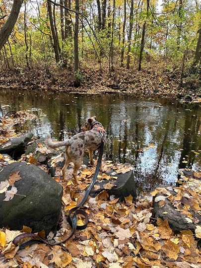
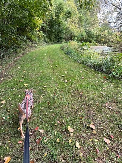
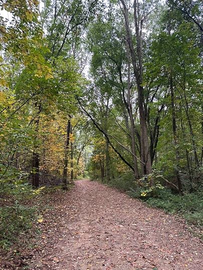
After the challenging section most of the rest of the trail is fairly flat, wide, and shaded. There are some areas with big boulders on the trail, but you walk between not over them. The main trail has several offshoots to the left that lead to the river and the trail ends at the banks of the river. There is also a trail off to the right that leads up near the backs of some homes. It’s quite a large incline and not shaded so this makes for a challenging and warm hike. The total distance from the parking lot to the end and back is just over 3M. Adding some of the trails to the river and up to the homes adds an additional few miles.
 Our Rating
Karlie, Sunny, and I rate Santa Margarita River Trail Preserve 4 out of 4 paws up. This spot has it all – a challenging but scenic dirt trail in the woods, a river where you can get your feet wet, large boulders to sit on and take in the views, some benches overlooking the river, a large parking lot, and a port-o-potty. There is truly something for everyone. The only possible downfall is the rocks and narrow trail at the beginning would be challenging for those with mobility or stability issues.
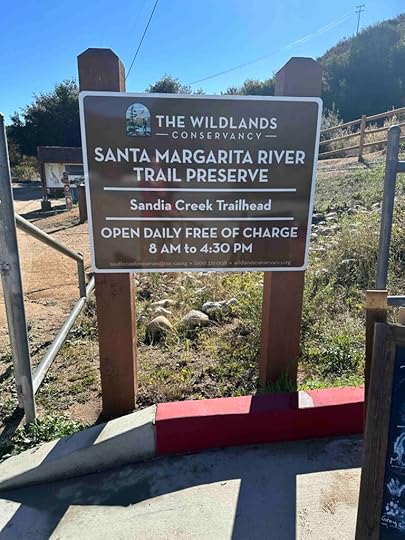
How do I get there?The address for Santa Margarita River Trail Preserve is 4251 River Edge Road in Fallbrook, CA. From I-15 take exit 51 toward Mission Road in Fallbrook. Turn left onto Old Hwy 395, then turn onto Mission Road. Follow that for nearly 5M then turn right onto N. Pico Avenue which turns into De Luz Road. Follow that for just over 1M and veer right onto Sandia Creek Road. After another mile you will find the parking lot on the right. Walk to the back of the parking lot and enter near The Wildlands Conservancy sign.
For more information on Santa Margarita River Trail Preserve check out The Wildlands Conservancy website and our earlier blog.
Santa Margarita River Trail Preserve – The Wildlands Conservancy
Santa Margarita River Trail – LiveLikeKarlie.com
The post Santa Margarita River Trail Preserve Revisited appeared first on Live Like Karlie.


November 17, 2023
Miramar Reservoir Revisited

Karlie and I visited Miramar Reservoir many times. In fact it was one of our favorite hiking spots in San Diego and you can read all about it at Miramar Reservoir. So it seemed only fitting that our first adventure upon returning to San Diego would be to Miramar Reservoir. The good news is that Sunny seemed to enjoy it as much as Karlie did. That made my heart happy.
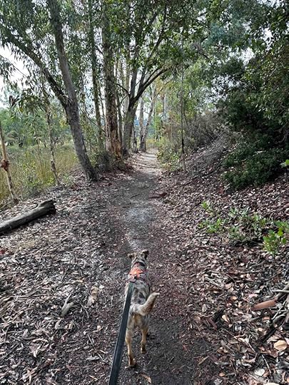
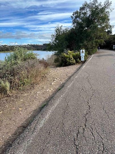
There are two trails around the reservoir – a dirt trail and an asphalt road. As usual we took the dirt trail instead of the asphalt trail favored by walkers and cyclists. During our visit the trail was more mud than dirt as we had recently had some rain. Despite that there were only a few areas with big puddles and luckily I found a way around them so my feet stayed dry. Sunny, on the other hand, didn’t seem to mind tromping through the mud and puddles.
At the start of the trail it feels more like a hike in the woods and you don’t really notice the reservoir. This quickly changes as you start to have views of the reservoir on the left side. After about half a mile there is a rock that juts into the reservoir. This is Karlie’s rock and the place we took a picture on every visit. Keeping with tradition we took a picture with Sunny.


After passing Karlie’s rock, the trail continues to wind around the reservoir with off and on views of it. At times the vegetation is quite tall and surrounds you making it difficult to see the reservoir. After about 3M you come upon a fishing pier and port-o-potty. It looks like the trail ends, but if you cross the road and look to the right you will find the continuation of the dirt trail. After another mile the dirt trail ends and you climb up to the asphalt road. This continues over the dam and back to the large parking lot and restroom. The total distance around the reservoir is about 5M.


The dirt trail is fairly flat, but does have sections where you can climb up to the asphalt road. It is wide in some sections, but also narrows in other areas. There are several sections where the grass on either side is so tall you can’t see other people coming toward you. This is rarely a problem as most people seem to take the asphalt road instead of the dirt trail. The dirt trail may not be appropriate for those with mobility or stability issues, but the asphalt road would be a good option for those individuals.
Our RatingMiramar Reservoir remains 4 out of 4 paws up. We love walking around the reservoir on the dirt path, but it’s also nice to have the option to walk on the asphalt road. Having the view of the reservoir and the opportunity to get close to it is an added bonus. Ample parking and restrooms along the trail make this hike nearly perfect.
How do I get there?The best way to locate the trail is to use Miramar Reservoir boat launch as the location. The directions will have you enter off Scripps Lakes Road and then turn near the water treatment plant. Follow the road to the large parking lot. Since we like to start the hike by walking on the dirt trail around the lake, we drive past the large parking lot and follow the road to the right. We continue as far as possible and park near where they close the road to vehicle traffic. Walk toward that area and either walk on the asphalt or take the dirt trail on the left.
For more information about Miramar Reservoir check out the San Diego website.
The post Miramar Reservoir Revisited appeared first on Live Like Karlie.
October 28, 2023
Cobus Creek County Park

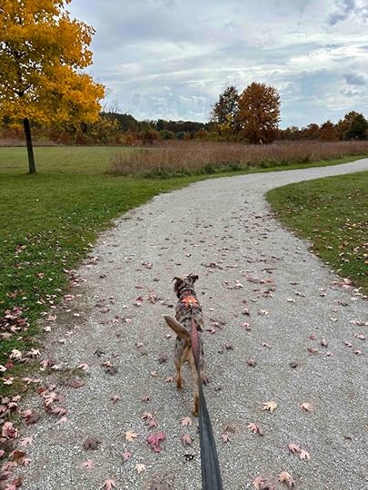
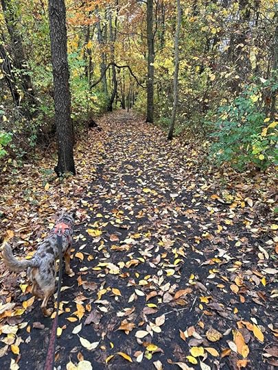
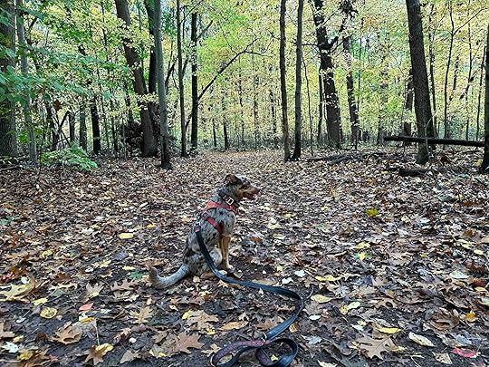
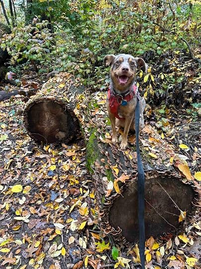
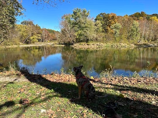
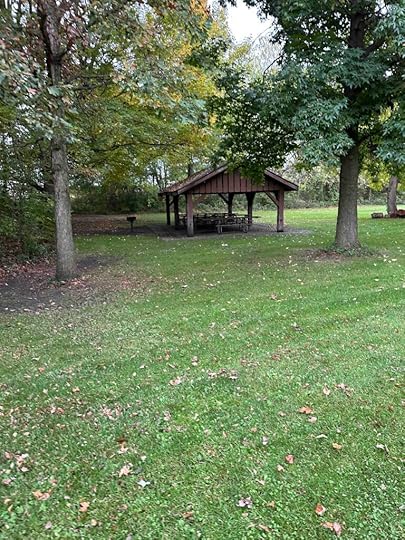
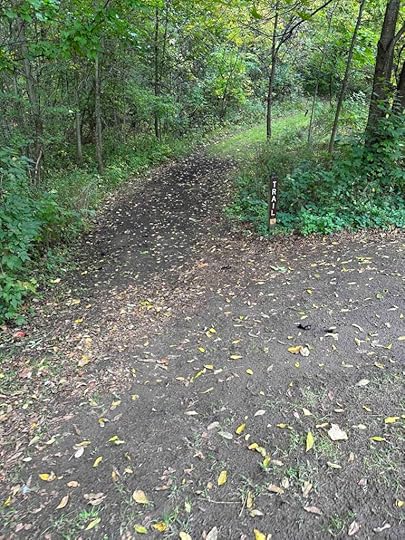
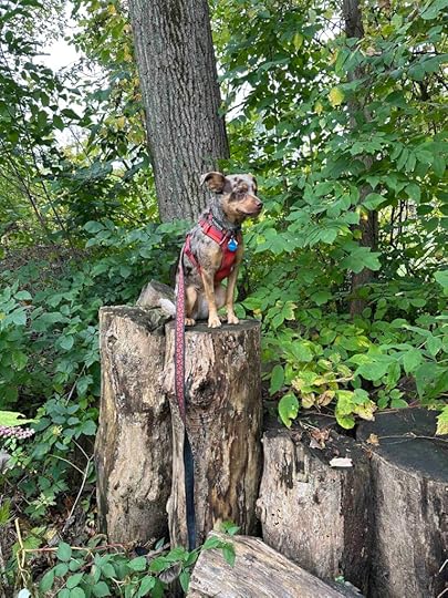
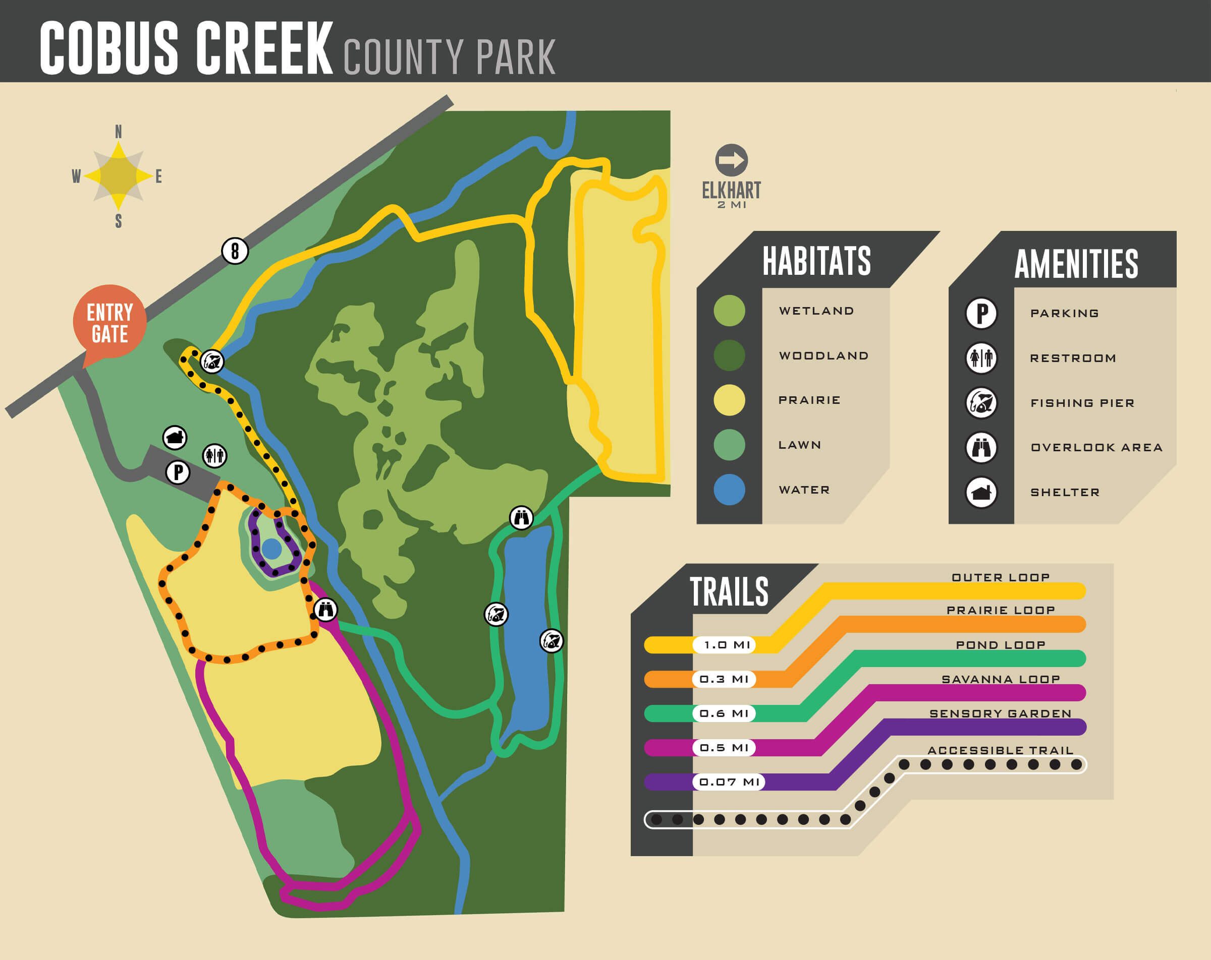
Another beautiful fall day means another adventure. This time we explored two parks in Elkhart, IN. The second stop was Cobus Creek County Park which consists of 84 acres of wetlands, prairie, woods and over two miles of trails. During our hike we found a creek, pond, and trails in both the woods and prairie. There is also a fishing pier, playground equipment, a sensory garden, and picnic shelter.
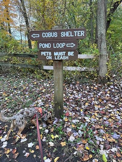
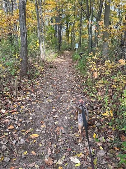
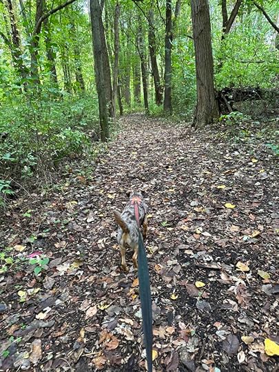
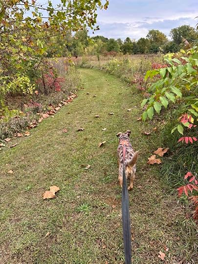
After parking the car we walked to the right and found the Prairie Loop trail which was a hard packed gravel trail through a prairie. After a short distance we found a trail sign and the Savanna Loop, a wooded trail. At the start this trail follows the road, although it is hidden from view. At this point it did not feel like a hike in the woods, but a path with trees on either side. Eventually it became more densely wooded and led us to the Cobus Creek, a cold-water trout stream that runs through the park. The best part for Sunny was finding a few areas where she was able to get down to the water and get her feet wet.
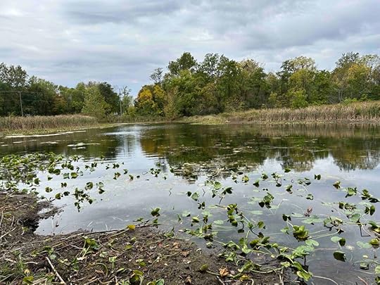
We continued following the creek and crossed a bridge to a trail that paralleled the creek. This then led us to the Cobus Pond Loop, which gave us views of the pond. We crossed a wood platform and found several overlooks, some with benches which made for a nice place to rest. Sunny enjoyed watching the ducks from this vantage point, but I’m not sure the ducks were as happy about this as she was.


After completing the pond loop we found the Outer Loop and followed it to the fishing pier and then back to the shelter and parking lot. The total distance we walked was 1.74M.
The park has a variety of trails with some signs, but no informational signs like those found at Boot Lake Nature Preserve. If you follow the signs toward the shelter that will lead back to the parking lot. We downloaded a copy of the trail map before leaving home which helped us keep from getting lost.
 Our Rating
Sunny and I give Cobus Creek County Park 4 out of 4 paws up. This park has something for everyone including the things we love – wooded trails, water with the ability to get down to it, and beautiful and interesting scenery. Ample parking and a restroom are added bonuses.
How do I Get There?The address for Cobus Creek County Park is 30680 Count Road 8, Elkhart, IN.
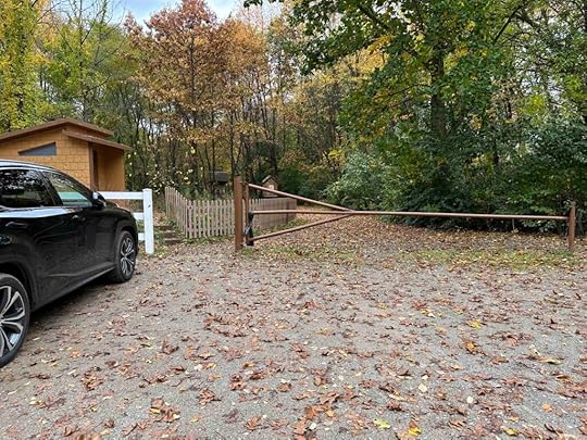
Since the Nature Preserve is a bit off the beaten path, we recommend visiting it with Boot Lake Nature Preserve. To get there take I-69 and exit at I-80/I-90 which is the Indiana State Toll Road. Keep right onto I-90W and continue for 52M. Exit at #92 onto IN-19 toward Elkhart. Cost of the toll on the day of our adventure was $3.80. Turn right onto IN-19 and then right onto County Road 6. After nearly 3.5M turn left onto County Rd. 10. After .3M turn right onto County Road 1 and continue for 1M, then turn right onto County Rd. 8. After .6M turn left into the parking lot. There is a wood fence with a driveway leading to the parking area. Follow the road to the end where you will find the parking lot.
From Boot Lake Nature Preserve take a left onto County Road 3N. After nearly half a mile take a slight right onto Edwardsburg Road and then turn right onto County Road 4. Follow that for 1.2M then turn left onto County Rd. 1. Continue for .6M then turn left onto County Rd. 10. After half a mile turn right onto County Rd. 1. Continue for a mile then turn right onto County Rd. 8. The parking lot is .6M on the left.
For more information about Cobus Creek County Park check out the Elkhart County Parks website.
The post Cobus Creek County Park appeared first on Live Like Karlie.
Boot Lake Nature Preserve
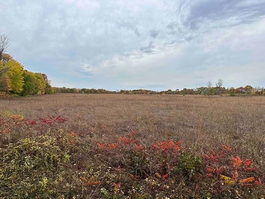
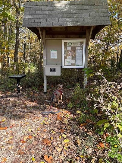
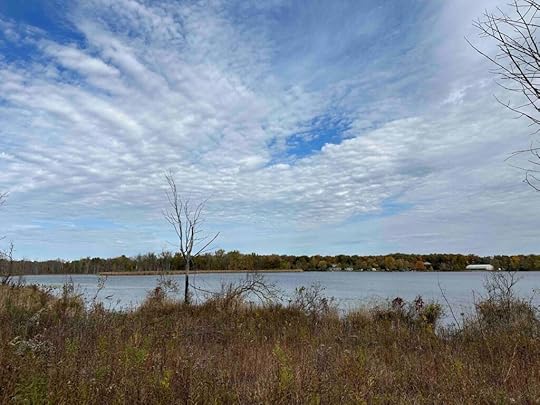
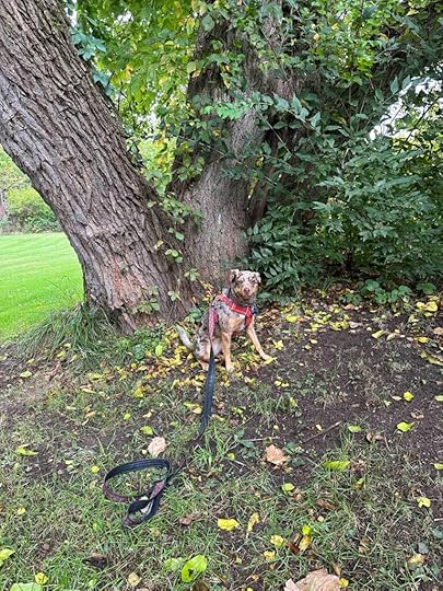
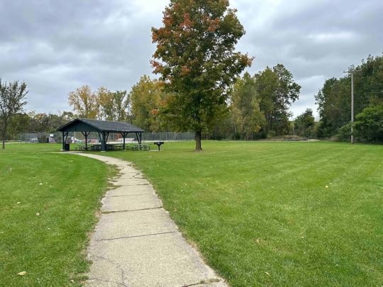
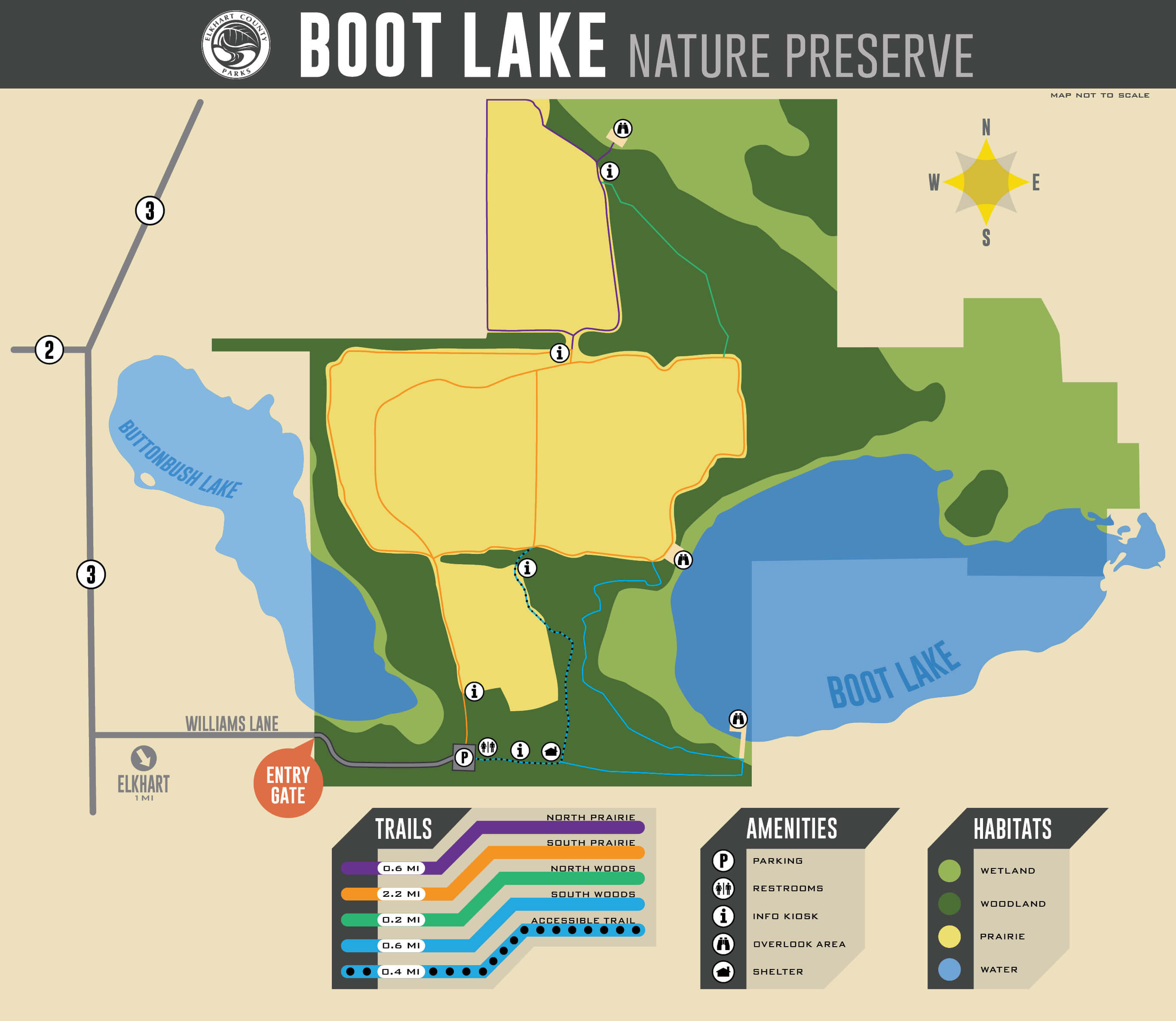
Another beautiful fall day means another adventure. This time we explored two parks in Elkhart, IN. The first stop was Boot Lake Nature Preserve which consists of 300 acres of wetland, forest, and prairie and four miles of trails. It is also home to over 200 species of birds making it a great place for bird watching and hiking. During our hike we found a picnic pavilion, wetland and prairie overlooks, and trails in both the forest and prairie.
After parking the car we found two entrances to the trails; one to the left of the parking area and one in front of the restroom. We entered in front of the restroom since this trail starts in the woods and the other one starts in the prairie. After a short distance we saw the picnic pavilion on our left. We continued into the woods and enjoyed the serenity of hiking among the trees.


Eventually the trail led to a large tree near the entrance to a dock. We continued onto the dock which led to an observation point on Boot Lake. We found a bench at the end of the dock making it a nice spot to rest and enjoy the scenery. Unfortunately you can only observe the lake from this observation point and not get down in the water. We found this to be true for both the lakes.


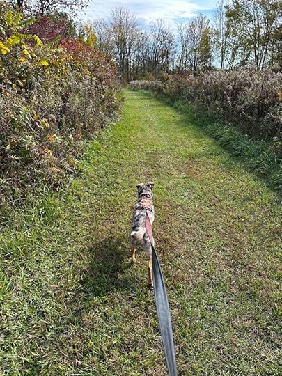
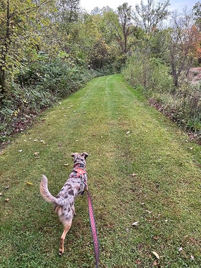
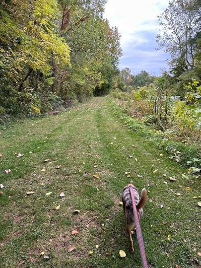
After checking out the dock observation point we continued on the trail and eventually ended up on the South Prairie Trail, which is a trail in the prairie (field). This also provided views of the lake, but we could not get very close to it. There were several spots to re-enter the woods and we did that and followed the North Woods Trail to the North Prairie Trail. As the name suggests the North Prairie Trail is another trail in a prairie. We followed this for quite awhile and eventually ended up on the South Prairie Trail which returned us to the parking lot. We hiked three miles and saw the majority of the preserve.


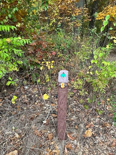
Although the preserve has a variety of trails both through the woods and prairies, it also has several informational signs with a map of the preserve. The map indicates “you are here” which really helps in finding your way. There are also color coded trail markers that correspond to the preserve map. We downloaded a copy of the trail map before leaving home which also helped keep us from getting lost.

 Our Rating
Sunny and I give Boot Lake Nature Preserve 3.5 out of 4 paws up. There are miles of trails both in the woods and prairies, views of two lakes, and some interesting docks and outlook points to climb on. There is also ample parking, a restroom, and trail maps throughout. The only downside for us, is no ability to get our toes wet.
How do I Get There?The address for Boot Lake Nature Preserve is 51430 County Road 3 in Elkhart, IN. Since the Nature Preserve is a bit off the beaten path, we recommend visiting it with Cobus Creek County Park. To get there take I-69 and exit at I-80/I-90 which is the Indiana State Toll Road. Keep right onto I-90W and continue for 52M. Exit at #92 onto IN-19 toward Elkhart. Cost of the toll on the day of our adventure was $3.80. Turn right onto IN-19 and then left onto County Road 4. After nearly 2.5M turn right onto Edwardsburg Road. After .2M turn right onto County Road 3N and continue for .4M, then turn right onto Willams Lane. The turn is just after a brick mailbox and there is a small sign for the preserve. Follow the road to the end where you will find the parking lot.
For more information about Boot Lake Nature Preserve check out the Elkhart County Parks website.
The post Boot Lake Nature Preserve appeared first on Live Like Karlie.
October 24, 2023
Baw Beese Trail

Another warm, sunny, fall day so we ventured to southern Michigan to explore the Baw Beese Trail. Although the route from Northern Indiana is a bit convoluted it is well worth the trip.
As you drive along Lakeview Dr. to Sandy Beach where we parked, you get a lovely view of Baw Beese Lake. A short way down the road you will see Owens Park on the right hand side. This is a lovely park with access to the lake, playground equipment, and picnic tables. We continued driving past the park until we came to Sandy Beach. We parked there and then walked across the road to the start of the trail.

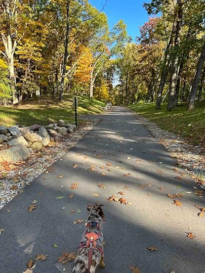
The trail is a wide asphalt trail with tall trees on either side that is shared by bikers, runners, and walkers. It is 8.2M long, however we only walked about 2M before turning around. Near the start of the trail is a memorial to black bears and a park bench. Sunny enjoyed posing near those.


As we continued on the trail we saw views of Baw Beese Lake. We also found another trail, Lockhaven Path, that climbed to a housing development. After walking to the end of that trail we turned around and walked back to the Baw Beese Trail. We continued on the Baw Beese Trail to Barnard St. before turning around. On our way back to the car we explored Owens Park where we found opportunities for Sunny to get her toes wet.


 Our Rating
Sunny and I give Baw Beese Trail 4 out of 4 paws up. It really has everything we look for in a great adventure – a wooded, scenic trail, the ability to walk several miles, a view of water and the ability to get our toes wet, good parking, and restrooms. Baw Beese Trail and the nearby parks have all this as well as playground equipment, boat launches, and picnic tables. This is an outing that most everyone could find something to enjoy and since the trail is asphalt and flat it would be appropriate for everyone.
How do I get there?Hillsdale, MI is not the easiest place to get to, but it sure is worth it. We parked at the Sandy Beach, but there is also parking at Owens Park. To get there take I-69 and exit on Copeland Road toward Kinderhook. Follow Copeland Road for about 3M and turn left onto S. Fremont Rd. After 2M turn right onto Lester Rd. Continue for 5.5M and turn left onto Kelley Rd. After half a mile turn right onto Reading Rd. Continue for 3M and then stay straight when Reading veers to the right. You will now be on Abbott Rd. Continue for 1.3M and then turn right onto W. Card Rd. Continue for 7M and then turn left onto S. Hillsdale Rd. Follow for 1.5M and then turn right onto E. Bear Lake Rd. After a mile turn left on Steamburg Rd. After nearly a mile turn right onto M-99N and follow for about half a mile. Turn right onto Ash Te Wette Beach Dr and then turn left onto Steamburg Dr. Follow for .7M and turn right onto Lakeview Dr. Continue for .3M and then turn right onto Waterworks Ave which turns into Lakeview Dr. Continue and park at Owens Park or Sandy Beach. During the season there is a $5/car fee to park at Sandy Beach.
For more information on Baw Beese Trail check out the Trail-Link website.
The post Baw Beese Trail appeared first on Live Like Karlie.
October 23, 2023
Merry Lea Environmental Learning Center
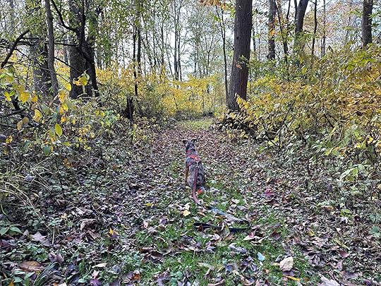
The sun came out on a beautiful fall day so we ventured to Albion to check out the Merry Lea Environmental Learning Center. It consists of peat bogs, wetlands, and wooded areas and provides environmental education to students. There are also trails throughout the property that are open to the public.
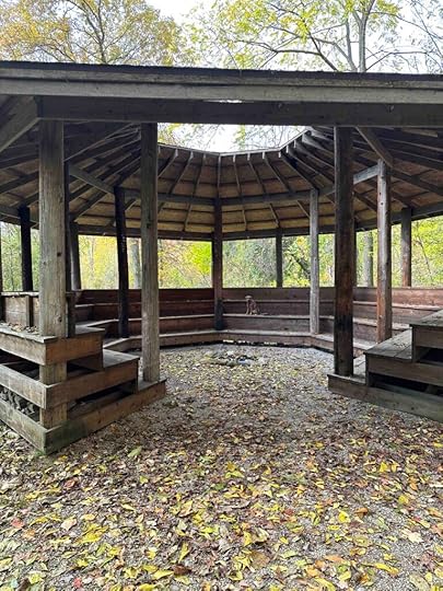
We parked at the Learning Center and started our hike by entering the woods near the entrance sign. The trails are dirt/grass in the woods and mowed grass in the fields. There are quite a few trails that intersect so it’s easy to get turned around and lost despite the trail markers. We printed a copy of the map from the website which helped keep us from getting lost. We followed several different trails in the woods and had views of a gazebo, the bog, and the lake. We also walked through a mowed field near the lake.
The Merry Lea Learning Center is a really interesting place and we enjoyed our hike. Most of our hike was through the woods, but we also hiked near the lake in a field. We had a peaceful hike and only encountered two other people. We found the trails to be flat and easy to maneuver. A few sections were a little muddy, but that likely was due to a recent rain. We walked 2.63M, but could have walked further as there are 6M of trails.
Our RatingSunny and I give Merry Lea Environmental Learning Center 3 out of 4 paws up. It’s a peaceful walk in the woods with views of the lake. We loved that you can walk for several miles, but wished we could get down to the water. There is plenty of parking and a port-o-potty near the start of the hike.
How do I get There?The address for the Merry Lea Environmental Learning Center is 2388 S 500 W in Albion, IN. Take IN-8 toward Albion then turn left on N 150 E. Follow for 2M and then it turns right and becomes E 100 N. Follow for 2.6M and turn left onto N Wolf Lake Road. Continue for 3.6M and turn right onto US-33/Lincolnway S. After .2M turn left onto IN-109 and continue 1.4M. Turn right onto W 275 S and continue for .6M, then turn right onto W 300 S. After .4M turn right onto S 500 W. After .3M turn right onto the gravel driveway near the sign. Follow the road to the parking lot.
For more information check out the Merry Lea Environmental Learning Center website.
Merry Lea Environmental Learning Center
The post Merry Lea Environmental Learning Center appeared first on Live Like Karlie.
Cataract Falls State Recreation Area
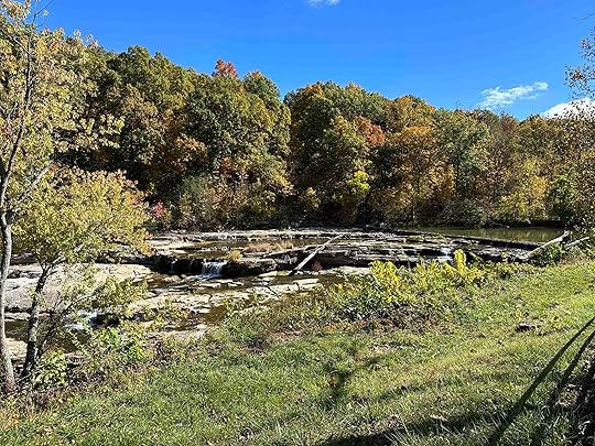
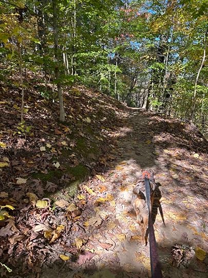
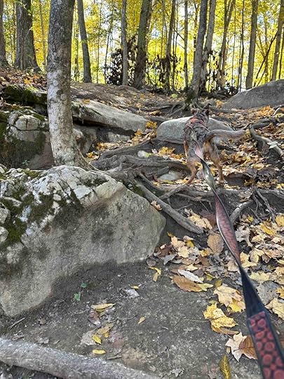
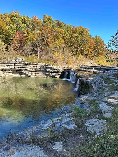
Sunny and I were in Bloomington, IN visiting her best friend and on the way home stopped at Cataract Falls State Recreation Area in Spencer, IN. What a wonderful place and a great way to break up the trip. Since it was a Sunday when the leaves were at their peak, there were a lot of other people who had the same idea. Despite that the trail was not overcrowded and we had a great time.
The main attraction of Cataract Falls State Recreation Area are the upper and lower falls. You can get a view of the upper falls by walking across the grassy area in front of the parking area. Although you can not walk out on the falls, you can enjoy viewing them from either the grass or an elevated platform.
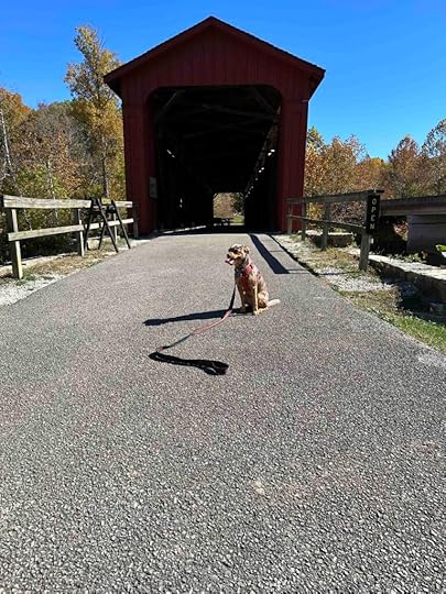
Covered BridgeAfter checking out the falls you can explore the only surviving covered bridge in Owen County. This bridge was constructed in 1875 and used for vehicular traffic until 1988 when traffic was diverted to a concrete bridge. Robert Smith built the bridge using a simple latticework of crossing timbers instead of the more popular Burr Arch trusses. In 2000 the bridge received extensive repairs and in 2005 it was listed on the National Register of Historic Places. Sunny and I enjoyed walking on the bridge and looking through the windows that overlook the falls.
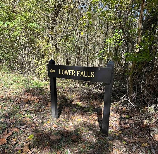
 Hike to the Falls
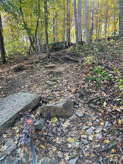
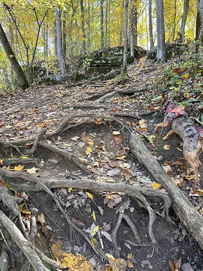
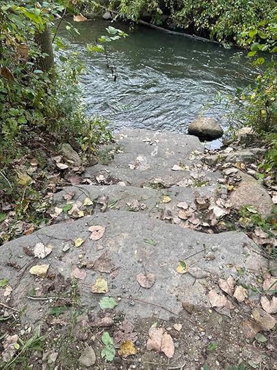
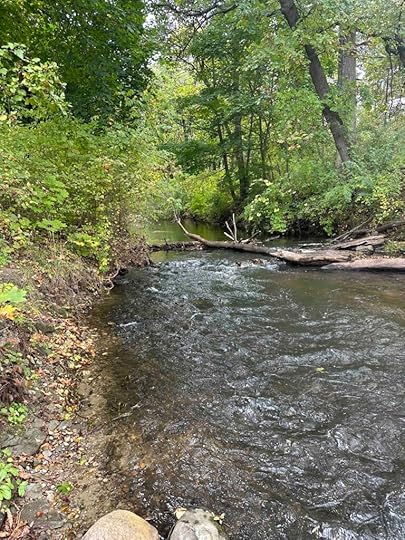
Next we decided to find the trail to the lower falls. We again walked past the upper falls and across the grass to the start of the trail. The trail is a typical dirt trail, but does have a steep decline shortly after starting (pictures below are of the return trip when we had to climb up the area we climbed down). This is not recommended for anyone with stability or mobility issues as it requires climbing over tree roots and steep natural steps. The rest of the trail is fairly flat and follows the creek. We found a spot to get down near the water and several areas to get down onto large stones in the creek. Sunny LOVED that.
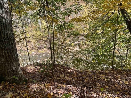
About three quarters of the way the trail ends at Picnic Road which leads to a picnic area. Continue past the picnic bench and look for the sign for lower falls and the continuation of the trail. This section of the trail continues through the woods, along the creek, and to the lower falls. After viewing the falls and taking a few pictures, we reversed our path back to the upper falls and the car. The total distance of our hike was just over 2M.
 Our Rating
Sunny and I give Cataract Falls State Recreation Area 4 out of 4 paws up. This is a beautiful area with the opportunity to see 2 waterfalls and hike along the creek. There are paths to get down to the creek and walk along the large stones which Sunny quite enjoyed. The trail along the creek between the falls is scenic and challenging. There is plenty of parking and restrooms. You can also picnic in several areas. This area really has something for everyone and is especially gorgeous in the fall when the leaves turn colors. We enjoyed our short visit and highly recommend this adventure.
How Do I get There?The address for Cataract Falls State Recreation Area is 2605 N. Cataract Rd. in Spencer, IN. From US-231 turn onto N. Cataract Rd/Cataract Falls Rd/County Rd 1050 N. Continue for 3M and turn right at Owen Park Rd. After going through the entry gate and paying ($7 for Indiana residents, $10 for non-residents – fee is for the car, not each individual), you can either park on the right near the upper falls or continue up the road and park at the lower falls.
For more information about Cataract Falls State Recreation Area check out the Indiana Department of Nature Resources website.
Cataract Falls State Recreation Area
The post Cataract Falls State Recreation Area appeared first on Live Like Karlie.
October 14, 2023
Baintertown – River Preserve County Park
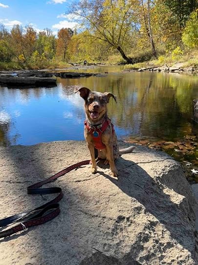
Sunny and I ventured to Elkhart County to check out the Baintertown – River Preserve County Park which consists of the Baintertown Dam, Baintertown Hydro, and Baintertown Park. These parks and trails make for an enjoyable, but short outing. The Baintertown Dam consists of a mowed grass trail along the Elkhart River that ends at the dam. The Baintertown Hydro consists of two trails – a dirt packed trail through the woods and a mowed grass trail along the Elkhart River. Baintertown Park consists of a short grass trail along the Elkhart River. Although we walked all these trails we only logged a little over 2M.
We started our adventure by checking out the Baintertown Park trail. This park has a restroom, picnic shelter, and plenty of parking. Although there is a trail, it is quite short. The trail follows the Elkhart River before coming to a dead end. From the parking lot to the end of the trail and back was less than half a mile. This was our least favorite of the trails as it was too short and not in the woods.
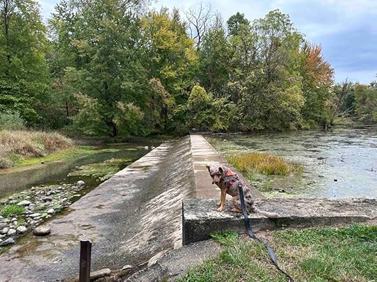
Next we checked out the Baintertown Dam which has a grass trail along the Elkhart River. The trail leads to the dam which is quite interesting. There is a picnic table in a clearing to the left of the trail. Although there is a spot near the picnic table to get down to the water we did not do that. During our visit the water was stagnate and green so I did not let Sunny put her toes in the water. The total distance we walked was less than a mile.
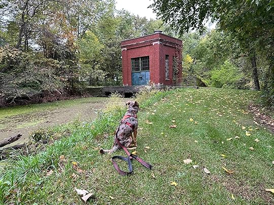
After checking out the dam we drove a short distance to the hydro trails. These were our favorite trails. The first trail we explored was behind the hydro plant and to the left. This was a short trail in the woods along the river. There was a wood platform at the start and some steep steps. We enjoyed finally finding a trail in the woods.
After returning to the hydro plant we took the grass trail to the right. Eventually there was a marker leading to another trail in the woods and back to the grass trail. The grass trail was the one we saw from the Baintertown Park. We followed the trail nearly to the road and then found a field on the left. The field had additional mowed grass trails through it and around a pond. After circling the pond we followed the grass trail back to the hydro plant and the parking lot. We walked just over a mile on both the hydro trails.
 Our Rating
We rate the Baintertown -River Preserve County Park 2.5 out of 4 paws up. Overall this is a nice system of trails, but few are in the woods and total distance is less than 2M. We prefer the Benton – River Preserve County Park which is more scenic, provides for a longer hike, and is just down the road. Below are our ratings for each trail.
We rate the Baintertown Dam trail 2 out of 4 paws up. The trail is well maintained and somewhat scenic, we just prefer hiking in the woods and a longer hike.
We rate the Baintertown Hydro 3 out of 4 paws up. The trail starts at the hydro plant which is quite interesting and has two sections that are through the woods. It also is the longest and most scenic of the trails.
We rate the Baintertown Park trail 2 out of 4 paws up. The trail is the shortest and least scenic, but does have a restroom.
How do I get there?Take 6 W to Syracuse and then turn right onto County Road 33 N. Follow for just under 3M and turn left onto County Road 42. After just under 2M turn left onto Lincoln Rd. After a less than half a mile you will see a parking lot on the left for the Baintertown Dam. To get to the Baintertown Park (67380 County Road 29) continue on Lincoln Road for .2M and the parking lot is on the right. To get to the Baintertown Hydro (67202 County Road 29) take a right out of the parking lot and continue on County Road 29 for .3M and the parking lot is on the right.
For more information check out Elkhart County Parks website.
The post Baintertown – River Preserve County Park appeared first on Live Like Karlie.
October 12, 2023
Ott Biological Preserve

On a somewhat overcast day we decided to venture to Michigan and check out two trails – Ketchum Park and Ott Biological Preserve. We definitely saved the best for last as we thoroughly enjoyed the beauty of Ott Biological Preserve.
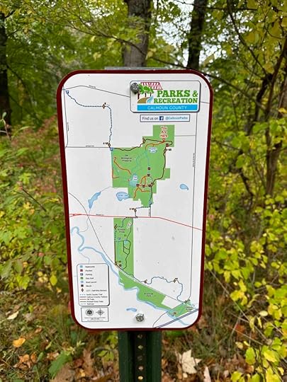
The preserve consists of 298 acres and includes a forest of ash, birch, dogwood, hickory, maple, oak, and spicebush trees, wetlands, and two lakes. There are over 5 miles of trails including part of the North County Trail, Calhoun County Trail, Iron Belle Trail, and Great Lake to Lake trail. The Calhoun County Trail travels the outer edge of the preserve while other trails travel through the middle of the preserve. There are two parking lots making the preserve accessible from the north and south.
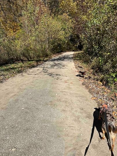
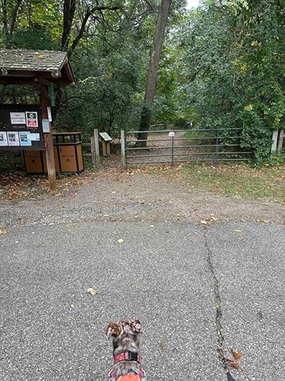
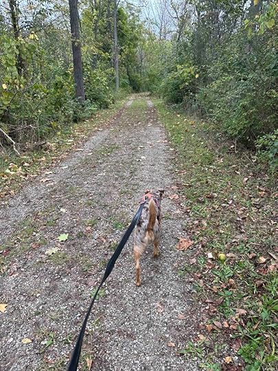
We parked at the south parking lot, walked past the metal gate, and took the trail to the right. The first thing we noticed was the beauty of this preserve. The trees surround you from every direction and since the leaves are starting to turn, it is absolutely beautiful. The next thing we noticed is the trail is quite wide and well maintained. It is packed gravel and dirt making it accessible for most people.

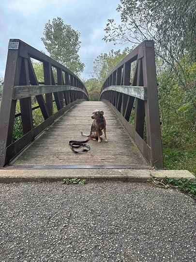
As we continued hiking on the trail we crossed several wood bridges. These did not go over streams or creeks, but wetlands and marshes. We also found some areas with large stacked stones creating retaining walls. Sunny loved investigating these and hunting for chipmunks that scurried in them. In addition to chipmunks we heard and observed birds, deer, and squirrels.

As we approached the end of the trail we saw a more rustic trail to the left. There was a map indicating that this trail lead to a lake so we decided to explore it. After a short distance we could see the lake and eventually found a short trail that took us down to it. Although there wasn’t an area where Sunny could put her toes in the water, she was able to stand on some tree trunks near the water. After exploring the lake we continued back to the main trail and to the north parking lot. Once there we turned around and headed back to the south parking lot.


Although the trails we explored had some inclines and descents, it was nothing too steep or difficult to navigate. We walked from the south parking lot to the north parking lot and back for a total of nearly 4M.
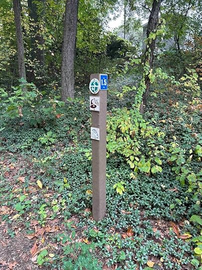
Our RatingSunny and I rate the Ott Biological Preserve 3.5 out of 4 paws up. We love the trail which is wide, well maintained, and surrounded by trees. It has trail markers and maps making it easy to know where you are. There are some side trails that travel through the woods and to the lakes. Two parking lots provide plenty of parking. The only downside is we did not find a restroom. Other than that, this is truly a beautiful hike in the woods and well worth the travel distance.
 How do I get there?
There are two parking areas and ways to access Ott Biological Preserve – 1129 Olive Street and 410 Jameson Street, both in Battle Creek, MI. The directions are for the Olive Street parking. Take I-69 across the Michigan border and then take exit #36 for I-94BUS/Michigan Avenue. Turn left onto M-96/Michigan Avenue and follow it for nearly 8M. Then turn right onto Arlington Avenue and after .2M look for the blue Ott Biological Preserve sign. Turn at the sign, park in the lot, and walk toward the back of the lot toward the gate.

For more information about Ott Biological Preserve check out the Calhoun County website.
The post Ott Biological Preserve appeared first on Live Like Karlie.
Ketchum Park

Ketchum Park in Marshall, MI is a neighborhood park with a kid’s playground, frisbee golf course, picnic areas, and a skate park. It also has a lovely out and back 1.5 M trail with views of Rice Creek on both sides.
After parking at the gravel lot on Montgomery Street near one of the picnic pavilions, we walked along the sidewalk behind the pavilion and over the bridge. From there we trekked across the grass field and found the entrance to the trail to the right of the skate park. The trail is a wide grass trail with Rice Creek running on either side of it. There are several areas with steep steps that lead down to the creek. Sunny enjoyed going down the steps, but unfortunately there isn’t much of a bank so she really couldn’t explore the water or put her toes in it. The water was also rushing fairly fast making it unsafe for her to get in it.
Although the trail isn’t in the woods, there are trees on both sides of it. And we even found some tree stumps that Sunny enjoyed getting on. In a few areas you can see homes on either side of the creek. Despite that this is a peaceful walk. Although the day we visited was overcast and chilly, on a sunny day this may be a warm hike as the trail is not sheltered from the sun. The trail is without any inclines or declines making it appropriate for most anyone.

 Our Rating
Sunny and I rate the trail at Ketchum Park 2.5 out of 4 paws up. The trail is mainly a grass trail between two sections of Rice Creek. It reminds us of the rail trails in Bloomington, IN. We like that you can get down to the water, but there isn’t much of a bank for exploring. Although the trail is well maintained, it’s not really a trail in the woods, which we prefer. We also did not find any restrooms. All in all, this is a lovely spot to walk if you live nearby or are in the area.
How do I get there?The address for Ketchum Park is 731 Montgomery St., Madison, MI. Take I-69 across the Michigan border and exit (#32) at F Dr/M-227. Stay on M-227 for nearly 5M then turn right onto W. Hughes St. After half a mile turn left onto S. Marshall Ave and continue for half a mile before turning right onto Warren St. After a short distance veer left onto Montgomery St. We parked at the gravel lot just past the “Kid’s Kingdom” and across from a picnic pavilion. Walk past the picnic pavilion and cross the bridge. Walk across the field and the entrance to the trail is to the left of the skate park.
The post Ketchum Park appeared first on Live Like Karlie.


