Andie LaComb's Blog, page 4
July 13, 2024
Fido’s Forest Revisited
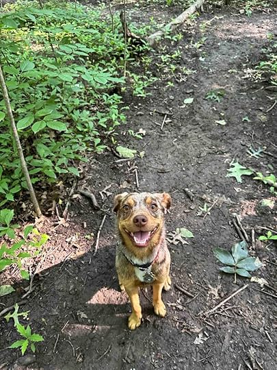
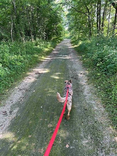
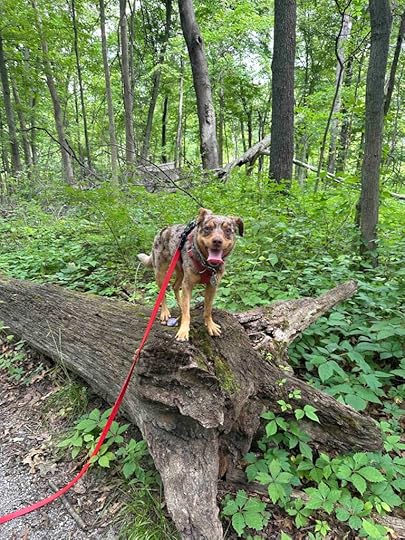
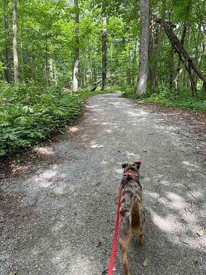
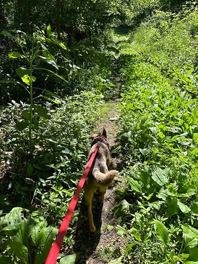
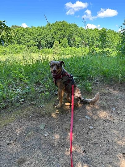
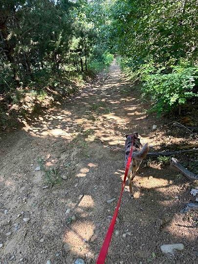
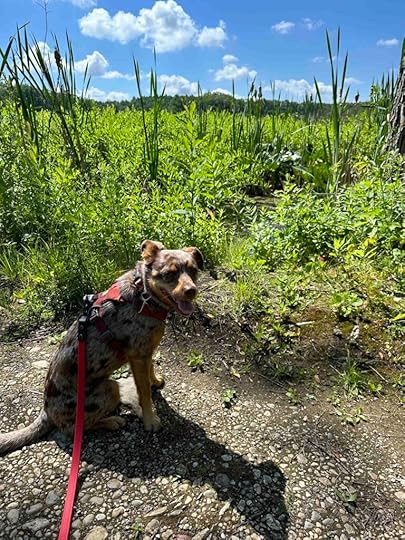
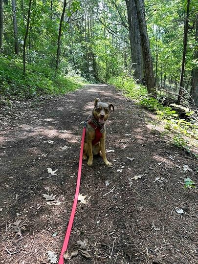
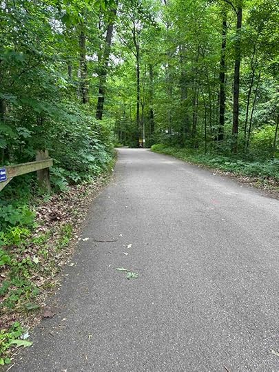
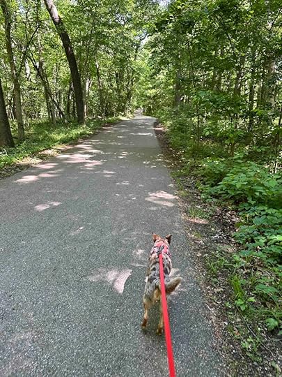
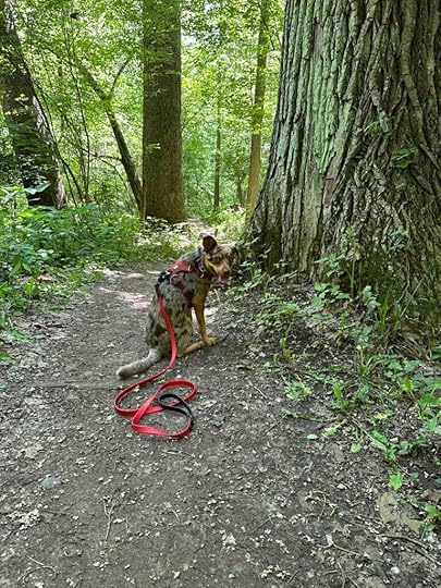
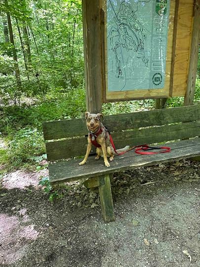
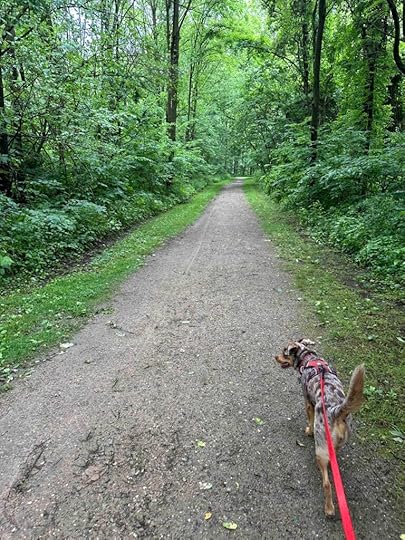
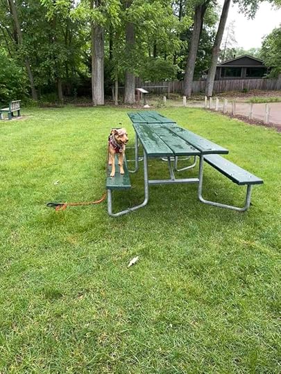
It’s been eleven months since the last time we visited Fido’s Forest. We absolutely loved it the first time so I’m not sure why we haven’t been back sooner. Regardless we returned this morning and I think Sunny had even more fun than the first time. She’s used to being in the woods, but having the chance to be off leash and explore what she wants and at her pace was priceless. I loved seeing her just being a dog and tried to keep up as she explored and made new paths through the woods. Since this visit was all about Sunny and her choices, I thought I would let her write today’s review.
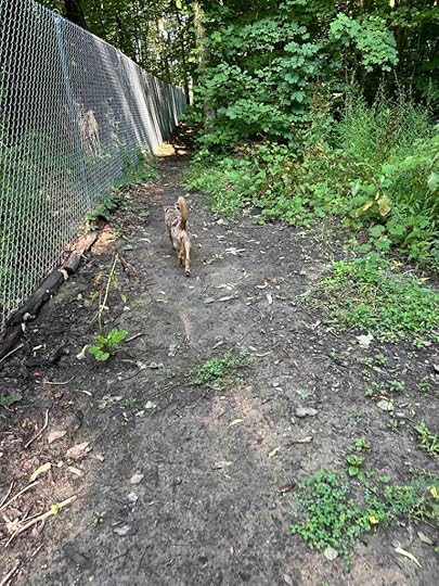
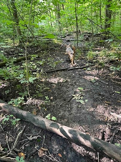
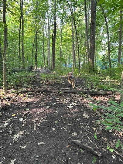
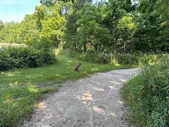
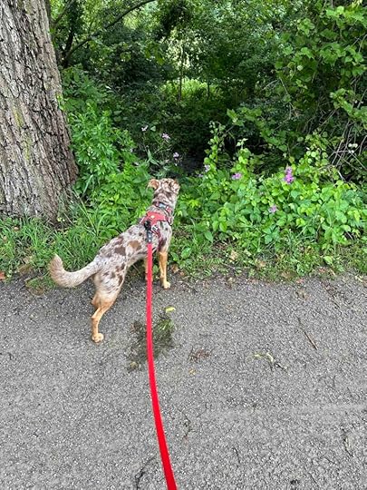
Sunny’s Perspective on Fido’s ForestWhat can I say? This was the best adventure EVER! I was so surprised when Andie took off my leash and harness and said “Go have fun!”. What does that even mean? Well, it didn’t take me long to find out. I was able to just run and explore EVERYTHING. There are trails through the forest, but those really are only suggestions. I mean who can keep on a trail when all the best stuff is in the woods and off the path? Plus it was super fun watching Andie try to make her way through the forest and keep up with me.
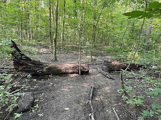
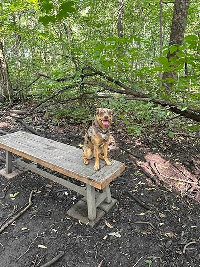
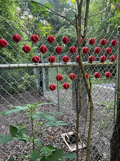
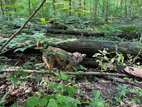
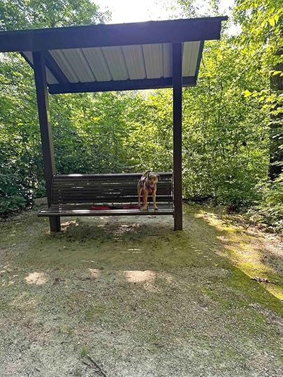
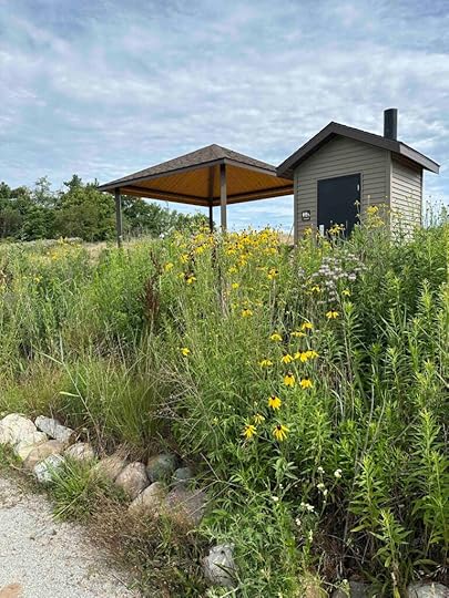
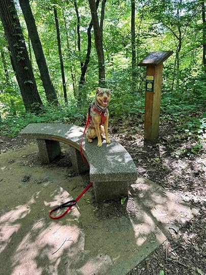
What I really like about the forest is, well, it’s a forest. There are downed tree limbs and trunks, so many critter smells, some benches and tree trunks to climb on, and a big tree root ball. They even have some tennis balls and other toys if you are into that kind of thing. I like to play with toys, but when I’m in the forest there are too many other interesting things to keep me busy to bother with toys. But if that’s your jam there is a box full of toys plus tennis balls in the fence at the entrance.
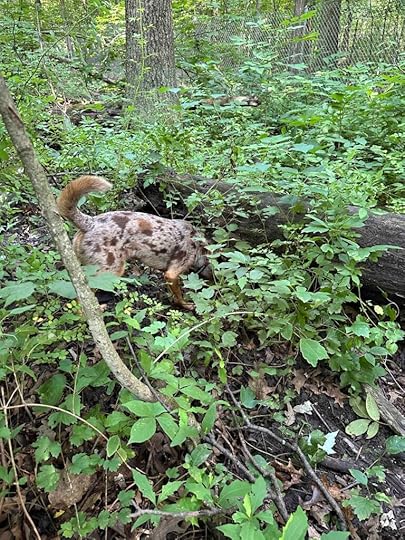
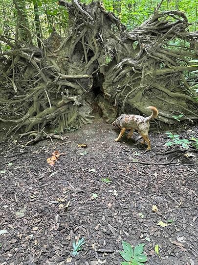
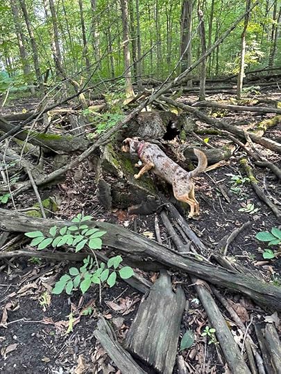
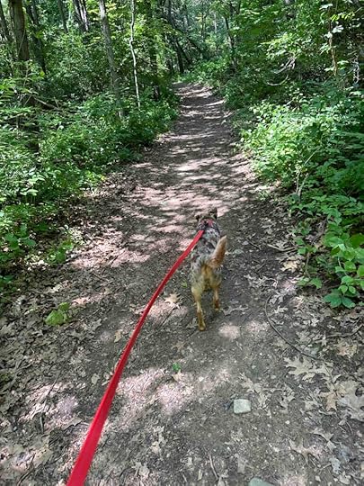
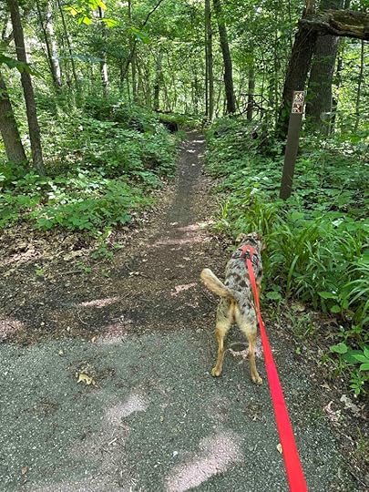
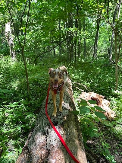
I don’t know how big the forest is, but I did my best to explore every square inch at least a couple times. I think my favorite part was some big tree trunks I found off the paths. Those had the best smells. I went back and forth giving them several good sniffs and then I returned a little later to do it again. I also liked smelling through the fence. There is a big fence around the whole place, but I stuck my nose in it to see what it smelled like on the other side. I also liked the big tree root ball from a tree that fell over. I’m pretty sure there were some critters under there and I did a lot of sniffing trying to find them.
We also played the recall game. That is one of my favorites because every time I get back to Andie she tells me how smart and good I am and then gives me some tasty treats. I like to see how fast I can run back. We did that a couple times and that was great fun.
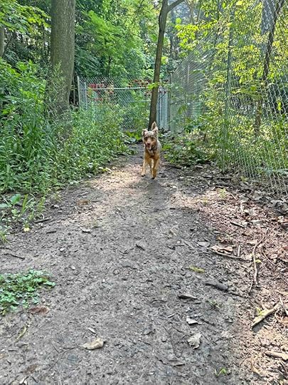
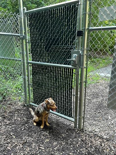
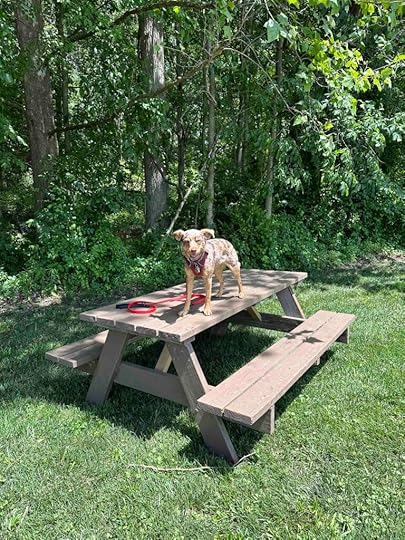
After a lot of running around and exploring it was time to leave. I was okay with that because I was getting a little tired. We went through the gate and I sat pretty at the second gate that leads to the parking lot. We were happy to see that no one else had entered the parking lot. I don’t mind meeting other dogs and people, but those are the rules. I got my boost into the car and we headed home. What a great adventure!
 Sunny’s Rating
If I could give Fido’s Forest more than 4 paws up I would. There’s nothing not to love – fenced forest with natural jumps (downed tree trunks and limbs), fun places to explore, and the smells are AMAZING! If you haven’t been yet, you need to book a visit pronto. Have your person check out their website today and book your visit.
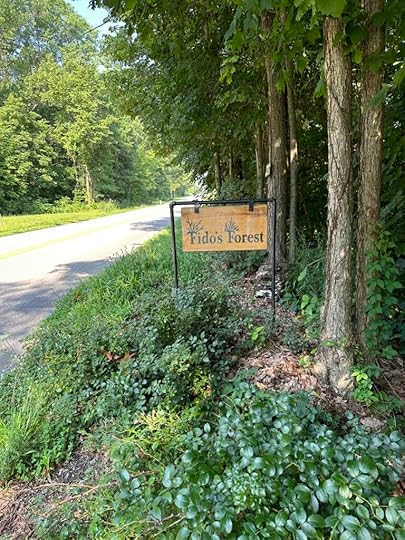
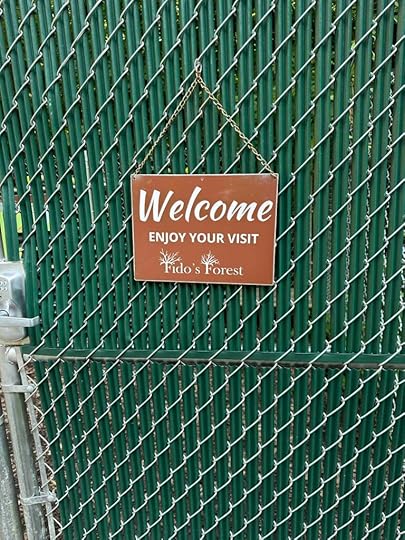
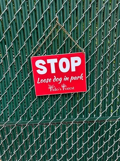
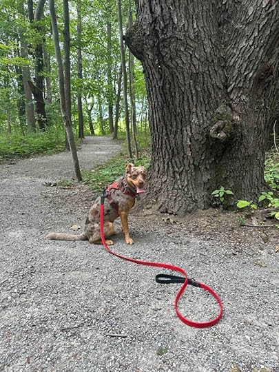
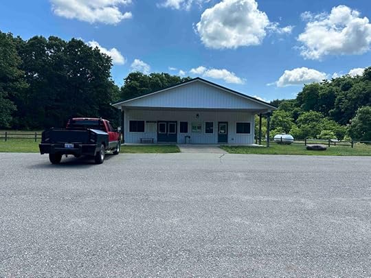
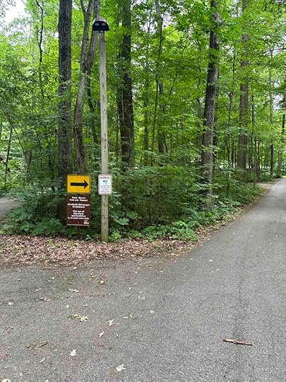
How Do I Get There?Take 69 toward Fort Wayne and exit at Dupont Road. Go west on Dupont Road for about 1.5M and then turn left onto Coldwater Road. After less than a mile, turn right onto E. Till Road. After 3 miles take the second exit to Till/Hugenard Road and continue another .6M and turn left on W. Wallen Road. Continue another half a mile and look for the Fido’s Forest sign on the right at 4582 W. Wallen Road, Fort Wayne. Pull into the parking lot and enter the entry code at the gate to enter the forest. Remember to look for the sign that says “Welcome to the Forest” and not to enter if it says “Stop – Loose Dog In the Park”.
For more information about Fido’s Forest check out these websites
Andie’s perspective on Fido’s Forest
The post Fido’s Forest Revisited appeared first on Live Like Karlie.


July 12, 2024
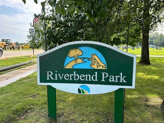
Riverbend Park
 How Do You Find Places to Visit?
I’m often asked how I find all the different places that we visit. It’s a combination of searching the internet, looking at online maps, and getting recommendations from other people. I spend a lot of time doing that and have a spreadsheet of places that we want to visit. I also log all our adventures so I can remember where we’ve been. One of the other ways I find locations is what happened today. We plan to go one place, but it doesn’t work out so we find a nearby park via GPS. What would we do without GPS?
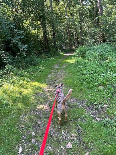
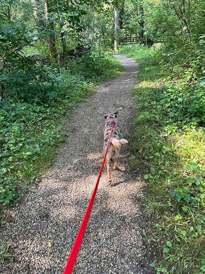
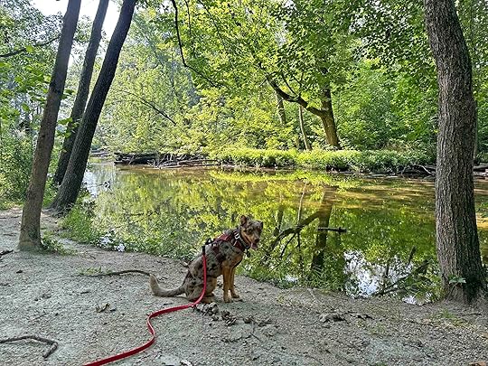
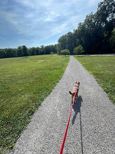
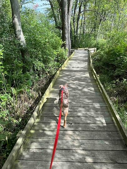
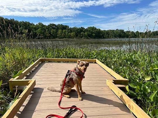
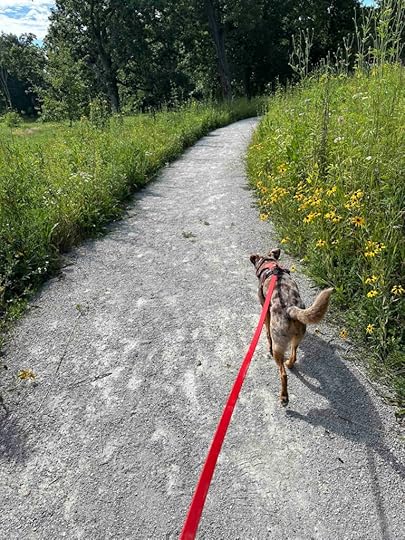
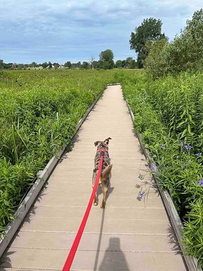
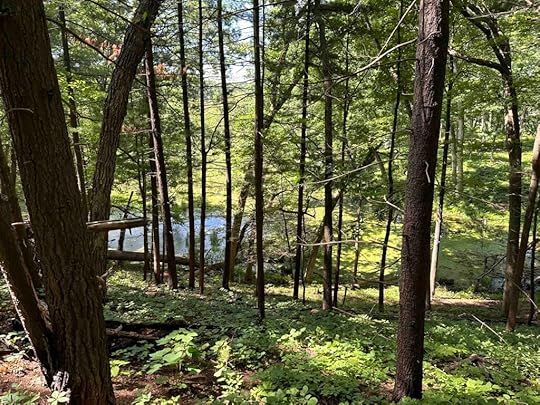
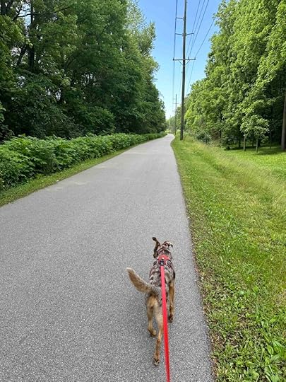
Today we planned to visit the Pumpkinvine Trail since we’ve had a lot of rain and I thought the dirt trails would be too muddy. I researched parking areas and picked one. The only problem is that the place GPS directed me to did not have a parking lot and I could not find one. That’s when I pulled over and asked GPS to find a nearby park. It directed us to Riverbend Park in Middlebury, Indiana. Although it was not what we had planned, we had a good time and found some trails in the woods.
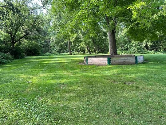
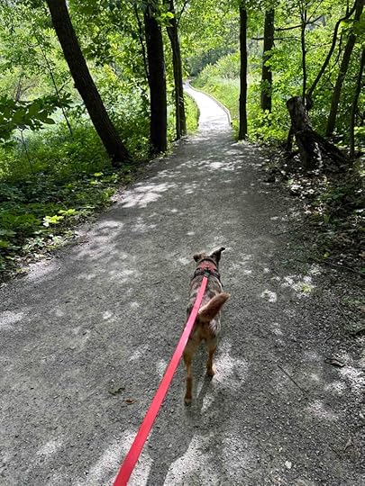
Our AdventureWhen we first drove up to the park I didn’t think we would find any trails. It had a basketball court, playground equipment, a picnic shelter, and restrooms. We walked past all of that and onto the grass. I figured we could at least get a little walk on the grass. What I did not expect was to find a trail in the woods at the back of the park. There were no signs directing us to it; we just got lucky.
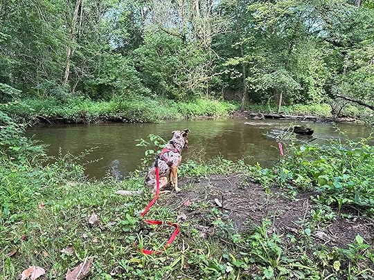
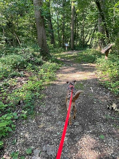
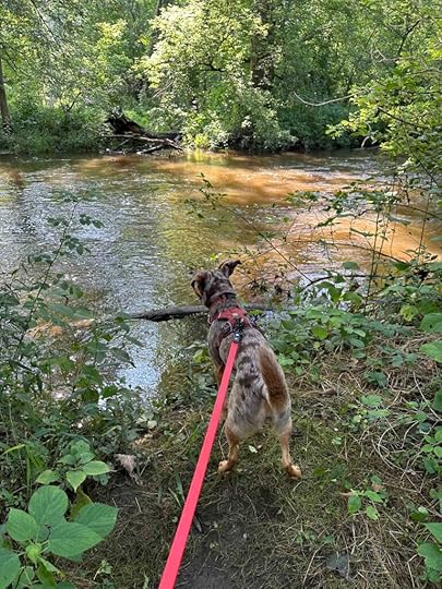
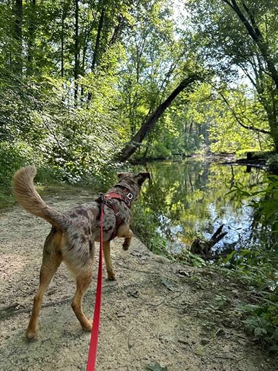
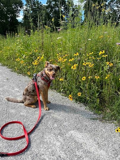
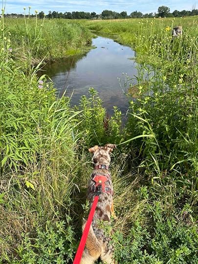
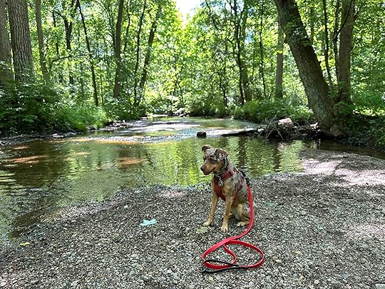
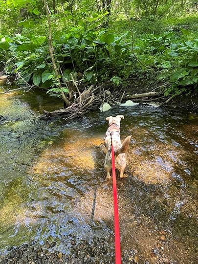
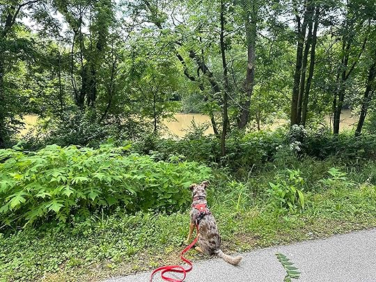
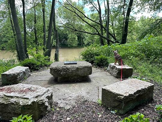
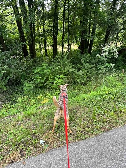
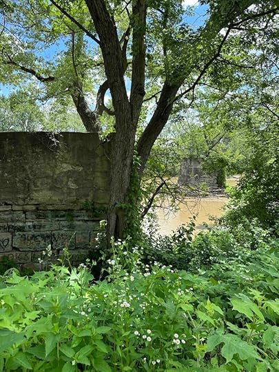
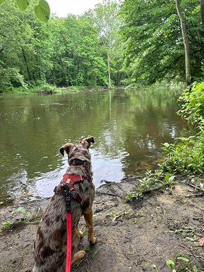
As we entered the woods there were little signs with pages of children’s books. I later learned these are for story time events that are held at the park. We followed the trail to the right as it followed the Elkhart River. The river was quite high and moving fast. Despite Sunny’s desire to get down to the water, we just observed it from the bank. There did not seem to be any place to get down and get her feet wet much to her disappointment. This did not stop her from checking it out several times.
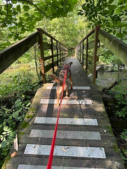
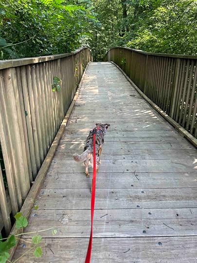
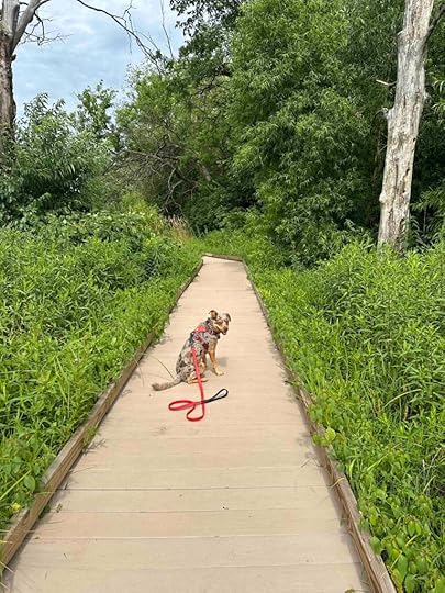
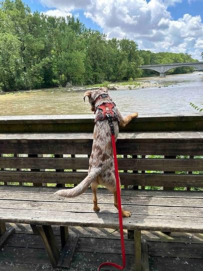
A short while later we came across a bridge that travelled over the river. Sunny was not a fan of this bridge. It was made of metal with large holes and her little paws kept getting stuck. Luckily she had someone to carry her across. Once on the other side we continued hiking along the river on the trail. And a short time later we crossed another bridge. This one was more to her liking since it was wood.
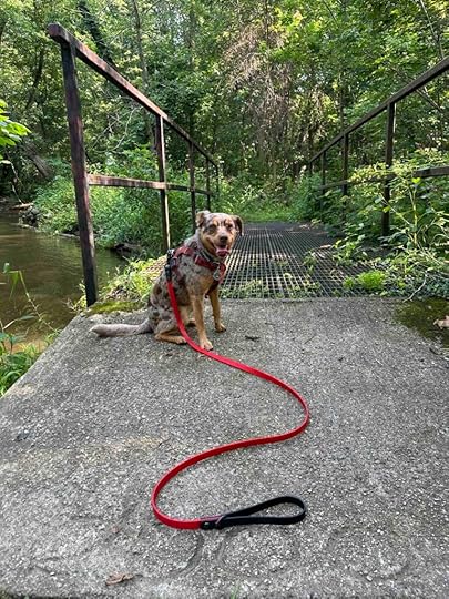
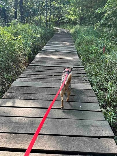
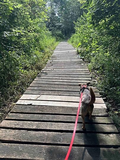
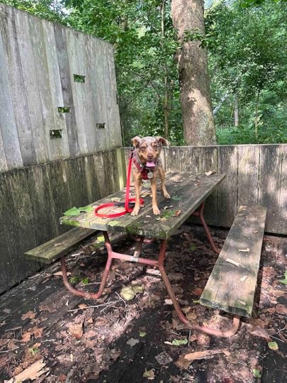
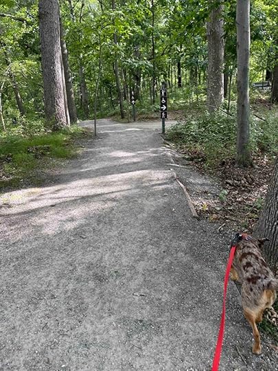
Eventually we found a section of wood boardwalk across the marsh. Some of the boards had large spaces between them so the girl with small paws had to be careful. As we walked on the boardwalk we came to a spot that led to a picnic bench. After checking it out we continued on the original boardwalk which led to some stairs up to a housing development.
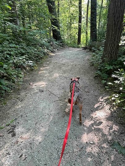
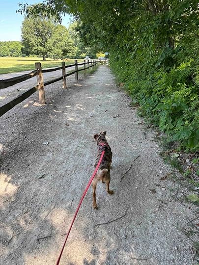
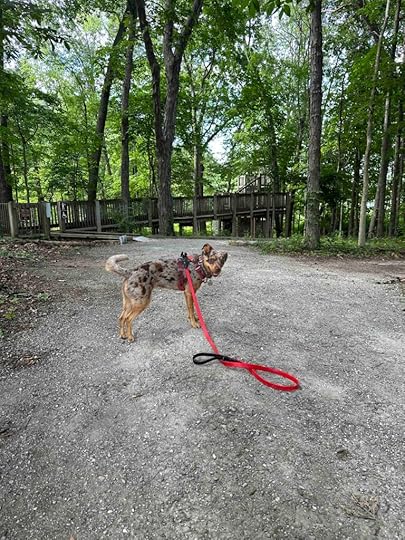
At this point we turned around and tetraced our steps back to where we entered the woods and found a gravel path on the other side of the picnic shelter. This took us back to the front parking lot along Warren Street where we parked our car. Our total hike was just over 1M.
Our RatingSunny and I rate Riverbend Park 2.5 out of 4 paws up. Although it’s a nice park, the trail is only a mile long and it’s not that challenging. It’s basically a narrow trail that winds through the woods, along and over the Elkhart River. We did enjoy seeing the water, but Sunny could not find a spot to get down to it. She always prefers to get her toes in the water. All in all this is a nice spot to picnic and take a short hike afterwards if you are in the area.
This trail would not be appropriate for those using wheelchairs or other mobility devices. It’s narrow and can get muddy after the rain. It also can get a little buggy since it’s near the water so you may want to use bug spray.
How Do I Get There?The address for the parking are at Riverbend Park is 511 E. Warren St., Middlebury, Indiana. From 69 take exit #348 toward Lagrange and follow 20 W for 28 miles. Turn right on County Road 43 and after 1.5M turn left onto County Road 16. Follow that for about a mile and turn left at the Riverbend Park sign. You can either park at the lot at the front or follow the road to the basketball court and playground area. To find the trail walk past the playground equipment and the large sand box near the tree. Keep walking toward the woods, it will seem like you can’t enter the woods. Once you get close you will see the entrance to the trail on the left side.
Please note this park is in Amish country so be cautious of horse and buggies and bikes on the side of the road as you drive. In some areas there is not much of a shoulder so please give them plenty of room and slow down when passing them.
Want more information about the park? Check out this website:
Middlebury City – Riverbend Park
The post Riverbend Park appeared first on Live Like Karlie.
July 8, 2024
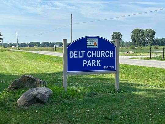
Lake Delt Church Park
After the noise and commotion of the July fourth weekend we were ready to get back to nature and the trails so we ventured to LaGrange County and Delt Church Park. What we found was a lovely park with a trail that meandered through the woods and fields while traveling along the Elkhart River.
History of Delt Church ParkI could not find any history about the Delt Church Park other than in 2020 the Parks and Recreation Department worked to remove invasive species and return the oak savanna. From what we observed today it seems they have accomplished that task.
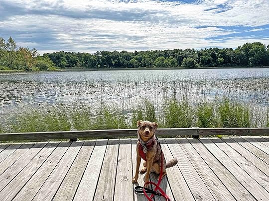
Our Adventure at Delt Church ParkOur adventure started by parking near the East River shelter. For there we walked to the left of the sign with the trail map. After a short distance we found a wood bridge over the Elkhart River and into the woods. As we followed the trail we noticed the Elkhart River on our right. There were several areas where we stopped to look at the river and a few where we could get down to it. We also found several benches throughout the woods, which Sunny enjoyed sitting on.
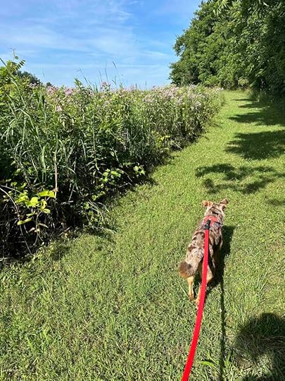
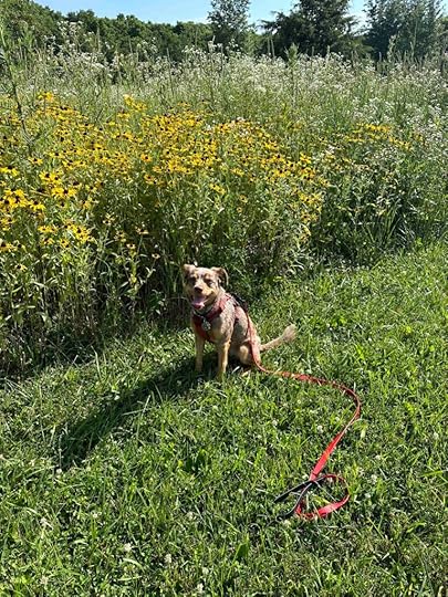
As we continued walking on the trail we came to a spot where the main trail continued straight, while another trail to the left led into a field. The field had beautiful wildflowers so we decided to take that trail. Since there weren’t many trees, this trail was mainly sunny and we were glad it was fairly early in the morning. We continued until it intersected with the main trail. Since we didn’t want to miss out on anything, we followed it to the right until we again came to the trail in the field. At this point we turned around, retraced our steps on the main trail until it intersected with the field trail, and then continued on the main trail.
The trail continued alternating between the woods and the field and had sections that traveled over the river. Near the end we came across a large field with some picnic pavilions and playground equipment. At this point, we could see our car in the distance. We took a moment to take a break in the shade under a tree and then continued. This led along the Elkhart River and back to the car. The total distance of the trail is 2.1M, however we logged nearly 2.5M since we backtracked a little.

 Our Rating
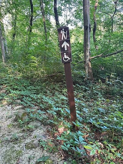
Sunny and I give Delt Church Park 3 out of 4 paws up. It’s a great spot for a picnic and a hike. The trail is accessible by those on foot or using a wheelchair or scooter. The downsides for us is the trail is only about 2 miles and it’s not that challenging. We did love that it followed the Elkhart River and the beautiful wildflowers in the field section. All in all a lovely place to spend time in nature and even have a picnic lunch. The park has some great amenities including a playground area, disc golf, restrooms, and picnic shelters. It is also very easy to follow the trail as it is well marked and it loops around so you really can’t get lost.
 How Do I Get There?
The park is off the beaten path, but GPS seems to know how to get there. I highly recommend using GPS with either Delt Church Park or 6455 S 200W, Wolcottville, Indiana as the location. Once you turn onto S 200W you will travel less than two miles before you see the blue Delt Church Park Sign. Turn right and follow the road to any of the different parking areas. We parked at the East River shelter and took the trail to the left of the sign with the trail map, but you can find the entrance of the trail in several other areas.
Please note that once you are in LaGrange County you will travel on several county roads with Amish farms on both sides. Be careful as the Amish travel on these roads in their horse and buggies and bikes and there is not much of a shoulder for them.
Want more information about Delt Church Park? Check out these websites.
The post Lake Delt Church Park appeared first on Live Like Karlie.
July 3, 2024
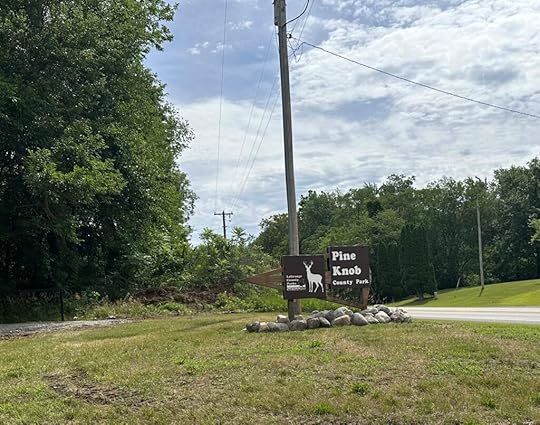
Pine Knob County Park
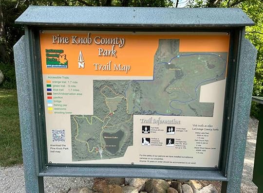
Another beautiful summer day in Northern Indiana so we headed out for an adventure and ended up in Howe, Indiana. We found Pine Knob County Park, a beautiful park of 254 acres with two small lakes, mature woods, a prairie, and a fen. There is also a club house, plenty of parking, picnic areas, and restrooms. The best part, though, are the four miles of handicap accessible trails through the prairie and woods.
History of Pine Knob ParkAfter the Indiana Governor signed legislation to create the Indiana Department of Conservation in 1919, communities were encouraged to form fish and game clubs. In 1934 LaGrange County residents formed the Howe Fish and Game Club and the Greenfield Township Fish and Game club. Then in 1943 the two clubs purchased the Meteer estate which later became the park. The original purpose was to use the land for a wild game refuge. In 1947 they built the current clubhouse and by 1948 the two clubs merged to form one club, the Pine Knob Conservation Club. The club continued meeting monthly until the late 1900s, but membership started to dwindle. By 2004 there were only 77 members and they voted to transfer the property to the LaGrange County Parks and Recreation Department who maintains the property today.
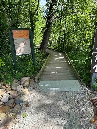
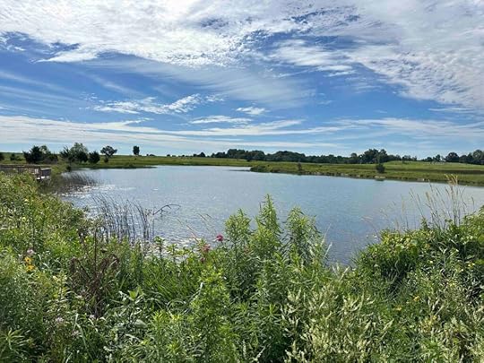
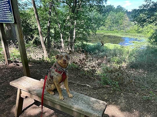
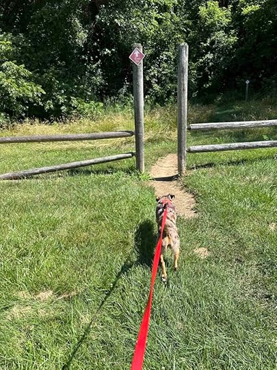
Our AdventureThe first thing you notice as you drive into the parking lot is the clubhouse. It’s a beautiful log building with Meteer Lake on the right. As you walk behind the clubhouse you notice two trails; one on the right and one on the left. We decided to take the trail on the right since we noticed an informational sign in front of it. This is the orange or archery trail which provides 3-D targets for archery and two shooting towers. You can also walk on the trail which has a restored prairie savanna, a densely wooded forest, and overlooks Meteer Lake and marshland.
We started walking on the trail and after a short distance of compacted limestone we found a long section of wood platforms. At first it’s fairly wooded, but soon you see peaks of Meteer Lake through the vegetation on the right. A little further it opens up to nice views of the lake and even a spot where there is a bench to sit and enjoy the view.
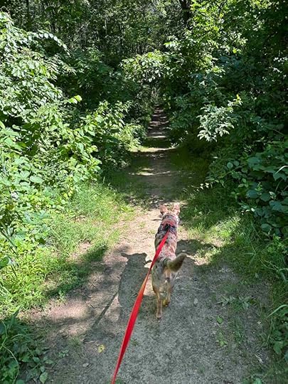
As we continued on the trail the boardwalk ended and we entered the woods. We continued to the right which was still the orange archery trail. We found another section of boardwalk across marshland and another view of Meteer Lake before re-entering the woods. Here we found one of the archery shooting towers.
 Fen Trail
We came upon another fork in the trail and kept right which took us onto the blue or Fen Trail. This trail winds through the prairie with views of native wildflowers, marshland, and Duff Lake. The trail is both compacted limestone and sections of boardwalk. We found this to be a truly peaceful and beautiful area. About halfway through we found a restroom and shelter which would be a lovely spot for a picnic.
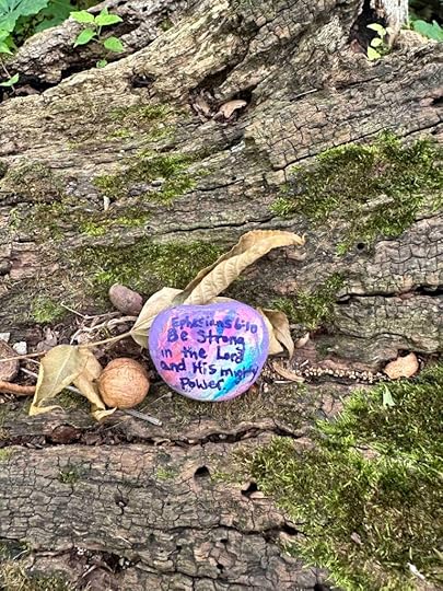
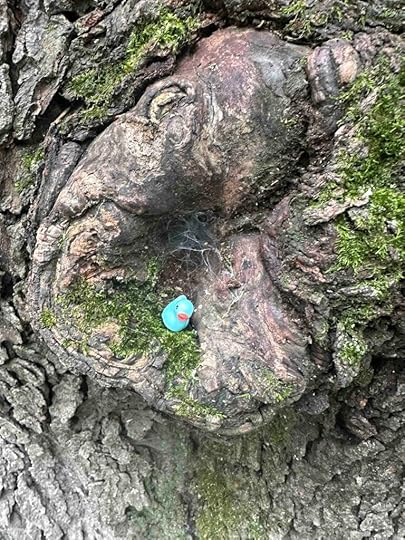
As we continued we came across Duff Lake where you can fish from the pier. After a little more walking on boardwalks we found ourselves back in the woods and a section of the archery trail. We found some interesting things in this spot; a cool log with a painted rock and a tree with a little duck. We really liked this part of the hike because the pine trees were so tall and lovely. The shade they provided was a welcome relief from the full sun in the prairie.

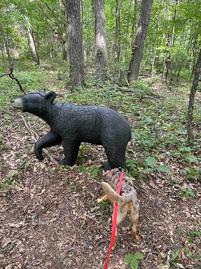
It was in this part of the hike that we noticed some critters in the woods. Sunny was first to notice a bear in the distance and wanted to investigate. Luckily after noticing he wasn’t moving we realized it was one of the 3-D archery targets. As our hike continued we saw several other fake animals in the woods. And of course we also saw many chipmunks and squirrels which also got Sunny’s attention.
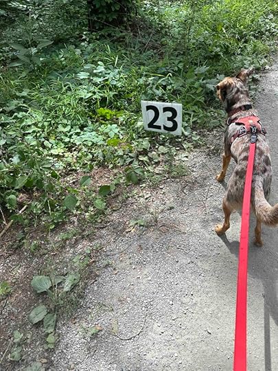
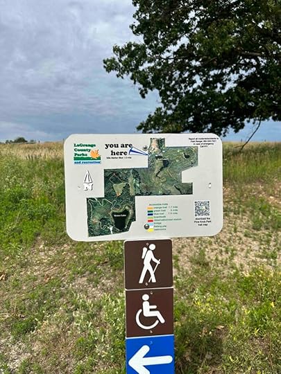
All along the archery trail we noticed markers which were helpful in letting us know we were still on the trail and traveling in the right direction. The signage throughout the trails was very good. There were maps indicating “you are here” as well as directional arrows indicating we were still going in the right direction. For most of our hike we just turned to the right which kept us on the full outer loop which was just over 3.5 miles.
 Our Rating
Sunny and I rate Pine Knob County Park 3.5 out of 4 paws up. It has nearly everything we love – miles of trails, water views, beautiful scenery, wooded areas, and a peaceful setting. The only downsides for us are the trail is not that challenging since it’s fairly flat and you can’t actually get down to the water to put your toes in it. Despite that it’s a beautiful place for a hike, you can log nearly 4M (and more if you do every trail), and there are areas to rest or have a picnic, as well as restrooms and plenty of parking. This is a place we highly recommend and it’s accessible for all no matter your mobility as the trail is wide and mostly crushed gravel or wood platforms over the water. We would caution hiking the fen trail in the heat of the day as there is not much shade and if you are hiking with a dog the boardwalks may get too hot for their feet.
 How Do I Get There?
The address for Pine Knob County Park is 2825E IN-120 in Howe, Indiana. From I-69 take the LaGrange exit and follow US-20W. After 12 miles turn right onto I-3W and follow that for 6 miles. Then turn left onto IN-120W and after about 3M look for the Pine Knob County Park sign on your right. Once you park your car you will see two trails on either side of the clubhouse. The trail to the right has the map and is the one we took. The one to the left is where we came out of the woods at the end of our hike.
Want more information about Pine Knob Park? Check out these websites.
The post Pine Knob County Park appeared first on Live Like Karlie.
June 24, 2024
MacCready Nature Reserve
Finally after a week of high temperatures and humidity it cooled down enough to go hiking. That means an adventure for Sunny and me. Today we ventured to MacCready Nature Reserve in Southern Michigan which has nearly seven miles of trails on 408 wooded acres with several ponds and marshes.
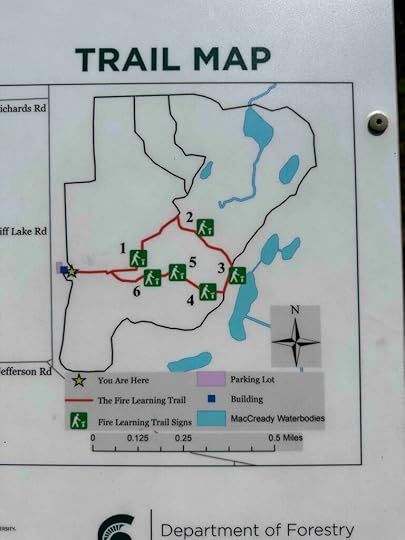
After parking the car we noticed the entrance to three different trails, one near the white building in the parking lot and one on each side of the parking lot. We took the trail on the left side of the parking lot (as you look at the white building). As we approached the entrance to the trail we noticed it was the red trail. According to the map this trail is an easy 1.6 mile trail. Although we did not hike the entire trail the nearly mile that we did was fairly easy. At the start it was a fairly wide flat dirt trail. After a short distance it became a bit overgrown, but there was still a path through it. This eventually became less overgrown and led to a pond.
We continued to follow the trail and noticed it became more difficult with a rocky surface and some inclines and descents. This was more our speed since we like more challenging trails. After hiking on this trail for a little bit, we found a blue sign indicating we now were on the blue trail. The signage for the red trail was not great, but we noticed more directional signs on the blue trail. As we continued on the blue trail we found a marsh and another pond. Eventually we came across a sign leading us back to the trailhead. We followed that and found the parking lot and our car.
 Our Rating
Sunny and I give MacCready Nature Reserve 3 out of 4 paws up. It’s a nice place to hike in the woods and the trails are both easy and challenging. Unfortunately although there are several different ponds and marshes, they are green and murky so no opportunity for Sunny to get her feet wet. We also noticed quite a few bugs on our hike, but luckily we knew this was likely so we used bug spray before the hike. Overall this is a nice place to take a hike in the woods, especially if you are in the area.
How Do I Get There?MacCready Nature Reserve is at 9241 – 9499 Skiff Lake Road in Clarklake, Michigan. It is about a quarter mile north of the intersection of Skiff Lake Road and Jefferson Road. The entrance is on the right across the road from a home and near the Michigan State University sign. As you enter the driveway you will see a white building and the parking lot on the left. Entrance to the trails are either on the right side of the white building or the right and left side of the parking lot.
For more information about MacCready Nature Reserve:
Guide to Jackson’s Hiking Trails
The post MacCready Nature Reserve appeared first on Live Like Karlie.
June 21, 2024
Baby, It’s Hot Out There – Heat Wave Canine Enrichment

The midwest has been having a heat wave this week which has grounded us from hiking. We aren’t fair weather hikers, but 90 plus degrees with humidity is not the best time to hike while wearing a fur coat. That doesn’t mean we are sitting around inside watching TV or that we aren’t getting out on walks. We’re just making some adjustments and coming up with other types of heat wave canine enrichment. I thought I would share our ideas and tips for still keeping Sunny’s mind and body moving when it’s too hot to hit the trails.
Adjust for the WeatherNormally Sunny and I take a very early morning walk, a mid-morning walk, and a late afternoon or evening walk. On days we go hiking the mid-morning walk is on the trails. With these warmer temperatures we are taking our mid-morning walk at 8 or 8:30A. We’ve also stopped our late afternoon walk and just take a short stroll around the block around 8P. And we take water with us on all our walks. It’s still warm, but not nearly as uncomfortable as it would be when the sun is at its highest and the temperature is at its warmest.
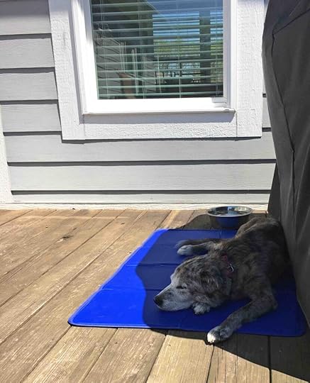
Stay Cool When OutsideDespite the temperature, Sunny and I are outside girls. We don’t want to be cooped up inside even when it’s hot. Thankfully our home has a covered patio with a fan so we are able to stay fairly comfortable. We have an outdoor dog bed on the patio and a big bowl filled with ice cubes and water. We also have a lot of trees so our backyard gets a lot of shade. Of course this does not stop Sunny for enjoying the sun and working on her tan, but it does give her a spot to get cool in the shade when she wants to.
When Karlie was with us we had to keep her cool because with her geriatric onset laryngeal paralysis polyneuropathy (GOLPP) the heat made breathing hard for her. So we had a cooling mat that she laid on while outside. We also had a cooling vest that I soaked in water and placed in the freezer. It made it a little hard to put on her, but kept her cool for a long time.

One other way to keep cool outside is to take a kong or similar toy and fill it with plain greek yogurt, peanut butter, mashed sweet potatoes, kibble, or whatever else your dog loves and put it in the freezer. It gives them something to do outside and has the cooling effect of ice cream without too much sugar.

 Take It Inside
Normally we spend most of our day outside, but with the heat we are limiting our backyard time to several hours. When we go inside we play indoor games – agility, food games, fetch with toys, and/or trick training. You can purchase agility equipment (check out Amazon) but you can also make it with PVC, pool noodles, dowels, and cones. This is something we did with Anna and Karlie and have continued with Sunny. For food games I take a variety of different size boxes and put crumpled paper, other boxes, pieces of cardboard, or toys in them and then sprinkle a little kibble. I also have some food puzzles and a snuffle mat. I place these items throughout the family room, even placing some under the coffee table, and just let Sunny investigate at her own pace. It’s great fun for her to sniff, tear, and explore looking for the food. One thing to keep in mind is the food used for enrichment should not be in addition to the daily allotment. You want to make sure your dog does not gain weight and become unhealthy. At the end of every day I measure out Sunny’s food for the next day and put it in my treat bag. This is what I use for her training and enrichment games.


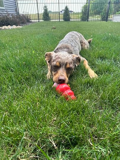
And you know you did a good job with heat wave canine enrichment if your dog passes out like Sunny afterwards.
 Resources for Heat Wave Canine Enrichment
There are so many options for heat wave canine enrichment and you really are only limited by your creativity. I try to think about what Sunny enjoys – eating, playing, sniffing, and chewing – and think of things we can do that involve those things. If you need ideas google canine enrichment and you will find oodles of ideas. To get you started, here are some resources for making canine enrichment, agility equipment, and food games as well as links to a cooling mat and cooling vest.
The post Baby, It’s Hot Out There – Heat Wave Canine Enrichment appeared first on Live Like Karlie.
June 13, 2024
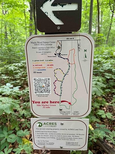
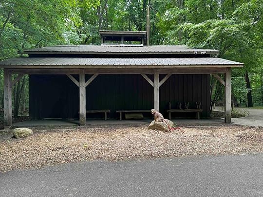
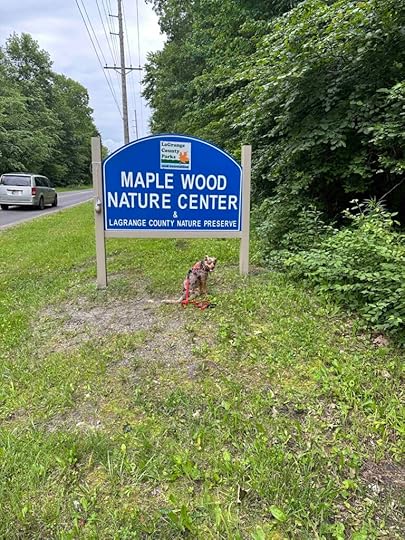
Maple Wood Nature Preserve
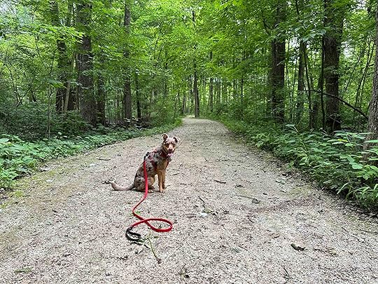
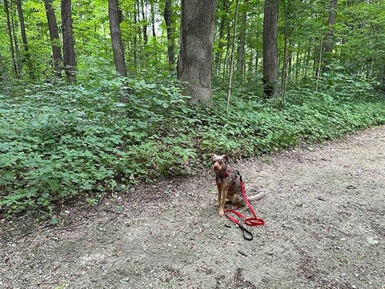
Sunny and I decided to get out on an adventure before the heat that is forecasted for later this week. We found ourselves at the Maple Wood Nature Preserve in LaGrange, Indiana. This is another lovely Acres Land Trust site, but this one is a little different than most of the others. In addition to the trails in the woods, there is a sugar shack and visitor center where an annual maple syrup festival is held in late March. They also host school visits and other events throughout the year at the shack and visitor center.
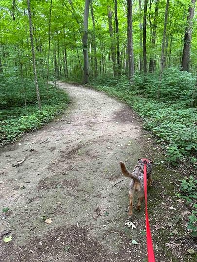
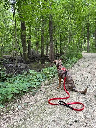
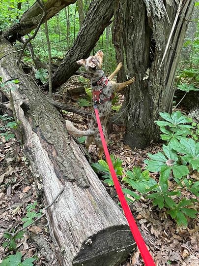
Our AdventureAfter parking the car, we walked between the sugar shack and visitor center to find the trails in the woods. The trails are fairly wide hard packed dirt/gravel that meander through the woods. They are surrounded by a variety of trees including beech, hickory, maple, and oak and other vegetation. A short distance from the start we also found a swamp. It was pretty mucky so Sunny did not get a chance to get down to it like she has on some of our other adventures.
We continued on the main trail and came across some side trails. Despite that we stayed on the main trail which led back to the sugar shack. Since that was less than a mile hike, we did another loop of the main trail until we came across the first side trail. That trail just looped around and back to the main trail so we continued around back to the sugar shack. We did this again and followed the second side trail which also looped back to the main trail. By doing this we ended up logging nearly 3 miles.
We were the only ones visiting the preserve so we had the trails to ourselves, other than the chipmunks. Sunny was thrilled that these little critters were scampering through the woods, but not thrilled that I would not let her chase them.
 Our Rating
Sunny and I rate Maple Wood Nature Preserve 3 out of 4 paws up. It’s a nice spot for a peaceful hike in the woods. The only downsides for us are no water feature for getting your toes wet and the trail is not very long or challenging. Despite that it’s a great place to get away from the hustle and bustle of every day life and get into the woods. The trails are easy to follow and would be suitable for those with mobility issues. We thoroughly enjoyed our visit and would recommend this spot especially if you are in the area.
How Do I Get There?The address for Maple Wood Nature Preserve is 4550 E. 100 S in LaGrange, IN. From IN-3N turn left onto E. 100S. Continue 3.5M until you see the Maple Wood Nature Preserve sign on the left. Turn left and then turn right at the sign and arrow. As you drive up the road you will see the Maple Wood Nature Center and maple sugar shack on the right and the parking area on the left. There are only spaces for five vehicles.
For more information about Maple Wood Nature Preserved check out these websites:
The post Maple Wood Nature Preserve appeared first on Live Like Karlie.
June 1, 2024
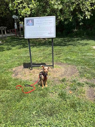
Tracey’s Trail
I had no idea the significance of Tracey’s Trail, but shortly after arriving I found out. Ironically we decided to explore Tracey’s Trail on the anniversary of Tracey’s passing. Even more unbelievably just as we approached the sign explaining the significance of the trail, I met Tracey’s best friend. I learned from her that Tracey’s Trail is named for Tracey Yeager, a young mother, who loved the outdoors and sadly lost her battle with cancer in 2010. To commemorate this love, her family and friends established the Tracey’s Trails Fund to support outdoor family-friendly recreation. Based on all the people I saw using the trails when we visited, it was a great success and I have to think Tracey would have been thrilled.
The trail consists of an asphalt main trail, the Heritage Trail, that is about .75M and travels from the parking lot on Roy Street to a park and parking lot on Union Street. There are also miles of mountain bike and hiking trails in the woods on either side of the Heritage Trail. Sunny and I started walking on the Heritage Trail, but ended up exploring some of the trails in the woods. We especially enjoyed the ones near the park since those traversed along Wyland Ditch, a fairly wide stream.
Although hikers are welcome to use the mountain bike trails, the bikers have the right of way so it’s important to listen for them and get out of the way. We found all the bikers to be friendly and considerate of those hiking. We did make sure to get off the trail and into the brush when we heard or saw one coming. While the asphalt trail was wide and relatively flat, the mountain bike trails were what you would expect. They had obstacles like tree roots, sharp turns, and inclines and descents. Although the main trail was scenic since it was surrounded by trees on both sides, we preferred the trails in the woods. Sunny was especially thrilled to find out she could get down to the water in several places.
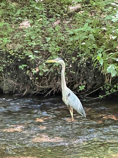
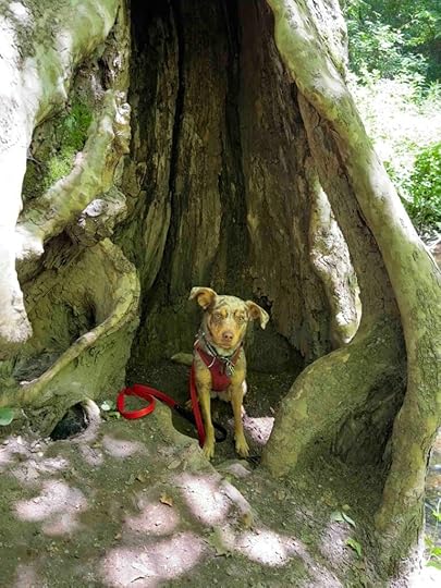
We found a lot of interesting things in the woods including some ducks and a crane in the ditch. There was an interesting tree trunk that was hollowed out. Sunny wasn’t too sure about posing in it, but she did. There was also a bridge over the ditch that led to trails on the other side of the water. This area also had a trail map and bench.
We explored the trails in the woods for quite some time before heading back to where we entered the woods. We got back on the Heritage Trail and followed it back to the parking lot on Roy Street. Both of the parking areas have small parks, including some picnic benches that make for a nice spot to rest or have a picnic.
 Our Rating
Sunny and I rate Tracey’s Trail 3.5 out of 4 paws up. Although the main trail was not very long the mountain bike trails meandered through the woods for many miles. We also found it easy to stay on track and not get lost in the woods, which is not always the case with mountain bike trails. The ability to get down to the water was an added bonus that we enjoyed. The only downside is the parking lot at Roy Street does not have a restroom.
How Do I Get There?We parked at the Roy Street entrance and used 408 Roy Street, Winona Lake, IN as our GPS destination. The parking lot is on the right-hand side of Roy Street. After parking walk to the left where you’ll find the sign and entrance to the trail.
For more information about the Winona Lake Trails and Tracey’s Trails check out these websites.
The post Tracey’s Trail appeared first on Live Like Karlie.
Wabash River Trail
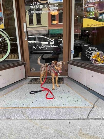
Sunny and I needed to get the Visit Wabash County Welcome Center so we decided to explore the Wabash River Trail while we were in the area. The reason for out stop at the welcome center was to pick up a copy of the 2024 Exploration Guide which featured a picture of Sunny at Kokiwanee. We also received a gift certificated to Alley Cat Outfitters for having our picture selected and wanted to stop there too. So we spent our afternoon exploring the trail and downtown Wabash. What we found was a nice trail along the river and a lovely downtown area.
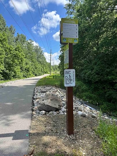
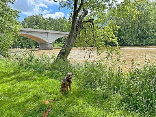
Wabash River TrailThe Wabash River Trail runs from Wabash to Lagro following the Wabash River for seven miles. It is a relatively flat asphalt trail with vegetation on both sides similar to the rail trails in Bloomington. It has great signage giving popular destinations and the distance. The trail is perfect for running, hiking, or biking.
Sunny and I parked at the Hill Street parking lot and followed the trail toward downtown Wabash. From this spot it’s about 1.3M to downtown. You can also go in the other direction to Lagro which is nearly 6M.
Shortly after starting our walk we found an opening in the vegetation to the left with a sign directing us to the Eilts Memorial. We followed the dirt path toward the river and found some stone seats and a memorial plaque overlooking the water. The memorial is dedicated to Ted and Gaye Eilts who, according to the plaque, had a deep appreciation of nature.
After enjoying the views at the memorial we continued on the main trail. The memorial gave one of the best views of the river as most of the rest of the trail had us looking through the trees and vegetation to see the river. And we did not find any spots to get down to the water. As we continued on the trail we passed an area with what appeared to be old bridge supports. Shortly after this we came upon Paradise Spring Historical Park.
Paradise Spring Historical Park has ten structures that were built in the early 1800’s for housing Native American Indians and soldiers who were negotiating land rights. In the late 1800’s a train depot was added. Today the structures and railroad remain as well as modern restrooms, parking, and a large grassy area perfect for picnicking. We decided this was a good time to take a rest and water break.
 Downtown Wabash
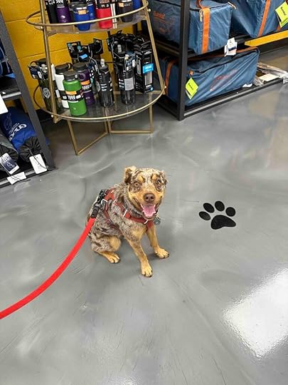
After a short break we continued onto E. Market Street into downtown Wabash. Soon we found the Welcome Center located on South Miami Street. Sunny and I entered and found a welcoming group of employees who were happy to meet Sunny. After receiving our copy of the guide and gift certificate we walked to Alley Cat Outfitters which is on Berry St. This is a nice spot for purchasing gear for running, biking, and kayaking. Sunny and I explored the store and found a pair of running socks for me. After exchanging the gift certificate for the socks and visiting with the employee we headed back to the Wabash River Trail which was located behind the store.

 Back on the Wabash River Trail
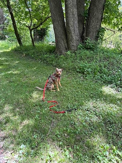
We walked along the trail toward the car and took a short detour that took us closer to the water. We explored that and then found another trail, Paradise Spring Riverwalk, that went closer to the water. This trail had a wood platform that allowed for a nice view of the river. Sunny enjoyed climbing up on the bench and looking at the water. From there we followed the trail back to the original trail and retraced our steps back to the parking area.
 Our Rating
Sunny and I give the Wabash River Trail 3 out of 4 paws up. We enjoyed that you could travel a long distance on the trail and end up at a park or downtown Wabash. We did wish there were some dirt trails and that the trail was more challenging. Despite that it’s a great trail for those with mobility or stability issues as it is stroller and wheelchair friendly. And pairing it with an excursion downtown or a picnic at the park make for a nice outing.
How Do I Get There?The Wabash River Trail has three parking areas Paradise Spring Historical Park in Wabash, Hill Street in Wabash, or Basin Street in Lagro. We parked at the Hill Street parking lot. Use 619 E. Hill Street as the destination and follow the trail sign to the parking lot. The trail is next to the parking lot. To walk to downtown Wabash take the trail to the right. Lagro is to the left.
The post Wabash River Trail appeared first on Live Like Karlie.
May 27, 2024
Mill Race Canal Trail
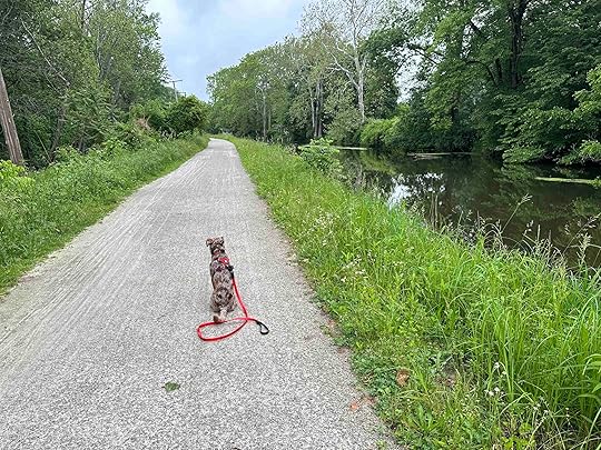
Despite a cool, drizzly day Sunny and I ventured to Goshen, IN to check out the Mill Race Canal Trail. What we found was a lovely popular trail along the canal and some additional trails in the woods.
History of the CanalThe Mill Race Canal was completed in 1868 and was a source of hydraulic power for Goshen’s businesses. Then in the late 1890’s Hawk’s Electric Company built a central generating station to provide electricity to Goshen, Middlebury, Millersburg, Benton, New Paris, Wakarusa, Bremen, Syracuse, and Milford. It continued to be the main source of electrical energy until the 1920’s. In 1968 ownership of the canal was transferred to the city of Goshen and today is mainly used for recreation.
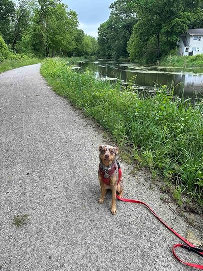
Our AdventureSunny and I walked from the parking lot across the dam to the start of the trail. We found a hard parked gravel trail running along the canal. On the right-hand side we could see the backyards of the homes that border the canal. On the left was dense vegetation with periodic views of the Elkhart River, trails in the woods, and even some farmland. We continued on the trail for about a mile and then took one of the trails to the left into the woods.
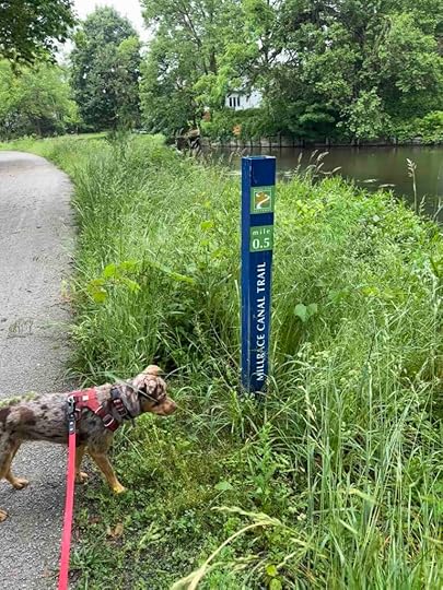
The trail in the woods had many offshoot trails, but we continued on the main trail so we didn’t get lost. At one point we were able to get down to the Elkhart River bank which made Sunny happy. We continued on the trail and eventually came to a gravel path with signs indicating loop 1 and loop 2. Since I didn’t know if these led back to the Mill Race Canal Trail, we turned around and backtracked to the canal trail. We continued back to the start of the trail and the parking lot.
Our total hike was just over 3M, but you can hike much further than this since the canal trail is 4M out and back and there are additional trails in the woods.
Our RatingSunny and I enjoyed our visit to Mill Race Canal Trail and rate it 3 out of 4 paws up. The main reason we did not rate it higher is the trail is not all that challenging. Despite that it’s a nice trail along the canal with some additional trails in the woods. It’s great for hiking and biking and would even be appropriate for strollers. There is also a nice parking area and a restroom and a picnic area at the Shoup-Parsons Woods park.
 How Do I Get There?
The trail can be accessed at the north end near the Goshen Brewery or at the south end at the Goshen Dam Pond and Shoup-Parsons Woods Park. We parked at the Shoup-Parsons Woods park which is at the intersection of Westwood Road and Gra-Roy Drive/Fair Oaks Drive. From there we walked past the restroom and across the dam to access the trail on the right near the sign.
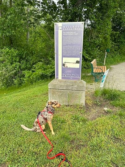
For more information about the Mill Race Canal Trail, check out the Visit Elkhart County website.
The post Mill Race Canal Trail appeared first on Live Like Karlie.