Andie LaComb's Blog, page 2
April 28, 2025
Ruth Kern Woodland Preserve
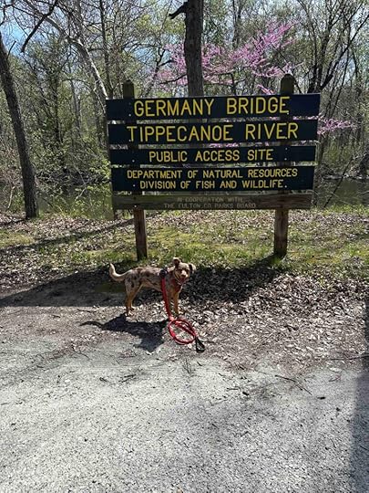
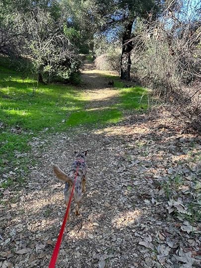
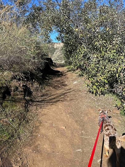
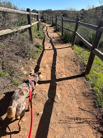
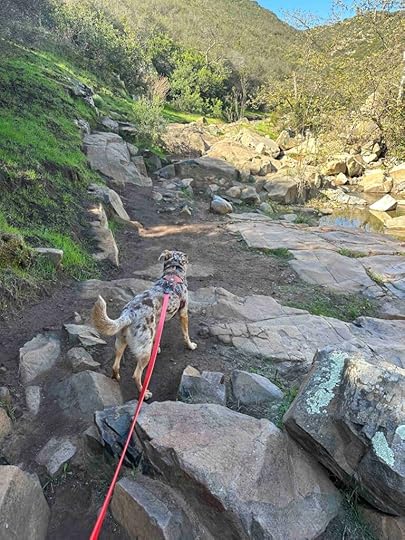
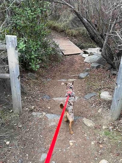
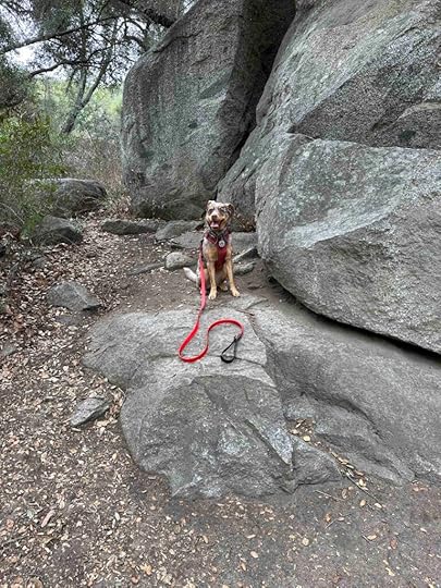
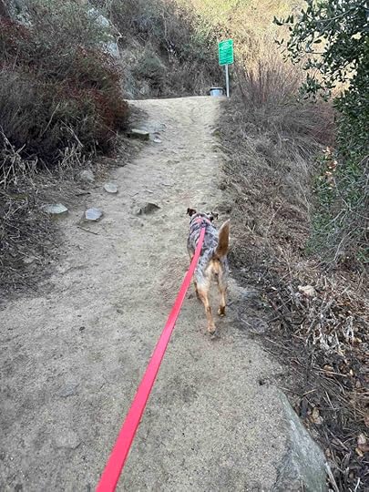
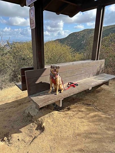
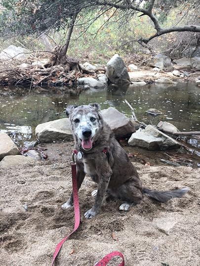
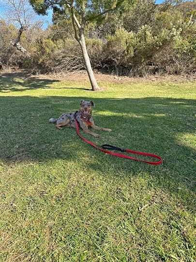
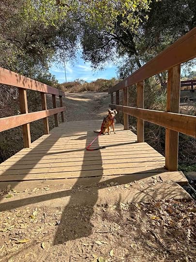
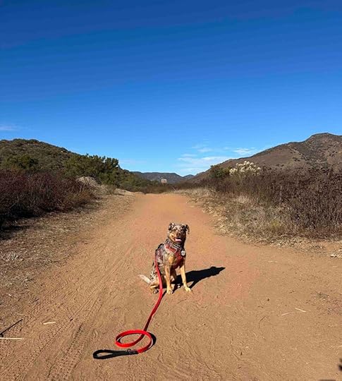
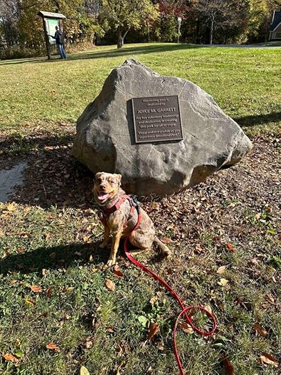
I grew up in a suburb of Rochester, NY so when I came across the Ruth Kern Woodland Preserve in Rochester, IN I knew we had to visit it. Although Rochester, IN is much different than Rochester, NY we enjoyed visiting the community and the preserve. And we found a second spot to visit – Germany Bridge County Park.
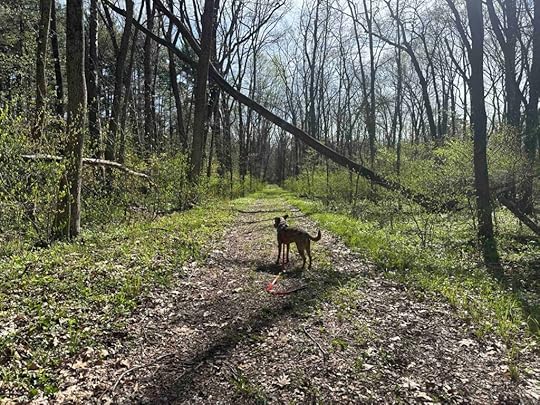
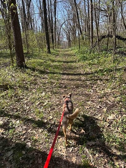
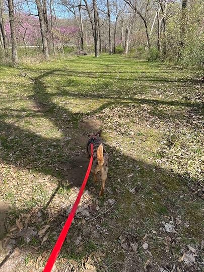
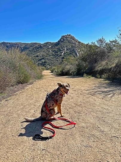
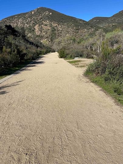
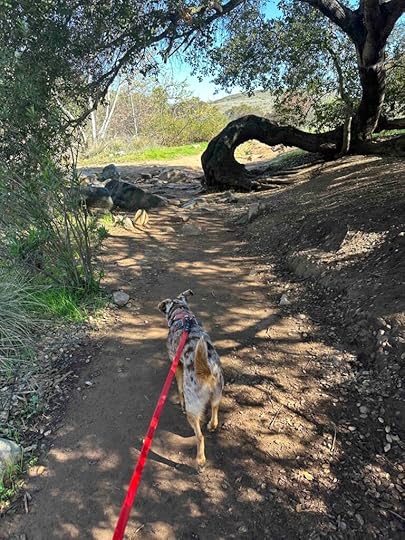
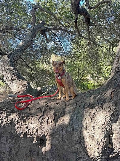
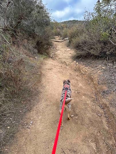
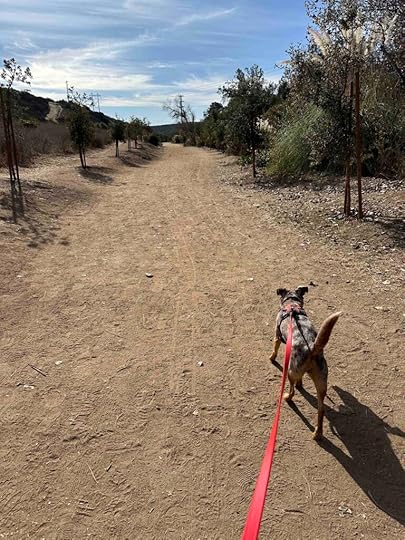
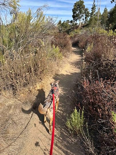
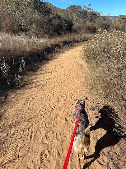
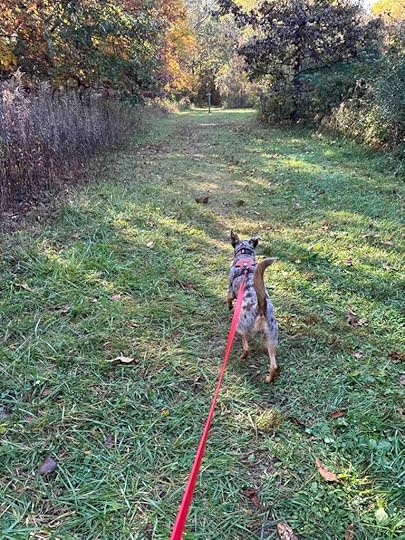
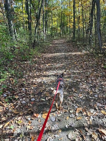
It was a beautiful spring day with lots of sunshine and temperatures in the 60’s so Sunny and I hit the road. We arrived at the preserve just after 10A and were the only car in the parking lot. What we found once we entered the preserve was a nice wide trail with a forest of trees on either side. A short distance from the parking lot and entrance we found a trail to the left. We didn’t take it, though, as our normal routine is to take the trails to the right. This keeps us from getting lost. So we stayed on the wider main trail.
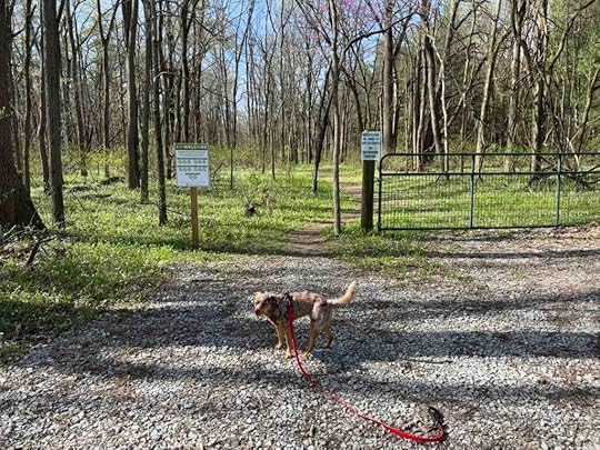

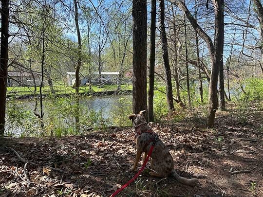
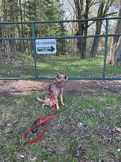
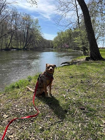
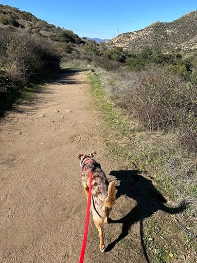
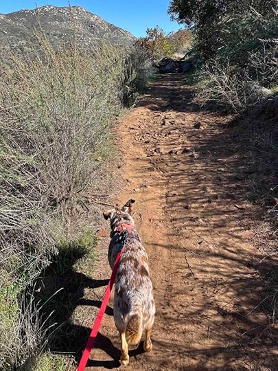
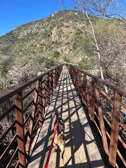
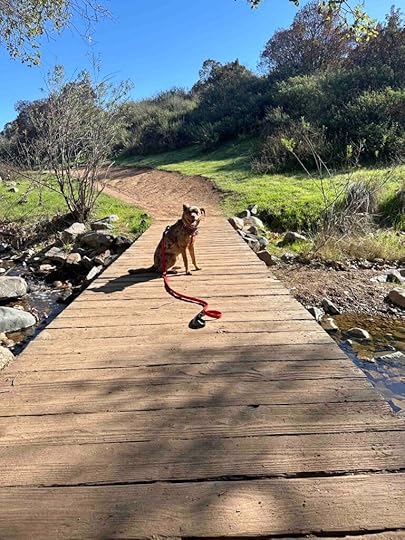
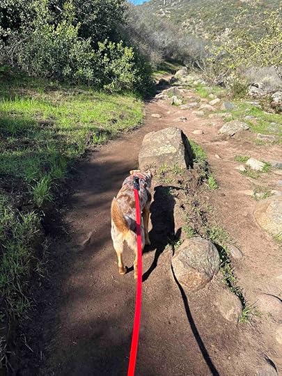
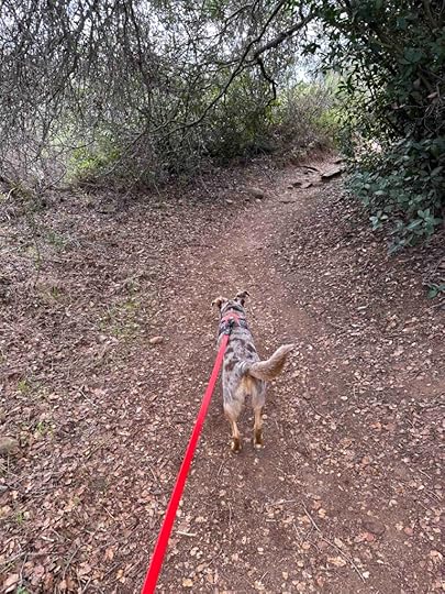
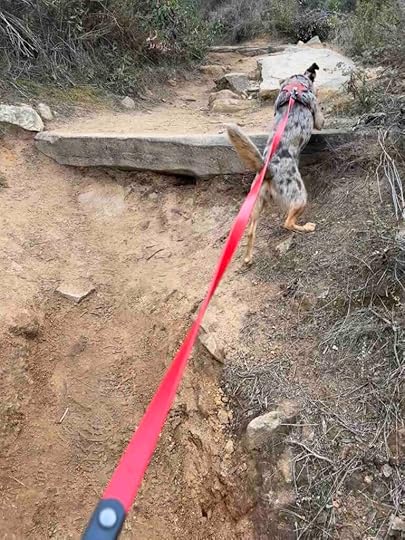
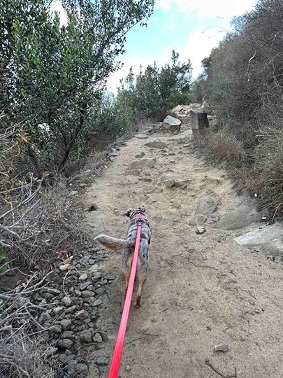
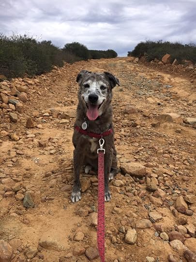
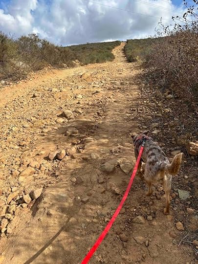
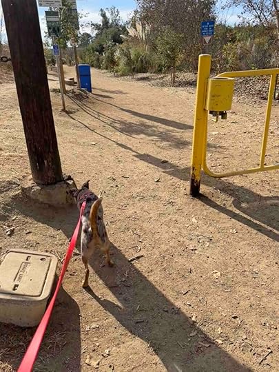
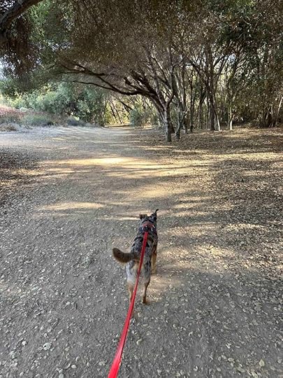
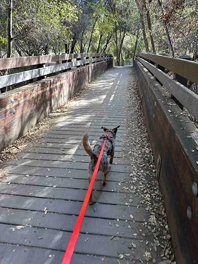
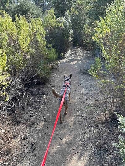
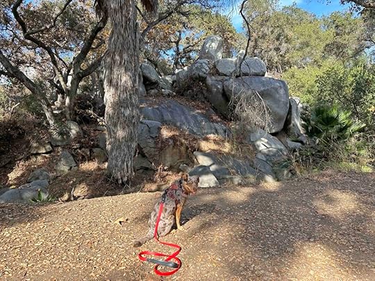
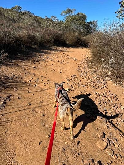
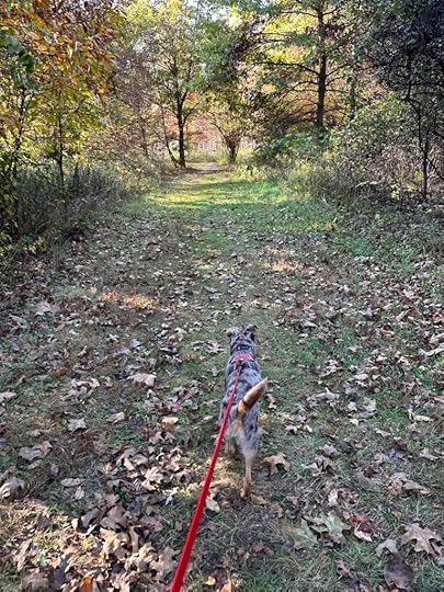
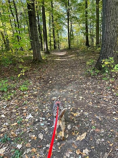
As we continued to walk we started to see the Tippecanoe River in the distance. The trail followed the river for awhile, but never close enough for us to get our toes wet. Despite this, we did get some nice views of the river. Eventually the trail led to another entrance to the preserve. This one was just a gate, with no parking. There was a sign indicating the parking lot was .4M down the road. After investigating the secondary entrance, we turned around and found a smaller trail to right that led through the woods. The trail wound around the woods and ended up back on the mail trail near the parking area. This is the trail to the left that we saw shortly after the start of our hike.


 Germany Bridge County Park
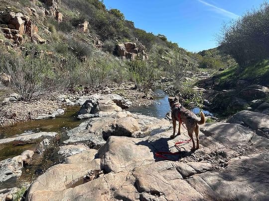
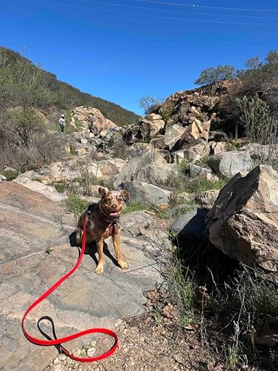
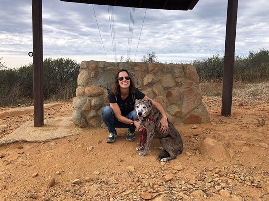
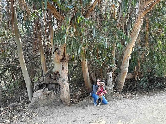
Since this park was less than a mile from the preserve we decided to check it out too. It’s basically a boat ramp with a picnic gazebo and a grassy area that follows the river for a short distance. We were able to get down to the water and put our toes in it. We also had better views of the river at this location. This would be a nice spot for a picnic or to launch a kayak.
 Sunny’s Perspective
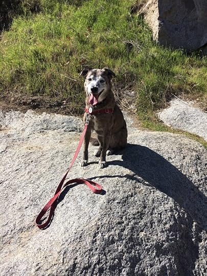
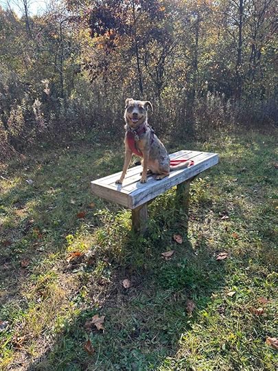
What a long car ride to get to this hike. Despite that the smells at the preserve were fantastic. And I heard and saw quite a few squirrels. I really wanted to chase them, but someone would not let me. We also visited another park that had better access to the river. That was fun!
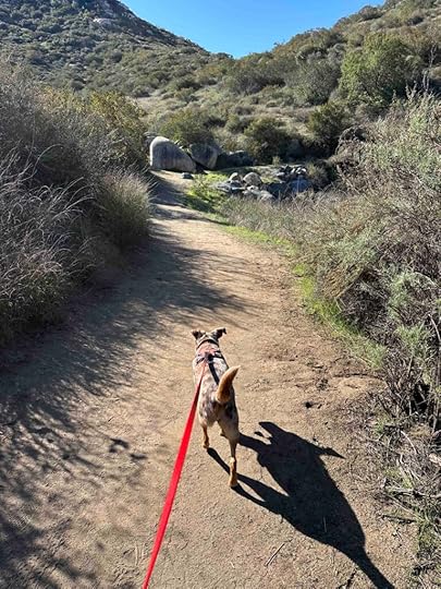
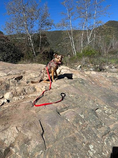
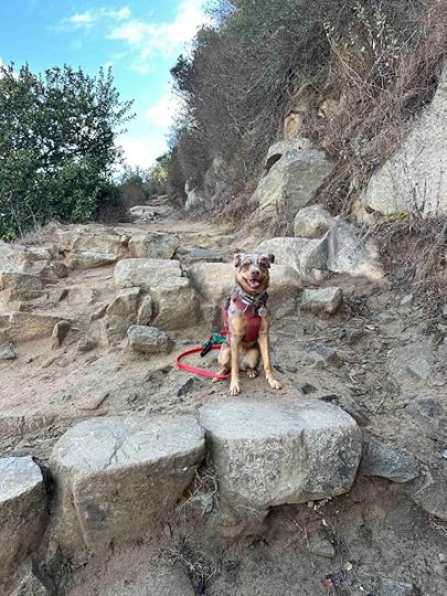
Our RatingWe hiked all the trails at the preserve for a total distance of 1.6M. The trails were easy to follow and mostly flat. Despite that since the trails are dirt and grass with roots, twigs, and leaves, they are not appropriate for those with stability or mobility issues. It’s a peaceful walk in the woods with partial views of the river. Parking is good, but there are no restrooms. Sunny and I give Ruth Kern Woodland Preserve 3 out of 4 paws up and recommend this hike for those in the area. It may not be worth a long drive since the trails are not very challenging and the total distance is less than 2M.
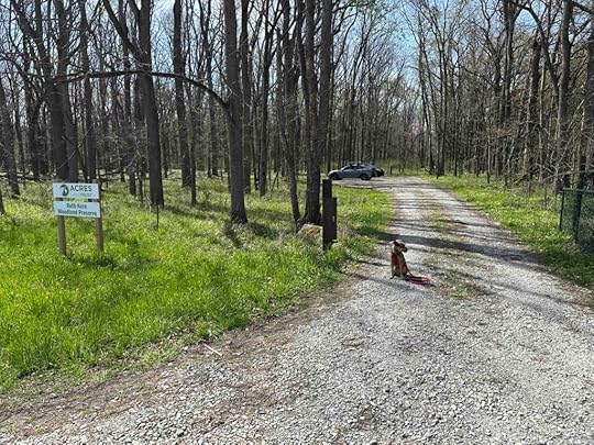
How Do I Get There?The address for the Ruth Kern Woodland Preserve is 3681 W. 450 N in Rochester, IN. From IN-25 S, turn right onto IN-110 W and follow that for just over 6M. Turn left onto US-31 S and continue for 3.6M then turn right onto E 450 N. At just under 4M, look for the Acres Land Trust sign on the left.
To get to the Germany Bridge County Park from the Ruth Kern Woodland Preserve, turn left out of the preserve. Then turn left at the next road – N 375 W. Follow for a short distance and the park is on the right.
For more information about Ruth Kern Woodland Preserve and Germany Bridge County Park check out these websites.
Acres Land Trust – Ruth Kern Woodland Preserve
Fulton County – Germany Bridge – County Park
The post Ruth Kern Woodland Preserve appeared first on Live Like Karlie.


April 24, 2025
Memories
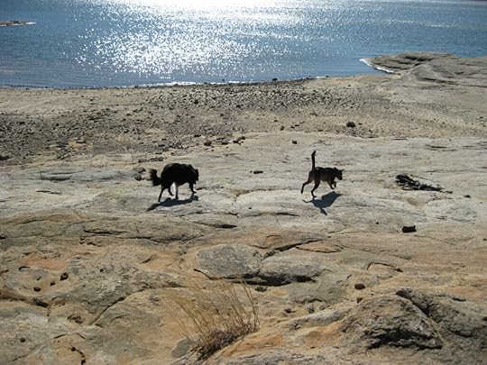
On our recent trip from San Diego to Northern Indiana we made a stop in Flower Mound, Texas where we lived for nearly twenty years. We adopted both Anna and Karlie there and they spent nearly half of their lives in Flower Mound. It’s a special place with a lot of memories for us. One of our favorite places is Lake Grapevine. When we lived in Flower Mound we spent time nearly every week in the spring, summer, and fall either kayaking or hiking along the shore. Of course we showed this special place to Sunny on our recent visit.
We visited both Murrell and Twin Coves Parks on Lake Grapevine. We spent a lot of time at both of these parks when we lived in Flower Mound. Although some improvements have been made both parks felt quite familiar to us. Walking around was a trip down memory lane and brought laughter and tears as we talked about the girls.

So many memories of walking with the girls came flooding back. We reminisced about all the times we spent there and how we would always find a tennis ball to play with Karlie. Before leaving the park we would hide the ball. The next time we came to the lake she would make a beeline for the hiding spot. She never forgot where we hid the ball. We didn’t find any tennis balls on this visit, but we enjoyed exploring the shore and walking around the park. To me it felt like Anna and Karlie were with us or at least watching over us. I could feel their presence and I’m sure it was because of all the time we spent there with them.

The memories of the girls and that life filled my heart. It reminded me that you can revisit places you made memories, but you can’t relive those lives. You make new memories. So on this trip we remembered all the fun we had and made some new memories with Sunny in a place that was special to Anna and Karlie.

The post Memories appeared first on Live Like Karlie.
March 30, 2025
Louis A Stelzer County Park
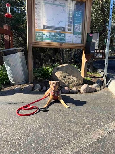
We recently visited the Louis A Stelzer County Park in Lakeside and found a wonderful place for picnics, exploring, and hiking. The park has a nice area for kids with playground equipment and paved trails, but it also has a section of wooded and dirt trails. That’s where we headed after a quick stop at the restrooms.
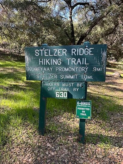
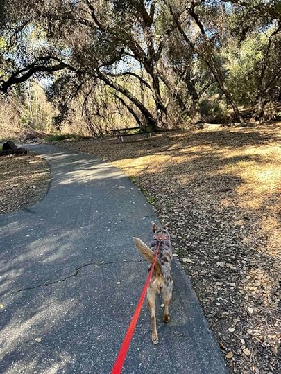
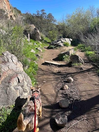
The entrance to the park and trails is just past the information sign and map. It starts with an asphalt trail that leads into the park toward the playground equipment and restrooms. We followed that trail and then headed to the right past a cool tree trunk and a trail sign. Shortly after that we found dirt trails that lead toward the hills.
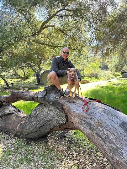
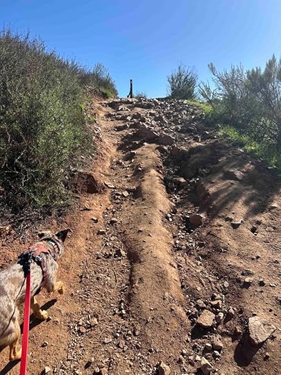
At first the trail meandered through a wooded area, but soon it opened up to a dirt trail up the hill and with views of hills in the background. We liked that because it was more like a typical San Diego area trail with rocks and pretty views. The climb was not too strenuous, but still gave nice views of the hills and mountains in the background. We hiked for about 1.5M and then turned around headed back to the park.
 Our Rating
Sunny and I give Louis A Stelzer County Park 3 out of 4 paws. It’s a nice area with trails that aren’t too difficult, but allow you to escape into nature. There is a restroom in the park and a parking lot. There is a $5 fee to park and plenty of areas for kids to play and to have a picnic.
How Do I Get There?From CA-52 take exit 18C and merge onto CA-67N toward Ramona. After just over 3.5M turn right onto Mapleview St. Continue for .3M and then turn left onto Ashwood St. After 1M it turns into Wildcat Canyon Road and a mile later you will see the entrance to the parking lot on the right.
For more information about Louis A Stelzer County Park check out these websites.
San Diego County Parks – Louis A. Stelzer County Park
The post Louis A Stelzer County Park appeared first on Live Like Karlie.
March 19, 2025
Oak Canyon Trail
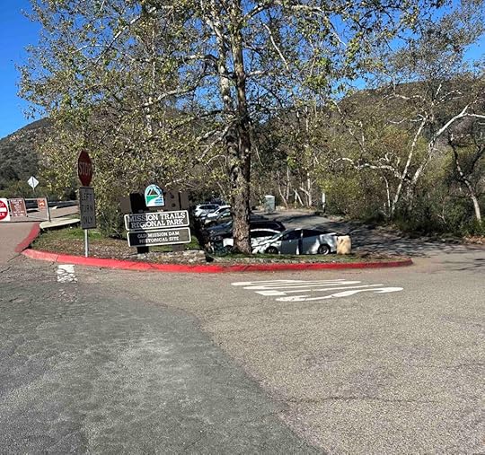
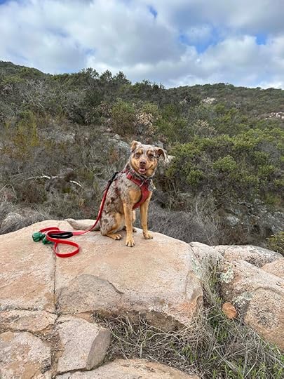
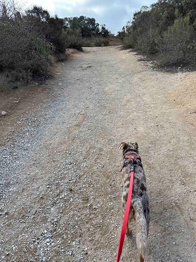
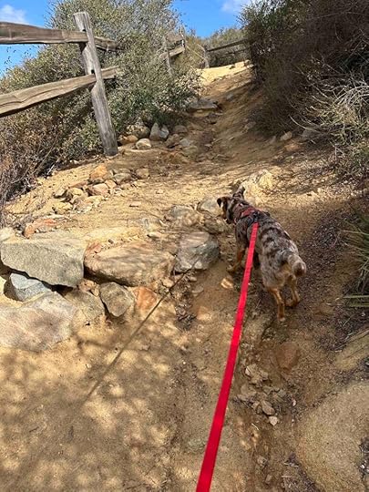
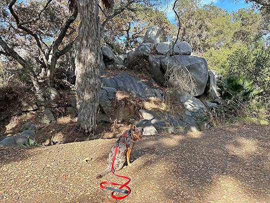
Want a hike along a creek that leads to a waterfall? Want to scramble up rocks and walk through wooded areas? Then the Oak Canyon Trail in Mission Trails Regional Park is the trail for you! We hiked the trail this morning and enjoyed the challenge of scrambling up the rocks and seeing the waterfall.
History of Mission Trails Regional ParkThe park’s land was originally used by the Kumeyaay, then catholic missionaries, farmers and ranchers, and even the military. In the late 1960’s the County of San Diego developed a plan for a regional park, however it wasn’t until the late 70’s and early – mid 80’s that much of the land was acquired and the fundraising and development of the park began. In 1995 the visitor’s center opened. Today the Mission Trails Regional Park, which owes it name to a community-wide contest, consists of over 8000 acres of rugged hills, valleys, and open spaces. It has about 60 miles of hiking trails, Lake Murray for recreational boating, and Kumeyaay Lake Campground. It is considered the third jewel in the City of San Diego Parks System.
Our AdventureWe have been to Mission Trails Regional Park many times and generally walk on the road and explore the easier trails just off the road. Today we tackled the Oak Canyon Trail which is a moderately challenging trail and not for those with stability or mobility issues. I also would not recommend it for small or young children.
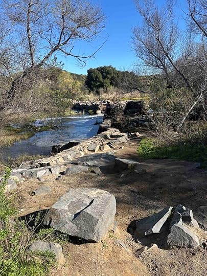
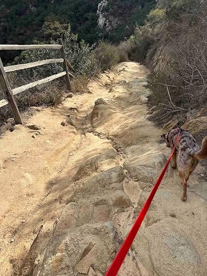
The entrance to the trail is near the Old Mission Dam. Unfortunately all the parking spots at the Old Dam parking lot were taken so we found a spot on the road and walked from there. The start of the trail is just past and to the left of the rest room in the parking lot. At the start of the trail is the Oak Canyon sign and then a walkway with a stone wall on either side. This leads past the dam and to a compacted granite trail. The trail continues until you cross a bridge over the creek which is where the trail truly starts.
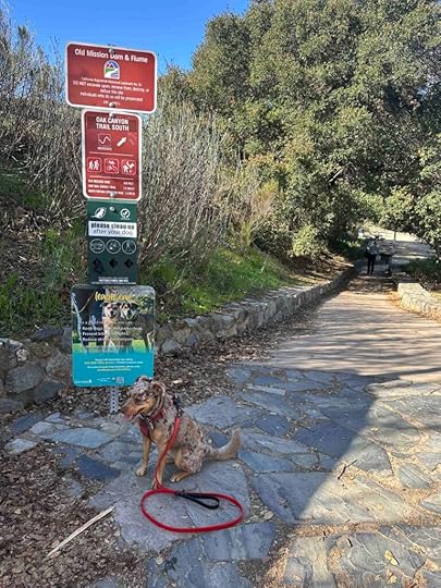
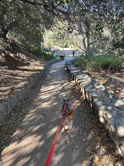
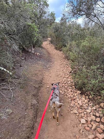
Once over the bridge the trail is packed dirt with rocks in a lot of the areas. It follows the creek with views of the creek, vegetation on both sides, and other large hills. You cross the creek several times on wood plank platforms and bridges. As the trail progresses you go through some wooded areas and in one of them we found a large oak tree. This was a great spot for a photo opportunity and Sunny was more than happy to oblige.
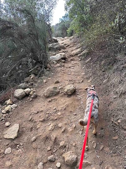
As we continued through the wooded area we approached the most challenging part of the trail. This area has large boulders that you need to scramble up. This part was challenging for Sunny and I because of our short legs. In one spot I had to lift her up because it was too big for her to jump up. This section is fairly narrow and can be challenging if other people are approaching. We made it through the section and back to the dirt trail which led up to the waterfall.
As you approach the waterfall you can hear the water, but it’s difficult to get a good view of it. We found a trail down to a spot in front of the waterfall, but did not go far enough to get a really good view of it. We just admired it from the distance and then retraced our steps and headed back to the parking lot and our car.
 Our Rating
Sunny and I rate the Oak Canyon trail 3.5 out of 4 paws up. It’s a somewhat challenging hike within the beautiful Mission Trails Regional Park. We loved scrambling up the boulders and the views of the creek and large hills. The trail is well-maintained with good signage making it relatively easy to stay on the trail. There’s ample parking both in a parking lot and on the street. The parking lot also has two porto-potties and the visitor center has a restroom. We consider Mission Trails Regional Park a must visit location in San Diego and Oak Canyon Trail a somewhat challenging hike for those who are in good shape and can handle climbing up boulders.
For additional information about Mission Trails Regional Park check out the following websites:
Mission Trails Regional Park – History
How Do I Get There?You can either drive to the visitor’s center, park in the lot, and walk the section of the road that is closed to vehicular traffic to the trail entrance or park at the Old Mission Dam. These directions are to the Old Mission Dam parking. From CA-52 take exit #13 – Mast Blvd and turn left. After .2M turn left onto West Hills Parkway and continue for .7M. Turn right onto Mission Gorge Road and continue .2 miles. Then turn right onto Father Junipero Serra Trail and after .7M turn right into the Old Mission Dam parking lot. You can also park along the road. The trail head is located across Father Junipero Serra Trail.
The post Oak Canyon Trail appeared first on Live Like Karlie.
February 17, 2025
Cowles Mountain
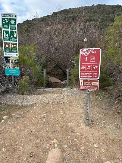
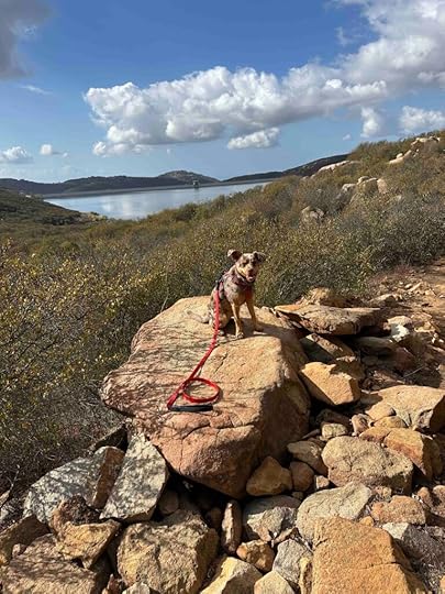
We love to hike up mountains and one that has been on our list for awhile is Cowles Mountain. It is the highest peak in the city of San Diego so we felt it was a must-do. Finally last week we set out to hike up the mountain and made it to the summit. Although there are quite a few different ways to get up the mountain we decided to try the Mesa Trailhead. It was a challenging, fun hike with beautiful views on the way up and back down.
 History of Cowles Mountain
Cowles Mountain was named after George Cowles who was a rancher and businessman in the mid to late 1800’s. Although his career started in New York City, he visited California in the 1870’s looking for land to purchase. He purchased 4000 acres in the El Cajon Valley and became well-known for growing olives and raisins and raising thoroughbred horses. When he died he left his estate to his wife who continued ranching until the 1890’s. In the 1960’s and 70’s the area surrounding the mountain experienced a housing boom and the city of San Diego considered developing an urban park. In 1974 the city and county of San Diego purchased Cowles Mountain with the plan to include it in the park which eventually became Mission Trails Regional Park.
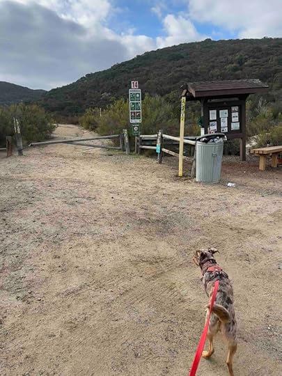
Our AdventureWhen trying to decide which trail to take we checked google maps and found the Mesa Trailhead which had a nice parking lot on Mesa Road just before the trailhead. I decided that would be a good place to start our trek up Cowles Mountain. As we drove down Mesa Road we began to wonder if this would be the case. The road deteriorated to a nearly dirt road, but we continued driving. After a short distance we came to the parking lot with the information kiosk. After parking the car we started walking on the dirt path that led to the Mesa Trailhead. Soon we saw a trail sign on the right.
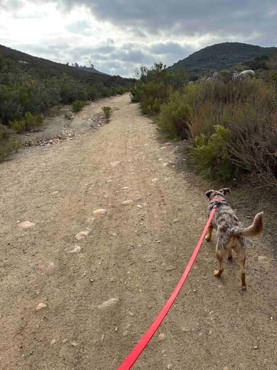
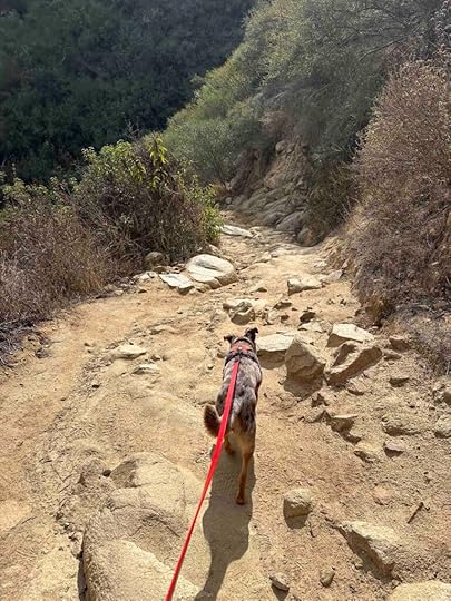
The trail took us over a creek and then the climb began. At first it was a somewhat gentle climb through a wooded area, but that did not last long. Soon we were climbing over big rocks and steps and winding our way to the top of the mountain. As we climbed we enjoyed the views of the surrounding areas which are beautiful.

In addition to the steep trail it was quite rocky and narrow in some areas. Sunny and I loved climbing over the steps and stones, but I started to think about the trip down and knew it would be a little more difficult. Eventually the Mesa Trailhead led us to the Big Rock and the Barker Way trails before we arrived at the Cowles Mountain service road and finally the summit. While most of our hike was quiet with few people that ended at the Cowles Mountain service road and the summit. I guess we took the path less traveled which was fine with us.
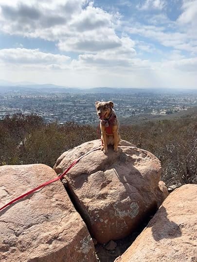
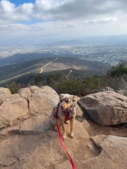
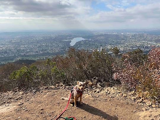
 Cowles Mountain Summit
Once at the summit we found several different areas to look at the view. Despite the number of people there was ample opportunity for everyone to look around and take pictures. Sunny was thrilled when several young hikers took a liking to her and she was the center of attention for a few minutes. After enjoying our accomplishment and the views we headed down the mountain. There were several areas where the steep incline turned into a steep and somewhat slippery descent. Hiking poles may have helped as the dry gravel and sand was a little slippery. Despite that we made it down the mountain safe and sound.
The total distance of the Mesa Trailhead to the summit is about 2.1M each way making for just over a 4M hike.
Sunny’s PerspectiveThis was such a fun hike! I love to climb and scramble across rocks and this hike had tons of that. Once we got to the top of the mountain there were so many people there and I loved getting pets from them. The way down was not as fun since I had to go “slow slow” so Andie didn’t fall, but it was still a great hike.
Our RatingSunny and I rate Cowles Mountain 4 out of 4 paws up. It has most everything we love – a well-marked challenging hike with beautiful views along the way, a nice summit, and good parking. The only downside is the descent can be a little tricky in areas, but hiking poles may have helped. This hike is not recommended for those with stability or mobility issues.
How Do I Get There?From CA-52 take exit #14-Mission Gorge Road and turn right onto Mission Gorge Road. Follow it for less than half a mile and turn left onto Mesa Road. Follow Mesa Road for just under a mile and you will find the parking lot on the left. Entrance to the trail is near the map kiosk.
The post Cowles Mountain appeared first on Live Like Karlie.
February 5, 2025
Three Year Anniversary
Being back in San Diego for the winter makes me miss Karlie more than usual. We walk the same streets and neighborhoods where she spent several years living and then returned for her last winter. There are so many reminders. I also take Sunny on the same adventures that Karlie and I took. I am reminded of her every day in so many ways. While it’s comforting and brings a smile to my face, it is also bittersweet because she is not here.
It’s been three years since we said goodbye and while I am not as heartbreakingly sad, I can’t believe she’s been gone that long. I can’t believe it’s been three years since I saw her sweet face smiling at me. I take solace in knowing we had the best life together and that I am sharing the same places and adventures with Sunny and hopefully giving her the best life. That keeps Karlie’s memory alive while doing something that both Sunny and I love. And this year on the third anniversary of Karlie’s last day we ventured to one of our favorite places – Santa Margarita River Trail.
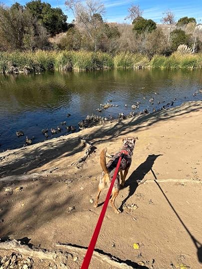
We started our adventure early leaving the house at 8A and arriving at the Santa Margarita Trail before 9:30A. I was surprised to see that the parking lot was nearly empty. After parking the car we started hiking on the trail. The memories of my visits with Karlie filled my thoughts. And as we hiked we came across spots where I had photographed Karlie. I took the opportunity to take pictures of Sunny in these areas. Our hike ended at the river crossing which we have never crossed. We explored the area before climbing on a rock and sharing a snack while my thoughts wandered to being there with Karlie the first time. After a little while we hiked back to the car and headed home. It was a good hike and a great way to share a special place with Sunny while remembering Karlie. I like to think that Karlie was watching and smiling down on us.
The post Three Year Anniversary appeared first on Live Like Karlie.
January 31, 2025
Elfin Forest Recreational Reserve
In December of the year we said goodbye to Anna and before GOLPP reared it’s ugly head, we took Karlie hiking at the Elfin Forest Recreational Reserve in Escondido. It was a great day and such a fun hike. Unfortunately we never returned until I took Sunny there last year and again this week. I’m really glad that we did because it’s such a fun place to explore with outstanding views and miles of trails.
History of Elfin Forest Recreational ReserveThe Elfin Forest Recreational Reserve is a 784-acre reserve that was developed with the San Diego County Water Authority and the US Department of the Interior – Bureau of Land Management. It was opened in 1992 and has about eleven miles of trails and six designated overlooks with views of the Pacific Ocean, Channel Island, Coronado Island, Laguna and San Bernardino mountain ranges, and the Olivenhaim Dam and Reservoir. The Escondido Creek watershed also flows from Lake Wohlford to the San Eligo Lagoon.
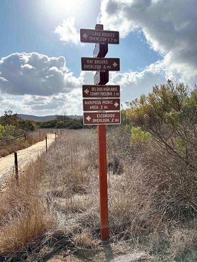
Our AdventuresDuring our first visit with Karlie we explored the Way Up Trail to the Harmony Grove Overlook and the Ridgetop picnic area. During this week’s visit with Sunny we also explored those areas, but then continued on the Ridgeline Maintenance Road to the Escondido Overlook, Lake Hodges Overlook Trail, the Witch Trail, the Botanical Trail, and the Creek Viewing Area. Although we hiked almost 6 miles, there are still several trails we did not explore and hope to return soon to check them out.
On both of our visits we started on the Way Up Trail which is probably the most hiked trail at the reserve. This trail is mostly uphill with a lot of stones and steps on the trail. It also has a series of switchbacks as you make your way to the Harmony Grove Overlook. There is a covered bench to take a break before continuing uphill to the Ridgetop picnic area. This is another nice spot to take a break and have a snack as there is a bench and a picnic table.

After a short rest we continued on the Ridgeline Maintenance Road to the Escondido Overlook and then started on several trails that followed the Olivenhaim Reservoir. The views of the water from most of these trails were amazing, but the trails were not for the faint of heart. They were mostly uphill with a lot of rocks on them. Although they were challenging on the way up, they were much more treacherous on the way down. Hiking poles would be helpful and shoes with good traction are a must.
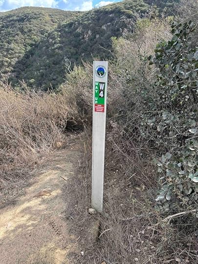
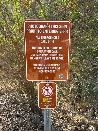
Due to the remoteness of these trails it is important to know what trail you are on. Signage through the reserve is fantastic including trail signs and mileage as well as sign markers letting you know where you are on each trail. This would be especially helpful if you needed to call the Forest Ranger for assistance. Before starting to hike there is an information sign indicating who to call in an emergency and requesting that you take a photo of it.
 Sunny’s Perspective
This place is fantastic! There are amazing smells and so many cool trails. I really liked jumping up all the steps and climbing. Going downhill was not as fun because Andie would not let me go too fast. At the end we explored and even climbed some stones across the creek which was so fun.
 Our Rating
Sunny, Karlie, and I give Elfin Forest Recreational Reserve four paws out of four paws up. It has everything we love – challenging trails, amazing views, a water feature, miles of trails, great parking, and a porto-potty. The other great thing is although it is a popular place to visit we felt like we mostly had the trails to ourselves. It should be noted that the trails are rugged and steep so this is not recommended for those with breathing, heart, or stability issues. There are also steep drop offs so it is not recommended for small children. And dogs must be kept on a 6-foot leash (no flexi-leashes).
How Do I Get There?There are two parking areas – the main lot at 8833 Harmony Grove Road and the overflow lot which is near 8574 Harmony Grove Road. From I-15 take the E. Via Rancho Parkway exit and turn left. Continue for 3.3M and turn right onto Del Dios Road which turns into W. Valley Parkway. After .4M turn left onto Citracado Parkway and continue for .6M before turning left onto Harmony Grove Village Parkway. After .4M turn left onto Harmony Grove Road. Continue another 2.2M and then turn left into the main parking lot. If this lot is full, turn right onto Harmony Grove Road and look for the yellow metal gate.
For additional information check out:
Elfin Forest Recreational Reserve
The post Elfin Forest Recreational Reserve appeared first on Live Like Karlie.
December 2, 2024
Buena Vista Park Trails
Now that we’ve been back in San Diego for a couple weeks we are getting back on the trails and exploring a little further from our home on the coast. Today we ventured to Vista to the Buena Vista Park Trails. This is a location we visited with Karlie in 2020, but never returned. I’m sure the reason was the nearly hour travel time and so many other great places closer to home. Despite that we thoroughly enjoyed our visit with Sunny today.
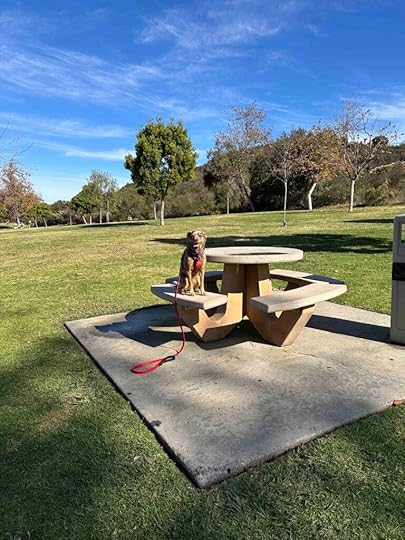
Our AdventureWhen you first arrive at the park it appears to just be a pond and grassy area with picnic tables, but if you venture a little further you will find a nice trail system. The trails start at the end of the parking area once you drive past the pond and restroom. You will see a metal gate and dirt trail. Walk past the gate and you’ll find several different trails.
We started on the main trail and shortly after passing a covered bench we took the trail to the right. After walking a short distance we found a nice grove of trees that was a perfect spot for a photo. As we continued we noticed we were walking near the Agua Hedionda Creek. Eventually we found a bridge that crossed the creek.
After that we started to enter a wooded area. This was my favorite part of the trail because it looked so serene. Not long after that we crossed another bridge and left the woods. We found ourselves entering an area that had brush on both sides that was taller than Sunny. And then the trail narrowed considerably. This part of the trail appeared to be used by mountain bike riders as we saw some jumps, although we did not encounter anyone on a bike. This section wound around and eventually became a much wider trail again.
We continued and eventually made it to the underpass of Melrose Drive. We continued and found another cool rock formation overlooking the creek. A short distance later the trail wound around and we again passed under Melrose Drive. before making our way back to the parking lot.
We hiked just over 2.5M, but could have added additional distance if we had explored some of the other trails. The beauty of these trails is despite a large number of cars in the parking lot and seeing a few people on the trails, we felt like we mostly had the place to ourselves. Most of the trails are quite wide making it easy to give people room if needed. There were quite a few other dogs on the trails, but everyone had them on their leash which was nice. All in all this is a fun place to take a hike and you can create different hikes depending on the different trails you explore.
Sunny’s PerspectiveThis place is fun! I loved sniffing all the incredible smells and exploring the different areas. It’s so fun to hike in places with sandy trails. There are a lot of birds and I kept checking the brush for lizards, but didn’t see any. I also liked resting in the shade and grass at the end. I just wish it wasn’t such a long drive to get there.
Our RatingSunny and I give Buena Vista Park Trails 3 out of 4 paws up. We liked all the different trails with different vegetation and especially enjoyed the shaded sections. The trails are easy to follow and the views of the creek are nice. Although the trails would not be good for those using scooters or other mobility devices due to the loose sand, they are relatively flat. The pond and picnic area are lovely and it’s nice to have restrooms. There is also ample parking.
How Do I Get There?From I-5 take exit #45 – Poinsettia Lane and continue on Poinsettia Lane for nearly 5 miles. Turn left onto Melrose Drive and then turn left on Shadowridge Drive. Take the next left onto Antiqua Drive which is the entrance to the park. Follow the road past the pond and bathroom and park near the metal fence and dirt trail.
The post Buena Vista Park Trails appeared first on Live Like Karlie.
December 1, 2024
San Dieguito River Park Trails – Rancho Bernardo
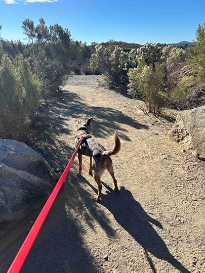
I took Karlie to the San Dieguito River Park Trails – Rancho Bernardo only one time. We enjoyed it, but for some reason we never returned. I think I found some other trails we liked better and forgot about it. Today we returned with Sunny and found it to be a nice place, but with some changes from my first visit.
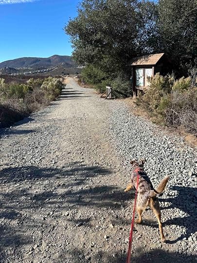
The first challenging part is getting to the trail. Although the address that google maps gives is the same as the Rancho Bernardo Community Park, the parking lot is before you get to the park. On this trip we did not realize that and drove to the park and walked around there first. It’s a lovely park and has a dog park, but what we wanted were the trails. We decided to get back in our car and drive to the trail parking lot we saw on the way to the park. Unfortunately we did not realize this was the parking lot we wanted until after we didn’t find access to the trails at the park.
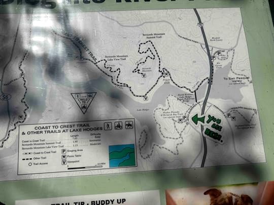
Once we arrived at the correct parking area we walked to the far left in the parking lot and found some big rocks. These are the entrance to the trail and lead to the sign with the trail map. What I remembered from my first trip with Karlie is you could get nice views of Lake Hodges. We took several different trails trying to find views of the lake today, but discovered that you can only see it very far off in the distance. It’s no longer visible up close as it was when Karlie and I visited in 2020, as shown in this picture.
Although not seeing the lake was a disappointment, we still enjoyed exploring the trails and seeing the mountains in the distance. Although we started on the Piedras Pintadas trail we also were on the Bernardo Bay trail and some unmarked trails. I am sure I could not replicate the exact route we took, but we found our way back to the start without much trouble and enjoyed our 2+M hike.

 Sunny’s Perspective
Hiking in San Diego is sure different than Indiana. There’s a lot of sand and not much grass or mud. And the rocks are so big! This place had great smells, but Andie would not let me put my face in the brush. She said something about snakes which I think would be great fun. Despite that the trail was pretty fun even though there wasn’t any shade so I got pretty warm. Thank goodness we had water with us. All in all I liked this place and hope we return to explore it some more.
Our RatingSunny and I give San Dieguito River Park Trails – Rancho Bernardo 3 paws up. There are a lot of different trails with varying degrees of difficulty, which we enjoyed. We were sorry to see that the lake has dried up and you can’t get much of a view of it. It is important to note the trail is not appropriate for those with stability issues and has little to no shade. It is also used by mountain bike riders so it’s important to watch out for them. There is plenty of parking in the parking lot and on the road and the parking lot has a port-o-potty. All in all this is a great place to explore.
How Do I Get There?The best way to find the trail and parking area is to use Piedras Pintadas Trailhead as the location in your GPS. The other alternative is to use Rancho Bernardo Park and to look for the trail parking lot on your right about half a mile before the park.
From I-15 take exit #26 – West Bernardo Dr./Pomerado Rd. Turn onto West Bernardo Dr. and follow it for about half a mile. You’ll see a wood sign on the right for the parking lot. Turn into the parking lot and park on the opposite end as the port-o-potty. The main entrance to the trail is near some large stones and leads to a sign with a map. We recommend taking a picture of the map so you don’t get lost while hiking as not all trails have signs.
The post San Dieguito River Park Trails – Rancho Bernardo appeared first on Live Like Karlie.
October 26, 2024
Woodland Park and Nature Preserve
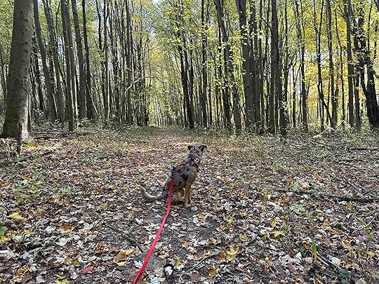
We’ve been having beautiful fall weather so Sunny and I have been enjoying being outside. Last week we decided to explore a new to us park and ventured to Battle Creek, Michigan to Woodland Park and Nature Preserve. It was well worth the trip and one we will visit again. It was especially beautiful as the fall colors are in full bloom.
History of the ParkThe park as it stands today was over thirty years in the making. In the 1990’s Raymond Pontoni sold 126 acres to the city of Battle Creek with help from the Michigan Department of Natural Resources Land Trust. The Pontonis donated an additional 18 acres which helped create the entrance off Helmer Road. In the early 2000’s Joyce Garrett learned of the land and approached the city with a plan to create a park. The city approved the plan in 2006 and Ms. Garrett and the Woodland Park and Nature Preserve committee worked to create the wonderful park and they continue to make improvements. In 2021 there was a ceremony and dedication of a bench in her honor.
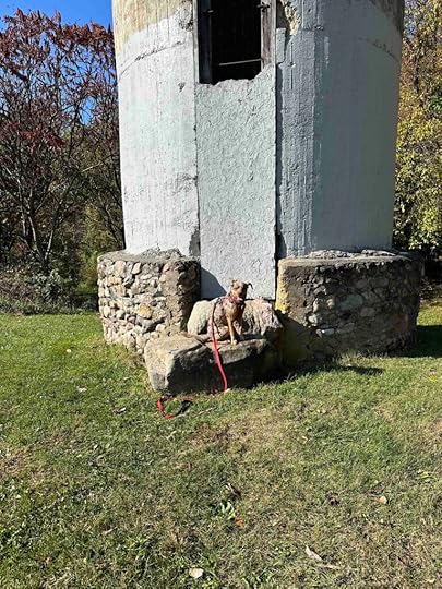
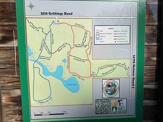
Our AdventureThere are two different entrances to the park, one off Helmer Road and one off Gethings Road. We chose to enter off Gethings Road. Once we parked the car the entrance to the trails was not easily visible so we checked the map at the entrance. We then walked toward the large tower and found a fence and the entrance to the trail.
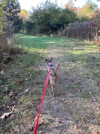
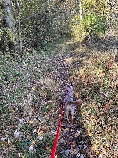
This trail was a mowed grass trail with vegetation on either side. It did not feel like we were in field or meadow because of all the trees on either side. We welcomed the sunshine that was shining on us since it was early and a little chilly. After a short distance we came to a sign and the option to continue straight ahead or turn to the right. My rule is to almost always take the trail to the right so I can find my way back to the car. Today was no different.
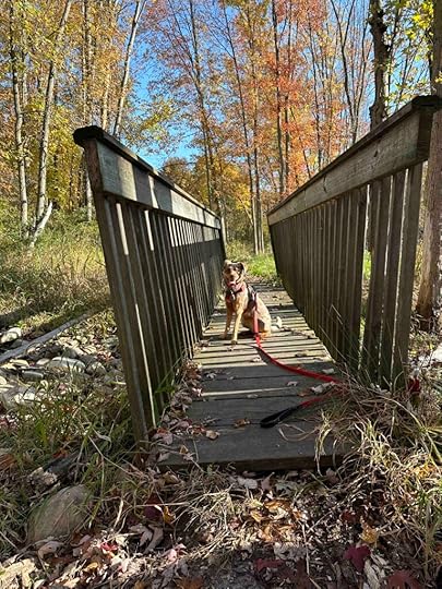
As we continued to follow the trail we started to enter the woods. Shortly after that we crossed a bridge, although there wasn’t any water during our visit. I’m sure during the spring it is a different story.
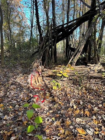
Shortly after entering the woods we found a fort made from fallen tree limbs. Sunny thought that was quite interesting and the smells were great. As we continued we found a section where the trail narrowed and was a bit overgrown. We still continued and wound around back to the bridge we had crossed. Later I learned we had explored the Bluebird Trail, Hidden Loop Trail, and part of the Beaver Trail.
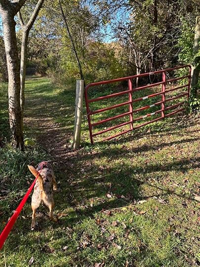
Next we took the Sumac and Beech Trails to the Kettle Lake Trail which eventually led to the entrance off Helmer Road and the Joyce Garrett bench. After reading the sign we headed back on the Pontoni Trail to the Hardwood Way Trail and the Prairie Trail. These led us back to the parking lot, but near the port-o-potty instead of the tower. We hiked over 3M and had a great time exploring.
We finished our adventure with a picnic lunch on the bench near the tower. All in all a wonderful adventure and worth the drive from Northern Indiana.
 Sunny’s Perspective
This was a great adventure! I love getting out in the fall because the smells are so much better and there are so many critters. I wish I was allowed to be off leash so I could chase them, but we always follow the leash rules. Despite that I loved exploring this place, especially the cool fort in the woods.
Our RatingSunny and I give Woodland Park and Nature Preserve 3.5 out of 4 paws up. It’s a beautiful area with trails in the woods and views of a lake. There is plenty of parking at two different entrances and port-o-potties. And there are benches for a picnic lunch. The trails are well maintained an although there were a few cars in the parking lot, we felt like we had the preserve to ourselves. All in all a wonderful place for a day in the woods and a picnic lunch.
How Do I Get There?From I-69 take exit #38 to I-94W and continue for 18M. Then take exit #95 and turn right onto Helmer Road. Follow Helmer Road for just over a mile and then turn left onto Gethings Road and continue for half a mile. Turn left to enter the parking area.
For more information check out this website.
Battle Creek Recreation Department
The post Woodland Park and Nature Preserve appeared first on Live Like Karlie.