Andie LaComb's Blog, page 3
September 27, 2024
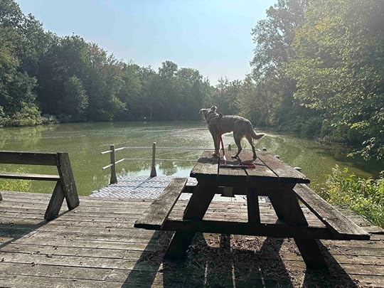
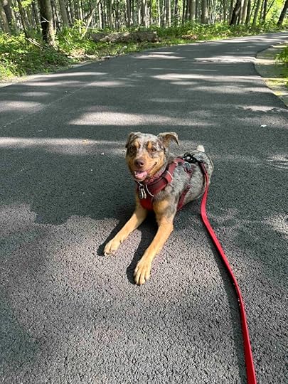
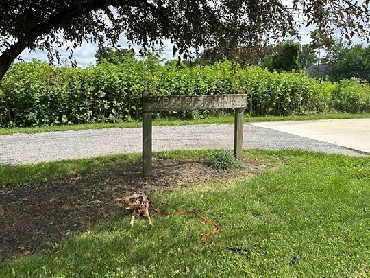
Payton County Park
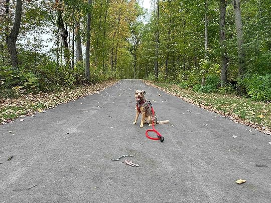
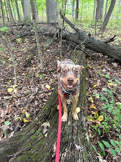
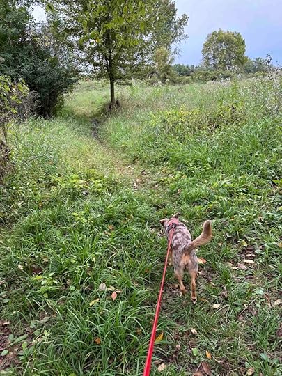
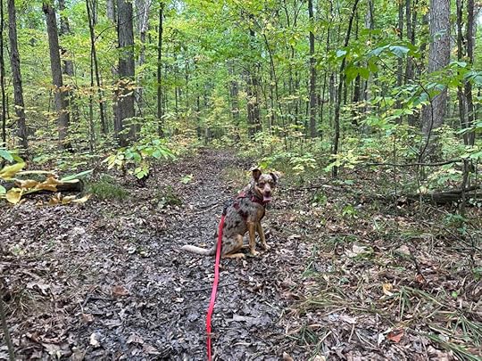
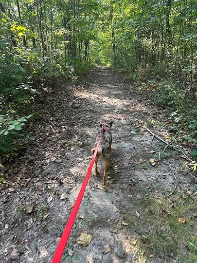
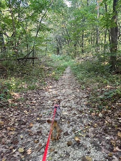
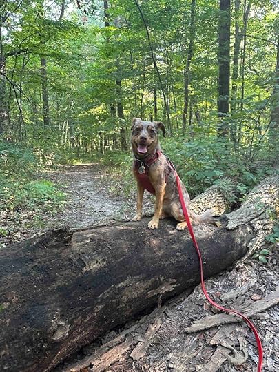
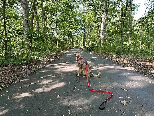
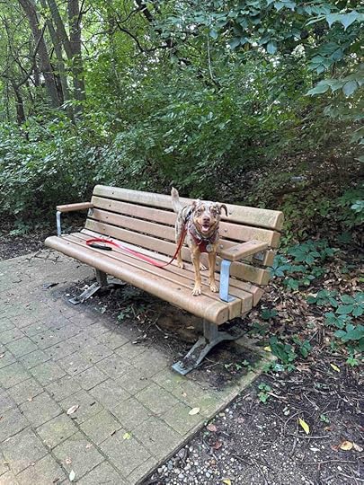
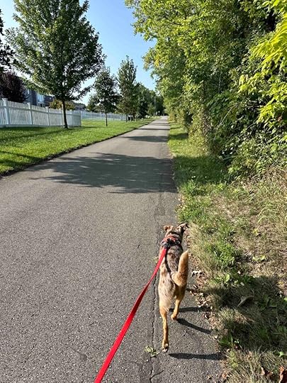
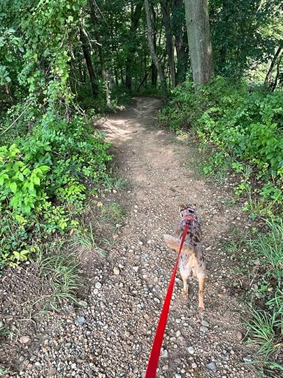
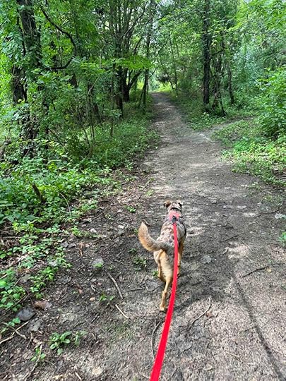
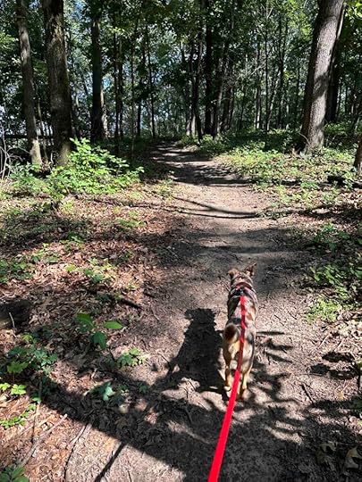
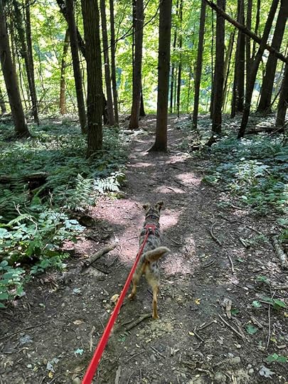
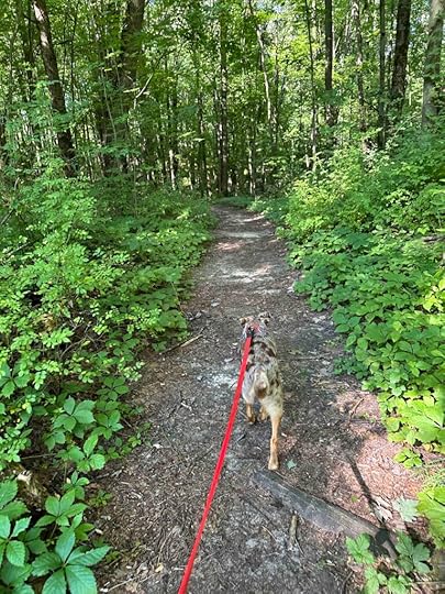
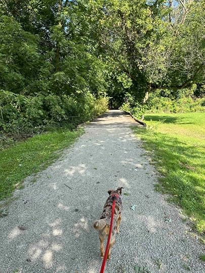
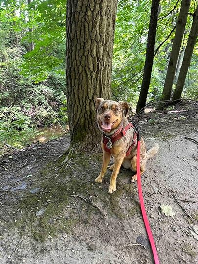
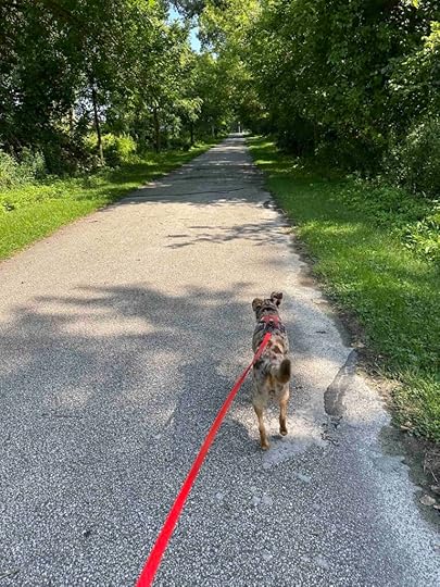
Near the end of August we visited Payton County Park to explore the Pufferbelly Trail. On that visit we did not explore the trails in the woods. Today we returned to do that and explore a different section of the Pufferbelly Trail. It was well worth the return trip.
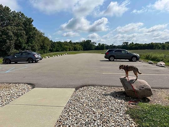
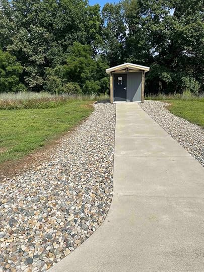
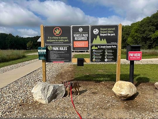
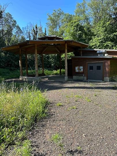
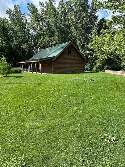
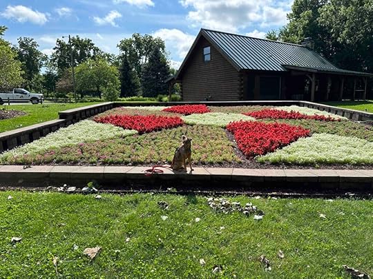
Payton County ParkPayton County Park, located in Allen County, Indiana, is a lovely park with a picnic shelter, playground equipment, paved trails that lead to the Pufferbelly Trail, and hiking trails. The hiking trails wind through 40 acres of old field, forest, and wetland areas. There is also ample parking and a port-o-potty.
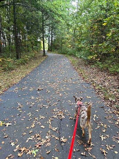
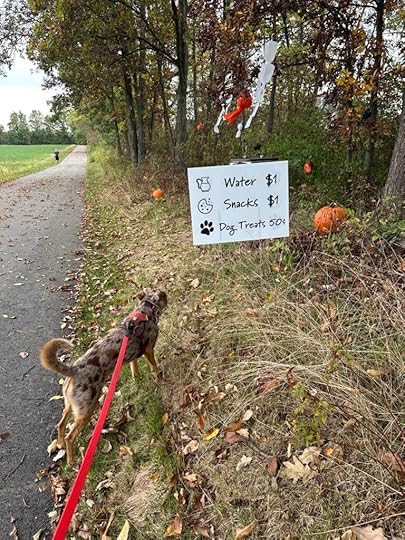
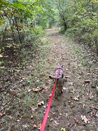
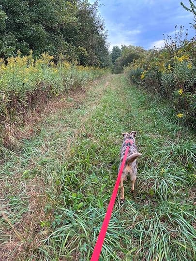
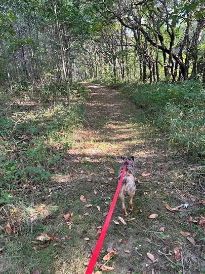
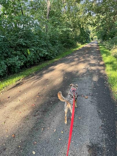
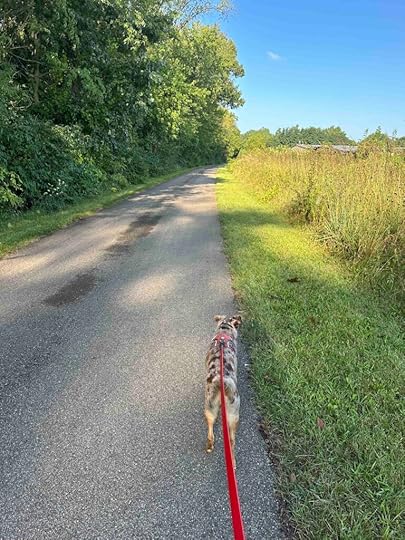
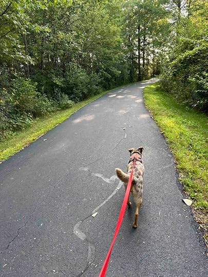
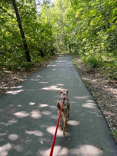
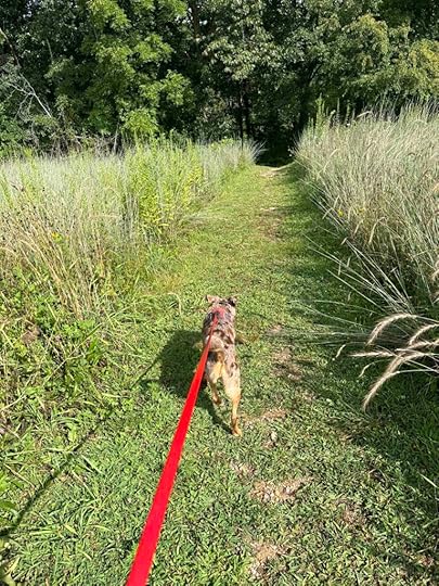
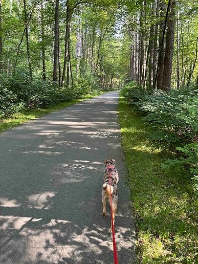
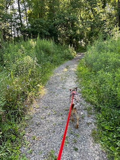
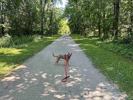
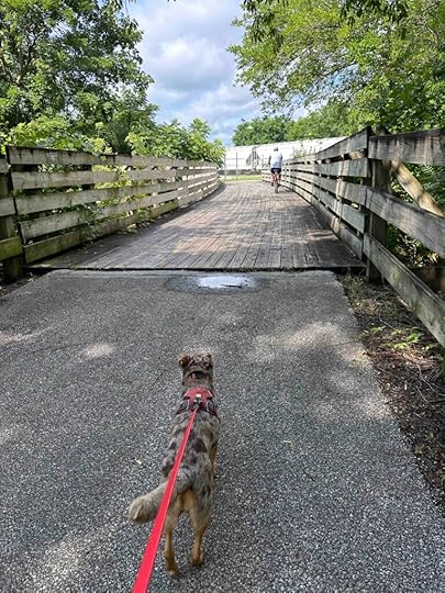
Our AdventureWe started by walking along the asphalt trail that passes the port-o-potty and turned left on the first section of the Payton Park Loop. This led us through an area with woods on both sides and to the Pufferbelly Trail. On our previous visit we turned right, but today we turned to the left. As we walked the woods gave way to fields and houses on either side. How lucky are the people who live behind this trail and can walk on it every day? We saw many trails from the back of homes to the trail. One family even set up a snack station for walkers and runners. Sunny enjoyed snooping as she heard they had dog treats and was trying to find them.
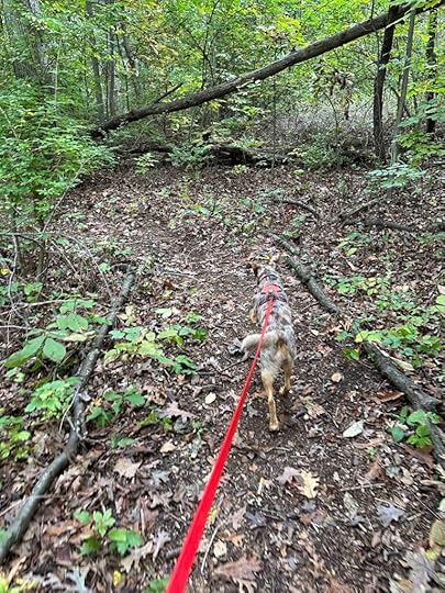
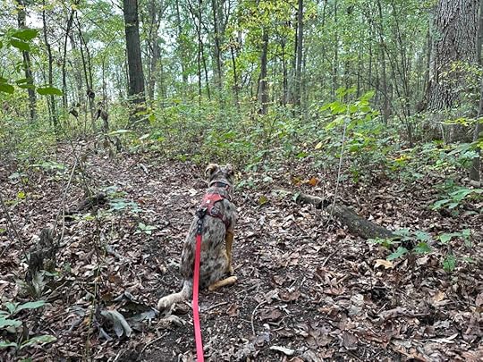
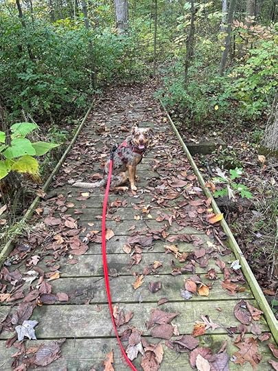
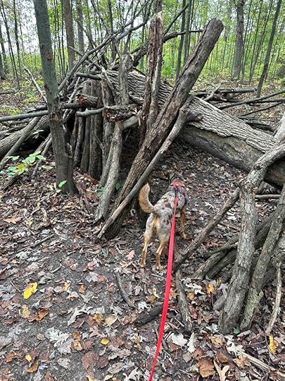
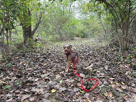
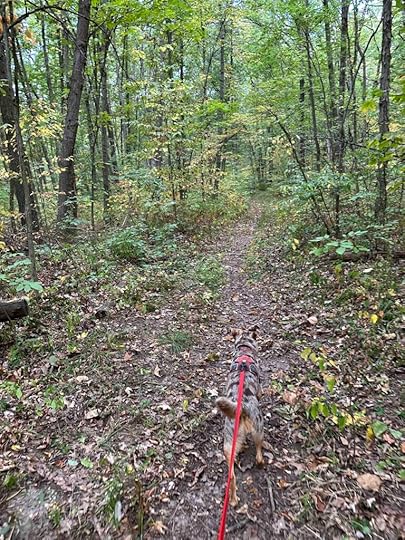
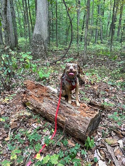
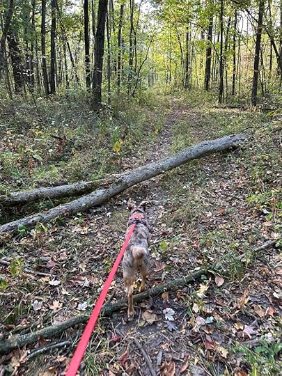
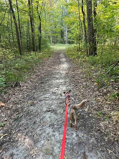
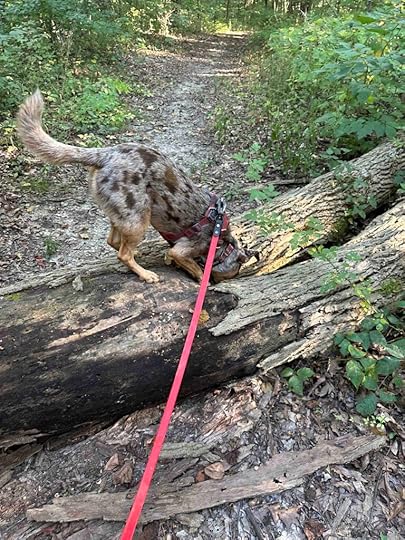
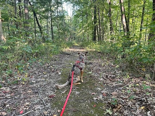
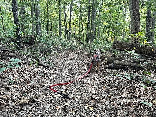
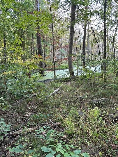
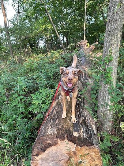
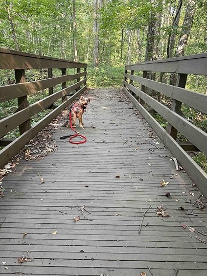
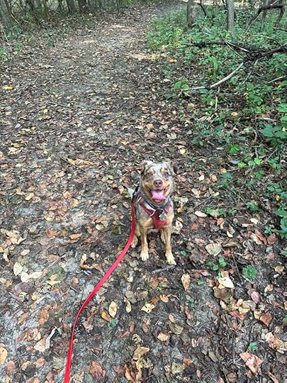
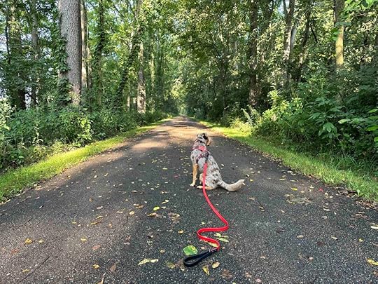
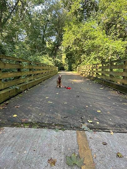
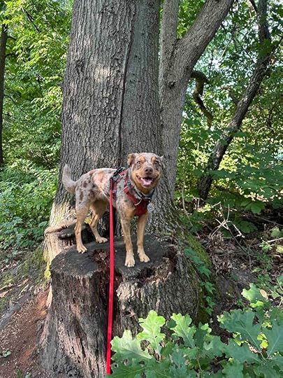
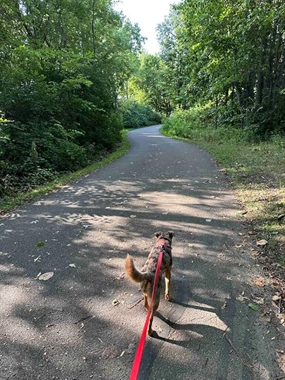
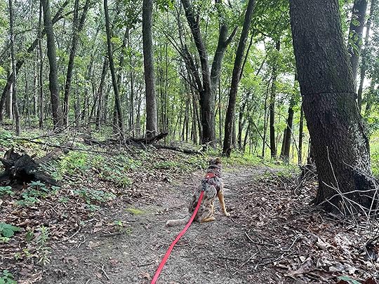
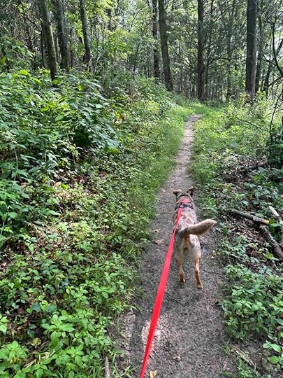
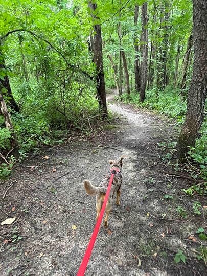
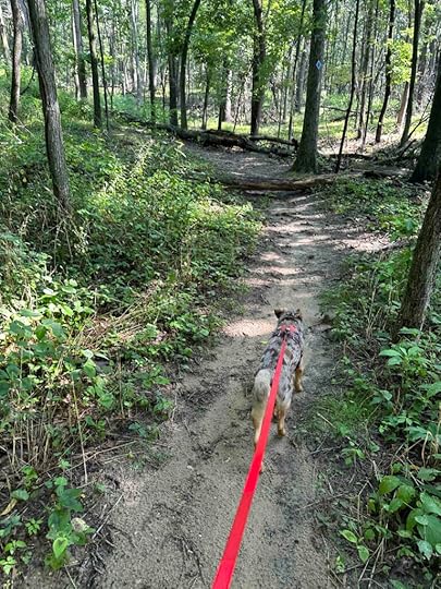
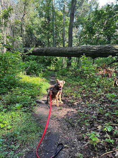
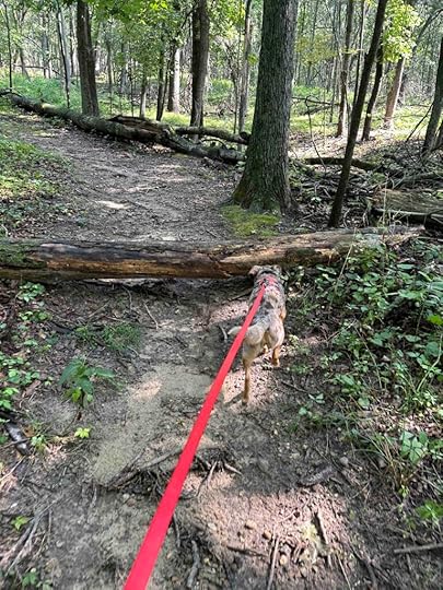
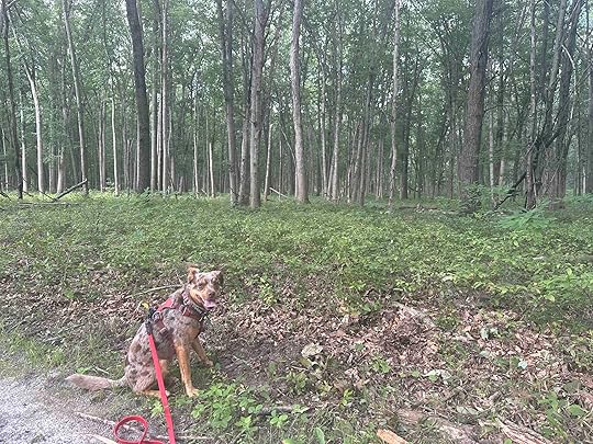
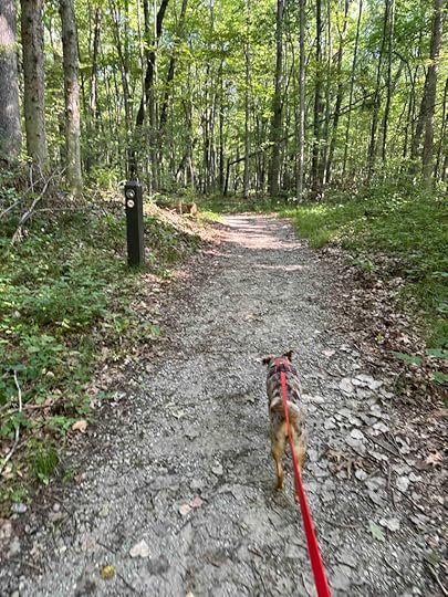
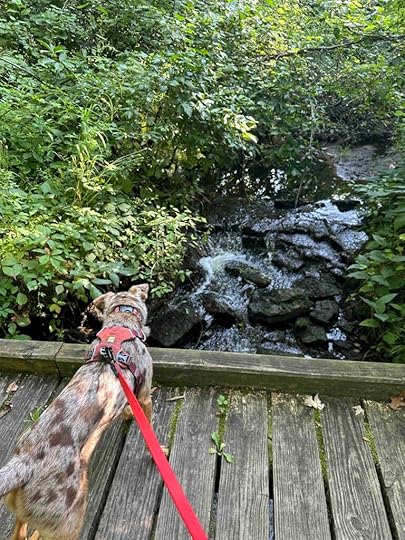
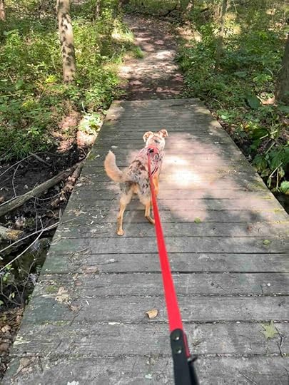
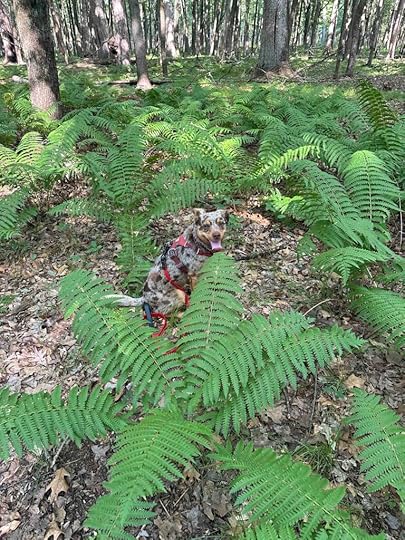
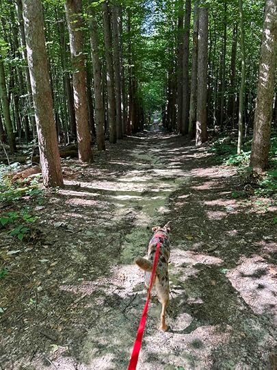
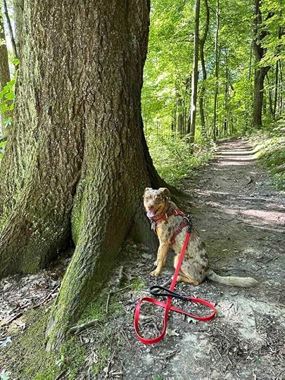
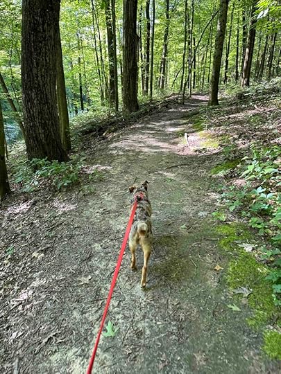
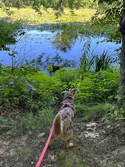
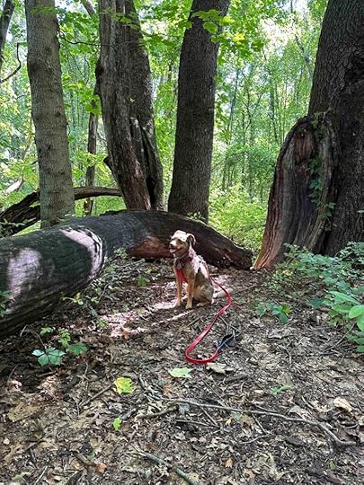
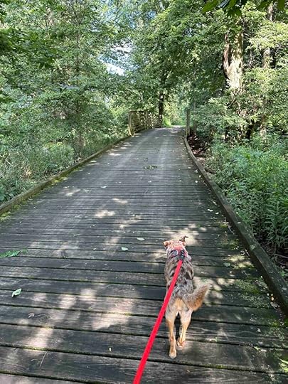
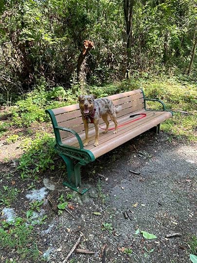
As we continued on the trail it eventually came to a road. Instead of crossing it to continue on the trail we turned around and made our way back to the Payton Park Loop and the trails in the woods. The first trail we explored was “A” trail and this one was our favorite. It was the most wooded and scenic. We meandered through the woods on a mulch path that was easy to follow. We crossed a little bridge and then a short while later found a fort built out of tree limbs. Sunny thought it was just the right size for her. We continued on the trail and it led us back to the Payton Park Loop trail.
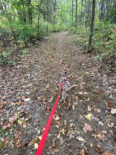
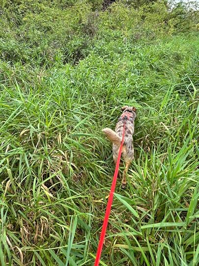
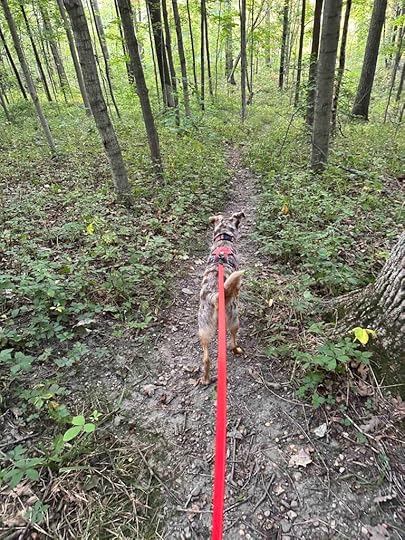
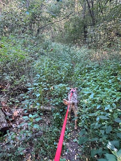
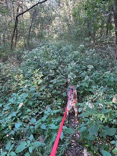
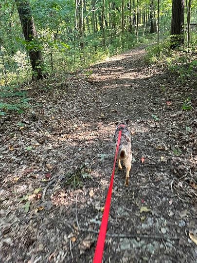
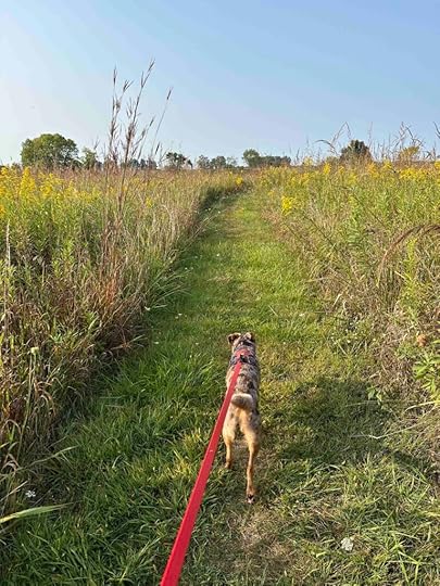
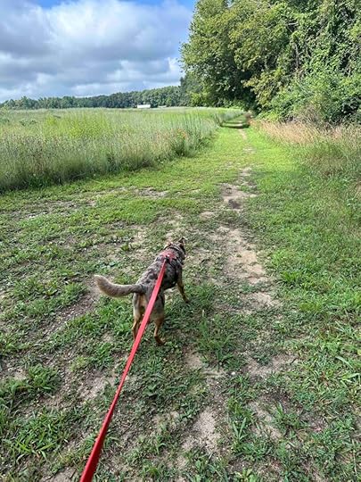
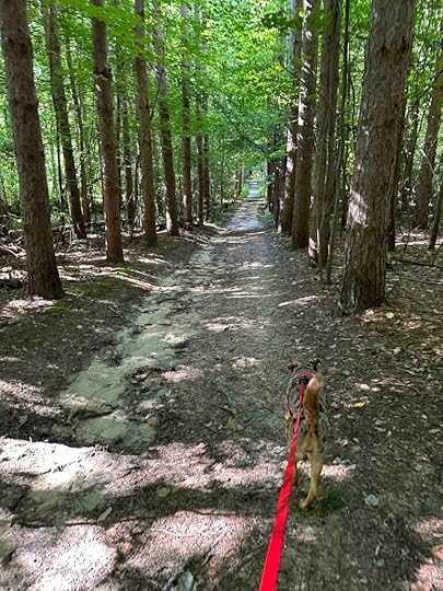
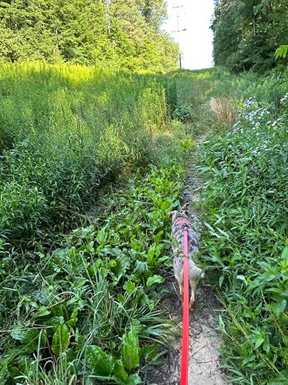
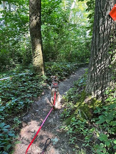
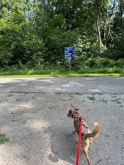
At this point we took a left and after a short distance found a trail marker for trail “B” on the right. This was a short mowed grass trail with trees on both sides. It ended at trail “C” so we followed it. This was another short mowed grass trail with trees on both sides. It ended at the asphalt Payton Park Loop trail. We crossed the loop trail and found trail “F”. This was a longer trail that started similar to B and C trails. Eventually it led to a field with some overgrown grass. As we walked further and further the grass got taller and taller nearly engulfing Sunny.
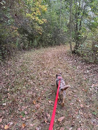
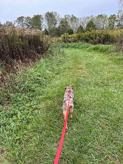
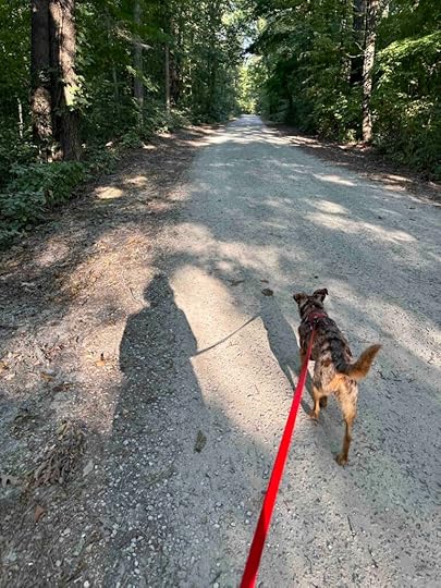
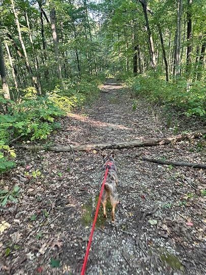
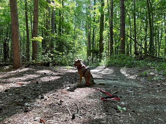
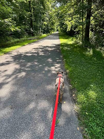
Eventually the F trail led to trail “G” which was a mowed grass trail through a field. After awhile it turned into another grass trail with woods on both sides before leading to the playground area and parking lot.
 Sunny’s Perspective
Loved this place! Although the Payton Park Loop Trail and Pufferbelly Trail are nice, I really loved when we got in the woods. The smells are so much better there and it’s just more fun to have mud, dirt, and grass in your toes. I got to explore a cool fort which had so many amazing smells in it. I also heard and saw a lot of squirrels that needed to be chased, but I could not do that. The only part I wasn’t too sure about was the tall grass on trail F. Thankfully that didn’t last too long.
Our RatingSunny and I give Payton County Park 3 out of 4 paws up. We love that you have so many options – playing in the park, picnicking, hiking in the woods, or walking along the asphalt paths. Even when you are on the asphalt paths you feel like you are in the woods most of the time. Having a port-o-potty is also really nice. This is a great place to visit with kids and dogs. Just remember that if you are using bikes you can only ride on the asphalt trails.
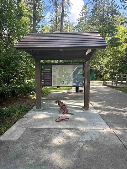
How Do I Get There?The address for the park is 13928 Dunton Road in Fort Wayne, IN. From Coldwater Road (County Road 427) turn west onto Gump Road and follow that for 1 mile. Then turn left onto Dunton Road and after 0.8 mile turn left at the wood sign and entrance. Parking is on the right and the port-o-potty is on the left behind a wood fence. There is also a trail map across from the port-o-potty. If you plan to hike the trails in the woods I would recommend picking up a trail map.
Want more information about Payton County Park? Check out these websites:
The post Payton County Park appeared first on Live Like Karlie.


September 20, 2024
Douglas Woods Nature Preserve
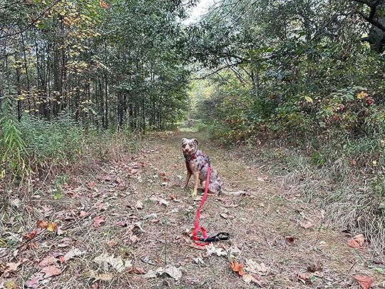
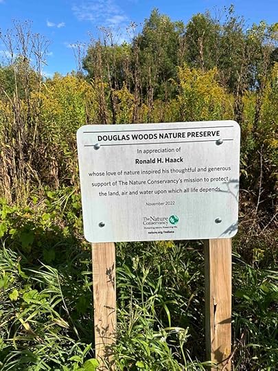
Another beautiful summer-like fall day so we decided to get out in the woods. Today we ventured to Hamilton, IN to explore Douglas Woods Nature Preserve which comprises nearly 400 acres of mature hickory, oak, and silver maple trees. Fish Creek also runs through the preserve. The Nature Conservancy maintains the preserve which is dedicated to Ronald Hack. What we did not realize is that the only real trail is one through the field that leads to the forest. According to the Visit Steuben County website the preserve does not have any trails and is for advanced explorers.
 Our Adventure
Our adventure started once we parked the car. As we approached the entrance we noticed it was pretty overgrown. We decided to walk through it to see if it improved and it did. Once we made it through the tall vegetation we found a grass trail with woods on both sides. The woods was pretty dense so we stayed on the grass trail. In one section we could see a pond quite a ways into the woods.
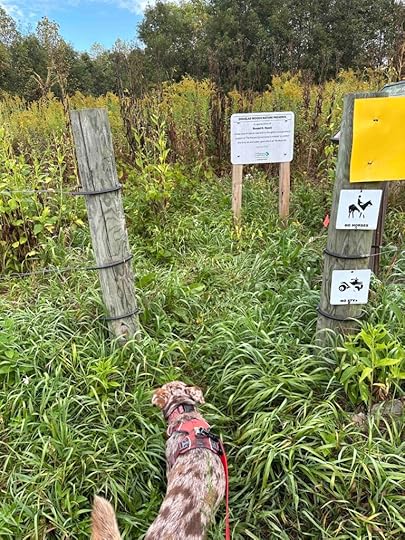
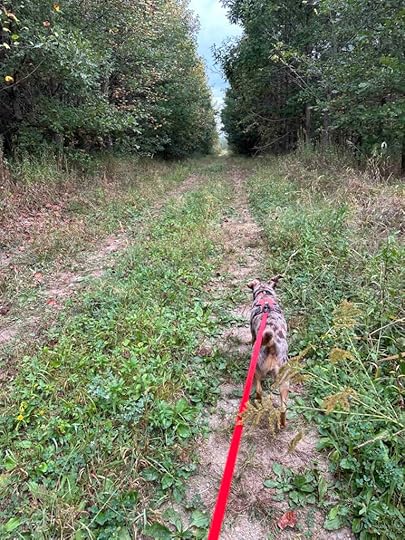
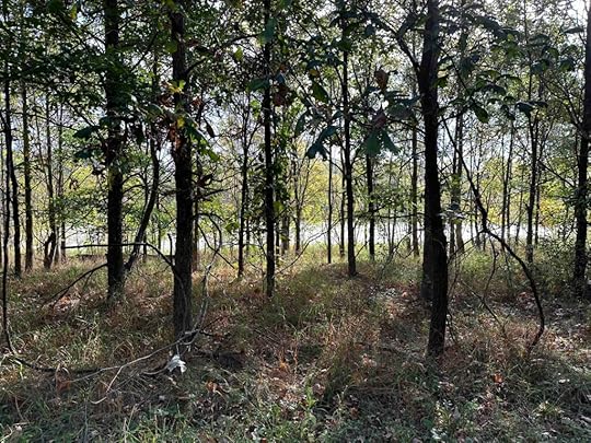
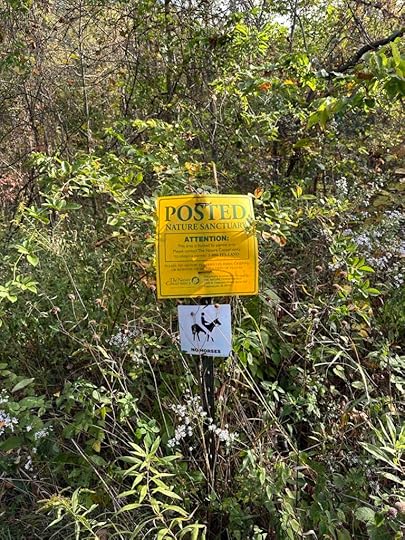
As we continued to hike we eventually came to an area leading into the woods with a sign indicating that hunting was allowed by permit only. Since there were no other cars in the parking lot we decided to continue on the trail. Thankfully we did not encounter any hunters. Although the Visit Steuben County website indicated that there were no trails through the woods, we found one to follow. It was not marked nor maintained, but we were able to follow it for a bit. The trail has some inclines and descents, but nothing very difficult. Despite that the trail would not be appropriate for anyone with stability or mobility issues. It also is not recommended for those not comfortable with walking through taller vegetation or over tree limbs. After about .8M our trail came to an end so we turned around and retraced our steps back to the car.
 Sunny’s Perspective
This place has the BEST smells. I’m telling you there are a lot of critters in these woods. It would have been better if I could have run off leash, but that didn’t happen. The trail was kinda challenging since I have short legs and I didn’t like going through the tall vegetation, especially at the start, since it nearly came up to my head. I had fun, but there are other places I like better.
Our RatingSunny and I rate Douglas Woods Nature Preserve 2 out of 4 paws up. Although it’s quite scenic and peaceful we prefer areas with better marked and maintained trails. We also prefer creeks and other water that we can easily access. This could be a lovely place for a hike, but would require some effort to maintain and mark the trail.
How Do I Get There?From 427N turn right onto County Road 4 and continue for a mile. Then turn left onto County Road 61 and after nearly a mile turn right onto IN-1S. Continue for 2 miles and then turn left onto County Road 4A. After about .4M look for a gravel driveway that leads to a parking area. The sign for the preserve is after the gravel driveway.
For more information about Douglas Woods Nature Preserve check out these websites:
The post Douglas Woods Nature Preserve appeared first on Live Like Karlie.
September 16, 2024
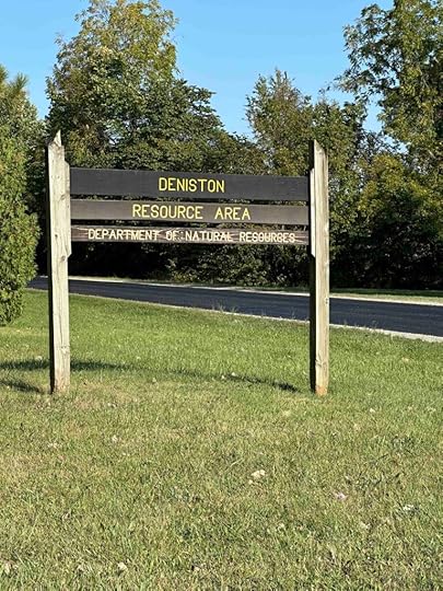
Deniston Natural Resource Area
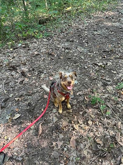
Another beautiful day in Northern Indiana had us looking for a new adventure. We decided to explore Deniston Natural Resource Area and I have to be honest. I was disappointed. Despite that we made the best of it and explored all the trails and the lake.
Deniston Natural Resource Area is a wooded area with a gravel road that leads to Robinson Lake. On either side of the gravel road there are trails in the woods. At one time camping was allowed however this is no longer the case.
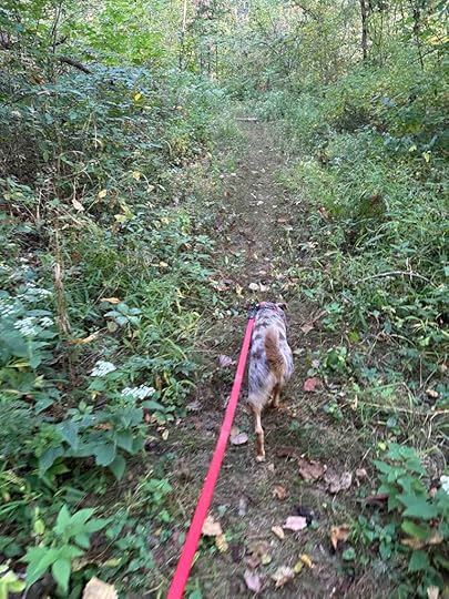
We started our hike by walking up the gravel road from parking area 1. After a short distance we found a trail on the left and entered the woods. The trail was quite wide with woods on either side. It started as packed dirt but quickly turned into rocks. After a short distance it opened to an area with a tree and some grass before narrowing and continuing downhill. This is where we turned around. The trail was quite narrow and very steep. I was not sure where it led and was concerned whether we could make it back up the steep incline. It also had narrowed so much that I wasn’t sure the trail was going to continue very much longer.
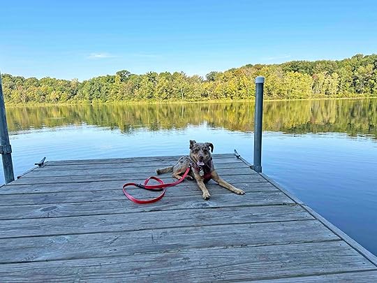
Once we returned to the gravel road we continued on it until we found Robinson Lake, the boat launch, and a dock. This area also had more parking and a port-o-potty. We explored the boat ramp and the dock before trying a trail behind the port-o-potty. This trail didn’t go very far before it was impassible. We turned around and walked back along the gravel road toward the car.
We found two additional trails to explore. The first one started like the first trail, but quickly became narrow with a lot of vegetation. Once Sunny was engulfed in the vegetation we decided to turn around.
A little while later we found another trail. This one had several logs over the path. Sunny and I didn’t mind climbing over them, but this might be difficult for some people. We followed the trail for a short distance and it started to get much more narrow and eventually was too overgrown for us to continue. We turned around and retraced our steps to the gravel road. By this time we were nearly back to the car and there were no other trails to explore.
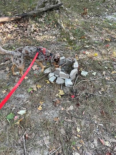
One thing we noticed on several trails were areas where campfires had recently been. It seems that although camping has not been allowed for several years that some people are still camping here. To be honest this spooked me a little even though we did not encounter anyone else in the woods.
Despite not being able to hike very far on the trails Sunny had a great time. There were a lot of critters in the woods. We could here the squirrels and chipmunks scampering around and chirping at us. We did not see any other critters but I am sure there were others watching us from afar.
Our RatingSunny and I rate Deniston Natural Resource Area 1.5 out of 4 paws up. The rating would be higher if the trails were in better condition. Although we managed to hike 1.85M it was only because we tried nearly every trail and walked along the gravel road to the lake. Despite the rating the woods are beautiful and the lake is lovely. There is also good parking and a port-o-potty near the lake.
How Do I Get There?The address for Deniston Natural Resource Area is 7865 W Lincolnway in Larvall, IN. From I-69 take exit 309B and turn onto US-30W/US-33N. Follow US-30W for 18 miles, then turn right onto W. Lincolnway and continue for nearly 9 miles. Look for the entrance sign and gravel road on the left. Once you turn onto the gravel road there is a parking lot on the left or you can continue on the road to the boat launch and park there. Do not park on any of the grassy areas.
I found it difficult to find very much information about Deniston Natural Resource Area. The Clearly Kosciusko County website has some basic information. Check it out at Clearly Kosciusko.
The post Deniston Natural Resource Area appeared first on Live Like Karlie.
September 13, 2024
Wildwood Acres
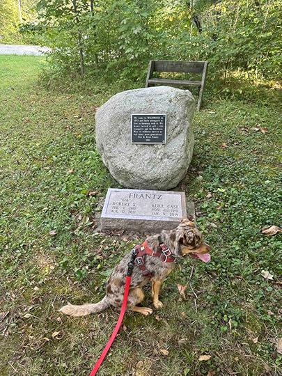
Since our summer weather is hanging on in Northern Indiana Sunny and I decided to take an adventure to Silver Lake, IN. We visited Wildwood Acres, another Acres Land Trust site. This location comprises a dense forest with a small pond, wetlands, and a prairie next to agricultural fields. The land was purchased from Bob and Alice Franz in 2002 with some additional land acquired in 2019. At the end of the trail near the parking area, is a memorial dedicated to the Franz’s. There is a plaque with the inscription “We came to Wildwood in 1973 and have attempted to live in harmony with it. We loved it all – the tranquility and the harshness. May its wildness survive us and many more generations.” That wish is certainly coming true now that it is an Acres Land Trust site.
 Our Adventure
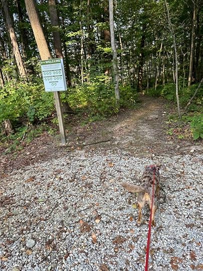
We arrived fairly early and were the only car in the parking area. In fact we did not encounter another person the entire time we explored the preserve. We started our adventure by entering the forest at the welcome sign near the trail head. Shortly after starting our hike we noticed a pond to our left. Thank goodness we did not get close enough for Sunny to put her toes in it since it was green with algae. As we continued hiking the trail progressed into the forest. Throughout the hike Sunny heard and smelled critters. From the sounds of the scurrying I would assume there were squirrels and chipmunks. We also saw several deer who ran through the woods before we got too close. Sunny was disappointed that she could not follow them into the woods.
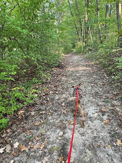
After passing a wetlands area the trail wound its way next to a field of corn before reentering the forest. We hiked for awhile in the forest and then passed more wetlands before entering a field surrounded by wildflowers. Unfortunately most of the flowers were no longer blooming. I imagine it’s quite pretty in the spring and early summer. The trail continues to wind around the field until it comes to a dead end. At this point we turned around and retraced our steps back to the forest.
After entering the forest we took the trail to the right instead of continuing the way we had come. This continued through the forest. Eventually we crossed a bridge that was built by an Eagle Scout. A short distance later we found a floating dock with a picnic bench on it. Shortly after that the trail led to the memorial and the parking lot. Our total distance was just under 3 miles.
 Sunny’s Perspective
This place has the best smells. I was constantly sniffing the ground and trying to find the critters that I could smell. There were also quite a few downed trees that I enjoyed climbing onto. I could see some green water in the distance, but didn’t get close enough to dip my toes in the water. I also saw some deer, one even stopped on the trail in front of us and watched us before running away. That was almost as exciting as the beavers we saw on the Pumpkinvine Trail. All in all this was a fun adventure.
Our RatingSunny and I rate Wildwood Acres 3 out of 4 paws up. It has several nice trails in the woods, but also some in a field. The trails are mostly flat, but a little difficult to follow. We were happy that we printed the trail map to figure out which trail to take. Although we enjoyed our adventure, we would prefer more trails in the woods. The trails in the woods were shaded, but those in the field were completely in the sun. All in all this is a nice place for a hike in the woods, especially if you are in the area. Like most Acres locations it is well maintained with no restroom. The parking area is nice and can accommodate several vehicles.
How Do I Get There?The address for Wildwood Acres is 409 IN-14 in Silver Lake, IN. From the Fort Wayne area take I-69 South and take exit #305 to IN-14W. Normally you should be able to follow IN-14W to the location, however during our visit there was some construction on IN-14W so we had to loop around it and then get back on IN-14W. We turned left onto S 700 E, then right onto E 1150 S, then right onto S 600 E and then back onto IN-14W. Wildwood Acres was a little over 5 miles further on IN-14W.
As you approach you will see a dirt road that looks like a driveway. There is a mailbox and an acres land trust sign. Turn into the driveway and proceed until you see the parking area. Remember not to park in front of the home as this is private property and not part of the Acres Land Trust location.
Want more information about Wildwood Acres? Check out the Acres Land Trust website.
The post Wildwood Acres appeared first on Live Like Karlie.
August 22, 2024
Rail Trails
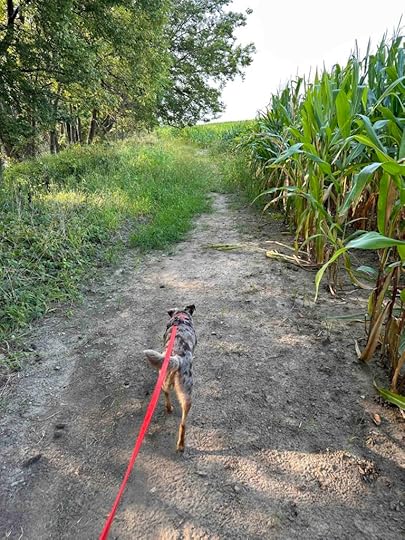
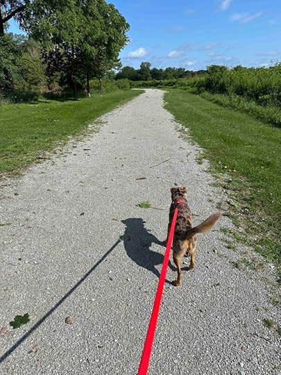
We’ve been having some truly beautiful and cooler weather so we’ve explored a couple rail trails. We like these kind of trails when it’s muddy or we just don’t feel like tromping in the woods. The nice part about the two we explored, the Pumpkinvine Trail and the Pufferbelly Trail, is they are fairly wooded on both sides. That makes you feel like you are still enjoying nature unlike typical walks on sidewalks in the neighborhood. The only downside of these trails is sharing them with bicyclists, although we find that most are friendly and courteous when they pass us.
Pumpkinvine TrailThe first trail we explored was the Pumpkinvine Trail. We have previously explored this trail and you can read all about it HERE, but on this day we accessed it from a different spot. We traveled to Middlebury, Indiana and found a parking area on CR 43. There was plenty of parking, a restroom, and a picnic table making this a nice spot to start a hike.
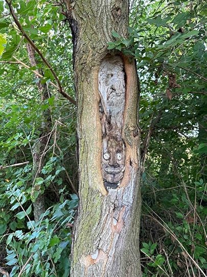
Once we started on the trail we immediately felt like we were in the woods. The trail is wooded on both sides with occasional peeks at farms. At one point we found an interesting face carving on a tree. We are always finding interesting things on our hikes.
As we continued we came across a bench and then the trail opened to a field on one side. In the spring and early summer I imagine it is filled with wildflowers. A little further we saw a Winnebago manufacturing facility. Although not especially scenic it was interesting to see all the Winnebagos. A little further we crossed a bridge over a small creek. The trail continued and became wooded again before heading out of the woods, passing Dairy Queen, and heading toward Middlebury. Sunny was disappointed we didn’t stop for ice cream, but it wasn’t even 10A. Instead we headed back to the car. We logged nearly 4M on our walk and enjoyed our rail trail adventure.
 Pufferbelly Trail
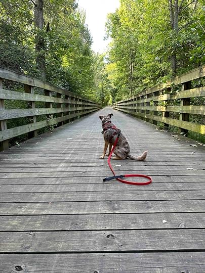
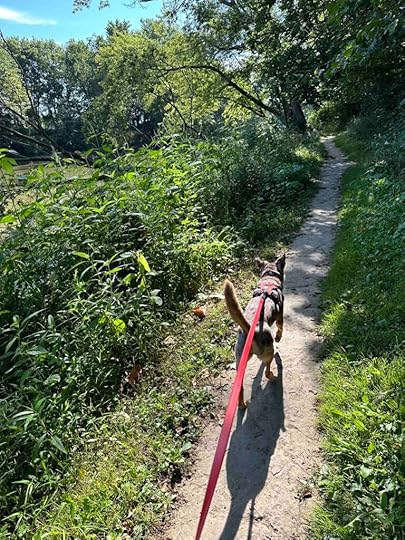
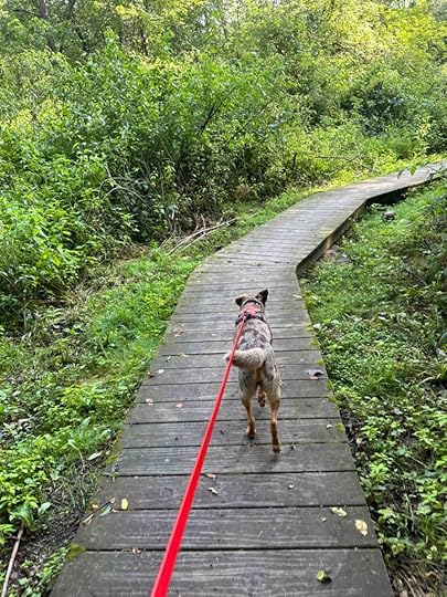
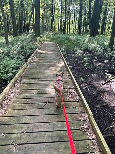
A few days later we ventured to the Payton County Park to hike on the Pufferbelly Trail. We have previously explored this trail and you can read all about it HERE and HERE. On this day, however, we decided to access the trail from the Payton County Park.
The Payton County Park is a lovely park with ample parking, a port-o-potty, playground equipment, and a picnic pavilion. There are also some trails in the woods. Although we did not explore the trails in the woods, we did enjoy walking on the Payton Park loop to the Pufferbelly Trail.
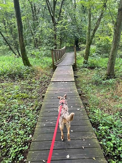
Once we started walking on the loop and the trail we felt like we were in the woods. After a short distance we could see some homes in the distance, but then it became more densely wooded before leading between two housing developments. In this area there were fences at the back of many homes and several had dogs who peeked their noses under the fence and barked at us. I’m sure they just wanted to join us on the trail. Once we passed the homes and crossed a busy street, the trail became more wooded and even had a bridge over a creek. This continued for awhile until we came across an interesting bench which we learned was a memorial to a young man who lost his life in 2017. At this point we had walked for 2M and decided it was time to turn around and head back to the car. This was another fun rail trail adventure and we plan to return to check out the trails in the woods and walk in the other direction on the Pufferbelly Trail.
 Sunny’s Perspective
Normally I like dirt trails better than sidewalks or asphalt trails, but the Pufferbelly and Pumpkinvine trails are really cool. It’s like walking in the woods on sidewalks. The smells on the sides of both trails were really good. The Pufferbelly trail even had chipmunks and squirrels. Too bad I couldn’t chase them into the woods. There were quite a few bikes on the Pufferbelly Trails which is not my favorite part since I also couldn’t chase them. All in all these were fun excursions, but I’m ready to get back on the dirt trails in the woods.
Our RatingSunny and I give both of these trails 3 out of 4 paws up. Although these are a nice change of pace from the woods and perfect for muddy days, we really do prefer being on dirt trails. We’ve been on the Pufferbelly Trail several times and the Payton County Park is our favorite place to access the trail. Both of these trails have great parking and are great for those with mobility issues.
How Do I Get There?The address for the Pumpkinvine Trail parking lot is Middlebury CR 43 and the address for the Payton County Park is 13928 Dunton Rd, Fort Wayne.
The post Rail Trails appeared first on Live Like Karlie.
August 13, 2024
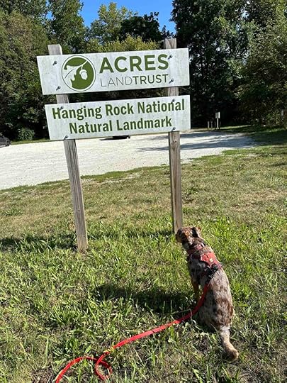
Hanging Rock National Natural Landmark
After a busy week of not getting out in the woods, we started this week with an adventure to Lagro, IN and the Hanging Rock National Natural Landmark. It was great to be back on the trails and we enjoyed exploring this amazing landmark.
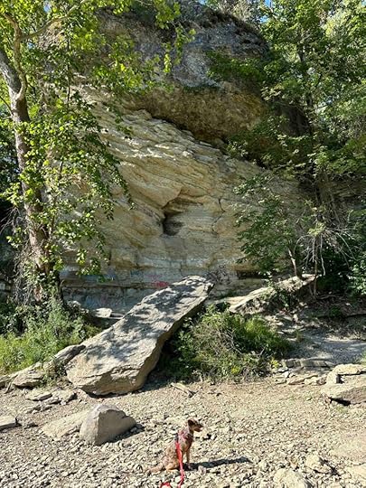
Hanging Rock is situated on the bank of the Wabash River. It contains a portion of Silurian coral reef and was formed when Indiana was covered by a shallow sea. When the river undercut the rock, the top of the rock was left overhanging its base giving the preserve its name.
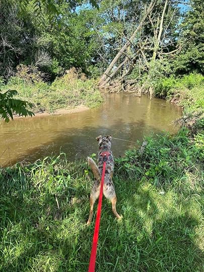
Our AdventureAfter parking the car we saw a path to the right and a deck with benches in front of us. We walked to the deck and once Sunny saw the Wabash River in front of us she wanted to get down to it. We took a path from the deck that ran along the river and found a spot to get down to the water, which Sunny enjoyed.
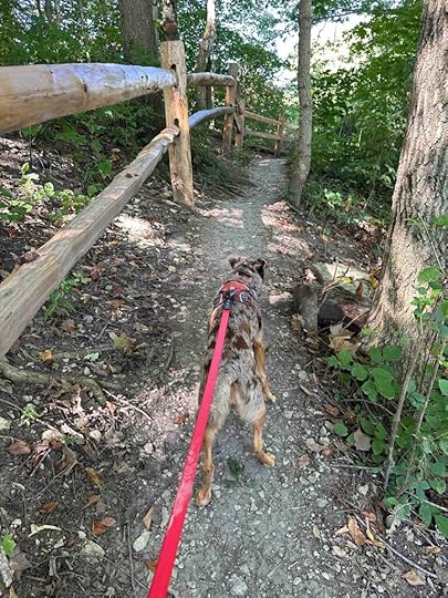
After that we continued following the path to the rock. The total distance wasn’t even a quarter mile. The path is narrow with sharp descents so it is not recommended for those who are unstable on their feet or who have a rambunctious dog that might pull them down. Luckily I was able to convince Sunny to go “slow slow”.
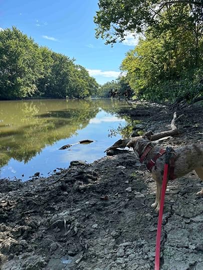
We found our way up to the rock and then walked down to the river bank again. This gave us a nice view of the rock which is pretty impressive. After exploring for a bit we took a different path back to the car. We found out this was the path we had noticed that was on the right after parking the car.
Although this is a short hike it is worth seeing. Sunny wasn’t so sure since we spent over an hour driving and only hiked a short distance. She was not thrilled about getting back in the car, but we drove to Kokiwanee Nature Preserve which is barely 2 miles away and well worth the visit. Check out our review from our visit to Kokiwanee in 2023.
Sunny’s PerspectiveThis place was pretty cool because we could get down to the water. I wanted to go fast on the trail, but Andie made me slow down because she didn’t want to fall. I guess that made sense, but I hate to go slow. Putting my feet in the river was fun, but I couldn’t believe it was such a short hike and I was not ready to get back in the car when we were done. Thankfully Andie took me to Kokiwanee Natural Preserve where we hiked for 3M and had a picnic lunch. That more than made up for the short hike at the Hanging Rock National Natural Landmark.
Our RatingSunny and I give Hanging Rock National Natural Landmark 3 out of 4 paws up. It’s a beautiful spot, but it’s a short hike and can be a bit of a challenge to get to the rock. Despite that we recommend this preserve especially if you visit other locations in the area like we did.
How Do I Get There?The address for the landmark is 4552 E. Hanging Rock Road in Lagro, Indiana. From I-69 take exit #296B-Lafayette Center Road and follow for 2 miles where it turns into E 900 N. After nearly 2 more miles turn left onto US 24W. After 20 miles turn left onto N 500 E and continue for .6M. Then turn right onto E. Blue Star Highway. After 1.6M turn left onto Davis Street and follow for nearly a mile then turn left onto Hanging Rock Road. After nearly a mile look for the Acres Land Trust sign on the left.
For more information about Hanging Rock National Natural Landmark check out the Acres Land Trust website.
Acres Land Trust – Hanging Rock
The post Hanging Rock National Natural Landmark appeared first on Live Like Karlie.
July 30, 2024
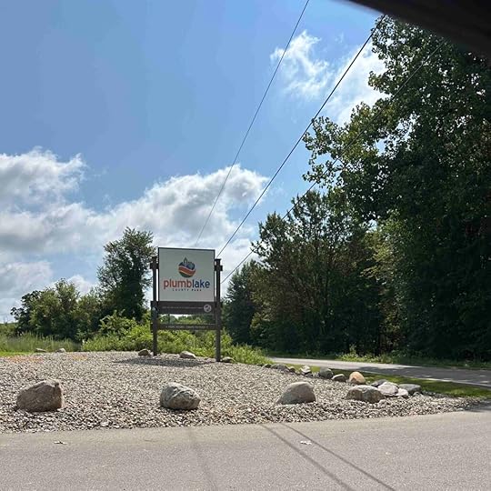
Plumb Lake County Park
With several days of rain in the forecast we got out on the trails this morning. We drove to Sturgis, Michigan to check out the Plumb Lake County Park. It’s a nice park with trails in the woods and in the prairie. We spent most of our time in the woods since it was a warm and sunny day.
Our AdventureUpon entering the park you have the option to drive to the right or left with both providing access to trails. We opted to go to the left and park near the restroom and picnic gazebo. As soon as we parked I noticed a sign indicating a $5 entry fee for non-residents. After paying and placing the registration on our dashboard we found the trail to the right of the picnic gazebo and playground. After a short distance on the mowed grass trail we entered the woods.
The wooded trail started with a small descent to a boardwalk over a marshy wetland. At the end you have the option of a trail to the right or left. We took the trail to the right and every time we had a choice to make we took the trail to the right. We often do that and find it keeps us from getting lost and sometimes takes us back to the entrance.
The trail took us further and further into the woods. Our view was mainly trees and brush. We did not find any bodies of water, although it appears that the other section of the park has trails near Plumb Lake. Our trail wound around and eventually we walked back across a boardwalk. This one led to a bridge and then back in the woods. Eventually the trail led back to the field where we could see the picnic gazebo in the distance. We followed the grass trail and since we had only walked about a mile we re-entered the woods to take the trail to the left after the first boardwalk.
That trail was similar to the first trail except it had more uphill and downhill sections. Again we took the trail to the right whenever there was a choice to make and eventually crossed the boardwalk and made our way back to the field, the grass trail, and the car. The total distance we walked was just over 2 miles. Normally we like to hike further, but it was a warm and humid day so we decided that was long enough to be in the woods.
 Sunny’s Perspective
This was a fun hike in the woods with some uphills and downhills. There was even a spot where I had to jump over a tree limb that was over the trail. I loved that! I smelled a lot of good things, but didn’t see any critters. I’m still looking for a beaver after I recently saw three on one of our hikes. The boardwalks were pretty fun to walk across. I was happy that the boards were close together so my paws didn’t fall in the cracks. It was hot when we got to the grass trail so I was glad we didn’t walk around that area too much. This was a pretty fun place, but it was kind of a long drive to get here.
 Our Rating
Sunny and I give Plumb Lake County Park 3 out of 4 paws up. We liked that the park has great parking, a restroom and picnic tables at the start, and somewhat challenging trails in the woods. The scenery is nice, but nothing special. It is also a little buggy so we were happy that we used bug spray. This trail would not be good for someone with mobility issues. The trail is fairly narrow, windy, and is a typical dirt trail in the woods with roots and rocky sections.
How Do I Get There?The address for the park is 29000 – 29500 E. Lafayette Road, Sturgis, Michigan. The route from Northern Indiana to Plumb Lake County Park has you travel on 69N and take exit #348 toward LaGrange. Take US-20W for about 12 miles and then turn right onto IN-3N. Follow that for 6 miles and turn left onto IN-120W. After a mile turn right onto N 475 E and follow that for 2.5 miles before turning left onto County Road 800N. Follow that for almost a mile until it turns into Carls Road. Continue for almost 3 miles then turn left onto US 12W. After a mile turn right onto Plumb School Road and then turn left onto E. Lafayette Road. Look for the Plumb Lake County Park sign and turn right. Follow the road to the fork in the road. We took the road to the left, but there are also trails to the right, which we did not investigate. Park and pay the $5 entry fee at the sign.
For more information about Plumb Lake County Park check out this website.
The post Plumb Lake County Park appeared first on Live Like Karlie.
July 27, 2024
Oak Openings Preserve
Another beautiful day so we took a road tip to Ohio to visit Oak Openings Preserve. The preserve consists of 5000 acres and has two campgrounds, over 70 miles of trails (bike, horse, and hiking), shelters, a playground, a lodge, a caretakers cottage, and much more. Although it took nearly 1.5 hours to get there, it was well worth the trip and one we plan to make again to check out more of the trails.
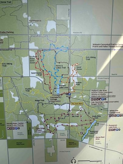
Our AdventureThere are several different areas to access the Oak Openings Preserve. We parked near the Oak Openings Preserve Metropark Lodge and walked toward the information kiosk. This kiosk has a map of the entire preserve and the trails. We took a quick look at the map and then headed off on the brown trail, which is an asphalt bike trail.
We planned to explore the sand dunes, but found it a little confusing to figure out how to get to that trail. Despite that we had a wonderful time exploring and hiked for nearly 4.5 miles. We followed the bike trail for almost a mile and then decided to head into the woods. We spent time on the blue, black, and yellow trails. I’m sure I could not retrace our steps, but we followed and crossed the creek several times, found the land of ferns, and enjoyed being in the middle of the beautiful oak trees.
After a couple miles we decided it was time to turn around and head back to the car. We retraced our steps and found the bike trail which led to the car. Once we arrived at the car we had a picnic lunch on the grass. All in all a lovely way to spend the morning.
Sunny’s PerspectiveIt was a really long drive to get to this place, but once we got out of the car it was super fun. The smells were fantastic even on the bike trail. But once we entered the woods, I was in heaven! The trail is pretty narrow and I smelled horses, birds, squirrels, and all sorts of critters. The bike trail was fun too because there were quite a few bikes and people. I like this place and hope we come back again.
Our RatingSunny and I rate Oak Openings Preserve 3.5 out of 4 paws up. The only downside is we found the trail map a little hard to understand so we didn’t get to the trails we wanted. Despite that we had a great time exploring the trails we did. The trails were well marked, too. There are several parking areas and the place we parked had a lodge with restrooms. We would recommend using bug spray as there are quite a few mosquitoes on the trails in the woods.
 How Do I Get There?
We used 5230 Wilkens Road as the destination, but there are other areas to park. We recommend looking at the MetroParks Toledo website (link below) to determine the trails you want to visit and select the best parking area. Then let your GPS guide you on the best route.
Want more information about Oak Openings Preserve? Check out this website.
The post Oak Openings Preserve appeared first on Live Like Karlie.
July 21, 2024
Lillian Anderson Arboretum
Another beautiful day means another adventure. This time we found ourselves in Kalamazoo, Michigan to hike in the woods at the Lillian Anderson Arboretum. Although it was nearly a two hour drive for us, it was well worth the trip and we highly recommend it.
About Lillian AndersonAfter our visit my first question was who is or was Lillian Anderson and why did someone create this arboretum in her name? A quick look at the website provides the answer. Her grandfather, Duncan, was one of the first pioneers of Oshtemo Township. He owned some land near the arboretum property and farmed it until his death in 1935. His son, Edward, purchased his own land, which is now the arboretum property, and farmed it with his wife, Mary Elizabeth and daughter, Lillian. They continued to live on and farm the land with Lillian rejoining them after college.
Even after her parent’s passed, Lillian continued to live at the family homestead until the mid 1970’s while working at the Kalamazoo Public Library. In 1982 she donated the arboretum land to Kalamazoo College and the First Presbyterian Church. And in 1998 the college obtained ownership of all the land with her approval and established the Lillian Anderson Arboretum. Lillian passed in 2001 leaving this beautiful property as a tribute to her family.
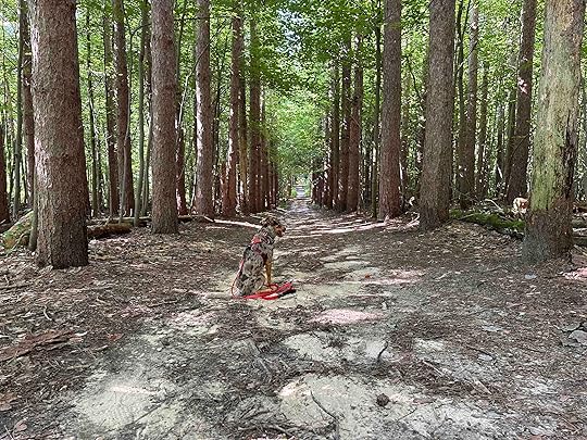
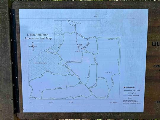
Our Adventure to Lillian Anderson ArboretumOnce we entered the trail we came upon a sign with a map of the arboretum. I took a picture of it and although the trails are marked well, I referenced it a few times to determine which trails to explore. I don’t know who named the trails, but they certainly chose names the described what was on each trail. They also had a sense of humor. The trails we explored, in order, were the Pavilion Road, Pine Connector, Magnificent Pines, Batts Pond, Gathje Hill, Marsh Woods, Bernie’s Landing, Poweline, Not so Magnificent Pines, Monarch Way, Meadow Run, and Pavilion Road toward the parking lot.
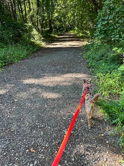
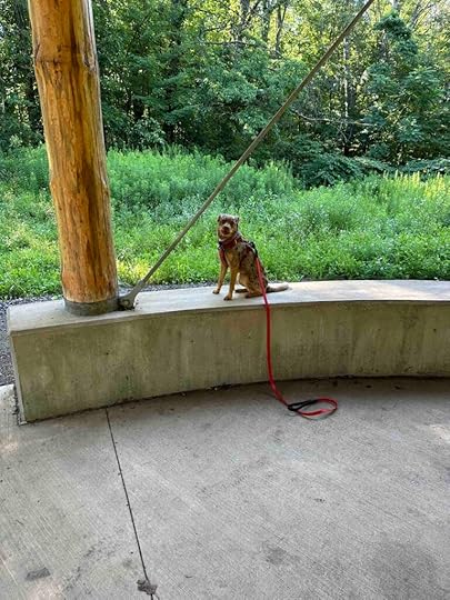
After reviewing the map we started our adventure by taking the trail in front of us. After a short distance of hiking in the woods we came to an opening and the Batts Pavilion. The pavilion does not have any picnic benches, but does have cement blocks for seating. After a quick rest, a.k.a photo opportunity, and look around we took the trail on the left side of the pavilion which led to the Magnificent Pine Yrail. This trail was aptly named as the pines in this area are truly magnificent.
We continued through the pine forest enjoying the beautiful and oh so tall trees. At the end we came to the Powerline Trail which is a trail through a grassy area with the power lines running through it. At this point we turned around and followed the Magnificent Pine Trail until we came to the Batts Pond Trail. Although there were pine trees in this area, they were not nearly as magnificent as the ones on the previous trail. We eventually came to a section that gave a view of the pond on the left side. The pond was quite still and covered with green so I was glad that we could not get any closer to it. A section of the trail appeared to lead to a bridge across it, but we opted not to take this route. Instead we continued until the trail crossed the Power Line Trail and led to the Gathje Hill Trail.
The start of the Gathje Hill Trail was similar to the other trails and after a shot distance turned into the Marsh Woods Trail. This seemed to be the most popular trail as we encountered several other hikers. The trail followed the marsh and although we were much closer to the marsh than the pond, Sunny still could not get her feet wet. She enjoyed looking at the water while contemplating how to get down to it. The Marsh Woods trail wound through the woods and then we came to Bernie’s Landing Trail on the left. After a short distance this led to the Power Line Trail. We took a right onto the Power Line Trail and then got on the Not So Magnificent Pines Trail.
We continued through the Not So Magnificent Pines, which are lovely, but not as magnificent as the others. When we came to the Pine Connector Trail we continued to the left and found the Monarch Way and then Meadow Run trails. These led back to the Pavilion Road and the car. It was a rather windy hike on a variety of trails, but we covered a large portion of the arboretum. Although we did not hike on every trail, we saw a large portion of the arboretum. Our total distance was just under 3M.
 Sunny’s Perspective
Okay, so this place is fantastic. It was mostly in the woods and the smells were fantastic. I loved seeing the pond and marsh, but really wanted to get down to them. No such luck. That didn’t damper my spirits. This place so many different areas to explore – the woods, marsh, pond, and a field. My favorite was probably the trail along the marsh because it overlooked the water and we ran into several other people and dogs. I love people and dogs! This really was a fun place to visit. It’s a kinda long trip to get here, but it really is fun and I hope we go back.
Our RatingSunny and I rate the Lillian Anderson Arboretum 3.5 out of 4 paws up. It’s truly a treasure and a wonderful place to visit. It has all the things we love – miles of trails that with some that are a little more challenging, good trail markers so you don’t get lost, beautiful views of trees and water, areas to rest and enjoy the scenery, and good parking. The only thing we did not find was a restroom and there was no way to get down to the water. The water was a little green and murky so I would not have let Sunny put her toes in it even if we could get down to it.
How Do I Get There?The hardest part of getting to Lillian Anderson Arboretum is the entrance is somewhat hidden with the sign not visible from the road. Other than that it’s fairly straight forward. The address is 7787 W. Main Street, Kalamazoo, MI. From I-94 take exit 74B to US-131 N toward Grand Rapids. After nearly five miles take exit 38B to M-43 W toward South Haven. After about .3M look for an asphalt driveway surrounded by trees on the left. This is the entrance. You will not see the sign until you drive into the driveway. Continue on the right and you will find the parking lot. The entrance to the trails is just off the parking lot and there is a trail map at the start.
Want more information? Check out the Lillian Anderson Arboretum website.
The post Lillian Anderson Arboretum appeared first on Live Like Karlie.
July 17, 2024
Pumpkinvine Trail
After a few days of morning rain and evening thunderstorms I decided it would be best to find an asphalt trail. I had heard about the Pumpkinvine Trail and thought it would be perfect for an adventure. We tried to visit the trail a few days ago, but I had no luck finding parking. This time I knew exactly where to park and we still ended up at a slightly different parking spot. The funny thing is it actually turned out to be better than the planned one.
I have a tendency to not look closely at my GPS and sometimes it takes me someplace slightly different than planned. And one time it took me to a trail of the same name, but nearly an hour away from the planned one. It doesn’t matter to Sunny and me because we get to explore new and different places. That is what happened today; we ended up at Abshire Prairie not Abshire Park for the start of our hike. It actually turned out that we liked that better than the park since we were able to explore the Abshire Park Trail.
Our AdventureAfter parking the car we walked onto a packed gravel trail that lead through the prairie and along Rock Run Creek. This trail was not shaded at all so it made for a warm walk, especially on the return to the car. On the left we caught glimpses of the creek and Sunny kept trying to figure out a way to get down to it. As we continued on the trail we saw the path entered the woods. We crossed over a bridge and after a short distance came to the start of the Pumpkinvine Trail.
At first we started to take the trail to the left toward Goshen and Elkhart, but then decided to go to the right toward Middlebury and Shipshewana. At this point the trail is asphalt and fairly shaded. As we followed the trail we came to Abshire Park. There’s quite a bit of parking and a restroom. There are also park benches and a lovely flower display.
After exploring the park we continued on the trail which crossed Lincoln Street. We were only able to go a short distance further as a storm had caused debris on the trail and the parks and recreation department blocked off the trail while they used chainsaws to clean up the debris.
After retracing our steps to the start of the trail we decided to explore the section toward Goshen and Elkhart. This was not as scenic and had a metal fence on the left side. It also follows the Rock Run Creek, which provides for some nice views. We only continued for a short distance before turning around since it was getting warm and Sunny was getting tired. Our total hike was just over 3M, but if you go from one end of the trail to the other you can bike/run/hike for nearly 17 miles
 Sunny’s Perspective of Pumpkinvine Trail
You know I prefer trails in the woods, but this Pumpkinvine Trail was pretty cool. I think my favorite part was the trail leading up to the Pumpkinvine Trail. I saw not one, not two, but three beavers on this trail. And I could smell them long before I saw them. That was really exciting. Sadly I was not allowed to get close to the beavers despite my best efforts.
I also liked being able to look at the water. Again I was not allowed to climb down the cliff and get in the water, but it was fun to watch it from above. I was really glad when the trail got a little more shady because although we went fairly early it was pretty humid and starting to warm up by the time we left. Thank goodness Andie always brings water for me. All in all I thought this was a great trail for a bike trail kinda trail.
Our RatingSunny and I rate the Pumpkinvine Trail 3 out of 4 paws up. It’s a nice trail that is good no matter your mobility. It’s wide giving bikes and other people plenty of room to pass. There is also a lot of grass on the side so it’s easy to step off the trail and give people additional room. We especially liked the views of the woods and the creek. This is a great place for a bike ride, run, or hike. The added bonus is Abshire Park that has both restrooms and benches so you can stop for a rest or even a picnic. We recommend the Pumpkinvie Trail if you live near Goshen or if you are looking for a trail that won’t be muddy.
How Do I Get There?There are two different areas to park to access the trail in Goshen, IN; Abshire Park or Abshire Prairie. Abshire Park is located at 1302 E. Lincoln Avenue and Abshire Prairie is located at 1711 E. Monroe St. We parked at Abshire Prairie so these directions are to that location.
Take US6W through Ligionier and then turn right onto US33W. Follow that for nearly 12 miles and then turn right onto Monroe Street. After about half a mile look for a driveway on the left. The sign is on the left down the driveway near the grass and easy to miss. If you pass the Elkhart County 4H Fairgrounds you’ve missed it. If you miss the Prairie and decide to go to Abshire Park instead, continue on Monroe Street for another nearly half mile, then turn left onto Blackport Drive. Continue for .7M, then turn left onto Lincoln Avenue. After less than half a mile you will see the entrance to the park on the left.
Want more information about the Pumpkinvine Trail? Check out this website.
The post Pumpkinvine Trail appeared first on Live Like Karlie.