
Andie LaComb's Blog, page 5
May 1, 2024
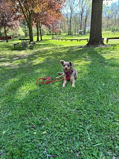
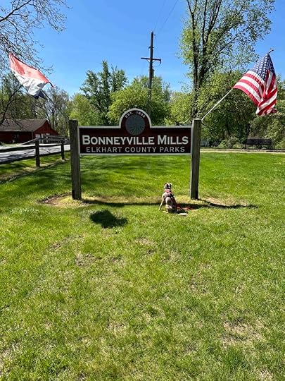
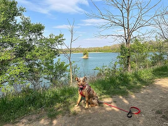
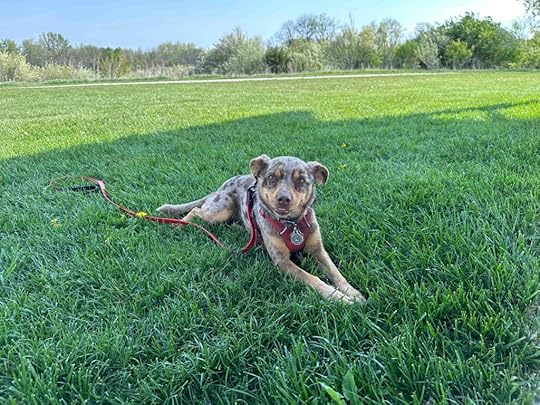
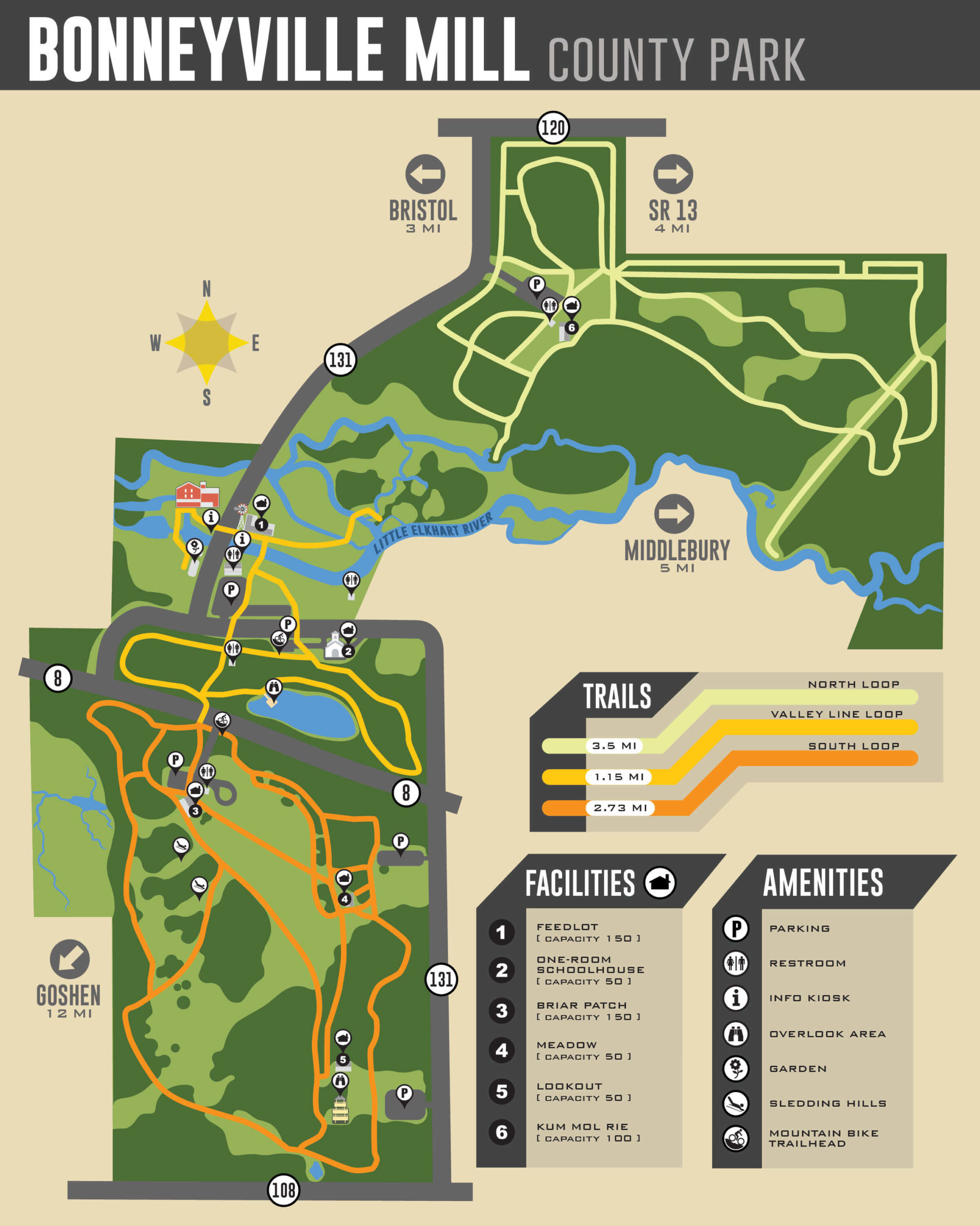
Bonneyville Mill County Park
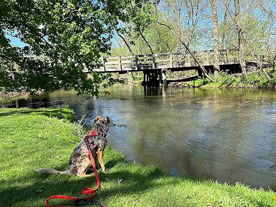
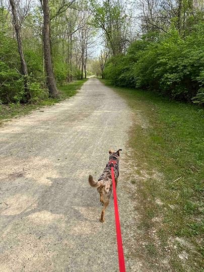
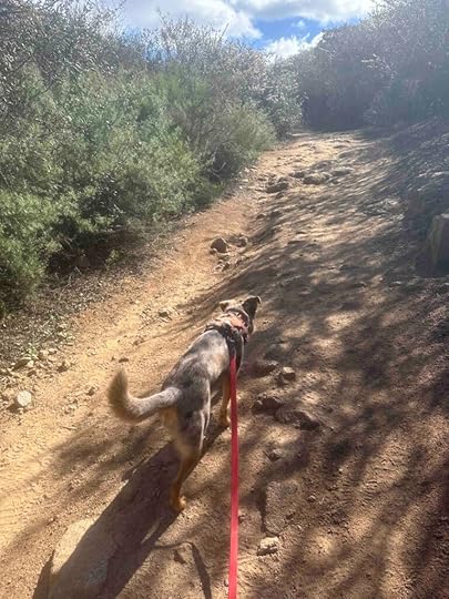
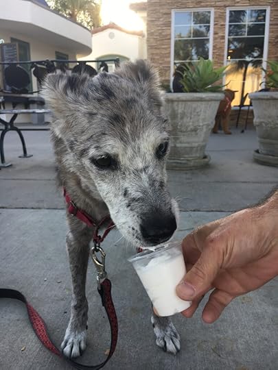
I picked up the brochure for the Bonneyville Mill County Park the last time we visited Elkhart County, Indiana and today we finally visited it. I am so glad that we did. What we found was a beautiful park with some historic buildings, trails in the woods and along the Little Elkhart River, and several areas to picnic. This park is well worth the drive and a spot we’ll visit again.
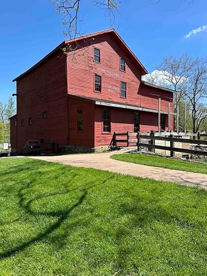
History of the MillIn the 1830’s Edward Bonney envisioned a city centered around a saw and grist mill on the Little Elkhart River. He selected the location for its proximity to the Toledo/Chicago trail and the St. Joseph River and built a mill with a horizontal water wheel. Unfortunately the railroads bypassed the area and the proposed canal system was not developed. This ended Bonney’s dream of an urban hub so he sold the grist mill.
Despite the sale, the mill continued to operate and provide local farmers and merchants with flour. Then during the Depression the mill owners formed the Bonneyville Power and Electric Company. They supplied hydroelectric power to about 45 customers. They continued to provide livestock feed, custom grinding, and the “Famous Buckwheat Pancake Flour” into the early 50’s. The mill was sold in 1968 and presented to the Elkhart County Park and Recreation board in 1969. Today the mill continues to grind corn, wheat, rye, and buckwheat from mid-April through mid-November.
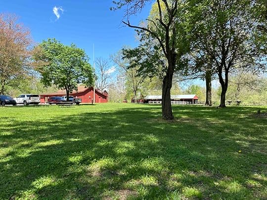
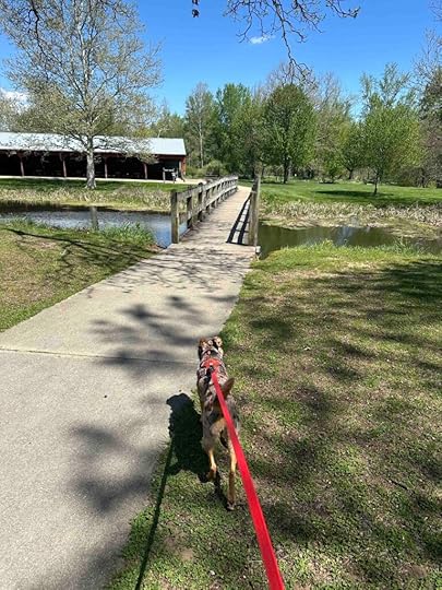
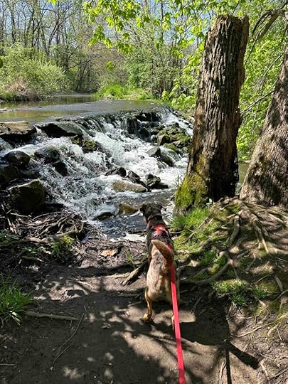
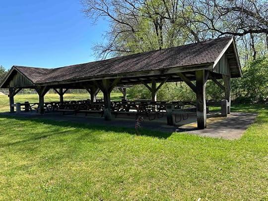
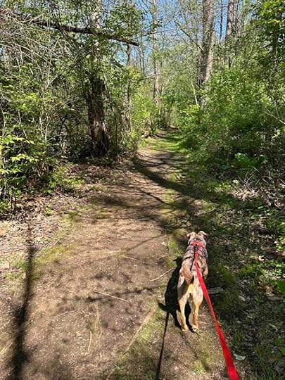
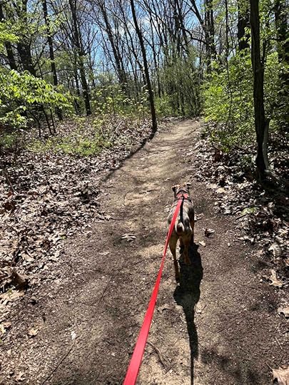
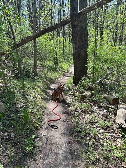
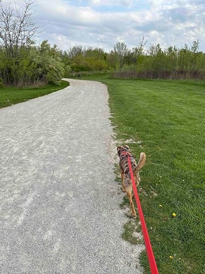
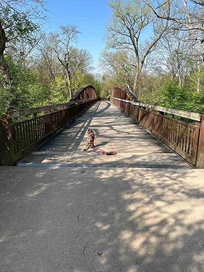
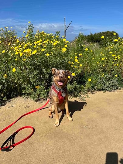
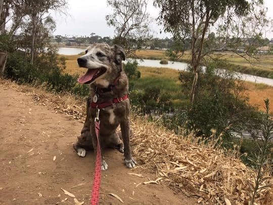
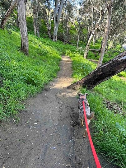
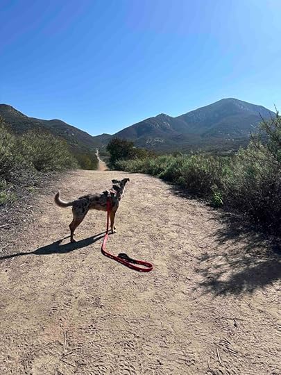
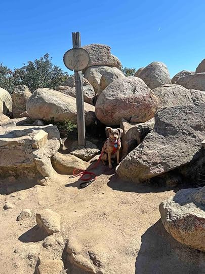
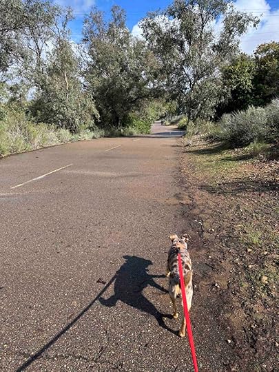
Our AdventureAfter parking the car we noticed two red buildings in the distance. As we approached we found the first one was the restrooms which were much needed after our 75 minute drive. Then we started to walk toward the second building which was the Feedlot, a shelter with picnic tables. As we walked along the sidewalk we noticed a large field to our right and heard running water that Sunny was very interested in investigating. We found a small waterfall and another bridge. After a photo of Sunny by the waterfall we walked over the bridge and found some dirt and grass trails in the woods. These were a little muddy since we recently had rain, but nothing too difficult to walk around.
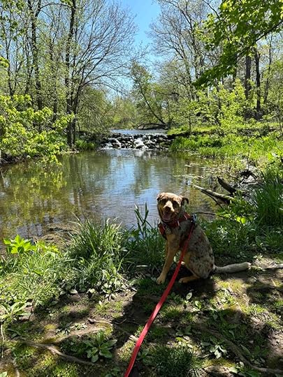
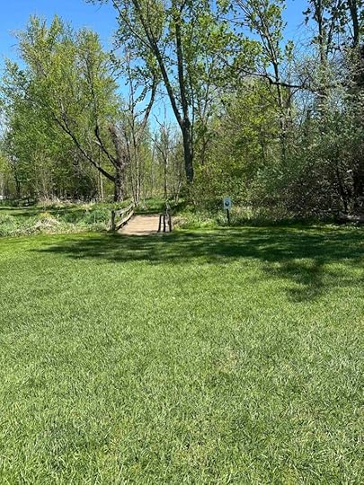
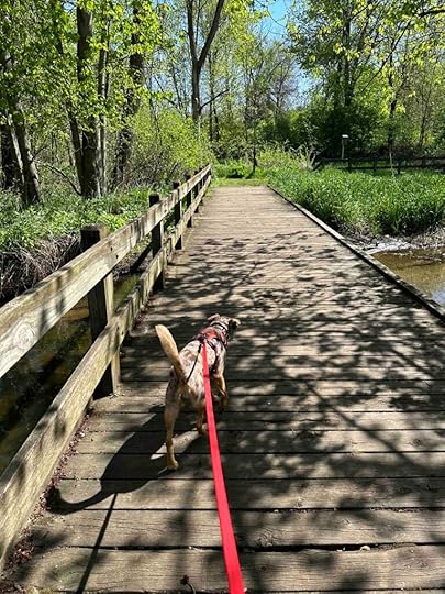
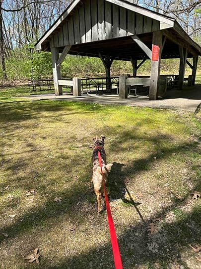
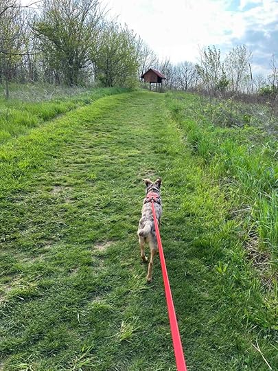
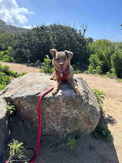
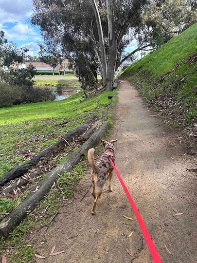
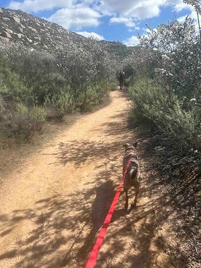
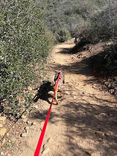
The trails travel through the woodlands and marshes and follow the Little Elkhart River. As we walked we found another small waterfall and several areas that overlooked the water. As we continued we approached a sign directing us to the Kum Mol Rie Shelter. We followed the grass trail which led to a large field and the picnic shelter. To the left of the shelter were more grass trails. These trails make up the North Loop and wind around for 3.5M. These trails are relatively easy, but would be not be appropriate for those needing mobility devices.

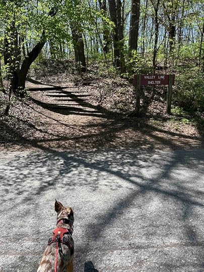
After exploring the North Loop trails we retraced our steps to the first waterfall and walked across the field behind the feedlot to the mill. The trail near the mill is short, but provides a nice view of the mill and the river. After exploring that we crossed back over the road to the large picnic area adjacent to the parking lot. We rested under the shade trees and looked at the brochure trying to find the other trails. As I was looking around I noticed a sign across the street for the Valley Line Shelter.
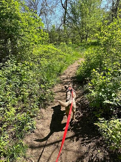
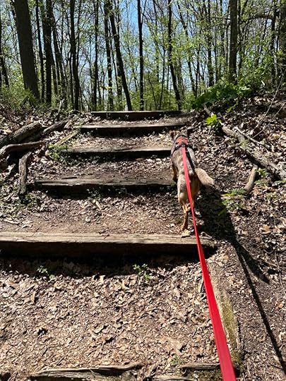
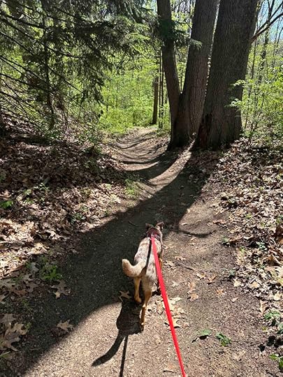
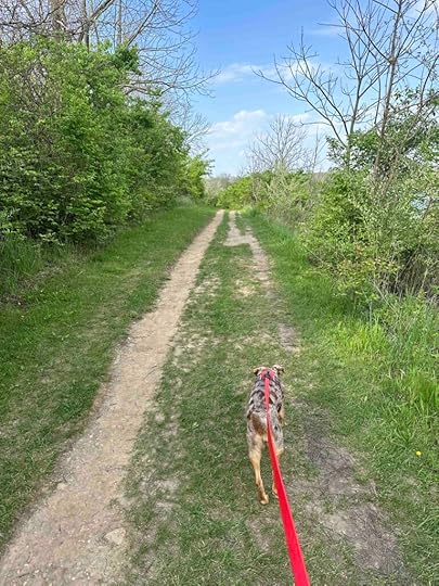
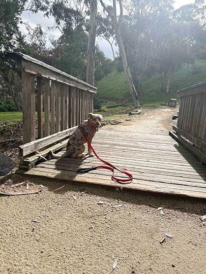
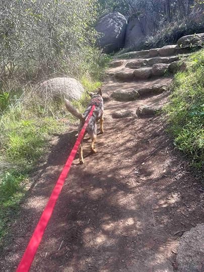
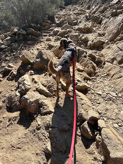
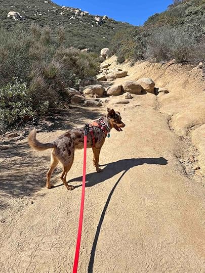
We decided to cross the road and see if these were the other trails…and they were! We climbed the stairs to the shelter and then found dirt trails in the woods. Although there are many intersecting trails, they are short and wind back to the start making it difficult to get lost. After walking along the Valley Line Loop, which consists of just over a mile of trails, we found a sign for the mountain bike trails. These comprise the South Loop trails and traverse for nearly 3 miles.
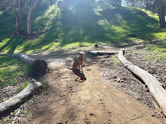
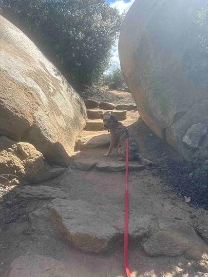
The mountain bike trails are narrow dirt trails that wind throughout the woods. They have some inclines and some exposed roots making these the most challenging of all the trails. Despite that I would mostly rate them as easy with some moderate sections. These would not be appropriate for those with stability or mobility issues. We managed to hike for nearly 4M, but if you did every trail you could hike about 7M.
 Our Rating
Sunny and I thoroughly enjoyed our visit to Bonneyville Mill County Park and rate it 3.5 out of 4 paws up. The only reason we did not rate it 4 paws up is the trails are not all that challenging. Despite that this park really does have it all – wonderful trails in the woods, a river with small waterfalls, picnic areas, and some history. There is also plenty of parking and a restroom.
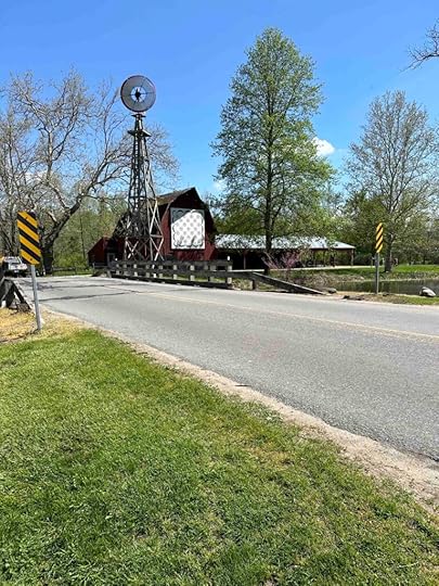
How Do I Get There?From IN-120 turn south onto CR-131 and continue for half a mile. You will pass the mill on the right with a Bonneyville Mills sign and come to an intersection. Turn left to stay on CR-131 and a short distance later turn left into the gravel parking lot.
For more information about Bonneyville Mill County Park, check out the Elkhart County Parks website.
The post Bonneyville Mill County Park appeared first on Live Like Karlie.


April 29, 2024
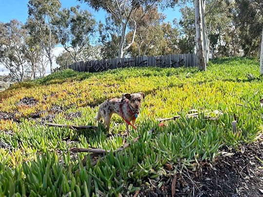
Prairie Oaks Metro Park
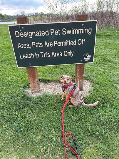
We recently took a road trip to Hillard, OH, just outside Columbus, OH and found the best spot for a hike, Prairie Oaks Metro Park. The park consists of 2291 acres with nearly 500 acres of prairies and grasslands, several deep lakes for fishing and boating, Big Darby Creek, and more than 10 miles of trails. The best part for Sunny and the reason I selected this park, was the off-leash dog beach along one of the lakes.
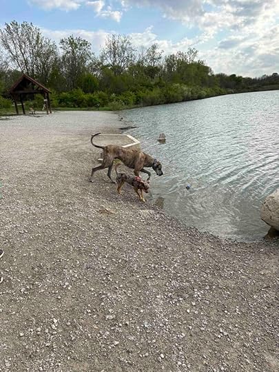
After parking at the Darby Bend Lakes parking lot we started walking west on the Darby Creek Trail. The trail is packed gravel and winds throughout the park. This section traversed between two lakes and toward the dog beach. We continued walking until we came across the sign indicating the off-leash dog beach. As we left the trail and walked past the sign we saw the beach along the lake and a Great Dane in the water. This was Zane, the Great Dane, who was a gentle giant. Sunny thought he was the biggest dog she had ever seen and had great fun playing with him. A short time later a yellow Labrador named Deuce came running from the trail and straight into the water. The three dogs played and explored the shore and grass. After playing for awhile we headed off to explore the trails.
We continued on the Darby Creek Trail and followed it through the woods to its end on Beach Road. Then we turned around and re-traced our steps until we came across the Mound Trail on the left close to the dog beach. This trail is grass and leads up a hill. It overlooks the lake and eventually turns into a dirt trail that leads back to the Darby Creek Trail. We continued on the trail which led to another lake and Big Darby Creek. We walked onto the bridge that goes over the creek to get a view of the creek and then continued on the Darby Creek Trail. Eventually we found our way back to the grass field adjacent to the parking lot. We hiked just over 3M, but there are many other trails so longer hikes are possible.
 Our Rating
Sunny and I rate Prairie Oaks Metro Park 4 paws up. This spot has everything – trails to hike, picnic areas, great parking with a restroom, and an off-leash dog beach. You can hike for miles, fish, kayak, and picnic. The trails are packed gravel, grass, and dirt. They are well marked with the name of the trail and trail maps. The trails we explored were relatively flat with views of the lakes and creek. The dog beach isn’t huge, but has plenty of room for the dogs to run, play in the water, and explore the shore. There is also a picnic area to sit and relax. All in all, this park is a perfect place to spend several hours hiking, picnicking, and playing in the water.
How Do I Get There?There are 5 different entrances to the park – Beaver Lake – 8921 Lucas Road, Darby Creek Boat Ramp – 4275 Amity Road, Darby Bend Lakes – 2755 Amity Road, Prairie Oaks Main Entrance – 3225 Plain City-Georgesville Road, and Sycamore Plains Area – 2009 Amity Road. We parked at the Darby Bend Lakes entrance since that is the closest one to the dog beach. From Scoiti Darby Creek Road turn onto Amity Road. Follow for 2.6M then turn right onto Darby Bend Lakes Park and follow it into the parking lot.
For more information about Prairie Oaks Metro Park check out their website.
The post Prairie Oaks Metro Park appeared first on Live Like Karlie.
March 25, 2024
Sunset Cliffs Natural Park
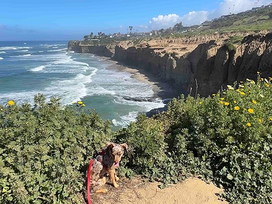
We love the ocean and have several favorite spots to run on the beach in San Diego. We also have several favorite spots for viewing the ocean. One of those is Sunset Cliffs Natural Park as it is one of the most stunning places to view the ocean. The fun part of it is there are actually two different sections which provide two entirely different experiences. And despite living in San Diego full time for nearly 7 years and part time for over 3 years, we just found out about one of the sections today!
Normally we visit the linear 18-acre area along Sunset Cliffs Blvd between Adair and Ladera Streets. You can park in one of the lots along Sunset Cliffs Blvd or along the road. The “trail” is a hard packed dirt path along Sunset Cliffs Blvd. that overlooks the ocean. Although the views are stunning you are essentially walking along a busy road. Despite that it’s well worth the visit.
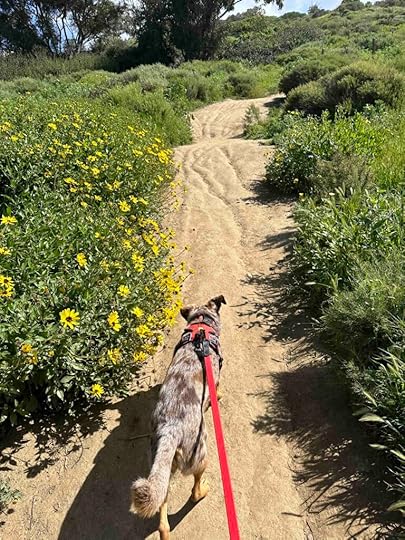
Today we let our GPS lead us to the park and it took us to an entirely different area that we knew nothing about. We drove through Point Loma Nazarene University and found a parking lot on the right-hand side. From there we found two entrances to the trails leading through a 50-acre hillside.
The trail is packed dirt with vegetation on either side and a stunning view of the ocean in front of you. The trail leads down the hill from the parking lot to other trails that wind around the hillside and cliffs. We found several areas to overlook the cliffs and down on the ocean. It was a little nerve-wracking to be that close to the edge and see the ocean so far below. Despite that we had a peaceful and wonderful hike along the trails. This is a much quieter and less busy way to enjoy the views than the section along Sunset Cliffs Blvd.
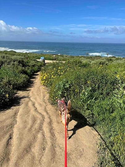
We only walked about 1.6M, but spent an hour wandering around and enjoying the views. A much longer hike could be done if you include both sections of the park. In addition to hiking the trails there are many areas to sit, relax, and enjoy the view.
 Our Rating
Sunny and I rate Sunset Cliffs Natural Park hillside 4 out of 4 paws up. The views are stunning, the trails are well maintained, and parking is great. Sunny also likes that there are quite a few bunnies and lizards which are fun to chase. It’s also fairly quiet, at least on a weekday morning making it a wonderful place to hike and even picnic.
How Do I Get There?Follow Catalina Blvd in Point Loma to Lomaland Dr. Take a right onto Lomaland Dr. and follow it through the entrance of Point Loma Nazarene University. The road winds around through the campus. Look for the parking lot on the right-hand side. There are two entrances to the trails from the parking lot and they are well-marked.
The post Sunset Cliffs Natural Park appeared first on Live Like Karlie.
March 4, 2024
Hosp Grove
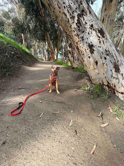
Karlie and I hiked so many different places in Southern California and one that we really enjoyed was Hosp Grove Park in Carlsbad. We loved being among the beautiful eucalyptus trees and the moderate inclines of the trails. Also we enjoyed that the trails are mostly shady which was especially helpful when Karlie was dealing with GOLPP-related breathing issues. We visited this trail several times and the last time was with my husband shortly after Karlie received her wings. Today I decided it was time to introduce Sunny to Hosp Grove Park and the trails. And while we hiked it felt like Karlie was walking the trails with us since it reminded me so much of all our visits.
 History Of Hosp Grove Park
Hosp Grove was created in 1908 when Hosp Eucalyptus Corp, an investment group, planted 219 acres of eucalyptus trees. They wanted to harvest the trees and sell the wood to the Santa Fe Railroad for railroad ties. Unfortunately this didn’t work out because eucalyptus trees are brittle and crack easily. So over time parts of the grove were sold and developed. Then, in 1986, the City of Carlsbad purchased the remaining 53 acres and created the park. The park is divided into two sections, the East Grove and the West Grove. The West Grove has trails, a playground, and a picnic area. The East Grove has trails and a picnic area. The trails in the West Grove are easier to follow, but neither is so expansive that you are likely to get lost. We’ve hiked both sections, but today we stayed in the West Grove.
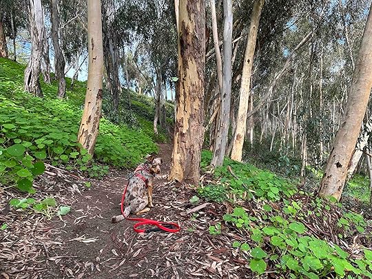
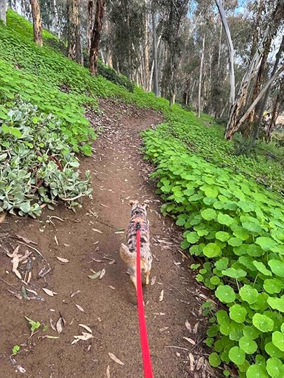
The TrailsThe trails in the West Grove follow and overlook Jefferson and Monroe Streets. They are hard packed dirt which can become muddy if it has rained recently. The trail starts by walking over a wood platform and then a bridge before coming to an option to go to the right or left. Both trails lead to a moderate uphill climb, but nothing too strenuous or challenging. When on the trails you can hear some road noise since both Jefferson and Monroe Streets are pretty busy. Despite that it is a tranquil hike because you are surrounded by eucalyptus trees. Hiking here reminds me of many of our hikes in Indiana because you feel like you are in a forest with all the trees.
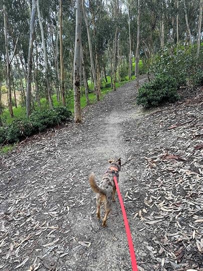
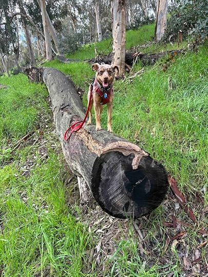
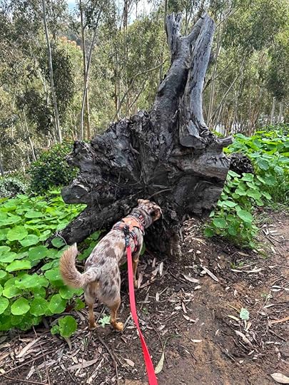
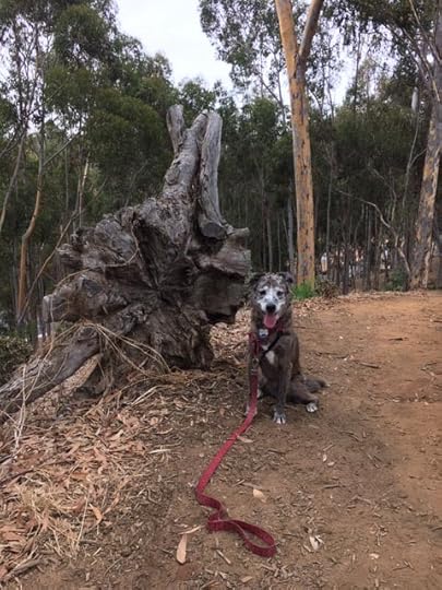
Today we hiked all the trails in the West Grove. Sunny enjoyed finding downed logs to sit on. We even found an uprooted tree which was also a photo opportunity with Karlie. I have so many memories of hiking with Karlie along these trails and it was fun to make new memories with Sunny today.
 Our Rating
Karlie, Sunny, and I rate Hosp Grove 3 out of 4 paws up. It’s a beautiful place for a hike despite being in the middle of a busy area. The trails are scenic and you can hike at least 2M in the West Grove with the opportunity for additional mileage in the East Grove. We have always found this to be a peaceful place for a hike and never encountered too many people on the trails. I imagine on the weekends it is busier, but during the week it’s a lovely place for a hike.
How Do I Get There?To find the West Grove of Hosp Park use Hosp Grove Playground as your destination. From I-5 take exit #51A – Las Flores Drive. After about .2M turn right onto Jefferson Street. The entrance to the park is on the right in less than a mile, just look for the Hosp Grove Park sign.
The post Hosp Grove appeared first on Live Like Karlie.
March 3, 2024
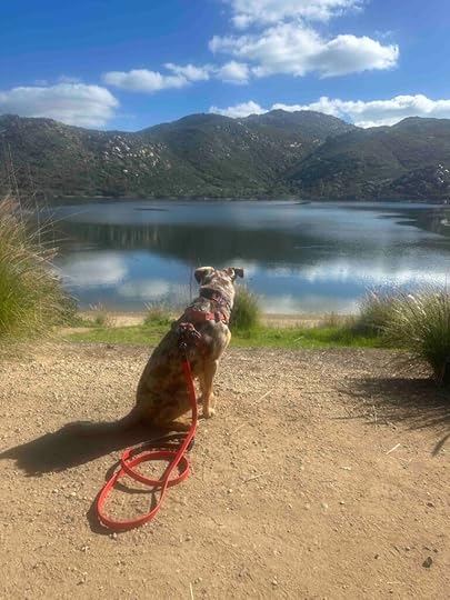
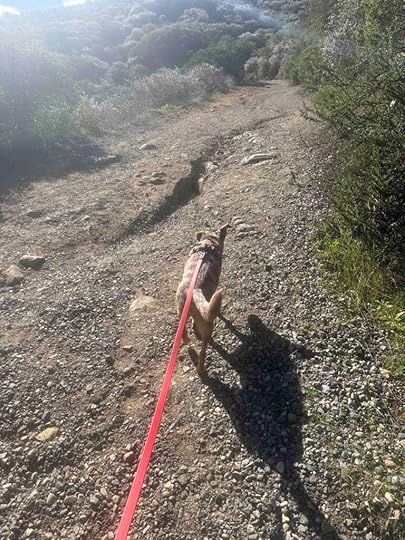
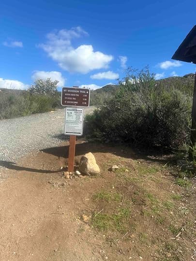
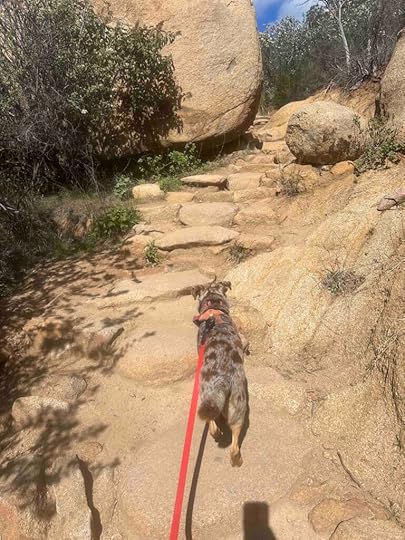
Mount Woodson Trail
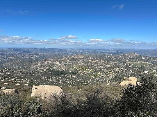
If you live in San Diego and like to hike, then you’ve heard of Potato Chip Rock. I have always wanted to climb up to the rock, but knew it was something that Karlie could not handle with her breathing issues related to GOLPP. So I waited until we adopted Sunny to tackle it. Of course we did many hikes before trying this one since it’s over 7M and an elevation gain over 2000 ft. It was not an easy hike, but it well worth the challenge and I highly recommend it.
The day of the hike we arrived at the Lake Poway Recreational Area a little after 9A. The park was already busy with kids and families. Despite that there was plenty of parking in the lot. After parking the car we walked toward the lake and found the start of the trail to the right of the restrooms.
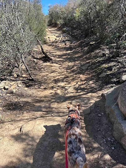
Are We on the Right Trail?The trail starts with a dirt trail that winds around part of Lake Poway. We followed this for awhile with me wondering if we were on the right trail. The signs indicated we were on the Lake Poway Trail with no indication it led to the Mount Woodson Trail. Despite that we kept following it and after almost a mile there was a sign for the Mount Woodson Trail. We turned right at the sign and started our trek up the mountain. At this point we were 2.9M from the summit.
 On the Mount Woodson Trail
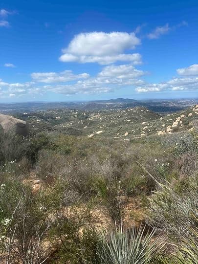
At this point the trail starts to go up the mountain and away from the lake. The climb is pretty steady, but there are sections that are somewhat flat giving you a chance to catch your breath. The trail alternates between hard packed dirt and rocks. As you climb you come to sections with stones that make steps. There are many switchbacks with these steps. We observed quite a few people using walking sticks which I image were helpful, especially on the way down. The views are absolutely beautiful the entire trip. There are sections with pretty vegetation on each side and sections with awesome views so if you get tired on the way up you can stop and take in the scenery. There are also quite a few spots where you can get up on the rocks for a closer view.
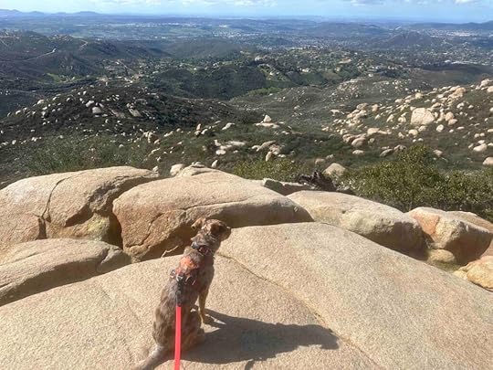 Summit and Potato Chip Rock
Once you reach the summit you see the Potato Chip Rock. I was surprised to only find three other people near the rock. I had expected long lines, but was happy to only find a few people waiting to take pictures on the rock. Getting on the rock requires climbing between two large rocks or jumping from one rock to the other. I could not figure out a way for Sunny and I to do this safely so we opted for a picture in front of the rock. After our picture we found another rock to sit on and enjoy the view while we ate lunch. And then it was time to make the descent, which was easier than the way up. The hardest part was keeping my energetic dog from going too fast!
 How Difficult is it?
I’ll be honest, I am a fairly fit person and I found this hike challenging. The steep inclines coupled with the sun and elevation caused me to breath heavier than normal. If you are going to try this hike, please make sure you are capable of a long hike with steep inclines most of the way. You also need to have sure footing as you will be traversing packed dirt and stones which can both be slippery, especially on the descent. There is little shade on this hike so bring more than enough water and start early, especially if you hike with a dog. And don’t forget to consider the fitness level of your dog before tackling this climb. Sunny is an active 2 year old and is used to long walks and hikes. We did several steep hikes before we tackled this one and I stopped often to give her a drink. This hike took us 3 hours to complete, with the trip down being faster than the trip up.
Our RatingSunny and I rate Mount Woodson Trail to Potato Chip Rock 4 out of 4 paws up. Although there is no water feature, this is a not to be missed hike. It’s a challenging and long hike, but the views along the way are amazing and well worth the effort. Once you reach the peak there’s the iconic Potato Chip Rock and plenty of other large rocks on which to take a well-deserved rest break. At the start is a beautiful park with restrooms and ample parking. A great spot for a picnic lunch or a rest after the hike.
How Do I Get There?The best way to find the trail is to use 14678 Lake Poway Road as the location. This will take you to the Lake Poway Recreational Area which is a huge park with playground equipment, picnic tables, grassy areas, restrooms, and a lot of parking. Park near the restrooms as the start of the trail is to the right of them. Although the trail is labeled Lake Poway Trail, this will take you to the Mount Woodson Trail. There is a $10 entrance fee to non-Poway residents on the weekends, but no fee on weekdays.
The post Mount Woodson Trail appeared first on Live Like Karlie.
March 1, 2024
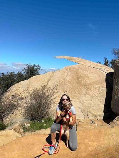
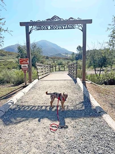
Iron Mountain
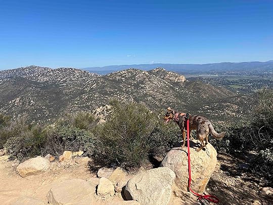
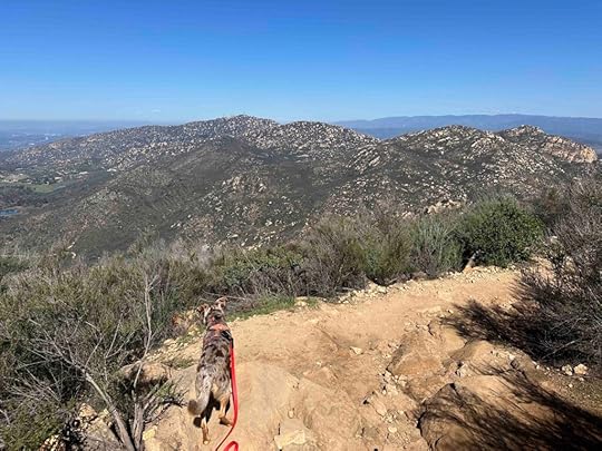
This week we decided to try a more challenging and longer hike – Iron Mountain, the second highest peak in Poway. We were not disappointed! It was challenging with an elevation gain of 1258 ft over almost 3 miles, but quite fun and beautiful. This is a hike I would highly recommend and one we hope to do again.
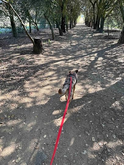
We started our hike by walking through the entrance gate which led to a dirt trail flanked by a row of trees on either side. This was one of the few shady spots on the entire hike. Once we got past the trees the trail was a fairly wide dirt trail with views of the mountains straight ahead. As we continued the trail narrowed a bit and started to climb uphill, but nothing too strenuous or steep.
As you start to climb the trail alternates between flat sections with hard packed dirt to uphill sections with rocks. And then as you approach the peak there are a lot of switchbacks with large rocks. You know you’ve reached the peak when you see the rock formation with the elevation sign. There is a picnic table (how in the world did they get that up there!?) to rest and several spots for taking pictures of the view.
 Our Rating
Sunny and I rate Iron Mountain 3.5 out of 4 paws up. The only thing missing is a water feature, but the views on the way to and at the summit nearly make up for that. There is plenty of parking and a restroom in the parking lot. The trail is well marked and easy to follow. Although it is moderately challenging, it is a fun hike with beautiful views. This hike is not recommended for those who can not climb rocks and fairly steep inclines or those with stability or breathing issues.
How Do I Get There?The best way to find the parking area and trailhead entrance is to use Iron Mountain Commuter Lot as the location. From Scripps Poway Parkway turn left onto CA-67N. Continue for 1.7M and then turn right into the parking lot. There is a restroom in the parking lot and the entrance gate is near the restroom.
The post Iron Mountain appeared first on Live Like Karlie.
February 10, 2024
Lake Murray
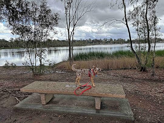
The last time I visited Lake Murray was with Karlie. In fact, it was her last adventure before she got her wings in 2022. We had such a good time that day and she was doing fantastic. Sadly, just a few days later she started to not feel well and just over a week later we said goodbye. Because of this returning to Lake Murray was bittersweet for me.

Despite that I decided it was the perfect spot for Sunny and I to go hiking after a week of rain. I knew all the other trails would be muddy and Lake Murray has an asphalt bike trail around part of the lake so it seemed like the perfect choice.
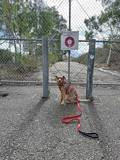
When Sunny and I arrived the skies were bright blue and the sun was shining. It was a beautiful day and we were so happy to be out of the house after a week of rain. We headed through the gate and started our walk on the bike path. We followed the route we had always done, but normally we would only walk about a mile before turning around. This time we followed the path all the way to the end. It winds around following the reservoir, goes past another parking area, a baseball field, and some homes on the hill. Eventually you come upon a gate across the path. This is the turn around point with a clever sign indicating if you don’t touch the sign that lap doesn’t count. Of course we did that after getting a picture of Sunny and then headed back to the car.
As we walked we noticed the skies getting grayer and some dark clouds, but we wanted to make it to the end so we kept walking. It started to sprinkle a little, but nothing too serious. The sprinkles were off and on until we made it to the turn around point. Once we turned around we noticed that the dark clouds were bigger and darker, but luckily it still never rained more than a light sprinkle. We made it back to the car and were on the road before the rains came. On the way home we ran into some heavier rain, but we didn’t mind since we were so happy to have been able to get out and hit the trails after a week of only walking in our neighborhood on sidewalks.
 Our Rating
Karlie, Sunny, and I rate Lake Murray 3 out of 4 paws up. Although it’s a beautiful place we prefer to hike on dirt trails. It was perfect for this hike, though, because the dirt trails were all too muddy. We also prefer getting our toes wet in the water and dogs are not allowed within 50 feet of the reservoir. Despite that it’s a fun place to visit and you can hike nearly 6 miles. Parking is great and there are rest rooms along the trail. There are also benches overlooking the reservoir which provides a nice spot to rest.
How Do I Get There?The best way to find this trail is to use Lake Murray Boat Launch as the location. From I-8 take exit #11 toward 70th Street/Lake Murray Blvd. Turn right onto Lake Murray Blvd. After .6M turn left onto Kiowa Drive. Continue for .3M then veer right at the Mission Trails Regional Park – Lake Murray sign. Follow the road to the end and either park on the left in the lot or the spots to the right. The entrance to the trail is near the parking spots on the right.
For more information about Lake Murray check out these websites.
City of San Diego – Lake Murray
Live Like Karlie – Lake Murray
Mission Trails Regional Park – Lake Murray
The post Lake Murray appeared first on Live Like Karlie.
February 5, 2024
Second Anniversary
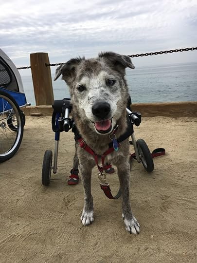
Sweet Karlie – I can’t believe today is the second anniversary of saying goodbye. I remember your last day like it was yesterday and yet it seems like forever. That was a sad day but you gave us one last gift of a trip to the beach and your beautiful smile. I’ve been back to our spot at Windansea Beach a few times since that day. I like to look out into the ocean and it always brings a smile to my face and tears to my eyes.
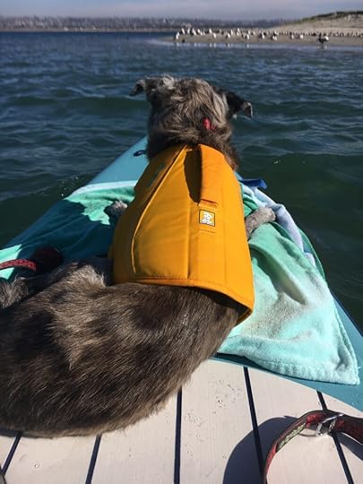
We’ve been back in San Diego for a few months now (the first time since we said goodbye) and I am reminded of you every day. Not just in the condo where I see your beautiful face in pictures on our walls, but on the streets. You owned these streets. So many people were routing for you and loved seeing you with your wheels. I loved sharing you with them and telling them about your wheels in the hopes that they would help another senior dog with hind end weakness. We walked so many miles on these streets and have so many memories. Starbucks and Bird Rock Coffee Roasters reminds me of getting you puppacinos. You were so happy licking the cups. CVS reminds me of the time we walked around outside while your buddy was inside buying some things. That’s one of my happiest memories and I’m so glad I captured our smiles in a photograph. Windansea reminds me not only of your last day, but the day we went to watch the sunset and you used your wheels on the sand. Mission Bay reminds me of all the times we kayaked there. I was so proud that you adapted to the SUP board after only ever being on a kayak before that. Liberty Station reminds me of all the times we walked there especially during COVID. Santa Margarita River Trail Preserve and Lake Miramar remind me of all of our adventures there since they were our favorite places. Trader Joe’s reminds me of the times during COVID that we stood outside in the line and then buddy went inside to do the shopping while we waited outside. Kate Sessions Park reminds me of all the times we played with a tennis ball there. And there are SO many more memories. We had a lifetime of wonderful memories and I am forever grateful I got to spend that time with you.


So on this second anniversary I am thinking of you and the wonderful life we shared. I am thankful for the time we had, the adventures we took, and all the memories we made. And I miss you EVERY. SINGLE. DAY.
My sweet little Bug, I love you forever and can’t wait until we meet again.
The post Second Anniversary appeared first on Live Like Karlie.
January 31, 2024
Mount Soledad National Veterans Memorial
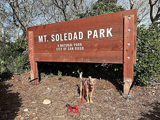
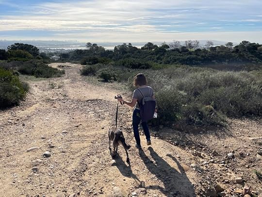
Last Sunday Sunny and I decided to go for a walk. A really long walk. We walked from our place near the ocean to Mount Soledad National Veterans Memorial. It was just over a 7M round trip. Of course with a name like Mount Soledad you can imagine that it was not an easy stroll, but one that involved hills. Despite the effort to get to the memorial, it was well worth it. This was Sunny’s first visit, but I had visited many times with Anna, Art, and Karlie. It was nice to revisit one of our favorite places with Sunny.
The first time we visited Mount Soledad was our first Thanksgiving in San Diego in 2014. We took the 5M roundtrip walk from our home in Pacific Beach to the memorial with Anna and Karlie. It was such a nice walk and a wonderful way to start our day.
Over the years we visited the memorial many times, once even to see the sunset. Our last visit with Karlie was in 2020 just before we moved to Indiana.
Mount Soledad National Veterans Memorial honors and celebrates all veterans – living and deceased, who have served since the revolutionary war. Plaques providing details of the veteran’s service are displayed on the walls of the memorial. It is quite an awesome sight. And there is a huge cross with an American flag so you can’t help but feel patriotic when you visit this location.
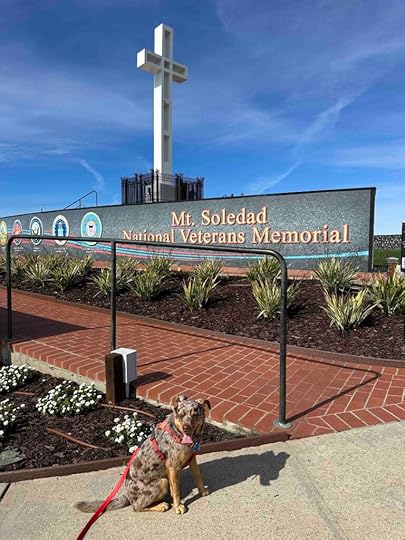
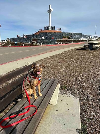
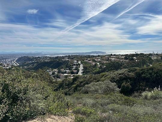
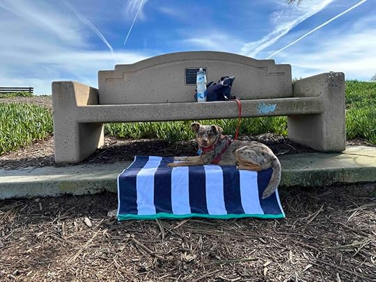
In addition to the veterans memorial there is a park with grass, a few trails, and some benches. It’s a great place to have a picnic and to take in the amazing views of La Jolla, the ocean, and Mission Bay as well as honor past and present veterans. And we would like to thank all those who have served our country. We truly appreciate your sacrifices.
 Our Rating
Karlie, Sunny, and I give Mount Soledad National Veterans Memorial 3 out of 4 paws up. Although it’s a beautiful spot it really doesn’t have too many trails for hiking. Despite that it’s a fun place to visit and we think it’s a not to be missed location in San Diego.
How Do I Get There?Mount Soledad National Veterans Memorial is located at 6905 La Jolla Scenic Drive in La Jolla, California. You can either take Mount Soledad Mountain Road or Cardeno Road to La Jolla Scenic Drive or Hillside Drive to Via Capri. From either Mount Soledad Mountain Road or Cardeno Road turn right onto La Jolla Scenic Drive and follow it uphill to the entrance. If you turn left onto Via Capri you’ve missed the entrance. From Hillside Drive turn left onto Via Siena then right onto Via Capri. Follow that uphill and turn left at the intersection of La Jolla Scenic Drive to enter the parking lot.
You can park either at the lower lot or drive up to the memorial and park around there. Parking is more limited at the top. The walk from the lower parking lot to the memorial is about a quarter mile.
For more information about Mount Soledad National Veterans Memorial check out their website.
Mount Soledad National Veterans Memorial
The post Mount Soledad National Veterans Memorial appeared first on Live Like Karlie.
January 24, 2024
Anna’s Spot
On Anna’s last day we spent the entire day celebrating her and doing some of the things she loved. We visited some of her favorite places, did some of her favorite things, and had special treats. We also just spent time together trying to soak up every little bit of Anna.
One of the places we visited was Kate Session’s Park in Pacific Beach, CA. We often brought the girls to this park. It’s a beautiful park with walking paths, trails, playground equipment, and a large grassy area. On Anna’s last day we found a secluded area at the back of the parking lot in the upper area and let the girls off leash to explore. There was a big mound of mulch that they enjoyed walking up and down. And they enjoyed snooping around the bushes and vegetation. We also found a big tree stump that had been decorated with graffiti. This area, and especially the spot near the tree stump, forever became Anna’s spot. The girls spent quite a bit of time exploring and we took many, many pictures and videos. After we said goodbye to Anna we brought Karlie back several times including on Anna’s birthdays and the anniversary of her last day. It made us feel close to Anna.

 Revisiting Anna’s Spot
After we said goodbye to Karlie and adopted Sunny one of the first places we brought Sunny was Anna’s spot. It was bittersweet to be there when both Anna and Karlie were gone, but it was important to me to share Anna’s spot with Sunny. The first time we visited Sunny was about 4 months old and so little.
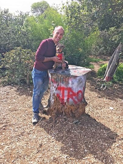
Today Sunny and I revisited Anna’s spot and I was sickened by what I saw. The entire area had a lot of downed trees and vegetation making it difficult to get to the tree stump. When we reached the tree stump I was sad to see that someone had set it on fire and burned at least half of it. The graffiti was almost entirely burned up. I don’t know when this happened since it’s been a year and a half since we’ve been in San Diego. Sadly this is likely the work of either kids or transients and it makes me mad. Not only because this was a special spot to me, but because people have so little respect for things. Despite that I will continue to visit this special spot and hope no further damage is done.

The post Anna’s Spot appeared first on Live Like Karlie.


