Andie LaComb's Blog, page 7
December 12, 2023
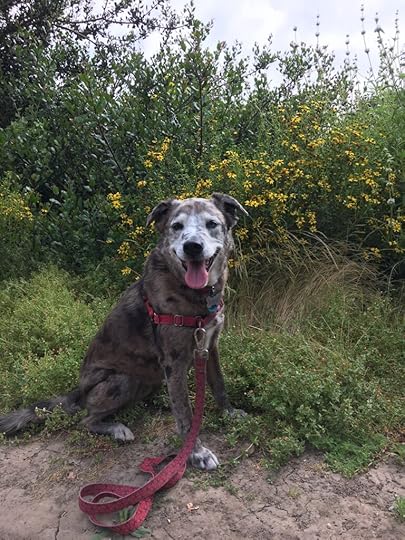
Manchester Preserve
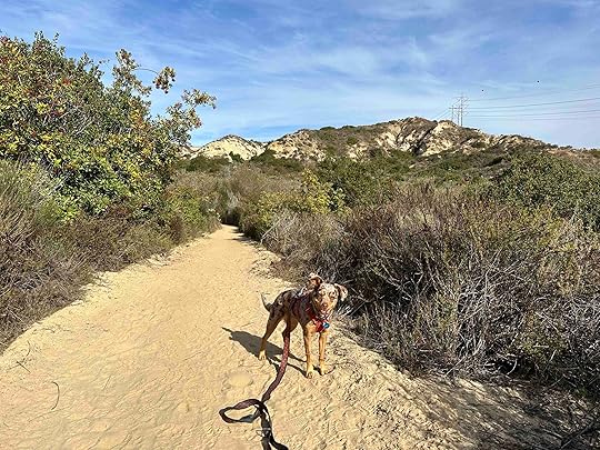
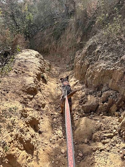
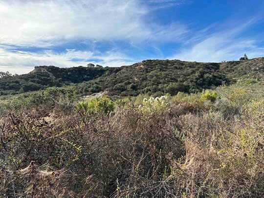
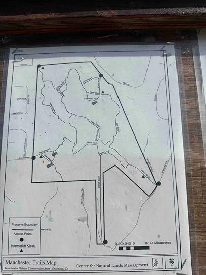
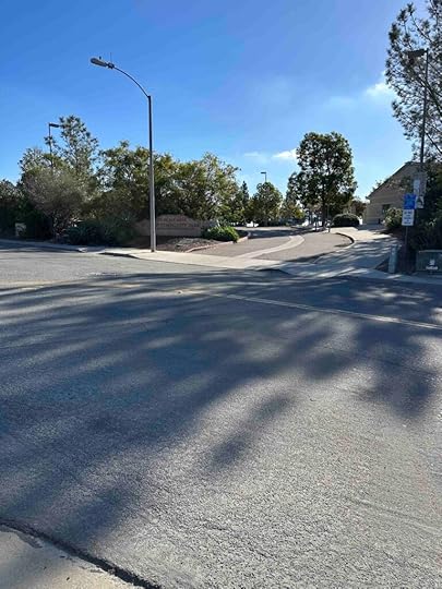
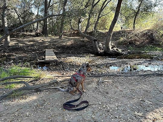
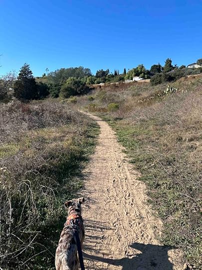
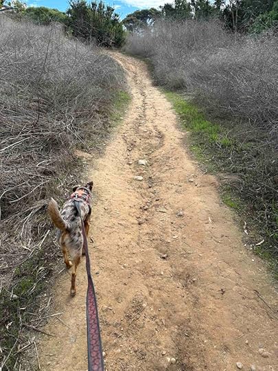
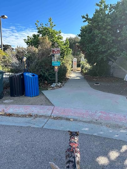
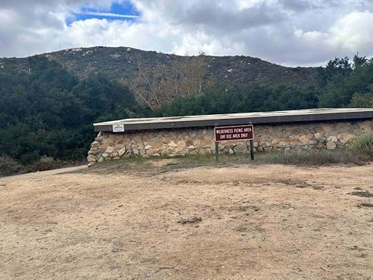
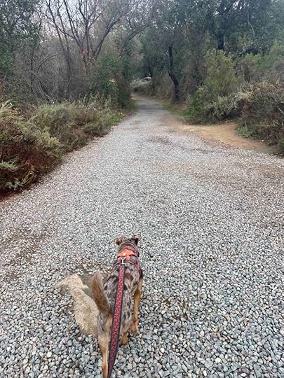
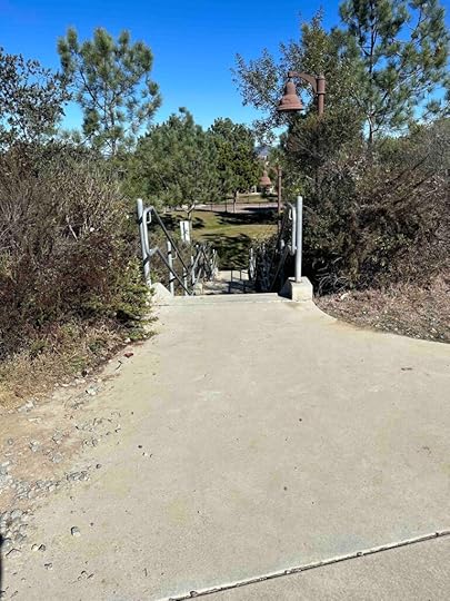
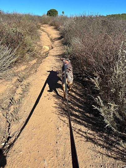
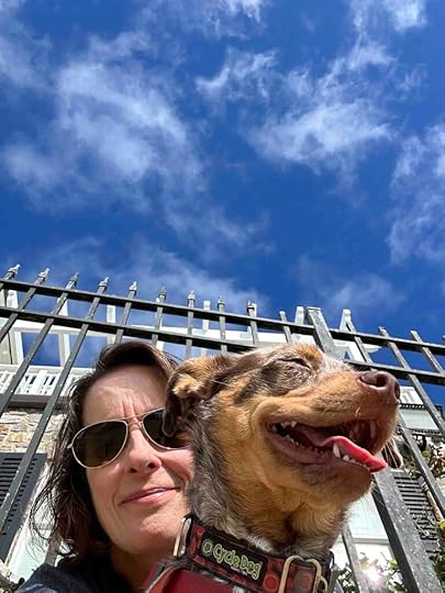
Manchester Preserve consists of 123 acres ranging from gentle slopes to steep canyon walls. There are many trails throughout the canyon with 5 different access points. The trails vary from hard-packed dirt to stones to sand. They wind down into the canyon giving views of the cliffs around you and native plants. This makes for a challenging, but beautiful hike.
I have such good memories of Manchester Preserve. Our first visit was with Karlie during COVID. We had been cooped up at home and only allowed to walk around our neighborhood when we decided to visit. Unfortunately upon arrival we found out the trails were closed. It was a great disappointment, but we returned later that year when the trails opened up and we were so happy that we did. Despite Karlie’s issues with GOLPP (geriatric onset laryngeal paralysis polyneuropathy) she was able to conquer some of the steep inclines and descents.
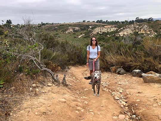
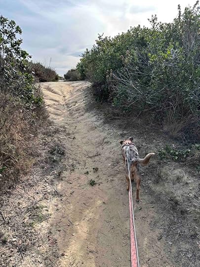
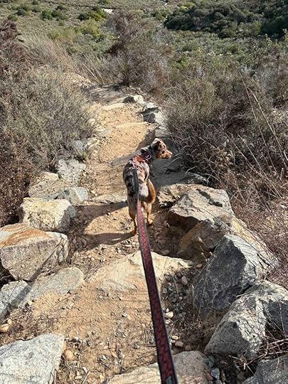
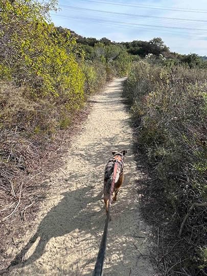
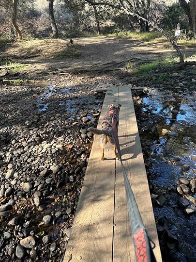
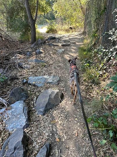
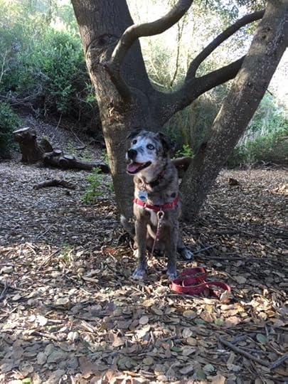
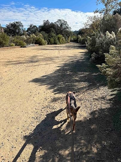
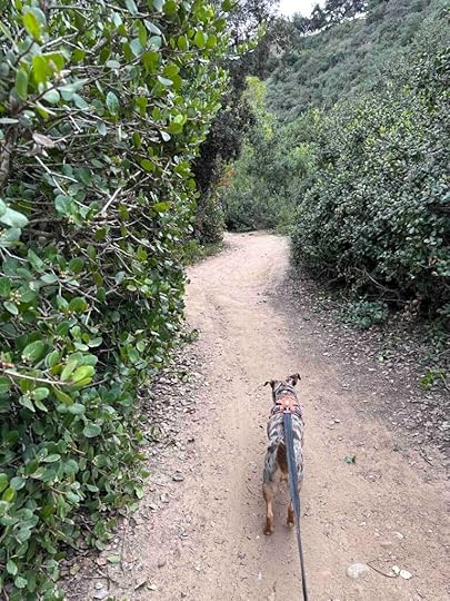
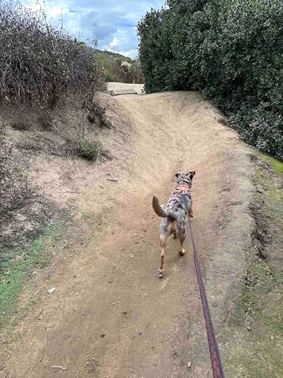
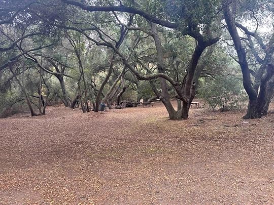
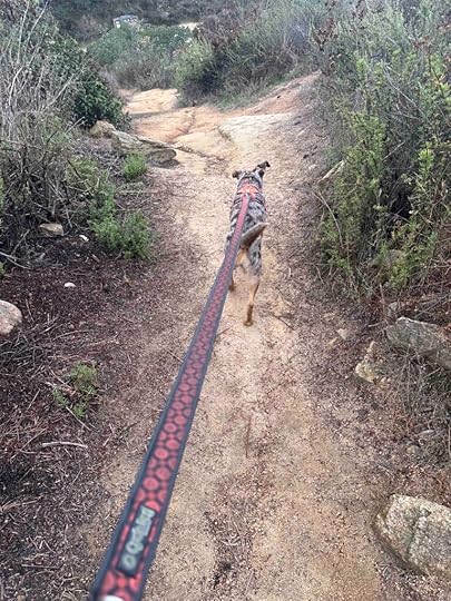
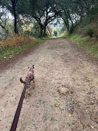
Today we took Sunny to explore the trails and we again had great fun. We took some of the same trails that we did with Karlie, but were able to go quite a bit further with Sunny. The trail starts with a small incline toward the trail map sign. From there you can go to the right or left and walk toward the canyon. Soon you come upon some steep stone steps that lead into the canyon. This is one of the hardest sections of the trail and lasts for quite awhile before coming to a narrow section carved through the stone and dirt. Eventually you come to a flatter and wider trail.
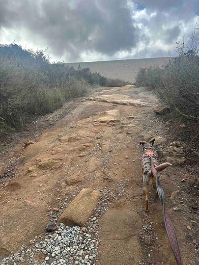
We walked along the trail for awhile and eventually found ourselves at another access point off Manchester Rd. On another day we may try starting here since there is a small parking lot. We turned around and started to head back to where we climbed into the canyon. At least that was the plan.
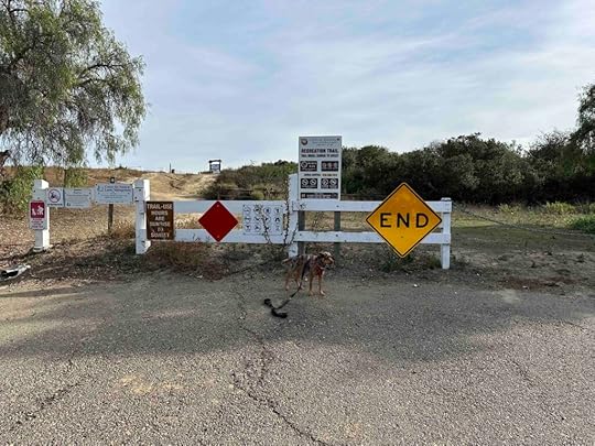
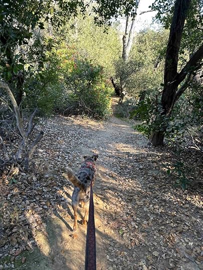
There are many trails and side trails through the canyon making it easy to get turned around. And to be honest that happened to us on this visit. We eventually found another access point off Taegan Lane and then used our GPS to follow the trails back to the car.
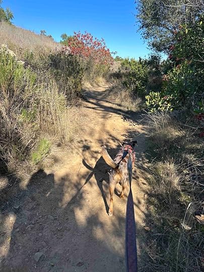
We walked just over 3M and could have walked many many more miles if we had taken all the different trails and side trails. Despite getting a little turned around we enjoyed our hike. It’s a beautiful setting with some uphill and downhill areas making it a fun, challenging hike.
Our RatingKarlie, Sunny, and I rate Manchester Preserve 3 out of 4 paws up. There are 5 different access points, a variety of trails with beautiful views, and the trails are challenging. The downsides are no restrooms, no water features, and the trails are not marked with their names making it easy to get turned around. It also can get quite warm as there is little shade. Overall we highly recommend this trail system, but it is not for those with limited mobility or stability as the trail involves sharp inclines and descents.
How Do I Get There?There are 5 different access points to the Manchester Preserve. We always enter at the Calle Ryan access point. From I-5 take exit #39 – Manchester Ave. Turn left onto Manchester Ave. and follow for about 1M before it turns into S. El Camino Real. Continue about .7M, then turn right onto Calle Ryan. Follow to the end and park on the street. Enter near the gate and walk up the hill toward the preserve sign.
For more information about Manchester Preserve check out the Center for Natural Lands Management and City of Encinitas websites.
Center for Natural Lands Management – Manchester Preserve
City of Encinitas – Trails and Open Spaces
The post Manchester Preserve appeared first on Live Like Karlie.


December 9, 2023
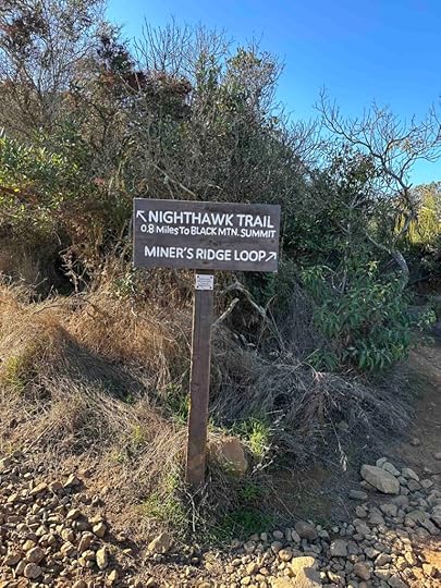
Black Mountain Nighthawk Trail
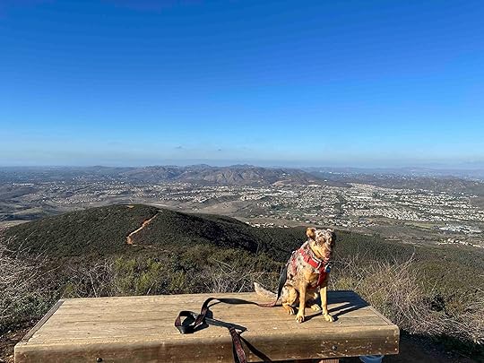
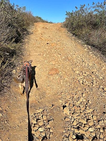
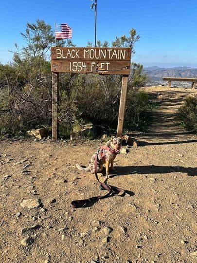
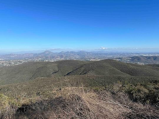
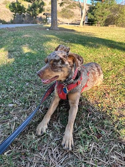
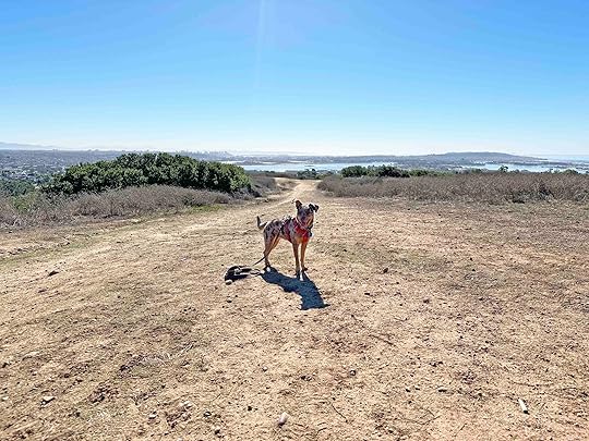
Another beautiful day in San Diego, another wonderful adventure. Sunny and I visited Black Mountain Open Space and conquered the Nighthawk Trail. This is a trail that Karlie and I hiked several times and is another of our favorites. Although Karlie (and Sunny) loved billy goating up the trail, it is not for the faint of heart. The trail is just over 2M and is nearly all uphill to a 1552 ft elevation summit. But the views along the way and especially at the summit are well worth the challenge.
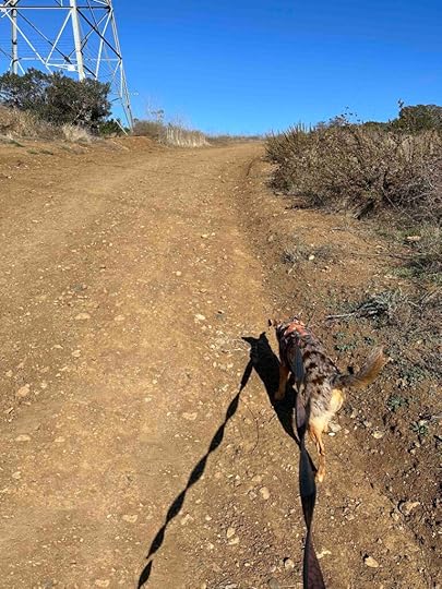
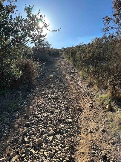
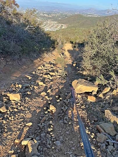
The trail immediately starts to go uphill as you walk past an electric transmission tower. Once past the tower it’s a typical packed dirt trail with vegetation on both sides. As you go a little further the trail becomes pretty rocky and remains that way for much of it.
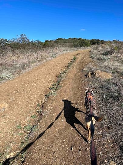
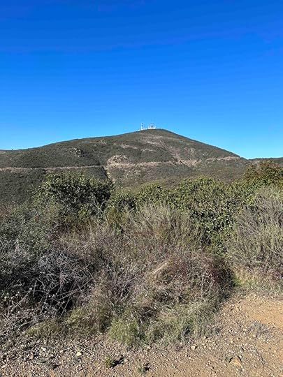
Throughout the hike you can see views of the summit which has satellite equipment on it. In the beginning it seems so far away, but eventually you make your way to it. On the way the trail is mostly in the open, uphill, and with little shade. Just when you think you can’t climb much more there is a big uphill section. This comes at .8M from the summit point and is probably the most challenging section of the hike. After that the uphill continues, but at a smaller incline and the views are amazing. Keep walking past the satellite equipment and you’ll find the summit sign and some benches to take in the view.
The return to the parking lot is nearly as challenging as the climb to the summit. Those big uphill sections with the rocks can be tricky to navigate. Eventually the inclines get less and you find yourself back at the park. Sunny and I enjoyed our hike of the Black Mountain Nighthawk Trail and I hope to return to investigate one of the other trails.
 Our Rating
Sunny, Karlie, and I rate the Black Mountain Nighthawk Trail 3.5 out of 4 paws up. We love the challenge, views, and length of the trail. The only thing missing is a water feature, but the views make up for it. This trail is almost entirely uphill and the walking surface is mostly stones and rocks. This makes it difficult for anyone with breathing, mobility, or stability issues. The length is just over 2M to the summit and it is mostly not shaded.
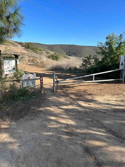
How Do I Get There?We always park at Hilltop Park which is located at 9711 Oviedo Way. From CA-56 take exit #7 – Black Mountain Rd. Continue for 1.2M then turn right onto Oviedo St. Continue for .3M then turn right onto Oviedo Way. Continue to nearly the end and turn right into the parking lot near the Hilltop Community Park sign. Turn left and continue to the back of the parking lot. The entrance of the park is near the trail map sign and gate.
For more information check out the San Diego website and trail map.
City of San Diego Website – Black Mountain Open Space Park
Black Mountain Open Space Park Trail Map
The post Black Mountain Nighthawk Trail appeared first on Live Like Karlie.
December 5, 2023
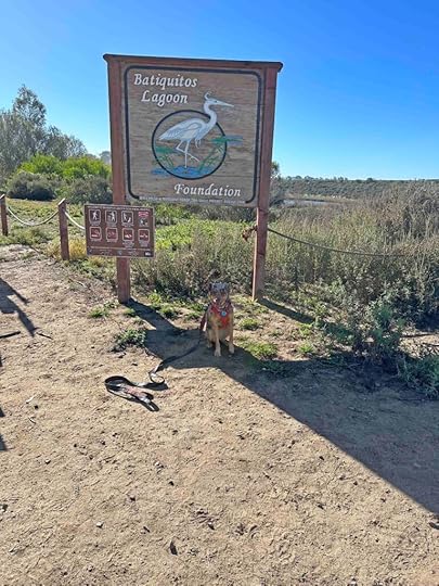
Batiquitos Lagoon Trail
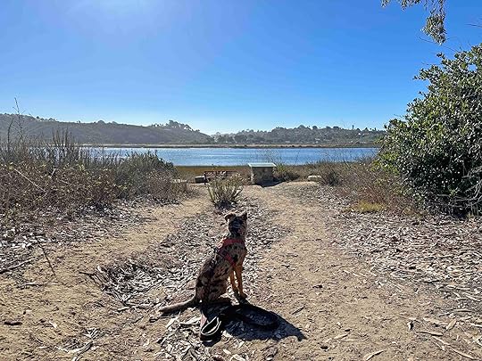
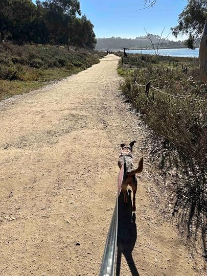
Another beautiful sunny day in San Diego means another adventure. Today we visited Batiquitos Lagoon Trail in Carlsbad, CA and we were not the only ones with that idea. Upon arrival we found the parking lot and street full of cars. Despite that we found a spot not too far from the trail entrance. After parking we walked toward the Batiquitos Lagoon Foundation sign and found the start of the trail.
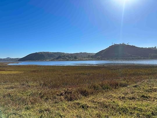
Batiquitos Lagoon is one of the few tidal wetlands left in Southern California. With the efforts of volunteers the wetland has been returned to tidal flushing and over 200 species of birds and 65 species of fish have been observed. It is located between southern Carlsbad and Encinitas and consists of 610 acres. The trail traverses along the lagoon for about 1.6M.
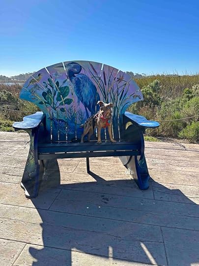
After passing the entrance sign we found the trail which is hard packed dirt, quite wide, and has views of the lagoon and mountains in the distance. A short distance after starting our hike we found some large decorated chairs on the right. Across the trail from the chairs is the nature center, which has restrooms. As we continued on the trail we saw several benches for resting and taking in the beauty of the lagoon.
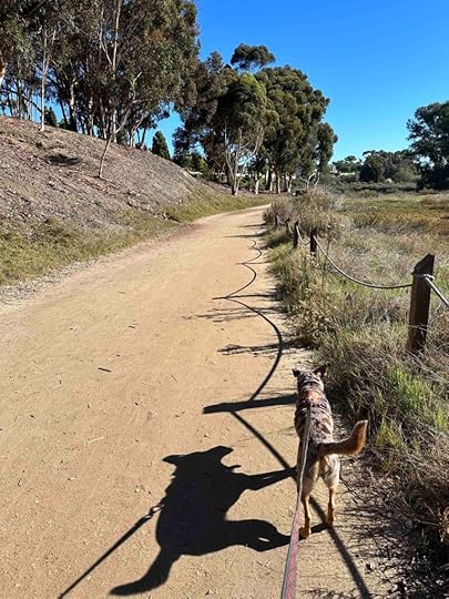
The trail is quite wide and flat making it appropriate for most everyone, however bikes are not allowed on the trail. We observed one person pushing a stroller and she did not seem to have any issue doing that. The trail is heavily used by walkers and runners and people with dogs. Dog are required to be on a leash and all that we observed were following this rule. Despite that this may not be appropriate for highly reactive dogs given the number of people and dogs on the trail.
Our RatingSunny and I rate Batiquitos Lagoon Trail 3 out of 4 paws up. It’s beautiful and well maintained, but there was not an opportunity to get down to the water and it was a bit too busy for our taste. It is a wonderful place to take a walk and has restrooms in the nature center and plenty of parking on the streets near the trail. It’s a great place to visit if you are in the Carlsbad area.
How Do I Get There?The address for Batiquitos Lagoon Trail is 7380 Gabbiano Lane. From I-5 take exit #45-Poinsettia Ln and turn right onto Poinsettia Ln. Continue for .3M and turn right onto Batiquitos Dr. After .5M turn right onto Gabbianno Ln and follow it to the end. There is a small parking lot on the right and plenty of parking on the street. Enter the trail at the sign.
For more information about the Batiquitos Lagoon Foundation check out their website.
The post Batiquitos Lagoon Trail appeared first on Live Like Karlie.
December 2, 2023
Marian Bear Memorial Park
Yesterday we ventured to Marian Bear Memorial Park, but it was not easy to get there. I planned to enter at the parking lot from Genesee St., but it was closed due to construction. Then we tried to enter the west parking lot from Regents Rd and there were several construction vehicles blocking the parking. Finally we entered the east parking lot from Regents Rd. This probably ended up being a better place to enter since it has a large parking lot with restrooms.
The park is in the San Clemente Canyon and stretches from highway 5 to 805. It was named after Marian Bear who was an active community member and environmentalist. She worked to preserve the canyons.
Upon entering the parking lot we parked close to the restrooms and entered the trail. After walking a short distance we entered a wooded area and came upon a creek with a wood platform across it. We walked across and had the option to take the San Clemente Trail to the right or left. We chose to walk to the right. The trail continued through the woods, across some rocks, and then opened up to a field with brush on either side and the highway overlooking it. This section was completely without shade and a bit desolate.
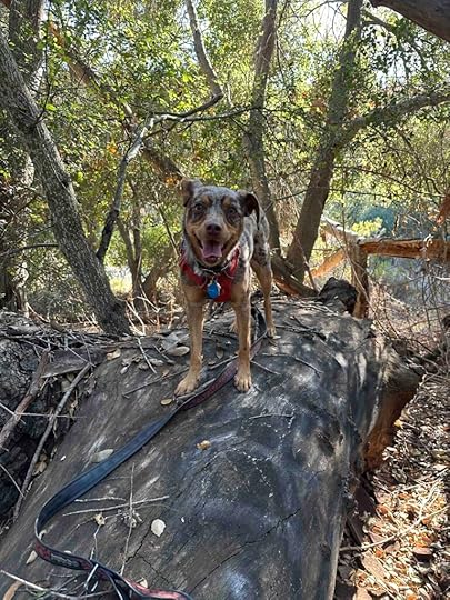
We continued and came across another wooded area where we found a log for Sunny to climb on. As we continued walking we entered another open area. We walked until we nearly reached Genesee St. Then we turned around and retraced our steps back to the creek overpass. Instead of crossing the creek we followed the trail until it ended a short distance. We turned around, returned to the original creek crossing, and headed back to the car. Our total walk was just over 2M.
The San Clemente Trail is mostly hard packed dirt and fairly narrow. It has some sharp inclines so the trail would not be good for strollers or those with mobility or stability issues. You also may encounter mountain bikers on the trail. For most of the hike you can hear the highway and in some areas you can see the cars racing by.
 Our Rating
Sunny and I rate Marian Bear Memorial Park 2.5 out of 4 paws up. Although it’s a nice trail that seems to go for several miles and there is a creek running through it, it felt slightly unsettling. It may just have been the time we selected to go, but all the other people there were individual men in their forties and fifties. Although most everyone was friendly, it was just odd and made me a little uncomfortable. Despite that the trail is nice, although much of it runs along the highway and you can hear quite a bit of road noise. This is a great place to go if you are in the neighborhood, but I wouldn’t go out of my way to stop here.
How Do I Get There?The section of the Marion Bear Memorial Park that we visited is off Regents Rd. From I-52E take exit #1B for Regents Rd toward Clairemont Mesa Blvd Keep right, follow signs for Clairemont Mesa Blvd and turn right onto Regents Rd. Take a right into the west parking lot and follow the road under Regents Rd to the east parking lot.
For more information about the Marian Bear Memorial Park check out the City of San Diego website.
City of San Diego – Marion Bear Memorial Park
City of San Diego – History of Marian Bear Memorial Park
The post Marian Bear Memorial Park appeared first on Live Like Karlie.
November 29, 2023
Mission Bay Kayaking
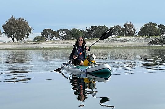
Karlie LOVED to go kayaking and when we lived in San Diego we went often on Mission Bay. After we moved out of our house and became a part-time resident in a condo we needed a smaller boat so we opted for an inflatable stand up paddle (SUP) board. Karlie quickly adapted and LOVED going out on it.
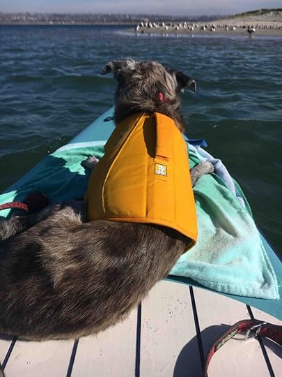
After we said goodbye to Karlie and adopted Sunny we started taking her on the SUP board. Unfortunately on our first outing she stepped right off the board and went under the water. Thankfully she was wearing her life vest so I grabbed the handle on top and lifted her back on the board. She had a look on her face that said, “what just happened?” Luckily she’s managed to stay on the board every time since that. She doesn’t quite love kayaking like Karlie did, but she seems to enjoy being out on the water as long as the waves from the big boats aren’t too high.
Since being back in San Diego we’ve taken Sunny out on the water a couple times. Every time we go it reminds me of Karlie. Part of it is that my view of Sunny from behind sitting on the front of the SUP reminds me of Karlie. She looks SO much like Karlie from that angle. And she is wearing Karlie’s old life vest since I forgot to bring hers with us. All the feelings and emotions of saying goodbye to Karlie come rushing back. I love Sunny, but I still miss Karlie immensely. I really don’t think that will ever go away. She was a huge part of my life and the memories are everywhere, especially here in San Diego.
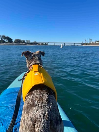
Despite that I am enjoying taking Sunny to all the places that I shared with Karlie. I am so thankful that Sunny loves to go hiking as much as Karlie did. It’s fun to take her to our favorite places. It reminds me of the fun we had with Karlie while making new memories with Sunny.
On our last kayaking trip I told Sunny all about Karlie and our last time on the water. Sunny may not have understood everything I said, but she listened and it made me feel good to talk about Karlie. So almost two years after saying goodbye to Karlie I am still working through the grief and sadness. I am so luck to have Sunny to make me smile and get me out to all our favorite places.
The post Mission Bay Kayaking appeared first on Live Like Karlie.
Tecolote Canyon Natural Park
Another close to home trail that we enjoy is Tecolote Canyon Natural Park. This park has it all – miles of trails and some grass fields as well as a visitor center, recreation center, and baseball fields. The first time we visited it with Karlie we explored the trails and then played with a tennis ball in the grassy area near the recreation center. The last time we visited with Karlie she was using her wheelchair and it had recently rained. It was one of my favorite outings because she did so well despite using her wheels. She seemed to enjoy taking them through the mud puddles. We took Sunny here when she was a puppy and today we returned.
 History of Tecolote Canyon
The Tecolote Canyon has an interesting history. Before it was acquired by the City of San Diego and turned into the Tecolote Canyon Natural Park it was used by the Kumeyaay Indians. Then in the late 1800’s settlers farmed and ranched in the canyon. Cattle were still roaming in the canyon in the early 1950’s. In 1978 the land was acquired by the City of San Diego and turned into the park we enjoy today.
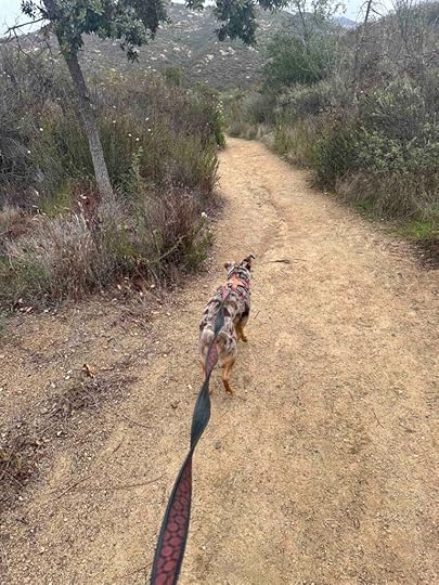
Our AdventureWe started our hike by walking on the wide main trail, the Tecolote Canyon trailhead. This trail starts next to the visitor’s center and continues for nearly 6.5M ending in Clairemont. We’ve never walked the entire trail. Instead we usually walk on the main trail until we find a side trail we want to explore.
At the beginning the Tecolote Canyon trailhead is a gravel, but soon turns into hard packed dirt. As it progresses there are sections that are like walking on a sandy beach. The trail is quite wide and mainly flat and straight. The side trails, however, are narrower with inclines and descents. They also have trees and vegetation providing some shade while the main trail has no shade. There is an area to the side of the main trail with a bench and a tree that provides a nice spot to rest and one where we normally take a picture. Because of the lack of shade it’s important to take water as this is generally a warm hike.
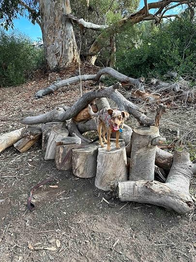
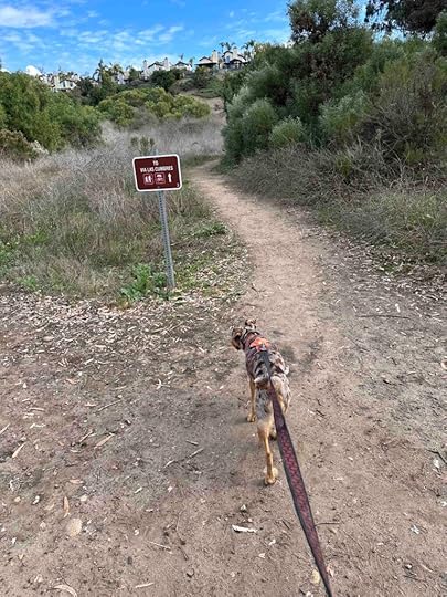
While on the main trail today we found a bench made from a sections of a chopped down tree. Since Sunny likes to jump up on benches we made sure to take a picture. After that we continued on the main trail for over a mile before finding the trail to Via Las Cumbres. This trail has a pretty steep incline and winds around to Via Las Cumbers. We stopped short of the road, turned around, and found another trail that returned us to the main trail. Then we continued on the main trail until it started to incline steeply. At this point we had walked nearly 2M so we decided to turn around.
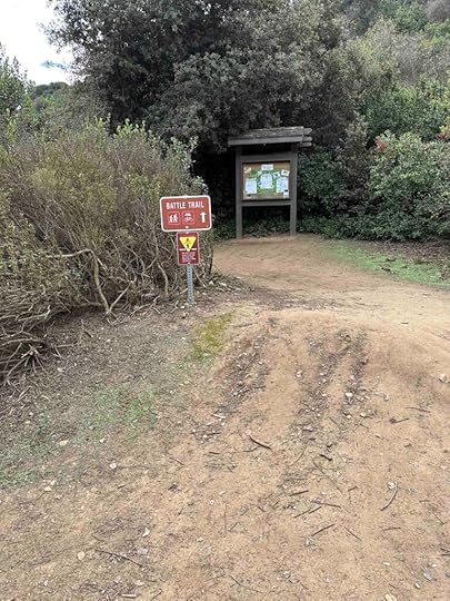
We were nearly back to the visitor’s center when we saw the Battle Trail to the left and decided to explore it. It wound around a wooded area away from the visitor’s center and eventually took us back to the main trail. We continued back on the main trail to the visitor’s center and back to our car. The total distance we hiked was 4.5M.
 Our Rating
Karlie, Sunny, and I rate Tecolote Canyon Natural Park 3.5 out of 4 paws up. The only thing missing is a water feature. We love the number of trails and the ability to walk longer distances. We love the scenery, the winding and hilly side trails that make things more interesting, and the wide main trail that allows plenty of room to get around other hikers. Also we love that the park has a visitor center with restroom, plenty of parking, and grassy areas for picnicking. All in all this is a wonderful park that we highly recommend visiting.
How Do I Get There?We always enter the park off Tecolote Road from Sea World Drive, but there are other access points. The entrance off Tecolote Road takes you to the visitor center and the main trail. After entering the parking lot continue driving to the back of the lot near the visitor center. Once you park, walk toward the visitor center to the trail entrance.
For more information about Tecolote Canyon Natural Park, check out the City of San Diego website.
City of San Diego – Tecolote Canyon Natural Park
The post Tecolote Canyon Natural Park appeared first on Live Like Karlie.
November 25, 2023
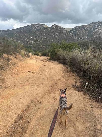
Lake Poway Trail
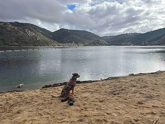
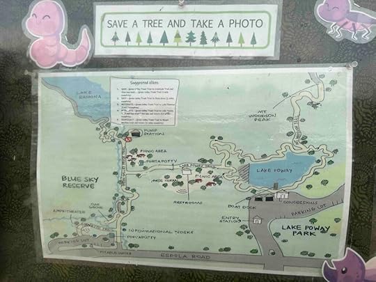
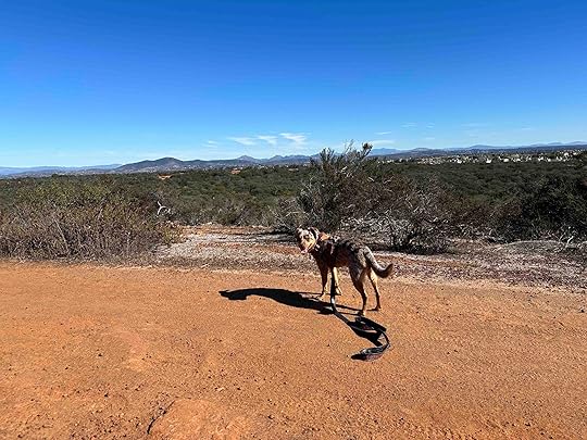
While many people go shopping on Black Friday we opted to be outdoors and ventured to the Blue Sky Ecological Reserve in Poway, CA. This reserve is a 700 acre canyon with a variety of trails including the popular Mount Woodson Trail. This was our first visit to the reserve, but it won’t be our last. On this trip we explored the Torretto, Green Valley Truck, and the Lake Poway Trails.
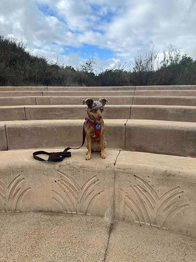
We parked shortly after entering the parking lot and took the first trail up the hill. This was the Torretto Trail which winds past an amphitheater and connects with the Green Valley Truck Trail. After almost a mile on the Green Valley Truck Trail we took the trail to the right which is the Lake Poway Trail. After a short time on the trail we came across a restroom and picnic area.
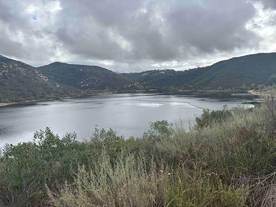
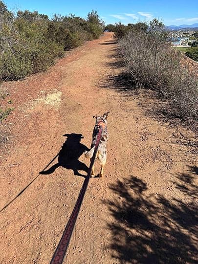
Shortly after passing the picnic area the trail starts to incline and wind around as it approaches the lake. This part of the trail is a bit challenging because of the steep inclines and large rocks on the trail. The views of the surrounding mountains, however, more than make up for the effort. As you approach the lake you see the dam and eventually climb up to overlook the lake.
As we overlooked Lake Poway we found a trail that descended down to the lake. This was a sharp descent that is not recommended for those unsteady on their feet. Going up on our return was much easier than climbing down with a young rambunctious dog. Luckily I managed to slow her down and stay vertical!
Lake Poway is a beautiful lake that is not only the water supply for Poway, but is also used for boating and fishing. The lake can be accessed either by hiking to it as we did or entering the park off Lake Poway Road. There is a fee for non-residents on weekends and holidays if you park here.
After exploring the lake we climbed back up the trail and retraced our steps to the car. Our total hike was just under 5M. As indicated on the trail map we could have walked entirely around the lake or hiked to Lake Ramona or Mount Woodson. We will definitely return to do all of those things.
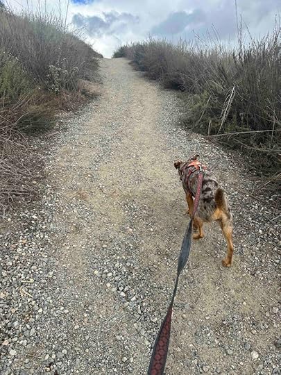
We really enjoyed the hike and encountered many other people and dogs on the trails. All the trails are pretty wide with the Green Valley Truck trail the widest. It’s more like a dirt road than a trail. The Lake Poway Trail was a little more narrow, but still wide enough to walk with several people across.
The trail is hard packed dirt with vegetation on both sides. The Green Valley Truck Trail has quite a bit of vegetation and trees, making this the most shaded part of the trail. The Lake Poway Trail is less shaded and could be quite warm on a sunny, summer day. The day of our hike it was mostly overcast making for a pleasant hike.
 Our Rating
We give the Lake Poway Trail at the Blue Sky Ecological Reserve 4 out of 4 paws up. It literally has everything we love – challenging trails, a water feature, wonderful scenery, great parking, and restrooms. It also has some benches along the trail overlooking the mountains and even a picnic area in the woods. There are also several different trails in the reserve so we plan to visit again and hike on those.
How Do I Get There?The parking are for the Blue Sky Ecological Reserve is at 16275 Espola Rd. in Poway, CA. From I-15 North take exit #19 for CA 56/Ted Williams Parkway and turn right. Continue for 2.5M then turn right onto Twin Peaks Road. After 2.3M turn left onto Espola Road. After 2.8M the parking lot is on the left. It’s a large parking lot with several access points to the trails. We parked close to where we entered and started on the Torretto Trail which led to the Green Valley Truck Trail and eventually the Lake Poway Trail.
For more information about the Blue Sky Ecological Reserve visit the City of Poway website.
Blue Sky Ecological Reserve – City of Poway website
The post Lake Poway Trail appeared first on Live Like Karlie.
November 22, 2023
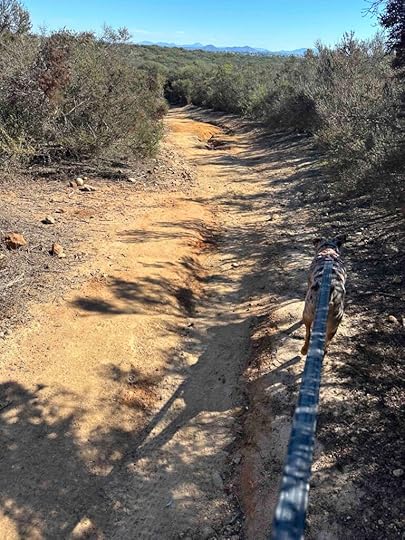
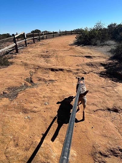
Carmel Mountain Preserve Loop
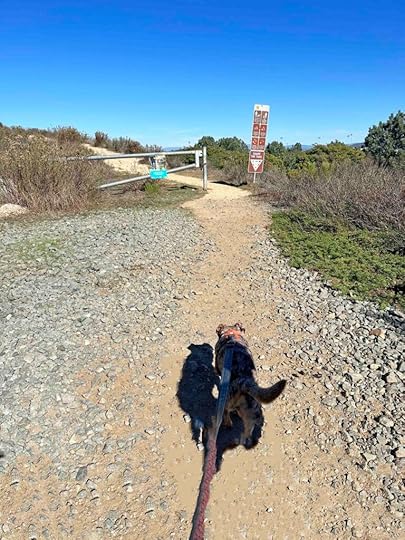
Today we ventured to Carmel Mountain Preserve Loop Trail which is part of the Carmel Mountain Preserve. The Carmel Mountain Preserve consists of several trails and access points. And the Loop Trail is accessed off Fairport Way in Carmel Valley.
The trail is hard packed dirt surrounded by vegetation, but few trees making it a hot and unshaded hike. The trail has some inclines and descents. There are views of the surrounding mountains and peaks of the ocean. Although the trail loops around we did not complete the loop as we took a side trail that looked interesting. It brought us off the trail and to the Ocean Air Park so our total hike was 1.5M. Looking at the map the trail does loop around and according to All Trails is nearly 3M.
Although we only encountered a few other people on the trail it is obvious that it is well used by people with dogs as there was quite a bit of poop left on the trail. We also saw horse hoof prints and saw signs indicating horses are allowed on the trail. I imagine many of the people in the housing development that borders the trail use it.
Our RatingSunny and I rate Carmel Mountain Preserve Loop Trail 3 out of 4 paws up. It’s a beautiful hike with views of the ocean and mountains. The trail is well maintained and quite wide. Parking is easy and the nearby park has restrooms. There is no water feature and little shade and the trail can be a little confusing as there are many side trails. This is one we will return to further explore the trail.
How Do I Get There?The best way to find this part of the Carmel Mountain Preserve is to use Ocean Air Park as the destination. We accessed the trail off Fairport Way just past the park. You can either park on the street near the entrance of the trail and sign or park at Ocean Air Park and walk up the steps to the entrance of the trail.
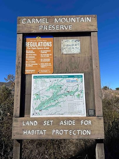
For a map of Carmel Mountain Preserve check out the San Diego website.
The post Carmel Mountain Preserve Loop appeared first on Live Like Karlie.
November 21, 2023
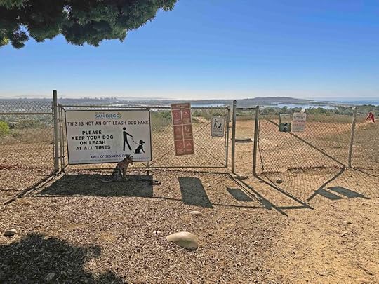
Kate Sessions Memorial Park Trails
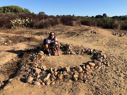
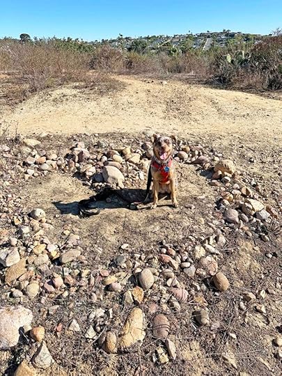
We decided to stay close to home for today’s adventure and explore Kate Sessions Memorial Park Trails. This is not to be confused with Kate Sessions Memorial Park, which is also a great place to take your dog. The trails, however, are a hidden gem in Pacific Beach and easy to miss if you don’t know they are there.
The trails are packed dirt and traverse through the vegetation which is mostly shrubs, brush, trees, and cacti. There is one main trail with many side trails that mostly wind back to the main trail. The main trail descends until it comes to a dead end. The way back is an incline and some of the other trails also incline quite a bit. Despite the variety of trails the total distance is less than 2 miles.
Although there are some trees and other vegetation there is nearly no shade making this a warm hike. We tend to visit this spot during the morning when the sun isn’t quite so hot. We always bring water because of the lack of shade, intense sunshine, and how dusty the trail is.
One of my favorite parts of this hike is the heart made from stones. We took a picture of Karlie inside the heart on one of our visits and of course we did the same with Sunny today.
This is a popular area for hiking with your dog, but despite the sign indicating dogs must be leashed, we have encountered off leash dogs many times. Thankfully that was not the case today.
Our RatingKarlie, Sunny, and I rate Kate Sessions Memorial Park Trails 3 out of 4 paws up. We like that the trail is a little challenging with the inclines and descents. Another bonus for us is that it’s close to home and you can get views of the ocean. The negatives are the lack of restrooms and the chance of encountering loose dogs.
How Do I Get There?The address for Kate Sessions Memorial Park is 5115 Soledad Road in Pacific Beach, however this is for the park, not the trails. To get to the trails take Soledad Road north and drive past the park. Continue up the hill and take a right onto Parkview Drive. Follow Parkview Drive until you see an open dirt area on the right between two houses. Park on the side of the road and walk toward the chain link fence. There is an opening in the fence to access the trails.
The post Kate Sessions Memorial Park Trails appeared first on Live Like Karlie.
November 19, 2023
Close to Home Adventure
Today we took a close to home adventure to a “hidden” beach in La Jolla. It’s not really hidden except maybe to tourists since all the locals know about it. I’m not revealing the exact location, though, since I want it to remain a somewhat hidden and local-only spot.
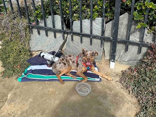
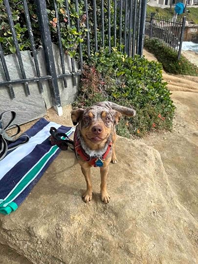
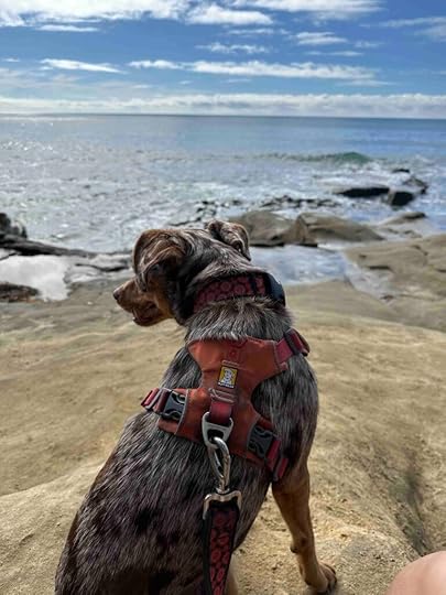
It’s one of my favorite places in San Diego to watch and play in the waves. There are big rocks to climb and sit on. You can also climb down to the beach that is between two big cliffs. Today we didn’t do that because the tide was in so far that there was no beach. Regardless Sunny and I enjoyed sitting on the rocks, watching the waves, and monitoring the birds. She was also quite pleased that other people were there so she could get some love and attention. She was quite disappointed, though, that we went at lunch time and I would not let her help people eat their lunch.
This adventure reminded me that sometimes the best adventures are close to home and even a short walk away. I think every community has an interesting spot that you can enjoy with your dog. And although we don’t have a beach or ocean in our hometown of Auburn, IN, we do have several close to home gems. These are locations that Sunny loves because they are different than just walking around our neighborhood, have dirt trails, and one even has a creek running through it. For our dogs any place with new smells is a grand adventure.

The post Close to Home Adventure appeared first on Live Like Karlie.