Andie LaComb's Blog, page 6
January 15, 2024
Lake Ramona Trail
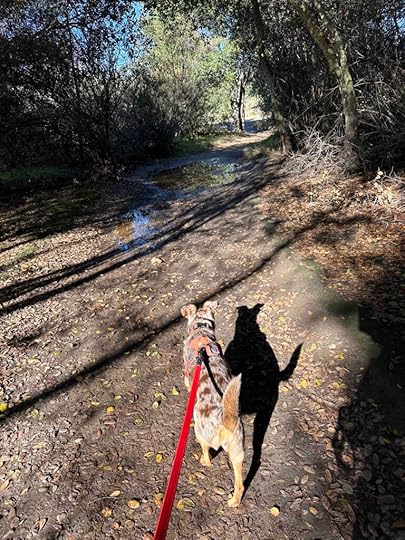
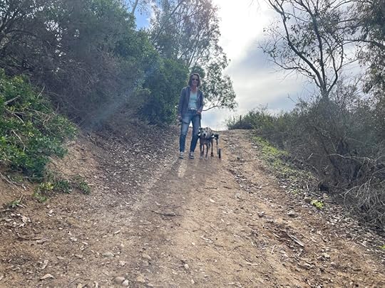
Another holiday and another visit to the Blue Sky Ecological Reserve in Poway. This time we decided to take the Lake Ramona Trail. We found this to be just as fun, but a little less busy than the Lake Poway Trail that we hiked the day after Thanksgiving.
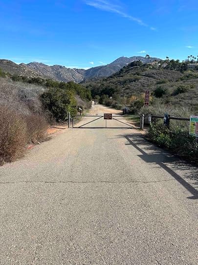
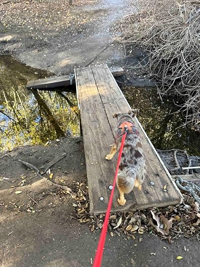
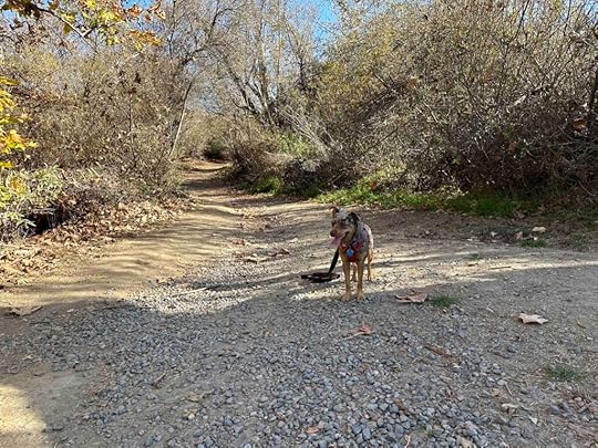
We were not the only ones who decided to hit the trails today so it was challenging finding a parking spot, but luckily we found one. After parking we walked past the port-o-potty and the sign with the reserve trails map and followed the trail sign pointing to the left. This led to a dirt trail along the street. A short distance later we found the entrance to the reserve and the Green Valley Truckee Trail.
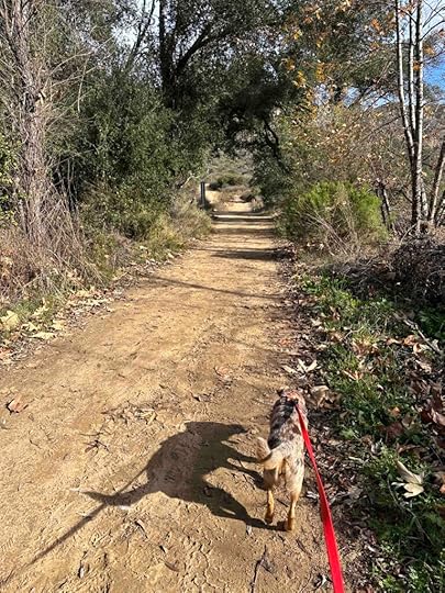
The beginning of the reserve is a hard packed dirt trail that after a short distance turns into a more wooded trail. After a short distance there is a sign on the left for the Creekside Trail. This is a short loop that goes along the creek and then rejoins the main trail. A short distance later is the Lake Poway Trail on the right. As the name implies this leads to Lake Poway. That is the trail we took during our last visit to the reserve. You can read about that on our blog – Lake Poway Trail.
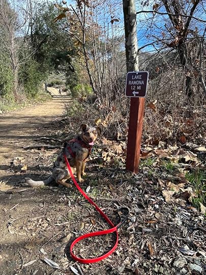
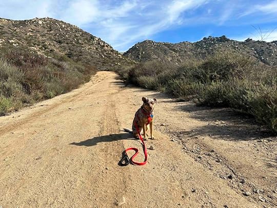
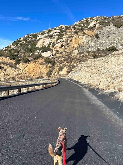
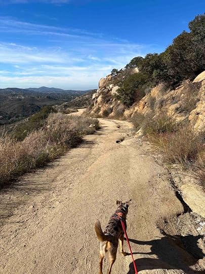
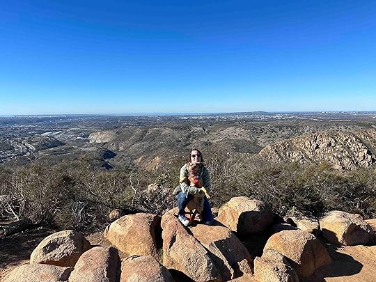
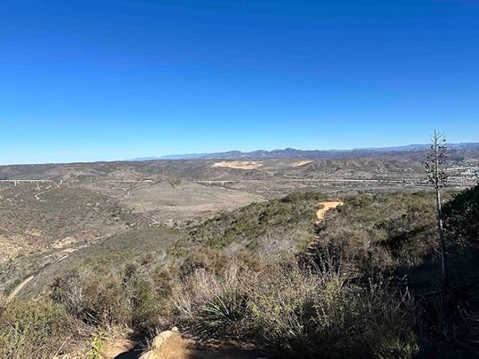
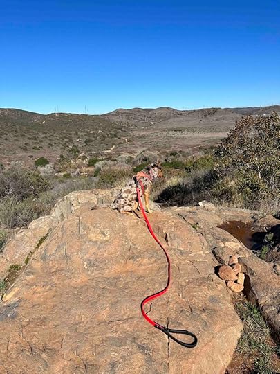
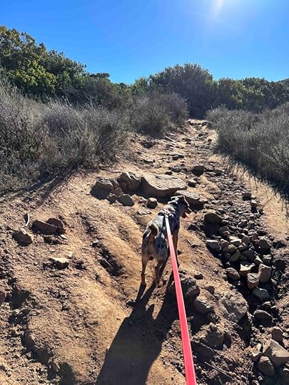
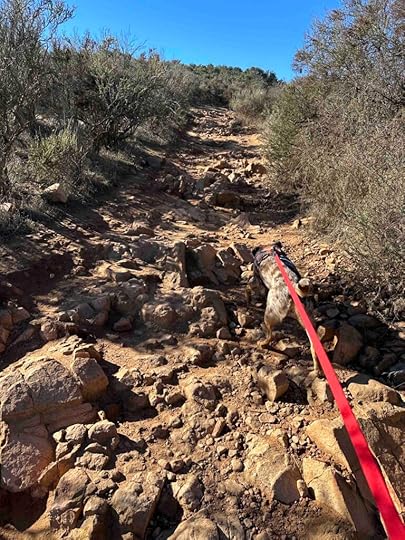
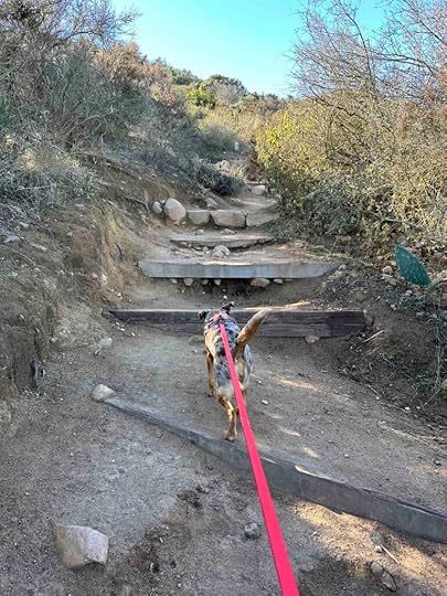
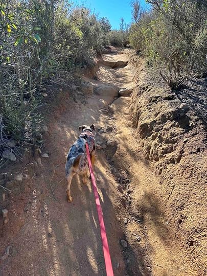
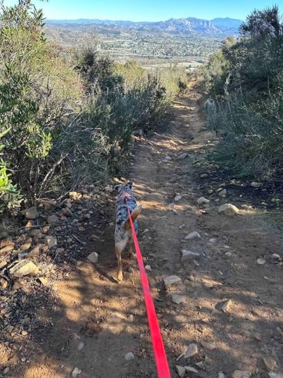
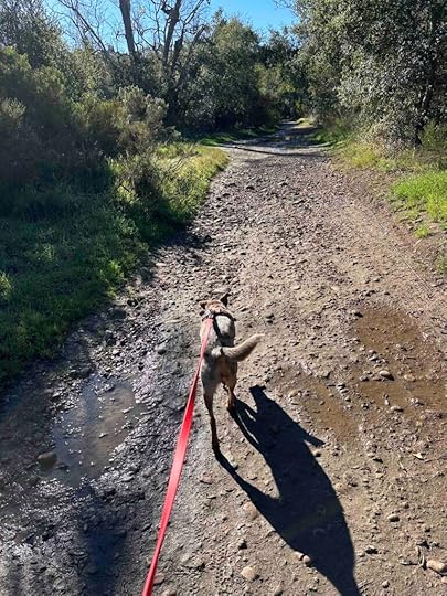
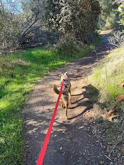
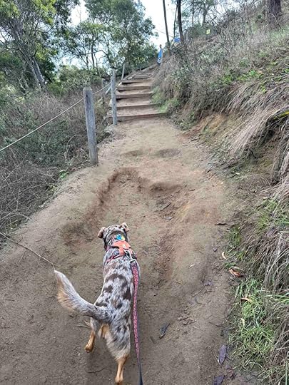
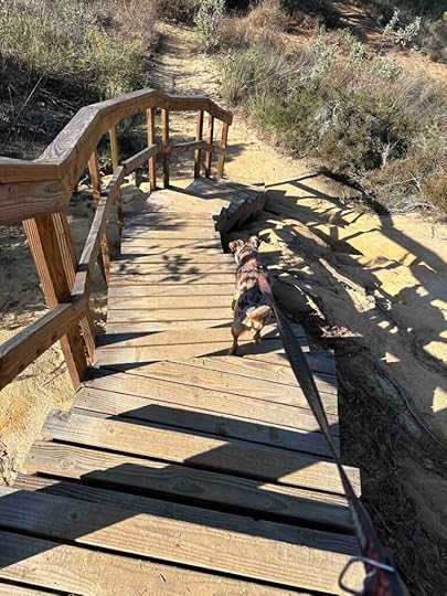
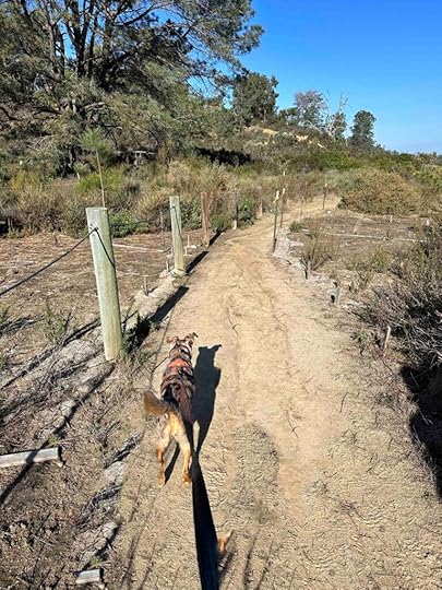
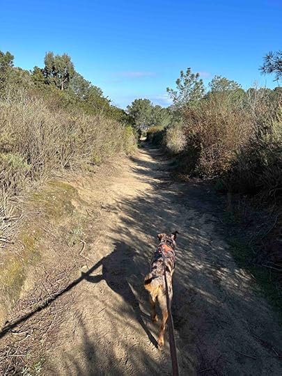
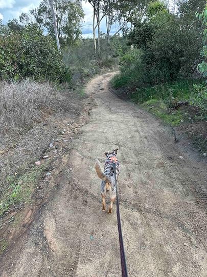
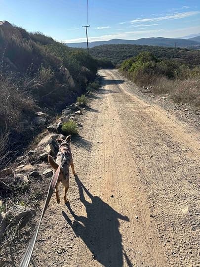
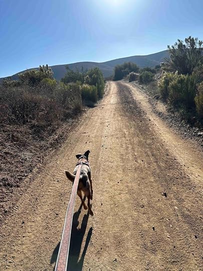
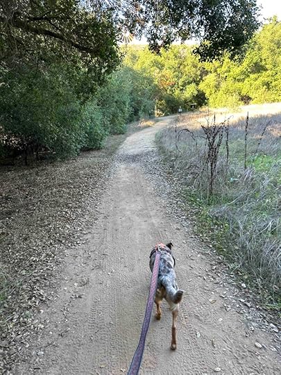
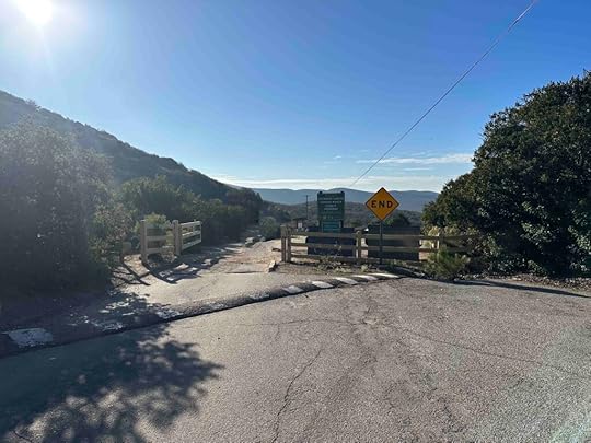
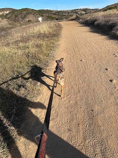
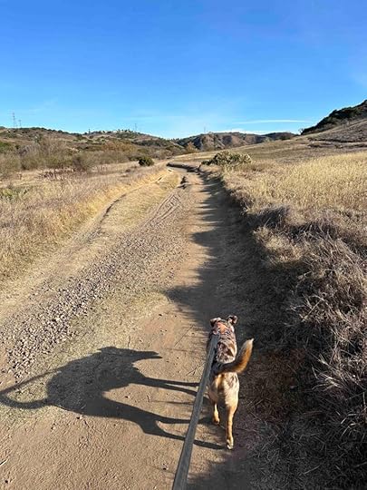
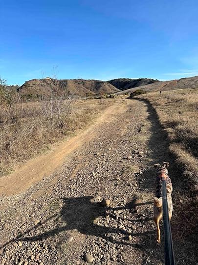
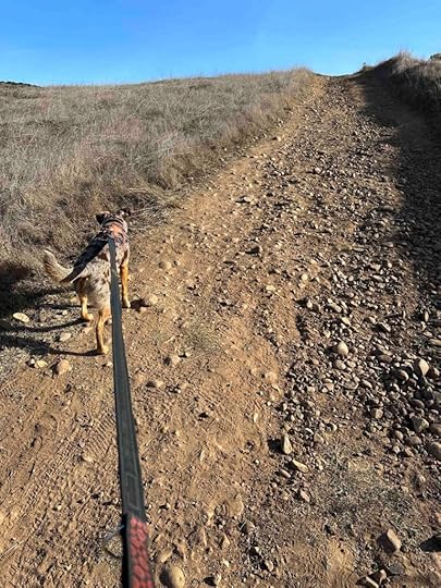
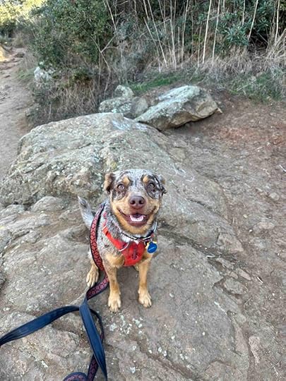
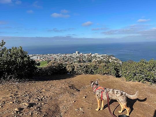
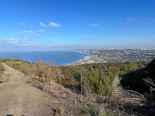
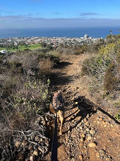
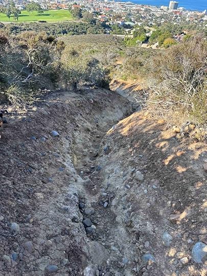
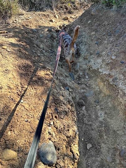
Today we walked past the Lake Poway Trail continuing on the Green Valley Truckee Trail. After just less than a mile we came to a Lake Ramona sign pointing to the left. We continued on that trail which wound up and around the hills and to lake Ramona. The trail was hard-packed dirt and mostly without shade. Although this trail is mainly uphill it is not as steep or challenging as other trails we’ve conquered. The trail is quite wide making it easy to walk side-by-side even when passing other people.
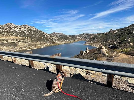
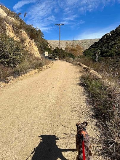
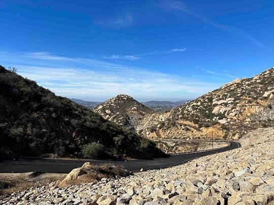
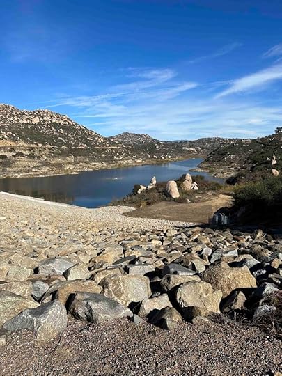
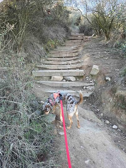
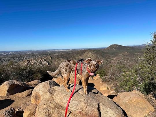
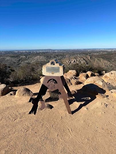
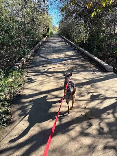
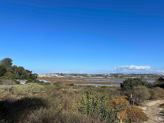
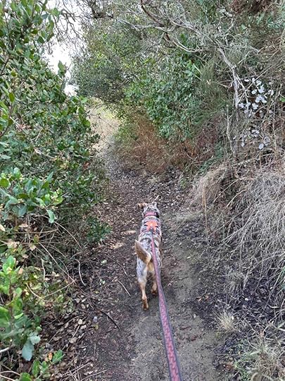
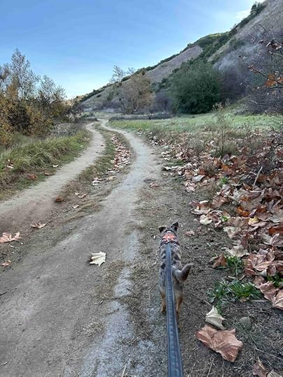
About a mile from the lake we saw what appeared to be the wall of a dam. As we approached it the dirt trail turned into an asphalt trail. It eventually took a sharp turn to the right and for a short distance was completely shaded. This was a welcome relief from the sun that was on us for most of the hike. At the top of the road was a port-o-potty and the lake to the right. Although you can not get down to the lake in this area, the views of it and the trail we climbed up on is beautiful.
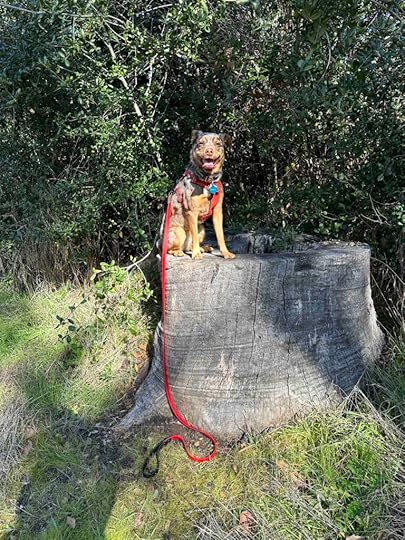
After spending some time taking in the views we headed back down the trail. Since the trail is not extremely steep, the trip down was not too difficult. Some of the trails we’ve taken have been harder going down than going up due to the steep incline. This was not the case today. We enjoyed seeing the views from a different perspective and soon were back down to the flat and wooded portion of the trail. Of course we found a tree stump that made a nice photo op for Sunny. We finished the hike and headed back to the car. Our total distance was just over 5M with an elevation gain of 943 ft.
 Our Rating
Sunny and I rate the Lake Ramona Trail at Blue Sky Ecological Reserve 4 out of 4 paws up. It has everything we love – challenging trails, beautiful views, interesting scenery along the trail, good parking, and restrooms. We highly recommend this trail and the Lake Poway Trail.
How Do I Get There?The parking are for the Blue Sky Ecological Reserve is at 16275 Espola Rd. in Poway, CA. From I-15 North take exit #19 for CA 56/Ted Williams Parkway and turn right. Continue for 2.5M then turn right onto Twin Peaks Road. After 2.3M turn left onto Espola Road. After 2.8M the parking lot is on the left. It’s a large parking lot with several access points to the trails.
For more information about the Blue Sky Ecological Reserve visit the City of Poway website.
Blue Sky Ecological Reserve – City of Poway website
The post Lake Ramona Trail appeared first on Live Like Karlie.


January 10, 2024
Coronado Dog Beach
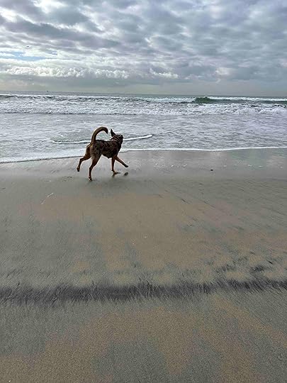
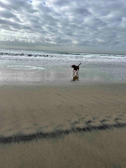
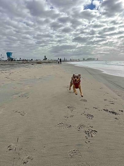
I am not a fan of dog parks, but I love Coronado Dog Beach and now Sunny does too. Today was actually the second time she’s been there. The first time she was a puppy and I wasn’t sure of her recall so we mostly walked a little on leash and then sat on the sand. Today she had the chance to run with the big dogs and check out the ocean. It was truly the best day ever.
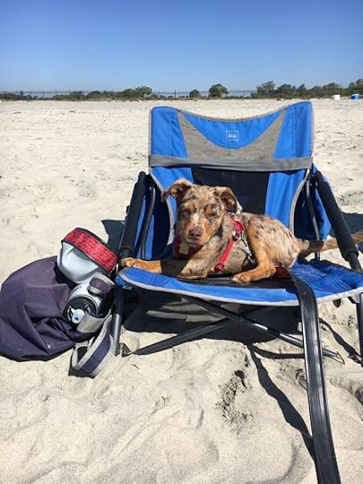
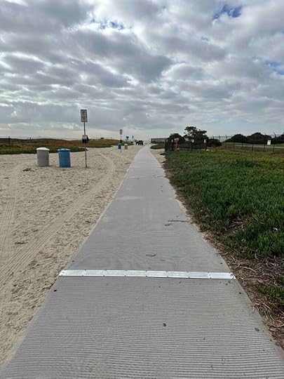
After parking the car on Ocean Boulevard near Sunset Park we walked across the street to the sidewalk on the sand that leads to the beach. Dogs are supposed to stay on leash until the end of the sidewalk so we waited until we were on the sand to let Sunny run free. As soon as we did she made a bee-line for the ocean. She loves the beach, but has a healthy respect for the ocean. Although she will run up to the water she has no interest in getting more than her toes wet. We played around on the sand, with her getting zoomies, and then started to walk down the beach. After a short while a big Husky came running up and they were off and playing. After awhile we headed further down the beach and interacted with a big Chocolate Labrador. Later she played with two more big dogs. After that it was time to head off the beach and walk around the neighborhoods before returning to our car and heading home.
A few things to know –
Coronado’s Dog Beach is open from 6A to sunset.The entrance is near the Naval Air Station entrance and across from Sunset Park.Parking is on the street.Dogs must remain on leash until you get to the end of the sidewalk that leads to the beach.The dog beach is on the right-hand side bordering the Naval Air Station.There is no restroom, but there is one a block down the sidewalk on Ocean Blvd.Dogs are not allowed at Sunset Park.Clean up after your dog.Our RatingSunny and I rate Coronado Dog Beach 4 out of 4 paws up. Your dog can run and play with other dogs while walking along the beach. The only way it could be better is if it was bigger. That’s not to say there isn’t plenty of room because there is quite a bit of space along the ocean and a large section of beach. It’s beautiful, the people do a good job of watching their dogs and picking up after their dogs, and there’s plenty of room for walking, sitting on the beach, and playing in the sand. It’s a not to be missed place in San Diego if you have a dog or just love dogs.
For more information about Coronado Dog Beach check out the Visit Coronado website.
How Do I Get There?Coronado Dog Beach is located at the most northern section of the beach near the Naval Air Station. The entrance is near the entrance to the Naval Air Station and across the street from Sunset Park on Ocean Boulevard. From I-5 take exit #14A for CA-75 toward Coronado. Continue over the bridge and onto Third Street. After .6M turn left onto Alameda Street. After 1M turn right onto Marina Avenue and after .2M turn right onto Ocean Boulevard. The entrance to the beach is on the left. Parking is on the street. Although there is no restroom at the dog beach, there is one a short distance down the sidewalk away from the Naval Air Station.
The post Coronado Dog Beach appeared first on Live Like Karlie.
January 8, 2024
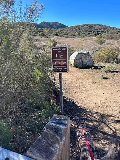
Kwaay Paay Peak Trail
Want a leg burning workout? Want to climb 875 feet in just over a mile? Then the Kwaay Paay Peak Trail in Mission Trails Regional Park is the trail for you! We conquered the climb this morning and it was a bit of a challenge for Sunny and me because of our short legs, but the views at the top are well worth the climb.
History of Mission Trails Regional ParkThe park’s land was originally used by the Kumeyaay, then catholic missionaries, farmers and ranchers, and even the military. In the late 1960’s the County of San Diego developed a plan for a regional park, however it wasn’t until the late 70’s and early – mid 80’s that much of the land was acquired and the fundraising and development of the park began. In 1995 the visitor’s center opened. Today the Mission Trails Regional Park, which owes it name to a community-wide contest, consists of over 8000 acres of rugged hills, valleys, and open spaces. It has about 60 miles of hiking trails, Lake Murray for recreational boating, and Kumeyaay Lake Campground. It is considered the third jewel in the City of San Diego Parks System.
Our AdventureWe have been to Mission Trails Regional Park many times and generally walk on the road and explore the easier trails just off the road. Today we tackled the Kwaay Paay Peak Trail which is a much more challenging trail and not for those with stability or mobility issues. I also would not recommend it for small or young children.
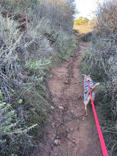
There are several entrances to the trail, but we decided to use the west trail near the Old Mission Dam. We were lucky to get the last parking spot at the Old Mission Dam parking lot across from the trail. After walking across the street to the trail entrance we started the climb. Although the trail immediately starts with an incline, it’s nothing compared to what is to come. The trail is packed dirt with rocks in a lot of areas. It’s fairly narrow, but mostly wide enough for two people to walk next to each other. There is vegetation on both sides and little shade making it a hot hike on a warm day. Luckily today was a cool morning.
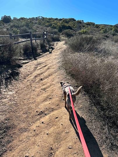
As we climbed we found some areas to stop and take in the views which are spectacular. Of course there were photo ops for Sunny who just wanted to keep hiking.
The trail is a nearly constant uphill with some sections steeper than others. Some of the inclines are covered with rocks while others have steps and stairs. The hardest part for Sunny and me were the steep steps that are not made for those with short legs. There are quite a few flights of these steps and just when you think you are done climbing, there are more steps and inclines. The steepest section of the trail are two flights of steps just prior to the summit.
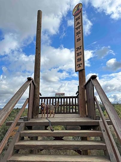
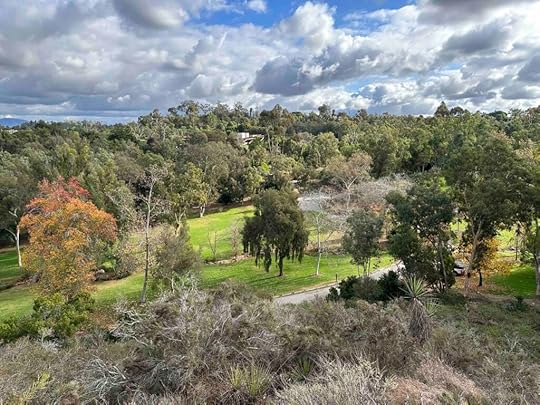
Just after conquering these stairs the trail levels off and you come to the summit and the marker. The summit provides beautiful views of the hills surrounding the area and other trails. There is also a bench and railing to rest and take in the views. After a short rest and many photographs we headed back down the trail, which was as challenging as the climb up due to the sharp descents and “slippery” dirt. Having a rambunctious young dog who likes to go fast may also have had something to do with it.
 Our Rating
Sunny and I rate the Kwaay Paay Peak trail 3.5 out of 4 paws up. It’s a challenging hike within the beautiful Mission Trails Regional Park. We loved the challenge of the hills and the views at the top. The trail is well-maintained with good signage making it easy to stay on the trail. There’s ample parking both in a parking lot and on the street. The parking lot also has two porto-potties and the visitor center has a restroom. We consider Mission Trails Regional Park a must visit location in San Diego and Kwaay Paay Peak Trail a challenging hike for those who are in good shape and can handle steep inclines and descents.
For additional information about Mission Trails Regional Park check out the following websites:
Mission Trails Regional Park – History
How Do I Get There?You can either drive to the visitor’s center, park in the lot, and walk the section of the road that is closed to vehicular traffic to the trail entrance or park at the Old Mission Dam like we did. These directions are to the Old Mission Dam parking. From CA-52 take exit #13 – Mast Blvd and turn left. After .2M turn left onto West Hills Parkway and continue for .7M. Turn right onto Mission Gorge Road and continue .2 miles. Then turn right onto Father Junipero Serra Trail and after .7M turn right into the Old Mission Dam parking lot. You can also park along the road. The trail head is located across Father Junipero Serra Trail.
The post Kwaay Paay Peak Trail appeared first on Live Like Karlie.
January 7, 2024
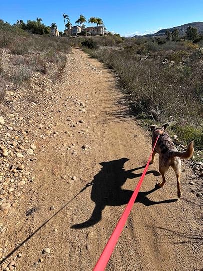
Los Penasquitos Canyon Trail Part 2
 History of Los Penasquitos Canyon
Los Penasquitos Canyon lies between Rancho Penasquitos, Sorrento Hills, and Mira Mesa. It comprises 4000 acres with a multitude of trails. It started out owned by Francisco de Maria Ruiz in 1815 and today is owned by the City of San Diego. The land was originally used to raise livestock and graze cattle. And in the 1960’s they tried to develop it, but by 1970 it was owned by the City and County of San Diego for use as a park and open space. We are certainly glad it was saved from development and preserved for biking and hiking.
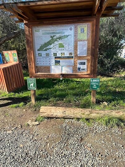
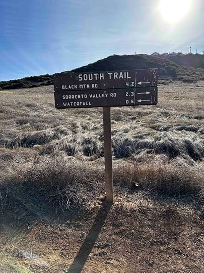
Los Penasquitos Canyon TrailThe Los Penasquitos Canyon Trail can be accessed from a variety of areas. Today we went to the trailhead off Black Mountain Road. At this location you can get onto the trail in several spots. We decided to go to the trailhead off Canyonside Park Driveway. This part of the trail leads to the Penasquitos Creek.
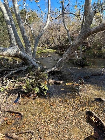
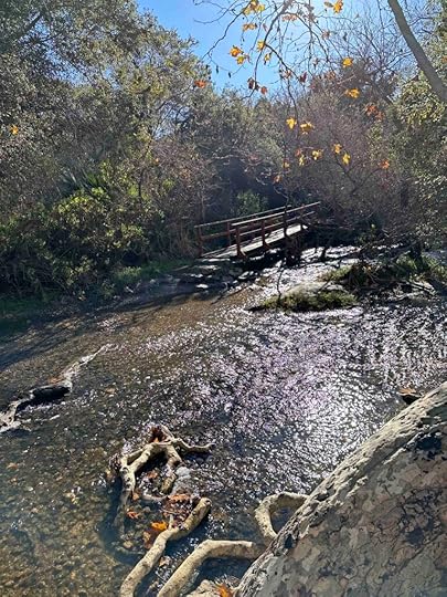
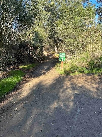
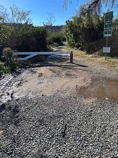
We had rain last night so the trail was a bit muddy. And when we got to the creek we noticed it had gone over the side. This closed a section of the trail as we could not get to the bridge over the creek. Instead we took the trail to the ranch and then continued past the ranch. This looped back to the original trail and over the creek. We followed that for awhile and then crossed back over the creek at the Penasquitos Creek Crossing. The trail then turned to the right and followed behind some homes. Eventually the trail led back to the ball fields and the parking lot. We managed to hike for 2.36M on a somewhat unconventional and circuitous route. No matter we had a wonderful day enjoying the sunshine and nature. Sunny was just happy to be back on the trails.
 Our Rating
Sunny and I rate this section of the Los Penasquitos Canyon Trail 3 out of 4 paws up. The main downside is parking can be challenging, especially on the weekend when the ball fields are busy. The trail is also susceptible to closing if the creek runs over the side. Despite that it’s a nice hike with some shade, especially near the creek. Most of the rest of the trail is in the open, making for a hot hike in the summer. The trail has a few inclines, but is mostly flat. There are only a few signs so it can be easy to get turned around. All in all this section of the trail provides a nice hike, but it’s not quite as scenic as the hike to the waterfall.
For more information about Los Penasquitos Canyon checkout the City of San Diego website.
City of San Diego – Los Penasquitos Canyon
How Do I Get There?For this section of the trail use 12350 Black Mountain Road as the location. From I-15 take exit #17 – Mercy Road. Turn left onto Mercy Road and follow it for 1.4M and then turn right onto Black Mountain Road. After .2M turn left onto Canyonside Park Driveway. We like to drive past the ball fields and at the end turn right to park. The trailhead is across the Canyonside Park Driveway. Just look for the trail map sign and gate. You can also access the trail on the left side near the end of the parking area.
The post Los Penasquitos Canyon Trail Part 2 appeared first on Live Like Karlie.
December 27, 2023
Annie’s Canyon Trail
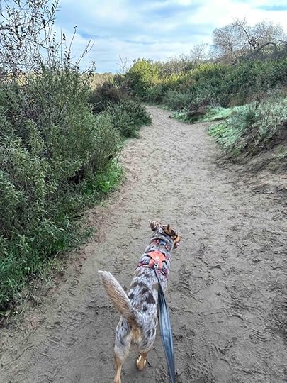
Annie’s Canyon Trail is a popular trail in Solana Beach and until today it is one we had not visited. I have wanted to hike this trail for quite some time, but didn’t think Karlie could handle the steep inclines. Since Sunny does not have any problem with inclines we finally explored the trail today. It was well worth the trip.
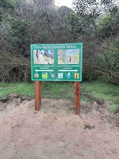
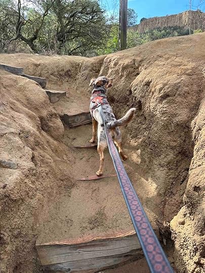
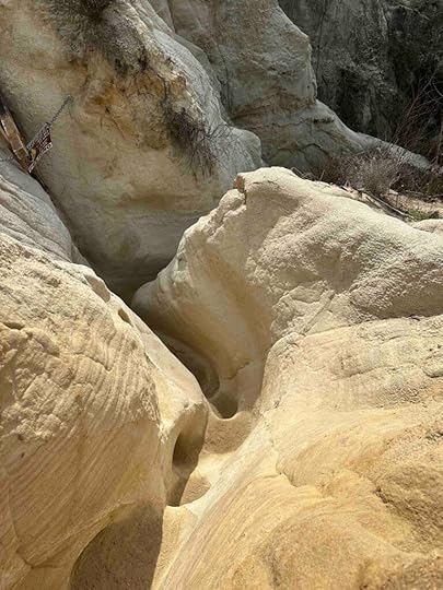
Annie’s Canyon, located in the San Elijo Lagoon Ecological Reserve, was once off-limits and prone to drug use and vandalism. Local residents with a generous donation cleaned it up and now it’s open for hiking. The highlight is the slot canyon which provides a narrow passage through the canyon, but this path is not for everyone since it is extremely narrow and requires you to climb a metal ladder to the peak. As an alternative there is a moderate switchback climb that requires scaling steep steps up to the peak.
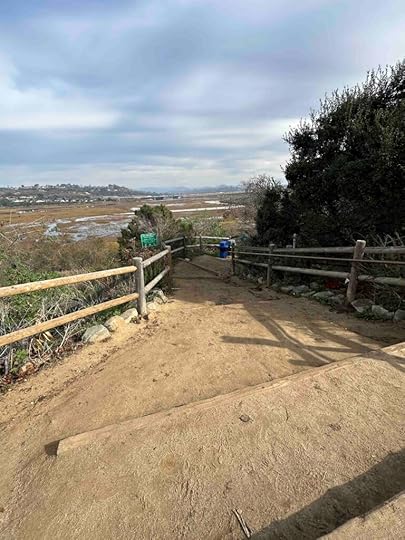
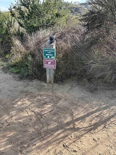
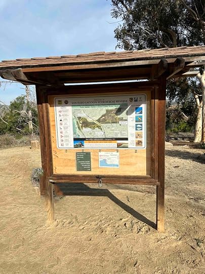
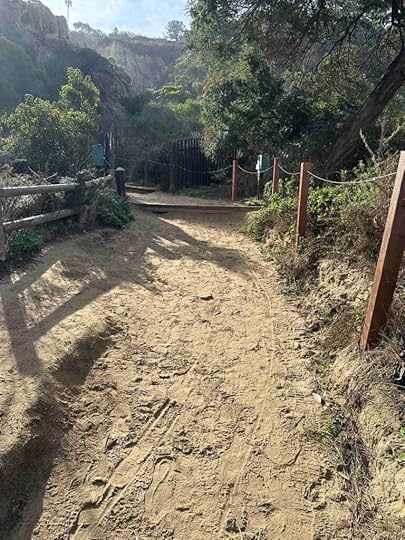
There are several areas to access the trail to Annie’s Canyon and we opted for the one off N. Rios Ave. The trail starts with a steep descent down some stairs and then levels out to a relatively flat trail with some rolling hills. It’s fairly shaded, at least in the morning, and gives views of the lagoon on the left. There are some side trails, but if you follow the Annie’s Canyon Trail signs you will come to an information kiosk with a trail map. Behind that is the trail that leads to Annie’s Canyon. A short distance down the trail and you come to a sign indicating two options – hiking through the slot canyon or up the switchback trail above the canyon. Both options lead to an overlook with views of the canyon, lagoon, and ocean and both present challenges.
 Annie’s Canyon Trail – Slot Canyon Route
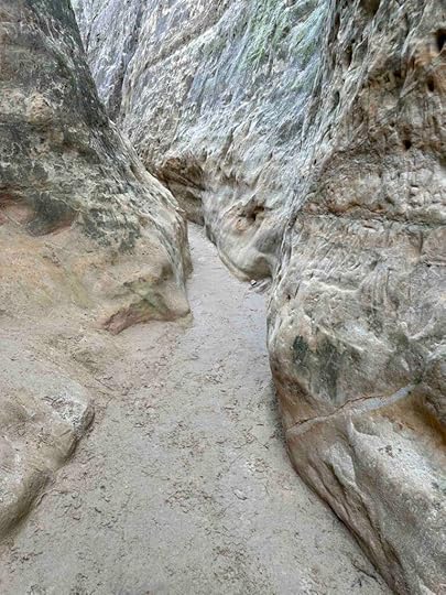
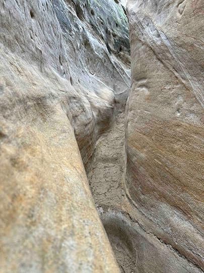
The trail that leads through the slot canyon is considered difficult and is not for those who are prone to claustrophobia. It starts with a narrow trail through the sandstone. The walls of the sandstone are immense and amazing. After a short distance the trail narrows considerably and requires scrambling and climbing through the sandstone. This is the point where we turned around. Although I was carrying Sunny on my back I did not know how narrow the path would become nor how long it was. The trail was extremely busy making it quite slow to try to get through this section. After going a short distance in this very narrow section we decided it would be best to turn around. I would recommend viewing the virtual tour before deciding to take this route as unless you decide to turn around before anyone else is behind you, you can’t turn around.
 Annie’s Canyon Trail – Switchback Route
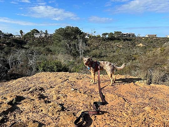
After realizing the concerns with progressing on the slot route we decided to take the switchback route. This route is a steep incline the whole way. Some sections are fairly narrow, but it does have steps. They were a little tall for Sunny and my short legs, but we still managed to scramble up them. The trip to the peak is about a quarter mile so although not a long hike, it is challenging, but fun. Once at the top you can see where the slot canyon route comes up. There are also views of the canyon, sandstone cliffs, and the lagoon. It’s well worth the hike to see these views.

The return trip is as challenging since you now have to climb down those steep inclines you climbed up. Once we returned to the area with the kiosk we ventured on the trail to the right for a short time. Eventually we turned around and returned to the entrance at N. Rios Ave. Then we turned right onto the Solana Point Circle and Pole Road Trails. We followed these trails to highway 101 and then returned to N. Rios Ave. Our total hike was 3.52M, but if you hike to the Annie’s Canyon overlook and back the hike is about 1.5M.
Our RatingSunny and I rate Annie’s Canyon Trail 3.5 out of 4 paws up. This is truly a unique hiking experience whether you go through the canyon or not. And the trail is challenging with either narrow passages and climbing or steep steps and a winding trail. The views through the sandstone and at the top are beautiful. The only downsides are parking is on the street, dogs are not allowed to walk through the slot canyon, and the trail can be crowded.
How Do I Get There?We entered Annie’s Canyon Trail from the Gemma Parks Interpretive Trail off N. Rios Ave. From I-5 take exit #37 – Lomas Santa Fe Drive and turn left onto Lomas Santa Fe Drive. Continue for 1M and turn right onto N. Rios Ave. Entrance to the trail is .8M at the end of N. Rios Ave. There is no designated parking area; parking is on the the side of the street. During weekends and holidays this is a popular trail, so it may be challenging to find a parking spot.
The trail can also be accessed from the Solana Hills Trail off Solana Hills Drive or Canyon Drive.
For additional information about Annie’s Canyon Trail check out the link below.
The post Annie’s Canyon Trail appeared first on Live Like Karlie.
December 25, 2023
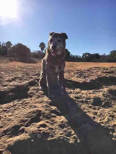
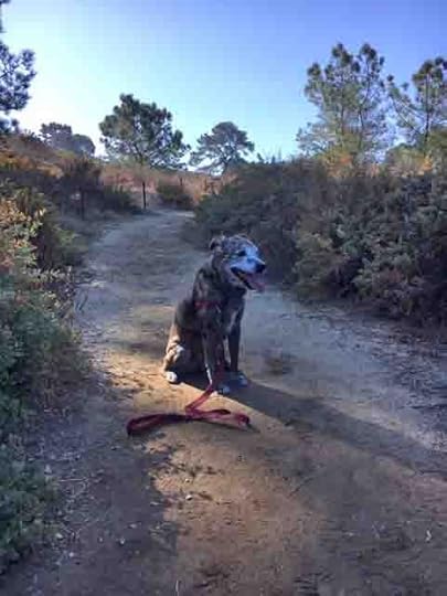
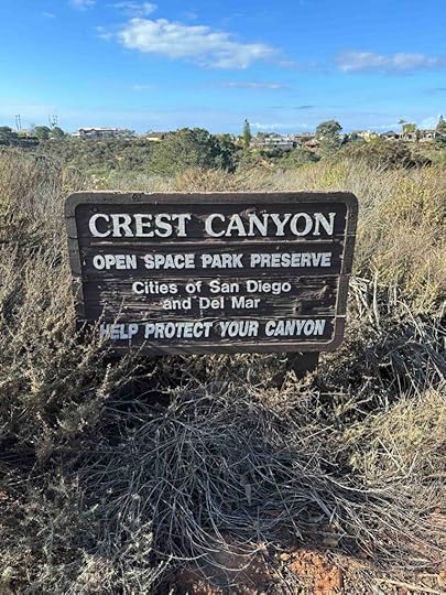
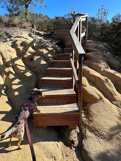
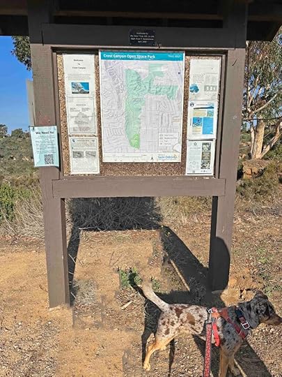
Crest Canyon
Crest Canyon is another location that Karlie and I visited a few times. I’ll admit that it wasn’t our favorite place since there are other spots we enjoy more. But today we decided to visit with Sunny since I was looking for a closer to home hike. What I found out is the trail has been expanded making it better than I remembered.
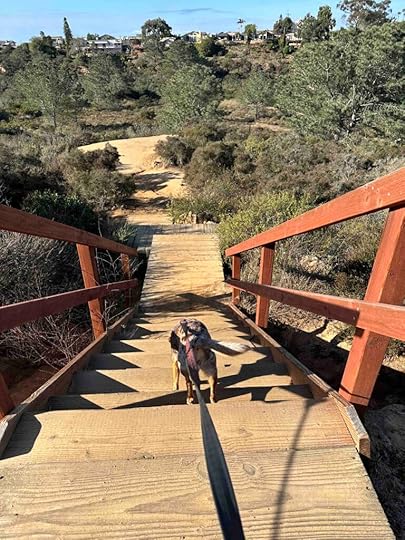
Crest Canyon, located between Del Mar and Del Mar Hills, has steep sandstone cliffs with beautiful views of the canyon below and the San Dieguito Lagoon. It provides about a 2.2M hike with the biggest challenge being the steep stairs to get into and out of the canyon. The trail is well marked and easy to follow and although fairly popular with runners and walkers it’s not over crowded. The biggest downfalls are there’s really only one trail so it’s the same hike every time, no designated parking, and no restrooms.
Visiting Crest CanyonAlthough the official entrance to the trail is at Durango Drive and Lozana Road, there are some trails on the upper section along Durango Drive. We usually park on Durango Drive shortly after turning off Del Mar Heights Road to explore these trails and get views of the canyon below. After that we walk along the side of Durango Road to the official entrance and the stairs to the canyon below.
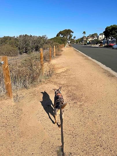
On this visit after entering the canyon we took the trail to the left. This is a loop trail so either direction will lead back to the stairs. The trail is a narrow dirt trail through the vegetation. There are poles with rope to keep you on the trail and out of the vegetation. As you walk along the trail there are views of the San Dieguito Lagoon. The trail winds down to Racetrack View Drive. This is another access point to the canyon and you can cross the road to the lagoon, which we did not do on this trip. After the sign at Racetrack View Drive the trail loops around back to the stairs.
 Our Rating
Karlie, Sunny, and I rate Crest Canyon 3 out of 4 paws up. We originally rated it 2.5 out of 4 paws up, but have increased the rating since the trail has been expanded making for a longer hike. The trail is not very challenging once you climb down the stairs and it’s the same hike every time. Despite that it’s a nice spot to enjoy the beautiful scenery and get away from the hustle bustle.
How Do I Get There?From I-5 take exit #34 – Del Mar Heights Road and turn left onto Del Mar Heights Road. After .6M turn right onto Durango Drive. You can park anywhere along Durango Drive. The official park entrance is at Durango Drive and Lozana Road. Entry into the canyon is to the left of the sign and down several steep flights of stairs.
For more information about Crest Canyon Park check out this link.
San Dieguito River Park – Crest Canyon
The post Crest Canyon appeared first on Live Like Karlie.
December 24, 2023
San Dieguito County Park
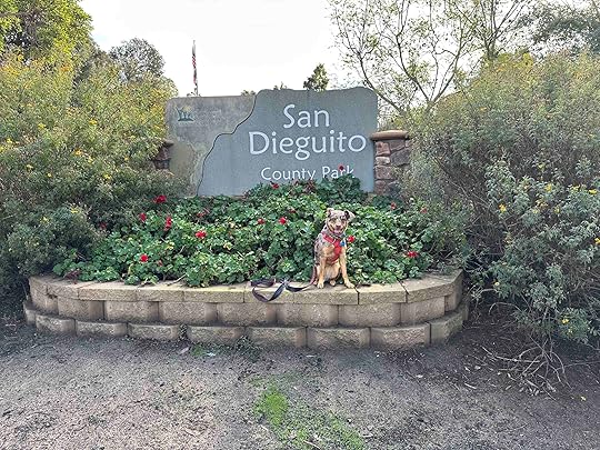
San Dieguito County Park is one of our favorite places to go for an adventure so yesterday we took Sunny there for the first time. Karlie and I visited this park many times with the last time being one of the most memorable. On her last visit Karlie was using her rear-wheel wheelchair. Despite that she conquered some big hills both paved and dirt. She had the best time and was all smiles on that visit.
Today we showed the park and all the trails to Sunny while reminiscing about our prior visits with Karlie. It was a good day and a good memory plus we made new memories with Sunny and she had a blast.
History of San Dieguito County ParkThe park has a rich history dating back to 1840 when the Mexican government granted the land to Juan Maria Osuna. He built a home for his family and used the land for farming and raising livestock. In 1906 the family sold the land to the railway who planted Eucalyptus seeds hoping to use the wood for railroad ties. When that didn’t work out, they sold individual lots that helped create Rancho Santa Fe. Later the land on which the park now stands was owned by the Santa Fe Irrigation District.
In 1952 the president of the irrigation district suggested creating a park. The San Dieguito Junior Chamber of Commerce agreed to sponsor it and originally envisioned a small park of about 5 acres. The president of the irrigation district, however, envisioned a much larger park of closer to 100 acres. After many meetings the County Board of Supervisors agreed to deed the park land to the County of San Diego in 1954. The cost was a symbolic $10. The upper park was completed in 1965 and the lower park in 1977.
Visiting San Dieguito County ParkThe park can be accessed from several different areas and you can either pay $3 to park in their parking lot or park on the street. We like to park on Highland Drive and either walk to the entrance or start walking on the Caballos Trail which goes entirely around the park. There are other trails off the Caballos Trail that lead into the park.
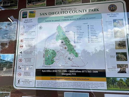
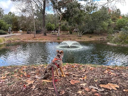
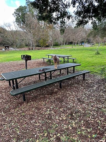
The park is divided into an upper and lower park. The lower park has grassy fields with picnic tables, restrooms, and a pond. It’s a nice spot for a picnic or to walk around. There is even a butterfly garden. The upper park has playground equipment, hiking trails, and several platforms overlooking the canyon and park below. There’s also some sandstone which is always fun to climb onto.
 Our Rating
Karlie, Sunny, and I rate San Diequito County Park 4 paws out of 4 paws up. This park truly has something for everyone – hiking trails, walking paths, picnic areas, grassy fields, parking (both paid and on the street), playground equipment, a pond, activity areas, and restrooms. It’s a not-to-be-missed spot in San Diego.
How Do I Get There?From I-5 take exit #37 – Santa Lomas Drive and turn right. Follow Santa Lomas Drive for 1.2M then turn left onto Highland Dr. After a short distance you can either park on the street (for free) or enter the parking lot near the San Diequito County Park sign. Parking in this lot costs $3/car.
For more information about San Diequito County Park check out these websites:
San Diego Parks – San Diequito County Park
Solana Beach Civic and Historical Society
The post San Dieguito County Park appeared first on Live Like Karlie.
December 23, 2023
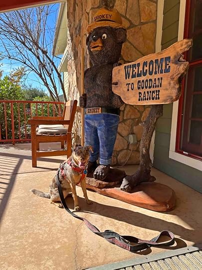
Goodan Ranch Preserve
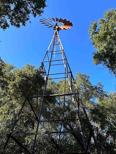
Goodan Ranch Preserve really was a ranch. In 1938 Roger and May Goodan bought the land and built the ranch where they spent the summers and weekends riding horses and relaxing. The property had a house, barn, garage, shed, water tower, and windmill, remnants of which you can still see today. The property was used to raise cattle until 1991 when it was purchased by the County of San Diego, City of Poway, City of Santee, and the State Wildlife Conservation Board. Today it is home to over 10 miles of trails used for biking, horse back riding, hiking, and running and a beautiful visitor center with a community room.
A few days ago we had a beautiful day and decided to hike Martha’s Grove Trail at Goodan Ranch Preserve. This is another trail that we previously visited with Karlie and decided to share with Sunny. There are 2 access points to the preserve – Highway 67 Staging Area and the Sycamore Canyon Road Staging Area. On both of our visits we started at the Sycamore Canyon Preserve Staging Area.
After parking you can either take Martha’s Grove Trail to the left behind the trail map or the gravel road straight ahead. I had planned to take the trail, but forgot we had to access it behind the sign so we took the gravel road. The views along the gravel road are nice, but we think it’s always better to be on a true trail. After walking about half a mile we came to an intersection and turned right onto Martha’s Grove Trail.
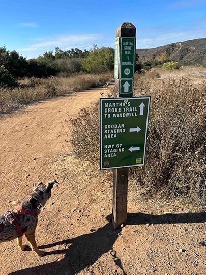
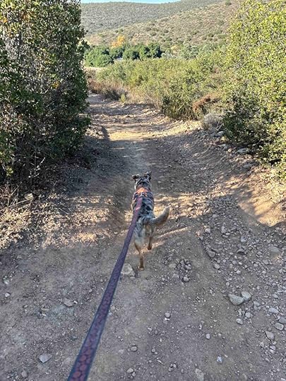
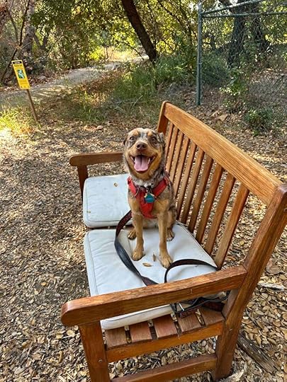
The trail is a little narrower and more rocky than the road, which makes it more interesting to us. It has some pretty good inclines and descents making for a more challenging hike. As you hike on the trail there are views of surrounding hills and vegetation. Eventually you can see a windmill in the distance. As you continue on the trail you come to a gravel road with the windmill in front of you. There is a nice bench in front of the windmill which is a great spot for a little rest.
If you turn to the right the trail leads past a storage shed and to the visitor center and remains of the ranch. The visitor center has restrooms and a picnic area. This is one of the few areas on the hike to get a little shade. Most of the trail is out in the open, but the picnic area has some trees and is quite nice for a break. If you continue on the road it leads back to the parking area on Sycamore Canyon Road. We logged 3.2M, but if you take Martha’s Grove Trail from the parking area the total distance is 3.5M.
 Our Rating
Karlie, Sunny, and I rate Goodan Ranch Preserve 3 out of 4 paws up. It’s a somewhat challenging hike to the ranch with beautiful views. The only true downside for us is there isn’t any body of water. Overall this is a fun place to hike and we highly recommend a visit especially if you are in or near Poway.
How Do I Get There?We like to access the preserve from the Goodan Ranch staging area at 16281 Sycamore Canyon Road in Poway. From I-15 take exit #18 – Poway Rd. and turn right onto Poway Road. Continue for nearly 5M and then turn right onto Garden Road. Continue for about 2M then turn right onto Sycamore Canyon Road. Follow this for about 1.4M. At the end drive over the speed bump and through the gated area to the parking lot. You can start the hike either on a dirt trail to the right, a dirt trail behind the trail map, or the gravel road straight ahead.
For more information about Goodan Ranch Preserve check out the links below.
County of San Diego Parks and Recreation – Goodan Ranch.
Goodan Ranch Preserve Brochure
The post Goodan Ranch Preserve appeared first on Live Like Karlie.
December 15, 2023
Los Penasquitos Canyon Trail
 History of Los Penasquitos Canyon
Los Penasquitos Canyon lies between Rancho Penasquitos, Sorrento Hills, and Mira Mesa. It comprises 4000 acres with a multitude of trails. It started out owned by Francisco de Maria Ruiz in 1815 and today is owned by the City of San Diego. The land was originally used to raise livestock and graze cattle. And in the 1960’s they tried to develop it, but by 1970 it was owned by the City and County of San Diego for use as a park and open space. We are certainly glad it was saved from development and preserved for biking and hiking.
Our First Trip to Los Penasquitos Canyon TrailThe Los Penasquitos Canyon Trail is one of many trails in the canyon and it leads to the Penasquitos Canyon Creek waterfall. The first time Karlie and I tried to hike to the waterfall we did not find it. We had a wonderful time exploring some other trails, but were disappointed we did not find the waterfall. We eventually hiked the trail with a dear friend who knew how to find the waterfall. That was perhaps one of my favorite hikes as Karlie was so happy that she sat near my friend overlooking the waterfall and gave her a kiss.
 Today’s Adventure
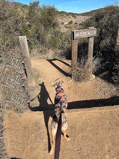
Today we returned to the canyon to see if we could find the waterfall with Sunny. Since there are many trails and signage is sparse I would highly recommend looking at the map of the trail prior to starting. The simplest way to keep on track is to always take the trail to the right. This holds true except at the very start where you take the trail to the left, but there is a sign indicating the waterfall is to the left. After that take the trail to the right and you will eventually make it to the waterfall.
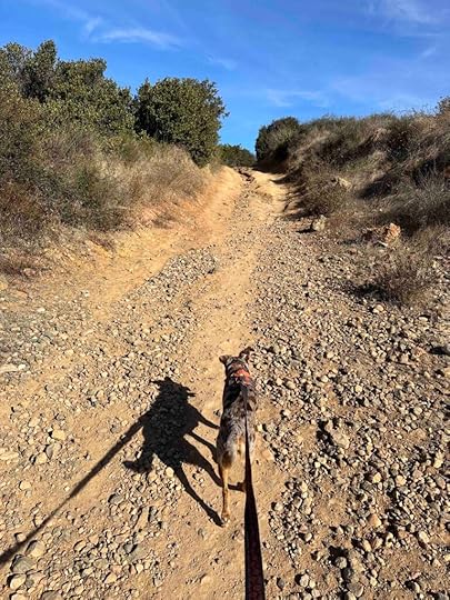
The trail starts past the metal gate and port-o-potty. It starts by winding to the left and under the Sorrento Valley Blvd overpass. Once through this section the trail becomes a wide hard-packed dirt trail. It continues through the canyon with views of the canyon walls and hills.
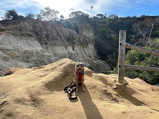
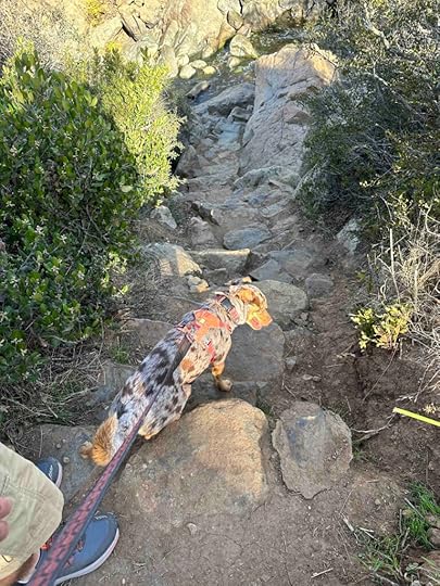
As the trail continues there are some uphill sections and some areas of the trail are covered with stones. This makes the hike a little more challenging, but nothing like Black Mountain Nighthawk Trail or La Jolla Natural Park. Eventually you come across a sign indicating the waterfall is .6M away. The trail continues and then you come to a sign indicating the waterfall is a few steps away.
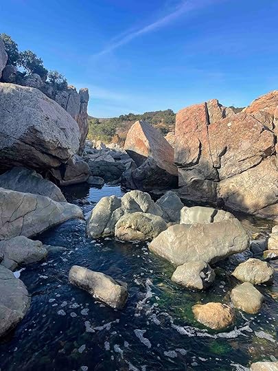
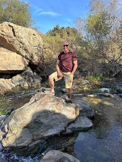
As you continue on the trail you see an overlook and then very steep steps down to the water. There is not much room once you get down to this area, but it’s a great place to cool off in the summer. After exploring the water for a bit we headed back up the steps and hiked to the car. Our total hike was 5.7M. We went early so it was chilly at the start, but was really starting to warm up on the return hike.

 Our Rating
Sunny, Karlie, and I rate Los Penasquitos Canyon Trail 3.5 out of 4 paws up. The only downside is there are few signs making it easy to take a wrong turn and not make it to the waterfall. Other than that it’s a beautiful hike along a creek with views of the hills along the way. Most of the hike is out in the open with little shade making it a hot hike once the sun is overhead. There is plenty of parking and a port-o-potty in the parking lot. This is a popular area so you likely will encounter other hikers and people on mountain bikes. All in all this is a fun hike and one we recommend.
For additional information about Los Penasquitos Canyon check out the City of San Diego website.
City of San Diego – Los Penasquitos Canyon Preserve
How Do I Get There?The parking lot for the west entrance to the Los Penasquitos Canyon is in the 4200 block of Sorrento Valley Blvd. From I-5 take exit #30 – Sorrento Valley Blvd. Continue on Sorrento Valley Blvd for about 1.1M and look for the parking lot on the right. Entrance to the trail is near the port-o-potty, metal gate, and wood sign.
The post Los Penasquitos Canyon Trail appeared first on Live Like Karlie.
December 12, 2023
La Jolla Natural Park
The La Jolla Natural Park is a hidden gem in La Jolla, CA. It’s a small park with amazing views of La Jolla, the cove, and the ocean. Although the trail is short, it’s quite challenging and can be accessed from two areas – Al Bahr Dr or Encelia Dr. We like to start the hike at Encelia Dr because you get to see the views at the start and end of the hike.
In 2019 we visited the La Jolla Natural Park with Karlie. It was a foggy day so the views weren’t quite as spectacular as they are on a clear day. Despite that we had fun exploring this park for the first time. We started at the top and hiked down to Al Bahr Dr. and then hiked back up to the top. Karlie was quite the billy goat that day leading the way and today was no different with Sunny.
We started by walking past the entrance gate and finding one of the dirt trails that leads to the overlook with the bench. We found the best views of the ocean, cove, and La Jolla at this vantage point. After enjoying the views we started to climb down the hill. The trail is quite narrow, covered with stones, and really steep. It does not flatten out much making it a challenging hike that requires hiking shoes or sneakers. The trail is also out in the open with little shade and leads down to Al Bahr Dr. There’s not much to see at this area so we turned around and headed back to the top. Total distance of this hike is just over 1M, but it is extremely challenging.
 Our Rating
Karlie, Sunny, and I rate the La Jolla Natural Park 3.5 out of 4 paws up. Although it’s a short hike, it is one of the most challenging hikes that we’ve done and we love that. Both Karlie and Sunny love to billy goat up and down hills so this is perfect for them. We also love the views of the ocean and La Jolla. It really is amazing. The only downsides are parking at the top is challenging, there is no restroom, and there is no water feature. Despite that this is a fun place to visit and a not to be missed spot.
How Do I Get There?The trail can be accessed via Al Bahr Dr or Encelia Dr. We always start at the top and hike to the bottom so we park on the street near 7333 Encelia Dr. From Prospect St. near the cove turn left on Girard Ave. and then left on Wall St. After .1M turn right onto Ivanhoe Ave and then turn left onto Silverado St. After .2M turn right onto Exchange Pl. and then turn right onto Country Club Dr. Veer left onto Romero Dr and follow it until Brodiaea Way veers left. Follow that until it ends at Encelia Dr. The entrance to the park is to the left, but you will need to drive on Encelia Dr to the right, park on the road, and walk back to the entrance.
For more information about La Jolla Natural Park check out LaJolla.com
The post La Jolla Natural Park appeared first on Live Like Karlie.