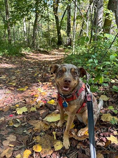
Andie LaComb's Blog, page 9
October 11, 2023
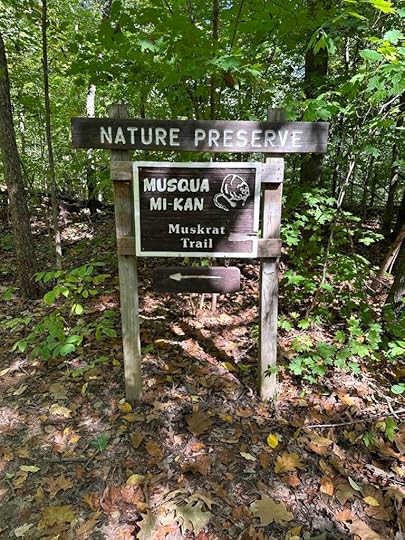
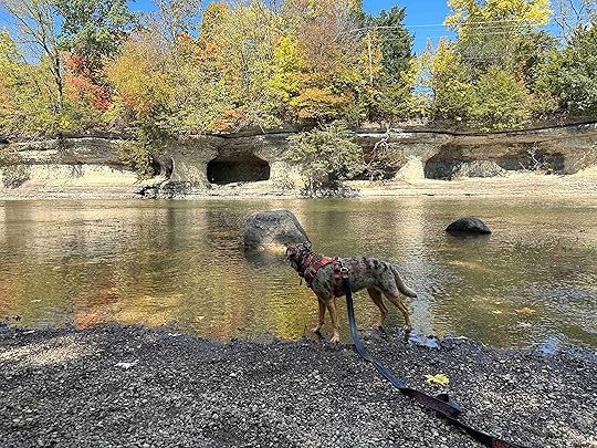
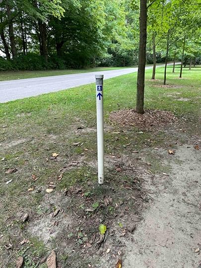
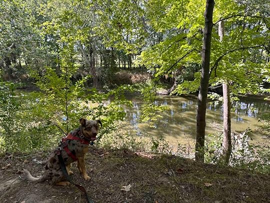
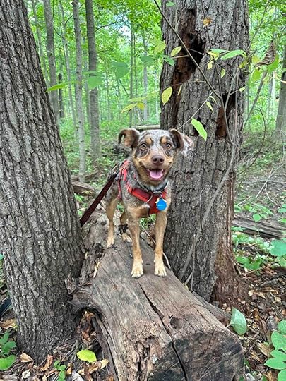
Evelyn and Wendell Dygert Nature Preserve
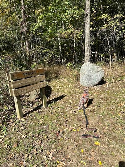
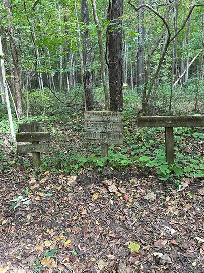
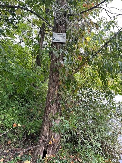
Another beautiful fall day with lots of sunshine means a road trip for Sunny and me. We ventured to Columbia City, IN to explore the Evelyn and Wendall Dygert Nature Preserve. This is another Acres Land Trust site and the namesakes donated it in 2001. The land was part of their farm and according to the memorial rock at the start “they shared this peaceful place”. I am so appreciative of them and others who donate their land so we can also enjoy their “peaceful places”.
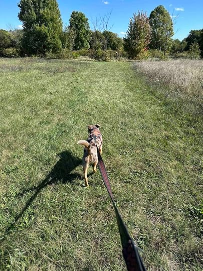
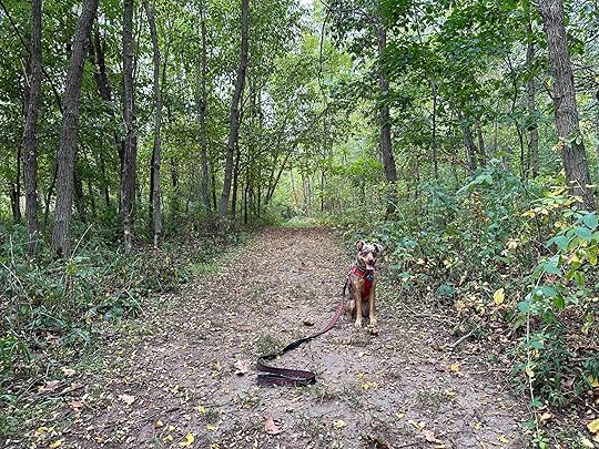
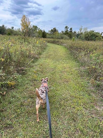
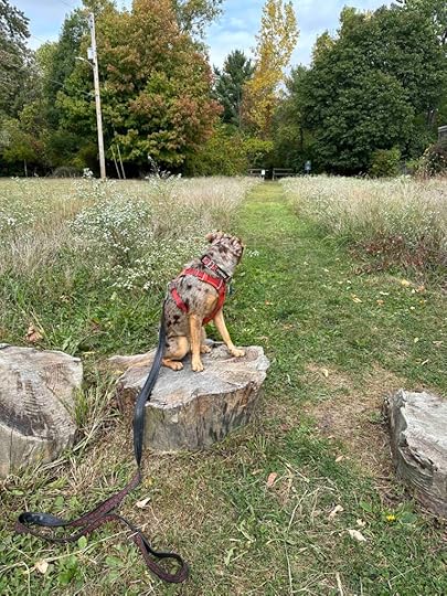
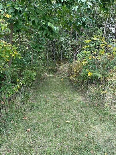
The preserve starts with a wide mowed grass trail from the parking lot to the memorial at the entrance of the woods. This part of the hike lasts about .4M and winds around a field which provides little to no protection from the sun. Since we prefer to actually be in the woods, this was our least favorite part of the hike.

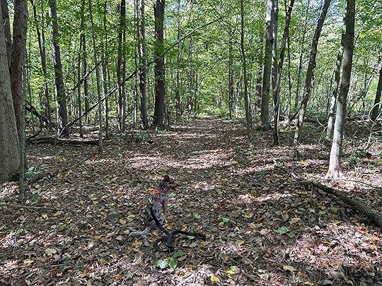
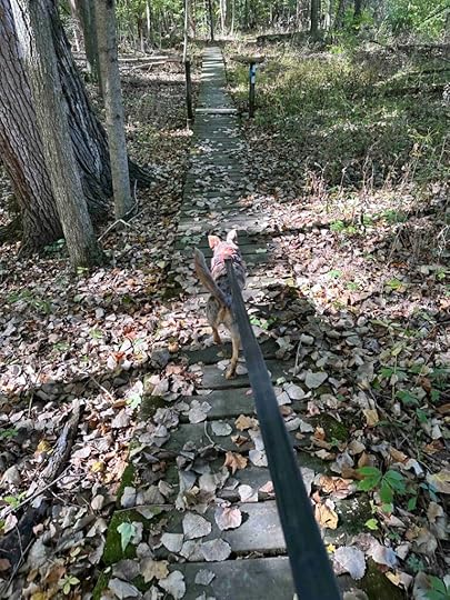
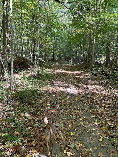
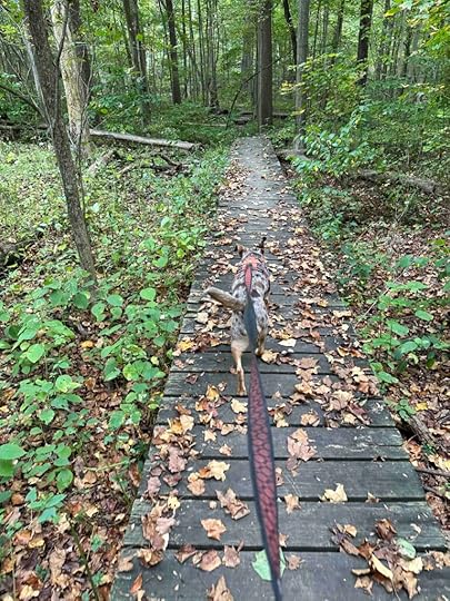
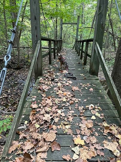
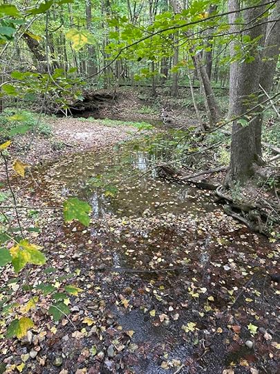
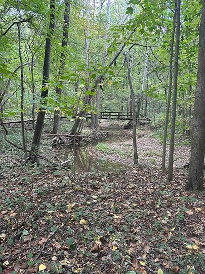
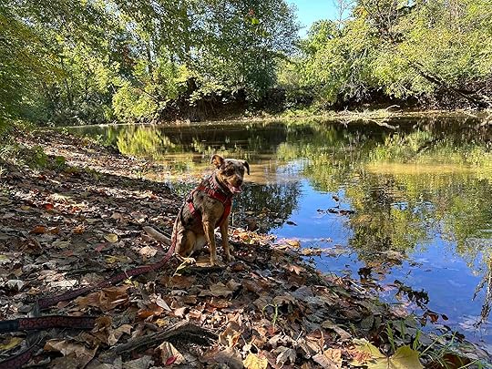
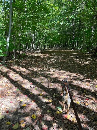
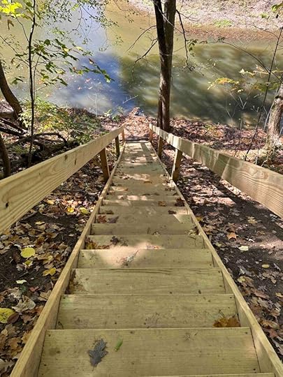
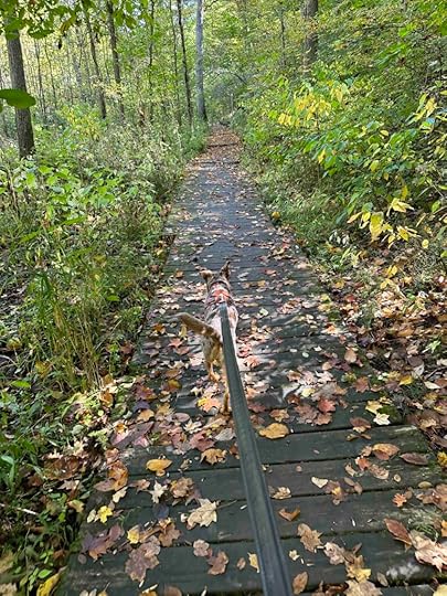
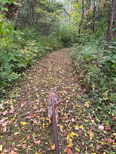
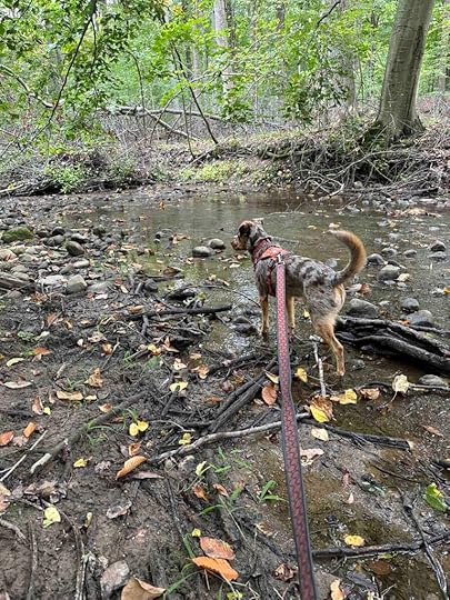
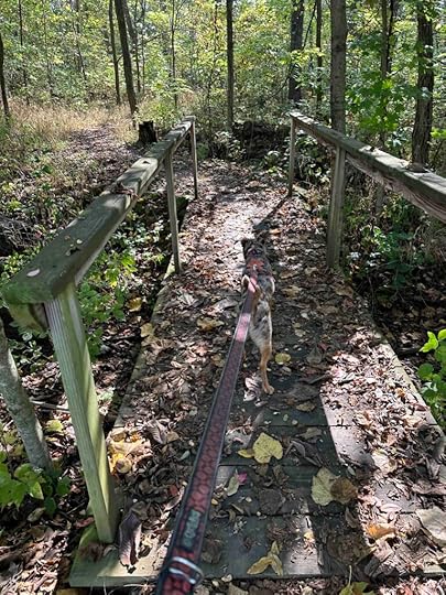
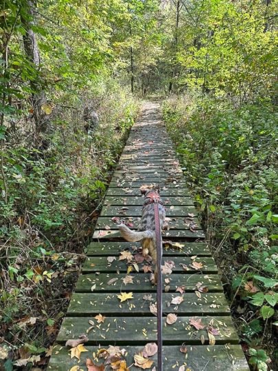
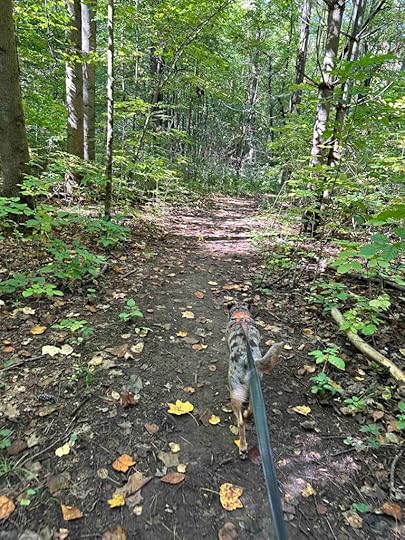
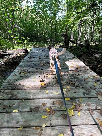
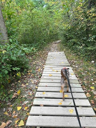
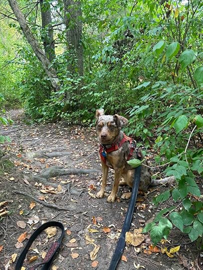
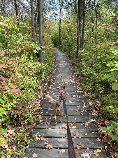
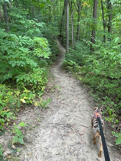
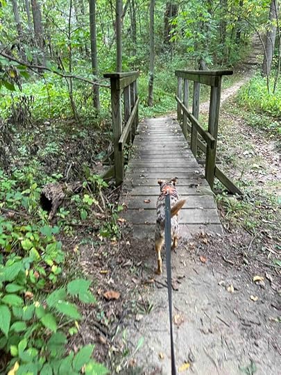
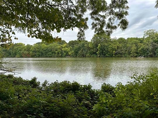
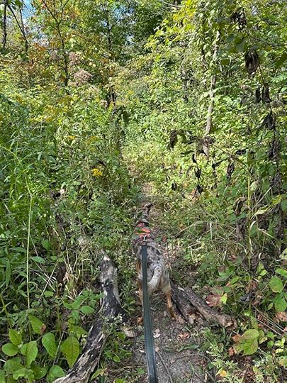
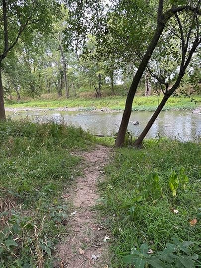
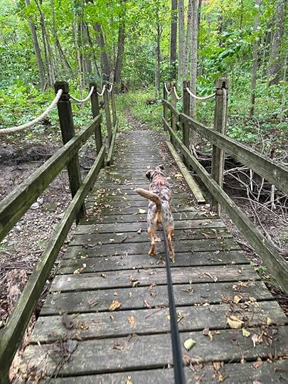
After passing the sign and memorial at the entrance the fun part of the hike starts. The trail narrows considerably as you enter and becomes a one-person trail as it winds through the woods. Once in the woods beech, cherry, hickory, maple, and oak trees surround you. Although we crossed several wood platforms and bridges, there is no stream or creek running through the preserve. We saw one small pond from the trail covered with green so I was glad we could not get down to it.
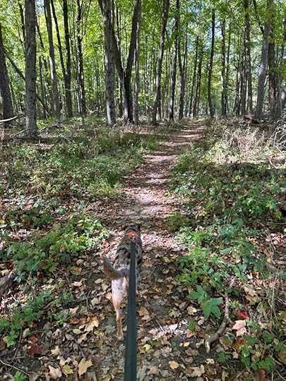
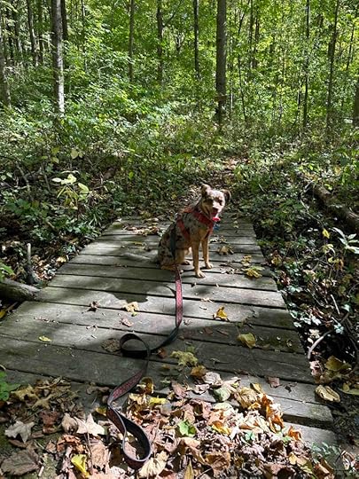
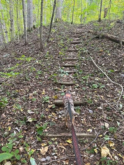
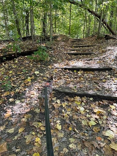
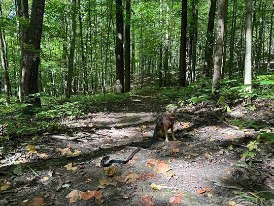
The hike consists of one main trail that winds throughout the woods. The steep inclines and descents make it a more challenging hike than some other Acres Land Trust locations. We saw several “closed” signs so at one time there were some additional trails. We hiked nearly 2M with nearly half of it on the mowed grass trail leading to the woods. This hike is not recommended for those with stability or mobility issues due to the inclines, descents, and roots on the trail.
Our RatingSunny and I rate the Evelyn and Wendell Dygert Nature Preserve 3 out of 4 paws up. Although there is no water feature to get your toes wet, this preserve provides a lovely walk in the woods. The trail is fairly challenging with views of the trees and ravines which make it an interesting hike. We also love the sentiment on the rock at the start and the idea that before the public enjoyed this space, it was enjoyed by Evelyn and Wendell.
How do I get there?The address of the nature preserve is 4245 N 50 W in Columbia City, IN. Take IN 9 north of Columbia City. Take County Road 500 N West for 2M then turn left onto N 50 W. After about .7M look for the white Acres Land Trust sign on the right. After parking, enter near the metal gate.

For more information check out the Acres Land Trust website.
Evelyn and Wendell Dygert Nature Preserve
The post Evelyn and Wendell Dygert Nature Preserve appeared first on Live Like Karlie.


October 9, 2023
Asherwood
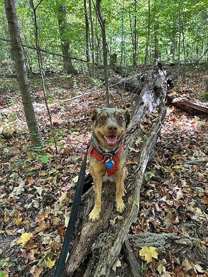
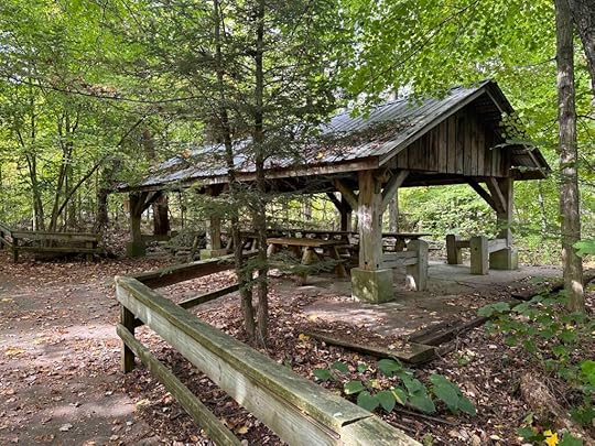
Although it was a cool day, the sun was out so it was perfect for taking a drive to Wabash, IN for an adventure. Sunny and I explored Asherwood which is another Acres Land Trust location. This site has 2.4M of trails (deer trail, frog pond trail, rabbit trail, tulip tree trail) in the woods that wind through the property and include ravines, a pond, and Asher Creek. There is also a picnic shelter and environmental center. We explored about 2M of the trails and thoroughly enjoyed ourselves.
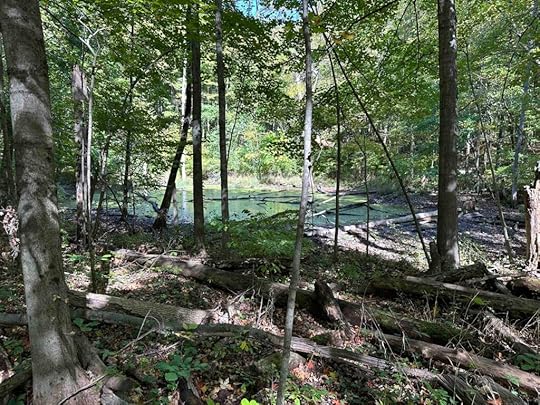
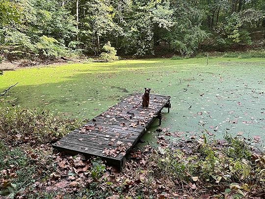
After parking the car we took the first trail to the right and followed it through the woods. This trail had a cement walkway next to the dirt trail. Eventually the cement ended and we found ourselves on Deer Trail. This trail wound through the woods and gave us views of the trees and ravines. At one point we came across Frog Pond and a trail to it, which we followed. Sunny was quite interested in the pond, but since it was covered in green I managed to keep her from going into it. She did enjoy climbing on the dock and sniffing near the water.
After exploring the pond we followed the trail back to Deer Trail. We walked over some wood planks and across a bridge over Asher Creek. There were several steep sections with steps and eventually the trail ended at a green grass field and the environmental center. We found another entrance to the woods, walked through some mowed grass trails, and ended back at the parking lot.
Asherwood provides a beautiful, but challenging walk through the woods. At times the trail was quite steep with both inclines and declines. Some sections of the trail were quite wide, but other portions were narrow and only wide enough for one person. Acres Land Trust rates the difficulty of the trails 5 out of 5 and we would agree. This hike is only recommended for those who have good mobility, stability, and are able to climb sharp inclines.
Our RatingSunny and I rate Asherwood 3.5 out of 4 paws up. It’s a fun and challenging hike through the woods with the ability to get down to the pond and creek. There are several trails which are well marked. We enjoyed the beautiful scenery and the challenge of the trails. This is one of the few Acres Land Trust locations with a restroom and there is even a shelter for picnicking. The only negative for us is the long travel time.
 How do I get there?
The address for Asherwood is 7496 SR 124 in Wabash, IN. Take the Huntington exit (#278) off I-69 and then follow 5N for 1.5M. Turn left onto 124W and continue for just over 25M. Shortly after passing S 650 W, look for the Asherwood sign on the right. Turn into the gravel driveway and follow it to the back to the parking lot. The trails are at the back of the parking area.

For more information check out the Acres Land Trust website.
The post Asherwood appeared first on Live Like Karlie.
October 7, 2023
Metea County Park
Another sunny fall day and another adventure to explore a local park. Today’s adventure was to Metea County Park near Leo/Cedarville. It’s a 250 acre park with 5 miles of trails, picnic areas, a nature center, and Cedar Creek running through it. The park has two entrances; one off Union Chapel Road, which is where we entered, and one off Hursh Road.
We started our exploration walking through the grass trails across from the parking lot near Union Chapel Road. After walking around the grass trails we found an entrance to the woods. We found a nice wide trail in the woods that lead to Cedar Creek. We started by hiking the Muskrat Trail and then ended up on the Softshell Turtle Trail. Eventually we found another trail that led to the Nature Center. Trail markers kept us from getting lost since many of the trails intersect. From the Nature Center we walked in the grass along the road back to our car. Our total distance was just under 3M, but there were several other trails that we did not explore so you could hike even further.
All the trails were well maintained and fairly wide. It truly felt like a hike in the woods and was mostly shady. We found access to the creek in several areas. The first one was a steep staircase that I would only recommend for those who are fit and have good stability. The bank at that section of the creek was fairly small, but still allowed Sunny to get her toes wet. After checking out the creek we continued on the trail and found another section to get down to the water that had a larger bank.
We found benches along the creek in several areas giving a nice spot to rest and enjoy the view of the creek. The trail was mostly flat, but had some inclines and descents. We also walked over wood planks and a bridge on the Softshell Turtle Trail.
 Our Rating
Sunny and I rate Metea County Park 3.5 out of 4 paws up. It’s really a lovely place with a variety of trails that follow Cedar Creek. You can get down to the water which Sunny loved. We were able to walk nearly 3M and still had other trails to explore. There’s great parking and a nature center with restrooms. There is an entrance fee, but that is not unusual for a park with this many trails and amenities.
How do I get there?Metea County Park is located just outside of Leo/Cedarville off Leo Rd. The address is 8401 N. Chapel Union Road. Take I-69 and exit on Union Chapel Road toward Leo/Cedarville. Continue on Union Chapel Road for 11.5M. Turn left at the entrance sign and drive to the payment station. The cost is $2/person for those age 7 and older. Children under 7 are free. You can either park in the gravel lot to the right or continue driving up the road to the nature center and park there. The nature center has restrooms.
For more information check out the Allen County Parks website.
The post Metea County Park appeared first on Live Like Karlie.
October 5, 2023
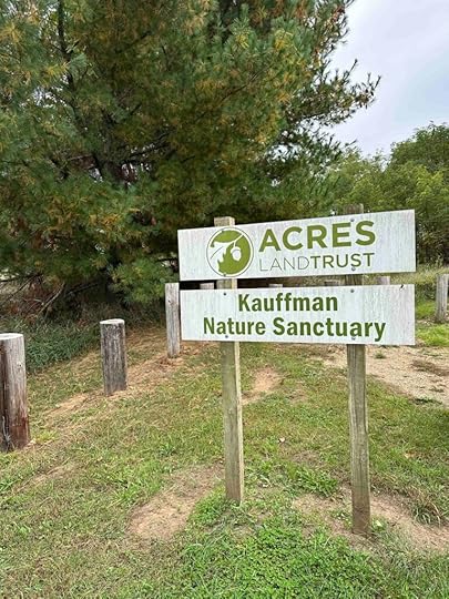
Kauffman Nature Sanctuary
A few last warm days before it turns cold so we ventured north to Michigan and visited the Kauffman Nature Sanctuary in Hudson, MI. This is the first Acres Land Trust location in Michigan and was donated by Janet Kauffman. She farmed part of the land before letting nature reclaim it. Today it provides a lovely hike in a field and the woods.
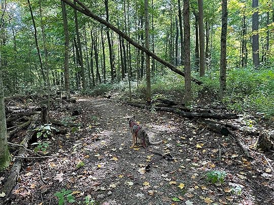
The trail winds through a mowed grass path in a field before entering the woods. Unlike other trails we’ve hiked in fields, the vegetation is low enough that you can see the surrounding area. This provides a nice view of the woods, field, and surrounding area. Shortly after walking in the field you enter an area with a wide trail in the woods. It’s not densely wooded which allows the sun to peak through. This, in combination with the open field portion, might make it a warm hike on a summer day.
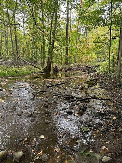
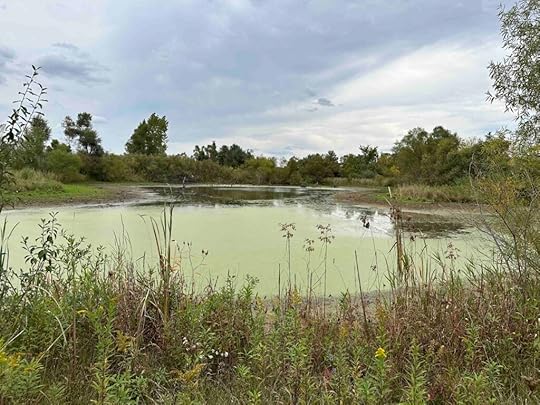
After walking in the woods for awhile, the trail opens back up into the field, and then back into the woods. This section of the woods leads to a stream that is one of Michigan’s headwater streams from Lake Erie. Sunny loved getting her toes wet in the water. This section of the trail dead ends at the stream so we made our way back to the main trail and continued. Shortly after that we found ourself back in the open field. After a short distance we saw a pond in the middle of the field. The trail continued back to the trail that leads to the parking lot.
Although there are some trails off the main trail, we just kept taking the trail to the right. This gave us a hike of nearly 1.4M. Most of the trail was flat, but there were some inclines and descents. The trail is fairly wide throughout, but like most trails in the woods would not be good for those with mobility or stability issues.
Our RatingSunny and I rate Kauffman Nature Sanctuary 2.5 out of 4 paws up. Although it’s a nice place to hike, about half the hike is in a field, which is not our favorite. We prefer to be in the woods. One of the sections in the woods leads to a creek and Sunny was able to get her toes wet which was a bonus. All in all this is a nice place for a hike, but if you prefer the woods to fields there are other locations that provide that.
How do I get there?Take 20E and follow into Ohio. Turn left onto 127N/Meridian Rd., a short time after turning you will cross the Michigan border. Continue on 127N/Meridian Rd. for 14.5M. Turn left onto Beecher Rd. After about 2M look for the sign on the left.
For more information check out the Acres Land Trust website.
The post Kauffman Nature Sanctuary appeared first on Live Like Karlie.
October 1, 2023
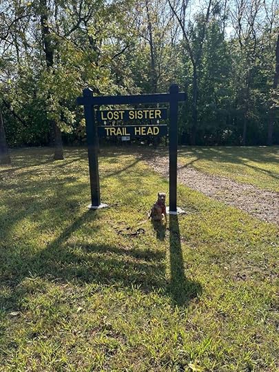
Lost Sister Trail
A beautiful fall day means an adventure. Today we traveled about an hour southwest of Fort Wayne to Peru, IN. Because we traveled a bit of a distance we visited two places – Lost Sister Trail and Seven Pillars Nature Preserve. Both were fantastic places to hike in the woods and well worth the travel time.
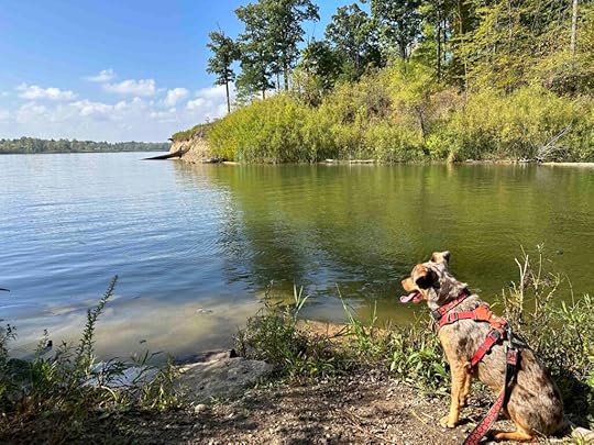
We started our adventure by exploring the Lost Sister Trail which winds around in the woods and along part of the Mississinewa River. It’s a typical hike in the woods with a dirt trail and some bridges and wood platforms. Although there is a main trail with markers, we found it easy to get off trail on side trails. In several areas the trail crosses a road, which we found less enjoyable than just hiking in the woods.
At one point we found a shelter that was in disrepair and an area to get close to the water. There wasn’t much shoreline for us to walk on, but Sunny was still able to put her toes in the water.
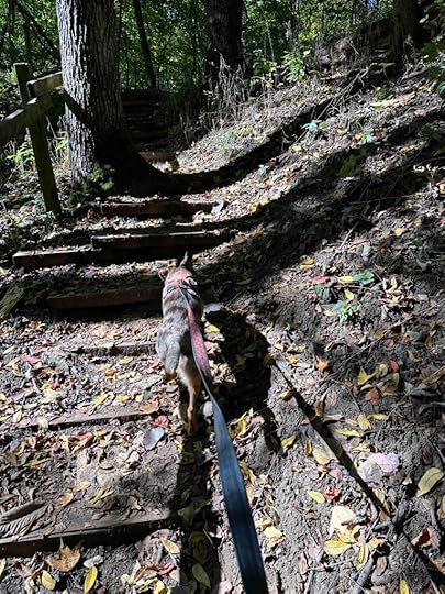
After exploring the river and the shelter we headed back on the trail toward the car. We ended up taking a different route that had some steep inclines with steps. Eventually we crossed the road again and found our way back to the parking lot.
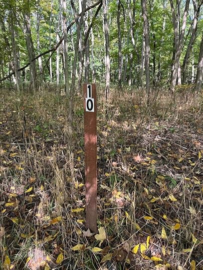
Although we did not walk the entire trail we hiked for just under 2.5M. According to All Trails the Lost Sister Trail loop is about 2M so we added some extra mileage by taking some of the side trails. There are numbered trail markers which we used to find our way back to the parking lot and should have used to keep on the main trail.
 Our Rating
Sunny and I rate Lost Sister Trail 3 out of 4 paws up. It’s a lovely hike in the woods, but we found it difficult to follow the trail. Although there are trail markers it’s easy to go off the trail and we did that several times. We enjoyed the views of the lake and being able to get down to the water. Having restrooms near the parking lot and access to a park with picnic tables was an added bonus.
How do I get there?From I-69 take exit #278 toward Huntington then turn right onto 5 North. Follow 5 for about 1.5M then turn left onto 124 West and continue for 26 miles. Turn left onto S 675 E and continue for 1.2 mile before turning right onto E 380 S/Mississinewa Dam Road. After about 0.1 mile turn left and then right into the parking lot. There is a building to the right which is the restroom and the entrance to the trail is straight ahead just past the sign.
The post Lost Sister Trail appeared first on Live Like Karlie.
Seven Pillars Nature Preserve
A beautiful fall day means an adventure. Today we traveled about an hour southwest of Fort Wayne to Peru, IN. Because we traveled a bit of a distance we visited two places – Lost Sister Trail and Seven Pillars Nature Preserve. Both were fantastic places to hike in the woods and well worth the travel time.
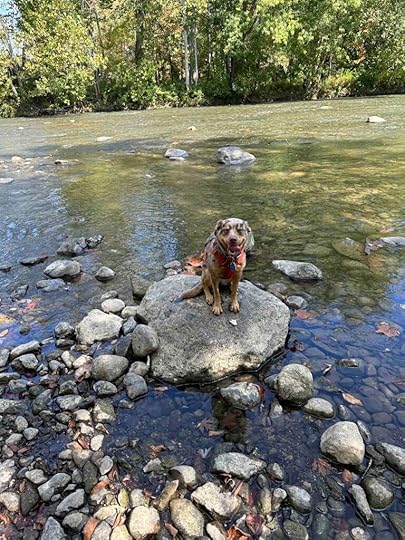
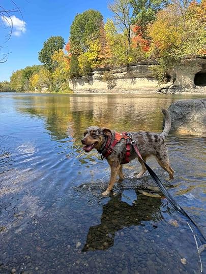
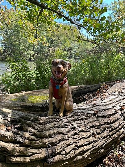
After exploring Lost Sister Trailhead and having a picnic lunch, we drove to Seven Pillars Nature Preserve, which is an Acres Land Trust site. We got a quick peak of the pillars for which the preserve is named as we turned the corner to enter the parking lot. Although the pillars and the Mississinewa River are the highlight of the preserve, there are some nice trails in the woods and that is where we started this adventure.
After parking our car we walked to the back of the parking lot and across the grass field to enter the preserve. Upon entering we found a nice dirt trail through the woods. The trail had a few wood plank overpasses and bridges and one really big hill. This hill is likely the main reason for the 4 out of 5 difficulty rating on the Acres Land Trust website. There is a main trail, however there are some other trails that branch off. We took one of these and ended up walking across a field and to the road that eventually led back to the parking lot, pillars, and river.
After hiking in the woods we walked along the road to the river and found some trails there too. We followed the trails and found two locations to get down to the banks of the river. Sunny put her toes in the water which made her day. The water is quite shallow making it a nice spot to play. And the views of the pillars is spectacular.
After returning home and looking at the preserve map we found that the main path loops around and returns to the parking lot. That would have been preferred to walking on the road back to the parking lot. The trail in the woods is 1.4M, but we walked nearly 2M between the trails in the woods and the trails along the river.
Our RatingSunny and I rate Seven Pillars Nature Preserve 4 out of 4 paws up. This spot really has it all in our book. You can go for a challenging hike in the woods and then walk along the Mississinewa River and get your toes wet. And the views of the pillars are outstanding. It also has a nice parking lot across from the river. The only thing missing is a restroom, but that isn’t enough to downgrade the rating.
How do I get there?From I-69 take exit #278 toward Huntington then turn right onto 5 North. Follow 5 for about 1.5M then turn left onto 124 West and continue for 26 miles. Turn left onto S 675 E and continue for 1.2 mile before turning right onto E 380 S/Mississinewa Dam Road. After 1.5 mile turn left onto S 550 E and then take the first right onto E 400 S. Follow that for 1.5 mile and then turn right onto S 400 E. After half a mile turn right to stay on S 400 E. After nearly a mile it turns left and turns into Mississinewa Road. Shortly after this look for the parking lot and sign on the left.
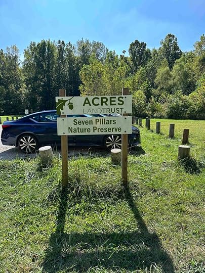
For more information check out the Acres Land Trust website.
The post Seven Pillars Nature Preserve appeared first on Live Like Karlie.
September 28, 2023
Traveling with Dogs
It’s that time of year when we travel to San Diego for the winter and a lot of other people travel to visit family. So I thought it would be appropriate to give some traveling with dogs tips. In addition to the long cross country trip, we travel a lot with our dogs. Of course there are the adventures which vary from 15 minutes to a couple hours. We’ve also taken many trips from Southern Indiana to Northern Indiana. When we lived in Bloomington Karlie and I made many trips to Northern Indiana to visit my parents. And when we were building our home in Northern Indiana we made monthly trips with Sunny to check on things.
Do Some Pre-PlanningTraveling with dogs requires a little preplanning, but can be quite fun. One of the most important things is to make sure your dog is comfortable and used to traveling in a vehicle. Making sure they have a comfortable, safe place in the vehicle is the first step. For Sunny (and Karlie before her) I set up a spot in the backseat with one of her favorite blankets. I put a box behind the front seat and place several large blankets and then her favorite blanket on it so she has the whole space behind the seat to stretch out. We also use a seatbelt attachment to secure her while we drive. And of course I give her some toys to keep her entertained.

The next thing is to take short trips to get your dog used to traveling in a vehicle. You don’t want trips to the vet to be the only time your dog travels in the car before a longer trip. We adopted Sunny in San Diego and less than 2 months later, when she was barely 5 months old, we drove to Bloomington, IN. We took many short trips before this trip to make sure she was comfortable traveling in a car. Despite that I was still amazed how well she did on our cross-country trip.
Find a Dog-Friendly HotelAnother important thing is finding a hotel that is dog friendly and has nice grassy walking areas. We also like to go to hotels with at least a small fridge and microwave so we can bring our own food instead of trying to find dog-friendly restaurants or ordering fast food. When you arrive at the hotel ask if they have designated potty spots. Don’t be surprised if it takes your dog a long time to pee and poop in unfamiliar areas. Some dogs get easily distracted by all the new sights and smells and struggle to do their business. Sunny is one of those dogs so we try to find quieter spots and let her explore. I also like to pre-plan places we can take a hike after we arrive at the hotel. When we drive across the country we have long days of driving so everyone is ready to stretch their legs and walk. Plus it’s fun to explore new areas.
 Bring a Doggy Bag
We also have a bag that has all of Sunny’s necessities including a towel, paper towels, toys, food portioned out for each day, treats, bowls, and a first aid kit. This bag is in an easily accessible area for the trip and I take it into the hotel every night. I also bring several of the blankets from the car into the hotel. I place those on the bed to protect it from fur and make it more comfortable for Sunny. When Sunny was younger we brought a travel crate for her to sleep in at night since she was not potty trained.
What Do you Suggest When Traveling with Dogs?I’m looking forward to our upcoming trip and hope these tips help you if you travel with your dog over the holidays. Although this list is not all inclusive, it’s what we’ve learned over the years with our dogs. What are some things that you do when traveling with your dog?
The post Traveling with Dogs appeared first on Live Like Karlie.
September 26, 2023
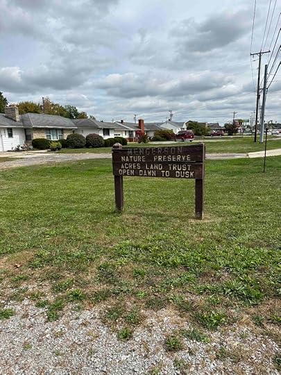
Mengerson Nature Reserve

A beautiful fall day means a hike in the woods for Sunny and me. Today we ventured to Mengerson Nature Reserve in Fort Wayne, Indiana. This is another Acres Land Trust location. It was part of the Carl Mengerson family farm and donated in 1989. Today it is a forested oasis in the middle of a commercial and residential area. It can be accessed from the parking lot on Stellhorn Road as well as the residential areas off Christian Avenue and Leeds Lane and behind the stores in Northwood Plaza.
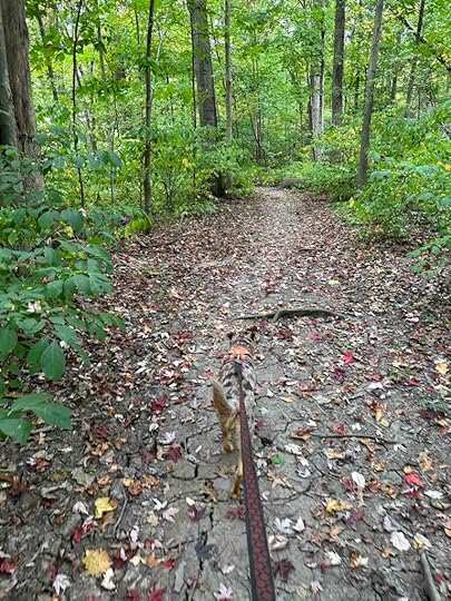
The entrance to the reserve starts after walking on a mowed grass path through a field between two homes. Upon entering the reserve you walk across some wood planks that lead to a dirt trail. Sunny’s little paws nearly slipped into the space between some of the planks so this is something to consider for smaller dogs. Once over the wood planks we really felt like we entered the woods. The trail was twisty and windy, but was mostly flat.
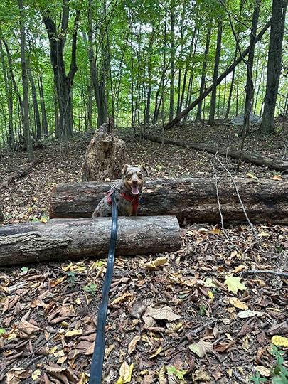
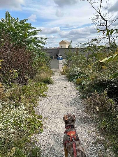
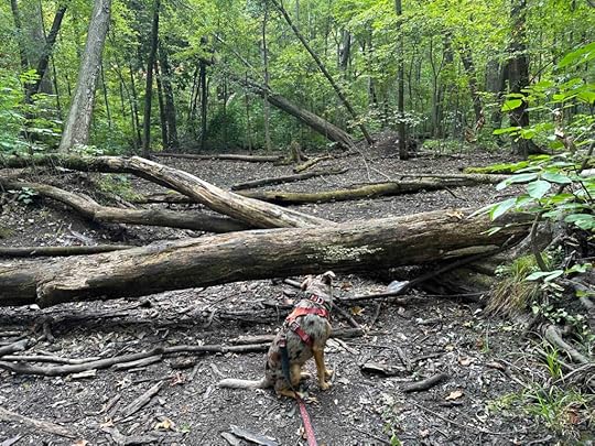
At one point we came to a fork in the trail and veered to the right. Our rule is that we always take the path to the right that way we never get lost. A little while later we took another trail to the right and this led to the back of Northwood Plaza. We turned around and continued on the trail which led to a bridge. Several more times we took the trail to the right. We walked over more wood planks, but these were positioned closer together so Sunny did not have any issues. We found quite a few fallen trees on the side of the trail which Sunny enjoyed exploring. Eventually we hopped over a fallen tree and came to the land of fallen trees and the end of the trail.

After exploring the land of fallen trees we turned around and headed back the way we came. We did not walk every trail, but we did walk many of them. The total distance was just under 1.5 miles. Although at the beginning of the hike we could hear road noise as we progressed it diminished. The leaves are just starting to turn and fall so it was a beautiful hike in the woods and one we will visit again.
 Our Rating
Sunny and I rate Mengerson Nature Reserve 3 out of 4 paws up. It’s a wonderful respite from the commercial and residential area that surrounds it. The trail is well maintained and is mostly flat, but does have a lot of roots making it more challenging for those with mobility issues. There are quite a few trails off the main trail. We walked nearly 1.5M and did not check out all the trails. There is parking, but it is limited to 3 vehicles. Although there are a couple bridges, there really isn’t any water to put your toes in. All in all a pleasant place for a hike in the woods.
How do I get there?Mengerson Nature Reserve is located at 5895 Stellhorn Road in Fort Wayne, Indiana. It is located off Maplecrest Road. You can get there from I-69 by taking exit #315 469E/30E. Continue on 469E/30E for about 2 miles and then take exit #29B to Maplecrest Road. Continue on MapleCrest Road for about 3 miles then turn right onto Stellhorn Road. The reserve is on the right about .3 miles from MapleCrest Road. There is a brown wood sign and a cement driveway that leads to a gravel parking lot.
For more information check out the Acres Land Trust website.
The post Mengerson Nature Reserve appeared first on Live Like Karlie.
September 20, 2023
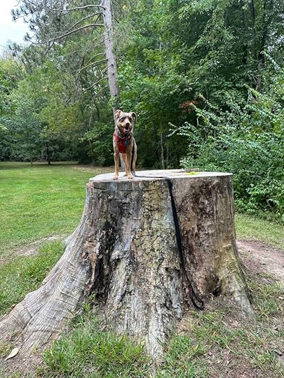
Harrison Lake State Park
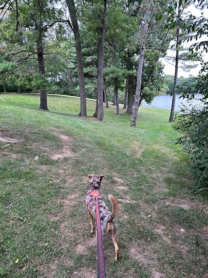
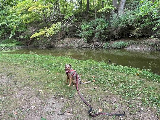
Today we ventured north to Ohio and Harrison Lake State Park. Although the park is popular for camping, fishing, and paddling, there are also trails around the lake, but at first I wasn’t so sure. We drove over an hour and when we first arrived I didn’t see any trails. I was disappointed and started to think we drove a long way just go to a park with a lake and picnic benches. Thankfully we explored and found a fun trail around the lake.
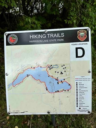
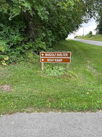
The park has several entrances and parking areas. We entered at the Marzolf Shelter and boat ramp and parked near the shelter and restrooms. After walking left toward a grassy area that abutted the lake, we found a trail through the grass and woods. This part of the trail travels and short distance and then opens up to a field. It does this a few times but luckily there are trail markers and a trail map to keep you from getting lost.

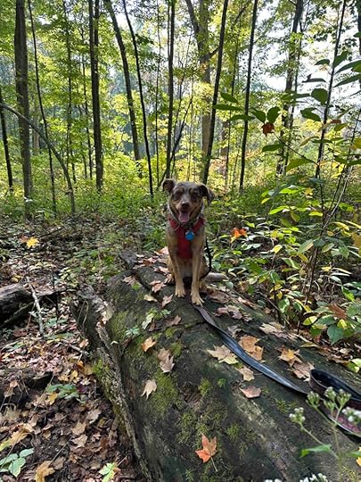
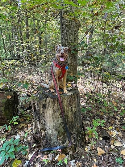
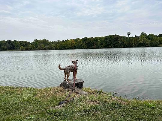
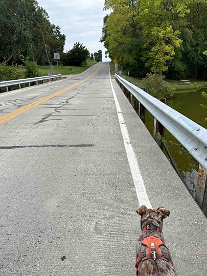
In one of the open fields we found a huge tree stump that Sunny enjoyed exploring. I had to help her get up on it which she thought was great fun. Shortly after exploring the tree stump you come to the entrance of the park off M. The only way to continue walking around the lake is to walk a short distance on M. There is no shoulder, but luckily the road did not seem too busy. Once across the road, look for the trail marker and enter the woods.
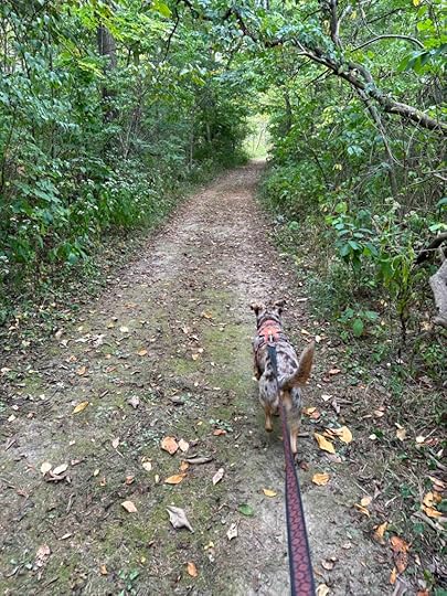
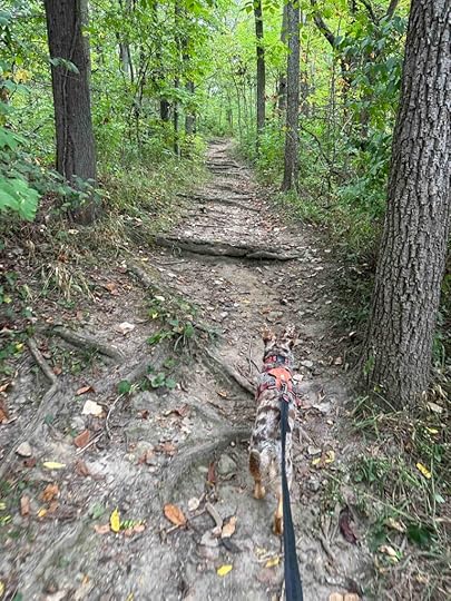
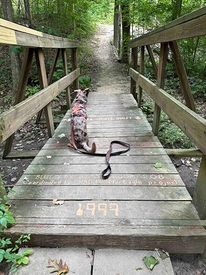
This is the best part of the trail. It truly is in the woods and the terrain is a little challenging. There are quite a few inclines and descents, a couple bridges over dry creeks, and a lot of roots and other obstacles on the dirt trail. This was our favorite part of the hike. You can see the lake through the woods for most of this part of the hike. There are also interesting signs throughout giving details about the flora and fauna. The first one about poison ivy almost had us turning back, but we decided to forge ahead.
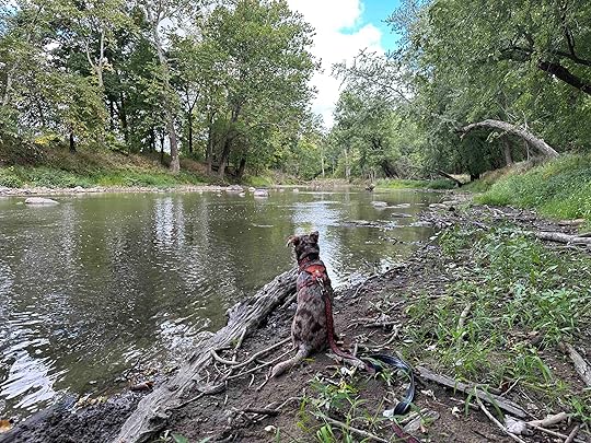
After trekking through the woods and across a bridge that was an Eagle Scout project, we came back to civilization and a park-like setting. This part of the trail is a little confusing since it’s not really a trail, just a walk through the park, similar to the beginning. We just followed the lake and hoped it would eventually lead back to our car. We walked past the beach, through a campsite, along a road, and eventually found our way back to the car. The total distance of our hike was 3.2M.
 Our Rating
Sunny and I rate Harrison Lake State Park a solid 3 out of 4 paws up. The only downside is the trail is not entirely in the woods and at one point you have to walk along the road. Otherwise the section in the woods is challenging and scenic, the lake is visible for most of the hike, and you can even get your toes wet. There is plenty of parking, restrooms, and areas to picnic. Just a lovely park that you can spend an entire day visiting.
How do I get there?Harrison Lake State Park is in Fayette, OH which is in Northern Ohio. There are several entrances, but we entered near the Marzolf Shelter and boat ramp on Park Road off M. To get there take 40 to the Ohio border where it turns into 249E. At Farmer, OH turn left onto 2E, which turns into 12C after less than 2M. Then turn left onto Townline Road which turns into 34W then County Rd 13. Then turn right onto County Road 13 which turns into 127N. Follow 127 for 10.5M. At West Unity turn left to stay on 127N. Continue for another 3.7M and then turn right onto O and after nearly a mile it turns into M. Follow M for nearly 2M and then turn left at the sign onto Park Road.
For more information about Harrison Lake State Park check out the Ohio Department of Natural Resources website.
The post Harrison Lake State Park appeared first on Live Like Karlie.
September 18, 2023
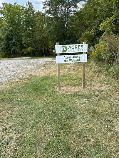
Acres Along the Wabash
A beautiful fall day means it’s time to get out on the trails so Sunny and I ventured south to Bluffton, Indiana to check out another Acres Land Trust location. Today we explored Acres Along the Wabash which provides a lovely walk in the woods along the Wabash River.
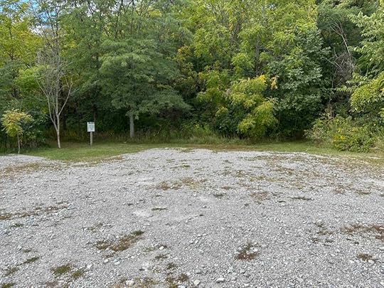
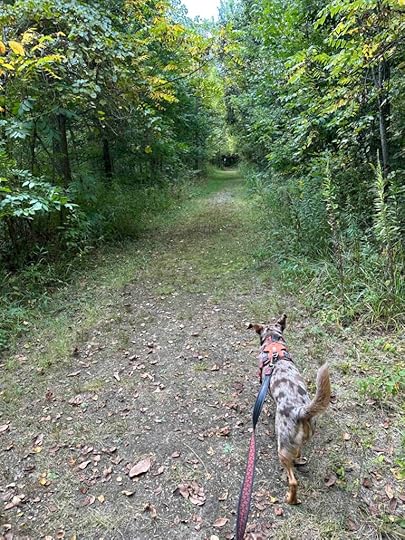
Upon arrival to the parking lot we noticed two mowed grass trails. We took the one on the left with the Acres Land Trust welcome sign. This trail starts out as a wooded mowed grass trail, but soon becomes a dirt and gravel trail through the woods. It’s quite scenic with views of hickory, oak, and walnut trees. Eventually the trail comes to a sign overlooking the Wabash River with a trail extending to the right and one to the left. We took the trail to the right hoping to find a way down to the water. Unfortunately after a short distance this trail deteriorates and is nearly impassable. Much to Sunny’s dismay, we turned around, walked back to the sign, and took the trail to the left.
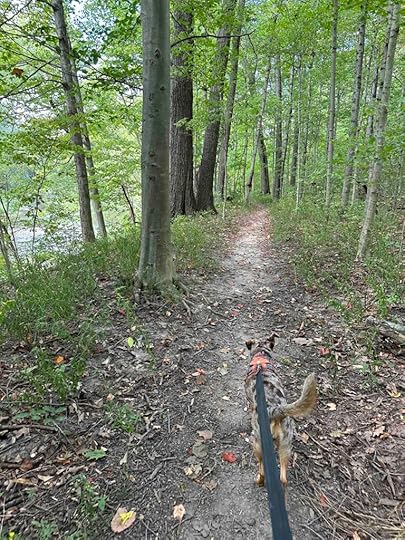
The trail to the left follows the Wabash River providing nice views of it. You can even sit on a bench to rest and look at the view. Eventually the trail travels down to the water. Sunny loved getting down to the river and putting her toes in it. There isn’t much of a short to walk along the water, but Sunny still loved being down by the water.
After spending time in the water, we retraced our steps back to the entrance and took the other trail. This trail also starts with a mowed grass section, but quickly turns into a dirt trail. There is a bridge to go over and then the trail ends where the first trail went to the right toward the deteriorated section. At this point we turned around and headed back to the car as we had explored all the trails. We logged nearly 2M on this hike by following all the different trails and offshoots.
 Our Rating
Sunny and I rate Acres Along the Wabash 3 out of 4 paws up. It’s a lovely walk in the woods along the Wabash River and you can get down to the river. Unfortunately the shore does not allow for walking along it so you can just put your toes in the water. The trail is fairly well maintained, except one section. The trail is mostly narrow and typical for a walk in the woods, so it could be challenging for those with mobility issues.
How do I get there?From I69 take exit #286 toward Markle/Decatur and turn onto 224E/E. Markle Road. Follow that for less than half a mile and then turn right onto 116E. Follow that for just over 7M and turn right into the parking lot.
For more information about Acres Along the Wabash check out the Acres Land Trust website.
The post Acres Along the Wabash appeared first on Live Like Karlie.