Andie LaComb's Blog, page 10
September 13, 2023
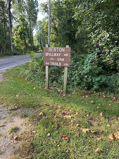
Benton – River Preserve County Park
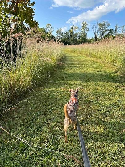
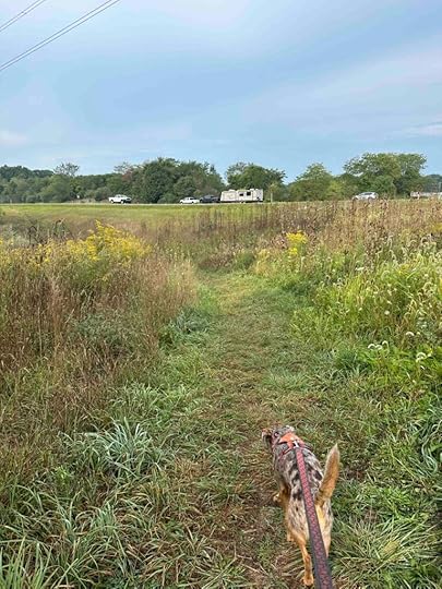
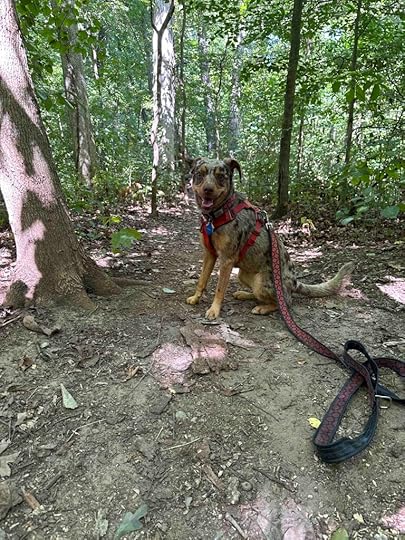
Sunny and I ventured to Elkhart County to check out the Benton – River Preserve County Park which consists of the Benton Dam, Benton Hydro, and Benton Spillway. These parks and trails make for an enjoyable outing and have something for everyone. The Benton Dam consists of mowed grass trails through a field which provides the opportunity for sighting wildlife. The Benton Hydro consists of a dirt packed trail covered with gravel and stones. It travels from the parking lot to the Benton Spillway. The Benton Spillway consists of a grass trail that leads over the spillway and connects with the Benton Hydro trail. We walked a portion of all of these trails and logged over 3M. It was a wonderful adventure and one we’ll do again.
We started our adventure by checking out the Benton Dam trails. These trails wind through a field with tall grasses. Although the Elkhart River runs nearby, we did not see it from the trail. We logged less than half a mile before coming to a spot to cross County Road 31 and access the other trails.
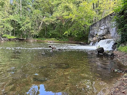
Next we checked out the Spillway parking area which has a restroom and some picnic benches. We walked a little further down County Road 31 and found the trail to the spillway. This trail goes along Elkhart River and over the spillway. We found a way to get down to the water so Sunny could put her toes in the water.
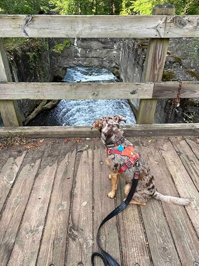
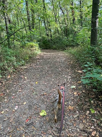
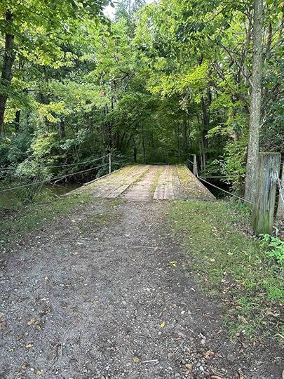
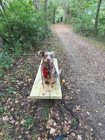
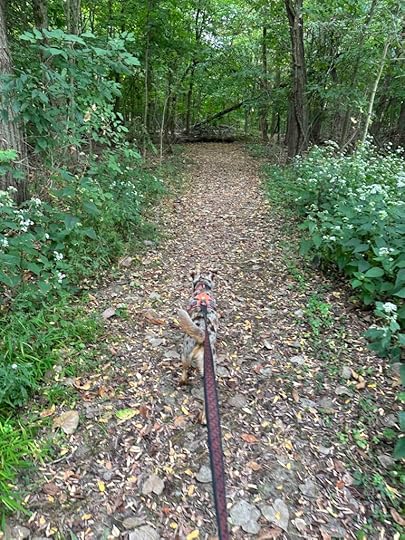
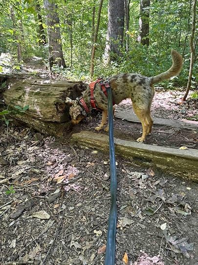
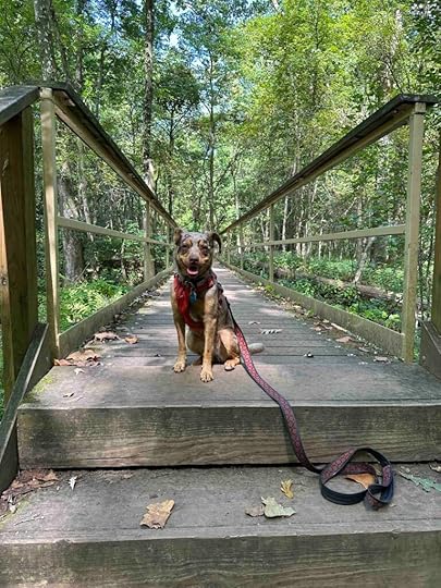
After checking out the spillway we walked over the bridge to the hydro trail. This was our favorite trail. It’s a nice wide trail through the woods with few inclines/descents. The trail follows the Elkhart River and crosses back over the river. You can also see a field of corn on the opposite side of the river. It’s not a walk in the woods, but a wooded walk. It’s peaceful, shady, and a lovely way to spend some time. Total distance from the parking lot to the spillway is about 2M.
 Our Rating
We rate the Benton -River Preserve County Park 3.5 out of 4 paws up for the variety of trails and the ability to access the water. Overall this is a lovely system of trails that offers something for everyone. Below are our ratings for each trail.
We rate the Benton Dam trail 2 out of 4 paws up. The trails are well maintained and somewhat scenic, we just prefer hiking in the woods.
We rate the Benton Spillway 3 out of 4 paws up. The trail leads to the spillway which is interesting and fun. It also gives the opportunity to get down to the water.
We rate the Benton Hydro trail 3.5 out of 4 paws up. The trail is the longest, most scenic, and goes from the spillway to the parking lot. The parking lot also has a port-o-potty.
How do I get there?Take 6 W to Syracuse and then turn right onto County Road 33 N. Follow for just under 3M and turn left onto County Road 46. After about a mile turn right onto County Road 31. After a short distance you will see a parking lot on the left for the Benton Spillway and a short distance later on the right for the Benton Dam. The Benton Dam parking lot is only open during the summer. The other option is to stay on County Road 46 for about 2M and then turn right on County Road 127. After about half a mile the parking lot is on the right. This parking lot is also only open during the summer.
For more information check out Elkhart County Parks website.
The post Benton – River Preserve County Park appeared first on Live Like Karlie.


September 11, 2023
Vandolah Nature Preserve
Another day, another Acres Land Trust adventure. Today we ventured to Leo to explore the Vandolah Nature Preserve. This land was the homestead of James and Rebecca Vandolah who moved to the area in 1837 and raised a large family. Four generations owned the land until great grandson (Charles) Byron Stellhorn donated it to the Acres Land Trust in 1989.
The entrance to the preserve leads you through a short wooded trail that opens onto a field with a mowed grass path. The field borders I-69 so you can’t help hear and eventually see the cars passing by on this section of the trail. This was our least favorite section of the preserve. We can only imagine what James and Rebecca would think about all these cars passing their land daily.
Luckily the noise and view of I-69 recedes as you enter the woods and see the beauty that surrounds you. This is one of the nicer Acres Land Trust locations that we’ve visited. The trail winds around and down into the ravine. There are views of the trees, ravine, and even a pond, but you can’t get to it. There were a couple closed trails, but we still managed to hike for 1.2M.
The trail is fairly narrow with quite a few inclines and descents. One of the inclines is quite steep and likely is the reason for the 4 out of 5 difficulty rating. There are several benches throughout to take a rest and Sunny enjoyed climbing up on those as well as some fallen trees.
 Our Rating
We give Vandolah Nature Preserve 3 out of 4 paws up. It’s a lovely spot for a hike and once you enter the woods after the grassy field entrance you forget about the highway. The downsides for us are no water feature that you can access, no restroom, and just over a mile trail. It’s a nice hike with some challenges due to the inclines and descents so we enjoyed ourselves despite the downsides.
How do I get there?From I-69 take exit 317 for Union Chapel Road. At the traffic circle take the first exit for Auburn Road. Follow for 3 miles and then continue onto Vandolah Road. After a short distance turn right onto Tother Road. The road ends at the parking lot for the preserve. Entrance to the preserve is on the right side.
For more information about Vandolah Nature Preserve check out the Acres Land Trust website.
The post Vandolah Nature Preserve appeared first on Live Like Karlie.
September 9, 2023
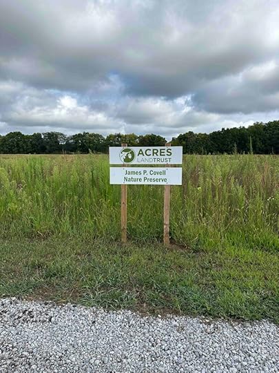
James P Covell Nature Preserve
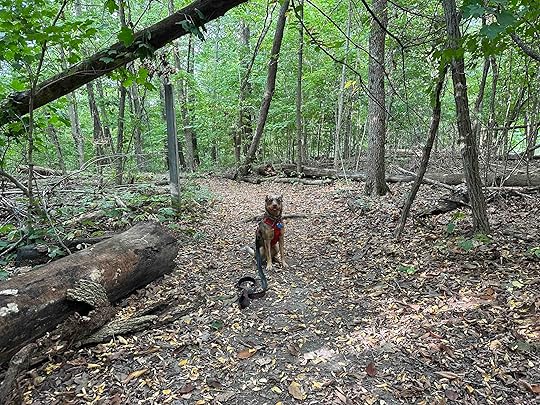
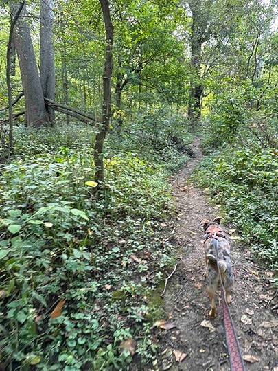
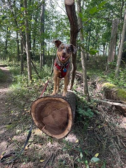
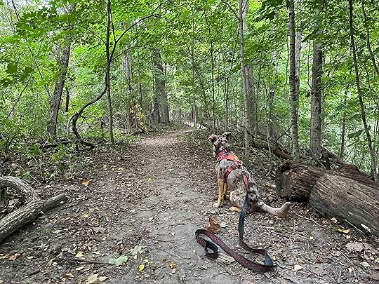
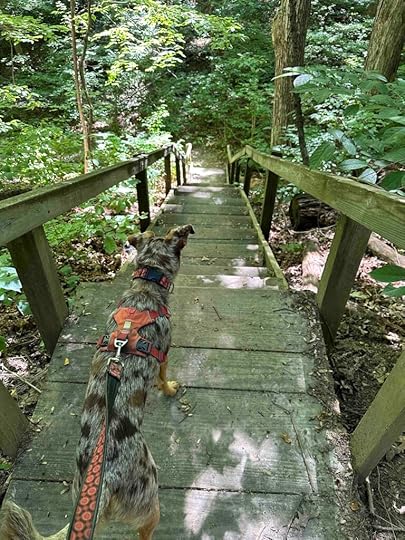
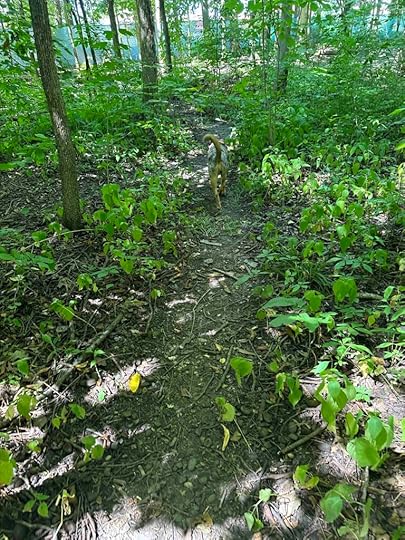
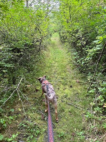
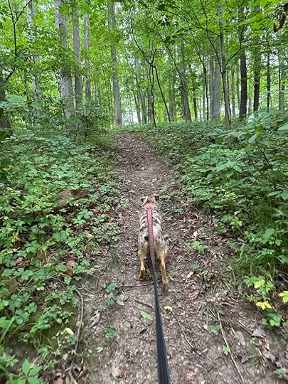
We decided to take a close to home adventure and found a hidden gem in our own community. Today we ventured to the James P Covell Nature Preserve in Auburn, Indiana and we are glad we did. This preserves is another Acres Land Trust location. In 2014 Dr. Jack Covell donated the land to preserve his late brother’s land for the animals that live there. We sure are happy that he did because it’s a lovely place for a hike and to put your toes in the water.
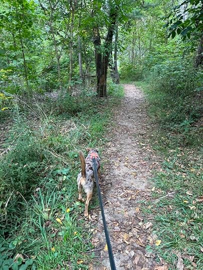
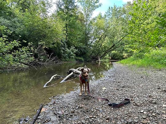
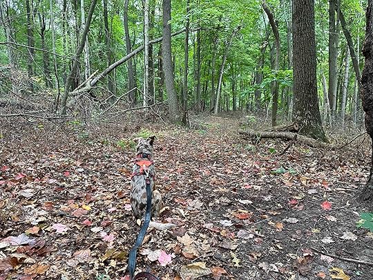
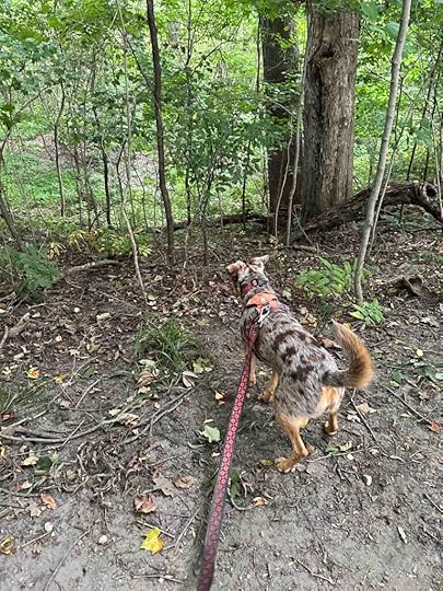
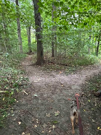
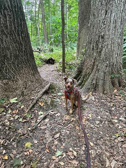
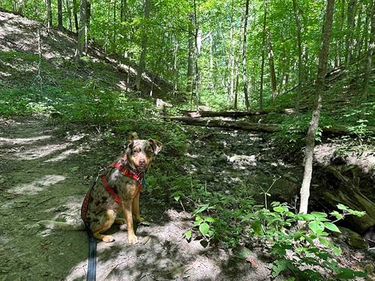
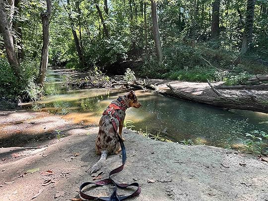
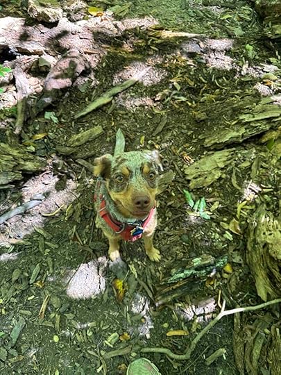
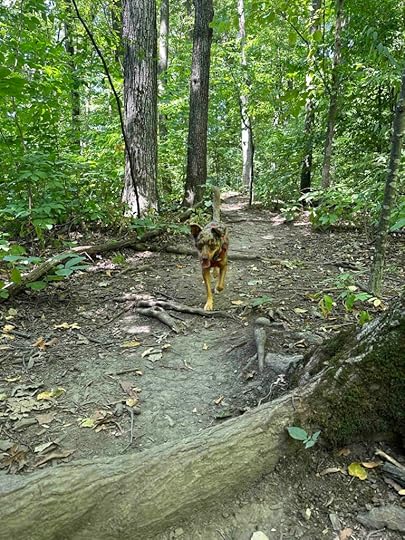
The parking lot has two mowed grass entrances to the preserve. We took the one near the right side of the parking lot. After about .25M we found the entrance to the trail in the woods. The trail is fairly narrow packed dirt surrounded by trees and brush. It leads to Cedar Creek, which is the highlight of the preserve, at least for Sunny and me. There are a couple areas that lead down to the creek. The first one requires a bit of a descent so those who are a little less sure-footed should wait for the other access point. Sunny enjoyed getting down into the water and exploring.
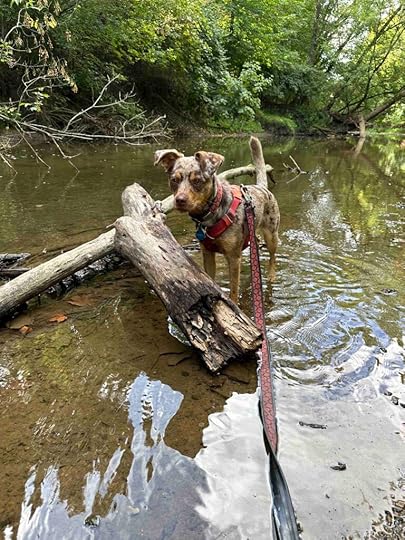
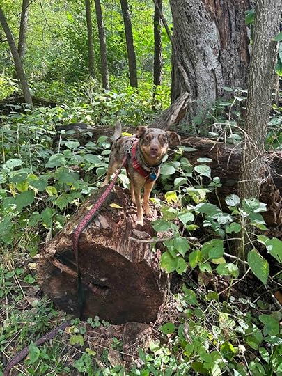
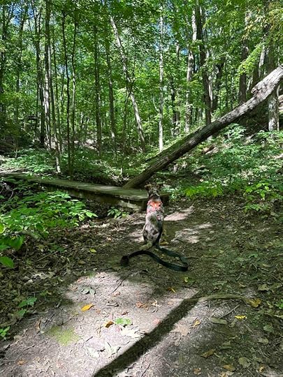
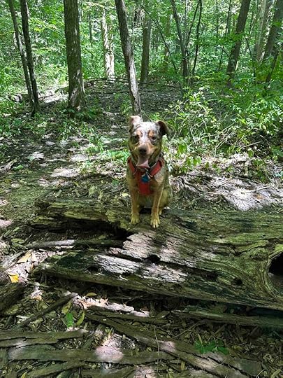
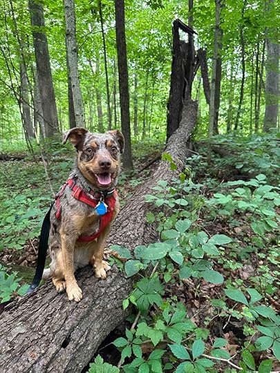
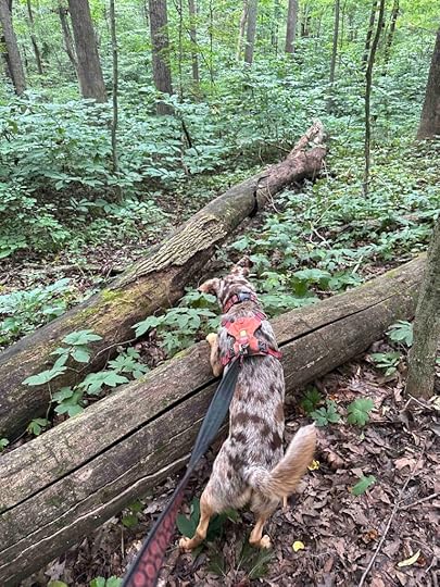
After romping around in the creek for quite awhile we climbed back to the trail and continued our hike. We found some interesting downed trees that Sunny enjoyed climbing on. All in all this was a fun adventure that we thoroughly enjoyed. The only thing that would have made it better is if the trail in the woods was a little longer. We walked a total of 1.03M, but that included time walking around the creek shoreline.
 Our Rating
Sunny and I rate the James P Covell Nature Preserve a solid 3.5 out of 4 paws up. The only thing this location needs is a longer trail. There is no restroom, but since we live close by that’s not a problem for us. There’s a nice parking lot, the trail is well maintained, and you can get down to the creek in several areas. Sunny LOVED getting her toes wet. Karlie would have absolutely loved this adventure just as Sunny did.
How do I get there?I almost hate to give directions since I would like this gem that is literally in my backyard to remain a secret, but since we encountered a couple people and dogs while we were there, I don’t think it’s much of a secret. From downtown Auburn take Main Street South until it ends at Ensley Avenue. Turn right and veer left onto Wayne Street. Follow Wayne Street for about 1.5M then turn left onto County Road 52. After about .3M the gravel parking lot is on the left. The sign for the preserve is at the back of the parking lot and the entrance to the preserve is via two mowed grass trails.
For more information check out the Acres Land Trust website.
James P. Covell Nature Preserve
The post James P Covell Nature Preserve appeared first on Live Like Karlie.
September 8, 2023
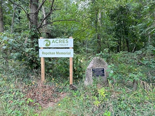
Ropchan Memorial Nature Reserve
A drizzly day did not stop us from venturing to Orland, Indiana to check out the Ropchan Memorial Nature Reserve. Although this was not our favorite hike, I’m glad we did it since this location will be retired at the end of 2023.
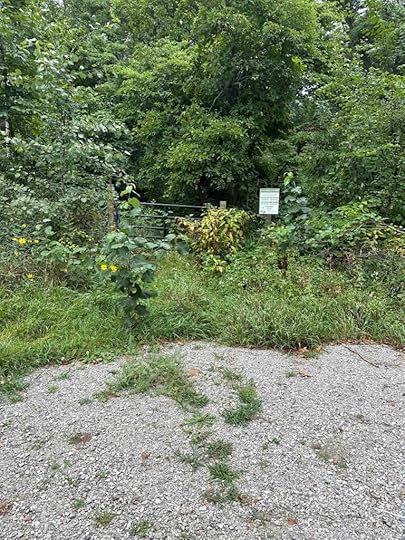
Ropchan Memorial Nature Reserve is an Acres Land Trust location. Sam and Adeline Ropchan created it by purchasing land from several private landowners from 1976 to 1982 and donating it to Acres Land Trust. At the edge of the parking lot is a memorial sign.
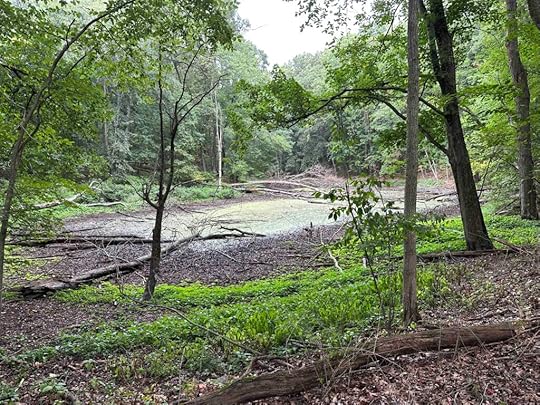
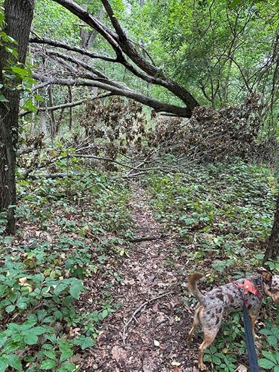
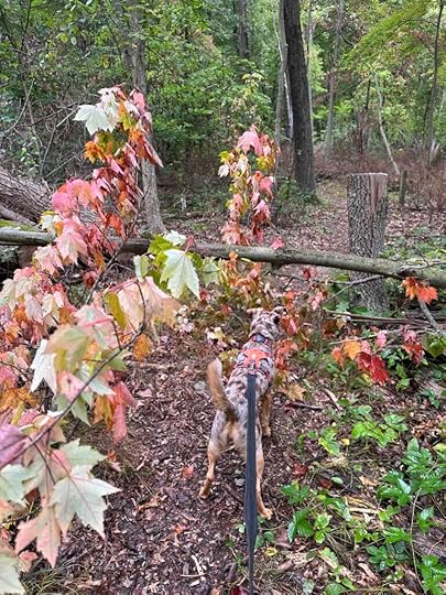
The entrance to the reserve is rather overgrown and we nearly didn’t enter because of this. We decided to walk through the growth to see if we could find the trail, which didn’t take long. Shortly after the entrance the trail splits and we took the trail to the right. The trail winds around in the woods and past a body of water. The trail does not go down to the water, which was okay since it was covered with green algae. At one point we came across another fork with a sign. We took the fork to the right which ended up winding around and back to the parking lot although it indicated it dead ended at a bog. We never found the bog, but we managed to loop back around the body of water covered with algae and to the parking lot.
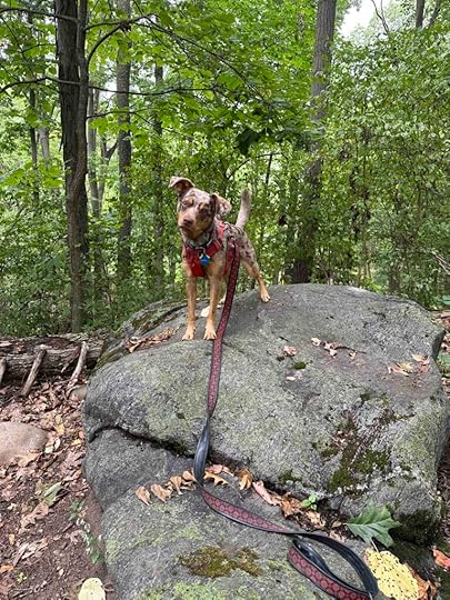
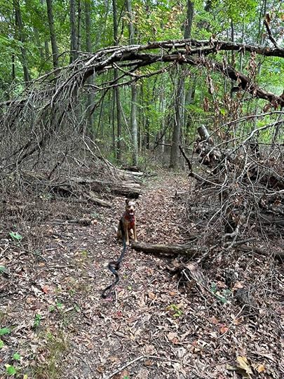
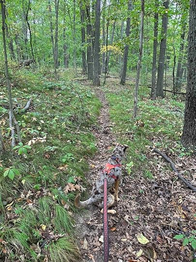
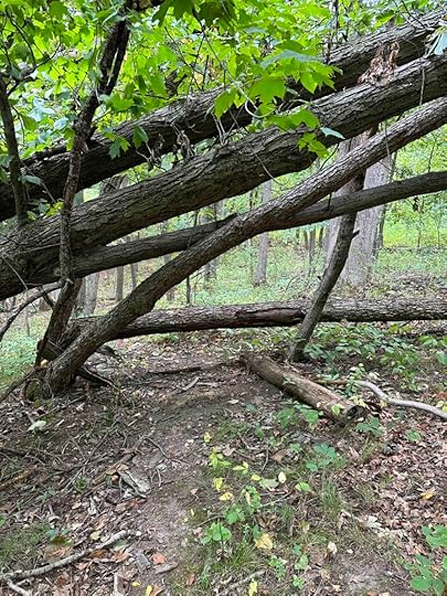
The trail is rather narrow and in many areas had trees blocking it. We managed to walk over, around, and under the trees, which made for a challenging hike. The trail is also somewhat overgrown in areas and has prickly vines that grab your legs and ankles. For this reason I recommend wearing jeans, which luckily I did. The trail also has some inclines and descents and quite a few obstructions on the ground. The difficulty rating on this hike should probably be at least 4 out of 5 due to all the obstructions on the trail.
 Our Rating
Unfortunately this location will be retired in December, 2023 and that is likely why it’s not in great repair. For this reason we can only give it 2 out of 4 paws up. I think this could be quite a nice hike, but the number of trees blocking the trail and the overgrown areas make it less enjoyable. There also is no way to get down to the water and no restroom, but the major reason for the low rating is the condition of the reserve.
How do I get there?From 69 and take exit 354 for IN-127N. Stay on IN-127 for about 2 miles, then turn left on IN-120W and continue for 7.5M. Turn right onto N 750W and look for the sign and parking lot on the right.
For more information check out the Acres Land Trust Website.
Ropchan Memorial Nature Reserve
The post Ropchan Memorial Nature Reserve appeared first on Live Like Karlie.
September 7, 2023
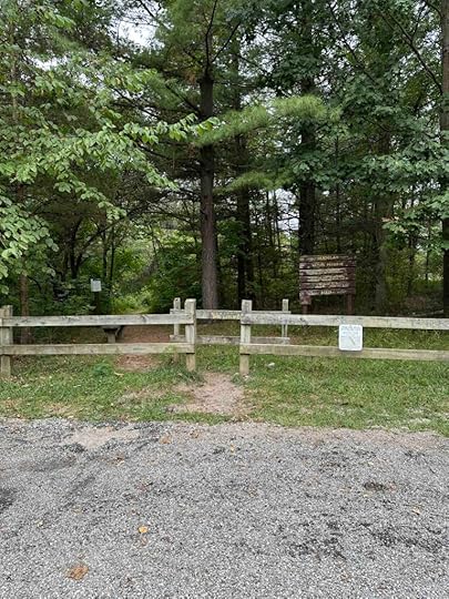
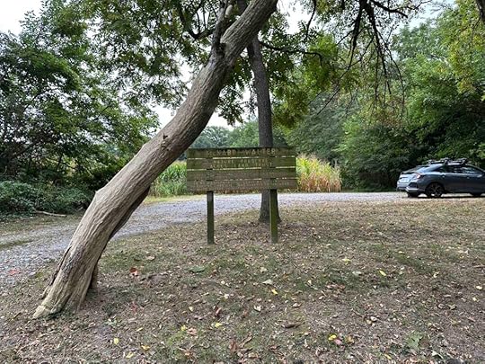
McNabb-Walter Preserve
Sunny and I decided to venture to Spencerville for an early morning hike this week. We visited the McNabb-Walter Preserve which is another Acres Land Trust location. This site was donated by Alwilda McNabb Walter and her husband, Martin in 1982. Alwilda was born on the land and she and her husband purchased it in 1944. The land included their home, the family farm, and a maple syrup operation.
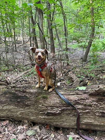
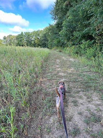
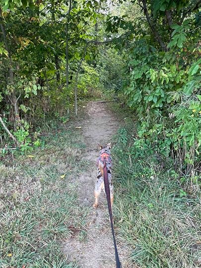
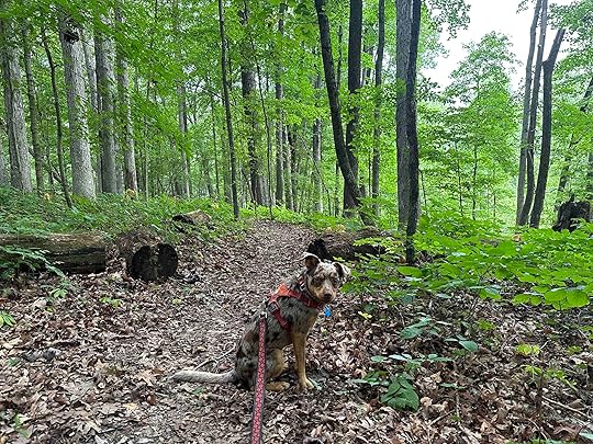
Although this is a relatively short hike at barely a mile, it is quite scenic with views of ravines and a variety of trees including ash, beech, maple, red and white oak, sugar maple, sycamore, and tulip. The trail is fairly flat, but does have a few inclines and descents. The trail is fairly narrow in most places and like most trails in the woods is packed dirt with vines and roots coming up. There is quite a bit of wildlife including deer and squirrels plus a variety of birds. Sunny had her nose to the ground for much of the hike so I can only assume there were great scents.
A short distance from the start you come to a fork in the path. We took the path to the right. This is the only trail and it loops around back to the fork. Since we wanted to have a little longer hike we did the loop twice, once starting to the right and the next time going to the left. We enjoyed both versions and the views it provided.
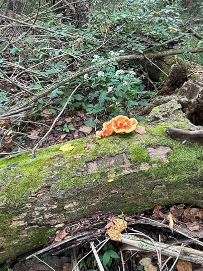
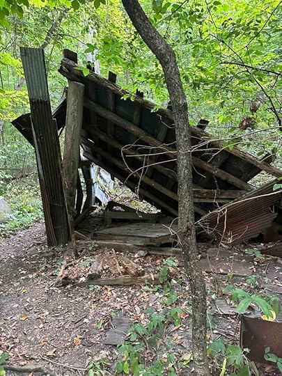
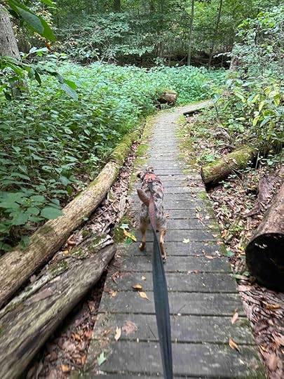
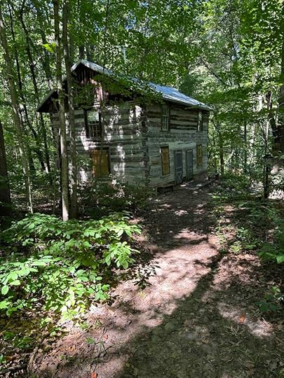
The highlight of the hike was coming up on the old maple syrup shack. Depending on which way you take the loop you either walk over a wood boardwalk on the way to the shack or after seeing it. There is also the land of cut down trees on one side of the shack. Sadly, the shack is deteriorating and over time will just be a memory. Sunny and I enjoyed exploring it and finding out what it was when we arrived home and checked the Acres Land Trust website.
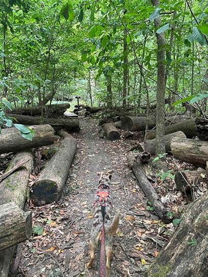
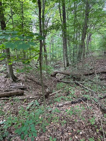
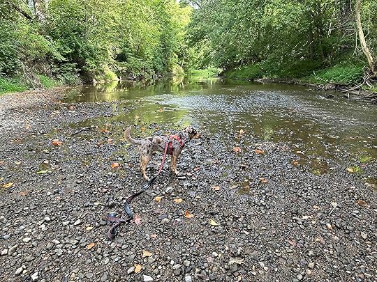
For the majority of the hike you enjoy the view of the standing trees as well as the downed ones. This made for a really scenic hike. At some points you stand above the ravines of the Davis and Fisher Creeks. Although you can see the creeks you can not get down to them from the trail. At the time of our visit there was little water in the visible portion of the creeks.
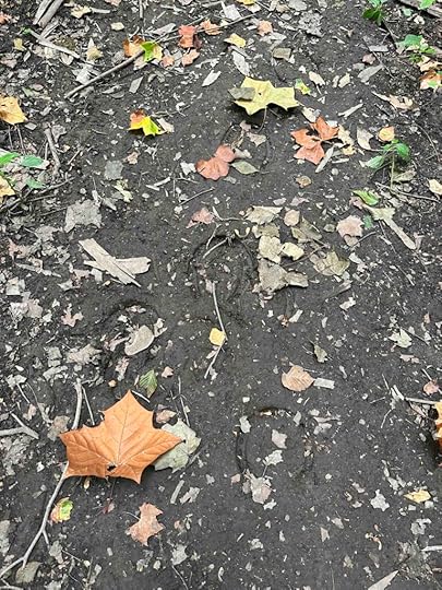
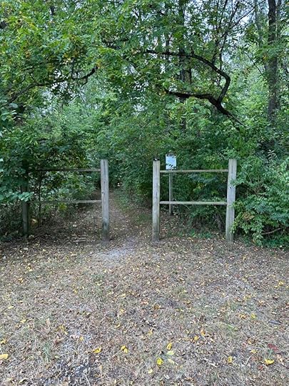
We had the preserve to ourselves the day of our visit. This made for a quiet, peaceful hike in the woods. We did notice some horse hooves in the wetter sections of the trail. I can’t imagine how a horse maneuvers over some sections of the trail since it’s narrow and the ravine is below. This likely is why the entrance sign indicates no horses, bikes, or motorized vehicles.
 Our Rating
Sunny and I give the preserve a solid 3 out of 4 paws up. We really enjoyed our hike and it’s quite scenic. The shortcomings for us are the inability to get down to the creeks (at least without doing a significant amount of off trail hiking) and the shortness of the hike. We remedied this by doing the hike once in each direction. There also is no restroom which is common for Acres Land Trust sites.
How do I get there?The McNabb-Walter Preserve is located in Spencerville, Indiana. From Spencerville take IN 1 South for about .2M and then turn left on County Road 68. Follow this for about .5M and then turn right at the first cross street which is County Road 57. After less than 1M turn right onto N. County Line Road which turns into Davis Road. Continue about .7M and look for the gravel parking lot and the sign on the left. Entrance to the preserve is on the right side of the parking lot.
The post McNabb-Walter Preserve appeared first on Live Like Karlie.
September 2, 2023
Wing Haven
A few days ago I planned to go to Wing Haven in Angola, IN and somehow ended up in Huntertown, IN. If you know anything about this part of Northern Indiana you know that Angola and Huntertown are not anywhere near each other. In fact they are opposite directions from where I live. The lesson here is not to become too dependent on your GPS. The good news is that Sunny and I finally made it to Wing Haven and we were glad we did.
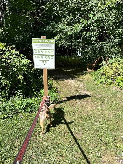
Helen Swenson donated the land for Wing Haven to the Acres Land Trust in 1984. She and her husband, Ben, purchased the land and built a home there while they managed the Potawatomi Inn at Pokagon State Park. They managed the inn from 1937 until 1948. The visitor center and artist studio you walk past at the beginning of the hike was their home. They also built and operated the Wing Haven Resort on land adjoining the northwestern edge of the preserve. Although Ben died in 1954, Helen continued to operate the resort for another 15 years.
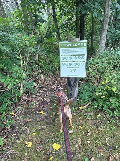
The main trail and entrance is near the parking lot and Acres Land Trust welcome sign. There are two other grass trails, one near the parking lot and one a little further down the road leading to the parking lot. We did not explore those, but likely will return to do that.
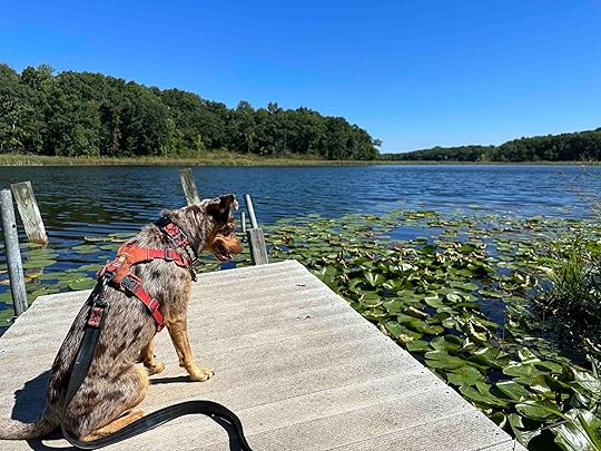
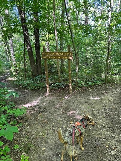
The trail takes you past the Swenson home and shortly to fork with two trails. One trail leads to Little Gentian Lake and the other to the Trillium Woods trail. We started by walking toward the lake since Sunny and I love water. The hike to the lake is fairly short, includes some wood platforms, and unfortunately does not end at a shoreline. Instead there is a small dock on the water. The views are quite nice, but Sunny was disappointed she could not put her toes in the water.

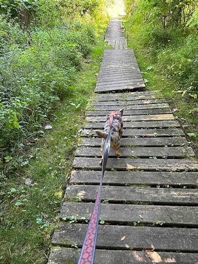
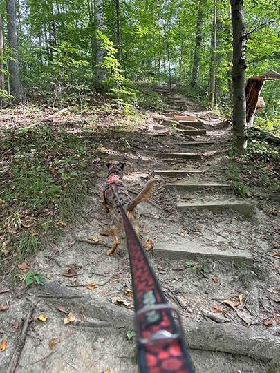
After enjoying the view of the water, we retraced our steps and took the Trillium Woods trail. This is your typical wooded trail with lots of inclines and descents. It also isn’t very wide and has roots and other obstacles making it a challenge for anyone with stability or mobility issues. In fact, this trail is rated a 4 out of 5 trail difficulty by Acres Land Trust and is not recommended for those not in good health.
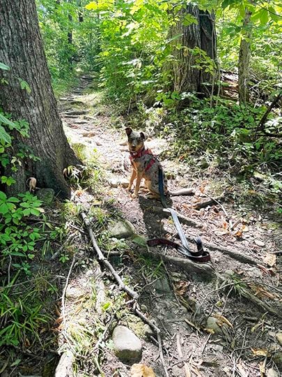
After walking for about half a mile there is a steep staircase to descend into the ravine. There appears to be a creek or stream that runs through the ravine, but sadly during our visit it was dry. We still enjoyed the views of the dry creek, forest, and fallen trees. This is one of the more scenic preserves we have visited.
After walking around in the ravine the trail takes a sharp incline up and out of the ravine. It comes up behind the visitor center/artist studio that was the Swenson home. The total distance for the walk to the lake and then through Trillium Woods was just under a mile. We did the Trillium Woods trail loop a second time for a total distance of 1.5M. The Acres Land Trust website indicates a trail distance of 1.9M and we assume that includes the two grassy trails that we did not investigate.
Our RatingWe rate Wing Haven 3 out of 4 paws up. It is a lovely walk in the woods with a view of the lake. There is even a rustic restroom at the start of the hike. Parking is great, too. The only thing that would make this better for us is if the trail was a bit longer and you could get down to the water. All in all this is a wonderful preserve for those who can handle inclines, descents, and uneven trails. We will definitely make the trip back to further investigate and hopefully when the creek has water in it.
How do I get there?Take 69 toward Angola and exit at IN 127. Take 127 South then turn left onto W 400 N. After about half a mile turn left onto the gravel road that looks like a driveway. Follow the road to the Acres Land Trust parking lot. Enter the trail near the Acres Land Trust white welcome sign.
For more information check out the Acres Land Trust website.
The post Wing Haven appeared first on Live Like Karlie.
August 30, 2023
Bicentennial Woods Again?
Today we did not intend to go to Bicentennial Woods again. We planned to go to another Acres Land Trust site, but my GPS had other ideas. The funny thing is the place I planned to go was north of us and Bicentennial Woods is south of us. Yeah, I was just a little distracted and really not paying attention. Despite that, Sunny and I had another great adventure to Bicentennial Woods.
Today was cool to start, but the sun came out and it felt nice to be hiking in the woods. We took the trail to the left at the entrance and followed it to the creek. Every time there was a fork in the trail, we took the trail to the right. This led us to and along Willow Creek, which Sunny loved.
We were not the only ones who had the idea to hike in the woods today. We encountered several people and a few dogs. This gave us some great opportunities to work on Sunny’s ability to remain calm around others. She just loves people and dogs so much that she struggles not to approach everyone. She did great!
So although today’s adventure did not go as intended, it turned out to be a great adventure. I think this is a good lesson to embrace things when they don’t go exactly as planned and make the best of every situation. Sunny didn’t have a clue that we were at the “wrong” place and maybe it wasn’t the wrong place after all.
Want to learn more about Bicentennial Woods? Read our other posts and check out the Acres Land Trust website.
The post Bicentennial Woods Again? appeared first on Live Like Karlie.
August 28, 2023
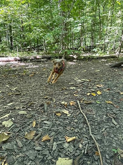
Fido’s Forest
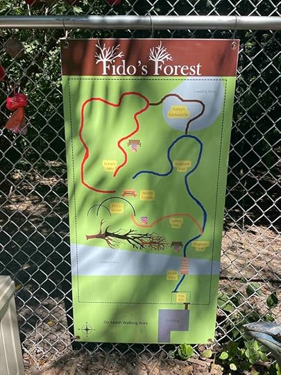
After hearing good things about Fido’s Forest we decided it was time to investigate it for ourselves and it did not disappoint. If you aren’t familiar with Fido’s Forest, it’s an appointment only wooded dog park in Fort Wayne. Only the person who reserves it can enter, making it perfect for reactive/fearful dogs. This would have been perfect for Anna and Karlie. You can also reserve it for several dogs for a doggy play date. And it’s a great spot to let your dog safely run free in the woods.
The reservation process provides details of how to make things safe for your dog and those who visit prior/after you. You can not enter the parking lot until the time of your reservation. This makes it safe for dogs who are reactive to others. Upon entering the parking lot you immediately see the fence and entry gate. Your reservation comes with a code to allow entry into the forest. Before entering, turn the sign from “Welcome to the Forest” to “Stop – Loose Dog In the Park”. Inside the entry is a box with water, toys, and poop bags, however it is suggested you bring your own. A map of the trails hangs on the fence.
 Once You Enter
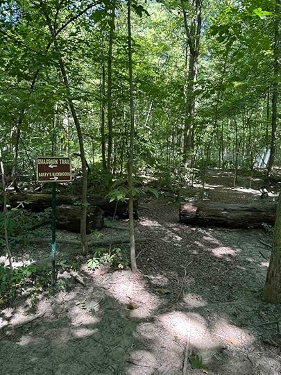
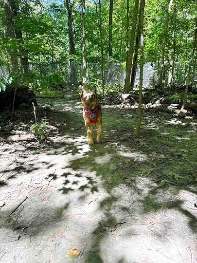
Upon entering the forest you see the trails straight ahead. It was at this point that I let Sunny off her leash. At first she stayed close, but then she realized she could run free. What fun! She explored every square inch of the forest – both using the trails and making her own. We tried to keep an eye on her as we wanted to be able to clean up if she decided to poop. We circled the entire property many, many times taking a variety of routes. Sunny led the way and we tried to keep up.
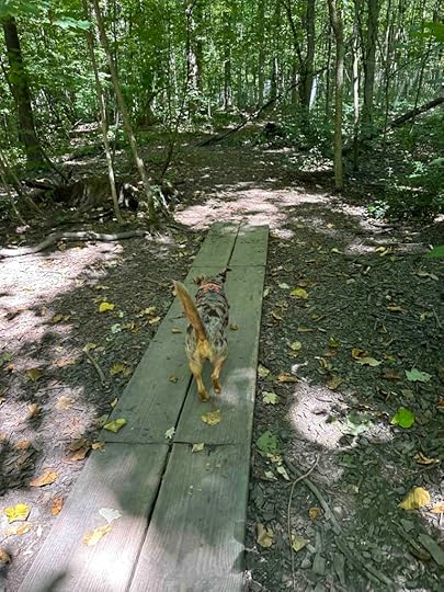
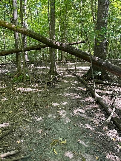
The entire forest is fenced and the one section that overlooks another property has a screen making it difficult to see in or out. This makes it feel quite private and secluded. The trails wind around the property. Sunny found many downed trees that she enjoyed jumping over. We also practiced her recall and she had great fun racing back as soon as she heard, “Sunny, COME!” There is also a picnic table and a bench should you need to rest.
At first I thought an hour might not be long enough, but by the end of our time Sunny was pooped out. We gave ourselves about 5 minutes to get out of the fenced area and into our car so we would not be late leaving. We had a great visit and we will return. I know Sunny enjoyed herself because once we arrived home she climbed on her bed and took a long nap.
Our RatingWe rate Fido’s Forest 4 out of 4 paws up. Although there is no water feature, the ability to let your dog off leash without worrying about other dogs more than makes up for it. The forest is large enough to give your dog plenty of space to roam, but not so large that you can get lost or lose your dog. The trails are well maintained and well marked, but there are also some trails that have been created by other dogs. There are so many interesting things for dogs to smell and lots of logs and trees for dogs to investigate and jump over. And probably the best part is it is set up so that if your dog is fearful/reactive to other people or dogs you can feel comfortable bringing them to the forest. We HIGHLY recommend a trip to the forest if you are anywhere near the Fort Wayne area.
How do I get there?Take 69 toward Fort Wayne and exit at Dupont Road. Go west on Dupont Road for about 1.5M and then turn left onto Coldwater Road. After less than a mile, turn right onto E. Till Road. After 3 miles take the second exit to Till/Hugenard Road and continue another .6M and turn left on W. Wallen Road. Continue another half a mile and look for the Fido’s Forest sign on the right at 4582 W. Wallen Road, Fort Wayne. Pull into the parking lot and enter the entry code at the gate to enter the forest. Remember to look for the sign that says “Welcome to the Forest” and not to enter if it says “Stop – Loose Dog In the Park”.
For more information check out Fido’s Forest website.
The post Fido’s Forest appeared first on Live Like Karlie.
August 26, 2023
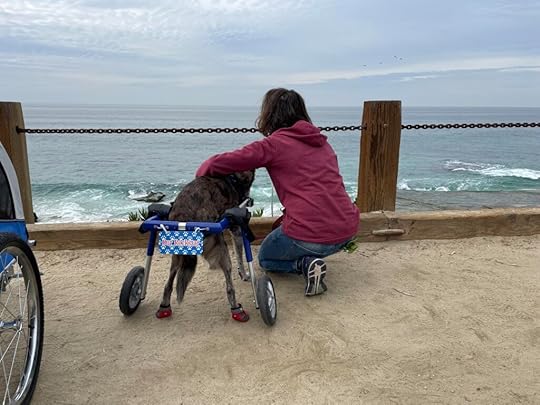
5184 Days
I recently saw a memorial someone gave to their dog after saying goodbye and it started with the number of days they shared together. That got me thinking about how many days Karlie and I shared. It was 5184. When I think about it that way it reminds me we had a long life together. I still wish we had more time, but I am grateful for all the days we had. And we mostly had really good days.
When I first adopted Karlie and her sister Anna I spent a lot of time helping them with their reactivity to dogs (Karlie) and people (Anna). We sat on the driveway watching people pass by and worked on not reacting to them. Eventually we progressed to local shopping areas. We also met with friends who helped walk them and spend time with them. But one of the best and most fun things I did was to take them to agility classes. These were just for fun classes and they sure were.
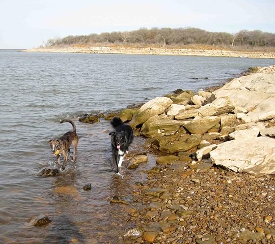
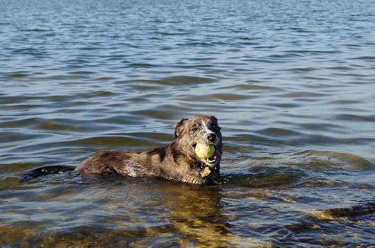
Not only did we do these things, but we kayaked and explored Lake Grapevine in Texas and Mission Bay in San Diego. We also spent endless hours in the backyard playing with the tennis ball. After we moved to San Diego we explored the beaches and parks. They also supervised our home and yard renovations. We had such fun until Anna started to slow down and eventually had seizures. Twelve years into Karlie’s life we said goodbye to our sweet Anna. And that’s when Adventures with Karlie began. It was a way to keep us from missing our sweet Anna.


So as I think back on our life together I remember all the fun times. I remember all the time spent learning about each other, developing our friendship and bond, and all the great adventures we had. I wish we had more time, but I know we did not waste one minute even after she started to have the symptoms of geriatric onset laryngeal paralysis polyneuropathy (GOLPP). We truly made the most of every day, did what we enjoyed, and always smiled. So although 5184 days wasn’t long enough, I have a lifetime of memories to look back on and most of the time they make me smile.

The post 5184 Days appeared first on Live Like Karlie.
August 25, 2023
Lloyd Bender Memorial Forest
We’ve had some hot and humid weather this week which has prevented us from going on adventures. Since today was a little cooler and less humid we decided to get out into the woods. We ventured to the Lloyd Bender Memorial Forest in Albion, Indiana which is another Acres Land Trust site.
Lloyd Bender purchased the land in 1924 to protect it from development and donated it to the Acres Land Trust in 1966. He wanted to preserve natural resources and wildlife for future generations to enjoy. And that’s just what we did today.
Little did I know when we visited that I am related to Lloyd Bender. It does seem fitting that one of my ancestors loved the outdoors as much as I do and wanted to preserve it. Anyway, Lloyd Bender was my great great uncle. He was the half-brother of my great grandfather on my mom’s side. My mom told me that Lloyd was a teacher in Noble County and also farmed the family homestead. My mom believes that the land he donated might have been the family farm and homestead since the river runs through it. She remembers visiting it when she was very young and being cautioned not to get too close to the river. I think this little piece of family history makes this memorial forest pretty special.
Just past the welcome sign at the entrance is a boardwalk over a wetland. On today’s visit things were pretty dry, but I imagine in the spring and fall the boardwalk is needed to keep your feet dry. After traversing the boardwalk we came to a grassy trail and then entered the woods. The trail winds around the woods with views of fallen trees, a forest of trees, and the South Branch of the Elkhart River. Sadly, the trail does not get close enough to the river to get down to it. Despite that it’s a pretty walk with some inclines and descents. The trail is a simple loop and is about 1.2M.
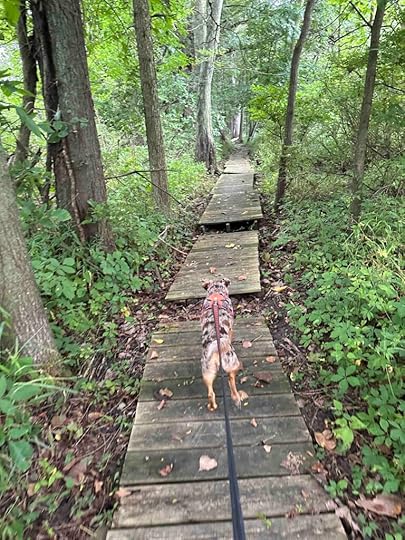
This adventure is not recommended for those with mobility or stability issues. The trail starts with a wood plank boardwalk with some sections that shift as you walk over them. Portions of the trail are narrow with tree roots in some areas. It also has some inclines and descents.
Our RatingDespite the familial connection we rate the Lloyd Bender Memorial Forest 2.5 out of 4 paws up. It’s a nice short hike in the woods, but you can’t get down to the river, there are no restrooms, and at least on our visit there were quite a few mosquitos. We enjoyed it, but there are other places we like better that are closer to us. Despite this I likely will return now that I know it was donated by my great great uncle. This is a great place to visit if you live near Albion, IN.
How do I get there?Take 8 toward and into Albion. In the downtown area turn south onto Orange St./9S. Continue for about half a mile then turn right onto W. River Road. Follow for about 2M until you see the white Acres Land Trust sign on the right. Pull into the drive and park.
For more information check out the Acres Land Trust website.
Lloyd W. Bender Memorial Forest
The post Lloyd Bender Memorial Forest appeared first on Live Like Karlie.