Andie LaComb's Blog, page 12
July 10, 2023
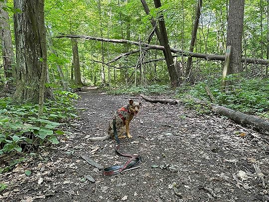
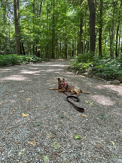
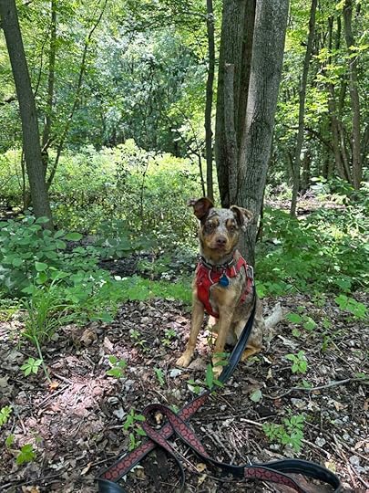
Edna W. Spurgeon Woodland Reserve
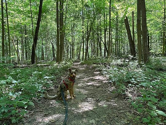
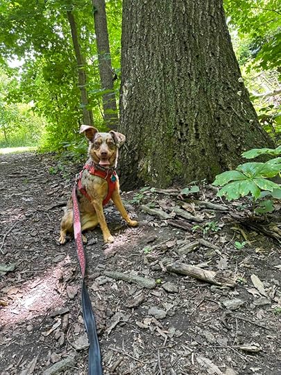
We ventured to Amish Country to visit the Edna W. Spurgeon Woodland Reserve in Ligonier, Indiana. This is another Acres Land Trust site, in fact it’s the first one.
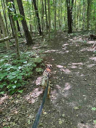
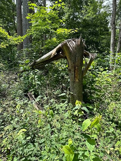
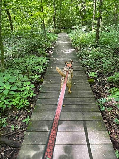
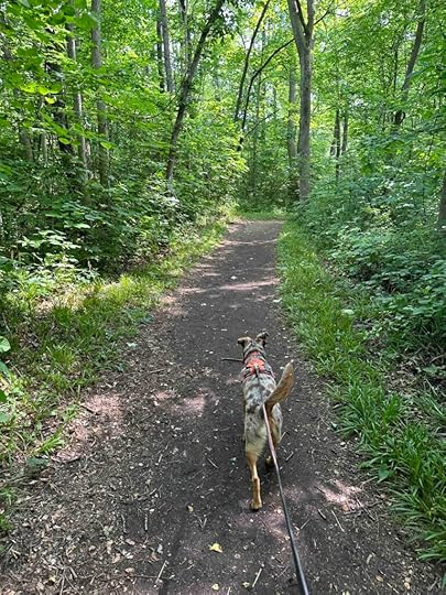
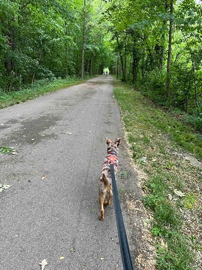
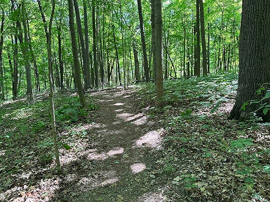
The dirt trail winds through the woods for nearly 1.5 miles. There is one main trail that has 2 loops off of it, making it easy to follow the trail. At the start the trail is quite wide, but it narrows as it progresses. There are some inclines and descents, but nothing too strenuous. As with most trails in the woods there are roots to navigate over. A few sections have wood planking to traverse over areas that may get wet.
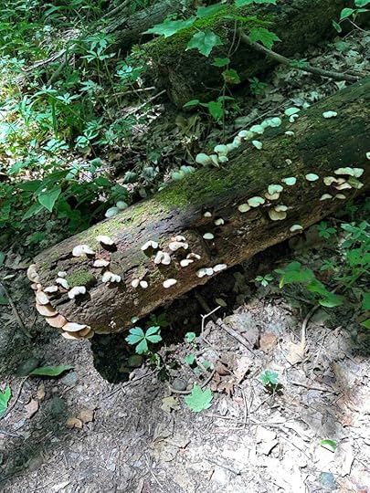
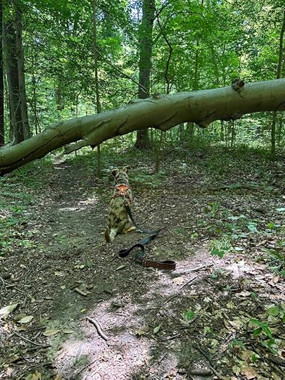
There are a variety of trees and other vegetation making it a scenic hike. May of the trees are quite tall and some have fallen over. In fact, there’s one that crosses the trail, but does not impede continuing the hike. The entire trail is shaded making it comfortable even on warmer days. Sunny heard many critters and sniffed some great smells.
For more information check out the Acres Land Trust website.
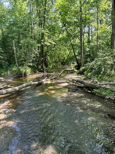
Our RatingWe rate Edna W. Spurgeon Woodland Reserve 3 out of 4 paws up. It’s a lovely wooded hike, but there’s no water feature or other unusual feature. There also is no restroom. If you live near Ligonier or are traveling in the area, it’s well worth a visit. Due to the twisty trail in the woods with descents and inclines, it is not recommended for those with mobility or stability issues.
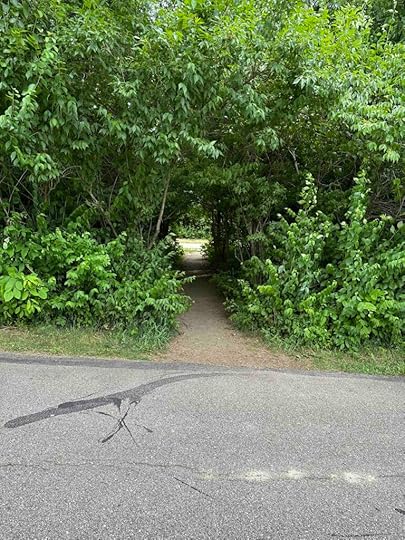
How do I get there?Take route 6 toward and through Wawaka, Indiana. Take a right onto N 600 W. My GPS had me turn into a gravel driveway, but this is not the entrance to the reserve. Instead, continue past the driveway for nearly half a mile until you see a gravel parking lot on the right with an Acres Land Trust sign out front. Enter the reserve near the gate.
The post Edna W. Spurgeon Woodland Reserve appeared first on Live Like Karlie.


July 9, 2023
Fogwell Forest
Another beautiful summer day in Northern Indiana so off we went on an adventure. This time we explored Fogwell Forest in Fort Wayne, Indiana. This is another Acres Land Trust location and is perfect for a nice peaceful walk in the woods. There isn’t any water, except puddles after a recent rain, but it’s a beautiful spot in the woods for a hike.
This property was part of the Fogwell Farm and had been in the family since the 1800’s when they settled in Allen County. It was donated to Acres Land Trust who maintains the property and allows the public to visit it.
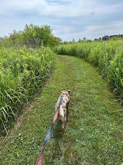
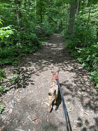
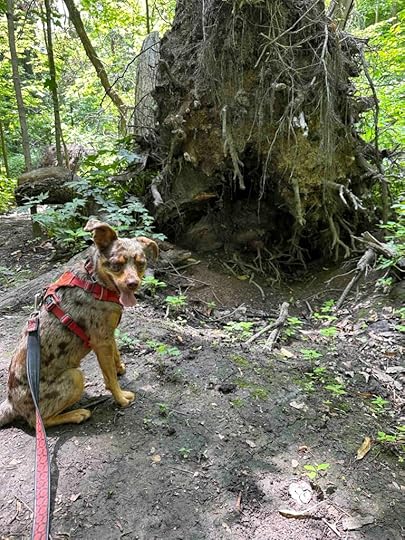
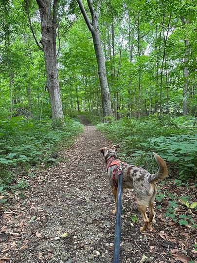
The start of the hike is a mowed grass path. There are two options to take from the parking lot, both end at the woods, just different sections of it. The rest of the hike is in the woods. It’s mostly flat and shady. We saw a lot of downed trees, which was interesting and made us think something caused them to fall. Many of the trees looked like they deteriorated from the inside and then the tree just folded and fell. There were also a lot of trees that fell over and took the roots with them. All of these trees were off the trail so they made for interesting things to observe, but did not hinder the hike.
The trail is a windy dirt path through the woods with roots. Some areas were wet, but it had recently rained. There are wood platforms over several areas that I imagine get water logged at times.
For more information visit Acres Land Trust website.
Our RatingWe rate Fogwell Forest 3 out of 4 paws up. It’s a wonderful place to hike in the woods, but there is no water feature. We also prefer to have the entire walk in the woods and this one starts with a mowed grassy trail. And of course, as with all Acres Land Trust sites, there is no restroom. Despite this, it really is a great place to hike especially if you live near Fort Wayne, Indiana. This location is not recommended for those with mobility or stability issues.
How do I get there?From 69 take exit 299 – Lower Huntington Road and turn left onto Lower Huntington Road. After about half a mile turn left to stay on Lower Huntington Road. Continue for another 1.3 miles and then turn right onto Whippoorwill Drive. Follow it for nearly half a mile and park in the parking lot at the end. The lot has room for about 6 vehicles.
The post Fogwell Forest appeared first on Live Like Karlie.
July 7, 2023
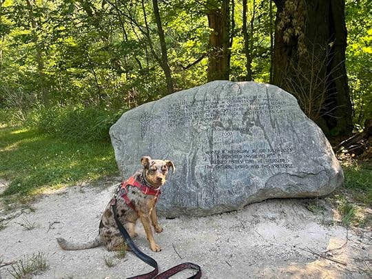
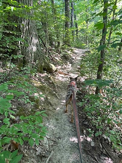
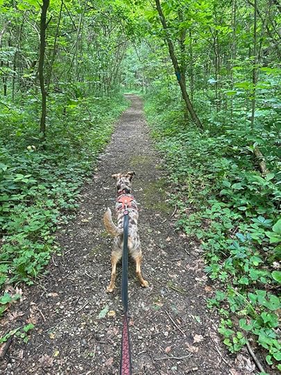
Hathaway Preserve
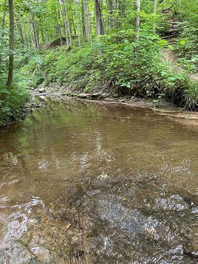
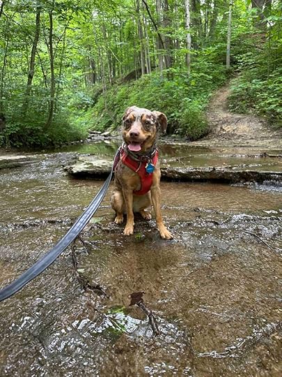
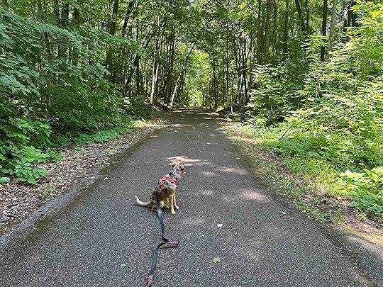
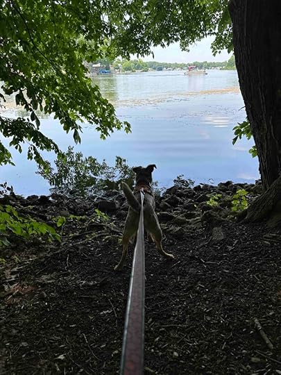
After not going on any adventures for over a week we decided it was time to get out and explore. We traveled to Wabash, Indiana to explore Hathaway Preserve at Ross Run. What a wonderful place that truly has it all – wooded trails, grassy trails, towering trees, shade, and a gorge with a stream running through it. And of course it’s beautiful and peaceful. Sunny and I hiked for nearly 2 miles on a loop trail that circled the gorge and returned us to the parking lot. Hathaway Preserve is a great place to explore that was well worth the over 1 hour travel time.
Hathaway Preserve is an Acres Land Trust location that the Hathaway family donated in honor of Dr. H. Russell Hathaway. There is a large stone at the entrance to the preserve indicating that Dr. Russell grew up in St. Joe, Indiana, was a family physician for 50 years, and loved the natural world. The family donated the land in his memory in 2007. The property is part of the Acres Land Trust who maintains and preserves it for the public to use.
There is a nice parking lot off Baumbauer Rd. with an Acres Land Trust site sign. Upon parking you walk through a mowed grass trail to a large stone memorializing Dr. Russell and the dedication of the land in his name. Just past the stone you either turn to the left and continue walking on mowed grass or travel straight into the woods and a dirt path. We selected the dirt path and continued hiking through the woods along Ross Run gorge. At several points we were able to get down to the water so Sunny could stick her toes in it just like Karlie always did.
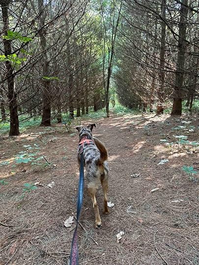
In several areas the path narrowed and was elevated quite a bit above the gorge. This made for some spectacular views. In one area we found an interesting old tree that required many photos to be taken in front of it. We also came across a path leading through a forest of evergreen trees. Sadly most of the trees seemed to be dying and had lost their needles. We took that path to the end and then turned around to take a mowed grass path that eventually led back to the parking lot. This is the same trail at the start that is to the left of the large memorial stone.

The majority of the trail is shaded making it a comfortable hike even in the summer. The one area that was not shaded was the mowed grass trail.
For more information visit the Acres Land Trust website.
Our RatingWe rate Hathaway Preserve 3.5 out of 4 paws up. This location is similar to and near Kokiwanee and is rated the same for the same reason – no restroom and the trail can be a little confusing. Sunny loved all the interesting smells and critters plus getting her toes wet in the stream. We would not recommend this trail for anyone with mobility or stability issues. The trail is narrow and has some inclines and descents. Like most trails in the woods it also has roots making it more difficult for those who are not sure-footed.
How do I get there?From 69 take the Huntington exit and travel west on 24 through Huntington. Turn left onto N 500 E and after about half a mile turn right on E. Blue Star Hwy. Follow this for about 1.5 miles and turn left onto 524. Follow for half a mile and turn right on E. Durnbaugh Rd. Follow this for several miles and then turn right onto E. Baumbauer Rd. The preserve is about half a mile on the right. There is a Acres Land Trust sign and a gravel parking lot.
The post Hathaway Preserve appeared first on Live Like Karlie.
June 18, 2023
Chain O’Lakes State Park
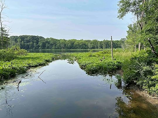
Chain O’Lakes State Park is another wonderful Indiana State Park in Albion, Indiana. This park really has it all – beaches, cabins, a campground, 23 miles of hiking trails, 12 lakes, a nature center, and picnic areas. You can even rent kayaks, canoes, and paddleboat to explore the lakes. Fishing is also allowed on the lakes. Dogs are not allowed on the beach, but can visit most of the other areas.
We recently visited Chain O’Lakes State Park on a busy Sunday in June. Despite many other people having the same idea, we had a pleasant hike on trail #5. This trail traverses around Sand Lake from the nature center/concession area and beach to the boat rental parking area. The trail is heavily wooded and in many areas you have views of the lake. It’s a mostly flat trail, but is dirt making it a little challenging for those with mobility issues. To return to the parking lot near the nature center/concession area requires walking on the grass near the road, but there is plenty of room.

After our hike we had a nice picnic lunch. There are many picnic areas in the grass surrounding the nature center/concession area parking lot. Many are in the shade making for a pleasant place to rest or have lunch even on warm days.
For more information about Chain O’Lakes State Park.
Our RatingWe rate Chain O’Lakes State Park 3.5 paws up. Trails are well marked, there are a variety of trails, parking is plentiful, there is a restroom, and there are several lakes. It’s a well maintained park and allows a variety of activities. This is one we will visit again and explore other trails and lakes.
How do I get there?Take 48 to E. Baseline Rd. and continue for 11 miles. Turn left on E 75 S and follow for about a mile. Turn left to enter the park. The current fee to enter an Indiana State Park is $7 for in-state vehicles and $9 for out-of-state vehicles. Price is per vehicle. Annual passes are available. For more information on fees, check the Indiana Department of Nature Resources website.
The post Chain O’Lakes State Park appeared first on Live Like Karlie.
June 17, 2023
Kokiwanee
A friend recommended we visit Kokiwanee in Lagro, Indiana knowing we like to hike in the woods near water. She said we would love Kokiwanee and she was right! This spot did not disappoint and was well worth the over one-hour drive.
The preserve’s land previously was mostly farm land and in 1945 the Girl Scouts, with help of the Kokomo Kiwanis, purchased it. The Girl Scouts operated a camp on the property from 1945 to 1996. There’s even a facebook group for those who attended the camp. The Acres Land Trust now maintains the land and allows the public to hike in it.
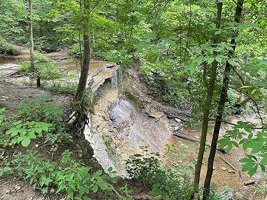
After parking in the lot off E 50 S, you can enter near the gate or the opening in the woods. We opted for the opening in the woods. Upon entering we found ourselves in a wooded wonderland with a tall forest of trees and bluffs above the Salamonie River. There are several trails in the woods marked by blue paint on tree trunks. We followed one that mostly traversed the bluffs above the Salamonie River. We passed a covered picnic area, a small shed, downed trees, and eventually found ourselves above Kissing Falls. It was truly beautiful and since we had rain a few days prior the falls were active. The distance to the falls is about 1.6M and it is a bit of a challenging hike as there are some inclines and descents. The trail is relatively narrow and dirt, stone, or grass covered. There are other trails and waterfalls which we plan to investigate on future trips to this wonderful preserve.
For more information visit the Acres Land Trust website.
Our RatingWe rate Kokiwanee 3.5 out of 4 paws up. The only reason for not giving it a full 4 paws up is there is no restroom and it is a little confusing with all of the different trails. Sunny loved not only the great smells and critters, but also getting her feet wet at the top of the waterfall. The trail is mostly shaded making this a great place to visit even on a warmer day. The trail can get muddy so proper footwear is a must. It is also not recommended for those with mobility or stability issues.
How do I get there?From 69 take the Huntington exit and travel west on E 900 N and then take a left onto 24 West. Follow 24 through Huntington until it turns into 9 South. Follow that for several miles and then turn right onto W. Division Road. Follow that for 7.6 miles and then turn left on Stone Road. There is an Acres Land Trust sign for Kokiwanee at this intersection. Stay on Stone Road for about half a mile and then turn right onto E 50 S. Less than a quarter of a mile and you’ll see the parking lot on the left.
The post Kokiwanee appeared first on Live Like Karlie.
June 15, 2023
Fishing Line Trail at Gene Stratton-Porter Historic Site
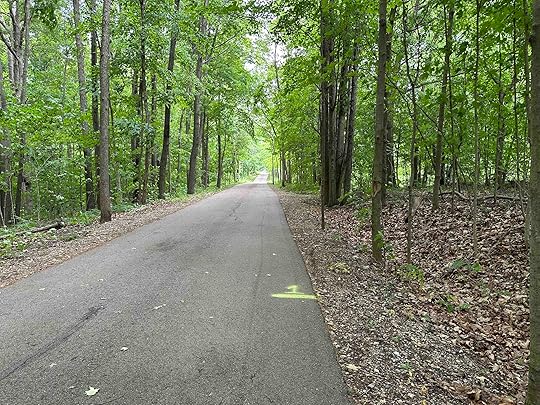
We had some rain earlier in the week so I was looking for an asphalt trail and stumbled across Fishing Line Trail at Gene Stratton-Porter Historic Site in Rome City, Indiana. It was well worth the half an hour drive for this adventure. Not only is there a nice asphalt trail, but a historic site with trails in the woods.
The Gene Stratton-Porter Historic Site is one of the former homes of Gene Stratton-Porter who was a writer, photographer, and film producer. She purchased the property and built the “cabin at wildflower woods” on Sylvan Lake in 1912. She moved to the property in 1914 and lived there until 1919 with her husband visiting on the weekends. Unfortunately as her popularity increased, she found the property was not private enough and moved to California. In 1946 it was donated to the State of Indiana and today is open to the public to explore the grounds, trails, and home.
Although we started our adventure by walking on the Fishing Line Trail, we did briefly explore the grounds and trails at the historic site. The trail we followed traversed past the visitor center, toward Sylvan Lake and the cabin. There are other trails that we did not explore, however we plan to return to investigate them.
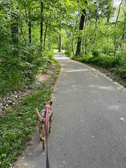
Prior to exploring the historic site and trails, we walked nearly 3M on the Fishing Line Trail. The trail is across E 850 N and is about 0.3M from the parking lot. It is a wide asphalt trail with woods on both sides. There are views of downed trees, creeks/ponds, and even a farm with cows and horses. It is similar to the rail trails in Bloomington, Indiana and on the day of our visit was fairly busy with people riding bikes. Because of the woods it’s mostly shaded and there are a lot of birds and squirrels which captured Sunny’s interest.
 Our Rating
We rate the Fishing Line Trail 3.5 out of 4 paws up. The reason this trail has a slightly higher rating than other asphalt trails is it is heavily wooded making it feel more like you are hiking in the woods instead of in an urban environment. There is also a restroom near the parking lot, which is always a plus. One other reason for the higher rating is the ability to also hike on dirt trails in the woods and the proximity to Sylvan Lake.
 How do I get there?
From E. North Street in Kendallville (6W) turn north onto 3. Then turn left onto N. Angling Road and follow it for a couple miles. From there turn left onto E 850 N and after a couple miles turn right onto Pleasant Point. After a short distance the parking lot is on the right. To get to the Fishing Line trail walk back toward and across E 850 N to an asphalt trail that leads to another asphalt trail in the woods. From the parking lot to the start of the Fishing Line Trail is about 0.3M. There are also trails in the woods and towards the Gene Stratton Porter historic site. After parking, walk towards the pavilion and you’ll find trails in the woods with some leading to the visitor center.
For more information about Gene Stratton-Porter.
For more information about Fishing Line Trail.
The post Fishing Line Trail at Gene Stratton-Porter Historic Site appeared first on Live Like Karlie.
June 12, 2023
Pufferbelly Trail – Parkview YMCA
Sunny and I returned to the Pufferbelly Trail, but this time we hopped on at the Parkview YMCA in Fort Wayne. We tried to hike this section of the trail several months ago, but ended up on the Salomon Farm Trail instead. See “How do I get there?” to find out how easy that is to do.
The Pufferbelly Trail is an asphalt trail through the woods with a creek running along and under it in some areas. Unfortunately we did not find any way to easily get down to the water. At times the trail also passes by the backyards of homes. As it traverses many miles, it intersects with roads where the vehicle traffic is not required to stop. Luckily there are stop signs for trail users reminding them that cross traffic does not stop.
The Pufferbelly Trail reminds us of the rail trails in Bloomington – asphalt trails through a wooded area. This section feels less like a walk through the city than the section near Franke Park. Although the trail is nearly 7 miles, we only walked 1.5 miles before turning around.

 Our Rating
We rate this part of the Pufferbelly Trail 3 out of 4 paws up. The trail is wide making it easy for cyclists and other walkers to pass each other. The trail does not allow access to the creek and there are no restrooms. Although Sunny and I prefer hiking in the woods on dirt trails, this is a nice option for those who want to cycle or who have mobility issues.
How do I get there?From Dupont Road in Fort Wayne, turn onto Dawsons Creek Blvd. Follow that to the entrance to the Parkview YMCA. Turn into the parking lot, take a left, drive past the playground, and park near the back of the lot. The trail is at the back of the parking lot. There are two trails – Salomon Farm Trail and Pufferbelly Trail. The first rail is the Salomon Trail. As you walk toward that trail you will see a clearing through the woods that leads to the Pufferbelly Trail. You can also access the Pufferbelly Trail by taking a left on the Salomon Farm Trail and walking toward the entrance to the YMCA parking lot. There you will see a sign on the right for the Pufferbelly Trail.
For more information about Fort Wayne Trails check out the Fort Wayne Trails website.
The post Pufferbelly Trail – Parkview YMCA appeared first on Live Like Karlie.
June 4, 2023
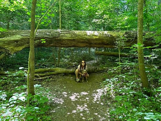
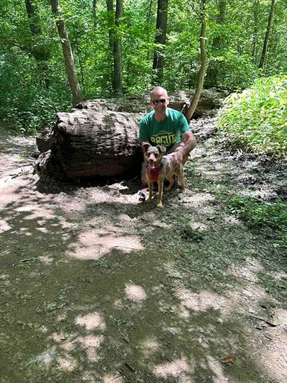
Bicentennial Woods Revisited
Our weather last week was hot, especially for early June in Northern Indiana, so I was looking for a place to hike that had shade. We ended up at Bicentennial Woods which we visited in April. It did not disappoint and despite the heat allowed for a nice, not too warm hike.
Bicentennial Woods is part of the Cedar Creek Corridor which is the largest forested area in the region. It is open daily until sunset, has a gravel parking lot that accommodates several cars, and no restroom. There was only one other person there on this visit.
We took the bridge over the creek and explored the other side. We found a nice, somewhat narrow trail, in the woods with vegetation on both sides. Sunny found many good things to explore and smell along the trail. We continued on the trail which followed the creek until there was an opportunity to get down to the creek. Sunny loved getting down to the water. After exploring for awhile we returned to the trail and found a downed tree which make for a great photo opportunity. There are many downed trees throughout Bicentennial Woods which are fun to explore.
Despite temperatures in the mid 80’s we managed to stay fairly cool on our hike. We brought plenty of water with us, but even for Sunny it was a comfortable place to hike. So far this is one of our favorite places in the area and I know we will return.
Our RatingThis section of Bicentennial Woods is just as nice as the area we explored in April. We rate Bicentennial Woods 3.5 out of 4 paws up. It’s scenic, a fun trail through the woods, has access to the water, and great parking. Sunny enjoyed exploring the trail and the water and Karlie would have loved this trail too.
How do I get there?Getting there is fairly straight forward. From Coldwater Rd. turn onto Schoaff Rd. About half a mile down the road, there is a sign on the left for Bicentennial Woods. It’s a little hidden behind some vegetation, but leads to the gravel parking lot. The trail is just off the parking lot.
For more information check out the Acres Land Trust website and my post from our first visit.
The post Bicentennial Woods Revisited appeared first on Live Like Karlie.
June 3, 2023
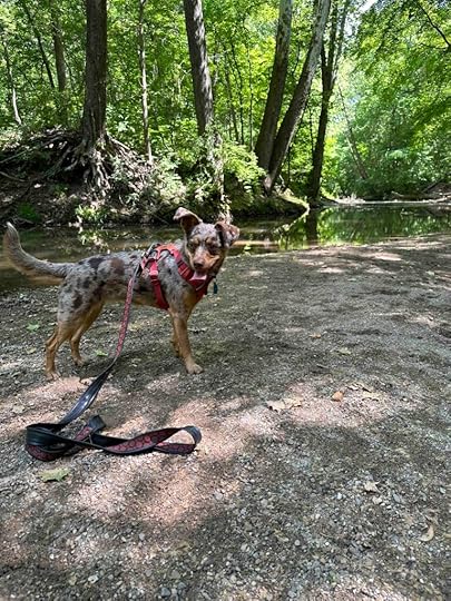
Pufferbelly Trail – Franke Park
Last week we decided to venture to Franke Park Trails in Fort Wayne, IN. Franke Park is a special place to me because my grandfather took my two younger cousins and I there quite often when we were little. I would visit Indiana for a week every summer and bounce from relative to relative. When I stayed with my grandpa he would take us to the Franke Park zoo and then to McDonalds. Those were special times and a great memory from my visits. Fast forward many, many years and now I live outside of Fort Wayne and am exploring different parks and trails in the area. Imagine my surprise to find that there are trails at Franke Park. So we loaded Sunny into the car and headed there to explore.
This is another adventure that did not go according to plan, but we still had a good hike and explored a new area. The GPS directed us to Sherman Blvd. off Coliseum Blvd., but as we approached the zoo entrance there was a sign for trail parking. Instead of listening to the GPS, we followed the sign to the parking lot on Franke Park Drive. Then we walked along Franke Park Drive toward and across Wells St. where we found the Franke Park Connector trail. This trail leads to the Pufferbelly Trail, which we tried to explore a few weeks ago, but ended up on the Salmon Farm Trail. Although we seem to get more turned around here, we are finding and exploring new areas. It’s fun to explore even if things don’t go according to plan.
Although the Pufferbelly Trail is quite nice, the walk from the parking lot to the connector trail and along the connector trail is not too scenic. It’s more of a city walk, but once you turn off the connector trail onto the Pufferbelly Trail you feel more like you are in the woods. We took a right at the end of the connector trail onto the Pufferbelly Trail. Then we walked to W. Jacobs Ave and back for a total of nearly 4M. The trail is asphalt and quite wide making it great for bikes and those with mobility issues. We encountered wild flowers, Spy Run Creek, and a park near an apartment complex. We were even able to get down to Spy Run Creek, which Sunny loved.

 Our Rating
All in all the Pufferbelly Trail is a nice place to take a walk or run. Although it’s in a city environment you do not feel like you are in the city. It’s is well maintained and peaceful. Despite several other walkers, cyclists, runners, and dogs we did not feel like it was too busy. We rate this location 3 out of 4 paws up mainly because it’s more of a city walk and there are no restrooms. We generally prefer hiking in the woods instead of asphalt, but this is a great option when you have mobility issues or want to ride a bike.
How do I get there?Turn onto Sherman Blvd. from Coliseum Blvd. Then take a left onto Franke Park Drive near the zoo entrance. The parking lot is on the right. After parking walk on Franke Park Drive away from the zoo, toward Wells Street. Cross Wells Street to the Franke Park Connector trail. The trail ends at the Pufferbelly Trail. We turned right onto the Pufferbelly Trail to start our walk.
For more information about Fort Wayne Trails check out the Fort Wayne Trails website.
The post Pufferbelly Trail – Franke Park appeared first on Live Like Karlie.
Pufferbelly Trail
Last week we decided to venture to Franke Park Trails in Fort Wayne, IN. Franke Park is a special place to me because my grandfather took my two younger cousins and I there quite often when we were little. I would visit Indiana for a week every summer and bounce from relative to relative. When I stayed with my grandpa he would take us to the Franke Park zoo and then to McDonalds. Those were special times and a great memory from my visits. Fast forward many, many years and now I live outside of Fort Wayne and am exploring different parks and trails in the area. Imagine my surprise to find that there are trails at Franke Park. So we loaded Sunny into the car and headed there to explore.
This is another adventure that did not go according to plan, but we still had a good hike and explored a new area. The GPS directed us to Sherman Blvd. off Coliseum Blvd., but as we approached the zoo entrance there was a sign for trail parking. Instead of listening to the GPS, we followed the sign to the parking lot on Franke Park Drive. Then we walked along Franke Park Drive toward and across Wells St. where we found the Franke Park Connector trail. This trail leads to the Pufferbelly Trail, which we tried to explore a few weeks ago, but ended up on the Salmon Farm Trail. Although we seem to get more turned around here, we are finding and exploring new areas. It’s fun to explore even if things don’t go according to plan.
Although the Pufferbelly Trail is quite nice, the walk from the parking lot to the connector trail and along the connector trail is not too scenic. It’s more of a city walk, but once you turn off the connector trail onto the Pufferbelly Trail you feel more like you are in the woods. We took a right at the end of the connector trail onto the Pufferbelly Trail. Then we walked to W. Jacobs Ave and back for a total of nearly 4M. The trail is asphalt and quite wide making it great for bikes and those with mobility issues. We encountered wild flowers, Spy Run Creek, and a park near an apartment complex. We were even able to get down to Spy Run Creek, which Sunny loved.
Our RatingAll in all the Pufferbelly Trail is a nice place to take a walk or run. Although it’s in a city environment you do not feel like you are in the city. It’s is well maintained and peaceful. Despite several other walkers, cyclists, runners, and dogs we did not feel like it was too busy. We rate this location 3 out of 4 paws up mainly because it’s more of a city walk and there are no restrooms. We generally prefer hiking in the woods instead of asphalt, but this is a great option when you have mobility issues or want to ride a bike.
How do I get there?Turn onto Sherman Blvd. from Coliseum Blvd. Then take a left onto Franke Park Drive near the zoo entrance. The parking lot is on the right. After parking walk on Franke Park Drive away from the zoo, toward Wells Street. Cross Wells Street to the Franke Park Connector trail. The trail ends at the Pufferbelly Trail. We turned right onto the Pufferbelly Trail to start our walk.
For more information about Fort Wayne Trails check out the Fort Wayne Trails website.
The post Pufferbelly Trail appeared first on Live Like Karlie.