Rick Just's Blog, page 9
October 11, 2024
Considering the Sagebrush
In some places in southern Idaho, sagebrush still stretches from horizon to horizon. It is so ubiquitous in the state that we seldom take notice. We should take notice, though, because it is under attack from civilization and the invasive species and wildfires it brings along with it.
Sagebrush, though not yet endangered, is experiencing rapid decline and fragmentation. That’s a serious problem for the 350 species that depend on it.
Today a little history of the plant.
Sagebrush is a multi-branched, gray-green shrub that stands from two to ten feet tall. You probably haven’t seen a ten-foot-tall sagebrush, lately, but they still exist in remote areas. That’s taller than a man on a horse. It has flowers, but they're so tiny you probably don't notice them. When sagebrush does bloom, it's not a sign of spring. Sage flowers in August and September, as many people with allergies can attest. When sagebrush blooms it releases pollen into the air. It's a common cause of hay fever in this area.
Pioneers, often sneezing, did find some uses for the shrub. Even green sage burns readily, so it went into a lot of campfires. At one point, the spare sagebrush trunks were converted into wooden sidewalks for the town of Meridian.
Settlers also learned that the land where sagebrush grew often had farming potential.
While domestic animals seldom eat it, sagebrush is a valuable food for antelope, elk, mule deer, moose, and sage grouse.
But no one was going to make a living off of sage grouse, so sagebrush had to go.
In 1870, the Idaho Statesman issued a challenge. Quoting here, “Who Will Try It! There are not a few men in this valley who are of the opinion that any portion of the broad tableland lying between the Boise and Snake rivers would if plowed a foot deep at this time and sown to wheat, yield a good crop next year without irrigation.”
Well, that might have worked in certain rare years. But trial and error proved that clearing the land with a team of horses and a grub hoe to get rid of sagebrush wasn’t enough. The soil was rich, all right, and would grow everything from wheat to apples and eventually suburbs, but it would take water. With irrigation canals and groundwater drilling, the desert has bloomed, though sagebrush is blooming much less than it once did.


October 10, 2024
Seamans Gulch Road
Seamans Gulch Road, in the Boise Foothills, leads to—and beyond—Seamans Gulch. Seamans Gulch is the site of the Ada County Landfill. The current landfill was engineered to last 100 years. With more than 535,000 tons received each year, that 100-year project is looking more like 60 years until that ravine is full.
But trash disposal, problematic as it may be, is not my reason for bringing up Seamans Gulch. I wanted to know where the name came from. The romantic in me—to the extent landfills can be romantic—would like to think it was named after the Newfoundland Meriwether Lewis brought along with him on his famous expedition. Alas, it wasn’t until the 1990s that we knew the true name of the dog. Seamans Gulch had been called that for several decades by that time.
Fortunately for me, Jay Karamales was also curious about the name. He did a deep dive into records and wrote a story about it for the Dry Creek Historical Society Summer 2022 newsletter.
He found that one Jasper William Seaman was one of many Forty-niners who never lost the dream of finding gold. Originally from Ithaca, New York, Seaman, and his family tried dream-chasing—not always for gold—in Arkansas, California, Washington, and Oregon, before moving to Boise in 1862. They settled on Government Island, where 9th Street crosses the Boise River today. Don’t bother looking for the island. It’s no longer there. In 1898, the south arm of the Boise River was filled in, joining the island to the land on that side of the river.
Col. Lugenbeel, of Fort Boise fame, had designated the island as a source of cottonwood trees from which to begin constructing buildings. The 100-acre island had been stripped of most of its trees by the time the Seaman family came along.
Karamales was unable to find out what Jasper did for a living, but his wife, Ann, ran a boarding house in town.
The Seaman family was prominent in Boise for several years, but Karamales wasn’t able to pinpoint a solid connection to the area around Seaman Gulch to solidify his theory about where the name came from.
Then, voila! his research took Karamales to the records of the General Land Office. The island-owning Seaman family had been a romp down the wrong rabbit trail.
Seamans Road/Gulch has a history not nearly as old as it had originally appeared. It goes back to 1935 when William Lewis Seaman Jr bought three 40-acre plots at the foot of then-unnamed Seamans Gulch. He bought another 540 acres nearby in 1939. He planted fruit trees and started Seaman’s Fruit Farm. They sold berries, fruit, and vegetables to whoever was willing to pay to pick them.
The fruit and vegetable farm did a good business until William Seaman died at age 74 in 1950. His son, Donald, took it over but was never able to make much of a go of it. It disappeared in the 1950s, but the Seaman name became attached to the road that ran through the property and to the gulch.
Thanks to Jay Karamales and the Dry Creek Newsletter for a couple of interesting stories rolled into one. Now, as long as those newsletters don’t all end up in the landfill, Idahoans will know the story behind the name.
English Major Note: It irritates many English majors—I am one—when they see an apostrophe used incorrectly. Seamans Gulch would, by the rules of English, be Seaman’s Gulch with an apostrophe, just as Seaman’s Fruit Farm has one. Oddly, English rules don’t apply here. For a scintillating explanation of why that’s the case, click here.
October 9, 2024
Linda Moulton Howe
I sometimes publish lists of people born in Idaho who have achieved some level of fame. Poet Ezra Pound made my list of Idaho writers because he was born in Bellevue, even though he hadn’t even begun to write with a crayon when he left the state.
Linda Moulton Howe has solid connections to Idaho, though her connections to reality have often been questioned. But, hey, I sometimes write fiction myself.
Howe isn’t a fiction writer. Her field is—and now my mind sees an actual field littered with slaughtered cows and crop circles—UFO reporting. But first, let’s make that Idaho connection.
Born Linda Moulton, on January 20, 1942, in Boise, she is the daughter of long-time Idaho Director of Aeronautics Chuck Moulton. She was a beauty queen: Miss Boise, 1963; Miss Idaho, 1963; Miss America participant in 1964. Moulton was also a scholar, receiving her BA in English Literature from the University of Colorado and a master’s in communication from Stanford.
Linda Moulton Howe was an award-winning environmental reporter for a Denver television station, producing several documentaries before moving on to WCVB in Boston. Her 1980 documentary A Strange Harvest received a regional Emmy and set her off on the UFO path.
She became an expert in Ufology, producing numerous programs about alien visitations. Howe produced the Sightings series on Fox and was a regular on Coast to Coast AM for 28 years. She has frequently been interviewed on network television when the subject of UFOs pops up.
Linda Moulton Howe is still active today, managing her website Earthfiles and producing a weekly YouTube program.
 Linda Moulton Howe receiving her regional Emmy. By Larry W. Howe - https://www.earthfiles.com/bio/index.php, CC BY 4.0, https://commons.wikimedia.org/w/index...
Linda Moulton Howe has solid connections to Idaho, though her connections to reality have often been questioned. But, hey, I sometimes write fiction myself.
Howe isn’t a fiction writer. Her field is—and now my mind sees an actual field littered with slaughtered cows and crop circles—UFO reporting. But first, let’s make that Idaho connection.
Born Linda Moulton, on January 20, 1942, in Boise, she is the daughter of long-time Idaho Director of Aeronautics Chuck Moulton. She was a beauty queen: Miss Boise, 1963; Miss Idaho, 1963; Miss America participant in 1964. Moulton was also a scholar, receiving her BA in English Literature from the University of Colorado and a master’s in communication from Stanford.
Linda Moulton Howe was an award-winning environmental reporter for a Denver television station, producing several documentaries before moving on to WCVB in Boston. Her 1980 documentary A Strange Harvest received a regional Emmy and set her off on the UFO path.
She became an expert in Ufology, producing numerous programs about alien visitations. Howe produced the Sightings series on Fox and was a regular on Coast to Coast AM for 28 years. She has frequently been interviewed on network television when the subject of UFOs pops up.
Linda Moulton Howe is still active today, managing her website Earthfiles and producing a weekly YouTube program.
Linda Moulton Howe receiving her regional Emmy. By Larry W. Howe - https://www.earthfiles.com/bio/index.php, CC BY 4.0, https://commons.wikimedia.org/w/index...
October 8, 2024
Idaho Hoaxes
Ralph Thurston, who follows my blog, sent me the clipping below this post. He wondered if I knew of other Idaho hoaxes. I couldn’t find anything else about this “find.” We are assuming it was a hoax because there is not a theme park now built around the 5,000-year-old ruins.
But to answer Ralph’s question, yes, I know of a few Idaho hoaxes. Hoaxes, by my definition, do not include April Fool’s Day jokes. Clever and humbling as those are, they just aren’t in the same category.
Here are a few I’ve previously written about, with the links to those stories. Probably the most famous and enduring hoax is the Bear Lake Monster. Note that this story includes a decidedly not-hoaxy piece on that big dog in Cottonwood. The William Clark Rock certainly smells like a hoax, though the artifact is still in the Idaho State Archives. Daniel Boone in Idaho qualifies as a hoax, even if the woman who publicized it sincerely believed in its validity.
Caleb Lyon, the second governor of Idaho Territory, famously embezzled more than $46,000 from intended for the Boise Shoshoni Tribe while he was in office. It’s less well-known that he started a frenzy of diamond prospecting by claiming that a diamond had been found near Ruby City. Hundreds flocked to stake their claims. Not a single diamond was found.
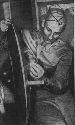
Kenneth Arnold, Idaho’s flying saucer man, is widely credited with starting the UFO mania that continues even today. His 1947 sighting generated a number of UFO hoaxes, perhaps the most famous of which was tied to Twin Falls. Following several sightings in Idaho in July of that year, some Twin Falls residents found a 30-inch disc in their backyard after hearing a thud at 2:30 in the morning. Police confiscated the object, which contained radio tubes, electrical coils, and wires underneath a plexiglass dome. The FBI turned the thing over to Army intelligence. They determined that it had been built by teenage pranksters. It got a lot of publicity before the Army got involved. When Army released a picture (below) of the suspicious disk, UFO reports dropped considerably. The Twin Falls saucer hoax came just three days after Army personnel found a “flying disc” that was later described as a weather balloon near Roswell, New Mexico.
There’s one more hoax that deserves a post of its own. Look for that one tomorrow.

But to answer Ralph’s question, yes, I know of a few Idaho hoaxes. Hoaxes, by my definition, do not include April Fool’s Day jokes. Clever and humbling as those are, they just aren’t in the same category.
Here are a few I’ve previously written about, with the links to those stories. Probably the most famous and enduring hoax is the Bear Lake Monster. Note that this story includes a decidedly not-hoaxy piece on that big dog in Cottonwood. The William Clark Rock certainly smells like a hoax, though the artifact is still in the Idaho State Archives. Daniel Boone in Idaho qualifies as a hoax, even if the woman who publicized it sincerely believed in its validity.
Caleb Lyon, the second governor of Idaho Territory, famously embezzled more than $46,000 from intended for the Boise Shoshoni Tribe while he was in office. It’s less well-known that he started a frenzy of diamond prospecting by claiming that a diamond had been found near Ruby City. Hundreds flocked to stake their claims. Not a single diamond was found.
Kenneth Arnold, Idaho’s flying saucer man, is widely credited with starting the UFO mania that continues even today. His 1947 sighting generated a number of UFO hoaxes, perhaps the most famous of which was tied to Twin Falls. Following several sightings in Idaho in July of that year, some Twin Falls residents found a 30-inch disc in their backyard after hearing a thud at 2:30 in the morning. Police confiscated the object, which contained radio tubes, electrical coils, and wires underneath a plexiglass dome. The FBI turned the thing over to Army intelligence. They determined that it had been built by teenage pranksters. It got a lot of publicity before the Army got involved. When Army released a picture (below) of the suspicious disk, UFO reports dropped considerably. The Twin Falls saucer hoax came just three days after Army personnel found a “flying disc” that was later described as a weather balloon near Roswell, New Mexico.
There’s one more hoax that deserves a post of its own. Look for that one tomorrow.
October 7, 2024
Our Beloved Sales Tax
Love it or hate it, you probably thought Idaho’s sales tax came into being in 1965. You thought right, but it wasn’t a complete thought.
A sales tax was first instituted in 1935. It was intended to generate revenue for the state during the Great Depression. The tax back then was 2 cents on the dollar. It didn’t last long, though. The 1937 Idaho Legislature repealed the tax, which was roundly reviled by consumers and businesses alike.
When the Legislature brought the tax back in 1965, they set the rate at 3 percent. By then, it was a little easier to collect and report tax revenue for businesses. Today, with electronic transactions and reporting, it’s even less of a burden for businesses. The public has largely accepted the sales tax, though there are frequent grumblings about exemptions that shouldn’t be exemptions and collecting the tax on groceries.
Reviled or not, the sales tax has gone up and down since 1965. It’s currently 6 cents on the dollar. The good news: this blog comes to you completely tax-free.
October 6, 2024
Challis Hot Springs
Robert Currie Beardsley, born in Woodstock, New Brunswick, Canada, in 1840, had tried his luck at running a sawmill in Montana and mining in California, but he didn’t make a real go of it until he moved to Idaho in 1877. He and two partners, W. A. Norton and J.B. Hood discovered what would become the Beardsley Mine near Bayhorse. The town was so named because an earlier miner who had a couple of bay horses first told of of riches along what would soon become Bayhorse Creek, about 14 miles southwest of Challis.
The Beardsley Mine once said to be the second-largest silver mine in the state, was one of two major operations at Bayhorse. The other was the Ramshorn Mine.
After operating his mine for several years, Robert Beardsley sold his share in the mine for $40,000, setting him up for life. Sadly, it was a short life.
In 1884, Beardsley traveled to New Orleans for the World’s Industrial and Cotton Centennial Exposition. It was one of the first major world expositions. Think of it as a world fair. Beardsley probably did not go seeking a wife. Nevertheless, he found one.
The New Orleans Times-Democrat reported that on the 18th of February 1886, “another link was forged in the chain that binds Louisiana to the far Northwest. It was a golden link, and took the shape of a marriage between Robert Beardsley, one of the representative men of Idaho Territory—a hard-headed, successful miner—and Miss (Eleanor) Nellie Hallaran, of Magazine Street, a native of this city. Mr. Beardsley met the lady last year while here on a visit to the Exposition. He said nothing but bore away in his Northwestern heart so strong an impress of her image that his return was a matter of necessity.” The newlyweds left the next day, taking a train to Blackfoot, then traveling by stage to Challis.
Though his name is attached to his mine in the history books, Beardsley left a legacy that far outlasted it. He homesteaded on property east of Challis in 1880. The view was gorgeous and the meadows green, but it was the water that attracted Beardsley. It was hot. So hot that horse teams pulling Fresno scrapers to dig the soaking pools had to be changed out every couple of hours to let their hooves cool down.
Known today as Challis Hot Springs, the place was originally the Beardsley Resort and Hotel. Robert Beardsley floated logs down the Salmon from forested hillsides upriver and pulled them out on his property to construct some early buildings. Perhaps this casual, friendly relationship with the river gave him a false sense of confidence.
On June 30, 1888, Beardsley set out to cross the river to his hot springs resort with a team of horses and a wagon. While a handful of people watched, the raging current caught and tumbled the wagon, pulling the team and Beardsley under. Beardsley was sighted for a time in the current, but there was no way to attempt a rescue. You can find his grave on the mountainside above the hot springs today.
Eleanor eventually remarried a man named John Kirk. Eleanor continued to build up the hot springs resort. Ownership eventually passed to Eleanor and Robert Beardsley’s daughter Isabella and her husband John Hammond in 1931. Their son Robert Beardsley Hammond took over the hot springs in 1951. Twenty years later, his son, Robert Charles Hammond, purchased Challis Hot Springs. Bob and his wife Lorna maintained a home on the property until November 2013, when Bob passed away. Their two daughters, Kate Taylor and Mary Elizabeth Conner, managed the property until 2023.
Today, the Idaho Department of Parks and Recreation manages Challis Hot Springs.
 Robert Currie Beardsley
The Beardsley Mine once said to be the second-largest silver mine in the state, was one of two major operations at Bayhorse. The other was the Ramshorn Mine.
After operating his mine for several years, Robert Beardsley sold his share in the mine for $40,000, setting him up for life. Sadly, it was a short life.
In 1884, Beardsley traveled to New Orleans for the World’s Industrial and Cotton Centennial Exposition. It was one of the first major world expositions. Think of it as a world fair. Beardsley probably did not go seeking a wife. Nevertheless, he found one.
The New Orleans Times-Democrat reported that on the 18th of February 1886, “another link was forged in the chain that binds Louisiana to the far Northwest. It was a golden link, and took the shape of a marriage between Robert Beardsley, one of the representative men of Idaho Territory—a hard-headed, successful miner—and Miss (Eleanor) Nellie Hallaran, of Magazine Street, a native of this city. Mr. Beardsley met the lady last year while here on a visit to the Exposition. He said nothing but bore away in his Northwestern heart so strong an impress of her image that his return was a matter of necessity.” The newlyweds left the next day, taking a train to Blackfoot, then traveling by stage to Challis.
Though his name is attached to his mine in the history books, Beardsley left a legacy that far outlasted it. He homesteaded on property east of Challis in 1880. The view was gorgeous and the meadows green, but it was the water that attracted Beardsley. It was hot. So hot that horse teams pulling Fresno scrapers to dig the soaking pools had to be changed out every couple of hours to let their hooves cool down.
Known today as Challis Hot Springs, the place was originally the Beardsley Resort and Hotel. Robert Beardsley floated logs down the Salmon from forested hillsides upriver and pulled them out on his property to construct some early buildings. Perhaps this casual, friendly relationship with the river gave him a false sense of confidence.
On June 30, 1888, Beardsley set out to cross the river to his hot springs resort with a team of horses and a wagon. While a handful of people watched, the raging current caught and tumbled the wagon, pulling the team and Beardsley under. Beardsley was sighted for a time in the current, but there was no way to attempt a rescue. You can find his grave on the mountainside above the hot springs today.
Eleanor eventually remarried a man named John Kirk. Eleanor continued to build up the hot springs resort. Ownership eventually passed to Eleanor and Robert Beardsley’s daughter Isabella and her husband John Hammond in 1931. Their son Robert Beardsley Hammond took over the hot springs in 1951. Twenty years later, his son, Robert Charles Hammond, purchased Challis Hot Springs. Bob and his wife Lorna maintained a home on the property until November 2013, when Bob passed away. Their two daughters, Kate Taylor and Mary Elizabeth Conner, managed the property until 2023.
Today, the Idaho Department of Parks and Recreation manages Challis Hot Springs.
Robert Currie Beardsley
October 5, 2024
Cartee and the Boise Meridian
Lafayette Cartee is a famous figure in Idaho history, but we often forget that he had an impressive history before he ever set foot in Idaho territory.
Born in Pennsylvania, he was a self-educated man who became an engineer, a surveyor, a horticulturist, and a politician. Cartee came to Oregon Territory in 1849. The territory needed surveyors more than any other profession there in the early years. All that land that brought Oregon Trail pioneers to the Northwest had to be surveyed to establish ownership. Cartee was much in demand, and apparently a popular figure. He served as a delegate to the Oregon territorial legislature for two terms, one as speaker of the house.
Cartee and his wife, Mary, who was also from Pennsylvania, had three daughters and a son. Shortly after Lafayette Cartee completed Oregon’s first railroad, his wife passed away.
So, when he and his family moved to Boise in 1863, knowing that the new Idaho territory would need surveyors, he was a widower with four children. He would never remarry.
It was as a surveyor that he made his mark on Idaho history. President Andrew Johnson appointed him to be Idaho’s Surveyor General in 1867.
That was the year he left his indelible mark on Idaho.
Surveyors have to start somewhere. Lafayette Cartee picked a small butte about 20 miles from Boise City and five miles from the Snake River for his survey’s initial point. From that point, a longitudinal line running south to the southern border of Idaho and north to the Canadian border, would become known as the Boise Meridian. It is commonly referenced on deeds all over the state, perhaps confusing some property owners briefly about how they ended up with property in Boise and/or Meridian.
So why did Cartee pick Initial Point butte? It doesn’t exactly tower over the terrain, rising only 365 feet above the desert floor.
The butte isn’t a particularly prominent specimen, but it was in the right place. The General Land Office instructed the Surveyor General to locate the initial point of survey on a conspicuous mountain or at the confluence of streams. But the north-south line had to go through to the borders uninterpreted by another state. That was a real constraint, as we’ll see in a minute. It also needed to be near where actual settlement was taking place and extend through Idaho’s mining regions. Boise fit the bill for settlement, and there were mining regions at Silver City and Idaho City in the south and the Silver Valley in the north.
But Carttee’s real constraint was the shape of the state of Idaho. The western border follows the Snake River from about Parma to Lewiston. That river bears back to the east in Hells Canyon between Lucile and Slate Creek. At that point, the western border of Idaho is only about two and a half miles from the Boise Meridian as it travels north. Meanwhile, in the panhandle, the Boise Meridian is only about 17 miles from the Montana border on the east. So that means Cartee only had a 19 ½ mile-wide corridor from north to south in which to put that critical line.
For a state 305 miles across at its widest part and 479 miles from the southern border to the border with Canada, that was a real constraint for Idaho’s surveyor general.
 Lafayette Cartee. (2023, July 3). In Wikipedia. https://en.wikipedia.org/wiki/Lafayet...
 The Idaho State Historical Society has several items related to Lafayette Cartee in their archives, including the Cartee canteen.
Born in Pennsylvania, he was a self-educated man who became an engineer, a surveyor, a horticulturist, and a politician. Cartee came to Oregon Territory in 1849. The territory needed surveyors more than any other profession there in the early years. All that land that brought Oregon Trail pioneers to the Northwest had to be surveyed to establish ownership. Cartee was much in demand, and apparently a popular figure. He served as a delegate to the Oregon territorial legislature for two terms, one as speaker of the house.
Cartee and his wife, Mary, who was also from Pennsylvania, had three daughters and a son. Shortly after Lafayette Cartee completed Oregon’s first railroad, his wife passed away.
So, when he and his family moved to Boise in 1863, knowing that the new Idaho territory would need surveyors, he was a widower with four children. He would never remarry.
It was as a surveyor that he made his mark on Idaho history. President Andrew Johnson appointed him to be Idaho’s Surveyor General in 1867.
That was the year he left his indelible mark on Idaho.
Surveyors have to start somewhere. Lafayette Cartee picked a small butte about 20 miles from Boise City and five miles from the Snake River for his survey’s initial point. From that point, a longitudinal line running south to the southern border of Idaho and north to the Canadian border, would become known as the Boise Meridian. It is commonly referenced on deeds all over the state, perhaps confusing some property owners briefly about how they ended up with property in Boise and/or Meridian.
So why did Cartee pick Initial Point butte? It doesn’t exactly tower over the terrain, rising only 365 feet above the desert floor.
The butte isn’t a particularly prominent specimen, but it was in the right place. The General Land Office instructed the Surveyor General to locate the initial point of survey on a conspicuous mountain or at the confluence of streams. But the north-south line had to go through to the borders uninterpreted by another state. That was a real constraint, as we’ll see in a minute. It also needed to be near where actual settlement was taking place and extend through Idaho’s mining regions. Boise fit the bill for settlement, and there were mining regions at Silver City and Idaho City in the south and the Silver Valley in the north.
But Carttee’s real constraint was the shape of the state of Idaho. The western border follows the Snake River from about Parma to Lewiston. That river bears back to the east in Hells Canyon between Lucile and Slate Creek. At that point, the western border of Idaho is only about two and a half miles from the Boise Meridian as it travels north. Meanwhile, in the panhandle, the Boise Meridian is only about 17 miles from the Montana border on the east. So that means Cartee only had a 19 ½ mile-wide corridor from north to south in which to put that critical line.
For a state 305 miles across at its widest part and 479 miles from the southern border to the border with Canada, that was a real constraint for Idaho’s surveyor general.
Lafayette Cartee. (2023, July 3). In Wikipedia. https://en.wikipedia.org/wiki/Lafayet...
The Idaho State Historical Society has several items related to Lafayette Cartee in their archives, including the Cartee canteen.
October 4, 2024
Craigmont, Idaho
I recently posted a piece about William Craig, the first white settler in what became Idaho. Because of his prominence a couple of things have been named in his honor. The most prominent is the Craig Mountain Plateau, that high country that stretches between the Snake, Salmon, and Clearwater rivers, and Craig Mountain or Craig Mountains.
Craigmont, Idaho is also named after William Craig, but has a longer naming history according to Lalia Boone, who wrote Idaho Place Names, A Geographical Dictionary. Part of Craigmont started out as Chicago, Idaho in 1898, then became known as Ilo. Ilo was on one side of the railroad tracks, while the town of Vollmer, incorporated in 1906, was on the other side. Populated largely by human beings, the towns were, of course, bitter rivals for a time. They came together in 1920 under the name of Craigmont.
Craig Creek, which empties into the Clearwater River, is named after a different Craig. George W. Craig settled on the creek in 1905.
 Road signs in Craigmont pinpointing the town by highway miles. Library of Congress photo by Lee Russell, 1941.
Craigmont, Idaho is also named after William Craig, but has a longer naming history according to Lalia Boone, who wrote Idaho Place Names, A Geographical Dictionary. Part of Craigmont started out as Chicago, Idaho in 1898, then became known as Ilo. Ilo was on one side of the railroad tracks, while the town of Vollmer, incorporated in 1906, was on the other side. Populated largely by human beings, the towns were, of course, bitter rivals for a time. They came together in 1920 under the name of Craigmont.
Craig Creek, which empties into the Clearwater River, is named after a different Craig. George W. Craig settled on the creek in 1905.
Road signs in Craigmont pinpointing the town by highway miles. Library of Congress photo by Lee Russell, 1941.
October 3, 2024
The Days of Community Radios
In the early days of radio, it was common for communities to come together to purchase a receiver. Radios were expensive and not affordable for everyone, so people often pooled their resources to buy a radio that could be shared among the community. This was particularly common in rural areas, where the cost of a radio was even more prohibitive.
These shared radios were often placed in a central location, such as a community center or a local store, where people could come and listen to news, music, and other broadcasts. In some cases, people would take turns bringing the radio home for a day or two so that they could listen to it in the privacy of their own homes.
The community of Kamiah came together in March, 1923 to purchase a receiver. The contract read:
“We, the undersigned, donate Three Dollars ($3.00) to be used by Jack Dundas and Hubert Renshaw in the purchase and installing of a Radio Receiving Machine. This Machine will be installed in Legion Hall, and belong to the undersigned and to those who wish to donate the same sum later. This fee will entitle me and my family (or if single, the company of one other) to free admission to all concerts.”
Forty-eight other residents sign the document and pitched in $3. The Receiver cost a little more than the $150 they raised. No word on how they made up the difference. That first receiver was terrible and the community got little use out of it. By the time they decided to ditch it, most everyone had begun to buy much less expensive sets of their own.
October 2, 2024
The Legislature Passed Out Divorces
Dealing with dueling lawyers is terrible enough, but what if you also had to deal with the Idaho Legislature?
In the early days of Idaho Territory, couples seeking to split had to appear before the Legislature, which acted as a divorce court.
Here’s an example of what that might look like from an 1881 divorce:
“Be it enacted by the Legislative Assembly of the Territory of Idaho, as follows:
“Section 1. That the bonds of matrimony heretofore and now existing between Martin Fallon and Mary Fallon, his wife, be, and the same are hereby dissolved, and declared void.
“Section 2. This act shall take effect and be in force from and after its passage.
“Approved February 9, 1881.”
We’d undoubtedly have a full-time Legislature today if that tradition had remained in place.