
Deborah Robson's Blog, page 11
June 29, 2012
Scenes from the Burke Gilman Trail, Seattle, part 2 (and High Park Fire note)
High Park Fire: 85% contained, and people are being allowed back in. Even those who are able to access their homes again were, until moments ago, still on pre-evacuation alert, with the potential for fire growth still extreme and terrain still, of course, difficult.
From Inciweb, "Incident meteorologist Mike Chamberlain said, 'I haven't been on many fires with Red Flag and flash flood warnings simultaneously.' " Fortunately, just a little rain fell: "Radar indicated strong rains Wednesday about 4:30 pm, but rain reaching the fire varied from .15" to only .01". Without flooding, the spatters of rain dampened the ash and soil enough to make mop-up easier Thursday. Some roads were muddy overnight."
And as I prepare to post this, the pre-evacuation status for returnees has been lifted. (Those fully evacuated are still evacuated.) The fire is still burning, but the crews expect it will not make more dramatic runs into new territory. Quoting today's report on Inciweb, "Some days the High Park fire did not move at all. Other days, it grew ferociously, running seven miles in five hours June 22, and nine miles in one day back on June 11. The lesson is that in this season of historic drought, dry windy weather can conspire to make for sudden and unpredictable fire growth. Local fire stations have re-staffed to support emergency response within their districts."
That means that conditions in the vicinity of the High Park Fire are approximating what will be the new "normal." It's quite different from the old one, especially for those whose homes and belongings are gone.
_____________
The greenery and water in Seattle have been a reminder to me of how much our perception of reality can shift, depending on our perspective, and may provide some long-distance comfort back home, too. As I post this, I'm on the way there again, having completed the tasks of this trip, along with yesterday's very pleasant bike ride.
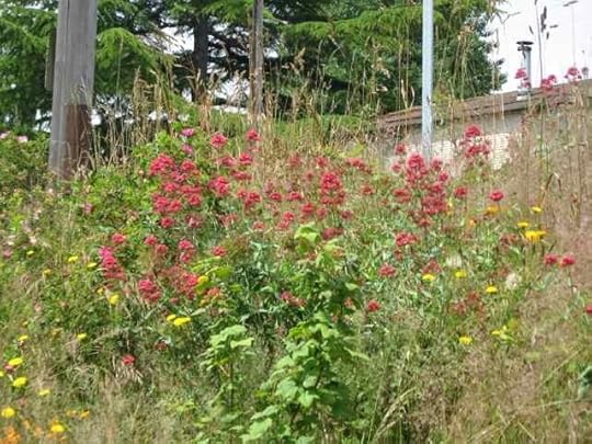
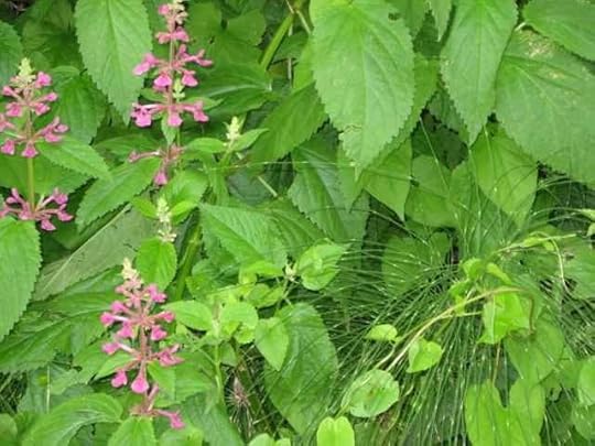
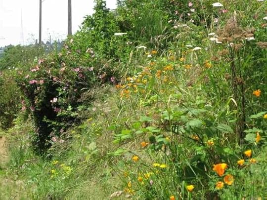
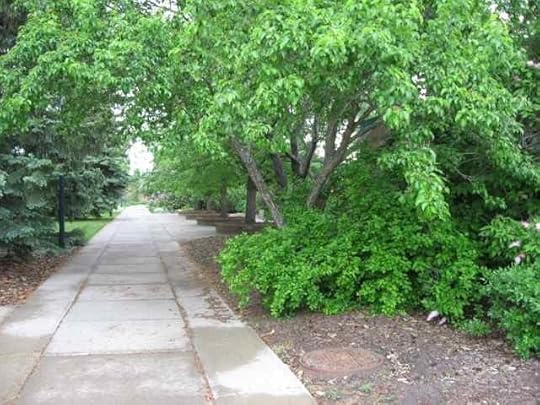
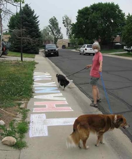
Continuing the clips from that ride along the Burke Gilman Trail (part 1 is here), I offer more flowers:
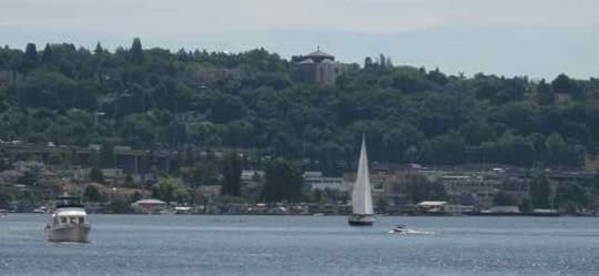
And more water and boats. I like water and boats on normal days, but with the fire at home they are even better to look at.
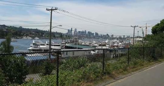
Not only big boats but little boats, too. I saw kayaks, canoes, and a single-person rowing scull.

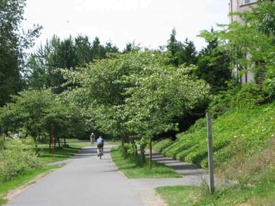
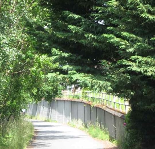
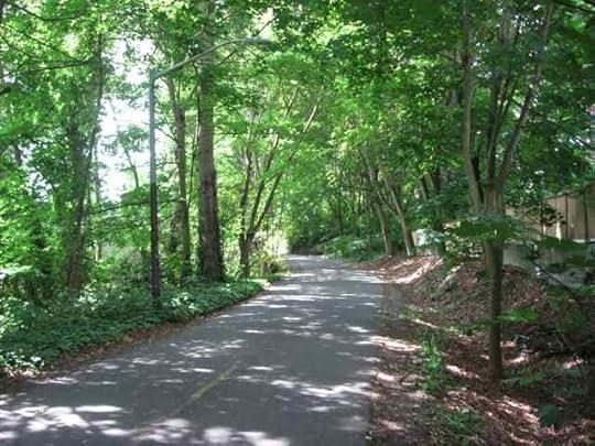
Some parts of the trail are wild-feeling, while others are extensively tended.
I loved the diversity of passageways.
Sailboat out there, too!
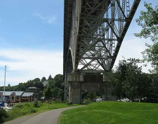
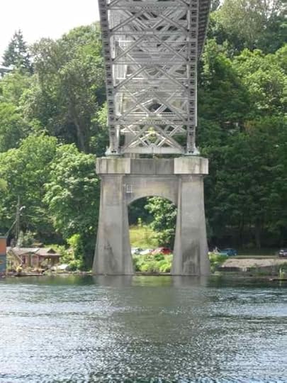
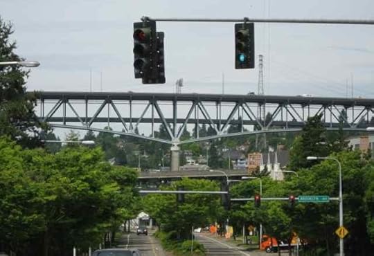
I went under the University Bridge, the I-5 bridge, the Aurora Bridge, and the Fremont Bridge. This is the Aurora bridge, which is apparently officially called the George Washington Memorial Bridge, although I've never heard it called that. To the left, those are houseboats.
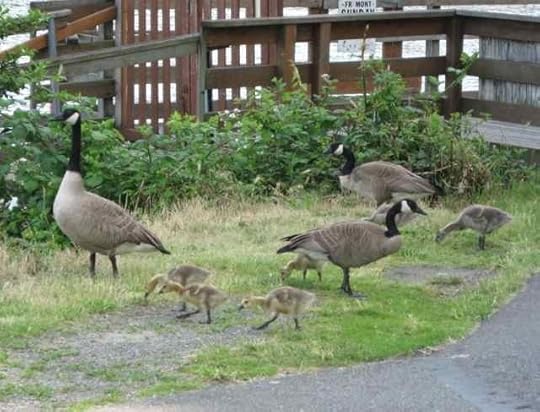
Some of the goslings I saw looked like teenagers (one of those is on the right), while others were still quite a bit smaller. The adults were vigilant (yes, there were four) while the little ones focused on learning to eat that green stuff.
West of the Aurora bridge is this statue of Sri Chinmoy.

This plaque is on the statue's base.

The Fremont Bridge, with attached TARDIS. . . .
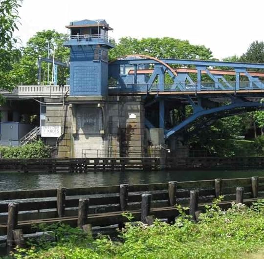
Built, if my Roman numeral reading ability is still with me, in 1916.

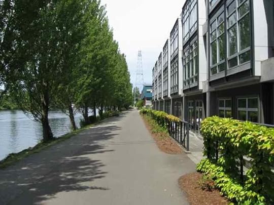
On the west side of the Fremont Bridge, the trail goes between the Ship Canal and a bunch of corporate offices. Offices of BIG corporations.
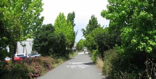
And here's the trail heading toward Ballard. I needed to quit taking photos because I had to pay more attention to where I was going.
I've been knitting, too. I have some pictures. But mostly I've been knitting just to stay grounded. Actually, I've got a lot more news. I need to get it written up!


Scenes from the Burke Gilman Trail, Seattle, part 1 (and High Park Fire note)
High Park Fire: Our friends were able to go back up to their land today. There is nothing left of the structures (barn, house, and cabin that predated their construction, which only happened a few years ago) except piles of burned remains. Next comes the clearing phase, before the rebuilding can commence.
Right now, our friends are looking for a place to live while they start their lives from the seeds that exist.
How to help people affected by the wildfires in Colorado.
_____
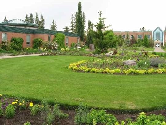
As a contrast to the charred landscapes back home, I offer some images taken today along the Burke Gilman Trail in Seattle. My sister loaned me her bike, which I used to take my computer to the Apple store for some R&R (fixed; no charge).
On the way to the store, I simply rode, since I wasn't sure how long it would take. On the way back, I stopped frequently to snap a few of the things that caught my attention. This will be in two parts, because I took a lot of pictures.
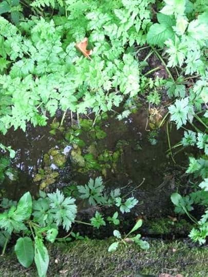
For friends back home the shiny stuff flowing at the lower part of this photo is water. Amazing. It was just there. Like all the green stuff was just there.
A little farther along the trail, there was a building on the University of Washington campus with something like curtains of water falling in openings—a number of them, with just one shown above. For all I know, it's a new form of wastewater treatment. Whatever: the sound was lovely.


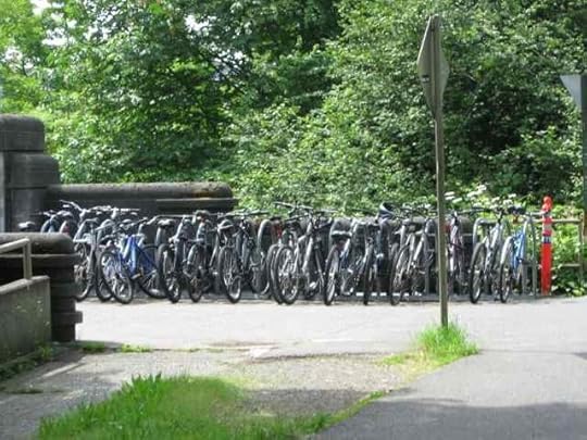
This was just one of several similar scenes, all with different configurations of racks and quantities of bikes.
I couldn't get enough of the green, or of the many colors, sizes, and textures of blossoms.

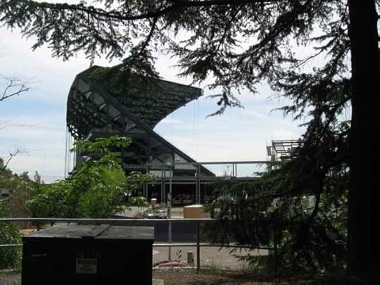
Stadium.

Along with a line of tall, more normal-looking trees:

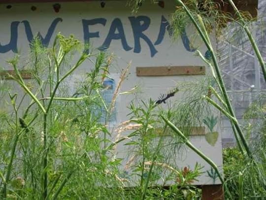
Not my best photo: UW Farm. I don't think there was a farm when I was a student at UW. Many things have changed in forty years. The landforms feel the same, but not much else does.
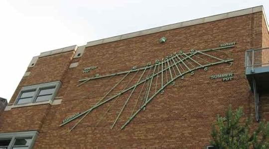
This cool sculptural piece is on the south side of one of the buildings in the university area.
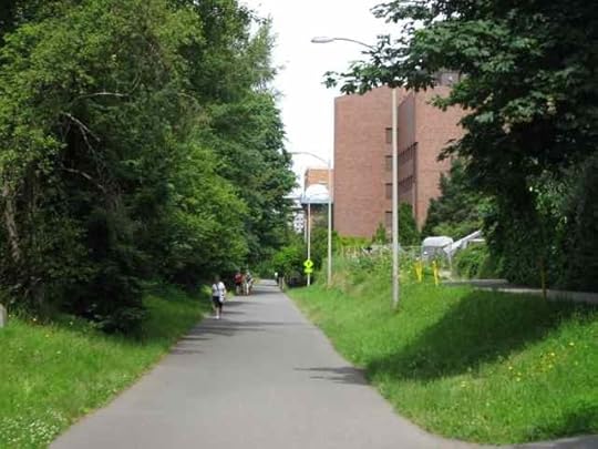
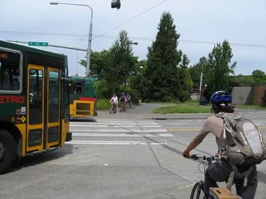
There are multiple intersections of transportation modes along the route.
The part of the trail I used passed under four bridges: Fremont, highway 99, I-5 (below), and University.
The trail is taken seriously as a travel route.

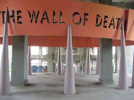
This next phenomenon, which I turned around to photograph from the far side, was odd enough that I had to look up information about it online.
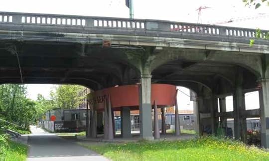
It's called the Wall of Death. It's public art, and it does refer to something real: it apparently concerns barnstorming motorcyclists of the 1920s and 1930s.
I noticed the smooth surface across from the sculpture had been interrupted with precast concrete parking stops, which I guessed, correctly, had been installed to prevent folks from skateboarding there. I was right, although the process has been through more than one iteration.

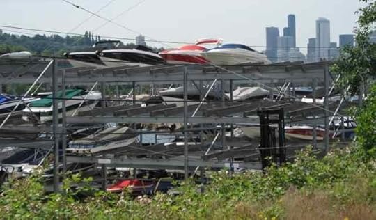
Some people have bookshelves. Others have boatshelves.
Temporarily ending with a bunch more flowers.
Part 2 of this tour is here.
June 27, 2012
High Park Fire, 7
What does "containment" of a wildfire mean? It doesn't mean control, and it doesn't mean the fire has been extinguished. It means that by some means or other a line has been created, through burning out fuels or digging down to bare dirt, over which the fire is less likely to be able to cross. Containment numbers are expressed as percentages and they go up and down, depending on the fire's behavior.
Here's a map from a government source (Inciweb) that shows the current containment status of the High Park Fire, west of Fort Collins, Colorado. I've marked the large numbers on it in order to refer to specific locations in this post.
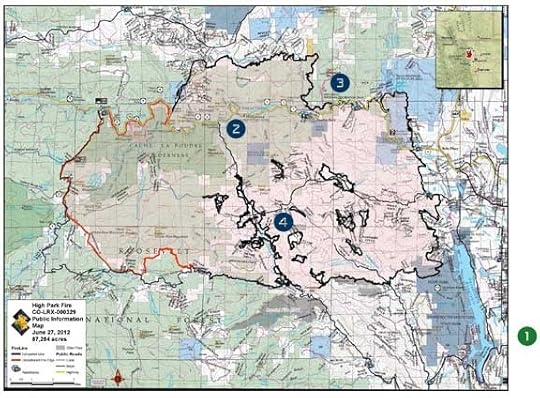
The original of that map, with more resolution, can be found on Inciweb.
The fire is the area marked in a pinkish shading, with boundaries in both black and red. The black boundaries indicate containment lines that are currently holding; the red indicate parts of the fire not yet contained. As of today, the fire covers 87,284 acres (just over 136 square miles, 353 square kilometers, or 35,322 hectares) and is 65% contained. As of today, the expected date for full containment is July 30, 2012.
1 - For people who are wondering, this is where we live. Yes, it's not far from the fire, but it's off the main map. Off the main map is really good. On the scale at the bottom, each of those sections is a mile, so the overall scale is 3 miles (4.8 km). The long body of water between us and the fire is Horsetooth Reservoir. The area west of the reservoir and south of the fire (to communities also off the map) have been evacuated from time to time.
2 - The yellow line running east to west above the number 2 is both the Poudre River and Highway 14. The original firefighting goal was to keep the flames from crossing the Poudre. They did cross over the weekend and burned all the area above that yellow line in very short order.
3 - The fire did not burn into this area because it was burned a few weeks ago by the Hewlett Fire, so that little fuel remained. The Hewlett Fire is still active (it's burning), but it is fully contained, and now serving as a fire-stop against the High Park Fire. Unfortunately, it did not stop the fire before it reached our friends' house.
4 - A lot of the High Park Fire firefighting efforts are now focused on maintaining and reinforcing the containment lines and holding what's been saved in the interior of the fire. Those black-contained shapes are the "islands" of unburned land (and buildings) within the main body of the fire. There are some houses standing in there, along with community structures like the Stove Prairie School, which is tremendously important to the mountain community.
The fire is still uncontained on the west and southwest; those are areas full of beetle-kill wood and there are fewer structures. (Rather, "fuller than elsewhere," since beetle-kill is widespread now. That article link is from 2008. We are at the "three to five years" that it mentions for extensive beetle-kill damage.)
Another useful map is this one, which shows the extent of the fire as of a few days ago (it appears to be the latest of its type, dated June 23) but also contains indicators of where there are structures: homes, the school, the volunteer fire stations, and so on. At the time the map was made, the school, at the intersection of Old Flowers Road and Stove Prairie Road, was untouched by fire. Many of us have been poring over this map, trying to determine whether particular buildings are likely safe or likely not.
"Mop up" actions are going on now within the fire perimeter, while the burning continues. Efforts go on to protect still-standing structures within the outer boundaries; to snuff out flare-ups; to remove fuel from areas where the fire can still be stopped; to remove dangerous trees that will impede evacuees' return; to restore power and other utilities.
This is the 8th consecutive day of Red Flag Warning, with high temperatures, low humidity, and potential gusty winds. The growth potential is still extreme, and the terrain difficulty is still, of course, high. People need to be simultaneously ready to return to their homes and to leave again at a moment's notice. The count of homes lost so far is 257.
With fires now burning near Colorado Springs (Waldo Canyon Fire) and Boulder (Flagstaff Fire, no Inciweb page), resources are being shared, allocated, and reallocated as needed to respond to changing conditions.
From Inciweb today:
"As crews gain containment on the High Park fire, fire managers plan to share resources with other fires along the Front Range.
" 'We are going to help those folks out,' said Incident Commander Beth Lund, coordinating the most effective use of resources.
"The High Park fire will retain more than enough resources to meet challenges our fire may offer."
Olds College, Alberta, during Fibre Week
While things are burning up near home, I've been on the road teaching. It's good to be distracted by the places I've been, and the good company I've had there. Last week I taught at the first few days of Olds College Fibre Week: a two-day workshop on wool types, and then a half-day session on how to buy fleeces.
In each case, I met (or, in some cases, re-met) wonderful people who were delightful to spend time with: both participants in the workshops and fellow workshop leaders.
I don't have photos of the rooms or fibers we worked with, because although I ignored the fire reports while I was teaching, I did check them on every break, despite occasionally flaky wireless reception where I was staying. One evening, I walked to the main building to get enough wireless signal to get current information, wishing that I could blow the rain that was falling on my head southward, across the 1200 or so miles to Colorado, where it's so sorely needed.
Although I can't send the rain to douse the fires, I can send photos, and hope they help the spirits of those who are there with a thought of cool and damp weather.
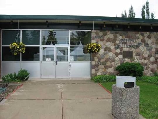
The Olds campus is a beautiful oasis, thanks to the strong horticultural program.
This is the view from the front door of the four-dorm-room townhouse in which I stayed, shared with Michelle Boyd and Donna Druchunas, who were excellent housemates. To get to the buildings where we were teaching, I walked straight down that path in front of this doorway to reach the other side of campus.
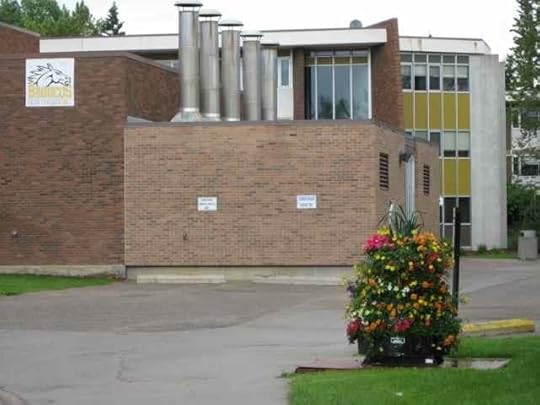
At the other side of the parking lot by the trees in the back of the photo above, I came to this, which was kind of a back entrance to the main building where the market was (along with the more reliable internet connections). I love the contrast of the mechanical systems and that lovely bunch of flowers.
A little farther along, my path passed among beautiful trees and shrubs, including lilacs, which surprised me with their scent every time I walked by them.
There were flowers everywhere, including these hanging baskets outside the Animal Science building.
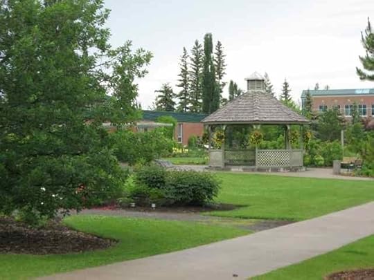
Near where the workshops were held, there was this gazebo, with more hanging baskets, and (out of sight) a rose garden.
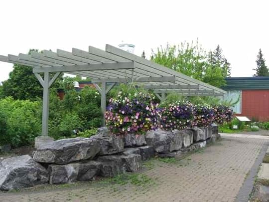
The following structure, with its floral adornments, was right outside the room where I taught. We could have seen it during the workshop except that we had to keep the shades down; the floor in that space was so well polished that if we didn't, the glare made spinning impossible! But I could enjoy this blooming abundance every time I went to or from the workshop space.
The building I taught in is on the left in this photo, and the location of most of the other workshops (and a main gathering place, and registration) was in the Land Sciences Building, directly ahead on the path, and on the right in the following photo.
There were a lot more special gardens that I didn't have time to explore. The ones that I did have a chance to experience were a blessing.
The best part, of course, was the people I got to visit and explore wools with, but I don't have any photos of them!
June 26, 2012
High Park Fire, 6
No photos today, unless I can think of something, like maybe a picture of the rain in Seattle, hoping it'll give the clouds in Colorado a hint about what they're supposed to do, if at all possible.
Meanwhile, I'm learning more about fire-fighting.
Crews work 14 days on and then get 2 days off. That includes incident commanders, so Bill Hahnenberg, who has been on the High Park Fire since it got big enough to warrant a Type 1 command, gets to rest for a couple of days before he's sent out to another fire (there are plenty of other fires around this year that need him). Beth Lund shadowed him for a day to get up to speed and took over at 2000 last night (which I convert to 8 p.m. MDT, but check my math, please: moving fast around here).
Type 1 teams are the most experienced, and are called in on the most serious fires. Here's some explanation of the acronyms used (IMT is Incident Management Team, for example), from Prescott, Arizona. And here's the IMT Center website, with a list of all the teams and their levels. There's a long list of teams, ranging from Type 4 to Type 1, that are called in to help when local resources need reinforcements.
Today's active fire map shows 38 of what are called large incidents burning, of which 3 have Type 1 teams assigned to them: High Park and Waldo Canyon, both in Colorado, and Bear Creek #4 in Alaska. (A large incident is defined as "A wildfire of 100 acres or more occuring in timber, or a wildfire of 300 acres or more occuring in grass/sage.")
Bill Hahnenberg's team is Rocky Mountain IMT1. Beth Lund's team is Great Basin IMT1-Lund (there are two Great Basin IMT1 teams, so they are distinguished by the commander's name). There are a handful of women as commanders; most are men.
Over the past few days, our county alone—Larimer County, Colorado—has had three wildfires burning, although two of those, the Halligan Fire and the Woodland Heights Fire, were not "large incidents" and were expected to be 100% contained by this morning. The Woodland Heights Fire, in Estes Park near Rocky Mountain National Park, was very small in comparison to the High Park Fire, reaching only 27.3 acres, yet nonetheless destroyed 22 homes and 2 outbuildings.
_______
Back to the High Park Fire, with a few things I'm learning:
It is currently at 87,250 acres (136 square miles).
Last night, firefighters held the northern line, despite 43 m.p.h. gusts of wind.
With the recent jump of fire over the Poudre River (the blast that took out the home and barn, and everything else, belonging to the friends who have been staying with us), estimated containment date has been moved from mid-July to July 30.
"Trees and grass remain as dry as they ever have been during the fire, and mosses and lichens are burning on granite rock." (From Inciweb.)
"Licensed river guides will transport a few crews across the Poudre Canyon by raft, using flotation devices, so firefighters can mop-up in otherwise inaccessible areas." (Also from Inciweb.)
The RAMS equipment that was brought in on Saturday is not only able to do infrared assessment of areas of heat during daylight hours (the regular equipment is limited to nighttime assessment) but can also distinguish between different types of heat sources: open flame, smoldering, buried, or diminishing heat. (From the Larimer County Emergency Information system.)
The afternoons and evenings still have Red Flag Warnings in place, for potential high fire activity: dry weather, high temperatures, and wind. Tuesday, today, is the sixth Red Flag day in a row.
So far, the count of homes lost is 257. A full count has not been completed because it's too dangerous in many areas and energy is going into keeping the fire from spreading, rather than inventorying where it's been. We have a lot of displaced people and animals around Fort Collins. There are thousands of people evacuated, and they are bunking in all available spaces outside the fire region, sometimes moving from one place to another from day to day, as open spots shift.
_______
Staying current with fire information requires checking both Inciweb and the Larimer County site, which update at different times. A few people are being allowed to return to their homes, although still with the awareness that they may need to re-evacuate on a moment's notice (as our friends had to).
_______
Some good news
Many people here are both affected by the fire and working on it, including reporters, and volunteer firefighters, and many others.
Animal rescue is ongoing. A few stories of that:
A hell-on-wheels cat rescued despite its temperament.
The Larimer County Sheriff's Posse has been focusing on large animals, like horses, sheep, and cattle, in collaboration with the Larimer Humane Society, which is coordinating rescue of animals of all types and sizes.
And, of course, there are many dogs, including these Border collies.
We hope that "our" brave dairy, Morning Fresh, continues to hold the fire back.
Finding spaces for all the animals has been a challenge. The humane society has been sheltering more than 500, from cats to a peacock. There's overflow being housed at the vet school. Many others are with friends and family. The friends who have been with us have found places to move their llamas (since their house and barn were confirmed as destroyed, temporary housing will no longer suffice for the large animals). We still have two of their dogs (and they get along great with ours).
Meanwhile, a friend in Scotland sent information on a horrific fire he lived through in France in 1989. The website is in French, and my French has become very rusty, but one phrase especially struck me as characteristic of what's happening around the High Park Fire, and that we need to encourage by recognizing the individuals both affected by and working to diminish the damage caused by this inferno: "un élan de solidarité et d'entraide s'était alors déployé pour lutter contre ces incendies. . . ."
My translation: A spirit of solidarity and of mutual aid was brought into action to battle against these fires.
May that spirit prevail. And, as I wrote on our friends' Facebook page this morning, may what rises from these ashes be of more value than what is lost, and may it be impervious to fire, flood, and all other perils.
June 24, 2012
High Park Fire, 5
I don't usually turn on my phone as soon as it's permitted upon landing. I usually don't need to.
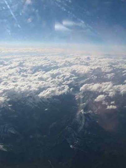
This time, after a flight over the Canadian Rockies, which were absolutely lovely and, from the air, very different from the southern Rockies where I live,
I did turn on my phone as soon as I could. It beeped at me that I had a message. My daughter had called fifteen minutes earlier to let me know that the friends who have been evacuated to our house have lost their home and barn: and, of course, everything else that was there.
Hope and smart building have not, in this case, been sufficient.
We do still hope that the one cat who remained in the house is okay. It's possible, because of how well the house was built, that she found shelter in the basement. The humane society has not found evidence that she didn't. On that hangs one more thread of possibility and optimism.
There's nothing to do or say beyond that right now.
Except to observe that I am learning more things about wildfire.
For instance, there is something called the Haines Index, which is a meteorological assessment used to analyze the potential behavior of wildfires. Quoting the Forest Service website about this tool, "The Haines Index can range between 2 and 6. The drier and more unstable the lower atmosphere is, the higher the index." Also, "This index has been shown to be correlated with large fire growth. . . ." The number 6, the highest level, indicates "High Potential (Dry Unstable Lower Atmosphere)."
The Haines Index for the area of the High Park Fire, the one near home, is at 6.
I have also learned about some new equipment being brought in to help the firefighters battling this monster. From the Inciweb site: "A (Radiometric Airborne Mapping System) RAMS unit was ordered and arrived Saturday afternoon. The radiometric imaging system, attached to the bottom of a helicopter, will provide infrared information similar to what officials have been using, with some key differences. The advantage of the RAMS unit is that it can be used during the daytime, and it can provide real time GPS coordinates for areas of identified heat. In addition it can provide information about the heat source (open flame, smoldering, buried, or diminishing heat). This information will help firefighters determine where suppression efforts should be focused."
So far, the night-time infrared flyovers have been providing some of the most useful insight into the fire's behavior. Information of that type, and of more precision, available during the daytime has got to be beneficial.
June 22, 2012
High Park Fire, 4
These photos are from Wednesday. Yesterday (Thursday) I flew to Alberta, and today (Friday) I started teaching at Olds College Fibre Week.
But on Wednesday I got to take a bike ride for the first time since the High Park Fire started. The air was clear enough, and it wasn't 100°F (38°C). Still there was a lot of diffuse smoke and a huge, billowing plume.
When I went into the garage to get the bike, I noticed this new deposit on the floor.
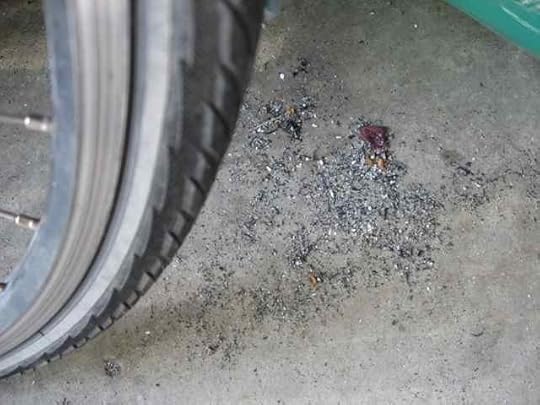
That's ash. The garage door has been closed; there are no windows, and while the garage isn't insulated or anything fancy like that, the seals on the door are pretty good. We are well outside all evacuation areas.
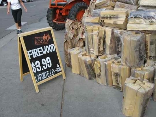
When I got to the store, I found this sign for local firewood, from Laporte, Colorado. Struck me a bit odd, since Laporte is . . . way too warm these days, due to the fire. Laporte's Cache La Poudre Middle School is the evacuation center for residents in the nearby canyons and Livermore, except when there's too much smoke and they relocate the evacuation center farther east.
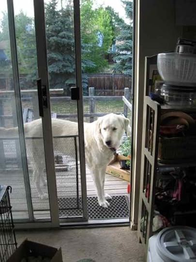
Meanwhile, our guests are faring well. Lady comes up to the step to visit.
Bear stays down in the yard, patrolling the perimeter.
Fire developments: why Red Flag Warnings are announced
While here in Canada, I'm following the fire closely, as you might imagine. The latest reports, arriving Friday evening as I write this post, indicate 992 new emergency evacuations today, a bunch of them in the past two hours.
There has been a Red Flag Warning in effect from noon today through tomorrow evening. Reasons, quoting from the Inciweb report for today: "Throughout the morning winds will gradually increase, becoming 15-25 mph gusting to 35. Temperatures will be 85 to 90 degrees with relative humidity of 10 to 15 percent. Fire activity is expected to increase in the afternoon as the Red Flag Warning goes into effect." This means that wind, temperature, and humidity conditions will promote further spread of the fire.
That report was later updated to this: "Shifting winds this afternoon caused the fire to spot across Poudre Canyon near Sheep Mountain. The spot established in the steep, rugged terrain and is burning at a rapid rate of spread. Air resources are available and will be utilized when and where smoke and weather allow." Heavy smoke makes locating and fighting spot fires difficult.
From the Larimer County Emergency Information Update released this morning:
"The Rist Canyon, Glacier View and Poudre Canyon Volunteer Fire Departments are looking for donations to help defray the costs of firefighters assigned to the High Park Fire. To make a donation, please visit their websites at:
Glacier View Fire - www.glacierviewfiredept.com
Rist Canyon Fire - www.rcvfd.org
Poudre Canyon Fire - www.poudre-fire.org
"Firefighters have put in nearly 250,000 hours of work on this fire (this translates into almost 18 years worth of hours), with only one reported injury." (From earlier reports: "At approximately 5:30 a.m. on Monday, June 18, 2012, a person assigned to the fire was involved in a non - life threatening injury. They were transported by ambulance to the hospital for treatment. The accident was not fire line related."
Hoping for far better news tomorrow.
And glad that friends have found refuge outside the danger area.
June 18, 2012
High Park Fire, 3
As of this morning, Monday, the High Park Fire is listed as covering 58,046 acres (about 91 square miles) and at 45% contained.
The word contained is one of the most important ones in the reports on progress in firefighting, so I decided to find out how it's defined. The Virginia Department of Forestry has a good collection of terms used in firefighting and discussions of wildfires. Here are three:
"Contain Fire An effort to prevent further spread of the fire. Frefighters or other resources stop the forward progress of a fire but have not put in all control lines.
"Control Line Also often called a 'fireline,' this includes lines constructed by firefighters as well as natural barriers to fire such as rock outcroppings, roads, and streams or other water bodies. Foresters construct fire lines by using bulldozers, leaf blowers, chainsaws, shovels, pulaskis, and rakes to clear the line of vegetation down to the mineral soil so that the fire will have nothing to burn when it gets to that point. A term used for all constructed or natural fire barriers used to control a fire.
"Control of Fire A fire is considered 'controlled' when it is completely surrounded by a 'control line,' which is expected to keep the fire from spreading further. Firefighters and/or other resources completely surround and leave no open line on the fire perimeter."
Note that none of these means that the fire is out or extinguished. What we have been told is that the fire will be put out this fall by nature. Between now and then, human efforts will go into limiting the damage, although even without a full evaluation of lost structures within the fire area the High Park Fire has already exceeded the structural damage of all previous Colorado wildfires. (The Hayman Fire covered the most area.)
Another term on that list has come into play here over the weekend (and continuing):
"Red Flag Warning A term used by weather forecasters to alert firefighters and citizens to ongoing or approaching fire weather conditions."
Our Red Flag Warning here is the result of very high temperatures (around 100°F/38°C) combined with very low humidity and high winds, at 30 to 50mph (48 to 80km/hr). Yesterday, the winds necessitated the temporary grounding of all the helicopters fighting this fire.
Here's a snapshot from our back yard at about 4:40 p.m. yesterday.
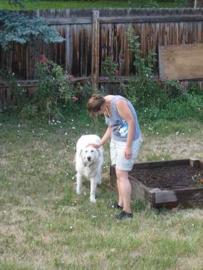
This was when one set of friends arrived at our house. They had been on pre-evacuation notice for a while and got a mandatory notice about 1 p.m.—first for two hours to get out, which shortly after was modified to 20 minutes. Fortunately, in the previous days they had already relocated most of their animals, leaving only one load to bring down the mountain when the "move it!" instructions came: the two remaining dogs, the cats, and themselves, with their two vehicles. The stock trailer was, I think, already down here from when they transported the loads of llamas. They had to check in at several places before they arrived at our house.
Fortunately, three of the four dogs had previously interacted a little. Nonetheless, we made sure the first meeting was out front, on relatively neutral territory. It seemed to go okay.
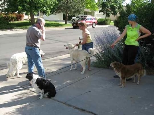
The BWDs (Big White Dogs) are livestock guardians, two of the four that keep track of the llamas when they're at home up in the mountains. The other two BWDs have been kenneled elsewhere since the llamas were moved (in two batches) to The Ranch, the place for evacuated large animals, and to a private ranch outside the fire area. I think the dogs are a combination of Anatolian shepherds and Akbash.
Finding safe places for animals is one of the challenges of wildfire. Getting them moved quickly and securely requires both advance planning and hard work. (Good news: ALL of the wolves from the WOLF Sanctuary have been evacuated now, and the fire dens that were in place for those that had to be left behind temporarily worked beautifully. Sanctuary evacuation is a big deal for animals and humans alike. Special temporary enclosures had to be constructed, and the animals all seem to be coping well with the move—not a given. Photos and more of the story are on WOLF's Facebook page. I know some of these animals, and they donated fiber for The Fleece and Fiber Sourcebook.)
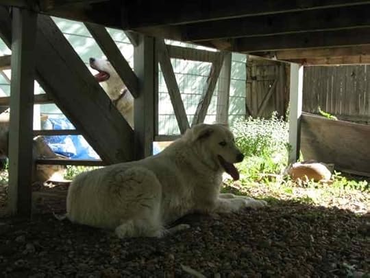
In the next photo, Bear is on the left and Lady on the right. They, and the other two of our friends' dogs who are not at our house, are all rescues. When she's at home, Lady actually lives in the house. Bear doesn't know what to do with a house. He wants livestock to keep track of.
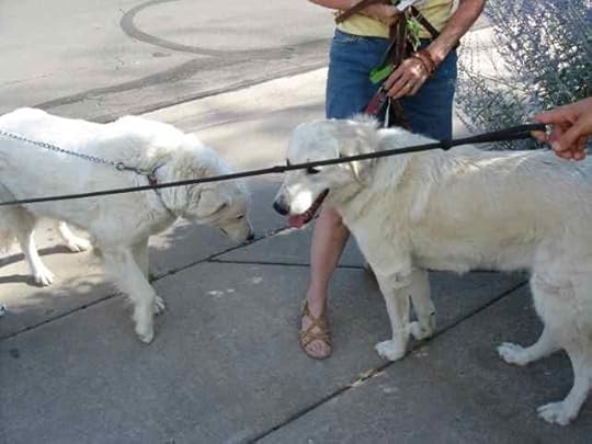
Given the calm reactions of the dogs to each other, we moved the big ones to the back yard, and let our relatively small ones in with them.
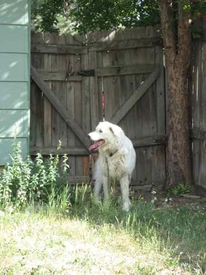
One of the reasons we have the dogs is that our fencing has been tested over the years by Border collies. We're ready for smart and independent dogs. That gate behind Bear looks a little rickety. Looks are deceiving. There's also a cattle gate right behind it, on the outside. It's secured in a bunch of different ways.
After both dogs checked the perimeter of the yard, Bear found the dirt-bed that our Aussie, Heather, made for herself a bunch of years ago. Heather is no longer with us, but her spirit remains in the household and apparently helped Bear feel like this was an okay place. Even if we didn't have llamas for him.
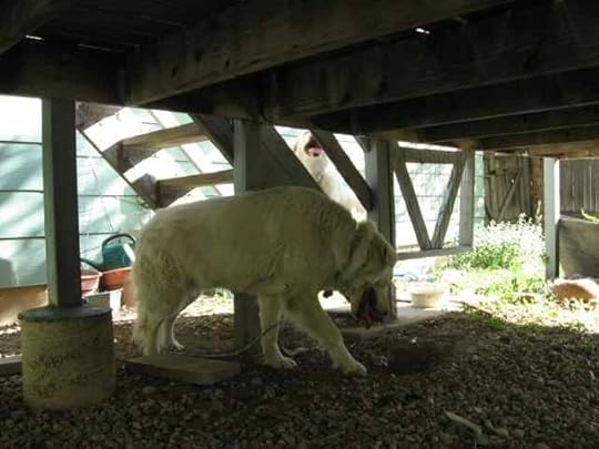
He settled in, while Lady continued to be antsy for a while.
And then she joined him.
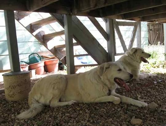
Earlier in the week, our friends brought down the dogloo (insulated doghouse, good for cold or heat), but the deck provides decent shade and we'll be rigging a sunshade for the dogs as well.
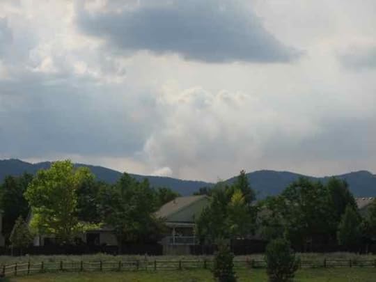
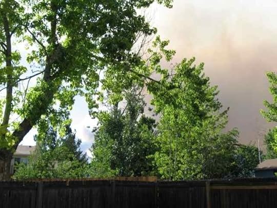
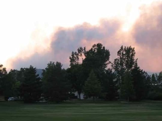
I'll close with two photos of the fire that evening. Here's about 6:50 p.m. when I went to the store for groceries, looking across the CSU vet school grounds. This is a bigger evening plume than we've seen, in part because of wind and perhaps also because some of the air-attack equipment had been grounded.
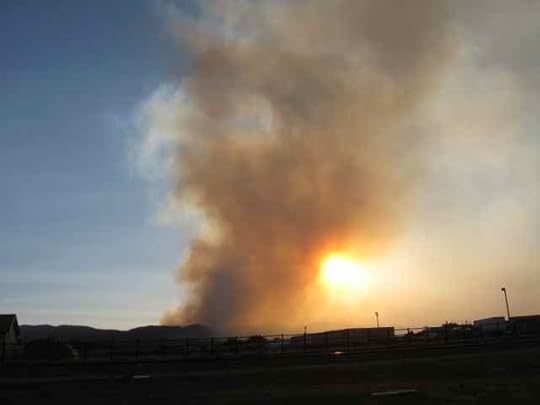
Around 8:40, the temperatures finally got into the lower 90s°F (low 30s°C) and we walked our dogs. This is what the fire looked like from our neighborhood park.
Our friends said the best thing in the day was turning off the cell phones that had been on 24 hours a day since this fire started (and had been also during the Hewlett Fire, for which they also evacuated).
We're taking it one day at a time.
Last night I heard from my Fleece and Fiber Sourcebook co-author Carol Ekarius that a fire has started near where she is. It's called the Springer Fire. Carol is the executive director of the Coalition for the Upper South Platte (CUSP) and part of her job involves environmental recovery from the Hayman Fire of 2002.
It's so dry and hot in the Rocky Mountains right now.
And despite all this, I need to finish prepping for upcoming teaching.

June 17, 2012
Lovely Lincoln Longwools, Estes Park Wool Market, and Craftsy.com
Last weekend I was at the Estes Park Wool Market both days. On Saturday, I went up with friends, to do some scouting for the video work scheduled for Sunday in conjunction with a course I'm doing for Craftsy.com. I'd already connected with some of the folks we would be visiting with for the filming, but needed to get a sense of what else was happening that we might need to know about. My reconnaissance was cut short because Saturday was the first day of the High Park Fire and as it grew (we could watch it), we needed to get back down the mountain. We had a good time, cut short.
Sunday, however, when the video crew assembled, we had a fantastic day. It was really windy, which made for some shooting challenges. I also kept an eye on the growing fire, although it was good to have work to distract me from what was happening in the mountains just north of us, closer to home. We got great interviews and video that will become part of the course, which should go live on Craftsy.com in July. I'll let folks know when that happens. It will be called "Know Your Wool," and it's about getting past the seduction of color (which is almost overwhelming) and softness (which is immediately appealing, too) to understand the fiber inside pure-wool yarns and to improve the knitter's (weaver's, crocheter's, other thread-bender's) ability to select the RIGHT wool for a project, and have more fun and more success with wool yarns.
Well. That was cumbersome to say, even if accurate. It's about wool. I like wool. There are lots of different kinds. Sometimes softness isn't what you need. Once you've picked the right wool, it can be made any color you want it to be. I think of the course as being about looking INSIDE the yarn and learning to tell the differences—like between pasteurized process cheese, mild cheddar, and asiago or brie.
Did I mention that viewers will be able to access the course free? Most of the Craftsy courses are paid products (reasonably priced), but the Craftsy folks are also making open-access offerings to introduce people to the idea of their platform, which is new and interactive and really cool. I talked to someone the other day who had signed up for a Craftsy course and was initially disappointed that she couldn't download it, like a normal CD thing—and then realized that there were so many extras involved that downloading would only provide her with part of the experience offered by the platform. There are downloadable support materials, but the courses as a whole involve a lot of other components that require the web. Yes, a decent internet connection is required. But this is fascinatingly cutting-edge stuff, and it's fun to be a part of.
Especially since we got to go to the wool market.
I didn't have many chances to take photos while we were there, because that wasn't my job, although I snapped a few and a friend sent me a couple that she'd taken. (I didn't even see her—that's how busy we were!)
We interviewed some of the shepherds who were participating in the National Lincoln Longwool Show and Sale. It was an incredible treat to have this show happen within reach of the video crew! I do love Lincolns. (I wrote a whole article about them for the Spring 2012 issue of Spin-Off magazine.)
We also interviewed Joanna Gleason, of Gleason's Fine Woolies, who raises Bond and Corriedale sheep. These breeds developed from crosses of Lincoln with Merino.
Working with Lincolns and Bonds for the video gave us the opportunity to offer a terrific view of one aspect of breed development and to provide dramatically different perspectives into sheep husbandry. And the shepherds with whom we were able to spend time are folks from whom I always learn something new.
Despite my lack of photo-taking time, this post will contain a lot of pictures.
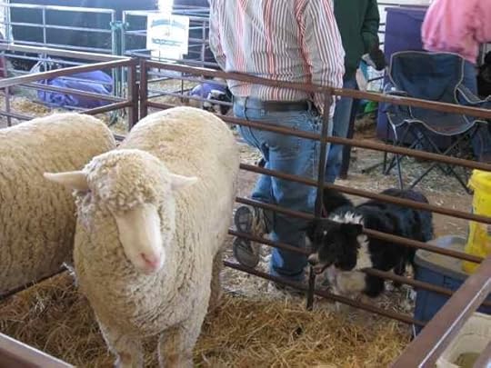
Border collies really like to work.
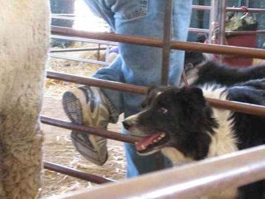
The sheep that Border collie thought needed to be watched were Columbias, which are really big (and a breed that provided one of the yarns I used as a demo in the course). I really don't think the sheep were planning to get out of line, but the dog was making sure they didn't.
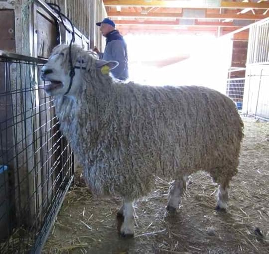
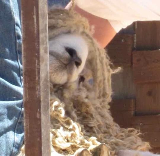
As I mentioned, having the National Lincoln Longwool Show and Sale at the wool market this year was a real treat for me. Very early in our visit to the fairgrounds on Sunday we saw this exceptionally handsome ram.
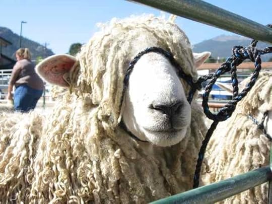
When I caught sight of him, I was looking for Christiane Payton, of North Valley Farm in Yamhill, Oregon. When Carol Ekarius and I were working on The Fleece and Fiber Sourcebook, Christiane helped me out with samples that let me represent Lincoln wool in all its colorful variety. I also was able to visit her flock on a road trip: that was a treat!
And there was Christiane, keeping a pen of Lincolns company. Including that ram.
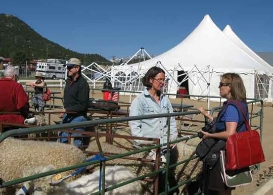
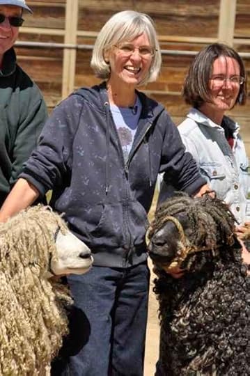
The photo above shows some of the great people I got to visit with that day. On the left, in the red jacket, is Christine Bazant, who bought the ram and would be taking him back to her flock in Oregon. In the dark green shirt is Brian Larson, from whose flock in Michigan the ram originated. In the light blue jacket is Christiane, who brought some of her beautiful colored sheep to the show and sale (I have a photo of one of them later in this post). And the woman in the blue shirt with all the equipment slung in bags on her shoulder is Liz Gipson, a former assistant editor of Spin-Off (after my time) and creator of books and DVDs on rigid heddle weaving.
Liz is the producer of the "Know Your Wool" Craftsy course that we were working on. She asked me to do it, and because I like her and thought it sounded like a cool idea, I said okay. Even though it meant getting in front of a camera myself (and talking and being recorded while there).
I love watching animal judging, especially with a good judge—as was the case on Sunday. Here he's evaluating our friend the ram, being shown by new owner Chris Bazant. (I only discovered the ram's identifying number, not his name. I suspect he has a name, and I look forward to knowing it.)
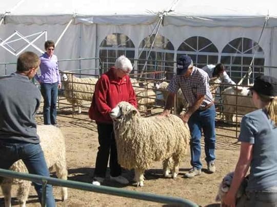
The judge liked what he saw.
The sheep had some commentary about being tied up and ignored in the barn. He was scheduled to be shorn that afternoon, and we were working out the timing issues for some video work. He was, I think, BORED.
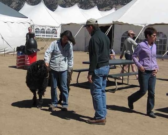
One of my favorite parts of the day was talking with Brian and Christiane about their Lincolns while we had the white ram and one of Christiane's colored rams with us. (The colored sheep had been shown on Saturday, so he was just hanging out with us.) Thanks to Theresa Meyer for this photo.
Here's another of Christiane's ram, although you can see more of his character in the photo above. He's a very mellow fellow.
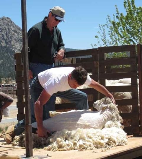
Shearing a Lincoln ram is not a job for an amateur. There's a lot of mass, muscle, and intelligence. It's a good thing the shearer on site at the festival is a pro! Here's Brian talking about how they'd like the ram's topknot to stay in place, with shearing to happen from the ears back.
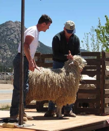
It's a lot of sheep to manage, and the shearer's skill is apparent in the ram's relaxed face. As you could see above when he was tied up, he would have complained if he'd been unhappy.
Ideally, the fleece will come off in one piece. The shearer follows a pattern and takes it off very methodically, shifting the sheep's position and his own grip as he proceeds. Lincoln locks, being long and relatively low in grease, tend to only loosely maintain their sheep-shape as a whole fleece as they're removed.
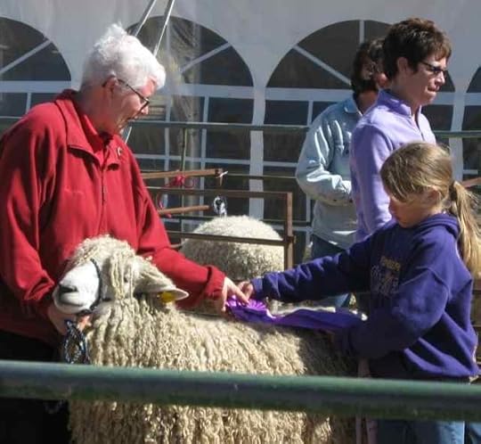
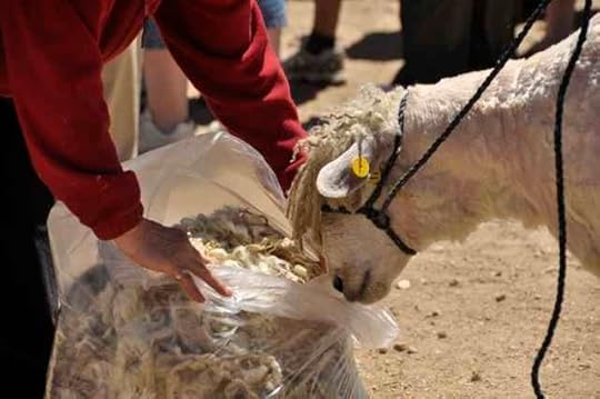
Chris showed the ram his fleece when the job was done, and he seemed pretty curious about the whole thing, although he obviously felt lighter. Given the weather, it was probably pretty pleasant for him to be no longer wearing about 20 pounds (9kg) of wool, handsome though he was while he had it on. (He'll grow more.) Thanks to Theresa Meyer for this photo, too!
Then we went over to the vendors' barn to talk with Joanna Gleason, although I don't have any photos of that. Some of the other folks may have had their cameras out, and if I can connect with anyone who documented that part of our trip, I'll share more in a future post. Otherwise, there will be video in the Craftsy course when it's available in July!
The video for the rest of the course was shot in Denver. On Wednesday, I drove to the city and stayed in a hotel so I wouldn't have to get up at 5 a.m. to be up the Craftsy studio for makeup at 7:45 a.m. We worked up the rest of the course between then and about 6:15 p.m., after which we went to the Craftsy offices for a meeting with all the other people who are involved in making the course happen and getting the word out. Yes, that meeting started at 6:30 p.m. Following that, a couple of us went back to the studio to pack up my demo supplies and all the clothes I had to bring (I wore something different for each lesson). I was home by a little before 10, and ready for dinner!
It was a positive experience throughout. The team was great. I look forward to seeing what they do with the materials we generated: it's all editing and presentation now. Out of my hands.
June 15, 2012
High Park Fire, 2
The breezy weather today has made the air quality in the city of Fort Collins a great deal better. However, it's not good news for firefighting on the High Park Fire, and more of our friends evacuated late last night. It's good when the phone rings after 10 p.m. with the message that dear friends are SAFE. (Another set of friends has just gotten in touch to say they're staying put for now. I have a lot of empathy, because they have already hauled all over the countryside with trailers full of animals for several weeks due to fire alerts, but I prefer personally to hear "out of the danger zone." I know that's selfish of me. The risk for them is not direct: it's that their one road out is too close for my comfort to areas that have been evacuated.)
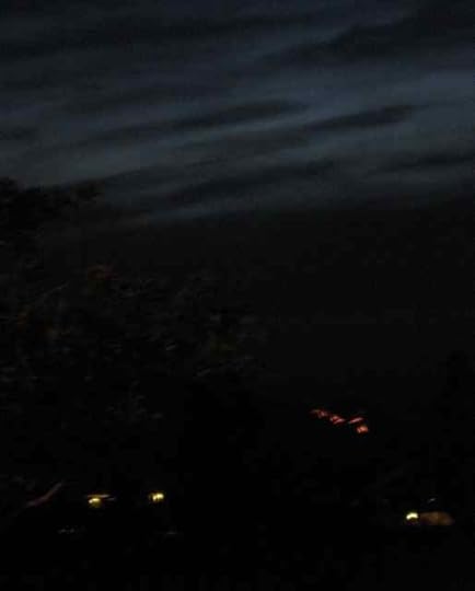
On Monday evening, even with a little point-and-shoot camera and no patience at all to figure out how to shoot in the dark, I got this photo from our neighborhood. That orange stuff is fire on this side of the ridge (although on the other side of Horsetooth Reservoir, which runs along the western edge of Fort Collins). That piece of fire has since been controlled and we're not seeing it now. (As of the latest reports that I have, within the past hour, the fire is at 52,068 acres, or just over 81 square miles, and 15% contained.)
Meanwhile, we do what we can. Which isn't a whole lot, other than remain on alert to take evacuees, both two-footed and four-footed (our house is actually better equipped for extra four-foots.) And this, a message for the firefighters in the sky:
We're pretty much on the flight path to the two bases for the firefighters working from the air (Fort Collins/Loveland airport and Rocky Mountain airport in Broomfield).
We got NIOSH N-95 masks earlier this week, when it hurt to breathe while walking. They handle particulates reasonably well, and that's the major risk with smoke coverage. (They are not effective against gases, but if there are gases people need to be out of the area altogether.) I do wish that there were masks the dogs could wear and would tolerate. Our walks have been very basic, with no extras.
Before we got the masks, the Bike Bandit was often seen in our area.
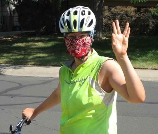
Some of us need a daily quota of exercise in order not to drive other household members nuts. That includes the Border collie among those who need more than simply throwing a rope chew around the house can provide.
We have seen only a handful of people wearing masks: a couple of other bikers, for example. We were REALLY glad to see sign shaker Tim Farnsworth with a mask on! He gets a lot of exercise in the course of his work, brightens our days here in the city, and the particulates associated with wildfire can be very small and can go deep into the lungs, even when the immediate irritation is relatively minor. We gave this guy a big thumbs-up when we passed him the other day, dancing and breathing relatively safely. True, the lungs will get rid of the stuff as soon as they can. But the discomfort is noticeable, and the effect of the masks in making for more comfortable breathing is, too.
The next post will be full of sheep. I'm off to start writing it now.
___
Edited to add that the final 17 wolves have been removed from the W.O.L.F. Sanctuary. The cabin where the founder/caretaker lived and the offices were maintained appears to have been burned, however.


