
David B. Williams's Blog, page 9
September 9, 2015
Denny Hill – Maps
People often ask me about Denny Hill, what it looked like and where was it. Below are a series of maps and one photograph that show the location of the hill and some of its topography.
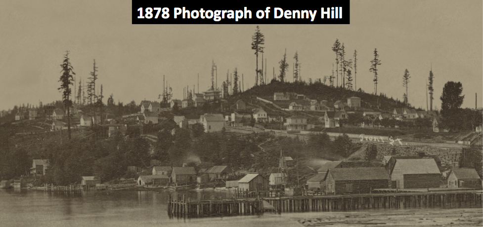
This is one of the earliest known photographs of Denny Hill, showing it after it has been logged somewhat.
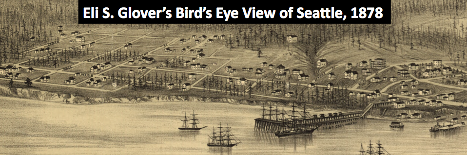
 Below is the first illustration of the hill. Note how few homes are on the hill. Hard to get a feel for the topography.
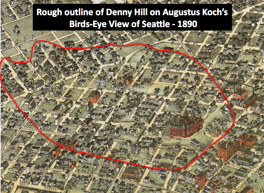
 Twelve years later and the hill has been much more developed, especially with the addition of the Denny Hotel and many homes.
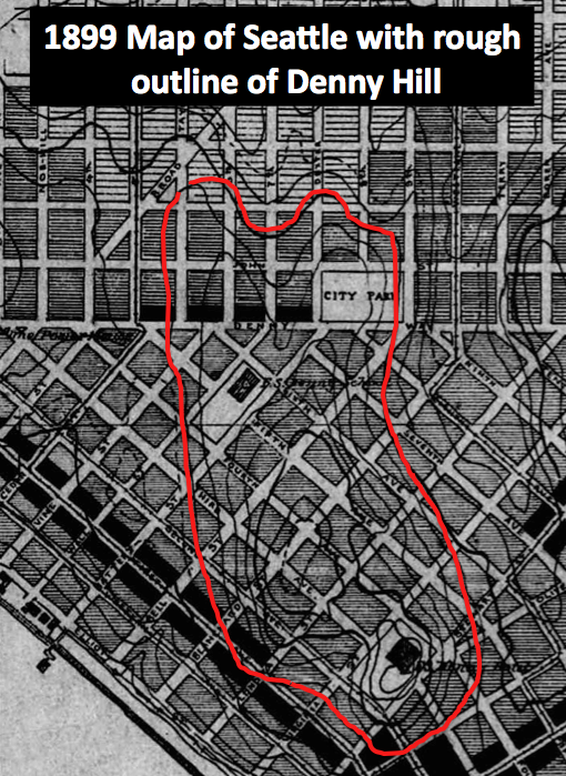
 Probably the best topographic map of Denny showing the two summits, each about 240 feet above sea level.
 The one post regrade map of Denny Hill shows what happened after the regrades lowered the land.
 A modern topographic map of Seattle showing the flattened landscape. Note the modern high point at 1st and Virginia.


September 3, 2015
Hitching Posts and Stepping Stones
Back in the day when horsepower referred to equine engines, many homes around Seattle had hitching posts and stepping stones. Very few of these remain.
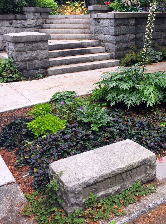 In fact, I know of only one stepping stone, the place where you would step out of your carriage and onto a raised block of stone. That one is on Capitol Hill at Fourteenth Ave E. and E. Valley St., on a street known as Millionaire’s Row. This stepping stone stood in front of the house of Elbridge Amos Stuart, the man who started the Carnation Evaporated Milk Company. They’re the ones with the famous slogan about contented cows.
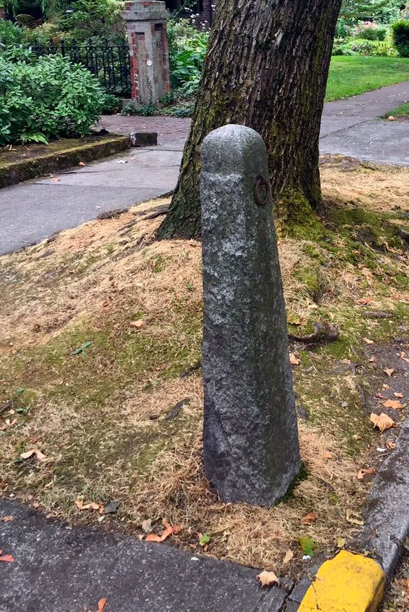 Regarding hitching posts, the one I know of is just south on Fourteenth, on the west side of the street. Both the post and step look to be made of Index Granite, one of the local building stones used in the late 19th and early 20th centuries in Seattle.
I suspect that there are more of each. If you know of any, please let me know. Thanks.
August 24, 2015
Maps/Images Too High and Too Steep
Just got my new book. I am very happy with how the images in it turned out and think they are a fine compliment to the text. For those of you who want a bit more detail or perhaps want to obtain copies, here are links to most (not all of them are on line) of the maps and photographs in Too High and Too Steep: Reshaping Seattle’s Topography.
End paper front – Augustus Koch’s Birds-eye-view of Seattle 1891 – Library of Congress webpage with ways to download in several formats.
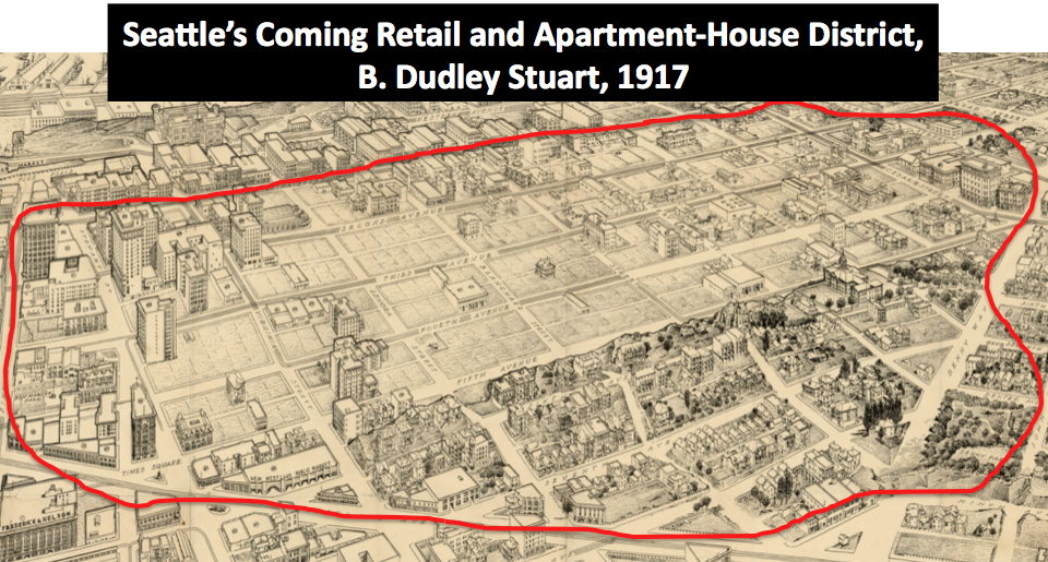
End paper back – B. Dudley Stuart’s Seattle’s Coming Retail and Apartment-House District – Washington State University map collection, which allows viewer to zoom in on map.
Frontispiece – Eli S. Glover’s Birds-Eye View of Seattle, 1878 – Library of Congress webpage with ways to download in several formats.
Pg. 42-43 Left half and right half of Peterson’s Panorama view of Seattle, 1878 – Seattle Public Library, which allows viewer to zoom in on map.
Pg. 52 – Charles Wilkes’s Elliott Bay map – Here’s a link to the maps on my website. Not as high resolution as other maps but still provides additional details.
Pg. 53 – John Taylor’s Seattle Profile, 1855 – Beinecke Library at Yale University, which allows viewer to zoom in on map.
Pg. 72 – U.S. Coast Survey map of Du Wamish Bay – Burke Museum’s Waterlines maps – Scroll down to Du Wamish map. Link will download approximately 20MB file of map.
Pg. 87 – After the Great Fire – University of Washington, not the best resolution but does allow for some zoom.
Pg. 95 – Filling the tideflats, 1895 – University of Washington, not the best resolution but does allow for some zoom.
Pg. 98 – U.S. Coast and Geodetic Survey, Seattle Bay 1899 – NOAA site, a slight variation on the map in the book.
Pg. 115, 124, and 134 – Lake Washington Topo Map, 1904 – Washington State University map collection, which allows viewer to zoom in on map.
Pg. 125 – Union Bay, circa 1916 – University of Washington, not the best resolution but does allow for some zoom.
Pg. 145 – Henry Wellge’s Bird’s Eye view of Seattle, 1884 – Library of Congress webpage with ways to download in several formats.
Pg. 150 – Washington Hotel, 1905 – City of Seattle Municipal Archives’ webpage with ways to download in several formats.
Pg. 151 – Washington Hotel Trolley – University of Washington, not the best resolution but does allow for some zoom.
Pg. 153-154 – Washing away Denny Hill – University of Washington, not the best resolution but does allow for some zoom.
Pg. 159 – Hydraulic Giant – University of Washington, not the best resolution but does allow for some zoom.
Pg. 168 – Spite Mounds – There are many editions of this image. Here’s the Library of Congress one, which is pretty high resolution but also printed backwards. And here’s a link to my explanation about what’s’ going on in this photo.
Pg. 171 – Michelson House, June 1910 – University of Washington, not the best resolution but does allow for some zoom.
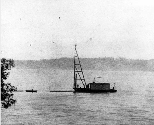
Pg. 178-179 – Self Dumping Scow – City of Seattle Municipal Archives, several photos of the scow.
Pg. 180 – Denny School – University of Washington, not the best resolution but does allow for some zoom.
Pg. 182 – First shovelful on Denny – City of Seattle Municipal Archives’ webpage with ways to download in higher resolution.
Pg. 183 – Last shovelful of Denny – City of Seattle Municipal Archives’ webpage with ways to download in higher resolution.
Pg. 192 – Before and after Denny Hill – City of Seattle Municipal Archives’ webpage with ways to download in higher resolution.
August 20, 2015
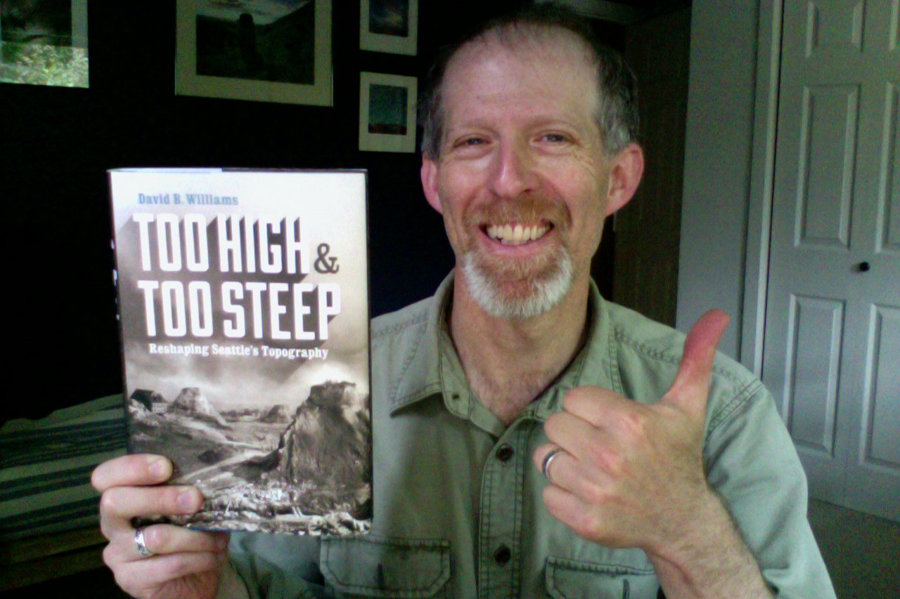
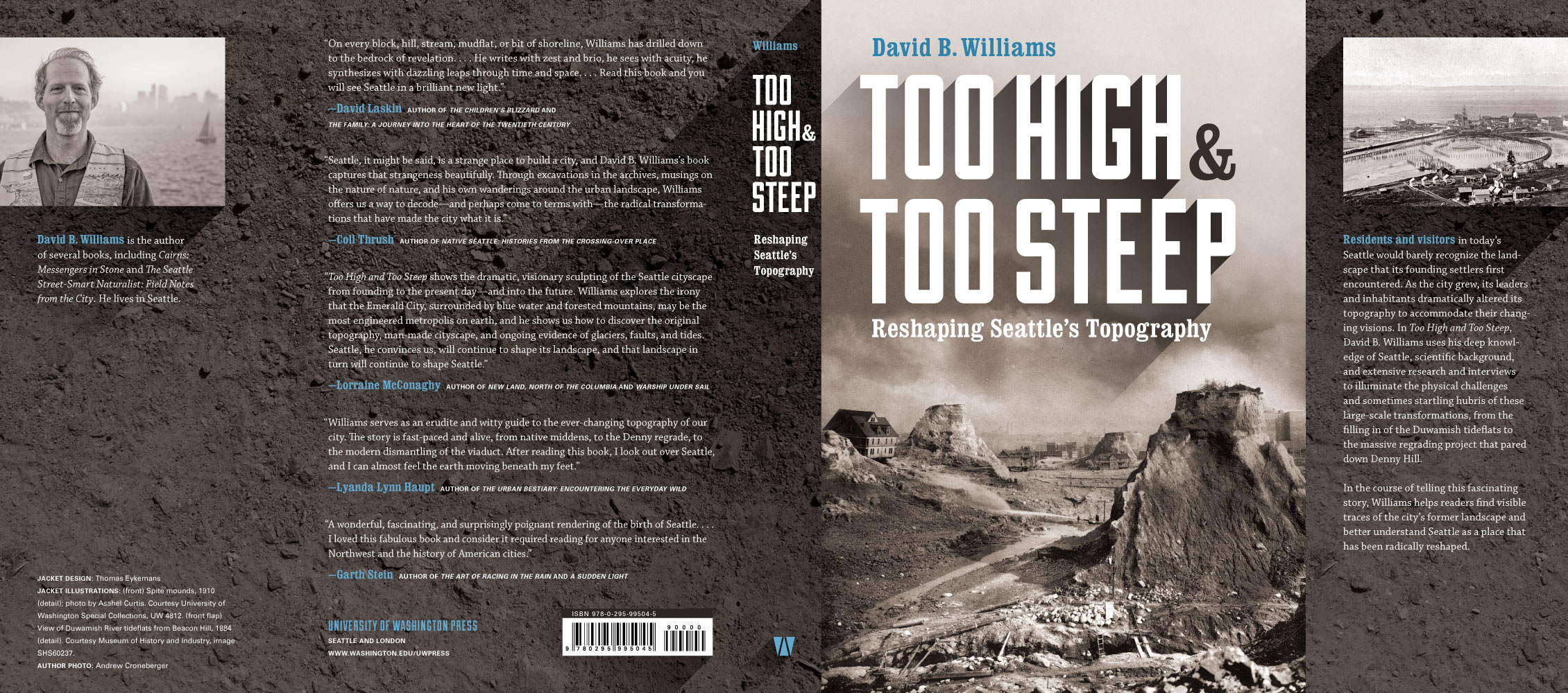
It’s here. My new book.
Pretty exciting as today I just picked up a copy of my new book. I think it’s rather handsome looking. Thanks again the UW Press for their wonderful editing and design. Just think you can be the first on your block to order a copy. Don’t be shy.
 A boy and his new book!
August 11, 2015
Flying Saucers at Mt. Rainier
There’s a nice little story in the New York Times today about flying saucers. Sixty eight years ago the world learned of their existence, or at least read the term for the first time. The phrase flying saucers developed in reference to objects that Kenneth Arnold had seen on June 24, 1947 flying over Mt. Rainier. Arnold described nine unusual, fast-moving objects “flying like a saucer would.” And term, flying saucer was born.
 Kenneth Arnold’s Flying Saucer
Turns out they were probably a flight of geese.
August 9, 2015
Seattle Technology-Pile Drivers
Modern Seattle likes to pay homage to high technology, such as apps, iPhones, and drones, but I would argue that some decidely primitive technology has had as great of impact on the city as any of the recent developments. This will be a multi-part posting. I start with the technology that drove the radical altering of Seattle’s waterfront and the Duwamish River’s tideflats and follow by exploring the tools that facilitated the city’s great regrades.
In May 1876, former Chief of Police Joe Surber floated a scow up to a dock at what is now First Avenue South and South King Street and was then the southern most point in Seattle. Sittting on the barge-like boat was a pile driver, which Surber would use to drive pilings, or wood logs, into the tideflats of the Duwamish River. Within months, he had built the first trestle, or bridge, across the tideflats; it would soon carry Seattle’s first important railroad and help transform the city.
 Surber’s Pile Driver (unknown origin)
Pile drivers, which have been around since at least the Romans, operate by dropping a heavy iron weight on the end of pile. One picture taken at the time shows Surber’s boat about equal in length to the 50-foot-tall tower that supported the iron hammer. A shack takes up the back half of the boat. Inside the shack was the steam engine that drove the hammer. With mud more than 30 feet deep on the tideflats, Surber needed piles up to 65 feet long.
Two whacks of the 3,000-pound-hammer would push the piles down through the soft mud to harder material below, with more blows—sometimes over 150—required to sink the log to a stable depth. Pile drivers used on Puget Sound in the 1890s struck 70 blows per minute. We have no record of how fast Surber worked but a report in the 1890s described pile drivers putting in from 26 to 200 piles per day.
 Pilings on the Duwamish River Tideflats – 1855 (courtesy of MOHAI)
Nor do we have any record of how many pilings were driven into shorelines around Seattle but it must number in the hundreds of thousands if not into the millions. Pile drivers built the trestles that allowed trains to cross the tideflats and to swing around downtown on what was Railroad Avenue and is now Alaskan Way; the wharves that were key to the city’s maritime trade, such as Yesler’s Wharf, which was part of Seattle’s first industry; and the thousands of piers and docks that jut out from shorelines on every body of water in the city.
Perhaps no picture better illustrates the use of pile drivers than this one taken in the days after Seattle’s Great Fire of 1889. There are at least three in the photo, and we know that many more were in use during the rebuilding of the city. You can also see the thousands of pilings, which had helped the city grow out into the water. They were the bones essential to Seattle’s growth and every single one had been put in place by that most simple and wonderful piece of technology, the pile driver.
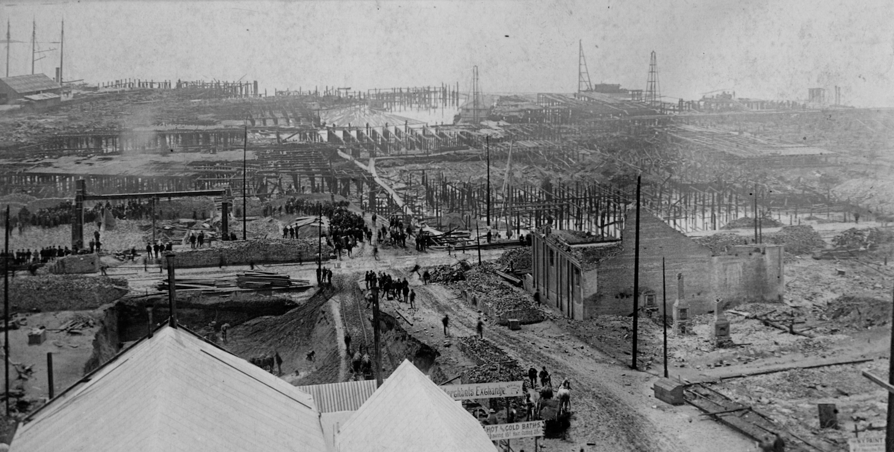 Pilings post-fire 1889 (Courtesy University of Washington Special Collections)
August 5, 2015
Cairns on NPR
Recently there has been a spate of news about cairns.
Editorial by Robyn Martin in High County News:
Story today on NPR by Stina Seig:
It’s a rather controversial topic. Here’s what I have written in past posts about this subject.
Follow up to an epidemic of cairns.
July 28, 2015
Name that Street
Over the past few weeks as I have been wandering the Seattle streets for my new book of urban walks, I have noticed a feature that I had previously noted but not thought too much about. It’s the handful of places in town where the name of the street is embedded in the sidewalk.
I have not been able to determine when any of these names went in or who did them and why but here’s a little background. In 1902, the city adopted Resolution No. 387, which declared “that all concrete sidewalks laid in the City of Seattle shall have the names of the streets countersunk in plain letters at the street intersections…” Two months later an article in the Seattle Times noted that R.H. Thomson, chair of the Board of Public Works, wanted “red cement [to] be used to fill the lettering so that a very pretty effect can evidently be had.” I have not been able to any red street names so suspect that Mr. Thomson’s preference was never practiced.
Apparently street naming tiles were somewhat common around the . The preferred style was to use are known as encaustic tiles, “made by the American Encaustic Tiling Company of Zanesville, Oho, in a style called ‘Alhambra’. The ‘Alhambra’ style consisted of a pearly white background and precise, royal blue Roman letters, each with a dark grey double outline.” This style can be found in Victoria, BC.
1. The most common in Seattle are blue and white tiles, which look a bit like the encaustic ones. There are several on Madison Street, including one with a spelling that looks as if it was done by a wee child. Here are the locations of those tiles.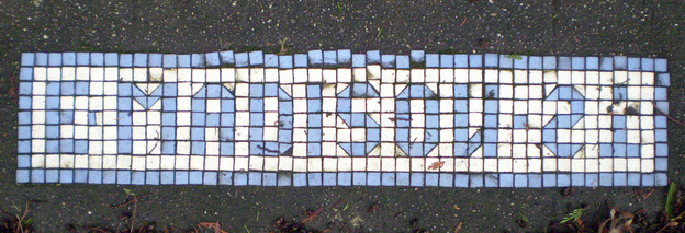 –Madison & East Thomas (between 26th & 27th)
–E. Lee St. (at E. Madison St.) [near 37th]
–28th Ave. N (Now Ave. E. – Madison Valley)
–29th Ave. N. (at E. Madison St.)
–E. Madison St. (at 32nd Ave. E.)
–32nd Ave. N. (at E. Madison St.)
–33rd Ave. N. (at E. Madison St.)
–E. Madison St. (at 37th Ave. E.)
In addition, the corner of 12th Ave. NE and NE 52nd St., in the University District, bears tiles of this style. I don’t know of any others in the UDistrict.
But if you really want to see blue and white tiles, go to Ballard, which has the most by far. Here is a map of them.
2. Downtown Seattle also has severaal streets with names embedded in the sidewalk. Instead of tile, the names are large bronze letters. Most of the ones I have seen are along Third Avenue between Seneca and Pine streets. 3. Beacon Hill – Several bronze names are embedded in sidewalks along South Massachusetts Street between 12th Avenue South and 14th Avenue South.
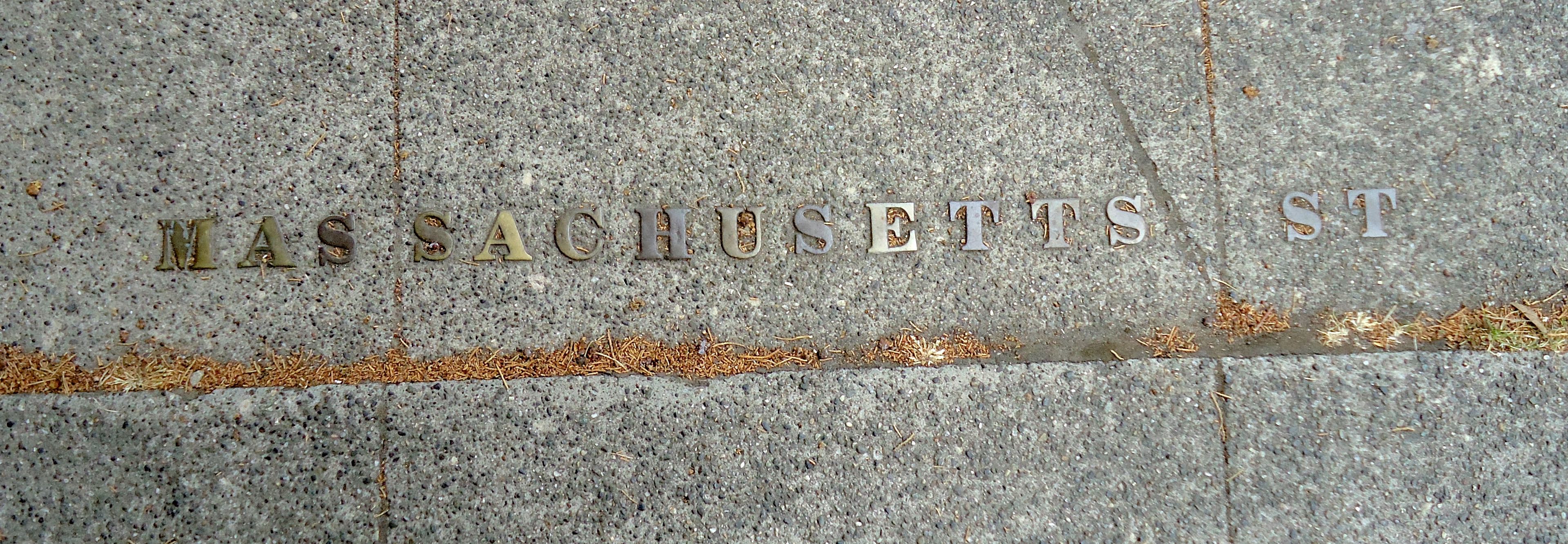 4. Capitol Hill – Found one corner with small bronze names at 11th Avenue East and East Republican Street.
 5. Others, that I learned about since my first post:
– SW corner First Avenue South and South King Street, font is sans serif, unlike other bronze ones (from Rob Ketcherside)
If you do know of any others please let me know.
July 22, 2015
When Seattle Was New York
Seattle’s story begins on November 13, 1851, when the Exact dropped off twenty two people on a prominent point of land jutting out into Puget Sound. It had been named Pt. Roberts in 1841, on Charles Wilkes’ United States Exploring Expedition but that name would not survive the settlers’ ambitions. Figuring that this would be the area where a new city developed, two of the twenty two, John Low and Lee Terry, filed land claims. They were wrong.
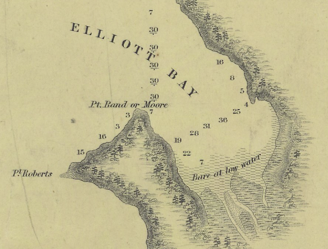 Charles Wilkes’ 1841 Map of Puget Sound
Those early settlers did not stay long and by early 1852 most had moved across Elliott Bay to what is now Pioneer Square. Only six remained, John Low, his wife and four children, and Charles Terry, who took over his brother’s land claim and ambitiously named the area New York. Low did not stay long however.
 Charles Terry’s advertisement in The Columbian
But Terry still held out hope and opened a store, which he called New York Markook House. Markook was a Chinook jargon term for trade. (Chinook jargon was the argot of the regional trade network.) Above is his advertisement in the September 11, 1852, The Columbian, the first newspaper in Washington Territory. Those few who stopped by the store could have found anything from raisins to crosscut saw files to coffee (this was the future home of Starbucks after all) to London Ale.
Nine months later Terry changed his mind. Now, he wanted to call the town Alki. (Al-key or Al-kye, that is the great pronuciation question in Seattle. Old timers will tell you that it rhymes with tree though few others will agree. No matter what, the word means “by and by” in Chinook jargon.) The editors of The Columbian applauded his decision. “We never fancied the name of New York on account of its inappropriateness but Alki we subscribe to instanta…Well done friend TERRY, success to thee and thy Alki.”
Success did not come though and in 1856 Terry traded his 320 acres for 260 acres across Elliott Bay in a little settlement recently named Seattle.
June 29, 2015
Too High and Too Steep – Book Jacket
Wow, just got to see the book jacket for my new book, Too High and Too Steep. Pretty exciting. Thanks kindly to the UW Press for a fabulous design and for all of their support. The book will be out in September. (click on cover for larger image)
 Too High and Too Steep – the jacket

