
Rob Casey's Blog, page 8
November 11, 2013
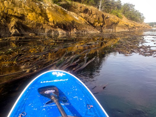
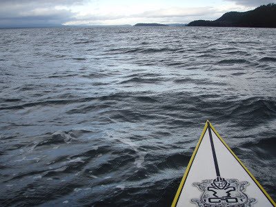
Paddling the Elwha River Mouth, 11/11/13
The Elwha's changing fast, or really morphing. in December of 2012 an expansive sandbar developed off the mouth several hundred feet. In September of 2013, another large section again developed off the mouth further extending the river delta. Sea birds have been taking advantage of the various offshore sandbars in large numbers.
I've been exploring the river mouth every few weeks during the pre, during and now post dam removal. Here's a few more pics of paddle there today. I found the small surfable standing waves in the river mouth on a no swell day in the Strait.
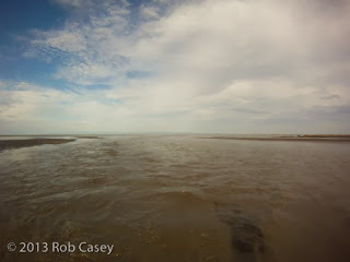
Looking north towards the Strait.

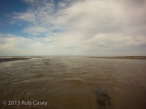
Looking upstream over smalls standing waves.

Dam release sediment line in Freshwater Bay.

I've been exploring the river mouth every few weeks during the pre, during and now post dam removal. Here's a few more pics of paddle there today. I found the small surfable standing waves in the river mouth on a no swell day in the Strait.
Looking north towards the Strait.
Looking upstream over smalls standing waves.
Dam release sediment line in Freshwater Bay.


October 6, 2013
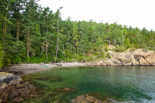
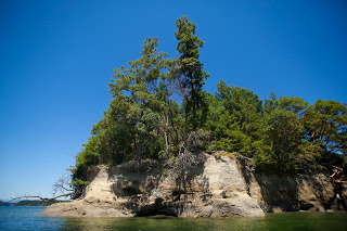
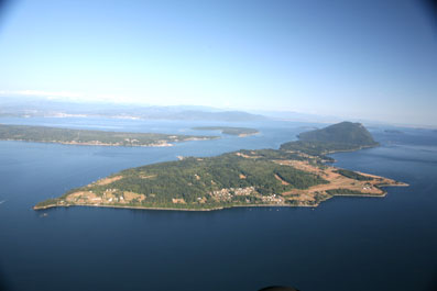
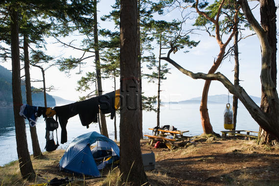
Burrows Island - An Easy Getaway
A 5-10 minute paddle from the Skyline Marina in Anaocortes, Burrows Island is a somewhat obvious yet hidden getaway. Skyline Marina is a huge facility yet undeveloped Burrows seems like it belongs in the Inside Passage or SE Alaska. There is a lighthouse on the western side of the island and a trail which circumnavigates most of the island. South of the island is Allan Island which is private.
On the eastern edge is Alice Bight, a small bay with a Cascadia Marine Trail campsite and rather comfortable outhouse.
Tidal currents rip around all sides of the island making it an fun circumnavigation. I like to cross from Skyline Marina and play in the small standing waves on the island's NE corner. Boat wakes collide with incoming current making for a few fun glides.
April 4, 2013
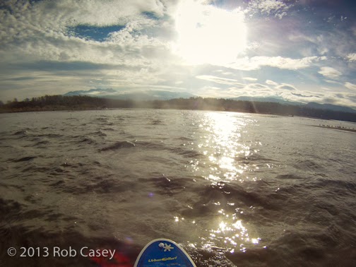
Trip #18 - Seattle - Golden Gardens to West Point Lighthouse
Sometimes the best paddle route is the one closest to where you live. A friend once told me that he got bored paddling on Shilshole Bay from Golden Gardens to the West Point Lighthouse at Discovery Park. For me, it's different every time, and I've been doing it nearly weekly for a decade.
Why I love paddling on Shilshole Bay:
- I enjoy the light outgoing always present current below the Chittenden Locks. I can teach my SUP students to ferry across the current, use eddies to go upstream then get a sorta free float back downstream. After heavy rain eddylines form behind obstructions giving myself and students practice in currents up to 4kts. Picturesque homes on stilts line the shores. Know anyone selling one - give me a holler! Note: SUPs aren't allowed to transit through the Locks.
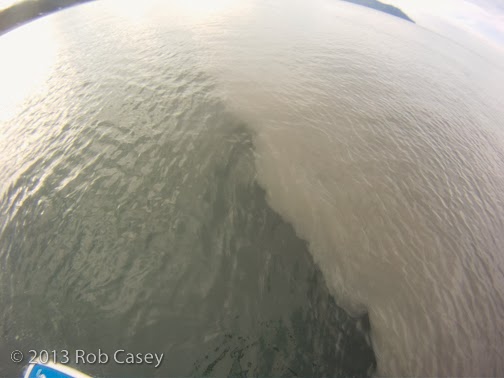
- Freighters put off up to chest high (5') surfable waves across from Ray's Boathouse at low tides. We alos surf tug wave in deep water offshore once a week. Wave faces can reach up to 6' with rides nearly 1/2 mile long. Read article on our surfing exploits in the Seattle Time, Here. I also surf behind most boats coming out of or going into the Locks. Great for SUP balance practice. Tip: Give boaters the right of way and make eye contact before getting their wave.
- High wind days create fun conditions if you're into that sort of thing. North winds over 20 knots create surf at Meadow Point and at the mouth of Salmon Bay. Southerlies create surf on the south side of West Point and fun downwind conditions between the point and Golden Gardens. Friends and I have paddled in up to 41 knots, our limit.
- Wildlife. On every paddle I pass a section with a half dozen harbor seals who frolic below my board or kayak, or follow me around. Sea lions bark in the distance, and sea life dart below my water craft on clear days. Whale sighting are few.
- Shilshole Marina, nearly 1.7 miles long provides protected paddling about 350 days a year. I take my SUP students in there for calm water and to work on directional control weaving through the many channels and pathways. Tip: Slow down for each aisle opening in case a boat is coming out.
- Paddling top West Point. From my launch at the Elks Beach below the Locks, the lighthouse is about 1.7 miles. It looks easy but currents and back eddies can hinder your speed. A straight line to the lighthouse isnt' always the easiest route. If there's an outgoing tide or strong southerly, the bay on the north side of the point becomes a big gyro or back eddy pushing current along shore to the point. Going point A to B would be bucking current the whole distance. Webcam from a house on Magnolia: http://www.brichmond.com/webcam/mywebcam_loop.htm
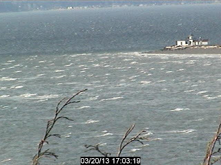
West Point at 30kts of Southerly Wind.
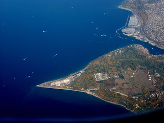
Shilshole Bay

Why I love paddling on Shilshole Bay:
- I enjoy the light outgoing always present current below the Chittenden Locks. I can teach my SUP students to ferry across the current, use eddies to go upstream then get a sorta free float back downstream. After heavy rain eddylines form behind obstructions giving myself and students practice in currents up to 4kts. Picturesque homes on stilts line the shores. Know anyone selling one - give me a holler! Note: SUPs aren't allowed to transit through the Locks.
- Freighters put off up to chest high (5') surfable waves across from Ray's Boathouse at low tides. We alos surf tug wave in deep water offshore once a week. Wave faces can reach up to 6' with rides nearly 1/2 mile long. Read article on our surfing exploits in the Seattle Time, Here. I also surf behind most boats coming out of or going into the Locks. Great for SUP balance practice. Tip: Give boaters the right of way and make eye contact before getting their wave.
- High wind days create fun conditions if you're into that sort of thing. North winds over 20 knots create surf at Meadow Point and at the mouth of Salmon Bay. Southerlies create surf on the south side of West Point and fun downwind conditions between the point and Golden Gardens. Friends and I have paddled in up to 41 knots, our limit.
- Wildlife. On every paddle I pass a section with a half dozen harbor seals who frolic below my board or kayak, or follow me around. Sea lions bark in the distance, and sea life dart below my water craft on clear days. Whale sighting are few.
- Shilshole Marina, nearly 1.7 miles long provides protected paddling about 350 days a year. I take my SUP students in there for calm water and to work on directional control weaving through the many channels and pathways. Tip: Slow down for each aisle opening in case a boat is coming out.
- Paddling top West Point. From my launch at the Elks Beach below the Locks, the lighthouse is about 1.7 miles. It looks easy but currents and back eddies can hinder your speed. A straight line to the lighthouse isnt' always the easiest route. If there's an outgoing tide or strong southerly, the bay on the north side of the point becomes a big gyro or back eddy pushing current along shore to the point. Going point A to B would be bucking current the whole distance. Webcam from a house on Magnolia: http://www.brichmond.com/webcam/mywebcam_loop.htm
West Point at 30kts of Southerly Wind.

Shilshole Bay
February 16, 2013
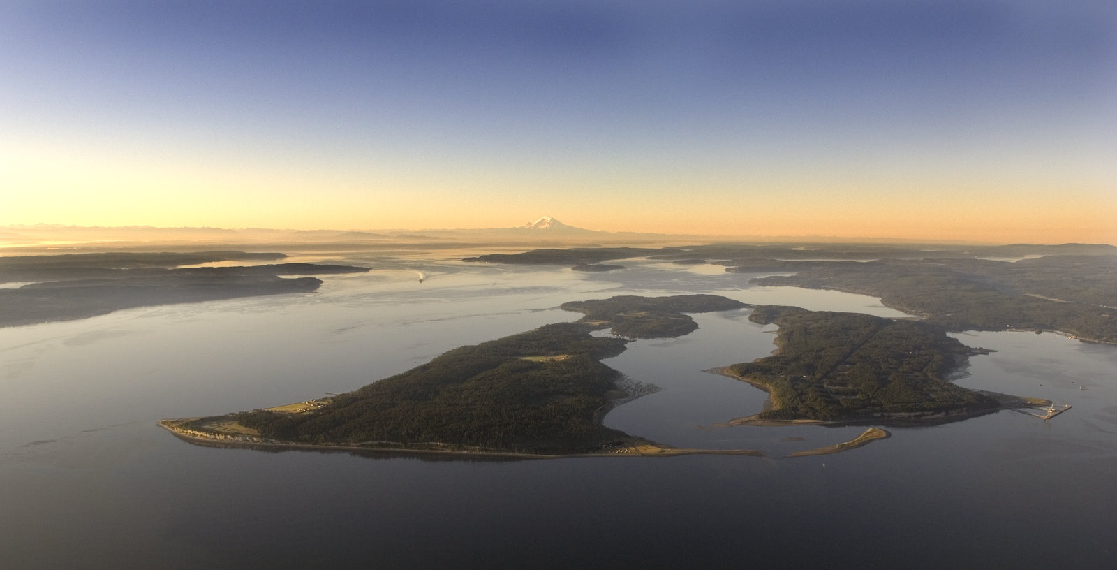
Ghost Forest, Sucia Island, Trip #50
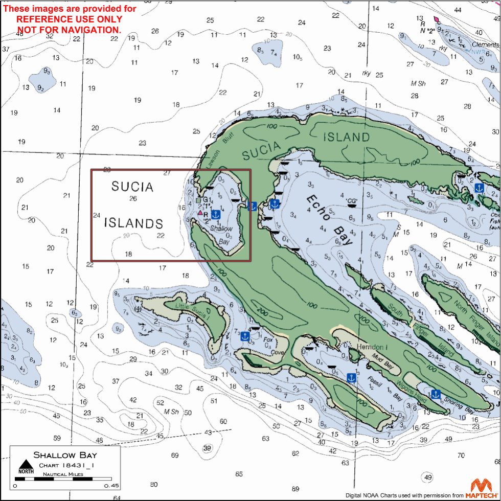
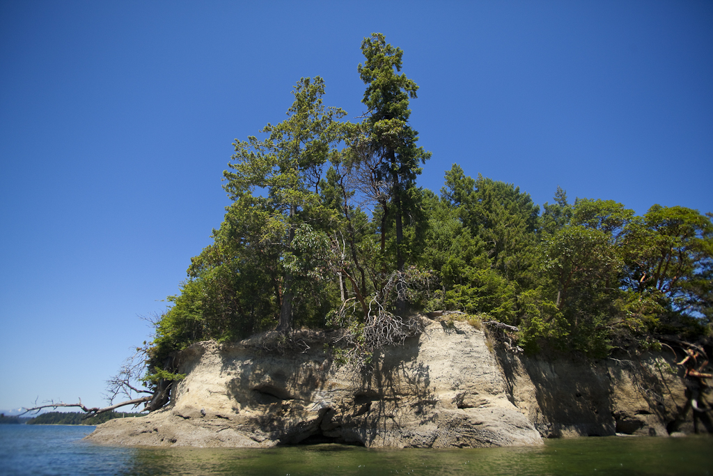
Sucia Island is one of several of the outer San Juan Islands, just one mile north of Orcas Island. Known for it's interesting geological features, protected coves, and in summer - very busy. Shallow Bay is on the west side of Sucia providing a very protected gunkhole (protected anchorage) for boats. The pic below is of the Ghost Forest on the southern part of the bay. There's a portage on the left side of the pic giving walkers and paddlers easy access to Echo Bay.
Take the Sucia Island Ferry from Outer Island Expeditions on Orcas to access the island via foot or kayak/sup. The channel separating Sucia from Orcas can be idyllic and calm or very rough with strong tidal current and rips. Check with Outer Island or Shearwater in Eastsound for local travel info before setting out.
The island is open all year and is uncrowded fall through winter but quite crowded with kayakers and boaters in summer. This blog has some great historical and geological info on the island. Boater blogs provide good info even if you're travelling via kayak, canoe, or sup. http://windborneinpugetsound.blogspot.com/2009/10/destination-sucia-island.html
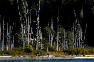
Ghost Forest in Shallow Bay
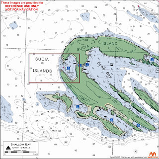
Sucia with detail of Shallow Bay

Take the Sucia Island Ferry from Outer Island Expeditions on Orcas to access the island via foot or kayak/sup. The channel separating Sucia from Orcas can be idyllic and calm or very rough with strong tidal current and rips. Check with Outer Island or Shearwater in Eastsound for local travel info before setting out.
The island is open all year and is uncrowded fall through winter but quite crowded with kayakers and boaters in summer. This blog has some great historical and geological info on the island. Boater blogs provide good info even if you're travelling via kayak, canoe, or sup. http://windborneinpugetsound.blogspot.com/2009/10/destination-sucia-island.html

Ghost Forest in Shallow Bay
Sucia with detail of Shallow Bay
February 14, 2013
St Patrick's Day Pints & Paddles - Lk Union
On St Patrick's Day check out Pints & Paddles a on water paddling festival at Alderbrook Resort. In conjunction with Union Paddle & Row, there will be vendor booths, a 2.5 mile all craft paddle race, and paddling demos and clinics. Contact Union Paddle for more info: Phone: 360-359-3308
Email: info@unionpaddleandrow.com


Email: info@unionpaddleandrow.com

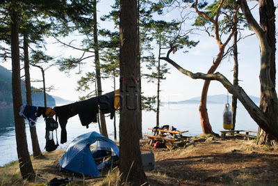
Campsite Update 2/13 for Cypress Head Trip #42
Here's a mid winter campsite update for Cypress Head on Cypress Island. Thanks to
"My crew and I were out there from the January 10th- 17th, reconstucting the 7 campsites located on the tide island above the tombolo. So far, we have constructed several hundred feet of split-rail fence along the eroding bluff on the site's north and northeast sides, and constucted 7 brand new tent pads at most of the former "unofficial" camping spaces. The tent pads are 10'x10', and will fit any large family tent, and possibly two 2 person tents. Obviously, our hopes are that campers will use only these camping spaces when on the upper campground. The two sites on the tombolo's west side remain unchanged, besides being slated for new fire rings. All sites will be recieving new firerings, and improvements to the picnic tables will also occur before the May opening. A new access trail to the tide island's south side will also be constructed before then, as the old trail takes hikers along parts of the eroding bluff. Several of the social trails around the campground were also decommissioned upon our visit, and a number of hazard trees were removed in the process. As to our code of ethics and general awareness, several bags of trash (mostly plastics) were removed from the beach."
Submitted 2/13 to the WWTA by:
Kristian Tollefson
WCC Crew Supervisor; Skagit DNR
February 8, 2013
Puget Sound Islands for Fitness Training Paddles
Darrell Bedmark, a prone paddle boarder who I regularly paddle with, mentioned that he was seeking trips where he could use to train for races. His hope was to find routes which are scenic and interesting rather than just a straight line or in our urban environment.
Here's a few suggestions of cool places to paddle if you're seeking a challenging distance or water conditions...
- Squaxin Island (South Sound) - undeveloped and owned by the Squaxin Tribe. You can't land there but it's undeveloped shores is probably how Wilkes of Vancouver saw the Sound for the first time.
- Lummi Island (North Sound) - Off Bellingham Bay, Lummi is partially developed but very interesting with beach homes, reef fishing platforms on it's west side, and vertical cliffs on the south side. Expect tidal currents. Best launch is adjacent to the Squaxin Ferry terminal.
- Marrowstone Island & Indian Island (Port Townsend) - One of my favorites while skipping music camp classes to hide in Fort Flagler's bunkers in the late 70's. Both lands have sections of very calm protected water and exposed areas to tide rips, wind, and freighter waves. Check the book for details. Best launches are Oak Bay; Port Hadlock; Mystery Bay; Fort Flagler; East Beach.
Determine distances using Google Maps, marine charts or if you can find them, the SeaTrails maps (we think this company has closed).
Prone Paddling: Using a long narrow surf ski like craft powered by hand paddling on knees or chest.
Others...
- Vashon Island
- Harstene Island
- Anderson Island
BC:
- Pender Island
- Saturna Island
- Wallace Island

Lummi Island
Marrowstone & Indian Islands
Squaxin Island, south side.

Here's a few suggestions of cool places to paddle if you're seeking a challenging distance or water conditions...
- Squaxin Island (South Sound) - undeveloped and owned by the Squaxin Tribe. You can't land there but it's undeveloped shores is probably how Wilkes of Vancouver saw the Sound for the first time.
- Lummi Island (North Sound) - Off Bellingham Bay, Lummi is partially developed but very interesting with beach homes, reef fishing platforms on it's west side, and vertical cliffs on the south side. Expect tidal currents. Best launch is adjacent to the Squaxin Ferry terminal.
- Marrowstone Island & Indian Island (Port Townsend) - One of my favorites while skipping music camp classes to hide in Fort Flagler's bunkers in the late 70's. Both lands have sections of very calm protected water and exposed areas to tide rips, wind, and freighter waves. Check the book for details. Best launches are Oak Bay; Port Hadlock; Mystery Bay; Fort Flagler; East Beach.
Determine distances using Google Maps, marine charts or if you can find them, the SeaTrails maps (we think this company has closed).
Prone Paddling: Using a long narrow surf ski like craft powered by hand paddling on knees or chest.
Others...
- Vashon Island
- Harstene Island
- Anderson Island
BC:
- Pender Island
- Saturna Island
- Wallace Island
Lummi Island
Marrowstone & Indian Islands
Squaxin Island, south side.
January 17, 2013
Cypress Head - one of my favorites. Trip 42
I first visited Cypress Head (Trip #42) during a Kayak Academy course with George Gronseth about a decade ago. The swift currents took it's toll on a few of the students while learning to paddle in tidal rapids off the point below the campground. The campground overlooks Bellingham Channel with distant views of Lummi Island and a feeling of being much further away than you are.
Current rips through the channel, so either time for slack tides or a minimal tidal exchange, or if you have solid skills in tidal rapids, use a flood to get in from Anacortes - ebb to return.
Due to DNR budget issues, the campground at Cypress Head and Pelican Beach to the north are now closed Labor Day through Memorial Day weekend.
January 8, 2013
Who says you can't surf in the San Juan Islands?
Nice swell coming in on the south tip of San Juan Island..

December 20, 2012
Part 3 in Mike Darbyshire's Gulf Islands SUP Tour
From Mike's blog,
Gulf Islands Solo Trip: Part 3: "Downwind"
"Doubled my distance for the day, saw orcas, downwind all the way and the sun came out to make this arguably the best day of my trip." Read More on his blog..
http://deepcovesup.blogspot.com/2012/12/gulf-islands-solo-trip-part-3-downwind.html

Gulf Islands Solo Trip: Part 3: "Downwind"
"Doubled my distance for the day, saw orcas, downwind all the way and the sun came out to make this arguably the best day of my trip." Read More on his blog..
http://deepcovesup.blogspot.com/2012/12/gulf-islands-solo-trip-part-3-downwind.html

Rob Casey's Blog

Rob Casey isn't a Goodreads Author
(yet),
but they
do have a blog,
so here are some recent posts imported from
their feed.

