
Rob Casey's Blog, page 10
June 15, 2012
60 Trips Book Launch Party, 6/27 Noble Fir / Ballard
60 Trips Book Launch Party! June 27th -
& WWTA Pub Night at The Noble Fir / Ballard / Seattle
WWTA friends and supporters at The Noble Fir in a benefit for Washington Water Trails Association on Wednesday, June 27, when $1 from each tap pour (pint of beer or cider) goes to WWTA throughout the night!
When: Wednesday, June 27, from 6:30pm until midnight
Where: The Noble Fir, 5316 Ballard Ave. NW, Seattle, WA 98119 http://thenoblefir.com/events.html


June 7, 2012
Trip #22 Southern Hood Canal
Called the 'Great Bend', the southern bend of Hood Canal at Annas Bay is also the mouth of the Skokomish River and it's expansive tide flats fanning out between Potlatch State Park and the tiny town of Union. Camp at the Cascadia Marine Trail site at the State Park and rent a SUP or kayak from Union Paddle Center. Bring a tide table to time the level correctly to avoid getting stuck in the mud below the river mouth. Calm waters are the norm on Annas Bay with quiet paddling in the off season. Use the Discover Pass to park along the road south of Union.


June 1, 2012
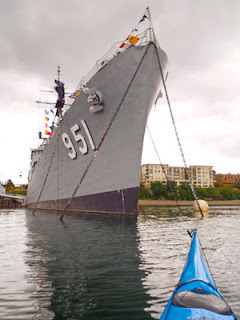
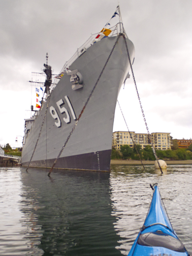
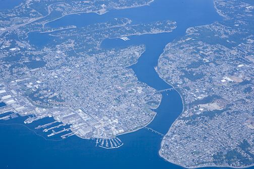
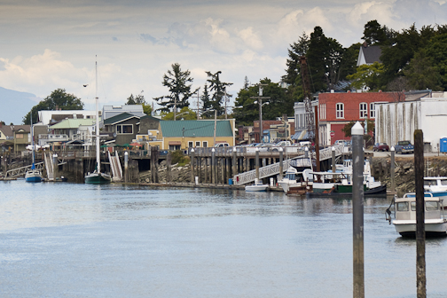
Trip #13 - Bremerton
Bremerton is a town of interesting Naval sights, old neighborhoods, and much like Seattle winding waterways and the bridges that connect the land together. The current can run fast through the Port Washington Narrows providing a free ride or uphill battle to those who aren't paying attention.
Trip #13 originates 13 miles to the west in Eagle Harbor on Bainbridge. The trip takes you through Rich Passage to Bremerton.


Trip #13 originates 13 miles to the west in Eagle Harbor on Bainbridge. The trip takes you through Rich Passage to Bremerton.
May 31, 2012
Trip #26 - La Connor & the Skagit River
Known for it's rich agricultural heritage and busy maritime scene, the Skagit Valley has several picturesque paddling trips. In Trip #26 you have several options to choose from. On the ebb, launch from Blake's Resort and float down downstream past Fish Town and thread your way through the swamp like tide flats below the Skagit River. Visit the interesting geological rock formations of Ika Island (no landing permitted) or the World War 1 era coastal fortifications on Goat Island.
Using a flood current paddle up the Swinhomish Channel to La Connor and enjoy the town's various shops, enjoy a beer at the La Connor Brewery or a gigantic cinammon roll at the Calico Cupboard. Camp at the Cascadia Marine Trail site in Pioeneer Park below the Rainbow Bridge.
Take the tail end of the ebb back down the Swinhomish Channel to the mouth of the Skagit, then paddle up the river on the flood tide back to Blake's.
May 30, 2012
Seeking Navigation & Marine Weather Training?
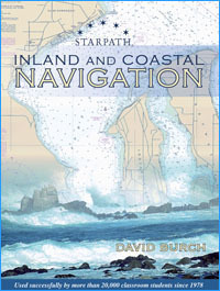
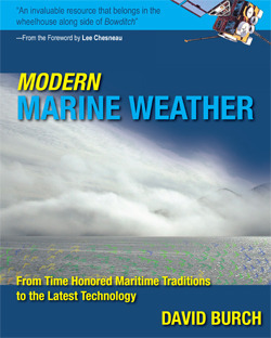
If you're seeking marine navigation and weather resources, books, online courses or apps, check out the Starpath School of Navigation in Seattle. Owner David Burch is the author of Kayak Navigation and several other publications on marine weather, GPS, and other cool stuff.
Sample Topics Covered:
- Celestial Navigation
- Modern Marine Weather
- Inland and Coastal Navigation
- The Barometer Handbook
More info here..Starpath


Sample Topics Covered:
- Celestial Navigation
- Modern Marine Weather
- Inland and Coastal Navigation
- The Barometer Handbook
More info here..Starpath


May 29, 2012
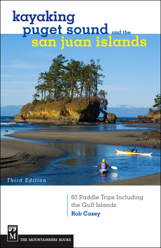
The Book has Launched!
My publicist at Mountaineers Books told me today that my 60 Trips Kayaking Puget Sound book has launched! Find it online at the usual spots and it should be on bookstore shelves now or in the near future.
For more info on the book, look Here.


For more info on the book, look Here.
May 17, 2012
Driftwood Shelter, Fay Bainbridge Park
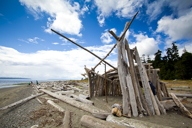
Fay Bainbridge Park, Bainbridge Island, WA


May 8, 2012


April 20, 2012
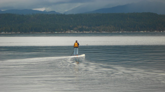
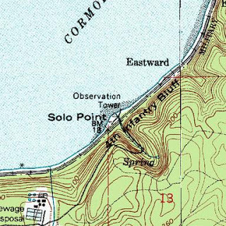
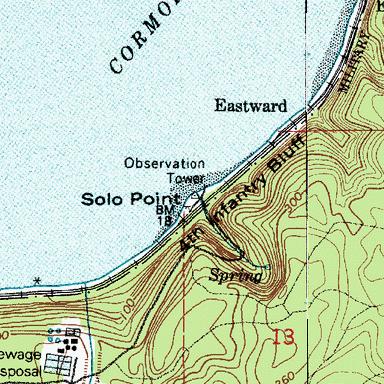
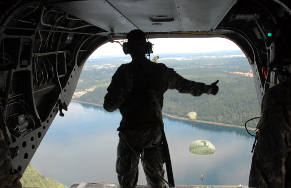
Solo Point Surprise
Last Monday I taught a SUP basic class to a woman who lives near Fort Lewis in South Puget Sound. Not knowing her area, she suggested Solo Point which is a little nub of land sticking out from the shore south of the town of Steilacoom. Right across from the point is tiny Ketron Island, a 10 minute paddle on a calm day. Views to the south include Anderson Island and the mainland near Luhr Beach on the south side of Nisqually Reach. To the north I spotted Fox Island and the Narrows Bridge. I was in awe of views from this easily accessed beach only a ten minute drive from I-5 (Exit 119).
Soon after my student arrived, a MP (Military Police) SUV pulled up blocking our access. Out pops a serious 20 something guy in full camo, a bullet proofed vest, and a two gun holster. He immediately asked for our IDs. I asked my student and she pointed out that military IDs are required to access the beach. On my way in, there were no visible signs from the freeway to the beach stating this, only a tank crossing side by the road. I later mentioned our encounter to Corey Dolan of Dolan's Board Sports in Tacoma. As a native Tacoma resident, he said the beach is used for combat exercises so they tend to be tight on security.
Aside from our MP encounter, the beach is along the main railway line for Burlington Northern and Amtrak. Trains roared by every ten minutes or so. Before launching or landing there, do your research or even contact Fort Lewis to inquire about using the beach.
Solo Point did make for a great point break on a strong southerly. Winds seemed to funnel between Ketron Island and the mainland which like many in Puget Sound are fiord like with steep tree lined hillsides. I surfed a few waist high waves in about 25kts of wind before heading home.
Location:
http://www.findlatitudeandlongitude.com/?loc=Solo+Point+Rd%2C+Fort+Lewis%2C+WA+98433%2C+USA&id=96517
April 18, 2012
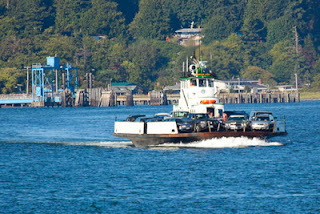
The Lummi Island Ferry - Bring Cash!
If you decide to take the Lummi Island ferry make sure you bring exactly $13 in cash. No cards are accepted or checks. We found out en route as they were collecting before we landed on the island. Luckily we had enough. A fun ride, this tiny ferry is a 10 minute ride each way.


Rob Casey's Blog

Rob Casey isn't a Goodreads Author
(yet),
but they
do have a blog,
so here are some recent posts imported from
their feed.

