
Rob Casey's Blog, page 3
June 20, 2017
Boating - Mysterious Anchor Image - Deception Pass State Park
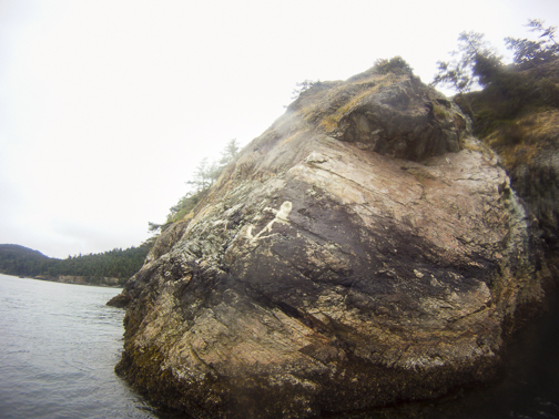
During my tidal rapids SUP class last week, we came across this anchor image on a rock at the south or right entrance to Bowman Bay in Deception Pass State Park. In the book this is, Trip 28
I've seen it before, the question is, what does it mean? And how did it get there?
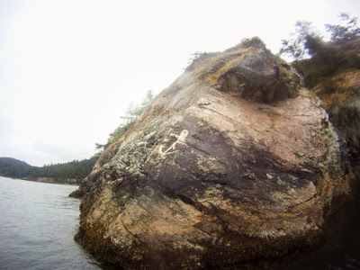 Anchor image in Deception Pass State Park
Learn more about my book Kayaking Puget Sound and the San Juans, 60 Trips. I also offer SUP and Kayak lessons available throughout the year at Salmon Bay Paddle. Questions about paddling on the Salish Sea, give me a holler anytime at salmonbaypaddle@gmail.com or 206-465-7167


May 28, 2017
Searching for Harbor Defense Bunkers along the Strait of Juan de Fuca
My obsession for exploring harbor / coastal defense forts started during a music camp on Marrowstone Island near Port Townsend in the late 1970's. Friends and I would skip class to explore the World War 1 era emplacements of Fort Flagler, then a relatively unknown fort. We knew every nook and cranny of the extensive fort and found many additional bunkers, usually fire control stations or searchlight emplacements hidden in the woods around the park boundaries.
In recent years, my interest has been renewed out of curiosity about the many hidden bunkers along the Strait of Juan de Fuca built during WW2 to support the cannons at Fort Hayden, now Salt Creek Recreation Area. As a photographer, I'm also working on a series of images showing the less known bunkers which are mostly covered by thick foliage and off the beaten path. These are hidden in the forest and when found appear like something out of an Indiana Jones movie. I'm motivated by the search as well as the find, which feels like 19th and 20th century archaeology.
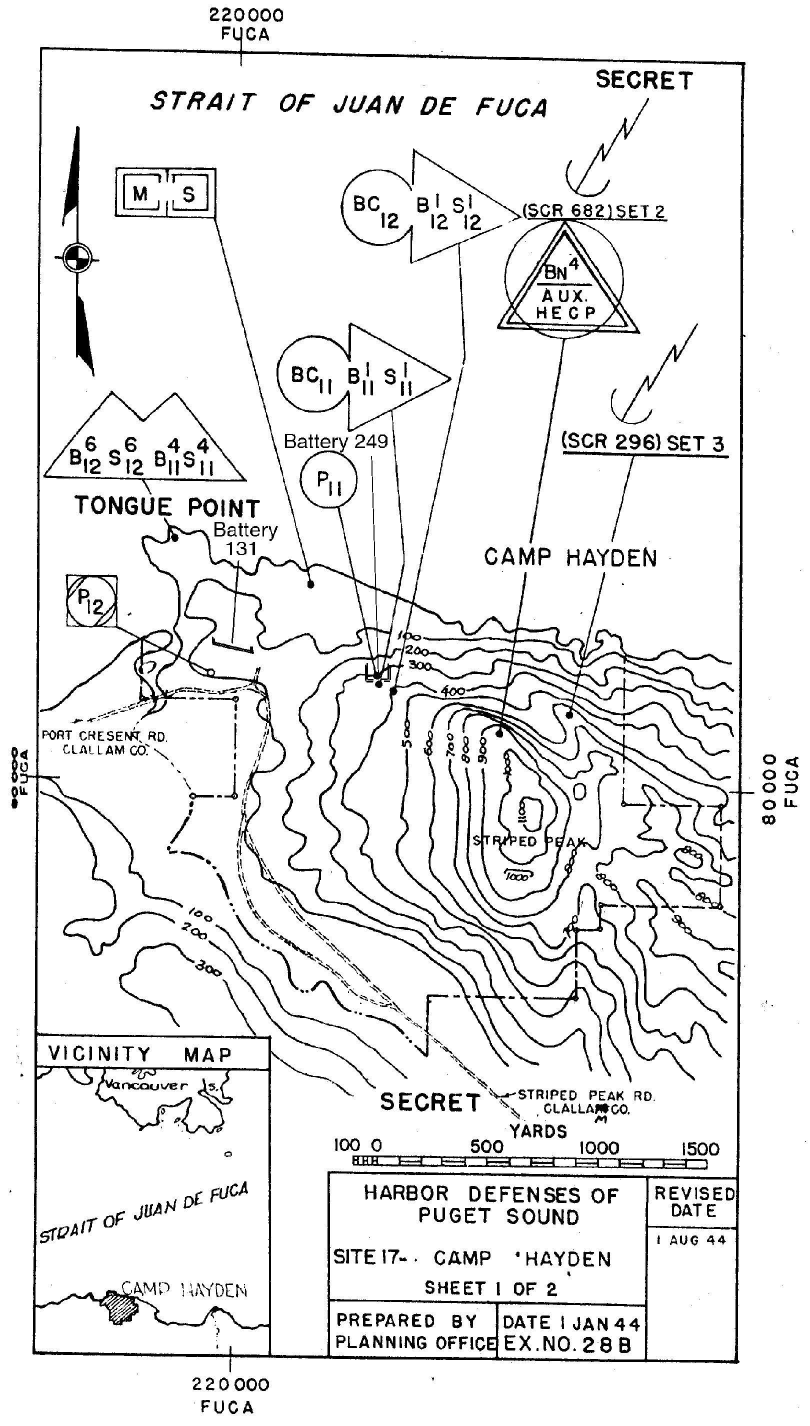
Some are on private land and a few are in DNR areas. The largest and most public emplacements on the Strait are at Camp Hayden (Salt Creek) where visitors can drive through Battery 131 which once employed two 16" cannons. These were fired once, but a turn of events in the Pacific War led the installments to become quickly outdated. Nearby, a battery of two 6" guns on Striped Peak can be easily accessed by a dirt road above the ranger station. Other fire control stations (slit bunkers) can be seen by the tent camping area and hidden in thick foliage on Striped Peak.
To support Battery 131, fire control stations were installed at Angeles Point, Agate Rock, Lyre, Majestic, Pillar Point and on Cape Flattery. Panama Mounts which are concrete circles were installed at Angeles Point and on a peninsula (private land) above the west side of the Elwha River which can be seen on Google Earth.
If you ask a local, many won't know of any additional emplacements beyond the public Salt Creek emplacements. A few friends have explored and found a few emplacements over the years thus motiving me to find those and others.
This link lists exact locations via Harbor Defense plans dating to the 1940's. But not all are as easily found as the maps show. Google Earth images show heavy forest over most of the sites and no sign of current or updated roads. A May 2017 search for the Agate Rock bunker was thwarted by dead end or heavily overgrown roads. It's on DNR land but bordered by private land on 3 sides. A Port Angeles local had been there and sent me a road map giving me a better idea of how to get there. Sounds like the best tool for search are a bicycle or motorcycle to more quickly access dirt roads and paths. We were on foot. In this video by RoadTrippers, motorcycles are used to search out bunkers in this area.

Learn more about my book Kayaking Puget Sound and the San Juans, 60 Trips. I also offer SUP and Kayak lessons available throughout the year at Salmon Bay Paddle. Questions about paddling on the Salish Sea, give me a holler anytime at salmonbaypaddle@gmail.com or 206-465-7167
In recent years, my interest has been renewed out of curiosity about the many hidden bunkers along the Strait of Juan de Fuca built during WW2 to support the cannons at Fort Hayden, now Salt Creek Recreation Area. As a photographer, I'm also working on a series of images showing the less known bunkers which are mostly covered by thick foliage and off the beaten path. These are hidden in the forest and when found appear like something out of an Indiana Jones movie. I'm motivated by the search as well as the find, which feels like 19th and 20th century archaeology.
Some are on private land and a few are in DNR areas. The largest and most public emplacements on the Strait are at Camp Hayden (Salt Creek) where visitors can drive through Battery 131 which once employed two 16" cannons. These were fired once, but a turn of events in the Pacific War led the installments to become quickly outdated. Nearby, a battery of two 6" guns on Striped Peak can be easily accessed by a dirt road above the ranger station. Other fire control stations (slit bunkers) can be seen by the tent camping area and hidden in thick foliage on Striped Peak.
To support Battery 131, fire control stations were installed at Angeles Point, Agate Rock, Lyre, Majestic, Pillar Point and on Cape Flattery. Panama Mounts which are concrete circles were installed at Angeles Point and on a peninsula (private land) above the west side of the Elwha River which can be seen on Google Earth.
If you ask a local, many won't know of any additional emplacements beyond the public Salt Creek emplacements. A few friends have explored and found a few emplacements over the years thus motiving me to find those and others.
This link lists exact locations via Harbor Defense plans dating to the 1940's. But not all are as easily found as the maps show. Google Earth images show heavy forest over most of the sites and no sign of current or updated roads. A May 2017 search for the Agate Rock bunker was thwarted by dead end or heavily overgrown roads. It's on DNR land but bordered by private land on 3 sides. A Port Angeles local had been there and sent me a road map giving me a better idea of how to get there. Sounds like the best tool for search are a bicycle or motorcycle to more quickly access dirt roads and paths. We were on foot. In this video by RoadTrippers, motorcycles are used to search out bunkers in this area.

Learn more about my book Kayaking Puget Sound and the San Juans, 60 Trips. I also offer SUP and Kayak lessons available throughout the year at Salmon Bay Paddle. Questions about paddling on the Salish Sea, give me a holler anytime at salmonbaypaddle@gmail.com or 206-465-7167
May 16, 2017
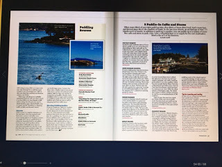
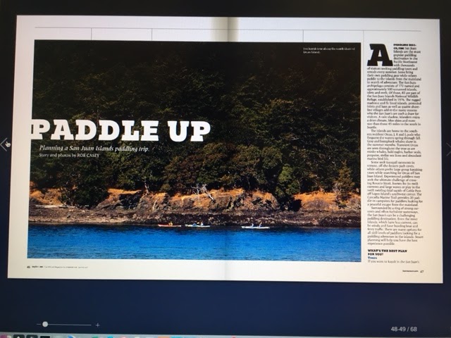
San Juan Islands - Planning a San Juan Islands Paddling Trip
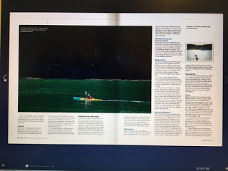
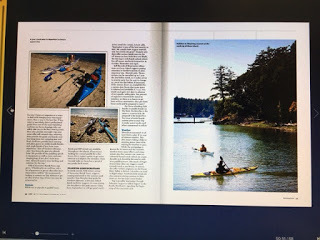
Check out my new article for Kenmore Air Magazine on
Planning a San Juan Islands Paddling Trip
.
A bonus addition to this article is another piece I wrote on 5 Paddle In Cafe & Stores in the San Juan's (Pg 58).
Read the Story Here
Learn:
- Where to go for your skill level
- Rent vs bringing your own boards/boats
- How to plan your trip for currents, weather, boat traffic, etc
- Who to rent and take paddling lessons from
- Going solo? What to pack, safety gear, etc
- Resources - my book, weather links, tide/current links
Thanks to various local San Juan Island's paddling business for their local paddling and travel info!

Learn more about my book Kayaking Puget Sound and the San Juans, 60 Trips. I also offer SUP and Kayak lessons available throughout the year at Salmon Bay Paddle. Questions about paddling on the Salish Sea, give me a holler anytime at salmonbaypaddle@gmail.com or 206-465-7167

A bonus addition to this article is another piece I wrote on 5 Paddle In Cafe & Stores in the San Juan's (Pg 58).
Read the Story Here
Learn:
- Where to go for your skill level
- Rent vs bringing your own boards/boats
- How to plan your trip for currents, weather, boat traffic, etc
- Who to rent and take paddling lessons from
- Going solo? What to pack, safety gear, etc
- Resources - my book, weather links, tide/current links
Thanks to various local San Juan Island's paddling business for their local paddling and travel info!


Learn more about my book Kayaking Puget Sound and the San Juans, 60 Trips. I also offer SUP and Kayak lessons available throughout the year at Salmon Bay Paddle. Questions about paddling on the Salish Sea, give me a holler anytime at salmonbaypaddle@gmail.com or 206-465-7167
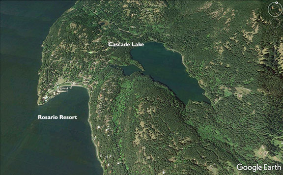
San Juan Islands - Orcas Island Paddler's Guide to Rentals
Kenmore Air has been in touch with me to provide guide services to one of their charters for a summer day trip from Seattle to Orcas Island. Their group has up to 25 participants which means we need to supply the boats and boards. In planning this tour, I've had a chance to chat with many of the board/board rental operations on the island. To save you the effort, here's a list of the basic rentals and resources I found..
Cascade Lake - a wilderness lake south of East Sound in Moran State Park. You may not think of paddling a lake given the epic paddling spots on the island, but it's actually a very pretty spot and will give more wind protection and opportunities for beginning paddlers not ready for tidal currents surrounding the rest of the island. Check in with Adventure Orcas for sup, canoe, pedal boats and kayak rentals. Nice folks!
West Beach Resort - Located on the west side of the island, West Beach has a string of rustic cabins in a nice bay with a view of Waldron Island. They have a few sup and kayak rentals for guests and run a weekly SUP race Sundays and Thursdays at 5:30pm. Race winner gets an off season night's stay!
Shearwater Kayak Tours - A great shop and professional rental operation, Shearwater also offers tours and/or has a summer base in spots like Deer Harbor, West Beach, Doe Bay and Rosario Resort. They also run tours out to Sucia Island.
Body Boat Blade - If you're looking for the best in sea kayak instruction not only on Orcas but in the entire region, BBB's owners Leon and Shawna are super professional, safe but also fun folks to paddle with. They also have a shop in East Sound. From the basic to advanced paddling including rolling, tidal rapids, adventure trip training to open water classes, they cover it all. And they have a few sups for rent on the island as well.
Need to get there in a jiffy? Take a day or overnight trip there with Kenmore Air. Avoid the ferries lines and traffic.
* Learn more about paddling in the San Juan's in my article planning for a paddling trip in the SJ's for Kenmore Air Magazine.
My book, Kayaking Puget Sound also has epic trips covering the entire island and surrounding islands.
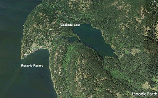 Cascade Lake, Orcas Island
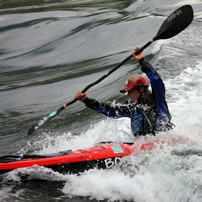 From the Body Boat Blade website
Learn more about my book Kayaking Puget Sound and the San Juans, 60 Trips. I also offer SUP and Kayak lessons available throughout the year at Salmon Bay Paddle. Questions about paddling on the Salish Sea, give me a holler anytime at salmonbaypaddle@gmail.com or 206-465-7167
May 15, 2017
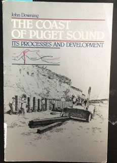
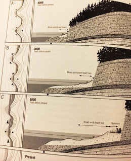
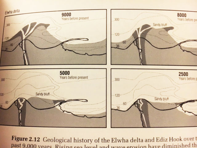
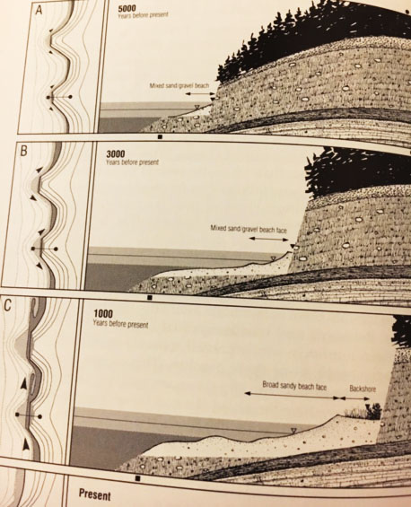
Coast of Puget Sound - Great Book about the Geology of Puget Sound
Due to the many posts I've added about the geology and development of Puget Sound, fellow paddler Granville Paules sent me an out of print book that puts all the Puget Sound and Salish Sea geology into context.
If you want to learn how Dungeness or Ediz hook were made, how beach erosion affects your beach place bulkhead and many other things, check out this book, if you can find it.
The Coast of Puget Soundby John Downing

Learn more about my book Kayaking Puget Sound and the San Juans, 60 Trips. I also offer SUP and Kayak lessons available throughout the year at Salmon Bay Paddle. Questions about paddling on the Salish Sea, give me a holler anytime at salmonbaypaddle@gmail.com or 206-465-7167
May 14, 2017
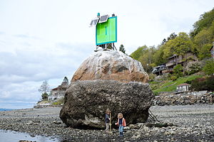
Erratic Boulders of Puget Sound
"A glacial ‘erratic’ is a rock fragment carried by glacial ice and transported some distance from the outcrop from which it was derived, and generally resting on bedrock of a different type* [although glacial or alluvial sediment may directly underlie the erratic. " (source: NW Geology)
Many erratic boulders line the shores of Puget Sound. Some large erratics can be found in Seattle such as 4 Mile Rock off the south side of Magnolia and this one below off North Beach of Discovery Park. Read more about erratic boulders (source: NW Geology)
Possibly the most interesting erratic is Haleelts Rock on the north end of Bainbridge Island which has a petroglyph on it's north facing side. See pic below.
6 erratics around Puget Sound
List of of 15 erratics around King Country, WA
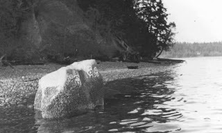 Haleelts Rock, Bainbridge Island
 4 Mile Rock
 Discovery Park erratic, North Beach
March 7, 2017
Spring Tides on Seattle's West Point, Trip #18
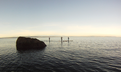
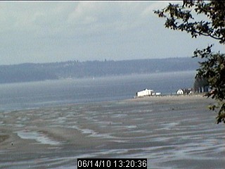
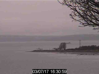
In cleaning out my laptop I came across an archive of webcam images from a privately run webcam that focuses on Seattle's West Point Lighthouse. The owner is a kite/sail boarder. They depict my 'backyard' paddling spot which I visit regularly. I've seen West Point in all times of the year from flat calm and glassy to gnarly 51 knot gales. I've surfed 10' freighter waves (no joke!) off the point and had half mile rides from tugs from the middle of Shilshole Bay to the point. On bucolic glassy summer days, it's a great escape from the hoards of paddlers on Seattle's lakes. Trip #18
Here's the webcam link
These images pulled from the webcam show a variety of conditions for the point.
 -2-3 tide most common April-July
 30-40 kt Southerly (gale)
 Container ship passing, waves in soon!
 March 7, 2017, lowish tide, calm conditions
Learn more about my book Kayaking Puget Sound and the San Juans, 60 Trips. I also offer SUP and Kayak lessons available throughout the year at Salmon Bay Paddle. Questions about paddling on the Salish Sea, give me a holler anytime at salmonbaypaddle@gmail.com or 206-465-7167
Support the Washington Water Trails Association and the Cascadia Marine Trail. The wwta works to create and protect access for paddlers on Puget Sound as well as provide an extensive network of over 60 paddle-in camping sites - www.wwta.org
Here's the webcam link
These images pulled from the webcam show a variety of conditions for the point.
 -2-3 tide most common April-July
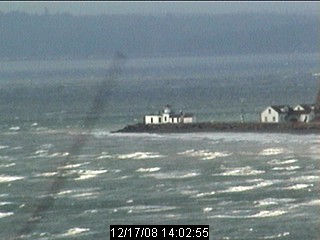 30-40 kt Southerly (gale)
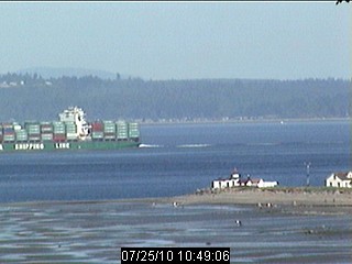 Container ship passing, waves in soon!
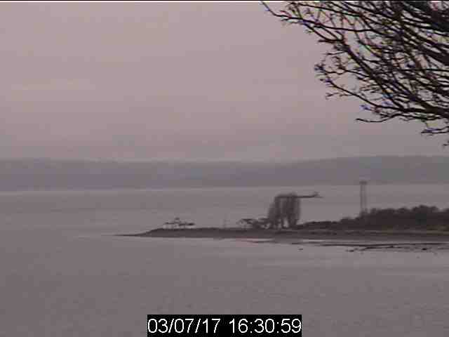 March 7, 2017, lowish tide, calm conditions
Learn more about my book Kayaking Puget Sound and the San Juans, 60 Trips. I also offer SUP and Kayak lessons available throughout the year at Salmon Bay Paddle. Questions about paddling on the Salish Sea, give me a holler anytime at salmonbaypaddle@gmail.com or 206-465-7167
Support the Washington Water Trails Association and the Cascadia Marine Trail. The wwta works to create and protect access for paddlers on Puget Sound as well as provide an extensive network of over 60 paddle-in camping sites - www.wwta.org
March 2, 2017
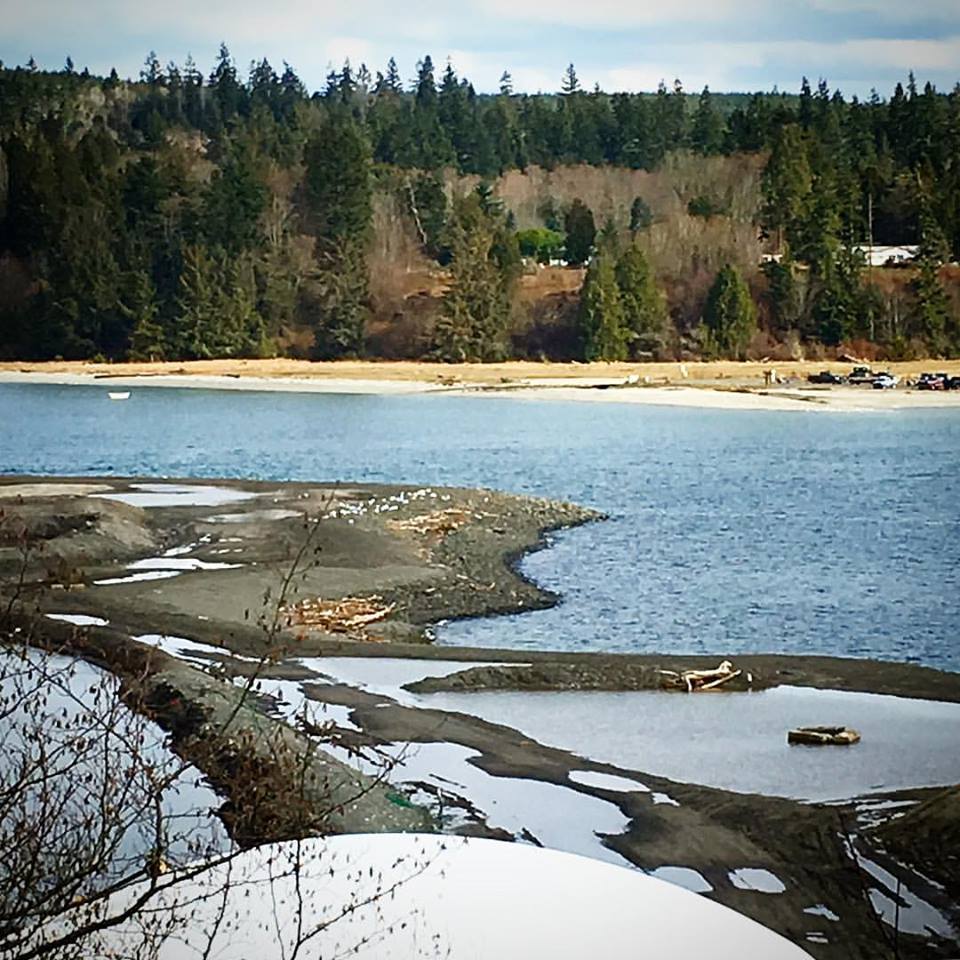
Beach Restoration of the Old Mill Site at Port Gamble - Trip #32
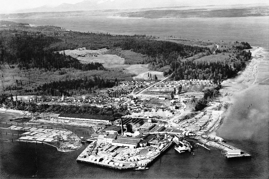 Old School viewLast time I drove on Highway 104 through Port Gamble, I got pretty excited to see that the old mill site is undergoing a transformation into a natural looking beach. A search resulted in info that the Washington Department of Fish and Wildlife (WDFW) will fund the restoration via a grant. See Below for details... (paragraph copied from here)
Once a big mill town owned by Pope and Talbot, the now restored charming town of Port Gamble is a roadside attraction for those driving to and from the Hood Canal Bridge in Kitsap County. A cafe, kayak store and a few other shops give visitors are good stop from traveling. I used to stop there to let the dog run on the big cemetery hill before or after long ferry waits at Kingston.
Trip #32 in the book
KITSAP COUNTY
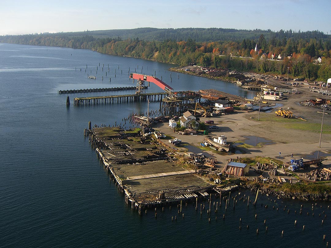 Before RestorationTeekalet and Port Gamble Restoration ($1,500,000)
Grant funding will be provided to the Port Gamble S’Klallam Tribe to work with Pope Resources and the Washington Department of Ecology to purchase the development rights of property at Port Gamble Bay and develop a restoration plan to restore coastal processes in the bay. The restoration plan, once implemented, will remove a significant portion of existing jetty, fill and rip rap to restore beach habitat. The restoration will enhance a toxics cleanup project at the mill site and bay.
Phase: Acquisition and design
Sponsor: Port Gamble S’Klallam Tribe
Contact: Roma Call (360) 297-9687
Other Puget Sound Restoration Projects
 Feb 2017
Learn more about my book Kayaking Puget Sound and the San Juans, 60 Trips. I also offer SUP and Kayak lessons available throughout the year at Salmon Bay Paddle. Questions about paddling on the Salish Sea, give me a holler anytime at salmonbaypaddle@gmail.com or 206-465-7167
Support the Washington Water Trails Association and the Cascadia Marine Trail. The wwta works to create and protect access for paddlers on Puget Sound as well as provide an extensive network of over 60 paddle-in camping sites - www.wwta.org

February 16, 2017
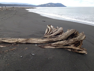
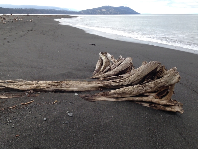
Elwha River Mouth - Washington's Newest Beach (Seattle Times article) Trip #40
I've had the opportunity to watch the Elwha River dam removals over the past few years. I surfed the river mouth pre-removal when the beach was cobble. Over the years, soft sediment began to not only cover the cobble but also extend the beach into the Strait several hundred feet. The sediment changed the river mouth from shallow reef style waves preferred by short boarders to sandy beach waves better suited for paddlers. Pre-removal, I was able to paddle up the river mouth nearly a quarter mile to a class 2 rapid, now the sediment has choked the mouth to where it's nearly impossible to make that trip. The sediment is so thick that you lose sight of your hand just below the water's surface.
Paddling the mouth is best at high tides when you can skim over shallow submerged sections of the delta. At low tides, you can paddle around the entire delta.
Be watchful of waves. The Strait can be flat calm, or not. Despite the differences in wave types, large waves can break on the west and north sides of the delta at any tide level. If you prefer a calm no wave day, use the following sites to forecast swell 4' or less, and no or little wind. A NW or W swell over 4' can deliver substantial waves to the delta. Or a strong W or NE wind (over 15kts). Use surf etiquette if other surfers are present.
Launch from Place Road (right fork) but be prepared for a 10 minute walk on gravel to the beach. Check out the book for additional launches. Trip #40
Read a great article on the post-release Elwha delta.. (posted 2/14/17)
Surf Forecast Sites I Use:
Surfwater.org - PNW surf forecasts
NOAA - Puget Sound to WA Coast Marine Forecast
WindAlert - Real time wind data
 Looking west towards Freshwater Bay and Striped Peak (courtesy of Doug MacDonald) / Seattle Times
February 6, 2017
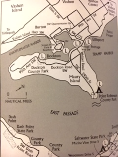
Portage - A Vashon Shortcut - Trip #11
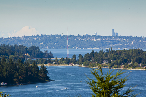 Portage from Maury Island, Seattle & Mt Rainier in backgrounIf you're paddling down Puget Sound from Seattle to Vashon Island, there's a long way around Maury Island, (SE Vashon) and a short way. The long way is over 8 miles from Tramp Harbor to the south tip of the island.
By portaging from Tramp Harbor over Portage, a narrow isthmus separating Vashon Island from Maury Island, the route through Quartermaster Harbor is only 4 miles in protected water.
Portage is approx 200 yards wide at high tide. Watch for speedy traffic. In Joel Roger's Water Trail book, a classic read, NW paddling guide Joel is seen crossing Portage during his epic paddle from Olympia to Pt Roberts following the Cascade Marine Trail.
The Shomamish People used Portage not only to shorten trips but to catch birds. By raising 300' wide nets, they would catch birds passing through the narrow gap.
Looking to rent a SUP on Vashon? Fat Cat Paddle Boarding operates during the summer on the south side of the point.
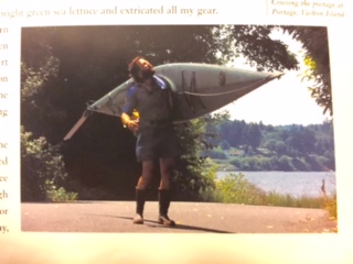 Joel Rogers crossing Portage
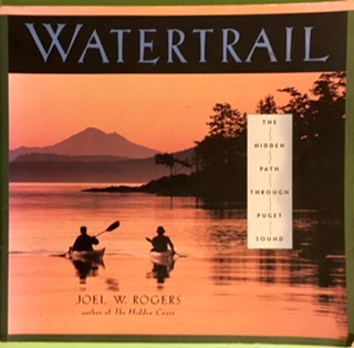
 ,
,
Rob Casey's Blog

Rob Casey isn't a Goodreads Author
(yet),
but they
do have a blog,
so here are some recent posts imported from
their feed.

