
Jennifer Bohnhoff's Blog, page 3
July 4, 2025
Walking the Wall: Day Two, Carlisle to Walton
This summer, my husband, four friends and I walked the English Heritage Trail that follows Hadrian's Wall. We began in the far west, at Bowness-on-Sol and walked east with the prevailing winds at our back. Our first day took us 15 miles, to the town of Carlisle.
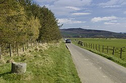
Because this section of the trail is very rural, we picked up lunch supplies at a grocery store in Carlisle before we set out. It was raining fairly hard as we were leaving Carlisle, and this caused a bit of difficulty. We needed to cross town to join the trail, and google maps was not very helpful in showing me which routes were just for cars and which routes were pedestrian friendly, nor did it show where fences barred the way. The rain didn't help, either. Every time a raindrop hit my phone's screen, the arrow jumped to it and I lost track off where I was! We added a little bit to what was supposed to be a short day by backtracking several times before we managed to get to the trail.

.jpg)
A riverside path took us along the banks of the River Eden until we reached Memorial Bridge, where we crossed and entered Rickerby Park. We passed a War Memorial before we left the park and entered the countryside. Like many of the monuments in Britain, both the bridge and the memorial are dedicated to thefallen of the First World War. This is a testament to how devastating that war was to the country, where approximately 880,000 men died. That amounts to 6% of the adult male population and 12.5% of those who were serving. In comparison, Britain lost only . 384,000 soldiers in World War Two.
 We followed the path past Carlisle Airport and many farms. The guidebook noted that one stretch, named Sandy Lane should have been named Clarty Lane, the word clarty being a local term for muddy. In one field there was the remains of an old tower, but the guidebook didn't provide any more information that the words "tower in field" to explain what it was. I fancied it an old outpost from the Norman era, looking for marauders coming down from Scotland.
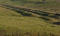
 As we neared Bleatarn Farm, the trail was slightly raised and arrow-straight. We were walking on the old Roman road! Bleatarn Farm is the site of an old Roman quarry. Its name mean Blue (blea) pond (tarn), and the pond that's mostly silted up is believed to once hold the fish used to feed the soldiers working in the quarry. Walking over history like this is eerie. I'm glad I had a guidebook that pointed out the shape of the landscape or I might never have noticed what I was walking through.
 The little town of Newton had an honesty-box snackshed that carried sandwiches and soups in addition to the usual cookies, chocolate bars, and drinks. We didn't eat there, but we did shelter from a squall that passed through, and we were grateful for the hospitality.
 Walton was only was only a little ways beyond Newton. It is a small town, and it was difficult to find room for six hikers there. We stayed in the a converted stable that had four bunk beds in a single room. It also had a little room with a fireplace, a kitchen, and a bathroom with a shower, toilet, and sink. The farm had a little more upscale accomodations, but they didn't sleep 6.
 Our accommodations weren't plush by any means, but they were cozy, and it was fun to meet the family who lived in the farmhouse. Diccon, the farmer, drove us into Walton and proudly pointed out that the gate in front of the village church was paid for by his grandfather. His twin toddlers were a delight to see mucking about the farmyard in their tiny wellies, and their dogs came and visited us in the bunkhouse. Dicon's father, Richard, enjoyed telling us stories about the old days.


And because it was my husband and my anniversary (45 years!) we stopped at
The Old Vicarage Brewery for a celebration pint. They have a bed and breakfast, and offer dinners and packed lunches to peoplewho stay with them.
That night we all slept soundly, excited that we'd finally see some above-ground traces of the wall on Day 3.


July 2, 2025
Walking the Wall: Things to See in Carlisle
 Carlisle is the biggest town along the western side of Hadrian's Wall, and is filled with great things to see. Its occupation goes way back to before the Roman invasion, when, according to a 6th century writer named Boethius, the area was a stronghold of the Carvetii tribe.
When the Romans came, they established a settlement called Luguvalium where Carlisle is today. The settlement is named after Lugus, a British/Celtic god whom Julius Caesar thought was synonymous with the Roman God Mercury. Most of what we know about Carlisle in Roman times comes from the writing of Tacitus. The ruins of a Roman fort, constructed in AD 73 out of timber, lies beneath Carlisle Castle. The fort protected a strategic location on the Roman road to the north and overlooked the confluence of the Caldew and Eden rivers.
By the early 2nd century, Luguvalium was one of several forts strung along the Stanegate, a road that
stretched from Carlisle to Corbridge. In AD 122, Hadrian visited the province and began the building of his wall. A new fort was built in the northern part of the Carlisle. Named Petriana after a 1,000-strong cavalry regiment that was housed there (the Ala Gallorum Petriana Petriana), it was the largest fort along the wall. There is an ongoing archaeological dig at the Carlisle Cricket Club that regularly unearths artifacts from the Roman period.
Because it is only eight miles from Scotland, Carlisle was an important military stronghold throughout the Middle Ages. Mary, Queen of Scots was imprisoned in its castle in 1568. When the Industrial Revolution began in the 19th century, it became a mill town boasting seven railway companies.
When we arrived in Carlisle at the end of our first day of hiking the wall, our first stop was at the Sands Center by Eden Bridge. That is where we got our second stamp on our passport. The Hadrian's Wall Passport is a fun souvenir, whose purchase supports the National Trail System, particularly the maintenance of the wall, its trails, and archaeological digs along the wall. Collecting the seven stamps available along the 84 mile journey can be a challenge!

We stayed the night in the County Hotel, which was conveniently located next to the train station and close to the bus station. While inexpensive, the hotel was old and a little shabby,but the real sticking point was thin, single pane windows that let in all thestreet sounds. There was a restaurant right under our room, and the voices andmusic continued until sometime after 2 in the morning.
Because we were afraid that tacking on sight-seeing after walking fifteen miles would be just too hard, we'd toured many of the sites in Carlisle the day before, when we were passing through on our way between Edinburgh and Bowness-on-Solway. Here are things I recommend:
If you are not staying in Carlisle, I recommend storing your luggage for the day to make sightseeing easier. We found a place just feet from the train station, so we didn't have to lug our things around.
 We picked up our English Heritage Passes at Carlisle Castle. The pass for overseas visitors is available for 9 or 16 consecutive days, and saved us a lot of entrance fees. You can buy it online and collect it at any of its sites, including the Castle. Carlisle Castle, built in 1092 by William Rufus, using stones from Hadrian's Wall, is still relatively intact. It now houses the Duke of Lancaster’s Regiment and the Border Regiment Museum.
We also visited the Carlisle Cathedral, which was free and had an interesting little museum down in its basement. One person we met along the way told me that Oliver Cromwell tore down some of the cathedral, and it was rebuilt later. If you walk around it, you will see that it definitely was built at different times. Some of the windows have round casements and some have pointed ones.
 I especially liked the choir area, which had richly carved seats.
 Our time in Carlisle was limited, and there were some places we missed, much to my regret.
The Tullie House Museum, which is named after the Jacobean mansion in which it is located, features exhibits on the Roman occupation of the region, Hadrian’s Wall, and the Border Reivers.
St. Cuthbert’s Church might have its origins before St Cuthbert's visit to Carlisle in 685. The Church stands square to the Roman Road and has a unique moving pulpit, a fourteenth century window, a window commemorating our hospitality to a Latvian Lutheran congregation, and a very attractive series of windows depicting the life of St Cuthbert.
The Guildhall Museum is which isbased in a 14th-century house and hosts exhibits related to the city’s 8medieval trade guilds, is closed until further notice.
Carlisle is one of the biggest towns along the Wall Trail, so it's a good place to do some shopping. One of our party needed new hiking poles, and there was an outdoor equipment store that had them. We also bought supplies for a picnic lunch at one of the grocery stores before we headed out to begin our second day along the trail.
As we left Carlisle, we passed two more sites that are worth a look. We took a riverside path along the
.jpg)
banks of the River Eden until we crossed at the Memorial Bridge, a lovely old suspension bridge. We then entered Rickerby Park, where a War Memorial dedicated to the fallen of the First World War sits close by the trail.
We continued walking. On this, our second day on the Hadrian's Wall Trail, we encountered some rain, but we were determined to make it to Walton by nightfall.
June 26, 2025
Walking the Wall: Day One, Bowness-on-Solway to Carlisle
 In June 2025, my husband, five friends, and I walked the length of Hadrian's Wall. We'd decided to walk west to east, with the prevailing winds at our backs, and so we'd taken a bus to Bowness-on-Solway the evening before and spent the night at the Shore Gate House, a lovely B&B run by Dave and Lucy, two of the kindest people you'd ever hope to meet. After an excellent full British breakfast in their sunny dining room, we headed out to begin our walk.
 The reason Bowness-on-Solway is the western end of the Hadrian’s Wall Trail is that it was where the wall ended. Defenses continued for another 40 miles down the coast, but although there were turrets and a milecastle, there was wall. A Roman fort called Maia controlled this western terminus of the wall. It was the second largest fort on the Wall,boasting an area of 5.8 (some sources say 7) acres, and was 616 ft. long and 420 ft. wide. The first fort was, like the wall in this area, built of turf and wood. Both the fort and the wall were later rebuilt in stone. Maia was an important fort, because it guarded the western shore and is at the furthest western point that the Firth can be forded. The fort is almost completely buried under the modern village and there are no visible remains.

.JPEG)
Our first stop was at the Banks Promenade, where we got our first stamp on our National Trail Hadrian's Wall Passport and took our starting picture. We had to take a selfie, which is no mean feat for a group of six, because there was no one around to take our picture. Then we began our longest day -- a walk of close to 16 miles.
The first part of the walk was along the coast of the firth, and we saw some signs warning us that the road could be under a foot of water during high tides. (Dave, our host in Bowness has assured us that the water wouldn't get close to the road, and he was, to our great relief, correct. We did see cattle being herded along the waterfront, and could look across the water to Scotland on the other side.

Sometime of the trail was along roads and some went through fields. The trail got quite muddy in places, but we were never lost. Hooray for good signage! As long as we saw an acorn, we knew we were going in the right direction.


We passed through the hamlet of Drumburgh (pronounced Drum Bruff), where we encountered our first Honesty Shack. Honesty Shacks are little places set up by the locals that offer hikers snacks. Some (like this one) have a roof so it’s a respite from the rain and a few (like this one) have a toilet and a sink for filling water bottles. Others are nothing more than a cooler set out by the curb. None of them are manned: they trust you to be honest and put some money into a provided tin if you eat something. There are honesty shacks all along the first half of the walk, and I found them enchanting.

Drumburgh also has a castle, which is really not a castle at all. It's a 14th century apele, or tower house. These were built to protect people and their good from reivers, people who came from over the firth to steal. It has extremely thick walls built with stones taken from Hadrian’sWall, and the first floor was used as a barn, to protect cattle.


We ate our sack lunches on a picnic table in a park in Burgh-by-Sands, a little town with a lot to recommend it. The Greyhound Inn was right next to the park, and looked to have nice offerings. Also in the park was a statue of Edward I of England, sometimes called "The Hammer of the Scots." Bus 93 passes through, so people who are too tired to go on can catch a ride back to Carlisle or to Bowness-on-Solway. Burgh-by-Sands was once the site of a Roman fort named Aballava, but all its stones have been taken and used in other building projects.
Next, we stopped at St.Michael’s church, which is largely built of stones from Hadrian's wall. It is also where King Edward's body lay after he died in 1307 while on his way to war against the Scots.


Sometime after that, the firth narrowed into a river, which we followed into Carlisle. It was a pretty walk, and we could tell by traffic noises that we were leaving the country and coming into an urban area. We walked through a nice city park in the last few miles, and ended at the Sands Center by Eden Bridge, where we were able to get our passport stamped once again.
We were tired by the time we got to Carlisle, and we knew that the next leg of our journey was also a long one, so we were glad that we'd seen the sites in this lovely town before we began our wall walk.
Jennifer Bohnhoff is a retired middle school and high school English and History teacher, and the author of 13 novels. Most of her writing is historical fiction and is written for middle grade readers and above. She is currently at work on a story set in Roman Britain.
June 21, 2025
Walking the Wall: Getting to the Starting Place

When I was in the fourth grade, I read a book by Rosemary Sutcliff entitled The Eagle of the Ninth, a Young Adult novel set in Roman Britain one generation after Hadrian's Wall was built.Sutcliff based her story on the question of the Ninth Legion, also known as Legio IX Hispana, who were assigned to the northern provinces, and founded the cities of York, Leicester, and Lincoln before mysteriously disappearing from the historical record. She uses one theory for their disappearance, plus the 1866 discovery of a Roman sculpture of an eagle in the town of Silchester to craft a story about Marcus Flavius Aquila, a young Roman officer who chooses an assignment in Britain so that he can discover the truth about his father, who disappeared when he was very young. Disguised as a Greek oculist and accompanied by Esca, his British freed ex-slave, Marcus travels beyond Hadrian's Wall in an attempt to learn the truth and recover the Lost Legion's gilded bronze eagle so that it can no longer serve as a symbol of Roman defeat – and thus be a danger to the frontier's security. This book piqued my interest in Roman Britain and the Iron Age, and made me want to explore the frontier between England and Scotland.
This summer, I finally got to fulfill that long held dream. After fifty five years, I finally got to hike the length of Hadrian's Wall. (What and where is Hadrian's Wall? Click here to find out.) I was joined in this grand adventure by my husband, two women who are hiking buddies of mine back home, and their husbands. I began planning the details of the trip eight months before we finally boarded a plane and began the adventure.
One of the first decisions I had to make was which direction we were to hike the 84 mile trail. Traditionally, people begin at Newcastle and hike west to Bowness-on-Solway, because that is believed to be the direction in which the wall was built. The milecastles, little fortlets that are built into the wall every mile, are numbered from east to west. Besides, getting to Newcastle is easy. It is a big city, and a hub for rail travel. It has an airport, and buses also come through, going in all four directions. However, I'd read that the prevailing winds came from the west, and that the views of the craigs, the most picturesque and dramatic scenery along the wall, was more stunning when seen looking east. So I chose to hike west to east, beginning at Bowness-on-Solway.

 Getting to Bowness-on-Solway, a little village that has just over a thousand people in it, was a bit harder. Located in Cumbria, the historic county of Cumberland, it lies on the southern side of the Solway Firth. Across the water lies Scotland. The nearest sizable town is Carlisle, some 15 miles to the east. We flew into Edinburgh, then took a train from Edinburgh's Waverley Station to Carlisle. The cost of tickets on the three carriers varies widely, and it is both advisable and cheaper to purchase them in advance. The 73 mile train trip took about an hour and a half.
 From Carlisle, we could either take a bus or a taxi to Bowness-on-Solway. We chose the bus, since it cost £3 and a taxi (which we would have needed two of since there were six of us with luggage) can easily amount to £30. We had a few hours to kill before our bus was to depart, so we we stowed our luggage in a hotel close to the train station, using an app called Stasher and saw a few sites, which I'll share in a future blog.

Our bus ride proved to be quite the introduction to rural British roads. It's unsettling enough to be traveling on what feels like the "wrong" side of the road, but when the road is barely wide enough, it's really unnerving, especially when the traffic going the other way seems to be coming right at you. Tall hedges bounded the road, making some of the travel feel like it was going through a green tunnel.
Fortunately, there were wide places in the road every so often, and drivers seemed to know exactly
where they were, so they could dart to the side as the bus barreled toward them. The only time the bus had to stop was for a herd of cows that didn't seem to understand that the bus outranked them. The bus driver waited patiently for the cows to move before hurtling on. Look closely and you can see the cows peering in the front windshield of the bus while my friend Caryl, who was right in front of me, laughs about it.

We arrived in Bowness-on-Solway in the early evening and checked into Shore Gate House, a B&B in a beautifully preserved 17th century mill house that sat right on the water's edge. All six of us have agreed that this was the finest lodgings of the entire trip. The rooms were clean and well appointed, and each had its own bathroom. David and Linda were the kindest of hosts. David let us in, then sat us in a front parlor, where he gave us each a cup of tea. He sat with us and discussed our plans, giving us advice, especially about meals along the trail. His advice proved spot-on and saved us from having to go hungry more than once. He even called ahead and secured tables for us.
 We had dinner that night in The King's Arms, a very traditional English pub, and then we wandered through the town, taking in its quaintness and making sure we knew exactly where to start the next morning. Bowness is a town with a lot of history. Maia, the last of the forts along Hadrian's Wall was here. After the Romans left, its inhabitants were frequently raided by Scots who'd crossed the firth, and they in turn raided the Scots. Now, it is a sleepy and peaceful place.


 My traveling buddy Jane, reading a sign that describes the life of a Roman soldier, and standing on the shore of Solway Firth just after sunset. It was low tide. At high tide, she would have been waist deep in water.
 As I slipped into bed that night, I felt that I had made the right choice in starting out from this magical place. I couldn't wait for morning, to begin the trek I had wanted to do for so long.
Jennifer Bohnhoff is a retired middle school and high school English and History teacher, and the author of 13 novels. Most of her writing is historical fiction and is written for middle grade readers and above. She is currently at work on a story set in Roman Britain.
June 5, 2025
Places to go to Experience the Civil War in New Mexico
Places to go to Experience
the Civil War in New MexicoA lot of time has passed since the Civil War moved through New Mexico. During that time, the Rio Grande has moved its bed, obliterating the old battlefield. Asphalt roads have been laid down where trails used to be. Old buildings have been torn down and replaced by others. All this makes it impossible to see that a soldier might have seen back in the 1860s, but there are still places a interested person can go to see what this period might have been like. Here are a few suggestions. Call ahead to make sure that sites are open.
In Texas
The Military Forces Museum in Austin is housed in a 1918 mess hall and features thousands of war relics and historic photos representing every war from Texas Independence to the present. 512-782-5659
The Institute of Texan Cultures in San Antonio has exhibits about the different cultures that have come together in Texas. They have a small exhibit of Civil War artifacts. 210-458-2300.The route that Sibley took to get to New Mexico roughly follows I-90. The Army of New Mexico did not stop at Fort Lancaster, which is located near the town of Sheffield, near I-10, but the ruins of the fort are open and a good example of the kinds of forts that were in Texas at the time. 432-836-4391. Farther west, Fort Davis also has a self guided walking tour. 432-426-3224. Old Fort Bliss is a reconstruction of the adobe fort that existed at the time of the Civil War, and is open for tourists. There is also a military museum at the newer portion of Fort Bliss that has artifacts and exhibits. 915-568-4518 or 915-588-8482.In New Mexico
It wasn’t there at the time, of course, but when Sibley invaded New Mexico, he largely followed what is now the 1-25 corridor. Here are some places where you can see places mentioned in this story. Call ahead to verify that sites are open.
Old Mesilla was the Confederate western headquarters. Located south of Las Cruces, you can visit the plaza, where the Confederate flag hung. There are Civil War artifacts in the Gadsden Museum, which is located at 1875 W Boutz Rd in Mesilla 575-526-6293.
San Augustin Spring, where Major Isaac Lynde surrendered the garrison of Fort Fillmore to Confederate Lieutenant Colonel John R. Baylor, is just over 14 miles east of Las Cruces on I-70. The springs are not easy to access, but the drive up to San Augustin Pass helps explain why Lynde’s men were struggling in the summer heat, and the view of White Sands and the Tularosa Basin is spectacular.
 Ft. SeldenThe Army didn’t create Fort Seldon until 1865, but the Confederates created Camp Robledo there in 1861 to protect the northern entrance of the Mesilla Valley. The present-day State Monument has displays and self-guided tours that reflect 19th century military life, with a focus on the Buffalo Soldiers and Douglas MacArthur, who lived at the fort when he was a young boy. 575-526-8911.
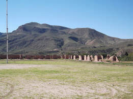
Only the bottom few feet of some adobe walls, the remnants of the stone jail, and some mounded dirt is all that’s left of Fort Craig, but the National Historic Site offers brochures and self-guided tours. 575-835-0412 From here, the Mesa de la Contadera looms up in the north, making it clear where the battle was fought. The actual battlefield is on private land and is inaccessible except by private tour. The Geronimo Springs Museum, in Truth or Consequences, has hosted these tours in the past. (575) 894-6600.
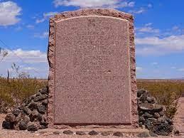 Close to the battlefield, on the west side of the Rio Grande is a Civil War Monument, erected in 1936, that honors the Confederate men and Texas Mounted Volunteers who died at the Battle of Valverde. To see it, take the San Marcial Exit off I-25 (A85) and go east. The monument is right near the entrance to the Armendariz Ranch. San Marcial, a small town built after the Valverde battle which is now a ghost town, is nearby. The town of Valverde, which was already abandoned by the time of the Civil War, was across the river from San Marcial.
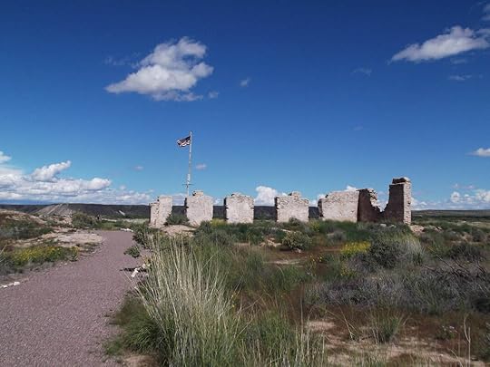
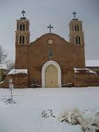 In past years, Socorro sponsored a reenactment of the Battle of Valverde on the weekend closest to the February 21 anniversary of the battle. The town also sponsors several historic walking tours that visit period houses around the plaza. 575-835-0424 The San Miguel church is also on the plaza. Both Pedro Baca and Manuel Armijo are buried there. (575) 835-2891. Some Civil War information can be viewed at the BLM office. (575) 835-0412 in Socorro.
 Alfred Petticolas, a Confederate sergeant, sketched this picture of the Confederate flag flying in front of Albuquerque's San Felipe Church when southern troops occupied Albuquerque from March 2 to April 12, 1862. Albuquerque’s Old Town plaza no longer flies the Confederate flag (it was finally taken down in the early 2000s), but two cannons remain near the grandstand. The cannons are replicas of two of the eight cannons which the Confederates buried in a stable behind the church so they could use the guns’ carriages to carry supplies. The cannons were dug up in 1889.
 They are also said to have buried some of their dead – casualties of battle or illness – in Albuquerque, but no Confederate graves ever have been found in the Albuquerque area.
 The National Cemetery in Santa Fe was created in 1867 as a result of John P. Slough's efforts to have proper burials for the soldiers killed at Glorieta. The first interments at the cemetery site were the remains of 265 U.S. soldiers taken from the battlefields of Glorieta, Kozlowsky's Ranch, and Fort Marcy. Later, the remains of five Confederate soldiers were removed from the Masonic Cemetery and reinterred in the Santa Fe National Cemetery. The cemetery also has the reinterred remains of soldiers from Fort Craig, which date from the Civil War era and include many Buffalo Soldiers from a later period. Captain James (Paddy) Graydon is buried in plot 9, C474. The cemetery also has a monument honoring the remains of 31 Confederate soldiers who were discovered in a mass grave on the site of the Glorieta battlefield on June 23, 1987 and were reinterred at the Santa Fe National Cemetery on April 25, 1993.
 Some of the heaviest fighting during the Battle of Glorieta Pass occured at Pigeon's Ranch. Built around 1857 by Alexander Vallé, a Frenchman known as Pigeon for his dancing style, this house is all that remains of his 23 room establishment that was a popular place to stay along the Santa Fe Trail. From 1926 to1937, when Route 66 passed right beside the house. it became a popular roadside attraction. All that remains is a single building which huddles, forgotten, along NM HW 50 just west of Pecos, New Mexico. The “Oldest Well in the U.S.A.” is still across the road from the ranch house. Pecos National Park holds what had been Kowzlowski's Ranch, where the Union made its headquarters for the Battle of Glorieta Pass. Their museum has some exhibits about the battle and, in the past, a Union and Confederate camp has been set up on the weekend closest to the date of the battle. A 2.3 mile Civil War Battlefield Trail can be accessed by checking in at the Visitor Center and getting a gate code from a ranger.
Planning to walk the Civil War Battlefield Trail? Here's a guide that supplements the one the forest service can sell you.
May 28, 2025
The Burning Season

I recently read a new release entitled The Burning Season, by Caroline Starr Rose, and wow! If every fourth grade classroom in New Mexico doesn't stock this book, they're missing out.
The Burning Season is an emotionally charged, free verse, middle grade novel. The words are spare, the text short, making it an ideal high-low book that will be accessible to all readers. And while it may be an easy read, it is an impactful one with plenty of emotional weight and heart-pounding action.
The Burning Season is about Opal Gloria Halloway, who wishes she didn’t have to follow in her grandmother and mother’s footsteps and become a fire lookout on Wolf Mountain in New Mexico’s Gila Wilderness. The three live in a single room at the top of a fire tower and are responsible for spotting smoke. Problem is, since her father died in a fire before she was born, the twelve-year-old is and has always been deathly afraid of fire.
Opal wishes she could live in Silver City, the town that's closest to where she lives. There, she could attend seventh grade, and join FFA and other after school activities with kids her own age. Out at the lookout, she feels isolated and alone.
One day, when her Mom had made the long trek to town for supplies and her Gran is off somewhere, Opal spots a spiral of smoke moving up the mountainside. She’ll have to gather her courage as she heads into the woods, beyond Wolf Ridge’s old blackened burn scar, to face down a fire on her own. Can she be brave enough when it really counts?
This is a beautiful book, and so current now, when much of the western half of the United States is facing threats from wildfires. I highly recommend it.
May 21, 2025
What is Hadrian's Wall?
 Hadrian's Wall is a stone wall that spans the English countryside and (basically) separates England from Scotland. Beginning in the east on the River Tyne, it stretches all the way to the Solway Firth in the west, a distance of 80 Roman miles, or nearly 73 modern miles. Hadrian's Wall served as the northern boundary of the Roman Empire in Britain, but it was not the limit of Roman influence.
Romans first arrived in Britain in 55 B.C., when Julius Caesar landed two legions on the coast of Kent. He returned the following years with 800 ships, five legions and 2,000 cavalry. This time, he managed to force the British warlord Cassivellaunus to pay tribute to Rome and he set up a client king named Mandubracius, of the Trinovante Tribe. Caesar included accounts of both invasions in Commentarii de Bello Gallico, or his Commentary on the Gallic Wars. This text contains the earliest surviving significant eyewitness descriptions of the island's people, culture and geography.
 The true conquest of Britain began in earnest in AD 43 under Emperor Claudius. By AD 87, most of what we now call England, Cornwall and Wales was under Roman control. In the north, a Roman road known as the Stanegate marked the northern boundary of the Empire. Stanegate, which means "stone road" in a Northumbrian dialect, is not the original, Roman name of the road, which has been lost to history.
The road is believed to have been built under Governor of Agricola, from 77 to 85 AD, during the reigns of the emperors Vespasian, Titus, and Domitian. Along the Stanegate, forts, including Vindolanda (Chesterholm) were spaced at one-day marching intervals, or 14 Roman and 13 modern miles. Corstopitum (Corbridge) and Luguvalium (Carlisle), guarded important river crossings.
Something happened in 119 AD that challenged Rome's authority over her northern border. Although information is scant and sketchy, it appears that a local rebellion led to the deployment of Legio VI Victrix to assist in suppressing the resistance.Soon after, Legio VI Victrix replaced the Legio IX Hispana in their quarters at Eboracum (York). No one knows what happened to the IX, but a vague correspondence between an ancient historian named Fronto and emperor Marcus Aurelius describes the strength of the Celtic forces and how many Roman soldiers lost their lives, and may refer to something that happened during this period. The Ninth Legion disappears from the historic record about this time, but whether they were annihilated in a battle with a British tribe or transferred out of Britain is a mystery. In the 1800s,German historian Theodor Mommsen theorized that the Celts in northern England, particularly the Brigantes, caused the demise of the Ninth . In her bestselling novel, The Eagle of the Ninth, British author Rosemary Sutcliff suggested that the Ninth fell victim to the wilderness and native hostility beyond Hadrian’s Wall. I read this historical novel when I was in the 4th grade and credit it with my love both for historical fiction and for Iron Age Britain.
.jpg) Whatever happened, British Governor Quintus Falco invited the Emperor Hadrian to visit Britain, in 122 and that led to the building of the wall about a mile north of the Stanegate that bears Hadrian's name. Perhaps Hadrian's Wall was built so that there would be no more disasters like the one that might have befallen the Ninth Legion. Perhaps the wall is just a massive monument to the power of Rome. Whatever it was intended to be, it is an impressive architectural feat.
Whatever happened, British Governor Quintus Falco invited the Emperor Hadrian to visit Britain, in 122 and that led to the building of the wall about a mile north of the Stanegate that bears Hadrian's name. Perhaps Hadrian's Wall was built so that there would be no more disasters like the one that might have befallen the Ninth Legion. Perhaps the wall is just a massive monument to the power of Rome. Whatever it was intended to be, it is an impressive architectural feat. The wall spans the width of northern England. It served both as a defensive fortification and as a customs facility, regulating trade and travel between the Roman provinces and the outlying areas. Gates we now call milecastles, since they were spaced about a Roman mile apart, contained garrisons that housed a few dozen men. In between each pair of milecastles were two towers, also staffed by soldiers on patrol along the wall.
The wall took six years to construct. The wall was not the same consistency throughout. In the west, the wall was 11 feet high, 20 feet wide, and made mainly of turf. In the east, the wall was 15 feet high, 10 feet wide, and made of stone. The construction of the wall was not a "one and done" prospect, and there is evidence in the stonework that the wall's configuration, including that of the milecastles and watchtowers along it, were often reconfigured. Some historians believe that the wall had crenelations along it. Others believe the walkway was exposed. There is also some evidence that the wall was whitewashed. What a statement a long, white ribbon of stone would have made as it wound itself through the hills!
The Wall was not built by slaves or by local people, but by the army. Keeping soldiers busy with building and road projects was one of the ways Rome kept its soldiers strong, healthy, and out of trouble. Legio II Augusta, Legio VI Victrix, and Legio XX Valeria Victrix left many inscriptions along the wall, demonstrating which sections they had worked on. Each legion consisted of about 5,000 infantrymen. There is evidence that auxiliary units – the other main branch of the provincial army – and even sailors from the Roman British fleet helped on some portions of the wall. While they built the wall, the Legions did not occupy it. Once they had finished construction, Legio II Augusta moved to their base at Isca Augusta (modern Caerleon), Legio VI Victrix to its base at Eboracum (York), and Legio XX Valeria Victrix to Camulodunum (Colchester), leaving maintenance and garrisoning of the wall to the auxiliary forces.About 10,000 soldiers filled the 14 forts along the wall, including cavalry units of 1,000 troops stationed at either end.

The western and eastern portions of the wall have largely disappeared over time, with many of their stones being pilfered for medieval and modern building and road projects. Although the road projects have been covered in asphalt and cannot be seen, there are many houses and churches along the wall that have stones whose inscriptions show they were clearly once part of the wall. Much of the center portion of the wall, which runs through wilder and less populated land, still stands.
 The wall and its milecastles and watchtowers does not stand alone. A large earthen rampart-and-ditch combination called the Vallum runs south of the Wall. This earthwork had a ditch that was 20 feet across and 15 feet deep. Archaeologists are still not certain what the purpose of the Vallum was, but it might have been the southern boundary of a military zone that included the Wall and the series of defensive ditches and berms on the northern side of the wall.
 Hadrian's Wall was not the limit of Roman influence in Britain. When Hadrian died in AD 138, his successor, Antoninus Pius moved the frontier north to the Forth–Clyde isthmus and built a new, turf wall. Later, four advance forts, each holding a 1,000-strong mixed regiment of infantry and cavalry, an irregular unit, and scouts were built north of the Wall. Hadrian's Wall continued to be occupied by the Romans for nearly 300 years, and the remains continue to awe visitors.
May 1, 2025
More on Medallion Trees
A couple of years ago I wrote about Medallion Trees in the Sandia Mountains. Last week, I went on a hike on which I came across four more medallions.
Medallion trees have an aluminum or brass or steel washer attached to them. These medallions are about 1½ to 2 inches in diameter and cover a hole where a core sample was taken. The core sample helped determine the germination date, or GD of the tree. Whoever took the sample then found an historic eventthat corresponded with that date and stamped in on the medallion. Some of the medallions include other information, including the type of tree. No one knows who created the medallion trees, or if they do, they aren't sharing that information. There are at least 84 medallion trees in the Sandias, although the numbering on some of the medallions suggest that there used to be over 100.
The hike I was on went along a trail that is sometimes called the North Faulty Trail and sometimes called the Mystery Trail. Like the medallions, no one knows who blazed this trail that begins near the Doc Long Picnic area and goes all the way to Sandia Man Cave. The trail is well traveled and well cared for despite the fact that the Forest Service does not recognize it or maintain it. It is one of the more level of the trails in the Sandias, which made it a good one to pick while I trained to walk along Hadrian's Wall, and event I've planned for June 2025.
 The first tree I came across was the Grimms Fairy Tales Tree. Marked as #126, this ponderosa pine had a germination date of 1812. The tree is named for the publication of Grimm's Fairy Tales, a book of German folktales compiled by Jacob (1785-1863) and Wilhelm (1786-1859) Grimm, two academic brothers who collected stories from the people. Cinderella, Hansel and Gretel, and Snow White are all part of this collection.
A little father along the path I came to a tree with a medallion that identified it as the Edward VI King of

England Tree. The medallion on this pinyon pine included no additional information, but a website says that this is tree #43 and the medallion was places in 1999, so I wonder if this is a replacement medallion. The website also had a GD of circa 1556. Edward VI was the only surviving son of Henry VIII. Born to Henry's third wife, Jane Seymour, Edward became King of England and Ireland on 28 January 1547, when he was only nine years old. The first English monarch to be raised as a Protestant, he died in 1553.

The Edward VI tree was a little bit off the trail, down a rather steep slope that was covered with dangerous stones that could roll away underfoot. The difficulty of the short walk is what prevented me from getting a good picture of the medallion that was on the Bloody Mary Tree. This pinyon pine was just a stone throw's away. This tree, marked as #44, also has data that was put on the tree in 1999. Also known as Mary I or Mary Tudor, she was the half sister of Edward VI, so it is fitting that their trees stand close to each other. Queen of England and Ireland from July 1553 and Queen of Spain as the wife of King Philip II from January 1556 until her death in 1558, she tried to bring Great Britain back into the Catholic fold.

The final tree I saw on my hike was the Anne Boleyn Beheaded Tree. This tree has a GD or somewhere around ~1536, and is tree #99. Anne Boleyn was the second wife of Henry VIII, and the mother of Queen Elizabeth. She was beheaded in 1536, after which Henry married Jane Seymour.
If you only knew about these trees, you might assume that most are tied in with British history. This isn't really the case.
Who created the medallion trees is a mystery. So is who created the North Faulty Trail. While I may not know who these intrepid and interesting people are, I am grateful for the work they have done in the Sandia Mountains, for they've made the world a more interesting place in which to roam.
April 24, 2025
Finding the Clovis Culture
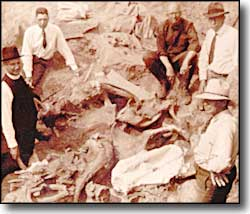 In 1926, when scientists from the Colorado Museum of Natural History found a stone projectile point imbedded in the rib of a bison antiquus, a large predecessor of modern American bison, changed the whole time frame for human habitation in North America.
 That point, found near the town of Folsom, in north eastern New Mexico, proved that early man had been hunting bison as far back as 9,000 B.C.E., 7,000 years earlier than previously thought. But that find was just the first of many that have pushed back our understanding of when humans came to the Americas. The hunt for the earliest American was on!
 As news of the Folsom find began to spread, people started taking an interest in old bones found in the ground. One of those was a 19 year old Eagle Scout from Clovis, New Mexico. His name was James Ridgely Whiteman.
One day in February of 1929, Whiteman was walking along Blackwater Draw, an arroyo between Clovis and Portales. In a letter he wrote to the Smithsonian Institution, he said he found fluted points in association with mammoth bones.
Mammoths weren’t alive at the time of the Folsom kills. If Whiteman was right, his find was even older.
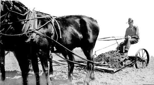
No one paid much attention to Whiteman's letter, and the discovery he had made in Blackwater Draw went unexplored. In 1932, a horse-drawn scraper that the highway department was using to collect gravel for a road project uncovered a huge pile of bones right where Whiteman had said they were.
 The next year, Edgar B. Howard, an archeologist from the University of Pennsylvania, began a four year excavation of the site. He and his colleagues found ancient spearheads, stone tools, hearths, and evidence of almost continuous human occupation at the site dating back 13,000 years. He named these people the Clovis people, after the nearby town of Clovis, New Mexico.
Howard concluded that Clovis people camped on the west side of the lake, where they could have a view of the surroundings. They didn’t seem to camp for long periods before they moved on to other places. If there were no mammoths around, they hunted smaller game.
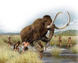 Blackwater Draw was an animal trap. Hunters waited until mammoths and other animals got trapped in the mud at the edge of a lake, then attacked them. Scientists have found other animal bones, too: Bison, saber toothed tigers, ambelodons, large ground sloths, peccaries,and dire wolves. Some might have been hunted, but others died of natural causes, got caught in the mud, or were killed by other animals.
 By the time of the Folsom Culture, there were no ground sloths, ambelodons or mammoths left, but they hunted at Blackwater Draw, too. Artifacts indicate that they tended to camp on the Northwest edge of the lake, where they could look for approaching herds of bison. Archaeologists can tell that Folsom groups stayed longer than the Clovis groups had, but they, too, moved on once they had skinned and butchered their bison.
One reason people did not remain at Blackwater Draw is that there is no good stone for making points in the area. The stones for points found at Blackwater Draw were brought from other places, including Alibates (near Amarillo, Texas), the upper Colorado River in Colorado, the Valles Caldera in New Mexico's Jemez mountains, and the Sangre de Cristo mountains, north of Santa Fe. The distribution and number of points help archaeologists determine how early man traveled throughout the area.
Today, there is a building sheltering the kill site at Blackwater Draw, which is part of the Blackwater Draw National Historic Landmark. The bones lay on many levels, showing the large period of time in which this site was an active hunting area. The different levels are clearly marked. Down the road is an excellent museum, and camp sites are available at Oasis State Park, which is a little more than four miles away.

A former middle school Social Studies and English teacher, Jennifer Bohnhoff is now a full time writer of historical and contemporary fiction for middle grade through adult readers. Her middle grade novel, In the Shadow of Sunrise, tells the story of a handicapped Folsom boy who is on the verge of manhood and learning his strengths.
April 16, 2025
Readings in Prehistory for Middle Grade and Adult Readers
If you ask nearly anyonefor a recommendation for a book set in prehistoric times, you’ll likely hear Clan of the Cave Bearmentioned. The first of Jean M. Auel’s six book Earth's Children series waspublished in 1980 and is still popular today. Set around 30,000 years ago, ittells the story of Ayla, an orphaned Cro-Magnon girl who is adopted and raisedby a tribe of Neanderthals. It is a coming-of-age book, but beginning with thesecond book, the explicit romantic sex makes it inappropriate for middle gradereaders. That is not to say that there are no books set in prehistoric times thatare appropriate for middle graders. Here are a few recommendations:
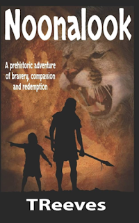
Set in Western Europe35,000 years ago, Noonalookis the story of a man who used to be great within his clan, but age anddisability has shoved him into the forgotten fringes of society. When a raidingparty leaves behind one of their young boys, Noonalook decides to return him tohis people. This story is unusual for a middle grade novel, as most stories inthis niche feature protagonists that are in their early to mid teens. Thedialog is often limited to indecipherable strings like "Sundu, gello narnodum. Stedona mellekon" and the like. While I understand when outsidersspeak gibberish, I wonder when it comes out of the mouth of our POV character.Shouldn't we readers be able to understand his words just as much as histhoughts? Self-published, it has a handful of errors.
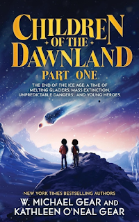
Childrenof the Dawnland is the first in a two book series by authors W. Michael Gearand Kathleen O'Neal Gear. Set at the endof the Ice Age, it tells the story of atwelve-year-old named Twig, who feels compelled to supress her spirit dreamsthat act like premonitions. When her village is attacked by an enemy people,Twig and her companion, Greyhawk, escape and begin a journey to find the caveof the reclusive witch-woman, Cobia, who might be able to interpret her dreamthat a green light is going to explode from the sky and destroy the world. Wellwritten, well researched, and exciting, I recommend this book highly.
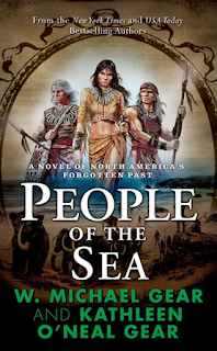
The Gears areamong those rare authors who can write both for adults and for children. If youare an adult and Children of the Dawnland appeals to you, I recommend People of the Sea. Set twelvethousand years ago, in the Sierra Nevada, the people are facing the end oftheir way of life and the glaciers melt, destroying the habitat of themastodons. The people wonder why the Spirits are taking away the animals theydepend on, and their fear is compounded when a beautiful woman arrives, fleeingfrom her abusive husband.
This novel is part of a series that progresses throughcenturies, from the first arrivals in the Americas through the coming of Europeans.The Gears, who are both writers and archaeologists, are probably the leadingexperts on early man in the Americas, and their books, both for children andadults, are depict the prehistoric world accurately and interestingly.
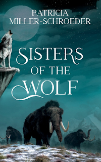 Patricia Miller-Schroeder’sSisters of the Wolf isa buddy journey novel, set in Ice Age Europe and featuring two girls in a questto escape a deranged, power-hungry kidnapper and return to their families.Keena is a Neanderthal and Shinoni a Cro-Magnon, but they must join forces tomake it through a dangerous Ice Age landscape filled with predatory animals,earthquakes and icy rivers. The cooperation doesn't just extend between races,but between species as the girl ally themselves with wolves, mammoths andhorses in their race to escape. This is a book that middle grade readers willlove, especially if they are looking for strong female protagonists, but itslips into fantasy a bit too much for my tastes. I just can’t buy their ridingmammoths and the like.
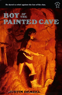
Justin Denzel’s TheBoy of the Painted Cave tells the story of the artistic Tao, who lives asan outcast because he’d rather paint wild bears and woolly mammoths than huntthem despite the fact that he is not one of the Chosen Ones who can be cavepainters. Alone in the wilderness, he makes allies of a wild wolf dog named Ram and the mysteriousGraybeard, who teaches him the true secret of the hunt. This book realisticallydepicts the prehistoric world.
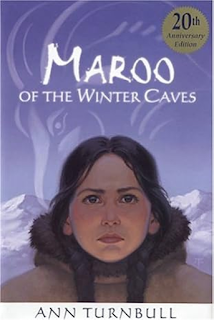 First published in 1984,Ann Turnbull’s Maroo of the Winter Caves, is a classic that
deserves tocontinue being read. Set in southern France during the last Ice Age, it tellsthe story of a girl in the Madeleine people, a group of semi-nomadic hunter gatherersthat lived in Europe 17,000-12,000 years ago. When multiple tragedies strikeher small band, Maroo and her younger brother Otak must leave her family andstrike out on their own to get help. Their route, over the mountains during ablizzard, is fraught with danger. I really appreciated how historicallyaccurate this book is. There was no magic, no fantasy silliness. The people'sspirit beliefs were believable. This is a short and easy read for youngermiddle grade readers who want to experience what life might really have beenlike.
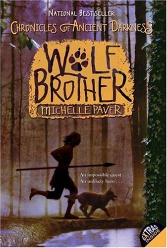 Wolf Brother is the firstbook in a series entitled the Chronicles of Ancient Darkness. Michelle Paver’sstory takes place in Europe six thousand years ago. Twelve-year-old Torak andhis wolf-cub companion journey through deep forests, across giant glaciers, andinto dangers they never imagined as they battle to save their world from evilforces which seek to destroy it. As muchfantasy as prehistory, there are plenty of monsters and magic and cross-speciescommunication for middle grade readers who don't want to be stuck in reality.
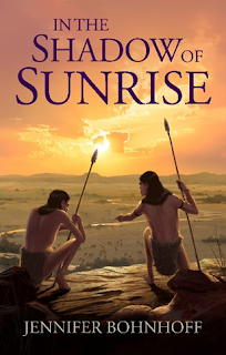 Lastly, I’d like torecommend you give my own contribution to prehistoric middle grade
novels a try. Set in what is now Colorado, New Mexico and Texas 10,000years ago, In the Shadow of Sunrise tells the story of Earth Shadow, a handicapped boy who is part of theFolsom Culture. He has come of age and is finally able to join the adults fromhis clan on a summer trip where he hunts, gathers supplies, makes alliances with people from other clans, and learns that his mental abilities more than compensate for his physical inabilities. I did extensive research and visitedthe locations that became scenes in this book, and I believe it accuratelydepicts the period while offering a heartwarming coming of age story.
I have one copy each of Maroo, Noonalook, Sisters of the Wolf and In the Shadow of Sunrise to give away to interested readers. All have been read but are in good condition. If you'd like to be considered for any of these titles, leave a comment below.


