Jennifer Bohnhoff's Blog, page 2
August 11, 2025
The Lost Book
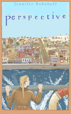
Perspective, my middle grade historical fiction set on Isle Royale during the Great Depression almost never got published. That's because I lost the manuscript.
This story's origins came in a family trip to Isle Royale during the summer of 2000. In case you've never been there, Isle Royale is a National Park on a remote island in Lake Superior. It sits near Michigan’s border with Canada, and can be accessed by boat from Duluth Minnesota and several Michigan ports, and by water plane. The island is car-free, with only a few lodgings. It is a wilderness of forests, lakes and waterways, where moose and wolves roam and loons sing their lonely song.Dive sites in the lake include several shipwrecks, and most people explore the island by backpacking and/or canoeing, portaging their canoes across narrow fingers of land to reach lakes and inlets.
I was transfixed by the beauty of the island when I went there. In the ten days we hikes, canoed and portaged the eastern end of the island, we saw only a handful of other people. It was probably the most isolated I have ever been. But beauty by itself does not make a story. You can write a poem about beauty, but a novel needs a plot. It needs characters who yearn for something, and it needs the story of how those character achieved—or didn't—the desires of their heart.
I didn't find the story until my last day on Isle Royale. We were taking the ferry back to Duluth when it
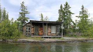
stopped near a rustic cabin that sat on the waterfront. As a sailor passed along mail and a box of groceries to a woman onshore, I learned that what I was seeing was becoming less and less common. Some, but not all of the people who owned land on the island were granted life leases by the government when the island became a national park in 1940. Those leases allowed the people who gained them to continue living on the island for their lifetime. It had been 60 years since those leases were granted, and most of the grantees were growing old. Many of the remaining grantees were just children when the park was created. It made me wonder what it would have been like to be one of those who lived on the island. How did they feel when they learned that their homes were soon to be taken over by a government that had a plan that might benefit the general populace, but would destroy their own life and livelihood?
I came home from that trip fired and inspired by that question, and within a year I had a completed manuscript. My main character was Genevieve Williams, a twelve-year-old girl who is put on a boat and sent to the island by relatives who do not want the burden of caring for her after her mother dies. She will now live on this isolated island with her father, a man she has never met and about whom her mother never talked. What Genevieve wants is to graduate from school so that she can go to art school. Once she's on the island, however, her artistic eye falls in love with its rustic beauty. She learns the story of the relationship between her mother and father and her whole understanding of the world changes, as does her priorities.
My manuscript went through several rounds of revisions and critiquing. I sent it out to several publishers. And, somewhere during the next few years, I bought a new computer and transferred everything over from the old one to the new, using floppy discs. My life may not have been as rustic as Genevieve's who worked by kerosine lamp light and cooked on a wood-burning stove, but technology was not what it is now back in 2002. Slowly, rejections of the manuscript came in the mail. When the last had trickled in, I looked for the manuscript so that I could decide whether to send it out to other editors and agents, or rewrite it. I found I could do neither. Somehow, the manuscript had not transferred from one computer to another. It was gone, without a trace.
Years passed. Every now and then I would think of Genevieve's story and feel a wave of sadness. The story was (I thought) gone forever. I became increasingly sure that it would have been my greatest success.
Then, a couple of years ago, a friend of mine was cleaning out her garage when she found a dusty old pile of papers. It was a copy of my Isle Royale story! I had given it to her to read through and comment, and somehow it had gotten misplaced. Lucky for me, my friend didn't throw the stack of papers away. She returned them to me. I could use that old manuscript and twenty years of acquired writing skills to create an even better story.
My husband, who is my hardest critique, says that this is my best story yet. I'm not so sure, but I am glad that it has finally, after a quarter of a century, seen the light of day.

Jennifer Bohnhoff is a retired English and history teacher who now writes contemporary and historical fiction for middle grade through adult readers. Perspective will be her fifteenth story to be published when it becomes available on October 7th.
Perspective can be preordered as an ebook on Amazon and as a paperback direct from the author.
August 9, 2025
Walking the Wall: Day 6 Housesteads to Chollerford

After a second night in lovely and accommodating Bowes Motel, we sat down to a hearty breakfast in the hotel's dining room. The staff graciously gave us a ride to Housesteads so we could continue the walk. That cut 1.8 miles off what was to be an 11.7 mile day.
This was the nicest day, weather-wise. The sky was clear and we had no rain.
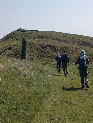
Our first challenge was climbing Sewingshields Crags, another of those picturesque hills on which the wall snakes up to high cliffs. Look carefully, and near the top of the hill you can see a little white dot. That's my husband, who is training for a marathon this fall and decided to take advantage of the lovely weather and run the course this day. The rest of us continued to walk and to marvel at the views—north into Scotland and south into England. They were breathtaking.
By lunchtime, we had made it to Brocolitia Roman Fort, an English Heritage Site that remains unexcavated. The man who runs the Corbridge Coffee Company’s Coffee van was a lot of fun to talk with. I bought a soda from him, the first sugary drink I had the whole time I was in England. In the hot sun, it tasted very, very satisfying.
Nearby Brocolitia, is Temple to Mithras, a mysterious god whose rituals were all secretive and still largely unknown. The Temple was probably built by soldiers based at the nearby fort in about AD 200. The three altars were found here, all dedicated by commanding officers of the unit stationed here, the First Cohort of Batavians from the Rhineland. There was money, cigarettes, and other offerings on the altars, showing the paganism is not dead, even now.

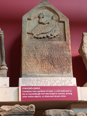
Just before we got to the Mithric Temple, we crossed a boggy area. The man at the Corbridge Coffee Company’s Coffee van let me know that was Coventina’s Spring. There is nothing there but a little raised wooden walkway to get you through the muck, but it had been the site of a huge hoard of coins, offerings to the water goddess that inhabited the spring. In 1876, John Clayton, an amateur archaeologist to whom Hadrian's Wall owes much, opened up Coventina's Well and discovered 13,487 coins, many of which dated to a55AD. He then hauled Coventina's altar to his house in Chollerford, which is now the Chester’s Museum.
Broccolita is on AD122 route, so one could take the bus from Vinolanda or Housesteads to Broccolita.
A little farther on, we got to Limestone corner, the northernmost point on the trail, and the farthest north that the Roman Empire reached. The rock here is not limestone as the name would imply, but the much harder whinstone, a kind of basalt. The stones show
signs of being worked by Roman masons, who must have realized that they were too hard to hack through and abandoned the project of clearing the ditch of them.

If you are not up to running or walking all the way to Chollerford, you're in luck. The Ad122 bus runs all the way there.
We stayed at The George Hotel in Chollerford. It had once been a pub and Inn, but a large addition was added to the back that's made it almost more of a conference center. The George has a lovely dining room with windows overlooking the River Tyne. The breakfast was buffet style, with lots of selection. It also has lovely grounds, with chairs and tables out on the lawn.
Instead of eating dinner there, we walked north to the next village and ate at The Crown, a fun pub with lots of interesting decor.

Chesters Fort was THE place to see in Chollerford. It is another place to stamp Hadrian's Wall passports, and is an English Heritage site. Chesters Fort (Cilurnum) was built in 123 AD just after the completion of the Wall. It guarded a bridge which carried the Military Roman road across the River North Tyne. It housed some 500 cavalrymen and was occupied until the Romans left Britain in the 5th century.
The land on which Chesters fort stands was bought in 1796 by a man named Nathaniel Clayton, who leveled the ruins to form a park between his mansion and the river. His son, John Clayton, was of a more curious and scientific mindset. When he succeeded to the property in 1832, he began excavating what his father had buried. He also began acquiring other properties that had remnants of the wall and Roman forts. His nephew, Nathaniel George Clayton,continued the work, opening the Chesters museum in 1896. The museum houses the extensive collection of antiquities discovered by John Clayton at Chesters and elsewhere along the Wall.

Jennifer Bohnhoff is a retired history and English teacher. She walked Hadrian's Wall in June 2025. If you'd like to begin at the beginning of this adventure, click here.
August 4, 2025
Walking the Wall: Day 5 Steel Rigg to Housesteads
Even though we made no forward progress, the fifth day of our hike along Hadrian's Wall ended up being the high point of the whole trip, both literally and physically.
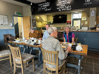
The morning began with breakfast at The Bowes Hotel in Bardon Mill, where a full English breakfast was included in the price of the room. If you've never had an English breakfast, it is quite a lot of food. We could have eggs, bacon, sausages, fried tomatoes, mushrooms, beans, and toast. The English have gotten smart, and realize that not all Americans appreciate black pudding and beans on their breakfast plates, so we each got a list of ingredients which we got to check off. We also had fruit and breads and the staff was happy to make a bowl of oatmeal for us if we wanted.
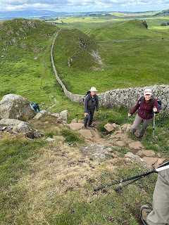
Our original plan was to walk the 1.8 miles north to Vindolanda, then pick up the AD122 bus, which would take us to Housesteads. The staff at the Bowes offered us a better option: a ride to wherever we wanted to go. We chose to be driven back west to Steel Rigg. This allowed us to walk some of the most dramatic and beautiful sections of the trail, the upland section along Whin Sill. Here, the wall follows the curving contours of the land, climbing up steep hills and sometimes clinging to the edge of cliffs. We were lucky that the rains of the day before had cleared and we had bright skies with billowy clouds, and enough of a breeze to keep us cool, but not enough to knock us off our feet! We were definitely "chuffing" quite a bit up these steep slopes, but it was worth it. The views were spectacular. I can only imagine how impressive the wall would have been when it stood 15 feet tall, with a walkway on the top, and was painted white. The wall was definitely a very visual statement of Roman power and engineering.
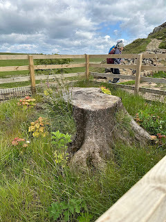
The most crowded part of the whole hike was Sycamore Gap,a dramatic dip in the ridgeline that held one of the most photographed trees in the country until a couple of mindless vandals cut it down a year ago. Perhaps 20 people were clustered about the stump, and their outrage and sorrow was palpable. The tree became famous when it appeared in Kevin Costner's 1991 film, Robin Hood: Prince of Thieves.
A few more scenic climbs, and we arrives at Housesteads, a Roman fort that is now an English Heritage Site and another of the places where we could get our passports stamped. There is an excellent museum run by The National Trust and English Heritage.
Housesteads is the best preserved of the thirteen permanent Roman army posts along the length of Hadrian's Wall. It has been called by many names over the years, including Vercovicium, Borcovicus, Borcovicium, and Velurtion. It is now called after the nearby 18th-century farmhouse of Housesteads.
The fort was built in stone by Roman legionaries in the decade after AD 122, soon after the construction of the wall began. Until the end of the 4th century, it housed an 800-strong infantry regiment of auxiliary troops. From the late 2nd century onward, the garrison was manned by the 1st cohort of Tungria, originally recruited from Germanic tribes in the region around Tongres, in modern Belgium.
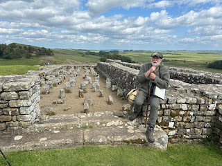
Before the trip began I was able to connect with Allen Woods, one of the interpreters who guides people through Housesteads. What a lucky find he was! Allen told us so much, in a way that we could understand, and with a great sense of humor. He helped us interpret not only the archaeological site, but the land on which it was built.
Allen was also kind enough to give us a ride back to Bardon Mill at the end of the day.
Housesteads is about halfway along Hadrian's Wall. It is also one of the highest points in the wall and definitely set along the most dramatic stretch, with views that reach far into Scotland and far south. Having good weather for this beautiful walk helped, but having someone knowledgeable to share his understanding with us really opened our eyes and made the tour more memorable. We walked a beautiful and rugged stretch of trail on this, our fifth day, and even if we ended up right where we began, it was the highpoint of the whole trip.
July 31, 2025
The delightful surprise of Bardon Mill.
Bardon Mill was not part of my plans for walking the Hadrian’sWall path. The town is too far off the trail and the AD122 bus doesn’t passthrough it. Circumstances, however, forced me to book rooms there, and I amglad I did.
Bardon Mill is a little over a mile south ofVindolanda, which itself is two miles south of Hadrian’s Wall. While the museumand excavations at Vindolanda definitely make it worth the detour, I could findno good reason why I should deviate an additional distance to see Bardon Mill.When you’re walking 10-12 miles a day, addingt hree extra miles is prettydaunting. Most hikers, and that
includes me, want to find lodgings as close tothe trail as possible.
For this section of the trail, that would have meant findingrooms in Once Brewed. However, we were a group of six, and Once Brewed is avery popular place. There were no rooms to be had, and once I began searching,it became apparent that there were no rooms to be had for miles around. I castmy net wider and wider, and finally found lodging for six in Bardon Mill. Someof the people in my group were skeptical about my choice, and I couldn’t blamethem.
The trail south from Vindolanda made it clear that BardonMill is not overly popular with hikers. It was
not well marked, and we got losta couple of times, but basically, the trail runs down a little valley through alush forest. We saw no one else as we walked. At the bottom of the valley, wehad to cross a very busy freeway, the A69, but once we had, we were enchanted by what wesaw.

Errington Reay & Co is the only commercial pottery in the United Kingdom that is currently licensed to produce salt glaze pottery. It was established in the village in 1878 and appears to still be going strong.It was right next door to our lodgings, so that when I looked out my window, I saw pottery. They made a large variety of wares, including thesedelightful chickens.


We stayed in the Bowes Inn, the pub that also seemed to be the center of social life in this village of 450 people. The staff was welcoming fromthe moment we walked in the door. We ate breakfast (included with the room) anddinner with them, and they packed lunches for us to eat on the trail.
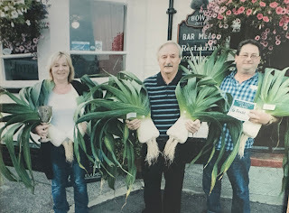
While we were there, there was a pool tournament going on in the pub. Apparently, the Leek club has a show here every year, at which the produce from which is auctioned off to raise funds for local charities. Bardon Millers are evidently very proud of their leeks. There were numerous pictures of them on the walls of the pub.
But their hospitality didn’t end there. Knowing that therewas no bus to accommodate us, we were offered rides up to the wall. Becausethey are not a taxi service, our drivers could not charge us a fee, but hopedthat we would provide them gas money, which we willingly did. We stayed twonights. The first morning we got rides back to Steel Rig, so that we could walkfrom there to Housesteads. This allowed us to walk some of the trail we missedby taking the bus from Walltown Quarry to Vindolanda, and we were glad we didbecause that section of the trail was spectacular. The second day we got ridesto Housesteads so we could continue on our way east along the wall.
This was a bit of an inconvenience for the staff. Becausethey have no bus and there are no schools in the village itself, their own children need rides to schools in the neighbouring villages of Henshaw, Haltwhistle, and Haydon Bridge. Offering ridesto hikers is a second priority. I got the feeling that this town would love havingthe AD122 pass through, both so that their children could use it and to attract more tourists.
The staff at the Bowes Inn treated us like family, the foodwas good, and the rooms were cozy and quiet. By the time we left, we were allin agreement that staying in Bardon Mill was not the bad idea we had allfeared.
July 29, 2025
Turning a New Place Mat
Some people turn over a new leaf at the start of the new year. I turn over the place mats.
I have a friend named Jessica Bonzen who is a quilter. She sells her beautiful handiwork at some of the same craft shows where I sell my books.
 Sorry for the fuzzy image.A few years ago I commissioned her to make some place mats just for me. Jessica created sets of four, specially shaped to fit the round table in the corner of my living room closest to the big picture window. When my husband and I sit there, it's like sitting on the edge of the world, looking out over God's glory.
One of the sets Jessica made me features red and white poinsettias. I wish the picture was clearer so that you could see how beautiful it is, but my camera and I seem to not be on speaking terms this new year.
 Besides the beautiful fabrics and quality workmanship Jessica puts into her products, one of the features I love the most is that her place mats are double-sided. Turn them over, and discover a new design! My Christmas place mats reverse into a wintry snow scene with cardinals and white aspen trees.
I'm ringing in the new year by turning over my place mats. Good bye, Christmas. You were wonderful, but it's time for a new year.
However you plan to commemorate the beginning of 2018, I wish you health and happiness.
July 23, 2025
The History of Isle Royale
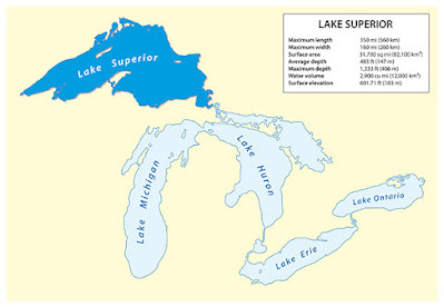
Isle Royale is an island in Lake Superior. If you look at a map of the lake and think it looks like a wolf looking left, Isle Royale would be the eye of the wolf.
The island's history spans thousands of years. During the last Ice Age,15,000 to 20,000 years ago, Isle Royale was covered with thick glacial ice. About 10,000 years ago, the ice receded from the Lake Superior basin and Isle Royale rose above the waters of the lake. Its rocks, which are layers of lava flows and conglomerates formed during the Mesoproterozoic era, were tilted up by the weight of the glaciers, then eroded into long fingers that were then surrounded by water. This gives the eastern side of the island the look of fiords.

We may never know when the first human ventured across the waters to land on the shore of Isle
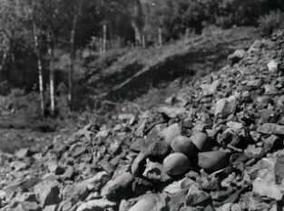
Royale, but it is certain that people had arrived by 2,5000 BCE or soon thereafter. Early visitors mined raw copper, searching for nuggets and veins of the bright metal, then beating it out of the bedrock with rounded, hand-held beach cobbles. Archaeologists have found large numbers of these hammerstones along Minong Ridge, which has many of these ancient mines. More than 1,000 pits attributed to the Indians have been located on the island, but none include habitation sites.
The Ojibwa call Isle Royale as "Minong," meaning "the good place." This may be because of the abundance of berries, including thimbleberries and blueberries.They mined copper and fished in the surrounding waters.Isle Royale remains within the traditional homelands of the Grand Portage Band of Lake Superior Chippewa.
European contact began with the French during the Seventeenth Century. Fur traders, including Brule in 1622, Nicolet in 1634, and the Jesuits Raymbault and Jogues in 1641 lead to increased interest in the island's resources, including copper and timber. However, the remoteness of the island and the challenging weather and sailing conditions limited the area's use.
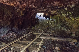
In the 1840s, Michigan's first state geologist, Douglass Houghton, reported on the wealth of copper on the island. That began a copper boom that lasted into the late 1890s. Unfortunately for the island, a common way to locate copper deposits was to burn forests, exposing surface rock. After the mining boom ended in the late 1890s, incidence of fire decreased and Isle Royale was not devastated by fire again until the 1930s, when it suffered its most devastating fire.
Fires, along with strikes and storms, also drove out the lumber industry, which tried to make a go of it on the island between 1892 and 1935.
The longest-lasting industry on Isle Royal was commercial fishing. While historical records are scanty,
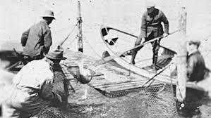
it's likely that The Northwest Fur Company got fish for its stations at the head of the lake in Western Lake Superior from the north side of the island sometime in the late 1700s. By the 1880's, from twenty to sixty crews came from the mainland to fish every year. They arrived in June and left in November, selling their catches to steamers from Duluth that made regular trips to the island to pick up fish and deliver supplies. During the early period, most fishermen were Cornish, English, or French. By the turn of the century, Norwegians, Swedes began to arrive, attracted by how similar the environment was to their homeland. Few fishermen or their families stayed on the island year-round. The isolation of the island once the lake froze, and the bitter weather permitted on the hardiest to stay.

Along with mining, lumber, and fishing, tourism tried to make a commercial success of itself on Isle Royale. Beginning in 1855, it established itself as a health destination, where cool weather and clean air could cure the sick. In the 1860's and 1870's, excursion boats carried travelers to the island, to picnic at the site of the Siskowit Mine or near the Rock Harbor lighthouse. Resorts were established on both sides of the island, and people from Minnesota, Michigan and Illinois began buying property for summer homes.
Private ownership of the island was not to last, however. In the 1920s, conservation efforts gained momentum, with advocates pushing for the island's preservation as a wilderness area. While some of the landowners were strong in support of the movement to create a park, others were not. In 1931, Congress authorized the establishment of Isle Royale National Park and the National Park Service began
acquiring all the lands and buildings belonging to the fishermen and summer residents. Some of those owners were given life leases.
The park was officially established on April 3, 1940, by President Franklin D. Roosevelt.
_____________________________________________________
Jennifer Bohnhoff is a former English and History teacher who now writes contemporary and historical fiction for middle grade through adult readers. Perspective, her novel set on Isle Royal in the 1930s, will be published in October, 2025. You can preorder the ebook or paperback now.

July 19, 2025
Walking the Wall: Day Four, Gilsland to Bardon Mill

If anyone were to ask me where to start an abbreviated hike of Hadrian's Wall, I would recommend Gilsland. The little village of Gilsland is small enough to be quaint, yet large enough to have some very nice features for hikers, the most important of these being the Samson Inn. Founded in 1601, this inn is the heart of the village in more ways that one. Back in 2022, the former owners decided to put it on the market. When no one stepped forward to keep the inn running, the village, realizing how important the Samson is not only to hikers, but to the community, decided to buy it itself. They formed the Gilsland Community Benefit Society Ltd (GCBSL), and after much grant writing and fundraising, which included pie sales and raffles, they were able to purchase the establishment. In October of 2024, after a renovation and thorough cleaning, the first pint was poured in the reborn pub. We weren't able to stay there, because the Inn was not yet taking reservations when I was scheduling this walk, but we did eat all our meals here and I can say they are friendly and helpful and we thoroughly enjoyed meeting the locals and sensing their pride in having kept this inn going.
Another place in town that I had intended to patronize was House of Meg, a tea room that comes highly recommended. Unfortunately, they were already closed when we made it into Gilsland, and it was still closed the next morning when we left.
Today was supposed to be an 11.5 mile day, but we decided to use the AD122 bus, which shortened things up considerably. I'll explain why as I tell you about the day.
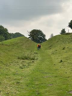
We left Gilsland on a cool and misty morning. Almost immediately, we were following the vallum, the huge ditch that runs along the southern side of Hadrian's Wall. The vallum is a unique feature, the only such ditch to run along any frontier in the Roman Empire. It was built a few years after the wall and is believed to mark the southern boundary of a military zone which is bounded on the north by the wall.
The word vallum actually means wall, and Hadrian's Wall itself is called Vallum Adriano in Latin. The Venerable Bede, an historian who lived in the eighth century provides the earliest surviving mention of the ditch. He refers to it as a vallum, or earthen rampart instead of as a fossa, and the term has set.
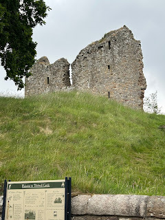
We soon came to Thirlwall Castle, a twelfth century home that was fortified in about 1330 by John Thirlwall. It stayed in the family despite the fact that Sir Percival Thirlwall was killed while acting as Richard III's standard-bearer at the Battle of Bosworth in 1485. A survey in 1542 stated that Robert Thirlwall owned the castle and it was in good repair, but in 1748 it was sold to the Earl of Carlisle, who had no use for yet another castle and allowed the structure to fall into decay. It is now an English Heritage Site, and they are working to protect it from further dereliction.
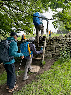
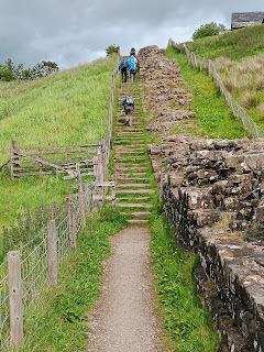 We found ourselves walking along the wall quite often. Sometimes we were in the vallum, and sometimes we walked beside it. We also found ourselves crossing over walls that divided one pasturage or field from another. There were ladder gates and "kissing" gates, and others whose names I do not know.

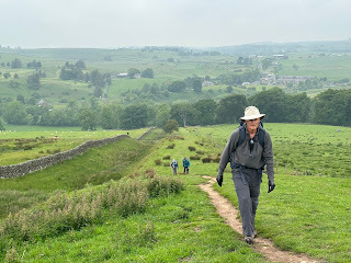
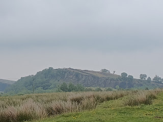
When we could see Walltown Crags looming through the mist, we knew it was time to stop at the Roman Army Museum . This museum is tied with a Roman fort known as either Carvoran or Magna and is run by the same people who administer Vindolanda. It is not an English Heritage site, but we found it was well worth the price of admission. I especially enjoyed their film, Edge of Empire, which showed computer-animations that began with an archaeological site, then built up the building that had once stood there.
In fact, the museum was so great and the weather had disintegrated so badly that we decided to pick up the AD 122 and take it all the way to Vindolanda, despite the fact that in doing so we would miss a good section of wall here, including Turrets44B and 45A and Walltown Quarry. We'd also miss another English Heritage site, Great Chesters Fort (Aesica) , which has the most complete Roman cavalry fort in Britain and a tearoom that came highly recommended.
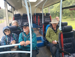
We ate our sack lunches on the AD122 bus https://www.gonortheast.co.uk/services/GNE/AD12 while rain spattered on the windshield. Although we felt a little disappointed in missing part of the wall hike, another walker who stayed in the same inn as us told us that he slipped and fell on the wet stones, and that the rain was vicious on the top of the crags. that made us feel a little better about our choice.
The bus dropped us off at Vindolanda, a fort that was built along the Roman road several decades before Hadrian began his wall. It is an excellent museum and archeological site, and we were glad that we'd created extra time to visit it. Vindolanda deserves at least three hours, and even then it has so much information and things to see that it is worth a blog all by itself.
When we were done with the museum, we hiked a little less than two miles to Bardon Mill, where we stayed at the Bowes Hotel, a lovely quaint Inn that treated us like family.
So why would I recommend Gilsland as the start of a shortened Hadrian's Wall hike? It was there that we truly began seeing the wall and vallum regularly, and that the scenery became spectacular, but it is also the first place where the AD122 can be accessed. Because of that, it would be possible to use Gilsland as a base to hike all the best miles and see all the best museums along the wall. We could have stayed here for days, yet we continued on, and the walking became more and more beautiful and challenging.
My visit to Isle Royale
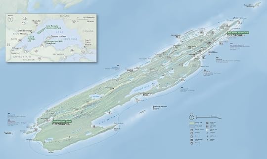
During the summer of 2000, my husband, three sons, and I went to Isle Royale National Park. If you have never been to Isle Royale, you're not alone. One of the least visited national parks in the United States, it attracts only around 25,000 visitors per year. In comparison, Yellowstone National park had 4.74 million visitors in 2024, and Great Smoky Mountains, the most popular national park in the United States, attracted over 12.1 million visitors.
 One reason this park is so undervisited is because it's a challenge to reach. An island in Lake Superior, it can only be visited by boat or seaplane. Private boats can come to the Isle, but we, like most visitors, took a ferry. The Voyageur II runs from Grand Portage, MN. It and its sister ship, the Sea Hunter III, reach Windigo in about 2 hours, but the Voyager continues on, traveling to Rock Harbor in about 8 hours. All along the way, it picks up and drops off passengers and, back when we traveled, mail and supplies for Islanders. Another company, The Royale Line, runs from Copper Harbor, MI, to Rock Harbor in 3.5 hours, and the Park Service (nps.gov/isro) runs the Ranger III from Houghton, MI, to Rock Harbor in about 6-hours.Isle Royale Seaplanes flies from Hancock, MI, and Grand Marais, MN, to Windigo or Rock Harbor.
Because of the severity of conditions on Lake Superior, the park is only open from mid-April through October. Weather can be unsettled in spring and fall; stormy conditions on Lake Superior affecting transport. Both Rock Harbor and Windigo have visitor centers that can help you orient and educate yourself, and can rent canoes and other supplies. They are open daily in season, with reduced hours outside of July and August. A visitor center at park headquarters in Houghton, Michigan is open year-round.

Once you've arrived, you'll find that Isle Royal is very rustic. 45 miles long and 9 miles wide, it has just one hotel, the Rock Harbor Lodge. The lodge's room have private baths, plus there is a dining room and a dockside store. Windigo has rustic one-room cabins, and there are 36 campgrounds scattered throughout the shores, and lakes, and promontories of the island. 17 of these campsites can accommodate larger groups.Some are nothing more than a flat spot and a fire ring, while others have three sided cabins, the fourth side covered in screen to keep out the mosquitos. We carried tents, sleeping bags and a backpacking stove, but welcomed the one cabin we came to during our five day trek. Non-fee permits are required for all camping and overnight boat docking or anchoring. Parties of 1 to 6 get permits on arrival but cannot reserve any specific sites. Groups of 7 to a maximum of 10 must reserve sites and obtain permits in advance through park headquarters.
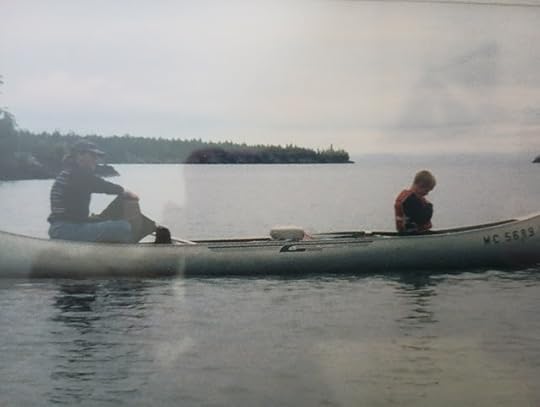
 Isle Royale National Park was designed to be a wilderness. It has no roads. If you want to travel the
island, you use one of the many foot trails, or a network of water routes for canoes and sea kayaks.The Greenstone Ridge Trail begins at Rock Harbor and follows the island's rocky spine, connecting numerous trails that drop off towards both the southern and northern shores in a web of hiking possibilities. This picture if of my three boys sitting on the granite rock at the island's highest point.
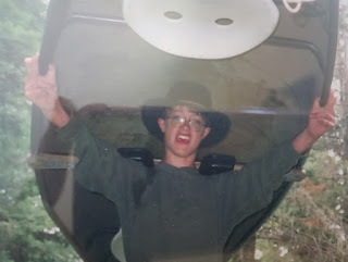 We landed at Rock Harbor, where we rented three canoes for the five of us. Our youngest was just six, and we would have liked to have only rented two canoes, but regulations forbid three people in any boat. Because of the nature of the landscape, we found ourselves hiking the fingers of land on the east side of the island, while portaging our canoes, then paddling across the inlets. This proved to be tricky, since only my husband and my oldest son were strong enough to portage a canoe. While the two of them hefted the canoes, my middle son and I carried all of our gear, which was stored in five backpacks, while the youngest loaded himself up with all our life vests and waddled his way to the next shore. Some of the portages were over a mile, and we had to cross back and forth several times to transfer all the equipment.
 We never got out into Lake Superior itself, which can be too rough for canoes. If we had, we might have been able to look down at some of the shipwrecks that ring the island, grim monuments to rocky reefs and shifting fog. Some people scuba dive down to these wrecks.
 We had a wonderful time on Isle Royale, but it was something that happened as we were leaving that
inspired me to write Perspective. The ferry had stopped near a rustic cabin that sat on the waterfront, and one of the sailors was handing mail and a box of groceries to a woman onshore. When I said that I'd like to own a cabin on the island, someone explained to me that it was impossible. When the island became a national park in 1940, some (but not all) of the people who owned land on the island were granted life leases. That allowed them to continue using their cabins until the grantee died. In 2000, it had been 60 years since those leases were granted, and most of the grantees were growing old. In the years since, they've died off, and the park service has taken control of the land. It made me wonder what it would have been like to be one of the families that lived on the island, and that wonder became the seed for a whole novel.
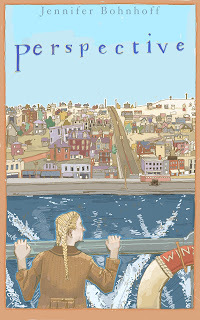
A former high school and middle school social studies and English teacher, Jennifer Bohnhoff writes historical and contemporary fiction for middle school through adult readers. Perspective is her story about a girl who joins her fisherman father on Isle Royale during the Great Depression, and will be published in the fall of 2025.
Please forgive the quality of some of these pictures! The only copies I can find are behind glass and hanging on the wall. I couldn't figure out a way to get them without shadows and reflections.
You can preorder a signed paperback copy of Perspective direct from the author here. It will be sent to you, along with some publication bling, when it is available.
July 14, 2025
Peaches and Cream Baked Oatmeal

I've been busy editing my cowboy romance and prepping my middle grade historical novel for a fall publication, but then my sister arrived with two flats of peaches! Heather lives in Alamogordo, some 200 miles south of me, and her spring starts nearly a month before mine does. Her summer lingers well after I've gotten my first frost, too. It's paradise for sunbirds and for gardeners, as long as they don't mind the heat!
Two flats of peaches aren't going to just sit around on my counter as I write, so I took a break before the fruit flies invaded. I've now got five bags of peaches in the freezer, we've had fresh peaches for breakfast, lunch and dinner the last couple of days, and I've made a peach cobbler, a peach upside down cake, two peach pies, seven jars of jam, and I've tried one new recipe: a breakfast dish that can be served room temperature or warm from the oven. It was so good that I decided to share it with you.
Peaches and Cream Baked Oatmeal tastes like it should be dessert, and I guess it could be if served with a dollop of ice cream or whipped cream. But it's pretty healthy, fairly low in sugar and fat, so why not enjoy it at breakfast time? I made it in advance, so that I could eat it right after coming home from the pool, where I swim a mile during the 6 am session.
Peaches and Cream Baked Oatmeal
1 1/4 cup nonfat milk, plus 1 TBS, divided1/4 cup sugar, plus 1 TBS, divided1 egg2 TBS butter, melted2 tsp vanilla extract, divided2 cups old fashioned rolled oats1 tsp baking powder1/4 tsp. salt1 cup peeled and diced fresh peaches4 oz. nonfat cream cheese, softened3 TBS peach jamPreheat oven to 350°. Coat an 8" baking dish with cooking spray.
Whisk 1 1/4 cups milk, 1/4 cup sugar, 1 egg, melted butter and 1 tsp vanilla together in a large bowl until smooth and the sugar is dissolved. Add the peaches, baking powder, salt and stir well. Pour mixture into the prepared baking dish and let stand for 15 minutes to let the oatmeal soak in the milk a bit.
Combine cream cheese, 1 TBS milk, 1 TBS sugar and 1 tsp vanilla and beat together until smooth and creamy. Spoon the cream cheese mixture over the oat mixture using a tablespoon. Place a spoonful of peach jam into the places that are not covered with cream cheese. Cut through the mixture several times to mix slightly, creating a marbled effect.
Bake until very lightly browned and set, 30-35 minutes. Let cool for at least 10 minutes.
Can be refrigerated in an airtight container for up to 1 week.
July 9, 2025
Walking the Wall: Day Three, Walton to Gilsland
Sunday, June 8 was the day that our hike along Hadrian's Wall got really interesting. We had embarked on this walk from Bowness-on-Solway, the western-most edge of the wall, and we had walked from there to Carlisle, the biggest town on the western section, and then on to the charming village of Walton, but it wasn't until the third day of our walk that we actually began seeing the wall. This little section, at a place called Hare Hill, might be the tallest remaining piece of the wall. Or it might be a 19th century reconstruction. Or it might be what is left of a barn that way made out of wall stones. Whatever it is, it thrilled us. After walking along the path that once held a wall, we were actually seeing wall! Then, almost immediately after seeing the wall, we deviated away from it.
On our third day, we walked what looked like 9.18 miles on the map, but actually ended up being a lot

longer because there were so many interesting things to walk through and around. The first of those things was Lanercost Priory. Founded in 1166 and built of stones taken from the wall, Lancercost was very important during the middle ages. Edward I rested here for five months as he tried to regain his health so that he could battle the Scots. He never made it, dying in Burgh-by-Sands, where his body laid in St. Michael’s church until being transported back to London.
Lanercost still serves as the parish church. There is a completely intact chapel that seats several hundred, and behind it lies the ruins of the older priory. As we walked through the ruins, the organist was warming up, giving us a background of beautiful music. The ruins are beautiful and haunting, and there are medieval memorials, Victorian gravestones, and Roman altars, giving a sense of the time that has passed and the lives affected by this church.

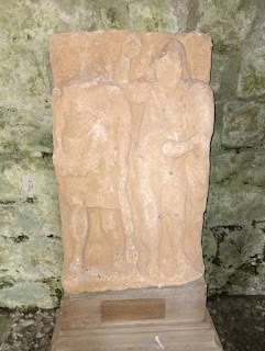
 Lanercost is an English Heritage site, so if you've bought a pass, it's free to enter. It had a lovely tea room, where we had an early lunch.
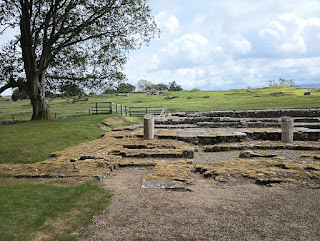
Another hour and a half on the trail and we got to Birdowald, which is also an English Heritage Site, and place to stamp our passports. It is one of the best preserved of the 16 forts along Hadrian’s Wall and is situated in a commanding position on a triangular spur of land bounded by cliffs to the south and east overlooking a broad meander of the River Irthing. In Roman times, the fort was known as Banna (Latin for “spur” or “tongue”), reflecting the geography of the site. Birdowald had a lovely little museum that was geared to kids.
Close to Birdowald we crossed the border from Cumbria into Northumberland. We also crossed a geological border that day, the place where sandstone was replaced by the longer lasting limestone, which explains why we were seeing more and more of the wall.
That night we stayed in a house in the village of Gilsland. We had two bathrooms for the six of us -- a luxury after sharing one bath at the bunkhouse -- and we had a washer/dryer that worked quite well once we figured out how to use it.

But the real "find" in Gilsland was the Samson Inn. This lovely old inn had closed last year. The village, realizing how vital it was to the economy and life of the place, ended up buying it when no one stepped forward. They''ve hired a manager and workers, and the inn now serves meals and has rooms to let. We ate dinner and breakfast there, and they packed us lunches. We were delighted with the place and wish it well in the future.
The next morning we headed out, knowing that some of the most beautiful and educational days lay ahead of us.


