
Matador Network's Blog, page 1346
May 11, 2018
Airbnb helping Puerto Rico
It’s been eight months since Hurricane Maria devastated the island of Puerto Rico. Hurricane Maria, a Category 4 storm, hit Puerto Rico so hard that everything from agricultural infrastructure to clean-water systems were nearly destroyed and the island’s economy came to a standstill.
Aside from donating or volunteering, there’s another way you can actually help the island and its residents: come down for a visit. The economy badly needs the influx of cash. If you happen to stay at an Airbnb while you’re there, bonus points if you sign up for an Airbnb Experience instead of joining a mainstream tour operator. The popular vacation rental site has announced that it will donate 100 percent of their share of proceeds earned through the tours to local nonprofits working to get the island back on its feet.
The Puerto Rico Airbnb Experiences, which pair guests with a local resident to experience anything from art to food to culture, will take you as deep as you want to go. You can venture far away from San Juan, the capital, and check out the far reaches of the island, or stick in town for a food tour or night out. There are nearly 50 different options to choose from, each of which lends a boost to a local resident with a backdoor influx of cash coming in from Airbnb.
Airbnb has been hard at work in Puerto Rico since the storm, housing relief workers and residents alongside tourists. As noted by Conde Nast Traveler, Airbnb’s vacation rentals have hosted over 112,000 guests since the hurricane and earned hosts more than $17 million, partially due to the fact that a number of hotels were damaged by the storm.
Not able to make it down? You can still make a donation. Here is a list of organizations on the ground helping the island recover from the devastation. 
H/T: Condé Nast Traveler

More like this: 20 images of Puerto Rico we can't stop looking at
The post Airbnb is going above and beyond to help Puerto Rico recover from Hurricane Maria appeared first on Matador Network.


Spectacular animal migrations
The rhythms of nature are one of our planet’s unstoppable forces. The promise of bountiful food and the calling of procreation leads animals across the globe to make epic treks almost unfathomable to humans. From the skies to the oceans, impressive groups of thousands — even millions — of animals make these yearly journeys. Here are the most spectacular animal migrations from around the world and where to see them.
1. Wildebeest and zebra: The Serengeti, Kenya, and Tanzania

Photo: Eric Isselee/Shutterstock
Following grasses that grow with seasonal rains, enormous herds of wildebeest and zebra traverse the Serengeti Plains each August and September. More than two million animals make the trek from Tanzania into Kenya, a scene dramatic enough on its own, but made even more so by the predators that lie in wait for unexpecting, injured, or weakened creatures. In addition to lions, cheetah, and hyena, the massive herd of wildebeests and zebras is frequently sprinkled with other charismatic megafauna looking for sustenance, including elephants, giraffe, and water buffalo.
When to visit: August-September
2. Monarch butterflies: Michoacán, Mexico

Photo: reisegraf.ch/Shutterstock
Every year, the skies of Northern Mexico bloom crimson with 300 million vibrantly colored butterflies commuting South to escape cold winter temperatures. Their destinations are the mountain regions of Valle de Bravo and Anguangeo, both areas home to designated butterfly sanctuaries. Some places attract such dense populations of butterflies that their combined weight snaps the branches of the trees on which they’ve alit.
When to visit: January-February
3. Caribou: Northeastern Alaska, United States
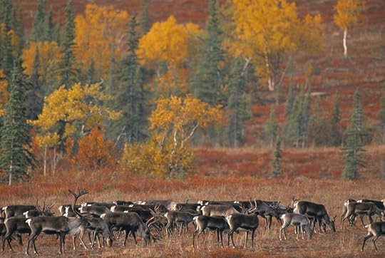
Photo: BMJ/Shutterstock
The Arctic National Wildlife Refuge, in the Northeastern corner of Alaska, is where over 100,000 caribou travel each summer to birth and raise their calves before heading south in advance of Alaska’s famously frigid Winter. Calves grow quickly in the 24-hour summer sun but herds are on constant alert for packs of wolves and giant grizzlies which lurk on the periphery. The awe-inducing landscape provides a spectacular backdrop for this epic gathering.
When to visit: June-July
4. Green sea turtles: Tamarindo, Costa Rica

Photo: Sergey Novikov/Shutterstock
Following the pull of the moon, thousands of endangered green sea turtles return to the beaches of their births to complete this yearly cycle of rebirth. The behemoths haul themselves onto land and lay eggs before returning to the sea. 45-55 days later, the sands of the beach come alive with thousands of tiny copies of their parents, rushing to the safety of the sea to one day complete the ritual themselves.
When to visit: June-July
5. Grey whales: Baja, Mexico
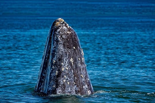
Photo: Andrea Izzotti/Shutterstock
On the southwest coast of Baja, Mexico the birthing lagoons mark the end of the spring journey of the Pacific grey whale. After gorging in the fertile waters of the Arctic, the whales head south to give birth in these warm, protected waters. These lagoons have become famous for their “friendlies,” whales that actually solicit interaction with humans. Just over 100 years ago, these same whales held a very different nickname: “devil fish”; smashing to bits the whaling boats which would converge on the lagoons for easy pickings.
When to visit: February-March
6. Red crabs: Christmas Island, Australia

Photo: KiltedArab/Shutterstock
Nearer to Indonesia than Australia, this Australian territorial island is alive with rainforest beauty. Each spring, from deep beneath green trees, more than 50 million red land crabs emerge from burrows and move in swarms to the coast for breeding. The mission is a famously suicidal one, with many crabs not surviving the journey through bustling towns and across busy roads. Those that make it release their eggs into the sea and successfully repeat the harrowing journey, pinchers crossed.
When to visit: October-November
7. Sandhill cranes: Kearney, Nebraska
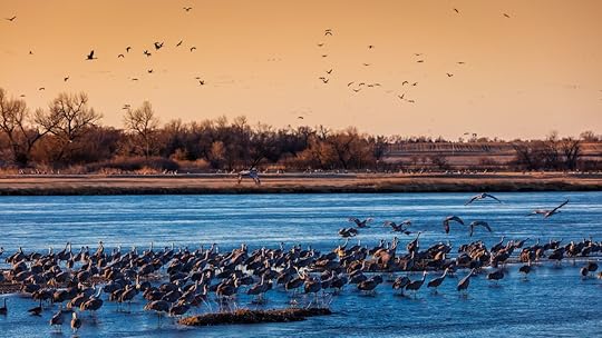
Photo: Joseph Sohm/Shutterstock
Located smack in the middle of the Central Nebraska Flyway, more than 80% of the world’s Sandhill Crane population descend on the small town of Kearney, Nebraska, each year. The protected marshes provide a safe place to feed and rest before resuming their northward migration. Over 650,000 cranes were estimated in the 2018 migration, making for a spectacular sight: at 3-4 feet tall, with a 6-7 foot wingspan, a flock of these majestic birds can literally darken the skies.
When to visit: March-April
More like this: Where to see all of the internet's favorite animals in real life
The post The most spectacular animal migrations around the world and where to see them appeared first on Matador Network.

Empanadas in Latin America
Empanadas are certainly among life’s simplest — and tastiest — pleasures. The name “empanada” is taken from the Spanish and Portuguese verb empanar, which means “to wrap in bread,” which essentially sums up what you get: anything from meats to cheeses to veggies, (often a combination of all of the above) stuffed inside a rich dough, then baked or fried to create a mouth-watering snack. But what many people don’t realize is that the styles of empanadas vary from country to country in South and Latin America. Every country will defend their empanada as best, and we’re certainly not going to get involved in crowning a champ. Decide for yourself instead, by trying all of these empanada variations in South and Central America before you die.
Argentina and Uruguay
Argentina is the South American country perhaps most associated with the empanada, at least when it comes to visitors from around the world. Uruguay’s proximity to the east of Argentina has allowed for similar, but not exact, empanada preparation.
Empanadas Mendocinas
A post shared by Alejandro Racciatti (@alejandroracciatti) on Apr 30, 2018 at 8:43am PDT
The Argentinian staple is a simple one and an ode to the cattle raising pastures of the country. Empanadas here are often built around one primary stuffing: ground beef, perhaps spiced with some cumin, typically served as an appetizer. This recipe also features hard boiled egg and green onions.
Sweet empanadas
A post shared by Lorca (@lorcacoffeebar) on Apr 8, 2018 at 4:03am PDT
Here’s an empanada perfect for dessert and popular in both Argentina and Uruguay. Crispy dough is stuffed with dulce de leche (a sweet milk common in both countries), or other sweet and creamy fillings. They are then fried, topped with a dusting of sugar or apple jam, and served.
Colombia and Venezuela
Colombians tend to get a little saucy, adding what’s called an aji sauce to their empanadas to complement the meat. They also may spice them up with cilantro or scallions, and add a bit of vinegar, salt, or lemon juice to mix. These are common varieties in the two countries:
Yuca empanadas
A post shared by LeClaire LeMaster (@claire_da_haymarket) on May 28, 2017 at 5:45pm PDT
Yuca empanadas swap out the traditional corn flour for yuca, or cassava. On the inside, you’ll find everything you’re used to, but the cassava allows for extra crispiness, especially when deep fried. Eating one of these is like biting into a corn dog at the county fair — with a Colombian twist.
Plantain empanadas
A post shared by Kimora (@kimorab_lib) on Apr 5, 2016 at 5:03pm PDT
Similar to yucca empanadas, plantain empanadas are made from dough that is boiled and mashed, stuffed with fillings, and then deep fried. The result is one of the crispiest empanadas found anywhere, perfect for an appetizer or as a quick bite from a street vendor. You’ll find these in Colombia as well as around the Caribbean.
Corn flour empanadas
#DonutFriday
Nobody likes #manicmonday. #TBT? Passe. A new trend is rising within the weekday hashtag scene and it’s for sure the most crave-able thing on Instagram. Tell me — what are you doing for #donutfriday?
A post shared by Ratio Coffee Bakery (@ratiovernonbakery) on Apr 5, 2018 at 10:56am PDT
This little ode to everything that’s right in the world recently burst its way into my Insta-bubble. I had to figure out where this started and who was responsible for it, and hungrily dove headfirst into the Insta-abyss, vowing to find the genius behind our new favorite thing. Along the way we found more than few gems that had us drooling over our keyboards.
A post shared by Mathew Hon Jun Yoon (@hon2838) on Apr 20, 2018 at 2:44am PDT
A post shared by ✖️Angie Cariou✖️ (@angiecupcake22) on Apr 3, 2018 at 3:30pm PDT
As our list of donuts to try grew past the amount any human should ever consume, we found out that #donutfriday actually started on Thursdays, and one Instagram account, in particular, seemed to own the strategy of staying ahead of the game by posting their #donutfriday photos a “hole” day in advance. Of the over 15,000 posts using the hashtag, Ratio Coffee & Pastry, a small bakery in Vernon, British Columbia, stood out. They’d been using the hashtag, long before it had been widely adopted, on Thursdays in order to allow ample time to get taste buds flowing before doors opened on Friday morning. The strategy seems to be working, as their posts routinely draw 200-plus likes.
Ratio, which also slings coffee, pizza, and other pastries, only sells donuts on #donutfriday. Available options change each week. The shop has generated a sort of cult following among locals as well as tourists in this mountain town about five hours northeast of Vancouver. “We weren’t just another place for people to get their daily fix,” says owner Andrew McWilliam “We stood apart for two reasons: our passion for quality and fostering community.” In the interest of including community members with dietary restrictions, Ratio features a gluten friendly and vegan option each week.
A number of other donut shops have since mastered the art of seducing the carb-loving public. Among the highlights:
Doodle Donuts in the UK:
A post shared by DoodleDonuts (@doodle_donuts) on Mar 30, 2018 at 3:39am PDT
Dorite Donuts in Chicago:
A post shared by Do Rite Donuts (@doritedonuts) on May 4, 2018 at 5:49am PDT
Avid Kitchen & Garden in New York:
A post shared by Avid Kitchen + Garden (@avidkitchenandgarden) on Apr 26, 2018 at 2:14pm PDT
Troudebeigne in Montreal:
A post shared by TROU DE BEIGNE (@troudebeigne) on Oct 18, 2017 at 5:28pm PDT
While you now know where to grab a donut the next time you’re in British Columbia, if you find yourself planted stateside, here are a list of the best donut hawkers in the US for your inaugural #donutfriday.
Union Square Donuts –Boston, Massachusetts
A post shared by Union Square Donuts (@unionsquaredonuts) on May 9, 2018 at 4:08am PDT
Few donut shops have the Instagram presence of Union Square Donuts. Their channel will have you drooling over your keyboard before you even scroll past the Top 9. If you’re in the Boston area, satisfy that craving with a jumbleberry donut: a creation straight out of Willy Wonka that combines blueberries, raspberries, strawberries, and cranberries in one glaze.
Voodoo Doughnut — Portland, Denver, Austin, Orlando
A post shared by Voodoo Doughnut (@voodoodoughnut) on Apr 10, 2018 at 9:10am PDT
Portland-based Voodoo Doughnut and their noticeable pink boxes filled with eccentric-flavored donuts are a cult phenomenon out west. None are more iconic than their maple bacon bar, which arguably kickstarted the bacon-on-desserts trend that isn’t leaving any time soon. Several other locations have opened since, including one on the east coast (finally) that just opened at Universal Studios in Orlando, Florida.
Dough — New York City
A post shared by Dough (@doughdoughnuts) on May 7, 2018 at 8:29pm PDT
Chef Fany Gerson turned this small Brooklyn donut shop into a mainstay of the city’s pastry scene. The donuts are as big as the name, and extra dense thanks to the unique brioche style, so make sure you wear your stretchy pants.
The Holy Donut — Portland, Maine
A post shared by The Holy Donut (@holydonutmaine) on Apr 12, 2018 at 4:02am PDT
If you’re a fan of potatoes, The Holy Donut is your spot. Potatoes are found in every single donut this shop makes, but no, they don’t taste like french fries; potatoes make up the dough base. If you’re a fan of pumpkin spice donuts come fall, be sure to try the equally delicious sweet potato donut.
Kettle Glazed Doughnuts — Los Angeles, California
A post shared by Kettle Glazed (@kettleglazed) on Oct 27, 2017 at 11:18am PDT
In a pursuit to ruin everyone’s strict Hollywood diets, Kettle Glazed serves up the ultimate indulgences. Try a flaky croissant-style donut, or a marshmallow cream-filled S’mores donut, topped with a graham cracker of course.
Round Rock Donuts — Round Rock, Texas
A post shared by Round Rock Donuts (@roundrockdonuts) on Dec 10, 2013 at 11:50am PST
Everything is bigger in Texas, and donuts are no exception. Round Rock Donuts is home to the Texas-sized donut (above), which they sling for the low price of $6.99.
Sweetwater’s Donut Mill — Kalamazoo, Michigan
A post shared by Grand Rapids #1 FoodBlog (@eatgr1) on Mar 29, 2018 at 3:39pm PDT
Sweetwater’s has taken over the donut scene in Michigan with force, with a loyal following patronizing each location. The Oberon, pictured above, is Michigan’s best donut. Case in point? There’s a pretzel on top.
The Salty Donut — Miami, Florida
A post shared by The Salty Donut (@thesaltydonut) on Apr 18, 2018 at 7:22am PDT
In the artsy Wynwood district of Miami, you’ll find a line stretching down the block every morning to grab a donut from the Salty Donut truck before they sell out. Inspired by the local Cuban flair, you’ll find donuts with ingredients like guava, pineapple, and best of all, rum. They even pipe rum directly into little donut holes with mini pipettes for a boozy treat.
More like this: Entemann's will pay you $5k and give you free donuts for a year to be their Chief Donut Officer
The post Celebrate #DonutFriday at the best donut shops in the United States appeared first on Matador Network.

The craft beer guide to Arlington TX
Arlington is already home to the Dallas Cowboys, the Texas Rangers, and the one and only International Bowling Museum & Hall of Fame. But you don’t just come to Arlington for the sports stuff…you come for some of the best craft beer in Texas.
For years, Texas had some of the most restrictive beer laws in the nation, but that started to change in 2013 when lawmakers softened regulations on small breweries. These days, an entirely new beer culture flourishes in the Lone Star State. And whether you’re a homebrewer, a serious connoisseur, or a lightweight looking for the lightest wheat ale you can find, you’ll find it all in Arlington’s craft brew scene. Here’s what’s on tap.
DIVISION BREWING

Photo: Division Brewing
This place started it all. Division was the city’s only locally owned brewery when it opened in late 2015 (with a New Year’s Eve bash, no less), paving the way for Arlington’s newest foodie/craft/entertainment niche. And founders Wade and Tami Wadlington, a husband-and-wife team, along with friend Sean Cooley, keep the homebrew vibe going strong no matter how many accolades they receive.
Division’s outdoor hangout area is a place where you can bring your dog — your kids even — and experience some of the most creative hand-crafted brews in the DFW area. This is where you sit down at the taproom’s bar next to the guy who brewed the beer you’re drinking. Consider it Arlington’s Cheers.
What to try
FrankenFroth Double IPA – a crowd favorite created with a simple two-row barley and lotsa, lotsa hops. Because it’s a double IPA, there’s a malty balance to the typical bitter kick of the hops, making for a tasty finish.
Rosalee – a fruity witbier made with an in-house Saison culture, and yes, you’re detecting hints of hibiscus and orange peel (they’re infused in the brew). This is Division’s first bottle-conditioned release, which basically means they add some sweetener during packaging to get the bubbles going, and voilà…natural carbonation right there in the bottle.
Xmas Morning – a porter with so many delicious notes rolled in that your tastebuds won’t know where to start. There’s cold-pressed coffee, yes, but there’s also coconut, and Hershey’s cocoa. Needless to say, it’s perfect for cold weather (though that can be hard to find in Arlington), in place of dessert, or, you know, just because.
LEGAL DRAFT BEER CO.

Photo: Legal Draft Beer Company
You’ve got to check out Legal Draft Beer Co., if not for their Donuts & Drafts pairing (yeah), simply for the artwork on the cans. Seriously, Legal has some of the cleverest packaging in the state.
The brewery is housed in a former car dealership that attracts big crowds into its welcoming taproom and beer garden, featuring its five flagship brews. And yes, a former attorney founded the place — Greg McCarthy and logistics guy Curt Taylor opened the brewery in 2016 as Arlington’s first high-production brewery.
What to try
Presumed Innocent IPA – described as an approachable American IPA with a bright citrus aroma from Cascade hops, though drinkers will tell you it’s got an unmistakable bitter finish. If you’re looking for a six-pack to take to a friend’s place, this is a reliable option.
Legal Blonde Lager – the brewery’s most popular and widely available, a straw-colored Munich lager. Smooth and easy to drink, it’s good for long summer evenings (they’ll be here before you know it). You’ll even find this beauty sold at the ballpark where the Texas Rangers play ball (for now).
Hung Jury Hefeweizen – a traditional weissbier that smells as good as it tastes. Brewed with orange peel and coriander, it’s just the right amount of sweet. It’s served unfiltered, but the real surprise is the slightest hint of banana in the flavor.
KOOL KEG

Photo: Veeka Skaya
If you have a personalized growler and/or a tailgating mission to fulfill, Kool Keg is your one-stop shop for craft beer, kegs, and margarita machines. They have 30 rotating taps at their growler bar, so you can find the exact brew you’re looking for, and they’ve got 300 kegs (pony kegs, too) in stock at any given time.
There’s a little something of everything here, from local favorites to hard-to-find names from around the country and beyond. Sample a couple of things that interest you, and when you’ve found the winner, fill a growler to take home — or grab a keg to be your group’s tailgating superstar.
And just in case you’re planning a longer stay in Arlington, you don’t have to worry about your growler beer going flat before you head home. Kool Keg’s Pegas CrafTap filling system supposedly maintains a growler’s freshness for up to three months.
GRABBING A BITE

Photo: Humperdink’s
A good brew should be balanced by a good meal — and that good meal should be paired with a good brew (really, it’s an ouroboros of delight). Humperdink’s is known for super-fresh burgers and steaks, but you’ve also gotta try the armadillo eggs (if you can handle a little jalapeño!). They also brew onsite, and their Humperdinks Porter won gold at the 2017 Best Little Brewfest in Texas.
J. Gilligan’s is worth a mention, too. They’re pretty much the ultimate sports bar — there’s even a shuttle to AT&T Stadium. But if you’re not there for the ride, you’re probably there for the beer and Irish Nachos. They’ve been featured on both Travel Channel and Food Network. That’s Arlington for you. Making headlines.
The post Craft beer lover’s guide to Arlington, TX appeared first on Matador Network.

May 10, 2018
Hawaii serious about climate change
Hawaii isn’t the easiest destination for most Americans to reach, but here’s a reason you can feel better about flying over there: the state just pledged to be completely carbon neutral by 2045.
The state’s legislature approved two bills to both develop a plan to reach the goal, known as Bill 2182, and to enact emission-offsetting programs throughout the state, known as Bill 1986.
In addition to serving as a reason to toast over a fruity, beachside cocktail, this announcement catapults Hawaii to the forefront of global climate action. A number of small countries including Iceland, Sweden, The Maldives, Norway, and Costa Rica have pledged carbon neutrality.
Hawaii has a particularly sharp reason behind their aggressive approach to combating climate change: the state’s isolated location in the Pacific Ocean places it among the most at-risk. Rising ocean waters could be devastating to the islands and their residents. The state already has a law in place mandating all utilities to source 100% renewable energy by the same 2045 deadline, and the new bills, if successfully enacted, will turn Hawaii into a place that actually offsets more carbon pollution than it produces. The next step is for Governor David Ige to sign the bills into law to get the process started.
Hawaii’s move comes at an important time in the global fight against climate change. The United States as a whole announced plans in 2017 to withdraw from the Paris Climate Accord in 2020. But since the announcement by President Trump, multiple states and cities have pledged to either keep or exceed their commitment to the accord. Prior to the passage of the two bills, Rhode Island had the most ambitious climate action plan of any US state, aiming to reduce greenhouse gas emissions 85% below 1990 levels by 2050.
More like this: Here’s why Costa Rica leads the Americas in its response to climate change
The post Hawaii gets serious on climate change and we couldn’t be happier appeared first on Matador Network.

What each US state imports
Have you ever questioned what the largest portion of your state’s income is spent on importing goods and services from abroad? You might be well aware of what you export, but in an attempt to understand the role importing plays in the economy, we’ve got a map for you. It gives us an overview of what the most popular imported goods are and how much was spent across the US in 2017. Each state is color-coded to offer a snapshot of the different sectors of industry the US is importing from.

Photo: Howmuch.net
Here are the top ten states that spend the most on imported goods and services.
1. California (Cars): $36,517M
2. Texas (Crude oil): $34,559M
3. New York (Diamonds): $20,296M
4. Illinois (Crude oil): $19,917M
5. Michigan (Cars): $18,404M
6. Louisiana (Crude oil): $15,949M
7. Tennessee (Medicine): $9,332M
8. Pennsylvania (Crude oil): $9,189M
9. Georgia (Cars): $9,1467M
10. Maryland (Cars): $8,368M
There are some surprising takeaways from this data. For example, many states import the same kinds of goods as they export, such as Texas who spent $34,559M on crude oil in 2017 yet exports $23,365M of it in a year. Tennessee has a similar situation as the state brings in $9,332M of medicine and sells around $2,320M of medical appliances overseas per year. And you might not have guessed it, but diamonds are New York’s largest import/export business.
The top-ranked states equate to $263 million in spending but this illustrates only a fraction of the total market. The US spends around $2.7 trillion on imported goods and services and a good chunk of it is unsurprisingly spent on oil.
More like this: The cost of health insurance in each state
The post This is what each US state imports the most from abroad appeared first on Matador Network.

Become the Chief Donut Officer
A long-running staple in America’s fried pastry movement wants to give you what might be the greatest job title ever: Chief Donut Officer. And it gets better — they’re going to pay you nicely to take the job. In addition to the $5,000 stipend, this is likely the only Chief Officer position that comes with free donuts.
If you’re ready to get one of the sweetest job on the planet, head over to the Chief Donut Officer page and answer the application questions. To become one of the five finalists, make sure your application is creative and shows your deep love for Entenmann’s donuts. You will stand out if you’re able to show your desire to spread your fried pastry obsession to others across the United States. So, if you have chops when it comes to getting your friends on board with ideas, or are the person who’s always organizing dinner parties and planning nights out, you’ll jump to the top of the pack.
You might come out on top even if you aren’t selected as the Chief Donut Officer. Four runners-up will receive $1,000 and a year of free donuts. You’re only in this for the donuts anyway, so what have you got to lose?
H/T: Thrillist
More like this: This booze brand will pay you $60,000 to spend 6 months adventuring outdoors
The post Entenmann’s will pay you $5k and give you free donuts for a year to be their Chief Donut Officer appeared first on Matador Network.

Southwest's 10 best hiking trails
Winter is finally coming to an end and the hiking trails of the spring season are reopening. There are some gorgeous hiking spots in Utah, Arizona, and New Mexico that are in their prime in the springtime. So, if you’re ready to stretch your legs into a new hiking and camping season, check out these 10 Southwestern trails that are ripe with amazing hiking opportunities.
1. Coyote Gulch — Glen Canyon Recreation Area, Utah
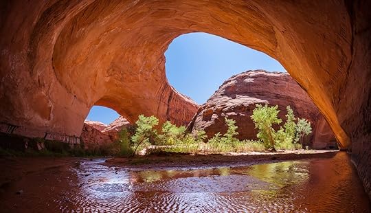
Photo: Matthew Connolly/Shutterstock
On a two to three-day backpacking trip in Coyote Gulch, you’ll see sandstone arches, waterfalls, towering rock formations, and you’ll get to hike through the winding river bottoms and view the Escalante River.
The sandstone arches are carved over years by the corrosive forces of ice, water, and wind. In the gulch, The Stevens Arch has a 225-foot span and is 160-foot tall, making it one of the largest in America. The Jacob Hamilton Arch has eroded directly over a river and hikers can walk through its center. The river is usually running at a depth of ankle to knee-deep in soft sand. Hikers can comfortably walk for a portion of the trail barefoot in the cool water.
The gulch is a popular destination in the Escalante area, but be warned, getting there is isn’t easy. To reach the recreation area, you must travel on Highway 12 until you turn onto Hole-in-the-rock road. Do not expect to make regular highway times on this road — it is a car-punishing, dirty washboard that can be completely impassable after flood conditions. A car with a higher clearance such as a Jeep or 4-runner is advised and you should call the NPS ahead of time to check the conditions. In the best of conditions, it is a slow, bumpy, self-doubt-filled slog to the trailheads, but don’t worry, the gulch is definitely worth it.
Because getting to the trailheads takes a while, if you are trying to push for a big hike on the same day as your drive in, you need to start early. If you get a permit at a visitor center on your way in, you can also car camp at a trailhead the night before your hike. There are various turnoffs on the road for other trails and canyons as well.
To tackle Coyote Gulch, there are several starting point options that offer hikes ranging from two miles to over twenty. The trails can be combined or sectioned to make a multi-day backpacking trip. Have some fun planning your route and check out other iconic parts of the gulch like the rock formation “crack in the rock,” so named because it is two big pieces of sandstone sandwiched together with just the slightest crack for hikers to press through. The squeeze is so tight, you will probably not fit if you are packed for an overnight stay.
The closest town is Escalante, Utah where you will need to gather all of your supplies. There is river water available on the hikes, but you will have to filter it before you quench your thirst. If you prefer to purchase store-bought gallons ahead of time and not mess around with river water, buy plenty of it. At an absolute minimum, you will be drinking half a gallon a day in the heat (keep in mind you have to carry it).
Always have a map and compass with you (maps are available at all of the grocery stores) because GPS can be unreliable and canyon hiking can be disorienting with limited trail markers or cairns leading the way. Following the river gets confusing in places, with multiple trails weaving down the gulch, so a map will help you follow the river down the gulch and navigate the hole-in-the-rock road.
This is not a trip for your canine friends. Leave the pups at home, they aren’t allowed in the gulch and it’s too hot to leave them in the car.
2. Peek-a-boo Gulch and Spooky Canyon — Glen Canyon National Recreation Area, Utah
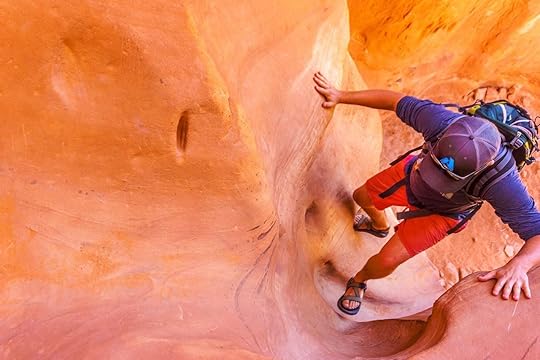
Photo: Katie Botwin
Water creates some amazing sights in nature and slot canyons have to be up there with the most awesome ones. Slot canyons are full of tight twists and turns in the rock and zebra-like patterns and stripes in the sandstone. When the sun hits them, they create a cascade of red and orange colors. Peek-a-boo Gulch and Spooky Canyon are located right next to each other and a combined trail leads you on a 3.5-mile loop to see both.
These canyons are also located off Hole-in-the-rock road at approximately the 26-mile mark, so this hike can be combined with a trip to see Coyote Gulch. You will make one turn onto Dry Fork Road and stay left to park at the trailhead. A trailhead sign greets you and warns you of the dangers of hiking in the desert and of getting caught in a slot canyon in rainy conditions. It is very important to know the weather before you enter a slot canyon. The walls are pinched so closely together that, in some places, you need squeeze through. When water enters there is nowhere for it to go but up and rapid filling can occur, so always check an up-to-date weather forecast and pop by the visitor center for current conditions.
Regardless of the weather, the bottom of these canyons rarely see sunlight because of their depth, so there is usually standing water in them. Commit to getting your shoes wet or take them off — the sandstone is forgiving on bare feet. Since the water never sees the sunlight, it is chilly, and the weather in the canyons may be cooler as well, so dress accordingly.
You may find a length of strong webbing useful on this hike for children or first-time canyoners. There are a few spots where you will have to pull yourself up a few feet to the next level of the canyon. A buddy with a strap can give you a helping hand.
There is no drinking water on this trip so pack it in. There is also not a lot of privacy on this hike, so take care of your restroom needs ahead of time to avoid an awkward encounter.
If you are claustrophobic, this is not a hike for you. Some of the sections are barely a person width wide and parties will have to use courtesy and patience when the canyon is busy to maneuver around each other.
3. Golden Cathedral/Grand Staircase — Escalante National Monument, Utah
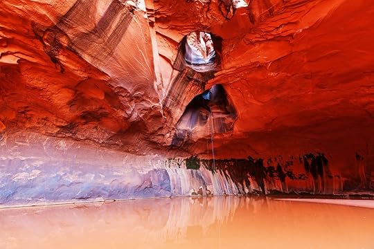
Photo: Galyna Andrushko/Shutterstock
In case you are still not convinced that a trip down the Hole-in-the-rock road is worth it, the Neon Canyon/Golden Cathedral is a third hike option off that road. This trail starts at the trailhead “Egypt” about 15 miles down the road. It passes through neon canyon and winds through river reeds and Escalante crossings. The canyon ends in a sandstone dome with skylights in the ceiling. There is usually a pool of water collected underneath which is sometimes deep enough for a swim. The rock formation gets its name from the glow it takes on when light enters the dome through the holes in its ceiling.
This is an out-and-back trail with a round-trip mileage of about 9 miles. It will probably take hikers the majority of a day to hike it as a day trip.
Any overnight stay requires a permit from the visitor center. If you want to camp in this area you will need to stop and get one before you drive the road.
This trail is not well marked and can be difficult and frustrating to follow. You will need a map and patience to find the correct route. It is always a good idea to speak with a ranger before your trip so they can answer any questions and point out current conditions of the trail. Take your time finding the correct trails and occasionally look behind you to clock the scenery to help you on your way back.
As always, bring plenty of water to drink and be prepared for the desert heat, even in spring. Prepare for this hike the same as the Coyote Gulch and Peek-a-boo and Spooky canyon trails, there are no services nearby and you will need to be completely self-sufficient.
4. The Needles — Canyonlands National Park, Utah
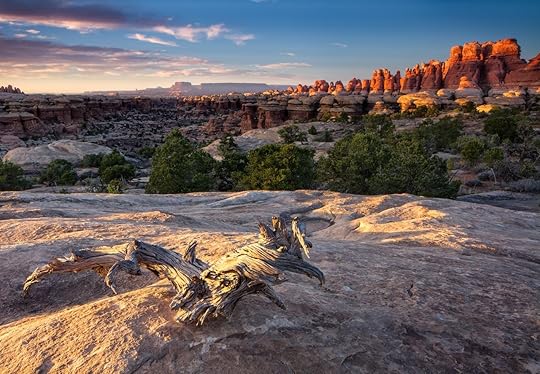
Photo: Erik Harrison/Shutterstock
The Needles gets its name from the spires of sandstone that congregate in pillars on the landscape. A hike in this area offers amazing views of striped, colorful sandstone formations and high desert arches. There are 60 miles of trails in the park you that can utilize for day hikes or a backpacking trip. Use the map to plan your route.
If you are going to be camping in the park, you will need to pick your campsites ahead of time and stop in at the visitor center prior to your trip to pick up your backcountry permits. Grabbing an annual National Parks pass saves you money over the year with entry into all of the parks and some additional perks.
Take careful note of the backcountry regulations to help make sure you and your group stay safe during your trip. The trails in the park are easy to follow and are well maintained by the rangers. Water here can be quite limited, so it is important to ask rangers about the current status of water sources. Canyonlands is located south of the town of Moab. You should supply here with food and fuel for your stoves. As always, check the weather before you head out.
5. North Kaibab Trail — Grand Canyon National Park, Arizona
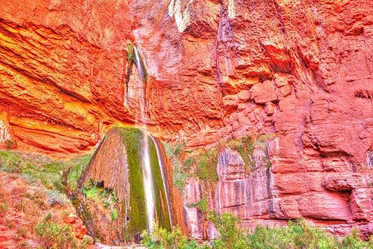
Photo: Anton Foltin/Shutterstock
The Grand Canyon is an expansive park with both the North and South Rim accessible to visitors. Springtime is the perfect time to plan a visit to the less-visited, crowd-free North Rim of the canyon (it reopens from its winter season on May 15th). You can find all related information on the North Rim road closures and backcountry reservations here.
Visitors can arrange to hike on various trails all the way to the South Rim and have a shuttle return them to their car on the North Rim. Scroll down on this page to the rim-to-rim shuttle service section for details.
The North Kaibab Trail is one of the more challenging hikes in North Rim part of the park. It can be hiked as an out-and-back trail with a total distance of 28 miles.
The North Kaibab Trail has some amazing sights along the way: a tunnel made of sandstone that you hike through called Supai Tunnel, and a 100-foot-high waterfall called Ribbon Falls.
The trail is very steep, which increases its difficulty. It has nearly 3,000 feet of elevation change dropping into and leaving the canyon. Leave your group more time for the return and uphill hike out of the canyon as the going will be slower.
Most people hike this trail in three to four days. There are two campgrounds that make planning an itinerary for the hike very easy. Cottonwood Campground is 6.8 miles from the trailhead and Bright Angel Campground is 14 miles from the trailhead. If you choose the traditional route of this trail, you will end at Bright Angel Campground and begin your return hike.
Get your permits ahead of time for the campgrounds using the online reservation system. Or try your luck with the lottery system at the visitor center the day of your trip.
Be prepared for unpredictable weather in the spring. Your group may encounter snow and cold temperatures in the evening and desert heat during the day. Always consult weather predictions ahead of time and pack in layers for warmth.
6. Paria Canyon — Vermilion Cliffs, Arizona
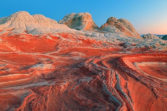
Photo: Johnny Adolphson/Shutterstock
Paria Canyon and the Vermillion Cliffs area are home to some of the heavy hitters of the desert hiking scene.
Buckskin Gulch can be found here, a canyon with a towering height that is uninterrupted for 21 miles. It is the longest and deepest of its kind in the surrounding states. It is also the most dangerous. There is a high risk of flash flooding when rain enters the canyon, and because of its depth and length, there are limited places to escape. There are entire trees wedged into the canyon thirty feet up from the power of flood water. Respect this hike and learn how to stay safe when canyon hiking before your trip.
There are multiple ways to enjoy Buckskin Gulch. It can be explored as a day hike or hiked as a two-day adventure with campsites at the confluence. This site is a great source for planning your route. Carry a map and compass with you at all times in the backcountry.
Permits for day hiking are available at each trailhead. There is also a fee for parking, bring small bills or checks. They do check, and you will get a ticket if you don’t pay the fee.
If you want to do a long day hike you can check out the local shuttle services that will pick you up at the end of your hike and return you to your car. This way, you can hike the canyon in one direction without the need to walk back.
If you want to overnight in the canyon you will need a backcountry permit from the BLM (Bureau of Land Management). Permits can be applied for ahead of time using the guidelines on this website. However, sometimes there are permits available on the day-of if there are cancellations.
Be prepared for wet and cold weather. The sunlight does not reach into the bottom of these canyons. Standing water is usually present from runoff. They can range in depth from ankle to shoulder-deep and the water is silty and mucky. Trekking poles are useful to gauge the depth of the mud before stepping in the water.
Bring a change of clothes and a pack that you can carry over your head for water crossings. Also, keep in mind that it will be colder in the canyons than the surrounding desert because of the lack of sunlight.
Once you are in the canyon, there are no places to exit. You will have to finish the hike or turn around and return the way you came if something goes wrong.
Pack in all of your water. The water in the canyon will be heavy with silt and debris and difficult to filter properly.
The Wave is another very famous rock formation in this area. It is a large sandstone formation that resembles undulating waves and is striated with vivid colors.
Obtaining a permit to visit The Wave is very tricky, and many people try for years. There is, however, a walk-in lottery every day for permits, so you may get lucky.
7. Gila Loop Trail — Gila Wilderness, New Mexico
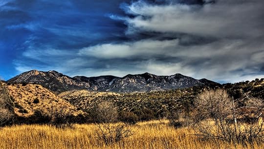
Photo: Jeff Marr/Shutterstock
The tiny town of Glenwood, NM is the closest town to the start of the Gila loop trail. This trail is a 21.5-mile loop that is a good two or three-day backpack for the average hiker. It passes over the ecosystems of the desert mesa and river valleys. It also features a natural hot spring a mile from the trailhead.
The forest is home to a variety of wildlife. During your hike, you will be in the habitat of elk, bighorn sheep, foxes, and porcupines.
To begin the hike, drive past the Gila visitor center here and park near the end of Highway 15. You will start your route at the Gila West Fork Trail. Take the time to visit the center for the most up-to-date information on park conditions. While you’re there, visit the Cliff Dwellings National Monument.
The cliff dwellings were created by an ancient people now known as the Mogollon Culture. The dwellings are built directly into the sides of the cliffs using loose rock and shale.
When you are ready to begin your backpacking trip, you will not need a permit. Plot your route on a map ahead of time and always carry a compass with you.
There are multiple river crossings on this route, so be prepared to get your feet wet. Trekking poles are always a good precaution when crossing rivers for gauging depth and providing stability.
Bring a form of water filtration with you to refill your supply. As always, be prepared for varying weather conditions and pack versatile clothing and the proper camping equipment.
8. McCauley Hot Springs — New Mexico
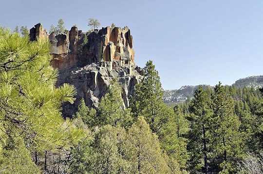
Photo: Richard Susanto/Shutterstock
Located near the town of Jemez Springs, McCauley hot springs is a good day hike option and easier hike for a more relaxing day outdoors. Battleship rock is a common starting point for the six-miles-out-and-back hike. Bring some small bills to pay for parking.
There is a waterfall and opportunity to swim in the springs on this hike. There are small fish that live in the pools that will nibble your skin while you are swimming.
This trail gets busy, so if you are looking for privacy, you will need to visit early or during weekdays to avoid the crowds.
Take caution to follow the appropriate trails to the spring as there are some false side trails that will lead you astray. Bring a map if you can and research your route ahead of time to stay on course.
9. White Sands National Monument — Arizona
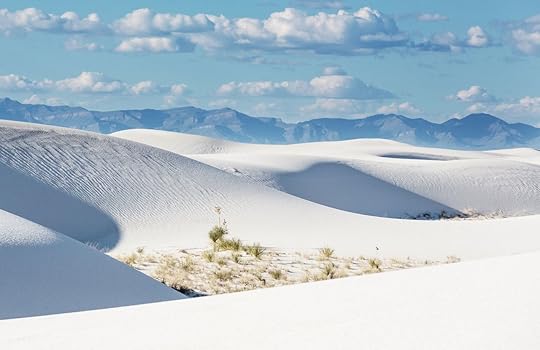
Photo: Galyna Andrushko/Shutterstock
White Sands National Monument is a unique natural formation. Gypsum has gathered here in such abundance that it has grown into large sand dunes. The gypsum gives the dunes their bright white coloration and they stretch on for miles in the park.
The Alkali flat trail offers views of some of the larger dunes and treks for a total distance of five miles. The trail is marked with poles and signs but it is still tricky to stay on track due to the shifting nature of the sands. Use caution when route finding.
Pack all of your water in and start early. The trail heats up in the day and no water is available on the dunes.
It is also possible to camp in the park with a permit. The camping is tightly regulated and you will be issued a campsite number. Permits are not reserved ahead of time and are available at the visitor center. Get in line early to make sure you get a spot.
Fun fact, the park is located next to an active missile range. If you come across any objects resembling a missile or projectile, the park advises you not to touch it for risk of explosion and alert a ranger of its location.
Besides day hiking, you can sand sled and go on full-moon hikes. The park’s things to do page can give you some ideas.
10. Tent Rocks Trail — Kasha-Katuwe Tent Rocks National Monument, New Mexico
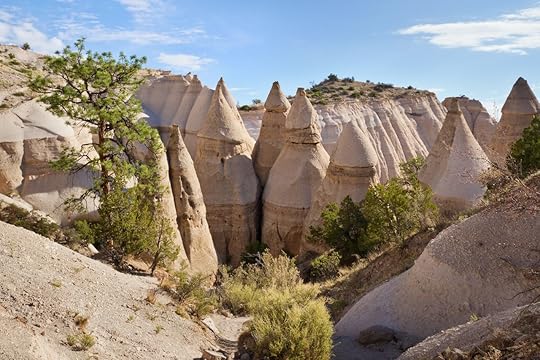
Photo: Sumikophoto/Shutterstock
Near the town of Cochiti Pueblo, Kasha-Katuwe Tent Rocks National Monument surrounds a natural rock formation created from volcanic activity millions of years ago. The collection of debris from the explosions forms towering Hoodoo rock formations that line this trail. Some of the monuments stand as tall as 90 feet.
In places, the trail narrows into a narrow slot canyon with striated rock formations. The trail is not long or difficult. It is only about 3 miles in length with moderate elevation changes. It is very popular, however, so if you want to avoid the crowds get moving early.
The site is sacred to the Cochiti Pueblo people, so it is important to stay on the trail and respect the space as sacred ground. The park is also closed for periods of time during religious ceremonies and observance, check the BLM website for updates.
Pets are not allowed in the park and parking costs $5, unless you have the National Parks annual pass which waives this fee. Get there early to avoid waiting in line to park.
Bring water, snacks, and dress in layers to adapt to the current weather conditions. There is limited shade on this hike so a hat, sunscreen, and sunglasses are necessary.
More like this: The ultimate Arizona road trip
The post An epic guide to hiking the American Southwest’s best 10 trails appeared first on Matador Network.

Road to Arctic Ocean
There’s a new way to reach the northern tip of Canada and touch the legendary waters of the Arctic. A new gravel road to the northern tip of the Northwest Territories, opened in November 2017, connects the primarily Inuit colony of Tuktoyaktuk to the larger town of Inuvik 93 miles to the south. Before the opening of the ‘Road To Tuk,’ this village abutting the Beaufort Sea and the Arctic Ocean was only accessible by plane or via an ice road in the winter.
About as wild and unspoiled as an Arctic town can be, Tuktouyaktuk is located above the Arctic tree line, meaning you can see for miles out across the northern tundra. The opening of the road aims to boost the local economy and allow for easier access to food and supplies for local residents. If you make it up there soon, you’ll be among the first tourists to visit this small Inuit settlement.
How long does it take?
A post shared by Phil (@4runnerphil) on Dec 26, 2017 at 4:51pm PST
Google Maps routes the 93-mile drive at 2.5 hours one way, so visiting Tuktoyaktuk and getting back to Inuvik is totally possible as a day trip. Of course, you have to get yourself in Inuvik first, which can be done via a connecting flight from Yellowknife. This is certainly the best option — were you to drive, the fast option has you dipping down into both Alberta and British Columbia before coming back north through the Yukon and finally back to the Northwest Territories, a 92-hour trip in itself.
How is the road?
A post shared by Radio-Canada Information (@radiocanadainfo) on Nov 15, 2017 at 4:33pm PST
The road is made of gravel and is accessible throughout the year. Although it was built to provide year-round access for residents and visitors, you still need to look out for winter conditions. On the way up and back you’ll pass beautiful lakes, streams, and plenty of pristine open wilderness — there’s not much in the way of settlements.
What can I do along the way?
A post shared by Jörg Michel (@joerg_stories_canada) on Mar 27, 2018 at 11:15am PDT
The first place you need to check out is the East Channel of the Mackenzie River, which you’ll see from the road as you approach. The river is the longest in Canada and heads north through the Northwest Territory to feed into the Arctic Ocean. The views of its snaking pathway from the side of the new highway are strikingly different than the more familiar waterways further south. You’ll then pass by the Arctic tree line at the northern edge of the Boreal Forest — there will be no trees north of you anywhere in the world.
Shortly afterwards, you’ll drive through reindeer grazing land. The animals you may see from the highway are Canada’s only herd of domestic reindeer.
Matador Network's Blog

- Matador Network's profile
- 6 followers

