
Jeffrey E.F. Friedl's Blog, page 15
October 29, 2016
Bad Experience with Amazon Fire TV, and Unhelpful Amazon Response

Amazon Fire TV Failure
nobody has any idea what this screen really means
( until now... this post tells you, like Amazon should have in the first place )
We wanted to be able to watch YouTube on the living-room TV, so I bought an Amazon Fire TV.
Living in Kyoto, I bought the Japan-market version that they warn can be used only within Japan. Fair enough.
However, in the process of trying to get it set up, I discovered some
important restrictions that they fail to disclose:
An Amazon account is required for most things to work. Not a problem for us, obviously,
but would be if we were gifting it to someone.
Then, to install the YouTube app on the device, so you can watch YouTube videos on the TV via the device
as they so-prominently advertise...
You must have a credit card.
You must have it registered in your Amazon account.
It must be a Japan-based credit card.
You must configure it for use with “1-click purchases”, even if you explicitly don't want that dangerous feature active.
None of these are disclosed, nor make any sense for a free app showing free content available freely,
to be used on a device that you own outright. I was able to install other apps without problem.
If your situation doesn't fulfill all these requirements, you're not told an up-front “you need
a Japan-based credit card configured for the 1-click feature”. Instead,
you're presented the dialog shown at the top of this post and left to figure it out for yourself.
First off, it starts out with “Purchase Failure”, which is
confusing because you're not trying to purchase anything. The app is free. The button to install it says
“Get”. This dialog is the first hint of “Purchase” to be encountered. It makes no sense.
Then it talks about “billing address” and “payment method”, but makes no mention of where it's looking
for these. It doesn't even indicate who is complaining.
Well, this error dialog pops up when merely trying to install the YouTube app, so I figure that the dialog must be from the
Amazon Fire TV. YouTube is free, after all.
So, I dig through the settings in the Amazon Fire TV, and find
nothing whatsoever about this. They do provide a way to purchase “Amazon
Coins”, which are apparently required when wanting non-free apps, but it seems not to be relevant
here.
Could it be related to the Amazon account registered to the device? I have a credit card in my account with a US billing
address... is the United States not a “supported country” as far as Amazon is concerned? (I used that card to purchase
this very device the previous day... did something change since then?)
I wonder whether they require a Japan-based credit card in your Amazon account. I
don't have a Japan-based credit card, but Fumie does, so I re-register
the Amazon Fire TV to her Amazon account.
It doesn't work.... I get the same “Purchase Failure” dialog as before.
Grasping at straws and digging around in her account settings at Amazon, I see that the billing
address for her Japan-based credit card has an optional part of the address empty, so I try filling that
in. It shouldn't matter, but I'm grasping at straws.
It doesn't work.... I get the same “Purchase Failure” dialog as before.
Searching all over creation (that is, The Internet), there's nothing about this until I read
something related to Amazon from four years ago, suggesting that something would work if you register a
credit card with their “1-click purchases” feature, in which
you immediately buy something by accidentally clicking on a single link.
I try to do this in Fumie's account, but since I had made a tiny change to
the billing address of her credit card, Amazon wouldn't let me use that credit card for anything new until I
could prove that I actually had the card by re-entering all its details. This is a great security
feature that stops people who break into your account from using your card to ship stuff to their new address, but it's really
biting me now because I want to get this set up for Fumie before she gets home, but she has the
card.
Along the way I submitted a help request to Amazon, and they responded promptly and politely and were completely unhelpful.
First they suggested that I set the 1-click purchase method to “COD”, but that option is simply not available.
Then they apologized and said that a Japan-based card is required to install any app, which I pointed out
was demonstrably false since prior to trying the YouTube app I had successfully installed and used two other apps.
Then they said essentially shrugged and said sorry.
In the end I got it working with Fumie's card in her account, but it was a decidedly unpleasant user
experience, especially in relief of the normally delightful experience we have with Amazon. The
latter is why I am a shareholder, though the former gives me pause that
they will follow Apple (of which I'm also a shareholder) down the “We just
don't care anymore” sinkhole. 


October 25, 2016
Pleasant Social Ride to Onyu Pass
Nikon D4 + Sigma 35mm F1.4 DG HSM — 1/640 sec, f/8, ISO 100 —
map & image data — nearby photos
Looking North at the Ocean
Salvo, Lianca, and Manseki
Onyu Pass (おにゅう峠), in the mountains a few hours north of Kyoto
We had a nice social group ride to Onyu Pass,
75km (47 mi) of mountain roads north of Kyoto. The entire trip was about 150km (93 mi).
SC-02H at an effective 21mm — 1/540 sec, f/1.7, ISO 50 —
map & image data — nearby photos
Morning Meetup
at the Sanjo Ohashi Bridge in Kyoto
L-R: me (USA), Manseki (Japan), Ionut (Romania), Yifen (USA), Lianca (South Africa)
(Salvo, from Italy, joined us a few minutes into the ride)
photo by Manseki Kanemitsu
Nikon D4 + Sigma 35mm F1.4 DG HSM — 1/640 sec, f/3.5, ISO 100 —
map & image data — nearby photos
Morning Stretch
or Wonder-Woman power pose, I don't remember
( the lens flare makes me think “morning stretch” )
Lianca was also present for my very first little ride 1¾ years ago
Nikon D4 + Sigma 35mm F1.4 DG HSM — 1/800 sec, f/3.5, ISO 100 —
map & image data — nearby photos
Departing Through Kyoto
7:24am
The first three hours would be just moving north, and would cover most of the length of National Route 367,
thereby mostly mimicking the start
of my recent “Stupid Cycling Tricks” ride.
Nikon D4 + Sigma 35mm F1.4 DG HSM — 1/1250 sec, f/3.5, ISO 100 —
map & image data — nearby photos
Passing Through Ohara
8:01am
Nikon D4 + Sigma 35mm F1.4 DG HSM — 1/80 sec, f/11, ISO 200 —
map & image data — nearby photos
First Big Climb
up the hairpins to Hanaore Pass
8:49am
Nikon D4 + Sigma 35mm F1.4 DG HSM — 1/100 sec, f/11, ISO 100 —
map & image data — nearby photos
Being Overtaken
by a faster group on one of the hairpins
8:51am
Nikon D4 + Sigma 35mm F1.4 DG HSM — 1/80 sec, f/16, ISO 280 —
map & image data — nearby photos
Kyoto's “I Fall” Tower
so named (by me) because the 308 steps to the top will do that to you
I've cycled these hairpins eight times so far, but had never stopped for the view. Today was a relaxing ride, so I indulged. The big tower in the center is the subject of “Kyoto’s “I Fall” Tower”
almost eight years ago.
Nikon D4 + Sigma 35mm F1.4 DG HSM — 1/1000 sec, f/16, ISO 2000 —
map & image data — nearby photos
First Tunnel
8:57am
Nikon D4 + Sigma 35mm F1.4 DG HSM — 1/1000 sec, f/16, ISO 1600 —
map & image data — nearby photos
Another Tunnel
9:05am
Nikon D4 + Sigma 35mm F1.4 DG HSM — 1/100 sec, f/2.5, ISO 6400 —
map & image data — nearby photos
Nikon D4 + Sigma 35mm F1.4 DG HSM — 1/1000 sec, f/5, ISO 320 —
map & image data — nearby photos
Theme for the Day
riding on a road alongside a river
9:12am
Nikon D4 + Sigma 35mm F1.4 DG HSM — 1/1000 sec, f/9, ISO 1100 —
map & image data — nearby photos
Big Salvo Smile
9:28am - taken while cycling at 39 kph (24 mph)
Salvo had been getting into and out of an aero position just to stretch his back, and had to laugh when I asked him
to repeat the process for the camera. But repeat it he did...
Nikon D4 + Sigma 35mm F1.4 DG HSM — 1/1000 sec, f/9, ISO 800 —
map & image data — nearby photos
Fake Aero
9:28am - taken while cycling at 43 kph (27 mph)
(but we did speed up a bit, so perhaps not so fake)
Nikon D4 + Sigma 35mm F1.4 DG HSM — 1/1000 sec, f/9, ISO 1000 —
map & image data — nearby photos
Back To Normal
Nikon D4 + Sigma 35mm F1.4 DG HSM — 1/1000 sec, f/9, ISO 560 —
map & image data — nearby photos
Rest Stop
9:55am
SC-02H at an effective 21mm — 1/2200 sec, f/1.7, ISO 50 —
map & image data — nearby photos
Ready to Continue
photo by Manseki Kanemitsu
Nikon D4 + Sigma 35mm F1.4 DG HSM — 1/1000 sec, f/9, ISO 400 —
map & image data — nearby photos
Photo Op
10:14am - taken while cycling at 27 kph (17 mph)
Nikon D4 + Sigma 35mm F1.4 DG HSM — 1/1000 sec, f/9, ISO 6400 —
map & image data — nearby photos
Entering the Next Climb
through an animal-control gate
10:18am
Nikon D4 + Sigma 35mm F1.4 DG HSM — 1/250 sec, f/9, ISO 6400 —
map & image data — nearby photos
Lovely Road
Nikon D4 + Sigma 35mm F1.4 DG HSM — 1/1000 sec, f/7.1, ISO 5600 —
map & image data — nearby photos
Nikon D4 + Sigma 35mm F1.4 DG HSM — 1/1000 sec, f/7.1, ISO 5600 —
map & image data — nearby photos
Nikon D4 + Sigma 35mm F1.4 DG HSM — 1/200 sec, f/7.1, ISO 6400 —
map & image data — nearby photos
Nikon D4 + Sigma 35mm F1.4 DG HSM — 1/250 sec, f/7.1, ISO 6400 —
map & image data — nearby photos
Steep Section
10:35am
Nikon D4 + Sigma 35mm F1.4 DG HSM — 1/640 sec, f/7.1, ISO 6400 —
map & image data — nearby photos
Still Lovely
10:41am
Nikon D4 + Sigma 35mm F1.4 DG HSM — 1/800 sec, f/8, ISO 6400 —
map & image data — nearby photos
Severe Bonk
some carbohydrates and a bit of rest and you'll be right as reindeer
Nikon D4 + Sigma 35mm F1.4 DG HSM — 1/640 sec, f/5.6, ISO 320 —
map & image data — nearby photos
Passing View
Nikon D4 + Sigma 35mm F1.4 DG HSM — 1/640 sec, f/6.3, ISO 3600 —
map & image data — nearby photos
Finally at the Top
Ohikodani Pass (大彦谷峠)
Nikon D4 + Sigma 35mm F1.4 DG HSM — 1/640 sec, f/6.3, ISO 4500 —
map & image data — nearby photos
? ? ? ? ?
( I've no idea )
Nikon D4 + Sigma 35mm F1.4 DG HSM — 1/640 sec, f/6.3, ISO 360 —
map & image data — nearby photos
Chilly Descent
the temperature hovered around 10~12℃ (low 50s F) all day
Nikon D4 + Sigma 35mm F1.4 DG HSM — 1/250 sec, f/6.3, ISO 6400 —
map & image data — nearby photos
Picturesque Waterfall
one of many we passed... one of many I don't have the skill to capture well
11:11am
Nikon D4 + Sigma 35mm F1.4 DG HSM — 1/160 sec, f/8, ISO 6400 —
map & image data — nearby photos
Challenging Descent
lot of rocks mixed in with the leaves
11:16am
Nikon D4 + Sigma 35mm F1.4 DG HSM — 1/640 sec, f/8, ISO 360 —
map & image data — nearby photos
Passing Through a Little Village
11:34am
Nikon D4 + Sigma 35mm F1.4 DG HSM — 1/640 sec, f/8, ISO 450 —
map & image data — nearby photos
Impromptu Bottle Refill
11:38am
Nikon D4 + Sigma 35mm F1.4 DG HSM — 1/640 sec, f/5, ISO 2000 —
map & image data — nearby photos
Mini Descent
12:01pm
Nikon D4 + Sigma 35mm F1.4 DG HSM — 1/640 sec, f/5, ISO 500 —
map & image data — nearby photos
Bike Bling
Ionut jokingly presented the ladies with flowers, with which they adorned their rides
12:09pm
Nikon D4 + Sigma 35mm F1.4 DG HSM — 1/640 sec, f/5, ISO 4000 —
map & image data — nearby photos
Starting the Climb to Onyu Pass
12:13pm
Nikon D4 + Sigma 35mm F1.4 DG HSM — 1/800 sec, f/7.1, ISO 100 —
map & image data — nearby photos
Early Flyby View
12:26pm - taken while cycling at 12 kph (7 mph)
We all rode together for the first while, but I eventually had the idea to try to get some shots of the group
from above, which meant going ahead enough to be above them on one of the many cutbacks.
Nikon D4 + Sigma 35mm F1.4 DG HSM — 1/640 sec, f/7.1, ISO 200 —
map & image data — nearby photos
Ionut Forges Ahead
12:27pm - taken while cycling at 21 kph (13 mph)
Nikon D4 + Sigma 35mm F1.4 DG HSM — 1/800 sec, f/8, ISO 100 —
map & image data — nearby photos
Susuki Grass
sandwiched between a guardrail and a wonderful view
12:29pm - taken while cycling at 17 kph (11 mph)
Not coming across any good views of the road below with people in them, I eventually gave up the idea
of getting a picture and decided to give a real effort for the rest of the climb.
First I had to catch Ionut.
We're more or less evenly matched, though he's a bit on the stronger side, but I had the advantage
of not having put in any real effort so far this day. He had done the previous climb in
a monumentally-fast 21 minutes,
while I had taken 37 minutes of lazy chatting and photography.
Plus, he hadn't done this climb before so had no idea what to expect or how best to pace himself. It was my fifth time.
So, I beat him to the top by 10 seconds.
Nikon D4 + Sigma 35mm F1.4 DG HSM — 1/640 sec, f/8, ISO 360 —
map & image data — nearby photos
Ionut Finally

October 22, 2016
Congratulations to Tetsuo for his Restaurant’s Michelin Star
iPhone 4S at an effective 35mm — 1/20 sec, f/2.4, ISO 400 —
map & image data — nearby photos
It All Started with One Beer
Nov 30, 2013
the first thing ordered by the first customer of his first restaurant
Congratulations to Tetsuo Azuma for his restaurant acá1° having been awarded a Michelin star, the only Spanish restaurant in Kyoto to have earned
the honor. For comparison, Osaka, which has double the population, has none. Tokyo, which has about 10 times the population, has three.
After working and apprenticing in Japan, New York, and Spain, he opened his own restaurant in November 2013.
I was his first customer.
iPhone 4S at an effective 35mm — 1/20 sec, f/2.4, ISO 125 —
map & image data — nearby photos
Opening-Day Menu
iPhone 4S at an effective 35mm — 1/20 sec, f/2.4, ISO 320 —
map & image data — nearby photos
Preparing a (the first!) Cheese Plate
Nov 30, 2013
We've seen Tetsuo on my blog before, a year before opening his restaurant, in “Father/Son Photo Shoot: Tetsuo and Issei”.
iPhone 4S at an effective 35mm — 1/15 sec, f/2.4, ISO 400 —
map & image data — nearby photos
Paul Barr Joins Me
Nov 30, 2013
as other customers also start filling the seats
iPhone 4S at an effective 35mm — 1/17 sec, f/2.4, ISO 400 —
map & image data — nearby photos
Mmmmmmm, Ham
Nov 30, 2013
as Damien Douxchamps also joins in on opening day
The thin-sliced ham calls to mind the tasty Spanish ham and
beer five years ago that led, in a curious way reported on that post, to me meeting Tetsuo in the first place.
iPhone 4S at an effective 35mm — 1/15 sec, f/2.4, ISO 500 —
map & image data — nearby photos
Grilled-Vegetable Plate
May 5, 2014
I've been to his restaurant a number of time since, of course, but seem to have photos from only a few visits.
(Somehow I guess I wanted to concentrate on the food instead of the photography?)
I'm no good at food photography anyway, and using a phone camera certainly doesn't help, but like
everything he prepares, his grilled vegetables are amazing, much more-so than the photo might allude to. Grilling vegetables is
such a simple thing and we've all done it, so why don't mine taste like this?
October 17, 2016
A Visit (or Four) to Kyoto’s Ushio Kannon Temple
iPhone 6+ — 1/120 sec, f/2.2, ISO 32 —
map & image data — nearby photos
Getting My Bell Rung
at the Ushio Kannon Temple (牛尾観音), Kyoto Japan
photo by Ionut Sandu
(Only iPhone photos today, sorry)
The other day I went for a ride with Ionut and his friend Suzuki-san (view on Strava). We started with the two-part climb up to th Ushio Kannon Temple in the Yamashina area of Kyoto.
The first part is 2.1 km (1.3 miles) at 8%,
which isn't so bad unless the road is wet, in which case it's suicide. In the most-steep areas entire width of the road is inexplicably
painted red (perhaps to warn you to the steepness?) but the paint makes for a ridiculously slippery
surface when wet.
Here's a photo from a ride in June when it was wet:
iPhone 6+ — 1/15 sec, f/2.2, ISO 80 —
map & image data — nearby photos
Unsafe at Any Speed
one day last June
今年の6月、濡れたのでメッチャ滑りやすい
The paint develops a sheen of green moss that also appears on the non-red areas, but the paint seems to both foster the moss,
and increase its slipperiness. It was sufficiently dangerous that time in June that I was scared to even hobble along by foot.
Anyway, I don't recommend this road when it's wet.
It wasn't wet this most recent time, and in trying to keep up with Ionut and Suzuki-san, I set my PR (personal record) for the first
part of the climb, so that was nice.
That first part leads to a parking lot, from which a second, more sinister climb emerges,
the 460m at 18% “Final Death Climb”.
Here's the video from my bike's front camera:
(There's also a video of the climb last January, from my bike's back camera.)
This was the fourth time I've done this climb, and I'm still scared every time to start it, praying that I don't lose footing
and fall over. So far so good. I thought it would have been the slowest time I'd done it, as I didn't put that much effort
(relatively speaking) into it, but it turns out it was my fastest of the four efforts, so hooray for a new PR here,
too.
iPhone 6+ — 1/120 sec, f/2.2, ISO 32 —
map & image data — nearby photos
End of the Climb
emerging up from lower right
photo from January
登りの終点、今年の1月
iPhone 6+ — 1/320 sec, f/2.2, ISO 32 —
map & image data — nearby photos
After My First Climb
in January
最初の登り、今年の1月
iPhone 6+ — 1/1050 sec, f/2.2, ISO 32 —
map & image data — nearby photos
After My Second Climb
also in January
二つ目の登り、今年の1月
Back to the recent climb with Ionut and Suzuki-san, at the end of the video you can see the
temple's priest/monk/owner (I'm not sure the proper word here) come out to chat and offer us a
refreshing shiso drink.
The guy is very friendly, and we ended up spending an hour with him as he kindly showed us around.
iPhone 6+ — 1/15 sec, f/2.2, ISO 64 —
map & image data — nearby photos
Heading To the Back
iPhone 6+ — 1/15 sec, f/2.2, ISO 40 —
map & image data — nearby photos
Waterfall
under which devotions are performed
Adherents stand under the water, usually in winter, for five minutes at a time to pray
(similar to what this guy is about to do). We were offered the opportunity to do it, but we politely declined.
October 15, 2016
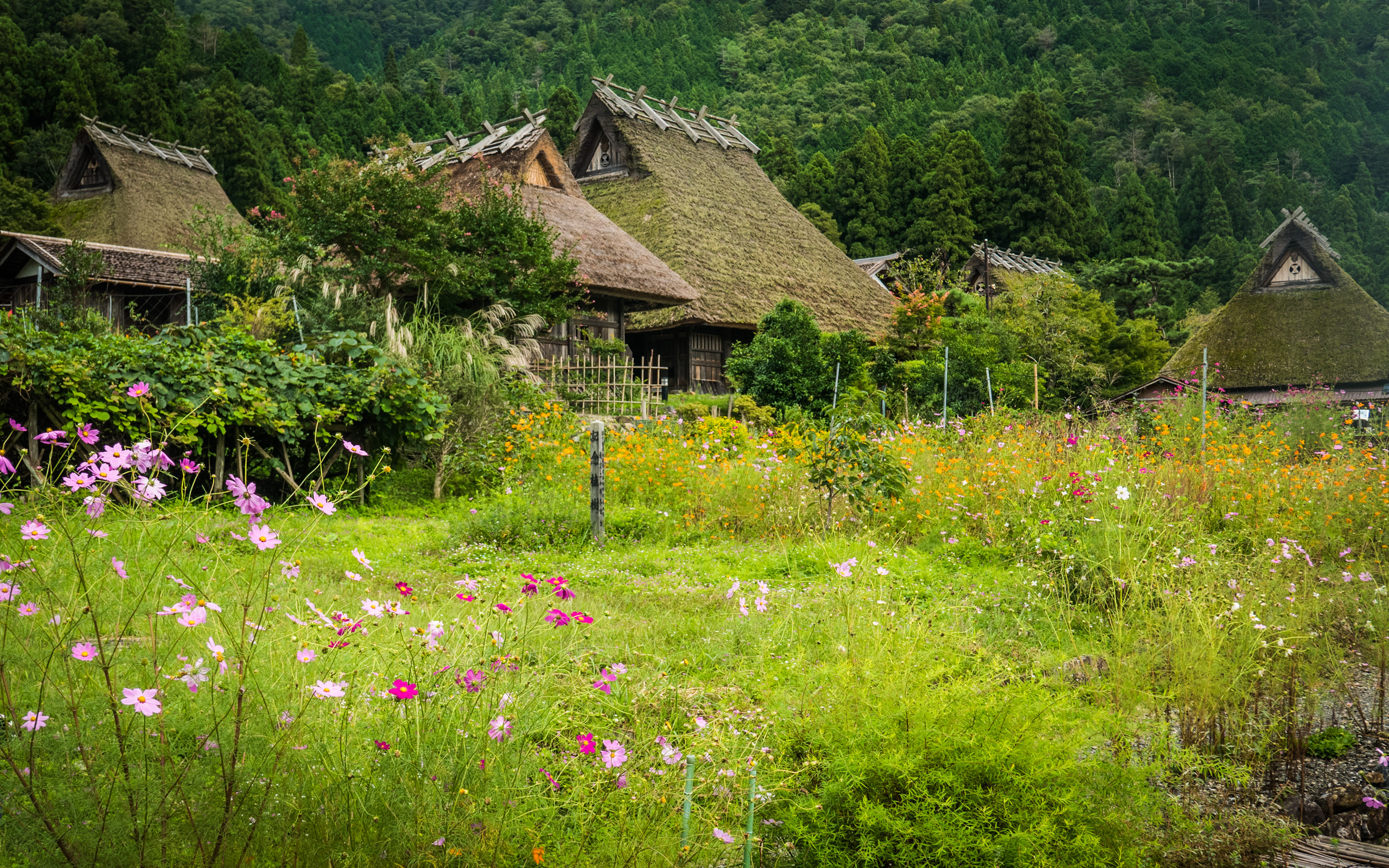
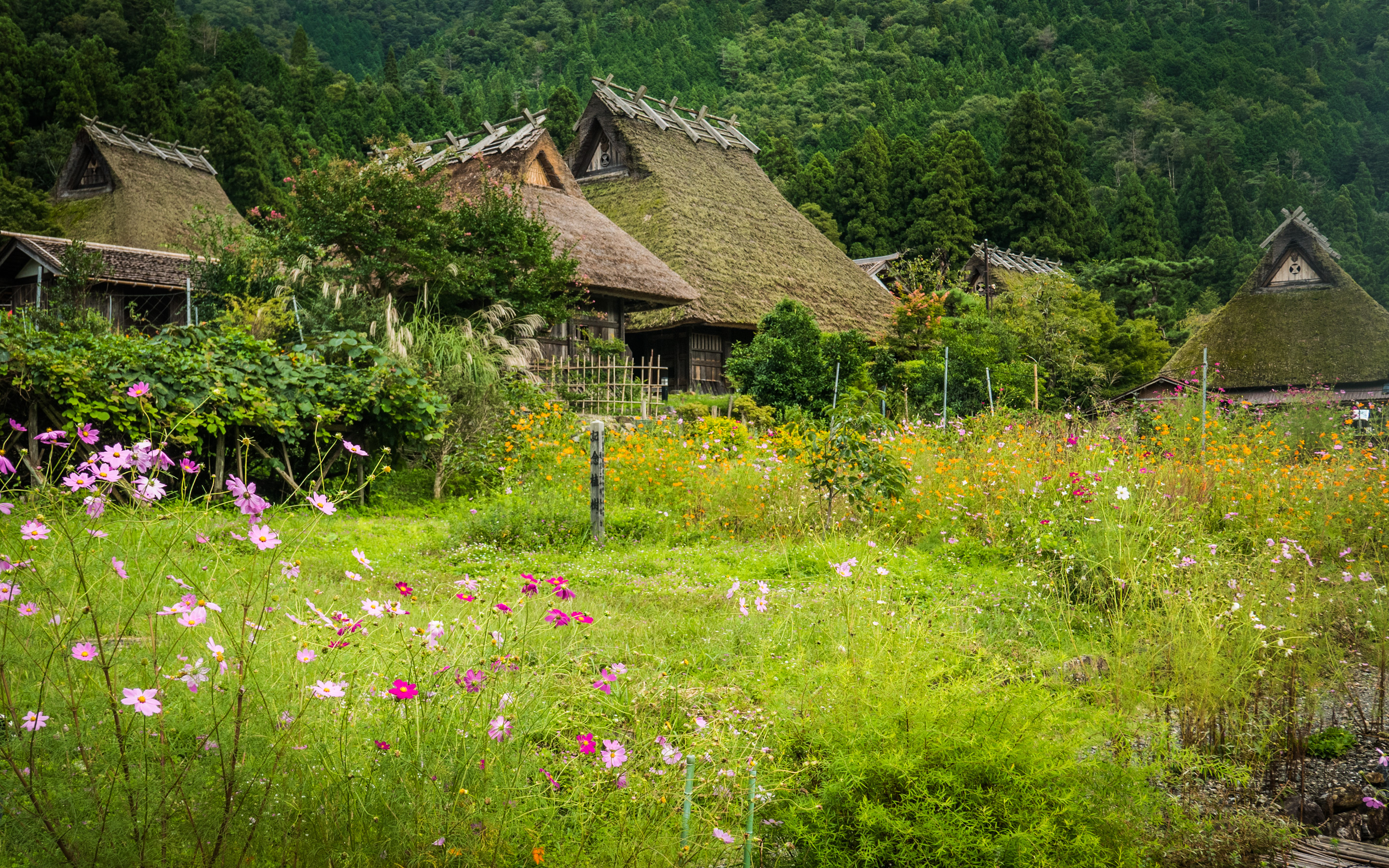
Social Ride to the Quaint Mountain Village of Miyama, With a Twist
Note: this article may not appear properly in news readers.
This article contains interactive aspects that are likely removed by most news readers. Please see this particular article directly on Jeffrey's blog for full functionality.
Panasonic LX100 at an effective 38mm — 1/160 sec, f/5.6, ISO 200 —
map & image data — nearby photos
Miyama, Japan
village in the mountains north of Kyoto
美山
Desktop-Background Versions
1280×800 · 1680×1050 · 1920×1200 · 2560×1600 · 2880×1800
A couple of weeks ago we had a nice social ride out to Miyama Japan. It was my third and most-relaxing visit, after the initial
shock of a tough ride a year ago that was my longest ride at the time, and
again via a mountains route not long after with Gorm.
This time we took a less-mountains route to get there, though for some it would be their longest ride by a factor of two.
Panasonic LX100 at an effective 24mm — 1/640 sec, f/5.6, ISO 200 —
map & image data — nearby photos
Meeting Up
at a convenience store in Kyoto
Panasonic LX100 at an effective 24mm — 1/1000 sec, f/5.6, ISO 200 —
map & image data — nearby photos
Manseki Climbs Toward Kyomi Pass
京見峠への万石さん
Panasonic LX100 at an effective 28mm — 1/125 sec, f/4, ISO 200 —
map & image data — nearby photos
Roadside Logging
( sorry for the fuzziness... I came upon the scene suddenly )
Panasonic LX100 at an effective 28mm — 1/125 sec, f/3.5, ISO 250 —
map & image data — nearby photos
Narrow Section of Route 162
taken while cycling at 26 kph (16 mph)
It's while inspecting our route on the map for this ride that I came up with the silly idea of
riding the entire length of National Route 162.
(Most of it is not narrow like this.)
Panasonic LX100 at an effective 28mm — 1/125 sec, f/3.5, ISO 200 —
map & image data — nearby photos
Three Ladies
front to back: Kumiko, Stephanie, Alicia
taken while moving at 24 kph (15 mph)
Panasonic LX100 at an effective 24mm — 1/125 sec, f/2.8, ISO 200 —
map & image data — nearby photos
Stephanie
Canadian triathlete new to Kyoto's mountains
Panasonic LX100 at an effective 24mm — 1/125 sec, f/2.5, ISO 200 —
map & image data — nearby photos
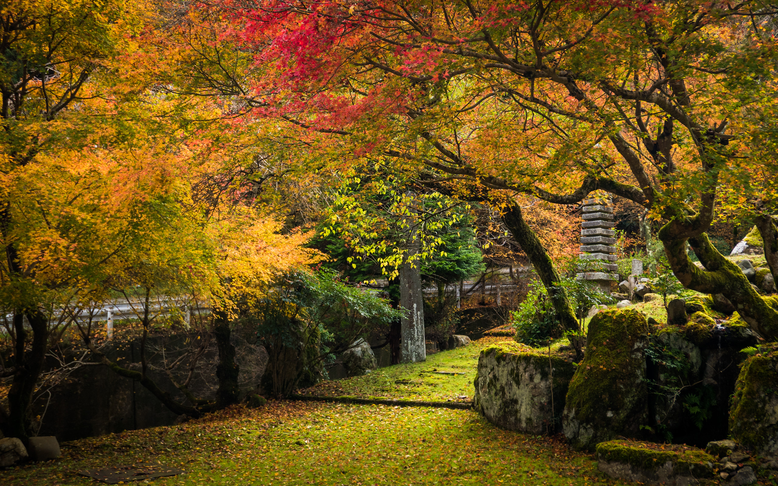
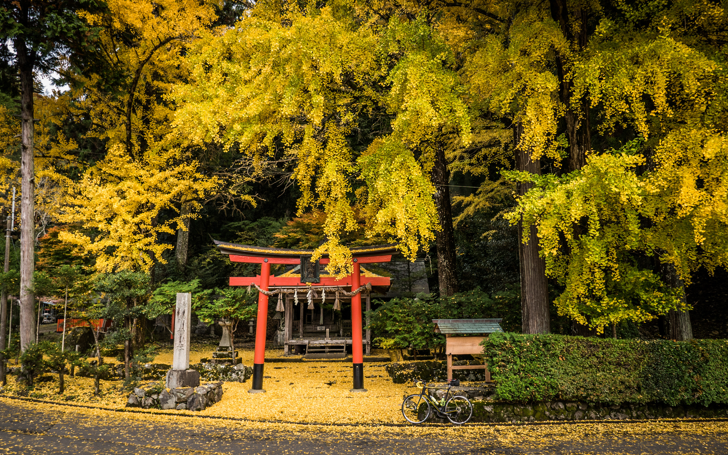
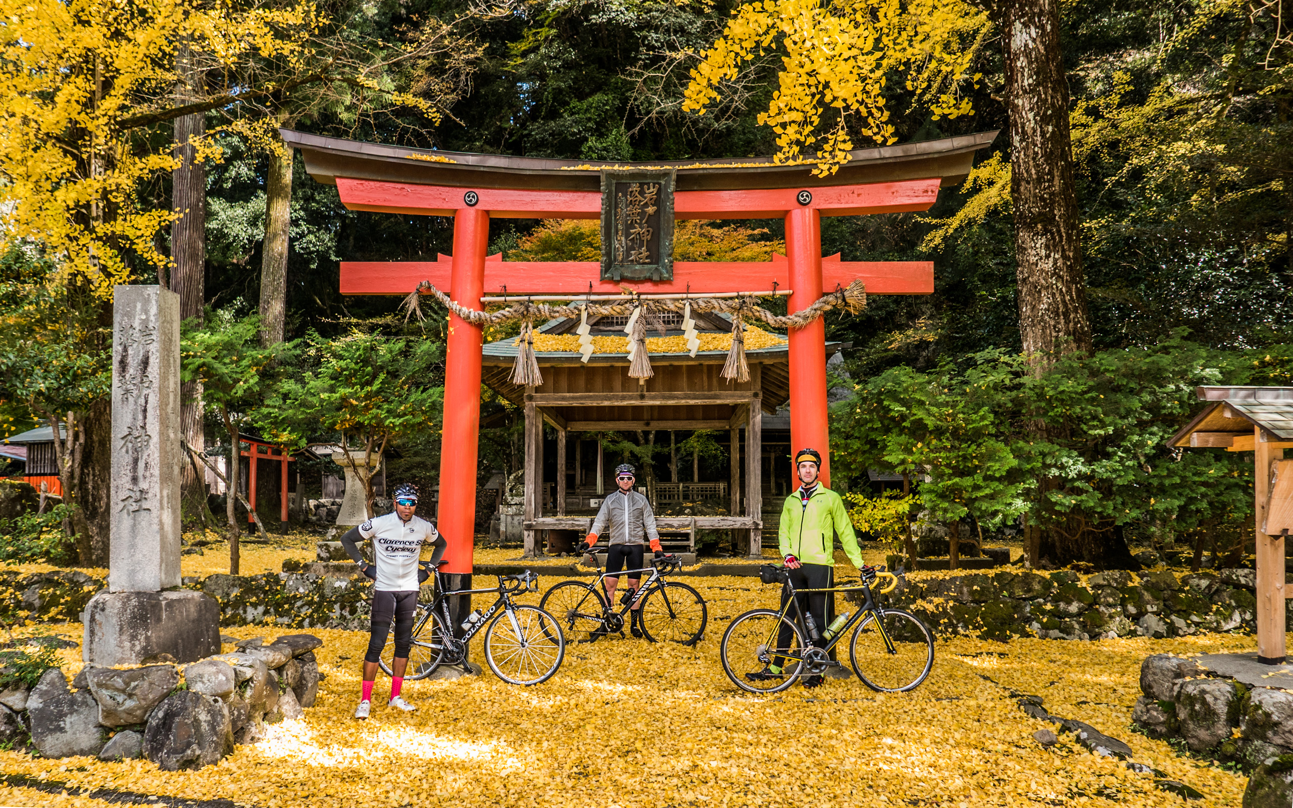
Quick Shrine Visit
Iwato Ochiba Shrine (岩戸落葉神社)
We paused to see the Iwato Ochiba Shrine, which is spectacular in autumn.
The nearby photos link shows many nice fall-foliage photos from
this shrine. We'll have to stop by again toward the end of November to see it in full glory.
Panasonic LX100 at an effective 24mm — 1/125 sec, f/5, ISO 200 —
map & image data — nearby photos
Heading Up
Manseki and Jamie in front of a pretty house
( one I've used as a backdrop before )
Panasonic LX100 at an effective 24mm — 1/125 sec, f/1.7, ISO 800 —
map & image data — nearby photos
Kasa Tunnel
uncomfortably narrow, but not too long
笠トンネル
Panasonic LX100 at an effective 28mm — 1/320 sec, f/5.6, ISO 200 —
map & image data — nearby photos
Flat Valley
Panasonic LX100 at an effective 24mm — 1/200 sec, f/5.6, ISO 200 —
map & image data — nearby photos
River in Miyama
Panasonic LX100 at an effective 40mm — 1/1000 sec, f/5.6, ISO 200 —
map & image data — nearby photos
Snack
hotcake, ice cream, and coffee
at the new and wonderful Joey's Bar
( a small cafe catering to motorcyclists, but at which all are welcome )
Panasonic LX100 at an effective 32mm — 1/125 sec, f/5.6, ISO 200 —
map & image data — nearby photos
Group Portrait
by Joey
Me, Manseki, Kumiko, Stephanie, Alicia, Jamie
At this point we'd gone about 50km (31mi) and still weren't halfway, though it was already approaching
the longest ride ever for Alicia and Stephanie. (Kumiko, I know, has done a 230km/143mi ride, because
it's documented here, though today's ride already had
about as much mountain climbing as that entire ride had, so they're each challenging in their own way.)
Joey's Bar was a wonderful place to relax, chat, and sip on coffee, so we ended up spending way too long there.
Finally we moved along toward the quaint village of Miyama...
Panasonic LX100 at an effective 44mm — 1/200 sec, f/5.6, ISO 200 —
map & image data — nearby photos
Arrival in Miyama
Panasonic LX100 at an effective 25mm — 1/200 sec, f/5.6, ISO 200 —
map & image data — nearby photos
Photo Ops
Panasonic LX100 at an effective 24mm — 1/200 sec, f/5.6, ISO 200 —
map & image data — nearby photos
Disconcerting
the big garage door with a roll shutter just doesn't fit the aesthetic
Panasonic LX100 at an effective 35mm — 1/160 sec, f/5.6, ISO 200 —
map & image data — nearby photos
Photo Op
Panasonic LX100 at an effective 75mm — 1/125 sec, f/5, ISO 200 —
map & image data — nearby photos
Powwow
Unfortunately, Jamie had been feeling increasingly ill, and had to abandon the ride at Miyama. The ladies returned to Kyoto via
the route we came, while I headed back via a route that was more mountainous, but perhaps quicker, to fetch my car. Manseki stayed
back to keep Jamie company.
The relaxing nature of the ride was over, and I lit the afterburners (which for me is more like a kid's fourth-of-July
sparkler) and headed back towards Kyoto over Sasari Pass. I'd done the western
climb to Sasari Pass — 5.6km/3.5mi at 6.2% — only once before, and absolutely hated every moment of it. It's felt unrelenting and steep. With that preconceived notion this time it was more tough mentally than physically, as I'm in much better
shape now, and those numbers (any distance at 6%) otherwise doesn't faze me.
After descending the other side, I got a message that Jamie had been able to get a lift from a local, so I no longer needed to
speed to Kyoto for my car. So, I returned back up to Sasari Pass and all the way back down the other side, to meet back up with
Manseki who would be heading this way from Miyama.
Panasonic LX100 at an effective 49mm — 1/125 sec, f/2.7, ISO 200 —
map & image data — nearby photos
Shades of Autumn
colored leaves accumulate
The timing was great as I arrived at the base of the climb just as Manseki was arriving from Miyama, so I turned around
and we headed back up.
Panasonic LX100 at an effective 24mm — 1/125 sec, f/4.5, ISO 200 —
map & image data — nearby photos
Heading Up to Sasari Pass
佐々里峠へ、美山から
Panasonic LX100 at an effective 24mm — 1/125 sec, f/1.7, ISO 250 —
map & image data — nearby photos
15 Minutes Later
not much has changed.... still climbing
Panasonic LX100 at an effective 24mm — 1/125 sec, f/1.7, ISO 200 —
map & image data — nearby photos
Cresting Sasari Pass
佐々里峠
It was my third ascent to Sasari Pass that day. After descending toward Kyoto, at just about the spot
I'd turned around the first time, we stopped by a cafe for coffee.
Panasonic LX100 at an effective 24mm — 1/125 sec, f/2.8, ISO 200 —
map & image data — nearby photos
Nameless Cafe
the sign says “coffee”
This cafe is in the middle of nowhere. There's not so much as a vending machine for miles in any direction. The coffee and bread were wonderful.
Manseki and I then returned to Kyoto over Hanase Pass. All in all the extra climbs up Sasari made it
a longer day for me than most, and the ride
totaled out at 139km (87mi) with 2,570m (8,425') of climb:
Here's the Relive.cc video:
Though we returned in three different groups, we all made it home fine, and everyone had a nice long ride under their belt.
October 12, 2016
Some Solo Exploration Beyond Mt. Atago
Note: this article may not appear properly in news readers.
This article contains interactive aspects that are likely removed by most news readers. Please see this particular article directly on Jeffrey's blog for full functionality.
Panasonic LX100 at an effective 24mm — 1/250 sec, f/5.6, ISO 200 —
map & image data — nearby photos
Different From Usual
Kyoto Arashiyama's Togetsukyo bridge from an uncommon vantage point
嵐山の渡月橋
After a wonderful ride with friends beyond Kyoto's Mt. Atago the other
day, I returned the next day for 110km (68mi) of solo exploration in the same general area.
Panasonic LX100 at an effective 75mm — 1/125 sec, f/5.6, ISO 200 —
map & image data — nearby photos
Bird and Bridge
more-traditional view of the Togetsukyo bridge
Early on in the ride I passed through Arashiyama in western Kyoto, with its famous bridge.
We've seen it before on my blog
in rain and in sun
and crowned by a rainbow. Today was fairly bland, but a big bird
was doing a batman pose, so that was something.
Panasonic LX100 at an effective 75mm — 1/125 sec, f/5, ISO 200 —
map & image data — nearby photos
“Me” Time
There's a path along the river southwest of the bridge that leads up to a temple with a great view that I visited some years ago, but apparently never posted about.
Anyway, the path is fine for a road bike for a while, and from the path I got the photo at the top of the page.
Eventually the path ends as far as bikes are concerned:
Panasonic LX100 at an effective 40mm — 1/125 sec, f/3.5, ISO 200 —
map & image data — nearby photos
End of the Path
unless you're really adventurous
It's probably not as bad as this climb, but I didn't have the guts
to try it just now.
Panasonic LX100 at an effective 24mm — 1/125 sec, f/3.5, ISO 200 —
map & image data — nearby photos
Near the End of the Path
Panasonic LX100 at an effective 24mm — 1/125 sec, f/1.7, ISO 2000 —
map & image data — nearby photos
Gathering Crowds
Arashiyama Bamboo Forest (嵐山竹やぶ)
The road through the bamboo forest in Arashiyama is a public road open to cars, but folks treat it like
their living room, wandering about aimlessly with their eyes glued to their camera or phone.
I then made my way up and over Mt. Atago, setting
a PR (personal record) by a wide margin,
which pleases me because I kept my effort low enough to not kill myself.
I missed beating my KOM time (“King of the Mountain”, the fastest time by a male) on
the Nishigaya Dam Descent by three
seconds because I saw a big monkey run across the road ahead of me, and didn't want to chance that there would be others. It's one thing to see wildlife at the side of the road
when slowly grinding uphill, but quite another when plunging downhill at 70kph (45mph).
Then for the first time I did the long fun New Momiji Descent, and
likely got the second-fastest time, but my activity doesn't match the segment for some reason. Sadly, the Strava support staff
member assigned to my query about it is either really lazy or a complete jerk because the cut-n-paste
responses have little to do with my actual question. It must be depressing to have a
job you just don't care about. Sigh.
Panasonic LX100 at an effective 72mm — 1/125 sec, f/5, ISO 200 —
map & image data — nearby photos
End of a Fun Descent
or start of a less-fun climb
Panasonic LX100 at an effective 24mm — 1/160 sec, f/5.6, ISO 200 —
map & image data — nearby photos
Flat Valley
Panasonic LX100 at an effective 24mm — 1/125 sec, f/4, ISO 200 —
map & image data — nearby photos
“Coffee” and “Open for Business”
sadly, neither were true
It was chilly (15℃/59℉) on the descent, so I was happy to find a coffee shop, but no one was around. I walked in and called out, but the place was deserted. Weird.
Panasonic LX100 at an effective 75mm — 1/160 sec, f/5.6, ISO 200 —
map & image data — nearby photos
Path Closed
Panasonic LX100 at an effective 24mm — 1/125 sec, f/1.7, ISO 250 —
map & image data — nearby photos
Mountainside Fountain
Much nicer than this, and sort of reminded me of
this. I paused to fill up.
Panasonic LX100 at an effective 75mm — 1/125 sec, f/5.6, ISO 200 —
map & image data — nearby photos
Mid-Climb Rest Area
Panasonic LX100 at an effective 24mm — 1/125 sec, f/5.6, ISO 200 —
map & image data — nearby photos
Nice View
Panasonic LX100 at an effective 24mm — 1/125 sec, f/3.2, ISO 200 —
map & image data — nearby photos
Intriguing!
unknown road rises sharply to the left
It wasn't unknown, actually, because I had done my homework.
It's a
short 180m at a steep 18%
access road to a water-storage tank...
Panasonic LX100 at an effective 26mm — 1/125 sec, f/5.6, ISO 200 —
map & image data — nearby photos
At The Top
Pre-ride research had brought me to this page that includes info
about this little climb. The photos at the time (three years ago) show little vegetation, but now it's
overgrown and encroaching on the road in a photogenically-pleasing manner....
Panasonic LX100 at an effective 24mm — 1/125 sec, f/4, ISO 200 —
map & image data — nearby photos
Heading Back Down
Panasonic LX100 at an effective 43mm — 1/125 sec, f/3.2, ISO 200 —
map & image data — nearby photos
Another Mystery Road
Panasonic LX100 at an effective 70mm — 1/125 sec, f/2.8, ISO 640 —
map & image data — nearby photos
Pretty Lane
quite steep, but it ends at a gate right after this
Panasonic LX100 at an effective 50mm — 1/125 sec, f/5, ISO 200 —
map & image data — nearby photos
Yagi is not Just a Town
it's an Amenity Town
( the only Japanese is the word for “sewer” )
Panasonic LX100 at an effective 27mm — 1/125 sec, f/5, ISO 200 —
map & image data — nearby photos
Amenity-Town Steepness
note that we're way above the house just beyond the car
Panasonic LX100 at an effective 43mm — 1/125 sec, f/4.5, ISO 200 —
map & image data — nearby photos
Amenity-Town View
Panasonic LX100 at an effective 24mm — 1/125 sec, f/2.5, ISO 200 —
map & image data — nearby photos
Amenity-Town Shrine
Hachimangu (八幡宮)
Panasonic LX100 at an effective 41mm — 1/125 sec, f/4, ISO 200 —
map & image data — nearby photos
Seen Better Days
according to the faded sign, a former drop-off point for a dry cleaner
Panasonic LX100 at an effective 24mm — 1/125 sec, f/2.8, ISO 200 —
map & image data — nearby photos
More Steepness
the photo doesn't capture it well, but
the road drops more than a story's height before the end of the building
Panasonic LX100 at an effective 60mm — 1/125 sec, f/2.8, ISO 320 —
map & image data — nearby photos
Thick
more “photo doesn't capture it well” with this one
the base is about 60cm (2') wide
I moved around to try minor roads I'd never been on.
Panasonic LX100 at an effective 24mm — 1/125 sec, f/2, ISO 200 —
map & image data — nearby photos
Pleasant Little-Used Road
Panasonic LX100 at an effective 24mm — 1/125 sec, f/2.5, ISO 200 —
map & image data — nearby photos
Secret Spot
Panasonic LX100 at an effective 32mm — 1/125 sec, f/2.2, ISO 250 —
map & image data — nearby photos
More Encroaching Grass
Panasonic LX100 at an effective 27mm — 1/125 sec, f/2.8, ISO 200 —
map & image data — nearby photos
Lovely Countryside Scene
with freshly-harvested rice on the other side of the river
Panasonic LX100 at an effective 75mm — 1/125 sec, f/2.8, ISO 1250 —
map & image data — nearby photos
Bridge of Dubious Reliability
Panasonic LX100 at an effective 24mm — 1/100 sec, f/1.7, ISO 200 —
map & image data — nearby photos
Another Side Climb
left for another time
I discovered a lot of new climbs and fun descents, and make some nice PRs (including one climbing
Kyomi North) without having
killed myself in the process, so that was very nice.
Less nice were the two flats I got at the end. I think the second flat was a tube that was bad to begin with, though it lasted
10 minutes, so I don't know.
All in all it was a great outing. As a bonus, for the first time this year, I was
actually ahead of my arbitrarily-picked 7,000km (4,350mi) goal for the year, which, after four months of unplanned travel,
I didn't think I'd be able to make.
(I still might not make it, with less riding in the winter, but it looks promising.)
Here's the Relive.cc video of this ride...
October 9, 2016
Sort of Silly Cycling: Covering the Full Length National Routes 367 and 162 Just for the Sake of It
Note: this article may not appear properly in news readers.
This article contains interactive aspects that are likely removed by most news readers. Please see this particular article directly on Jeffrey's blog for full functionality.
Panasonic LX100 at an effective 24mm — 1/125 sec, f/5.6, ISO 200 —
map & image data — nearby photos
Off The Northern Coast
Sea of Japan from Fukui Prefecture
日本海、福井県の若狭三方から
先週なんとなく国道367号線と国道162号線のゼンセンを乗るのは面白いかもと思いました。
普通はサイクリングすろと国道を抜きたいですが、今回ワザトこの国道の全線を乗る。京都市内の五条烏丸で始まる国道367号線を乗って北へ。
そして、日本海の近くの福井県三方で始まる国道162号線で南へ。
結局225キロをゆったり走りました。京都市周辺以外には道は良かった。車は少なかった。
Last week I got it into my head to do a “theme” bicycle ride: ride
the length of National Routes 367 and 162. The total of both is about 183km (114mi), but with the
transition between and bits before and after, the ride (see at Strava)
ended up being 225km (140mi).
Both routes have endpoints in Kyoto, and many fun rides include parts of them, but in most cases the national routes are used
begrudgingly as a quick way to get to the fun part of the ride. The ride is fun despite the parts on the national
route, which with traffic and tunnels, generally fall into the “less fun” category.
So, I thought it'd be something (what I'm not exactly sure) to face this head on and make them the point of the ride.
For reference, here they are on the map:
image data
National Route 367 is in purple; it's about 57km (35mi) long.
National Route 162 is in green; it's 127km (78mi) long
(I live at the yellow star)
I went to the base of the purple route and took it north, then continued to the top of the green route, by which I then
returned to Kyoto.
Here's the view on Strava:
Panasonic LX100 at an effective 32mm — 1/320 sec, f/5.6, ISO 200 —
map & image data — nearby photos
Start of National Route 167
Corner of Gojo and Karasuma Streets, downtown Kyoto Japan
7:36am
Panasonic LX100 at an effective 24mm — 1/125 sec, f/5, ISO 200 —
map & image data — nearby photos
First Turn Coming Up
7:53am - taken while cycling at 25 kph (15 mph)
Within the city the idea of a “National Route” is merely notational, and it shifts streets a few times
before it settles on the actual stretch of blacktop that heads north into the mountains. There are only
three such turns on the entire length of road, and all are within the first little bit, but I managed to
screw even that up and managed to get off course in the first 10 minutes. Sigh.
But, I quickly recovered and that was the last navigational mistake of the day, thank goodness.
Soon I was out of the city...
Panasonic LX100 at an effective 24mm — 1/320 sec, f/4.5, ISO 200 —
map & image data — nearby photos
An Hour In
8:45am — typical scene

Panasonic LX100 at an effective 24mm — 1/125 sec, f/4.5, ISO 1250 —
map & image data — nearby photos
Monkeys!
crop from a larger photo; taken while climbing a steep rise at 12 kph (8 mph)
Panasonic LX100 at an effective 24mm — 1/125 sec, f/4.5, ISO 250 —
map & image data — nearby photos
Steep Climb!
this is much more fun to go down (like this
and this) than to climb up
The weather forecast for Kyoto had a 0% chance of rain, but upon exiting a long tunnel an hour and a half in, at the highest
elevation I'd reach all day, I was reminded that I was no longer in Kyoto... it was cold, windy, and rainy.
It rained on and off for much of the day until I got back to Kyoto.
Panasonic LX100 at an effective 24mm — 1/125 sec, f/4.5, ISO 500 —
map & image data — nearby photos
Passing The Turnoff To Kuta
9:12am - taken while cycling at 41 kph (26 mph)
An hour and a half into Route 367 I came to the turnoff to the Kuta region. I'd just been here on the ride mentioned
in the previous point, as the fork between fast and safe,
where I'd opted away from the national route in the increasing darkness. No worries about that today.
Rough calculations told me that I'd make it home by daylight if I could maintain a 20kph pace (12½mph), including all stops.
(I left at about 7:30am; sunset was about 5:30pm).
That's an easy pace to maintain on all but the few steepest sections of these big modern roads, but the devil is in the
“including all stops” detail. It's amazing how much time you can lose pausing for traffic lights, traffic, taking photos, buying a
drink, eating, or just to catch your breath, much less to mechanical issues like flat tires. So it was comforting to compare the
hours ticking off the clock, to the kilometers ticking up on the readout, and realize that I was keeping comfortably within
range.
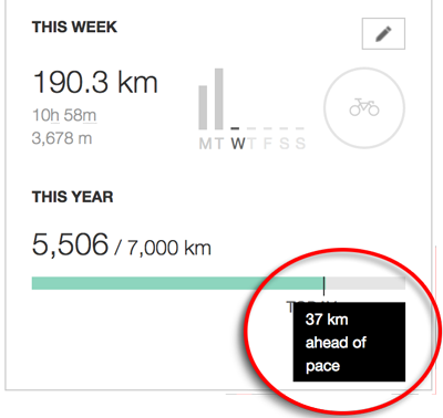
(My cycling computer, a Garmin 820, has a “virtual partner” feature where it can ostensibly tell you how far ahead or behind
a certain pace you are, but it was ridiculously incorrect — “2 minutes behind” instead of “35 minutes ahead”, for example.
Perhaps somehow its functionality changes if you're navigating a route? Sigh, I may have to actually hunt down the manual.)
Panasonic LX100 at an effective 24mm — 1/125 sec, f/4.5, ISO 1000 —
map & image data — nearby photos
Wet and Rainy
but little traffic this far north, 44km (28mi) into Route 367
9:23am - taken while cycling at 18 kph (11 mph)
Panasonic LX100 at an effective 24mm — 1/320 sec, f/5.6, ISO 200 —
map & image data — nearby photos
Crossing a River
over a riverside campground
Panasonic LX100 at an effective 24mm — 1/640 sec, f/4.5, ISO 200 —
map & image data — nearby photos
Kutsuki Village
near the turnoff to the ski grounds mentioned in the previous post
9:37am - taken while cycling at 13 kph (8 mph)
I'd never been farther north than this village, so I was happy to see new road. I was greeted with a
130m (430') climb, then a descent
toward the end of the road...
Panasonic LX100 at an effective 44mm — 1/125 sec, f/2.6, ISO 200 —
map & image data — nearby photos
The End of National Route 367
9:57am — 2:20 and 57km (35mi) from the start
After finishing National Route 367, I had to continue away from Kyoto another hour's ride farther
north toward the start of National Route 162, and as I started that leg, I made
a shocking discovery: the gear shifters on my bike was almost out of battery!
My bike has Shimano Di2 electric derailleurs, powered by a battery that I have to charge a few times a year. The previous night I'd checked and found it had 29% battery left, enough to
last a month. At the start this morning, though, the readout said 20%, so
I started to worry that the readout wasn't trustworthy, but it remained at 20% halfway up Route 367, so
my mind was put at ease. But now, at the end of Route 367, I was shocked to see it at 10%! If I were to run out of battery, I'd be stuck in whatever gear the bike was in for
the rest of the ride.
To save on battery I removed the wireless-communication module (which communicated the untrustworthy battery level to my
cycling computer), and tried to avoid shifting as much as possible. In one sense it created a perhaps useful kind of training as I
stuck with a single gear through a much wider range of cadence/power than I would naturally do.
With some trepidation I made my way north on Route 303, filled with trucks and blistering cross winds. I'd ridden in
strong winds before (e.g. this ride to Osaka), but never at high speed. I guess in this case I was lucky for the trucks, because traffic was moving at the posted 50kph speed limit, so I found
some shelter in the lee behind a truck and could avoid some of the stronger gusts.
Panasonic LX100 at an effective 24mm — 1/500 sec, f/5.6, ISO 200 —
map & image data — nearby photos
Typical Scene
10:24am - taken while cycling at 17 kph (11 mph)
Panasonic LX100 at an effective 32mm — 1/125 sec, f/2.2, ISO 250 —
map & image data — nearby photos
Lunch
at a convenience store, 3½ hours in
chicken breast, rice ball (already eaten), and a doughnut
Panasonic LX100 at an effective 24mm — 1/320 sec, f/5.6, ISO 200 —
map & image data — nearby photos
Approaching National Route 162
11:13am - it begins at the next left
Panasonic LX100 at an effective 24mm — 1/320 sec, f/5.6, ISO 200 —
map & image data — nearby photos
Anonymous-Looking Intersection
Kyoto is to the left, 125km (78) miles away
The first few hundred meters of National Route 162 is a flyover bridge above some railroad tracks, and “officially”
bicycles are not allowed on that short stretch. No one was around so I took it, and can't understand why bicycles would
be prohibited... it would have been perfectly safe even in heavy traffic. It took 30 seconds to transverse.
15 minutes of pleasant cycling later, I arrived at the first tunnel of National Route 162:
Panasonic LX100 at an effective 24mm — 1/125 sec, f/2.2, ISO 200 —
map & image data — nearby photos
National Route 162 Tunnel #1
Tunnels with traffic can be particularly dangerous for bicycles, so we're generally aware of them and their condition
when planning a route, and try to avoid them when conditions warrant. But with today's theme ride, I'd take all tunnels however
they came.
And they came. National Route 367 has six tunnels over its length. They tend to be safer when riding south-to-north because the slope lets you ride with traffic, which is why I did today's loop in this counter-clockwise direction.
The roads I took to move to the start of National Route 162 included two tunnels.
National Route 162, though, has 18(!) tunnels over its length.
Passing through this first tunnel, I emerged to find the Sea of Japan:
Panasonic LX100 at an effective 43mm — 1/160 sec, f/5.6, ISO 200 —
map & image data — nearby photos
First View of the Ocean
11:33am - four hours in
Panasonic LX100 at an effective 24mm — 1/160 sec, f/5.6, ISO 200 —
map & image data — nearby photos
A Minute Later
from sea level
The road hugs the coast for a while, but rises and falls sharply. During one of the rises, I took the photo that leads
this post.
Panasonic LX100 at an effective 24mm — 1/125 sec, f/5.6, ISO 640 —
map & image data — nearby photos
Typical Scene
11:47am - taken while cycling at 40 kph (25 mph)
Panasonic LX100 at an effective 24mm — 1/160 sec, f/5.6, ISO 200 —
map & image data — nearby photos
Typical Village
nestled in a cove
Panasonic LX100 at an effective 24mm — 1/125 sec, f/4.5, ISO 200 —
map & image data — nearby photos
Valley View from a Bridge
of rice fields both abandoned and in use
Panasonic LX100 at an effective 24mm — 1/200 sec, f/5, ISO 200 —
map & image data — nearby photos
Hugging the Coast
12:03pm - taken while cycling at 40 kph (25 mph)
Panasonic LX100 at an effective 24mm — 1/320 sec, f/5.6, ISO 200 —
map & image data — nearby photos
Descending into Obama City
12:28pm - taken while cycling at 28 kph (17 mph)
I wanted to stop by The Mermaid to replicate this photo, but National Route 162
doesn't pass by (it's a block or two over), so I'd have to leave it for another day.
Panasonic LX100 at an effective 24mm — 1/160 sec, f/5.6, ISO 200 —
map & image data — nearby photos
Right Turn South, Toward Kyoto
12:33pm - taken while cycling at 23 kph (14 mph)
The sign in the photo above had the first mention of Kyoto I'd noticed.
In the photo above, on the left side of the road, there's a temperature readout (23℃, about 74℉). Just behind
it, a man dressed in blue is standing... sort of hiding.
Panasonic LX100 at an effective 24mm — 1/125 sec, f/5.6, ISO 200 —
map & image data — nearby photos
Hello
12:33pm - taken while cycling at 23 kph (14 mph)
In the far background is another policeman with a red “STOP!” flag, who will run out into traffic to stop someone the first
policeman identifies as breaking some law. I most commonly see them standing like this near intersections looking for folks who
make illegal turns (seemingly ignoring the plethora of folks who brazenly run red lights in the most staggeringly-obvious way),
but in this case the first policeman was standing without a good view of an intersection, so I'm guessing he's on the watch for
those not wearing seat belts.
I wasn't wearing a seat belt, but somehow skated by safely.
October 1, 2016
What an Adventure: a Slow but (Mentally) Grueling Century Ride
Panasonic LX100 at an effective 38mm — 1/125 sec, f/4.5, ISO 200 —
map & image data — nearby photos
Ready to Start
Stephanie and Manseki
7:30am, Kyoto Japan
I had quite the bicycle ride last week; this blog post is mostly a diary for my own memory.
What started out as a pleasant ride with friends ended up 12 hours later being a
test of nighttime eyesight and creative headlight battery management.
The Relive.cc video of the ride gives a sense of this never-ending ride.
I planned a longish ride to the north of Kyoto, but would be joined at the beginning by Stephanie and Manseki. We'd intended to head over the mountains via the Hiei climb, but rush-hour traffic on the narrow road made us turn
around and head north via Ohara.
Panasonic LX100 at an effective 24mm — 1/320 sec, f/5.6, ISO 200 —
map & image data — nearby photos
Among the Spider Lilies of Ohara
大原の彼岸花の中で
Panasonic LX100 at an effective 24mm — 1/320 sec, f/5.6, ISO 200 —
map & image data — nearby photos
SC-02H at an effective 21mm — 1/700 sec, f/1.7, ISO 50 —
map & image data — nearby photos
photo by Manseki Kanemitsu
From Ohara, Stephanie returned to Kyoto for an appointment, while Manseki and I continued north up the Tochu climb, then down
toward Lake Biwa.
My main goal of the ride was to do a particular climb way up north, but also try a bunch of short-but-intense tangential climbs
hanging off the route along the way. I'd found them by scouring satellite photos via Google Earth looking for what seemed to be
paved roads up into the mountains; until I tried them, I didn't know whether access was even allowed, or whether they were paved,
but this kind of exploration is all part of the fun.
I had done some of these climbs on
“Disappointing and Truncated “Search for The Big Steep” Ride”
earlier in the month, including
the 1.4km @ 13% “Blueberry Fields” climb
and the 1.6km @ 12% Kurihara climb.
Panasonic LX100 at an effective 75mm — 1/125 sec, f/5.6, ISO 200 —
map & image data — nearby photos
Manseki Finishing
the Myodokai Climb
妙道会のHCの終点
1.7km @ 8%
The first tangential climb today was the Myodokai Climb, a nicely-paved
1.7km (1mi) at a mild 8%. It's on the grounds of a Buddhist organization's campus, so there's little traffic, and it offers nice
views during the return descent.
Panasonic LX100 at an effective 75mm — 1/250 sec, f/5.6, ISO 200 —
map & image data — nearby photos
Halfway Back Down
I'd also done this one earlier in the month, and as is my habit the first time I ride a climb, I'd taken it slowly.
This time wasn't the first time, so I put a bit of effort into it. I enjoy going slowly more than quickly, at least on the
up-hill parts.
September 25, 2016
Feeling Good: Leg Healing Well, and Good Deeds Done
I posted the other day about ripping a calf muscle while playing
“livingroom soccer” with my son, and lamented that I'd be out of action for a while, because after a certain age, the body just
doesn't heal as well as it used to.
I took a careful approach, resting the leg as much as possible and having Kentaro Kataoka
look after it daily.
Surprisingly, I found that I could hobble after a few days, and that it was good enough to make a ginger test bicycle ride after only a week. It was still uncomfortable at
times when walking, but there was no pain when I rode, so whatever muscle was ripped was not involved in cycling, at least so long
as things went smoothly.
So the next day I went on a long (but still easy) ride with Kyoto
friend Ionut. It was a wonderful ride, much of it in the pouring rain that made me feel like this.
I still feel pain in the leg, but not at all when cycling, so that's great.
At the end of that first test ride last Wednesday, on the way home I was riding along the Kamo River, which had flooded the
previous day due to a typhoon near miss. It had apparently been a mild version of this flooding. Anyway, the riverside path was littered with sticks and mud left
from the flood waters, with the occasional bit of garbage as well, and at one point I had to do a double-take as I passed some
garbage... the name of a local bicycle shop (Silbest Cycle) was clearly visible. I had to go
back and look.
It turned out to be
a full shop-original cycling kit (jersey and bib shorts),
soaked in mud and leaves and bugs. Aside from the mud and leaves and bugs, it's an expensive bit of kit.
My first thought was “what is this doing here”, and I couldn't come up with a plausible explanation,
but it was obvious that it wasn't just forgotten there and that someone might show up any moment to pick it up. So I picked
up the sopping mess and brought it home and washed it. It came out nice and clean.
So after the next ride, I stopped by the cycle shop and explained the odd story, and asked whether they might be able to send
a note out to their club members. I figure that someone who would buy a shop's original cycle wear would be a member of the shop's club, and it turns out
I was right. I got a call from the shop today... they found the person.
It turns out that the owner had a some stuff stolen, and the thief apparently had no interest in
cycling wear so dumped it by the river.
So, on today's little ride, I dropped it off at the cycle shop for
the owner to pick up. Good deed done. Feels nice.
September 20, 2016
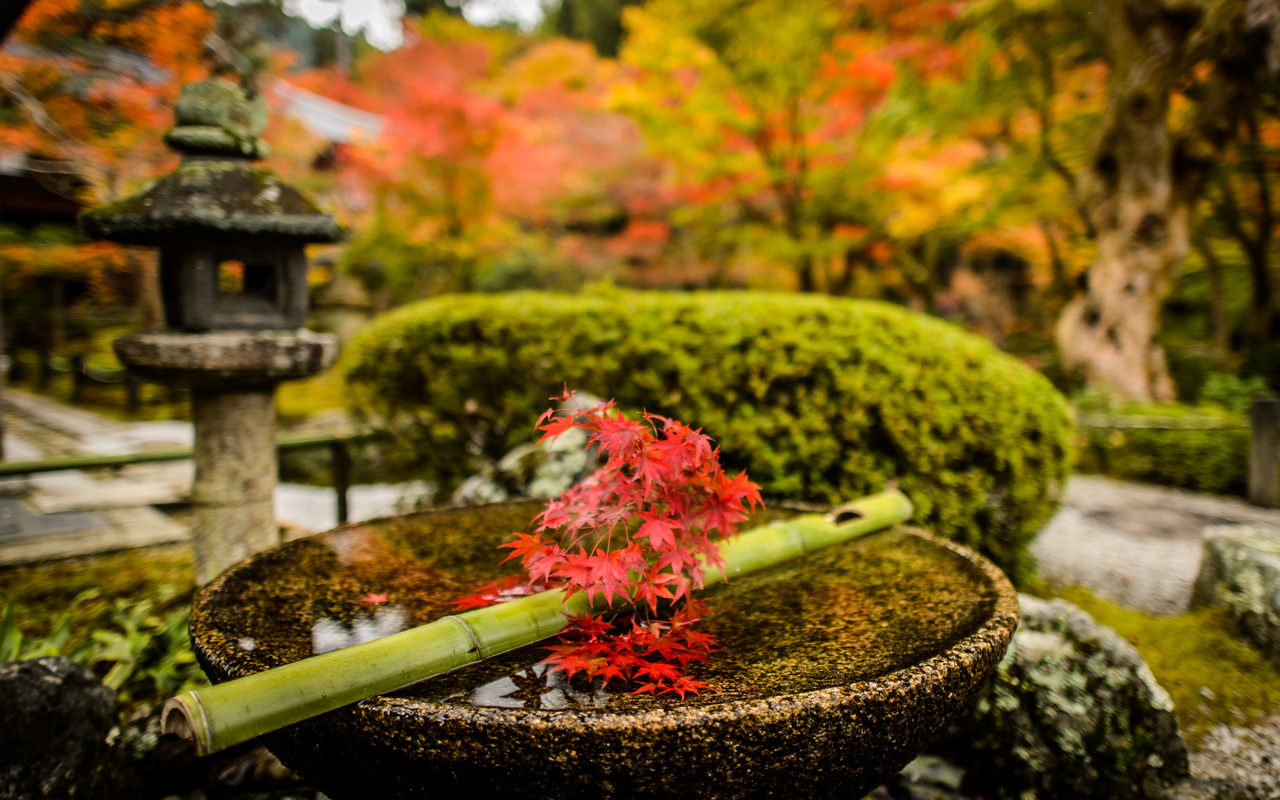
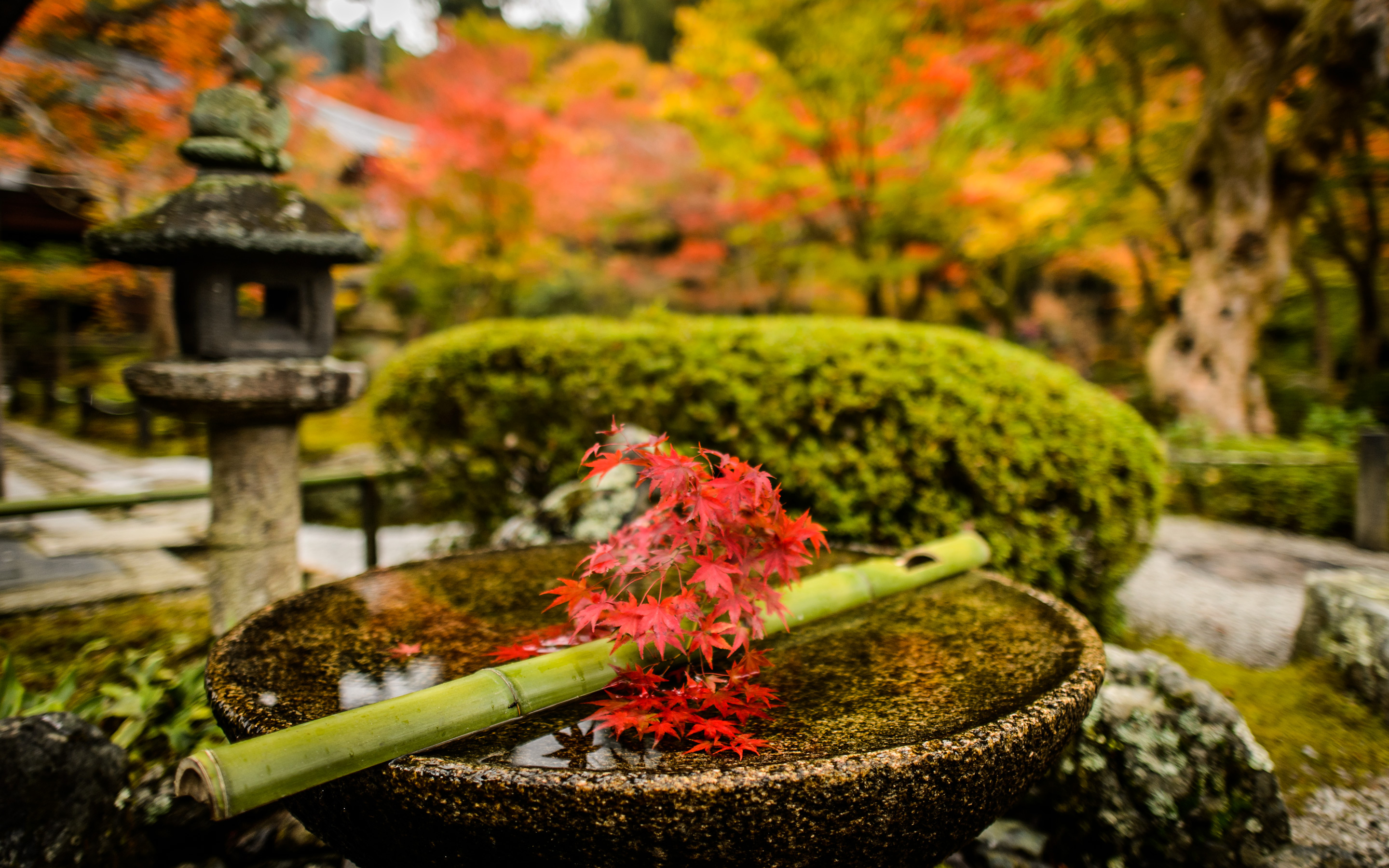
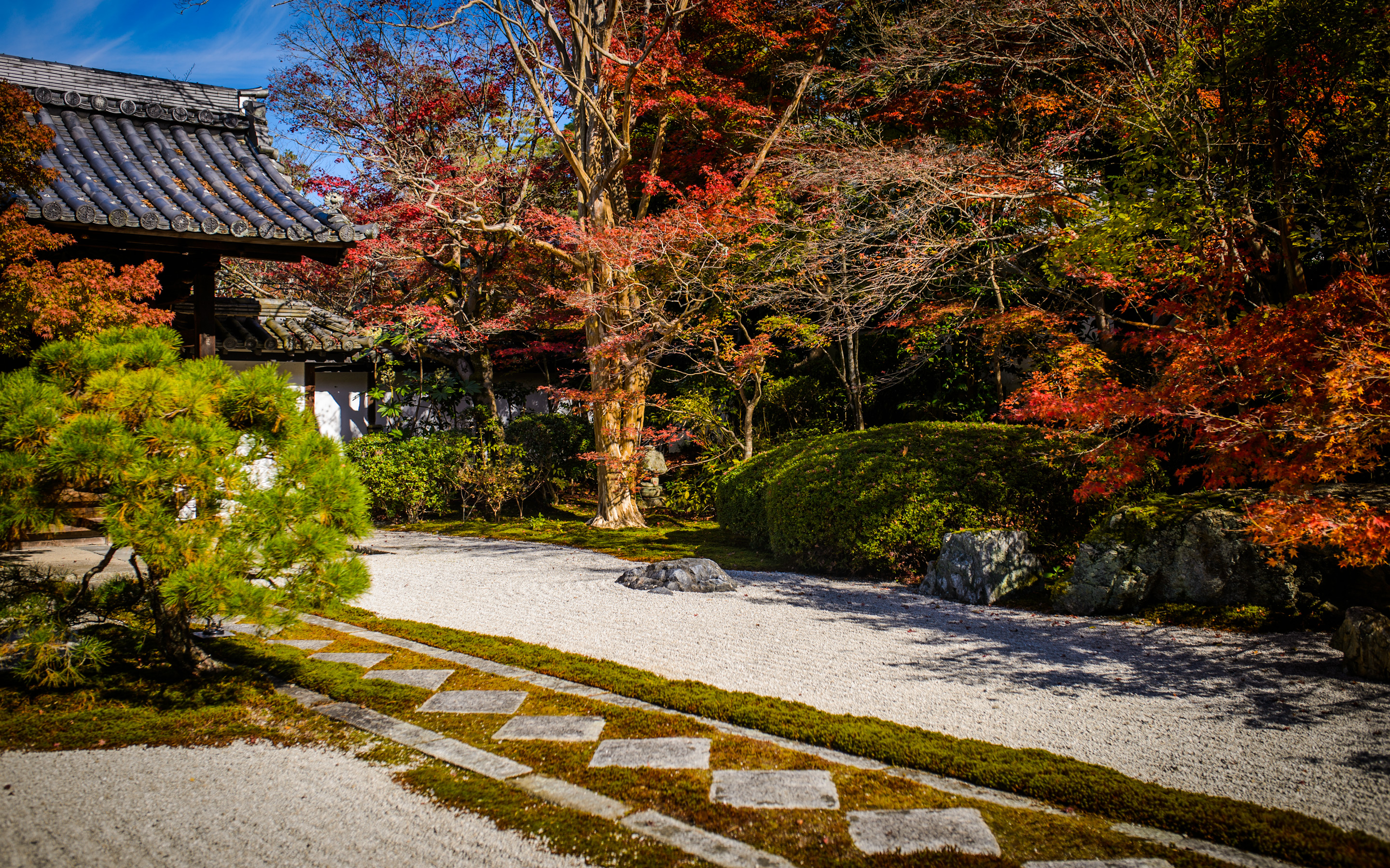
Looking Ahead To Fall with a few Shots from Last Season
Panasonic LX100 at an effective 37mm — 1/125 sec, f/2.4, ISO 200 —
map & image data — nearby photos
Hidden Treasure
photo from last fall
å»å¹´ã®ç§
Desktop-Background Versions
1280×800 · 1680×1050 · 1920×1200 · 2560×1600 · 2880×1800
It's still six weeks before the fall colors arrive in Kyoto, so here's a look forward with a few shots
from various outings last year.
My cycling buddies would be surprised to know that they likely pass this garden fairly often.
(Those curious about the location can follow the map link under the photo).
ä»åã®æ´æ°ã¯å»å¹´ã®ç§ã®ããããã
Nikon D4 + Nikkor 24mm f/1.4 — 1/400 sec, f/1.4, ISO 500 —
map & image data — nearby photos
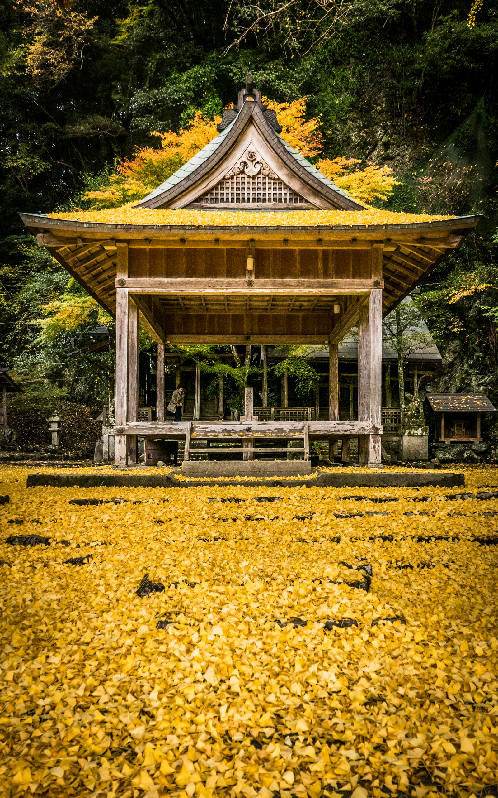
at the Enkoji Temple (åå 寺)
Desktop-Background Versions
1280×800 · 1680×1050 · 1920×1200 · 2560×1600 · 2880×1800
Nikon D4 + Nikkor 24mm f/1.4 — 1/400 sec, f/1.4, ISO 450 —
map & image data — nearby photos
Panasonic LX100 at an effective 24mm — 1/125 sec, f/2.5, ISO 200 —
map & image data — nearby photos
at the Iwato Ochiba Shrine (岩æ¸è½èç¥ç¤¾)
Panasonic LX100 at an effective 28mm — 1/125 sec, f/4, ISO 200 —
map & image data — nearby photos
Vertical Desktop-Background Versions
1050×1680 · 1200×1920 · 1600×2560
Panasonic LX100 at an effective 24mm — 1/125 sec, f/2.8, ISO 200 —
map & image data — nearby photos
Desktop-Background Versions
1280×800 · 1680×1050 · 1920×1200 · 2560×1600 · 2880×1800
Panasonic LX100 at an effective 24mm — 1/125 sec, f/1.7, ISO 200 —
map & image data — nearby photos
Roadside-Mirror Selfie
taken while on this ride
Panasonic LX100 at an effective 24mm — 1/125 sec, f/2.5, ISO 200 —
map & image data — nearby photos
Random House's Yard
near the “Hidden Treasure” garden from the first photo
Desktop-Background Versions
1280×800 · 1680×1050 · 1920×1200 · 2560×1600 · 2880×1800
Panasonic LX100 at an effective 24mm — 1/125 sec, f/2.8, ISO 200 —
map & image data — nearby photos
Back Here Again
with Michael and Andy
Desktop-Background Versions
1280×800 · 1680×1050 · 1920×1200 · 2560×1600 · 2880×1800
Nikon D4 + Sigma 35mm F1.4 DG HSM — 1/400 sec, f/3.5, ISO 110 —
map & image data — nearby photos
Tenjuan Temple (天æ庵)
on a washed-out bright day
Desktop-Background Versions
1280×800 · 1680×1050 · 1920×1200 · 2560×1600 · 2880×1800
Nikon D4 + Voigtländer 125mm f/2.5 — 1/400 sec, f/2.5, ISO 360 —
map & image data
— nearby photos
Desktop-Background Versions
1280×800 · 1680×1050 · 1920×1200 · 2560×1600 · 2880×1800
Nikon D4 + Nikkor 24mm f/1.4 — 1/400 sec, f/1.4, ISO 2200 —
map & image data — nearby photos
Garden Viewing
at the Enkoji Temple (åå 寺)
Nikon D4 + Voigtländer 125mm f/2.5 — 1/400 sec, f/2.5, ISO 1250 —
map & image data — nearby photos
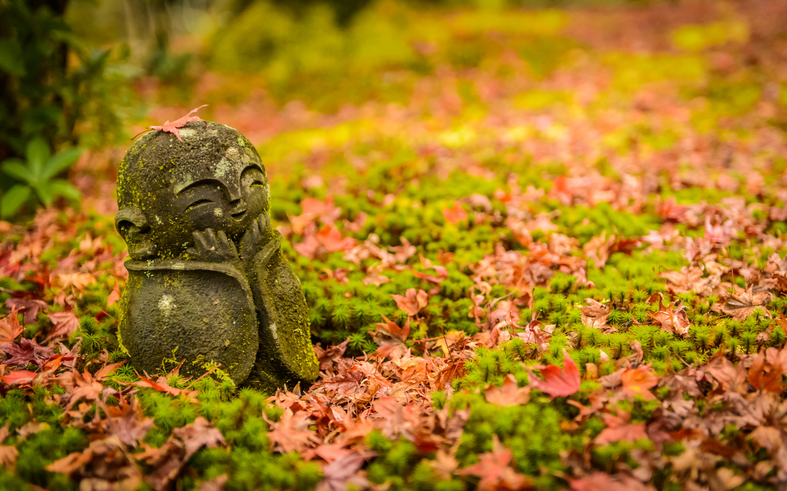
Photographing a Cute Little Statue
Nikon D4 + Nikkor 24-70mm f/2.8 @ 60mm — 1/400 sec, f/2.8, ISO 4000 —
map & image data — nearby photos
My Turn
Desktop-Background Versions
1280×800 · 1680×1050 · 1920×1200 · 2560×1600 · 2880×1800
Nikon D4 + Voigtländer 125mm f/2.5 — 1/400 sec, f/2.5, ISO 1600 —
map & image data — nearby photos
Chimping
Other posts from the outings that these photos came from include:
“Great Day in Kyotoâs Colorful Northern Mountains, and at Stravaâs Kyoto Office”
“Cycling to Kyotoâs Ochiba Shrine Amid the Fall Colors”
“The Tenjuan Temple (Fall Colors and a Wigglegram)”
“Wigglegram of a Pleasant Couple Among the Fall Colors at Kyotoâs Enkoji Temple”
Jeffrey E.F. Friedl's Blog

- Jeffrey E.F. Friedl's profile
- 13 followers

