S.D. Falchetti's Blog, page 12
August 1, 2018
Pixel Plan Day 10 - Nebraskan Sunset
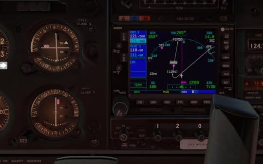
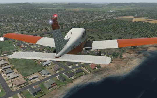
Wahoo is a small town with 4500 people. I check out the Saunders County Museum before leaving for my next leg. It's sunny and clear as KAHQ falls behind me.
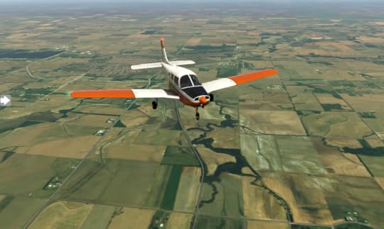
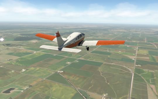
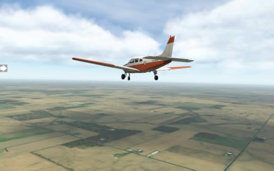
Endless green tiles knit the landscape together as I venture towards Grand Island. A few clouds drift in, but they're high and sparse, and don't affect my course. When I land at KGRI Grand Island, it's busy, with a few heavies readying for departure.
I'm a bit museum-ed out, so for a change of place I visit the Crane Trust Nature and Visitor Center. I grab dinner at Sin City Grill, then I'm back in the air for a late-day departure. Next up is KLBF North Platt.
The sun grows weary and drops beneath the horizon as I travel.
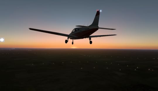
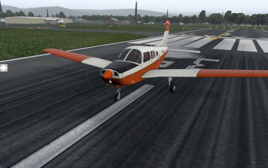
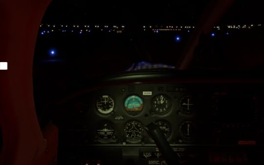
KLBF's light's are a welcome sight.
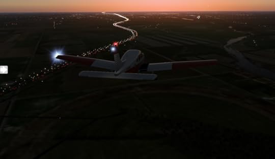
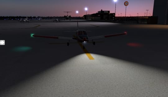
The last light fades as I roll into the general aviation area. Tomorrow's another day, and on to Akron.


July 30, 2018
Pixel Plane Day 9 - Wahoo
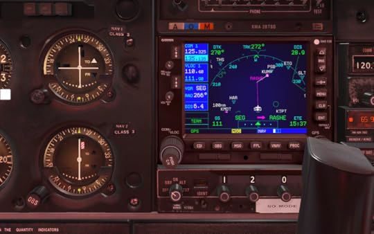
I catch breakfast at Red Oak's Feedlot Restaurant, then check out the Burlington Northern Depot and WWII Memorial Museum. After that, I'm back in the air enroute to Wahoo, Nebraska.

The most direct route is over Offut airforce base. A check of my sectional map shows this to be Class C airspace (indicated by the solid magenta circles on the map).

The numbers 50/SFC and 50/25 tell me the airspace extends from the the surface (SFC) to 5000 feet (50) near the airport and from 2500 feet (25) to 5000 feet (50) in the outer ring. It's a bit like a mushroom-shaped column of air. I can fly under the mushroom dome, until I hit the stalk, over the mushroom, or around it. Or, I can contact ATC and request clearance to fly through it.
I make all the wrong choices. I decide to fly at 6000 feet over the Charlie airspace, to avoid entering it. Sure enough, I'm flying VFR and encounter scattered clouds at 6000 feet when I'm over the heart of the controlled airspace, ending up contacting ATC to descend and enter. My other option was to do a one-eighty. I'm nearly at the transition of the inner to outer ring, so they direct me down to 2000 feet, which will take me below the airspace and clear of the clouds.
In hindsight, a much better plan would have been to route south via Plattsmouth, avoiding the airspace altogether.
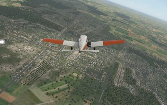
I pass a wind farm, turbines turning slowly on endless plains.


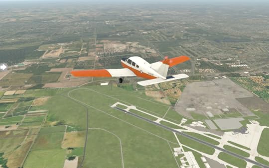
Wahoo, Nebraska comes in to view. I can tell I've found the municipal airport because someone has painted the letters WAHOO on the roof of one of the airport buildings. I grab some lunch at Chip's before prepping for my next leg to KGRI Grand Island.
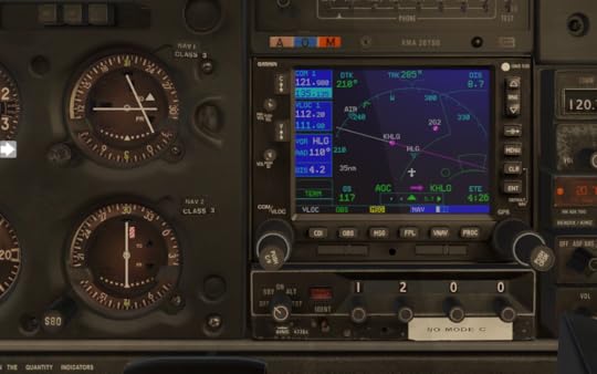
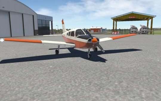
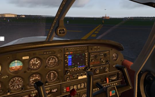
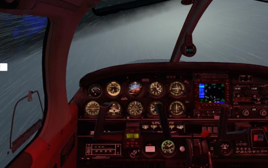
Point of Order: The XPlane Piper Warrior II model I'm using for my flight has a Bendix/King KT76A transponder. If you look closely at my cockpit screenshots, you'll see there's a "NO MODE C" sticker beneath the transponder. For purposes of my cross-country trip, I'm assuming I replaced it with a KT76C (or something newer) to have Mode C, which reports altitude to ATC and is required to enter Class B and C airspace. Otherwise I would not be able to land at my destination, KSFO San Francisco, or Chicago O'Hare, which are both Class B airspace.
July 29, 2018
Pixel Plane - Day 8 - Oh Deere
At one-hundred-and-twenty-one nautical miles, the flight from Chicago to Moline was one of my longer ones. Cruising speed on my Warrior II is 118 knots. After a good night's sleep, I wake up and grab breakfast at Quad City Coffee and Pancake House, then it's off to sightsee. I check out the John Deere Pavillion and the Figge Art Museum before returning to the airport. It's cloudy when I take off, but there's still a great view of Quad City.
The flight to KCID Cedar Rapids is shorter, at seventy-one nautical miles. The overcast clouds continue, washing everything in desaturated tones.
I visit Brucemore in Cedar Rapids, do a walk-by of the Paramount Theatre and Cedar Rapids Museum of Art, then I'm back in the air for my trip to KDSM Des Moines. At first it's fairly clear skies with green fields stretching on forever.
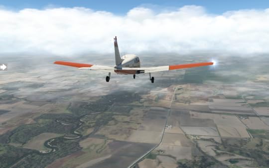
I'm flying at five-thousand feet when the cloud bank rolls in, but I have plenty of warning and descend to twenty-five hundred long before it's upon me.
The landing is smooth and I grab some dinner at the Flying Mango (which I feel should be my new callsign) before checking out the Salisbury House and Garden and Pappajohn Sculpture Park. Tomorrow it's on to KRDK Red Oak.
July 28, 2018
Pixel Plane - Day 7 - Save Ferris
After spying a Piper Turbo Arrow IV available for rental in the KORD general aviation area, I decide to take it out for a morning spin. The cockpit is virtually identical to my Warrior's, except for those three teal lights next to the throttle. Retractable landing gear.

It really moves when I take off. I wouldn't mind having it for my cross-country trip. Those miles would fly by.

After a bit of city sightseeing, I return to KORD.

I spend the day touring Chicago and tracing Ferris Bueller's steps in one of my favorite movies, Ferris Bueller's Day Off. I visit Tribune Tower, Marina City, the Skydeck of Willis Tower, Wrigley Field, and the Art Institute of Chicago. I feel like Ferris racing in slow motion to get back to the airport for my departure.
I'm back in the air late in the day, leaving Chicago O'Hare.


After thirty minutes it's endless green fields until I approach Moline.

I set down in KMLI Quad City Moline. Tomorrow's another day, and I'll explore it a bit before continuing on to Cedar Rapids.
Pixel Plane - Day 6 - Flying with Style
It's mid-afternoon and sunny when I take off from Fort Wayne, heading to South Bend. The wind has calmed and it's nice to relax and have a smooth flight.
Soon I'm lined up with the runway and touching down in KSBN South Bend.

I catch a cab to Notre Dame and check out the Studabaker National Museum. Dinner is at Tippecanoe Place, a restaurant in the Studabaker Mansion. With a full belly, I head back to the airport. The sun is getting low as I prep for the next leg.
I'm excited about this flight. I'll be flying over Lake Michigan at sunset to arrive at Chicago O'Hare. The first waypoint is named STYLE, so I'll be flying with style.

The fading daylight turns orange as I leave the shoreline behind me.

For a while, there's nothing but the sun dipping beneath the water.

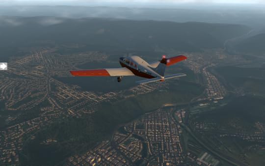
Skyscrapers are prominent as the shoreline comes into view.
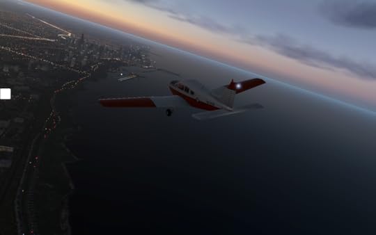
I indulge myself with a flyby of Chicago O'Hare.

Finally I set down on runway 27R before parking in the general aviation area.

It's tempting to explore Chicago's night life, but it's been a long day with many hours of flight, and I check into my hotel. I'm asleep moments after my head hits the pillow.
Pixel Plane - Day 5 - Fort Wayne
My day starts with bacon and eggs at the Big Apple Cafe before heading out for my 9 am departure in Newark, Ohio. Some puffy clouds alternate breaks in the sunshine, with a touch of wind.

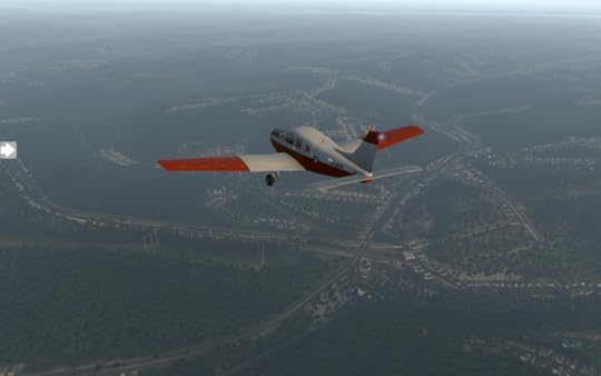
In no time the landscape changes, cities and towns giving way to farmland.

I take the time to tinker with the Bendix/King KN62A DME. Like many of the other navigation devices, it tunes into a navaid frequency. I look up a nearby VOR/DME and dial in the frequency. It displays distance to the VOR and time to station. It amazes me how many separate navigation devices are on the plane.

Procter and Gamble's Lima plant is not far from the KOAH airport, sitting on the other side of a reservoir. I fly over it before lining up with the airport.

After a short break in Lima, I take off just before noon and head towards KFWA Fort Wayne. The clouds continue and the wind picks up, swaying my warrior to and fro.
Crosswinds keep me on my toes as I try to keep on centerline for the runway, and it's a relief when I finally set down.

I've got short rest here and some time to explore Fort Wayne before heading to my next destination, KSBN South Bend.
July 26, 2018
Pixel Plane - Day 4 - Monstrous Picnic Baskets
After three days of rain and clouds, it's refreshing to wake up to a crisp sunrise glaring through my hotel's curtains. I grab breakfast at Flood City Cafe, then I'm off to the airport to prep for an 8 am departure. The sky has a few scattered clouds as my Warrior climbs to cruising altitude.
For most of the trip I fly at 6000 feet, the clouds above me at 9000 feet, until I get closer to my destination. Puffy cumulus clouds roll in underneath me. I descend below them.
Wheeling, West Virginia is a bit misty as it comes into view, but visibility is good and I have no trouble with the approach to KHLG.
To help me with that approach, I discover the Garmin OBS function, which allows me to link the OBS knob from my NAV1 gauge to the GPS. This means I can set my desired approach angle for the runway and have the GPS display it a a line. When I come near the line, I just need to turn into it and I'll be perfectly lined up with the runway.
Incidentally, did you know that runway numbers are the rough heading of the runway? Runway 9 has a heading of 90 degrees (relative to magnetic north). Runway 12 is 120 degrees. The real runway angle may be 91.2 degrees (you get it from the FAA airport map), but 90 will get you in the ballpark.
Wheeling is a charming city which was the original capital of West Virginia. I take some time to explore the Wheeling Suspension Bridge, built in 1849. After a bit of sight-seeing it's back to the airport for a noon departure. There's not a cloud in the sky when I take off.
Most of the route is very rural, and pretty.
It turns out that where I'm heading, KVTA Newark, Ohio, has an NDB (non-directional beacon) located right near the airfield. My Warrior has an ADF (automatic direction finder) gauge which I have not used yet. I look up the NDB frequency and tune it into my King KR85 unit. ADFs work a bit like those hand-held trackers you see in old spy movies. The needle points in the direction of the signal. When the needle points up, you're going straight towards it. I rotate the card on my ADF to match my current heading so that the needle points to the heading of the signal.
ADF - bottom left gauge. My little plane stick figure should fly in the direction of the needle, which in this case is straight ahead.
I also discover my Garmin has pre-programmed approaches and departures for each airport. This makes life even easier.
Regardless, I still dial runway nine's localizer into NAV1. A turn on final and a smooth landing, just as clouds start to roll in. I spotted something that couldn't be real as I made the turn, and made a mental note to ask about it on the ground.
The locals point me in the direction of the thing which couldn't be real: a giant basket as big as an office building, complete with windows. A short cab ride takes me there, and I tilt my head towards the sky to check it out. It's a giant Longaberger basket. More specifically, it was the headquarters for Longaberger, opened in 1997, sold in 2018. A smile pulls across my face as I feel like I've been shrunk in a sci-fi movie,
July 24, 2018
Pixel Plane - Day 3 - Penn State
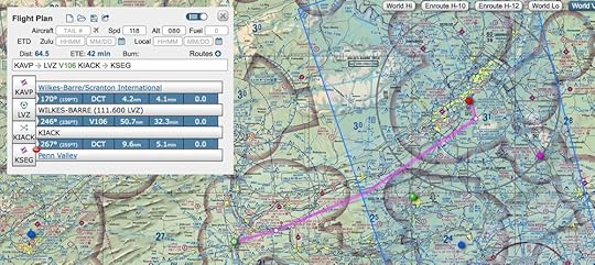
Today the rain continued in its same pattern: downpour, drizzle, sunshine, downpour. My original plan was a direct flight to KJST John Murtha Johnstown-Cambria County Airport, my last stop in Pennsylvania, but the weather is iffy and I decide to break the trip into two hops. I key my stop into the Garmin: KUNV - University Park 51 Airport. Fifty-one nautical miles, land, assess the weather, then on to Johnstown. The transponder is set to 1200 for VFR flight without ATC guidance.
It's drizzling as I line up on the KSEG Penn Valley runway, but there's no wind.
By the time I land at University Park, visibility has decreased and I don't get much of a Penn State aerial view.
I explore State College for an hour, which goes by in a blink, and pose for a picture next to the Nittany Lion Shrine statue. Sunlight's broken through the clouds and the rain has subsided. Looks promising. I prep for my next hop and take off.
With the fog gone, I can see State College properly from the air.
As the sun gets low, rolling mountains drift by until Johnstown comes into view. Like many Pennsylvania towns, it's an old steel maker.
The fading sunlight turns orange as I pull into the general aviation area at KJST. I watch a Cessna take off to my right, flying the pattern for a sunset view.
July 23, 2018
Pixel Plane - Day 2 - First Flight Complete
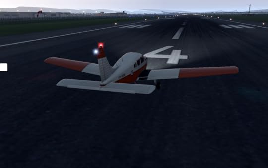
The weather is mixed today, with rain in the morning, sunshine in the afternoon, and rain again in the evening. I take advantage of the midday weather and prep the Warrior at noon. ATC assigns runway four. It's overcast with bits of sunlight breaking through, but winds are calm.
Moments later I'm rolling down the runway, rotating, and climbing away from KAVP.
It's a quiet, scenic trip, past endless green mountains and curving highways. I turn at LVZ VORTAC and heads towards KSEG. I've checked the airport chart and know the runway will be nearly perpendicular to me at one-hundred-and-seventy degrees, so I plot at heading taking me at an angle south of it. Forty-five minutes go by, and I become aware of how painfully slow the Warrior's 118 knot cruising speed is. My navigation is spot on, though, and I see Penn Valley's airport beacon off my right wing.
A turn for final approach and I'm all lined up. I wonder about the houses just before the end of the airfield as I buzz over their roofs. Plates must rattle each time a plane glides past.
The touchdown is clean and I taxi and park. It's a little past 1 pm and I've got a three hour break before heading up for my next leg. I spied the Selinsgrove Speedway as I made my descent. A quick conversation with the locals reveal nothing is happening there today, so I ask about places for lunch. They send me to the Selinsgrove Brewing Company, but it's not my speed for lunch, and I'm flying, so I opt for the Kind Cafe, grabbing a seat at one of the tables outside.
July 22, 2018
Pixel Plane - Day 1 - Almost (virtually) died
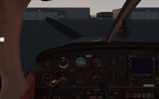
With my flight plan mapped out, I started the first leg of my coast-to-coast X Plane adventure. The weather looked dicey with overcast clouds and rain throughout the day, but conditions at the airport weren't bad. Visibility was ten miles with clouds at 9000 ft. The Warrior was waiting in the general aviation area. I set it up cold and dark, going through the startup checklist to turn everything on in the right order.
Today's flight plan was a 60 nm hop to Penn Valley airport via LVZ and KIACK waypoints.
After taxiing from the general aviation area to runway four, takeoff was straightforward with a muted sunset to my left.
I set up my Garmin with the flight plan, tuned NAV1 to the LVZ frequency and and NAV2 to the VORTEC near the destination airport. A brief fiddle with the OBS nobs to set up my headings, and then I was in the air. It was pretty for a while. Looked a bit misty, but there was no precipitation and visibility of ground lights was good.

I reach my first waypoint without any fuss and turn into the second. Twenty minutes goes by quietly. Raindrops pelt my windshield as a Cessna passes within a mile of me.

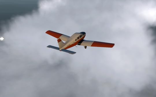
It's still not windy as the rain picks up, but I see lightning flashes ahead. With little warning, the cloud bank envelops me. Visibility is abruptly zero with a disco strobe effect. I realize my anti-collision lights are making it worse and turn them off. Now it's just a haze of solid gray.
I pull up the map of nearby airports. Hazleton is ten minutes away, but in the direction of the storm. KAVP is fifteen minutes behind me, but has ILS approaches. I turn around. I'm flying blind in the cloud for a while, watching my instruments, tuned back into the LVZ VORTEC. I look up the runway ILS frequency I want to use at KAVP and tune it into NAV2. After a nerve-wracking span of time, the cloud breaks and I see city lights.

The wind hits me, tossing me everywhere. Even in a simulator, I am getting motion sick. Despite the aid of the ILS guidance, I miss the runway and do a flyby. I try three more times before finally putting the plane down, too fast, and skid off the runway onto a taxiway. After a moment to collect my thoughts, I putter over to the general aviation area and go through the post-flight shutdown checklist.
Once everything is off, I flick on my flashlight and hop out of the plane. The rain patters on my face as I step off the wing and onto the apron. I'll get a good night's sleep and hope tomorrow's weather looks better.