
MaryAnn Bernal's Blog, page 88
July 26, 2016
Stonehenge and Nearby Stone Circles Were Newcomers to Landscape worked by Ice Age hunters
Ancient Origins

About 5,000 years ago, not far from Stonehenge on Salisbury Plain in England, some people built a stone circle smaller than its more famous counterpart. But for some reason, sometime after they built it, they dismantled the circle of bluestones and removed them.
Stonehenge and “Bluestonehenge,” as researchers have dubbed it, and other manmade features within a mile or two of the famous site were newcomers among some very ancient human-worked features in the landscape, a group of researchers says.
The archaeologists published an article this month about Bluestonehenge in the journal Antiquity (closed access) that says it and Stonehenge, a third stone circle several hundred meters away known as Amesbury henge and another at Durrington Walls came much later than when Stone Age hunter-gatherers began building features in wood in the area.
 A digital reconstruction of Bluestonehenge by Henry Rothwell (
Wikimedia Commons
)About 9,000 years ago, some people built wooden features that may have been ceremonial or ritual in nature—possibly aligned to solstice sunsets. Chemical traces of the pinewood are still detectable in the postholes in the soil near Stonehenge.
A digital reconstruction of Bluestonehenge by Henry Rothwell (
Wikimedia Commons
)About 9,000 years ago, some people built wooden features that may have been ceremonial or ritual in nature—possibly aligned to solstice sunsets. Chemical traces of the pinewood are still detectable in the postholes in the soil near Stonehenge.
Prehistoric people built Bluestonehenge out of bluestones that came from far away and later removed those stones to Stonehenge, the researchers think. The smaller Bluestonehenge monument was connected to its more famous counterpart by a feature called the Avenue—a broad road leading from Stonehenge to the River Avon about 500 meters (1640.4 feet) away.
“Stonehenge has long been known to form part of a larger prehistoric landscape,” write archaeologist Michael J. Allen and his colleagues. “In particular, it is part of a composite monument that includes the Stonehenge Avenue and the newly discovered West Amesbury henge, which is situated at the eastern end of the Avenue beside the River Avon. Inside that henge lies an earlier circle of stoneholes, formerly holding small standing stones; this is known as ‘Bluestonehenge’.”
 Features of the immediate landscape of Stonehenge include three stone circles, at Stonehenge itself, at the Neolithic village of Durrington Walls, which are still standing, and another that was taken down—Bluestonehenge. (Drawn by Joshua Pollard for Antiquity)The researchers said the Avenue has been known for centuries, but in 2008 and 2009 the Stonehenge Riverside Project did more explorations and dug new trenches and ascertained that the road reached the River Avon.
“The aim was to establish whether the Avenue was built in more than one phase, and whether it actually reached the river, thereby addressing the theory that Stonehenge was part of a larger complex linked by the river to Durrington Walls henge and its newly discovered avenue, two miles upstream,” they wrote.
All along from 1719 AD through to the present day, researchers have been analyzing the Avenue and digging in it to determine its parameters and purposes. Scholars have proposed theories about the prehistoric banks, ruts, ditches and ridges and stripes in the soil of the Avenue. There has been speculation that the ancient people dug the ditches of the Avenue and built other monuments in the area to align with the winter and summer solstice sunsets.
 The Avenue, a road leading from Stonehenge to Bluestonehenge at the River Avon, was part of a larger network of monuments in the area, including stone circles at West Amesbury and Durrington Walls. (Photograph by Adam Stanford in Antiquity)Stonehenge is near three Early Mesolithic postholes that held pine posts 1 meter (3.1 feet) in diameter. These postholes are 250 meters (820.2 feet) west of the Avenue and hint “at the possibility that this unusual solstitial alignment, formed by the ridges and stripes, was recognised long before the Neolithic. These vertical pine posts or tree-trunks were erected, probably one after the other, in the centuries around 7000 BC by hunter-gatherers, three millennia before the beginning of agriculture in Britain. Monuments built by hunter-gatherers are generally rare; although large pits are known from this period, the Stonehenge postholes are unparalleled anywhere for the Early Mesolithic of Northern Europe.”
Also, along the River Avon researchers have found activity from the 8th millennium BC through the 5th millennium BC, “making it, potentially, an unusually ‘persistent place’ within the early Holocene,” the authors wrote. The Holocene was the most recent Ice Age that began around 10,000 years ago.
 Stonehenge is situated among a number of nearby prehistoric monuments, including the newly discovered Bluestonehenge, a smaller circle that was 500 meters away at the end of a road leading to the River Avon. (
Wikimedia Commons photo
/Michael Osmenda)As for the bluestones of Bluestonehenge, which are missing, the researchers speculate they were taken to Stonehenge. They say they are uncertain of the date of construction of Bluestonehenge, but it occurred about the same time the people were digging the ditches of the Avenue, building West Amesbury henge and rearranging some other bluestones at Stonehenge.
Stonehenge is situated among a number of nearby prehistoric monuments, including the newly discovered Bluestonehenge, a smaller circle that was 500 meters away at the end of a road leading to the River Avon. (
Wikimedia Commons photo
/Michael Osmenda)As for the bluestones of Bluestonehenge, which are missing, the researchers speculate they were taken to Stonehenge. They say they are uncertain of the date of construction of Bluestonehenge, but it occurred about the same time the people were digging the ditches of the Avenue, building West Amesbury henge and rearranging some other bluestones at Stonehenge.
These works were possibly carried out by people of the Beakers culture, the authors wrote.
“The arrival of Beakers and accompanying continental European styles of mortuary practice and material culture signalled a major social and cultural transition in Britain, including the decline of large-scale labour mobilisation for megalith-building,” their paper states.
One of the authors, archaeologist Mike Parker Pearson, has speculated that stone henges were meant for the dead, and wood henges found in the vicinity were features meant for living people.
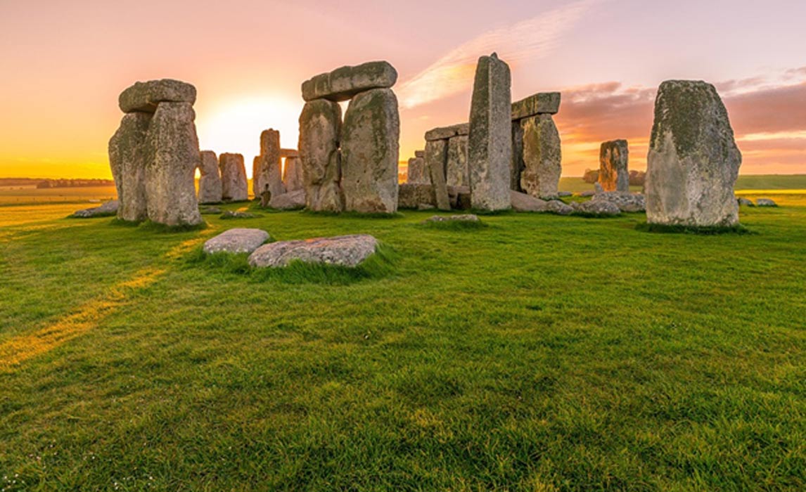
Top image: Stonehenge England ( public domain )
By Mark Miller
About 5,000 years ago, not far from Stonehenge on Salisbury Plain in England, some people built a stone circle smaller than its more famous counterpart. But for some reason, sometime after they built it, they dismantled the circle of bluestones and removed them.
Stonehenge and “Bluestonehenge,” as researchers have dubbed it, and other manmade features within a mile or two of the famous site were newcomers among some very ancient human-worked features in the landscape, a group of researchers says.
The archaeologists published an article this month about Bluestonehenge in the journal Antiquity (closed access) that says it and Stonehenge, a third stone circle several hundred meters away known as Amesbury henge and another at Durrington Walls came much later than when Stone Age hunter-gatherers began building features in wood in the area.
A digital reconstruction of Bluestonehenge by Henry Rothwell (
Wikimedia Commons
)About 9,000 years ago, some people built wooden features that may have been ceremonial or ritual in nature—possibly aligned to solstice sunsets. Chemical traces of the pinewood are still detectable in the postholes in the soil near Stonehenge.Prehistoric people built Bluestonehenge out of bluestones that came from far away and later removed those stones to Stonehenge, the researchers think. The smaller Bluestonehenge monument was connected to its more famous counterpart by a feature called the Avenue—a broad road leading from Stonehenge to the River Avon about 500 meters (1640.4 feet) away.
“Stonehenge has long been known to form part of a larger prehistoric landscape,” write archaeologist Michael J. Allen and his colleagues. “In particular, it is part of a composite monument that includes the Stonehenge Avenue and the newly discovered West Amesbury henge, which is situated at the eastern end of the Avenue beside the River Avon. Inside that henge lies an earlier circle of stoneholes, formerly holding small standing stones; this is known as ‘Bluestonehenge’.”
Features of the immediate landscape of Stonehenge include three stone circles, at Stonehenge itself, at the Neolithic village of Durrington Walls, which are still standing, and another that was taken down—Bluestonehenge. (Drawn by Joshua Pollard for Antiquity)The researchers said the Avenue has been known for centuries, but in 2008 and 2009 the Stonehenge Riverside Project did more explorations and dug new trenches and ascertained that the road reached the River Avon.“The aim was to establish whether the Avenue was built in more than one phase, and whether it actually reached the river, thereby addressing the theory that Stonehenge was part of a larger complex linked by the river to Durrington Walls henge and its newly discovered avenue, two miles upstream,” they wrote.
All along from 1719 AD through to the present day, researchers have been analyzing the Avenue and digging in it to determine its parameters and purposes. Scholars have proposed theories about the prehistoric banks, ruts, ditches and ridges and stripes in the soil of the Avenue. There has been speculation that the ancient people dug the ditches of the Avenue and built other monuments in the area to align with the winter and summer solstice sunsets.
The Avenue, a road leading from Stonehenge to Bluestonehenge at the River Avon, was part of a larger network of monuments in the area, including stone circles at West Amesbury and Durrington Walls. (Photograph by Adam Stanford in Antiquity)Stonehenge is near three Early Mesolithic postholes that held pine posts 1 meter (3.1 feet) in diameter. These postholes are 250 meters (820.2 feet) west of the Avenue and hint “at the possibility that this unusual solstitial alignment, formed by the ridges and stripes, was recognised long before the Neolithic. These vertical pine posts or tree-trunks were erected, probably one after the other, in the centuries around 7000 BC by hunter-gatherers, three millennia before the beginning of agriculture in Britain. Monuments built by hunter-gatherers are generally rare; although large pits are known from this period, the Stonehenge postholes are unparalleled anywhere for the Early Mesolithic of Northern Europe.”Also, along the River Avon researchers have found activity from the 8th millennium BC through the 5th millennium BC, “making it, potentially, an unusually ‘persistent place’ within the early Holocene,” the authors wrote. The Holocene was the most recent Ice Age that began around 10,000 years ago.
Stonehenge is situated among a number of nearby prehistoric monuments, including the newly discovered Bluestonehenge, a smaller circle that was 500 meters away at the end of a road leading to the River Avon. (
Wikimedia Commons photo
/Michael Osmenda)As for the bluestones of Bluestonehenge, which are missing, the researchers speculate they were taken to Stonehenge. They say they are uncertain of the date of construction of Bluestonehenge, but it occurred about the same time the people were digging the ditches of the Avenue, building West Amesbury henge and rearranging some other bluestones at Stonehenge.These works were possibly carried out by people of the Beakers culture, the authors wrote.
“The arrival of Beakers and accompanying continental European styles of mortuary practice and material culture signalled a major social and cultural transition in Britain, including the decline of large-scale labour mobilisation for megalith-building,” their paper states.
One of the authors, archaeologist Mike Parker Pearson, has speculated that stone henges were meant for the dead, and wood henges found in the vicinity were features meant for living people.
Top image: Stonehenge England ( public domain )
By Mark Miller


July 25, 2016
Ancient Egyptian Logbook of Inspector Who Helped Construct the Great Pyramid Revealed
Ancient Origins
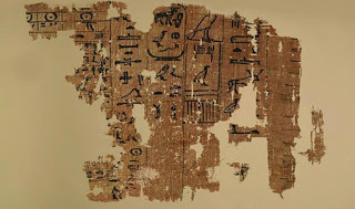
Some of the details of the construction of the Egyptian Great Pyramid are revealed to the public for the first time when they go on display at the Egyptian Museum in Cairo. The information comes in the form of a papyri logbook written by an inspector named Merer. While much about the building of the pyramids remains unknown and speculative, the precious text sheds at least some light on the later aspects of the building process.
According to Live Science, Merer wrote in hieroglyphics how he was in charge of about 200 men and gave some information about the construction process while he was working on it in the 27th year of Khufu's reign.
 Statue of Khufu in the Cairo Museum. (
Public Domain
)Writing on the document in 2014 (it was unearthed in 2013), the archaeologists Pierre Tallet and Gregory Marouard said that the pyramid was nearing completion when the text was written. Merer wrote that the work at that time was focused on creating the limestone casing to cover the pyramid.
Statue of Khufu in the Cairo Museum. (
Public Domain
)Writing on the document in 2014 (it was unearthed in 2013), the archaeologists Pierre Tallet and Gregory Marouard said that the pyramid was nearing completion when the text was written. Merer wrote that the work at that time was focused on creating the limestone casing to cover the pyramid.
4,600-year-old step pyramid uncovered in Egypt and its purpose is a mysteryDiscovery of 5,000-year-old Hieroglyphs Change the Story of a Queen, a Pharaoh, and an Ancient CityThe archaeologists’ research on the logbook was published as an article in the journal Near Eastern Archaeology. They explained in their article that the document is comprised of more than 300 fragments of varying sizes and provides details on the inspector’s daily activities over several months.
 Concentration of papyri in the rubble on which the logbook was written. (
P. Tallet
)The logbook was discovered at the Red Sea harbor of Wadi al-Jarf and Live Science reports that “It dates back about 4,500 years, making it the oldest papyrus document ever discovered in Egypt.”
Concentration of papyri in the rubble on which the logbook was written. (
P. Tallet
)The logbook was discovered at the Red Sea harbor of Wadi al-Jarf and Live Science reports that “It dates back about 4,500 years, making it the oldest papyrus document ever discovered in Egypt.”
Apart from the information on daily activities, Merer’s log (and others found at the site) also provide additional interesting tidbits of data. The archaeologists wrote in their articles that:
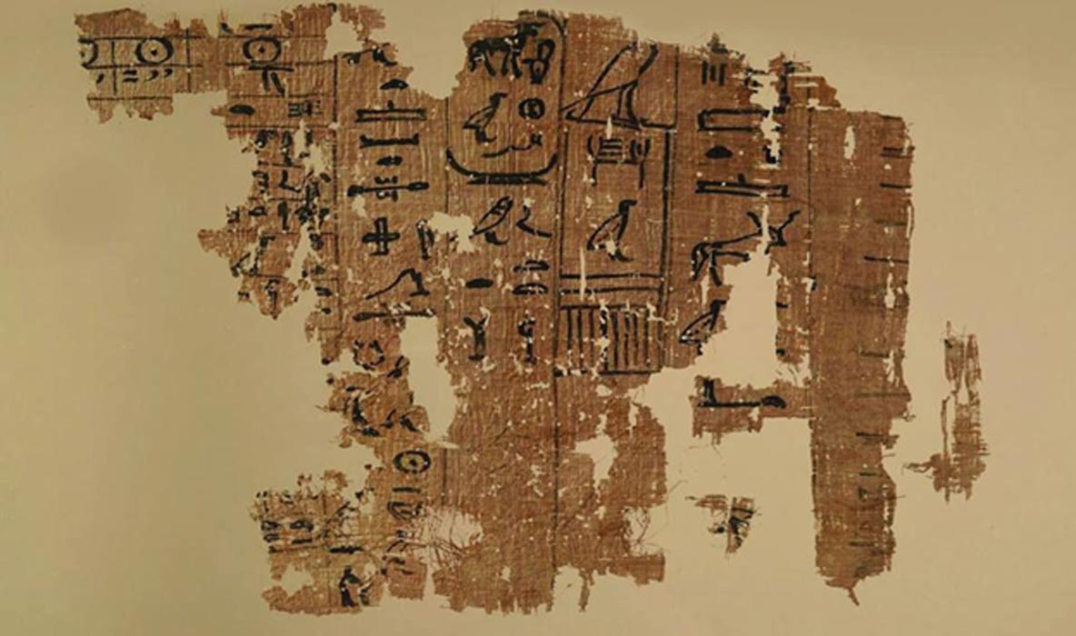
Sarcophagus of Egyptian High Priest Unearthed with Hieroglyphic Inscriptions and Scenes of Offerings Analysis Begins on Cosmic Particles in the Egyptian Bent Pyramid – Will This Help Explain How the Pyramids Were Built? The Great Pyramid, also known as the Pyramid of Cheops and Pyramid of Khufu, is comprised of more than 2 million limestone blocks weighing from 2 to 70 tons. Thus, it is interesting to note that Merer’s logbook explains from where this material was quarried and how it was transported towards the pyramid’s site. Tallet and Marouard’s article says that the logbook:
 Left: Part of a papyrus inscribed with an account dating to the reign of Khufu (13th cattle count). (
G. Pollin
) Right: Account on a papyrus (A) and a detail of one page of inspector Merer's “diary” (B), mentioning the “Horizon of Khufu.” (
G. Pollin
)The Great Pyramid is the only Giza pyramid that has air shafts . This pyramid was built with such precision that it has been said that it would be difficult to replicate it even with today’s technology. This point is one of the reasons why so many people are fascinated by the pyramid’s construction.
Left: Part of a papyrus inscribed with an account dating to the reign of Khufu (13th cattle count). (
G. Pollin
) Right: Account on a papyrus (A) and a detail of one page of inspector Merer's “diary” (B), mentioning the “Horizon of Khufu.” (
G. Pollin
)The Great Pyramid is the only Giza pyramid that has air shafts . This pyramid was built with such precision that it has been said that it would be difficult to replicate it even with today’s technology. This point is one of the reasons why so many people are fascinated by the pyramid’s construction.
Within the Great Pyramid, there are areas that are called the King's Chamber, the Queen's Chamber, and the Subterranean Chamber. It should be noted however that there is much debate over these names and the purpose of the pyramid itself. Mainstream archaeology accepts that the pyramid was built around 2500 BC and commissioned by King Khufu for his tomb. However, much controversy surrounds these conclusions. For example, German archaeologists in 2013, argued that the Great Pyramid is much older and served a different purpose .
The debate over the pyramid’s construction and use continues to enthrall many researchers and, although work continues at the site, many of the questions behind this fascinating ancient structure remain unanswered.
 The Great Pyramid of Giza. Source: BigStockPhoto Top Image: One of the papyri in the ancient logbook which documented some details on the later construction period of the Great Pyramid of Giza. Source:
Egyptian Ministry of Antiquities
The Great Pyramid of Giza. Source: BigStockPhoto Top Image: One of the papyri in the ancient logbook which documented some details on the later construction period of the Great Pyramid of Giza. Source:
Egyptian Ministry of Antiquities
By Alicia McDermott
Some of the details of the construction of the Egyptian Great Pyramid are revealed to the public for the first time when they go on display at the Egyptian Museum in Cairo. The information comes in the form of a papyri logbook written by an inspector named Merer. While much about the building of the pyramids remains unknown and speculative, the precious text sheds at least some light on the later aspects of the building process.
According to Live Science, Merer wrote in hieroglyphics how he was in charge of about 200 men and gave some information about the construction process while he was working on it in the 27th year of Khufu's reign.
Statue of Khufu in the Cairo Museum. (
Public Domain
)Writing on the document in 2014 (it was unearthed in 2013), the archaeologists Pierre Tallet and Gregory Marouard said that the pyramid was nearing completion when the text was written. Merer wrote that the work at that time was focused on creating the limestone casing to cover the pyramid.4,600-year-old step pyramid uncovered in Egypt and its purpose is a mysteryDiscovery of 5,000-year-old Hieroglyphs Change the Story of a Queen, a Pharaoh, and an Ancient CityThe archaeologists’ research on the logbook was published as an article in the journal Near Eastern Archaeology. They explained in their article that the document is comprised of more than 300 fragments of varying sizes and provides details on the inspector’s daily activities over several months.
Concentration of papyri in the rubble on which the logbook was written. (
P. Tallet
)The logbook was discovered at the Red Sea harbor of Wadi al-Jarf and Live Science reports that “It dates back about 4,500 years, making it the oldest papyrus document ever discovered in Egypt.”Apart from the information on daily activities, Merer’s log (and others found at the site) also provide additional interesting tidbits of data. The archaeologists wrote in their articles that:
“Merer's journal also mentions his passage at an important logistic and administrative center, ‘Ro-She Khufu’ - which seems to have functioned as a stopping point near by the Giza plateau. It is especially specified that this site is under the authority of a high rank official, Ankhhaef, half-brother of Khufu, who was his vizier and “chief for all the works of the king” at the end of the reign. Other logs found in the same archive also give information about others missions accomplished by the same team of sailors during the same year, notably the building of a Harbor on the Mediterranean Sea coast.”
Bust of Prince Ankhhaef, Khufu’s half-brother and vizier. ( Keith Schengili-Roberts/CC BY SA 2.5 ) Live Science reports that it is uncertain how long the logbook will be on display at the Egyptian Museum.
Sarcophagus of Egyptian High Priest Unearthed with Hieroglyphic Inscriptions and Scenes of Offerings Analysis Begins on Cosmic Particles in the Egyptian Bent Pyramid – Will This Help Explain How the Pyramids Were Built? The Great Pyramid, also known as the Pyramid of Cheops and Pyramid of Khufu, is comprised of more than 2 million limestone blocks weighing from 2 to 70 tons. Thus, it is interesting to note that Merer’s logbook explains from where this material was quarried and how it was transported towards the pyramid’s site. Tallet and Marouard’s article says that the logbook:
“records a period over the course of several months – in the form of a timetable with two columns per day – with many operations related to the construction of the Great Pyramid of Khufu at Giza and the work at the limestone quarries on the opposite bank of the Nile. On a regular basis, there are also descriptions concerning the transportation, on the Nile and connected canals, of stone blocks, which had been extracted from the northern and southern quarries of Tura. These blocks were delivered within two or three days at the pyramid construction site, called the ‘Horizon of Khufu’.”Some researchers say that the ’Horizon of Khufu’ refers to the pharaoh Khufu’s name for his necropolis.
Left: Part of a papyrus inscribed with an account dating to the reign of Khufu (13th cattle count). (
G. Pollin
) Right: Account on a papyrus (A) and a detail of one page of inspector Merer's “diary” (B), mentioning the “Horizon of Khufu.” (
G. Pollin
)The Great Pyramid is the only Giza pyramid that has air shafts . This pyramid was built with such precision that it has been said that it would be difficult to replicate it even with today’s technology. This point is one of the reasons why so many people are fascinated by the pyramid’s construction.Within the Great Pyramid, there are areas that are called the King's Chamber, the Queen's Chamber, and the Subterranean Chamber. It should be noted however that there is much debate over these names and the purpose of the pyramid itself. Mainstream archaeology accepts that the pyramid was built around 2500 BC and commissioned by King Khufu for his tomb. However, much controversy surrounds these conclusions. For example, German archaeologists in 2013, argued that the Great Pyramid is much older and served a different purpose .
The debate over the pyramid’s construction and use continues to enthrall many researchers and, although work continues at the site, many of the questions behind this fascinating ancient structure remain unanswered.
The Great Pyramid of Giza. Source: BigStockPhoto Top Image: One of the papyri in the ancient logbook which documented some details on the later construction period of the Great Pyramid of Giza. Source:
Egyptian Ministry of Antiquities
By Alicia McDermott
July 24, 2016
The 8 bloodiest Roman emperors in history
History Extra
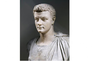
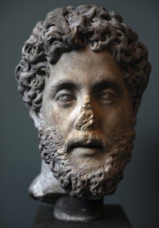
Marble bust of Roman emperor Gaius, known as Caligula, in AD 23. (Photo by DEA/A DAGLI ORTI/De Agostini/Getty Images)
We all know about the Roman Emperors, don't we? Mad, bad and decidedly dangerous to know. Who can forget Peter Ustinov's Nero in the 1951 epic Quo Vadis?, or John Hurt's tortured and murderous Caligula in the BBC's I, Claudius?
In fact, as historians point out (to anyone who will listen), many of the emperors on the list below were competent – even gifted – administrators, and the sources for some of the more lurid stories about them are not always above suspicion of exaggeration or invention. And some of the crimes that most shocked their contemporaries, like a penchant for performing in public, would not necessarily offend us so much today.
Some emperors, like Nero or Domitian, have passed into history as models of erratic, paranoid tyrants; others, like Diocletian, were able administrators, providing good government (unless you happened to be a Christian, in which case you were in great peril). Even under the worst emperors Rome continued to function, but involvement in public life could become a decidedly dangerous business.
Tiberius (ruled AD 14–37)Tiberius was the successor to Augustus, though Augustus did not particularly want Tiberius to succeed him, and it was only the untimely death of the emperor's grandsons Gaius and Lucius, and Augustus's decision to exile their younger brother, Agrippa Postumus, that put Tiberius in line for the imperial throne.
Tiberius was a gifted military commander and respected the authority of the senate. However, he had a gloomy and increasingly suspicious outlook that won him few friends and led him into a bitter dispute with Agrippina, the widow of his war hero nephew Germanicus. Fatally, Tiberius relied heavily on the ambitious and ruthless Aelius Sejanus, who instituted a reign of terror until Tiberius, learning that Sejanus planned to seize power himself, had him arrested and executed.
Tiberius sank into morbid suspicion of everyone around him: he retreated to the island of Capri and revived the ancient accusation of maiestas (treason) and used it to sentence to death anyone he suspected. Roman historians Suetonius and Tacitus give us a picture of Tiberius living on Capri as a depraved sexual predator, which may owe more to colourful imagination than to fact, though he certainly made use of a sheer drop into the sea to dispose of anyone he took issue with. Tiberius was not a monster in the mould of some of his successors, but he certainly set the tone for what was to come.

Bust of the Roman emperor Tiberius. (Photo by Art Media/Print Collector/Getty Images)
Gaius (Caligula) (ruled AD 37–41)Gaius (‘Caligula, or ‘little bootee’ – a childhood nickname given him by his father's troops) is best known for a series of eccentric actions, such as declaring war on the sea and proclaiming himself a god.
His reign actually began quite promisingly, but after a serious bout of illness he developed paranoia that led him into alarmingly erratic behaviour, possibly including incest with his sister, Julia Drusilla, whom he named as his heir.
Gaius took particular delight in humiliating the senate, claiming that he could make anyone consul, even his horse (though, contrary to the popular story, he didn't actually go through with this). As the son of Germanicus [a prominent general], Gaius was keen to establish his military credentials, though his campaign in Germany achieved little and his abortive invasion of Britain had to be turned into a battle with the sea god Neptune: he is said to have told his troops to attack the waves with their swords and gather seashells as booty.
Gaius declared himself a god and used his divine status to establish what was, in effect, an absolutist monarchy in Rome. He followed Tiberius's example of using treason trials to eliminate enemies, real or imagined. In the end it was his rather childish taunting of Cassius Chaerea, a member of the Praetorian guard, which brought Gaius down. Chaerea arranged for his assassination at the Palatine Games. He is supposed to have protested that he couldn't be killed because he was an immortal god, but he turned out to be rather less immortal than he thought.
Nero (ruled AD 54–68)Nero is the Roman Emperor we all love to hate, and not without reason. He was actually a competent administrator, and he was aided by some very able men, including his tutor – the writer Seneca. However, he was also unquestionably a murderer, starting with his step-brother Britannicus, with whom he had been supposed to share power, and progressing through his wife Octavia, whom he deserted for his lover, Poppeaea, and then had executed on a trumped-up charge of adultery.
Probably on Poppaea's prompting he had his own mother murdered, though the initial attempt, using a collapsible boat, went wrong, and she had to be beaten to death instead. He then kicked Poppaea to death in a fit of anger while she was pregnant with his child.

Roman emperor Nero. (Photo by Ann Ronan Pictures/Print Collector/Getty Images)
Contrary to the myth, Nero did not start the great fire of Rome, nor did he ‘fiddle’ (nor even play the lyre), while the city burned – in fact, he organised relief work for its victims and planned the rebuilding. But Nero’s fondness for his own music and poetry, which made him force senators to sit through his own interminable and talentless recitals, meant people could easily believe it of him.
Nero was much hated for building his huge, tasteless ‘golden house’ complex [aka the Domus Aurea, a large landscaped portico villa] in the ruins of what had been the public area of central Rome. He undoubtedly persecuted Christians in large numbers, and his childish insistence on winning the laurels at the Olympic Games in Greece – whether or not he actually won, or indeed finished the race – brought the whole empire into disrepute.
Nero was toppled by an army revolt that sunk into a destructive three-way civil war.
Domitian (ruled AD 81–96)Domitian was the younger son of Vespasian, the general who had emerged from the chaos after Nero's fall and restored a certain element of stability and normality to Roman public life.
Domitian inherited none of his father's charm and, like others on this list, he suffered from deep suspicion of those around him, amounting to paranoia, possibly a result of his narrow escape from being killed during the civil war. He was particularly suspicious of the senate and had a number of leading citizens executed for conspiracy against him, including 12 ex-consuls and two of his own cousins.
Domitian’s rule became steadily more autocratic, and he demanded to be treated like a god. He turned against philosophers, sending many of them into exile, and he arranged the judicial murder of the chief vestal virgin, having her buried alive in a specially constructed tomb.
Domitian was eventually brought down by a conspiracy arranged by his wife, Domitia, and was somewhat inexpertly stabbed by a palace servant. Some historians think Domitian's tyranny has been overstated; others have compared him to Saddam Hussein at his most vengeful.
Commodus (ruled AD 180–192)Commodus was the emperor immortalised by Joaquin Phoenix in Ridley Scott's Gladiator (2000). Commodus was indeed a passionate follower of gladiatorial combat, and himself fought in the arena, sometimes dressed as Hercules, for which he awarded himself divine honours, declaring that he was a Roman Hercules.
Commodus was the son of the philosopher emperor Marcus Aurelius and, although the film's scene in which Commodus kills his own father is invention, it is true that Commodus was the very opposite of all that his father had stood for. Vain and pleasure-seeking, Commodus virtually bankrupted the Roman treasury and he sought to fill it up again by having wealthy citizens executed for treason so he could confiscate their property.
Soon, people began plotting against him for real, including his own sister. The plots were foiled, however, and Commodus set about executing still more people, either because they were conspiring against him or because he thought they might do so in the future. Eventually the Praetorian prefect and the emperor's own court chamberlain hired a professional athlete to strangle Commodus in the bath.
Bust of the emperor Commodus. (Photo by Anderson/Alinari via Getty Images)
Marcus Aurelius Antoninus I (Caracalla) (ruled AD 211–217)Marcus Aurelius Antoninus was the son of the highly able and effective emperor Septimius Severus. ‘Caracalla’ was a nickname, derived from a hooded coat from Gaul that he introduced into Rome.
Severus named his younger son, Geta, as co-heir with Caracalla, but the two quickly fell out and civil war seemed imminent until Caracalla averted this scenario by having Geta murdered.
Caracalla dealt brutally with opponents: he set about exterminating Geta's supporters, and similarly wiped out those caught up in one of the city of Alexandria's regular local risings against Roman rule.
Caracalla is remembered for the magnificent bath complex named after him in Rome, and for extending Roman citizenship to all free men within the empire ¬– though he was probably simply trying to raise the money he needed for his own lavish spending. He certainly turned the surplus he inherited from his father into a heavy deficit.
Caracalla was a successful, if ruthless, military commander but he was assassinated by a group of ambitious army officers, including the Praetorian prefect Opellius Macrinus, who promptly proclaimed himself emperor.
Marcus Aurelius Antoninus II (Elagabalus) (ruled AD 218–222)Elagabalus was a relative of Septimius Severus's wife, put forward to challenge Macrinus for the throne after the murder of Caracalla. Elagabalus overthrew Macrinus and promptly embarked on an increasingly eccentric reign. His nickname came from his role as priest of the cult of the Syrian god Elah-Gabal, which he tried to introduce into Rome to universal consternation, even having himself circumcised to show his devotion to the cult.
Elagabalus deliberately offended Roman moral and religious principles, setting up a conical black stone fetish – a symbol of the sun god Sol Invictus Elagabalus – on the Palatine Hill and marrying the chief vestal, for which, under normal circumstances, she should have been put to death.
Romans were particularly offended by Elagabalus’s sexual behaviour – as well as a string of marriages he also openly took male lovers, and he seems to have been what would nowadays be recognised as transgender.
Few historians have much good to say about Elagablus, and eventually the Romans' patience gave out: Elagabalus was murdered in a conspiracy organised by his own grandmother.
Diocletian (AD 284–305)It may seem unfair to include Diocletian in this group, since he is best known for the risky but sensible decision to divide the government of the Roman empire in two, taking Marcus Aurelius Maximianus as his co-emperor, each with a subordinate known as a Caesar, in a four-way division of power called the tetrarchy.
Diocletian was a good administrator, and managed to hold his divided command structure together at a time when the Roman empire was coming under increasing pressure from its enemies outside its boundaries. What gets Diocletian included here, however, is his utterly ruthless persecution of Christians.
Christians had long been regarded by most Romans with a mixture of distaste and a rather amused tolerance, but Diocletian set about the total eradication of the religion. Churches were to be destroyed, scriptures publicly burnt, and Christian priests imprisoned and forced to conduct sacrifices to the emperor on pain of death. Christians who refused to give up their faith were tortured and executed.
It was an unusually vicious persecution, given that the Romans were usually accepting of other religions, and it reflects Diocletian's fear that, at a time when unity of purpose was essential for the empire's survival, Christianity represented a rejection of Roman religious values that he could not afford to allow.
Sean Lang is a senior lecturer in history at Anglia Ruskin University, and the author of publications including British History for Dummies (2004), European History for Dummies (2011) and First World War for Dummies (2014).

Marble bust of Roman emperor Gaius, known as Caligula, in AD 23. (Photo by DEA/A DAGLI ORTI/De Agostini/Getty Images)
We all know about the Roman Emperors, don't we? Mad, bad and decidedly dangerous to know. Who can forget Peter Ustinov's Nero in the 1951 epic Quo Vadis?, or John Hurt's tortured and murderous Caligula in the BBC's I, Claudius?
In fact, as historians point out (to anyone who will listen), many of the emperors on the list below were competent – even gifted – administrators, and the sources for some of the more lurid stories about them are not always above suspicion of exaggeration or invention. And some of the crimes that most shocked their contemporaries, like a penchant for performing in public, would not necessarily offend us so much today.
Some emperors, like Nero or Domitian, have passed into history as models of erratic, paranoid tyrants; others, like Diocletian, were able administrators, providing good government (unless you happened to be a Christian, in which case you were in great peril). Even under the worst emperors Rome continued to function, but involvement in public life could become a decidedly dangerous business.
Tiberius (ruled AD 14–37)Tiberius was the successor to Augustus, though Augustus did not particularly want Tiberius to succeed him, and it was only the untimely death of the emperor's grandsons Gaius and Lucius, and Augustus's decision to exile their younger brother, Agrippa Postumus, that put Tiberius in line for the imperial throne.
Tiberius was a gifted military commander and respected the authority of the senate. However, he had a gloomy and increasingly suspicious outlook that won him few friends and led him into a bitter dispute with Agrippina, the widow of his war hero nephew Germanicus. Fatally, Tiberius relied heavily on the ambitious and ruthless Aelius Sejanus, who instituted a reign of terror until Tiberius, learning that Sejanus planned to seize power himself, had him arrested and executed.
Tiberius sank into morbid suspicion of everyone around him: he retreated to the island of Capri and revived the ancient accusation of maiestas (treason) and used it to sentence to death anyone he suspected. Roman historians Suetonius and Tacitus give us a picture of Tiberius living on Capri as a depraved sexual predator, which may owe more to colourful imagination than to fact, though he certainly made use of a sheer drop into the sea to dispose of anyone he took issue with. Tiberius was not a monster in the mould of some of his successors, but he certainly set the tone for what was to come.
Bust of the Roman emperor Tiberius. (Photo by Art Media/Print Collector/Getty Images)
Gaius (Caligula) (ruled AD 37–41)Gaius (‘Caligula, or ‘little bootee’ – a childhood nickname given him by his father's troops) is best known for a series of eccentric actions, such as declaring war on the sea and proclaiming himself a god.
His reign actually began quite promisingly, but after a serious bout of illness he developed paranoia that led him into alarmingly erratic behaviour, possibly including incest with his sister, Julia Drusilla, whom he named as his heir.
Gaius took particular delight in humiliating the senate, claiming that he could make anyone consul, even his horse (though, contrary to the popular story, he didn't actually go through with this). As the son of Germanicus [a prominent general], Gaius was keen to establish his military credentials, though his campaign in Germany achieved little and his abortive invasion of Britain had to be turned into a battle with the sea god Neptune: he is said to have told his troops to attack the waves with their swords and gather seashells as booty.
Gaius declared himself a god and used his divine status to establish what was, in effect, an absolutist monarchy in Rome. He followed Tiberius's example of using treason trials to eliminate enemies, real or imagined. In the end it was his rather childish taunting of Cassius Chaerea, a member of the Praetorian guard, which brought Gaius down. Chaerea arranged for his assassination at the Palatine Games. He is supposed to have protested that he couldn't be killed because he was an immortal god, but he turned out to be rather less immortal than he thought.
Nero (ruled AD 54–68)Nero is the Roman Emperor we all love to hate, and not without reason. He was actually a competent administrator, and he was aided by some very able men, including his tutor – the writer Seneca. However, he was also unquestionably a murderer, starting with his step-brother Britannicus, with whom he had been supposed to share power, and progressing through his wife Octavia, whom he deserted for his lover, Poppeaea, and then had executed on a trumped-up charge of adultery.
Probably on Poppaea's prompting he had his own mother murdered, though the initial attempt, using a collapsible boat, went wrong, and she had to be beaten to death instead. He then kicked Poppaea to death in a fit of anger while she was pregnant with his child.
Roman emperor Nero. (Photo by Ann Ronan Pictures/Print Collector/Getty Images)
Contrary to the myth, Nero did not start the great fire of Rome, nor did he ‘fiddle’ (nor even play the lyre), while the city burned – in fact, he organised relief work for its victims and planned the rebuilding. But Nero’s fondness for his own music and poetry, which made him force senators to sit through his own interminable and talentless recitals, meant people could easily believe it of him.
Nero was much hated for building his huge, tasteless ‘golden house’ complex [aka the Domus Aurea, a large landscaped portico villa] in the ruins of what had been the public area of central Rome. He undoubtedly persecuted Christians in large numbers, and his childish insistence on winning the laurels at the Olympic Games in Greece – whether or not he actually won, or indeed finished the race – brought the whole empire into disrepute.
Nero was toppled by an army revolt that sunk into a destructive three-way civil war.
Domitian (ruled AD 81–96)Domitian was the younger son of Vespasian, the general who had emerged from the chaos after Nero's fall and restored a certain element of stability and normality to Roman public life.
Domitian inherited none of his father's charm and, like others on this list, he suffered from deep suspicion of those around him, amounting to paranoia, possibly a result of his narrow escape from being killed during the civil war. He was particularly suspicious of the senate and had a number of leading citizens executed for conspiracy against him, including 12 ex-consuls and two of his own cousins.
Domitian’s rule became steadily more autocratic, and he demanded to be treated like a god. He turned against philosophers, sending many of them into exile, and he arranged the judicial murder of the chief vestal virgin, having her buried alive in a specially constructed tomb.
Domitian was eventually brought down by a conspiracy arranged by his wife, Domitia, and was somewhat inexpertly stabbed by a palace servant. Some historians think Domitian's tyranny has been overstated; others have compared him to Saddam Hussein at his most vengeful.
Commodus (ruled AD 180–192)Commodus was the emperor immortalised by Joaquin Phoenix in Ridley Scott's Gladiator (2000). Commodus was indeed a passionate follower of gladiatorial combat, and himself fought in the arena, sometimes dressed as Hercules, for which he awarded himself divine honours, declaring that he was a Roman Hercules.
Commodus was the son of the philosopher emperor Marcus Aurelius and, although the film's scene in which Commodus kills his own father is invention, it is true that Commodus was the very opposite of all that his father had stood for. Vain and pleasure-seeking, Commodus virtually bankrupted the Roman treasury and he sought to fill it up again by having wealthy citizens executed for treason so he could confiscate their property.
Soon, people began plotting against him for real, including his own sister. The plots were foiled, however, and Commodus set about executing still more people, either because they were conspiring against him or because he thought they might do so in the future. Eventually the Praetorian prefect and the emperor's own court chamberlain hired a professional athlete to strangle Commodus in the bath.
Bust of the emperor Commodus. (Photo by Anderson/Alinari via Getty Images)
Marcus Aurelius Antoninus I (Caracalla) (ruled AD 211–217)Marcus Aurelius Antoninus was the son of the highly able and effective emperor Septimius Severus. ‘Caracalla’ was a nickname, derived from a hooded coat from Gaul that he introduced into Rome.
Severus named his younger son, Geta, as co-heir with Caracalla, but the two quickly fell out and civil war seemed imminent until Caracalla averted this scenario by having Geta murdered.
Caracalla dealt brutally with opponents: he set about exterminating Geta's supporters, and similarly wiped out those caught up in one of the city of Alexandria's regular local risings against Roman rule.
Caracalla is remembered for the magnificent bath complex named after him in Rome, and for extending Roman citizenship to all free men within the empire ¬– though he was probably simply trying to raise the money he needed for his own lavish spending. He certainly turned the surplus he inherited from his father into a heavy deficit.
Caracalla was a successful, if ruthless, military commander but he was assassinated by a group of ambitious army officers, including the Praetorian prefect Opellius Macrinus, who promptly proclaimed himself emperor.
Marcus Aurelius Antoninus II (Elagabalus) (ruled AD 218–222)Elagabalus was a relative of Septimius Severus's wife, put forward to challenge Macrinus for the throne after the murder of Caracalla. Elagabalus overthrew Macrinus and promptly embarked on an increasingly eccentric reign. His nickname came from his role as priest of the cult of the Syrian god Elah-Gabal, which he tried to introduce into Rome to universal consternation, even having himself circumcised to show his devotion to the cult.
Elagabalus deliberately offended Roman moral and religious principles, setting up a conical black stone fetish – a symbol of the sun god Sol Invictus Elagabalus – on the Palatine Hill and marrying the chief vestal, for which, under normal circumstances, she should have been put to death.
Romans were particularly offended by Elagabalus’s sexual behaviour – as well as a string of marriages he also openly took male lovers, and he seems to have been what would nowadays be recognised as transgender.
Few historians have much good to say about Elagablus, and eventually the Romans' patience gave out: Elagabalus was murdered in a conspiracy organised by his own grandmother.
Diocletian (AD 284–305)It may seem unfair to include Diocletian in this group, since he is best known for the risky but sensible decision to divide the government of the Roman empire in two, taking Marcus Aurelius Maximianus as his co-emperor, each with a subordinate known as a Caesar, in a four-way division of power called the tetrarchy.
Diocletian was a good administrator, and managed to hold his divided command structure together at a time when the Roman empire was coming under increasing pressure from its enemies outside its boundaries. What gets Diocletian included here, however, is his utterly ruthless persecution of Christians.
Christians had long been regarded by most Romans with a mixture of distaste and a rather amused tolerance, but Diocletian set about the total eradication of the religion. Churches were to be destroyed, scriptures publicly burnt, and Christian priests imprisoned and forced to conduct sacrifices to the emperor on pain of death. Christians who refused to give up their faith were tortured and executed.
It was an unusually vicious persecution, given that the Romans were usually accepting of other religions, and it reflects Diocletian's fear that, at a time when unity of purpose was essential for the empire's survival, Christianity represented a rejection of Roman religious values that he could not afford to allow.
Sean Lang is a senior lecturer in history at Anglia Ruskin University, and the author of publications including British History for Dummies (2004), European History for Dummies (2011) and First World War for Dummies (2014).
July 23, 2016
Prehistoric village people
History Extra
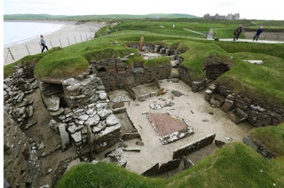
Houses of the Neolithic settlement of Skara Brae. (Photo by Jeremy Sutton-Hibbert/Getty Images)
Packed with historic sites of all ages from prehistoric remains to World War II wrecks in Scapa Flow, there’s more than enough history on mainland Orkney and the outer islands to hold your interest for weeks.It’s the prehistoric remains for which Orkney is most remarkable, particularly those of the Neolithic period (around 4000–2000BC). This was when agriculture first became established in Britain, and people began to start living in permanent settlements based around farms. This was a change from the mobile lifestyle of the Mesolithic period (10000–4000BC), when they moved following the seasonal round of hunting and gathering.The Mesolithic people have left little evidence of their passing in these islands. Their settlements weren’t built to last, so the ephemeral remains of their homes can only be traced by careful archaeological excavation. With the onset of the Neolithic and the move from hunting to agriculture as the way of life, however, our ancestors began to make more of a dent on the landscape: their settlements, their monuments, and sometimes even their trackways and field systems survive.It’s generally easier to see the remains of death, burial and ritual of our Neolithic forebears than it is to see their settlements. These were the people who built long barrows, such as the well-preserved example at West Kennet in Wiltshire, as tombs for their ancestors. They are also responsible for henges and stone circles, Stonehenge being the most obvious example, and even more enigmatic ritual monuments like the massive man-made mound of Silbury Hill, again in Wiltshire.Large earthwork and stone monuments like these are easy to spot in the landscape, but it’s harder to find evidence of the places where the Neolithic people who built them lived. And that’s where Orkney comes into its own – here you can see both settlements and monuments in one place; that’s why much of the mainland island has been designated a World Heritage Site. Our voyage of discovery takes in the heart of Neolithic Orkney: Maeshowe is one of the finest examples of a prehistoric burial mound in Britain, the Stones of Stenness and the Ring of Brodgar are impressive examples of the ritual monuments of the time, whilst the villages of Skara Brae and Barnhouse are amongst the best-preserved Neolithic settlement sites in Britain. With this astonishing combination of archaeological sites, the area is one of the only places in the country where you can get a real feel for the way of life of Britain’s first farmers.Orkney archaeologist Julie Gibson knows more than most about the islands’ heritage. She sums up what you can see; “If you go to Barnhouse, you are actually in a village lived in by the people who put up the Stones of Stenness next door.”The reason you can still see Barnhouse and Skara Brae boils down to the availability of natural resources. High winds have been battering the islands for thousands of years, so trees have struggled to survive. On mainland Britain, excavations have shown that Neolithic settlements were of wood, which has since rotted away. The Orcadians lacked timber but did have a ready supply of a more permanent material: stone. Their villages survive because they are constructed of sandstone slabs, which lie ready-quarried by the sea all around the coast.“Because they built in stone, so it leaves everything in 3D,” explains Julie. “In the rest of the country you’re dealing with wooden structures in prehistory, so archaeologists are left with negative evidence and have to play the game of join-the-dots. Here you’ve got positive evidence so the past is that much clearer.”There aren’t many places in the world that can boast a practically intact 5,000-year-old village. Skara Brae was occupied from around 3100BC to 2500BC, and after that it was hidden under a sand dune until a wild storm revealed it in the winter of 1850. The village is unlike any you’ll see today. It’s a semi-subterranean place, built inside a huge mound of decomposed vegetable matter, dung, animal bones, stone and shell. The midden was built on the site first and then roundhouses and connecting passageways were dug into the massive compost heap. The homes were therefore cocooned from the excesses of Atlantic weather by a layer of insulating matter.Ten houses are visible at Skara Brae (though they were not all built and occupied at the same time). They are single-room affairs revetted with dry stone walling and each one would have had a roof supported either by timber, if it was available, or whalebone. The roofs are gone now so you look down into the houses from above, and what you see inside is amazing. All the furniture was of stone, so beds, cupboards, dressers, stone boxes, hearths and doors all survive. The interior of a Neolithic house at Skara Brae, Orkney. (Photo by Werner Forman/Universal Images Group/Getty Images)Each house has about 36 square metres of floor space, more than half the average floor space of a modern two-bed house (61.5 square metres), so an estate agent would probably describe them as spacious studio apartments. Their low doorways and the winding passages prevented the wind rushing in, and with a fire in the central hearth, you can imagine a picture of cosy domesticity you wouldn’t normally associate with prehistory. As all the houses are similar in size and fittings without anything that looks like a chief’s dwelling, Skara Brae is generally thought to have been an egalitarian society where all members were roughly equal in status.Life wasn’t idyllic for the people of Skara Brae, however, as Julie explains. “If you look at the skeletal material, you became very aware of the humanity of the people you’re dealing with. Terrible arthritis, heads grooved by carrying baskets round their heads. These were people only marginally shorter than us, people who are clearly us – only a long time ago – whose thought processes you have to reach through analogy – that’s what makes it difficult to understand them.”We may not know what they thought but we do have a fair idea of what they did during the day. Archaeologists have concluded the villagers were fishermen and farmers who grew barley and wheat, kept cattle, sheep and pigs, and supplemented their diet with seafood and sea-birds. The 20 or so families that lived in the village seem to have had peaceful relations with their neighbours around the islands as Skara Brae wasn’t built for defence and no weaponry has been found. Several similar villages have been discovered in the Orkneys, including the nearby one at Barnhouse.Instead of fighting one another, the villagers appear to have devoted their spare time to building tombs and monuments. And they must have had a fair bit of time to spare; it’s estimated that it would have taken 150,000 hours to build the two stone circles of Stenness and Brodgar. The Stones of Stenness are thought to have been in existence by 3000BC, so it was contemporary with the occupation of Skara Brae (3100–2500BC). Brodgar is thought to be a little later, probably dating to the middle of the third millennium BC. The huge circular tomb of Maeshowe is also thought to be roughly contemporary – built some time after 3000BC and possibly used for centuries thereafter.The two stone circles sit on narrow promontories of land looking out over the lochs of Harray and Stenness. Brodgar is the bigger, but both occupy dramatically scenic locations. The sheer scale of Brodgar can’t fail to impress and bring home the amount of work that went into it.Maeshowe is an entirely different sort of monument. You can see its mound from the Stones of Stenness, and though it’s not much to look at on the outside, when you get inside you know you’re in a very special place.You have to shuffle through a low narrow slab-lined passage to get inside. Consider as you do that your shoulders are rubbing on the same stones that the Neolithic builders touched 5,000 years ago. Once inside, you’re standing in one of the best examples of a chambered tomb in Britain.These sorts of tombs are numerous in the Orkneys and archaeologists conjecture, from what’s been found in the others, that each of the side cells at Maeshowe would have held the bones of many members of the local population. In similar monuments, the bones of many people have been discovered, jumbled together in a pattern not comprehensible to modern eyes.We don’t know for sure what was in Maeshowe because the tomb was raided by Vikings 1,000 years ago (you can see their runic graffiti on the walls) and the place contained only a single skull fragment when excavated in the 19th century. Nevertheless, it’s a uniquely atmospheric place to visit and a supreme example of the Neolithic stonemason’s skill.Given that all these mighty monuments were built at around the same time as Skara Brae was occupied, and lie only a few miles from the settlement, it’s an obvious conclusion to make that the villagers were involved in the construction and use of the stones and tomb. To add weight to the argument, a specific type of pottery, grooved ware, has been found in excavations at all these places. As you wander round the stones at Stenness and Brodgar, or crouch down at the entrance of Maeshowe, there’s one question that springs to mind: ‘Why did the villagers of Skara Brae go to all the trouble of constructing these places?’ We’ll never know for certain. Without written records, all we can do is theorise. It is likely some ritual was carried out inside the circles, perhaps based on astronomical calculations, or on some sort of religion, but that’s as much as we can say without delving into mere conjecture.Archaeologists suggest that monuments like Maeshowe were required in the Neolithic period, because people needed, in a way they’d never felt before, to associate themselves with the land they had started to farm so others couldn’t take it away. One way to create a sense of ownership was to develop an ancestor cult, burying their forefathers’ bones near the land they considered theirs and performing ceremonies to strengthen their age-old claim to their territory.One thing is certain; it took a massive community effort to build these structures. It was certainly more than a job that just the small population of Skara Brae could have managed, and this has led to another theory; that the building of Maeshowe suggests a move from self-governing villages to a regional authority which organised people throughout the Orkneys to build the tomb.The social bonds of close-knit settlements like Skara Brae would have broken down as people began to associate more with the regional power than the old independent village structure, perhaps leaving the village to live in smaller farmsteads. It’s a reasonable explanation for why Skara Brae was abandoned; another more prosaic possibility is that the place was overwhelmed by a huge sandstorm.Either way, the magnificent remains are there to see today. If you want to get a first-hand impression of the way of life, and death, of the first farmers in the British Isles, Orkney is the closest place you’ll get to experiencing it.

Houses of the Neolithic settlement of Skara Brae. (Photo by Jeremy Sutton-Hibbert/Getty Images)
Packed with historic sites of all ages from prehistoric remains to World War II wrecks in Scapa Flow, there’s more than enough history on mainland Orkney and the outer islands to hold your interest for weeks.It’s the prehistoric remains for which Orkney is most remarkable, particularly those of the Neolithic period (around 4000–2000BC). This was when agriculture first became established in Britain, and people began to start living in permanent settlements based around farms. This was a change from the mobile lifestyle of the Mesolithic period (10000–4000BC), when they moved following the seasonal round of hunting and gathering.The Mesolithic people have left little evidence of their passing in these islands. Their settlements weren’t built to last, so the ephemeral remains of their homes can only be traced by careful archaeological excavation. With the onset of the Neolithic and the move from hunting to agriculture as the way of life, however, our ancestors began to make more of a dent on the landscape: their settlements, their monuments, and sometimes even their trackways and field systems survive.It’s generally easier to see the remains of death, burial and ritual of our Neolithic forebears than it is to see their settlements. These were the people who built long barrows, such as the well-preserved example at West Kennet in Wiltshire, as tombs for their ancestors. They are also responsible for henges and stone circles, Stonehenge being the most obvious example, and even more enigmatic ritual monuments like the massive man-made mound of Silbury Hill, again in Wiltshire.Large earthwork and stone monuments like these are easy to spot in the landscape, but it’s harder to find evidence of the places where the Neolithic people who built them lived. And that’s where Orkney comes into its own – here you can see both settlements and monuments in one place; that’s why much of the mainland island has been designated a World Heritage Site. Our voyage of discovery takes in the heart of Neolithic Orkney: Maeshowe is one of the finest examples of a prehistoric burial mound in Britain, the Stones of Stenness and the Ring of Brodgar are impressive examples of the ritual monuments of the time, whilst the villages of Skara Brae and Barnhouse are amongst the best-preserved Neolithic settlement sites in Britain. With this astonishing combination of archaeological sites, the area is one of the only places in the country where you can get a real feel for the way of life of Britain’s first farmers.Orkney archaeologist Julie Gibson knows more than most about the islands’ heritage. She sums up what you can see; “If you go to Barnhouse, you are actually in a village lived in by the people who put up the Stones of Stenness next door.”The reason you can still see Barnhouse and Skara Brae boils down to the availability of natural resources. High winds have been battering the islands for thousands of years, so trees have struggled to survive. On mainland Britain, excavations have shown that Neolithic settlements were of wood, which has since rotted away. The Orcadians lacked timber but did have a ready supply of a more permanent material: stone. Their villages survive because they are constructed of sandstone slabs, which lie ready-quarried by the sea all around the coast.“Because they built in stone, so it leaves everything in 3D,” explains Julie. “In the rest of the country you’re dealing with wooden structures in prehistory, so archaeologists are left with negative evidence and have to play the game of join-the-dots. Here you’ve got positive evidence so the past is that much clearer.”There aren’t many places in the world that can boast a practically intact 5,000-year-old village. Skara Brae was occupied from around 3100BC to 2500BC, and after that it was hidden under a sand dune until a wild storm revealed it in the winter of 1850. The village is unlike any you’ll see today. It’s a semi-subterranean place, built inside a huge mound of decomposed vegetable matter, dung, animal bones, stone and shell. The midden was built on the site first and then roundhouses and connecting passageways were dug into the massive compost heap. The homes were therefore cocooned from the excesses of Atlantic weather by a layer of insulating matter.Ten houses are visible at Skara Brae (though they were not all built and occupied at the same time). They are single-room affairs revetted with dry stone walling and each one would have had a roof supported either by timber, if it was available, or whalebone. The roofs are gone now so you look down into the houses from above, and what you see inside is amazing. All the furniture was of stone, so beds, cupboards, dressers, stone boxes, hearths and doors all survive.
The interior of a Neolithic house at Skara Brae, Orkney. (Photo by Werner Forman/Universal Images Group/Getty Images)Each house has about 36 square metres of floor space, more than half the average floor space of a modern two-bed house (61.5 square metres), so an estate agent would probably describe them as spacious studio apartments. Their low doorways and the winding passages prevented the wind rushing in, and with a fire in the central hearth, you can imagine a picture of cosy domesticity you wouldn’t normally associate with prehistory. As all the houses are similar in size and fittings without anything that looks like a chief’s dwelling, Skara Brae is generally thought to have been an egalitarian society where all members were roughly equal in status.Life wasn’t idyllic for the people of Skara Brae, however, as Julie explains. “If you look at the skeletal material, you became very aware of the humanity of the people you’re dealing with. Terrible arthritis, heads grooved by carrying baskets round their heads. These were people only marginally shorter than us, people who are clearly us – only a long time ago – whose thought processes you have to reach through analogy – that’s what makes it difficult to understand them.”We may not know what they thought but we do have a fair idea of what they did during the day. Archaeologists have concluded the villagers were fishermen and farmers who grew barley and wheat, kept cattle, sheep and pigs, and supplemented their diet with seafood and sea-birds. The 20 or so families that lived in the village seem to have had peaceful relations with their neighbours around the islands as Skara Brae wasn’t built for defence and no weaponry has been found. Several similar villages have been discovered in the Orkneys, including the nearby one at Barnhouse.Instead of fighting one another, the villagers appear to have devoted their spare time to building tombs and monuments. And they must have had a fair bit of time to spare; it’s estimated that it would have taken 150,000 hours to build the two stone circles of Stenness and Brodgar. The Stones of Stenness are thought to have been in existence by 3000BC, so it was contemporary with the occupation of Skara Brae (3100–2500BC). Brodgar is thought to be a little later, probably dating to the middle of the third millennium BC. The huge circular tomb of Maeshowe is also thought to be roughly contemporary – built some time after 3000BC and possibly used for centuries thereafter.The two stone circles sit on narrow promontories of land looking out over the lochs of Harray and Stenness. Brodgar is the bigger, but both occupy dramatically scenic locations. The sheer scale of Brodgar can’t fail to impress and bring home the amount of work that went into it.Maeshowe is an entirely different sort of monument. You can see its mound from the Stones of Stenness, and though it’s not much to look at on the outside, when you get inside you know you’re in a very special place.You have to shuffle through a low narrow slab-lined passage to get inside. Consider as you do that your shoulders are rubbing on the same stones that the Neolithic builders touched 5,000 years ago. Once inside, you’re standing in one of the best examples of a chambered tomb in Britain.These sorts of tombs are numerous in the Orkneys and archaeologists conjecture, from what’s been found in the others, that each of the side cells at Maeshowe would have held the bones of many members of the local population. In similar monuments, the bones of many people have been discovered, jumbled together in a pattern not comprehensible to modern eyes.We don’t know for sure what was in Maeshowe because the tomb was raided by Vikings 1,000 years ago (you can see their runic graffiti on the walls) and the place contained only a single skull fragment when excavated in the 19th century. Nevertheless, it’s a uniquely atmospheric place to visit and a supreme example of the Neolithic stonemason’s skill.Given that all these mighty monuments were built at around the same time as Skara Brae was occupied, and lie only a few miles from the settlement, it’s an obvious conclusion to make that the villagers were involved in the construction and use of the stones and tomb. To add weight to the argument, a specific type of pottery, grooved ware, has been found in excavations at all these places. As you wander round the stones at Stenness and Brodgar, or crouch down at the entrance of Maeshowe, there’s one question that springs to mind: ‘Why did the villagers of Skara Brae go to all the trouble of constructing these places?’ We’ll never know for certain. Without written records, all we can do is theorise. It is likely some ritual was carried out inside the circles, perhaps based on astronomical calculations, or on some sort of religion, but that’s as much as we can say without delving into mere conjecture.Archaeologists suggest that monuments like Maeshowe were required in the Neolithic period, because people needed, in a way they’d never felt before, to associate themselves with the land they had started to farm so others couldn’t take it away. One way to create a sense of ownership was to develop an ancestor cult, burying their forefathers’ bones near the land they considered theirs and performing ceremonies to strengthen their age-old claim to their territory.One thing is certain; it took a massive community effort to build these structures. It was certainly more than a job that just the small population of Skara Brae could have managed, and this has led to another theory; that the building of Maeshowe suggests a move from self-governing villages to a regional authority which organised people throughout the Orkneys to build the tomb.The social bonds of close-knit settlements like Skara Brae would have broken down as people began to associate more with the regional power than the old independent village structure, perhaps leaving the village to live in smaller farmsteads. It’s a reasonable explanation for why Skara Brae was abandoned; another more prosaic possibility is that the place was overwhelmed by a huge sandstorm.Either way, the magnificent remains are there to see today. If you want to get a first-hand impression of the way of life, and death, of the first farmers in the British Isles, Orkney is the closest place you’ll get to experiencing it.
July 22, 2016
Burned 3,000-Year-Old Settlement Frozen in Time May Have Been Torched by Raiding Party
Ancient Origins
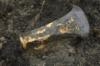
Archaeologists speculate that a raiding party torched a Bronze Age settlement on stilts that was well-preserved in the silt of the river it fell into about 3,000 years ago. A number of hints at the site, which is just east of Petersborough, England, including palisades made of new wood, indicate the people had lived there just a short time before it burned.
Sponsored by Revenue.com The site is at a quarry about 120 km (74.5 miles) north of London called Must Farm. An archaeologist discovered it in 1999 when he saw wooden stakes or palisades sticking out of the mud and silt, which preserved them and many other artifacts as well. Scorching and charring of the wood also helped to preserve some of the material.
 Preserved wood at Must Farm by Dr Colleen Morgan (
public domain
)A website about the site and excavations there states: “At some point after the palisade was created a fire tore through the settlement, causing the platform to drop into the river below where the flames were immediately quenched. As the material lay on the riverbed it was covered with layers of non-porous silt which helped to preserve everything from wooden utensils to clothing. It is this degree of preservation which makes the site fascinating and gives us hundreds of insights into life during the Bronze Age.”
Preserved wood at Must Farm by Dr Colleen Morgan (
public domain
)A website about the site and excavations there states: “At some point after the palisade was created a fire tore through the settlement, causing the platform to drop into the river below where the flames were immediately quenched. As the material lay on the riverbed it was covered with layers of non-porous silt which helped to preserve everything from wooden utensils to clothing. It is this degree of preservation which makes the site fascinating and gives us hundreds of insights into life during the Bronze Age.”
 The ancient people built the roundhouses over the water and encircled them with a possibly defensive palisade. Drawing by Vicki Herring for Cambridge Archaeological UnitWhile the entire site is fantastic, with its nine log boats found nearby, nine roundhouses and many important artifacts, two of the most important finds were textiles and vitrified foods. Also, beads, likely from the Balkans and the Middle East, showed there was long-distance trade in Britain, where the Bronze Age began about 4,000 to 4,500 years ago
The purpose of the textiles has not been discovered because there are no telltale clues such as cuffs to say whether it was used for clothing or other purposes. However, one of the team members, Susanna Harris of Glasgow University, said they have found fine linen with thread counts of 30 per centimeter, as fine as any cloth known from Europe of the time. “I counted them several times, thinking ‘This can’t be right,’” Harris told ScienceMag.org. The team has also found hanks of yarn and balls of thread.
 This photo may not look like much, but it is a fantastically preserved specimen of a 3,000-year-old textile piece from the Must Farm site. An expert says some of the textiles at the site are as fine as any of Europe at that time. Photo by Cambridge Archaeological UnitArchaeologists working on Must Farm revealed some of their findings to the media this week. Now they intend to retreat into the laboratory to more closely examine and analyze the many artifacts they have discovered at this site.
It’s the best Bronze Age settlement ever found in the United Kingdom,” said Mark Knight, project manager with the Cambridge Archaeological Unit, a private company that is in charge of the excavations. “We may have to wait a hundred years before we find an equivalent.”
The archaeologists say the roundhouses were about 8 meters (26.25 feet) in diameter. They were built above the water as a defense and to facilitate trade on the river, which led to the North Sea and other farms in the area.
Each house had woodworking tools, including chisels, axes and gouges. They also had sickles to reap grain, spears for hunting and perhaps fighting, and sets of ceramics that contained tiny cups, fine bowls and storage jars.
In the northeast sector of each house were butchered lambs. Dumped into the river were parts of deer and wild pigs. The archaeologists speculate the inhabitants may have had a taboo against butchering wild game indoors.
 A bowl with a woodchip. Photo by Cambridge Archaeological UnitSeveral food vessels contain charred, wheat, barley and residues of food that had already been cooked. One bowl of stew had a spoon in its burned crust. Experts hope to get Bronze Age recipes from the prehistoric smorgasbord.
Tree rings from wood used to construct the roundhouses and palisade were from about 1290 to 1250 BC and were all green and undisturbed by insects. That, plus wood chips found there, tell archaeologists it was a new settlement when it burned.
Archaeologist Karl Harrison of Cranfield University has been analyzing the fire damage and scorch marks to determine if the fire started in a house or outside. If it started inside, it may have been from a cook fire. If the blaze started outside, it might have been a case of arson. “It was rapid, smoke-filled, and incredibly destructive,” he told ScienceMag.org. “You’d have a couple of minutes to scrabble around.”
The people never returned to the site, which ensured it was well-preserved for modern archaeologists to discover and analyze.
Top image: A bronze socketed ax was one of many Bronze Age tools found at Must Farm, a site that dates back about 3,000 years and is the finest site of that era ever found in Britain and one of the finest in Europe. Photo by Cambridge Archaeological Unit.
By Mark Miller

Archaeologists speculate that a raiding party torched a Bronze Age settlement on stilts that was well-preserved in the silt of the river it fell into about 3,000 years ago. A number of hints at the site, which is just east of Petersborough, England, including palisades made of new wood, indicate the people had lived there just a short time before it burned.
Sponsored by Revenue.com The site is at a quarry about 120 km (74.5 miles) north of London called Must Farm. An archaeologist discovered it in 1999 when he saw wooden stakes or palisades sticking out of the mud and silt, which preserved them and many other artifacts as well. Scorching and charring of the wood also helped to preserve some of the material.
Preserved wood at Must Farm by Dr Colleen Morgan (
public domain
)A website about the site and excavations there states: “At some point after the palisade was created a fire tore through the settlement, causing the platform to drop into the river below where the flames were immediately quenched. As the material lay on the riverbed it was covered with layers of non-porous silt which helped to preserve everything from wooden utensils to clothing. It is this degree of preservation which makes the site fascinating and gives us hundreds of insights into life during the Bronze Age.”The ancient people built the roundhouses over the water and encircled them with a possibly defensive palisade. Drawing by Vicki Herring for Cambridge Archaeological UnitWhile the entire site is fantastic, with its nine log boats found nearby, nine roundhouses and many important artifacts, two of the most important finds were textiles and vitrified foods. Also, beads, likely from the Balkans and the Middle East, showed there was long-distance trade in Britain, where the Bronze Age began about 4,000 to 4,500 years agoThe purpose of the textiles has not been discovered because there are no telltale clues such as cuffs to say whether it was used for clothing or other purposes. However, one of the team members, Susanna Harris of Glasgow University, said they have found fine linen with thread counts of 30 per centimeter, as fine as any cloth known from Europe of the time. “I counted them several times, thinking ‘This can’t be right,’” Harris told ScienceMag.org. The team has also found hanks of yarn and balls of thread.
This photo may not look like much, but it is a fantastically preserved specimen of a 3,000-year-old textile piece from the Must Farm site. An expert says some of the textiles at the site are as fine as any of Europe at that time. Photo by Cambridge Archaeological UnitArchaeologists working on Must Farm revealed some of their findings to the media this week. Now they intend to retreat into the laboratory to more closely examine and analyze the many artifacts they have discovered at this site.It’s the best Bronze Age settlement ever found in the United Kingdom,” said Mark Knight, project manager with the Cambridge Archaeological Unit, a private company that is in charge of the excavations. “We may have to wait a hundred years before we find an equivalent.”
The archaeologists say the roundhouses were about 8 meters (26.25 feet) in diameter. They were built above the water as a defense and to facilitate trade on the river, which led to the North Sea and other farms in the area.
Each house had woodworking tools, including chisels, axes and gouges. They also had sickles to reap grain, spears for hunting and perhaps fighting, and sets of ceramics that contained tiny cups, fine bowls and storage jars.
In the northeast sector of each house were butchered lambs. Dumped into the river were parts of deer and wild pigs. The archaeologists speculate the inhabitants may have had a taboo against butchering wild game indoors.
A bowl with a woodchip. Photo by Cambridge Archaeological UnitSeveral food vessels contain charred, wheat, barley and residues of food that had already been cooked. One bowl of stew had a spoon in its burned crust. Experts hope to get Bronze Age recipes from the prehistoric smorgasbord.Tree rings from wood used to construct the roundhouses and palisade were from about 1290 to 1250 BC and were all green and undisturbed by insects. That, plus wood chips found there, tell archaeologists it was a new settlement when it burned.
Archaeologist Karl Harrison of Cranfield University has been analyzing the fire damage and scorch marks to determine if the fire started in a house or outside. If it started inside, it may have been from a cook fire. If the blaze started outside, it might have been a case of arson. “It was rapid, smoke-filled, and incredibly destructive,” he told ScienceMag.org. “You’d have a couple of minutes to scrabble around.”
The people never returned to the site, which ensured it was well-preserved for modern archaeologists to discover and analyze.
Top image: A bronze socketed ax was one of many Bronze Age tools found at Must Farm, a site that dates back about 3,000 years and is the finest site of that era ever found in Britain and one of the finest in Europe. Photo by Cambridge Archaeological Unit.
By Mark Miller
July 21, 2016
Child Doodles Discovered in 14th Century Manuscript
Ancient Origins
Researchers have discovered a set of children's doodles in the margins of a medieval manuscript. The discovery sheds new light on the knowledge and education of children in the Middle Ages and their similarities to children of today.
A report recently published in the journal Cogent Arts & Humanities, described the remarkable 14th-century book from a Franciscan convent in Naples, which contains the doodles spotted in the margins. They are the work of mischievous little kids, and very similar to what children do nowadays.
According to Deborah Thorpe, an author of the study, the drawings were discovered by chance while researching an unrelated project. As an expert of the medieval manuscripts from the University of York in Canada, she believes that the drawings depict a human, a cow or horse and some kind of demon or devil.
“I was looking through a database of medieval manuscripts online and I found images of these beautiful doodles in the margins and to me they looked like they were done by children. I thought ‘this is really interesting, has anyone written anything about this?’' she said in a statement.
 A child’s drawing of a person found in the manuscript. LJS 361, Kislak Center for Special Collections, Rare Books and Manuscripts, University of Pennsylvania Libraries folio 23r.Thorpe didn't have the knowledge to analyze the discovery properly, so she recruited several child psychologists. They came up with a set of criteria, which helped them to classify the sketches and determine the approximate age of the drawer. They checked the elongated shapes, the really long legs, the lack of a torso, and the focus on the head. There are similarities between the drawings that children make at specific ages. The researchers concluded the drawings likely came from children between the ages of 4 and 6 years old.
There are later examples of the historical children’s drawings, but Thorpe believes that this is the first time that children’s drawings in medieval books have been classified as the work of children with the use of a set of psychological criteria. It shows that children enjoyed playing and learning, expressing their imagination exactly like today's children.
The manuscript covers knowledge about an astronomy, biblical dates and tables for determining any day of the week between 1204 and 1512, religious sermons, and astrology.
Thorpe’s discovery, although impressive, is not the only or the oldest child’s drawing that has been found from the past. April Holloway from Ancient Origins reported in June 29, 2014 about another fascinating discovery. As she wrote: ''Archaeologists have unearthed six ancient Russian birch-bark texts in the historical city of Vekliky Novgorod in north-western Russia, according to a report in Voice of Russia. The discovery adds to the collection of more than 1,000 birch-bark texts, which have been immensely significant in changing traditional ideas about literacy rates in ancient Russia, opening a new page in the study of the Russian language, and shedding light on early northern Russian culture.
 Birch-bark letter no. 202, mid-13th century, produced by a child. Photo source:
Wikimedia
Among their authors and addressees of the birch-bark documents are priests, high officials, house owners, merchants, stewards, craftsmen, warriors, women, and even children. For example, the document contains spelling lessons and drawings made by a boy named Onfim, who is estimated to have been between 6 and 7 years old at the time.
Birch-bark letter no. 202, mid-13th century, produced by a child. Photo source:
Wikimedia
Among their authors and addressees of the birch-bark documents are priests, high officials, house owners, merchants, stewards, craftsmen, warriors, women, and even children. For example, the document contains spelling lessons and drawings made by a boy named Onfim, who is estimated to have been between 6 and 7 years old at the time.
The first birch bark letter was found on July 26, 1951 by Nina Fedorovna Akulova, and at least 1025 have been unearthed thereafter – 923 in Novgorod alone – typically dating from the period between late 11 th and early 15 th century. Almost all of them were written with styluses of bronze and iron, and never ink. The letters were preserved due to the swampy soil which isolated them from oxygen. Many of them are found in streets, because streets were paved with logs, which eventually sank into the soil, with additional layers burying older ones, including the letters.''
Top image: Child doodles found in a Medieval manuscript. LJS 361, Kislak Center for Special Collections, Rare Books and Manuscripts, University of Pennsylvania Libraries folio 26r.
By Natalia Klimzcak

Researchers have discovered a set of children's doodles in the margins of a medieval manuscript. The discovery sheds new light on the knowledge and education of children in the Middle Ages and their similarities to children of today.
A report recently published in the journal Cogent Arts & Humanities, described the remarkable 14th-century book from a Franciscan convent in Naples, which contains the doodles spotted in the margins. They are the work of mischievous little kids, and very similar to what children do nowadays.
According to Deborah Thorpe, an author of the study, the drawings were discovered by chance while researching an unrelated project. As an expert of the medieval manuscripts from the University of York in Canada, she believes that the drawings depict a human, a cow or horse and some kind of demon or devil.
“I was looking through a database of medieval manuscripts online and I found images of these beautiful doodles in the margins and to me they looked like they were done by children. I thought ‘this is really interesting, has anyone written anything about this?’' she said in a statement.
A child’s drawing of a person found in the manuscript. LJS 361, Kislak Center for Special Collections, Rare Books and Manuscripts, University of Pennsylvania Libraries folio 23r.Thorpe didn't have the knowledge to analyze the discovery properly, so she recruited several child psychologists. They came up with a set of criteria, which helped them to classify the sketches and determine the approximate age of the drawer. They checked the elongated shapes, the really long legs, the lack of a torso, and the focus on the head. There are similarities between the drawings that children make at specific ages. The researchers concluded the drawings likely came from children between the ages of 4 and 6 years old.There are later examples of the historical children’s drawings, but Thorpe believes that this is the first time that children’s drawings in medieval books have been classified as the work of children with the use of a set of psychological criteria. It shows that children enjoyed playing and learning, expressing their imagination exactly like today's children.
The manuscript covers knowledge about an astronomy, biblical dates and tables for determining any day of the week between 1204 and 1512, religious sermons, and astrology.
Thorpe’s discovery, although impressive, is not the only or the oldest child’s drawing that has been found from the past. April Holloway from Ancient Origins reported in June 29, 2014 about another fascinating discovery. As she wrote: ''Archaeologists have unearthed six ancient Russian birch-bark texts in the historical city of Vekliky Novgorod in north-western Russia, according to a report in Voice of Russia. The discovery adds to the collection of more than 1,000 birch-bark texts, which have been immensely significant in changing traditional ideas about literacy rates in ancient Russia, opening a new page in the study of the Russian language, and shedding light on early northern Russian culture.
Birch-bark letter no. 202, mid-13th century, produced by a child. Photo source:
Wikimedia
Among their authors and addressees of the birch-bark documents are priests, high officials, house owners, merchants, stewards, craftsmen, warriors, women, and even children. For example, the document contains spelling lessons and drawings made by a boy named Onfim, who is estimated to have been between 6 and 7 years old at the time.The first birch bark letter was found on July 26, 1951 by Nina Fedorovna Akulova, and at least 1025 have been unearthed thereafter – 923 in Novgorod alone – typically dating from the period between late 11 th and early 15 th century. Almost all of them were written with styluses of bronze and iron, and never ink. The letters were preserved due to the swampy soil which isolated them from oxygen. Many of them are found in streets, because streets were paved with logs, which eventually sank into the soil, with additional layers burying older ones, including the letters.''
Top image: Child doodles found in a Medieval manuscript. LJS 361, Kislak Center for Special Collections, Rare Books and Manuscripts, University of Pennsylvania Libraries folio 26r.
By Natalia Klimzcak
July 20, 2016
8 of Britain’s most mysterious ruins
History Extra
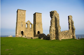
Reculver Towers, the site of one of the earliest Roman forts built to protect passing vessels. The remnants of the Reculver fort can today be seen underneath the large 12th-century towers of the ruined St Mary’s Church. (Photo by Loop Images/UIG via Getty Images)
Ruthven BarracksWith the distant backdrop of the Cairngorms and amid spectacular scenery, Ruthven is a must-see for anyone travelling through Scotland.
During the early 18th century the British government was a nervous one. It had just quelled (in 1715) the first of what would be two Jacobite uprisings, and it sought to subdue the unruly clans of the Highlands. Situated on the main Perth to Inverness road, with a crossing of the river Spey, Ruthven was strategically placed for the building of an army outpost and in 1719 Ruthven Barracks was built on the site of a 13th-century castle.
In 1745 its defences were put to the test when it was attacked by John William O’Sullivan and his group of 300 Jacobites. The barracks successfully warded off the attack with only 12 redcoats. Accounts of the day claim they suffered only one casualty, who received a fatal gunshot to the head after leaning too far over the ramparts. The Jacobite army returned the following year, and the ruins we see today are the result of the damage they inflicted.
Before the barracks were built, there is a tale of a dark figure who arrived at the former castle one night in the 14th century. He challenged Alexander Stewart, known as the ‘Wolf of Badenoch’, to a game of chess (or cards depending on sources). By morning the shadowy figure was gone and all the men of the castle lay outside its walls blackened and dead having been struck by lightning. The Wolf remained unharmed, although all the nails in his boots had been removed.
 Ruthven Barracks. (Photo by David Hamilton)
Reculver TowersTo the Greeks, the Isle of Thanet (or Ynys Thanatos) was a dark place where, legend had it, unmanned boats took the souls of the dead across the water. The river Wantsum, which once separated the isle from mainland Kent, is long gone; it silted up and the last ship sailed through the channel in 1672. Today much of the land is marsh land and makes for an important habitat for local wildlife.
In its heyday the Wantsum would have been an important shipping channel. Such was its importance to the Romans that they built forts at Richborough in the south and Reculver in the north to protect passing vessels. You can still see remnants of the Reculver fort, underneath the large 12th-century towers of the ruined St Mary’s Church.
The original church dates from AD 669 and would have been constructed almost entirely from pillaged stone from the Roman fort. Much of the church and the fort slipped in the sea over the centuries and today large sea defences have been built to protect the sites and the shoreline.
Today the Thanet coastal path (Ramsgate and Herne Bay via Margate) runs past the site.

Tower at Reculver. (© Mark Eaton/Dreamstime.com)
Hampton GayOn Christmas Eve 1874, the packed London to Birkenhead train derailed at Shipton-on-Chirwell, Oxfordshire, sending 34 people to their death and injuring many more. Local residents, hearing what must have been horrifying sounds, were first on the scene to help. Among those coming to the aid of the stricken train was Sir Randolph Churchill from nearby Blenheim Palace, where he was celebrating the christening of his son Winston.
Not all the locals were forthcoming, however. Story has it that when the injured passengers called on Hampton Gay Manor for shelter, they were turned away into the night. It was said that when the household refused to help, a curse was put upon it. Some 13 years later, when a fire gutted the interior of the house, causing the roof to collapse, it was seen as a sign the curse had come to fruition. Many cast doubt on the story, however, claiming the house did indeed offer help.
All that now stands of the once grand manor house is a gutted shell hidden behind a clump of deciduous trees in a village outside of Oxford.
 Hampton Gay. (Photo by David Hamilton)
Magpie mineMagpie mine dates from the mid-18th century, a boom time for the lead industry. South of the village of Sheldon, within the Peak District National Park, it was built to exploit the Bole Vein, a rich vein of lead running underneath the Derbyshire countryside. Despite its position, Magpie was so beset with problems throughout its working life that it was thought to be cursed.
In reality its bad luck can be explained by the fact that it was not alone in seeking to make a profit from the Bole Vein. Neighbouring Maypitt also laid claim to the vein and a fierce rivalry developed between the two mines. The dispute could not be settled in the courts and things escalated when explosives used in Magpie mine had a knock-on effect in the neighbouring shaft injuring one of the Maypitt workers.
In a cold act of revenge, Maypitt workers lit fires in underground shafts to smoke out Magpie workers. The Magpie miners were not ones to be bullied, however, and they retaliated by lighting yet more underground fires. This resulted in the death of three Maypitt workers who suffered smoke inhalation.
Nowadays the mine is a far more peaceful place to visit: its ruins are a short stroll from the nearest road or can be taken in as part of a longer walk in the area.
 Magpie mine. (Photo by David Hamilton)
Candleston Castle, south WalesA short walk from Ogmore Castle in the Vale of Glamorgan, another perhaps more sorrowful castle stands overgrown and hidden in the woods. Slowly being reclaimed by nature, Candleston Castle is the crumbling ruin of a 14th-century fortified manor house. It is situated on the edge of the Merthyr Mawr National Nature Reserve, the second-highest reserve of sand dunes in Europe. The dunes are a rare and important habitat for nesting birds and insects, and their sheer size makes for a unique afternoon out for the family.
The castle hasn’t always been such a bleak site, however – at one time it would have been at the centre of where the thriving village of Treganlaw (Welsh for ‘the town of a hundred hands’) once stood. The castle’s demise began when the village and all its farmland disappeared underneath the dunes following a series of violent storms. Myths and legends have built up around the vanishing village, with stories of the villagers appearing in ghostly form in search of their lost homes.
 Candleston Castle. (Photo by David Hamilton)
Thetford Warren Lodge, NorfolkRabbits were a rare sight in medieval England and were prized for both their meat and their fur. Commercial warrens, such as the one at Thetford, were lucrative businesses, and landlords set on protecting their assets constructed large defensive lodges. With its metre-thick walls and its box-shaped structure, the building appears as if a celestial dice has been tossed into the Norfolk countryside. It stands in woodlands planted by the forestry commission, and yet rather than seeming manmade, the area feels wild and untouched.
Local tales tell of two ghostly apparitions defending the ruined lodge. The first – and most sinister – is that of a faceless man thought to be the victim of the gamekeeper’s gun or an escaped leper from the nearby colony. The second has a much more Monty Python feel about it: many have claimed to have seen a large, ghostly white rabbit with wild red eyes standing guard over the Lodge. Legend has it that anyone who gazes into the eyes of this overgrown phantom will have very little time left in this world!
 Thetford Warren Lodge. (© 67photo/Alamy Stock Photo)
Hermitage Castle, Scottish BordersPositioned on the historically contested border between Scotland and England, Hermitage Castle rises up in the landscape like a huge block of brutalist medieval architecture. Described by historical author George MacDonald Fraser as “the guardhouse of the bloodiest valley in Britain”, the ruin also has the reputation of being one of the most haunted castles in Britain.
A former resident, the loathed William de Soulis, was a deeply unpleasant man who practised black magic, kidnapped local children and even stabbed a dinner guest in the back. It is said that the soul of De Soulis, along with his supernatural aid – an evil goblin assassin known as Robin Redcap – are forever trapped within the walls of the castle. Those living nearby say they have heard at night the screams of the ‘bad lord’s’ victims!
 Hermitage Castle. (© Steve Morris/Dreamstime.com)
St Mary’s Church, East Somerton, NorfolkIn a county with an abundance of ruined churches, the 15th-century St Mary’s in East Somerton stands out from the pack. In its heyday it must have been an awe-inspiring church, as even today the sheer size of the place is staggering.
Built in the Gothic Perpendicular style, the church would have had a similar look to Gloucester Cathedral or King’s College Chapel in Cambridge, albeit on a smaller scale. Having fallen into disuse in the 17th century, it now lies hidden among the trees and despite its size you have to be practically inside the church’s perimeter before it becomes apparent. It has an otherworldly, almost fairytale, feel to it, which is further enhanced by a large oak tree that has taken root inside the church ruins. If you are to visit just one ruined church in Norfolk, it should undoubtedly be St Mary’s.
[image error]
St Mary’s Church, East Somerton, Norfolk. (© Sonnydaez/Dreamstime.com)
David Hamilton is the author of Wild Ruins, a guidebook to Britain’s ruins that details how to visit and gain access to 300 hidden historical spots.

Reculver Towers, the site of one of the earliest Roman forts built to protect passing vessels. The remnants of the Reculver fort can today be seen underneath the large 12th-century towers of the ruined St Mary’s Church. (Photo by Loop Images/UIG via Getty Images)
Ruthven BarracksWith the distant backdrop of the Cairngorms and amid spectacular scenery, Ruthven is a must-see for anyone travelling through Scotland.
During the early 18th century the British government was a nervous one. It had just quelled (in 1715) the first of what would be two Jacobite uprisings, and it sought to subdue the unruly clans of the Highlands. Situated on the main Perth to Inverness road, with a crossing of the river Spey, Ruthven was strategically placed for the building of an army outpost and in 1719 Ruthven Barracks was built on the site of a 13th-century castle.
In 1745 its defences were put to the test when it was attacked by John William O’Sullivan and his group of 300 Jacobites. The barracks successfully warded off the attack with only 12 redcoats. Accounts of the day claim they suffered only one casualty, who received a fatal gunshot to the head after leaning too far over the ramparts. The Jacobite army returned the following year, and the ruins we see today are the result of the damage they inflicted.
Before the barracks were built, there is a tale of a dark figure who arrived at the former castle one night in the 14th century. He challenged Alexander Stewart, known as the ‘Wolf of Badenoch’, to a game of chess (or cards depending on sources). By morning the shadowy figure was gone and all the men of the castle lay outside its walls blackened and dead having been struck by lightning. The Wolf remained unharmed, although all the nails in his boots had been removed.
Ruthven Barracks. (Photo by David Hamilton)Reculver TowersTo the Greeks, the Isle of Thanet (or Ynys Thanatos) was a dark place where, legend had it, unmanned boats took the souls of the dead across the water. The river Wantsum, which once separated the isle from mainland Kent, is long gone; it silted up and the last ship sailed through the channel in 1672. Today much of the land is marsh land and makes for an important habitat for local wildlife.
In its heyday the Wantsum would have been an important shipping channel. Such was its importance to the Romans that they built forts at Richborough in the south and Reculver in the north to protect passing vessels. You can still see remnants of the Reculver fort, underneath the large 12th-century towers of the ruined St Mary’s Church.
The original church dates from AD 669 and would have been constructed almost entirely from pillaged stone from the Roman fort. Much of the church and the fort slipped in the sea over the centuries and today large sea defences have been built to protect the sites and the shoreline.
Today the Thanet coastal path (Ramsgate and Herne Bay via Margate) runs past the site.
Tower at Reculver. (© Mark Eaton/Dreamstime.com)
Hampton GayOn Christmas Eve 1874, the packed London to Birkenhead train derailed at Shipton-on-Chirwell, Oxfordshire, sending 34 people to their death and injuring many more. Local residents, hearing what must have been horrifying sounds, were first on the scene to help. Among those coming to the aid of the stricken train was Sir Randolph Churchill from nearby Blenheim Palace, where he was celebrating the christening of his son Winston.
Not all the locals were forthcoming, however. Story has it that when the injured passengers called on Hampton Gay Manor for shelter, they were turned away into the night. It was said that when the household refused to help, a curse was put upon it. Some 13 years later, when a fire gutted the interior of the house, causing the roof to collapse, it was seen as a sign the curse had come to fruition. Many cast doubt on the story, however, claiming the house did indeed offer help.
All that now stands of the once grand manor house is a gutted shell hidden behind a clump of deciduous trees in a village outside of Oxford.
Hampton Gay. (Photo by David Hamilton)Magpie mineMagpie mine dates from the mid-18th century, a boom time for the lead industry. South of the village of Sheldon, within the Peak District National Park, it was built to exploit the Bole Vein, a rich vein of lead running underneath the Derbyshire countryside. Despite its position, Magpie was so beset with problems throughout its working life that it was thought to be cursed.
In reality its bad luck can be explained by the fact that it was not alone in seeking to make a profit from the Bole Vein. Neighbouring Maypitt also laid claim to the vein and a fierce rivalry developed between the two mines. The dispute could not be settled in the courts and things escalated when explosives used in Magpie mine had a knock-on effect in the neighbouring shaft injuring one of the Maypitt workers.
In a cold act of revenge, Maypitt workers lit fires in underground shafts to smoke out Magpie workers. The Magpie miners were not ones to be bullied, however, and they retaliated by lighting yet more underground fires. This resulted in the death of three Maypitt workers who suffered smoke inhalation.
Nowadays the mine is a far more peaceful place to visit: its ruins are a short stroll from the nearest road or can be taken in as part of a longer walk in the area.
Magpie mine. (Photo by David Hamilton)Candleston Castle, south WalesA short walk from Ogmore Castle in the Vale of Glamorgan, another perhaps more sorrowful castle stands overgrown and hidden in the woods. Slowly being reclaimed by nature, Candleston Castle is the crumbling ruin of a 14th-century fortified manor house. It is situated on the edge of the Merthyr Mawr National Nature Reserve, the second-highest reserve of sand dunes in Europe. The dunes are a rare and important habitat for nesting birds and insects, and their sheer size makes for a unique afternoon out for the family.
The castle hasn’t always been such a bleak site, however – at one time it would have been at the centre of where the thriving village of Treganlaw (Welsh for ‘the town of a hundred hands’) once stood. The castle’s demise began when the village and all its farmland disappeared underneath the dunes following a series of violent storms. Myths and legends have built up around the vanishing village, with stories of the villagers appearing in ghostly form in search of their lost homes.
Candleston Castle. (Photo by David Hamilton)Thetford Warren Lodge, NorfolkRabbits were a rare sight in medieval England and were prized for both their meat and their fur. Commercial warrens, such as the one at Thetford, were lucrative businesses, and landlords set on protecting their assets constructed large defensive lodges. With its metre-thick walls and its box-shaped structure, the building appears as if a celestial dice has been tossed into the Norfolk countryside. It stands in woodlands planted by the forestry commission, and yet rather than seeming manmade, the area feels wild and untouched.
Local tales tell of two ghostly apparitions defending the ruined lodge. The first – and most sinister – is that of a faceless man thought to be the victim of the gamekeeper’s gun or an escaped leper from the nearby colony. The second has a much more Monty Python feel about it: many have claimed to have seen a large, ghostly white rabbit with wild red eyes standing guard over the Lodge. Legend has it that anyone who gazes into the eyes of this overgrown phantom will have very little time left in this world!
Thetford Warren Lodge. (© 67photo/Alamy Stock Photo)Hermitage Castle, Scottish BordersPositioned on the historically contested border between Scotland and England, Hermitage Castle rises up in the landscape like a huge block of brutalist medieval architecture. Described by historical author George MacDonald Fraser as “the guardhouse of the bloodiest valley in Britain”, the ruin also has the reputation of being one of the most haunted castles in Britain.
A former resident, the loathed William de Soulis, was a deeply unpleasant man who practised black magic, kidnapped local children and even stabbed a dinner guest in the back. It is said that the soul of De Soulis, along with his supernatural aid – an evil goblin assassin known as Robin Redcap – are forever trapped within the walls of the castle. Those living nearby say they have heard at night the screams of the ‘bad lord’s’ victims!
Hermitage Castle. (© Steve Morris/Dreamstime.com)St Mary’s Church, East Somerton, NorfolkIn a county with an abundance of ruined churches, the 15th-century St Mary’s in East Somerton stands out from the pack. In its heyday it must have been an awe-inspiring church, as even today the sheer size of the place is staggering.
Built in the Gothic Perpendicular style, the church would have had a similar look to Gloucester Cathedral or King’s College Chapel in Cambridge, albeit on a smaller scale. Having fallen into disuse in the 17th century, it now lies hidden among the trees and despite its size you have to be practically inside the church’s perimeter before it becomes apparent. It has an otherworldly, almost fairytale, feel to it, which is further enhanced by a large oak tree that has taken root inside the church ruins. If you are to visit just one ruined church in Norfolk, it should undoubtedly be St Mary’s.
[image error]
St Mary’s Church, East Somerton, Norfolk. (© Sonnydaez/Dreamstime.com)
David Hamilton is the author of Wild Ruins, a guidebook to Britain’s ruins that details how to visit and gain access to 300 hidden historical spots.
July 19, 2016
23 Wrecks Found in Ship Graveyard in Aegean Sea in Just 22 Days
Ancient Origins
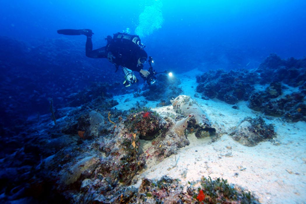
It is the second time in a little over the year that researchers in Greece have announced the discovery of nearly two dozen sunken ships in the Aegean Sea. In the area of Fourni, a group of 13 islands between the islands of Samos and Icaria in Greece, a place known as the ‘ship graveyard’, they recovered magnificent treasures among the ancient wrecks.
According to National Geographic , 23 ships were discovered last month, the oldest of them dating back to 525 BC. Among the wrecks were ship cargoes from the Classical period (480-323 BC), the Hellenistic period (323-31 BC), the Late Roman period (300-600 AD), and the Medieval period (500-1500 AD). During the exploration they found stunning artifacts including bowls, plates, pots, storage jars, lamps, black painted ceramic fine-ware, and more.
 An earthenware vessel found at one of the shipwreck sites. Credit: Vasilis Mentogianis Most of the artifacts that survived are amphorae, which are clay storage jars. In ancient times, they were used by merchant ships to transport cargo of olive oil, wine, fish sauce, and other condiments. Due to the state of preservation of the amphorae, it is possible to identify their place of origin as the styles and the visually distinct vessels are still visible. Incredibly, the vessels were found to originate in Cyprus, Egypt, Samos, Patmos, Asia Minor, mainland Greece, Rome, Spain, and even North Africa.
  Several amphorae found at a shipwreck site. Credit: Vasilis Mentogianis The wrecks were discovered by a team led by George Koutsouflakis and his co-director Peter Campbell of RPM Nautical . They started the research in the 2016 season with a team of 25 divers, archaeologists, and artifact conservators. After only 22 days they discovered an impressive 23 wrecks.
 As they described:
''As we hovered above the suspected site the first two divers strapped on roughly 50 pounds of gear and tumbled backward over opposite sides of the boat, leaving only a froth of surface bubbles as they descended. One of the divers was Manos Mitikas, the local Fourni free diver who called Koutsouflakis a year ago with the map of wrecks. His leads had already helped the team discover many shipwrecks. This morning they were searching a site at a depth of more than 197 feet (60 meters). Scuba tanks were essential. We waited on the surface, the waves pushing us away from the drop point. The moments while divers are submerged are always tense. Even experts risk equipment failures, insufficient decompression, and the dangerous confusion induced by nitrogen narcosis. After 25 long minutes an inflatable red buoy finally popped above the surface of the waves. They'd found the wreck and marked its position.''
 The remains of an ancient ship found near Fourni in Greece. Credit: Vasilis Mentogianis It is not a first discovery by this team. A little bit more than a year ago Mark Miller from Ancient Origins reported that the researchers found another impressive group of wrecks in the same sea. He wrote:
 ''Archaeologists doing an underwater survey in the Aegean Sea in Greek territorial waters have found an amazing 22 shipwrecks of merchant vessels that sank between 700 BC and the 16th century AD. The researchers have surveyed just 5 percent of the coasts of the Fourni archipelago and expect to find many more shipwrecks there when they return to continue their survey.
The lead researcher, Peter Campbell, told Ancient Origins the large number of wrecks in the small area surveyed is because of the volume of ancient ship traffic, not because of dangerous waters.
“It’s such a rare find,” Campbell said in an electronic message. Experts are calling this one of the top archaeological discoveries of 2015.
The Fourni archipelago covers an area of 17 square miles (44 square kilometers) between the islands of Icaria and Samos and is right in the middle of an ancient east-west trade route and another route running north to south that connected the Aegean and Black Sea area to the Levant of the eastern Mediterranean.
More than half of the ships were wrecked during the Late Roman Period of 300 to 600 AD. Other ships were from the Archaic Period of 700 to 480 BC, the Classical period of 480 to 323 BC, the Hellenistic of 323 to 31 BC, through the Late Medieval of the 16th century, according to Discovery.
Three of the ships had amphora types that hadn’t been found previously on shipwrecks. The cargoes show evident trade between the Aegean and Black seas, Cyprus, the Levant and Egypt during every phase. The team took representative artifacts from each shipwreck to analyze and perhaps later put them on display to the public''
 A diver explores a sunken cargo of amphorae from the late Archaic period (c. 525-480 BC). Credit: Vasilis MentogianisThe researchers discovered 45 wrecks during two seasons only, however, the finds have caused conflict between fishermen and archeologists. After registering the underwater sites, the Greek government typically prohibits fishing in the area. While such an impressive amount of wrecks brought huge fame to the researchers, it also brought many troubles. Koutsouflakis decided to make the conflict smaller so, working from within the Ephorate of Underwater Antiquities, he has helped to drastically reduce the size of the banned areas. However, archeologists will need to spend many seasons investigating the sites before tha bans can be lifted.
Top image: A diver exploring one of the wreck sites. Credit: Vasilis Mentogianis
By Natalia Klimzcak
July 18, 2016
Rare Discovery of Late Roman official and Precious Belt Buckle Unearthed in Leicester
Ancient Origins
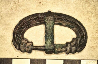
Archaeologists from University of Leicester Archaeological Services (ULAS) have recently excavated a Late Roman cemetery at Western Road in Leicester's West End. Amongst the 83 skeletons recorded by the team, one burial is proving to be very exciting.
The simple grave in question had been dug into mudstone on the west bank of the River Soar, to the south-west of the Roman town close to the important road known as the Fosse Way. Buried in the grave was the remains of a middle-aged man wearing an elaborately decorated belt in a style that would have been worn by a Late Roman soldier or civil servant during the second half of the 4th century or the early 5th century AD.
The find, which is rare in Britain, was positioned at the waist of the skeleton and comprises a belt buckle, belt plate and strap end.
Nick Cooper, Post-Excavation Manager at ULAS, said: "The survival of the delicate thin sheet bronze belt plate is remarkable. It is cast in the so-called 'chip-carved' style decorated with interlocking spirals and would have been riveted to a wide leather belt or girdle with a thinner securing strap running through the buckle and ending with the strap end."
 The belt buckle with thin sheet bronze plate recovered in Leicester. Credit: University of LeicesterThe buckle is decorated with dolphin heads and the strap end is decorated with crouching dogs on either side of its tapered end.
Parallels for this belt set have been found in other Late Roman cemeteries, for example in London, Dorchester on Thames and Winchester, and at the shore fort on the opposite side of the English Channel at Oudenburg in Belgium.
Research shows that these belts were worn across north-eastern France, Belgium, and along the eastern frontier of the Roman Empire, running along the Rivers Rhine and Danube, where soldiers were stationed. There is some contemporary pictorial evidence to suggest that this type, specifically, was worn by members of the Late Roman military and civilian elite and that the belts were important symbols of authority.
 Crouching dogs can be seen on either side of the strap end. Credit: University of Leicester.The recent discovery at Western Road is the first occurrence of such a complex belt set in Roman Leicester. The belt's owner was aged between 36 and 45 when he died. He had survived poor health in childhood to lead a comparatively fit adult life but at some point he had fractured his left forearm; an injury that had healed well but left his wrist weakened. This type of injury is known as a 'parry fracture' and is typically caused by raising the arm to ward off a blow or a falling object. The man had also damaged muscles in his upper right arm and shoulder. Such injuries could possibly be caused by over-use, overextending the muscles with movements such as throwing and lifting. Whilst it is difficult to identify exactly what caused these injuries, they are consistent with those a soldier might suffer and reinforce the theory that this man was either a member of the late Roman army or, perhaps following retirement, became an important local civil servant.
The project is funded by Jamie Lewis Residential as part of the site's redevelopment. Excavation and analysis of the skeletal assemblage has been carried out by a multi-disciplinary team of researchers from University of Leicester Archaeological Services (ULAS), York Osteoarchaeology Ltd., the Scottish Universities Environmental Research Centre (SUERC) and the British Geological Survey (BGS). The belt has been conserved by Graham Morgan.
Top image: The belt buckle is decorated with dolphin heads. Credit: University of Leicester
Source: University of Leicester. "Archeology: Rare discovery of Late Roman official buried in Leicester." ScienceDaily. ScienceDaily , 7 July 2016. www.sciencedaily.com/releases/2016/07/160707101031.htm

Archaeologists from University of Leicester Archaeological Services (ULAS) have recently excavated a Late Roman cemetery at Western Road in Leicester's West End. Amongst the 83 skeletons recorded by the team, one burial is proving to be very exciting.
The simple grave in question had been dug into mudstone on the west bank of the River Soar, to the south-west of the Roman town close to the important road known as the Fosse Way. Buried in the grave was the remains of a middle-aged man wearing an elaborately decorated belt in a style that would have been worn by a Late Roman soldier or civil servant during the second half of the 4th century or the early 5th century AD.
The find, which is rare in Britain, was positioned at the waist of the skeleton and comprises a belt buckle, belt plate and strap end.
Nick Cooper, Post-Excavation Manager at ULAS, said: "The survival of the delicate thin sheet bronze belt plate is remarkable. It is cast in the so-called 'chip-carved' style decorated with interlocking spirals and would have been riveted to a wide leather belt or girdle with a thinner securing strap running through the buckle and ending with the strap end."
The belt buckle with thin sheet bronze plate recovered in Leicester. Credit: University of LeicesterThe buckle is decorated with dolphin heads and the strap end is decorated with crouching dogs on either side of its tapered end.Parallels for this belt set have been found in other Late Roman cemeteries, for example in London, Dorchester on Thames and Winchester, and at the shore fort on the opposite side of the English Channel at Oudenburg in Belgium.
Research shows that these belts were worn across north-eastern France, Belgium, and along the eastern frontier of the Roman Empire, running along the Rivers Rhine and Danube, where soldiers were stationed. There is some contemporary pictorial evidence to suggest that this type, specifically, was worn by members of the Late Roman military and civilian elite and that the belts were important symbols of authority.
Crouching dogs can be seen on either side of the strap end. Credit: University of Leicester.The recent discovery at Western Road is the first occurrence of such a complex belt set in Roman Leicester. The belt's owner was aged between 36 and 45 when he died. He had survived poor health in childhood to lead a comparatively fit adult life but at some point he had fractured his left forearm; an injury that had healed well but left his wrist weakened. This type of injury is known as a 'parry fracture' and is typically caused by raising the arm to ward off a blow or a falling object. The man had also damaged muscles in his upper right arm and shoulder. Such injuries could possibly be caused by over-use, overextending the muscles with movements such as throwing and lifting. Whilst it is difficult to identify exactly what caused these injuries, they are consistent with those a soldier might suffer and reinforce the theory that this man was either a member of the late Roman army or, perhaps following retirement, became an important local civil servant.The project is funded by Jamie Lewis Residential as part of the site's redevelopment. Excavation and analysis of the skeletal assemblage has been carried out by a multi-disciplinary team of researchers from University of Leicester Archaeological Services (ULAS), York Osteoarchaeology Ltd., the Scottish Universities Environmental Research Centre (SUERC) and the British Geological Survey (BGS). The belt has been conserved by Graham Morgan.
Top image: The belt buckle is decorated with dolphin heads. Credit: University of Leicester
Source: University of Leicester. "Archeology: Rare discovery of Late Roman official buried in Leicester." ScienceDaily. ScienceDaily , 7 July 2016. www.sciencedaily.com/releases/2016/07/160707101031.htm
July 17, 2016
Where history happened: the Wars of the Roses
History Extra
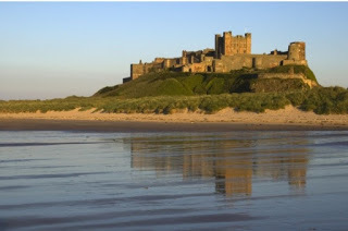 Bamburgh Castle. © Darren Turner | Dreamstime.com
During the second half of the 15th century, the people of England witnessed three regional revolts, 13 full-scale battles, ten coups d’etats, 15 invasions, five usurpations, five kings, seven reigns, and five changes of dynasty. Little wonder then that the Wars of the Roses – the name given to the exceptional period of instability that occurred between 1450 and 1500 – have long been regarded as one of the most compelling and, above all, confusing, periods of British history.
If there’s two facts that people know about the Wars of the Roses, it is that they pitched the Red Rose of the House of Lancaster against the White Rose of the House of York – and that they dragged on for a very long time, taking almost a century to peter out.
Fewer people will be aware that the conflict was sparked by a cataclysmic train of events in 1450 that saw England blighted by a massive slump, a government quite without credit, defeat abroad, a parliamentary revolt and a popular rebellion. It was an inability to resolve these issues over the following ten years that brought the Yorkists and Lancastrians to blows.
The Wars of the Roses are best conceived as three individual conflicts. The First War, from 1459–61, witnessed the Yorkist Edward IV (1461–83) overthrowing the Lancastrian Henry VI (1422–61). The Second War, from 1469–71, led to the restoration of Henry VI in 1470, but ended with Edward IV back on the throne in 1471.
The Third War, from 1483 until at least 1487, saw Edward IV’s son Edward V (1483) deposed by the new king’s uncle, Richard III (1483–5), who was himself defeated at Bosworth in 1485 by the first Tudor king, Henry VII (1485–1509). Enemies of the new Tudor dynasty continued to scheme until 1525 – though, in the eyes of the paranoic Henry VIII (1509–47), the threat remained until 1541.
The three principal wars consisted of lightning campaigns that were resolved quickly on the field of battle. Each of these battles bears a name, and we know roughly where they happened. Modern archaeological surveys have revealed scatterings of artefacts on the fields of Towton and Bosworth, but nothing much to see. There were very few sieges: London was threatened three times and the Tower of London taken twice. For long periods, 1461–69, 1471–83, and after 1485, most of the kingdom – all the south, Midlands, East Anglia and West Country – was at peace.
So how did the wars start? The clash between Henry VI and Richard Duke of York at Ludford Bridge in 1459 is sometimes cited as their opening act. Richard had long opposed the king but was routed at Ludford and died in 1460. However, his allies soon declared Henry – who had suffered mental illness – unfit to rule. In 1461 they replaced him with York’s son, Edward IV, and confined Henry to the Tower.
At first, Edward ruled through his elder cousin, Warwick (the Kingmaker), and then through a series of favourites. Prominent among them was William Herbert, the new ruler of Wales, whose power was soon seen as a threat to Warwick. In fact, it was largely to destroy Herbert that Warwick and Edward’s brother, Clarence, rebelled in 1469, deposing Edward and returning Henry to the throne.
But Edward wasn’t gone for long. He recovered his crown in 1471 – after destroying his enemies at Tewkesbury – and ruled for a further 12, relatively stable years. During this time, he moved between his palaces in the Thames Valley, settled on Windsor for his burial and embarked on the reconstruction of St George’s Chapel as the spiritual heart of the house of York.
He dispatched his eldest son, Edward Prince of Wales, to Ludlow Castle to govern Wales, and saw to it that his brother, Richard Duke of Gloucester, became lord of the north.
This period of peace was to come to an abrupt end on Edward’s death in 1483. The king’s son and successor, Edward V, was deposed and consigned to the Tower by the Duke of Gloucester, who was himself to meet a violent death as Richard III two years later.
Richard may not have reigned long but he did have time to transfer Henry VI’s body to St George’s Chapel in a symbolic act of reconciliation with the Lancastrian line. That wasn’t enough to stop the bloodshed. In 1485, at the battle of Bosworth, Richard was killed and Henry VII (nephew of Henry VI) became the first Tudor king.
Shakespeare and almost everybody since has hailed Henry VII as England’s saviour and celebrated the battle as the end of the Wars of the Roses. In doing so, however, they have merely been regurgitating Tudor propaganda, promulgated at once to deter resistance.
In reality, Henry had to contend with a host of plots and a succession of rivals – this despite the fact that he had married Elizabeth of York, the daughter of Edward IV. Their son, Henry VIII, was thus the heir of Lancaster and York, the red and the white rose.
Yet Henry VII decided not to join in death his father-in-law, Edward IV, and his uncle, Henry VI at Windsor, choosing instead to build a grand new Lady Chapel at Westminster Abbey for himself. This splendidly florid structure proclaimed that the Wars of the Roses were over and that the new Tudor dynasty had arrived.
Where history happened1) Ludlow Castle, ShropshireThe medieval history the Crowland Chronicle claims that the Wars of the Roses started with the rout of Ludford in 1459. Faced by Henry VI’s Lancastrian army, the Yorkists deserted their troops and fled abroad.
Ludlow Castle, near to Ludford, was the principal seat of Richard Duke of York. It was here that his elder sons, Edward (the future Edward IV) and Edmund, were brought up. When York fled, his duchess was arrested and the town was sacked.
Ludlow Castle was built by Richard’s Mortimer ancestors to contest the Welsh, and still towers above the river Teme. Wales was governed from here from 1473 in the name of Prince Edward, the future Edward V, by Henry VII’s son, Prince Arthur, and by the Council of Wales.
Ludlow’s walls, keep, chapel and apartments remain intact, but it is entirely roofless. What it also lacks now are the furnishings, hangings and other decorations that made a luxurious 15th-century palace out of a rugged fortress.
Tel: 01584 873355
www.ludlowcastle.com

Ludlow Castle. © Denis Kelly | Dreamstime.com
2) Bamburgh Castle, NorthumberlandThe royal castle at Bamburgh rears up on a rocky outcrop over the North Sea and Holy Island. Built to defend the north against the Scots, Bamburgh was one of the Northumbrian castles that resisted the Yorkists after 1461.
Several times the castles of Alnwick, Bamburgh, Dunstanburgh and Warkworth were held against Edward IV, taken, and seized again by the Lancastrians. When the Earl of Warwick besieged the castle in 1464, his army was left starving, dispirited and sodden by the wintry Northumbrian rain.
After the Lancastrians’ final defeat at Hexham in 1462, Bamburgh fought on. The Yorkists bombarded it with their great guns and the garrison eventually surrendered. Its commander was excavated from the debris and suffered a traitor’s death at York. Only Harlech in north Wales held out.
Most of the buildings of Bamburgh Castle survive, albeit much restored. Visible for many miles around, this remains a glorious memorial both to the Scottish wars and to Northumbrian resistance to the Yorkists.
Tel: 01668 214515
www.bamburghcastle.com
3) Raglan Castle, MonmouthshireRaglan Castle was the seat of William Herbert, the first Welshman to rise into the nobility after the English conquest of the country. He was the right-hand man in Wales both of Richard Duke of York and his son Edward IV. It was Herbert who captured Harlech Castle for the Yorkists and he was created Earl of Pembroke for his efforts.
The new earl made himself the greatest and richest man in Wales. Onto an existing castle, he added a prodigious tower that possessed every conceivable 15th-century mod con. However Herbert’s rise terrified the Earl of Warwick into rebellion in 1469 and, in the subsequent battle, Herbert was killed leading an army of Welshmen.
Herbert’s descendants occupied Raglan until it was slighted in the English Civil War. It now remains a splendid ruin. The great gatehouse still features impressive machicolations (through which objects could be thrown at attackers) and the great tower has large windows opening into what once was the most stately suite of rooms.
Tel: 01291 690228
www.cadw.wales.gov.uk

Raglan Castle, Monmouthshire. © Sandra Richardson | Dreamstime.com
4) Gainsborough Old Hall, LincolnshireGainsborough Old Hall was built by Sir Thomas Burgh, master of the horse to Edward IV. He made himself the greatest man in Lincolnshire during the eclipse of the local Lancastrian lords, Welles and Willoughby.
Yet the lords made their peace with Edward and were restored. They found Burgh in their way and late in 1469 they sacked his house at Gainsborough. When an angry Edward IV threatened vengeance, they rebelled in support of the Duke of Clarence. Defeated at Empingham in 1470, Lord Welles and his son were executed, leaving Burgh in charge as the king’s man in Lincolnshire.
Gainsborough Old Hall is the monument to his wealth, his eminence, and to civilian life at the heart of civil war. Certainly not defensible, it is a huge black-and-white, timber-framed house, now partly fronted with mellow red brick with a stone bay window and a tower.
Tel: 01684 850959
www.gainsborougholdhall.com
5) Tewkesbury Abbey, GloucestershireThe Benedictine abbey of Tewkesbury, one of the greatest monasteries outside royal hands, was modernised by the Younger Despenser in the 1300s. Warwick the Kingmaker’s mother-in-law, Isabel Despenser, and son-in-law, Clarence, were both laid to rest here.
It was also at Tewkesbury, in 1471, that the Lancastrian army of Queen Margaret of Anjou was caught by Edward IV and decisively defeated in the fields overlooked by the abbey. Henry VI’s son, Prince Edward of Lancaster, was killed in the field or executed immediately afterwards.
The fleeing Lancastrians who took refuge in the abbey emerged when promised their lives, but were slaughtered nevertheless. Many of them were buried with the prince in the abbey church, which had to be reconsecrated.
Of the battle itself, there is little to see, but the abbey church, one of the greatest noble mausolea, was saved at the Reformation. It still contains a semi-circle of burial chapels and the marked graves, both of Prince Edward and Clarence.
Tel: 01455 290429
www.tewkesburyabbey.org.uk

Tewkesbury Abbey. © Chrisp543 | Dreamstime.com
6) Middleham Castle, North YorkshireMiddleham Castle mattered much more in the Wars of the Roses than its modest size suggests. It was originally built for a vassal of the Earl of Richmond at a time when the Scottish border was much closer than it is today. Gradually the lords of Middleham eclipsed those of Richmond and came to dominate the north.
In the 13th century, the castle came under the control of the Neville family.
Middleham was home to Richard Neville, Earl of Salisbury – who took part in the battles of St Albans (1455) and Ludford (1459) – and his son, Warwick the Kingmaker.
Neville’s son-in-law, Richard Duke of Gloucester ruled the north from here before usurping the throne in 1483. Richard’s only son, Prince Edward, was born at Middleham. Although Henry VII confiscated the castle, he feared rebellions from this area in 1485–9 and probably later too.
The market town of Middleham has dwindled into a village and the parish church never became the college that Richard III planned. The ancient walls and keep remain as ruins, but Warwick of Gloucester’s 15th‑century additions – at least one storey of stately apartments and domestic buildings – have disappeared.
Tel: 01455 290429
www.middlehamonline.com
7) St George’s Chapel, Windsor Castle, BerkshireSt George’s Chapel has links with four kings who ruled and fought during the Wars of the Roses. Edward IV set out to build a splendid new chapel here both for the Order of Garter and for his own burial. He completed the east end, railed off the north chancel chapel for himself, and awarded some of his favourites – including his friend and brother-in-arms, William Lord Hastings – burial here too.
Edward died before it was all finished but Richard III made use of it as well, having the saintly Henry VI moved to Windsor. Henry VII’s financial genius, Reginald Bray, completed the works and Henry himself was originally intended to be buried here.
Located within the lower castle ward, St George’s is a masterpiece of late perpendicular architecture, distinguished especially by fan vaulting throughout, plus Tudor arches, and huge windows. The choir stalls feature the coats of arms of almost every knight of the Garter.
www.stgeorges-windsor.org
[image error]
St George’s Chapel, Windsor Castle. © Emotionart | Dreamstime.com
8) The Tower of London, LondonWilliam I’s great tower was built to overawe London and was the royal palace from which coronation processions progressed to Westminster. Three times during the Wars of the Roses it was besieged: by Jack Cade (leader of a popular revolt) in 1450; by the Yorkists in 1460; and by the Lancastrians under Thomas Neville (known as ‘the bastard of Fauconberg’) in 1471.
It was during the wars that the Tower acquired its sinister reputation. Henry VI perished here in 1471 – a fate shared by Clarence in 1478, Edward IV’s ally Lord Hastings (1483) and Clarence’s daughter, Margaret (in 1541).
The pretender to Henry VII’s throne Perkin Warbeck was also imprisoned here. Most famously, it was here that Richard III lodged his nephews, the two Princes in the Tower, and here surely that they perished, probably in 1483.
The Tower of London is a great concentric castle around the Norman keep fronting the river Thames. What we can see now was already there in the 15th century, and almost no buildings have been lost. Because it continued in use, however, the furnishings and decorations are of later eras.
Tel: 0844 482 7777
www.hrp.org.uk
9) Bosworth Field, LeicestershireThe battle of Bosworth, where Richard III was killed and Henry Tudor became King Henry VII, is traditionally hailed as the last act of the Wars of the Roses and the Middle Ages.
It was here in Leicestershire that Henry’s Franco-Scottish army, which had landed at Milford Haven in Wales, destroyed the forces of the ruling king. Probably both wanted the battle for fear that the enemy would grow stronger with time. The clash appears to have taken a decisive turn when Richard led an assault on Henry’s lines. The attackers were destroyed by troops under Sir William Stanley and the king’s fate sealed.
Yet the Wars of the Roses didn’t die with Richard – invasions, battles and executions continued for more than 60 years. The course of the battle and even its precise location is obscure. Fifteenth-century clashes leave little impression on the landscape, and for centuries historians mistakenly believed that the battle was fought at Ambion Hill.
In 2009, archaeological investigations identified numerous small finds that suggest it was fought between Dadlington, Shenton, Upton and Stoke Golding.
Tel: 01455 290429
www.bosworthbattlefield.com
10) Westminster Abbey, LondonThe great Benedictine abbey of Westminster beside the royal palace has been the setting for the coronations and burials of monarchs since Edward the Confessor. Henry VI, Edward IV, Richard III and Henry VII were all crowned here, and Edward IV’s queen, Elizabeth, took sanctuary within these walls in 1470-1 and 1483-4.
No space remained for royal burials, so Edward IV and Richard III rest elsewhere. However, Henry VII made room for himself by replacing the eastern chapel with his own great Lady Chapel. Within it he built his tomb: a mausoleum for his new Tudor dynasty separate from that of York.
The abbey church is a masterpiece of the Decorated style. The huge Henry VII Chapel develops the Perpendicular style into something distinctively Tudor, characterised by its strange pendant vaults and casement windows, unprecedented but also without sequence. The brazen effigies of Henry, his queen and mother by Torrigiano are almost the first English examples of the new Italian Renaissance art.
Tel: 020 7222 5152
www.westminster-abbey.org
Michael Hicks is professor of medieval history at the University of Winchester and author of The Wars of the Roses (Yale University Press).
 Bamburgh Castle. © Darren Turner | Dreamstime.com
 During the second half of the 15th century, the people of England witnessed three regional revolts, 13 full-scale battles, ten coups d’etats, 15 invasions, five usurpations, five kings, seven reigns, and five changes of dynasty. Little wonder then that the Wars of the Roses – the name given to the exceptional period of instability that occurred between 1450 and 1500 – have long been regarded as one of the most compelling and, above all, confusing, periods of British history.
If there’s two facts that people know about the Wars of the Roses, it is that they pitched the Red Rose of the House of Lancaster against the White Rose of the House of York – and that they dragged on for a very long time, taking almost a century to peter out.
Fewer people will be aware that the conflict was sparked by a cataclysmic train of events in 1450 that saw England blighted by a massive slump, a government quite without credit, defeat abroad, a parliamentary revolt and a popular rebellion. It was an inability to resolve these issues over the following ten years that brought the Yorkists and Lancastrians to blows.
The Wars of the Roses are best conceived as three individual conflicts. The First War, from 1459–61, witnessed the Yorkist Edward IV (1461–83) overthrowing the Lancastrian Henry VI (1422–61). The Second War, from 1469–71, led to the restoration of Henry VI in 1470, but ended with Edward IV back on the throne in 1471.
The Third War, from 1483 until at least 1487, saw Edward IV’s son Edward V (1483) deposed by the new king’s uncle, Richard III (1483–5), who was himself defeated at Bosworth in 1485 by the first Tudor king, Henry VII (1485–1509). Enemies of the new Tudor dynasty continued to scheme until 1525 – though, in the eyes of the paranoic Henry VIII (1509–47), the threat remained until 1541.
The three principal wars consisted of lightning campaigns that were resolved quickly on the field of battle. Each of these battles bears a name, and we know roughly where they happened. Modern archaeological surveys have revealed scatterings of artefacts on the fields of Towton and Bosworth, but nothing much to see. There were very few sieges: London was threatened three times and the Tower of London taken twice. For long periods, 1461–69, 1471–83, and after 1485, most of the kingdom – all the south, Midlands, East Anglia and West Country – was at peace.
So how did the wars start? The clash between Henry VI and Richard Duke of York at Ludford Bridge in 1459 is sometimes cited as their opening act. Richard had long opposed the king but was routed at Ludford and died in 1460. However, his allies soon declared Henry – who had suffered mental illness – unfit to rule. In 1461 they replaced him with York’s son, Edward IV, and confined Henry to the Tower.
At first, Edward ruled through his elder cousin, Warwick (the Kingmaker), and then through a series of favourites. Prominent among them was William Herbert, the new ruler of Wales, whose power was soon seen as a threat to Warwick. In fact, it was largely to destroy Herbert that Warwick and Edward’s brother, Clarence, rebelled in 1469, deposing Edward and returning Henry to the throne.
But Edward wasn’t gone for long. He recovered his crown in 1471 – after destroying his enemies at Tewkesbury – and ruled for a further 12, relatively stable years. During this time, he moved between his palaces in the Thames Valley, settled on Windsor for his burial and embarked on the reconstruction of St George’s Chapel as the spiritual heart of the house of York.
He dispatched his eldest son, Edward Prince of Wales, to Ludlow Castle to govern Wales, and saw to it that his brother, Richard Duke of Gloucester, became lord of the north.
This period of peace was to come to an abrupt end on Edward’s death in 1483. The king’s son and successor, Edward V, was deposed and consigned to the Tower by the Duke of Gloucester, who was himself to meet a violent death as Richard III two years later.
Richard may not have reigned long but he did have time to transfer Henry VI’s body to St George’s Chapel in a symbolic act of reconciliation with the Lancastrian line. That wasn’t enough to stop the bloodshed. In 1485, at the battle of Bosworth, Richard was killed and Henry VII (nephew of Henry VI) became the first Tudor king.
Shakespeare and almost everybody since has hailed Henry VII as England’s saviour and celebrated the battle as the end of the Wars of the Roses. In doing so, however, they have merely been regurgitating Tudor propaganda, promulgated at once to deter resistance.
In reality, Henry had to contend with a host of plots and a succession of rivals – this despite the fact that he had married Elizabeth of York, the daughter of Edward IV. Their son, Henry VIII, was thus the heir of Lancaster and York, the red and the white rose.
Yet Henry VII decided not to join in death his father-in-law, Edward IV, and his uncle, Henry VI at Windsor, choosing instead to build a grand new Lady Chapel at Westminster Abbey for himself. This splendidly florid structure proclaimed that the Wars of the Roses were over and that the new Tudor dynasty had arrived.
Where history happened1) Ludlow Castle, ShropshireThe medieval history the Crowland Chronicle claims that the Wars of the Roses started with the rout of Ludford in 1459. Faced by Henry VI’s Lancastrian army, the Yorkists deserted their troops and fled abroad.
Ludlow Castle, near to Ludford, was the principal seat of Richard Duke of York. It was here that his elder sons, Edward (the future Edward IV) and Edmund, were brought up. When York fled, his duchess was arrested and the town was sacked.
Ludlow Castle was built by Richard’s Mortimer ancestors to contest the Welsh, and still towers above the river Teme. Wales was governed from here from 1473 in the name of Prince Edward, the future Edward V, by Henry VII’s son, Prince Arthur, and by the Council of Wales.
Ludlow’s walls, keep, chapel and apartments remain intact, but it is entirely roofless. What it also lacks now are the furnishings, hangings and other decorations that made a luxurious 15th-century palace out of a rugged fortress.
Tel: 01584 873355
www.ludlowcastle.com
Ludlow Castle. © Denis Kelly | Dreamstime.com
2) Bamburgh Castle, NorthumberlandThe royal castle at Bamburgh rears up on a rocky outcrop over the North Sea and Holy Island. Built to defend the north against the Scots, Bamburgh was one of the Northumbrian castles that resisted the Yorkists after 1461.
Several times the castles of Alnwick, Bamburgh, Dunstanburgh and Warkworth were held against Edward IV, taken, and seized again by the Lancastrians. When the Earl of Warwick besieged the castle in 1464, his army was left starving, dispirited and sodden by the wintry Northumbrian rain.
After the Lancastrians’ final defeat at Hexham in 1462, Bamburgh fought on. The Yorkists bombarded it with their great guns and the garrison eventually surrendered. Its commander was excavated from the debris and suffered a traitor’s death at York. Only Harlech in north Wales held out.
Most of the buildings of Bamburgh Castle survive, albeit much restored. Visible for many miles around, this remains a glorious memorial both to the Scottish wars and to Northumbrian resistance to the Yorkists.
Tel: 01668 214515
www.bamburghcastle.com
3) Raglan Castle, MonmouthshireRaglan Castle was the seat of William Herbert, the first Welshman to rise into the nobility after the English conquest of the country. He was the right-hand man in Wales both of Richard Duke of York and his son Edward IV. It was Herbert who captured Harlech Castle for the Yorkists and he was created Earl of Pembroke for his efforts.
The new earl made himself the greatest and richest man in Wales. Onto an existing castle, he added a prodigious tower that possessed every conceivable 15th-century mod con. However Herbert’s rise terrified the Earl of Warwick into rebellion in 1469 and, in the subsequent battle, Herbert was killed leading an army of Welshmen.
Herbert’s descendants occupied Raglan until it was slighted in the English Civil War. It now remains a splendid ruin. The great gatehouse still features impressive machicolations (through which objects could be thrown at attackers) and the great tower has large windows opening into what once was the most stately suite of rooms.
Tel: 01291 690228
www.cadw.wales.gov.uk
Raglan Castle, Monmouthshire. © Sandra Richardson | Dreamstime.com
4) Gainsborough Old Hall, LincolnshireGainsborough Old Hall was built by Sir Thomas Burgh, master of the horse to Edward IV. He made himself the greatest man in Lincolnshire during the eclipse of the local Lancastrian lords, Welles and Willoughby.
Yet the lords made their peace with Edward and were restored. They found Burgh in their way and late in 1469 they sacked his house at Gainsborough. When an angry Edward IV threatened vengeance, they rebelled in support of the Duke of Clarence. Defeated at Empingham in 1470, Lord Welles and his son were executed, leaving Burgh in charge as the king’s man in Lincolnshire.
Gainsborough Old Hall is the monument to his wealth, his eminence, and to civilian life at the heart of civil war. Certainly not defensible, it is a huge black-and-white, timber-framed house, now partly fronted with mellow red brick with a stone bay window and a tower.
Tel: 01684 850959
www.gainsborougholdhall.com
5) Tewkesbury Abbey, GloucestershireThe Benedictine abbey of Tewkesbury, one of the greatest monasteries outside royal hands, was modernised by the Younger Despenser in the 1300s. Warwick the Kingmaker’s mother-in-law, Isabel Despenser, and son-in-law, Clarence, were both laid to rest here.
It was also at Tewkesbury, in 1471, that the Lancastrian army of Queen Margaret of Anjou was caught by Edward IV and decisively defeated in the fields overlooked by the abbey. Henry VI’s son, Prince Edward of Lancaster, was killed in the field or executed immediately afterwards.
The fleeing Lancastrians who took refuge in the abbey emerged when promised their lives, but were slaughtered nevertheless. Many of them were buried with the prince in the abbey church, which had to be reconsecrated.
Of the battle itself, there is little to see, but the abbey church, one of the greatest noble mausolea, was saved at the Reformation. It still contains a semi-circle of burial chapels and the marked graves, both of Prince Edward and Clarence.
Tel: 01455 290429
www.tewkesburyabbey.org.uk
Tewkesbury Abbey. © Chrisp543 | Dreamstime.com
6) Middleham Castle, North YorkshireMiddleham Castle mattered much more in the Wars of the Roses than its modest size suggests. It was originally built for a vassal of the Earl of Richmond at a time when the Scottish border was much closer than it is today. Gradually the lords of Middleham eclipsed those of Richmond and came to dominate the north.
In the 13th century, the castle came under the control of the Neville family.
Middleham was home to Richard Neville, Earl of Salisbury – who took part in the battles of St Albans (1455) and Ludford (1459) – and his son, Warwick the Kingmaker.
Neville’s son-in-law, Richard Duke of Gloucester ruled the north from here before usurping the throne in 1483. Richard’s only son, Prince Edward, was born at Middleham. Although Henry VII confiscated the castle, he feared rebellions from this area in 1485–9 and probably later too.
The market town of Middleham has dwindled into a village and the parish church never became the college that Richard III planned. The ancient walls and keep remain as ruins, but Warwick of Gloucester’s 15th‑century additions – at least one storey of stately apartments and domestic buildings – have disappeared.
Tel: 01455 290429
www.middlehamonline.com
7) St George’s Chapel, Windsor Castle, BerkshireSt George’s Chapel has links with four kings who ruled and fought during the Wars of the Roses. Edward IV set out to build a splendid new chapel here both for the Order of Garter and for his own burial. He completed the east end, railed off the north chancel chapel for himself, and awarded some of his favourites – including his friend and brother-in-arms, William Lord Hastings – burial here too.
Edward died before it was all finished but Richard III made use of it as well, having the saintly Henry VI moved to Windsor. Henry VII’s financial genius, Reginald Bray, completed the works and Henry himself was originally intended to be buried here.
Located within the lower castle ward, St George’s is a masterpiece of late perpendicular architecture, distinguished especially by fan vaulting throughout, plus Tudor arches, and huge windows. The choir stalls feature the coats of arms of almost every knight of the Garter.
www.stgeorges-windsor.org
[image error]
St George’s Chapel, Windsor Castle. © Emotionart | Dreamstime.com
8) The Tower of London, LondonWilliam I’s great tower was built to overawe London and was the royal palace from which coronation processions progressed to Westminster. Three times during the Wars of the Roses it was besieged: by Jack Cade (leader of a popular revolt) in 1450; by the Yorkists in 1460; and by the Lancastrians under Thomas Neville (known as ‘the bastard of Fauconberg’) in 1471.
It was during the wars that the Tower acquired its sinister reputation. Henry VI perished here in 1471 – a fate shared by Clarence in 1478, Edward IV’s ally Lord Hastings (1483) and Clarence’s daughter, Margaret (in 1541).
The pretender to Henry VII’s throne Perkin Warbeck was also imprisoned here. Most famously, it was here that Richard III lodged his nephews, the two Princes in the Tower, and here surely that they perished, probably in 1483.
The Tower of London is a great concentric castle around the Norman keep fronting the river Thames. What we can see now was already there in the 15th century, and almost no buildings have been lost. Because it continued in use, however, the furnishings and decorations are of later eras.
Tel: 0844 482 7777
www.hrp.org.uk
9) Bosworth Field, LeicestershireThe battle of Bosworth, where Richard III was killed and Henry Tudor became King Henry VII, is traditionally hailed as the last act of the Wars of the Roses and the Middle Ages.
It was here in Leicestershire that Henry’s Franco-Scottish army, which had landed at Milford Haven in Wales, destroyed the forces of the ruling king. Probably both wanted the battle for fear that the enemy would grow stronger with time. The clash appears to have taken a decisive turn when Richard led an assault on Henry’s lines. The attackers were destroyed by troops under Sir William Stanley and the king’s fate sealed.
Yet the Wars of the Roses didn’t die with Richard – invasions, battles and executions continued for more than 60 years. The course of the battle and even its precise location is obscure. Fifteenth-century clashes leave little impression on the landscape, and for centuries historians mistakenly believed that the battle was fought at Ambion Hill.
In 2009, archaeological investigations identified numerous small finds that suggest it was fought between Dadlington, Shenton, Upton and Stoke Golding.
Tel: 01455 290429
www.bosworthbattlefield.com
10) Westminster Abbey, LondonThe great Benedictine abbey of Westminster beside the royal palace has been the setting for the coronations and burials of monarchs since Edward the Confessor. Henry VI, Edward IV, Richard III and Henry VII were all crowned here, and Edward IV’s queen, Elizabeth, took sanctuary within these walls in 1470-1 and 1483-4.
No space remained for royal burials, so Edward IV and Richard III rest elsewhere. However, Henry VII made room for himself by replacing the eastern chapel with his own great Lady Chapel. Within it he built his tomb: a mausoleum for his new Tudor dynasty separate from that of York.
The abbey church is a masterpiece of the Decorated style. The huge Henry VII Chapel develops the Perpendicular style into something distinctively Tudor, characterised by its strange pendant vaults and casement windows, unprecedented but also without sequence. The brazen effigies of Henry, his queen and mother by Torrigiano are almost the first English examples of the new Italian Renaissance art.
Tel: 020 7222 5152
www.westminster-abbey.org
Michael Hicks is professor of medieval history at the University of Winchester and author of The Wars of the Roses (Yale University Press).


.jpg)
.jpg)