Shane K. Bernard's Blog, page 6
February 12, 2013
A Film Documents South Louisiana's Logging Industry, ca. 1925: Responsible Stewardship or Environmental Disaster?
Earlier today I learned of a two-part, roughly thirty-minute black-and-white silent film from circa 1925 documenting the daily operations of a south Louisiana cypress company. (I later realized that, purely by coincidence, an old high-school classmate of mine put the digitized film online.)
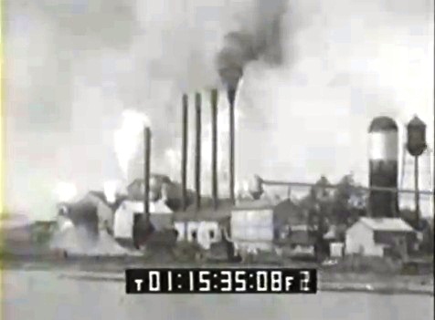
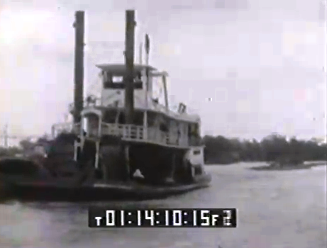
The movie shows lumberjacks in pirogues (small flat-bottomed boats) cutting down ancient cypress trees in or around the Atchafalaya Basin; a pull boat drawing the logs onto a canal using a chain and windlass; a dredge boat armed with a steam shovel extending the logging canals into a cypress swamp; a locomotive pulling flatcars of logs to the mill; a "towboat" (actually the full-fledged steamboat Sewanee) pulling a "boom" of logs to the mill; "overhead electric cars" — presumably state-of-the-art technology at the time — carrying logs around the lumberyard; "mechanical electric stackers" piling lumber; and early gas-powered trucks pulling wagons of lumber.
The film in question was shot by L. K. Williams, a member of the Williams family of Patterson who operated the massive F. B. Williams Cypress Company, located in that same town on or near the banks of Bayou Teche. The waterway from which L. K. Williams filmed the cypress mill (seen on reel two) is quite possibly the Teche itself, but it's difficult to say because there are many man-made canals around Patterson. The scene in question just as easily could have been shot from one of those canals.
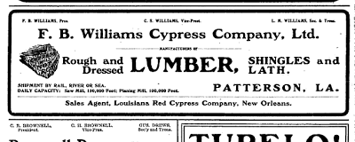 Advertisement for F. B. Williams Cypress Company, Patterson, La.
(Source: The Lumber Trade Journal, 15 Sept 1914)
Note the industry-specific terms* that appear in the film’s captions: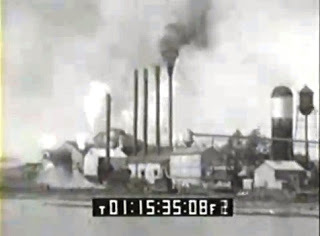 F. B. Williams Cypress Company, Patterson, La.,
as shown in the ca. 1925 film.
I cannot find a definition for a run, another term used in the captions, but it is presumably the same as that for gutter road, which is "The path followed in skidding logs" — skid meaning "To draw logs from the stump to the skidway, landing, or mill." In turn, a skidway is "Two skids laid parallel at right angles to a road, usually raised above the ground at the end nearest the road.” The same source adds, "Logs are usually piled upon a skidway as they are brought from the stump for loading upon sleds, wagons, or cars."
This film provides a valuable insight into a now dormant Teche country industry: once lumber mills dotted the lower bayou, drawing on the nearby massive cypress swamp that is the Atchafalaya Basin, as well as on other, smaller cypress swamps in the region. Whether or not this turn-of-the-twentieth-century industry represented responsible stewardship of Louisiana’s natural resources or an environmental disaster (or something in between), I leave to viewers to decide. I myself do not weigh in on the issue because I have not researched the matter, and while it would be easy to deem it an "environmental disaster" I do not know this as a matter of fact.
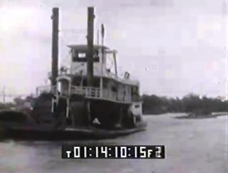 The steamboat Sewanee, as shown in the ca. 1925 film.
It tows a "boom" of logs behind it.
*Definitions are quoted from: Bureau of Forestry, U.S. Department of Agriculture, Terms Used in Forestry and Logging (Washington, D.C.: U.S. Government Printing Office, 1905).
The movie shows lumberjacks in pirogues (small flat-bottomed boats) cutting down ancient cypress trees in or around the Atchafalaya Basin; a pull boat drawing the logs onto a canal using a chain and windlass; a dredge boat armed with a steam shovel extending the logging canals into a cypress swamp; a locomotive pulling flatcars of logs to the mill; a "towboat" (actually the full-fledged steamboat Sewanee) pulling a "boom" of logs to the mill; "overhead electric cars" — presumably state-of-the-art technology at the time — carrying logs around the lumberyard; "mechanical electric stackers" piling lumber; and early gas-powered trucks pulling wagons of lumber.
The film in question was shot by L. K. Williams, a member of the Williams family of Patterson who operated the massive F. B. Williams Cypress Company, located in that same town on or near the banks of Bayou Teche. The waterway from which L. K. Williams filmed the cypress mill (seen on reel two) is quite possibly the Teche itself, but it's difficult to say because there are many man-made canals around Patterson. The scene in question just as easily could have been shot from one of those canals.
.png) Advertisement for F. B. Williams Cypress Company, Patterson, La.
Advertisement for F. B. Williams Cypress Company, Patterson, La.(Source: The Lumber Trade Journal, 15 Sept 1914)
Note the industry-specific terms* that appear in the film’s captions:
Boom, n. Logs or timbers fastened together end to end and used to hold floating logs. The term sometimes includes the logs enclosed, as a boom of logs.
Crib, n. Specifically, a raft of logs; loosely applied to a boom of logs.
Float road[, n.]. A channel cleared in a swamp and used to float cypress logs from the woods to the boom at the river or mill.
 F. B. Williams Cypress Company, Patterson, La.,
as shown in the ca. 1925 film.
I cannot find a definition for a run, another term used in the captions, but it is presumably the same as that for gutter road, which is "The path followed in skidding logs" — skid meaning "To draw logs from the stump to the skidway, landing, or mill." In turn, a skidway is "Two skids laid parallel at right angles to a road, usually raised above the ground at the end nearest the road.” The same source adds, "Logs are usually piled upon a skidway as they are brought from the stump for loading upon sleds, wagons, or cars."
This film provides a valuable insight into a now dormant Teche country industry: once lumber mills dotted the lower bayou, drawing on the nearby massive cypress swamp that is the Atchafalaya Basin, as well as on other, smaller cypress swamps in the region. Whether or not this turn-of-the-twentieth-century industry represented responsible stewardship of Louisiana’s natural resources or an environmental disaster (or something in between), I leave to viewers to decide. I myself do not weigh in on the issue because I have not researched the matter, and while it would be easy to deem it an "environmental disaster" I do not know this as a matter of fact.
 The steamboat Sewanee, as shown in the ca. 1925 film.
It tows a "boom" of logs behind it.
*Definitions are quoted from: Bureau of Forestry, U.S. Department of Agriculture, Terms Used in Forestry and Logging (Washington, D.C.: U.S. Government Printing Office, 1905).


February 4, 2013
A Glimpse from 1968: Historic Films Looked at Cajuns and Creoles in Epic Year
A couple months ago or so Cajun fiddler David Greely sent me a link to a 1968 film on YouTube. The film showed elderly Cajun couples dancing to late Cajun accordionist Aldus Roger (pronounced RO-ZHAY in the French manner).
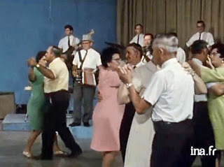 Aldus Roger and his band perform for dancers.
Source: La Louisiane (1968)
The video captivated me because moving images of Cajun musicians from the late 1960s or earlier are rare. I was not alone in my interest — the video caused a momentary stir among others interested in Cajun culture.
I say "momentary" because almost as soon as David spread the word about this YouTube footage, the original poster suddenly yanked it from the Internet. This is quite possibly my fault, because when I saw the film I immediately e-mailed the original poster to ask, "Where did you get this? Do you know where I can get a copy? It is extremely important to those who study Cajun culture, and I would like to obtain dubs for preservation and research purposes." (I paraphrase.)
Within a few hours the YouTube video was gone and the poster never answered my query. Indeed, with the video removed I had no way to contact the poster, even to ask the name of the film.
Today I decided to see if I could track down the documentary in question. And, by Googling the words "cadien," "documentaire," "musique," and "1968," I was able to find the film.
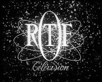 Logo of the ORTF.
Source: Les archives de la télévision
Actually, I found three films (and there are perhaps more), all shot between 1968 and 1969 by the Office de radiodiffusion télévision française(ORTF), operated by the French government.
This was a vital time in Cajun and Creole history. As I note in my book The Cajuns: Americanization of a People : Cover of my book
The Cajuns: Americanization of a People (2003)
La Louisiane : Fête de l'écrevisse, May 1968 (14 mins. 31 secs.)Source: INA.fr
One of the two films, titled "La Louisiane : Fête de l'écrevisse" ("Louisiana: Crawish Festival"), features the 1968 Breaux Bridge Crawfish Festival. It originally aired in May that year and its summary reads:
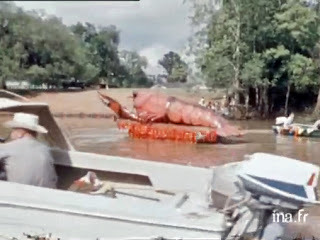 A crawfish float on Bayou Teche,
Breaux Bridge Crawfish Festival.
Source: La Louisiane: Fête de l'écrevisse (1968)
On a less serious note, the film depicts a boat parade on Bayou Teche, a crawfish race, and, in one scene, a van decorated to promote Cajun musician Happy Fats LeBlanc's live Saturday TV program, Mariné, which aired on KLFY-TV 10.
The other film, titled "La Louisiane," was originally released in September 1968 and documents French culture in general in and around Lafayette, Louisiana. It begins with Cajun fishermen in the Gulf of Mexico and, later, includes that priceless footage of Cajun musician Aldus Roger playing for elderly Cajun dancers. It appears to me that the Roger footage was shot at KLFY's studio, originally located on Jefferson Street near its intersection with Pinhook Road. I assume the event is Roger's weekend live Cajun music TV program, which aired on KLFY from the mid-1950s through the 1960s. (I'm unsure when it fell from the station's lineup.) The only reason I doubt we are seeing Roger's weekend program, however, is the inclusion of news in French — unless that was actually part of Roger's program. (The show might be one of KLFY's other long-running local programs, Passe Partoutor Meet Your Neighbor, but I've never heard of either having live studio dancers.)
La Louisiane, September 1968 (15 mins. 2 secs.)Source: INA.fr
Intriguingly, this second film includes an interview in French with future Louisiana governor Edwin Edwards and a rare interview with former U.S. congressman James "Jimmy" Domengeaux (pronounced in the French manner as DUH-MAZH-ZHEE-O, much like the surname of baseball great Joe DiMaggio). (I mention Domengeaux in previous articles here and here.) The same year this documentary appeared, Domengeaux became president of the newly created Council for the Development of French in Louisiana (CODOFIL) — a group that in coming decades would spearhead the teaching of French in Louisiana public schools. It was a revolutionary idea, for less than a decade earlier Louisiana children had been punished in schools for speaking French.
The summary of this film reads: Jimmy Domengeaux interviewed.
Source: La Louisiane (1968)
A third film, shot the next year, is available per the INA website, but only as a short preview: it is titled, " Les Enfants de Francien : En Louisiane ," which I suppose could be translated as "The Children of Old French: In Louisiana." It originally aired in June 1969 and according to the summary it asks:
Addendum of 12 February 2013
A third south Louisiana-related film is available for viewing in its entirety through the INA website. Shot in 1976 — eight years after the above two La Louisiane films — it depicts, among other subjects, Louisiana schoolchildren singing "Frère Jacques"; Cajun radio-and-TV personality (and sometimes Cajun singer) Jim Olivier giving a weather forecast in French (another KLFY reference, possibly from the Passe Partout morning program); a second interview with Jimmy Domengeaux (whose group, CODOFIL, is mistakenly called the "Comité du defense du français" — unless a distinct group by this name existed, but I've never heard of it); and a glimpse of Michael Doucet and a few other Cajun musicians performing for the camera. (The musicians may comprise an early version of the band BeauSoleil or perhaps another of Doucet's groups, Coteau.)
 Aldus Roger and his band perform for dancers.
Source: La Louisiane (1968)
The video captivated me because moving images of Cajun musicians from the late 1960s or earlier are rare. I was not alone in my interest — the video caused a momentary stir among others interested in Cajun culture.
I say "momentary" because almost as soon as David spread the word about this YouTube footage, the original poster suddenly yanked it from the Internet. This is quite possibly my fault, because when I saw the film I immediately e-mailed the original poster to ask, "Where did you get this? Do you know where I can get a copy? It is extremely important to those who study Cajun culture, and I would like to obtain dubs for preservation and research purposes." (I paraphrase.)
Within a few hours the YouTube video was gone and the poster never answered my query. Indeed, with the video removed I had no way to contact the poster, even to ask the name of the film.
Today I decided to see if I could track down the documentary in question. And, by Googling the words "cadien," "documentaire," "musique," and "1968," I was able to find the film.
 Logo of the ORTF.
Source: Les archives de la télévision
Actually, I found three films (and there are perhaps more), all shot between 1968 and 1969 by the Office de radiodiffusion télévision française(ORTF), operated by the French government.
This was a vital time in Cajun and Creole history. As I note in my book The Cajuns: Americanization of a People :
That year, 1968, was remarkable nationally and internationally. The Tet Offensive marked a turning point in the Vietnam War. LBJ announced he would not seek reelection to the presidency. Martin Luther King, Jr., and Robert Kennedy were assassinated. Campus rallies erupted into violence amid cries of “Revolution!” Police bullied protestors and innocent bystanders at the Democratic National Convention in Chicago. . . .
Acadiana [i.e., Cajun Louisiana] also witnessed incredible events of its own during 1968. Besides the creation of [French education group] CODOFIL, it saw the passage of several laws that bolstered the status of French in Louisiana. The state legislature mandated that public elementary schools offer at least five years of French instruction, and that public high schools offer the subject for at least three years, along with at least one course on the history and culture of French America. It required state colleges and universities to offer teacher certification in elementary school French, and it approved the publication of legal notices and other public documents in French. It also demanded that state-funded educational television be bilingual, showing French programming in equal proportion to its French-speaking viewers. Finally, the legislature authorized the establishment of a non-profit French-language television corporation in conjunction with [local university] USL, to be called Télévision-Louisiane.
 Cover of my book
 The Cajuns: Americanization of a People (2003)
Other events contributed to making 1968 an astounding year for the French preservation movement. USL committed itself to becoming “a world linguistic center” by establishing an Institute of French Studies and by expanding its role in training French educators. Civic leaders opened cultural exchanges with other French-speaking regions, symbolically pairing Lafayette with the city of Longueuil, Quebec, in what became known as a jumelage (twinning). Business leaders conducted a trade mission to Quebec in order to develop commercial ties. Educators started a summer student exchange program, sending Cajun children to Quebec, and hosting French Canadian children in south Louisiana. An International Acadian Festival took placed in Lafayette, attracting over one hundred governmental and media visitors from Canada and France for two days of receptions, lectures, exhibits, films, tours, and other events that highlighted the region’s French heritage.
Cajuns quickly grasped the significance of this amazing period. “Historians will circle calendar year 1968,” announced Acadiana Profile, a new bilingual magazine, “as the time when the . . . French Renaissance took form and shape and direction in Louisiana.” . . .Shot in 1968, two of the films appeared in a French series called "En Couleur des U.S.A" ("In Color USA"). Both are available for viewing in their entirety per the website of the Institut national de l'audiovisuel (INA), or National Audiovisual Institute, of France.
La Louisiane : Fête de l'écrevisse, May 1968 (14 mins. 31 secs.)Source: INA.fr
One of the two films, titled "La Louisiane : Fête de l'écrevisse" ("Louisiana: Crawish Festival"), features the 1968 Breaux Bridge Crawfish Festival. It originally aired in May that year and its summary reads:
Reportage sur le festival de l'écrevisse à Breaux Bridge, en Louisiane, dans le pays cajun, avec de nombreuses festivités : course d'écrevisses, fanfares, danses, concours d'épluchage d'écrevisses et parades (une pour les blancs et une autre pour les noirs, alors qu'en théorie la ségrégation n'a plus cours).Translation:
Report on the Crawfish Festival of Breaux, Bridge, in Louisiana, in Cajun country, with many festivities: crawfish races, bands, dances, crawfish peeling contests, and parades (one for whites and another for blacks, even though segregation is no longer acceptable).The absence of black people among the festival goers struck me as peculiar, even as the film itself depicts a black parade and a white parade. This was, of course, 1968, about a year before south Louisiana finally integrated its elementary and high schools (despite the fact that fifteen years earlier the Supreme Court, per the case Brown v. the Board of Education, had declared "separate-but-equal" education to be unconstitutional).
 A crawfish float on Bayou Teche,
Breaux Bridge Crawfish Festival.
Source: La Louisiane: Fête de l'écrevisse (1968)
On a less serious note, the film depicts a boat parade on Bayou Teche, a crawfish race, and, in one scene, a van decorated to promote Cajun musician Happy Fats LeBlanc's live Saturday TV program, Mariné, which aired on KLFY-TV 10.
The other film, titled "La Louisiane," was originally released in September 1968 and documents French culture in general in and around Lafayette, Louisiana. It begins with Cajun fishermen in the Gulf of Mexico and, later, includes that priceless footage of Cajun musician Aldus Roger playing for elderly Cajun dancers. It appears to me that the Roger footage was shot at KLFY's studio, originally located on Jefferson Street near its intersection with Pinhook Road. I assume the event is Roger's weekend live Cajun music TV program, which aired on KLFY from the mid-1950s through the 1960s. (I'm unsure when it fell from the station's lineup.) The only reason I doubt we are seeing Roger's weekend program, however, is the inclusion of news in French — unless that was actually part of Roger's program. (The show might be one of KLFY's other long-running local programs, Passe Partoutor Meet Your Neighbor, but I've never heard of either having live studio dancers.)
La Louisiane, September 1968 (15 mins. 2 secs.)Source: INA.fr
Intriguingly, this second film includes an interview in French with future Louisiana governor Edwin Edwards and a rare interview with former U.S. congressman James "Jimmy" Domengeaux (pronounced in the French manner as DUH-MAZH-ZHEE-O, much like the surname of baseball great Joe DiMaggio). (I mention Domengeaux in previous articles here and here.) The same year this documentary appeared, Domengeaux became president of the newly created Council for the Development of French in Louisiana (CODOFIL) — a group that in coming decades would spearhead the teaching of French in Louisiana public schools. It was a revolutionary idea, for less than a decade earlier Louisiana children had been punished in schools for speaking French.
The summary of this film reads:
Ce reportage en Louisiane du sud part à la découverte des habitants francophones du pays acadien, dans la région de Lafayette : les trappeurs (piégeurs) des marécages du bayou Vermilion, les pêcheurs de crevettes (descendants de bretons ou normands installés d'abord au Canada) dans le port de Delcambre, les noirs descendants de créoles de Saint Domingue et Haiti. A Lafayette, une chaine de télévision et une station de radio émettent des programmes en français. James Domegeaux (un avocat de Lafayette), un représentant du Congrès et le gouverneur de Louisiane témoignent de leur volonté de sauvegarder le français en Louisiane.Translation:
This report on south Louisiana sets out to discover the French-speaking residents of Acadian country in the Lafayette area: trappers of the wetlands of Bayou Vermilion, shrimp fishermen (descendants of Bretons and Normans who first settled in Canada) at the port of Delcambre, black descendants of Creoles from Santo Domingo and Haiti. In Lafayette, a television station and a radio station broadcast programs in French. James Domegeaux (a lawyer from Lafayette), a congressman [Edwards, who was not yet governor], and a governor of Louisiana [John McKeithen], show their desire to preserve French in Louisiana.
 Jimmy Domengeaux interviewed.
Source: La Louisiane (1968)
A third film, shot the next year, is available per the INA website, but only as a short preview: it is titled, " Les Enfants de Francien : En Louisiane ," which I suppose could be translated as "The Children of Old French: In Louisiana." It originally aired in June 1969 and according to the summary it asks:
Comment peut-on être de culture française sans être français ? Ce reportage présente la communauté acadienne située dans les marais du delta du Mississippi.Translation:
Can French culture exist without being French? This report presents the Acadian community located in the marshes of the Mississippi delta. [I suspect the geography is off slightly.]I re-post these videos because they afford a fascinating glimpse into the state of south Louisiana’s Cajun and Creole culture in the late 1960s, right at the birth of the French revival movement — as perceived at the time by the French media.
Addendum of 12 February 2013
A third south Louisiana-related film is available for viewing in its entirety through the INA website. Shot in 1976 — eight years after the above two La Louisiane films — it depicts, among other subjects, Louisiana schoolchildren singing "Frère Jacques"; Cajun radio-and-TV personality (and sometimes Cajun singer) Jim Olivier giving a weather forecast in French (another KLFY reference, possibly from the Passe Partout morning program); a second interview with Jimmy Domengeaux (whose group, CODOFIL, is mistakenly called the "Comité du defense du français" — unless a distinct group by this name existed, but I've never heard of it); and a glimpse of Michael Doucet and a few other Cajun musicians performing for the camera. (The musicians may comprise an early version of the band BeauSoleil or perhaps another of Doucet's groups, Coteau.)
January 30, 2013
A Snake, a Worm, and a Dead End: In Search of the Meaning of "Teche"
Note: This is a draft. . . .
I recently read about astronomer Johannes Kepler, who spent years forging a theory about the operation of the Solar System — only to admit to himself eventually that the data simply did not support his theory.
Keppler had to throw out his beloved theory.
So I suppose I should not feel too bad about spending the past five days fleshing out a theory about the origin of the word Teche, only to have to toss it after realizing it just didn't stand up to scrutiny.
I ought to explain that in my forthcoming book about the history of Bayou Teche, I grapple with the alleged origins of the word Teche. One of these etymologies — indeed, the one cited most commonly in popular and academic literature — holds that Teche derives from the Chitimacha word for “snake.” The problem with this claim, I observed, is that there is no known Chitimacha word for “snake” that even remotely resembles Teche.
In short, I found this etymology dubious and searched for other explanations. And for the past five days I thought I’d found one — a good one.
Last week I drove to Louisiana State University to visit its Museum of Natural Science. I made the two-hour drive to examine Chitimacha Indian baskets, some of them a century old. All came ultimately from the Chitimachas’ ancestral lands at Charenton, Louisiana (now the Sovereign Nation of the Chitimacha), located about 25 miles southeast of my home.
While scrutinizing the baskets, the museum staff showed me a booklet of handwritten notes by Mrs. Sidney Bradford, née Mary Avery McIlhenny, daughter of Tabasco sauce inventor E. McIlhenny. An avid basket collector, Bradford used the booklet around 1900 to record traditional basket pattern names.
Glancing through the booklet, I noticed under one drawing of a basket pattern she (or a member of the tribe) had written in pencil, “Tesh mich.”
Tesh?
This, of course, is the exact pronunciation of the name of the bayou.
Beneath “Tesh mich” someone had translated the phrase into English: “worm tracks.”
Previously I had been unable to find a Chitimacha word that sounded like Teche. I had consulted Daniel W. Hieber’s Chitimacha-English dictionary (a work in progress accessible here via the Internet), Morris Swadesh’s 1950 Chitimacha-English dictionary, and the published research of noted anthropologist John R. Swanton. But I did so all without success. This confused me, because according to any number of present-day sources, Teche is supposed to mean “snake,” and according to legend the bayou bears this purportedly Chitimacha name because long ago a giant snake created the bayou’s meandering course. As tribal legend maintains:
Yet Bradford had translated Tesh as “worm.” Perhaps, I thought, the word Teche didn’t come from the Chitimacha for “snake”; perhaps it came instead from the Chitimacha for “worm.” A snake and a worm are similar in shape: both are writhing, legless, elongated creatures. Perhaps someone long ago garbled the original story and in translation the worm became a snake?
Swanton’s published writings seemed to support my budding hypothesis. Aware of Bradford’s interest in Chitimacha basketry, Swanton in 1911 wrote of a few specimens she had collected, “All of the designs are tci'cmic, or ‘worm-track’ designs. . . .”
Here, Swanton rendered the Chitimacha word for “worm” not as “tesh,” as Bradford did, but as “tci’c,” and elsewhere “tciic”.
Well, I thought, tci’c and tciic vaguely remind me of Teche.
I further sensed I was on the right track when I read Swanton’s note that “[the letter] c in Chitimacha words used in these [basket] descriptions is pronounced the same as English sh.” In other words, tci’c and tciic were pronounced “tshesh” and “tsheesh”— extremely close to the modern pronunciation of Teche!
I believed I had just about nailed down the origin of Bayou Teche’s name. I had strong evidence, I felt, that the name came from tci’c and tciic, the Chitimacha words for “worm,” which Bradford had rendered as Tesh. Moreover, tradition held that a giant snake had formed the Teche, and does not a worm twist and turn like snake? Could not someone have confused the two creatures when translating the myth into English? And, finally, was not the winding shape of the bayou reflected in the very “worm track” pattern of the Chitimacha baskets?
Then my hypothesis unraveled. Consulting a noted linguist who specializes in Native American languages in the South, I learned that Swanton had used “Americanist phonetic notation” when writing out Chitimacha words. This phonetic system did not correspond to the phonetics learned in elementary schools or used in standard dictionaries. In fact, when Swanton wrote tci’c and tciic, I learned, he meant for them to be pronounced not “tsheesh,” as I thought, but “cheesh”. This, I had to admit, didn’t sound so much like Teche anymore.
Still, I countered, why would Mrs. Bradford (or one of her Chitimacha contacts) have written Tesh in her booklet as the tribal word for “worm”?
I double checked the booklet: Yes, it definitely read Tesh. But as I leafed through the booklet’s other handwritten notes, I saw that the same person who penciled Tesh as Chitimacha for “worm” rendered the word on other pages as chi, chie, chis, and chish. These sounded little like Teche, but very close to “cheesh,” the correct pronunciation.
Indeed, Swadesh, using a different phonetic system when he compiled his Chitimacha dictionary in 1950, wrote the word for “worm” as ǯiːš. When translated into easy-to-read phonetics (for non-linguists like me), ǯiːš would similarly be pronounced “cheesh.”
Moreover, the linguist told me that in the early twentieth century Swanton noted in an unpublished work that the Chitimacha name for the Teche was qukx — a word that sounded nothing like Teche.
In fact, the Chitimacha phrase for “Bayou Teche” was qukx caad.
I already knew the phrase qukx caad. Indeed, it was the very fact that qukx sounded nothing like Teche that caused me to question the popular etymology in the first place. Frankly, I had suspected that qukx caad was a recent folk etymology — that is, I thought perhaps someone, hearing that the Chitimacha had traditionally called the bayou (albeit in their own language) “Snake Bayou,” had consulted a Chitimacha dictionary (perhaps one of those I myself was using), looked up the tribal words for “snake” and “bayou,” and assumed that Chitimachas in earlier times must have used the same words, qukx caad, to indicate Bayou Teche.
Now, however, I knew my hunch was wrong: Swanton’s unpublished work from the early twentieth century proved that the Chitimacha had indeed traditionally called the bayou qukx caad — Snake Bayou.
But — and this is important — if the traditional Chitimacha name for Bayou Teche was qukx caad . . . then where did the word Teche fit into the story?
I was back where I started: qukx and Teche bore no resemblance to each other, either in pronunciation or appearance. So where did the word Teche come from? And if the Chitimacha had not used the term, had it come from the early French or Spanish pioneers and cartographers? And if from them, where did they get it? Perhaps from the Attakapas, or the Houma, or the Choctaw? The latter seemed possible, for other nearby place names derive their names from Choctaw — for example, Atchafalaya and Catahoula.
What if Teche came to the region from the Afro-Caribbean world, I wondered, perhaps even from West Africa itself? Certainly there is precedent in words like yamand gumbo. (See my previous articles about the Afro-Caribbean origin of the word gumbo here and here.)
As I’ve stated previously, I enjoy historical detection. It’s what drew me to my career in history. And while the detective work sometimes pays off, other times it leads nowhere — such as in this instance. But I have another hypothesis, one I won’t discuss here, that remains feasible. And so I fall back on that idea, but will keep looking for alternate explanations for the name of the bayou.
I recently read about astronomer Johannes Kepler, who spent years forging a theory about the operation of the Solar System — only to admit to himself eventually that the data simply did not support his theory.
Keppler had to throw out his beloved theory.
So I suppose I should not feel too bad about spending the past five days fleshing out a theory about the origin of the word Teche, only to have to toss it after realizing it just didn't stand up to scrutiny.
I ought to explain that in my forthcoming book about the history of Bayou Teche, I grapple with the alleged origins of the word Teche. One of these etymologies — indeed, the one cited most commonly in popular and academic literature — holds that Teche derives from the Chitimacha word for “snake.” The problem with this claim, I observed, is that there is no known Chitimacha word for “snake” that even remotely resembles Teche.
In short, I found this etymology dubious and searched for other explanations. And for the past five days I thought I’d found one — a good one.
Last week I drove to Louisiana State University to visit its Museum of Natural Science. I made the two-hour drive to examine Chitimacha Indian baskets, some of them a century old. All came ultimately from the Chitimachas’ ancestral lands at Charenton, Louisiana (now the Sovereign Nation of the Chitimacha), located about 25 miles southeast of my home.
While scrutinizing the baskets, the museum staff showed me a booklet of handwritten notes by Mrs. Sidney Bradford, née Mary Avery McIlhenny, daughter of Tabasco sauce inventor E. McIlhenny. An avid basket collector, Bradford used the booklet around 1900 to record traditional basket pattern names.
Glancing through the booklet, I noticed under one drawing of a basket pattern she (or a member of the tribe) had written in pencil, “Tesh mich.”
Tesh?
This, of course, is the exact pronunciation of the name of the bayou.
Beneath “Tesh mich” someone had translated the phrase into English: “worm tracks.”
Previously I had been unable to find a Chitimacha word that sounded like Teche. I had consulted Daniel W. Hieber’s Chitimacha-English dictionary (a work in progress accessible here via the Internet), Morris Swadesh’s 1950 Chitimacha-English dictionary, and the published research of noted anthropologist John R. Swanton. But I did so all without success. This confused me, because according to any number of present-day sources, Teche is supposed to mean “snake,” and according to legend the bayou bears this purportedly Chitimacha name because long ago a giant snake created the bayou’s meandering course. As tribal legend maintains:
Many years ago . . . there was a huge and venomous snake. This snake was so large, and so long, that its size was not measured in feet, but in miles. This enormous snake had been an enemy of the Chitimacha for many years, because of its destruction to many of their ways of life. One day, the Chitimacha chief called together his warriors, and had them prepare themselves for a battle with their enemy. In those days, there were no guns that could be used to kill this snake. All they had were clubs and bows and arrows, with arrowheads made of large bones from the garfish. . . . The warriors fought courageously to kill the enemy, but the snake fought just as hard to survive. As the beast turned and twisted in the last few days of a slow death, it broadened, curved and deepened the place wherein his huge body lay. The Bayou Teche is proof of the exact position into which this enemy placed himself when overcome by the Chitimacha warriors. (Source: Chitimacha.gov)
Yet Bradford had translated Tesh as “worm.” Perhaps, I thought, the word Teche didn’t come from the Chitimacha for “snake”; perhaps it came instead from the Chitimacha for “worm.” A snake and a worm are similar in shape: both are writhing, legless, elongated creatures. Perhaps someone long ago garbled the original story and in translation the worm became a snake?
Swanton’s published writings seemed to support my budding hypothesis. Aware of Bradford’s interest in Chitimacha basketry, Swanton in 1911 wrote of a few specimens she had collected, “All of the designs are tci'cmic, or ‘worm-track’ designs. . . .”
Here, Swanton rendered the Chitimacha word for “worm” not as “tesh,” as Bradford did, but as “tci’c,” and elsewhere “tciic”.
Well, I thought, tci’c and tciic vaguely remind me of Teche.
I further sensed I was on the right track when I read Swanton’s note that “[the letter] c in Chitimacha words used in these [basket] descriptions is pronounced the same as English sh.” In other words, tci’c and tciic were pronounced “tshesh” and “tsheesh”— extremely close to the modern pronunciation of Teche!
I believed I had just about nailed down the origin of Bayou Teche’s name. I had strong evidence, I felt, that the name came from tci’c and tciic, the Chitimacha words for “worm,” which Bradford had rendered as Tesh. Moreover, tradition held that a giant snake had formed the Teche, and does not a worm twist and turn like snake? Could not someone have confused the two creatures when translating the myth into English? And, finally, was not the winding shape of the bayou reflected in the very “worm track” pattern of the Chitimacha baskets?
Then my hypothesis unraveled. Consulting a noted linguist who specializes in Native American languages in the South, I learned that Swanton had used “Americanist phonetic notation” when writing out Chitimacha words. This phonetic system did not correspond to the phonetics learned in elementary schools or used in standard dictionaries. In fact, when Swanton wrote tci’c and tciic, I learned, he meant for them to be pronounced not “tsheesh,” as I thought, but “cheesh”. This, I had to admit, didn’t sound so much like Teche anymore.
Still, I countered, why would Mrs. Bradford (or one of her Chitimacha contacts) have written Tesh in her booklet as the tribal word for “worm”?
I double checked the booklet: Yes, it definitely read Tesh. But as I leafed through the booklet’s other handwritten notes, I saw that the same person who penciled Tesh as Chitimacha for “worm” rendered the word on other pages as chi, chie, chis, and chish. These sounded little like Teche, but very close to “cheesh,” the correct pronunciation.
Indeed, Swadesh, using a different phonetic system when he compiled his Chitimacha dictionary in 1950, wrote the word for “worm” as ǯiːš. When translated into easy-to-read phonetics (for non-linguists like me), ǯiːš would similarly be pronounced “cheesh.”
Moreover, the linguist told me that in the early twentieth century Swanton noted in an unpublished work that the Chitimacha name for the Teche was qukx — a word that sounded nothing like Teche.
In fact, the Chitimacha phrase for “Bayou Teche” was qukx caad.
I already knew the phrase qukx caad. Indeed, it was the very fact that qukx sounded nothing like Teche that caused me to question the popular etymology in the first place. Frankly, I had suspected that qukx caad was a recent folk etymology — that is, I thought perhaps someone, hearing that the Chitimacha had traditionally called the bayou (albeit in their own language) “Snake Bayou,” had consulted a Chitimacha dictionary (perhaps one of those I myself was using), looked up the tribal words for “snake” and “bayou,” and assumed that Chitimachas in earlier times must have used the same words, qukx caad, to indicate Bayou Teche.
Now, however, I knew my hunch was wrong: Swanton’s unpublished work from the early twentieth century proved that the Chitimacha had indeed traditionally called the bayou qukx caad — Snake Bayou.
But — and this is important — if the traditional Chitimacha name for Bayou Teche was qukx caad . . . then where did the word Teche fit into the story?
I was back where I started: qukx and Teche bore no resemblance to each other, either in pronunciation or appearance. So where did the word Teche come from? And if the Chitimacha had not used the term, had it come from the early French or Spanish pioneers and cartographers? And if from them, where did they get it? Perhaps from the Attakapas, or the Houma, or the Choctaw? The latter seemed possible, for other nearby place names derive their names from Choctaw — for example, Atchafalaya and Catahoula.
What if Teche came to the region from the Afro-Caribbean world, I wondered, perhaps even from West Africa itself? Certainly there is precedent in words like yamand gumbo. (See my previous articles about the Afro-Caribbean origin of the word gumbo here and here.)
As I’ve stated previously, I enjoy historical detection. It’s what drew me to my career in history. And while the detective work sometimes pays off, other times it leads nowhere — such as in this instance. But I have another hypothesis, one I won’t discuss here, that remains feasible. And so I fall back on that idea, but will keep looking for alternate explanations for the name of the bayou.
January 10, 2013
Galaxies, Bowling and Swamp Pop: Johnny Preston and The Cajuns in Escondido
This is so trivial a matter I'm unsure why I wrote it up . . . but I did. And so here you have it:
A friend of mine sent me a link to one of those "remember-the-days?" websites that feature images of a younger America. This particular collection of photographs focused on gas stations across the country from the 1920s through the 1960s. You can see the site for yourself here.
One of the images captured a California gas station and what I believe to be a 1962 Ford Galaxie at the pump. (Correct me if I'm wrong about the make or model — I originally thought it was a 1960 Chevy Impala.)
 Filling up next to the Escondido Bowl.
Behind the car stands a sign for a bowling alley, restaurant, and coffee shop called the Escondido Bowl. Thus, judging from this sign and the Galaxie — as well as from the other cars in the image — the photograph was taken in Escondido, California (located below Los Angeles near San Diego), in or shortly after 1962.
What really caught my eye, however, was the marquee below the Escondido Bowl signage. It read:
Johnny PrestonThe Cajuns
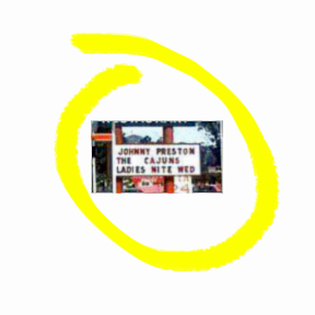 See? "Johnny Preston" and "The Cajuns."
For those who don't know, Johnny Preston had an international number one hit single in 1959 with the song, "Running Bear," written by J. P. Richardson (aka The Big Bopper, who died in the same plane crash that killed Buddy Holly).
Johnnie Preston singing "Running Bear."(Source: NRRArchives on YouTube.com)
In 1996 I published my first book, Swamp Pop: Cajun and Creole Rhythm and Blues, about the swamp pop musical genre of south Louisiana and east Texas. Swamp pop is a combination of New Orleans-style rhythm-and-blues, country-and-western, and Cajun and black Creole music. It was invented by Cajun and black Creole teenagers in the mid- to late 1950s, and its heyday stretched from 1958 to 1964, ending with the advent of the British Invasion.
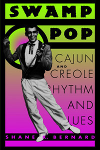 Cover of my book Swamp Pop.
Among the pioneer swamp pop musicians I interviewed for the book was Johnny Preston — real name Johnny Preston Courville. As his tell-tale ethnic surname suggests, he was a Cajun, hailing from the Beaumont-Port Arthur area of east Texas (to which many south Louisiana Cajuns migrated during the early to mid-twentieth century). I assumed "The Cajuns" was the name of Preston's band — though I'd never heard of him fronting a band by this name.
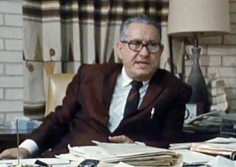
I told my father, swamp pop musician Rod Bernard, about Johnny’s name appearing on the marquee. He replied, "Well, I toured with Johnny on the West Coast around that time. A bunch of us from around here toured with him out west."
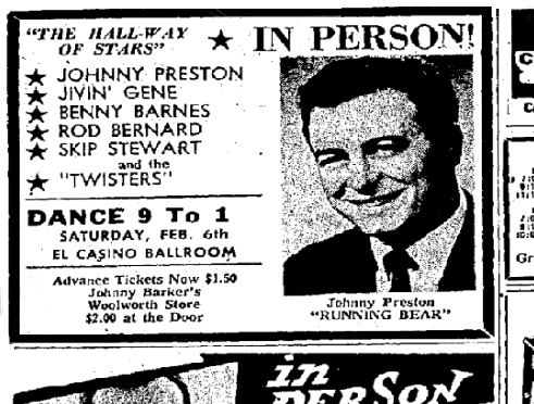 Newspaper ad for a 1960 tour out west featuring Dad,
Johnny Preston, Jivin' Gene, Benny Barnes, and Skip Stewart.
(Source: Tucson Daily Citizen, 30 January 1960)
Dad and I suddenly had the same thought: What if he had been there, with Johnny, at the Escondido Bowl when the photograph in question had been taken? Perhaps "The Cajuns" referred to the other singers in the tour group, all but one of whom, Benny Barnes, were indeed Cajuns? The other singers were Dad, Jivin’ Gene (real name Gene Bourgeois) and Skip Stewart (Maurice Guillory); Dad’s band, The Twisters — some of whose members were Cajuns — served as the backing band for the tour group.
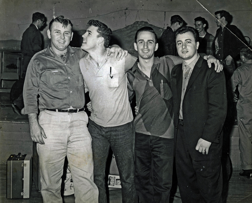 Left to right, Benny Barnes, Jivin' Gene,
 Dad, and Johnny Preston, ca. 1960.
(Source: Author's Collection)
I checked a few online newspaper archives and found that Johnny Preston toured the West Coast, including the Escondido area, with a band called "The Cajuns" in 1964 and 1965 — a few years after he toured the West Coast with Dad and the other swamp pop artists. In other words, Dad was not with Johnny when the gas station photograph was taken. Not that it matters. Still, it would have been a neat coincidence. In any event, the gas station photograph captures a moment in time when swamp pop music was young and often performed by its pioneers far beyond its homeland. Swamp pop still exists today, but its pioneers are slowly passing away, and the genre is largely confined to the dance halls and honky tonks of south Louisiana and East Texas.
Addendum: In retrospect I think I wrote this as nothing more than an exercise in historical detection (which I enjoy).
November 25, 2012
Sur le Teche: Exploring the Bayou by Canoe, Stage 3
Continued from Part II:
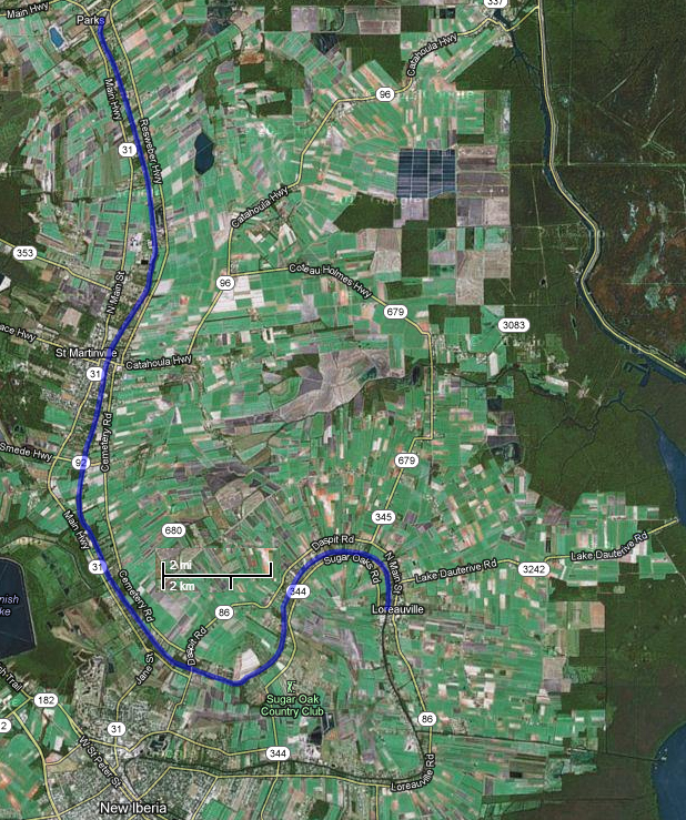
The third leg of our Teche trip took place on December 3, 2011, and stretched between the towns of Parks and Loreauville. The temperature that day was 55 °F in the morning, 81 °F in the afternoon; the sky was partly cloudy. Present, as always, were Keith Guidry and myself. On this particular stage, however, we were accompanied by Don Arceneaux, who shared our interest in the bayou and its history. Don would follow us in his small one-man kayak.
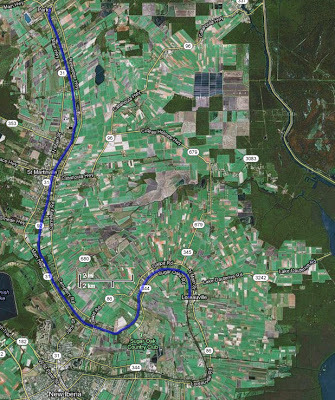 Aerial photograph of Stage 3, Parks to Loreauville.
(Source: Google Maps)
We put in at 9 a.m. at Cecile Rousseau Memorial Park [30.214696, -91.82829] in Parks. Passing many modern houses along the Teche, we soon reached the community of Levert-St. John [30.158533, -91.812519], the first sugar plantation we encountered (to my knowledge) since starting our trip at Port Barre months earlier. As The Louisiana Planter and Sugar Manufacturer noted in 1890:
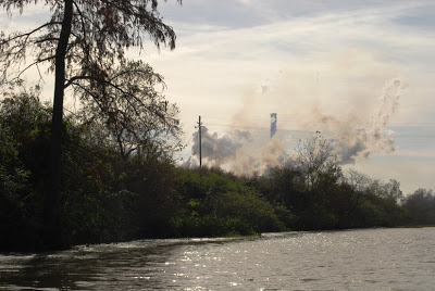 Approaching the Levert-St. John sugar refinery near St. Martinville.
(Photo by author)
St. John Plantation, now organized under the modern corporate name Levert-St. John, LLC, is owned by the Levert Companies. As the company’s website notes, “The principal asset of this company [Levert-St. John] is agricultural land (approximately 11,000 total acres), all in St. Martin Parish, Louisiana. The Levert-St. John, LLC lands are made up primarily of four plantations, St. John, Banker, Burton and Stella, all in St. Martin Parish.” Of that 11,000 acres, approximately 75% is dedicated to sugar production, the remainder focusing on rice and crawfish production.
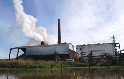 Levert-St. John sugar refinery on Bayou Teche.
(Photo by author)
The sugar refinery at Levert-St. John dominates the surrounding flat sugarcane fields. We were fortunate to canoe past the structure at the height of grinding season (which runs from October to January), when the complex belches enormous clouds of steam into the winter sky. At any given time sugar mills either smell pleasantly sweet, like molasses, or they emit a god-awful stench, to which nothing of a polite nature compares. Levert-St. John must have smelled sweet that day, because I made no reference to the odor in my journal, and I believe I would have remembered the alternative.
In addition to the hissing, breathing refinery, we saw here the 264-foot-long, 14.7-foot-wide Levert-St. John Bridge, which appears on the National Register of Historic Places (site #98000268, added 1998). A double Warren truss swing bridge made of rusted steel girders, it was constructed in 1895 for railroad and pedestrian traffic. Eventually, however, the rails were covered with asphalt to form a single-lane bridge for automobiles (which I remember driving across in the 1980s — not the most secure experience). According to a study conducted for its National Register candidacy, the Levert-St. John Bridge is “the oldest known [extant] bridge in Louisiana, as well as the only known bridge of its type in the state. . . .”
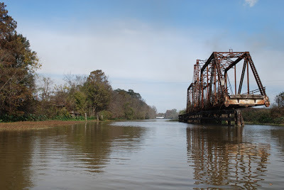 The now defunct Levert-St. John Bridge.
The year "1895" is cut into the steel plate above the opening.
(Click to enlarge; photo by author)
After paddling around and even under the bridge, Keith, Don, and I continued on toward St. Martinville. On the outskirts of town we reached the Longfellow-Evangeline State Historic Site [30.135863, -91.819224](more on Longfellow and Evangeline below), the centerpiece of which is Maison Olivier, a “Raised Creole Cottage . . . which shows a mixture of Creole, Caribbean, and French influences.” The home was built circa 1815 by French Creole planter Pierre Olivier Duclozel de Vezin, from whom two of my occasional canoeing partners, Preston Guidry and his brother Ben, trace direct lineage. I could not see the cottage from the bayou, but I did see Spanish longhorn cattle — a fitting living history display, because Spanish longhorn was indeed the variety of cattle raised in Louisiana during its colonial period (1699-1803). This variety is no longer seen in south Louisiana — at least not from my experience — although Texas longhorns still inhabit parts of that state, I having seen them for myself in the Hill Country.
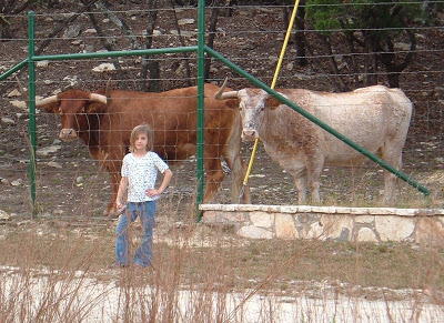 My daughter flanked by two longhorns in Texas.
(Photo by author)
Immediately south of Longfellow-Evangeline, and just beside St. Martinville Senior High School (from which, by the way, Preston and Ben graduated), one can see, behind a low dam, the Cypress Bayou Coulee Canal [30.131748, -91.822636] running northwest into Bayou Tortue Swamp. A major wetlands area, Bayou Tortue Swamp begins on the north near Breaux Bridge and stretches to the Terrace Highway (Highway 96) on the south, and from the natural Teche levee on the east to an area abutting the Lafayette Regional Airport on the west. (It’s funny how I grew up in Lafayette never knowing such a large swamp existed nearby. Granted, I knew Lake Martin, but I had no idea it was part of a much larger swamp ecosystem.)
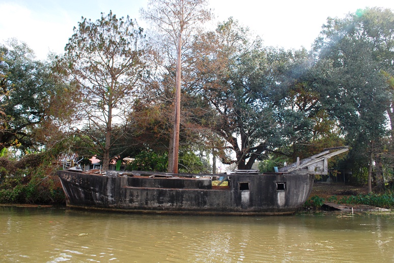
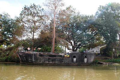 The cement boat at St. Martinville.
(Photo by author)
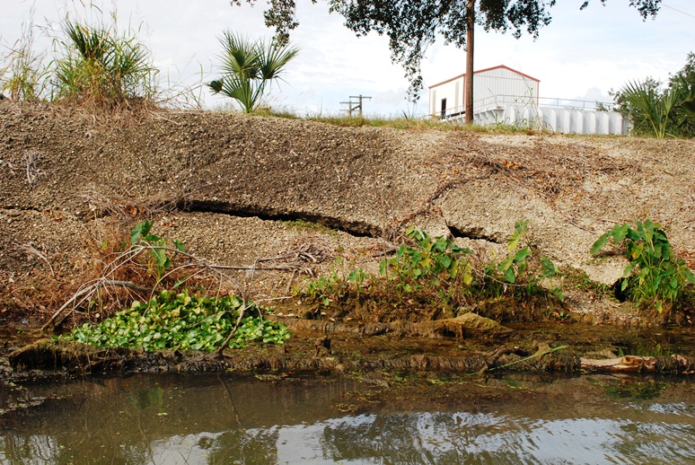
As we neared downtown St. Martinville, Keith showed me two peculiar landmarks. One of these is a boat made of cement, now dilapidated and slowly sinking into the bayou. Cement boats, it turns out, are not unheard of. The other landmark is the site of a small cave [30.124257, -91.826246] in which local children used to play. Infinitely smaller than the one in which Tom Sawyer and Becky Thatcher became lost, the cave entrance has now been sealed with cement for reasons of safety; but you can see the cement patch over the cave’s entrance, about a hundred yards from the downtown bridge over the Teche. Preston once shoved a paddle into a crack in the cement, and the paddle went in all the way to the grip — a good five feet or so. (Decades ago I explored a similar cave in a bluff of the Vermilion River, just south of the bridge over which E. Broussard Road [Highway 733] crosses that bayou. There was not much to the cave: its pale clay walls extended into the bluff about ten or twelve feet before ending in a small hole in the ceiling, which in turn opened onto a pasture.)
 Cement now covers the cave entrance.
(Photo by author)
From the bayou at St. Martinville we saw St. Martin de Tours Catholic Church, the Acadian Memorial, the Museum of the Acadian Memorial, the adjacent African-American Museum, the Old Castillo Hotel (about which I’ve written previously) and the Evangeline Oak [30.121953, -91.827244], under which the Acadian maiden Evangeline went insane pining for her lost love Gabriel . . . well, that is how I heard the story.
American poet Henry Wadsworth Longfellow mentions St. Martinville in his epic poem Evangeline, first published in 1847:
In his book In Search of Evangeline, historian Carl A. Brasseaux has demonstrated that Evangeline never existed; nor did Emmeline Labiche, an Acadian exile on whom Longfellow supposedly based the character of Evangeline. Thus, neither Evangeline nor Emmeline are buried in “Evangeline’s Tomb” next to St. Martin de Tours. Yet the events against which Longfellow set the tragedy of Evangeline — the brutal mid-eighteenth-century expulsion of the Acadians from Nova Scotia by the British military — are factual, as is the settlement of many Acadian exiles in the St. Martinville area (among them my own ancestors, including Michel Bernard, who arrived in 1765 with
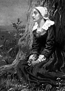 Evangeline.
(Artist: Frank Dicksee, 1882)
According to various sources, St. Martinville was known in olden times as “le petit Paris” because of its lavish social life — a story I’ve always regarded with some skepticism. Occupied by a church since the 1770s, the place, known as the Poste des Attakapas (a term that often referred to the region and not a specific locale), amounted to little until the early nineteenth century. At that time, however, local landowners divided their property into lots; sold or rented these parcels to settlers; and called the resulting community “St. Martinsville” after the local church’s patron saint. Thus, there seems to have been little time for St. Martinville to have flourished as a “little Paris” before the onslaught of tough economic times during and after the Civil War. The “petit Paris” claim, however, can be traced back as far as 1884, when (oddly enough) The Irish Monthly magazine of Dublin reported, “Before the war, which was peculiarly disastrous in its effects on this town, St. Martin’s used to be called Le petit Paris and was perhaps the most aristocratic place in Louisiana. But now many of its houses look old and dilapidated, and few traces of the little Paris remain.” (Source: Anonymous, “From Acadie to Attakapas: The Wanderings of Evangeline,” The Irish Monthly 12 [1884], p. 179.)
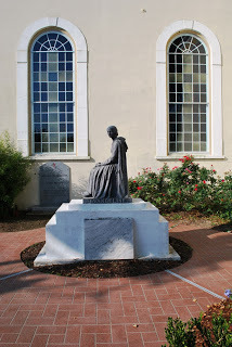 "Evangeline's Tomb," St. Martinville, Louisiana.
(Photo by author)
Brasseaux shares my skepticism, however, observing,
 Cover of Brasseaux's French, Cajun, Creole, Houma (2005).
As we left St. Martinville and paddled into the countryside, I spotted a few ibises on a mud flat, pecking away at minnows. As a historian I found this of interest because the ibis, with its distinctive downturned beak, is strongly linked to ancient Egypt. There religious mythology associated the ibis with Thoth, the ibis-headed god of wisdom and writing. The “father of history,” Herodotus, recorded of ancient Egypt, “When a man has killed one of the sacred animals, if he did it with malice . . . he is punished with death; if unwittingly, he has to pay such a fine as the priests choose to impose. When an ibis, however, or a hawk is killed, whether it was done by accident or on purpose, the man must needs die [my italics].” The ibises we saw that day were young white ibises whose plumage had not yet turned completely white.
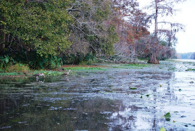 A pair of ibises along the Teche below St. Martinville.
(Photo by author)
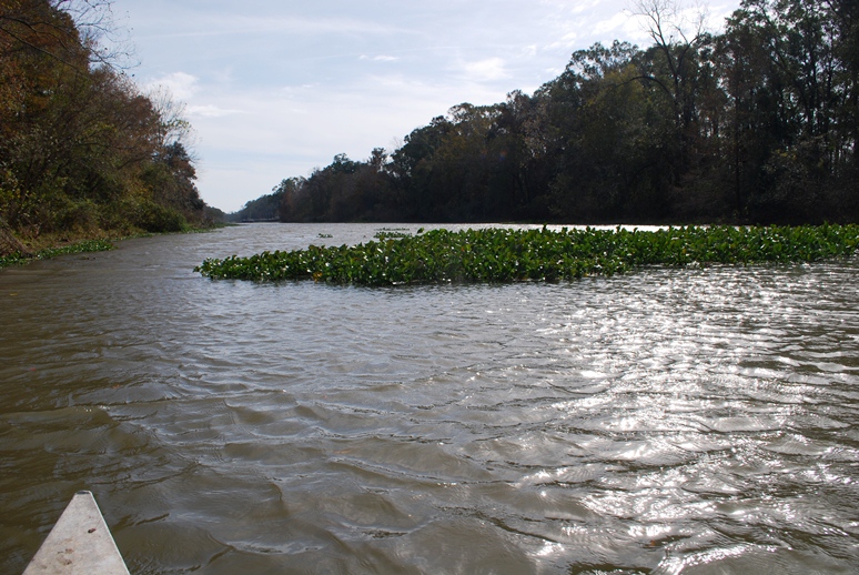
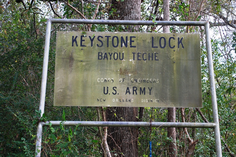
A little after 1 p.m. we spotted the Keystone Lock and Dam [30.071095, -91.828859], for all practical purposes a convenient line of demarcation between the upper and lower Teche. Between the dam and us floated numerous islands of water hyacinth, one of them, the largest, measuring about 75 feet in length. Since starting our trip at Port Barre, we have worried about hyacinth. An invasive species, we feared it would at some point block our progress, clogging the entire bayou from one bank to the other. Those we now saw represented the largest concentration we had yet encountered, but it was not enough to stop us; we merely paddled around the aquatic plants or sometimes plowed straight through them, feeling the drag on the bottom of the canoe. Aerial photographs showed even denser masses of water hyacinth ahead of us, near Baldwin and Franklin. But we would not reach those towns on the current stage.
 A raft of water hyacinths floating on the Teche.
The Keystone Lock and Dam are in the distance.
(Photo by author)
As we closed in on the dam, the sound of water topping the cement structure became louder. Here we had no choice but to do a portage. I don’t know how people pronounce “portage” elsewhere in the country, but in south Louisiana the most common pronunciation I hear is the French pronunciation, which is POR-TAHZH. What is perplexing, however, is that the French place name Fausse Pointe — an archaic name for our stopping point that day, Loreauville, as well as for a stretch of the Teche near New Iberia, and now the name of a nearby lake and state park — is almost universally pronounced (that is, arguably mispronounced), even by Cajuns who know the local patois, as FAW-SEE POINT instead of FAHS POINT. This Anglicized pronunciation jars me, just as the English pronunciation of portage jars me.
 We went ashore here to make a portage.
(Photo by author)
So we made a portage, hauling our canoe and Don’s kayak up a steep embankment on the east side of the Teche, carrying the boats about a hundred yards along a trail through a patch of woods, lowering them down another embankment (much steeper than the first), and putting them back into the water just below the lock and dam. The Tour du Teche race organizers had sunk some 4x4 posts in this last embankment and, evidently running ropes between the posts, had rigged up a method for lowering canoes into the bayou. Unfortunately, no ropes were present on our visit, so we had to make do without this convenience. (Were we trespassing here? It was unclear: We exited the bayou on federal property, but at some point may have entered private property. I say this because just before we lowered our canoes back into the water we spotted a “Private Property” sign — but, confusingly, it was facing the wrong direction, so that canoers could not see the sign until after the fact. In any event, canoers cannot pass the dam and lock without making a portage, and as a result the location offers itself as a legitimate candidate for right of way. But I leave this matter for others to solve.)
 Keystone Lock and Dam from downstream.
(Photo by author)
Once back in the water, we continued to paddle downstream, noting juglines on the bayou and beaver gnaw marks on tree trunks. We passed the entrance to the Joe Daigre Canal [30.064878, -91.826166], which runs a short distance to Bayou Tortue. In turn, that bayou wraps itself around the northern bank of Spanish Lake before entering Bayou Tortue Swamp.
 Don Arceneaux in his kayak.
(Photo by author)
At 2:50 p.m. we reached Daspit Bridge [30.040546, -91.800843], and it was around this time that we noticed a sweet molasses smell — another sugar refinery in operation. We passed many modern suburban houses on the east bank and at 3:20 p.m. I spotted a wall of green in front of us — What was it? I wondered. A painted green wall, perhaps the side of a large barn? It seemed to rise two stories or more. I realized it was a grassy hill rising above the bayou's bluff. (An archaeology friend later suggested the hill as a likely candidate for an Indian mound.) “What is this place?” I asked Don, who, it turned out, knew precisely what it was. He’d scouted ahead, putting his kayak in near Daspit Bridge a few days earlier. Now he was toying with me, awaiting my reaction to the grassy hill, below which a coulee or small bayou entered the Teche.
It was the mouth of Bayou La Chute [30.03667, -91.786284] and the site of the eighteenth-century waterfall that emptied into the Teche.
 Entrance to Bayou La Chute (center) as seen from the Teche.
The grassy hill at right appears much higher from a distance.
(Photo by author)
Don had identified this site as the probable location of the waterfall — it just made sense, topographically. Additional research on my part revealed that locals called this small tributary Bayou La Chute . . . and “La Chute” in French means “the waterfall.” (See my detailed article on our search for the waterfall’s site.) There is no waterfall today, its ten-foot drop, made of dirt or clay, having eroded away, or been removed by human activity.
A paddle up Bayou La Chute is worth the effort. Although modern neighborhoods encroach on more than one side (including a neighborhood under construction), I found Bayou La Chute in some ways more beautiful than the Teche. In its dark swampiness I half expected to see Yoda, and because of its winding narrowness, lined with bamboo (a nonindigenous plant no doubt loosed from someone’s garden), it reminded me of an amusement park jungle ride.
 On Bayou La Chute; for scale, note fishing chair on left bank.
(Photo by author)
We stopped at a fork in Bayou La Chute, and made our way back to the Teche to continue toward Loreauville. With the sun sinking and the sky dimming, we had one more discovery to make that day, the so-called “tombs” [30.062517, -91.769417] I mentioned in one of my previous articles. I no longer think these are tombs, but, rather, pilings belonging to a nineteenth-century sugar mill or steam pump. Indeed, we were now in sugar country, passing through one old sugar plantation after another — some now transformed into neighborhoods, some still producing sugar, but, of course, without the slaves who once carried out the grueling tasks associated with making sugar — cutting cane by hand, hauling it to the sugar house, feeding it into the rollers, boiling the saccharine juice, refining it again and again until, at the exact moment, a “strike” was poured, and if all went well creating granulated brown sugar seeped with molasses. Loaded into oversized barrels called hogsheads, the commodity traveled via Teche steamboats to New Orleans, where it would be sold on the local market, or transferred to schooners for sale on the East Coast market.
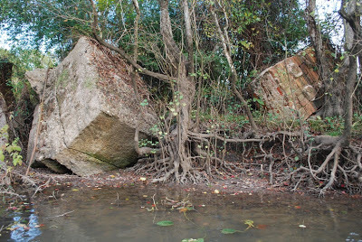 "Tombs" on the Teche.
I now believe these are old industrial pilings.
(Photo by author)
On the outskirts of Loreauville we saw three immense boat-building facilities and a couple of vessels associated with the petroleum industry — a living quarters boat and a jack-up boat. These sights reminded us that although we paddled inland on a bayou whose mouth did not empty into open water (the Teche originally poured into the Lower Atchafalaya River, but now diverts into the Calumet Cut, known less poetically as the Wax Lake Outlet), we were nonetheless not that far from the Gulf of Mexico.
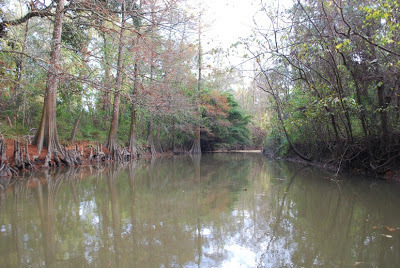
 A typical scene on the Teche that day.
(Photo by author)
Modern homes and businesses ran along the bayou at Loreauville. We drew up to our designated landing, the town’s bridge [30.056791, -91.740185], which stands next to a volunteer fire station and an old jailhouse. We debarked and hauled the canoe and kayak up a high bluff below the jailhouse. Don had an easier time with his small kayak, but Keith and I struggled with the 17-foot metal canoe. Wrestling with the boat, the two of us suffered simultaneous asthma attacks — a humorous coincidence, but only in retrospect. Fortunately, we each brought an inhaler, and soon we were enjoying hamburgers at the nearby (and aptly named) Teche Inn, located a block or two from the bayou. Distance covered that day: 19.15 miles.
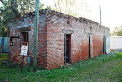 The old Loreauville jail on the banks of the Teche.
(Photo by author)
Continued in Part IV. . . .
The third leg of our Teche trip took place on December 3, 2011, and stretched between the towns of Parks and Loreauville. The temperature that day was 55 °F in the morning, 81 °F in the afternoon; the sky was partly cloudy. Present, as always, were Keith Guidry and myself. On this particular stage, however, we were accompanied by Don Arceneaux, who shared our interest in the bayou and its history. Don would follow us in his small one-man kayak.
 Aerial photograph of Stage 3, Parks to Loreauville.
(Source: Google Maps)
We put in at 9 a.m. at Cecile Rousseau Memorial Park [30.214696, -91.82829] in Parks. Passing many modern houses along the Teche, we soon reached the community of Levert-St. John [30.158533, -91.812519], the first sugar plantation we encountered (to my knowledge) since starting our trip at Port Barre months earlier. As The Louisiana Planter and Sugar Manufacturer noted in 1890:
St. John sugar refinery’s almost new outfit will meet a splendid and very large sugar crop this grinding [season] in St Martin parish. This excellent central sugar system by its benign influence . . . has encouraged for many miles around the growth of sugar cane. Col. J. B. Levert, the enterprising owner of the large sugar estate St. John and its grand sugar refinery, deserves credit for his push and energy and public spirit.
 Approaching the Levert-St. John sugar refinery near St. Martinville.
(Photo by author)
St. John Plantation, now organized under the modern corporate name Levert-St. John, LLC, is owned by the Levert Companies. As the company’s website notes, “The principal asset of this company [Levert-St. John] is agricultural land (approximately 11,000 total acres), all in St. Martin Parish, Louisiana. The Levert-St. John, LLC lands are made up primarily of four plantations, St. John, Banker, Burton and Stella, all in St. Martin Parish.” Of that 11,000 acres, approximately 75% is dedicated to sugar production, the remainder focusing on rice and crawfish production.
 Levert-St. John sugar refinery on Bayou Teche.
(Photo by author)
The sugar refinery at Levert-St. John dominates the surrounding flat sugarcane fields. We were fortunate to canoe past the structure at the height of grinding season (which runs from October to January), when the complex belches enormous clouds of steam into the winter sky. At any given time sugar mills either smell pleasantly sweet, like molasses, or they emit a god-awful stench, to which nothing of a polite nature compares. Levert-St. John must have smelled sweet that day, because I made no reference to the odor in my journal, and I believe I would have remembered the alternative.
In addition to the hissing, breathing refinery, we saw here the 264-foot-long, 14.7-foot-wide Levert-St. John Bridge, which appears on the National Register of Historic Places (site #98000268, added 1998). A double Warren truss swing bridge made of rusted steel girders, it was constructed in 1895 for railroad and pedestrian traffic. Eventually, however, the rails were covered with asphalt to form a single-lane bridge for automobiles (which I remember driving across in the 1980s — not the most secure experience). According to a study conducted for its National Register candidacy, the Levert-St. John Bridge is “the oldest known [extant] bridge in Louisiana, as well as the only known bridge of its type in the state. . . .”
 The now defunct Levert-St. John Bridge.
The year "1895" is cut into the steel plate above the opening.
(Click to enlarge; photo by author)
After paddling around and even under the bridge, Keith, Don, and I continued on toward St. Martinville. On the outskirts of town we reached the Longfellow-Evangeline State Historic Site [30.135863, -91.819224](more on Longfellow and Evangeline below), the centerpiece of which is Maison Olivier, a “Raised Creole Cottage . . . which shows a mixture of Creole, Caribbean, and French influences.” The home was built circa 1815 by French Creole planter Pierre Olivier Duclozel de Vezin, from whom two of my occasional canoeing partners, Preston Guidry and his brother Ben, trace direct lineage. I could not see the cottage from the bayou, but I did see Spanish longhorn cattle — a fitting living history display, because Spanish longhorn was indeed the variety of cattle raised in Louisiana during its colonial period (1699-1803). This variety is no longer seen in south Louisiana — at least not from my experience — although Texas longhorns still inhabit parts of that state, I having seen them for myself in the Hill Country.
 My daughter flanked by two longhorns in Texas.
(Photo by author)
Immediately south of Longfellow-Evangeline, and just beside St. Martinville Senior High School (from which, by the way, Preston and Ben graduated), one can see, behind a low dam, the Cypress Bayou Coulee Canal [30.131748, -91.822636] running northwest into Bayou Tortue Swamp. A major wetlands area, Bayou Tortue Swamp begins on the north near Breaux Bridge and stretches to the Terrace Highway (Highway 96) on the south, and from the natural Teche levee on the east to an area abutting the Lafayette Regional Airport on the west. (It’s funny how I grew up in Lafayette never knowing such a large swamp existed nearby. Granted, I knew Lake Martin, but I had no idea it was part of a much larger swamp ecosystem.)
 The cement boat at St. Martinville.
(Photo by author)
As we neared downtown St. Martinville, Keith showed me two peculiar landmarks. One of these is a boat made of cement, now dilapidated and slowly sinking into the bayou. Cement boats, it turns out, are not unheard of. The other landmark is the site of a small cave [30.124257, -91.826246] in which local children used to play. Infinitely smaller than the one in which Tom Sawyer and Becky Thatcher became lost, the cave entrance has now been sealed with cement for reasons of safety; but you can see the cement patch over the cave’s entrance, about a hundred yards from the downtown bridge over the Teche. Preston once shoved a paddle into a crack in the cement, and the paddle went in all the way to the grip — a good five feet or so. (Decades ago I explored a similar cave in a bluff of the Vermilion River, just south of the bridge over which E. Broussard Road [Highway 733] crosses that bayou. There was not much to the cave: its pale clay walls extended into the bluff about ten or twelve feet before ending in a small hole in the ceiling, which in turn opened onto a pasture.)
 Cement now covers the cave entrance.
(Photo by author)
From the bayou at St. Martinville we saw St. Martin de Tours Catholic Church, the Acadian Memorial, the Museum of the Acadian Memorial, the adjacent African-American Museum, the Old Castillo Hotel (about which I’ve written previously) and the Evangeline Oak [30.121953, -91.827244], under which the Acadian maiden Evangeline went insane pining for her lost love Gabriel . . . well, that is how I heard the story.
American poet Henry Wadsworth Longfellow mentions St. Martinville in his epic poem Evangeline, first published in 1847:
On the banks of the Têche, are the towns of St. Maur and St. Martin. There the long-wandering bride shall be given again to her bridegroom, There the long-absent pastor regain his flock and his sheepfold.
In his book In Search of Evangeline, historian Carl A. Brasseaux has demonstrated that Evangeline never existed; nor did Emmeline Labiche, an Acadian exile on whom Longfellow supposedly based the character of Evangeline. Thus, neither Evangeline nor Emmeline are buried in “Evangeline’s Tomb” next to St. Martin de Tours. Yet the events against which Longfellow set the tragedy of Evangeline — the brutal mid-eighteenth-century expulsion of the Acadians from Nova Scotia by the British military — are factual, as is the settlement of many Acadian exiles in the St. Martinville area (among them my own ancestors, including Michel Bernard, who arrived in 1765 with
 Evangeline.
(Artist: Frank Dicksee, 1882)
According to various sources, St. Martinville was known in olden times as “le petit Paris” because of its lavish social life — a story I’ve always regarded with some skepticism. Occupied by a church since the 1770s, the place, known as the Poste des Attakapas (a term that often referred to the region and not a specific locale), amounted to little until the early nineteenth century. At that time, however, local landowners divided their property into lots; sold or rented these parcels to settlers; and called the resulting community “St. Martinsville” after the local church’s patron saint. Thus, there seems to have been little time for St. Martinville to have flourished as a “little Paris” before the onslaught of tough economic times during and after the Civil War. The “petit Paris” claim, however, can be traced back as far as 1884, when (oddly enough) The Irish Monthly magazine of Dublin reported, “Before the war, which was peculiarly disastrous in its effects on this town, St. Martin’s used to be called Le petit Paris and was perhaps the most aristocratic place in Louisiana. But now many of its houses look old and dilapidated, and few traces of the little Paris remain.” (Source: Anonymous, “From Acadie to Attakapas: The Wanderings of Evangeline,” The Irish Monthly 12 [1884], p. 179.)
 "Evangeline's Tomb," St. Martinville, Louisiana.
(Photo by author)
Brasseaux shares my skepticism, however, observing,
The Creoles’ fall from grace [after the economic devastation of the Civil War] gave rise to a body of mythology regarding a golden age that never was. Most southern Louisianians are familiar with the stories of the spiders imported from China for the Oak and Pine Alley wedding [held near St. Martinville], with the celebrated performances of French opera companies in antebellum St. Martinville, with the presence of the great houses of French nobility who took refuge along Bayou Teche after the French Revolution, and with the donation of a baptismal font by Louis XVI to St. Martin of Tours Catholic Church — all stories proven unfounded by recent historical research. Yet these stories persist because they gave, and still provide, the fallen Creole elite with a continuing sense of social prominence based upon perceived past glories. (Brasseaux, French, Cajun, Creole, Houma: A Primer on Francophone Louisiana [2005], p. 102.)
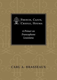 Cover of Brasseaux's French, Cajun, Creole, Houma (2005).
As we left St. Martinville and paddled into the countryside, I spotted a few ibises on a mud flat, pecking away at minnows. As a historian I found this of interest because the ibis, with its distinctive downturned beak, is strongly linked to ancient Egypt. There religious mythology associated the ibis with Thoth, the ibis-headed god of wisdom and writing. The “father of history,” Herodotus, recorded of ancient Egypt, “When a man has killed one of the sacred animals, if he did it with malice . . . he is punished with death; if unwittingly, he has to pay such a fine as the priests choose to impose. When an ibis, however, or a hawk is killed, whether it was done by accident or on purpose, the man must needs die [my italics].” The ibises we saw that day were young white ibises whose plumage had not yet turned completely white.
 A pair of ibises along the Teche below St. Martinville.
(Photo by author)
A little after 1 p.m. we spotted the Keystone Lock and Dam [30.071095, -91.828859], for all practical purposes a convenient line of demarcation between the upper and lower Teche. Between the dam and us floated numerous islands of water hyacinth, one of them, the largest, measuring about 75 feet in length. Since starting our trip at Port Barre, we have worried about hyacinth. An invasive species, we feared it would at some point block our progress, clogging the entire bayou from one bank to the other. Those we now saw represented the largest concentration we had yet encountered, but it was not enough to stop us; we merely paddled around the aquatic plants or sometimes plowed straight through them, feeling the drag on the bottom of the canoe. Aerial photographs showed even denser masses of water hyacinth ahead of us, near Baldwin and Franklin. But we would not reach those towns on the current stage.
 A raft of water hyacinths floating on the Teche.
The Keystone Lock and Dam are in the distance.
(Photo by author)
As we closed in on the dam, the sound of water topping the cement structure became louder. Here we had no choice but to do a portage. I don’t know how people pronounce “portage” elsewhere in the country, but in south Louisiana the most common pronunciation I hear is the French pronunciation, which is POR-TAHZH. What is perplexing, however, is that the French place name Fausse Pointe — an archaic name for our stopping point that day, Loreauville, as well as for a stretch of the Teche near New Iberia, and now the name of a nearby lake and state park — is almost universally pronounced (that is, arguably mispronounced), even by Cajuns who know the local patois, as FAW-SEE POINT instead of FAHS POINT. This Anglicized pronunciation jars me, just as the English pronunciation of portage jars me.
 We went ashore here to make a portage.
(Photo by author)
So we made a portage, hauling our canoe and Don’s kayak up a steep embankment on the east side of the Teche, carrying the boats about a hundred yards along a trail through a patch of woods, lowering them down another embankment (much steeper than the first), and putting them back into the water just below the lock and dam. The Tour du Teche race organizers had sunk some 4x4 posts in this last embankment and, evidently running ropes between the posts, had rigged up a method for lowering canoes into the bayou. Unfortunately, no ropes were present on our visit, so we had to make do without this convenience. (Were we trespassing here? It was unclear: We exited the bayou on federal property, but at some point may have entered private property. I say this because just before we lowered our canoes back into the water we spotted a “Private Property” sign — but, confusingly, it was facing the wrong direction, so that canoers could not see the sign until after the fact. In any event, canoers cannot pass the dam and lock without making a portage, and as a result the location offers itself as a legitimate candidate for right of way. But I leave this matter for others to solve.)
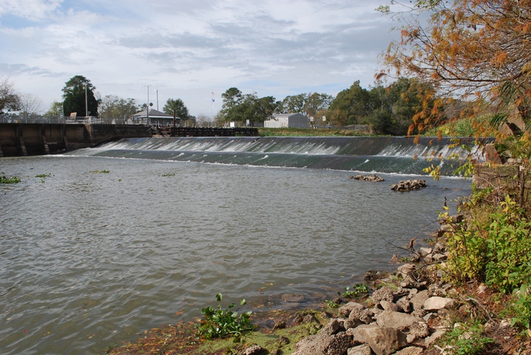 Keystone Lock and Dam from downstream.
(Photo by author)
Once back in the water, we continued to paddle downstream, noting juglines on the bayou and beaver gnaw marks on tree trunks. We passed the entrance to the Joe Daigre Canal [30.064878, -91.826166], which runs a short distance to Bayou Tortue. In turn, that bayou wraps itself around the northern bank of Spanish Lake before entering Bayou Tortue Swamp.
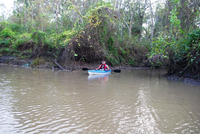 Don Arceneaux in his kayak.
(Photo by author)
At 2:50 p.m. we reached Daspit Bridge [30.040546, -91.800843], and it was around this time that we noticed a sweet molasses smell — another sugar refinery in operation. We passed many modern suburban houses on the east bank and at 3:20 p.m. I spotted a wall of green in front of us — What was it? I wondered. A painted green wall, perhaps the side of a large barn? It seemed to rise two stories or more. I realized it was a grassy hill rising above the bayou's bluff. (An archaeology friend later suggested the hill as a likely candidate for an Indian mound.) “What is this place?” I asked Don, who, it turned out, knew precisely what it was. He’d scouted ahead, putting his kayak in near Daspit Bridge a few days earlier. Now he was toying with me, awaiting my reaction to the grassy hill, below which a coulee or small bayou entered the Teche.
It was the mouth of Bayou La Chute [30.03667, -91.786284] and the site of the eighteenth-century waterfall that emptied into the Teche.
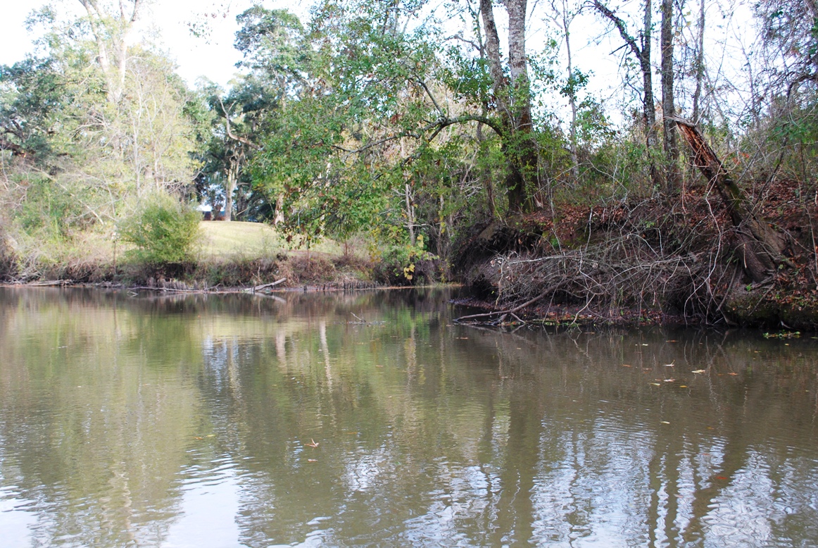 Entrance to Bayou La Chute (center) as seen from the Teche.
The grassy hill at right appears much higher from a distance.
(Photo by author)
Don had identified this site as the probable location of the waterfall — it just made sense, topographically. Additional research on my part revealed that locals called this small tributary Bayou La Chute . . . and “La Chute” in French means “the waterfall.” (See my detailed article on our search for the waterfall’s site.) There is no waterfall today, its ten-foot drop, made of dirt or clay, having eroded away, or been removed by human activity.
A paddle up Bayou La Chute is worth the effort. Although modern neighborhoods encroach on more than one side (including a neighborhood under construction), I found Bayou La Chute in some ways more beautiful than the Teche. In its dark swampiness I half expected to see Yoda, and because of its winding narrowness, lined with bamboo (a nonindigenous plant no doubt loosed from someone’s garden), it reminded me of an amusement park jungle ride.
 On Bayou La Chute; for scale, note fishing chair on left bank.
(Photo by author)
We stopped at a fork in Bayou La Chute, and made our way back to the Teche to continue toward Loreauville. With the sun sinking and the sky dimming, we had one more discovery to make that day, the so-called “tombs” [30.062517, -91.769417] I mentioned in one of my previous articles. I no longer think these are tombs, but, rather, pilings belonging to a nineteenth-century sugar mill or steam pump. Indeed, we were now in sugar country, passing through one old sugar plantation after another — some now transformed into neighborhoods, some still producing sugar, but, of course, without the slaves who once carried out the grueling tasks associated with making sugar — cutting cane by hand, hauling it to the sugar house, feeding it into the rollers, boiling the saccharine juice, refining it again and again until, at the exact moment, a “strike” was poured, and if all went well creating granulated brown sugar seeped with molasses. Loaded into oversized barrels called hogsheads, the commodity traveled via Teche steamboats to New Orleans, where it would be sold on the local market, or transferred to schooners for sale on the East Coast market.
 "Tombs" on the Teche.
I now believe these are old industrial pilings.
(Photo by author)
On the outskirts of Loreauville we saw three immense boat-building facilities and a couple of vessels associated with the petroleum industry — a living quarters boat and a jack-up boat. These sights reminded us that although we paddled inland on a bayou whose mouth did not empty into open water (the Teche originally poured into the Lower Atchafalaya River, but now diverts into the Calumet Cut, known less poetically as the Wax Lake Outlet), we were nonetheless not that far from the Gulf of Mexico.
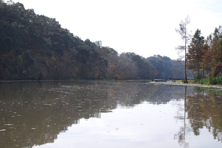 A typical scene on the Teche that day.
(Photo by author)
Modern homes and businesses ran along the bayou at Loreauville. We drew up to our designated landing, the town’s bridge [30.056791, -91.740185], which stands next to a volunteer fire station and an old jailhouse. We debarked and hauled the canoe and kayak up a high bluff below the jailhouse. Don had an easier time with his small kayak, but Keith and I struggled with the 17-foot metal canoe. Wrestling with the boat, the two of us suffered simultaneous asthma attacks — a humorous coincidence, but only in retrospect. Fortunately, we each brought an inhaler, and soon we were enjoying hamburgers at the nearby (and aptly named) Teche Inn, located a block or two from the bayou. Distance covered that day: 19.15 miles.
 The old Loreauville jail on the banks of the Teche.
(Photo by author)
Continued in Part IV. . . .
Sur la Teche: Exploring the Bayou by Canoe, Stage 3
Note to reader: This is still a draft. . . .
Continued from Part II:
The third leg of our Teche trip took place on December 3, 2011, and stretched between the towns of Parks and Loreauville. The temperature that day was 55 °F in the morning, 81 °F in the afternoon; the sky was partly cloudy. Present, as always, were Keith Guidry and myself. On this particular stage, however, we were accompanied by biologist Don Arceneaux, who shared our interest in the bayou and its remarkable history. Don would follow us in his small one-man kayak.
We put in at 9 a.m. at Cecile Rousseau Memorial Park in Parks. Passing many modern houses along the Teche, we soon reached the community of St. John, the first sugar plantation we encountered since starting our trip at Port Barre months earlier. As The Louisiana Planter and Sugar Manufacturer noted in 1890:
St John sugar refinery’s almost new outfit will meet a splendid and very large sugar crop this grinding [season] in St Martin parish. This excellent central sugar system by its benign influence . . . has encouraged for many miles around the growth of sugar cane. Col. J. B. Levert, the enterprising owner of the large sugar estate St John and its grand sugar refinery, deserves credit for his push and energy and public spirit.
Approaching the St. John sugar refinery near St. Martinville.(Photo by author)
St. John Plantation, now organized under the modern corporate name Levert-St. John, LLC, is owned by the Levert Companies. As the company’s website notes, “The principal asset of this company [Levert-St. John] is agricultural land (approximately 11,000 total acres), all in St. Martin Parish, Louisiana. The Levert-St. John, LLC lands are made up primarily of four plantations, St. John, Banker, Burton and Stella, all in St. Martin Parish.” Of that 11,000 acres, approximately 75% concerns sugar production, the remainder focusing primarily on rice and crawfish production.
St. John sugar refinery on Bayou Teche.(Photo by author)
The sugar refinery at St. John dominates the surrounding landscape of flat sugarcane fields. We were fortunate to canoe past the structure at the height of grinding season (which runs from October to January), when the complex belches enormous clouds of steam into the winter sky. At any given time sugar mills either smell pleasantly sweet, like molasses, or they emit a god-awful stench, to which nothing of a polite nature compares. St. John must have smelled sweet that day, because I made no reference to the odor in my journal, and I think I would have remembered the alternative.
In addition to the hissing, breathing refinery, canoers will see here the 264-foot-long, 14.7-foot-wide Levert-St. John Bridge, which appears on the National Register of Historic Places (site #98000268, added 1998). A double Warren truss swing bridge made of rusted steel girders, it was constructed in 1895 for railroad and pedestrian traffic. Eventually, however, the rails were covered with asphalt to form a single-lane bridge for automobiles (which I remember driving across in the 1980s — not the most secure experience). According to a study conducted for its National Register candidacy, the Levert-St. John Bridge is “the oldest known [extant] bridge in Louisiana, as well as the only known bridge of its type in the state. . . .”
The now defunct Levert-St. John Bridge.Note the year "1895" is cut into the steel plate above the entrance.
(Click to enlarge; photo by author)
After paddling around and even under the bridge, Keith, Don, and I continued on toward St. Martinville. On the outskirts of town we reached the Longfellow-Evangeline State Historic Site (more on Longfellow and Evangeline below), the centerpiece of which is Maison Olivier, a “Raised Creole Cottage . . . which shows a mixture of Creole, Caribbean, and French influences.” The home was built circa 1815 by French Creole planter Pierre Olivier Duclozel de Vezin (from whom two of my canoeing partners, Preston and Ben Guidry, trace direct lineage through their maternal line). Unfortunately, I could not see the cottage from the bayou, but I did see Spanish longhorn cattle — a fitting living history display, because Spanish longhorn was indeed the variety of cattle raised in Louisiana during its colonial period (1699-1803). This variety is no longer seen in south Louisiana — at least not from my experience — although Texas longhorns still inhabit parts of that state, I having seen them for myself in the Hill Country.
My daughter flanked by two longhorns in Texas.(Photo by author)
Immediately south of Longfellow-Evangeline, and just beside St. Martin Senior High School (from which, by the way, Preston and Ben graduated), one can see, behind a low dam, the Cypress Bayou Coulee Canal running northwest into Bayou Tortue Swamp. A major wetlands area, Bayou Tortue Swamp begins on the north near Breaux Bridge and stretches to the Terrace Highway (Highway 96) on the south, and from the natural Teche levee on the east to an area abutting the Lafayette Regional Airport on the west. (It’s funny how I grew up in Lafayette never knowing such a large swamp existed nearby. Granted, I knew Lake Martin, but I had no idea it was part of a much larger swamp ecosystem.)
The cement boat at St. Martinville.(Photo by author)
As we neared downtown St. Martinville, Keith showed me two landmarks that Preston had mentioned to me earlier. One of these landmarks is a boat made out of cement, now dilapidated and slowly sinking into the bayou. Cement boats, it turns out, are not unheard of. The other landmark is the site of a small cave in which local children used to play. Infinitely smaller than the one in which Tom Sawyer and Becky Thatcher became lost, the cave entrance has now been sealed with cement for reasons of safety; but you can see the cement patch over the cave’s entrance, about a hundred yards from the downtown bridge over the Teche. Preston once shoved a paddle into a crack in the cement, and the paddle went in all the way to the grip — a good five feet or so. (I once explored a similar cave in a bluff of the Vermilion River, just south of the bridge over which E. Broussard Road [Highway 733] crosses that bayou. There was not much to the cave: its light-colored dirt or clay walls extended into the bluff about ten or twelve feet before ending in a small hole in the ceiling, which in turn opened onto a pasture.)
Cement now covers the cave entrance.(Photo by author)
From the bayou at St. Martinville we saw St. Martin de Tours Catholic Church, the Acadian Memorial, the Museum of the Acadian Memorial, the adjacent African-American Museum, the Old Castillo Hotel (about which I’ve written previously) and the Evangeline Oak, under which the Acadian maiden Evangeline went insane pining for her lost love Gabriel . . . well, that is how I heard the story. American poet Henry Wadsworth Longfellow mentions St. Martinville in his epic poem Evangeline, first published in 1847:
On the banks of the Têche, are the towns of St. Maur and St. Martin. There the long-wandering bride shall be given again to her bridegroom, There the long-absent pastor regain his flock and his sheepfold.
In his book In Search of Evangeline, historian Carl A. Brasseaux has demonstrated that Evangeline never existed; nor did Emmeline Labiche, an Acadian exile on whom Longfellow supposedly based the character of Evangeline. Thus, neither Evangeline nor Emmeline are buried under “Evangeline’s Tomb” in St. Martinville. Yet the events against which Longfellow set the tragedy of Evangeline — the brutal mid-eighteenth-century expulsion of the Acadians from Nova Scotia by the British military — is factual, as is the eventual settlement of many Acadian exiles in the St. Martinville area (among them my own ancestors, including Michel Bernard, husband of Marie Guilbeau, who arrived in 1765 with Beausoleil Broussard).
"Evangeline's Tomb," St. Martinville, Louisiana.(Photo by author)
According to various sources, St. Martinville was known in olden times as “le petit Paris” because of its lavish social life — a story I’ve always regarded with some skepticism. Occupied since the mid-1700s, the place amounted to little more than a neglected military outpost, the Poste des Attakapas, until the early nineteenth century, when local landowners divided their property into lots; sold or rented these parcels to settlers; and called the resulting community “St. Martinsville,” after the local church’s patron saint. Thus, there seems to have been little time for St. Martinville to have flourished as a “little Paris” before the onslaught of tough economic times during and after the Civil War. The “petit Paris” claim, however, can be traced back as far as 1884, when (oddly enough) The Irish Monthly magazine of Dublin reported, “Before the war, which was peculiarly disastrous in its effects on this town, St. Martin’s used to be called Le petit Paris and was perhaps the most aristocratic place in Louisiana. But now many of its houses look old and dilapidated, and few traces of the little Paris remain.” (Source: Anonymous, “From Acadie to Attakapas: The Wanderings of Evangeline,” The Irish Monthly 12 [1884], p. 179.)
Cover of Brasseaux's French, Cajun, Creole, Houma (2005).Brasseaux shares my skepticism, however, observing,
The Creoles’ fall from grace [after the economic devastation of the Civil War] gave rise to a body of mythology regarding a golden age that never was. Most southern Louisianians are familiar with the stories of the spiders imported from China for the Oak and Pine Alley wedding [held near St. Martinville], with the celebrated performances of French opera companies in antebellum St. Martinville, with the presence of the great houses of French nobility who took refuge along Bayou Teche after the French Revolution, and with the donation of a baptismal font by Louis XVI to St. Martin of Tours Catholic Church — all stories proven unfounded by recent historical research. Yet these stories persist because they gave, and still provide, the fallen Creole elite with a continuing sense of social prominence based upon perceived past glories. (Brasseaux, French, Cajun, Creole, Houma: A Primer on Francophone Louisiana [2005], p. 102.)As we left St. Martinville and paddled into the countryside, I spotted a few ibises on a mud flat, pecking away at minnows. As a historian I found this of interest because the ibis, with its distinctive downturned beak, is strongly linked to ancient Egypt. There religious mythology associated the ibis with Thoth, the ibis-headed god of wisdom and writing. The “father of history,” Herodotus, recorded of ancient Egypt, “When a man has killed one of the sacred animals, if he did it with malice . . . he is punished with death; if unwittingly, he has to pay such a fine as the priests choose to impose. When an ibis, however, or a hawk is killed, whether it was done by accident or on purpose, the man must needs die [my italics].” The ibises we saw that day were young white ibises whose plumage had not yet turned completely white.
A pair of ibises along the Teche below St. Martinville.(Photo by author)
A little after 1 p.m. we spotted the Keystone Lock and Dam, for all practical purposes a convenient line of demarcation between the upper and lower Teche. Between the dam and us floated numerous islands of water hyacinth, one of them, the largest, measuring about 75 feet in length. Since starting our trip at Port Barre, we have worried about hyacinth. An invasive species, we feared it would at some point block our progress, clogging the entire bayou from one bank to the other. Those we now saw represented the largest concentration we had yet encountered, but it was not enough to stop us; we merely paddled around the aquatic plants or sometimes plowed straight through them, feeling the drag on the bottom of the canoe. Aerial photographs showed even denser masses of water hyacinth ahead of us, near Baldwin and Franklin. But we would not reach those towns on the current stage.
A raft of water hyacinths floating on the Teche.The Keystone Lock and Dam are in the distance.
(Photo by author)
As we closed in on the dam, the sound of water topping the cement structure became louder. Here we had no choice but to do a portage. I don’t know how people pronounce “portage” elsewhere in the country, but in south Louisiana the most common pronunciation I hear is the French pronunciation, which is POR-TAHZH. What is perplexing, however, is that the French place name Fausse Pointe — an archaic name for our stopping point that day, Loreauville, as well as for a stretch of the Teche near New Iberia, and now the name of a nearby lake and state park — is almost universally pronounced, even by Cajuns who know the local patois, in the Anglo manner — that is, FAW-SEE POINT instead of the traditional FAHS POINT. This pronunciation jars me, just as the Anglo pronunciation of portage jars me.
We went ashore here to make a portage.(Photo by author)
So we made a portage, hauling our canoe and Don’s kayak up a steep embankment on the east side of the Teche, carrying the boats about a hundred yards along a trail through some woods, lowering them down another embankment (much steeper than the first), and putting them back into the water just below the lock and dam. The Tour du Teche race organizers had sunk some 4x4 posts in this last embankment and, evidently running ropes along the posts, had rigged up a method for lowering canoes into the bayou. Unfortunately, no ropes were present on our visit, so we had to make do without this convenience. (Were we trespassing here? It was unclear: We exited the bayou on federal property, but at some point may have entered private property. I say this because just before we lowered our canoes back into the water we spotted a “Private Property” sign — but, confusingly, it was facing the wrong direction, so that canoers could not see the sign until after the fact. In any event, canoers cannot pass the dam and lock without making a portage, and as a result the location offers itself as a legitimate candidate for right of way. But I leave this matter for others to solve.)
Keystone Lock and Dam from downstream.(Photo by author)
Once back in the water, we continued to paddle downstream, noting juglines on the bayou and beaver gnaw mark on the tree trunks. We passed the entrance to the Joe Daigre Canal, which runs a short distance to Bayou Tortue. In turn, that bayou wraps itself around the northern bank of Spanish Lake before running into Bayou Tortue Swamp.
Don Arceneaux in his kayak.(Photo by author)
At 2:50 p.m. we reached Daspit Bridge, and it was around this time that we noticed a sweet molasses smell — another sugar refinery in operation. We passed many modern suburban houses on the east bank and at 3:20 p.m. I spotted a wall of green in front of us — What was it? I wondered. A painted green wall, perhaps the side of a large barn? It seemed to rise two stories or more. I eventually realized it was a grassy hill rising above the bluffs along the bayou. “What is this place?” I asked Don, who, it turned out, knew precisely what it was. He’d scouted ahead, putting his kayak in near Daspit Bridge a few days earlier. Now he was toying with me, awaiting my reaction to the grassy hill, below which a coulee or small bayou entered the Teche.
It was the mouth to Bayou La Chute and the site of the eighteenth-century waterfall that emptied into the Teche.
Entrance to Bayou La Chute (center) as seen from the Teche.The grassy hill is at right, appearing lower here than from a distance.
(Photo by author)
Don had identified this site as the probable location of the waterfall — it just made sense, topographically. Additional research on my part, however, revealed that locals called this small tributary Bayou La Chute . . . and “La Chute” in French means “the waterfall.” (See my detailed article on our search for the waterfall’s site.) There is no waterfall today, its ten-foot drop, made of dirt or clay, having eroded away, or been removed by human activity.
A paddle up Bayou La Chute is worth the effort. Although modern neighborhoods encroach on more than one side (including a neighborhood under construction), I found Bayou La Chute in some ways more beautiful than the Teche. In its dark swampiness I half expected to see Yoda, and because of its winding narrowness, lined with bamboo (a nonindigenous plant no doubt loosed from someone’s garden), it reminded me of an amusement park jungle ride.
On Bayou La Chute; for scale, note fishing chair on left bank.(Photo by author)
We stopped at a fork in Bayou La Chute, and made our way back to the Teche to continue toward Loreauville. With the sun sinking and the sky dimming, we had one more discovery to make that day, the so-called “tombs” I mentioned inone of my previous articles. I no longer think these are tombs, but, rather, pilings belonging to a nineteenth-century sugar mill or steam pump. Indeed, we were now in sugar country, passing through one former sugar plantation after another — some now transformed into neighborhoods, some still producing sugar, but, of course, without the slaves who once carried out the grueling tasks associated with making sugar —cutting cane by hand, hauling it to the sugar house, feeding it into the rollers, boiling the saccharine juice, refining it again and again until, at the exact moment, a “strike” is poured, and if all went well creating granulated brown sugar seeped with molasses. Loaded into oversized barrels called hogsheads, the commodity traveled via Teche steamboat to New Orleans, where it would be sold on the market, or transferred to schooner for sale in the markets of the East Coast.
"Tombs" on the Teche.I now believe these are old industrial pilings.
(Photo by author)
On the outskirts of Loreauville we saw three immense boat-building facilities and a couple of vessels associated with the petroleum industry — a living quarters boat and a jack-up boat. These sites reminded us that although we paddled inland on a bayou whose mouth did not even empty into open water (the Teche originally poured into the Lower Atchafalaya River, but now diverts into the Calumet Cut, known less poetically as the Wax Lake Outlet), we were nonetheless not that far from the Gulf of Mexico.
A typical scene on the Teche that day.(Photo by author)
Modern homes and businesses ran along the bayou at Loreauville. We drew up to our pre-designated landing, at the town’s bridge, which stands next to a volunteer fire station and the old town jail from, I presume, the early twentieth century. We debarked and hauled the canoe and kayak up a high bluff below the jailhouse. Don had an easier time with his small kayak, but Keith and I struggled with the 17-foot metal canoe. Wrestling with the boat, the two of us suffered simultaneous asthma attacks — in retrospect a humorous turn, though not at the time. Fortunately, we each brought an inhaler, and soon were enjoying hamburgers at the nearby (and aptly named) Teche Inn, located in Loreauville a short walk from the bayou.

October 30, 2012
Sur le Teche: Exploring the Bayou by Canoe, Stage 2
Continued from Part I:
Preston, Jacques, Keith and I made stage two of our run down the Teche on November 5, 2011, putting in where we left off last time, at Arnaudville [30.397596, -91.930761], right behind Myron’s Maison de Manger. That day the sky was mostly clear and the temperature was 41 °F in the morning, 72 °F in the afternoon, and in the low to mid-50s °F by the time we got started. We paddled southeast with the current toward our stopping point, the town of Parks.
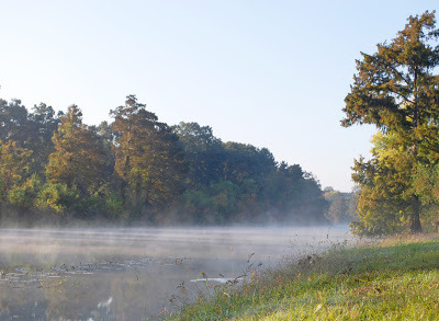 Bayou Teche on the morning of the second stage.
(Photo by author)
Early on I observed more garbage than previously in the bayou, including two basketballs and a few ice chests. Basketballs and ice chests became common sights on the Teche. (We saw about ten ice chests that day.) People spend an awful lot of money on basketballs and ice chests that ultimately become flotsam on the bayou. On this and future runs Keith and I competed half-heartedly to see who could spot the largest number of these objects.
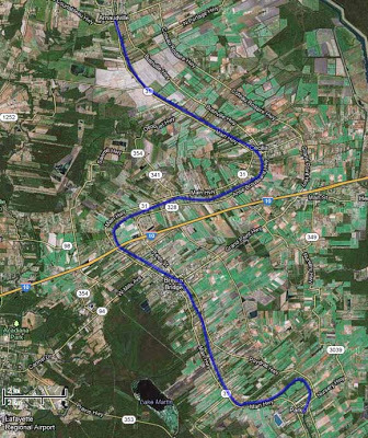 Aerial photograph of Stage 2, Arnaudville to Parks.
(Source: Google Maps)
The first town we reached that day was Cecilia [30.336093, -91.855681]. There many houses lined the Teche, one of which had a dock sporting a ship’s name plate: Argosy President. It sounded like a riverboat casino, many of which can be found along the Gulf Coast — not on the Teche, but, as I’ll discuss later, there is a land-based casino within site of the bayou farther downstream. (The nearest riverboat casino is the Amelia Belle, located on Bayou Boeuf some eight miles from the Teche’s mouth.) Some Internet sleuthing revealed that Argosy President was the former name of a 180-foot, 1,200-ton “platform ship” (built 1985) now known as the Ensco President. (Source: ShipsAndOil.com.) Given south Louisiana’s deep-rooted ties to the petroleum industry, it didn’t surprise me that the Argosy President supplied offshore oil platforms.
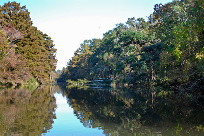 A typical bayou scene that day.
(Photo by author)
We soon paddled under Poché Bridge [30.312121, -91.902679] — known for the boudin at nearby Poché's Market on the west bank of the Teche — and a short time later saw a patch of land occupied by numerous chickens, each dwelling in its own little coop. They looked to me like fighting cocks, even though Louisiana outlawed cockfighting in 2008. Some south Louisianians condemned the ban, asserting that cockfighting was a Cajun tradition and so ought to be preserved. Indeed, the symbol of the Cajun activist group Action Cadienne — dedicated to preserving the Cajun French dialect — is a fighting cock. (I suppose one could argue that the symbol is not a fighting cock — the animal has no metal spurs or barbs attached to its legs — but merely a very angry rooster, talons poised to attack. But it seems clear to me that the symbol is meant to evoke south Louisiana’s rural cockfighting tradition.)
It was here, around Cecilia, that we first saw signs of beavers, whose gnaw marks now and then decorated the trunks of trees along the bayou. Many of these marks appeared fresh, yet we never spotted any of the creatures at work. On a later stage of the trip, when we diverted onto Bayou La Chute for a short paddle, we saw a few beaver slides — paths carved in the mud by the semi-aquatic rodents gliding into the water over and over again on the same spot. But again, no actual beavers. (They are largely nocturnal.)
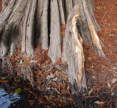 Beaver gnaw marks on a cypress knee.
(Photo by author)
On this stretch I took note of the many species of plant life along the Teche: live oak, cypress, pecan, elephant ears, reeds and rushes (called by our Cajun ancestors “les joncs”), many Chinese tallow (an invasive species). Occasionally we saw clumps of cypress knees rising from the water, or from the muddy batture, the sometimes flooded strip of land between the water’s edge and the bayou’s bank or natural levee. Some of the cypress knees along the Teche grow fairly tall, two or three feet in height. I've seen some of these knees (not necessarily those on the Teche) made into lamps or clocks.
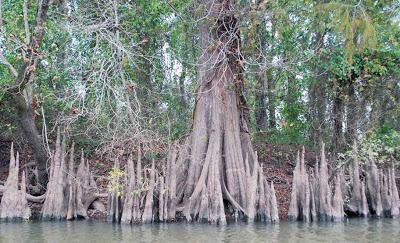 Cypress knees along the Teche.
(Photo by author)
It was also on this stretch that we found an interesting artifact protruding from the water: a rusted but intact riveted pipe [30.351333, -91.887117] about a foot in diameter and running a good eight to ten feet before disappearing into the dark, soggy bank. It looked like — well, a smokestack from a steamboat. There were certainly plenty of steamboats on the Teche from around 1830 to the steam era's final gasp around World War II. “And what if it belonged to a gunboat?” I could not help but wonder. Gunboats steamed up and down Bayou Teche during the Civil War, and sometimes went to the bottom, either because they sank in battle, were scuttled, or hit a snag.
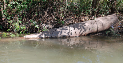 The riveted pipe.
(Photo by author)
I suspended judgment until I collected more evidence and eventually, I think, discovered the object’s purpose. Paddling downstream over several months, we saw here and there what at first appeared to be burial tombs, inevitably made of the red-orange brick common to the region. Some of these "tombs" sat close to the water’s edge; others crumbled into the water and in the shade disappeared beneath the bayou's black surface. These brick “tombs,” however, often sprouted sizable rusted iron bolts, which were clearly intended to hold a large piece of machinery in place.
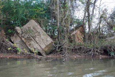 "Tombs" along the Teche.
(Photo by author)
At first I thought these “pilings,” as I began to call them in preference to “tombs,” must have been associated with sugarhouses, which once lined the bayou from St. Martin Parish to the bayou’s mouth. This was all sugar country, and one sugar plantation after another ran long the waterway. The pilings seemed to be of the correct nineteenth-century vintage for a sugarhouse. We finally noticed a piling with rusty iron machinery still bolted to it. It turned out to be a powerful steam pump — a beautiful machine that looked like it might have belonged in the engine room of the Titanic, if only it had been on larger scale. We stopped the canoe so that I could photograph it more closely. Letters embossed in the oxidized iron read:
IVENS DOUBLE SUCTION PUMPBOLAND & GSCHWIND CO LTDNEW ORLEANS LA
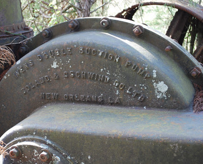 Model and manufacturer embossed on the pump housing.
(Photo by author)
Rising vertically from this steam pump stood a riveted iron pipe very similar to the one we saw in the bayou around Cecilia.
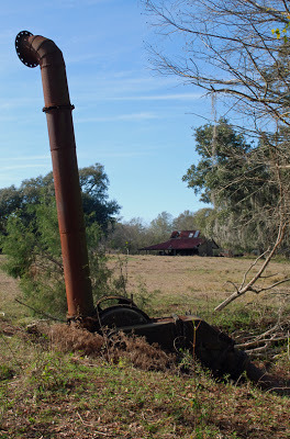 The entire pump assembly with upright riveted pipe.
(Photo by author)
But what was the purpose of this pump and the three or four others we eventually found along the Teche? Did they pump water from the Teche, or intothe Teche?
Sugarcane planting required excellent drainage, and as historians Glenn R. Conrad and Ray F. Lucas observe in their book White Gold: A Brief History of the Louisiana Sugar Industry, 1795-1995 (1995), “After the introduction of steam power, many planters installed steam water pumps to pump water over the protection levees into the back lowlands.” But the pumps we saw did not sit next to back lowlands; they sat next to the Teche itself.
 Patent drawing for a similar Ivens pump, dated 1899.
(Source: Google Books)
It is nonetheless possible the pumps fed excess rainwater into the bayou, or, in dry times, drew water from the Teche for irrigation. It may be, however, that some of these pumps were used to flood rice fields, because for a period some farmers along the Teche actually grew rice. I do not believe it is by chance, for example, that the Conrad Rice Mill (maker of KONRIKO products) stands in New Iberia, just blocks from the Teche. The mill’s location is likely a vestige of these nearly forgotten rice-growing days along the bayou.
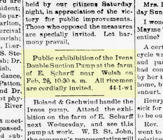 A 1902 reference to the pump in question,
from the Jennings, La., Jennings Daily Record.
(Source: Chronicling America)
In any event, I remain unsure of the exact purpose of these steam pumps.
 Approaching I-10 by canoe.
(Photo by author)
Preston, Jacques, Keith and I continued to head downstream along the bayou. South of Cecelia the bayou skirted Interstate 10, the superhighway stretching from Florida to California. The sound of speeding vehicles, including eighteen-wheelers, became increasingly loud — an unavoidable incursion of the rapid modern world into our slow exploration of the Teche. To compound this feeling a B-52 bomber circled overhead, creating mammoth shadows on the clouds below it. I’d never seen a B-52 except in photos until the previous weekend, when I attended an airshow in Lafayette; now I’d seen two B-52s in only a week. Go figure! (The nearest B-52 base is Barksdale Air Force Base in north Louisiana, some two hundred miles to the north.)
 The bayou gets wider as we paddle downstream.
Note egret in flight at left.
(Photo by author)
It was at this time that we saw our first motorboat on the bayou. Previously we had encountered only canoes, pirogues, and other small wooden boats, all paddle-driven, and none of them actually on the bayou, but on shore, leaning against sheds or sitting upside down on blocks. Even the motorboat in question was moored to a dock. It drove home the point that the Teche so far seemed underutilized by sportsmen and pleasure boaters. We had traveled some thirty miles from the bayou's headwaters and had yet to see any other boaters. At 1:40 pm we passed under I-10 [30.290904, -91.928508] and reached the outskirts of Breaux Bridge. From this point on we saw increasing numbers of “bushlines,” “trotlines” (or “troutlines,” as some say), and “juglines,” all simple but effective means of fishing on the Teche. In the case of a bushline, a fishing line with hook and sinker is tied to a low-hanging branch and left unattended to make a catch. A trotline, on the other hand, consists of a line tied horizontally over the surface of the water, say from one low-hanging branch to another, and to which are tied several fishing lines with hooks and sinkers. A jugline consists of a floating plastic jug (often an empty soda or bleach bottle), to which are tied a hook and sinker, as well as a weight to keep the jug from drifting away. It is understood that one never touches another’s lines, but once I inspected a jugline out of curiosity. Pulling up the line I found it baited with chicken and weighted by a railroad spike. I immediately put the jugline back in the water so that it could “do its thing.”
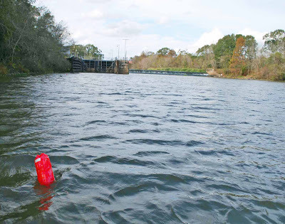 A jugline farther down the Teche,
with the Keystone Lock and Dam in background.
(Photo by author)
As we entered Breaux Bridge [30.275719, -91.897652] we saw modern suburban homes along the banks. Later, as we exited the town, we passed the entrance of the Ruth Canal [30.245531,-91.8811] in the west bank; it runs to Lake Martin and from there to the Vermilion River. Along this stretch we spotted a blue heron on the hunt and two or three dead animals in the water — deer or goats or large dogs, I couldn’t tell. We saw enough of these in the Teche to dissuade me from ever wanting to swim in the bayou, much less drink from it, or even eat a fish from it. I admire, however, the brave appetites of those bushline, trotline, and jugline fishermen.
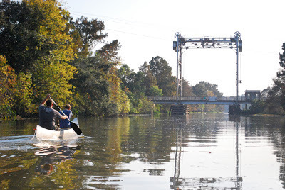 Approaching Parks, Louisiana.
(Photo by author)
Toward the end of the day we finally encountered our first fellow boater.
We landed at Cecile Rousseau Memorial Park [30.214696, -91.82829] in Parks at 4:45 pm, having covered 23.6 miles in 5 hours, 57 minutes. We now had ninety miles left to go before we reached the mouth of the Teche.
Continued in Part III. . . .
 Only in south Louisiana:
trashcan in Rousseau Park, Parks, Louisiana.
(Photo by author)
Preston, Jacques, Keith and I made stage two of our run down the Teche on November 5, 2011, putting in where we left off last time, at Arnaudville [30.397596, -91.930761], right behind Myron’s Maison de Manger. That day the sky was mostly clear and the temperature was 41 °F in the morning, 72 °F in the afternoon, and in the low to mid-50s °F by the time we got started. We paddled southeast with the current toward our stopping point, the town of Parks.
 Bayou Teche on the morning of the second stage.
(Photo by author)
Early on I observed more garbage than previously in the bayou, including two basketballs and a few ice chests. Basketballs and ice chests became common sights on the Teche. (We saw about ten ice chests that day.) People spend an awful lot of money on basketballs and ice chests that ultimately become flotsam on the bayou. On this and future runs Keith and I competed half-heartedly to see who could spot the largest number of these objects.
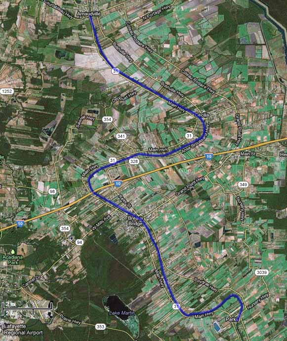 Aerial photograph of Stage 2, Arnaudville to Parks.
(Source: Google Maps)
The first town we reached that day was Cecilia [30.336093, -91.855681]. There many houses lined the Teche, one of which had a dock sporting a ship’s name plate: Argosy President. It sounded like a riverboat casino, many of which can be found along the Gulf Coast — not on the Teche, but, as I’ll discuss later, there is a land-based casino within site of the bayou farther downstream. (The nearest riverboat casino is the Amelia Belle, located on Bayou Boeuf some eight miles from the Teche’s mouth.) Some Internet sleuthing revealed that Argosy President was the former name of a 180-foot, 1,200-ton “platform ship” (built 1985) now known as the Ensco President. (Source: ShipsAndOil.com.) Given south Louisiana’s deep-rooted ties to the petroleum industry, it didn’t surprise me that the Argosy President supplied offshore oil platforms.
 A typical bayou scene that day.
(Photo by author)
We soon paddled under Poché Bridge [30.312121, -91.902679] — known for the boudin at nearby Poché's Market on the west bank of the Teche — and a short time later saw a patch of land occupied by numerous chickens, each dwelling in its own little coop. They looked to me like fighting cocks, even though Louisiana outlawed cockfighting in 2008. Some south Louisianians condemned the ban, asserting that cockfighting was a Cajun tradition and so ought to be preserved. Indeed, the symbol of the Cajun activist group Action Cadienne — dedicated to preserving the Cajun French dialect — is a fighting cock. (I suppose one could argue that the symbol is not a fighting cock — the animal has no metal spurs or barbs attached to its legs — but merely a very angry rooster, talons poised to attack. But it seems clear to me that the symbol is meant to evoke south Louisiana’s rural cockfighting tradition.)
It was here, around Cecilia, that we first saw signs of beavers, whose gnaw marks now and then decorated the trunks of trees along the bayou. Many of these marks appeared fresh, yet we never spotted any of the creatures at work. On a later stage of the trip, when we diverted onto Bayou La Chute for a short paddle, we saw a few beaver slides — paths carved in the mud by the semi-aquatic rodents gliding into the water over and over again on the same spot. But again, no actual beavers. (They are largely nocturnal.)
 Beaver gnaw marks on a cypress knee.
(Photo by author)
On this stretch I took note of the many species of plant life along the Teche: live oak, cypress, pecan, elephant ears, reeds and rushes (called by our Cajun ancestors “les joncs”), many Chinese tallow (an invasive species). Occasionally we saw clumps of cypress knees rising from the water, or from the muddy batture, the sometimes flooded strip of land between the water’s edge and the bayou’s bank or natural levee. Some of the cypress knees along the Teche grow fairly tall, two or three feet in height. I've seen some of these knees (not necessarily those on the Teche) made into lamps or clocks.
 Cypress knees along the Teche.
(Photo by author)
It was also on this stretch that we found an interesting artifact protruding from the water: a rusted but intact riveted pipe [30.351333, -91.887117] about a foot in diameter and running a good eight to ten feet before disappearing into the dark, soggy bank. It looked like — well, a smokestack from a steamboat. There were certainly plenty of steamboats on the Teche from around 1830 to the steam era's final gasp around World War II. “And what if it belonged to a gunboat?” I could not help but wonder. Gunboats steamed up and down Bayou Teche during the Civil War, and sometimes went to the bottom, either because they sank in battle, were scuttled, or hit a snag.
 The riveted pipe.
(Photo by author)
I suspended judgment until I collected more evidence and eventually, I think, discovered the object’s purpose. Paddling downstream over several months, we saw here and there what at first appeared to be burial tombs, inevitably made of the red-orange brick common to the region. Some of these "tombs" sat close to the water’s edge; others crumbled into the water and in the shade disappeared beneath the bayou's black surface. These brick “tombs,” however, often sprouted sizable rusted iron bolts, which were clearly intended to hold a large piece of machinery in place.
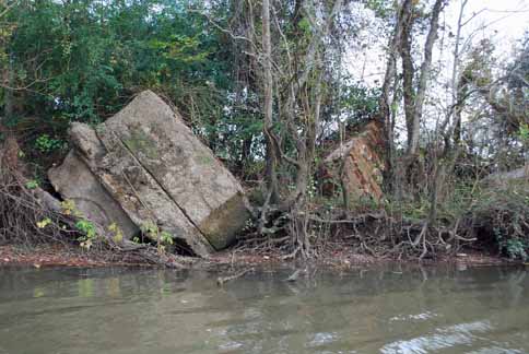 "Tombs" along the Teche.
(Photo by author)
At first I thought these “pilings,” as I began to call them in preference to “tombs,” must have been associated with sugarhouses, which once lined the bayou from St. Martin Parish to the bayou’s mouth. This was all sugar country, and one sugar plantation after another ran long the waterway. The pilings seemed to be of the correct nineteenth-century vintage for a sugarhouse. We finally noticed a piling with rusty iron machinery still bolted to it. It turned out to be a powerful steam pump — a beautiful machine that looked like it might have belonged in the engine room of the Titanic, if only it had been on larger scale. We stopped the canoe so that I could photograph it more closely. Letters embossed in the oxidized iron read:
IVENS DOUBLE SUCTION PUMPBOLAND & GSCHWIND CO LTDNEW ORLEANS LA
 Model and manufacturer embossed on the pump housing.
(Photo by author)
Rising vertically from this steam pump stood a riveted iron pipe very similar to the one we saw in the bayou around Cecilia.
 The entire pump assembly with upright riveted pipe.
(Photo by author)
But what was the purpose of this pump and the three or four others we eventually found along the Teche? Did they pump water from the Teche, or intothe Teche?
Sugarcane planting required excellent drainage, and as historians Glenn R. Conrad and Ray F. Lucas observe in their book White Gold: A Brief History of the Louisiana Sugar Industry, 1795-1995 (1995), “After the introduction of steam power, many planters installed steam water pumps to pump water over the protection levees into the back lowlands.” But the pumps we saw did not sit next to back lowlands; they sat next to the Teche itself.
 Patent drawing for a similar Ivens pump, dated 1899.
(Source: Google Books)
It is nonetheless possible the pumps fed excess rainwater into the bayou, or, in dry times, drew water from the Teche for irrigation. It may be, however, that some of these pumps were used to flood rice fields, because for a period some farmers along the Teche actually grew rice. I do not believe it is by chance, for example, that the Conrad Rice Mill (maker of KONRIKO products) stands in New Iberia, just blocks from the Teche. The mill’s location is likely a vestige of these nearly forgotten rice-growing days along the bayou.
+1900-1903,+February+20,+1902,+Image+1.jpg) A 1902 reference to the pump in question,
A 1902 reference to the pump in question,from the Jennings, La., Jennings Daily Record.
(Source: Chronicling America)
In any event, I remain unsure of the exact purpose of these steam pumps.
 Approaching I-10 by canoe.
(Photo by author)
Preston, Jacques, Keith and I continued to head downstream along the bayou. South of Cecelia the bayou skirted Interstate 10, the superhighway stretching from Florida to California. The sound of speeding vehicles, including eighteen-wheelers, became increasingly loud — an unavoidable incursion of the rapid modern world into our slow exploration of the Teche. To compound this feeling a B-52 bomber circled overhead, creating mammoth shadows on the clouds below it. I’d never seen a B-52 except in photos until the previous weekend, when I attended an airshow in Lafayette; now I’d seen two B-52s in only a week. Go figure! (The nearest B-52 base is Barksdale Air Force Base in north Louisiana, some two hundred miles to the north.)
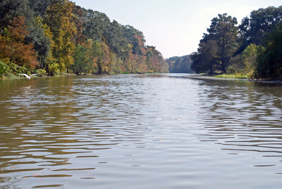 The bayou gets wider as we paddle downstream.
 Note egret in flight at left.
(Photo by author)
It was at this time that we saw our first motorboat on the bayou. Previously we had encountered only canoes, pirogues, and other small wooden boats, all paddle-driven, and none of them actually on the bayou, but on shore, leaning against sheds or sitting upside down on blocks. Even the motorboat in question was moored to a dock. It drove home the point that the Teche so far seemed underutilized by sportsmen and pleasure boaters. We had traveled some thirty miles from the bayou's headwaters and had yet to see any other boaters. At 1:40 pm we passed under I-10 [30.290904, -91.928508] and reached the outskirts of Breaux Bridge. From this point on we saw increasing numbers of “bushlines,” “trotlines” (or “troutlines,” as some say), and “juglines,” all simple but effective means of fishing on the Teche. In the case of a bushline, a fishing line with hook and sinker is tied to a low-hanging branch and left unattended to make a catch. A trotline, on the other hand, consists of a line tied horizontally over the surface of the water, say from one low-hanging branch to another, and to which are tied several fishing lines with hooks and sinkers. A jugline consists of a floating plastic jug (often an empty soda or bleach bottle), to which are tied a hook and sinker, as well as a weight to keep the jug from drifting away. It is understood that one never touches another’s lines, but once I inspected a jugline out of curiosity. Pulling up the line I found it baited with chicken and weighted by a railroad spike. I immediately put the jugline back in the water so that it could “do its thing.”
 A jugline farther down the Teche,
with the Keystone Lock and Dam in background.
(Photo by author)
As we entered Breaux Bridge [30.275719, -91.897652] we saw modern suburban homes along the banks. Later, as we exited the town, we passed the entrance of the Ruth Canal [30.245531,-91.8811] in the west bank; it runs to Lake Martin and from there to the Vermilion River. Along this stretch we spotted a blue heron on the hunt and two or three dead animals in the water — deer or goats or large dogs, I couldn’t tell. We saw enough of these in the Teche to dissuade me from ever wanting to swim in the bayou, much less drink from it, or even eat a fish from it. I admire, however, the brave appetites of those bushline, trotline, and jugline fishermen.
 Approaching Parks, Louisiana.
(Photo by author)
Toward the end of the day we finally encountered our first fellow boater.
We landed at Cecile Rousseau Memorial Park [30.214696, -91.82829] in Parks at 4:45 pm, having covered 23.6 miles in 5 hours, 57 minutes. We now had ninety miles left to go before we reached the mouth of the Teche.
Continued in Part III. . . .
 Only in south Louisiana:
trashcan in Rousseau Park, Parks, Louisiana.
(Photo by author)
Sur la Teche: Exploring the Bayou by Canoe, Stage 2
Continued from Part I:
Preston, Jacques, Keith and I made stage two of our run down the Teche on November 5, 2011, putting in where we left off last time, at Arnaudville, right behind Myron’s Maison de Manger. That day the sky was mostly clear and the temperature was 41 °F in the morning, 72 °F in the afternoon, and in the low to mid-50s °F by the time we got started. We paddled southeast with the current toward our stopping point, the town of Parks.
Bayou Teche on the morning of the second stage.
(Photo by author)
Early on I observed more garbage than previously in the bayou, including two basketballs and a few ice chests. Basketballs and ice chests became common sights on the Teche. (We saw about ten ice chests that day.) People spend an awful lot of money on basketballs and ice chests that ultimately become flotsam on the bayou. On this and future runs Keith and I competed half-heartedly to see who spotted the largest number of these objects.
Aerial photograph of Stage 2, Arnaudville to Parks.
(Source: Google Maps)
The first town we reached was Cecilia. There many houses lined the Teche, one of which had a dock sporting a ship’s name plate: Argosy President. It sounded like a riverboat casino, many of which can be found along the Gulf Coast — not on the Teche, but, as I’ll discuss later, there is a land-based casino within site of the bayou farther downstream. (The nearest riverboat casino is the Amelia Belle, located on Bayou Boeuf some eight miles from the Teche’s mouth.) Some Internet sleuthing revealed that Argosy President was the former name of a 180-foot, 1,200-ton “platform ship” (built 1985) now known as the Ensco President. (Source: ShipsAndOil.com.) Given the region’s deep-rooted ties to the petroleum industry, it didn’t surprise me that the Argosy President supplied offshore oil platforms.
A typical bayou scene that day.
(Photo by author)
We soon paddled under Poché Bridge — known for the boudin at nearby Poché Market on the west bank of the Teche — and a short time later saw a patch of land occupied by numerous chickens, each in its own little coop. They looked like fighting cocks to me, even though Louisiana outlawed cockfighting in 2008. Some south Louisianians condemned the ban, asserting that cockfighting was a Cajun tradition and so ought to be preserved. Indeed, the symbol of the Cajun activist group Action Cadienne — dedicated to preserving the Cajun French dialect — is a fighting cock. (I suppose one could argue that the symbol is not a fighting cock — the animal has no metal spurs or barbs attached to its legs — but is merely a very angry rooster, talons poised to attack. Yet it seems clear to me that the symbol is meant to evoke south Louisiana’s rural cockfighting tradition.)
It was here, around Cecilia, that we first saw signs of beavers, whose gnaw marks now and then decorated the trunks of trees along the bayou. Many of these marks appeared fresh, yet we never spotted any of these creatures at work. On a later stage of the trip, when we diverted onto Bayou La Chute for a short paddle, we saw a few beaver slides — paths carved in the mud by these semi-aquatic rodents gliding into the water over and over again on the same spot. But again, no actual beavers. (They are largely nocturnal.)
Beaver gnaw marks on a cypress knee.
(Photo by author)
On this stretch I took note of the many species of plant life along the Teche: live oak, cypress, pecan, elephant ears, reeds and rushes (called by our Cajun ancestors “les joncs”), many Chinese tallow (an invasive species). Occasionally we saw clumps of cypress knees rising from the water, or from the muddy batture, the sometimes flooded strip of land between the water’s edge and the bayou’s bank or natural levee. Some of the cypress knees along the Teche grow fairly tall, two or three feet in height. I've seen some of these knees (not necessarily those on the Teche) made into lamps or clocks.
Cypress knees along the Teche.
(Photo by author)
It was also on this stretch that we found an interesting artifact protruding from the water: a rusted but intact riveted pipe about a foot in diameter and running a good eight to ten feet before disappearing into the dark, soggy bank. It looked like — well, a smokestack from a steamboat. There were certainly plenty of steamboats on the Teche from around 1830 to the steam era's final gasp around World War II. “And what if it belonged to a gunboat?” I could not help but wonder. Gunboats steamed up and down Bayou Teche during the Civil War, and sometimes went to the bottom, either because they sank in battle, were scuttled, or hit a snag.
The riveted pipe.
(Photo by author)
I suspended judgment until I collected more evidence and eventually, I think, discovered the object’s purpose. Paddling downstream over several months, we saw here and there what at first appeared to be burial tombs, inevitably made of the red-orange brick common to the region. Some of these "tombs" sat close to the water’s edge; others crumbled into the water and in the shade disappeared beneath the bayou's black surface. These brick “tombs,” however, often sprouted sizable rusted iron bolts, which were clearly intended to hold a large piece of machinery in place.
"Tombs" along the Teche.
(Photo by author)
At first I thought these “pilings,” as I began to call them in preference to “tombs,” must have been associated with sugarhouses, which once lined the bayou from St. Martin Parish to the bayou’s mouth. This was all sugar country, and one sugar plantation after another ran long the waterway. The pilings seemed to be of the correct nineteenth-century vintage for a sugarhouse. We finally noticed a piling with rusty iron machinery still bolted to it. It turned out to be a powerful steam pump — a beautiful machine that looked like it might have belonged in the engine room of the Titanic, if only it had been on larger scale. We stopped the canoe so that I could photograph it more closely. Letters embossed in the oxidized iron read:
IVENS DOUBLE SUCTION PUMPBOLAND & GSCHWIND CO LTDNEW ORLEANS LA
Model and manufacturer embossed on the pump housing.
(Photo by author)
Rising vertically from this steam pump stood a riveted iron pipe very similar to the one we saw in the bayou around Cecilia.
The entire pump assembly with upright riveted pipe.
(Photo by author)
But what was the purpose of this pump and the three or four others we eventually found along the Teche? Did they pump water from the Teche, or intothe Teche?
Sugarcane planting required excellent drainage, and as historians Glenn R. Conrad and Ray F. Lucas observe in their book White Gold: A Brief History of the Louisiana Sugar Industry, 1795-1995 (1995), “After the introduction of steam power, many planters installed steam water pumps to pump water over the protection levees into the back lowlands.” But the pumps we saw did not sit next to back lowlands; they sat next to the Teche itself.
Patent drawing for a similar Ivens pump, dated 1899.
(Source: Google Books)
It is nonetheless possible the pumps fed excess rainwater into the bayou, or, in dry times, drew water from the Teche for irrigation. It may be, however, that some of these pumps were used to flood rice fields, because for a period some farmers along the Teche actually grew rice. I do not believe it is by chance, for example, that the Conrad Rice Mill (maker of KONRIKO products) stands in New Iberia, just blocks from the Teche. The mill’s location is likely a vestige of these nearly forgotten rice-growing days along the bayou.
In any event, I remain unsure of the exact purpose of these steam pumps.
Approaching I-10 by canoe.
(Photo by author)
Preston, Jacques, Keith and I continued to head downstream along the bayou. South of Cecelia the bayou skirted Interstate 10, the superhighway stretching from Florida to California. The sound of speeding vehicles, including eighteen-wheelers, became increasingly loud — an unavoidable incursion of the rapid modern world into our slow exploration of the Teche. To compound this feeling a B-52 bomber circled overhead, creating mammoth shadows on the clouds below it. I’d never seen a B-52 except in photos until the previous weekend, when I attended an airshow in Lafayette; now I’d seen two B-52s in only a week. Go figure! (The nearest B-52 base is Barksdale Air Force Base in north Louisiana, some two hundred miles to the north.)
The bayou gets wider as we paddle downstream.
Note egret in flight at left.
(Photo by author)
It was at this time we saw our first motorboat on the bayou. Previously we had encountered only canoes, pirogues, and other small wooden boats, all paddle-driven, and none of them actually on the bayou, but on shore, leaning against sheds or sitting upside down on blocks. Even the motorboat in question was moored to a dock. It drove home the point that the Teche so far seemed underutilized by sportsmen and pleasure boaters. We had traveled some thirty miles from the bayou's headwaters and had yet to see any other boaters. At 1:40 pm we passed under I-10 and reached the outskirts of Breaux Bridge. From this point on we saw increasing numbers of “bushlines,” “trotlines” (or “troutlines,” as some say), and “juglines,” all simple but effective means of fishing on the Teche. In the case of a bushline, a fishing line with hook and sinker is tied to a low-hanging branch and left unattended to make a catch. A trotline, on the other hand, consists of a line tied horizontally over the surface of the water, say from one low-hanging branch to another, and to which are tied several fishing lines with hooks and sinkers. A jugline consists of a floating plastic jug (often an empty soda or bleach bottle), to which are tied a hook and sinker, as well as a weight to keep the jug from drifting away. It is understood that one never touches another’s lines, but once I inspected a jugline out of curiosity. Pulling up the line I found it baited with chicken and weighted by a railroad spike. I immediately put the jugline back in the water so that it could “do its thing.”
A jugline farther down the Teche,
with the Keystone Lock and Dam in background.
(Photo by author)
As we entered Breaux Bridge we saw modern suburban homes along the banks. Later, as we exited the town, we passed the entrance of the Ruth Canal in the west bank (+30° 14' 43.80", -91° 52' 51.77"); it runs to Lake Martin and from there to the Vermilion River. Along this stretch we spotted a blue heron on the hunt and two or three dead animals in the water — deer or goats or large dogs, I couldn’t tell. We saw enough of these in the Teche to dissuade me from ever wanting to swim in the bayou, much less drink from it, or even eat a fish from it. I admire, however, the brave appetites of those bushline, trotline, and jugline fishermen.
Approaching Parks, Louisiana.
(Photo by author)
Toward the end of the day we finally encountered our first fellow boater.
We landed at Cecile Rousseau Memorial Park in Parks at 4:45 pm, having covered 23.6 miles in 5 hours, 57 minutes. We now had ninety miles left to go before we reached the mouth of the Teche.
Only in south Louisiana:
trashcan in Rousseau Park, Parks, Louisiana.
(Photo by author)

Preston, Jacques, Keith and I made stage two of our run down the Teche on November 5, 2011, putting in where we left off last time, at Arnaudville, right behind Myron’s Maison de Manger. That day the sky was mostly clear and the temperature was 41 °F in the morning, 72 °F in the afternoon, and in the low to mid-50s °F by the time we got started. We paddled southeast with the current toward our stopping point, the town of Parks.
Bayou Teche on the morning of the second stage.(Photo by author)
Early on I observed more garbage than previously in the bayou, including two basketballs and a few ice chests. Basketballs and ice chests became common sights on the Teche. (We saw about ten ice chests that day.) People spend an awful lot of money on basketballs and ice chests that ultimately become flotsam on the bayou. On this and future runs Keith and I competed half-heartedly to see who spotted the largest number of these objects.
Aerial photograph of Stage 2, Arnaudville to Parks.(Source: Google Maps)
The first town we reached was Cecilia. There many houses lined the Teche, one of which had a dock sporting a ship’s name plate: Argosy President. It sounded like a riverboat casino, many of which can be found along the Gulf Coast — not on the Teche, but, as I’ll discuss later, there is a land-based casino within site of the bayou farther downstream. (The nearest riverboat casino is the Amelia Belle, located on Bayou Boeuf some eight miles from the Teche’s mouth.) Some Internet sleuthing revealed that Argosy President was the former name of a 180-foot, 1,200-ton “platform ship” (built 1985) now known as the Ensco President. (Source: ShipsAndOil.com.) Given the region’s deep-rooted ties to the petroleum industry, it didn’t surprise me that the Argosy President supplied offshore oil platforms.
A typical bayou scene that day.(Photo by author)
We soon paddled under Poché Bridge — known for the boudin at nearby Poché Market on the west bank of the Teche — and a short time later saw a patch of land occupied by numerous chickens, each in its own little coop. They looked like fighting cocks to me, even though Louisiana outlawed cockfighting in 2008. Some south Louisianians condemned the ban, asserting that cockfighting was a Cajun tradition and so ought to be preserved. Indeed, the symbol of the Cajun activist group Action Cadienne — dedicated to preserving the Cajun French dialect — is a fighting cock. (I suppose one could argue that the symbol is not a fighting cock — the animal has no metal spurs or barbs attached to its legs — but is merely a very angry rooster, talons poised to attack. Yet it seems clear to me that the symbol is meant to evoke south Louisiana’s rural cockfighting tradition.)
It was here, around Cecilia, that we first saw signs of beavers, whose gnaw marks now and then decorated the trunks of trees along the bayou. Many of these marks appeared fresh, yet we never spotted any of these creatures at work. On a later stage of the trip, when we diverted onto Bayou La Chute for a short paddle, we saw a few beaver slides — paths carved in the mud by these semi-aquatic rodents gliding into the water over and over again on the same spot. But again, no actual beavers. (They are largely nocturnal.)
Beaver gnaw marks on a cypress knee.(Photo by author)
On this stretch I took note of the many species of plant life along the Teche: live oak, cypress, pecan, elephant ears, reeds and rushes (called by our Cajun ancestors “les joncs”), many Chinese tallow (an invasive species). Occasionally we saw clumps of cypress knees rising from the water, or from the muddy batture, the sometimes flooded strip of land between the water’s edge and the bayou’s bank or natural levee. Some of the cypress knees along the Teche grow fairly tall, two or three feet in height. I've seen some of these knees (not necessarily those on the Teche) made into lamps or clocks.
Cypress knees along the Teche.(Photo by author)
It was also on this stretch that we found an interesting artifact protruding from the water: a rusted but intact riveted pipe about a foot in diameter and running a good eight to ten feet before disappearing into the dark, soggy bank. It looked like — well, a smokestack from a steamboat. There were certainly plenty of steamboats on the Teche from around 1830 to the steam era's final gasp around World War II. “And what if it belonged to a gunboat?” I could not help but wonder. Gunboats steamed up and down Bayou Teche during the Civil War, and sometimes went to the bottom, either because they sank in battle, were scuttled, or hit a snag.
The riveted pipe.(Photo by author)
I suspended judgment until I collected more evidence and eventually, I think, discovered the object’s purpose. Paddling downstream over several months, we saw here and there what at first appeared to be burial tombs, inevitably made of the red-orange brick common to the region. Some of these "tombs" sat close to the water’s edge; others crumbled into the water and in the shade disappeared beneath the bayou's black surface. These brick “tombs,” however, often sprouted sizable rusted iron bolts, which were clearly intended to hold a large piece of machinery in place.
"Tombs" along the Teche.(Photo by author)
At first I thought these “pilings,” as I began to call them in preference to “tombs,” must have been associated with sugarhouses, which once lined the bayou from St. Martin Parish to the bayou’s mouth. This was all sugar country, and one sugar plantation after another ran long the waterway. The pilings seemed to be of the correct nineteenth-century vintage for a sugarhouse. We finally noticed a piling with rusty iron machinery still bolted to it. It turned out to be a powerful steam pump — a beautiful machine that looked like it might have belonged in the engine room of the Titanic, if only it had been on larger scale. We stopped the canoe so that I could photograph it more closely. Letters embossed in the oxidized iron read:
IVENS DOUBLE SUCTION PUMPBOLAND & GSCHWIND CO LTDNEW ORLEANS LA
Model and manufacturer embossed on the pump housing.(Photo by author)
Rising vertically from this steam pump stood a riveted iron pipe very similar to the one we saw in the bayou around Cecilia.
The entire pump assembly with upright riveted pipe.(Photo by author)
But what was the purpose of this pump and the three or four others we eventually found along the Teche? Did they pump water from the Teche, or intothe Teche?
Sugarcane planting required excellent drainage, and as historians Glenn R. Conrad and Ray F. Lucas observe in their book White Gold: A Brief History of the Louisiana Sugar Industry, 1795-1995 (1995), “After the introduction of steam power, many planters installed steam water pumps to pump water over the protection levees into the back lowlands.” But the pumps we saw did not sit next to back lowlands; they sat next to the Teche itself.
Patent drawing for a similar Ivens pump, dated 1899.(Source: Google Books)
It is nonetheless possible the pumps fed excess rainwater into the bayou, or, in dry times, drew water from the Teche for irrigation. It may be, however, that some of these pumps were used to flood rice fields, because for a period some farmers along the Teche actually grew rice. I do not believe it is by chance, for example, that the Conrad Rice Mill (maker of KONRIKO products) stands in New Iberia, just blocks from the Teche. The mill’s location is likely a vestige of these nearly forgotten rice-growing days along the bayou.
In any event, I remain unsure of the exact purpose of these steam pumps.
Approaching I-10 by canoe.(Photo by author)
Preston, Jacques, Keith and I continued to head downstream along the bayou. South of Cecelia the bayou skirted Interstate 10, the superhighway stretching from Florida to California. The sound of speeding vehicles, including eighteen-wheelers, became increasingly loud — an unavoidable incursion of the rapid modern world into our slow exploration of the Teche. To compound this feeling a B-52 bomber circled overhead, creating mammoth shadows on the clouds below it. I’d never seen a B-52 except in photos until the previous weekend, when I attended an airshow in Lafayette; now I’d seen two B-52s in only a week. Go figure! (The nearest B-52 base is Barksdale Air Force Base in north Louisiana, some two hundred miles to the north.)
The bayou gets wider as we paddle downstream. Note egret in flight at left.
(Photo by author)
It was at this time we saw our first motorboat on the bayou. Previously we had encountered only canoes, pirogues, and other small wooden boats, all paddle-driven, and none of them actually on the bayou, but on shore, leaning against sheds or sitting upside down on blocks. Even the motorboat in question was moored to a dock. It drove home the point that the Teche so far seemed underutilized by sportsmen and pleasure boaters. We had traveled some thirty miles from the bayou's headwaters and had yet to see any other boaters. At 1:40 pm we passed under I-10 and reached the outskirts of Breaux Bridge. From this point on we saw increasing numbers of “bushlines,” “trotlines” (or “troutlines,” as some say), and “juglines,” all simple but effective means of fishing on the Teche. In the case of a bushline, a fishing line with hook and sinker is tied to a low-hanging branch and left unattended to make a catch. A trotline, on the other hand, consists of a line tied horizontally over the surface of the water, say from one low-hanging branch to another, and to which are tied several fishing lines with hooks and sinkers. A jugline consists of a floating plastic jug (often an empty soda or bleach bottle), to which are tied a hook and sinker, as well as a weight to keep the jug from drifting away. It is understood that one never touches another’s lines, but once I inspected a jugline out of curiosity. Pulling up the line I found it baited with chicken and weighted by a railroad spike. I immediately put the jugline back in the water so that it could “do its thing.”
A jugline farther down the Teche,with the Keystone Lock and Dam in background.
(Photo by author)
As we entered Breaux Bridge we saw modern suburban homes along the banks. Later, as we exited the town, we passed the entrance of the Ruth Canal in the west bank (+30° 14' 43.80", -91° 52' 51.77"); it runs to Lake Martin and from there to the Vermilion River. Along this stretch we spotted a blue heron on the hunt and two or three dead animals in the water — deer or goats or large dogs, I couldn’t tell. We saw enough of these in the Teche to dissuade me from ever wanting to swim in the bayou, much less drink from it, or even eat a fish from it. I admire, however, the brave appetites of those bushline, trotline, and jugline fishermen.
Approaching Parks, Louisiana.(Photo by author)
Toward the end of the day we finally encountered our first fellow boater.
We landed at Cecile Rousseau Memorial Park in Parks at 4:45 pm, having covered 23.6 miles in 5 hours, 57 minutes. We now had ninety miles left to go before we reached the mouth of the Teche.
Only in south Louisiana:trashcan in Rousseau Park, Parks, Louisiana.
(Photo by author)
October 16, 2012
Serendipity and Fort Tombecbe: Cooperation between Historians and Archaeologists
About two years ago my friend, genealogist Winston De Ville, sent me a hand-drawn colonial-era map or plan of a fort. I wasn't sure why he sent it to me, because the plan was unrelated to any of my research. In retrospect, he isn't sure why he sent it to me, either. The other documents he included with the plan concerned Bayou Teche, a subject on which I was (and am still) conducting research. Perhaps he got the fort plan mixed up with the Teche material and sent it to me by mistake?
 The plan of a colonial-era fort.
(Source: Winston De Ville, FASG;
colorized by the author)
Regardless, he sent me the plan of the fort, I put it in my files "just in case," and I forgot about it.
Two days ago I was looking through my files and pulled out the plan of the fort. It occurred to me that another friend, archaeologist Dr. Ashley A. Dumas of the University of West Alabama, might find the plan of interest. She is presently excavating colonial-era Fort Tombecbe, located in rural Alabama. Surely it's not the same fort, I thought, but perhaps it will be useful for comparison with Tombecbe.
So I scanned and e-mailed the plan it to her, stating in my cover note, "Don't know if this is of interest to you or not."
To which Dr. Dumas replied, "Holy cow, that is Fort Tombecbe!!!! The fort I work on now! Any date associated with it? Did you find it yourself or is it online?"
 Close up of the fort in the plan.
(Source: Winston De Ville, FASG;
colorized by the author)
I didn't respond immediately as I was off doing research. A short time later Dr. Dumas wrote back again, "Can you get a higher resolution image? Can I get one? I can't read all the writing. It looks like a draft plan of the fort, possibly by Lusser. Or maybe shows changing alignment of the palisade wall? Do you see that funny little rectangle with the circle attached in one corner of the fort? That's the bread oven. I excavated a portion of that structure and that bastion corner this summer."
Still I didn't reply, spurring another e-mail from Dr. Dumas: "Shane! you're killing me. Do you know if I can get a better copy?"
When I returned to my office I did not read Dr. Dumas’ e-mails in order. I therefore was unaware she had already identified the fort in the plan as Tombecbe when I wrote back:
"What, is it a helpful map??? That's the best copy I can scan from my photocopy, which in itself is crappy. Anyway, does the map mean anything to you? (I saw ‘tombe’ in the French at top, and for a second thought it might be ‘Tombegbe’ but I don't think so; I think it's just the [French] verb ‘tomber.’)”
To which Dr. Dumas quickly responded, "No, no. It's Fort Tombecbe. Where'd you get the copy? Is there a catalog number or something that I can use. . . ?"
 Fort Tombecbe (May 1737) by Ignace Broutin.
(Source: 2012 Fort Tombecbe Archaeological Project)
I finally understood the relevance of the plan and told Dr. Dumas where to find the original. (It's in Spain.) I then re-scanned in higher resolution the archaic French writing, "inverted" the scan's color in Photoshop to generate an easier-to-read negative, and asked Dr. Dumas, "Does this help to read the French (see attachment)?"
Unfortunately, I forgot to attach the scan, prompting Dr. Dumas to e-mail me back, "There's no attachment. I think you're trying to give me a heart attack."
I eventually sent Dr. Dumas the color-inverted image (the next day when I returned to my office).
 Some of the French text on the plan of the fort.
(Source: Winston De Ville, FASG;
colorized by the author)
On examination of the plan, Dr. Dumas observed that "The scale is at the bottom and goes up to 60 toises [one toise = 6.396 U.S. feet]. I think that the strange little geometric drawings above the fort represent [early Louisiana colonial governor] Bienville's encampment of April-May 1736. The timing of this map is interesting because it coincides with Bienville's first arrival at Tombecbe to meet with Choctaw chiefs." She added, "Desperate to get a good copy!"
Despite the unintended humor and fumbling around on my part, this is a good example of "interdisciplinary cooperation" among scholars — in this case, a historian helping an archaeologist. And of course it works in reverse, too. (Oddly enough, I tend to work more with archaeologists than with other historians.) And yet the incident also serves as a good example of serendipity: Had not Mr. De Ville accidentally sent me a plan of a fort unrelated to my own research, and had I not kept it, filed it away, and stumbled across it a few nights ago while looking for something else, I might never have thought of sending it to Dr. Dumas. And even then I did not think it would turn out to be the fort she'd been excavating.
Sometimes research and discovery happens this way: I can't tell you how many things I've discovered in my own research by accident. (Take, for example, the Cajun Coonass airplane photo about which I've written previously.)
For more information on archaeology at the fort, see The 2012 Fort Tombecbe Archaeological Project blog site.

October 7, 2012
Sur le Teche: Exploring the Bayou by Canoe, Stage 1
My next book is a history of Bayou Teche (due to be finished next year). As research for this project I resolved to paddle the entire length of the bayou. I didn’t see how I could not paddle it. Had I not paddled it, someone, somewhere — at a book signing, during an interview — would inevitably ask, “Have you ever been on Bayou Teche?” to which I would have had to answer, “No — but I live two blocks from it. And I drive across it every day on the way to work.”
 The paddlers for stage one, at the Courtableau landing.
Back row: Jacques, Preston, and me; in front, Keith.
(Click images to enlarge them; photograph by author)
So I decided to explore the entire bayou, and to do so not by motorboat (which seemed like cheating), but the old-fashioned way, by canoe — all approximately one hundred thirty-five miles of it. It just seemed like the right thing to do. And this proved correct, because I found there is no substitute for seeing for oneself, from a boat, where Bayou Courtableau gives rise to the Teche, where Bayou Fuselier cuts over from the Teche toward the Vermilion, where the Teche zigzags at Baldwin and juts out at Irish Bend, running ever closer to its mouth (which actually no longer exists — I’ll explain this later).
I would not canoe the entire bayou at once, however, but in stages over many months. I planned to canoe slowly, stopping to take notes and photographs and to record GPS coordinates.
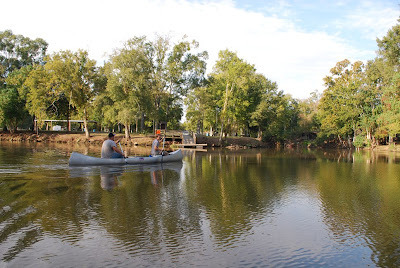 Preston and Jacques heading into the Teche from the Courtableau.
(Photograph by author)
I drafted two friends to assist me in the trek, both archaeology graduates from UL-Lafayette: Preston Guidry and Jacques Doucet. Preston’s father, Keith Guidry, made up a last-minute addition to the team; and while Preston and Jacques ended up sitting out several of the stages, Keith became a constant. In addition, Preston’s brother, Ben Guidry, filled in for him on a couple of stages; and fellow historical researcher Don Arceneaux joined us for one stage. Of this group I was the least experienced paddler, but the others, some of whom paddled often — including in the challenging Atchafalaya swamp — made up for my greenness. Together, an Arceneaux, a Doucet, three Guidrys, and a Bernard, we would seek an answer to the profound question, “How many Cajuns does it take to paddle Bayou Teche?”
 Aerial photograph of Stage 1, Port Barre to Arnaudville.
(Source: Google Maps)
We began around 9 am on October 23, 2011. The temperature that morning was cool (about 56 °F), but grew warmer in the afternoon (about 81 °F). The sky was mostly clear. We chose that day to start our trip because it fell shortly after the annual Tour du Teche canoe race. (We didn’t want to get in the way of the racers, and so let them go first.) We put in at the public boat ramp at Port Barre [30.558367, -91.954874], on the Courtableau about three hundred yards east of the headwaters of the Teche.
I later found out that the Courtableau Inn, a nightclub owned by my great-grandfather, Oscar Bordelon — first name pronounced OH-SCARE in the French manner — stood literally right across the bayou from the boat ramp, on the lot now occupied by the "Squeaky Clean Car/Boat Wash." It was there, in that nightclub around 1950, that my father heard Cajun musicians like Papa Cairo and Nathan Abshire. He also recalls slot machines lining the walls, even though the devices were illegal at the time. But those were the days of "Cat" Doucet, legendary St. Landry Parish sheriff, who treated gambling and other prohibited vices with a degree of forbearance.
 My great-grandfather's nightclub;
at far right you can see Bayou Courtableau behind the club.
(Source: The Johnnie Allan Collection, UL-Lafayette)
Within minutes of embarking we were paddling on the Teche itself, which there is narrow (varying from about 75 to 95 feet wide, not much larger than a sizable coulee), with dense tree canopies on either side reaching toward the opposite bank and pressing in toward our canoes.
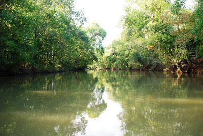 On the Teche near its origin at Port Barre.
(Photograph by author)
The current at Port Barre was fairly swift and strong — bayous are usually known for lethargic currents — and with casual paddling it carried our two canoes downstream at a decent clip. This fooled us into thinking we would make similarly fast headway the entire length of the bayou; but farther down the current slowed and, eventually, reversed — reducing our progress and making the paddling a more grueling task. By the fourth or fifth stage it took us ten or twelve hours to accomplish what we originally achieved in half that time. But this lesson would not be learned for several more months, undertaking, as we did, a stage every month to month and a half.
Shortly after leaving Port Barre we spotted a coyote running parallel to the bayou on the east bank — the first sign of wildlife on our trip. We soon saw a number of large bones on the west bank, probably cattle. Right before that we had caught a strong scent of cattle dung and must have been passing a ranch (or vacherie, as our ancestors would have called it). We would pass other ranches during the several stages of our trip. On one occasion Keith shouted something about "hamburgers" to a staring bull (or was it a horse?), to which the bull stepped forward and aggressively stomped a hoof. That much is true, but the story became more elaborate in the retelling, so that after several months it had the enraged bull jumping into the bayou to chase our canoe.
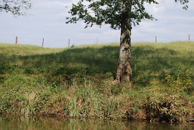 Grazing land along the Teche south of Port Barre.
(Photograph by author)
There would be plenty of other humorous stories and jokes on the trip, including recurring riffs on Apocalypse Now ("Never get out of the boat!") and, inevitably, Deliverance (explanation unnecessary). One time on that first day Keith and I stopped our canoe beside a bridge to wait for Preston and Jacques. As we floated there, someone above threw a bottle from a passing car: the bottle burst as it clipped the railing and splashed in the water beside me, still in its anonymous paper bag. "I believe someone just tried to kill me," I calmly observed, to Keith's amusement.
Not too long after seeing the coyote, Preston and Jacques spotted a water moccasin swimming in the bayou; it was, surprisingly, the only snake we saw during the many stages of our trip. Likewise, we saw only one alligator, and it was dead.
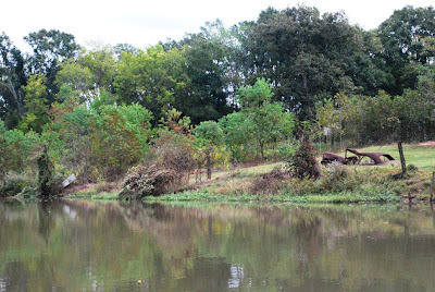 An old car along the Teche.
(Photograph by author)
I noticed much less garbage on the bayou than expected, certainly a tribute to the efforts of Cajuns for Bayou Teche. This group sponsors the Tour du Teche race and uses funds generated from the event to clean up the bayou. The largest quantity of garbage I saw that day lay inside the city limits of Port Barre, where certain persons used the banks of the bayou as private trash heaps. Outside of town, however, the garbage became less frequent. Some it was clearly vintage, which gave it a certain respectability: no one wants to see a new clothes washing machine or recent-model car half-submerged in the bayou or half-buried in its rising banks; but a rusty Depression-era clothes washer or vintage 1950s coupe are more interesting and even somehow appealing in their antiquity.
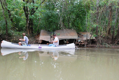 Another old car along the Teche.
(Photograph by author)
Only a few houses lined the Teche between Port Barre and the next bayouside community, Leonville [30.473495, -91.98005]. On the outskirts of Leonville, however, we saw a few suburban-style houses, which removed the illusion of being in wilderness. We reached Leonville at 11:45 am to the sounds of the church carillon. Just south of town, as we headed back into countryside, we spotted a nutria on the bank, scurrying to hide itself from us. Within the hour, just below the Oscar Rivette Bridge [30.447948, -91.924641], we saw a large owl. Five minutes later we passed under high-voltage transmission lines, whose audible hum and static made me nervous to sit between them and a body of water.
 Keith and me (in front) on the Teche.
(Photograph by Jacques Doucet)
We observed pecan pickers here and there just north of the next community on the bayou, Arnaudville, as well as a large bird I recorded as an “anhinga.” I’m no ornithologist, however, but it looked fairly large and sported dark plumage and black legs — possibly not an anhinga, but a little blue heron. We would see many herons or egrets on our stages, often a single large bird whose solitary hunting we interrupted repeatedly, spurring him farther and farther down the bayou in front of our canoes.
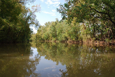 View of the Teche from my canoe.
(Photograph by author)
At 1:45 pm we arrived in Arnaudville [30.397596, -91.930761], our terminus for this stage of the trip. We pulled ashore at Myron’s Maison de Manger (excellent burgers), right below the junction of the Teche and Bayou Fuselier.
On the same side of the Fuselier stood the vacherie of my colonial-era ancestor, Lyons-born planter Gabriel Fuselier de la Claire. It’s an extravagant name, but if he had been a big wheel in France I doubt he would have chosen to brave the south Louisiana frontier. With its heat, humidity, mosquitoes, alligators, pirates, and occasional slave or Indian revolts, the French and Spanish colony was no paradise, despite its idealized portrayals in literature. (See Longfellow’s Evangeline.)
 Late eighteenth-century map of the Teche
("Teichte") showing location of Fuselier's vacherie (red arrow).
Waterway labeled "Fourche du Vermillon" [sic] is Bayou Fuselier.
(Source: St. Martin Parish Courthouse,
courtesy Don Arceneaux & George Bentley;
colorized by the author)
Fuselier de la Claire prospered in Louisiana, however, as did his heirs — but somewhere down the line (probably during Reconstruction) the family lost its fortune and ended up marrying into my impoverished clan of subsistence-farming Cajuns. The same happened to the delaMorandieres, deLivaudaises, and other French Creole aristocrats who wound up in my family tree. After a generation or so nothing remained of them culturally, except for my grandmother’s memory that her elderly in-law, the last delaMorandiere of the line, “spoke that fancy French.”
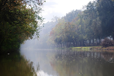 My favorite photo from that day on the Teche, October 2011.
(Photograph by author)
A folksy hand-painted sign hangs beside the bayou near the landing at Myron’s, erected by the local Sons of Confederate Veterans chapter (or “encampment,” as they call it). Erected solely for the benefit of boaters, the sign stated that several steamboats sank at that site during the Civil War.
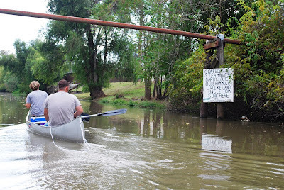 Sign listing steamboats that sank on that spot during the Civil War.
(Photograph by author)
The Official Records of the conflict indicate that the five vessels had been scuttled by the Rebels to keep them from falling into enemy hands. As a Union officer wrote in April 1863:
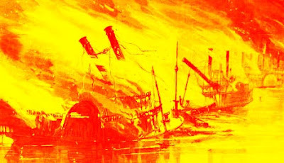 Burning steamboats.
(Source: Harper's Weekly [1869];
colorized by author)
So who knows how many cannons, shot, belt buckles, bullets, and other Civil War artifacts lay in the mud at the bottom of the bayou, artifacts we paddled over unknowingly as our trip that day came to an end.
After 19 miles of paddling we all were exhausted, but I seemed by far in the worst shape. My arms hurt as though I'd been lifting barbells for too long, and my palms, covered with a metallic sheen from the paddles, were sore with blisters. "Next time," I thought, "use gloves." By the time I reached home, I hurt all over: I don't exaggerate when I say I've never felt such excruciating pain in my arms, chest, and back. My bones themselves seemed to ache, right down to the marrow. No matter in what position I sat or lay, I could not lessen the discomfort. This was my penalty for undertaking the trip in poor shape. I swallowed some aspirin and slept horribly, but by morning the pain had disappeared except for vague aching in my upper arms. Fortunately, the pain did not return after future stages. I merely needed this first stage to break myself in.
Continued in Part II. . . .
 The paddlers for stage one, at the Courtableau landing.
Back row: Jacques, Preston, and me; in front, Keith.
(Click images to enlarge them; photograph by author)
So I decided to explore the entire bayou, and to do so not by motorboat (which seemed like cheating), but the old-fashioned way, by canoe — all approximately one hundred thirty-five miles of it. It just seemed like the right thing to do. And this proved correct, because I found there is no substitute for seeing for oneself, from a boat, where Bayou Courtableau gives rise to the Teche, where Bayou Fuselier cuts over from the Teche toward the Vermilion, where the Teche zigzags at Baldwin and juts out at Irish Bend, running ever closer to its mouth (which actually no longer exists — I’ll explain this later).
I would not canoe the entire bayou at once, however, but in stages over many months. I planned to canoe slowly, stopping to take notes and photographs and to record GPS coordinates.
 Preston and Jacques heading into the Teche from the Courtableau.
(Photograph by author)
I drafted two friends to assist me in the trek, both archaeology graduates from UL-Lafayette: Preston Guidry and Jacques Doucet. Preston’s father, Keith Guidry, made up a last-minute addition to the team; and while Preston and Jacques ended up sitting out several of the stages, Keith became a constant. In addition, Preston’s brother, Ben Guidry, filled in for him on a couple of stages; and fellow historical researcher Don Arceneaux joined us for one stage. Of this group I was the least experienced paddler, but the others, some of whom paddled often — including in the challenging Atchafalaya swamp — made up for my greenness. Together, an Arceneaux, a Doucet, three Guidrys, and a Bernard, we would seek an answer to the profound question, “How many Cajuns does it take to paddle Bayou Teche?”
 Aerial photograph of Stage 1, Port Barre to Arnaudville.
(Source: Google Maps)
We began around 9 am on October 23, 2011. The temperature that morning was cool (about 56 °F), but grew warmer in the afternoon (about 81 °F). The sky was mostly clear. We chose that day to start our trip because it fell shortly after the annual Tour du Teche canoe race. (We didn’t want to get in the way of the racers, and so let them go first.) We put in at the public boat ramp at Port Barre [30.558367, -91.954874], on the Courtableau about three hundred yards east of the headwaters of the Teche.
I later found out that the Courtableau Inn, a nightclub owned by my great-grandfather, Oscar Bordelon — first name pronounced OH-SCARE in the French manner — stood literally right across the bayou from the boat ramp, on the lot now occupied by the "Squeaky Clean Car/Boat Wash." It was there, in that nightclub around 1950, that my father heard Cajun musicians like Papa Cairo and Nathan Abshire. He also recalls slot machines lining the walls, even though the devices were illegal at the time. But those were the days of "Cat" Doucet, legendary St. Landry Parish sheriff, who treated gambling and other prohibited vices with a degree of forbearance.
 My great-grandfather's nightclub;
at far right you can see Bayou Courtableau behind the club.
(Source: The Johnnie Allan Collection, UL-Lafayette)
Within minutes of embarking we were paddling on the Teche itself, which there is narrow (varying from about 75 to 95 feet wide, not much larger than a sizable coulee), with dense tree canopies on either side reaching toward the opposite bank and pressing in toward our canoes.
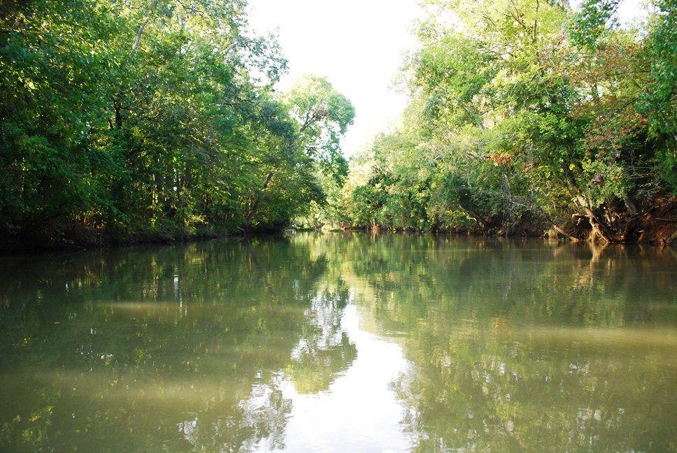 On the Teche near its origin at Port Barre.
(Photograph by author)
The current at Port Barre was fairly swift and strong — bayous are usually known for lethargic currents — and with casual paddling it carried our two canoes downstream at a decent clip. This fooled us into thinking we would make similarly fast headway the entire length of the bayou; but farther down the current slowed and, eventually, reversed — reducing our progress and making the paddling a more grueling task. By the fourth or fifth stage it took us ten or twelve hours to accomplish what we originally achieved in half that time. But this lesson would not be learned for several more months, undertaking, as we did, a stage every month to month and a half.
Shortly after leaving Port Barre we spotted a coyote running parallel to the bayou on the east bank — the first sign of wildlife on our trip. We soon saw a number of large bones on the west bank, probably cattle. Right before that we had caught a strong scent of cattle dung and must have been passing a ranch (or vacherie, as our ancestors would have called it). We would pass other ranches during the several stages of our trip. On one occasion Keith shouted something about "hamburgers" to a staring bull (or was it a horse?), to which the bull stepped forward and aggressively stomped a hoof. That much is true, but the story became more elaborate in the retelling, so that after several months it had the enraged bull jumping into the bayou to chase our canoe.
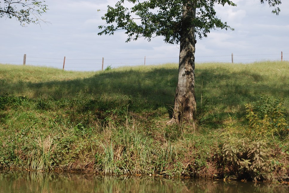 Grazing land along the Teche south of Port Barre.
(Photograph by author)
There would be plenty of other humorous stories and jokes on the trip, including recurring riffs on Apocalypse Now ("Never get out of the boat!") and, inevitably, Deliverance (explanation unnecessary). One time on that first day Keith and I stopped our canoe beside a bridge to wait for Preston and Jacques. As we floated there, someone above threw a bottle from a passing car: the bottle burst as it clipped the railing and splashed in the water beside me, still in its anonymous paper bag. "I believe someone just tried to kill me," I calmly observed, to Keith's amusement.
Not too long after seeing the coyote, Preston and Jacques spotted a water moccasin swimming in the bayou; it was, surprisingly, the only snake we saw during the many stages of our trip. Likewise, we saw only one alligator, and it was dead.
 An old car along the Teche.
(Photograph by author)
I noticed much less garbage on the bayou than expected, certainly a tribute to the efforts of Cajuns for Bayou Teche. This group sponsors the Tour du Teche race and uses funds generated from the event to clean up the bayou. The largest quantity of garbage I saw that day lay inside the city limits of Port Barre, where certain persons used the banks of the bayou as private trash heaps. Outside of town, however, the garbage became less frequent. Some it was clearly vintage, which gave it a certain respectability: no one wants to see a new clothes washing machine or recent-model car half-submerged in the bayou or half-buried in its rising banks; but a rusty Depression-era clothes washer or vintage 1950s coupe are more interesting and even somehow appealing in their antiquity.
 Another old car along the Teche.
(Photograph by author)
Only a few houses lined the Teche between Port Barre and the next bayouside community, Leonville [30.473495, -91.98005]. On the outskirts of Leonville, however, we saw a few suburban-style houses, which removed the illusion of being in wilderness. We reached Leonville at 11:45 am to the sounds of the church carillon. Just south of town, as we headed back into countryside, we spotted a nutria on the bank, scurrying to hide itself from us. Within the hour, just below the Oscar Rivette Bridge [30.447948, -91.924641], we saw a large owl. Five minutes later we passed under high-voltage transmission lines, whose audible hum and static made me nervous to sit between them and a body of water.
 Keith and me (in front) on the Teche.
(Photograph by Jacques Doucet)
We observed pecan pickers here and there just north of the next community on the bayou, Arnaudville, as well as a large bird I recorded as an “anhinga.” I’m no ornithologist, however, but it looked fairly large and sported dark plumage and black legs — possibly not an anhinga, but a little blue heron. We would see many herons or egrets on our stages, often a single large bird whose solitary hunting we interrupted repeatedly, spurring him farther and farther down the bayou in front of our canoes.
 View of the Teche from my canoe.
(Photograph by author)
At 1:45 pm we arrived in Arnaudville [30.397596, -91.930761], our terminus for this stage of the trip. We pulled ashore at Myron’s Maison de Manger (excellent burgers), right below the junction of the Teche and Bayou Fuselier.
On the same side of the Fuselier stood the vacherie of my colonial-era ancestor, Lyons-born planter Gabriel Fuselier de la Claire. It’s an extravagant name, but if he had been a big wheel in France I doubt he would have chosen to brave the south Louisiana frontier. With its heat, humidity, mosquitoes, alligators, pirates, and occasional slave or Indian revolts, the French and Spanish colony was no paradise, despite its idealized portrayals in literature. (See Longfellow’s Evangeline.)
 Late eighteenth-century map of the Teche
("Teichte") showing location of Fuselier's vacherie (red arrow).
Waterway labeled "Fourche du Vermillon" [sic] is Bayou Fuselier.
(Source: St. Martin Parish Courthouse,
courtesy Don Arceneaux & George Bentley;
colorized by the author)
Fuselier de la Claire prospered in Louisiana, however, as did his heirs — but somewhere down the line (probably during Reconstruction) the family lost its fortune and ended up marrying into my impoverished clan of subsistence-farming Cajuns. The same happened to the delaMorandieres, deLivaudaises, and other French Creole aristocrats who wound up in my family tree. After a generation or so nothing remained of them culturally, except for my grandmother’s memory that her elderly in-law, the last delaMorandiere of the line, “spoke that fancy French.”
 My favorite photo from that day on the Teche, October 2011.
(Photograph by author)
A folksy hand-painted sign hangs beside the bayou near the landing at Myron’s, erected by the local Sons of Confederate Veterans chapter (or “encampment,” as they call it). Erected solely for the benefit of boaters, the sign stated that several steamboats sank at that site during the Civil War.
 Sign listing steamboats that sank on that spot during the Civil War.
(Photograph by author)
The Official Records of the conflict indicate that the five vessels had been scuttled by the Rebels to keep them from falling into enemy hands. As a Union officer wrote in April 1863:
I was there [Breaux Bridge] informed that the steamboats Darby, Louise, Blue Hammock, and Uncle Tommy had passed up the bayou the day before — that is, the evening of the 16th instant — . . . having valuable stores belonging to the enemy. . . . I sent forward a man up the Bayou Teche to ascertain the position and condition of the boats. He reported next morning that all of them had been burned at the junction [of bayous Teche and Fuselier] as soon as the enemy learned of the arrival of my command at Breaux Bridge. . . . [At] the junction I examined the wreck of four steamboats. The water having risen after the rains of Saturday night and Sunday morning, 18th and 19th instant, I was unable to see any names on the boats, or the guns reported to have been left on the Darby. Their smoke-stacks and part of their machinery only were above water. From all the information I received I have no doubt of their being the Darby, Louise, Blue Hammock, and the Crocket. The Uncle Tommy is burned higher up in the Bayou Teche, and the wreck of this boat is high enough out of water to see her name. Cargoes of beef, rum, sugar, and commissary stores, cloth, uniforms, and large quantities of arms and ammunition were destroyed in these boats. Some barges took off portions of the cargoes of ammunition and arms from these steamboats before they were set on fire. (Source: The War of the Rebellion: A Compilation of the Official Records of the Union and Confederate Armies, Series 1, Volume 15, Part 1 (Baton Rouge-Natchez), 343-44.)
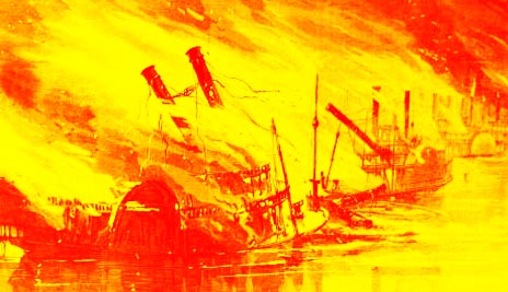 Burning steamboats.
(Source: Harper's Weekly [1869];
colorized by author)
So who knows how many cannons, shot, belt buckles, bullets, and other Civil War artifacts lay in the mud at the bottom of the bayou, artifacts we paddled over unknowingly as our trip that day came to an end.
After 19 miles of paddling we all were exhausted, but I seemed by far in the worst shape. My arms hurt as though I'd been lifting barbells for too long, and my palms, covered with a metallic sheen from the paddles, were sore with blisters. "Next time," I thought, "use gloves." By the time I reached home, I hurt all over: I don't exaggerate when I say I've never felt such excruciating pain in my arms, chest, and back. My bones themselves seemed to ache, right down to the marrow. No matter in what position I sat or lay, I could not lessen the discomfort. This was my penalty for undertaking the trip in poor shape. I swallowed some aspirin and slept horribly, but by morning the pain had disappeared except for vague aching in my upper arms. Fortunately, the pain did not return after future stages. I merely needed this first stage to break myself in.
Continued in Part II. . . .