Andy Burnham's Blog, page 206
February 15, 2020
Kestor Settlement
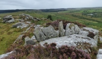
Photos from the excavation in 2005, and a link to the excavation report in the comments. Also photos from our visit last May.. On the slopes of Kestor, Chagford Comon, are the remains of a large ancient settlement with around twenty-seven hut circles. Apart from the major bronze age remains to be found, evidence of settlement dating back to the Neolithic and even before have been found here. The remains of many huts can be seen, but perhaps more impressive are the associated field systems and boundary walls.
Published on February 15, 2020 10:58
February 11, 2020
St Hilda's Church (Hartlepool)
Located on the Headland, a unique part of Hartlepool which is physically quite separate from the rest of the town, the building of the present church was begun in 1190. St Hilda is recorded as having come to Hartlepool to succeed St Bega in around AD647, taking charge of a monastery of both nuns and monks, before moving to Whitby as its first Abbess in around AD657. Displayed against the eastern wall of the St. Nicholas Chapel, on the southern side of sanctuary, can be found the Hildthryth stone, a late 7th/8th century grave marker or name stone. It is surrounded on four sides by golden ammonites, the symbol of Hartlepool.
Published on February 11, 2020 10:07
Parkfields Park Stone Circle
An impressive modern stone circle just north of Warrington with a henge, inner ring or cove of stones, solsticial (or near solsticial) alignments, outlying stones in direct alignment with the main circle, holed stones with possible astronomical alignments, a long barrow, sympathetic layout and planting of vegetation and more.
Published on February 11, 2020 08:58
February 10, 2020
Turmaden d'es Capita
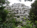
Talayot in Balearic Isles (Menorca / Minorca). A circular talayot is located near the northern edge of a plateau which provides extensive views towards the north and east. The entrance to the structure opens to the south, while its chamber is collapsed.
Published on February 10, 2020 14:12
February 9, 2020
Skottehjem Rundhøj
An Burial mound in Bornholm made of earth and stones. At the top is a larger hole, in which are found several stones.
Published on February 09, 2020 11:28
Sa Tanca 'e s'Ozzastru 3 Tomba di Giganti
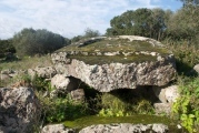
This tomb in Sardinia is built in red trachyte, with the row technique. The 9.50 m long corridor is full of debris. The bilytic stele, originally 3.20 m high, is broken and lies upside down on the entrance to the burial chamber.
Published on February 09, 2020 11:25
February 7, 2020
Callanish 11
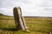
Geophysical survey finds evidence of a stone circle at this standing stone site in the Calanias complex, and possible an ancient lightning strike - more in the comments on our page . Standing Stone in Lewis on a peat-covered terrace about fifty metres across. There is a fine view across the whole Callanish area from this spot.
Published on February 07, 2020 10:11
Clickhimin
A good example of a broch tower with associated secondary buildings of Iron Age date. Location about 1m SW of Lerwick on the A970
Published on February 07, 2020 07:55
February 4, 2020
Hawk's Tor (South)
A recently discovered stone row in Cornwall, very different in character to all of the others in South West England. The single row is made up of five large and medium sized stones wedged into a natural crevice and packed with smaller stones. It measures only 4.7m long, and points at a "dramatic notch in an adjacent tor". It also has views across to Lundy, the Bristol Channel and the Plymouth Sound.
Published on February 04, 2020 04:15
Eylesbarrow
The remains of two very large oval cairns on the summit of Eylesbarrow. The easternmost, called Eylesbarrow, measures 28m east to west and 26m north to south with a height of 1.8m. The other measures 20m east to west and 22m north to south and is 1.2 m high.
Published on February 04, 2020 04:15


