Adam Yamey's Blog: YAMEY, page 228
December 6, 2017
IN THE GODS' OWN COUNTRY - ISLAM & CHRISTIANITY IN KERALA

Until recently, I had blithely assumed that Islam entered the Indian subcontinent from its northwest fringes – from Afghanistan and elsewhere. In November 2017, I made a trip to Kochi (Cochin) in Kerala during which we were taken to see a mosque, the first to be built on the Indian subcontinent. Built long before the Mughal invasion, it is in the Kodungallur district on the estuary of the River Periyar, about thirty kilometres north of Ernakulam. I learned that this small area of southwestern India is of historical significance for at least three religions.
Kodungallur, watered by the River Periyar and backwaters, was a globally-important historical economic area, variously known as: ‘Muziris’, ‘Cranganore’, and ‘Shingly’. Until it silted up (many centuries ago), it was one of the ports where much trade (export of: spices, textiles, pearls, gems, and other exotic valuables) occurred between foreigners from the west and the local inhabitants. The silting resulted from the opening-up of a passageway for the River Periyar from the lagoon to the Arabian Sea at Cochin (now ‘Kochi’). This reduced the flow of the river through the backwaters between Cochin and its original mouth near Kodungallur, and caused its consequent clogging up.
Long before the invasion of the Portuguese in the 15th century (AD), these foreigners included the Greeks, the Romans (who were great consumers of pepper from Kerala), the Arabs, the Jews, the Chinese, and many others. The Romans spent so much on pepper that ancient authors recorded that it led to a great depletion in the empire’s coffers. Once, I visited a museum in Kozhikode (Calicut), which had many examples of foreign coins (Roman and otherwise) that had been found in the area. Extensive finds of ancient foreign coins have also been made in the Kodungallur area.

After crossing the water in a vehicle ferry from Fort Cochin, we drove along the long, slender Vypin Island through luxuriant, densely populated, countryside towards Kodungallur. The roads in this crowded tropical Garden of Eden were richly ‘decorated’ with flags and posters bearing the hammer and sickle of Communism, and placards showing portraits of Marx, Engels, Lenin, and, sometimes, Stalin and/or Che Guevara. The Communists have been an important and, most say, a constructive political influence in Kerala since the 1950s.

When we parked in Kodungallur, I spotted a banner with a fine portrait of Stalin opposite the Cheraman Jumma Masjid. This mosque was established during the life of, or very shortly after the death of, the Prophet Muhammad (c. 570-632 AD).
It is said that one night the Hindu ruler of Kodungallur Cheraman Perumal (a member of the Chera dynasty) had a dream in which the full moon was split in two. No one could explain the meaning of this until he met some traders, who had sailed across from Arabia. Their explanation led Cheraman to travel to Mecca, where he met the Prophet Muhammad, and became converted to Islam. He sent word back to Kerala that his people should embrace Islam and follow the teachings of Malik bin Deenar (died 748 AD), whom he dispatched to India. Cheraman, who remained for some years in Arabia, died on his way back to India.
When Malik arrived in Kodungallur, he was permitted to build what is now called the Cheraman Mosque. This was the first ever mosque to be constructed on the Indian subcontinent. Nothing remains of the original building. It was reconstructed in the 11th century, then again in the 14th. In 1504, the mosque was destroyed by the Portuguese when Lopo Soarez de Algabria (c. 1460-1520) attacked Kodungallur (see: “Muslim Architecture of South India”, by M Shokoohy, publ. 2003). Later, it was rebuilt, and in 1974 it was enlarged and surrounded by a modern structure. What the visitor sees from outside is largely unexceptional apart from the tiled roof of the oldest part of the mosque which can be seen above the modern extensions.

Male visitors may enter after washing their feet in a special area close to the mosque. I was shown the inner sanctuary, which is all that remains of the pre-1974 building. A remarkable feature is a large metal lampstand in which oil lamps (‘diyas’) may be held. This lampstand would not look out of place in a Hindu temple. The wooden ‘mimbar’ (pulpit) is elaborately constructed and delicately decorated. Next to it is the ‘mihrab’, a niche in the wall facing in the direction of the Kaaba in Mecca, with its semi-circular arch. This is a part of the mosque built in the 16th century. There are two graves draped with red and green silk cloths in a small room leading off from the inner sanctuary. These are the graves of Habib bin Malik and his wife Khumarriah. A door beyond the graves leads into a poky room from which women are allowed to view the graves. Although Malik bin Deenar was the first ‘Ghazi’ (leader) of the mosque, he handed it over to his relative Habib after a few years. Malik was buried elsewhere in Kerala (at Kasaragod).

The museum and gardens of the mosque are open to all. The garden has an attractive square tank (rather like a Hindu temple tank), where fishes swim. It is next to a cemetery. I noticed that several trees growing nearby were home to a colony of large bats, who hung from branches upside down and motionlessly.

The museum attached to the mosque contains a lovely model of what the mosque must have looked like before it was modernised. Like some historic mosques that I have seen in Kozhikode, the earlier Cheraman mosque, was similar architecturally to Hindu temples (and other buildings) in Kerala. Other exhibits included photographs and a wooden funeral bier. I was thrilled to stand where Islam made its first concrete foothold in India. This shrine is a site that is more evocative than visually interesting. I was told that the mosque has very few foreign visitors, who are neither Muslim nor Arab, and that I was one of its rare ‘white’ tourists.
From the Cheruman Mosque, it is a short drive to the Thiruvanchikulam Mahadeva Temple (‘Mahadeva’ for short). This Hindu temple, probably first built in the 8thcentury (AD), is dedicated to Shiva. The earliest recorded reference to it is in some Tamil hymns, which were first recorded in writing in about the 10thcentury. With its many steep, often gabled, tiled roofs, it is a typical example of Keralan temple architecture. Some buildings within the temple’s compound have several roofs, each one projecting from different levels of the building, producing a pagoda-like effect that is characteristic of many temples and other buildings in Kerala.

The white outer walls of the central building, the inner sanctum, are covered, from ground to roof-level, with dark timber planks arranged to form a huge lattice of rectangles, rather like a huge set of pigeon-holes. At the base of each rectangle, there is a small horizontal metal dish that can be used to hold oil and a taper. When lit, each of these little dishes become small diyas (lamps).
To the rear (east) of the central sanctuary, there is a shelter supported by eight thick circular columns with Doric capitals. Immediately east of this, but within the walls of the compound, there is a tall pagoda-like building whose stone walls are covered with elaborately carved pilasters. This building is above the compound’s eastern doorway.

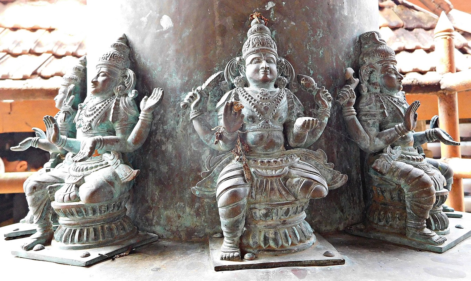
Under the shelter, we saw a set of weighing scales. These are used to weigh offerings to the temple. For example, a donor would sit on one of the weighing pans, whilst his gift (be it rice or gold) is loaded on the other pan until it weighs the same as its donor. The scales were close to a tall metal lamp stand used for oil lamps. A simple wooden ladder rested against it. This is used to place, and light, diyas out of reach at the top of the tall stand. The base of the stand was sculpted in the form of a tortoise. Set into the floor surrounding the lampstand there were several prostrate women carved in stone, their clasped hands pointing towards the stand. Between them and the inner temple building, there was a ring of seated metal sculpted deities, each with four arms.
Many of the roof gables were decorated with painted sculptures of religious figures. Some of these supported the edge of the tiled roofs of the gables like caryatids. Apart from the buildings already described, the compound contained several smaller buildings housing shrines. Unfortunately, during our visit there was nobody about to unlock any of the buildings including the main temple.
Less than six kilometres southwest of the Temple lies the St Thomas Shrine (in the district of Azhikode) also known as the ‘Marthoma Church’. It stands close to the north bank of the River Periyar about two kilometres from its entry into the sea. It is at, or near, this spot where the apostle St Thomas is supposed to have landed in India in 52 AD, some five to six centuries before Islam reached the same district. I have injected an element of uncertainty because some authorities have proposed that Thomas first set foot in India in various places far away from Kerala. However, many agree that he landed first somewhere near to modern day Kodungallur, and this has been commemorated by the shrine, which was built in its present incarnation in the early 1950s. It replaces an earlier church in old Cranganore, which was destroyed during a battle between the (Roman Catholic!) Portuguese and the Muslims in 1536.

The shrine that faces the lovely tree-lined shores of the River Periyar is a flamboyant construction painted in white. The domed church, which lacks any architectural merit and contains a relic of St Thomas, lies between two sweeping curved colonnades topped with statues. The relic was brought to Kerala from Italy in 1953. The whole structure, church and colonnades, looks like an elaborate wedding cake or the set for a Bollywood dance routine.
Between the church and the water, there is a tall shiny metal column surmounted by a golden cross with two cross-bars. This high structure resembles those often found in or outside Hindu temples (used for holding diyas). We noticed that these columns, inspired by those associated with Hindu temples, are becoming quite common outside churches in Kerala. Both in mosques and churches that I have visited in India, features ‘borrowed’ from Hinduism can be found within them. Despite the introduction of ‘newer’ religions such as Christianity and Islam, it seems that Indian worshippers do not entirely abandon their ‘Hindu heritage’.

There is a colourful building, the Marthoma Smruthi Tharangam, which is next to the church and behind one of the colonnades. Its imaginative architectural style defies categorization. You might describe it as ‘A Keralan Disneyland meets the Vatican’. The building houses a theatre where ‘digital shows’ describing the life of St Thomas and the story of his relic may be watched.
St Thomas is believed to have been martyred in Chennai. There is a cave, which I have visited, at the top of St Thomas Mount in Chennai, where the saint was speared. It contains a slab of rock in which there are two hand-shaped impressions, which are believed to have been made Thomas’s hands. This cave, like the shrine at Kodungallur, attracts many pilgrims.
When St Thomas landed in Kerala, there were already Jews living there. Shortly after his arrival, following the destruction of Jerusalem in 70 AD, many more arrived as refugees. Jewish people have been associated with Kerala for a long time. For how long, the historians disagree. Most agree that Jews on King Solomon’s trading vessels visited the Keralan ports about 900 years before Christ’s birth. These Jewish mariners are believed to have brought exotic items such as peacocks, monkeys, and ivory from India to Solomon’s palace in the Holy Land. It is unlikely that any of Solomon’s people settled in Kerala.
From some centuries before and after the birth of Christ, Cranganore was ruled by the Chera dynasty. The Cheras permitted the settlement of Jewish people in Cranganore. Their descendants lived in India until after independence (in 1947) and the foundation of Israel, where many of India’s Jews migrated (for economic reasons).
The Cheras allotted the Jews a small piece of land, named Anjuvannam, in the Cranganore district, which became a ‘Jewish kingdom’. Its inhabitants collaborated in many fruitful ways with their Chera, and then later, Chola hosts.
Various factors including the silting up of the Periyar as well as the decline of the Chera dynasty and their succession by the rival Cholas, caused many of the local Jewish people to move to Cochin. However, some Jews remained in what remained of Cranganore after it became less important than Cochin. The Jewish ‘kingdom’ of Anjuvannam continued after the fall of the Chera dynasty, which fell in the 12th century. By the time that the Portuguese began establishing themselves in Kerala, the Jewish community in Cochin was much more significant economically than that in Cranganore.
Today, several synagogues still stand in the Kodungallur, the old Cranganore, area. There was a total of twelve in Kerala during the heyday of Jewish presence in the state. We visited two synagogues near Kodungallur. Both have been looked after well, but are no longer used for worship. The two that we saw are far less-visited than the well-known and undoubtedly beautiful Pardesi Synagogue in bustling Mattancherry, in whose Jew Town the Jewish traders, of which only one remains, have been replaced by mainly Kashmiri Muslim traders, who are, incidentally, excellent salesmen.

The Paravur synagogue was first established in the 12th century AD, and then renovated by David Yakov Castlier in the late 16th, or early 17thcentury. Its architecture is typically Keralan. The first floor of the front entrance building has a deep veranda beneath a tiled roof supported by four pairs of columns. A covered passageway lined by stout columns leads from the entrance to the synagogue itself. The roof of the corridor is lined with wood.
The synagogue’s interior is simple. The original fittings have been moved to Israel, and have been replaced by replicas. If you were unaware of this, you would believe that you were seeing the originals. The carved wooden ark, or cupboard, in which the Torah scrolls were kept, has been reproduced, but is empty. The centrally located circular ‘bima’ or pulpit is wooden, constructed with turned wood balustrades. As with other synagogues in Kerala, there is an upper bima, which is formed by a semi-circular platform projecting from the first-floor gallery where women worshippers were required to be. The upper bima, a speciality of Keralan synagogues, was used only on special occasions, whereas the lower one was for routine use.

Women worshippers entered their first-floor gallery by way of the covered corridor running above that which connects the entry building to the ground floor of the synagogue. This upper corridor is lined with wooden slats which curve outwards from the floor towards the arched ceiling. In cross-section, this corridor resembles the hull of a boat. The slats sheltered women from the sun, and, also, made them difficult to see from outside.
Descriptive notices and photographs line the walls of the synagogue’s buildings. These provide information about Jewish life as it was in Kerala. From Paravur, it is a short drive (about two kilometres) to the smaller Chendamangalam Synagogue, which is close to the left bank of the Periyar. This synagogue was first built in 1420 AD, rebuilt after a fire in 1614, and renovated several times since. In the grounds in front of the main entrance, there is a small stone memorial to Sara, daughter of Israel, who died in 1269. This might have been brought by the Jews who migrated to Chendamangalam in the 13th century.


The entrance hall of the synagogue leads into the main prayer space through a door surrounded by colourful paintwork. Glass lamps of various designs hang from the colourful wooden ceiling decorated with carved, painted lotus flowers. The centrally located circular wooden bima is similar in design to that at Paravur. As in Paravur, there is an upper bima, which forms part of the gallery reserved for women. The female congregants stood or sat behind wooden lattice-work screen, the ‘meshisah’, hidden from the men during services. A staircase leads from the main entrance to the women’s area behind the screen. Another staircase with carved wooden banisters allowed the clerics to climb up from the main prayer area to the upper bima without having to see the women.

The ark, which was used to contain the Torah scrolls, is made of colourfully painted teak wood. There are three intricately carved pillars decorated with floral motifs on either side of the cupboard doors. The doors are also covered with painted plant motifs in bas-relief. The luxuriant decorative vegetation continues as decoration on the parts of the ark above the doors. Red, green, and gold are the colours which figure most on this almost baroque piece of furniture.
In the small grounds within the synagogue’s perimeter walls, there are a few gravestones with inscriptions in Hebrew.

I noticed a carved circular stone, whose perimeter was carved with a ring of leaf-shaped depressions. These were probably filled with oil and tapers, and then lit to be used as diyas. Thus, we find the diya holders characteristically used in Hindu temples not only in temples but also in mosques, churches, and synagogues. The reason for this is likely to have been because this was the normal form of lighting in India of old.
Most of Kerala’s Jewish folk have left for foreign parts. Neighbouring the synagogue in Chendamangalam, there is a newly built house bearing a Jewish name plate. The guardian of the synagogue told us that this was the home of a Keralan Jew who had left for Israel, but had returned to Kerala to live out his retirement.
We returned via the Vypin ferry station to Fort Cochin, where we were staying. On our way we drove along roads decked with Communist (and, also, BJP) banners. Our route took us past peaceful, rustic backwaters with occasional Chinese fishing nets. These backwaters are far more pleasant than those near to Alleppey, which are unpleasantly congested with boats and house-boats used by tourists.

Our brief visit to the Kodungallur district, a centre of global trade many centuries ago, was fascinating. It is an area, where four religions co-exist peacefully, and where two of them are supposed to have entered the Indian subcontinent. While reading about the history of this small corner of Kerala, one thing impressed me. That is, the almost complete lack of certainty about its early history. Like St Thomas, its story is full of doubts. To quote the small guidebook I bought at the Cheraman mosque:
“Total absence of reliable historical records make early history of Kerala a bundle of legends.”
PLEASE VISITADAM YAMEY'SWEBSITE:http://www.adamyamey.com


November 24, 2017
EXPLORING INDIA WITH A BABY

It was early in 1996. We never intended taking our nine-month old daughter to visit Hampi in the Indian state of Karnataka to see the ruins of the once great city Vijayanagara, which had in its heyday rivalled Rome in its splendour. We had hoped that her grandparents in Bangalore were going to baby-sit for us, but just before my wife and I were about to depart they felt unable to oblige. So, with little preparation, we boarded the sleeper from Bangalore to Hospet, the nearest town to Hampi. My wife clutched our little one on a narrow, hard, swaying railway bunk bed, desperately trying to prevent her from falling off.
At Hospet, our hosts, officials at a local mining company, greeted us with banners which they had made for us. They drove us to a comfortable hotel, whose rooms lacked air-conditioning and fridges. The ambient temperature never dropped below thirty Celsius, even at night. When our daughter needed a bottle of milk, we prepared it, and had to use, and then dispose, of it in less than 45 minutes because in that heat the artificial milk deteriorated rapidly.
Hospet in 1996 was less sophisticated that it was, say, a decade later. We ate in simple restaurants, often outdoors under shades. Our daughter took a shine to the South Indian food that we were usually served. She took this from our plates and, also, to our horror, off the not too clean floor. Years later, I can report that unlike many of her school friends she has never suffered from allergies. I am sure that her foraging in Hospet is to some extent to be thanked for that.

Occasionally, I felt like eating North Indian food. We found places, which bore the notice “NIDS”, which meant ‘North Indian dishes served”. I should have known better than to order a ‘NID’ in a very provincial South Indian area, but I did, and was usually disappointed by the curious concoctions that appeared on my plate. On one occasion, I ordered a ‘Peshawari naan’, something that I love. What arrived was surreal. It looked like a circular pizza base that had been painted bright green, and it was covered by bits of dried fruit and fresh banana. It was almost, as they say in the USA: ‘close, but no cigar’.
Optimistically, we had taken a folding ‘buggy’ to Hospet. This never got used, as there was hardly a square metre of ground smooth enough to roll it. Luckily, our hosts drove us around the vast archaeological site in a large four-wheel drive. Our daughter, sat happily perched on or other of our laps as we bounced across the rough ground between the various attractions.
In 1996, the ruins at Hampi were in a far better condition than they are now. For example, the Vittala Temple with its musical pillars was in fine condition. Now, it is a sad shadow of what it was in 1996. It has been vandalised by evil-doers as well as by the authorities, who have tried to save it from collapsing by adding hideous concrete supports. Back in ’96, it was possible to wander from one attraction to another through a landscape romantically dotted with fragments of earlier civilisations, both Hindu and Islamic. In contrast, today the major attractions are walled off, and attract entry fees. Although I consider Hampi still to be a most exciting archaeological area, it has lost some of the charm that it had when we visited with our baby. She has not only visited Hampi thrice since and is planning another trip soon, but has also grown up to become a professional art-historian. I like to think that her early exposure to mediaeval Indian art has played a role in the evolution of her professional interests.
Our baby had no difficulty with the high temperatures and discomforts during our visit to Hampi and Hospet. She seemed to have enjoyed it immensely. Not only that, but so did the locals. Wherever we went, and this was true of most other places that we visited in India in 1996, she was adored by everyone including total strangers. We had thought that I, a ‘gora’ (a fair-skinned non-Indian), would have attracted attention during our trip from Bangalore, but this was not the case. I was ignored, but our little child was mobbed by well-meaning passers-by, especially little boys who patted her affectionately and told us how sweet she was.

Some short while after our trip to India, we visited Italy, a country famed for spoiling children with affection. At the end of our visit, we concluded that the Indians are far more ‘soppy’ about little children that even the Italians.
Enjoy books written by the author-dentist, ADAM YAMEY.Visit: http://www.adamyamey.com
October 21, 2017
A SURPRISING VILLAGE IN ESSEX
 James Thorne wrote (in his “Handbook to the Environs of London”) in 1876: “East Tilbury is curiously out-of-the-way and old world like…”. It retains its feeling of being out-of-the-way, but no longer looks old world. Apart from the church, its rectory, and the fort, there are four cottages dated 1837. The rest of the buildings are much newer. The same goes for the village’s only pub, The Ship, which was rebuilt in 1957 when it looked the same as it does today. There has been an inn on its site since the 18th century, and maybe earlier. I had a mediocre lunch in the pub. I thought that was nowhere else to eat in the small village, but later discovered that the Fort (see below) has a café.

The flint and rubble gothic church of St Catherine contains much fabric dating back to mediaeval times, back to the 12th century. When viewed from the north or east, the church does not appear to have a tower. The reason is that the tower and part of the south aisle were destroyed by naval artillery in a battle between the British and the Dutch at Tilbury Hope in 1667. According to contemporaneous church records, by 1667 the tower was already in a poor state. Some say that it might have collapsed without the help of military intervention.

From the south side of the church, you can see an ugly square-based stone addition to the old church. This stump is all that was built of a replacement tower begun in the First World War by men of a garrison of the Coalhouse Fort (see below). It was to have commemorated those fallen in WW1. However, the authorities stopped the building works because the builders were not following correct procedures. Across the road from the church, stands the Rectory, an elegant brick building with large windows. It was built in the early 1830s to replace an earlier one which had been badly damaged in the battle mentioned above.

The village’s only thoroughfare continues downhill, almost to the north bank of the Thames. It ends at the car park for visitors to the Coalhouse Fort. During the early 15th century following an infiltration of the Thames by the French, King Henry IV allowed the inhabitants of East Tilbury, at that time classed as a ‘town’, to build defensive ramparts. In 1540, King Henry VIII ordered that a ‘blockhouse, be constructed at Coalhouse Point. This point on a curve in the Thames is so-named because by well before the 18thcentury coal was being unloaded from craft at this ferry point close to the village. The coal was transported westwards towards Grays and Chadwell along an ancient track known as the ‘Coal Road’.

In 1799, when it was feared that the French led by Napoleon Bonaparte would try to invade via the Thames, a new gun battery was built at East Tilbury. In the 1860s, when another French invasion was feared, a series of forts were built along the shores of the estuary of the Thames. One of these was the Coalhouse Fort at East Tilbury. Thus, the by then somewhat insignificant village became part of London’s defences.

The Fort was built between 1861 and ’74. Surrounded by a semi-circular moat and raised on a mound, the Fort is not particularly attractive. However, it is set in beautifully maintained parkland. From the slopes of the mound, there are great views of the Thames, which sweeps around the point, and its rural southern shore. The moat is separated into two sections by a short sharp-ridged stone wall, which was likely to have been built when the Fort began to be constructed. When I looked for the Fort on old detailed (25 inch to the mile) Ordnance Survey Maps (pre-1939), the moat is marked, but the Fort is not (probably, in theinterests of security). A ‘Coalhouse Battery’, which ran more-or-less parallel to the village’s only street was marked as “dismantled” on a 1938 map, but not the Coalhouse Fort.


The outer walls of the Fort have had all manner of later structures built on them: gun-emplacements, searchlight emplacements, and other shelters, whose functions were not obvious to me. There is a large concrete bunker outside the Fort, between it and the moat. Its shape might be described as three intersecting concrete blocks. This is marked on the tourist map as a ‘minefield control tower’. I believe that was it used to control electrically-fired mines in the estuary. Nearby and closer to the river, there is a smaller concrete bunker. The Fort’s interior was closed when I visited it, but I was able to get a peek through its main gates, which were open. Tramway tracks lead into the Fort. Old maps show that these led from the Fort to a small landing stage at Coalhouse Point, which is a short distance southwest of the Fort. The Fort ceased to be used after 1957.

Just over a mile north-west of the Fort, the road to East Tilbury Station passes through a most fascinating place. One of the first things you will see along the road from the Fort is a vast factory, which closed in 2005. Made of concrete and glass, but in a poor state of decoration, its flat roof carries a high water-tower labelled ‘Bata’. This was part of the factory complex that the Bata Company began building in 1932.
The Czech Thomas Bata (1876-1932) was born in the Moravian town of Zlin. He became the founder of Bata Shoes in 1894 in Zlin. He modernised shoe-making by moving it from a craftsman’s process to and mechanised, industrialised one. Bata’s company also revolutionised the way industrial enterprises were run, introducing a profit-sharing system that involved all of its workers, and provided a good reason for them to work enthusiastically. During the period between the two World Wars, the forward-thinking Bata opened factories and individual companies in countries including: Poland, Yugoslavia, India, France, Holland, Denmark, the United Kingdom and the USA. The company in India is still very active, almost every small town or village having at least one Bata retailing outlet. I have bought many pairs of comfortable Bata-manufactured shoes from Bata stores in India.
In anticipation of WW2, Bata’s son, the prudent Thomas J Bata (1914-1980), and one hundred other Czech families firm moved to Ontario (Canada) to form a Canadian Bata company. After WW2, the Communist regimes in Czechoslovakia and other ‘iron-curtain’ countries nationalised their local Bata firms. Meanwhile, Thomas J continued to develop the Bata firms in Canada and the UK, and opened up new Bata companies and factories in Asia, Africa, the Middle East, and Latin America.Bata senior was keen on the ‘Garden City Movement’. He was concerned that his workers lived (close to his factories) and worked in a pleasant environment, and lacked for nothing. A pioneer of this in the UK was Titus Salt, who built his gigantic mill in the 1860s near Bradford in West Yorkshire. He created a new town, Saltaire, around his textile factory. This consisted of better than average homes for all of his workers (and their families) from the humblest to the most senior. In addition, he built schools, a hospital, open-spaces, recreation halls, a church, and other requisite of Victorian life. In Zlin, Bata created something similar, a fully-equipped town for his workers in park-like surroundings around his factory in the 1920s. The homes he built for the workers are still considered desirable today.

The factory at East Tilbury, was another example of a town built specially for its workers. One lady with whom I spoke there told me that she had worked for Bata’s for twenty-seven years. She told me that in its heyday the Bata ‘town’ was self-sufficient. It had workers’ homes, shopping facilities (including a supermarket and a Bata shoe store), a restaurant, a hotel, a cinema, a school, a library, farms, and playing fields.The factory buildings at the East Tilbury site, some of which have been adopted by other businesses, were built using a construction system devised (employing reinforced concrete frames that allowed for great flexibility of design) by the Czechs Frantisek Lydie Gahura (1891-1958), Jan Kotera(1871-1923), and Vladimir Karfic(1901-1996). The site bought by Bata in Essex in late 1931 was ideally placed in level open country near to both the railway and the river. His intention was to build a vast garden city around his factories, which was to produce boots and shoes in East Tilbury.Mr Bata senior was killed in an air-crash in 1932 near Zlin, and so never saw the completion of his creation in Essex, whose construction only began in early 1933. Construction of the factory buildings and the workers’ housing went on simultaneously. By 1934, twenty semi-detached houses of the same design as those in Zlin were built by local builders, and equipped with Czech fittings. The houses look just like many houses built in Central Europe. As Steve Rose wrote in The Guardian newspaper (19th June 2006):“East Tilbury doesn’t look like it belongs in Britain, let alone Essex, and in a sense it doesn’t. It’s a little slice of 1930s Czechoslovakia, and the most Modern town in Britain.” Later, more homes were built, but designed like many British suburban houses.

There is a huge building across the main road opposite the factory buildings. Part of its ground floor is now home to a Co-op supermarket. The whole building, which has now been converted to flats, was the ‘Bata Hotel’. Until recently, the Co-op was still named the Bata supermarket. One man, who has lived in the Bata Estate for many years, told me that he recalled seeing swarms of workmen in white protective clothing crossing the road from the factory and then entering the hotel during their lunch-break. He told me that the first floor of the hotel was a ‘restaurant’ for the factory workers.

I met this man in what is now called ‘East Tilbury Village Hall’. This was formerly the Bata cinema.Looking somewhat Central European in design, the former cinema was undergoing much-needed electrical re-fitting. In a way, I was lucky because the workers had left the door open to a building that is often locked closed these days. I entered the foyer, which was being used to store the stock of the local public library. An office to the left of the foyer used to serve as the cinema’s ticket office. A couple of old-fashioned film posters have been put on the foyer’s walls to recreate what it used to be like.

A man, who oversaw the hall’s maintenance, showed me the auditorium. It had a new wooden floor marked out for indoor sports. He explained that the floor had been ‘sprung’ when it was laid originally. This was so that it could be used as a dance-floor. The banked chairs for the audience were originally designed in an ingenious way, only lately beginning to be employed in other much newer buildings, so that they could be folded away when the hall was needed for, for example, a dance. There was a proper theatre stage at the far end of the hall. This still has the original stage lights that were fitted when the hall was built. The old-fashioned control panel for this lighting was still in place.

My guide then told me that beneath the stage, there was a reinforced bunker for use during air-raids. He took me through a door at the back of the stage, and then down some concrete steps. At the bottom, there was a heavy metal sliding-door painted grey. He slid this open to reveal the large reinforced concrete bunker beneath the stage. Its walls were thick. It is now used as a storage area.After seeing the old cinema, I entered the large grassy area to the south of it. In the centre of it, raised on a stepped plinth, there is a war memorial. The memorial bears the words: “… to the memory of those of the British Bata Shoe Company who gave their lives for freedom 1939-1945”. To the south of the memorial park, there is a large field, now used for agricultural purposes, that was once a Bata playing field.

Across the road from the war memorial in the grounds of the factory, there is a statue of Thomas Bata senior, who died in 1932. When I visited it many years ago (in the late 1980s), it stood in a small green area, a little park. During my recent visit (October 2017) it was surrounded by tall piles of sand being used by building contractors. Some of the Bata factory buildings have already been modernised and are being used for industrial or commercial operations. The main large derelict building, which is surmounted by a water tank, might be destined for conversion into ‘loft apartments’ for residential use. One building, a small tall construction near the main road, remains derelict at present. It might, one informant suggested, have been used for milling activities.During the early 1980s, British Bata began greatly reducing its production activity at East Tilbury. The Bata industrial estate finally closed in 2005. With the closing of the British Bata firm, Bata shoe-retailers, which were common in British high streets, have disappeared. The nearest Bata shoe store to the UK is now in Best (just north of Eindhoven) in the Netherlands.

From having been one of the bastions defending London from naval attack along the River Thames, East Tilbury became home for an exciting and successful industrial enterprise. Now, the extensive vestiges of this are being restored and re-used in an attempt, which looks like being successful, to keep the area alive and prosperous.
READ FASCINATING BOOKS BY ADAM YAMEY
DISCOVER MORE HERE:
http://www.adamyamey.com
October 15, 2017
DAVID HOCKNEY IN BRADFORD

The renowned contemporary artist David Hockney was born in Bradford (West Yorkshire) in 1937. In the suburbs of Bradford, there is an art gallery, Cartwright Hall, which Hockney used to visit in his youth. He said of this place: “I used to love going to Cartwright Hall as a kid, it was the only place in Bradford I could see real paintings.” He used to visit it as a schoolboy and young student during the 1940s and ‘50s. In July 2017, the establishment opened a new gallery dedicated to Hockney’s works. It was to see this that we set off by bus (a ten minute ride) from Bradford to Lister Park in which the Hall is located. What we found exceeded our expectations.
The building of Cartwright Hall (as a purpose-built art gallery) was financed by Samuel Cunliffe Lister (1815-1906), the son of a Bradford textile mill owner. Lister became wealthy through the development of new and improved textile mill technology. The house was named after Edmund Cartwright (1743-1823), an inventor of various textile processing machines including one for wool combing, which contributed greatly to Lister’s financial success. Modestly, Lister named the Hall after the inventor rather than himself.
Lister Park is extensive. It includes a fantastic feature, The Mughal Garden. If it had not been for the miserable grey sky and the absence of the Taj Mahal, with a little bit of imagination one might mistakenly believe that this garden was a replica of the water features that the Mughals delighted in creating in what became (in 1947) India and Pakistan. Opened in 2001, this garden, designed in conformity with Mughal gardening convention, reflects the cultural affinities of Bradford’s large South Asian community. This exotic-looking place, set within a conventional British municipal park, is in harmony with the multicultural range of exhibits within the Gallery.
The neo-classical Cartwright Hall was designed by the architects JW Simpson and EJ Milner Allen, both from London. Its interior is spacious, not in the least bit stuffy or airless (as for example is the National Gallery in Edinburgh).

Stained-glass by Dante Gabriel Rossetti
We began by looking at some of the works that Hockney might have examined during his youthful visits. These include paintings by well-known artists such as: Romney, Gainsborough, Reynolds, Vasari, Reni, and many of the Pre-Raphaelites. Mingling with these, there are paintings by some of Hockney’s predecessors from Bradford. One of these was Richard Eurich (1903-1992), the son of Dr Frederick William Eurich (1867-1945). Dr Eurich, who arrived in Bradford from Chemnitz (in Germany) aged seven, pioneered a method of cleaning wool so that it became free of the deadly anthrax spores that had taken the lives of many wool workers in Bradford. His son Richard studied at Bradford School for Arts and Crafts, where Hockney also studied later.
Sir William Rothenstein (1872-1945) attended Bradford Grammar School, where both Richard Eurich and, later, David Hockney were pupils. He studied art at the Slade School in London. He became a war artist in WW1. At least one of his war paintings was on display. Rothenstein was a son of Moritz Rothenstein, one of several Jewish entrepreneurs who came from Germany to Bradford in the mid-19thcentury. These entrepreneurs played important roles in promoting the city’s textile industry. William’s painting “Carrying the Law” has a particularly Jewish theme. In the 1930s, William, by then in London, hosted the Indian Nobel Prize winner Rabindranath Tagore, who dedicated his collection of poems “Gitanjali” to him.

By William Rothenstein
This brings me to something that I really liked about the Gallery. The paintings (and stained-glass) by European artists, both well-known and not so famous, are hung side-by-side with works by artists with South Asian heritage. This is done so successfully that one does not feel that there is any cultural clashing between them. It made me think how wonderful it would be if people of different origins could coexist so harmoniously.

By Sylvat Aziz
The South Asian artists, to mention but a few, include Jamini Roy (whose pictures we did not see on display during our visit), Salima Hashmi, Arpana Kaur, Sylvat Aziz, and Gurminder Sikand. In addition to these paintings, we saw one Indian film poster on display. Just opposite the main entrance on the ground floor, there is a reflective sculpture by Anish Kapoor.

By Anish Kapoor
The new Hockney Gallery is itself a masterpiece of gallery curation. It contains some of Hockney’s earliest works done in the 1950s. These works, somewhat more conventional than his later creations, show him as a highly skilled draughtsman and artist. They portray his home town beautifully. The gallery also contains some of Hockney’s more current work, including a series of paintings done during one of his visits to his native Yorkshire. There is also one of his famous swimming pool pictures. The gallery features a ‘recreation’ of one of Hockney’s studios. This display includes a couple of the artist’s sketch books and pads. I was particularly intrigued by two publications on display, which were illustrated by Hockney: one was a Bradford telephone directory, and the other a guide book to Bradford.

David Hockney: Self-portrait (1954)
Our visit to the Cartwright Gallery was enjoyable, and left me thinking that even if one saw nothing else in Yorkshire, this place is a ‘must’.
The town of Saltaire is a short bus ride from Lister Park, and another mecca for lovers of Hockney’s art. Before 1851, this place did not exist. It was built by a benevolent industrialist Sir Titus Salt (1803-1876) as a model village for the workers in his textile factory, Salts Mill, which neighbours it. The place’s name derives from Sir Titus’s surname and the River Aire, which runs close to the mill. The mill is separated from it by the Leeds and Liverpool Canal. Saltaire is a well-preserved ensemble of Victorian buildings. It has been designated a ‘UNESCO World Heritage Site’.

Salts Mill painted by David Hockney
Hockney lovers might focus only on the enormous Salts Mill, but this is a mistake because it would mean missing the fascinating little town, an industrial forerunner of ‘idyllic arcadian’ garden suburbs and cities, such as those in north-west London, Letchworth, and Welwyn. It is also an antecedent of garden cities designed to house factory workers such as: the Bata village at East Tilbury; Zlin in the Czech Republic; and Zelenograd (i.e. ‘green city’) near Moscow in Russia.
Victoria Street leads down towards the railway, the mill, the canal, and the river. The upper section is lined with attractive stone buildings on one side. On the other side, there is a rectangular green space, Alexandra Square, surrounded by more buildings, alms-houses. The former ‘Sir Titus Salts Hospital’ (dated 1868) stands where Victoria and Saltaire Roads cross each other.
Further down the hill, we reach the Salt Building, which is marked as ‘schools’ on an 1889 map. It was a ‘factory school’. Mill owners were obliged by laws (passed after 1833) to provide their child-workers with education. Now a part of Shipley College, it still serves an educational purpose.
Opposite this architecturally whimsical building, there is a larger one set back from the road. With two storeys of windows topped with circular arches and a grandiose central doorway surmounted by a tower, this is Victoria Hall. This was completed in 1871 for Sir Titus to the designs of Lockwood and Mawson. Originally, it was an educational institute, but now its grand hall and other rooms are also used for special occasions such as weddings.

The Salts Mill stands almost at the bottom of Victoria Street. Ignore this for the moment, and enter Albert Terrace. But, before doing so, you should take a look at the Saltaire United Reform Church, which stands in its own grounds close to the canal. This interesting Italianate building with a circular tower mounted on a circle of Corinthian pillars was built for Sir Titus in 1859, designed by Lockwood and Mawson.
Albert Terrace runs along the lower ends of several steep streets where the mill employees lived in houses of different sizes according to their inhabitant’s ranking in the firm’s hierarchy. The streets are separated by the backyards of the buildings on them, and between them the narrow back alleyways, which are now crowded with ‘wheelie-bins’ used for placing domestic refuse.
Some of the buildings on these streets are taller than their neighbours. These housed lower-paid workers. Those houses between them, which have small front gardens, were homes to foremen and supervisors. Senior members of the firm had larger houses with bigger front gardens.
On Titus Street, parallel to Albert Terrace but at a higher altitude, there are small terraced dwellings without front gardens whose front doors open straight out onto the pavement. These residences were the homes of the lowest paid workers and their families. Although different classes of mill employees were allotted different kinds of houses, all of them from the humblest to the highest lived together in close proximity. It is interesting that the founders of Hampstead Garden Suburb in North London, where I grew up, tried to achieve the same social mixing. I do not believe that it was ever achieved there.
The school on Albert Road, now a primary school, has been present since 1893 if not before. Near the south end of Albert Road at its meeting with Saltaire Road, there is a stone building whose two sets of enormous doors are surmounted with triangular pediments bearing weather-worn coats of arms. Now a restaurant, this was formerly a tramway depot.

The Salts Mill, the former textile factory, is now home to a huge exhibition of works by David Hockney. This is arranged on three floors of the building in what were once huge halls where William Blake’s ‘dark satanic mills’ churned out the materials that made Bradford prosperous. Actually, this particular mill seems to have been quite well-lit.
On the lowest floor and the one above it, the walls are hung with works by Hockney, mostly prints, but, also some paintings. Much of the floorspace in the ground floor gallery is filled with tables containing merchandise for sale, including, appropriately, artists’ materials. On the second floor, there is a vast bookshop, also lined with works by Hockney.
The uppermost floor is a huge exhibition space without merchandise. Its walls were lined with Hockney’s pictures. They can be seen at their very best in this spacious hall supported by cast-iron pillars. This gallery leads to a café, where ‘light bites’ and drinks are available.
Beyond the café, there is a permanent display of objects relating to the history of Salt Mill. These include items such as: old factory equipment; examples of textiles produced; a dental chair from the factory’s own dental clinic; and a small fire-engine. On one wall there was an old notice informing workers what to do if fire broke out. This was printed in English, Italian, and Polish. The factory closed in 1986, long before Poland joined the European Union and the recent influx of working people from Poland. The existence of the Polish instructions suggests that even in the 1980s Bradford had a significant Polish population. According to an article published on a BBC website (in September 2014): “In the 1940s it was immigrants from Poland who came to Bradford. They viewed themselves as political émigrés so it was important to maintain a national identity, traditional ideas, values and customs, all of which were being suppressed in their homeland which was under Nazi rule.”

Some decorative porcelain in the museum bears the crest of the Salts family. It includes an alpaca, whose wool, combined with other animal’s fleeces, was an important contribution to the prosperity of Sir Titus’s family. Near this display of porcelain, there is a cleverly devised portrait of Sir Titus made using fabric from which pieces have been removed selectively to produce the image.
We did not eat at the café, but at Salts Diner on the floor with the gallery/bookshop. The Diner’s menu cards and napkins are designed by David Hockney. The diner’s walls are lined with the artist’s works. We ordered two dishes: a smoked chicken with mango salad, and steak with chips and Béarnaise Sauce. We washed these down with a lovely beer specially created for the Saltaire Diner. Without hesitation, I can say that this was the best quality food that we have ever eaten in a café or restaurant attached to a museum or gallery.

Napkin with a drawing by David Hockney
Although there is no shortage of works by Hockney at the Salts Mill, I much preferred the smaller but exquisitely curated gallery of his art at nearby Cartwright Hall. However, a Hockney aficionado will be missing a great experience by not making the trip ‘up north’ to see the Hockney exhibits just outside Bradford.
READ AND ENJOY BOOKS BY
ADAM YAMEYVisit: http://www.adamyamey.com
October 11, 2017
FRESTONIA lives again!

Overshadowed by the charred remains of Grenfell Tower (built in 1974 as part of the Lancaster West Estate), Freston Road runs close to Latymer Road Underground Station. During the early 1970s when tower blocks, such as the ill-fated Grenfell, were being built, Freston Road was a jumble of run-down, mostly vacant, Victorian dwellings.
Squatters moved into these empty houses in the early 1970s. When the Greater London Council (‘GLC’) wanted to redevelop the area that included Freston Road, all of the residents adopted the surname ‘Bramley’, so that the GLC would be faced with housing a very large family. When the Council threatened compulsory eviction at a meeting attended by more than 200 residents, the residents under threat declared that the area around Freston road should become an independent republic, separate from the UK. Thus, was born the ‘The Republic of Frestonia’ in 1977.
The Republic, which applied for membership of both the UN and the European Economic Community, survived for several years. Life in the ‘Republic’ was recorded in photographs by the photographer Tony Sleep. An exhibition of his beautiful photographs of life in Frestonia opened this evening (11th October 2017) at the Frestonia Gallery at 2 Olaf Street, W11 4BE. It will continue until 10th of November. The gallery is housed within the Peoples Palace (built 1902), which is almost the only remaining building amongst those which existed during the lifetime of the Republic.
In addition to the wonderfully composed black and white photographs, there are also display cases containing documents relating to the Republic. These include contemporaneous press-cuttings, the application to the UN, and special postage stamps issued by the Republic. The exhibition is a worthy homage to a fascinating episode in London’s complex history.

Tony Sleep with one of his photos projected behind him
The opening of the exhibition was a very special occasion. Not only was Tony Sleep present, but also some of the now ageing inhabitants the short-lived Republic.
This is an exhibition well worth visiting – not to be missed.
See also: https://londonadam.travellerspoint.com/32/
Now, it's time to read a book by ADAM YAMEY:
visit: http://www.adamyamey.com
October 8, 2017
AN ALBANIAN CONDUCTOR IN LONDON

CONCERT 7th OCT 2017 AT ST STEPHENS CHURCH SW7 4RL
Last night (7th Oct 2017), I attended an orchestral concert performed by the London City Philharmonic, an orchestra whose players come from all over the world. The conductor was the Albanian Olsi Qinami, a founder of the orchestra. The programme, “Tales from the East”, consisted of music by eastern European composers with one exception.
The concert began with a sensitive rendering of Antonin Dvorak’s “Slavonic Dances”. This was followed by Max Bruch’s “Kol Nidrei”, Adagio on Hebrew Melodies”. Bruch was not an Eastern European, having been born a Protestant in Cologne (in 1838). He was fond of using ‘exotic’ themes in his compositions. The piece for cello soloist and orchestra, which we heard last night looks eastwards in a romantic way at a prayer of the Ashkenazi Jews, which is recited at Yom Kippur. The cellist, Alexandra Fletcher, a Londoner, played beautifully.
These two well-known pieces were followed by two compositions, which deserve to be better-known. The first was a piano concerto (“Concerto for piano and orchestra in one movement”) by Fatos Lumani (born 1983), a Professor at the State University of Tetova in Macedonia. The soloist in this powerful, invigorating piece was Shkelzen Baftiari, an Albanian Macedonian who lives in Skopje (Macedonia). His playing of this complex composition was masterful. The orchestra accompanied him skilfully, seemingly with great ease given how difficult this piece is to perform.
The evening continued with an orchestral piece, “Arbereshes Sime”, by the Albanian composer Gerti Druga. He was born in Kuçovë (Albania) in 1986. The first part of this beautiful composition was based on the melody of a song sung by the Arbëreshë people, descendants of Albanians who escaped from the Ottomans in the 15thcentury and settled in Italy, where, to this day, they speak an archaic form of Albanian and maintain the traditions of their ancestors. During second half of the piece, the music livened up considerably. It reminded me, and I mean this in a positive way, of the best of the stirring propagandistic music that the former Communist regimes used to inspire their people. The orchestra was accompanied by Shkelzen Baftiari on the piano and featured solos by the orchestra’s leader, the Finnish-born violinist Alina Hiltunen. I was not alone in enjoying this piece; the audience loved it.
After the interval, the orchestra, as always directed skilfully by Olsi Qinami, gave a great performance of Tchaikovsky’s Symphony Number 4. Lasting just under an hour, the orchestra never flagged. Their account of this moving piece was exhilarating.
If you did not attend this concert, I feel sorry for you because you missed a great musical experience!
ENJOY BOOKS WRITTEN BY ADAM YAMEYVISIT: http://www.adamyamey.com
September 5, 2017
THE KING OF THE ZULUS STAYED HERE

Melbury Road: Tower House: gargoyle
Roque’s map drawn in the early 1740s shows that Kensington was then a small village separated by open country (Hyde Park and the grounds of Kensington Palace from the western edge of London (marked by the present Park Lane). It lay on The Great West Road, a turnpike road leading from the city to Brentford and further west (e.g. Bath and Bristol). Kensington was separated from the next settlement, Hammersmith, by agricultural land with very few buildings.
The name ‘Kensington’ appeared in the Domesday Book as ‘Chenisitum’, which is based on the name of a person who held a manor in Huith (Somerset) during the reign of Edward the Confessor (ruled 1042-1066). During the 17th century, large houses such as Kensington Palace and the now demolished Campden and Holland Houses were established in Kensington and needed people to service and protect them. This and the fact that it was on the busy Great West Road must have influenced the growth and importance of the village. Being close to the ‘Great Wen’ as William Cobbett (1763-1835), a great advocate of the countryside, rudely described London, yet separated from it (as was also Hampstead), Kensington attracted people, including many artists, to live there, especially in the 18th, 19th, and early 20th centuries. During the 18th century, reaching Kensington from London, only four miles from the city’s Temple Bar, was not without danger as highwaymen operated in Hyde Park.

Mosaic by Fox schoolkids Church Str Kensington
This exploration begins (close to Notting Hill Gate Tube station) at the northern end of Church Street, which in the 1740s led from the Kensington Gravel Pits (now, Notting Hill Gate) that lined the northern edge of Bayswater to the centre of Kensington Village. Today, the road follows the same course as it did in the 18th century. Close to the Post Office and the Old Swan Pub (apparently, Christopher Wren and King William III drunk in one of its earlier reincarnations), there is an alleyway decorated with tiling designed by pupils of the nearby Fox Primary School.

Clementi lived here Kensington Church Str

Churchill Arms Kensington Church Str
Just south of some of the numerous antique dealers’ shops that line Church Street, there is an 18th century house where the Italian-born composer Muzio Clementi (1752-1832) lived for many years. Nearby, is the colourfully adorned Churchill Arms pub, which was established in the mid-18th century. It offers Thai food. A tree on the corner of Church Street and Berkeley Gardens is labelled with a plaque stating that it came from Kensington in Maryland (USA) in 1952.

Berkely Gardens
A large brick-built block of flats on Sheffield Terrace is named Campden House. This and Campden House Close, which leads off Hornton Street, are reminders that they were built on the extensive grounds of the former Campden House, which was built about 1612 (see: http://www.british-history.ac.uk/surv...). An illustration published by The Reverend Lyson in 1795 shows that this was a fine building rivalling places such as Hatfield House. Sadly, it was demolished in about 1900.

Campden House Close

Sibelius in Gloucester Walk Kensington

Corner Hornton Str and Holland Str

Charles Stanford lived here Holland Str

Corner Hornton and Holland Streets
Just before Hornton Street reaches the Town Hall and Library, it meets Holland Street. A small building on the corner was once the home of the composer Charles Stanford (1852-1924) between 1894 and 1916. Its drain pipe is embellished with two small bas-reliefs of animals. I wonder whether he ever bumped into the Finnish composer Jean Sibelius (1865-1957), who lived close by in Gloucester Walk during 1909. Opposite Stanford’s house, stands number 54 Hornton Street, which used to be number 43. The ‘43’ remains on the building, but has been struck out with a line.

Drayson Mews

Elephant and Castle Holland Street

Gordon Place
Holland Street is full of treats. Number 37 was home to the lesbian novelist Radclyffe Hall (1880-1943) between 1924 and 1929. It is worth wandering along the picturesque cobbled Drayson Mews before returning to Holland Street. The popular Victorian Elephant and Castle pub is opposite a delightful cul-de-sac Gordon Place, which is overhung with vegetation growing in the gardens lining it. The pub bears a large picture of an elephant with a castle on its back. This closely resembles part of the coat of arms of the Worshipful Company of Cutlers (see: http://www.cutlerslondon.co.uk/compan...).

Old houses, number 12 Holland Street
The artist Walter Crane (1845-1915), who collaborated with William Morris, lived in number 13 Holland Street from 1892 onwards. This house is opposite number 12, the street’s oldest surviving building, which was built about 1730. It was built on the site of a ‘dissenting house’ built in 1725 (see: http://www.british-history.ac.uk/surv...).

Carmel Court

Carmelite Monastery

Carmelite Church Kensington Church Street

Carmelite Church Kensington Church Street
The narrow partly covered Carmel Court next to number 12 leads to the south side Catholic Carmelite monastery (Victorian) and its newer Church (built between 1954 to 1959, and designed by Sir Giles Gilbert Scott [1880-1960]). The name of its neighbour on Church Street, Newton Court, recalls that in 1725 the scientist Isaac Newton (1643-1727) lived somewhere close-by (see: http://www.isaacnewton.org.uk/london/...). Returning via Church Street to Holland Street, there is a Lebanese restaurant on the corner. This is housed in what was the Catherine Wheel pub until 2003.

The former Catherine Wheel pub on Kensington Church Street

St Mary Abbots

St Mary Abbots Kensington

St Mary Abbots Kensington

St Mary Abbots Kensington
The lower end of Church Street is dominated by the tall spire of St Mary Abbots Church. The present building, a Victorian gothic structure, was built in the early 1870s to the designs of Sir George Gilbert Scott (1811-1878; grandfather of Sir Giles Gilbert Scott), who died in Kensington. A sort of cloister leads from the war memorial and flower stall at the corner of Church Street to the church’s western entrance. The church’s interior is grand but not exceptional.

St Mary Abbots School Kensington

St Mary Abbots School Kensington

St Mary Abbots Gardens
To the South of the path leading to the church, there is a Victorian gothic school building, part of St Mary Abbotts Primary School. This school was founded nearby in 1645 (see: http://www.sma.rbkc.sch.uk/history-of...). In about 1709, it was housed in two buildings on the High Street, where later the old Kensington Town Hall was built (it was demolished in 1982, and replaced by a non-descript newer version on Hornton Street). High on the wall of the Victorian school building, there are two sculptured figures wearing blue clothing, a boy and a girl. These used to face the High Street on the 18th century building. The boy holds a scroll with the words: “I was naked and ye clothed me” (from Matthew in the New Testament). The school continues to thrive today.

Former public library Ken High Str
Walk through the peaceful St Mary Abbots Gardens – once a burial ground (and in the 1930s, also the site of a coroner’s court), and you will soon reach a wonderful Victorian gothic/Tudor building on the busy High Street. Faced with red bricks and white stonework, this was built as the local ‘Vestry Hall’ in 1852. It was designed by James Broadbridge. From 1889 to 1960, it housed Kensington Central Library, which is now located in a newer, less decorous, building in Hornton Street. The former Vestry Hall is now home to an Iranian bank. Incidentally, there are many Iranians living in Kensington.

Barkers High Str Kensington

Derry and Toms building High Str Kensington
Lovers of art-deco architecture need only turn their backs on the old Vestry Hall to behold two perfect examples of that style. They used to house two department stores: Derry and Toms built in 1933; and Barker’s (built in the 1930s). Barker’s took over its rival Derry and Tom’s in 1920. Both replaced older buildings, were designed by Bernard George (1894-1964), and are covered with a great variety of art-deco ornamentations. The Derry and Toms building has a wonderful roof garden,

Barkers High Str Kensington

Barkers High Str Kensington

Barkers High Str Kensington

Derry and Toms building High Str Kensington
The Kensington Roof Gardens (opened 1938) has a restaurant open to the public. In the early 1970s, the Derry and Toms building briefly housed the then extremely trendy Biba store, the inspiration of Polish-born Barbara Hulanicki. Now, there are various retail stores using the ground floors of these two buildings. The upper floors of Barker’s contain the offices of two newspapers: The Evening Standard, and The Daily Mail. A short street, Derry Street, running between these two buildings leads into Kensington Square.

Kensington Square Gardens
With a private garden in its centre, Kensington Square is surrounded by fascinating old buildings (for a history and guide, see: https://www.rbkc.gov.uk/sites/default...). The setting-out and development of the square began in 1685, when it was named ‘Kings Square’ in honour of the ill-fated James II, who had been crowned that year. In those early days, this urban square was surrounded by countryside – gardens and fields (see: “London” by N Pevsner, publ. 1952). With the arrival of the Royal Court at Kensington Palace in the 17th century (King William III, who ruled from 1689 to 1702, suffered from asthma, and needed somewhere where the air did not aggravate his condition – see: http://www.british-history.ac.uk/surv...), the square became one of the most fashionable places to live in England, but this changed when George III (ruled 1760-1820) moved the Court away from Kensington. After 1760, the square was mostly abandoned, and remained unoccupied until the beginning of the 19th century. Nowadays, its desirability as a living place for the well-off has been firmly restored.

Edward Burne Jones lived in Kensington Sq
The attractive garden in its centre is adorned with small neo-classical gazebo. The houses surrounding the garden have housed many famous people. Number 40 has a 19th century façade, which conceals an earlier one. It was the home of the pathologist Sir John Simon (1816-1904), a pioneer of public health. Between 1864 and 1867, the painter Sir Edward Burne-Jones (1833-1898) lived at number 41, which has Regency features as well as newer upper floors.

11 and 12 Kensington Square

11 Kensington Sq Mazarin Herring and Talleyrand might have lived here
At the south-east corner of the square, the semi-detached numbers 11 and 12 were built between 1693 and 1702. The attractive shell-shape above the front door of number 11 bears the words: “Duchess of Mazarin 1692-8, Archbishop Herring 1737, Talleyrand 1792-4”. Although it is tempting to believe that these celebrated people lived here, this was probably not the case. The Duchess, a mistress of Charles II, is not thought to have ever lived in the square. Talleyrand (1754-1838) did stay in the square, maybe or maybe not in this house, which was then occupied by a Frenchman, Monsieur Defoeu. As for Herring (1693-1757), he did live in the square but not at number 11. So, whoever put up the wording had a sense of history, but was lacking in accuracy.

Kensington Court Mews

TS Eliot lived here

Joan Sims lived here on Thackeray Street
Thackeray Street leads to Kensington Court, where a picturesque courtyard, named Kensington Court Mews, is surrounded by former stables. South of this, its neighbour, a 19th century brick apartment block, Kensington Court Gardens, was the home and place of death of the poet TS Eliot (1888-1965). Returning to the square via Thackeray Street, we pass Esmond Court (named after one of Thackeray’s novels), where the actress, best-known for her roles in the “Carry-On” films, Joan Sims (1930-2001) lived.

John Stuart Mills 18 Kensington Sq

Maria Assumpta Church Kensington Sq

Maria Assumpta Church Kensington Sq

Heythrop College Kensington Sq
The philosopher John Stuart Mill (1806-1873) wrote important books on logic and Political Economy while living in number 18 Kensington Square (built in the 1680s) between 1837 and 1851. Close by, the row of old buildings interrupted by a newer building, the Victorian gothic Roman Catholic Maria Assumpta Church, which was built in 1875 to the designs of George Goldie (1828-1887), TG Jackson (1835-1924) and Richard Norman Shaw (1831-1912). George Goldie also designed the church’s neighbouring convent buildings, which are now adorned by a ground floor gallery consisting of six large windows and the main entrance door, which was added in the 1920s. The former convent is now the home of the University of London’s Heythrop College. Specialising in the study of philosophy and religion, the college was incorporated into the university in 1971. However, amongst all the university’s constituent colleges, Heythrop goes back the furthest, having been founded by the Jesuits in 1614. Founded in Belgium, it moved to England during the French Revolutionary Wars at the end of the 18th century.

Kensington Sq West side

30 Kensington Sq Hoare's House

Hoare's arms on 30 Kensington Square
The west side of the square presents a fine set of facades dating back to when the square was first established. Each of the buildings is of great interest, but the one which caught my attention is number 30, which is adorned with double-headed eagles, a symbol used by, to mention but a few: the Hittites, the Seljuk Turks, the Holy Roman Empire, Mysore State, the Russians, the Serbians, and the Albanians. The bicephalic birds on number 30 relate to none of these, but, instead, to the Land Tax Commissioner Charles Augustus Hoare (see: “A Collection of the Public General Statutes passed in the Sixth and Seventh Year of the Reign … of King William the Fourth 1836”) of the Hoare family of bankers. He bought the house in about 1820, and died in 1862 (see: http://www.british-history.ac.uk/surv...).

33 Kensington Sq Mrs Patrick Campbell lived here
Number 33 was built in the early 1730s. Between 1900 and 1918, the actress Mrs Patrick Campbell (1865-1940), who was born in Kensington, lived there. She is said to have inspired some of the plays written by George Bernard Shaw. From Kensington Square, it is a short walk to High Street Kensington Station, which is entered via a shopping arcade that leads to a covered octagonal entrance area decorated with floral bas-reliefs, suggestive of the era of art-nouveau.

High Street Ken Station

Cafe Nero Wrights Lane
At the corner of Wrights Lane, there is a branch of the Caffe Nero chain, which is housed in a modern, glass-clad narrow wedge-shaped building. Further down Wrights Lane, there is a charming old-fashioned tea shop, The Muffin Man, which serves excellent reasonably priced snacks and light meals. Before reaching this eatery, take a detour to visit Iverna Gardens.

St Sarkis Iverna Gdns
At the southern end of the small square, there is the Armenian Church of St Sarkis, which was built in 1922-23 with money supplied by the Gulbenkian family. Built to resemble typical traditional churches in Armenia, it was designed by Arthur Davis (1878-1951), who was born in, and died in Kensington.

Our Lady of Victories

Our Lady of Victories

Mosaics outside Our Lady of Victories
Much of the High Street is occupied by shops housed in unexceptional buildings. To the west of most of these, stands the Roman Catholic Church of Our Lady of Victories. Its entrance screen on the High Street was designed by Joseph Goldie (1882–1953). It served as the entrance to a church that was destroyed by bombing in WW2. The present church was built in 1957, designed by Adrian Gilbert Scott (1882-1963), brother of Sir Giles (see above).

Old Odeon cinema High Str Ken
Beyond the north end of Earls Court Road, two buildings are currently behind builders’ hoardings. One, the old post-office, will probably be demolished, but the other, an Odeon cinema, is to have its impressive neo-classical art-deco façade preserved, but its interior will be re-built. Originally named the ‘Kensington Kinema’, it was opened in 1926. It was closed in 2015 (see: http://cinematreasures.org/theaters/1...).

Edwardes Square east side

Scarsdale Tavern Edwardes Sq

Edwardes Sq Sir William Rothenstein lived here
Further west, a narrow road leads from the High Street into Edwardes Square. This Georgian square was laid out by a Frenchman, the architect Louis Léon Changeur, between 1811 and 1820, and named after William Edwardes (1777-1852), the 2nd Lord Kensington, who owned the land which it occupies (see: http://www.british-history.ac.uk/surv...). At the south-east corner of the square, there is an almost-hidden pub, the Scarsdale Tavern, which was established in 1867. Opposite it, is the two-storey house where the painter and writer Sir William Rothenstein (1872-1945) lived between 1899 and 1902. Like so many other London Squares, this one has a centrally located private garden. At its southern edge, there is a neo-classical pavilion, now called ‘The Grecian Temple’, and still used by the head gardener. The garden’s paths were laid out by an Italian artist Agostino Aglio (1777-1857), who, having arrived in the UK in 1803 to assist the architect William Wilkins, lived in the square between 1814 and 1820.

The Grecian Temple Edwardes Sq

Edwardes Square Studios

Edwardes Sq West side
Edwardes Square Studios opposite the Temple was home to artists including Henry Justice Ford and Clifford Bax. Better-known today than these two was the comedian Frankie Howerd (1917-1992), who also lived on the square from 1966 until his death. The north-western corner of the square leads back into the High Street. Immediately west of this, there is a row of three neighbouring Iranian food stores and an Iranian restaurant. The presence of these is symptomatic of the many emigrants from Iran, who have settled in Kensington.

Iranian shops and restaurant Hig Str Ken

2 St Mary Abbots Place

9 St Mary Abbots Place White Eagle Lodge
Just west of the Iranian establishments, there is a cul-de-sac called St Mary Abbots Place. The façade of number 2 (part of a building called Warwick Close) is adorned with wooden carvings that have an art-nouveau motif. Above an entrance to number 9, there is a bas-relief of an eagle. Until recently, this building housed a branch of ‘The White Eagle Lodge’, a spiritual organisation founded in Britain in 1936 (see: https://www.whiteagle.org/). At the end of the street, there is a large brick building with a neo-Tudor appearance. This was built for the painter Sir William Llewellyn (1858-1941).

St Mary Abbots Place White Eagle Lodge and Llewellen's brick house

St Mary Abbots Place

GK Chesterton lived on Warwick Gardens
At the northern end of Warwick Gardens, a house (number 11) bears a plaque celebrating that the writer GK Chesterton (1874-1936) lived in it. He was born in Kensington.

Column on Warwick Gdns

Column on Warwick Gdns
Opposite the house on an island around which traffic flows, there is a tall pink stone column, surrounded by palms and surmounted by an urn. It is dedicated to the memory of Queen Victoria. Dated 1904, it was designed by HL Florence, who was President of The Architectural association between 1878 and ’79.

47 Addison Road

Olympia from Napier Road
The continuation of Warwick Gardens north of the High Street is called ‘Addison Gardens’. The west side of this is lined by some 19th century houses with neo-gothic features. Napier Road leads off Addison towards, but does not reach, the Olympia exhibition halls. At the corner where the two roads meet, there is a large house, number 49 Addison Road.

49 Addison Rd

49 Addison Rd. W14 Crest of Herbert Schmalz
Behind it, and easily visible from Napier Road, this house has an extension with a huge ornately framed north-facing window. Above this, there is the date “1894” and a figure holding an artist’s palate overlaid with the intertwined initials “HS”. And below that, a motto reads in German “Strebe vorwaerts” (i.e. strive ahead). This was the studio built for the pre-Raphaelite painter Herbert Gustave Schmalz (1856-1935), who was a friend of the painters William Holman Hunt and Frederic Leighton (see below).

St Barnabas Addison Road
The delicate-looking 19th century gothic church of St Barnabas stands on Addison Road just north of Melbury Road. This was designed by Lewis Vulliamy (1791-1871), and built by 1829. Prior to its existence, the only parish church in Kensington was St Mary Abbots. St Barnabas was built to serve people living in the new housing that was rapidly covering the land to the west of the centre of Kensington (see: http://www.stbk.org.uk/about-us/#about). It never had a graveyard because by the 1820s sanitary authorities were discouraging the placing of these so close to the centre of London.

Sir Hamo Thornycroft lived here in Melbury Rd
Melbury Road is lined with grand houses built between 1860 and 1905, some of them containing large artists’ studios. Many well-known artists, members of the ‘Holland Park Circle’, have lived and worked in this street and Holland Park Road that leads off it. A plaque next to a large north facing studio window on number 2 Melbury Road commemorates that English sculptor Hamo Thornycroft (1850-1925) worked here.

8 Melbury Rd
The large number 9 is in ‘Queen Anne style’, and was built in 1880. Opposite it, number 8, designed by Richard Norman Shaw, with north-facing studios was built for the painter Marcus Stone (1840-1921). In later years, this house, now converted into flats, was from 1951-1971 the home of the film director (who made many films with Emeric Pressburger including “Black Narcissus” and “The Red Shoes”), Michael Powell (1905-1990).

Tower House Melbury Road

Tower HouseMelbury Road
Melbury Road is dominated by a tall circular brick tower topped with a tiled conical roof. This is attached to number 29, the Tower House. It was built between 1875 and ’80 by, and for the use of, the architect William Burges (1827-1881). Architect of Cardiff Castle and Oxford’s Worcester College, he died in Tower House soon after it was built. In the 1960s, this large amazing brick-built mock mediaeval house was abandoned, and damaged by vandals, but it has been restored subsequently. The actor Richard Harris bought it in 1969, and in 1972 it was bought by the Led Zeppelin guitarist, Jimmy Page, who is keen on the works of Burges and of the Pre-Raphaelite Brotherhood.

Stavordale Lodge Melbury Rd

31 Melbury Rd. Sir Luke Fildes lived here
Stavordale Lodge, opposite the Tower, is a complete contrast. This gently curved apartment block was built in 1964. It faces the Tower House’s neighbour, number 31 (‘Woodland House’). Designed by Richard Norman Shaw, who was well-acquainted with the art establishment, in about 1875, this large house was home to the painter and illustrator Luke Fildes (1844-1927). The film director Michael Winner (1935-2013) lived here from 1972 to 2013, and now it is the home of the singer Robbie Williams.

18 Melbury Rd. King Cetshwayo and Holman-Hunt lived here

18 Melbury Rd. King Cetshwayo and Holman-Hunt lived here
Woodsford Court, number 14, is built on the site of the home of the Scottish painter Colin Hunter (1841-1904), who lived there from 1877 until his death in a house that was bombed in 1940. Number 18, close-by, was the home, studio, and place of death of, of the pre-Raphaelite painter William Holman-Hunt (1827-1910) from 1903 onwards. Earlier in 1882, this house, built in 1877, hosted a very important guest, King Cetshwayo (Cetshwayo, ka Mpande, c1832-1884), King of the Zulus. After being defeated by the British in the Anglo-Zulu War of 1879, Cetshwayo was held captive in Cape Town. During his exile, he visited London in 1882:
“On his arrival, 18 Melbury Road … was made more appropriate to his needs and those of his chiefs. The beds, for instance, were reduced to floor level. On waking on 5 August, the ex-king ‘made his way through the various rooms of the house, examining them with curiosity’.
Outside, a huge crowd of people had gathered, eager to see Cetshwayo. The Times described how ‘at times the ex-king would appear for a moment at one of the windows, and he was invariably greeted with cheers’. Cetshwayo himself looked upon the throng ‘as a display of friendly feeling towards him’. By the close of his visit, he had become something of a celebrity.
In an interview given while at Melbury Road, Cetshwayo said that he regarded the war as ‘a calamity’. He had made it clear that the purpose of his visit to England was his restoration to the throne, reasoning that his people wanted him and that there would be another war if he didn’t return. Following a meeting with Gladstone and a visit to Queen Victoria at Osborne House, his reinstatement was agreed.” (see: http://www.english-heritage.org.uk/vi...-). The British allowed him to return to Zululand in 1883.

47 Melbury Rd

Robertson Clan crest 47 Melbury Rd
Number 47, opposite the King’s lodging, was designed by Robert Dudley Oliver (died 1923, aged 66), a London-based architect, for the painter and playwright Walford Graham Robertson (1866-1948). It contained his studio, which he shared with the Scottish impressionist painter Arthur Melville (1858-1904) from about 1896 until Melville’s death. Above the attractive front door, there is a bas-relief of the coat-of-arms of the Robertson Clan.

South House Holland Park Rd
Holland Park Road runs from Melbury Road back to Addison Road. Number 10, South House with annex bearing a prominent Dutch gable, was built in about 1893. It stands on the site of the former farm house of Holland Farm, on whose lands Melbury Road was laid in 1875. The building contained the studio of the Anglo-American portraitist James Jebusa Shannon (1862-1923). The studio and its adjoining residence are now used as two separate dwellings.

Leighton House
The house neighbouring Shannon’s, Leighton House, rivals Tower House in its extraordinariness. It was the home and studio of the painter Frederic Leighton (1830-1896). In 1864, he leased the house in Holland Park Road from Lady Holland. With the help of the architect George Aitchison (1825-1910) he modified it, and was able to occupy it in late 1866. Amongst many additions made by Leighton, the most remarkable is the Arab Hall (1877-79). This Moorish hall was built to accommodate Leighton’s considerable collection of tiles that he had acquired during his visits to the east. The hall also contains carved Damascus latticework and other souvenirs from the Middle East. A gentle fountain adorns the floor of the hall, and adds to its exotic atmosphere. The exterior brickwork of the hall and its tiled dome surmounted by the crescent of Islam reflect the hall’s oriental interior.

Leighton House
The Arab Hall is reason enough to visit Leighton House, but there is more to see. Visitors can wander around some of its rooms, climb up the tile-lined staircase, view the north-facing studio, and enjoy the occasional special exhibition held regularly in the house and the attached Perrin Gallery (designed by Halsey Ricardo [1854-1928], and completed 1929).

Leighton House

Leighton House
Leighton House has a lovely large garden, which is occasionally open to the public. From it, you can get a good view of Leighton’s studio windows framed in Victorian cast-iron. It also contains a long path covered by a leafy trellis and a large sculpture of a ‘tribesman’ fighting a large serpent. Called “A Moment of Peril”, it was sculpted by Leighton’s friend Thomas Brock (1847-1922), who, also, created Imperial Memorial to Queen Victoria in front of Buckingham Palace, and the statue of Queen Victoria that stands at the edge of Cubbon Park in Bangalore (India). During summer, coffee is available for visitors.

14 Holland Park Rd
Leighton’s neighbour to the west was the artist Valentine Cameron Prinsep (1838-1904), who was born in Calcutta (India) of British parents. His house, number 14, was designed by Philip Webb (1831-1915) and built in the mid-1860s. A ‘father’ of arts-and-crafts architecture, Webb did not give the exterior of this house many of its characteristics, apart from, as a neighbour pointed out to me, its amazing variety of differently shaped windows.

Phil May lived at 20 Holland Park Road

Court House Holland Park Road

Holland Park Road west of number 30
Number 20 Holland Park Road (built late 1870s), where the caricaturist Phil May (1864-1903) lived and worked, is joined to its western neighbours by an arch. A roadway passes under the arch to the entrance of Court House, a relatively modern home (built 1929; architect: AM Cawthorne) without any special architectural merit. It stands on ground, which was occupied by fields and gardens, which in the 1860s neighboured the grounds of Little Holland House (demolished 1875 in order to lay out Melbury Road), where the sculptor and painter GF Watts (1817-1904) had once lived. An archway by the west side of number 30 is adorned with a circular bas-relief of the head of a man wearing a laurel wreath.
Returning to High Street Kensington, we find at the eastern end of the Melbury Court block of flats a plaque commemorating the cartoonist Anthony Low (1891-1963), who lived in flat number 33.

Design Museum
Set back from the main road, and partly hidden by two hideous cuboid buildings, stands an unusual glass-clad building with an amazing distorted tent-shaped roof (made of copper). This used to be the Commonwealth Institute. Built in 1962 (architects: Robert Matthew Johnson-Marshall & Partners), I remember, as a schoolboy, visiting the rather gloomy collection of exhibits that it contained shortly after it opened.

Design Museum

Design Museum

Design Museum

Paolozzi at Design Museum
The Institute closed in late 2002, and the fascinating building stood empty until 2012, when it was restored and re-modelled internally. In 2016, the building became the home of the Design Museum. Like the architecturally spectacular Guggenheim Museum in Manhattan, the building competes with the exhibits that it contains, and then wins over them hands down. The displays in the Design Museum are a poor advert for the skills of British designers, whereas the building’s restored interior is a triumph. This is a place to enjoy the building rather than the exhibits. One notable exception to this comment is the sculpture by Eduardo Paolozzi (1924-2005), which stands in front of the museum.

Holland Park gates Ken High Str

Trafalgar Way notice Ken High Str
The museum borders Holland Park, which is well-worth exploring. By the park’s High Street entrance, there is a plaque giving the history of the ‘Trafalgar Way’. This was the route taken between Falmouth and London by Lieutenant John Richards Lapenotière (1770-1834), when he carried news of Nelson’s victory at Trafalgar in 1805. It is at this point that I will let you rest on a bench in the park, or to enjoy its lovely Kyoto Japanese Garden.
Kensington, a village beyond London’s 18th century limits, assumed importance when the Royal Court moved to Kensington Palace. Since then, it has become incorporated gradually into the city without losing much of its earlier charm. Not far from the Royal Academy, many artists have lived in the area. Today, it is one of the more prosperous parts of London, favoured by increasing numbers of wealthier foreigners as a desirable place to reside. Visit the area, and you will see why.

Leighton House
THE KING OF THE ZULUS STAYED HERE remains copyright of the author ADAMYAMEY, a member of the travel community Travellerspoint.
Post tags: london studios kensington kensington palace artists royalty holland park cetshwayo philosophers paolozzi
Comment on this entry | Tweet this | Your own free travel blog | More Travellerspoint blogs
August 15, 2017
OTTOMAN HERITAGE & A RIVER THAT'S NOT A RIVER
An Orthodox priest Green Lanes
More than fifty percent of London’s inhabitants were born abroad.Generalizing, certain ethnic groups have congregated in particular areas of London. As examples of this: Bangladeshis in Tower Hamlets; West Indians in Brixton; Punjabis in Southall; Poles in Hammersmith and Ealing; Nigerians in south-east London; and Koreans in New Malden. North-east London contains many people whose origins were places that once formed part of the huge Ottoman Empire. They come from, for example: Albania, Bulgaria, Cyprus, Kosovo, Kurdistan, and Turkey. Green Lanes is one of the ‘post-Ottoman heartlands’ of north-east London, and it is here that this exploration begins.
Turnpike Lane station
Turnpike Lane Underground station stands at the intersection of Turnpike Lane (formerly part of ‘Tottenham Lane’) and Green Lanes. Between about 1715 and 1872, a toll-collecting station (a ‘turnpike’) stood at this road junction. The present art-deco station was designed by Charles Holden (1875-1960), who designed many stations on the Piccadilly Line. It opened in 1932. Its tall ticket hall resembles the station he created at Alperton. The curved building beside it, which is part of the station, now contains an eatery with a Turkish name. The ventilator grids on the platforms are decorated with a horseman riding towards the turnpike gate.
Turnpike Lane station ventilation grid
Green Lanes is one of the longest streets (with a single name) in London. It stretches south from Winchmore Hill to Newington Green, over six miles. It is part of an old road (it may have been in existence in the 2nd century AD) that ran between Hertford and London’s Shoreditch. It was used much by drovers bringing animals to London for slaughter. In general, a ‘green lane’ is a byway that has existed for centuries. They were sometimes used as drovers’ thoroughfares. While most green lanes are barely used unmetalled and often overgrown rustic tracks today, Green Lanes is quite the opposite.
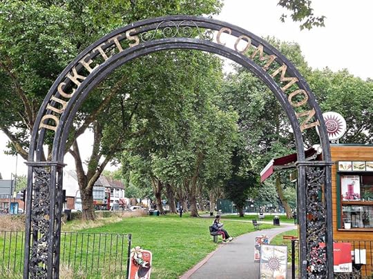
Ducketts Common
Ducketts Common is a park bordering the west side of Green Lanes. It is all that remains of the former Dovecote Farm that was on land once owned by Laurence Duket, a goldsmith. In retaliation for an attack of Ralph Crepyn (c. 1245 – before 1331), a lawyer and one of London’s first Town Clerks, Duket was murdered in about 1283 (see: http://www.british-history.ac.uk/no-s...). This episode of mediaeval history has been fictionalised by Paul Doherty in his 1986 novel “Satan in St Mary’s”.
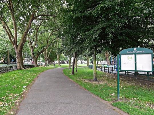
Ducketts Common

Liberty Church Frobisher Rd, formerly the Premier Electric Theatre
Today, the Common is a much-used open space with trees, partly covered by grass, and partly by sports facilities. Facing the south end of the park, stands the Liberty Church (on Frobisher Road). This is housed in a former cinema. Built in 1910 as ‘The Premier Electric Cinema’ to the designs of William Emden and Stephen Egan (see: http://cinematreasures.org/theaters/2...), this was one of London’s first purpose-built cinemas. The original building is hidden behind a crumbling art-deco façade, badly in need of redecoration, that was added in 1938. After several name and ownership changes, the building finally stopped being used as a cinema in 2003. Its present owners, The Liberty Church, moved in 2003.
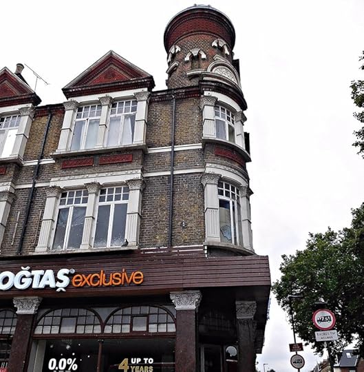
Former Queens Head pub Green Lanes
At the corner of Frobisher Road and Green Lanes, there is a late Victorian brick building (built 1898) adorned with pilasters and topped by a round tower. This was the Queens Head pub until it closed in 2010. The building stands on the site of the original pub, built in 1794. From 1856, the pub’s owner ran an ‘omnibus service’ from London and Winchmore Hill. Today, the building houses a branch of Dogtas, the Turkish furniture retailer. There are two Bulgarian eateries, a breakfast joint and a café/bar, across Green Lanes opposite the old pub.
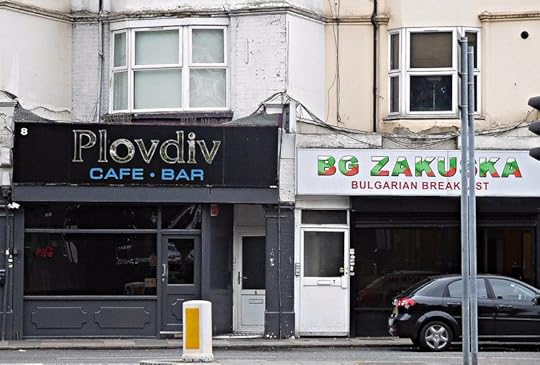
Bulgarian cafes on Green Lanes

Inter4national Food Green Lanes
Just south of the former pub, there is a row of shops, Queens Parade, that illustrates beautifully the international flavour of this area. Neighbouring a used car dealer and beneath a huge McDonald’s advertisement, is IFC Food Centre, which claims to stock food products of interest to: Iranians, Poles, Romanians, Hungarians, Bulgarians, Lithuanians, and … ‘English’. This is close to Savalan, a supermarket that contains a halal butcher. Then, there is a small Turkish bakery, where fresh products (including simit, bread, pide, lahmacun, börek, baklava) are baked on the premises.
Simits from a Turkish bakery in Green Lanes

Albanian pizzeria (Durazzo) on Green Lanes
Almost next to the bakery, there is a pizzeria named ‘Durazzo’, which is the Italian name for Albania’s important seaport Durrës. It is run by Albanians. Nawroz restaurant (named after the Persian new year) at the end of the Parade offers Iranian (Persian) food. The Corner Café and Bar opposite it has a large covered terrace with comfortable chairs for the many smokers sitting there. Its drinks menu offers ‘raki’. I do not know whether this is the type drunk in Albania or the Turkish drink that resembles the Greek ouzo.
Hindu temple Green Lanes

Hindu temple Green Lanes
In complete contrast to the eateries and shops neighbouring it and wedged between them, is the Om Shakthivel Temple. Adorned with pictures of peacocks outside, it is a small Hindu temple. This caters for Tamil speakers. A lady cleaning the temple gave me a booklet, written both in Tamil and English. It contains stories of people who have had their misfortunes reversed by praying to Shakthivel.
Bardhoshi Albanian restaurant Green Lanes
Unlike other Albanian restaurants that I have come across in London, Bardhoshi Bar and Restaurant, makes no attempt to hide its ethnic origins. Its menu, displayed outside on the pavement of Green Lanes, is in Albanian with English translations in smaller letters. The first time that I entered this was early one weekday morning. The espresso I ordered was first-class and served, as it would be in Albania, with a glass of cold water. The lady who served me, the owner’s wife, told me that she and her family come from northern Albania. They have recently taken over the restaurant from another Albanian family from the southern Albanian city of Korçë. She also told me that there are two other Albanian restaurants in the vicinity, the Pizzeria Durazzo being one of them. These establishments attract Albanian and Kossovars from the surrounding districts and, also, from further out of London.
On the Saturday evening when we visited Bardhoshi at about 7 pm, every table was occupied by men. Almost all of them were having alcoholic drinks, mostly Mexican beer but also raki and other hard drinks. Almost without exception, they were enjoying food as well. A large TV screen was showing programmes (sports and music videos) from Kosovo and Albania. We were warmly welcomed by the owner.
Bread cheese and pickles at Bardhoshi
The food was good, at least as good as much that we ate in Albania. A basket of warm bread was accompanied by delicious pickled apple peppers and white cabbage. My wife ordered a delicious okra (lady’s finger) with lamb casserole. I had qofte (minced meat kebabs – very often served in Albania) served with a generous mixed salad. We washed this enormous meal down with shots of good quality Albanian raki, and finished the meal with good espresso coffee, once again served with glasses of iced water. The waitress, an Albanian from Shkodër who had been brought up in Greece (where many Albanians have worked since Communism ended in Albania in 1990), busily served everyone in the restaurant. When we had finished our meal, the lady chef came out to meet us. We told her that we had enjoyed our meal, and she looked pleased. As we were leaving, the waitress presented us with a complementary package containing some soup for us to enjoy at home.
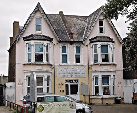
Turkish Cypriot Association Green Lanes
Turkish dental surgery Green Lanes
Across Green Lanes and further south, there is a pair of semi-detached houses, which house the Turkish Cypriot Community Association. Established in 1978, it “provides culturally, linguistically and religiously sensitive services to Turkish and Kurdish speakers residing in the UK” (see: http://tcca.org/). Nearby and across the road from this, is Duckett Dental Surgery which advertises a “Turk dis doktoru”, i.e. a Turkish dentist. Further south from this, there is a branch of The Turkish Bank.
Turkish Bank Green Lanes
A large building opposite the bank houses the ‘Hawes and Curtis Outlet Store’, which sells shirts for men. In the past, this building was marked on detailed maps as a laundry. Located next to Langhams Working Men’s Club, this was once the ‘Oaklands Laundry’, a large business in the days before domestic washing machines became common (see: http://www.woodses.co.uk/life-on-the-...).
Former laundry on Green Lanes

Bulgarian grocery Green Lanes
The brick and stone neo-gothic Harringay United Church was opened in 1902. Facing it across Green Lanes, is ‘Evmolpia’, a Bulgarian grocery store named after the ancient Thracian name for the Bulgarian city of Plovdiv (see: http://www.plovdiv.bg/en/about-plovdi...). This shop adjoins Salisbury Promenade, a row of shops contained in a long tile-covered building, whose architecture resembles that of many art-deco cinemas.
Salisbury Promenade Green Lanes
Staircase to Legends Gym in Salisbury Promenade Green Lanes
An historic photograph reveals that it had already been built by 1934, when the upper floor was occupied by a ‘Billiardrome’ and the lower by shops. Shops and restaurants occupy the ground floor. A snooker hall and gym centre occupy the building’s only upper floor. The staircase leading from the street to the gym is decorated much as theatres and cinemas built before WW2 used to be.
The Salisbury, Green Lanes
The Salisbury, Green Lanes
The grandiose Salisbury pub, a masterpiece of stone and brickwork with decorative gables and towers topped with domes, is on the corner of St Annes Road and Green Lanes. Built to the designs of John Cathles Hill (1857-1915), an architect, developer, and founder of the London Brick Company, this pub opened in 1899. On both sides of Green Lanes beyond this hostelry, there are lines of shops and restaurants, mostly Turkish.
Gökyüzü Restaurant

Bakery, Green Lanes

Turkish confectionery shop, Green Lanes
I have only been to one of these restaurants to date: Gökyüzü. It is a large restaurant, modern in design, with good service and lovely food in generous portions. It is opposite a big supermarket called Yasar Halim, which was established in 1981. The window of its bakery section has the word ‘patisserie’ written in French, Greek, and Turkish. Apart from several Turkish restaurants, all of which attract large numbers of diners, there is: a Turkish bakery specialising in gözleme (savoury flatbreads filled with, for example, spinach, egg, or cheese); Turkish jewellery shops; a Polish grocery; a Polish restaurant; a Hungarian supermarket (‘Paprika Store’); and, even, a branch of the UK chain ‘Iceland’.
Turkish shops Green Lanes

Making gözleme in Green Lanes

Green Lanes Station
The Overground line, which runs between Gospel Oak and Barking, traverses Green Lanes over a metal bridge on which the words ‘Harringay Green Lanes’ are written in large orange capital letters. Just south of this, on the corner of Williamson Road and Green Lanes, there is a notice about the history of the Harringay Arena. The Arena, an indoor stadium which could seat 10,000 people, was built in by the Canadian-born Brigadier-General AC Critchley (1890-1963) in 1936. Originally designed for that popular Canadian sport ice-hockey, the Arena was also used for boxing, horse-shows, basket-ball (during the Olympic Games of 1948), and Billy Grahame’s preaching rallies. It was built besides an outdoor stadium for grey-hound and motor-cycling racing, which Critchley had built in 1927. The Arena, designed by the modernist architect Oscar Faber (1886-1956), a structural engineer – a pioneer of the use of reinforced concrete in the UK, closed in 1978, and its open-air neighbour closed in 1987. Where these two landmark buildings once stood, a large, mundane branch of Sainsburys stands instead.
Beaconsfield pub Green Lanes
The Beaconsfield hotel/pub is across the Green Lanes facing the notice about the Arena. This Victorian building with tall brick chimneys dates from before 1894. The pub was possibly designed by JC Hill, who designed The Salisbury (see above).
Finsbury Park viewed from Green Lanes

New River in Finsbury Park, viewed from Green Lanes
Just south of this, the New River flows out of Finsbury Park and eastwards under Green Lanes. It is here that I left the ‘post-Ottoman trail’, and joined the footpath that runs beside this waterway, which despite its name is not a river but a canal. Elsewhere, I have described the New River’s lovely course through Canonbury. The walk that begins at Green Lanes is at first less charming than that through Canonbury, but gradually begins to rival it.
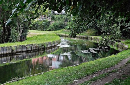
New River near Eade Road

New River by Eade Road
The New River was opened in 1613 to conduct drinking water to the New River Head in London’s Clerkenwell from springs in Hertfordshire and, also, from the River Lea. Before it was built, Londoners had to rely on oft contaminated local wells and streams, as well as The Thames, for its water supply. Now, there is a properly sign-posted footpath (see: http://shelford.org/walks/newriver.pdf) that runs along most of The New River’s 28-mile length. At first, the path I followed ran roughly parallel to Eade Road. Bounded on both sides by unattractive landscape, the canal winds its way along a strip of grassland punctuated by occasional trees and bushes. The canal is raised above the land to its north, and from it there is a fine view over the semi-industrial landscape of Harringay and beyond.
New River Studios

New River Seven Sisters Rd bridge
Shortly before reaching the bridge carrying Seven Sisters Road over it, the canal passes the brightly decorated New River Studios, which is housed in a former industrial building, a converted furniture warehouse (see: http://newriverstudios.com/). The Studios’ mission is to provide a centre for the promotion of arts and other creative pursuits. It is run on a ‘not-for-profit-basis’. Just beyond the studios, the canal passes under a graffiti-covered, unattractively designed brick and concrete bridge over which the busy Seven Sisters Road crosses.
Bunker on New River at Seven Sisters Rd Bridge

New River: The Sanctuary at Amhurst Park
On the west side of the bridge, I spotted a small brick-built structure that looked like a military bunker. Across the canal from this, there is a brick and stone neo-gothic church on Amhurst Park. This is now ‘The Sanctuary’, a church run (since 2003) by Resurrection Manifestations, which is an affiliated member of Resurrection Power and Living Bread Ministries International. On Sundays, one of its services is in a local Ghanaian language (see: http://www.resman.org/history/).
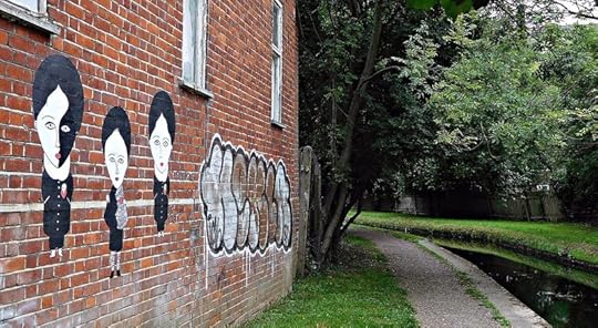
New River graffiti near Newnton Close

Newnton Close bridge over New River
The canal makes a U-turn just east of the church, and begins flowing in a south-west direction. While it is turning, it flows under a brick footbridge with metal railings at the eastern end of Newnton Close. Next, the visitor must make a choice. Whether to continue along the path beside the canal or to make a small diversion to enter the Woodberry Wetlands.
Woodberry Wetlands
The wetlands form a nature reserve surrounding the East Reservoir, one of two adjoining expanses of water that collect water from the New River. The East Reservoir and its neighbour The West Reservoir were built in 1830 to supply water to the then developing suburbs of Stoke Newington and Stamford Hill (see: http://www.woodberrywetlands.org.uk/a...). In 1992, the reservoirs were offered for sale to be filled in and then used for building purposes. Fortunately, this did not happen. In 2016, the land surrounding the East Reservoir was developed as a nature reserve, and opened to the public.
East Reservoir from Woodberry Wetlands
The walk through the Wetlands is delightful, and popular with mothers pushing their babies in buggies. Near the entrance, I saw a maintenance hut outside of which I saw a rack on which several pairs of red rubber gloves were hanging out to dry; it looked ghoulish. The reservoir is surrounded by untamed grassland. The water contains islands of reedbeds. A modern housing development consisting of apartment blocks of varying heights overlooks the reservoir from its western shore. When I visited the reserve, I spotted little wildlife apart from plants, ducks, and a pair of cormorants, one of which had pale white breast feathers. The path within the Wetlands leads around the reservoir to The Coal House Café (see below).
Ivy House Sluice New River

Ivy House Sluice New River
Returning to the bridge at Newnton Close, I re-joined the canal. Just before it skirts the East Reservoir, it passes beneath a small brick building that straddles the water. This is the Ivy House Sluice, which was built in the first half of the 19th century. Its hand-operated sluice-gate machinery is still in working order.
Modern sluice mechanism New River and East Reservoir
As I walked along the north-western side of the East Reservoir, I met many people with young children. Quite a few of them were speaking in Slav languages. Shortly before the path reaches the Lordship Lane bridge over the New River, there is an elaborate modern sluicing system. This regulates entrance of water from the canal into the East Reservoir. Its apparatus includes an automated weed-grabbing mechanism that plucks weeds and other rubbish from the New River, and then deposits on the bank so that it can be collected and removed (see: http://www.londongardenstrust.org/fea...).
Coal House Cafe on East Reservoir

Large birds on East reservoir
A pathway leads from this machine along the south-western shore of the East Reservoir to the elegant brick-built Coal House Café. Constructed in 1833, this was, as its name suggests, once used for storing coal. At one end of the building there is an enormous white stone commemorative slab with words carved on it, including: “These reservoirs the property of the New River Company were begun in the year 1830 and were completed in the year 1833 under the direction of Mr William Chadwell Mylne, their engineer…”
The Scottish born architect and engineer William Chadwell Mylne (1781-1863) was a son of Robert Mylne (1733–1811), who not only built the first Blackfriars Bridge but was also the New River Company’s surveyor. William became the Company’s Chief Engineer when his father retired in 1810. Apart from the reservoirs, he was responsible for another significant building in the neighbourhood (see below).
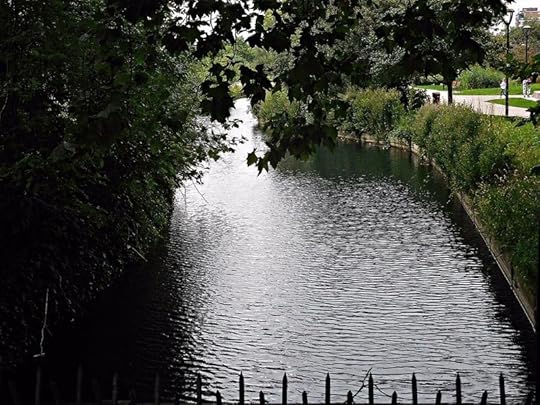
New River flowing from Lordship Lane Br south

New River Riverside Gardens
The New River continues beyond Lordship Lane for a few yards before it begins to skirt the western shore of the West Reservoir. First it passes a couple of modern fountains – one of them is spherical. They decorate the blocks of flats surrounding Riverside Gardens. From here onwards, the path has been re-built and looks attractive, but overly ‘manicured’.
View across West reservoir to Stoke Newington West Reservoir Centre

Family group on New River near West reservoir
Across the reservoir I saw a tall brick building with tall windows. This was flanked by long low newer single-storey wings, outside of which there were many small sailing dinghies. Behind this building, there were several tall brick-built towers crowned with castellated walls. I stopped an elderly couple to ask them to identify what I was seeing. They did not know because, like me, they were visiting the area for the first time. They had South African accents, and were in London visiting their children, none of whom lived anywhere near these reservoirs. They told me that whenever they visit London, they explore a part of it which is new to them. I admired them for their adventurousness.
Paddling on West reservoir
I continued along the path, stopping to watch families of wildfowl swimming in the water. As I rounded the lake, and got closer to the long low building with boats stacked outside it, I saw groups of children paddling kayaks in the West Reservoir, which is now used mainly for water-sports. The building with the boats outside it is the West Reservoir Centre. Its central tall structure was formerly a water filtration centre, which was built in the 1930s.
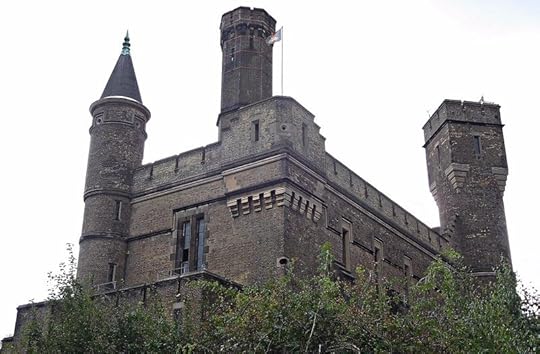
Victorian pumping station Green Lanes

Victorian pumping station Green Lanes: Mylne's logo and a climbing wall
Just before the New River disappears under Green Lanes, it passes what looks like a grimly forbidding castle. Built in 1855 to house a pumping station, it bears a logo consisting of the letters in the name ‘Mylne’. This is because it was built by WC Mylne, who had built the Reservoirs. It was designed by the architect Robert Billings (1813-1874), who also wrote many books including his four-volume “Baronial and Ecclesiastical Antiquities of Scotland”. The pumping station was built to pump water from the reservoir to northwest London, which was suffering from a cholera epidemic at that time (see: http://www.londongardenstrust.org/fea...). Between 1953 and 1995, when it was converted into a climbing centre, the pump stood disused.
I re-joined Green Lanes about just over half of a mile south of where I left it to follow the New River. But, I had walked almost thrice that distance by following the canal.
Brownswood pub Green Lanes
The late 19th century Brownswood pub is several yards north of Clissold Park. Its name refers to the Manor of Brownswood, which probably existed before the first written record of it was produced in the early 12th century (see: http://www.british-history.ac.uk/vch/...).
Clissold Park
Clissold Park, where we end this exploration, was once the grounds of Clissold House (originally called ‘Paradise House’). The house was built in the early 1790s for the Quaker merchant, philanthropist, and anti-slavery campaigner Jonathan Hoare, who was a member of the well-known Hoare family of bankers. Hoare wanted a new home close to the New River, and the site he chose to lease in 1790, the present park, used to have the canal flowing through it until it was re-routed.
Clissold Park
In 1811, the estate was bought by Augustus Clissold (c. 1797-1882), an English Anglican priest, who was an exponent of the theological ideas proposed by Emanuel Swedenborg (1688-1772). After Clissold’s death, there were plans to sell the park for building development. Fortunately for us, two local politicians, John Runtz (a director of the New River Company; 1818-1891) and Joseph Beck (an optical instrument maker; 1828-1891), were able to persuade the Metropolitan Board of Works to buy the land in 1887, and then to develop it as a public park.
Clissold Park

Clissold Park
The park contains various water features, which are remnants of the part of the old course of the New River from the time when it used to flow through it. These include two lakes, and a stretch of what looks like a canal. The latter is traversed by an elaborate cast-iron bridge, which is far more attractive than any of the bridges that I saw while walking along the New River further north.
House at Clissold Park

House at Clissold Park
The bridge is almost in front of the house that was built for Hoare. With six Doric pillars supporting a veranda that runs the length of the front of the house, the brick-built house has two main floors and an extensive basement. It is now used for private functions such as weddings, and contains a popular café. Most of the rooms that I entered were sparsely, if at all, furnished. The main staircase is a spectacular, almost spiral construction.
Aviary at Clissold Park

Drinking fountain at Clissold Park
In addition to the water features, the park contains a small animal enclosure that includes an aviary and a butterfly house. Near this, there is a pink granite drinking fountain erected in 1890, and dedicated to the memory of Messrs Beck and Runtz. Near the Clissold Road exit, I saw a stone fragment with the date 1790 carved on it. At the exit near Riversdale Road, which recalls the former course of the New River, there is a small brick building on Green Lanes with shuttered windows. Labelled ‘Pump House’, it is a reminder of the days when the New River flowed through the park.
HARRING 9l Clissold Park pump house
Opposite the pump house, stand the forlorn remains of what was once the White House pub. This was in business from 1866 until 2013. Nearby, there are bus stops that allow you to travel either back up north, or into the centre of London.
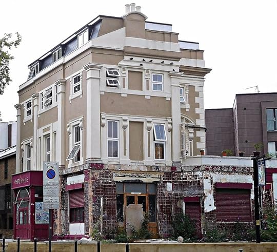
White House pub now closed on Green Lanes
This walk fulfilled several of my pleasures, including: discovering places new to me; exploring London’s lesser-known waterways; and enjoying the cosmopolitan nature of the city. People from the formerly Ottoman territories have moved into north-east London both to escape from the horrors of war (e.g. the break-up of the former Yugoslavia, and troubles in Kurdistan and Cyprus) and, also, to enjoy the economic advantages of living in Western Europe. However, I often wonder whether they miss the lovely scenery and better climate of the places they have left in order to live in one of the more aesthetically bleak parts of London.
East Reservoir looking north
OTTOMAN HERITAGE & A RIVER THAT'S NOT A RIVER remains copyright of the author ADAMYAMEY, a member of the travel community Travellerspoint.
Post tags: london turkey cyprus albania bulgaria haringey harringay clissold park new river
Comment on this entry | Tweet this | Your own free travel blog | More Travellerspoint blogs
August 8, 2017
BIRYANI, BAGELS, AND ... A YURT

Brick Lane on Sunday
Before 1485, Brick Lane was called ‘Whitechapel Lane’. As early as 1401, land was leased along it (at a high rent) for tile making (see: http://www.british-history.ac.uk/vch/...). On a map published in the 1560s, Brick Lane, which started life as a path through fields, is shown with its current name, but without buildings along it (see: http://www.british-history.ac.uk/surv...). By the 17th century, it was partly lined with houses and partly with fields (see: http://www.british-history.ac.uk/no-s...). The thoroughfare derives its name from the places that it passed, where either clay (for tiles) and/or brick earth was dug up. When the architect Christopher Wren (1632-1723) visited the lane in 1670, he had to walk along it because it was unsuitable for coaches. He found it to be very dirty and lined with mean dwellings. Despite many plans to ‘improve’ it, the lane retains its narrowness and lay-out that recall its rustic origins.

Brick Lane arch
This exploration begins at Middlesex Street (called ‘Peticote Lane’ before about 1830), which is close to Liverpool Street station. It is only worth visiting on a Sunday morning, when it is filled with stalls selling mainly clothes. This is the ‘Petticoat Lane’ Market. It runs through the part of Spitalfields that used to be well-known for garment manufacture. In the 17th century, much of this trade including dyeing and weaving was carried out by Huguenot refugees who had fled from France, and then later in the 19th century by Jewish refugees, who had sought refuge from the pogroms in the Russian Empire.

Middlesex Street Petticoat Lane Market

Middlesex Street Petticoat Lane Market

Middlesex Street Petticoat Lane Market

Middlesex Street Petticoat Lane Market

Middlesex Street Petticoat Lane Market

Middlesex Street Petticoat Lane Market
There are numerous stalls along the street. Many of them offer clothes allegedly made by well-known manufacturers, such as Marks and Spencers, Armani, and H&M, at knock-down prices. Quite a throng of people visit this market each week. Where Middlesex Street ends at the western end of Whitechapel High Street, there stands a tall conical sculpture covered with figurative bas-reliefs. This is ‘Spitalfields Column’ sculpted by Richard Perry in 1995.

Spitalfields Column by Richard Perry 1995

Hoop and Grapes pub Aldgate High Str
Almost opposite this across the main road, there is a pub called The Hoop and Grapes. Built in the late 17th century on the site of St Bride’s graveyard, it is a rare surviving example of a type of building that used to be quite common in London (see: https://www.historicengland.org.uk/li...).

Altab Ali Park
Moving east along Whitechapel High street, passing Osborn Street (the southern stretch of Brick Lane), we reach Altab Ali Park. This park is built on the site of St Mary’s Church, which was destroyed by bombing in 1940, and its cemetery. It commemorates the murder of the 24-year-old Bengali machinist in May 1978, which was perpetrated by members of the racist National Front (see: “Spitalfields: a battle for land”, by C Forman, publ. 1989). When Bengalis from Bangladesh began arriving in the East End during the 1970s, there was much antagonism to them. This was exploited ruthlessly by the National Front.

Sheed Minar Monument replica in Altab Ali Park

Gate to Altab Ali Park
The pleasant park contains a few gravestones and, also, a replica of the Shaheed Minar Martyrs’ Monument, which was originally erected in Dhaka (Bangladesh) to remember those killed during the Bengali Language Movement demonstrations of 1952 in what was then East Pakistan. The wrought-iron gateway to the park designed by David Peterson, and installed in 1989, combines elements of traditional Bangladeshi design with English Perpendicular gothic architecture. The former St Mary’s Clergy House survived the Blitz, and currently houses a Japanese restaurant.

Altab Ali Park former St Marys Clergy House

St Boniface German RC Church
St Boniface German Roman Catholic Church, just south of the park, was consecrated in 1960, having been rebuilt on the site of an earlier church that was destroyed (by German bombing) during WW2. The first church was founded in 1809 to cater for the needs of German-speaking immigrants, who had settled in the East End. Many of them were involved in the sugar industry. The church continues to be used by German-speakers. Being so close to London’s docks, Spitalfields, the area through which Brick Lane runs, and neighbouring areas in the East End was the locale where immigrants from many places (including France, Ireland, Germany, and Russia) first settled, the most recent being people from Bangladesh. With the advent of air travel and the Channel Tunnel, later immigrants have made their first homes in Britain in a more diverse set of locations.

Whitechapel Art Gallery

Whitechapel Art Gallery: former library
Across the road, almost facing the park, one cannot miss the art-nouveau façade of the Whitechapel Art Gallery), which now also occupies its neighbour the former Passmore Edwards Library. It was designed by Charles Harrison Townsend (1851-1928). The gallery’s foundation was encouraged by the local social reformers Canon Samuel Barnett and his wife Henrietta (see: “Henrietta Barnett: Social Worker and Community Planner”, by M Watkins, publ. 2011). This couple, who later founded the Hampstead Garden Suburb, strongly believed that bringing art to the poor, who lived in the East End, would uplift them both morally and culturally. Whether they achieved this or not, the gallery remains one of London’s most exciting venues for contemporary art exhibitions.
Whitechapel Art Gallery
A plaque on the wall of the gallery records that the short-lived Jewish artist and painter Isaac Rosenberg (1890-1918) “studied here”. This refers to the Passmore Edwards Library, which opened in 1892 and closed in 2005. Known as the ‘University of the Ghetto’, it was a haven for many generations of studious refugees. “Until the 1970s, when they completed their exodus to the elevated heights of Stamford Hill and Golders Green, working-class Jewish men and women went there to read the books and newspapers that they lacked in their tenement homes” (see: http://www.telegraph.co.uk/culture/bo...). Later, the Jewish readers were replaced by Somali and Bangladeshi refugees.

Whitechapel Art Gallery: Anarchist bookshop
A narrow alleyway next to the west side of the gallery leads to an anarchist bookshop, the retail outlet of the Freedom Press, whose history extends back to the earliest days of anarchism (see: https://freedompress.org.uk/freedom-p...). Although the arrangement and display of the books and pamphlets on sale here is anything but anarchic, many of the texts relate to the theory and practice of anarchism.

Khushbu restaurant

Sonali Bank Osborn Str
Khushbu restaurant stands at the corner of Osborn Street and Whitechapel High Street. This unpretentious eatery offers great north Indian food at low prices, and it is considerably better quality than most of the numerous restaurants on the rest of Brick Lane. It prepares an excellent biryani, but only twice a week: lamb on Wednesdays, chicken on Fridays. The Sonali Bank on Osborn Street is a Bangladeshi bank serving the mainly Bangladeshi population around Brick Lane.

Former Ye Frying Pan pub

Confectionery shop Brick La
A short way up Brick Lane, a somewhat damaged archway with oriental motifs crosses the road. Next to it is the former ‘Ye Frying Pan’ pub. There has been a pub on this site since before 1805. It closed in 1991. The premises now house ‘Shaad’, a Bangladeshi restaurant. Just north of this, there is a row of food shops catering to the local Bangla people. One of these, a confectionery shop, supplies delicious freshly-made mishti doi.

Pride of Spitalfields pub Heneage Str
The ‘Pride of Spitalfields’ pub in Heneage Street, which was laid out in the early 19th century, has a remarkably rustic feel about it. Entering this old-fashioned pub is like stepping out of cosmopolitan London and into village England. The pub was founded as ‘The Romford Arms’ in the 19th century next to ‘Best & Co’ brewery, which closed in 1902.

Fashion Street

Fashion Street
The south side of Fashion Street (originally called ‘Fossan Street’, when it was laid-out in about 1655) is occupied by a building with pseudo-Moorish facades (built 1905). This building, ‘The Fashion Street Arcade’ was the creation of builder Abraham Davis, who ran out of money to pay its rent in 1909, before completing his ambitious plans for it (including shops, baths, and reading rooms).

Christ Church Primary School Brick La

Plaque on Christ Church Primary School Brick La
Christ Church School on Brick Lane is a neo-gothic Victorian building. A plaque on one of its walls records that the present building was built in 1873 to replace an earlier building containing the parochial schools and house, which used to stand in the courtyard of the local church, Christ Church Spitalfields. This church, which stands on the corner of Fournier Street and Commercial Street, is a masterpiece by the architect Nicholas Hawksmoor (1666-1736).

Jumma Masjid
The Brick Lane Mosque or ‘Jumma Masjid’ stands at the corner of Brick Lane and Fournier Street. It is housed in what was once a Huguenot Church, then a Wesleyan chapel, then a Methodist chapel, and then a synagogue (its congregation, ‘Machzike Hadath’, now has a synagogue in Golders Green). This was built in 1743. It started being used as a mosque in 1976, by which date many Bangladeshi people had begun living in the area. A shiny, decorated stainless-steel columnar minaret, 90 feet high, stands outside the mosque.

Fournier Str

Fournier Str and Wilkes Str
Fournier Street, which used to be called ‘Church Street’, is lined with 18th century houses, many of which retain original external features including elaborately decorated front doors. Number 33a, the entrance to a courtyard, is flanked by the doorways to numbers 33 and 35. A sign above 33a reads “S. Schwartz”, a Jewish name. This house like most of the others in the street were originally owned by Huguenots with French surnames. Schwarz’s name and that of CHN. Katz (a dealer of string and paper bags; see: http://www.independent.co.uk/life-sty...) at 92 Brick Lane are reminders of the important Jewish presence in the district in the 19th and 20th centuries (some years before the Bangladeshis began arriving).

Princelet Str

Birthplace of Miriam Moses in Princelet Str

Princelet Str
Lovers of historic vernacular architecture should wander down Fournier Street, whose present name has Huguenot origins, and then enter Wilkes Street and Princelet Street. These thoroughfares are richly endowed with 18th century buildings mostly in good repair, displaying many original external fixtures and fittings including fine door-knockers. Many of these fine homes were built by wealthy Huguenots as single-family dwellings, but, as time passed, many of them became subdivided into flats.
The Jewish Miriam Moses (1884-1965) was born in Princelet Street, near where there had once been a small synagogue (at number 19). Daughter of a Jewish immigrant tailor, she was a feminist and social reformer. She became Stepney’s first female Mayor in 1931(see: “The Palgrave Dictionary of Anglo-Jewish History”). A house almost opposite bears a faded board with the words ‘Modern Saree Centre’. It closed some time ago.
restaurant
Brick Lane restaurant
Brick Lane restaurant
Returning to Brick Lane, it is impossible to ignore the often-vibrant signs above a cluster of restaurants run by Bangladeshis, offering Indian and Bangladeshi food. Each one of them boasts winning a prize, anything from “Best Curry House on Brick Lane” to “One of the World’s Best Curry Houses”. I have not tried any of them, so cannot comment on whether the accolades are deserved. If I want to eat Indian food in this area, I make a bee-line for Khushbu (see above), which does not display any extravagant claims. Until it closed some years ago, we used to enjoy excellent biryanis (cooked by Punjabis from Lahore) at ‘Sweet and Spicy’ at the corner of Chicksand Street. This has been replaced by an eatery serving ‘sticky wings’.

Hafiz barber shop, Brick Lane
Hafiz barber shop on Brick Lane used to be run by three Lahori Punjabis. My wife often used to wait for me there while my hair was being cut. The three men would chat animatedly but amicably with her in Hindustani about India, her native land, and Pakistan, their native land. At the same time, a television used to broadcast a Pakistani channel, which I could just see out of the corner of my eye from where I sat having my trim. These three have sold their shop, which used to look slightly unkempt, to new Pakistani-born owners, who have smartened the place. They also do a good cut, and, like their predecessors, are friendly.

Mayfair Brick Lane
Nearby, there is a 20th century building with the word ‘Mayfair’ in large tiled letters at its top. This was a cinema that functioned between 1937 and 1967. For a brief while after that, it showed ‘Bollywood’ films (see: http://www.eastend-memories.org/cinem...). Even as late as the 1950s, the majority of the Mayfair’s clientele was Jewish (see: Gil Toffel: “Cinema-going from Below: The Jewish film audience in interwar Britain”, in Participations, Vol 8, issue 2, Nov 2011). Currently, the former cinema building is home to two restaurants and an estate agent.

Trumans Brick La
The middle section of Brick Lane is dominated by the premises of the Truman Black Eagle brewery. The following is summarised from an on-line history of it (see: https://www.trumansbeer.co.uk/about-u...). The brewery was founded in 1666, when Brick Lane was still a track through fields. For a brief period during the 18th century, it was the world’s largest brewery. In 1989, the brewery closed. In 2010, James Morgan and Michael-George Hemus revived the Truman’s brewing activities, opening a new brewery in Hackney Wick in 2013.

Trumans Brick La Barrel filling room beneath brewery

Trumans Brick Lane: barrel-rolling rails
The enormous Brick Lane premises, which are well-worth exploring, are currently used as a recreation area containing, markets, spaces for artistic events, restaurants, food-stalls, and restaurants. Although beer is no longer brewed here, the old brewery is a hive of activity, and very popular with visitors. Some of the brewery’s buildings were built in 18th and 19th centuries. The ground floor of the building where the beer was brewed is now used as an antique market. Its ceiling is supported by metal pillars, but it is the floor which I found most interesting. It is criss-crossed with a network of rail tracks sunk into it. These were used to guide the barrels around the area. The casks were filled from shoots (no longer visible) that allowed the beer to flow down from the floor above, and when full, these heavy vessels were rolled along the tracks to a loading area.

Trumans Brick Lane: Sir Thomas Buxton lived here
Across Brick Lane from the brewery building with a clock tower, there is another historic part of the brewery, which was once the home and office of Sir Thomas Fowell Buxton (1786-1845). In 1811, Buxton became a partner in the Truman company (which became known as ‘Truman, Hanbury, Buxton & Co.) In addition to this, he was: a Member of Parliament; an anti-slavery activist; an opponent of capital punishment; a supporter of prison reform; and a founder of the (now ‘Royal’) Society for the Prevention of Cruelty to Animals.

Brick Lane Bookshop
Just beyond the brewery, there is the Brick Lane Bookshop, which is well-supplied with books about London’s East End. The bookshop started life as a ‘community bookshop’ in Watney Market in 1977 (see: http://bricklanebookshop.org/history/...). After moving to Whitechapel Road for a few years, where it was known as ‘Eastside and attracted many local writers and artists, it moved to Brick Lane.

Sclater Street
Sclater Street, just north of the railway bridge, has retained its original 18th century street name sign. Dated 1778, this decorative sign is attached to a wall next to two newer signs, one in English, the other in Bengali script. In the 19th century, a bird market was held in Sclater Street on Sundays. Sunday is still a popular market day in the East End (e.g. the Petticoat Lane Market and the Columbia Road flower market).
All of the street name signs along and near to Brick Lane are in both English and Bengali. My wife, who, having been educated in Calcutta, can read the Bengali script, says that the signs in that script are precise transliterations of the English names. One street whose name amuses me, is ‘Bacon Street’. In the 19th century there was a ‘ragged school’ (for educating destitute children) on this street, but I do not know if its name refers to food or a person. It does not seem an appropriate name for a thoroughfare in a district which was once populated mainly by Jews, and now by Moslems. Before 1912, the section of this street to the east of Brick Lane was known as ‘Thomas Street’ (see: http://www.maps.thehunthouse.com/Stre...), but the western section has always been Bacon Street.

Brick Lane on Sunday

Sunday at Brick Lane

Sunday Brick Lane

Brick Lane Sunday
On Sundays, the section of Brick Lane between the brewery buildings and Bethnal Green Road becomes a vibrant, bustling street market with plenty of stalls selling food and a wide variety of other goods. On a recent visit, I saw a man with several chess boards in front of him. Out of his love for the game rather than for financial gain, he was willing to challenge any passer-by to a game. He played several games at once and at great speed. Just beyond him, the queue stretching out of the Beigel Bake at number 159 Brick Lane was long.

Brick Lane Sunday
The Beigel Bake, not to be confused with its inferior neighbour ‘Beigel Shop’ at number 155, is a marvellous establishment. It is open 24 hours a day, and serves the best filled bagels that I have ever eaten. The warm juicy salt-beef, which is made on the premises, is generously stuffed into freshly baked Jewish-style bagels (made in a kitchen visible from the shop) with or without gherkins and mustard. It is difficult to open one’s mouth wide enough to bite into these enormous flavoursome sandwiches. For those who do not like beef, there are other fillings including chopped herring, egg, smoked salmon, and cream cheese. In addition to the bagels, this popular outlet sells breads and cakes.

Beigel bakery queue

Beigel bakery Brick Lane

Beigel Bakery Brick Lane - old prices!
The Beigel Bake opened in about 1976, and superseded one owned by a Mr Lieberman. According to Rachel Lichtenstein (in her book “On Brick Lane”, publ. 2007), there was a bagel bakery on this site since 1855. The Beigel Bake offers some of the best value quality food in London.
Brick Lane continues north of Bethnal Green Road, but soon peters out both physically and in its liveliness. If you do venture here, take a look down Padbury Court (formerly ‘Princes Court’).

Padbury Court
In the 19th century, a William Padbury owned a box-making business in this lane (see: https://www.ancestry.co.uk/boards/thr...). One side of the road has modern housing, but the other has a row of two-storey brick-built modest dwellings, probably 19th century. A stone in the gardens opposite Padbury Court commemorates the planting of an oak tree in 1996 by the Boundary Community School, a community centre in nearby Club Row. This was done to raise awareness of our effects on the environment in the minds of young people. If you continue north from here, you will eventually reach Columbia Road, where a Sunday flower and plant market is held (discussed elsewhere). Alternatively, retrace your steps down Brick Lane to Buxton Street.

Buxton Str

Buxton Street
Buxton Street (once called ‘Spicer Street’) runs east along the northern boundary of the old Truman brewery. First, it skirts an open space, a recreation ground, called Allen Gardens. This land, now owned by Christ Church Spitalfields, was formerly the site of All Saints’ Church, Buxton Street. Built in a ‘Norman’ style to the designs of a pupil of Augustus Pugin, Thomas Larkins Walker (1811-1860), it was consecrated in 1839 (see: http://www.british-history.ac.uk/surv...). Although it survived WW2, it was demolished soon after 1951, when its parish merged with that of its neighbour Christ Church.

Old St patricks School Brick Lane
Allen Fields surrounds a cluster of old brick buildings, a tiny microcosm of Victorian London. They face onto both Buxton Street and the short, narrow, cobbled Shuttle Street. Number 35 Buxton Street, a fine Georgian residence, was formerly the vicarage to All Saints’ Church. Across the small cobbled cul-de-sac, Shuttle Street, stands The Old St Patrick’s School. It was once a Roman Catholic school. It was built between 1831 and 1833 to the designs of a builder, William Bush. In 1848, prior to the construction of the nearby neo-gothic St Anne’s Church (first used in 1855, but only completed in 1894; architect: Gilbert Blount [1819-1876]) , the school was used to hold services on Sundays. Now, the building is no longer a school.

Cooperage Spital Street
East of The Old St Patrick’s School along Buxton Street, we reach a real treat. But before doing so, spend a moment in Spital Street, where a graffiti-covered doorway marks the entrance to the old Trumans brewery cooperage, the place where barrels were assembled using staves of wood and iron hoops.

Spitalfields City Farm
The treat is Spitalfields City Farm (see: http://www.spitalfieldscityfarm.org/), one of several such farms that I have visited. Founded in 1978, it is wedged between Buxton Street and a railway line busy with frequent trains travelling to and from Liverpool Street. This oasis of greenery and farmyard is, and has always been, lovingly maintained by volunteers. Close to the railway line and standing amidst various flowering plants including some tall sunflowers, I saw a Mongolian-style yurt, apparently the only yurt in the east of London. It can hold up to twenty people, and is hired out for holding parties. There is also a café and a farm shop, selling plants and vegetables.

Spitalfields City Farm yurt
The farm has several enclosures containing animals. I saw a couple of large pigs taking a siesta under two large, leafy trees. Two donkeys were being fed by visitors in an area overlooked by the west front of St Anne’s Church. In the neighbouring small field, there were a number of goats with variously coloured furs. In between the animal areas, there were terrains planted with vegetables, fruits, and flowering plants. Signs in both English and Bengali exhort people to wash their hands after touching animals. This compact but lovely farm is in the heart of what was once one of the most economically-deprived areas of London. I enjoyed visiting it, and when I was there I could see that children were loving the experiences that are otherwise difficult for inner-city London children to savour.

Spitalfields City Farm

Spitalfields City Farm

Spitalfields City Farm
Brick Lane is well-worth visiting, not only because of its fascinating reminders of communities that used to live there, but also because of its vibrant Bangladeshi community, and, also, because it has become a magnet for trendy youngsters and tourists.
Many of the ‘trendy’ shops offer clothes and other gear for youngsters, who regard themselves as ‘indie’ – that is to say ‘alternative’, they want to stick out from the crowd. However, in Brick Lane, the crowds of youngsters who all want to be ‘indie’, have a uniformity that seems contrary to the concept of ‘indie’. Although diversely dressed, often in ‘retro’ clothes (i.e. clothes that were the rage in the 1950s to 1980s), these ‘indie’ folk have, actually, succumbed to a new conformity.

Brick Lane on Sunday
This survey of the delights of Brick Lane and around will be followed soon by another piece that will concentrate on the immigrants that arrived in the area before the Bangladeshis: namely the Huguenots and the Jewish people. If you have not yet visited Brick Lane, you should do so soon.
BIRYANI, BAGELS, AND ... A YURT remains copyright of the author ADAMYAMEY, a member of the travel community Travellerspoint.
Post tags: market jewish bangladesh yurt whitechapel brick lane bagels bengali shoreditch huguenot
Comment on this entry | Tweet this | Your own free travel blog | More Travellerspoint blogs
August 5, 2017
A MOSQUE AND A RESTAURANT, BOTH TURKISH
I have visited Kingsland Road so many times, but never ventured east of it along Shacklewell Lane until today. This time, the bus from Newington Green, a route we had not used previously, deposited us outside the UK Turkish Islamic Trust, a mosque on Shacklewell Lane.

Former Shacklewell Lane synagogue
This mosque is housed in a former synagogue, the ‘Stoke Newington Synagogue’, which despite its name is closer to Dalston than Stoke Newington. It opened in 1903, after the English banker and entomologist, the Honourable Nathan Charles Rothschild (1877-1923), a member of the famous Rothschild family, laid a memorial stone.

Former Shacklewell Lane synagogue
This stone mentions that the building’s architect was Lewis Solomon (1848-1928), Honorary Architect to the Federation of Synagogues, and, also, Architect and Surveyor to the United Synagogue. The synagogue’s treasurer was, at that time Gustave Tuck (1857-1942), Chairman and Managing Director of Raphael Tuck and Sons, Ltd (a well-known producer of illustrated postcards; see: https://tuckdb.org/history). University College London, which I attended as a student, has a lecture theatre named in his memory.

Former Shacklewell Lane synagogue
During its heyday (in the 1950s), the synagogue had over 500 male seat-holders (see: http://www.jewishgen.org/jcr-uk/Londo...). The congregation was Ashkenazi Orthodox. The synagogue closed in 1976, when its congregation merged with that of Hackney Synagogue.

Former Shacklewell Lane synagogue
In 1977, the newly formed UK Turkish Islamic Trust began to make moves to acquire the former synagogue to convert it for use as a mosque for the Turkish Cypriot community (see: http://www.ukturkishislamictrust.co.u...). In 1983, a dome was added to the building, otherwise many of the synagogue’s original architectural features have been preserved.

Former Shacklewell Lane synagogue
The UK Turkish Islamic Trust was founded by Ramadan H Guney (1932-2006), the owner of the enormous Brookwood Cemetery (in Surrey) since 1983. Mr Guney emigrated to the UK from Cyprus in 1958. He began a business selling ethnic music recordings to London’s Turkish communities. When we arrived at the mosque, we were greeted by Ramadan’s welcoming daughter Zerin, who, with her brother, run the establishment. She allowed us to look inside the mosque. I visited the downstairs section where men pray, and my wife was taken to the first-floor gallery, which is reserved for women, as it was when the building was a synagogue.

Gökyüzü Restaurant
We chatted to Zerin about the mosque and, also, about eating Turkish food in the neighbourhood. The two restaurants she recommended, Umut 2000 in Crossway and Mangal 1 in Arcola Street, are also our favourites amongst the Turkish restaurants in Dalston. She added that another place to go for really good Turkish food was Green Lanes in Harringay. In particular, she recommended Gökyüzü (26-27 Grand Parade, Harringay, London N4 1LG).

Gökyüzü Restaurant

Gökyüzü Restaurant

Gökyüzü Restaurant
After a couple of bus journeys, we reached Gökyüzü, a large modern restaurant surrounded by many other Turkish eateries. We had not reserved, and there was not a problem finding a table in this vast restaurant. The dining area is spacious, airy, and modern – subtly stylish. As soon as we sat down, we were given menus and, before ordering, the following complementary items were placed in front of us: a generous mixed salad, freshly baked bread, and a yoghurt with cucumber dip (cacik). We ordered fried liver (Arnavut Ciğeri, or ‘Albanian liver’) and Iskender Kebab (döner kebab with cubes of bread in a spicy tomato sauce with yoghurt). Both dishes were very good. After this modest meal, we ordered glasses of Turkish tea, which, we later discovered were ‘on the house’. Service was friendly and efficient, and the prices were quite reasonable.

Gökyüzü Restaurant: complementary starters

Gökyüzü Restaurant: Arnavut cigeri

Gökyüzü Restaurant: Iskender kebab

Gökyüzü Restaurant
If it had not been for my interest in the history of London’s Jewish community, we would not have met the delightful Zerin Guney, and would not necessarily have made the fruitful journey to Green Lanes.

Gökyüzü Restaurant
A MOSQUE AND A RESTAURANT, BOTH TURKISH remains copyright of the author ADAMYAMEY, a member of the travel community Travellerspoint.
Post tags: food london mosque restaurant turkish jewish synagogue islam cypriot grill dalston harringay kebabs
Comment on this entry | Tweet this | Your own free travel blog | More Travellerspoint blogs