Tim Havenith's Blog, page 14
February 26, 2021
Route 005 Around the Source of the Marden
This is an enjoyable 2.4 mile walk from Olivers Hill in Cherhill, to the source of the River Marden and back again.

Important information:
This route is great for walkers and runners - and perhaps those with mountain bikes, but unfortunately it's no good for pushchairs or mobility scooters.
There are plenty of inclines and declines on this route. Parts of this route can be boggy and slippery after rain and during the winter months. Please wear appropriate clothing and stay safe.
There is The Black Horse Inn, in Cherhill, but other than this there are no toilets or benches along this walk.

Directions
1) Park on Olivers Hill in Cherhill and cross over Labour-in-Vain Hill, which is part of the A4. Follow the track between the hedge and the verge.
 2) This part is slightly uphill to Red Barn, which I am told used to be red. These days it is looking a bit dilapidated. Enter through the gate and immediately turn right to follow the length of the field.
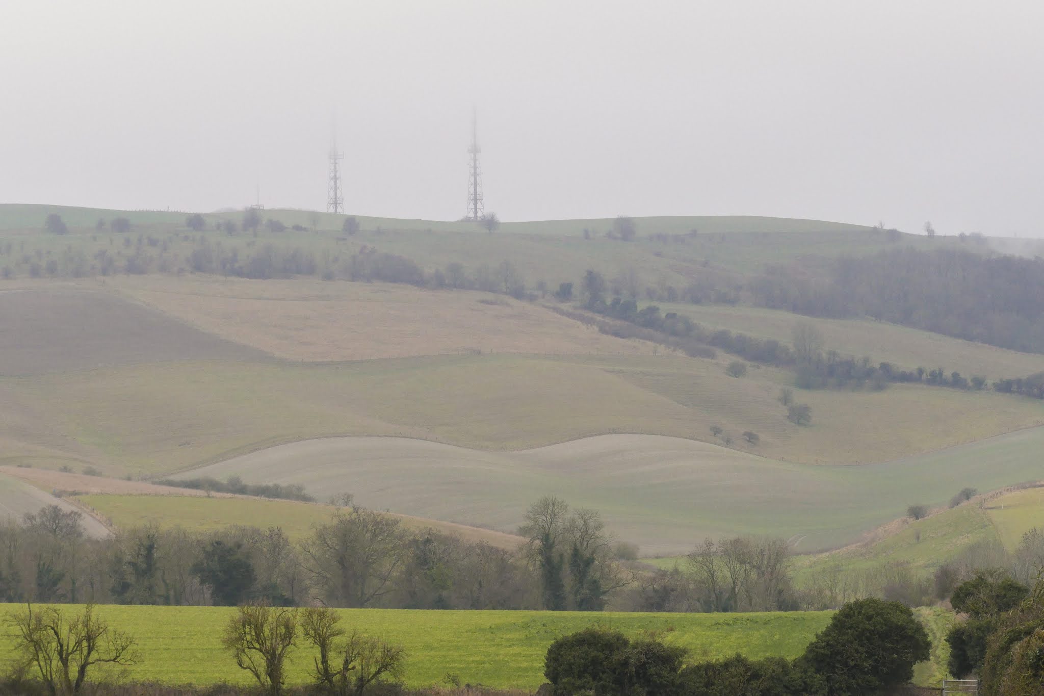 3) Along this stretch, you will begin to get wonderful views of the area. First the hill at Cherhill Downs, upon which are Oldbury Barrows, a collection of round barrows and a pond barrow, which Grinsell dated to the Bronze Age.You'll also see the communication masts up on Morgan's Hill, which will feature in a future walk.
 4) At the end of this field, go through the metal gate. From here you will see another barn; often stacked with hay bales, along with views of the Lansdowne Monument. This monument, in dire need of repair, was built in 1845 using a design by Sir Charles Barry for the 3rd Marquis of Lansdowne, in memory of his ancestor Sir William Petty. Unfortunately, repairs completed in 1990 by the National Trust used soft stone, which is now crumbling down.
  5) You will then come to a track. When you reach a bend in the track, leave the track, joining a rights of way footpath.
6) Very soon after joining this path there is a fork. Follow this to the right, which will take you past Toghill House, which was built in the mid-1700s. Once the home of the Rivers family, one of whom, Arthur Rivers, was the Waterworks Manager. More recently, the house was renovated by John Grierson (1898-1972), a film maker who coined the term ‘documentary’. His brother, Andrew Anthony 'Tony' Grierson MBE (1895-1968), was a GP at Elm Grove in Calne for around twenty years. Grierson Close in Calne is named after Dr. Grierson.Be mindful! This path is steep and after rain, or in winter, it can be very boggy and slippery.From this path it is possible to see the beginning of the reservoir that once served Calne with safe, clean, water.

7) From this point on, listen out for the river. You will soon come to a bridge. The weir on the western side turns the river into a rushing torrent, even at this close proximity to the source. Excess water often pours out of the hills near the source adding to the flow the runs to the reservoir.

8) Simply looking over the eastern side of the bridge, will reveal a slow running, crystal clear river.
 9) From the bridge, continue south along the track. This will curve to the right and take you up to South Farm.
10) You will then come to the end of the track you were on, as it joins a main track. Turn almost 180° to your left as you join this track. Follow the track, which will take you east.
 11) Along your left is the steep drop to the source of the River Marden, which can be glimpsed between the trees. The gate to the source of the Marden is always unlocked, however there is no formal public access to this land, which, along with the reservoir is owned by the Bowood Estate.To your right you will see a beautiful piece of land, called Blackham bottom in the 1800s, and now goes by the name of Bacon Bottom, possibly a corruption of the earlier name. It is often filled with sheep, making it even more picturesque.
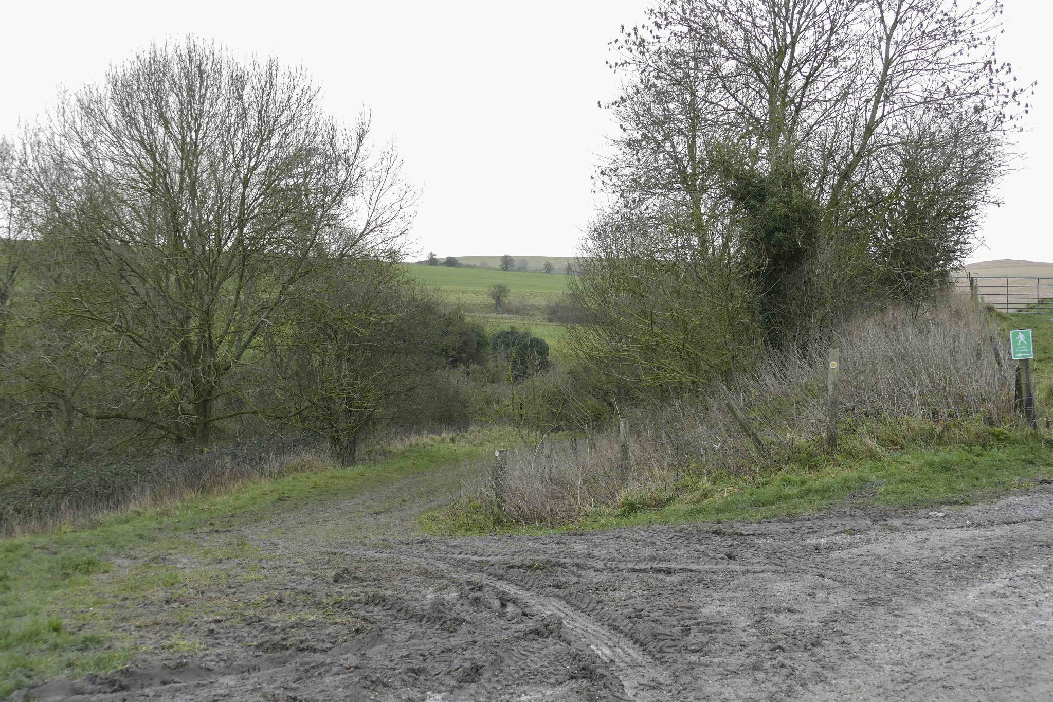
12) At this point you'll come to a junction, take the left-most option. Following the track around to the left. You'll get lovely views of the monument again, however keep following the track to the left.

13) Keep close to the trees and you'll see a small metal gate and a caution to keep dogs on a lead due to the release of wild birds (pheasants). Continue through and you'll come up to fencing and clear arrows that will enable you to keep to the public right of way. We're now coming back around the source. Keep your eyes peeled for sights of the river to your left as you continue onwards.

14) Walk around the black metal gate when you reach it. Afterwards you'll be back at the junction near Toghill House. Keep to the right and then turn right to enter into the fields that you walked on your outward journey.There are the two metal gates to go through on your return.Make sure you stop and enjoy the view as you return to the A4. If it's open, perhaps pop into The Black Horse before you leave.
Thank you for using this route!
Words and Photographs: Tim HavenithMap from the lovely folks at OpenStreetMap.


February 11, 2021
Route 002b - Horsebrook Nature Trail - Circular
This walk is an extension of Route 002a - Horsebrook Nature Trail - Linear that takes you through the nature trail, walking along Shelburne Road, before bringing you to the A4, which is the an old Turnpike Road. Then you'll walk along The Green, a very important part of Calne, which will return you to Horsebrook. There's much history along this walk, which comes in at under 1 mile.

Important Information:
There is roadside parking available. There are no benches or toilet facilities. While route 002a is accessible, there are steps at the end of the nature trail, making this part of the circular walk inaccessible for wheelchairs or mobility scooters.
 1) This picturesque stretch of land next to the river Marden was gifted to the town by three-time Calne Borough mayor, Charles Robert Syms. Walking along the recently upgraded path, so much wildlife can be seen, from brown trout and mandarin ducks to squirrels and deer.
Beginning at Horsebrook, which has space for on street parking, the first sight of the river is gained from the bridge. Looking further down the street, you will be able to see Horsebrook mill. The mill, also known as Swaddon’s mill, for one of the families that ran the mill, originally dates back to the 1600s as a fulling mill.
The mill was sold and converted a few times before being rebuilt by Joseph Bailey in 1822, who turned it into a five-storey factory, the biggest in Calne at the time. The mill was devastated by fire in 1861 and the 1930s, before eventually being turned into flats.
Facing south on the bridge, you will see a path to the right of the bridge railing, from here we begin our walk along this peaceful brook. Since the path was upgraded in 2018, this walk is now accessible from here to the steps encountered at Brewers Lane.
Horsebrook, a name which was in use by 1828, likely refers to horses that would have used the brook when at the mill. This first stretch of the walk is bordered by wild garlic in the spring, such an evocative scent – and just one of the many plant species that make this trail such a paradise.

2) Horsebrook Trail Plaque
Following the path as it meanders, we come upon a plaque commemorating Syms, who was a local and well-known builder around Calne. He developed nearby Horsebrook Park c. 1954 and it was the remaining land, which couldn’t be used for housing, that was donated to the town.
Further along the path, to the left, is an opening that reveals a cluster of bug hotels, also some young trees, which will make the path even more secluded in time. For now, we can see the housing on Saddleback Close with their gambrel roofs and riverside gardens.
 3) As we leave the nature trail, what always grabs me is the amount of birdsong along the trail. As the crow flies, the trail is only 200 metres from the A4: The Great West Way. For me, the highlight of the walk is the exotic-looking mandarin duck. Seeing them perched on the branches of trees never ceases to amaze me. They’re often seen across the river, in an opening just prior to the steps that lead out of this section of the trail. Quiet patience may also bring out the muntjac deer that frequent the site.
 4) Upon climbing the steps, turn right on to Brewers Lane, which leads to Shelburne Road.
5) Shelburne Road, built from 1890, is named after the Earl of Shelburne, a courtesy title that is now used alternately with Earl of Kerry between the Marquis of Lansdowne's eldest son and heir apparent. As you walk towards London Road, part of the A4, keep as eye out for a builder's stone high up on the side wall of a terrace of four cottages known as Sunny Terrace.

6) Arriving at the junction between Shelburne Road and London Road, look across the A4 to your left, towards T.K. Tackle. In the wall next to the gate is an old milestone stating, '87 Miles from London. 19 to Bath'. This harks back to the days of the turnpike roads. Calne was served by a turnpike road from the 1700s. The Turnpike Trust ceased on Tuesday, 31 October 1871, with all equipment auctioned off.

7) Turn to the right and walk along this old turnpike road. The row of terraces across the road are called Lansdowne Row, which was built around 1883 for the workers at the Bowood Estate.At the junction with Thomas Court, cross the road and continue on. Thomas Court is named for the garage run by Cyril Thomas, an all-round good guy in the town, and a three-time Mayor for Calne between 1944-46.The last cottage on Lansdowne Row is The London Road Inn, which has operated as an Inn since at least 1828. Evidence of a brewhouse has been discovered behind the inn at Back Road.At this point cross the other entrance to Shelburne Road and continue onwards, enjoying the elevated pavement that allows you to look down on the cars!

8) Coming to the end of our time on London Road, we will walk past one of the oldest buildings in Calne, The White Hart. It was built in the late 16th century, with the first mention of the Hart Inn in 1659 in the Guild Steward's Book. This Inn has been very important, hosting many Mayors dinners, auctions, and many other high profile events. Unfortunately, the White Hart has been run down over many years. In 2020, planning permission was granted for some conversion into accommodation and renovation of the existing pub. It was then purchased at auction and it is hoped that the re-development of this listed building will commence in the near future.

9) Now we take another right turn, this time onto The Green; an area that's very important in the history of Calne - and a place that could fill a book with its history. As we walk along these, mostly listed, buildings, I'll mention Priestley House. This is the house that Joseph Priestley likely occupied during his time living in The Green with his family. He performed many experiments during his time in Calne, however none parallel his experiments at Bowood, which led to the discovery of oxygen in 1774.
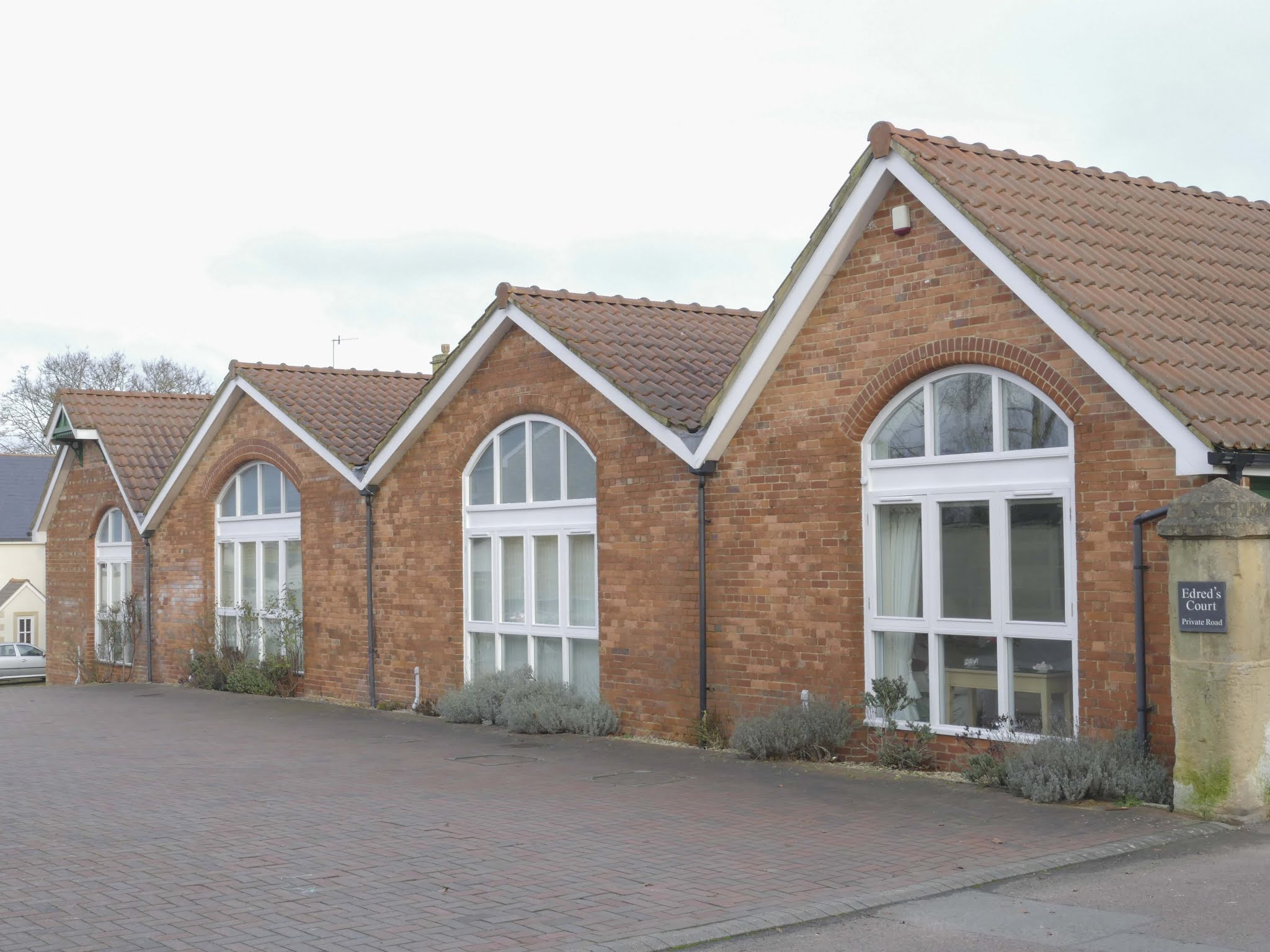
10) Keeping to the right with lead you to Horsebrook, past Maundrell House. This house is named after owner E.W. Maundrell. Edred's Court is built on the land of the original foundry which was built c. 1850s and was managed to c. 1885 by George Gough. Afterwards, the business was run by E.W. Maundrell, and made a wide range of goods, that included manhole and drain covers (one can still be seen on North End). The foundry closed in 1957, while the site was still used for engineering until the late 1990s.
Continue along Horsebrook back to the start point at the bridge, perhaps taking a few extra mindful moments to watch the water flow past and catching sight of some of the trout that populate the river.
Thank you for using this route!
Click to watch the video of Route 002a - Horsebrook Nature Trail - Linear .
Steps 1-3 originally published at: https://www.visitwiltshire.co.uk/calne/blog/read/2020/08/walk-walking-the-horsebrook-nature-trail-b457
Words and Photographs: Tim Havenith
Map from the lovely folks at OpenStreetMap.
February 5, 2021
Tree measuring on Abberd Drove
Sure enough, a line of trees starting near what is now The Slades dotted a procession all the way to Abberd Plantation, along a lane known as Abberd Drove in the 1840s: Spitfire Road, today.
During the 1840s, much of the land either side of the drove was owned by Marquis of Lansdowne, Henry Petty Fitzmaurice and used as allotments by many local residents.
Sadly, Abberd Plantation no longer exists, but has been replaced by High Penn Solar Farm.
 Abberd Drove to Abberd Plantation, lined with trees.
Now, it was likely that these were the same trees as see in the 1886 OS map, but there was only one way to be sure; and that was to measure one.
So, one cold January day, I set off with my family to measure an oak tree, but how does one measure a tree? And, what did we find?
 An old drove lined with English oak trees
 Red kites:
 More common than muck?The Woodland Trust has an excellent PDF which describes measuring an oak tree to estimate its age. The basic method is using a long piece of string or tape measure, at least 5 metres in length (but longer to be safe), then feeding that string around the girth of the selected tree (ideally between two or more of you) at a height of 1.5 metres. You can then use this measurement to check page two of the PDF to get an estimate of your tree.
As we wandered down the old Abberd Drove, the sky peppered with red kites, that have become even more common than muck around these parts, we picked out a tree we felt had an averaged-sized trunk.
Our tree, the third one from the turn off to the Sands Farm Materials Recovery Facility, gave us a measurement of 4.68 metres (15ft 4inches). This measurement places the tree between 1815, the British victory at the Battle of Waterloo, and 1715, the year of the First Jacobite rebellion in Scotland.
 My awesome eldest assisting with
 the measurement.
This result suggests that this tree, and all the other oaks along this length, are indeed the trees shown on the OS map of 1886.
Two questions remain - and will probably endure: Why were the trees planted, and by who?
While not every question can be sufficiently answered, it is the exploration into history that is important. Not only was this great time spent with my family, I found it to be a fantastic way to bring nature and local history together.
We'd love to hear about any of your tree exploits in and around Calne. Head over to Calne Tree Planting Partnership Facebook page to share your adventures with us!
January 31, 2021
Place names of Calne: Round House
 Round House. Calne Heritage Centre Collection.
The Round House was a beautiful building at Wessington Park. This octagonal building originally thought to be a building to dry wool, but by the time it was demolished it had been converted into 3 cottages, with the thatched roof being updated to a tiled roof[1].
When used to dry wool, it is likely that, in common with other 'round houses', it would have had a central flue with slatted floors from drying. The 1840s Tithes record this area as having sundry owners and sundry occupiers.
It was demolished in the 1970s, certainly by 1973, when it was reported as demolished in the Calne Community Exhibition of 1973[2].
It was replaced by a small street that bears the name 'Round House' and allows us to remember what we have lost.
References:
[1] Treloar, P., 1988. Greetings from Calne. 1st ed. Calne: Calne Town Council.
[2] Tanner, G. and Downham, R., 1973. Calne Community Exhibition. 1st ed. Chippenham: Calne Borough Council.
January 29, 2021
Route 004 - Penn Wood (High Penn)
This is a 1 mile walk around Wiltshire Wildlife Trust's Penn Wood nature reserve, taking in plenty of wildlife and two ponds, and if you're patient, at least one kingfisher.

This route is, unfortunately, not accessible. After rain, some of the route can be very muddy, so ensure appropriate clothing.
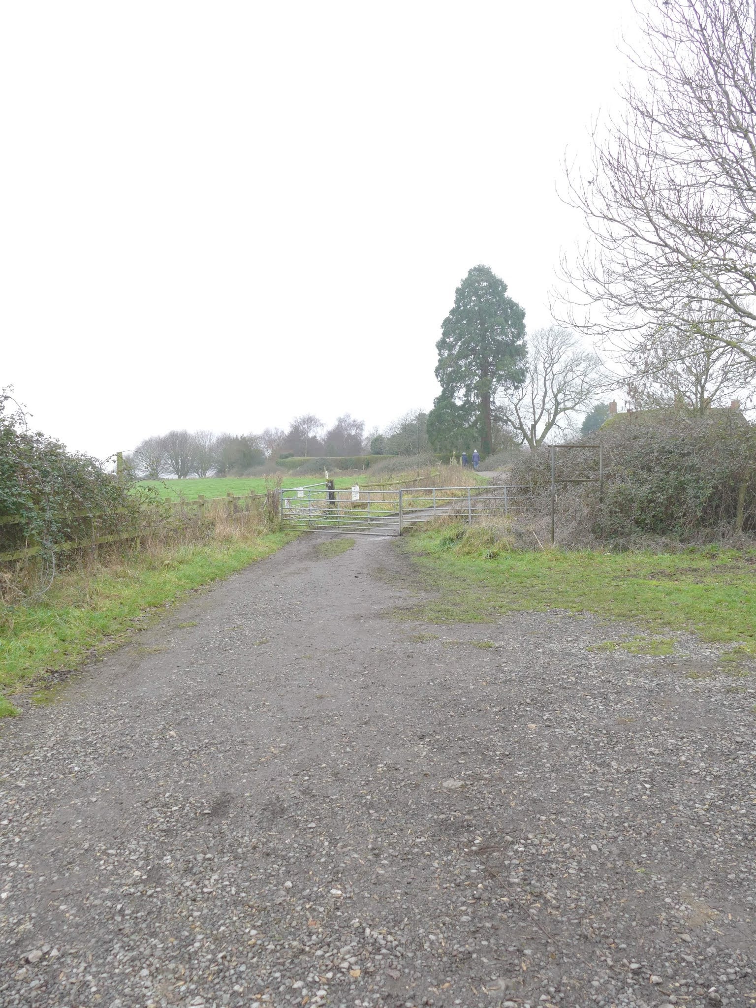
Access to the nature reserve is gained from High Penn, off Oxford Road, by the new housing development. Follow the main track uphill to the top, parking in the gap between High Penn farm access gate and the nature reserve gates.
 Directions1) There are two lots of gates to pass to gain entry into the reserve. When through the gates keep to the left track.
After the parking place, we passed High Penn farm, which likely originated from the common pasture called 'Penn' in the 1600s. It was held by William Northey in 1728 and accounted for 131 acres. Over time most of the land has been sold, with the nature reserve on a long-term lease from Hills Waste.

2) Take the left-most track along the edge of the 7.7 hectare nature reserve. In the 1930s, this land was first worked as a sand quarry by The Hills Group, before being used for inert landfill.

3a) You will then reach a metal gate. Here we will turn left, keeping to the main reserve, however if you're a Geocacher, you may wish to detour and collect the caches before returning to the walk. Also, on the other side of the gate is the slow worm refuge, which was populated in 2003 by slow worms from the allotments near Newcroft, before Hills Homes developed housing there.
After a short distance you will arrive at a pond surrounded by trees.

3b) You can turn left, following the blue line on the map, if you'd like to take in the views of this pond. If you're patient, you may see a kingfisher swooping across the pond's surface.

4) Returning back to the main route, follow the track ahead, which will lead to a private fishing lake.

5) Even in winter, this fishing lake provides beautiful views, with lots of birds to see. Take care when walking around the pond, as some of the path is narrow and close to the water.
Aside from the lake at Bowood, Penn Wood likely boasts the largest publicly accessible bodies of water in this area of Wiltshire and is quite a well kept secret!
6) Follow the track around and past the fishing lake. At the junction, take the left path which will bring you back to the gates that we started out from.
There are many paths within the nature reserve, which are well worth exploring. There are thousands of trees, and in the summer plenty of orchids to enjoy.
Thank you for using this route!
Words and Photographs: Tim Havenith
Map from the lovely folks at Google.
January 25, 2021
Route 003a - Cherhill Downs Walk (Short)
This is a walk up to the Cherhill White Horse, around the Lansdowne Monument and back down to the A4 alongside the village of Cherhill.

The route is around 1.70 miles and will take around 1 hour without stops.
This route is not suitable for wheelchairs / pushchairs. Please ensure that you dress sensibly , there are some sharp uphill and downhill stages over chalk which can become very slippery.
Parking is available at Cherhill village or the lay-bys along the A4 (please be careful if using these, the A4 is a busy and fast road).
While there are no shops at Cherhill, during normal times, The Black Horse pub is open (check with the pub for opening times).

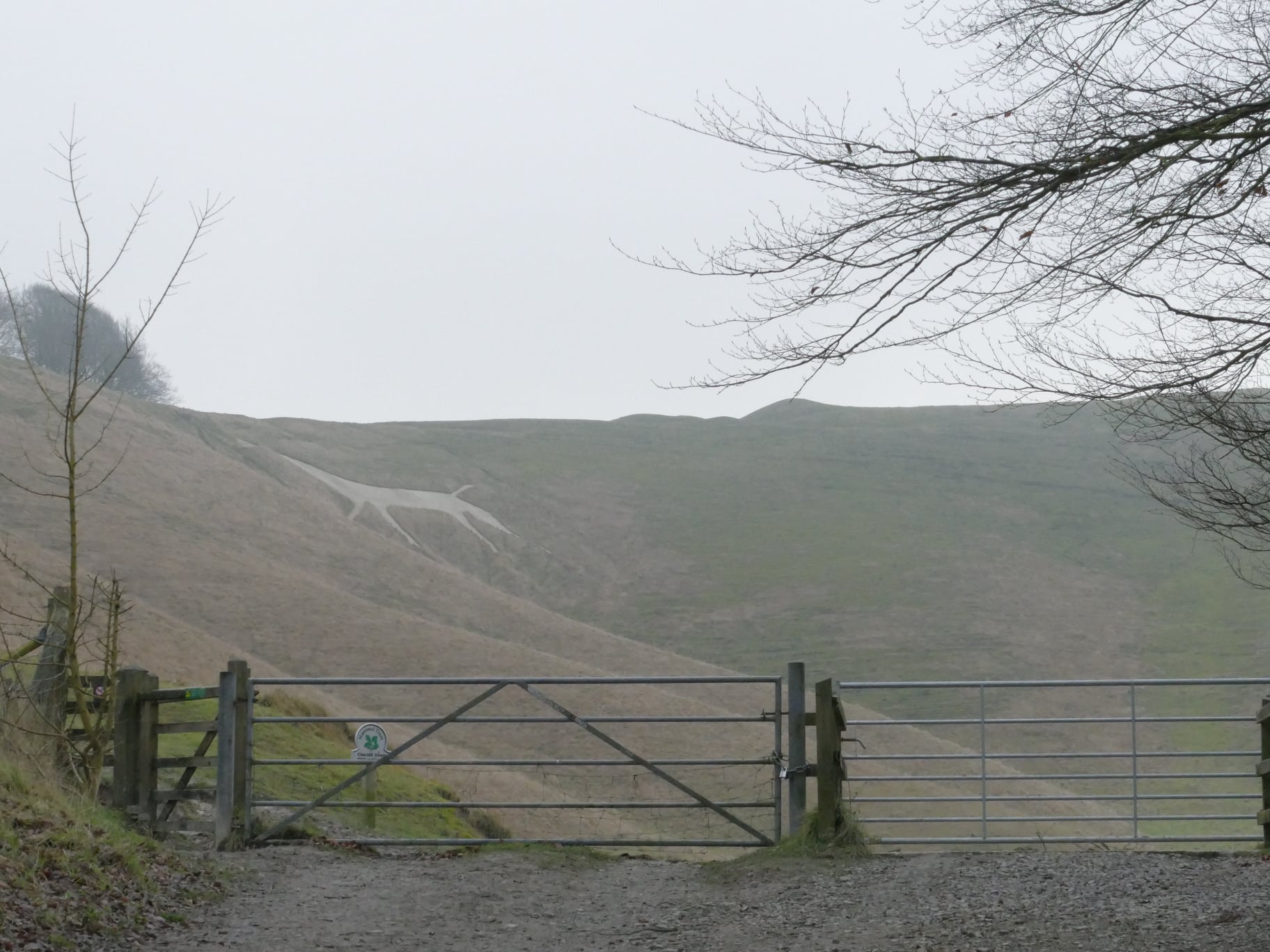
1) When you have parked / arrived at the start point. Enter the track by the White Horse information board and walk along the lovely beech trees. Soon you will be afforded your first view of the horse, monument, and Oldbury Castle.
2) At the gate, take a moment to sit on the bench, knowing that the next stage is a pretty serious (for Wiltshire) uphill climb.

3) Make your way up the chalk path, taking in the ever-expanding view of this wonderful area.
The White Horse was a scheme brought about by Dr Christopher Alsop, doctor at Bowood, in 1780. It is Wiltshire's second oldest horse and was made under his instruction - by megaphone!
 4) At the top of the hill, follow the path veering right and head towards the Lansdowne Monument.
To your left is Oldbury Castle, an iron age hillfort. Amazingly, a 1996 geophysical survey discovered 20 circular features within the hillfort. These are thought to be the 2000 year old remains of Iron Age round houses.
At this stage you will be at the highest part of the walk, at around 258 metres.
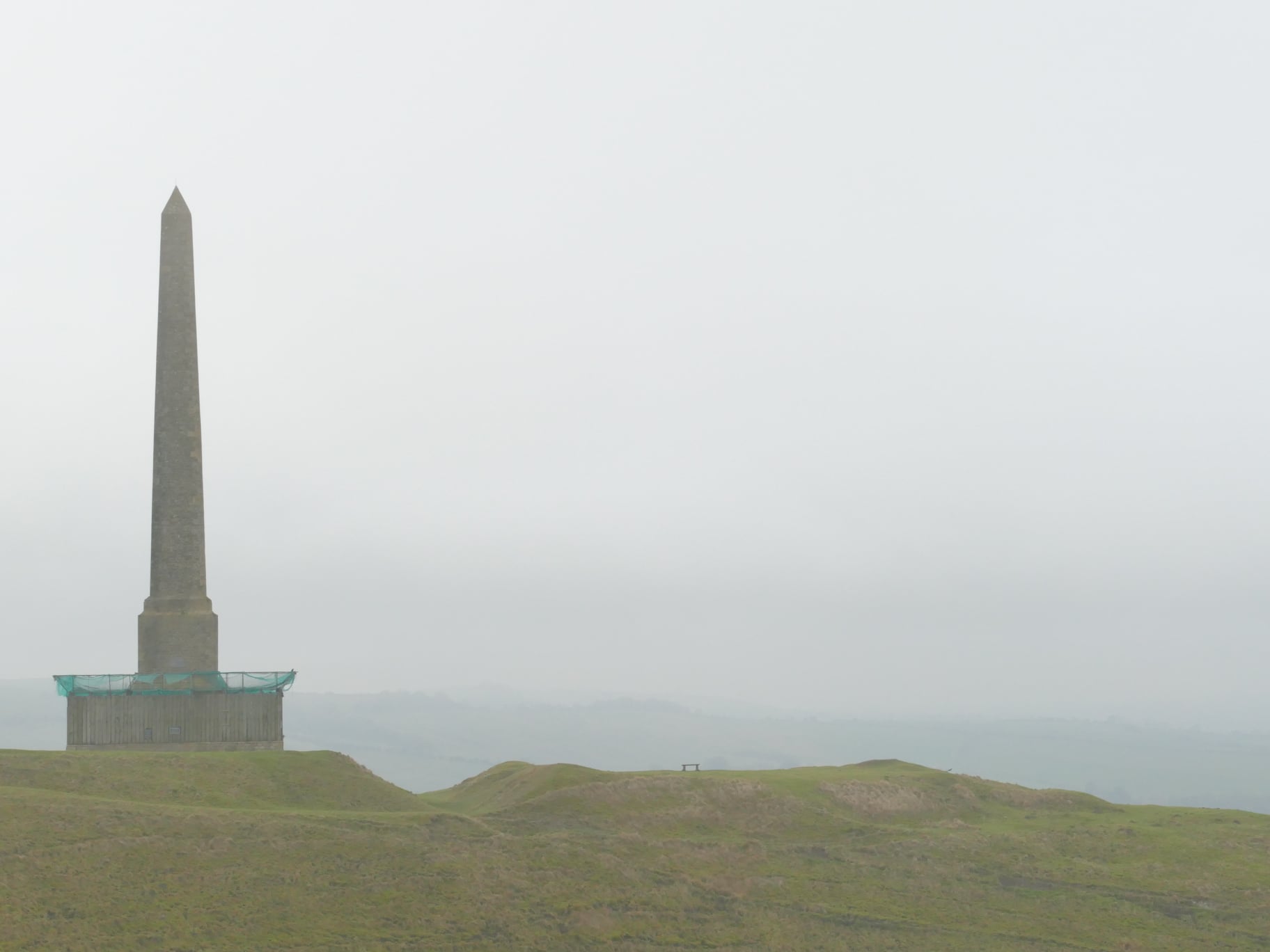
5) As you approach the monument, veer to the right of it. This will allow you to read the information board and appreciate the work that must have gone into this structure. It must have been difficult work getting all of this stone up the hill in the 1700s.
This monument, in dire need of repair, was built in 1845 using a design by Sir Charles Barry for the 3rd Marquis of Lansdowne, in memory of his ancestor Sir William Petty. Unfortunately, repairs completed in 1990 by the National Trust used soft stone, which is now crumbling down.
 6) Near the monument is a bench to rest and enjoy the view, perhaps have your lunch!
After the monument, follow the path to the right, there is a fence to the left. Follow this down to the wooden gate, which you can open via the latch.
Keep to the left of the mound, which we'll walk around.
The the left you will see some woodland a short distance away. Within this woodland the River Marden emerges, making its way to Calne and then towards Chippenham to meet with the River Avon.

7) As we round the mound, you will see some gates. Head to the leftmost gate, which can be operated by latch.
Make your way down the chalk path, which is steep - and can be slippery.
As you reach the bottom, there are gaps in the hedgerow, take a moment to appreciate the views of the monument, castle, and horse. Such a spectacular part of Wiltshire.

8) Crossing the A4, you will see that there is a Queen Victoria wall box, possibly dating from the 1890s.
From this point, make your way back to your vehicle, while making the most of the countryside views on your way.
Thank you for using this route!
Words and Photographs: Tim Havenith
Map from the lovely folks at OpenStreetMap.
Route 002a - Horsebrook Nature Trail - Linear
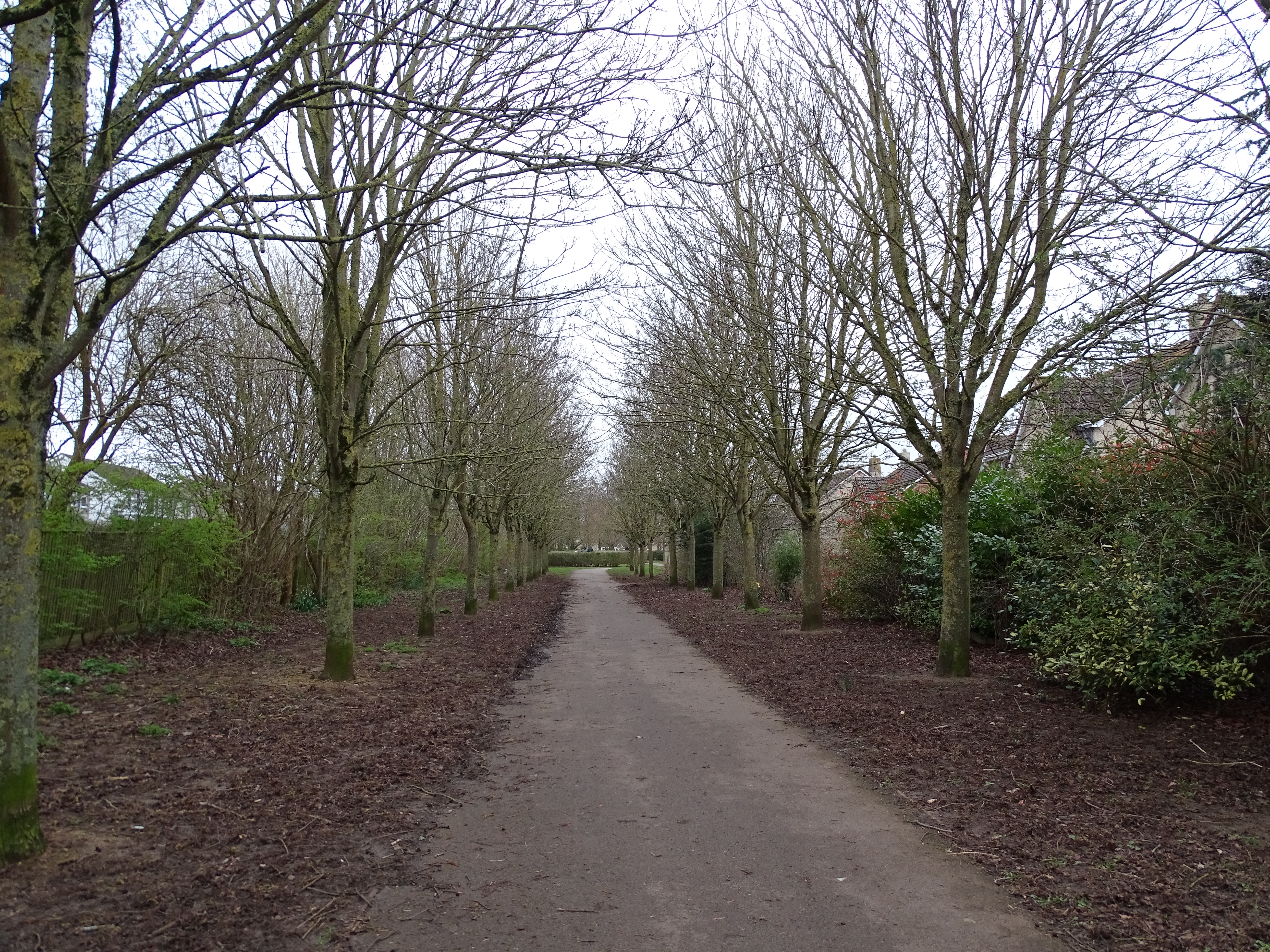
This short linear walk will take you along the Horsebrook Nature Trail, one of Calne's best kept secrets
 Important Information:
There is roadside parking available. There are no benches or toilet facilities. This path is fine for pushchairs and wheelchairs - I would expect it to be find of mobility scooters (please give me feedback if you have experience of this route with a mobility scooter).
1) This picturesque stretch of land next to the river Marden was gifted to the town by three-time Calne Borough mayor, Charles Robert Syms. Walking along the recently upgraded path, so much wildlife can be seen, from brown trout and mandarin ducks to squirrels and deer.Beginning at Horsebrook, which has space for on street parking, the first sight of the river is gained from the bridge. Looking further down the street, you will be able to see Horsebrook mill. The mill, also known as Swaddon’s mill, for one of the families that ran the mill, originally dates back to the 1600s as a fulling mill.
The mill was sold and converted a few times before being rebuilt by Joseph Bailey in 1822, who turned it into a five-storey factory, the biggest in Calne at the time. The mill was devastated by fire in 1861 and the 1930s, before eventually being turned into flats.
Facing south on the bridge, you will see a path to the right of the bridge railing, from here we begin our walk along this peaceful brook. Since the path was upgraded in 2018, this walk is now accessible from here to the steps encountered at Brewers Lane.
Horsebrook, a name which was in use by 1828, likely refers to horses that would have used the brook when at the mill. This first stretch of the walk is bordered by wild garlic in the spring, such an evocative scent – and just one of the many plant species that make this trail such a paradise.
2) Horsebrook Trail Plaque
Following the path as it meanders, we come upon a plaque commemorating Syms, who was a local and well-known builder around Calne. He developed nearby Horsebrook Park c. 1954 and it was the remaining land, which couldn’t be used for housing, that was donated to the town.
Further along the path, to the left, is an opening that reveals a cluster of bug hotels, also some young trees, which will make the path even more secluded in time. For now, we can see the housing on Saddleback Close with their gambrel roofs and riverside gardens.
3) As we come to the end of our walk, what always grabs me is the amount of birdsong along the trail. As the crow flies, the trail is only 200 metres from the A4: The Great West Way. For me, the highlight of the walk is the exotic-looking mandarin duck. Seeing them perched on the branches of trees never ceases to amaze me. They’re often seen across the river, in an opening just prior to the steps that lead out of this section of the trail. Quiet patience may also bring out the muntjac deer that frequent the site.Upon climbing the steps, you can continue across Brewers Lane to a second, shorter section of the trail. Alternatively, turn right following Shelburne Road up to London Road. Turn right again and follow London Road to The Green. Again, turning right, continue to Horsebrook, completing the walk. The final option, is to stop before the steps, turn back, and enjoy the trail in reverse.
Thank you for using this route!
Click to watch the video.
Originally published at: https://www.visitwiltshire.co.uk/calne/blog/read/2020/08/walk-walking-the-horsebrook-nature-trail-b457
Words and Photographs: Tim Havenith
Map from the lovely folks at OpenStreetMap.
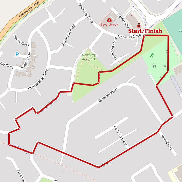
Route 001a Newbury Avenue Park (Short)
This route is less than 1 mile with an altitude variance of around 15 feet.
Important information:
Plenty of roadside parking is available for those that don't live along the route.
Additionally, there is a local centre, which includes a Tesco Express.
While this walk is fine for pushchairs, an oddly placed gate at the North End Play Area and some kerbs mean that I wouldn't recommend this route for mobility scooters.
Directions:
1a) I will start describing this route from Amberley Close, where the path follows a line of trees, then an avenue of trees that lead directly to Newbury Avenue Park.
1b) Newbury Avenue Park
There is a lovely circle of lime trees here, and plenty of benches. There is a dog bin, however no litter bins yet.

2) Exit the park on via the western path and continue in a westerly direction through Newbury Avenue.
This development was part of the Persimmon-led Lansdowne Park estate, built in the 2000s.

3) Cut through, via the gates on the left and at the end of this short alleyway, turn left again. The path bends a little before coming to more gates. At this point, turn left onto Carpenter's Close.
You will notice that this is no longer a close. It was opened up during the same Lansdowne Park development, which added Woodsage Way.
4a) Continue on to Braemor Road, a 1960s development. Braemor Road will turn a left corner, with the straight direction becoming North Way. Just after this point, on the left, is an alleyway with a lovely beech hedge.
Follow this alleyway to the North End Play Area.
There is plenty of play equipment for children, along with benches.

4b) Exiting the northern end of the park will lead you back to Amberley Close, the end of this circular walk.

Thank you for using this route!
Words and Photographs: Tim Havenith
Map from the lovely folks at OpenStreetMap.
December 31, 2020
Place Names of Calne: Holy Trinity, Trinity Park and Church View
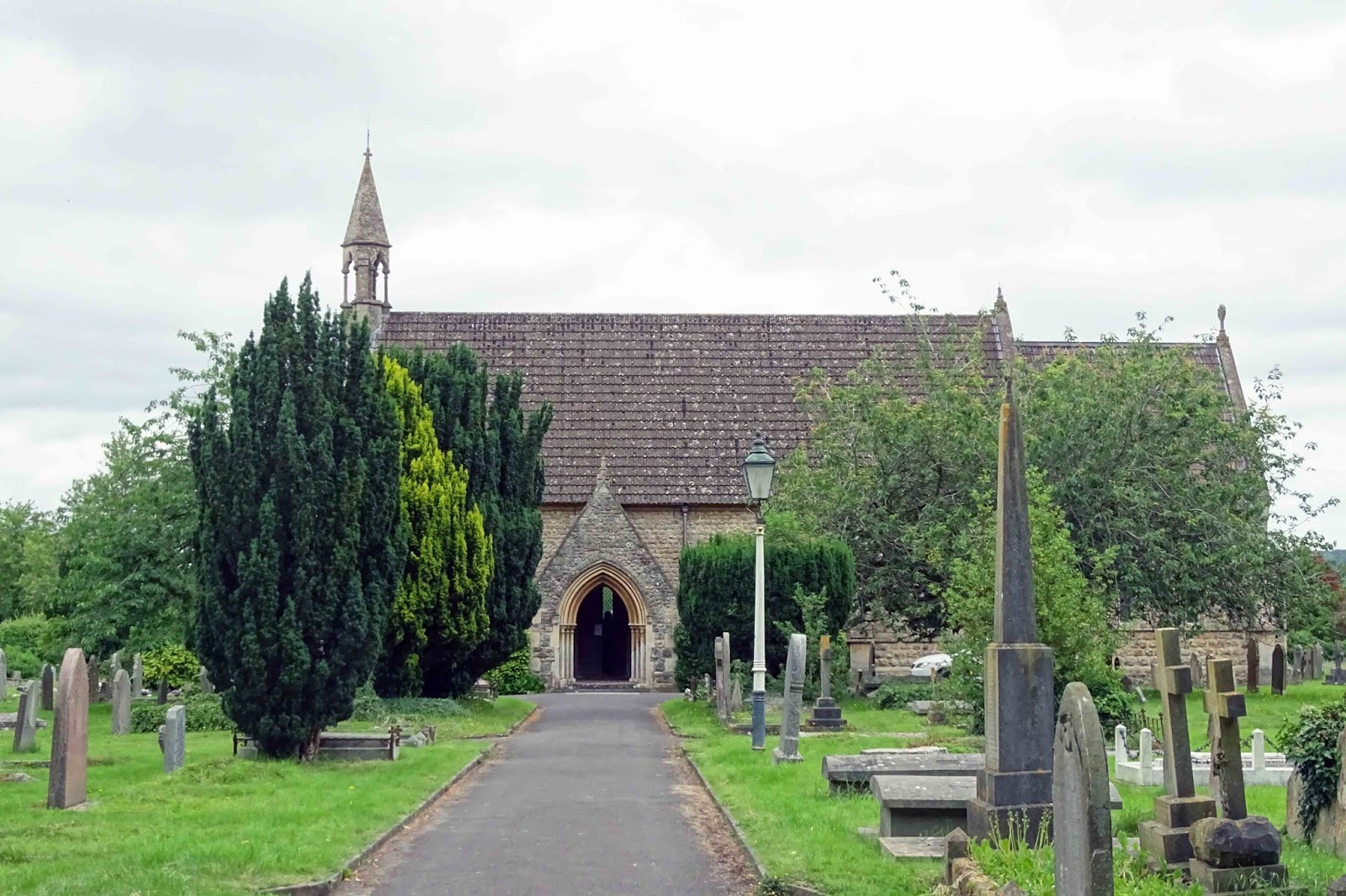 Both the church and school of Holy Trinity were built in 1867, with the church being Grade II listed, and is the resting place for many of Calne's residents, such as Canon Duncan of St. Mary's, since St. Mary's churchyard closed[1][2].
Holy Trinity refers to the Christian doctrine that while there is one God, there are three divine representations, referred to as the Father, the Son, and the Holy Spirit.

Trinity Park was developed in the 1970s-1980s and comprises primarily of detatched housing, with some terraced near the end of the street. The housing is either block or brick with some having interesting wooden bays on the first floor.
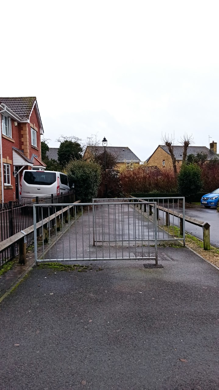
 Church View
Church View was built in 2006[3] by Colburn Homes on land that is inbetween Trinity Park and Tudor House. This land was previously a site for warehouses.
I've included Church View in this post as being opposite Holy Trinity, it must have been named for this church!
References:
[1] CHURCH OF THE HOLY TRINITY, Calne - 1270942 | Historic England. 2019. CHURCH OF THE HOLY TRINITY, Calne - 1270942 | Historic England. [ONLINE] Available at: https://historicengland.org.uk/listing/the-list/list-entry/1270942. [Accessed 30 June 2019].
[2] Calne - Holy Trinity C. of E. School, Calne. 2019. [ONLINE] Available at: https://history.wiltshire.gov.uk/community/getschool.php?id=440. [Accessed 30 June 2019].
[3] Application number N/06/02474/REM.
[4] Consecration John Bull - Monday 28 March 1853 [ONLINE] Available at: https://www.britishnewspaperarchive.c... [Accessed on 10 March 2020]
November 30, 2020
Place Names of Calne: Bremhill View
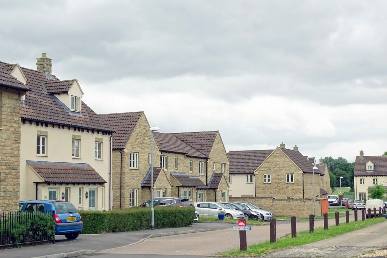
 Bremhill View is located off Lickhill road and is a group of terraced houses that leads to Calne Football Club[1], which has been there since the 1960s.
The street itself was built as part of the Calne Borough Council's (disbanded 1974) pre-war Northend estate[2], the first council estate in Calne. All of these houses have a distinctive elongated hexagon style chimney stack, that is not carried on with the more recent developments, such as the 1960s-built, Braemor Road.
The road itself actually faces the beautiful village of Bremhill, which it is named for and lies around 1 mile to the north west.
 Note the interesting chimney stacks.
References:
[1] Calne Town. 2019. Calne Town. [ONLINE] Available at: http://www.pyramidpassion.co.uk/html/calne_town.html. [Accessed 29 June 2019].
[2] Calne: The town in the 20th century | British History Online. 2019. Calne: The town in the 20th century | British History Online. [ONLINE] Available at: https://www.british-history.ac.uk/vch/wilts/vol17/pp44-51. [Accessed 29 June 2019].