Tim Havenith's Blog, page 12
October 16, 2021
Please donate to Calne Food Bank #WorldFoodDay
I've just been reminded that it's #WorldFoodDay today.
Calne Food Bank do a fantastic job in our town. It's so important that it receives our continuing support, particularly with their home under threat of demolition.If you aren't able to get food to them right now, please consider donating to our Fundraiser. With the nights drawing in, every little helps.Please donate:https://gofund.me/0de89d26Thanks,Tim

October 1, 2021
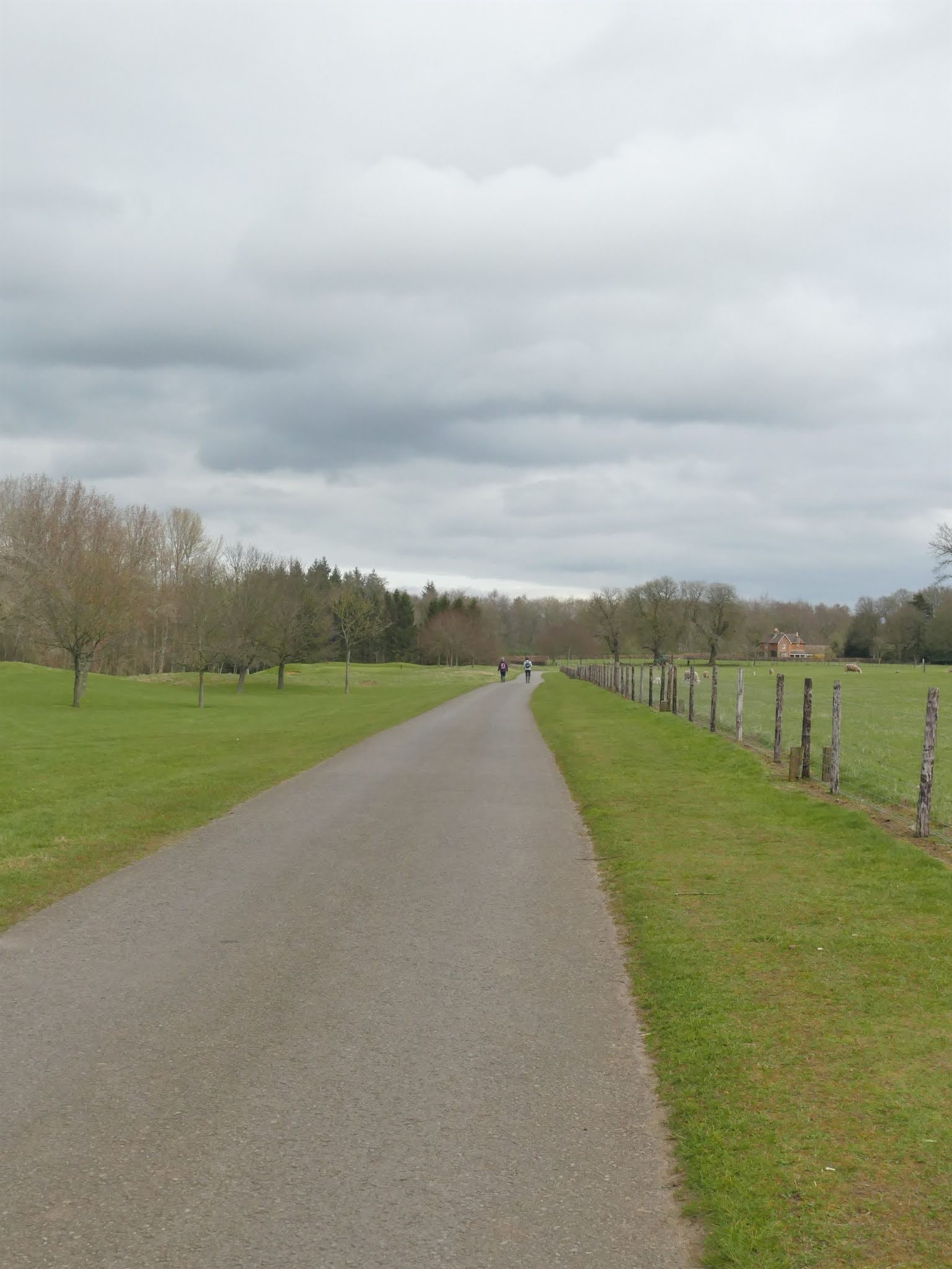
Route 014: Bowood Circular
This 6.5 mile trail will lead you through the Rights of Way paths around the beautiful grounds and lake of the Bowood Estate.

Important information:
Parking is available in the lay-by opposite Pillars Lodge. Take special care crossing Silver Street (A3102).
This trail is accessible from Pillars Lodge to the bridge by the lake and back again, creating a 1.2 mile (2 km) trail.
There are not many benches along this trail. The Black Dog Inn is worth a visit, when open.
Please make sure that dogs remain on a lead as there are livestock in the fields. Part of this walk goes across a permissive path, for which walkers are welcome.
Directions:

1) This trail begins at Pillars Lodge. The gate pillars that give this Grade II listed, early Victorian, cottage its name, used to be much closer to the road, but have been moved back as the road has been widened.
This part of the trail is a single track for just over half a mile. When you reach the fork in the track, continue straight on, ignoring the right fork that leads to Pinhills (and upon which track we shall return).
Shortly after Pinhills, to your right, is Hilltop Plantation. At Hilltop, behind the woodland, a scatter of Romano-British pot including Savernake, North Wiltshire coarsewares and combed tile have been found in the past.
As you continue, there are some gaps in the woodland, revealing beautiful countryside. One sweet name is Half Moon piece, named for its shape. Evidence suggests that this piece of land has been a wooded plantation for at least 180 years.
If you're keeping to the accessible track, then now is a good place to turn back as the track isn't as well kept further on.
If you're continuing, take the gate on the right of the track to follow the lake.

3) Cross the grassy bridge and continue through the large white metal gate. Turn right to follow the path alongside the lake.
It can often be the case that you have the RoW around Bowood more or less to yourself - and what a beautiful landscape it is.

4) This whole landscape is a Grade I listed park and garden. With views across the lake, it is not difficult to see why. Believe it or not, under the waters lie the remains of the village, or hamlet, of Mannings Hill.The rising lake eventually subsumed the village, with cottages built for the displaced residents, possibly at Sandy Lane. One apocryphal story tells that one old lady refused to leave her house, staying until the rising waters reached her hearth.

5) Follow the path around to the right. Cross the dam, via the kissing gates, that separates the lake from the ponds that are fed by Wash Way stream. To the right of this bridge you will hear a cascade, built c. 1765. There is no public access to the cascade, which is Grade II listed and likely another Capability Brown feature, but it is created of two high steps of tufa. The water from the pond supplies this cascade from a covered opening, which falls into a brick-lined circular tank.

6) Follow the well-worn path and go through the kissing gate beside the wooden gate. Continue along the path to the right edge of the field, following the blue 'Public Footpath', which will lead you across the middle of the field, often occupied by sheep.
7) Follow the path through the kissing gate, at the end of this field you will be at the tarmac track that connects to an old farmstead called The Osprey, which as its origins back in the 1750s.
Turn right and follow this track, with the golf course to your left. The wood, a little further on, to your left is called Brick Kiln Wood and was the home to a Brick Works back in the 1800s.

8) Following the blue 'Public Footpath' signs, provided by the Bowood Estate, will take you past a tree plantation and The Osprey.Shortly afterwards, you will take a right. Then a left, following a short way to the east.Then take another left to follow the path into the woodland.

9) Continue to follow the path through the woodland. Eventually, you will have the gold course to your left. You will then notice that the access road into Bowood House and Gardens is visible on your right. Continue onwards, until there is a gap in the trees. This will allow access to the access road. Follow this through the large white gates and onto Church Road.Straight ahead is the 1873-built house and village hall, which was previously a school and built for the Bowood Estate.

10) After exiting Bowood onto Church Road, turn right onto Old Road. taking in the varied beautiful houses along this road; which used to be called Rag Lane.

11) At the end of Old Road, turn right onto New Road (A4), keeping to the pavement.At a group of cottages, the path becomes a driveway before ending. At this point cross the road, taking good care.Continue in the same direction on the other side of the A4, crossing Norley Road.

12) Shortly after Rumsey Farmhouse, you will be treated to the fabulous view of Cherhill White Horse and Black Dog bridge, designed by Mark Lovell, for the millennium. The main arch of this bridge utilises redwood glue laminated (glulam) beams and is a fantastic advertisement for the Sustrans cycle route that it serves.

13) Just after the exit road from Bowood House and Garden, the path begins on the south of the A4 again. When it is safe cross the road. You are now walking alongside the runoff stream from the Bowood Lake, which will join the River Marden near the bridge.
As you continue under the bridge, take a moment to take in the architecture of the bridge. Then turn right up the track to Black Dog Halt. As the top of the incline, you'll be greeted by the two dogs of Black Dog Halt. The gate and railings were designed by artist, Laura Lian, after winning a 1988 competition to separate the cycle path from the residential houses, including the old station master's house.

14) Head left (south east) away from the bridge. You will walk past the old station master's house, dated 1874, with a version of the Lansdowne crest. The bungalow before this house was part of the stables when the halt was operational. It has since been converted into a lovely bungalow by Patrick Wiltshire, who called it Patrick's Folly.
Continue along the cycle path for around 0.75 miles / 1.20km, until you reach a gate on your right with a notice stating 'Permissive Right of Way to Wenhill Lane'.This field leads you towards Wenhill, at the end of the field, pass the gate onto the track, turning right towards Wenhill Cottages.
Shortly, you will see a blue 'Public Footpath' sign. Follow this into the field and you will reach a Bowood information board.

15) Continue along the well-worn path, which differs to the Right of Way shown on the OS maps and no longer provides any access.

16) Eventually, you will see a gap in the hedge ahead. Cross the wooden plank bridge and the stile, keeping to the left edge of the next field.

17) Follow the path to the left at the next blue sign and cross the stile. Turn right and follow the path as it curves and reaches an access road to the Bowood Estate.
In the grounds of Pinhill farm, which is to the right of the cottages, is an L-shaped house, said to have been constructed from the ruins of the manor house by Ambrose Blake. The moat remains as a scheduled monument. The moat was drained on 8 January 1644 and the manor house destroyed by Royalists as part of Civil War action. There was no fighting here, with the Parliamentarians surrendering.
After the end of the Civil War, Ambrose was back at Pinhills. His son, Henry, became MP for Calne in 1695, 1698, and 1701. It seems that being a Royalist did not hinder the families progress after the Civil War.

18) Join the access road walking away from the cottages and through a young avenue of trees.
Eventually you will join Pinhills Lane, which quickly joins the access road that we started on at the start of the trail. Continue towards Silver Street and the end of the trail.
Thank you for using this route!
Words and Photographs: Tim HavenithMap from the lovely folks at OpenStreetMap. © OpenStreetMap contributors
September 30, 2021
Place Names of Calne: Northfields
 Northfields
Northfields was a developement that was built at the end of North End, along with Braemor Road and Corfe Crescent in the 1960s.
Back in the 1840s, the land that is now Northfields, was plot number 193 for the tithe awards. This was one of the many plots owned by the Marquis of Lansdowne, Henry Petty Fitzmaurice and was one of the plots within North Field and was used as arable land.
This was one of the most northerly fields of Calne.
September 3, 2021
Route 013: Abberd Brook and The Recreation Ground
This is a 1.3 mile route taking in a lovely stretch of Abberd Brook, past a spring-fed pond and two play areas. The route will then take you through the underpass at Prince Charles Drive and the fantastic mosaics. Coming back along the other side of the brook, the route will take you past the Coleman's Farm Learning and Community Centre and around the Recreation Ground, which was given to Calne by Thomas Harris. Finally, you'll walk past the house that Joseph Priestley lived in during the time he discovered Oxygen at Bowood before finishing at the point where Abberd Brook meets the River Marden.

Important Information:
There is plenty of free parking in the car park at the start point of this route.
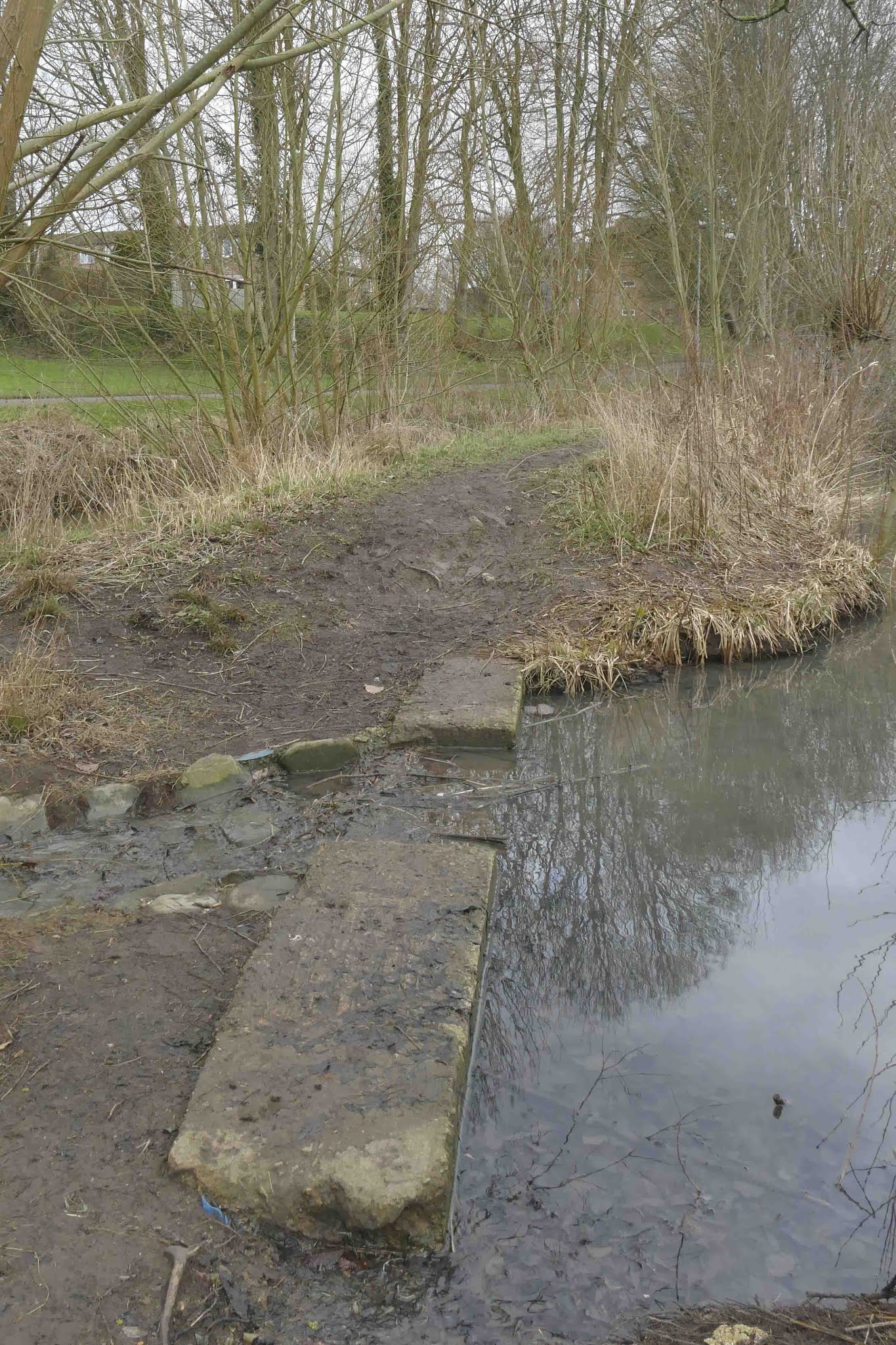
There are shops nearby, including Sainsburys. There are also public toilets available at The Pippin.This route is fantastic for kids, as there are plenty of ducks close to the start point and often at the pond, so bring along some food for them, if you like. There are also two play areas along the route and another at The Recreation Ground, just off the route. The route can be made accessible by missing out the pond, which can be seen from the main footpath.I have done this route with a pushchair with no problems, however depending on the pushchair, you may struggle at the concrete weir that allows access to the bank between the brook and the pond. Returning back around the pond to the bridge will allow you to continue the route.

Directions
1) This route begins where the Abberd Brook flows into the River Marden, at the free car park close to Sainsburys.Take a moment to read the information board that was installed by the Friends of the Abberd Brook (which is now Friends of the Marden Valley). If you've brought food for the ducks, you'll often find a raft of ducks from her all the way to the pond.

3) Take a right, crossing over the bridge, to explore the pond in greater detail. There are two options, one is taking the lower route, using the wooden platform. The other is taking the upper path around the pond. Both routes meet at the grass near the bench on the other side of the pond.
If you find that this part of the walk is not accessible to you, please continue along the brook at direction number 6.

6) After crossing the bridge, turn right to continue along the brook. Soon you'll reach the two play areas, which are separated into age groups. Just a short distance from the play areas, keeping to the path along the brook, at the back of the houses, you'll reach the stepping stones, which are fun for all generations! After a quick play, return to the route and continue along the path.


8) These mosaics, placed in 2011 and 2014, are an excellent example of a community project. Friends of the Abberd Brook, along with artists, Gill and David Reeves, and children from Priestley Primary School created these wonderful mosaics. Further along the route, you'll see even move colourful mosaics at the community centre.

9) The path along the brook goes as far as the bridge near Brook Way. Take a right to cross the bridge, but as you do, look along the length of the brook. Interestingly, no natural river will run straight for more than 10 times its width. Even the straightened brook is starting to meander within its narrow course.
Take a right as you leave the bridge, to come back to the underpass at Prince Charles Drive.
10) As you reach the underpass, follow the path to the left. At Prince Charles Drive, feel free to cross over wherever you find it safe to do so.
To reach the accessible crossing, cross Falcon Road and continue up Prince Charles Drive a short distance.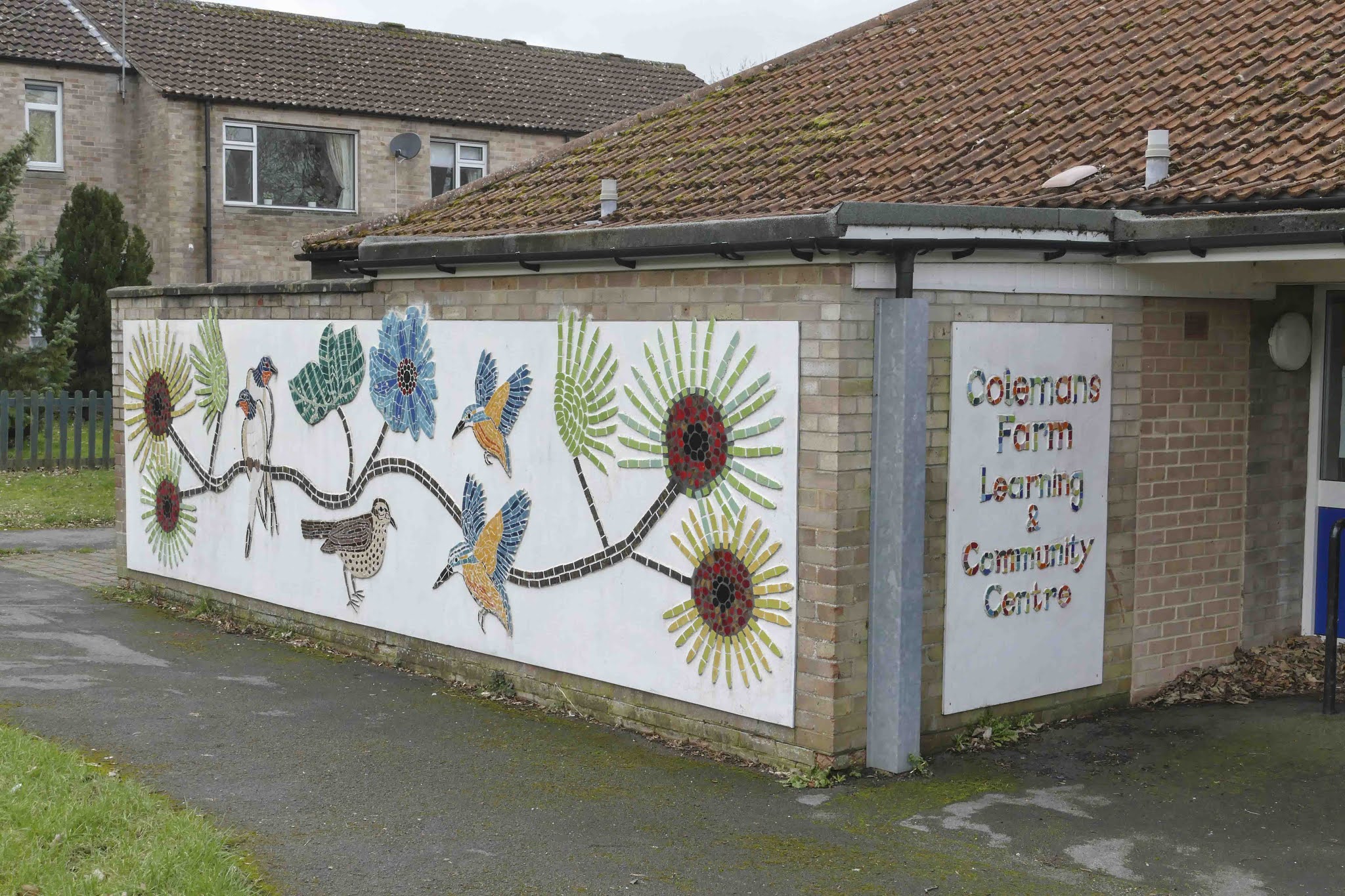
11) Now on the other side of Prince Charles Drive, follow the route back towards the underpass. Cross Forman Street, to the path on the other side of the street, then take a left to walk westwards along it. After a short distance, you'll reach the Colemans Farm Learning and Community Centre, which in 2013 was brightened up with a mosaic. The mosaic comprising of birds and flowers was created as part of a community project spearheaded by ceramicists, David and Gill Reeves.


13) Upon reaching a junction, follow the path to the left. Walking past the copper beech trees, perhaps taking a moment to sit on a bench.

14) The Recreation Ground was given to Calne by Thomas Harris, of C&T Harris, on Friday 21 August 1891, as a way to celebrate his silver wedding anniversary. Having been in the unfortunate position to lose his first two wives, you can imagine that he never expected to celebrate 25 years of marriage.For a long time, the ground were home to a cycle track, but as recreation tastes changed, the track was removed.
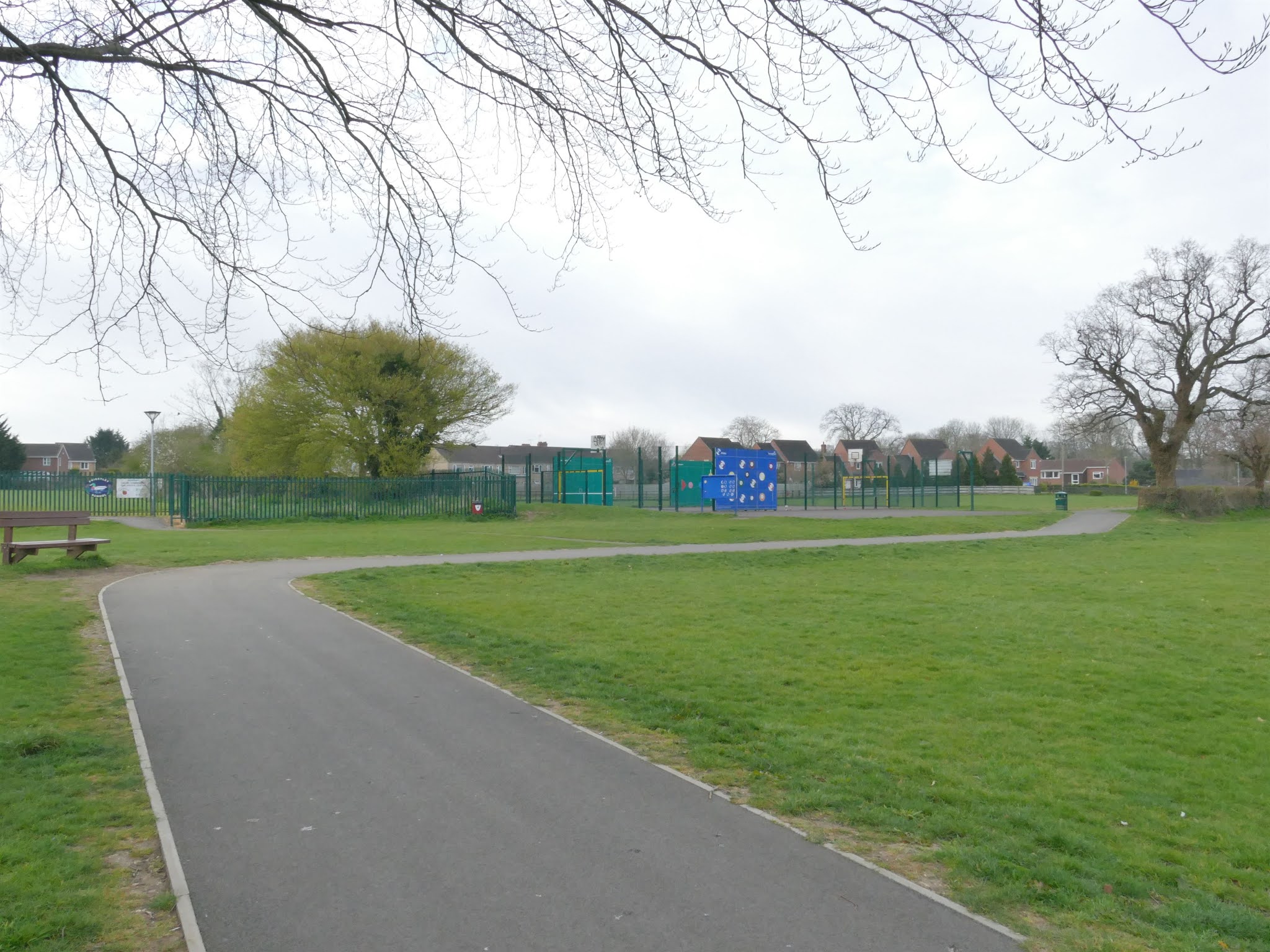
15) As you continue along the path, you will reach an area known as Hillcroft, which was owned by the Calne Methodist Church and was leased to Calne Town Council for close to 60 years before it was put up for sale. Worried about the loss of recreation space, eventually, the Council would acquire the land, part of which became a small development of five red brick houses, which were built c. 1999 – 2002, with the rest remaining as recreational ground.As you reach the enclosed play space, keep to the right path at the trees, heading towards the Calne Bowls Club, which was established in 1914.

16) After passing the Bowls Club, you will reach the pavilion, which operated as a Red Cross Auxiliary Hospital during WWII. When Thomas Harris gave the town the Recreation Ground, his wife, Elizabeth, gave a drinking fountain. However, as time passed, the fountain deteriorated and became beyond repair by the early 1920s. The drinking fountain that is currently in place was originally located at The Square in Calne was moved to replace it.
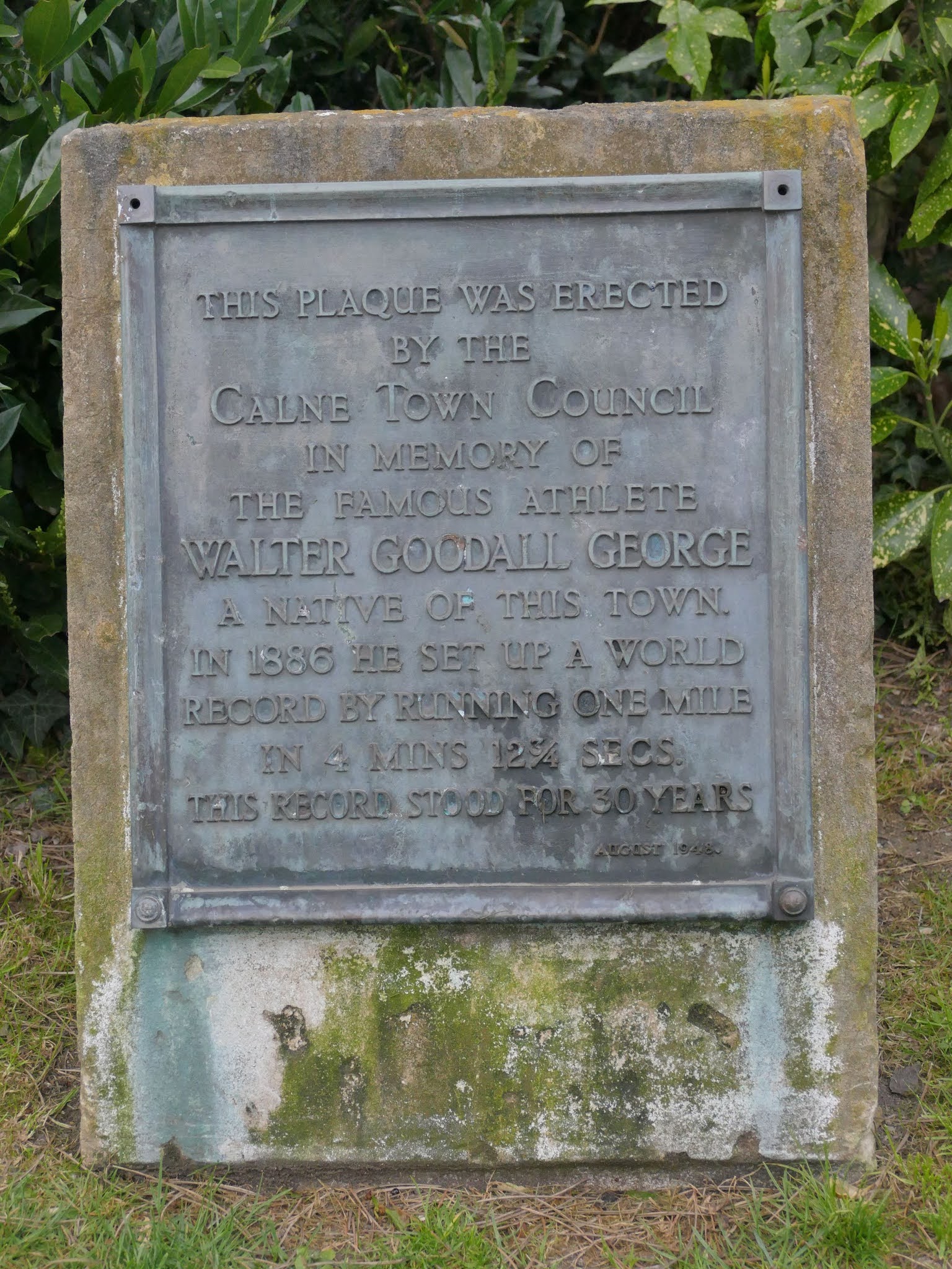 17) There are many lovely trees within the Recreation Ground, including some Scots Pine trees, along with some Lawson Cypress. The final point of interest I will mention is the plaque placed for Walter Goodall George. This is one of two plaques for the man who held the record for running one mile for over 30 years from 1886. His father, Frederick Benjamin George, operated a druggist and chemist shop in the Strand, but the family moved from Calne while Walter was still a boy.
Continue out of the gates, taking note of the Catetakers Cottage that was provided with the Recreation Grounds.

18) You will now be at the junction between Mill Street and Anchor Road. Cross to Mill Street, this time keeping to the path on the right-side of the road.
The house pictured, 3 Anchor Road, was originally the caretaker's cottage. This was part of Thomas Harris' gift to Calne when he presented the Recreation Ground to the town.

19) After a short distance, you will reach Calne Mill, which was a corn mill, closing in around 1966.Take a right, following the path and bridge along the River Marden back towards the car park. Across the river you'll see the building that used to house the Co-op, which was closed in April 2020. You'll also see the plaque affixed to a stone proclaiming the area to be Doctor's Pond. The actual pond is said to have been in the area where the car park that served the Co-op. It is named for Joseph Priestley, who experimented a lot in the pond, which is how it got the name. Priestley is most well known for discovering Oxygen, which he first discovered in his laboratory at Bowood House.

20) When you reach the end of the bridge, you've reach the end of the walk. However, take a moment to turn back around and notice where the Abberd Brook meets with the River Marden. These waters will meet with the River Avon on the east of Chippenham in a few miles time. Eventually, they will flow as far as Avonmouth before joining the Bristol Channel.
Thank you for using this route!
Words and Photographs: Tim Havenith
Map from the lovely folks at OpenStreetMap. © OpenStreetMap contributors.
August 31, 2021
Place Names of Calne: Broken Cross

The area we know as Broken Cross started as a north-south street planned village that included a mill standing and a demesne farmstead[1], with other farmsteads built in it. The Eastman Street manor, later became the Prebendal manor, essentially an endowment to support the clergyman at Salisbury Cathedral. After enclosure, this manor had 690 acres north and east of Calne[2].
Eastman Street
By the 1300s, it had been given the name of Eastman Street, which continued until at least until 1843. However, a 1728 map lists this tything as East Meade Street, which seems to be confirmed by Wilson in his Imperial Gazetteer of England and Wales (1870-72), which lists the population of the tything as 450[2a].
Around 1822, the main house on the predendal estate, which dates to around 1600, was transferred to the vicarage in exhange for the 12 acres that was allotted to the vicar in 1818. Around this time it's possible that the demesne farmstead went out of use, with the other farmsteads of Eastman Street following in the later 1800s. Along with the Grade II listed Vicarage[3], which dates to around 1600, there are two other farmhouses that still exist on what is now The Pippin. 17 and 19, The Pippin[4], dates from the late 1600s, with 55 and 57, The Pippin, another house converted into two dwellings, dates from the later 1600s, or early 1700s[5].
 17 and 19, The Pippin
 previously a farmhouse connected to the Eastman Street estate.
The MP George Lowe (1600-1682) lived on Eastman Street at the prebendal manor (by lease), saw one of the few brushes of Civil War activity that occurred in Calne. His father, Richard Lowe (d.1624) was MP for Calne in 1597, 1601, and 1614 and loaned £16 13s. 4d. to the Crown in 1604[6].
In May 1644 Edward Massey, stormed to Calne through Chippenham and arrested Lowe. His arrest was due to his attendance at the parliament, or King's assembly, in Oxford, which conducted a vote declaring the Parliamentarian members in Westminster to be traitors. Lowe stated that he didn't remain for the vote, but was there to look after an estate he had in trust. Whatever the truth, Lowe was allowed to remain at his home until he was committed to Ely House for close to 1 year. His early voluntary submission meant that the committee, who fined him only a tenth, rather than a third of his estate. Lowe was again the MP for Calne in 1661, although doesn't seem to have been very active[7].
Over time, the land of the Eastman Street Estate was purchased by various people, including George Walker Heneage, around 1856, who purchased 98 acres and added to his High Penn farm.
Broken Cross
The earliest mention I can find of Broken Cross is on a 1728 map that attributes two fields, Great Broken Cross, and Broken Cross, to Sarah Phillips. At one time, this was land of the church and it may well be possible that a cross at one time stood around this location. While many other places named 'Broken Cross' have historical evidence of their broken cross, we sadly don't[8]. Another possibility is that the name comes from the shape of the 'cross' roads here. It is easy to see on the 1840s tithe map that the cross roads don't form a standard cross, but is instead, staggered - this layout is still the same today, see map below. A final idea is that the land was near a crossroad or that runs across a road, this idea could have some merit as there is a path that breaks up Sarah Phillips broken cross fields[9].
 Broken Cross(Road?) via Google
By 1900, Eastman Street was known as Broken Cross Road, however by 1923, this was known as Pippin Road. These days, it is simply The Pippin, with Broken Cross being a connecting street between The Pippin and Abberd Way. Broken Cross is home to James House and the Medical Centre. James House, named for Dr. Alastair James, is a 22 flat residential home for the elderly, now owned by GreenSquare. Calne Family Health Centre was opened in November 1970 and is still home to many of Calne's excellent community health services[10]. The bungalows at the end of Broken Cross was part of Phase 6 of the Coleman's Farm Estate, developed c. 1973-1975.
References:
[1] Calne: Calne outside the town | British History Online. 2019. Calne: Calne outside the town | British History Online. [ONLINE] Available at: https://www.british-history.ac.uk/vch/wilts/vol17/pp51-64#anchorn6. [Accessed 14 August 2019].
[2] Calne: Manors and other estates | British History Online. 2019. Calne: Manors and other estates | British History Online. [ONLINE] Available at: https://www.british-history.ac.uk/vch/wilts/vol17/pp64-79#highlight-first. [Accessed 14 August 2019].
[2a] Wilson, J., 2019. Imperial Gazetteer of England and Wales. 1st ed. London: A Fullarton & Co..
[3]
THE VICARAGE, Calne - 1247332 | Historic England. 2019. THE VICARAGE, Calne - 1247332 | Historic England. [ONLINE] Available at: https://historicengland.org.uk/listing/the-list/list-entry/1247332. [Accessed 31 August 2019].
[4] 17 AND 19, THE PIPPIN, Calne - 1247468 | Historic England. 2019. 17 AND 19, THE PIPPIN, Calne - 1247468 | Historic England. [ONLINE] Available at: https://historicengland.org.uk/listing/the-list/list-entry/1247468. [Accessed 14 August 2019].
[5] 55 AND 57, THE PIPPIN, Calne - 1270865 | Historic England. 2019. 55 AND 57, THE PIPPIN, Calne - 1270865 | Historic England. [ONLINE] Available at: https://historicengland.org.uk/listing/the-list/list-entry/1270865. [Accessed 14 August 2019].
[6] LOWE, Richard (-d.1624), of Eastman Street, Calne, Wilts.; formerly of Salisbury, Wilts. | History of Parliament Online. 2019. LOWE, Richard (-d.1624), of Eastman Street, Calne, Wilts.; formerly of Salisbury, Wilts. | History of Parliament Online. [ONLINE] Available at: https://www.historyofparliamentonline.org/volume/1604-1629/member/lowe-richard-1624#footnoteref16_gzh8mi2. [Accessed 14 August 2019].
[7] LOWE, George (c.1600-82), of Calne, Wilts. and Pennyfarthing Street, Oxford. | History of Parliament Online. 2019. LOWE, George (c.1600-82), of Calne, Wilts. and Pennyfarthing Street, Oxford. | History of Parliament Online. [ONLINE] Available at: https://www.historyofparliamentonline.org/volume/1660-1690/member/lowe-george-1600-82. [Accessed 14 August 2019].
[8] Calne: Calne outside the town | British History Online. 2019. Calne: Calne outside the town | British History Online. [ONLINE] Available at: https://www.british-history.ac.uk/vch/wilts/vol17/pp51-64#anchorn6. [Accessed 14 August 2019].
[9] Cavill, P., 2018. A New Dictionary of English Field-Names. 1st ed. Great Britain: English Place-Name Society.
[10]Beale, N., 1998. Is that the Doctor?. 1st ed. Trowbridge: Cromwell Press.
August 13, 2021
Route 012: Calne to Bremhill Circular
This 3.2 mile trail will take you across the countryside connecting Calne and Bremhill, bringing you back down past the Dumb post Inn to the confluence of Fishers Brook and Cowage Brook, before heading back into the fields near Swerves Farm back into Calne.

Important Information:
On-street parking is available near Tesco Express, which is the start and finish point of this trail.
The trail incorporates, stiles, gates, and bridges over fields and roads. Part of this trail is along the road at Dumb Post Hill and down past Ratford Bridge and Swerves Farm. Please follow the Highway Code advice and face oncoming traffic when walking the road.
Directions
1) At Tesco Express, cross at the light-controlled crossing and follow the pavement to the roundabout at the end of School Road. Follow the pavement to the right, onto Beversbrook Road.
 2) As you continue on, look out for Lickhill Farm to your right. Safely cross the road at the Public Footpath sign, which leads to a stile. Cross this and the field beyond it. There are another two stiles, which will get you across the farm track and into another field. This field is often used by cows.
3) There are expansive views from this field, which provide the first glimpse of Bremhill. This place name is 'bremel', for a collection of brambles. Over time the village name became bremhill; effectively, brambles on the hill. Bremhill has a long history with Athelstan ging Bremhill to Malmesbury Abbey in 935.Continue along the edge of this field, crossing the stile at the lower corner.

4) A short distance further along leads to a bridge over Fisher's Brook. This brook has also been known as Bevers Brook in the past, as highlighted by a 1827 Parish map used by William Lisle Bowles, vicar of Bremhill, poet and writer on histories of Bremhill and Lacock.
Continue across the bridge and up along the left edge of the following field. As you continue up the hill, take a look back at the view. You be able to follow Fisher's Brook due to the corridor of shrubs and trees, which makes for a lovely view.

5) As you reach Lower Whitley Farm, take a left through the gap in the hedge, just before the 'Private Land' notice. With the hedge on your right now, continue along down past the horse paddocks and through the gate. At the end of the paddocks, you will reach a smaller gate, which in turn will lead you to a bridge over Cowage Brook.

6) While you're on the bridge, take a moment to view Cowage Brook. This brook has its origins as far away as Tockenham, Lyneham and the medieval village of Woodhill, near Bushton.
Continue along the right edge of the adjoining field, until you reach the next gate. Continue on through the next field, going through the gate next to the metal trough.

7) You are now in the final field before reaching Bremhill. Continue onwards to the top right corner of the field. Upon going through the gate, you will reach the village via the alleyway, emerging at Brook Farm.
Take a left, continuing past the picturesque Grade II listed well house, built c. 1875 of ironstone rubble with a timber frame and a pyramidal roof of fishscale tiles.
After a short distance, you will reach a bench, where you may wish to take a well earned rest. Here you will see the scheduled, and Grade II listed, medieval village cross with octagonal base and shaft. The amount of wear on the steps show the importance of the cross of the years.

8) The walk continues around right of the churchyard boundary of Grade I listed, St. Martin's. This church has Anglo-Saxon origins, with additional work in the 1200s, 1400s, and a restoration in 1850. It was here that William Lisle Bowles served as vicar between 1804-45. It was another vicar of Bremhill, John Tounson, who provided the funds for the almshouses on Kingsbury Street in Calne.
Where the churchyard wall meets the main road, there is a stone pillar signifying the end of the wall. To the right of this is a metal kissing gate. Take this path, following it around to the right and past Bremhill Manor.

9) Bremhill Manor is another of Bremhill's many listed buildings. The handsome Manor was built around 1820, however there is earlier work to the rear.
Continue along the path, with views opening up to the south west.

10) As you continue along the field, go through the kissing gate and through the wooden gate beyond. Continuing down the driveway to the main road will bring you out at the Dumb Post Inn, which is well worth a stop when open.
11) Take care as you cross the road and walk south, facing oncoming traffic. There are many wonderful views as you make your way down to Ratford.Upon reaching Ratford Bridge, take a moment to find the confluence between Fisher's Brook and Cowage Brook, a short distance from here, the Cowage Brook joins with the River Marden.

12) Further along the trail is an outbuilding next to Bridge Cottage. This corrugated iron room that was used as a Baptist Chapel between 1900 and 1970. It has since been turned into a residential annexe.

As you continue along the road, passing Swerves Farm, you will see that the reflective posts come to an end. Just past this point the Right of Way path crosses the road through the hedges. Cross over the road and over the stile, now heading more or less east.
Tracks in the field will lead you to a corrugated crossing over a water course and into another field, heading south east.
You will then reach the final stile, which brings you out to Greenacres Way, part of Calne's relief road. Take care when crossing, the continue through the hedge into a green space and follow the curved path, which will bring you out a Newbury Avenue.
Cross Newbury Avenue and follow it to another green space, Newbury Park. You will be greeted with horse chestnut trees and benches.

When you are ready, continue on past the circle of lime trees, and through the avenue of trees that follows.
Follow the path, which leads back to Amberley Close and back to the start of the walk.
Thank you for using this trail!
Words and Photographs: Tim HavenithMap from the lovely folks at OpenStreetMap. © OpenStreetMap contributors
July 31, 2021
Place Names of Calne: Beach Terrace
 The creation of Beach Terrace, dated November 2000.
 From the collection of Don Lovelock, reproduced with the kind permission of Calne Heritage Centre.Beach Terrace as we know it today was created as part of the massive redevelopment of Calne, known as phase 2 and costing around £5 million[1]. After the demolition of the Harris bacon factories, which was completed in 1985, both sides of the very straight Marden were put to grass. At this point the area began to be known as the 'beach', which must be why this terrace got its' name. In this area tug of wars competitions were arrange between different pubs and clubs. The way is was is missed, but the redevelopment has created a wonderful feature out of the river.
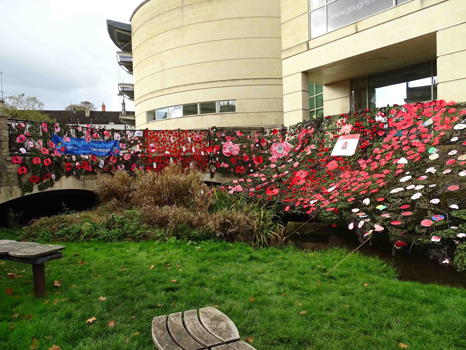 The 2018 rememberance display at Beach Terrace.
Created by many local schools.The Marden was re-meandered, with stone, gravel, and planting to create a more natural river channel. The planting of yellow flag iris, marsh marigold, and purple loosestrife, has brought much life to the area.
The river wall has fantastic bas reliefs made by Richard Cowdy and Vivien ap Rhys Price, which include: mammals, birds, fish, plants and people; which all go with the theme of ‘Breath of Life’.
This is particularly relevant to Calne, which has ties with Joseph Priestley, who lived in Calne when he discovered Oxygen at Bowood, and Jan Ingen-Housz, the scientist who discovered Photosynthesis and now lies at St. Mary’s Church.
The inner bends of each meander have cleverly been configured to allow the public very close access to the river. This area is well used throughout the summer, particularly at events such as The Lions Duck Race and the Calne Bike Meet.
 Beach Terrace as it is now, Calne Bike Meet 2019.
The creation of the terrace also included the buildings seen to the left of the photo above, which includes some popular local shops and accommodation, along with the Calne millenium library. Nicholas Pearson Associates, the consultancy firm the built the library won the 2003 Civic Trust Award for their library design[2].
A short video about Beach Terrace and the River Wall can be viewed below:
References:
[1] Project Details - Viewing Images. 2019. Project Details - Viewing Images. [ONLINE] Available at: . [Accessed 09 August 2019].
[2] Awards. [ONLINE] Available at: https://npaconsult.co.uk/awards/ [Accessed 09 August 2019].
July 2, 2021
Route 010: Around Morgan's Hill
Morgan's Hill is a beauty spot that is a pleasure to experience whatever the season. This is a 2 mile route that can be walked within an hour, but you may wish to spend much longer than that in this well-loved nature reserve.

Important Information:
Morgan's Hill can be accessed from the car park at the Smallgrain Picnic Area. From Calne take the A4 to Quemerford, turning right at the junction signposted Bishops Cannings. Continue through Blackland until you see the signpost for Smallgrain Picnic Area on your left. Turn here and park in the car park.
This route is not accessible to wheelchairs, pushchairs, etc due to steps and stiles.
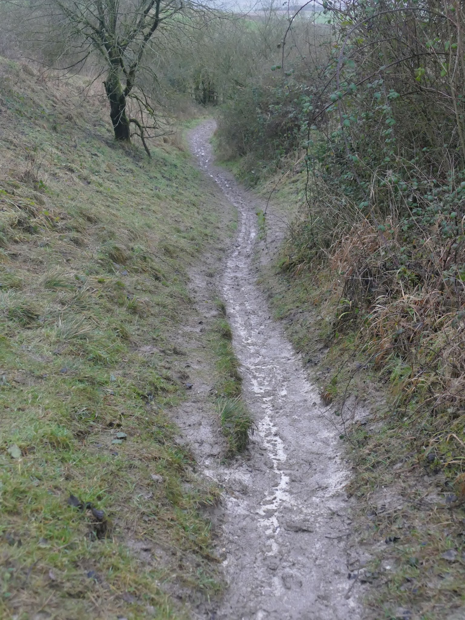
The route can be muddy, with mixed terrain and varying altitude.

Directions
1) Park at Smallgrain Picnic Area and follow the path north east past the beech tree. Down the steps you will join the Byway, which you should follow to the east, taking a right turn.

2) This Byway continues for around 300 metres. There will be plenty of chance to take in the expansive views to your left. Wellington Barn and the Lansdowne Monument are two easily recognisable features of the landscape.
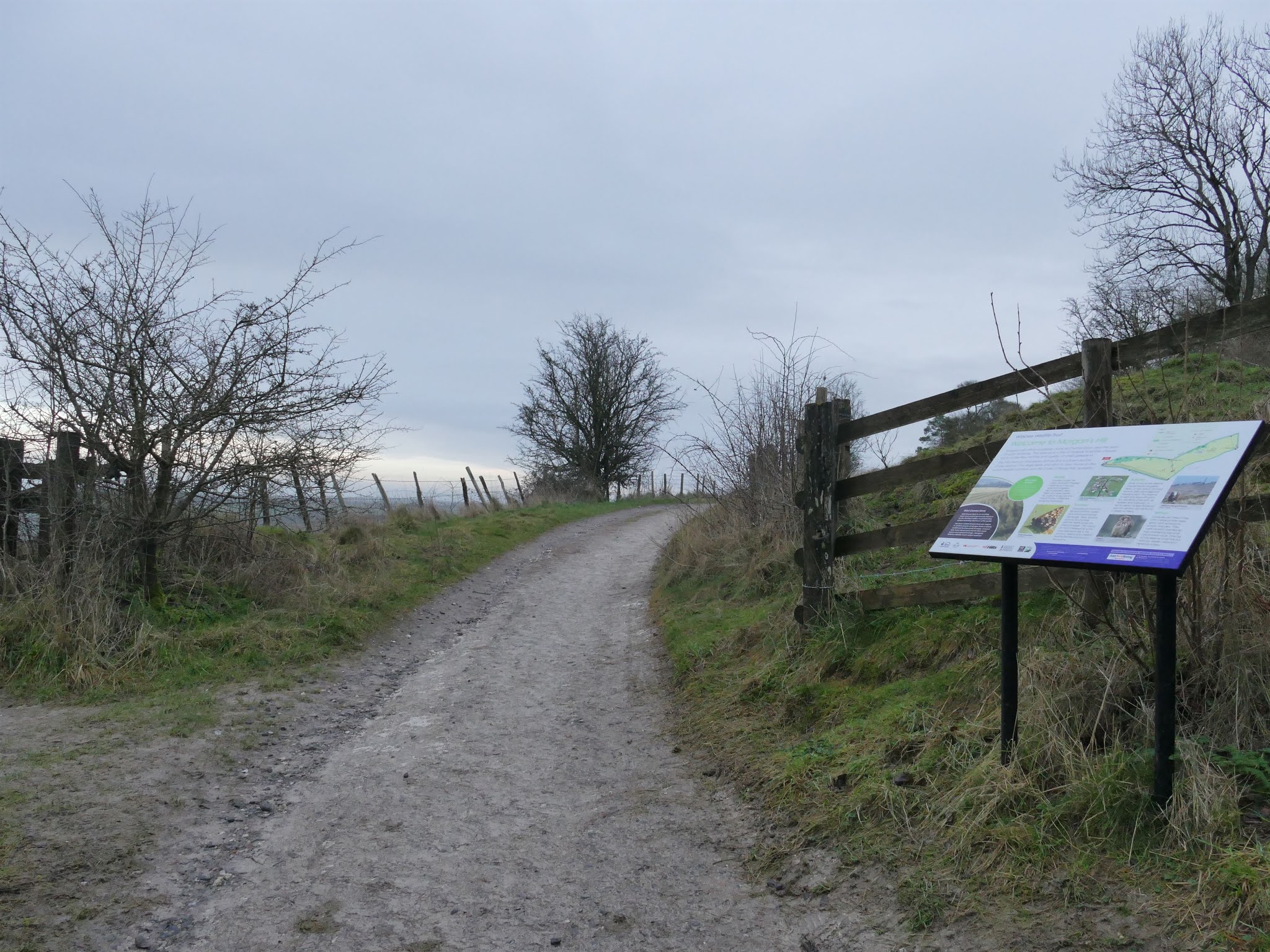
3) You will then reach a three-way junction and an information board for Morgan's Hill. Continue along the Byway. Until you come to a wooden gate.
While we walk, we can consider how Morgan's Hill got its name:
The Morgan of Morgan's Hill is said to be one Mr. John Morgan of Heddington who robbed and murdered his uncle. Morgan was apparently hung before a large crowd on this hill that now bears his name.200
Morgan's Hill is a 12.6-hectare site of Special Scientific Interest, since 1951. It is well recognisable due to the two masts that can be seen for miles around.

4) As you continue on, you may notice this memorial stone to Beatrice Gillam MBE (1920-2016) within Morgan's Hill, on your right.
Beatrice Gillam received her MBE in 1983, for work done for the Wiltshire Wildlife Trust, of which, she was a founder member.
Gillam seems to have been very active over decades in surveying wildlife and campaigning, including being a voluntary warden for the precursor to Natural England. Her research notes and notebooks are held by the Wiltshire and Swindon History Centre.
It seems fitting that Gillam is remembered at such an important site.

5a) If you would like a shorter walk, or you would like to explore the nature reserve, take the side-gate into the nature reserve. There is a worn path that will take you in a south west direction uphill to a wide wooden gate.
The route information will continue again at number 11.
5b) To continue the full route, walk past this gate and the sheep fold shortly after it for another 350 metres.
 6) You will come to a staggered crossroad, with a metal gate to the right. Next to this gate is a wooden gate, which will allow access to the bridleway within Morgan's Hill.
7) This part of the route is quite steep. Head towards the tree in the distance and the gate shortly beyond it.

8) Continuing onward, you will pass the communications towers that are visible for a good distance.
The hill has a long history of communication being home to a Marconi Imperial Wireless Chain receiving station from 1913 to 1935, seeing some conversions along the way to enable different uses.
In 1981 Wiltshire Constabulary erected the current masts, with microwave dishes added in 1998, by Mercury Communications, a mobile phone network provider.
In 1990 the MoD applied to site a mobile prefabricated building with a 2700 litre fuel storage tank and satellite dishes, however their current involvement is unknown. It is currently thought that Arqiva, a telecommunications company providing infrastructure and broadcast transmission facilities, manages the site.

9) As you continue past the communications, head towards the plantation of trees. The earthworks that you are walking towards as part of the Wansdyke.
The Wansdyke is a series of defensive linear earthworks from the early medieval period. It is now a well-known walking route separated into the East Wansdyke and West Wansdyke, which connect at Morgan's Hill.
 10) As you reach the Wansdyke, turn right. You can either follow the field, or walk within the earthworks.
11) If you left us at number 5a, this is where the directions continue.Continue the route through the wide wooden gate. The route from here gets steep and can be slippery/muddy.
12) This section continues for around 500 metres and there are some views of the North Wilts Golf Club. You will eventually reach the information board that you saw on the way out.
At this point take a left back onto the Byway and head back west back to the car park.

13) After a short distance, you will reach the steps back that will lead you to the car park.
Thank you for using this route!
Words and Photographs: Tim HavenithMap from the lovely folks at OpenStreetMap. © OpenStreetMap contributors
June 30, 2021
Place Names of Calne: Back Road (Back Lane, Back Street)
 7-10 Back Road.Back in 1885 Back Road, off London Road, was called Back Lane. By 1899 this was called Back Road [1].
In medieval villages, Back Lane, was a road that ran parallel to the main road at the far end of burgage plots. Burgages were town properties rented out by a lord or a king. While Back Road does run (mostly) parallel to London Road, I can't find any evidence that the properties were burgage plots. It looks likely that this road was named at a later date as an access road, with the name previously being Quarry Street[2].
7-10 Back Road is a group of Grade II listed cottages. These are late 1700s, with no earlier buildings still existing on Back Road. In 1695, a Presbyterian chapel was built in Back Road, with a congregation that numbered around 250 by 1717[3]. It is possible that the influence of Joseph Priestley, a preacher at this chapel in the 1770s, paved the way for it to become a Unitarian chapel. The congregation dwindled to 30 in 1829 and closed by the late 1830s. The building was reused by Primitive Methodists and the Salvation Army, but demolished in the 1960s.
Back Street, now Church Street
The part of Church Street from Kingsbury Street to the Green, where Divine on the Green currently operate, previously also called Rotten Row, was called Back Street in 1885[4]. By 1899 the whole of this street was called Church Street[1].
Resources:
[1] View: Wiltshire XXVII.5 (Calne Within; Calne Without) - Ordnance Survey 25 inch England and Wales, 1841-1952. 2019. View: Wiltshire XXVII.5 (Calne Within; Calne Without) - Ordnance Survey 25 inch England and Wales, 1841-1952. [ONLINE] Available at: https://maps.nls.uk/view/106027852. [Accessed 31 July 2019].
[2] Calne: The town to c.1800 | British History Online. 2019. Calne: The town to c.1800 | British History Online. [ONLINE] Available at: https://www.british-history.ac.uk/vch/wilts/vol17/pp34-41#highlight-first. [Accessed 31 July 2019].
[3] Calne: Protestant nonconformity | British History Online. 2019. Calne: Protestant nonconformity | British History Online. [ONLINE] Available at: https://www.british-history.ac.uk/vch/wilts/vol17/pp109-111#anchorn1. [Accessed 31 July 2019].
[4] View: Wiltshire XXVII.5 (Calne Within; Calne Without) - Ordnance Survey 25 inch England and Wales, 1841-1952. 2019. View: Wiltshire XXVII.5 (Calne Within; Calne Without) - Ordnance Survey 25 inch England and Wales, 1841-1952. [ONLINE] Available at: https://maps.nls.uk/view/120377388. [Accessed 31 July 2019].
May 31, 2021
Place Names of Calne: Churchill Close
 Churchill Close
Churchill Close is a close of two stretches, with a main close and then a close that forks off about half way. It was constructed in the 1960s as a development of semi-detached and terraced houses with separate garage blocks.
It is named for Winston Churchill, the British politician who led our country to victory as PM during the Second World War. He was also prime minister from 1951 to 1952, shortly before this development was built.
In March 2004, residents of Churchill Close finally won their battle for remedial work to reconstitute land that had subsided from their back gardens. While the land belongs to North Wiltshire District Council, they didn't accept liability[1], however they did put aside around £650,000 to tackle the issue. This included strengthening the land behind the houses, allowing the boundaries to be reinstated, in addition each property was given 1 additional metre of land. This was retained by a wooden crib-lock wall that was tied in to steel poles. The project to resolve this issue began in July 2005 and was expected to complete by October that year - putting an end to 8 years of misery[2]. The work was completed under planning application, N/04/03494/FUL.
There is also an interesting heritage assessment that was compiled in support of a planning application for development off Silver Street, that suggests Churchill Close could be the nucleus of a Romano-British settlement[3]. With pottery, Iron objects, brooches, and numerous coins being found in the gardens of London Road and Churchill Close, perhaps the case could be made for an organised dig to make sense of this site.
References:
[1] The Wiltshire Gazette and Herald. 2019. Council set to take action on subsidence | The Wiltshire Gazette and Herald. [ONLINE] Available at: https://www.gazetteandherald.co.uk/news/7283721.council-set-to-take-action-on-subsidence/. [Accessed 08 August 2019].
[2] The Wiltshire Gazette and Herald. 2019. Work begins to restore disappearing gardens | The Wiltshire Gazette and Herald. [ONLINE] Available at: https://www.gazetteandherald.co.uk/news/7244216.work-begins-to-restore-disappearing-gardens/. [Accessed 08 August 2019].
[3] Land at Silver Street, Calne, Wiltshire - Heritage Assessment. 2016. Context One Archaeological Services Ltd.