Do You Need GPS to Hike in Hawaii?
 Maybe you've never been hiking before in Hawaii, or perhaps you're planning to tackle a trail for which the latest USGS topo map dates from the 1970s. If so, you might be wondering if a GPS device or smartphone could help you out. On faint footpaths over lava fields marked only by ahu (cairns) or into valleys usually only visited by pig hunters, could GPS save you from getting dangerously lost?
To hike the most popular, easily accessible trails on the main Hawaiian Islands, you don't need GPS. (In fact, you might not even need hiking boots - but the 'rubbah slippah' debate is a subject for another post!) Just pay attention to roadside mile markers to find the trailhead, then follow the all-ages crowd ambling into the ferny forest for a waterfall swim.
Trails managed by the state-wide Na Ala Hele: Hawaii Trails System & Access program are often marked with signs not just at the trailhead, but at key junctions along the way. It'd be difficult to get lost, given how well-trod many trails in Hawaii are. In quite a few places, your smartphone or GPS device won't work anyway, making the point moot.
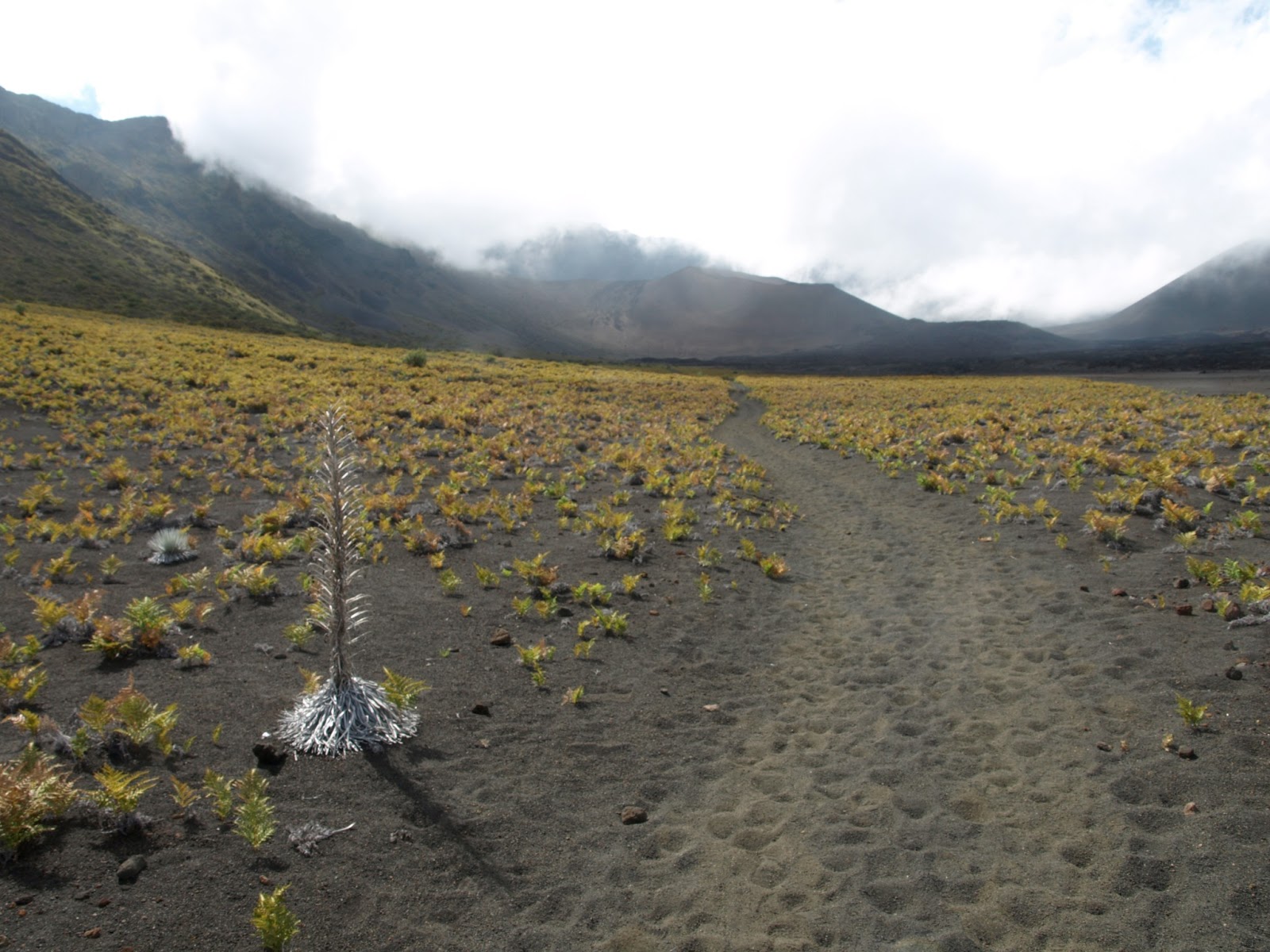 When I was researching my book Top Trails Maui: Must-Do Hikes for Everyone, I carried a handheld GPS device on every hike. I found it useful for pinpointing exactly where remote or badly signposted trailheads are. I also found it helpful for navigating little-traveled trails, for example, the Kaupo and Skyline Trails [PDF] on the backsides of Haleakala volcano. Both of those trails end in places that feel eerily like the middle of nowhere (respectively, Kaupo town off the remote Piilani Hwy and Polipoli Spring State Recreation Area). It also helped to know how far I'd already hiked and what elevation I was at, to keep from being misled by confusing trails-of-use. Being at such a high elevation on these trails also ensured that the GPS reception remained strong and clear enough.
 I'd used a GPS device before on the summit trail up Mauna Kea, Hawaii's highest peak, and when trekking across lava flows and cinder deserts inside Hawaii Volcanoes National Park, both on the Big Island. On Kauai, GPS prevented me from getting lost on a network of trails inside Kokee and Waimea Canyon State Parks. On Oahu, GPS was essential for trekking overgrown trails to summits in the Koolau Mountains above Honolulu (at that time, Na Ala Hele didn't post Oahu trail maintenance updates on Facebook like they helpfully do now).
 Overall, on 90% of hiking trails in Hawaii, you don't really need GPS. It'll be just another electronic device weighing down your pockets. But if you're planning on doing any wilderness hiking, GPS might be your next best island hiking buddy.
Find out more about Hawaii's waterfall and volcano trails on my book blog, Top Trails: Hiking on Maui.
Related links:
Maui's Best Walks for Wildlife Watching
Big Island's Volcanoes & Valleys - My CNN Story
Leave Your Car in LA - Take Amtrak Instead
Photo credits: West Maui Mountains, Haleakala National Park & Kihei (Sara Benson & Michael Connolly Jr.)


No comments have been added yet.