Explore the Rocks of Flat Top-State Game Lands 57
 Conglomerate Cave
Length: Variable, route is up to you. You can expect to hike 6-9 miles.
Difficulty: Challenging, rocky and rugged. You should be comfortable with off trail navigation.
Scenery: Extensive rock formations, overhangs, caves, boulders, chasms, mazes. Spruce, hemlock, and moss forests.
Parking: 41.496585, -76.131970
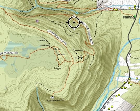
Description: This is the hike for you if you like rock formations and features. These rock features cover Bartlett Mountain and Flat Top. This hike explores the east rim of Flat Top. The route is up to you. There are no blazes or marked trails. There are unblazed trails on old logging and jeep roads up to the top. However, a hike to the rocks is off trail. A georeferenced PDF map is attached below.
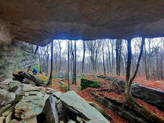
We hiked north to south along the east escarpment of Flat Top. First there was a giant overhang, cliffs, and boulders. Next was my favorite part, an area of caves and mazes in a spruce and hemlock forest. This rock area is extensive with so many cool spots to check out. Here we found an ice cave, with a floor of solid ice. This is just north of the faint, unblazed Hidden Passage Trail. Next was The Fins, three gigantic, tilting boulders. One has a striking, narrow fin. Further to the south were a series of overhangs at various sizes. Some were quite large. Finally, we reached Conglomerate Cave, a giant overhang notable for its thick pebbly conglomerate rock.
The next area we checked out were the “jenga rocks”, an escarpment of square and rectangular outcrops. The highlight here was a cave passage.
Another amazing spot in SGL 57.
 No trails are marked. Off trail hiking required. Area is rocky and rugged. Locations are approximate. Basemap by Ben VanRiper. A link to download this georeferenced PDF map is below.Bartlett MountainDownload
View this post on InstagramA post shared by Jeff Mitchell-Outdoors Author (@hiking_mitch)
View this post on InstagramA post shared by Jeff Mitchell-Outdoors Author (@hiking_mitch)
View this post on InstagramA post shared by Jeff Mitchell-Outdoors Author (@hiking_mitch)
View this post on InstagramA post shared by Jeff Mitchell-Outdoors Author (@hiking_mitch)
Jeff Mitchell's Blog
- Jeff Mitchell's profile
- 3 followers


