Caves, Rocks, and Overhangs of White Brook-SGL 57
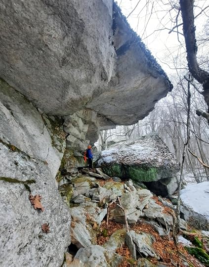
 The overhangs
Length: Various, route is up to you. You can expect to hike 5-6 miles.
Difficulty: Challenging. Terrain is rocky and rugged with cliffs and ledges. There is a significant climb up to the rocks.
Parking: parking area at 41.496557, -76.131983
Highlights: Huge rocks, mazes, chasms, caves, overhangs, boulders. Waterfalls and cascades.
Description: I’ve known of these rocks for years, but never explored them. I’ve hiked by them dozens of times. I finally went. It’s incredible how much beauty SGL 57 has after exploring it for almost 20 years.
I do not describe a route, that is up to you. There are no signed or blazed trails. The map below highlights old forest roads and grades, which are generally easy to follow. The rocks are off trail and the terrain is rugged. I will describe the highlights.
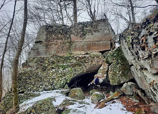
We hiked the rocks from north to south. The first area is the overhangs and Glazed Cave. These are among the largest rocks on the hike. Enjoy the beauty. The rocks are huge as are the jutting overhangs. To reach the Glazed Cave, you must scramble up a steeply sloping 6 foot boulder wedged between the rocks and go into an open chasm with a big birch tree. The cave is so named because one side was glazed with sheets of ice. The cave has a roof and jumbled rock, with another passage underneath it. A beautiful and unique spot.
The large rocks continue. The next spot is Comma Rock, as it kind of resembles a comma. The rocks recede a little and then we entered a very unique cove-the Rocks of the Springs. This place has a Zen vibe to it. Numerous springs trickle and cascade within the ledges and cliffs and flow from the base.
The rocks recede and we hiked south, nearing White Brook. We then entered cliffs, ledges, and the boulder maze. These rocks weren’t gigantic, but the all the rooms, passages, and caves, made it a highlight. I called it the Maze of Infinity because it was that surprising. It’s actually not that large of an area, but it is packed with nooks and crannies. Nearby, White Brook cascaded over the rocks.
Nearby was the unmarked trail up White Brook, which we took back down. Enjoy this amazing place.
 Comma Rock
 Black dots are rocks. Blue are cascades or falls. No trails are marked or blazed. This map shows locations of unmarked trails, old logging roads, and grades. Locations are approximate. Rocks are off trail. Base map by Ben Van Riper.
View this post on InstagramA post shared by Jeff Mitchell-Outdoors Author (@hiking_mitch)
View this post on InstagramA post shared by Jeff Mitchell-Outdoors Author (@hiking_mitch)
View this post on InstagramA post shared by Jeff Mitchell-Outdoors Author (@hiking_mitch)
View this post on InstagramA post shared by Jeff Mitchell-Outdoors Author (@hiking_mitch)
View this post on InstagramA post shared by Jeff Mitchell-Outdoors Author (@hiking_mitch)
View this post on InstagramA post shared by Jeff Mitchell-Outdoors Author (@hiking_mitch)
Jeff Mitchell's Blog
- Jeff Mitchell's profile
- 3 followers


