Backpacking the Allegheny Front Trail-East Loop
 Allegheny Front Trail
Length: 31 miles
Blazes: Yellow. Some side trails are blue. The trail is well blazed and most trail junctures have signs.
Trail conditions: Overall, the trail was in good shape with some blowdowns. Some rhododendron tunnels were brushy. I believe all stream crossings had bridges.
Difficulty: Moderate, overall. This loop has forgiving terrain, however, the section along the vistas is rugged.
Parking: There are several places to park. The most common trailhead is on PA 504: 40.916978, -77.977045. Black Moshannon State Park (call the park office first about parking): 40.914892, -78.058861. Beaver/Shirks Rd: 40.888138, -78.039010.
Highlights: Vistas, meadows, scenic streams, streamside hiking, great campsites, good isolation, Black Moshannon State Park, bogs, wetlands, pine and spruce forests, extensive boardwalks, extensive rhododendron tunnels, mountain laurel, blueberries, beautiful fern meadows, wildflowers.
Issues: sections of the Moss Hanne Trail can be flooded or muddy in high water.
Best camping: Benner Run, Black Moshannon Creek, Smays Run
Direction of description: Counterclockwise from Beaver/Shirks Rd.
Duration: 2-3 days
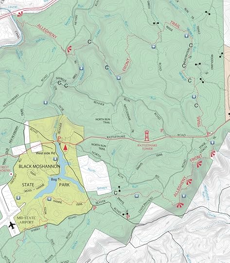
Maps: available online, or by contacting Moshannon State Forest. (Online map). A Black Moshannon State Park trail map would also be helpful.
Description: The Allegheny Front Trail (AFT) is a 42 mile loop that encircles Black Moshannon State Park. This trail has an “east loop”, comprised of the eastern half of the loop and the cross connector trails, Shingle Mill and Moss Hanne trails. This is an excellent backpacking loop with beautiful, diverse scenery, great camping, and forgiving terrain, for the most part. I think it is one of the best backpacking loops in the Mid Atlantic region.
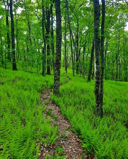
I began at the parking area at Beaver or Shirks Road. A yellow side trail takes you to the AFT. I hiked counterclockwise. The trail was beautiful with rolling terrain, fern meadows, and hardwoods. Many azaleas were blooming, infusing the air with a sweet scent. Descend to Smays Run with great camping. The hilly nature of the trail continues with fern glades, meadows, and hardwoods. Cross Underwood Road and gradually climb to the trail’s namesake, the Allegheny Front. The front marks the dividing line between the Allegheny Plateau and the Ridge and Valley region.
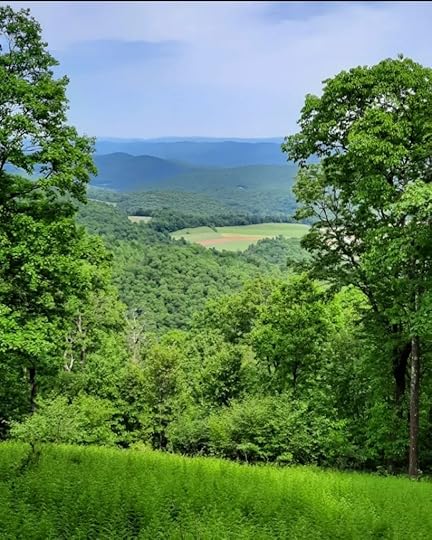
Descend from the front among boulders and rocks before reaching the first view. The next four miles are by far the most rugged on the loop as the trail goes up and down along the front. You will descend into hollows with small streams and then back up to the plateau. The terrain is rocky. The four vistas are very scenic with the northern one being the most impressive. Reach PA 504 and a popular trailhead for the AFT.
The remainder of the loop is moderate, even easy for fit backpackers. The climbs and descents are gradual with lots of level hiking. Hike across meadows and a grove of spruce. Descend into Rock Run with three places to camp. At times the run is close to the AFT, but most of the time it is not. The Rock Run Trails join the AFT.
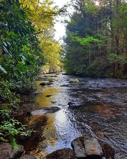
Climb away from Rock Run and traverse hilly terrain with fern meadows, blueberry meadows, and hardwood forests. The fall colors through here must be incredible. Descend to Benner Run, a highlight of the loop. Enjoy the pristine, tumbling creek with extensive rhododendron tunnels and hemlocks. There is one excellent place to camp. Benner Run is gorgeous.
But the scenery doesn’t stop. Cross a footbridge on Black Moshannon Creek and hike along this stunning creek with more tunnels, hemlocks, and great camping. Leave the AFT and continue up the creek on the Shingle Mill Trail. The beauty does not stop; this loop has incredible streamside hiking. Cross a gravel road and continue along the creek. The sublime scenery continues. Through here I saw many pink lady slippers.
Reach the state park dam and hike along the lake, taking in the views. This loop as it all, from vistas, to streamside hiking, and hiking along a lake. Cross PA 504. I did a mile roadwalk on the Westside Road and then hiked the boardwalk on the Bog Trail. This trail is excellent as it explores the wetlands with views across the water. Next, turn left onto the Moss Hanne Trail. This yellow trail is unique. It is easy and rolling as it wraps around the wetlands. There are numerous short boardwalks, and two very long ones. It was a joy to hike. You will be able to see the wetlands and maybe some unique plants.
Enter the woods and climb gradually to the AFT; turn left. The AFT is fairly easy, hilly, and passes through small meadows and pine groves. There are several shorter boardwalks. Enjoy more views of the bog, including beaver dams. Cross another boardwalk, cross Julian Pike, and turn right onto the yellow side trail back to the parking area.

 Black Moshannon Creek

More photos:
View this post on InstagramA post shared by Jeff Mitchell-Outdoors Author (@hiking_mitch)
View this post on InstagramA post shared by Jeff Mitchell-Outdoors Author (@hiking_mitch)
View this post on InstagramA post shared by Jeff Mitchell-Outdoors Author (@hiking_mitch)
View this post on InstagramA post shared by Jeff Mitchell-Outdoors Author (@hiking_mitch)
View this post on InstagramA post shared by Jeff Mitchell-Outdoors Author (@hiking_mitch)
View this post on InstagramA post shared by Jeff Mitchell-Outdoors Author (@hiking_mitch)
View this post on InstagramA post shared by Jeff Mitchell-Outdoors Author (@hiking_mitch)
Jeff Mitchell's Blog
- Jeff Mitchell's profile
- 3 followers


