Donut Hole/Post Draft Loop-Sproul State Forest
 Post Draft Vista
Length: Approx. 6-7 mile loop
Parking: Pull off parking on Hyner Mountain Road (where this description begins): 41.358681, -77.612945. There is also parking on Old View Road: 41.343858, -77.586890.
Difficulty: moderate to difficult
Highlights: Views, meadows, spring wildflowers, isolation, gorges, small streams, ferns, mountain laurel blooms.
Issues: Nettle in the summer, particularly the bottom half of Post Draft Hollow Trail.
Trail conditions: Overall the trails are in good condition and are blazed well. Some junctures have signs.
Blazes: Donut Hole Trail (DHT) is orange. All other trails are yellow. DHT also has yellow blazes. Cleveland Hollow Trail is not blazed, but is obvious.
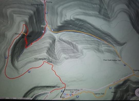
Description: This is another great loop near Hyner View State Park. I recommend going clockwise for the more gradual climbs and to save the views towards the end of the hike. From Hyner Mountain Road, follow the DHT up a valley with a creek. The trail is on a forest road. Reach a juncture. Follow the yellow Post Draft Hollow Trail to the left; you will return on the DHT to the right.
The yellow trail makes its way up a scenic wooded gorge with a small creek. Nettle is an annoyance in the bottom half of the gorge, but it becomes less prevalent on the upper half. The climb is gradual and steady. As you near the top, mountain laurel becomes common. The trail levels and reaches Old View Road. There is parking to the left. Cross the road, see a sign for Johnson Run Trail and then make an immediate right onto Ligenza Trail. This trail is enjoyable as it meanders through the woods with meadows and ferns. There is one view at a pipeline clearing.
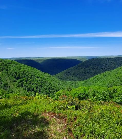
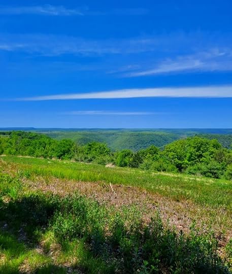
Reach a gate and stop. The Ligenza Trail goes left, but you’ll want to go right. Walk Old View Road a short distance and turn right onto Cleveland Hollow Trail, there is a sign. This trail follows an old forest road and does not have blazes, but it is obvious. Reach the DHT, turn right. The DHT is a pleasure to hike as it meanders through laurel and woodlands. Reach a pipeline swath and hike it for a few hundred feet with nonstop views. The DHT turns left back in the woods, but go off trail a hundred feet to a stunning campsite and view. This is not to be missed.
The DHT follows an old woods road with rolling terrain. Descend on a ridge and reach more views at a swath. The SOB Hill descends steeply to the right, it is used by trail running races. The DHT follows a more gradual descent on an old road. The SOB Hill rejoins and re-cross the swath with another view. Descend into the gorge with switchbacks. This wooded gorge is scenic with beautiful forests, springs, a small creek, and many wildflowers. Complete the loop and retrace your steps back to the car.
These trails are maintained by the PA Trail Dogs. The Keystone Trails Association also maintains trails in the area.
 Views on the Donut Hole Trail
 This map is not a GPS track, it is for general directional purposes only.
More photos:
View this post on InstagramA post shared by Jeff Mitchell-Outdoors Author (@hiking_mitch)
View this post on Instagramhttps://www.instagram.com/p/Csr9zB9spxr/?utm_source=ig_web_copy_link&igshid=MzRlODBiNWFlZA==A post shared by Jeff Mitchell-Outdoors Author (@hiking_mitch)
View this post on InstagramA post shared by Jeff Mitchell-Outdoors Author (@hiking_mitch)
Jeff Mitchell's Blog
- Jeff Mitchell's profile
- 3 followers


