
Garmin inReach deep dive: Default & downloadable maps & imagery
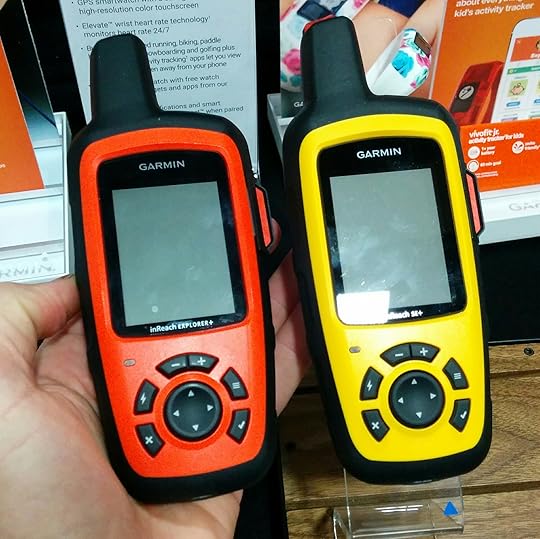

The new Garmin inReach SE+ (yellow) and Explorer+ (orange) are best described as conventional handheld GPS units with satellite text messaging.
Overnight I received this question from reader Bob B.:
Can other topo maps be downloaded onto the Garmin inReach Explorer+?
This question — and just about any other that you can imagine — has been answered previously in my previous posts about the Garmin inReach SE+ and Explorer+:
Preview: New Garmin inReach SE+ and Explorer+
12 FAQ’s: inReach SE+ & Explorer+ || Incl, Will old devices be serviced?
But I sympathize for any reader looking for the answers, because there are a dizzying number of informative comments — 240 total and counting. So I have decided to aggregate map-related information into this single post, to make for easier finding.
inReach SE+ vs. Explorer+
In 2016 Garmin bought DeLorme, which released the original inReach SE and Explorer models in 2014. In 2017 Garmin released two new inReach models:
Garmin inReach SE+ ($400)
Garmin inReach Explorer+ ($450)
The primary difference between the devices is that the Explorer+ is pre-loaded with topographic maps while the SE+ has only a simple grid map (i.e. no features or contour lines, just its location plus any imported or created routes, waypoints, and breadcrumbs).
Deeper dive: inReach Explorer+
Pre-loaded data
When purchased in North America, the Explorer+ is preloaded with the following maps:
Topo 24K for the US and Canada (Made by DeLorme)
Topo 125K for Mexico (Made by DeLorme)
World Wide BaseMap (Made by DeLorme)
These maps have not been updated since the 2017 product release, and they will not be updated by Garmin.
Downloadable data
The Earthmate has 2 GB of internal storage for additional data.
The following maps can be added to the device:
OpenStreetMaps, which covers the world and offers road detail, and light topographic detail. Sometimes they include trails. These maps are just like Garmin’s Cycling maps, and receive updates.
Earthmate Hunt Edition costs $35 per year and includes GMU boundaries, land ownership, and public land survey maps for all 50 states. It can be viewed directly on the inReach Explorer+ after being synced with the Earthmate app.
What’s not pre-loaded or downloadable
The Explorer+ (nor the SE+) have SD or micro-SD slots, so data that is stored in this format (e.g. Onxmaps Hunt Chip) cannot be loaded.
The devices are not compatible with Garmin Base Camp, so you cannot load the data onto the device from there. Instead, you must use the Explore portal, which was carried over from DeLorme. I would expect the second-gen Garmin inReach units to be better intergrated into Garmin’s systems.
None of the preloaded or downloadable maps offer automatic routing. This is different from Garmin City Navigator and Garmin Topo 24K maps, which will give turn-by-turn directions between two points using roads or trails.
Earthmate app
The Earthmate app is included with purchase of an inReach SE+ or Explorer+, and it can be purchased separately. In addition to the aforementioned OSM and Hunting Edition maps, additional data can be downloaded to Earthmate:
NOAA Nautical Charts
Aerial Imagery
USGS 7.5-minute quads
Canadian quads
These tiles cannot be viewed directly in the inReach devices. However, the inReach GPS can be used to identify its location on the phone screen, rather than using the phone GPS.
Functionality with and without a subscription
To use the inReach as a two-way satellite messenger, a service plan is required.
To use the inReach as a GPS, the device must be activated but does not need a valid service plan. This currently costs $25 per year.
Additional questions about the maps and imagery on the inReach+ units and Earthmate? Leave a comment.
The post Garmin inReach deep dive: Default & downloadable maps & imagery appeared first on Andrew Skurka.


