
Simon Duringer's Blog, page 10
July 8, 2016
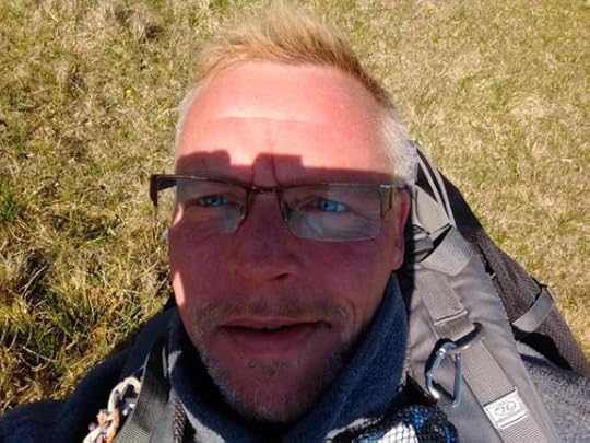
Volunteering Abroad
With BREXIT just concluded (we think), volunteering overseas allowed me to learn about the cultures of other Europeans from their own mouths and in their own back yards... It is also why I believe we Brits should protect our own culture for future generations (as should the people of each eurozone country!)
Visiting them I respected their laws and cultures (even if I didn't always agree with them!) It would be nice to imagine the same thing might happen in Britain one day... Is it really that much to ask?
http://simonduringer.com/on-my-travel...


Volunteering abroad
Volunteering Abroad
I suppose that for most people, the idea of embarking on a major travelling experience on a shoestring budget strikes around the pre- and post-grad era of life. Perhaps I simply wasn’t ready for this ‘bug’ back then, as in my case it didn’t hit until just seven months ago, by which time I was most certainly on the wrong side of forty!
It must be said that the events of the past few months have come together more through luck and love than my good judgement, but the trip has been a life-changing experience that I think I should share.
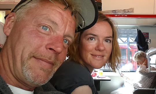
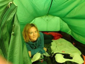
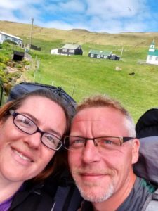
When I first met my partner, Jenny, she already had ambitious ideas for travel firmly inscribed on her bucket list. This – or rather her impending absence from my life in the UK – didn’t seem such a bitter pill to swallow, as her plans were a predefined part of the ‘relationship’ bundle, and therefore it would have been totally inappropriate for me to suggest ‘dropping the dream’ on my account. Since at that time there was no way I could have entertained the idea of going on such a venture, or indeed adventure, it was just something I simply accepted. Besides, after Christmas 2015 I did manage to go with Jen to France where she would drop off her car, cats and belongings with friends before heading off into the wild!
As somebody who suffers from insomnia, my condition worsened after Jen had left on the first leg of her trip, partly due to not having her by my side and partly due to my flawed attempts to keep track of the numerous time differences as she moved from one eastern country to another! Communication, as I have since discovered for myself, is far from easy to prearrange; Jen was travelling on a shoestring budget, volunteering and staying in hostels where often Wi-Fi and phone signals were only available for fleeting minutes, usually at the worst time for us both. However, we persevered until Easter 2016, when Jen came back to the UK for a ‘break’. I found this term difficult to understand at the time – a break from her holiday?! Now, though, I’ve shared the experience, the time-critical planning and organising, the constant moving around, the pace that leaves little time for pause… and so the need for a break makes perfect sense!
During Jen’s visit to the UK and after long thought, consultation and consideration, we worked out how to make it possible for me to join in the journey with her. We achieved that objective some weeks after that Easter visit, by which time Jen had visited a further two countries: I flew out from London to meet her in Helsinki. Aware (though she denies it!) that I was effectively gate-crashing her trip, I was reluctant to do much in the way of decision-making. After all, I was now able to be there with and for her, and still did not want her to change her plans simply because she had a passenger in tow. Initially, the trip was more about being with Jen rather than being involved in her exploits, but that very quickly changed as we got started in our first volunteering role in Finland.
Before leaving the UK in April, Jen took me through the websites she had discovered which assisted her in planning volunteering roles; HelpX, WWOOF and Workaway. Since all three work along the same principles – give a few hours of work a day in exchange for bed and board – they’re a very cheap way of gaining insight into different cultures. I therefore decided to help Jen plan some of these stints, looking ahead, guided by her aims and objectives. All I really knew at that time is that the plan was to travel from Finland to a further four countries: Sweden, Norway, the Faroe Islands and Iceland, before finally heading back home. I say ‘home’ meaning the UK, although both Jen and I gave up our respective accommodations before leaving the UK *Eeeeek*!
Prior to Finland, Jen’s travels had already taken her from the UK to France, Japan, Malaysia and New Zealand, then back to the UK in April, and then off again a fortnight later to Italy and Rhodes before meeting me in Helsinki and continuing her journey with me. Her goal was to find out more about how countries other than the UK were becoming more eco-friendly, and to improve her own knowledge of permaculture and sustainable practices. Her findings are interesting and well documented in her own blog: www.lionessabroad.weebly.com
For both of us this had turned into the opportunity of a lifetime.
Volunteering abroad with our first host (well, my first; probably about Jen’s seventh!), in Finland was a real eye-opener for me. Micke is an actor and teacher whose knowledge about ‘getting back to nature’ was astonishing.
He’d gained expertise in all sorts of things from harnessing the sun’s natural energy to making fuel out of human poo! He was developing what he hopes will one day become an arts and crafts centre for like-minded creative sorts, and his pad, next to lake Karjalohja, was anything but what I had expected. Through working with and talking to Micke we learned SO many new things – again, see lionessabroad for a fuller description! For instance, natural antibiotics taken from the sap of birch trees; running cars such as his Volvo V70 on biogas (recycled poo!); working his in-house sauna by natural means; and generally living a modern-day eco-friendly life without giving up the luxuries and conveniences that many of us Westerners are accustomed to. Parts of his house and workshop are still under construction, but nothing would go to waste. An example: one outbuilding we helped to put together had been built from scratch using recycled wood salvaged from a nearby farm, whose owner had discarded the older wood in order to renovate with brand new material.
Micke was not 100% self-sufficient, but had designed his house – everything from the sauna and wet room area to the underfloor heating – to be run using a modern, eco-friendly methodology. He and his partner eat a mainly vegetarian diet, supplemented by the fruits of their labour as extremely competent foragers! The range of food produced, whilst mostly new to me, was extremely edible. Micke and I also *ahem* went fishing, and as per one of my own principles, ate what we caught. It was an eye-opener to eat pike-perch, a form of fish which in the UK might have been caught for sport and returned to the river.
Moving on from Finland, we headed to an eco-village in Sweden called Stjarnsund. This was not via the volunteering websites, but rather through a direct and speculative email from Jen to the site managers which, I am happy to say, paid off! We were hosted by a native Swedish-American gentleman, David, and his wife Eliza.
The fact that they said “yes” to our request to come and volunteer was something of a risk for them and a stroke of luck for us; previous Stjarnsund volunteers had turned out simply to have cheap travel on their agenda rather than any eco-passion of their own. I think it was a breath of fresh air for Eliza and David to work with ‘mature’ folk like Jen and myself, who have genuine, and in my case growing, desire to learn about what they were trying to achieve.
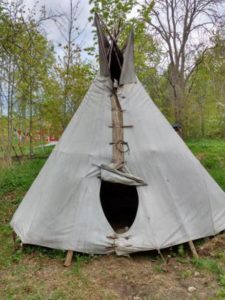
The eco-village, or community, was home to around 100 people from surrounding districts, and the area was steeped in history about people who had arrived over the decades to live a more holistic lifestyle. Jen and I lived in a tepee…
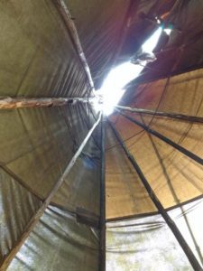
…but as a second wave of rain set in we were moved to what the others called a “tiny house”.
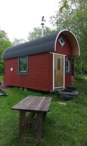
It was minimalistic living at its best! Imagine a bedsit with everything you could possibly need handy and within reach. The house designs were similar to those of boats and/or motorhomes but these wooden dwellings were unique in that they were all built on site, once again harnessing the natural resources available within the community. Here again we saw a common thread between Finland and Sweden: nothing recyclable went to waste…
Members of the eco-village at Stjarnsund meet weekly and discuss any community issues, an example being a neighbouring farmer who, much to the displeasure of the community, was developing a huge swathe of his own land with GM products, using poisonous chemicals to keep away weeds. When David and I talked with the farmer directly, even he started to have second thoughts about the methods he had essentially been coerced into using for commercial purposes/gain.
David and Eliza were essentially the leaders of the village community, and had previously engaged with local politicians to discuss what the community was trying to achieve. They had also held open days so curious locals could become more informed about their goals. Stjarnsund was something of a ‘back to basics’ form of living, but it was enlightening and enjoyable in a different way from the work and lifestyle we had been involved with in Finland. David, like Micke, is also something of an innovator 
July 3, 2016
Walking in the wild
http://simonduringer.com/on-my-travel...
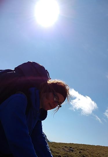
Walking on the wild side
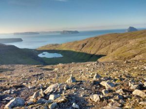
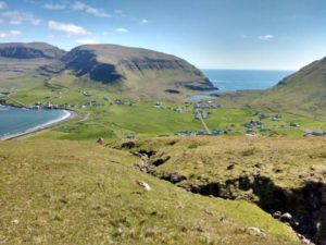
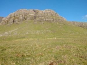
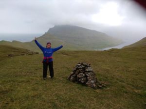
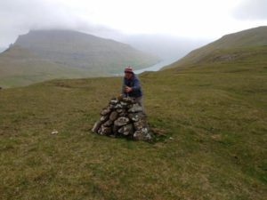
Slaettaratindur Mountain, The Faroes
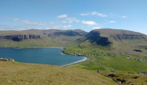
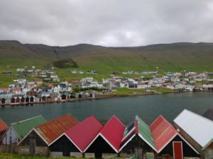
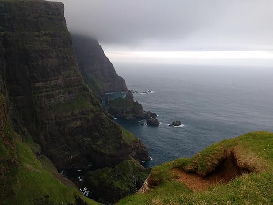
I have written a fair few blogs about the Faroe Islands recently, but I hope that my incessant whingeing about their ‘out of capital’ public transport system hasn’t put people off visiting this picturesque place! There really is more to this group of eighteen islands than meets the eye.
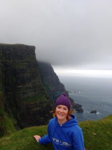
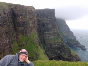
For example, the Faroes won a major ‘sustainability’ award as recently as 2015. One magazine named them as one of the Top 10 island locations to visit in the world, and during our eleven-day visit Jen and I crossed paths with writers and photographers from both Lonely Planet and National Geographic, who had come to document some of the country’s natural wonders.
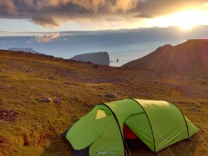
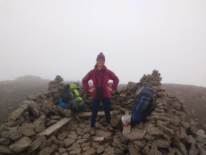
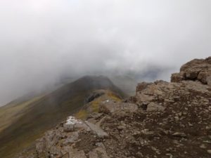
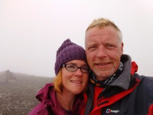
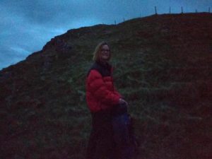
There is a tradition in the Faroes that on the longest day of the year, June 21st, people head up into the mountains, scale the highest peak, and then party and play music while watching the sun set… and rise again about three hours later! Jen and I ourselves were on our way to the top of the highest mountain (Slaettaratindur, 882m) and witnessed some of the most incredible scenery and views on that very night.
In our case, as we’d chosen an unconventional route from sea level to the summit, Jen and I did not make it in one day. We were also climbing straight on the back of our longest jaunt to date, having just finished a 43-km hike from the northern to the southern tip of Suduroy, the Faroes’ southernmost island. In fact, I would guess we completed around 80km of mountainous hikes during our eleven days on the islands, but the views were simply so stunning that even with aching bones and muscles it was hard to resist going out again!
It came as something of a shock to me just how steeped in history the Faroe Islands are, and really how odd it is that they still appear to operate under medieval laws. The total islands’ population is a mere 40,000 people, with around 26,000 of them living in the capital. But in 2015 the island was effectively hit with a landslide of tourism, as it was one of the best places to view the total solar eclipse (20 March, 2015), something we had witnessed in the UK back in 1999 in Devon and Cornwall. This phenomenon, guaranteed to draw a global audience, nearly crippled the Faroes Islands’ infrastructure which is simply not equipped to cater for double or triple the usual number of people.
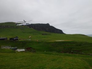
I am guessing that the 2015 eclipse, aside from putting the Faroe Islands firmly on the map, prompted the government to invest heavily in their islands. Putting aside for a moment the haphazard service Jen and I experienced as tourists there, the ‘quality’ of the logistical machinery – buses, ferries and helicopters – is really quite amazing. I think the challenge they face is simply drawing in the expertise to make it all gel. In my own humble opinion and that of a few journalists and islanders we spoke with along the way, currently it simply doesn’t.
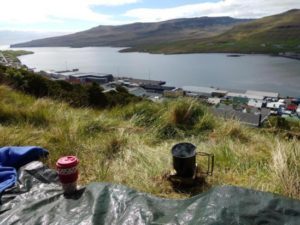
Both the islands and the Faroese people are quite amazing and once you touch base with them they seem to have an innate inclination to assist with anything one needs to know. Whether offered by people we stayed with, managers at hostels or simply nearby individuals who noticed our occasional vexed ‘lost tourist’ looks, help never seemed far away. Also the islanders, who primarily speak Faroese and Danish, have a great grasp of the English language, especially in the capital, Torshavn.
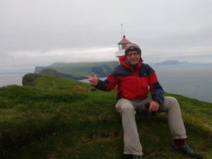
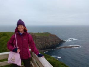
As well as being a fantastic spot to watch the solar eclipse, the Faroe Islands are a great place to see the Northern Lights (Aurora Borealis) during the winter months. In summer there are many other reasons to go – maybe not for the weather (!) but for the incredible scenery or indeed the wildlife. The island of Mykines is a puffin breeding ground, and whilst people are asked to stay away from nesting areas, it’s almost impossible to hike to Mykines holm lighthouse, the westernmost point of all the Faroe Islands, without having close encounters with these wonderful creatures.
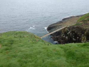
Indeed, adrenaline junkies might also wish to go to Mykines purely to experience the ride on the tiny ferry that transports tourists to the island! Mykines is home to a population of just 12 people, so the ferry is a lifeline to the islanders and manages to stick to its timetable in some incredible sea states.
The Faroe Islands’ history, from sport to literature and everything in between, is very well documented on Wikipedia.
The country has been the home of world-class athletes and writers during its recent history, despite having such a small population. Indeed, as we found out whilst touring the islands, almost every village seems to have its own football pitch, regardless of whether or not there are enough inhabitants to put together a team! And in 2014, as a full UEFA member, it created one of the biggest upsets in football history by qualifying for the championships after beating Greece in a qualifying match!
Will I return?
I don’t quite know, as there are so many countries and places around the world I would like to visit. But as they say; “Never say never!” and I would certainly like to remain informed about how the islands’ travel network will be developed over the next decade or so. Perhaps as a transport operations manager I was just expecting too much. Perhaps I should give them a hand!
But ultimately Jen and I were there to explore, hike and expand our horizons, and I think in that respect the Faroes are an incredible place!
For the hiker, whether alone or in a group, it is a perfect spot for ‘thinking’ time, as one can literally travel village to village over numerous mountains without encountering a soul. Also, for an insomniac like me it is ideal place to visit in summer, where for several months the sky remains light 24 hours a day!
This post was edited by the lovely Jennifer Lyon whose travel blog can be found by clicking here.
Simon Duringer is an award-winning blogger, interviewer and author. His own books can be found on Amazon too by clicking any of the following icons…


June 27, 2016
Into The Wild - Part 3
There's only one way to find out and here is the link!
http://simonduringer.com/on-my-travel...
Into The Wild – Part 3
Into The Wild – Part 3
For those who have been following what should have been a single blog piece, namely: Into The Wild, about the longest hike (43km) on the island of Suduroy, Faroe Isles. Well, this is finally it!
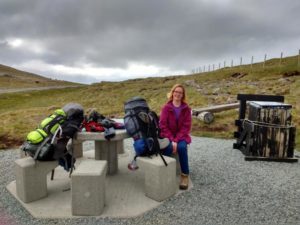
For those who haven’t read the previous pieces, please feel free to refer back to Into The Wild – Part 1 and Part 2, where you will discover why we’re doing this, what has happened so far and how we got to this point in time, i.e. hiking about 15km, each with around 17-20kg of rucksack on our backs, without yet crossing the starting line!
The good news is that we are still talking, discovering, enjoying, yet ultimately, a bit more frustratingly, we are aching!!
Having woken up weary and tired (well, I did anyway) we breakfasted in the wild outdoors, enjoying the view from our lovely not-quite-campsite, before setting off for the start line at Sandvik. Slightly perturbed by the less than up-to-date tourist maps and the apparent ‘black magic’ approach to finding buses, we sensibly decide to swing by the information office first, and subsequently the small village dock to buy camping gas for the trip…
The Faroe Islands aren’t exactly huge; there are eighteen islands in all, total population forty-ish thousand, of whom around twenty-four thousand live in the capital Torshavn. The islands are joined in some cases by bridges or subsea road tunnels, and there are also plenty of ferries. There is even, as we were later to find out, a helicopter taxi service which is almost as cheap as one of their elusive buses!
On this day, however, Jen and I had just one simple goal: to finally get started and to be ready for anything once we were on our way Into The Wild! Our fortunes soon looked a tad brighter after a chat with the owner of the gas store, who happened to be the president of the Runavik boating association. Meeting him was one of the first tasters we had of Faroese hospitality; whilst buying gas we were offered (and accepted!) a much-needed free cup of coffee, and were invited to fill our water canisters etc. as we sought advice and information from him. On the down side, and without wishing to demean his extended hand of friendship, the hospitality was so good that we almost missed our bus!
But for those of you who have made it through the previous two blog pieces about this, our tiny adventure, you’ll be glad to read that we didn’t miss it; in due course a bus driver rolled up, stopped, informed us he had to drop some people somewhere else, and assured us he would be back in half an hour or so *groan* to take us to said destination. The good news? He did actually return, and we hopped aboard like excited schoolchildren, as it seemed the never-ending list of setbacks might finally have been put behind us!
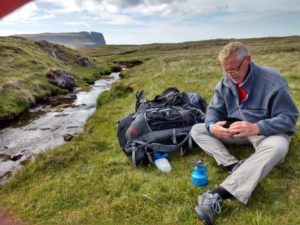
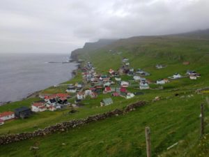
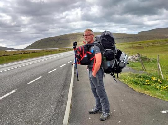
The bus driver, another pleasant chap, finally dropped us off at a very scenic village named Sandvik, where there were great views across the ocean. Sandvik has grey sandy beaches, similar to those in Tenerife except here they are totally tourist-free! The time was 1340hrs (1.40pm) and given that we had a 15-hour hike ahead of us, I found myself feeling glad, for the second time, that I’d carried full camping gear on my back through four countries. Until now it hadn’t been necessary, but I knew all that gear was about to prove essential! Even with 24 hours of light this hike simply wasn’t going to happen in a ‘regular’ day.
Jen had already foreseen this likelihood of overnighting somewhere, and looked ahead at where we might stay. In fact, looking back, other than my own general state of fitness, it would seem that everything was planned to perfection.
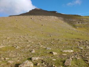
The beginning was a gradual incline on tarmac, so not the steepest of walks, and as we began to get into our stride the logistics of getting thus far seemed well behind us. The walk started at sea level, and the first peak of the day was Skalafjall at 374 metres. On ‘alien’ terrain we were not the fastest and a fair bit of map-checking took place on the way. We reached the ‘end of the road’, a gravel farmer’s track, in fairly good time, checked the map again and then glanced upwards to the peak… Now, 374 metres may not be far in a straight line, but on a steep gradient it looks rather daunting. To be fair, this wasn’t the most difficult we have ever climbed… probably about half that (I’m thinking of Scafell Pike, England’s highest peak), but there was no questioning the distance, as we were starting within a pebble’s throw of the North Atlantic shoreline!
One hour and thirty-five minutes after leaving that most friendly, and now distant, bus driver at Sandvik, we had scaled our first peak and I was literally floored…
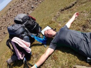
It is amazing how fast time flies when you are trying to persuade your body to return to an appropriate heartbeat and breathing pace, and what appeared to be five to ten minutes later was actually an Ecoffee mug of stove-fuelled coffee later. Having regained my composure I persuaded Jen to relinquish the map for a moment so I could congratulate myself on the vast distance we had travelled… Ermmm, it was disappointing! Lol… A mere 1-1.5km from the start point. Agreed, it had been mostly straight uphill, but the maths just didn’t add up… If this 42km walk theoretically takes 15-16 hours, we should have been 4-5km into it by now.
So, undeterred, I/we get up… we have to move wiser and faster. Both determined fighters, we jump to our feet. (Can one tell when a blatant mis-truth is told in my blogs?)
Okay, so I roll onto my front, lever myself onto my knees which simply want to collapse back down again, and slowly rise up bleating the word “Baaaaaah” on my way back up to human height. Then of course I realise that the 20 kg still perched on the peak also needs to come with me, on my back! There are a few moments in my blogs that I simply can’t describe 100% truthfully for legal reasons, and my utterance as I looked down at my bergen at this point was one of them!
It is 1547hrs (3.37pm) and we are on our way again! It has to be said that the views, once I’d got myself upright, were breathtaking (excuse the pun!).
Suddenly, the aches and pains gave way to a sense of achievement and renewed enthusiasm. It’s funny; one would now have expected the downhill stretch to Hvalba to have been a relief, but despite the incredible views all the way down, the terrain was rough and VERY steep, and with the burden of equipment bearing down on my knees I developed ‘wobbly knee syndrome’. This almost amusing state of being is not quite pain, but the feeling of joints physically gyrating, making it rather awkward to stand up or make one’s legs move in the direction the brain is telling them to. But we soldiered on and after exactly one hour reached Hvalba, where we decided to stop for a bite to eat. By now it was 1647hrs (4.47pm) and I’d been getting a little concerned on the descent – as if I needed another reason to fret – that nowhere could we see anything resembling a shop, campsite or water stop!
Of course I was over the moon to discover my suspicions were correct… *Doh*. Did we miss the “village centre”? I think not – the place really was tiny. So we continued to walk until I saw what I am fairly certain was a new house build. And where there are cement mixers and builders’ equipment there is generally water (other than the salty kind that surrounded us on two or three sides!). There also happened to be, on this lifeless site, a couple of walls down to the sea which provided a perfect wind break.
“Yup, it’s time for tea!”
This was a delightful moment, which turned into a delightful two hours..
We cooked with the sun on our backs, shaded from the wind, and were able to refill our bottles with life-giving fresh water. It was a five-star picnic next to a calm Atlantic ocean bay. To be honest we could have stayed there all night, but with time pressing on it was back to the maps and a realisation that two hours was a fairly long break on such a hike. Now we had to get moving in order to make the campsite.
A second realisation was quick to follow… if we hiked the ‘tourist’ route, we simply weren’t going to make our destination in time. We required a shortcut. Yes, yes, I know that sounds like a cop-out but we were back at sea level, and more climbing lay ahead. We discussed it for a while and ermmm 30 seconds after the discussion started we were on our way.
Destination: the official route up the “Prestgata” (= Priest’s Path) which would lead us about 380 metres above sea level… again!
The odd thing about my body is that it lies to me. It says things are OK when in actual fact they are anything but. Mentally my mind is now telling me that perhaps a tad more research might have been useful before setting off. What I’d assumed would have been a great day’s hiking was rapidly turning into a Scafell-esque climb with the exception that we were each carrying almost 20kg on our backs.
If somebody had outlined such a proposal to me prior to the climb, I might have laughed, reminded them of my age, probably made an appropriate, yet sarcastic remark such as: “I could if I wanted to but don’t fancy it today”, and then fished out my phone to call a taxi.
But my body was actually urging me on and somehow!
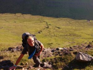
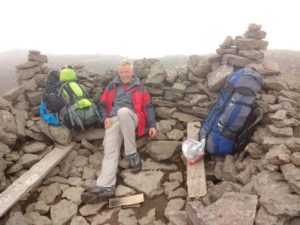
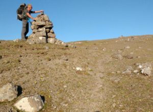
Two hours later at 2040hrs (8.40pm), we were at another peak on the Prestgata where we stopped, dumped our bergens down next to a cairn like irritated teenagers, put water on to boil for a fast caffeine hit, and looked back at the awesome climb we’d just achieved up gravel, rock and scree. Without entirely knowing beforehand what the day had in store for us, we had ascended the same vertical distance as Scafell Pike, which I might add we have never done with so much kit! *Yayyy*. It was a euphoric moment, and now nature, as if to say “Well done!”, rewarded us with a jaw-dropping panorama that I shall not forget in a hurry.
Well, that’s the upside. The downside is that it was getting late, there wasn’t an official campsite for a few kilometres yet and this hike was turning into something of a life challenge! With few alternatives and a strong desire for a shower, we set off again towards our next “milestone” town, ironically the one we had set off from that very morning! However, if we had made it all the way there again to reclaim our random grassy camping spot, we would have been horrendously behind schedule. It was already 2240hrs (10.40pm) so Jen and I decided that instead, the campsite marked on the map at Oravik, approximately 4km further on by road, would be our evening’s resting place.
We had discussed the water situation, you know, just in case the ‘official’ maps were wrong or facilities were not available at the campsite… so as we headed along the road we kept a keen eye out for water, of the fresh, cold and salt-free variety! We stopped at the Krambatangi ferry terminal and had a nose around for free-standing water pipes. Annoyingly, I found one… I say annoyingly as neither Jen nor I could extract any water from it, so with the terminal building itself locked up for the night we soldiered on! I guess it was about two hundred yards further up the road when I nudged Jen… I don’t think Jen, who is the most patient of individuals, actually appreciated the reason for that nudge until I pointed out what I’d seen next to us in a driveway… A HOSE PIPE!
Of course there was no reason to be nervous – well, maybe there was a bit as we took water that wasn’t ours. Re: where to sleep, we were both fully aware by now that maps and timetables, whilst ‘official’ printed matter, bear little resemblance to what actually exists and/or happens. So we sauntered off with full water containers and low expectations of nothing more than our comfy tent, wherever the next stop would allow us to pitch it…
Imagine our surprise… (yes, it is getting tedious and repetitive isn’t it… darned lucky this isn’t fiction!), there was no campsite at Oravik…
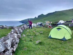
I should reinforce the fact that both Jen and I are usually very patient individuals! However, I must admit that now there was a distinct, unspoken feeling that we two great friends were becoming equally fed up. Out came the maps again, and we decided to keep walking and look for somewhere to wild camp along the way. It was about a kilometre later that we discovered another mini-paradise next to the sea. A bit stony, but hey… We pitched for the night at 0110hrs (1.10am) about 100 yds short of Hovstunnilin (one of many road tunnels on the Faroe Islands, this one 2435m in length).
All seemed well and even though we were in full view of the road, we were simply too tired to care! In fact we didn’t worry at all about being “caught”, but we did get a bit of a shock in the wee small hours when a bird got between the inner and outer layers of the tent and became trapped! The bird escaped, leaving both Jenny and I momentarily traumatised at the racket that had dragged us out of our slumber, but then as I unzipped the inner tent all became clear. I was confronted by the biggest swarm of mosquitoes I’d ever seen, and as I happen to be a mosquito ‘magnet’ that meant only one thing! Ten minutes later our tent was packed away, I had “gained” 20-30 bites, and we headed off at speed to a layby over the road – a far safer spot to make breakfast!
Day 2 didn’t start until noon. We had spent a fair while looking at the official route and decided to take a detour. My estimation on how fast and far we could walk had been, at best, a guesstimate based upon how fast I walk back at home over distances of between 10-20km, how long and fast I was made to walk during military training (ermmm, over 15 years ago! Lol) and how fast Jen and I have hiked up and around mountains wearing daysacks back in the UK. It seemed my estimations for THIS trek had been quite dramatically wrong. In fact it may have been more accurate to put 10 numbers into a hat and used the first one randomly selected as our speed. We simply weren’t cutting the mustard!
After consultation we decided, against my better judgement, to head straight through the tunnel instead of over the mountain through which it passed. As I have been in charge of operations for several major UK tunnels I was fairly certain that we would get through fairly quickly, probably by way of a ‘blue light taxi
I was fairly certain that we would get through fairly quickly, probably by way of a ‘blue light taxi’
(for those who are not aware I speak of our fellow servicemen in the police force or Traffic Officer Service who would, in my day, have collected “tunnel pedestrians” such as ourselves and verbally humiliated us before giving us a free taxi ride to the closest exit!). However this was not happening for us today, and whilst blushes were saved, my legs grew more tired as we simply kept walking (uphill!) and made it through to the proverbial light at the end. Total time 40 minutes on a slight incline… We were actually doing ok! Next stop ermmm Porkeri..?
Now, I do happen to believe that somebody ‘upstairs’ tends to look after me in awkward situations and when we happened upon Porkeri, another tiny village/town, our luck was so good that we were actually suspicious. Surely the man upstairs had organised this! In front of us was a food shop (trust me these aren’t as common as one might think in the Faroes!) and after the shop a sign, not only for toilets but also showers. The public facility was by no means second-rate either but brand spanking new, which might account for why it was not on any map! Believe me when I say it was like winning the lottery, the Grand National and the Derby all at once! Such a small place and no clue as to these wonderful facilities on any map, anywhere (I should refer readers back to my Into The Wild Part 1 and Part 2 blogs rather than revisit the Faroe infrastructure again!)
Of course, with such facilities at our disposal our stay at Porkeri extended from an expected half hour to a glorious hour and forty minutes. We fed, showered and even indulged in ice cream whilst soaking up the views, which it has to be said – glorious as they are – can be seen from almost anywhere on any of the eighteen islands. Then we headed off. Our target minimum for the day was the town of Vagur, and having been spoilt rotten at our last sign of civilisation we floundered slightly. Neither of us had done any writing for some time and we actually had a real opportunity for a few hours’ recovery. Arriving at Vagur we both instinctively nodded to each other; it was as though we had picked up on the speechless conversations witnessed in Norway some weeks earlier. No actual talking or negotiating was required. We simply looked at each other, gasped ‘Norwegian style’ (a little tic we’ve noticed in the locals around these parts!) and the deal was made. The last stage of our 43km was almost in sight, but the weather was due to close in and we were both becoming weary. Our umpteenth new plan was forged that afternoon!
We called ahead to spend a night at ‘The Scouthouse’ a quaint youth hostel (on top of the hill!) but they were full that evening… however, in true Faroese style the lady informed us we could use it the following night and she would, on our behalf, call around the locality and find us a room! *Wow!* We hadn’t banked on two nights under a real roof, but with great minds thinking alike, a challenge to complete and the weather due to close in within twenty-four hours, it didn’t take a rocket scientist to work out this plan…
We received a confirmation callback within ten minutes, and then we were off to the home of a Faroese lady called Kitty! If we had been in a fairy-tale she would probably have played the part of the fairy godmother! Although Kitty did not speak a single word of English she made us most welcome and quickly headed off to the shop to organise a veritable feast for our breakfast! Meanwhile we were hatching our plan for the next day: leave our big bags at the Scouthouse the following morning, set off lightly-laden to the southernmost tip of Suduroy, return by bus that afternoon and rest before catching another bus to our pre-booked ferry… It was a plan so cunning that even Rowan Atkinson would struggle to find a fox cunning enough to outwit it – simple yet reliant on Faroese buses… *Urghhh*.
Filled to the rafters with a fuller-than-full breakfast we climbed the steep hill back up to the Scouthouse the next morning. We let someone know our stuff was there, flexed our now-free shoulders (hooray!) and then it was time to begin the last leg of our hike Into The Wild.
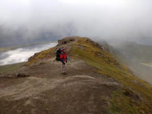
I think we were both filled with incredible emotion that morning. It was the first time in days we were walking without the burden of 20kg bergens, the end was in sight (well, on a map anyway) and despite our aching legs we soon hit a ‘home’ pace. We covered 4.5km to Lopra, from sea level to around 280m, in an hour!
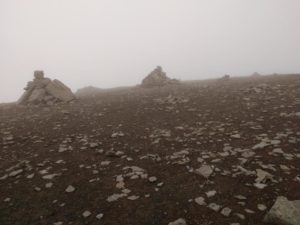
We moved on and detoured to a cliff face above Skarvastakkur in approximately 40 minutes of climb and reached the highest point of the day, around 470m (Beinisvoro) at about 1445hrs (2.45pm). This part of the hike was amazing, even though the views were soon obscured by dense fog! We had to reach the southernmost point, Akraberg, and go back 2km to catch a bus leaving at 1630hrs (4.30pm), and it sure looked like we would make it… It was touch and go as we followed a well-trodden path and roads on the final leg but our spirits had changed and it looked as though our perseverance would pay off.
At the Akraberg/Sumba junction we stopped to consult maps.
It would seem we MIGHT make it to the southernmost tip of the island but the last stretch of road was another sharp incline. The question was, if we pressed on to achieve our goal would we make it back in time to catch the one and only elusive bus of the day? We decided to chance it… Worst-case scenario would be a cold and dreary 18km hike back to the scout house, but we simply couldn’t come this far and not give it a shot!
Determination I guess comes in many forms. For me the ‘yomp’ mode was activated! I am told that when in ‘the zone’ I can walk long distances more quickly than others can run. Pain was put to one side and I found the ‘zone’. Jen on the other hand is a fell runner, who for the last few days had been burdened with the full weight of a bergen. With the end in sight and no such restrictive force holding her back, and perhaps also with one eye on the clock, she let me get to within a hundred or so yards of the finish before finding her ‘zone’, which quickly brought her level and cruising past me at warp speed! There were only a few moments to savour the finish, take a few pictures and soak up the view before we had to get back to Sumba and catch the bus…
Sadly, that wasn’t quite the end. Although the hike Into The Wild we had set out to achieve was completed there was a moment of realization in Sumba that no bus would arrive! As with Porkeri there were excellent facilities and I suspect that the man ‘upstairs’ was looking down on us kindly once more as, Jen, looking for the correct door to a lavatory, happened in on a council meeting regarding tourism! Yup, you had to be there to believe it!
They kindly informed us, after calling the bus company on our behalf, that the bus driver would not be coming to Sumba that day! However, they were all heading back to Vagur after their meeting and we managed to hitch a lift all the way back to the Scouthouse!
The Suduroy trek is approximately 43km long, and according to the hiking guide book one should expect to take 15-16 hours walking time to complete it. Whilst we were not really interested in timings, we did mark our stop off points and times along the way and were both fairly delighted that we had completed the task, cutting a few corners but adding several more, in 13 hours and 38 minutes. And that was hot on the heels of the two fully-burdened 7km treks we had done on the two previous days before getting started…
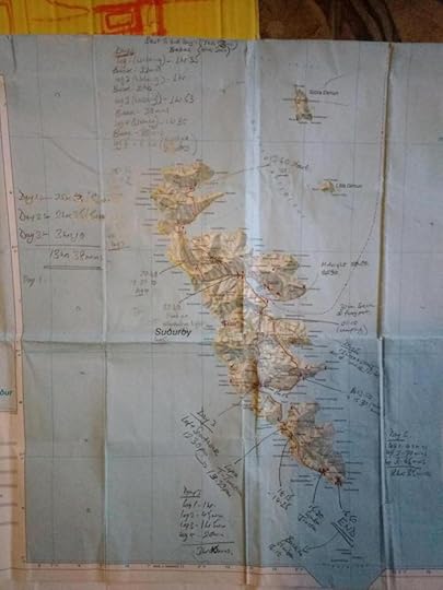
Our time on the Faroe Islands is now at an end and whilst there is another trekking/camping adventure that I’m sure people have guessed I plan to impart, from here we are off to Iceland…
Jen’s comments to me? “Si, we’re off to Iceland next, so is there anything in particular you’d like to do?”
My reply? “Well, there’s a trek of some 80+ km that looks like fun!”
Current status: Still under negotiation!
This post was edited/censored by the lovely Jennifer Lyon whose travel blog can be found by clicking here.
Simon Duringer is an award-winning blogger, interviewer and author. His own books can be found on Amazon too by clicking any of the following icons…
June 21, 2016
Into The Wild – Part 2
Into The Wild (Part 2)

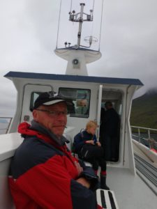
I wasn’t expecting much from the ferry that took us from the capital of the Faroe Islands to the island of Suduroy. I mean, with all due respect to the Faroese, their capital is home to around 24,000 people, i.e. two thirds of the population of all 18 islands. Therefore a large and full ferry of the size I am used to (Cross-Channel, say) leaving the Faroese capital might be akin to a mass migration, rather than a day trip! Not that it would make worldwide news or anything, since Faroe is rather small…
But, I am pleased to say it was a marvellous trip. Whilst June is too late in the year to offer much of a chance of seeing the Northern Lights the views and landscapes of the many islands we passed were breathtaking! So, whilst sitting out on a spacious and uncrowded smoking platform, enjoying a pipe stoked with a cool Cherry Ambrosia flavoured tobacco I had discovered in Stockholm some weeks earlier, my mind turned to the upcoming trip Into The Wild. Thoughts sprang to mind of my glory days some 15 years earlier – when I would lug a full bergen up mountains with pine poles and all manner of military equipment – and I finally gave some serious thought to what was essential for our “small” excursion. Sorry, for those who may not have read my previous Into The Wild post, I refer to our small 43km excursion, on foot, through mountains, wild camping…
Yes, I know I may have been slightly condescending about those day trippers’ bags in my last post, but hey, to be fair Jenny and I previously scaled Britain’s highest mountain with daysacks in a fairly ground-breaking time so travelling light can’t be all bad! Anyway, as the aroma of cherry filled the outer deck I began thinking ahead, all in all about an hour or two ahead! That was as much time as I had left to get my head straight before we would reach harbour. Jenny on the other hand was already busy in the main cabin area figuring out which campsites may be available to us, writing down telephone numbers, checking out websites, campsite facilities and emailing ahead… You know, all that boring *ahem* woman-type stuff!
Nothing was left to chance, in my mind. I knew and had lugged all the equipment we required around half of Europe and we had already done a 7km trial hike from the airport to the hostel the previous evening. Following our trial trek we had satisfactorily reduced our load by about 10kg, largely through returning to Vagar airport on the morning of Day 2 and begging the information desk lady to keep hold of our non-essential equipment for eleven days! Therefore, aside from throbbing limbs, the odd blister and back pains that are probably natural for a guy on the wrong side of forty, we were ready for anything.
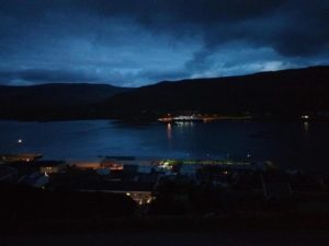
That couple of hours passed me by rather quickly and as the boat rolled in to Krambatangi harbour Jen and I gathered our belongings and headed for the ferry terminal. The time was about midnight by my reckoning, but that was no bother really as for one I am an insomniac and for two it doesn’t get dark on the Faroe Islands in June.
It did bother us both a tad that Krambatangi neither sounds nor is spelt in Faroese like Tvoroyri, which is where we had been led to believe we would land. But, really that was fine, or might have been if either of us were Pal Joensen (The Faroese Olympic swimmer), as we could clearly see Tvoroyri very close by across a small stretch of water… in the UK we call such waters: estuaries! Lol.
I guess it was about five minutes after we’d been spotted staring at our shiny new map in disbelief that a local Faroese lady kindly informed us that if we wanted to take the bus we should hurry as the bus drivers tend not to hang around…and bless her, she was right and he didn’t.
Our next encounter was with the ferry terminal official who was very keen to assist us. It is something we have both noticed about local Faroese people, they are indeed very helpful to foreigners. Sadly, on this occasion the best news she could give us was the direction of our upcoming walk… But hey ho, we had arrived, so what on earth could be more pleasant on such a beautiful evening than another 7km practice hike to the campsite and a warm shower before the morning?
Looking back I think it was in the late 1990’s that I discovered, or more to the point was informed of, a major personal defect (one of many I am sure!) that when I am nervous I smile a lot. Indeed, often under such circumstances I accompany such smiles with wise-cracks, or perhaps they should be renamed unwise-cracks. In the past such unwise-cracks especially did not go down well with military instructors. But it should be said that even as, on one occasion, an instructor threw my entire ‘bed space’ from a first floor window after I unintentionally trod on and ruined his highly polished boot cap, that or other such incidents of similar severity pale into insignificance compared to the fear a loved one can instil with a simple glance!
On passing this moment off with a smile and remarking that this would simply be another ‘opportunity’ for a 7km practice hike bearing full bergens I detected a glance from my side..
…I suppose that asking somebody to accompany one on a full-kit 7km hike after midnight and following a day’s travelling would warrant nothing less. But hey ho, it was either that or pitch the tent outside the ferry terminal!
Perhaps there are a couple of things newbies to The Faroe Islands might find it useful to know at this stage:
1. Bus timetables do not mean much to bus companies here. It is although somebody once charitably drew up an ‘ideal world’ type of table for the government who in turn adopted it as the official timetable, published it and never passed it on to the bus company! Bus timetables (outside the capital) can very rarely be found at bus stops too.
2. As with point 1. It would appear that a well-meaning hiker may have done the same with campsites, i.e. drawn up a map of the 18 islands, added where it would be great to see campsites, forwarded it to the relevant authority, who once again transposed it onto various (not all) tourist and hiking information maps but perhaps got distracted in between the map printing and distribution process, forgetting to ask the land owners if their back gardens could be used as such sites and/or whether people could use their facilities…
But I digress. Back at the ferry port we had now organised ourselves and started walking! I don’t mind saying that it is a disheartening feeling when one can see a destination several hundred meters away ‘as the crow flies’ and at the same time realise that it will be a good and hard hour or so of yomping before one will arrive…
Seven kilometres later I think both Jen and I were about ready for some serious rest. But first we needed to find the campsite, and I don’t mind saying that this was proving somewhat problematic. The maps and directions from the port staff simply did not tally. We climbed…and climbed until the town of Tvoroyri was below us… Now, this shouldn’t have been difficult, as we had the map and the port official had agreed that said campsite was on the previous, official, football ground of the town. (I mean you can’t really hide things of that size, right?). Looking down, now from above most of the town, there was nothing resembling even an allotment patch, let alone a full-size football pitch…
With an executive decision required, between us, we decided to ‘wild camp’. An interesting notion since we were pretty much skirting the edge of a town. There was nothing to say this was disallowed and the only sign about wild camping was very friendly: ‘Verboten’ – Thankfully, I don’t speak Faroese – But the pixies told me it means ‘all foreigners welcome to camp wherever you please!’
We get as close to where the sign on the map suggests there should be a campsite, and find nothing but buildings in progress. One last looksee, as by now discussions about food are taking place, and no campsite equals no water… and whilst we would not die without water for a single evening, it sure would be nice before settling down and indeed setting off the next morning to at least have a coffee!
So, looking around the building site on the side of what may or may not have been a hospital, I was suddenly taken aback. As I stared through a glass door at internal building works the door decided to open, and a light automatically came on inside. *BINGO*. Jen didn’t take much convincing to follow me in, and having established that this really was a building site (with a partly-built bathroom two metres from that welcoming door, he-he-he!) we managed to fill enough water containers not only to rustle up something to eat that evening, but also to wash, have water on hand all night and enjoy a late-night coffee (in my case).
Following this refuelling stop the night could hardly have been better. Once we had picked and agreed on our ‘pitch’ – pretty much where the campsite SHOULD have been! we woke the next morning to five-star views across the bays and also had enough water to make a hearty bowl of porridge with coffee the next morning!
We had now hiked around 15km with full gear and we hadn’t even got past the starting line yet!
But, start we did… Our Into The Wild quest was merely hours away. My bed, on the other hand is minutes away, and therefore my friends you will need to come back soon to find out what happened when we actually got started on the North to South hike of the island of Suduroy on the Faroe Islands.
Thanks for reading and please come back soon.
Goodnight!
This post was edited/censored by the lovely Jennifer Lyon whose travel blog can be found by clicking here.
Simon Duringer is an award-winning blogger, interviewer and author. His own books can be found on Amazon too by clicking any of the following icons…
June 20, 2016
Into The Wild
“Simon, I’ve got hold of a hiking book with all routes for the Faroe Islands. Can you take a look and let me know if there is any of them you specifically want to do during our visit..?”
I can only guess that the above comment has the same effect on me as it would on a chocolate addict being led into a candy store and being told, “You can have any bar of chocolate but you can only have one… which would you like?”
In such a case you kick the ingredient section into touch, regardless of allergies, and just head for the biggest bar!
“Found it!” was the reply after simply looking at the index… Yup, the biggest will do fine. 43km from the northernmost point of the island of Suduroy, Sandvik (give or take a hundred yards), to its southernmost point, Akraberg. “Let’s wild camp,” I added. Of course walking the route ‘book’ style means taking a day bag, perhaps a flask of coffee and a sandwich and nailing it in the 15-16 hours of walking time as suggested, in a day.
‘Camping’, however, requires a few extra items: a tent, sleeping equipment, food, the means to heat food, water, provision for first aid, clothes, maps, overnight bags, etc etc.
Simon knows best *ahem*, after all 43km is only twice the return distance between Dawlish and Shaldon around where I live in the UK plus about 3km… so we should have been able to nail it with ease in around 7 hours…
I guess I should halt for a moment and mention my lovely partner and hiking buddy Jennifer Lyon, as she is a fell runner and unafraid of a challenge. My point being that I guess I will never know whether or not she knew (or hoped!) in advance of handing me ‘that’ hiking book, which route I would choose. I am guessing however that she has never done a fell run with between 17-20kg of equipment on her back, let alone a distance as long as 43km. But, giving nothing away other than an eye roll at my choice, it gave me that ‘first bite of the chocolate bar’ feeling that we were on the same page, so to speak. Ah, but there is one other thing I should mention briefly whilst setting the scene. My Dawlish to Shaldon round trip back in the UK consists of anything BUT going Into The Wild; it’s a flat sea wall from start to finish! There’s a nice cafe called ‘The Clipper’ at the half way point where one can sit back, enjoy a wonderfully whisked up cafe latte whilst soaking up the sunny views of the Teign estuary before returning home. Equipment-wise I generally take nothing but my mobile phone, and that’s just to capture any unexpected nature shots on the way! On the other hand, for those who aren’t familiar, the Faroe Islands are located between northern Scotland, Norway and Iceland. They’re at the mercy of the full force of the North Atlantic weather systems, and in June it never goes dark… The islands are also home to many, many mountains which when climbed from sea level (as most are) involve a height gain akin to climbing England’s highest mountain, Scafell Pike… But, all that aside, hand on heart I can say it seemed like a good idea at the time!
So, to the adventure…
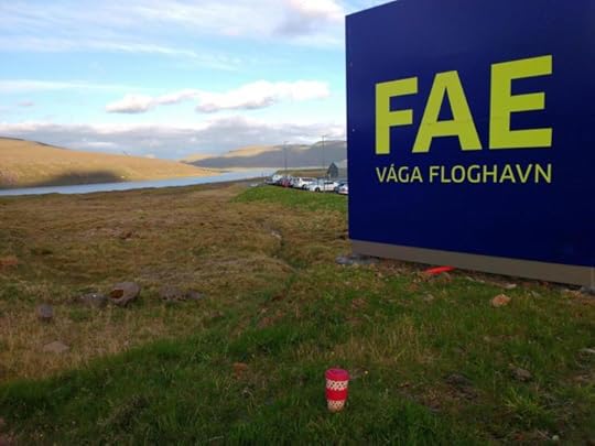
Girl and Boy, both carrying 17-20kg on their backs and full carry-on luggage by their sides, fly from Bergen to the Faroe Islands. After a 7km ‘practice’ hike straight from the airport to the luxury of a proper bed – tired, ermmm, exhausted actually, but nonetheless still undeterred – have a ‘traditional’ night’s sleep before heading back to the left luggage area of the airport the following morning to drop off as much luggage as possible! It simply wasn’t feasible to take the additional 10kg or so of hand luggage up those mountains with us. We head off on a bus to the capital Torshavn where we find a quaint town with some extremely helpful people. We find the ferry terminal, get times for ferries to Tvoroyri (on Sudoroy, our hiking destination) and head off for our ‘last pre-walk supper’. On the way to the Western-style fast food restaurant we collect an OS-style map and whilst waiting for the ferry we eat and pore over our destination.
Now, I am not a nervous kind of guy, but there’s a look that girls give guys sometimes that suggests they may not be entirely happy with said guy’s forward planning (you know what I mean, guys… right?).
Jen has now had a good look at the map. Nervous quiet follows… an odd smile… a ‘Simon, you haven’t a clue what you’ve signed us up for… now we’re in, don’t mess it up or else!’ type of look!
I guess it was about halfway through our burger that ‘the’ look came and, I confess, other than looking at the index page several days earlier, the actual content of the hike hadn’t even crossed my mind until we entered the premises for lunch…
So, I joined in and looked at the map. Guys, the burger was great! Fries were well cooked, the sauces on offer were lovely and by Jove it filled a gap. I’m fairly sure the food was cooked well enough but I couldn’t help but feel a little nauseous. You see, on my maps of Dawlish and its surrounding area there are pretty much no contours to speak of i.e. the little orange lines that let you know how steep and fast the landscape changes. The closer together the lines, the steeper the incline/decline… Now I was looking at my Faroe map, and my eyes were seeing nothing but orange…
On a happier note, the ferry was on time and the journey was most scenic and beautiful. The trip – essentially a two-hour cruise, paid only in one direction even though most folks go both ways – cost us around ten pounds each, possibly the biggest bargain of the trip so far. Beyond that… Well, it is getting late so I’m afraid you’ll just have to wait to hear about what happened on our trip Into The Wild.
One thing I can assure you all of is that it was anything but plain sailing!
Come back soon and read how it all turned out…
This post was edited/censored lovely Jennifer Lyon whose travel blog can be found by clicking here.
Simon Duringer is an award-winning blogger, interviewer and author. His own books can be found on Amazon too by clicking any of the following icons…


