
David S. Ferriero's Blog, page 4
September 17, 2021
Acknowledging our History: The National Archives at San Francisco and the San Francisco Federal Records Center, San Bruno, California
This post is another in my ongoing blog series that acknowledges the ancestral lands on which the National Archives’ buildings are situated across the country. This series of acknowledgements is a simple way to offer our recognition and respect to the people who once lived on these lands.
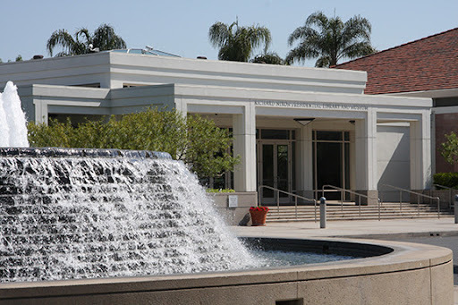
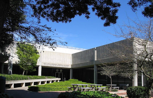 Photo of the National Archives and Federal Records Center, San Bruno, California
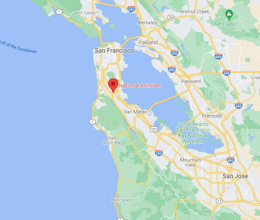
The National Archives at San Francisco and the San Francisco Federal Records Center is located in San Bruno, California, which is situated on the ancestral lands of the Ramaytush Ohlone people.
 https://native-land.ca/wp/wp-content/uploads/2018/06/Ohlone-tribes.jpg
“The Ramaytush (pronounced rah-my-toosh) are the only original people of the San Francisco Peninsula. In the baptismal records of Mission Dolores, Aramay referred specifically to the area containing the villages of Timigtac and Pruristac. The term Ramaytush became a linguistic designation for a dialect of the Costanoan language that was spoken by the original peoples of the San Francisco Peninsula. Most descendants of the indigenous groups of the San Francisco Bay Area, however, refer to themselves as Ohlone while a few others use Costanoan.
The title Ramaytush Ohlone recognizes the Ramaytush as a part of a larger group of the Ohlone/Costanoan peoples who lived in the area of the San Francisco Bay south to Monterey. Prior to the arrival of the Spanish in 1769, the Ramaytush Ohlone numbered approximately 1400 persons and lived in eleven tribelets.” From the Association of Ramaytush Ohlone website.
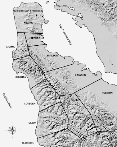 “Tribelets” of the Ramaytush Ohlone people
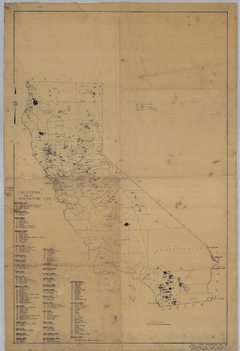 Map of California Reservations and Rancherias, 1954 – 1954. National Archives Identifier 57316280
My thanks to Stephanie Bayless, Director of Archival Operations, National Archives at San Francisco, John Seamans, Archives Technician, National Archives at San Francisco for the research, images and information they provided for this post.
For Additional Information:
Margolin, Malcolm. The Ohlone Way: Indian Life in the San Francisco-Monterey Bay Area. Heyday; Second edition. (August 1, 1978) https://heydaybooks.com/catalog/the-ohlone-way-indian-life-in-the-san-francisco-monterey-bay-area/
Alan Leventhal, Dolores Sanchez et al. “A Contemporary Ohlone Tribal Revitalization Movement: A Perspective from the Muwekma Costanoan/Ohlone Indians of the San Francisco Bay Area.” http://www.muwekma.org/publications/tribalpublications.html
Map of California Reservations and Rancherias, 1954 – 1954. National Archives Identifier 57316280


September 15, 2021
The Importance of Acknowledging our History: The Richard M. Nixon Presidential Library and Museum
This post continues my ongoing blog series that acknowledges the ancestral lands on which the National Archives’ buildings are situated across the country. This series of acknowledgements is a simple way to offer our recognition and respect to the people who once lived on these lands.
 Richard Nixon Presidential Library and Museum
The Richard Nixon Presidential Library and Museum is located in Yorba Linda, California, which is situated on the ancestral lands of the Hotuuknga Tribe which was a branch of the Tongva Nation.
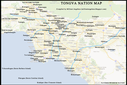
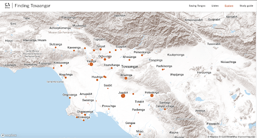 Maps courtesy of MilitantAngeleno and Los Angeles Times
Enter your address in this interactive map of Traditional Native Lands to see who once lived where you are now.
My thanks to Meghan Lee-Parker, Archivist, Richard Nixon Presidential Library and Museum, for the research and information she provided for this post.
For additional information:
Yorba Linda: Its History by March Butz The Yorba Legacy by Mary Ruth EricksonTongva Nation websiteSeptember 9, 2021
We Remember: 20th Anniversary of 9/11
This year marks the 20th anniversary of the September 11, 2001 terrorist attacks on the United States. The National Archives and the National Archives Foundation remembers this event with a series of virtual programs accessible live to viewers across the country. Learn more about the live programming, as well as featured documents and educational resources on the National Archives Foundation website.
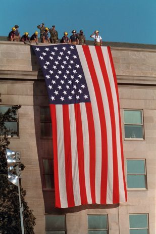 Firefighters unfurl a large American flag over the scarred stone of the Pentagon in Arlington, Virginia on September 12, 2001. Photographer: Paul Morse, National Archives Identifier 5997275
Additionally, as the nation’s record keeper, the National Archives safeguards many records related to the events of September 11, including the 9/11 Commission Records, Federal Aviation Administration (FAA) records, as well as many White House photographs documenting the days and weeks surrounding the event.
 Firefighters await the arrival of President George W. Bush to Port Authority in New York City. Photographer: Paul Morse.
National Archives Identifier 5997307
Firefighters await the arrival of President George W. Bush to Port Authority in New York City. Photographer: Paul Morse.
National Archives Identifier 5997307
9/11 Commission Records
The National Commission on Terrorist Attacks Upon the United States, known as the 9/11 Commission, was an independent, bipartisan commission created by Congress. The Commission’s mandate was to provide a “full and complete accounting” of the attacks of September 11, 2001 and to provide recommendations as to how to prevent such attacks in the future. When the 9/11 Commission closed on August 21, 2004, it transferred legal custody of its records to the National Archives. The Commission encouraged the release of its records to the fullest extent possible in January 2009. A large percentage of the Commission’s records are national security classified files. NARA maintains a list of documents released since the records were opened in 2009. Learn more about the 9/11 Commission Records.
 September 11, 2003 – Temporary memorial near Shanksville, Pennsylvania honoring the passengers and crew of Flight 93, hijacked on September 11, 2001.
National Archives Identifier 5616340
September 11, 2003 – Temporary memorial near Shanksville, Pennsylvania honoring the passengers and crew of Flight 93, hijacked on September 11, 2001.
National Archives Identifier 5616340
 A worker stands at Ground Zero in New York City.
National Archives Identifier 5997364
Photographer: Paul Morse
A worker stands at Ground Zero in New York City.
National Archives Identifier 5997364
Photographer: Paul Morse9/11 Federal Aviation Administration (FAA) Records
Following the September 11, 2001, terrorist attacks, the Federal Aviation Administration (FAA) (Record Group 237) compiled records from its staff and aviation facilities to support internal and external investigations of the events. The records consist of 126 cubic feet of textual, audio, and electronic files relating to the actual terrorist attacks, the FAA’s involvement in the monitoring of United Airlines Flights 175 and 93 and American Airlines Flights 11 and 77, and the Federal Government’s subsequent actions in the aftermath of the attacks. Learn more about the 9/11 Federal Aviation Administration (FAA) Records and view the Finding Aid.
 Firefighters brave the thick smoke as they search for survivors through the rubble and debris of the World Trade Centers in New York City in the area known as Ground Zero, after the 9/11 terrorists attacks, 9/14/2001. National Archives Identifier 6640973 Scene Camera Operator: PH2 Jim Watson, USN
9/11 Photograph Collection
In the days following the September 11 terrorist attacks, White House photographers took over 50,000 photographs capturing the horror and heroism, the courage and compassion surrounding the attacks. View the collection of 9/11 photographs from the George W. Bush Presidential Library on Flickr.
 President George W. Bush embraces a firefighter at the site of the World Trade Center during his visit to New York City.
National Archives Identifier 5997299
Photographer: Paul Morse
President George W. Bush embraces a firefighter at the site of the World Trade Center during his visit to New York City.
National Archives Identifier 5997299
Photographer: Paul Morse
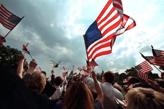 Staff members wave American flags as they gather on the South Lawn of the White House as President George W. Bush and Mrs. Laura Bush depart for Camp David aboard Marine One.
National Archives Identifier 5997343
Photographer: Paul Morse
Staff members wave American flags as they gather on the South Lawn of the White House as President George W. Bush and Mrs. Laura Bush depart for Camp David aboard Marine One.
National Archives Identifier 5997343
Photographer: Paul MorseWe invite you to join us for our virtual programming this week as we reflect on the legacy of 9/11, remember the heroism, and honor the individuals and families impacted. Learn more on archives.gov.
September 7, 2021
Acknowledging our History: The National Archives at Riverside and the Riverside Federal Records Center, Perris, California
This post is another in my ongoing blog series that acknowledges the ancestral lands on which the National Archives’ buildings are situated across the country. This series of acknowledgements is a simple way to offer our recognition and respect to the people who once lived on these lands.
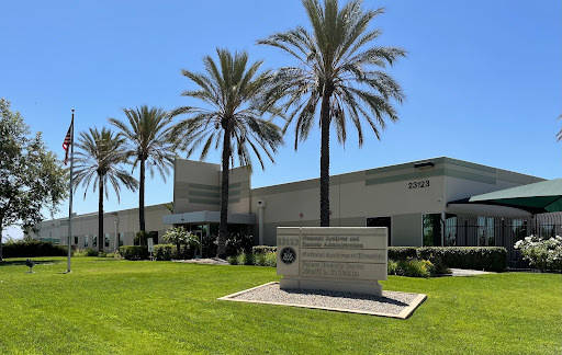 Image courtesy of Kimberly Gorman, 2021
The National Archives at Riverside and the Riverside Federal Records Center are located in Perris, California, which is situated on the ancestral lands of the Payómkawichum or “People of the West”, who are today known by the band names Pechanga, Pauma, Pala, Rincon, San Luis Rey, La Jolla, and Soboba; this area also saw traditional uses by the Cahuilla people to the east.
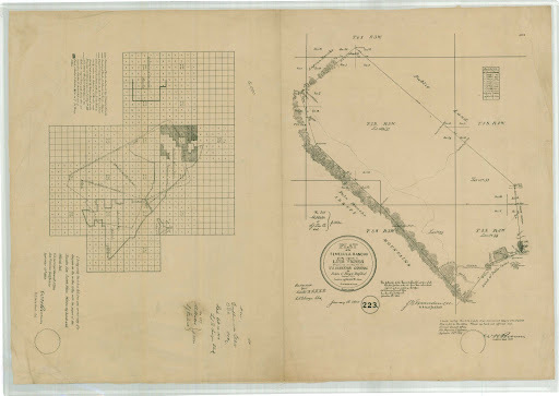 Plat of the Temecula Rancho and Diagram Showing the Boundaries of the Rancho San Jacinto Viejo, Patented, and the Rancho El Sobrante de San Jacinto, Patented. NARA’s facility is located on Section 12, T4W R4S, which is just off of the corner of the large drawing.
The treaties made with the peoples of California were never ratified by the U.S. Senate. The lands that the Perris Facility stands on were ceded under the auspices of the Treaty of Temecula (Unratified California Treaty K, 1852). These treaties were unratified, thereby leaving tribes without protections under U.S. law. See Lisa Miller’s treatment of the history in this Prologue article.
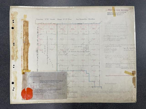 Plat Map from NARA’s holdings in RG 49, Records of the Bureau of Land Management.
Enter your address in this interactive map of Traditional Native Lands to see who once lived where you are now.
My thanks to Gwen E. Granados, Director, Kimberly Gorman, Archives Technician, and Stephanie C. Smith, Archives Technician at the National Archives at Riverside, for the research, images and information they provided for this post.
Additional Information:
Pechanga Band website: https://www.pechanga-nsn.gov/index.php/history
Prologue Article regarding the Unratified California Treaties: https://www.archives.gov/files/publications/prologue/2013/fall-winter/treaties.pdf
Treaty of Temecula (Unratified California Treaty K, 1852) https://catalog.archives.gov/id/55030733
Photograph of Osevio Saldago and Family in Front of Their Old Home Near the Pechanga Reservation
https://catalog.archives.gov/id/170102827Photograph of Osevio Saldago in Front of His New House at Pechanga
https://catalog.archives.gov/id/170102825Curtis Collection photographs, LOC:
https://www.loc.gov/pictures/collection/ecur/item/89708404/https://www.loc.gov/pictures/collection/ecur/item/93502792/September 1, 2021
The Importance of Acknowledging our History: The National Archives and the National Personnel Records Center, St. Louis, Missouri
This post is another in my ongoing blog series that acknowledges the ancestral lands on which the National Archives’ buildings are situated across the country. This series of acknowledgements is a simple way to offer our recognition and respect to the people who once lived on these lands.
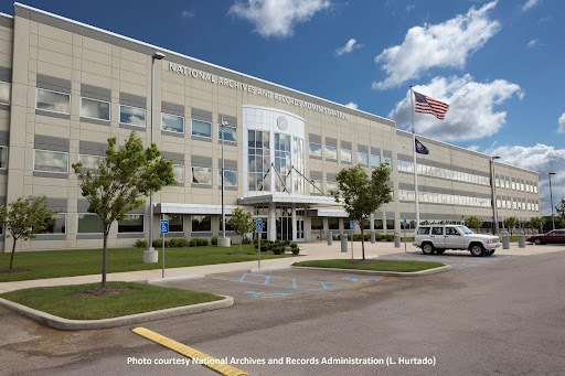 National Archives and the National Personnel Records Center, photograph courtesy of L. Hurtado
The National Archives at St. Louis and the National Personnel Records Center, are located in Spanish Lake, Missouri, which is situated on the ancestral lands of the Osage Nation, the predominant peoples of the area.
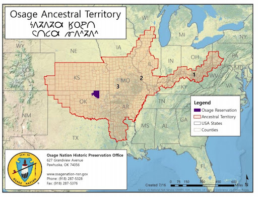 Ancestral lands map from Osage Nation website:
https://osagenation.s3.amazonaws.com/B/B.1.a.AncestralLandsMap%20Poster.pdf
Ancestral lands map from Osage Nation website:
https://osagenation.s3.amazonaws.com/B/B.1.a.AncestralLandsMap%20Poster.pdf
“In 1808, the Osage signed their first treaty with the new government, ceding much of their homeland. The deal was made in Fort Osage, a new trading post and factory at present-day Sibley, Missouri. The question remains whether the Osage—or other tribes—fully understood the terms.” from Missouri Life Magazine
There are no recognized tribes in Missouri today. A state law, passed in 1839 made it illegal for Indians to reside in the state. This law was not repealed until 1909.
Enter your address in this interactive map of Traditional Native Lands to see who once lived where you are now.
My thanks to Gwen Grenados, Director, National Archives at Riverside, for the research and information she provided for this post.
For additional information:
Cession 67, Treaty of November 11, 1808 https://www.loc.gov/resource/g3701em.gct00002/?sp=37
Ceded lands map from Osage Nation website: https://osagenation.s3.amazonaws.com/B/B.2.a.CededLandsMap&Poster.pdf
Cultural History of the Osage: https://www.osageculture.com/culture/cultural-history
Approachable summaries of Osage (and Missouria) land uses (the whole series of articles is is worth reading) https://missourilife.com/the-tribes-of-missouri-part-1-when-the-osage-missouria-reigned/
Osage Nation website: https://www.osagenation-nsn.gov/
August 30, 2021
The Importance of Acknowledging our History: The Dayton Federal Records Center and the Kingsridge Federal Records Center, Dayton, Ohio
This post is another in my ongoing blog series that acknowledges the ancestral lands on which the National Archives’ buildings are situated across the country. This series of acknowledgements is a simple way to offer our recognition and respect to the people who once lived on these lands.
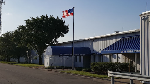 The Dayton Federal Records Center, Dayton, Ohio
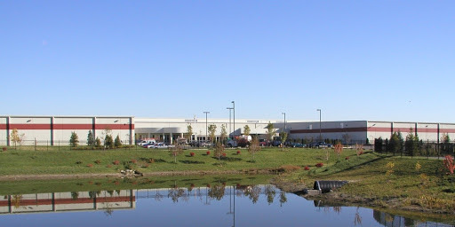 The Kingsridge Federal Records Center, Kingsridge, Ohio
The National Archives’ Dayton Federal Records Center and Kingsridge Federal Records Center, are located in Dayton, Ohio, which is situated on the ancestral lands of Kaskaskia peoples.
“Although the Kaskaskia natives did not live in great numbers in Ohio, they, like other tribes with claims to Ohio land, were forced to sign the Treaty of Greenville (1795) and relinquished their claims to land in the majority of present-day Ohio.” from Ohio Central History.org
 The location of NARA’s two Federal Records Centers in Dayton, Ohio.
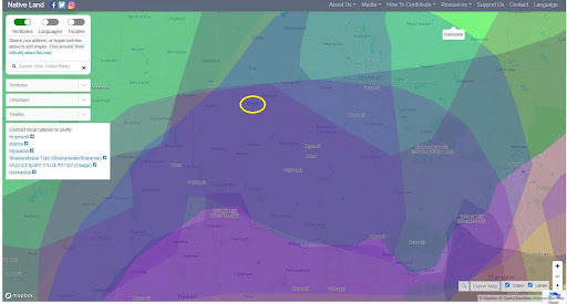 Location of the federal Records Centers on the traditional lands of the Kaskaskia peoples from
https://native-land.ca/
Location of the federal Records Centers on the traditional lands of the Kaskaskia peoples from
https://native-land.ca/
Enter your address in this interactive map of Traditional Native Lands to see who once lived where you are now.
My thanks to Allison Cutuk, Assistant Director, Kingsridge-FRC, Saundra Coleman, Archives Technician, Kingsridge-FRC, and Aaron Sipes, Supervisory Archives Specialist, Dayton-FRC, for the research and information they provided for this post.
For Additional Information:
Treaty of Greenville 1795https://ohiohistorycentral.org/w/Treaty_of_Greeneville_(1795) https://ohiohistorycentral.org/w/Treaty_of_Greeneville_(1795)_(Transcript)NARA’s digital copy of the Treaty of Greenville 1795: https://catalog.archives.gov/id/170281462Popular points of interest within 25 miles include:
– SunWatch Indian Village which is an archeological park/village recreation: https://www.sunwatch.org/
– Fort Ancient State Memorial: Native American hilltop enclosure: https://www.ancientohiotrail.org/sites/fort-ancient
– Miamisburg Mound Ancient burial mound: https://www.atlasobscura.com/places/miamisburg-mound
August 25, 2021
The Importance of Acknowledging our History: The Ronald Reagan Presidential Library and Museum, Simi Valley, California
This post is another in my ongoing blog series that acknowledges the ancestral lands on which the National Archives’ buildings are situated across the country. This series of acknowledgements is a simple way to offer our recognition and respect to the people who once lived on these lands.
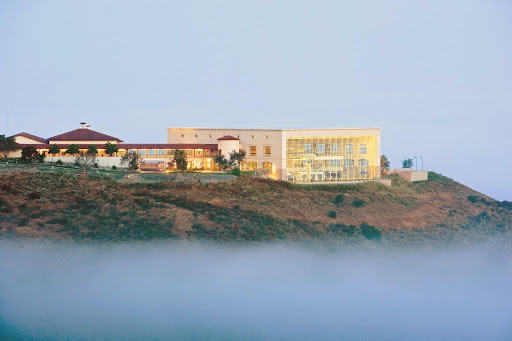
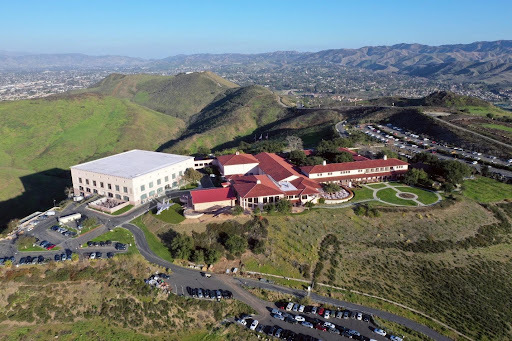 Aerial view of the Ronald Reagan Presidential Library and Museum, Simi Valley, California
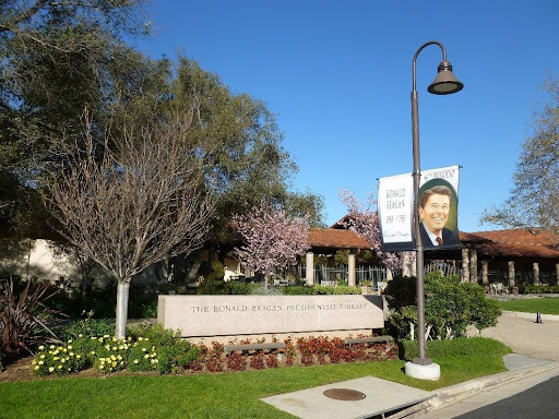 Entrance to the Ronald Reagan Presidential Library and Museum
The Ronald Reagan Presidential Library and Museum is located in Simi Valley, California, which is situated on the ancestral lands of the Chumash peoples.
 The Ronald Reagan Presidential Library and Museum, Simi Valley, California
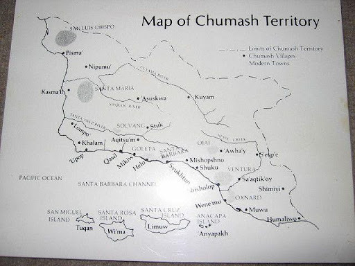
The Chumash People lived in Simi Valley as long as 10,000-13,000 years ago up until the early 1800s. Simi Valley’s name derived from the Chumash word Shimiji, which refers to the stringy, thread-like clouds that typify the region. Three Chumash settlements existed in Simi Valley during the Mission period in the late 18th and early 19th century: Shimiyi, Ta’apu, and Kimishax or Quimisac.
Map of the Chumash Territory:
 https://commons.wikimedia.org/wiki/File:Chumash_villages.svg
 https://native-land.ca/maps/territories/ventureno/
Enter your address in this interactive map of Traditional Native Lands to see who once lived where you are now.
My thanks to Ira Pemstein, Supervisory Archivist, Aimee Muller, Archivist, and Michael Pinckney, Archivist, all from the Ronald Reagan Presidential Library and Museum, for the research and information they provided for this post.
Recommended Readings:
Educational Resources from Chumash Indian Museum: https://www.chumashmuseum.org/educational-resources
“Chumash Values” by Mati Waiya, Wishtoyo Chumash Foundation: https://www.wishtoyo.org/cp-chumash-values
“Chumash History”, Wishtoyo Chumash Foundation: https://www.wishtoyo.org/cp-chumash-history
Trails on Micqanaqa’n Traditional Territory: https://www.trailforks.com/indigenous_land/view/101/
“The Names and Locations of Historic Chumash Villages,” Chester King, The Journal of California Anthropology, 2(2), 12-01-1975: https://escholarship.org/content/qt8833s5k5/qt8833s5k5.pdf?t=krnji3
“Chumash Indians in Simi Valley” by John R. Johnson, Ph.D. page 5-21, Simi Valley: A Journey Through Time, published by the Simi Valley Historical Society and Museum, 1997: https://www.simihistory.com/books/
“The History of Chumash Trail and Chumash Park”, Rancho Simi Recreation and Park District: https://www.rsrpd.org/simi_valley/historical_landmarks/history_of_chumash_trail_at_chumash_park.php
“Three Chumash-Style Pictograph Sites in Fernandeño Territory” by Albert Knight: https://www.scahome.org/publications/proceedings/Proceedings.26Knight.pdf
“Chumash Life,” Santa Barbara Museum of Natural History: https://www.sbnature.org/collections-research/anthropology/chumash-life/
Publications related to Chumash Indians, Santa Barbara Museum of Natural History: https://www.sbnature.org/collections-research/publications/?page=2&publishedBy%5Bdate%5D=2021-06-09%2012%3A00%3A43.374425&publishedBy%5Btimezone_type%5D=3&publishedBy%5Btimezone%5D=America/Los_Angeles
National Archives Catalog Link:
chumash – Catalog Search (archives.gov)
Additional Links:
https://www.californiafrontier.net/
https://www.chumashmuseum.org/
https://sanctuaries.noaa.gov/news/nov18/dark-water-journey-chumash-tomol-crossing.html
https://www.sanbuenaventuramission.org/history/chumash-first-people-of-the-land
https://www.wishtoyo.org/cp-chumash-history
August 20, 2021
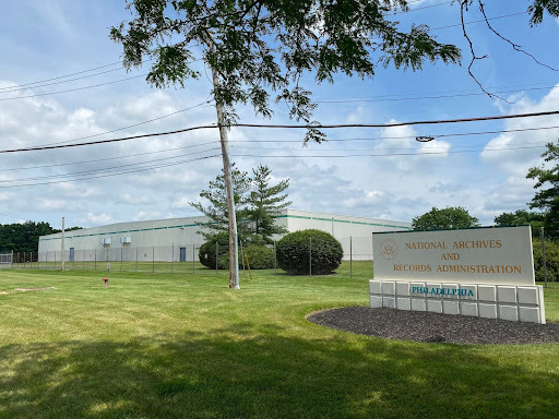
The Importance of Acknowledging our History: The National Archives and Federal Records Center, Philadelphia, Pennsylvania
This post is another in my ongoing blog series that acknowledges the ancestral lands on which the National Archives’ buildings are situated across the country. This series of acknowledgements is a simple way to offer our recognition and respect to the people who once lived on these lands.
The National Archives at Philadelphia and Philadelphia Federal Records Center is located in Philadelphia, PA, which is situated on the ancestral lands of Lenape, also known as the Lenni-Lenape or Delaware Indians.
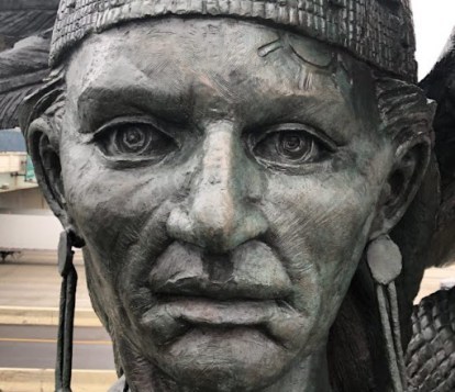 Statue of Chief Tamenend, Philadelphia
from Association for Public Art
Statue of Chief Tamenend, Philadelphia
from Association for Public Art
“In the city of Philadelphia stands a statue of Chief Tamanend, a revered leader among the Lenape, who signed many treaties with William Penn. The history of the Lenape is truly the history of Pennsylvania.” from Lenape Nation of Pennsylvania.
 2021 photographs provided by Grace Schultz, Archivist, National Archives at Philadelphia
In the 1680’s the Lenape negotiated with William Penn to facilitate his founding of the Colony of Pennsylvania. By the time of the War for Independence, the Lenape had been forced from their homelands into what was western Pennsylvania. On September 17, 1778, they signed a treaty, a military alliance, with the United States to allow for troops movements and fort construction in our fight with the British, a ratified treaty that today is in our holdings: Ratified Indian Treaty 8: Delaware – Fort Pitt, September 17, 1778.
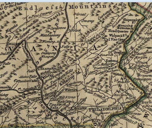 By the time this
map
was printed in 1771, the Lenape had been forced northwest of Philadelphia, their nation noted here as the Delaware.
By the time this
map
was printed in 1771, the Lenape had been forced northwest of Philadelphia, their nation noted here as the Delaware. Enter your address in this interactive map of Traditional Native Lands to see who once lived where you are now.
My thanks to Patrick Connelly, Director of Archival Operations and Grace Schultz, Archivist (both from the National Archives at Philadelphia) and Cody White, Research Services Subject Matter Expert for Native American Related Records, for the research and information they provided for this post.
For additional information:
Lenape Nation of Pennsylvania University of Pennsylvania Department of Anthropology Land Acknowledgement The Original People and Their Land: The Lenape, Pre-History to the 18th CenturyAugust 16, 2021
The Importance of Acknowledging our History: The John F. Kennedy Presidential Library and Museum, Boston, Massachusetts
This post is another in my ongoing blog series that acknowledges the ancestral lands on which the National Archives’ buildings are situated across the country. This series of acknowledgements is a simple way to offer our recognition and respect to the people who once lived on these lands.
The John F. Kennedy Presidential Library and Museum, is located in Boston, Massachusetts, which is situated on the ancestral lands of the Pawtucket and Massachusett peoples.

“Indigenous people have lived in Massachusetts for 12,000 years. The first known inhabitants of Massachusetts were Paleoindians who moved into New England just as the glaciers were retreating at the end of the last ice age. By the 16th century, New England was home to 100,000 Native people, with many residing in Massachusetts. Even today, there are still 37,000 Native-Americans living in Massachusetts, according to the 2010 Federal Census.” From the History of Massachusetts Blog, Native American Tribes in Massachusetts.
 JFK Library (from Google maps)
 Same area showing Pawtucket and Massachusetts lands from https://native-land.ca/
 The JFK Library uses this land acknowledgement for some family programming, which the Outreach and Program Manager drafted based on conversations with members of the Wampanoag Nation:
“To open, I humbly start with a land acknowledgment to recognize the Indigenous tribes of the Pawtucket and Massachusett peoples of the Wampanoag Tribal Confederation territories who both past and present — and throughout many generations — have stewarded the land where the Kennedy Library is today. While a land acknowledgment is not enough, it is an important way to promote Indigenous visibility, and it serves as a reminder that we are on stolen and settled Indigenous land. I invite us all to contemplate how to better support Indigenous communities and to learn how to honor and take care of the land that each of us inhabits.”
My thanks to Rachael MacAskill, Assistant Director, JFK Library, and Maria Quintero, Outreach and Program Manager, JFK Library, who provided maps, photos and researched the information for this land acknowledgment.
Enter your address in this interactive map of Traditional Native Lands to see who once lived where you are now.
Additional information:
Native Land Map: Massa-adchu-es-set
Native Land Map: Pawtucket
400 years of Wampanoag History
August 13, 2021
The Importance of Acknowledging our History: the National Archives and Federal Records Center in Fort Worth, Texas
This post is part of our ongoing blog series that acknowledges the ancestral lands on which the National Archives’ buildings are situated across the country. This series of acknowledgements is a simple way to offer our recognition and respect to the people who once lived on these lands.
The National Archives at Fort Worth and Federal Records Center is located in Fort Worth, Texas, which is situated on lands that are rich in the history of numerous indigenous peoples. Nations with territories overlapping on the present-day address of the National Archives at Fort Worth, include the Comanche, Kickapoo, Jumano, Tawakoni, and Wichita peoples.
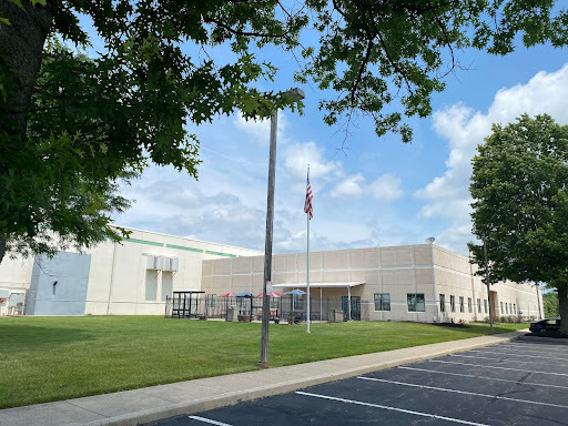
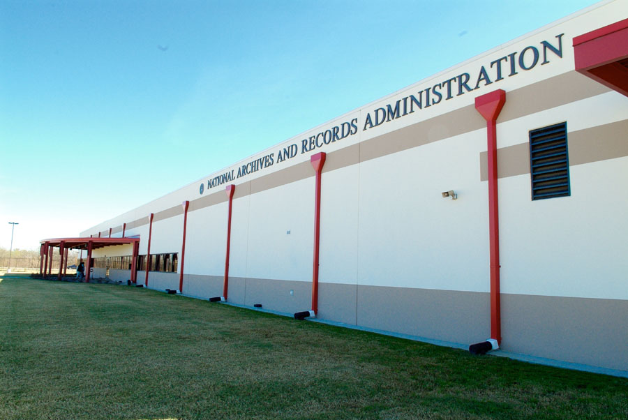
 National Archives at Fort Worth, Burgess Building
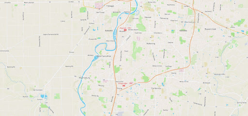
The area where the current Fort Worth Archives building is located is near the Trinity River and its tributaries such as Village Creek. The building is located near the current boundary between the cities of Fort Worth and Arlington. The building is part of an industrial/manufacturing area that is serviced by multiple railroad lines.
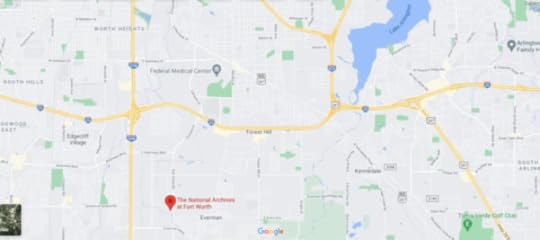 Current Google map; Lake Arlington now exists in the area where the Battle of Village Creek occurred
 (see article: Battle of Village Creek, Texas State Historical Association) .
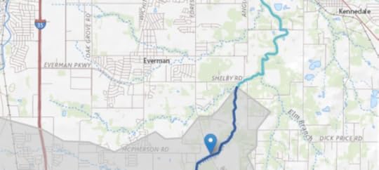 Current USGS map of Village Creek area. The National Archives building is located near tributaries of Village Creek.
Inhabitants of villages along Village Creek that became the city limits of Fort Worth and Arlington included Caddo, Cherokee, and Tonkawa peoples. This area was the site of the 1841 Battle of Village Creek, now Lake Arlington.
The National Archives at Fort Worth building is located in Tarrant County which was inhabited by the following tribes at different times: Tonkawa, Hasinai Caddo, Comanche, Kiowa, and Wichita.
“Little is known of the Indians who inhabited the area of present-day Tarrant County before the coming of European explorers in the sixteenth century. Groups thought to have been in the area were the Tonkawas and the Hasinai Caddos. By the late 1700s the Comanches, Kiowas, and Wichitas had also moved into the region. When White settlers came they clashed with the native population. The battle of Village Creek occurred in 1841. A seventy-man force, led by Gen. Edward H. Tarrant, seized and destroyed three Indian villages. Although this expedition and others like it cleared permanent Indian settlements from the area, trouble with the Comanches and Kiowas continued into the 1870s.”
From the Tarrant County Historical Association website.
Peoples who lived along the present Fort Worth/Arlington border included: Caddos, Hainais, Anadarkos, and fragmentary groups of Cherokee, Creek, Seminole, Waco, and Kickapoo peoples.
Enter your address in this interactive map of Traditional Native Lands to see who once lived where you are now.
My thanks to Michael Wright, Director of Archival Operations, Melinda Johnson, Archies Specialist, and Stacey Wiens, Archives Specialist, National Archives at Fort Worth, who researched the information for this land acknowledgement.
Additional Information:
Maps
 1836 Caddos in Trinity River area
, from texashistory.unt.edu
1836 Caddos in Trinity River area
, from texashistory.unt.edu 1839 Map of Texas, showing Trinity River area with Caddo village that was burned notated
, from texashistory.unt.edu
1839 Map of Texas, showing Trinity River area with Caddo village that was burned notated
, from texashistory.unt.edu
1835-1854 Map showing tribe locations in the Ft Worth area around the time of the Bird’s Fort treaty.
From the Texas Beyond History website, with permission from the author.
 Cadastral map of Tarrant County, 1856. Tarrant County is divided into land plots. Village Creek is labeled as Caddo Creek. From texashistory.unt.edu
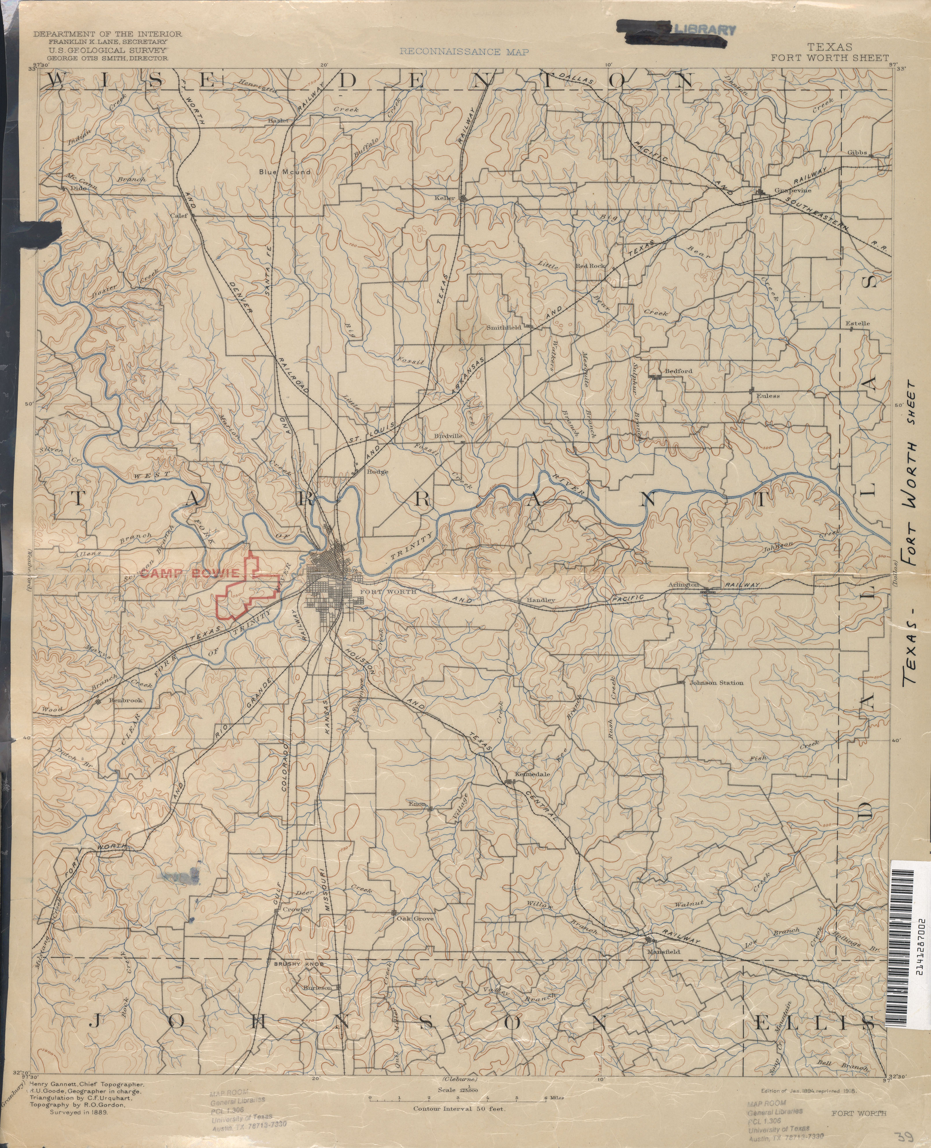
1889 Topographic map that shows Village Creek, railroads, and the town Enon that no longer exists –all in the general area where the archives building is now. Zoom of future location of National Archives at Fort Worth building. Village Creek is visible. From the University of Texas Libraries Map Collection
 1889 Topographic map; zoomed out to show Trinity River and railroad tracks. From the University of Texas Libraries Map Collection
General Information: Tribes in Texas
Native American Relations in Texas, Texas State Library
Indigenous Peoples of Texas, FamilySearch
Tribe-Specific Information
Caddo
Caddo Nation, Southern Plains Tribal Health Board
Caddo, Texas State Historical Association
Caddo Fundamentals, Texas Beyond History
Caddo Voices, Texas Beyond History
Early Caddo History, National Park Service
Cherokee
Cherokee, Texas State Historical Association
Comanche
Comanche, Texas State Historical Association
Creek
Creek, Texas State Historical Association
Jumano
Jumano, Texas State Historical Association
Kickapoo
Kickapoo, Oklahoma Tribe website
Kickapoo, Kansas Tribe website
Kickapoo, Texas State Historical Association
Seminole
Seminole, Texas State Historical Association
Tawakoni
Tawakoni, Texas State Historical Association
Tawakoni, Oklahoma Historical Society
Tonkawa
Tonkawa, Texas State Historical Association
Wichita
Wichita Historical Resources, Wichita Tribes
Wichita, Texas State Historical Association
Additional Resources:
Introduction to Archeology, Prehistory, and Historic Sites, Texas Historical Commission, Archeology
Native American Relations, Texas State Library
Border Land: The Struggle for Texas, 1820-1879,University of Texas Arlington
Battle of Village Creek overview, Texas State Historical Association
Overview of Tarrant County history, Texas State Historical Association
National Archives Research Guides:
Guide to Native Communities Desert Southwest (see the Texas section), National Archives
Central Plains Native Communities Research Guide
National Archives Catalog:
Land and Railroads
As seen in the map above from 1889, railroads run very close to the present-day site of the National Archives at Fort Worth. As railroad companies sought expansion of the lines in the 1800s, questions arose as to whether the railways were passing through tribal land, legally or not, etc.
Letters Received, 1887, File No. 6811, Record Group 94: Records of the Adjutant General’s Office, 1762 – 1984
In 1887, Cheyenne and Arapaho questioned the legality of railroads being built across their lands. These are internal War Department letters in response. Refer to Acts of Congress that permit railroad companies access to these lands. Includes Fort Worth and Denver City Railroad which is a line that connects to the railways running very near the present-day site of the National Archives at Fort Worth.
Schedule of Damages for Right of Way of the Missouri, Kansas, and Texas Railway Company for its Atoka Branch Through Tribal Lands of the Choctaw Nation, Series: Railroad Right of Way Maps, 1902 – 1930, Record Group 75: Records of the Bureau of Indian Affairs, 1793 – 1999
The Missouri, Kansas, and Texas Railroad runs very close to the present-day site of NA at FTW.
Map of the Province of Texas
“This map was captured from the Ninth Division of the Imperial Mexican Army during the Mexican-American War.” [trails of tribes are marked]
Treaties
Ratified Indian Treaty 197: Caddo – Agency House, Caddo Nation, Louisiana, July 1, 1835
Printed Copy of the Treaty Between the United States of America and the Caddo Nation of Indians, Concluded July 1, 1835 – Ratified February 2, 1836 (Copy 1 of 2)
See also:
Sha’chahdínnih (Timber Hill), Treaty and Abandonment, Texas Beyond History
Caddo Treaty, The University of Oklahoma College of Law Digital Commons
David S. Ferriero's Blog


