Sarah Ballance's Blog, page 5
December 5, 2014
$300 Holiday Cash #Giveaway

An Amazing Group of Authors & Bloggers have joined with me to bring you 1 fabulous prize
1 lucky winner will receive $300 Cash!
Holiday Cash Giveaway Sponsors
I Am A Reader
FeedYourReader
eBooksforReview
Kathryn Chastain Treat
TMBA Corbett Tries to Write
Amy Harmon
Kelsey Ketch
KellysLuckyYou
Ann’s Afterthoughts
Margaret Anne @ Natural Chow
Lori’s Reading Corner
Corina Lombardi
Heather Gray (Author)
Cynthia Luhrs Author
Donna Hatch
LeahSay’s Views
Laurie Treacy, Author
Glistering Bs Blog
Unshelfish
The Discerning Reader
A Tattered Copy
My Book Self
Author Inger Iversen
Simple Wyrdings
Deb Atwood Author
Reviews from a Bookworm
Sarah Ballance
Lexia Press
Rockin’ Book Reviews
A. Wrighton, Author
Scrapn’ Today
Angela Myron
Leisure Reads
Author B. Kristin McMichael
Laurie Here – Cont Fiction and MORE
Author Melissa Wright
MoreThanaReview
Giveaway Details
$300 Paypal Cash – click here to enter giveaway
Ends 12/21/14
Open only to those who can legally enter, receive and use money sent via Paypal. Winning Entry will be verified prior to prize being awarded. No purchase necessary. You must be 18 or older to enter or have your parent enter for you. The winner will be chosen by rafflecopter and announced here as well as emailed and will have 48 hours to respond or a new winner will be chosen. This giveaway is in no way associated with Facebook, Twitter, Rafflecopter or any other entity unless otherwise specified. The number of eligible entries received determines the odds of winning. Giveaway was organized by Kathy from I Am A Reader and sponsored by the author, bloggers and publishers on the sponsor list. VOID WHERE PROHIBITED BY LAW.


November 21, 2014
$250 Thankful for Cash Giveaway (November 15 – December 15)

An Amazing Group of Authors & Bloggers have joined together to bring you 1 fabulous prize
1 lucky winner will receive $250 Cash!
Sponsor List
I Am A Reader
eBooksforReview
Librarian Lavender
Unshelfish
The Discerning Reader
Camelia Miron Skiba
Kimber Leigh Wheaton
Ask Away
Barefoot by the Sea
Addicted Readers
Sarah Ballance
MoreThanaReview
Aubrey Wynne: Historical Romance
D.E. Haggerty author
Laurie Treacy, Author
Sydney Strand
AuggieTalk
A Fortress of Books
Laurie Here – Cont Fiction and MORE
Monique Bucheger
Kelsey Ketch
KellysLuckyYou
Books R Us
Lori Reading Corner
Kelvin O’Ralph
Author Barbara Silkstone
Giveaway Details
$250 Paypal Cash
Ends 12/15/14 - Rafflecopter giveaway – click here to enter
Open only to those who can legally enter, receive and use money sent via Paypal. Winning Entry will be verified prior to prize being awarded. No purchase necessary. You must be 18 or older to enter or have your parent enter for you. The winner will be chosen by rafflecopter and announced here as well as emailed and will have 48 hours to respond or a new winner will be chosen. This giveaway is in no way associated with Facebook, Twitter, Rafflecopter or any other entity unless otherwise specified. The number of eligible entries received determines the odds of winning. Giveaway was organized by Kathy from I Am A Reader and sponsored by the author, bloggers and publishers on the sponsor list. VOID WHERE PROHIBITED BY LAW.


November 20, 2014
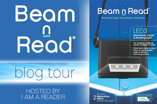
Product Review & $25 #Giveaway: Beam n Read Hands Free Light
So I was given this awesome little light in exchange for an honest review, and I’ll spare you the suspense: I LOVE IT! My review follows the product details and the scoop on the $25 giveaway, so be sure to read all the way to the end.

Purchase your own Beam N Read Reading Light from
AMAZON
Beam N Read Hands Free Travel and Reading Light
New edition Beam n Read Hands-Free Light delivers a wide & bright light that lights up 2 book pages and doesn’t disturb others. It’s a true reading light that works with all printed books, Kindles and other eReaders (whether naked, skinned, or covered), PLUS newspapers, magazines, newsletters, loose documents, and other items that can’t support a clip-on light. Worn around the neck, there’s no need to shift it when reading paperbacks.
Included are two 2 special Relaxation Filters: BNR Orange for a softer, warmer light that blocks energizing blue light (especially useful when reading to relax in bed); BNR Red to block blue light and reduce ambient light for sensitive bed partners.
Standard alkaline AA batteries (not included) last an extra long 100 hours, far longer than flashlights and clip-on lights resulting in a lower cost to use (and fewer batteries in the trash). This light is still bright when others have gone dim. Save batteries for when you’re on the go with the optional USB/AC Power Kit with 12 ft of cable that lets you plug into the included USB/AC adapter. Or plug into a USB car adapter/charger, or a computer USB port, or a USB adapter/charger for cell phones, etc.
In addition to reading, this 3 LED hands-free light is great for crafts, travel, and walking in dim or dark places such as an attic, basement, or around the house during a power outage. Use it for writing journals, working, camping, changing diapers at night, and a lot more.
Makes a Great Gift!
AMAZON
Testimonials
“I’ve never liked clip-on book lights because they add weight to the book, sometimes fall off, make it awkward to hold the book, and interfere with page turning. The Beam N Read has none of these problems, making them a pleasure to use” – BethFishReads.com
“The red filter is my favorite. My hubby doesn’t like when I turn on a bright reading light in the dark…It cuts down ambient light, making everyone happy.” – Momwitha.com
“The Beam N Read is by far the best personal reading light we have ever come across,” – Scott Carmichael, Executive Editor, Gadling.com
Features
For hands free personal light anywhere; extra bright light is easy on the eyes; doesn’t disturb others
Wide light from 3 LEDs in a row lights up 2 book pages; works with ALL Kindles, eReaders
BNR Orange Relaxation Filter softens and warms the cool LED light and blocks energizing blue light
BNR Red Relaxation Filter blocks blue light, reduces ambient light, & helps maintains night vision
Alkaline AA batteries (not incl) last Extra Long 100 hours, 3-10x longer than most clip-on lights
Purchase your own Beam N Read Reading Light from
AMAZON
Also Available
Beam N Read USB/AC Power Kit

Save batteries for when you’re on the go or the next power outage with the Beam n Read Accessory USB Power Kit.
It works with all Beam n Read LED Hands-Free lights (3 and 6 LED lights).
In addition to the adapter’s 6 foot BnR to USB cable, this kit includes an additional 6 foot USB extension cord letting you work up to 12 feet from a USB-A socket. Need a longer cable? – just add a standard USB extension cable. Use the included USB/AC adapter or a USB DC car adapter/charger, or a computer’s USB port, or the USB adapter/charger for your cell phone, e-reader, etc. You may leave batteries in the Beam n Read or take them out to make a super lightweight light.
Please note this kit is for external power adapter and will not recharge batteries.
Purchase your Adapter from Amazon
November 10th to December 10th
Website * Facebook * Pinterest
$25 Tour Giveaway
Enter to win an Amazon Gift Card or Paypal Cash
Ends 12/15/14 - a Rafflecopter giveaway
Open only to those who can legally enter, receive and use an Amazon.com Gift Code or Paypal Cash. Winning Entry will be verified prior to prize being awarded. No purchase necessary. You must be 18 or older to enter or have your parent enter for you. The winner will be chosen by rafflecopter and announced here as well as emailed and will have 48 hours to respond or a new winner will be chosen. This giveaway is in no way associated with Facebook, Twitter, Rafflecopter or any other entity unless otherwise specified. The number of eligible entries received determines the odds of winning. Giveaway was organized by Kathy from I Am A Reader and sponsored by readinglight.com. VOID WHERE PROHIBITED BY LAW.
Product Review
First impression out of the box? This sucker is BRIGHT. That was because I didn’t read the directions…I just pulled it out and started looking at it and when I flipped the light backward I met the piercing glow of three LED bulbs. That might sound like a bad thing, but truly, I was impressed. I can’t tell you how many so-called reading lights have given me a headache from eye strain, and I’m happy to say that was not an issue with the Beam n Read. And those of you who are not fans of brilliant white light, it comes with red and orange covers (called “relaxation filters”) that snap SO EASILY over the light. It’s literally a one-second adjustment even for the most mechanically inept (or temporarily blinded) among us.
As for wearability, the Beam n Read comes with an elasticized neck strap that adjusts infinitely. The strap is lightweight, as is the light, so the pairing works. The base of the light is not small – it’s roughly the size of a deck of cards – but this actually works very much in its favor because that base provides stability. (In other words, if I’m reclined and take a deep breath, the light doesn’t roll off my chest.)
If you’re a late night reader who doesn’t love creeping off to the bathroom in the middle of a great suspense novel, you’ll appreciate that the Beam n Read doubles as a flashlight. This is also a nice perk for power outages or in any other instance when you need a lightweight, easily maneuverable flashlight. (If you’ve ever tried to fit a full sized flashlight into a tight spot, then you know what I’m talking about.)
The Beam n Read nails it with the fine print: it really is a great anywhere, anytime personal light. It’s perfect for readers, but it’ll come in handy for pretty much anyone. Grab one for yourself and keep a few on hand for gifts. Five stars all the way!
Note: I was given a complimentary Beam n Read in exchange for an honest review.


November 14, 2014
Six Kids and 6,000 Miles: #RoadTrip Pics from the Road Home
After visiting some awesome places – Moab/Arches in Utah, Vegas, Hoover Dam, Death Valley, the Grand Canyon, and Sunset Crater Volcano – we are making a stop in Texas then heading home. But first…more from Arizona and New Mexico, then on to the deep south (from where I have almost no photos because we crossed most of it in the dark, lol).

The view alongside I-40 in Arizona. This is some of the flattest land we’ve seen in quite some time!

Arizona from I-40.

Still in Arizona and still on I-40 and is that…green? And boy, does that road go on forever!

I-40 in Arizona. Every now and then we fell into one of these gully-type sections of road, then we were back up and the view went on forever.

And then there were these, LOL. It’s almost dizzying how these appear from nowhere. (That exit sign, by the way, has one of my book titles on it!) Still on I-40 in Arizona.

Very cool, unusual rocks along I-40 in Arizona just west of the New Mexico line.

Welcome to New Mexico!

New Mexico along the I-40 corridor.

Note the train entering this picture from the right. We saw more trains along I-40 in Arizona and New Mexico than I’ve seen anywhere in my life. Multiple trains at once, many with cars stacked 2 high, really gave the kids something to talk about.

I never did figure out if this was a cloud or smoke, but it’s really cool how it lounges on that mountain. We’re still in New Mexico on I-40.

…and now we’re in Texas. This was a creek, and we’re on a bridge. There’s not a drop of water to be found, and this scenario repeated itself over and over and over again. We’re now heading south from Amarillo toward Dallas-Fort Worth.

This is typical of the very small Texas towns we drove through on 287 south between Amarillo and the Dallas area.

Hello, Forth Worth, Texas. Now wait for it…
 Welcome to Atlanta, Georgia! Can you tell the difference? Me either, LOL.
 This was the weather we “enjoyed” on the home stretch. It rained on our very first day of traveling and on our very last, and everything in the middle was amazing. (Even that 107 degrees in Death Valley, because who wants to go to Death Valley and say it was only 85 degrees? LOL.) These flags are part of the famed Talladega Superspeedway in Alabama.
 This picture was taken in Texas, but I thought it was a fitting closing image for our road trip that literally took us across the United States and back, through 20 states and over 6,000 miles. From the Eisenhower tunnel, elevation 11,658 feet, to Badwater Basin at 282 feet below sea level and from 29 degrees in Vail, CO to 107 degrees in Death Valley, CA, this country is an experience in contrasts, each one more unforgettable than the last. If you ever have a chance to see it from the road, take it. You’ll remember it for the rest of your life. :)
If you’ve missed a day or simply want to revisit one, here’s the entire trip at a glance. Thanks so much for joining me on this journey…I hope you’ve enjoyed the ride!
Part 1: Driving Cross Country
Part 2: Rockies to Moab
Part 3: Arches National Park
Part 4: Moab to Vegas
Part 5: Vegas, Lake Meade, and the Hoover Dam
Part 6: Death Valley National Park
Part 7: The Desert Southwest
Part 8: The Grand Canyon
Part 9: Sunset Crater Volcano
Part 10: The Road Home


November 13, 2014
Six Kids and 6,000 Miles: #RoadTrip Pics from Sunset Crater Volcano
Just south of the Grand Canyon is Sunset Crater Volcano National Monument, where we hiked the lava trail with the kids. Walking on lava isn’t an experience one easily forgets, but I took pictures anyway, lol.
Sunset Crater Volcano National Monument

The volcano is straight ahead. When it blew, the top came off and left a rather unimpressive lump behind. But still cool. SO cool.

Here are the stats. That is a LOT of material (1 billion tons), and 800 square miles is a lot of real estate. (Forgive me…I’m a bit of a science geek. LOL.)

Four of my kids ahead of me on the trail through the lava.

Nearly 1,000 years after the eruption, vegetation remains sparse.

A nice shot of color on this October day at Sunset Crater.

The side of that mountain has been bare for nearly 1,000 years. It’s a little mind boggling to consider.

A look at the trail ahead. The differing colors of rock are fascinating.
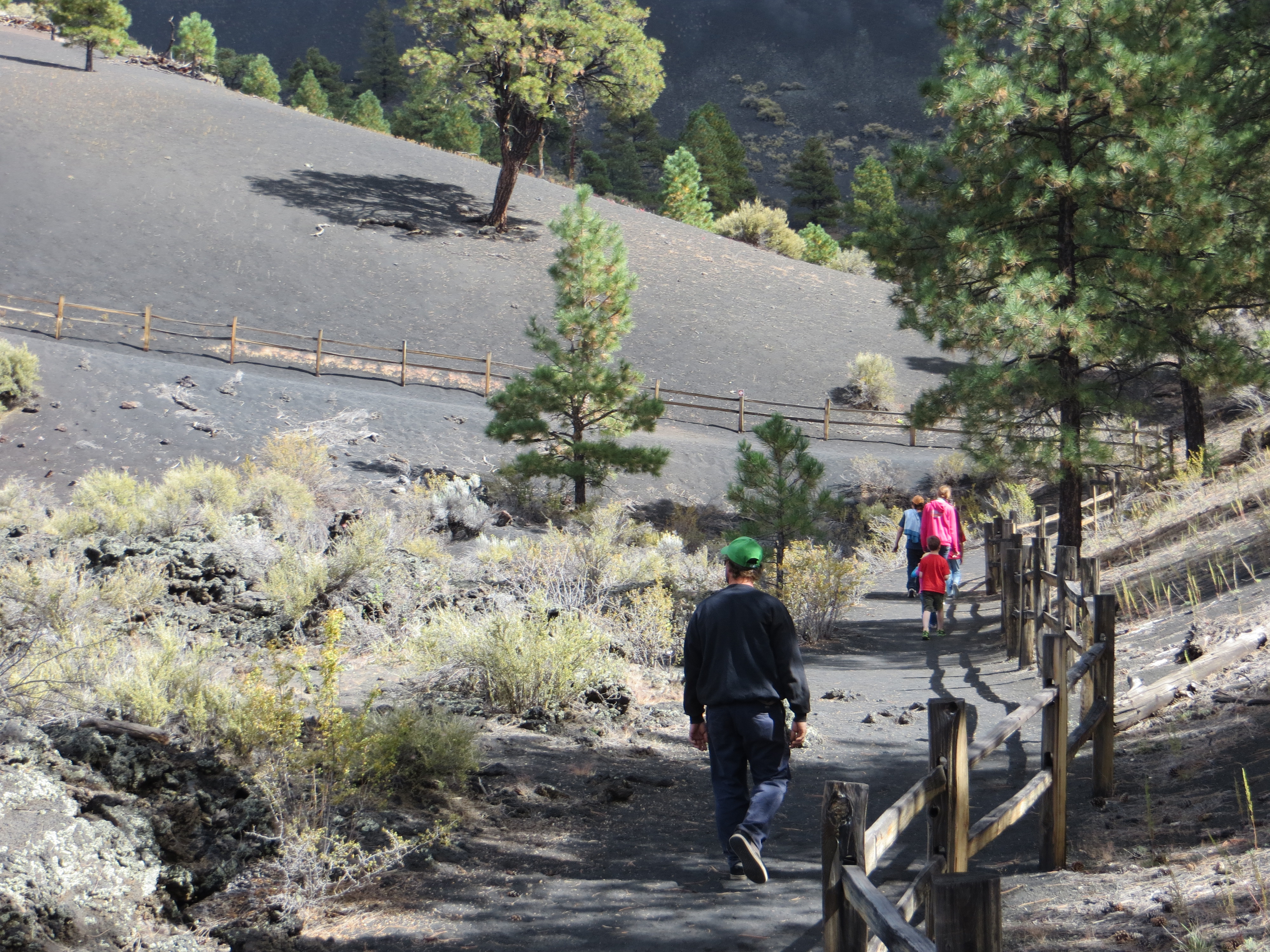
The family ahead of me on the lava trail at Sunset Crater Volcano. The hillside looks landscaped…it’s hard to believe it’s all natural and all volcanic.

I don’t know how long that tree has been there, but it sure fits the setting.

This is a spatter cone. Lava actually spewed from this vent during the eruption, so to stand here is a bit surreal. This one has eroded over time, but the sides you see were built by the eruption.

That hooded creature is one of my children. I love the splash of color in this shot, and the distant views are gorgeous.

I don’t know what this hole is here for, though clearly someone has engineered something down there with the grate. All I know is this kid feels like he climbed into an ACTUAL VOLCANO and when you’re a 7-year-old boy, you can’t get much cooler than that. :)

More of the Sunset Crater Volcano lava field.

This tiny, delicate flower contrasts beautifully with the volcanic rock in the background.
 One last look back at the Sunset Crater Volcano lava field with the mountain in the background. We’re hitting the road and heading east, so tomorrow I’ll show you pictures from the trip home. If you’ve missed any of our previous visits, you can catch up here:
Part 1: Driving Cross Country
Part 2: Rockies to Moab
Part 3: Arches National Park
Part 4: Moab to Vegas
Part 5: Vegas, Lake Meade, and the Hoover Dam
Part 6: Death Valley National Park
Part 7: The Desert Southwest
Part 8: The Grand Canyon


November 12, 2014
Six Kids and 6,000 Miles: #RoadTrip Pics from The Grand Canyon
Photos just can’t touch the enormity that is the Grand Canyon. Even after driving cross country through that changing landscape, each mile seemingly more vast than the one before it, the size of the Grand Canyon is nearly beyond comprehension. Even though photos don’t do it justice, I hope you’ll enjoy this glimpse of one of the most remarkable sights the southwest has to offer.
The Grand Canyon
 This photo is from Mather Point, which is near the west entrance on the south rim. The north rim offers a less spectacular view than the south so it tends to be less crowded, plus lodging and food services are closed for the winter months, which naturally cuts down on the amount of visitors.

About 5 million people visit the Grand Canyon each year, and while the greater concentration of the traffic occurs during the summer months, that breaks down to an average of 13,699 a DAY, and the north rim only accounts for 10% of those visits.

I am zoomed way in on this one. This is the Colorado River at the bottom of of the Grand Canyon. It’s remarkable that this little ribbon of water created the landscape you see before you. (Actually it’s borderline ridiculous, but I believe them. LOL.)
 Yep, that little bit of water did all this. Just…wow.

The sun sinking low over the Grand Canyon.

I love this one with the bird soaring over the canyon. I wish I had a little less sky in it but it’s HARD to capture an image like this. Sneaky little suckers, they are!

The family at the Grand Canyon.

This breaktaking sight goes on in three directions as far as the eye can see.

Standing on the south rim looking northeast.

Here’s another one of my bird pictures. :)

We drove in on AZ-64 and followed it east along the south rim. Here,the views are less “traditional” but are no less stunning.

Look at these little beauties! This just made my day.

My two boys absolutely insisted I take a photo of them where it looked like they were falling into the Grand Canyon. Problem was, most places there was no way to do that without them actually dangling over the side. I wasn’t too happy about THIS spot, but I relented and they got their pictures. Here’s one…

…and there’s the other. *shakes head at boys*

This little guy met us at the Tusayan ruins. His actual size is about that of my outstretched hand.

This is the Desert Watchtower. It’s not actually old – just built to look that way. It overlooks the Grand Canyon.

This is the eastern end of the south rim road. That’s the mighty Colorado River, which averages 300 feet wide throughout the park. It looks so much smaller down there!

Here’s another bird photo, but the background isn’t very exciting. LOL.

As the road occasionally winds away from the canyon, we’re treated to one amazing view after the next.

Even the rocks closest to you are so, so far away. It’s hard to grasp just how far you can see here, so let me throw some numbers at you. The Canyon is about a mile deep and averages about ten miles across, though the actual width varies from a mere 600 feet to a whopping 18 miles.

Here’s a final glimpse of the Colorado River at the bottom of the Grand Canyon.

And that’s it. We’re now on 89-S headed away from the Grand Canyon. Before we get back on I-40, we’re going to stop for a quick hike…on a volcano! SO MUCH AWESOME. Check back tomorrow for those pictures, and in the meantime if you’ve missed a day you can catch up here:
Part 1: Driving Cross Country
Part 2: Rockies to Moab
Part 3: Arches National Park
Part 4: Moab to Vegas
Part 5: Vegas, Lake Meade, and the Hoover Dam
Part 6: Death Valley National Park
Part 7: The Desert Southwest


November 11, 2014
Six Kids and 6,000 Miles: #RoadTrip Pics from The Desert Southwest
After leaving Death Valley, we headed back to Nevada then southeast through Arizona toward the Grand Canyon. Here are a few of my favorite pictures from the journey.

Would you look at that road stretch ahead through the Nevada desert? Wow!

Remember that crazy-high bridge by the Hoover Dam? Here we are about to cross…

…and this is the view from on top of it. You can’t see NUTTIN’! And I’m sitting up high in a SUV, too. *sad face*
 When we crossed that bridge, we left Nevada and entered Arizona. Here we are just a few miles from the bridge with a view of the Colorado River.

After Death Valley, this landscape is practically lush, LOL!

I’m in endless awe of these mountains…the whole trip has been nothing but amazing views (which explains the 3,500 pictures I took, lol.)

We’re headed east in Arizona and despite the fact that we’re still in the desert, we have definitely noticed a trend toward greener vistas.

Does anyone else want to peek into those holes to see what’s inside? :)

Grass! Dead grass, but still. Grass! LOL.

I love this view, although just seeing that much road ahead was a bit exhausting. We’re probably nearing 4,000 miles into our 6,000 mile journey at this point and we’ve been on the road seven days.

The view from I-40 near Flagstaff, Arizona

We took a left off I-40 at Flagstaff and we’re now on 64 headed north to the Grand Canyon. This is a long stretch of road (45 mins to an hour) and this is pretty much the only thing you see. As a kid, I was unimpressed, LOL.

More of AZ-64 as we head north toward the Grand Canyon.

Ignore the truck in front of us (and I assure you we aren’t that close…I’m zoomed in again) and take a look at the horizon. That rumpled white rock is our first glimpse of the Grand Canyon!

Here’s the Grand Canyon entrance station (west entrance on the south rim). We’ll see much more of the Grand Canyon tomorrow, but I’ll leave off with our first good view (below), this from Mather Point. No photo will ever capture how vast this is, but y’all know me…I made a few hundred attempts anyway, LOL.
SO MUCH WOW. Much more from the Grand Canyon tomorrow. In the meantime, if you’ve missed any of our previous stops you can catch up here:
Part 1: Driving Cross Country
Part 2: Rockies to Moab
Part 3: Arches National Park
Part 4: Moab to Vegas
Part 5: Vegas, Lake Meade, and the Hoover Dam
Part 6: Death Valley National Park


November 10, 2014
Six Kids and 6,000 Miles: #RoadTrip Pics from Death Valley National Park in CA
Last month we packed up our SUV and the RV and headed west…ALL the way, as it turns out. We made it all the way to California’s Death Valley National Park, and let me tell you, it was unforgettable. Take a look!
Death Valley National Park

This is the road to Death Valley out of Pahrump, Nevada. I’d never been to Death Valley before this trip, so you can imagine the anticipation brought on by this view!

Excuse the bugs on the windshield. We’re winding our way toward Furnace Creek on the road that weaves through the Black Mountains to the south and Funeral Mountains to the north.

Pretty standard as far as National Park entrances go, but it was missing one component we normally see, and that’s a entry station. Instead, they have drop boxes to pay the entrance fees. Must be too hot out there to staff!

I love the depth in this photo. If you look near the top, you see layer after layer of these stark mountains, almost entirely devoid of vegetation.

As varied and striking as the terrain, the one consistency was the utter lack of anything living. No bugs and very few plants made for an alien landscape.

Ladies and gentlemen, this was after 5pm in the month of October. O.o

I believe these are the Black Mountains. We’re headed south in Death Valley National Park toward Badwater Basin, which is the lowest point in all of North America.

See? I told you I’d been to the moon! This is quite literally as far as the eye can see.

We’re still headed south in Death Valley National Park toward Badwater Basin. The salt flats are up ahead on the right.

This is one of those pictures where the road tells the story. If you follow it ahead, you’ll see a couple of cars that are little more than specks. The road goes on to the right of the image, disappearing at the base of the mountains. It’s unbelievable how huge those rocks are!

This is Badwater Basin, which more or less exists in a valley between mountain ranges. This water is said to be spring fed, and because of the salt flats it’s inhospitable to say the least. It’s also the only water anywhere around, though it amounted to little more than a generously sized puddle and had no depth whatsoever.

This is Badwater Basin. At 282 feet below sea level, it’s the lowest point in North America. You’re standing on the eastern side looking west, and the white is where people have walked out and packed the salt flats. There’s a much better view ahead. :)

The sign warns that walking after 10am is not recommended. Considering it was 107 degrees late-day October, I can’t fathom what an August afternoon would bring.

Here’s the promised close-up of the salt flats. It looks like rock but it crushes easily, almost like powder or fine sand in your hands.

Here’s one of the very few plants I found in Death Valley, and honestly it’s so much like a dried flower I can’t even say it’s alive. The salt flats are in the distance.

Here’s another example of Death Valley’s “plant life.”

These are my kids climbing in Death Valley. I had to zoom way in for this one…without the zoom I could barely see them.

It was hard to get a good sunset picture here because the sun’s glare washed out my pictures. In this one looking north, I can’t tell where the clouds end and the mountains begin. Incidentally, we were there during a full moon and missed the dark skies so I missed an amazing photo op, but that just gives me a reason to go back. :)

We drove over 6,000 miles cross country and back and gas prices ranged from $2.75 – $3.25 almost everywhere else. This lone gas station at Furnace Creek inside Death Valley was one glaring exception. (We only bought four gallons. It was NOT the time to fill up, lol.)

Having sold our first born for gas (not really), we are now headed out of California. You’ve got to love these “dips” on the road between Death Valley and Pahrump, NV…at 55mph, you left your stomach in the bottom of each and every one of them

One last view of California’s striking mountain ranges before we head south, then east into Arizona to see what the Colorado River has been up to. I hope you’ll join me tomorrow for more, and in the meantime you can catch up on anything you may have missed here:
Part 1: Driving Cross Country
Part 2: Rockies to Moab
Part 3: Arches National Park
Part 4: Moab to Vegas
Part 5: Vegas, Lake Meade, and the Hoover Dam


November 7, 2014
Six Kids and 6,000 Miles: #RoadTrip Pics from Vegas, Hoover Dam, and Lake Meade
Vegas isn’t exactly a family venue, but you can’t NOT see Vegas. Fortunately, with a lot of strategy and a little bit of luck we kept the kids from seeing anything too crazy…in fact, our closest calls with anything inappropriate were in Walmart when we stopped to buy sunscreen and water. (Seriously.) Anyway, Lake Meade and Hoover Dam are just outside of Vegas, so in this installment we’ll check out all three.
Vegas, Hoover Dam, and Lake Meade

Here it is again…The Vegas! Look for it on my 2015 release schedule. ;)

We went through Vegas toward the Hoover Dam in hopes of seeing it before it got dark. This is Lake Meade, which was created by the dam. Even after the record rainfall that fell a month before our arrival, the lake is treacherously low. To illustrate,most of the light coloring you see near the water is actually supposed to be under water.

Boulder City, NV sunset on the way to the Hoover Dam.

The last time I visited the Hoover Dam – about 20 years ago – the road actually went across the top of the dam. Now they’ve built this bridge, the deck of which is a whopping 900 feet above the surface of the Colorado River below. To grasp the scale of this bridge, check out the towers to the left.

This is the back of the Hoover Dam on the Lake Meade side. The dam actually straddles Arizona and Nevada, and in this image you’re standing in Arizona. The two towers closest to you are in Arizona and the two on the far side are in Nevada. The dam harnesses the power of the Colorado to generate electricity, so what you’re looking at is a huge power plant. Whereas the old road went directly across the dam, unrestricted, now they search your vehicle before you’re allowed to drive across. (Turns out we had a surplus of kids, water bottles, and granola wrappers.) Thru traffic traverses the enormo-bridge, which (spoiler alert) offers no view whatsoever. The sides are too high, probably to keep high profile vehicles from blowing over the edge. (We were restricted to the center lanes, if you can imagine. LOL.)

In this view, your back is to the dam and you’re looking toward Lake Meade. Sadly, all that white rock is supposed to be under water, which really underscores the severity of the drought. (The line in the water is to keep boats from getting too near the dam.)

This is another shot of the lake side of the dam with the new bridge at the top. Just wait until you see the other side of this dam…the bridge looks a lot higher over there!

So it got dark and we had to leave the dam. Meh. But no worries, because it was time to show the kids the lights of Vegas. I’ll spare you a surplus of pictures – there are much better ones out there than mine – but hey, we were there. And it was AWESOME!

Here’s a shot of the Vegas strip through my dirty windshield. (Not that we didn’t clean it, but you drive a few thousand miles and you cause some carnage, lol.)

I have no idea how many rooms these casinos have, but the number must be staggering. You’re only looking at a portion of The Cosmopolitan in this shot, and Caesar’s Palace makes this place look small. (I couldn’t even get Caesar’s Palace in one shot, if that tells you anything.)

The Eiffel Tower does Vegas.

I did not drink while in Vegas, but I have a feeling had I imbibed, this little section of sidewalk would have put me on the ground, LOL. (I’ll have to test that theory when we go back without the kids.)

Excalibur Hotel and Casino…the younger kids loved this one.

The Luxor is a massive pyramid complete with a Sphinx. You can’t tell in this picture, but that light at the top is a beam that cuts through the sky until it hits the clouds. It’s like one of those car dealer spotlights, only so much better.

New York, New York on the strip.

Here we are the next morning, headed back to the Hoover Dam. Here’s another look at Lake Meade. All of that light colored rock should be under water, and it’s worth mentioning that this is just a small portion of a much larger lake.

You are now standing on top of the Hoover Dam (formerly the Boulder Dam) with Lake Meade behind you and the Colorado River far below. VERY far below. There are CARS down there, y’all.

It’s difficult to capture this enormity in one shot. Below is the Colorado River and the power plant. Looking up, the bridge deck is 900 feet above the water surface. That’s roughly a NINETY STORY BUILDING, you guys. O.o

My kids in front of Lake Meade.

This one really illustrates the water crisis. The light part of that pyramid rock – and everything around it – is supposed to be under water. If you look closely, you’ll see a few vehicles on the “beach” down there. When you consider how small those cars, you gain some perspective on just how much water is missing.

We headed back to Vegas for a look at the strip in the daylight, then went back to the RV pack up and hit the road. When it was all said and done, we’d made five – FIVE! – trips through Las Vegas!
 Saying goodbye to Las Vegas (for now…because we’ll come back through one more time, LOL) and heading west again, this time for Death Valley, California. YOU GUYS, I feel like I have been to the MOON, but you’ll have to wait until Monday to find out why. :) In the meantime, check out posts you’ve missed as we’ve literally driven across the country:
Part 1: Driving Cross Country
Part 2: Rockies to Moab
Part 3: Arches National Park
Part 4: Moab to Vegas


November 6, 2014
Six Kids and 6,000 Miles: #RoadTrip Pics from Moab to the Outskirts of Vegas
Yesterday’s pictures took us through phenomenal Arches National Park in Moab, Utah. Today we hit the road and head west, this time toward Sin City. Let’s take a ride!

We’re on I-70 headed west toward I-15 and this, ladies and gentleman, is Utah…as far as the eye can see.

Here’s a closer view of some of those formations. If you look to the right you’ll see the landscape changes yet again with the whiter rock in the background.

If ever I wished I could capture something with my camera, it would be this stretch of I-70 to I-15 that runs from Utah through the corner of Arizona into Nevada. The enormity of the amount of rock they moved to make the road is simply unfathomable.

OMG, y’all, do you see the tiny ribbon of road glimmering near the center of this image? There are very small specks on the road…cars. This land is just so massive and pictures don’t do it justice.

The rocks at the center are eye catching, but if you look past them you’ll see row after row of similar formations. It’s hard to comprehend the vastness here.

Here’s another one where the road tells the story. Look ahead and you’ll see the semi trucks, then look beyond them and toward the upper left of the image and you’ll find the road simply goes on and on. Breathtaking.

Nature is an artist if ever there was one. These layers are pretty striking!

Note the rock standing between the lanes…and how big it all is compared to the trucks on the road.

Again, when you take into account the size of the cars you gain a whole new perspective for the land. We’re still in Utah, headed southwest.

This looks so meticulous. It’s hard to believe it’s out there, so happenstance.

Around every bend in the road, something breathtaking awaited.

They have the occasional issue with falling rock out here, lol.

Um, are you seeing this? There are miles and miles of road cut through these rocks. It’s just…I have no words.

This picture really wasn’t late in the day, but it almost looks like a sunset picture. We’re on I-15 headed south toward Vegas.

I know I’m getting a bit repetitive, but wow. Just…WOW.

We were originally going to make this trip in early September, and we were to have come through this stretch of road less than 24 hours after those hurricane remnants flooded Vegas and washed out sections of I-15. This is one area where the road was gone, and as you’ve seen from the other pictures, there’s not much by way of detours out here. Our travel delay was definitely a blessing!

The view alongside I-15 in Nevada headed into…

Vegas, baby! Here’s the skyline with the Stratosphere prominent in the center. Tomorrow’s pictures will explore the views around Las Vegas, including Lake Meade, the Hoover Dam, and the Vegas strip. I hope to see you back! In the meantime,if you missed the road that got us here, check out previous posts via the following links:
Part 1: Driving Cross Country
Part 2: Rockies to Moab
Part 3: Arches National Park