Jack Erickson's Blog, page 6
July 16, 2012
Picton
Picton
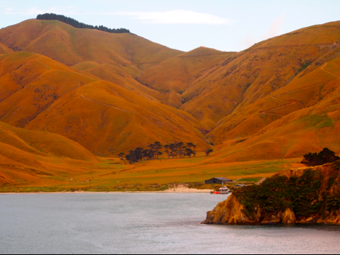
Golden hills on Arapawa Island where Captain Cook landed in 1770
Our journey across Cook Strait took about an hour in which we clutched the upper deck railing, battling strong winds and stinging sea spray from the two meter high waves slamming against the hull. The experience was exciting and we scanned the horizon from the open, choppy sea east and west, to the windswept landscapes of New Zealand’s islands.
We had taken a ferry across the North Sea from mainland Scotland to the Orkney Islands last June. But that journey had only been about 45 minutes, also against strong winds and sea spray. Our smaller Scottish ferry was like a row-boat compared to our multi-deck car and truck ferry we took across Cook Strait. Our Scottish ferry was more heavily pummeled by the strong currents where the North Atlantic Ocean collides with the North Sea in the narrow 15 km channel. You can read more about our Orkney – North Sea adventure here.
As we approached the Marlborough channel, we got our last view of Cape Terawhiti on the north island and Arapawa Island in the south.
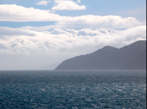
Cape Terawhiti on southern tip of north island
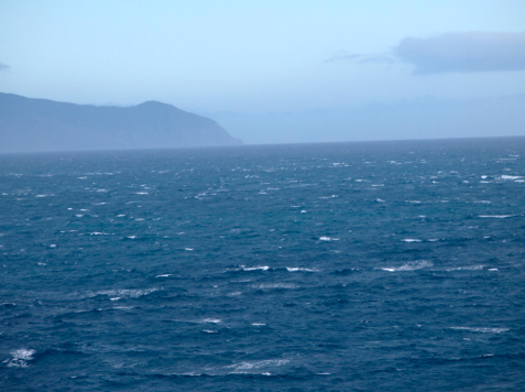
Arapawa Island on the south island
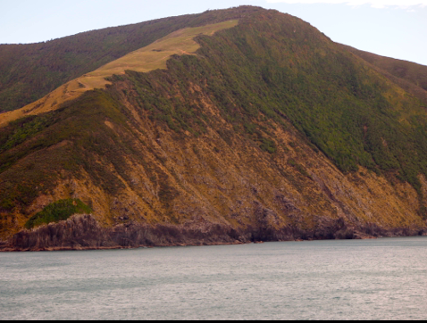
Arapawa Island on north of Tory channel
Arapawa Island
Departing Cook Strait, we passed Arapawa Island where Captain Cook landed in 1770. Climbing to the ridge of one cove, Captain Cook looked west toward the Tasman Sea and acknowledge that he’d discovered the strait that was named after him. When Cook’s ship Endeavor departed Arapawa island, it sailed toward the strait. But winds calmed and the Endeavor was almost grounded on the rocky coastline.
The winds calmed and the sea smoothed as we entered Tory Channel. We appreciate the change in weather which allowed us to admire the interesting coves and hillsides of Arapawa which looked almost habitable compared to the wind-whipped and barren southern tip of the north island.
Whalers came to Cook Strait in the 1790 and established stations on Arapawa in 1820 where they processed whales harvested in the strait. Some twenty whale species, including southern right, humpback, blue, and sperm whales thrived in the strait. After whaling was banned, whales slowly returned to the strait where they breed and feed. Orca, seals and dolphins also inhabit the rich waters of the strait.
Nineteenth century British whalers also brought cattle, sheep, and goats to Arapawa to stock small farms. When the whalers left in 1960′s, the animals became feral and roamed the island. One species of goat became extinct in Britain but still lives on Arapawa.
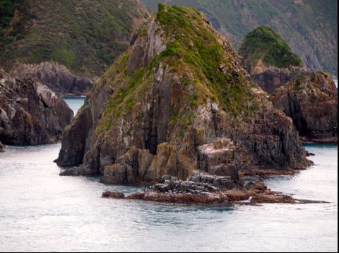
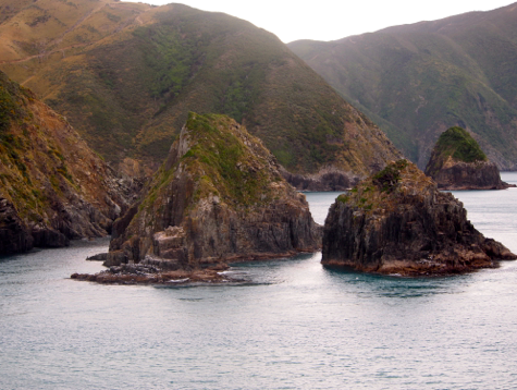
Rocky outcrops along Marlborough channel
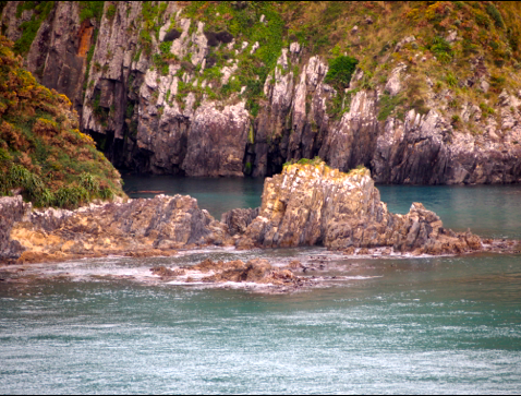
Seals swam among rocky formation
Queen Charlotte Sound
Our ship turned from Tory Channel into Queen Charlotte Sound where the scenery became more colorful, lush green hillsides and golden valleys with a haze of purple almost like an Impressionist painting. And we saw our first signs of life on the southern island, small farmhouses with hillside pastures and fishing boats anchored in coves. We even passed a fish farm.
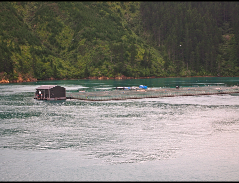
Fish farm on Queen Charlotte Sound
Our destination was the port of Picton in a protected harbor nestled in steep hillsides. The weather was pleasant sailing down Queen Charlotte Sound. The afternoon sun warmed the air and we passed sailboats and fishing boats sailing toward the strait.
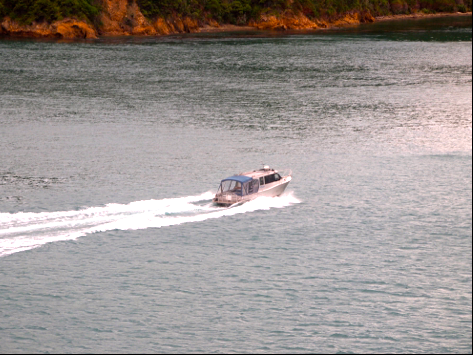
Small boat motoring along Queen Charlotte Sound
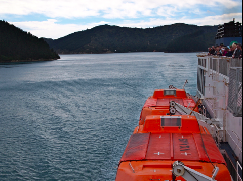
Sailing calmer waters of Queen Charlotte Sound
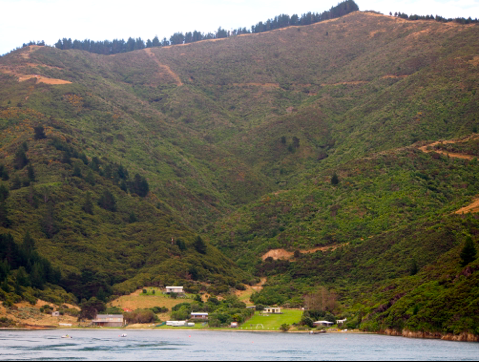
Greener hillsides along Marlborough channel
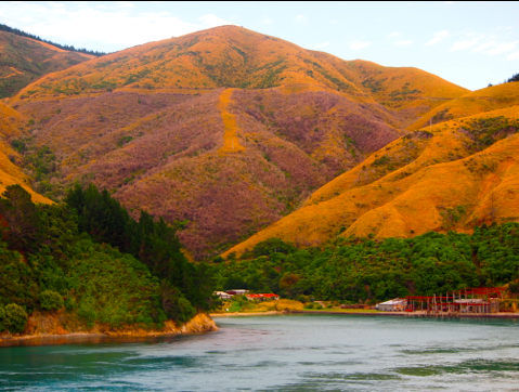
Golden hillsides along Marlborough channel
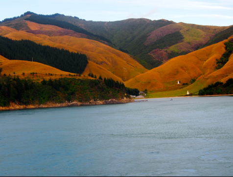
Golden valley
The upper deck was packed as passengers relaxed at the railing and took photos of the beautiful scenery. It was an international gathering; we heard Spanish, German, English, Russian, French, and even the familiar Aussie accent. But no Americans that I can recall.
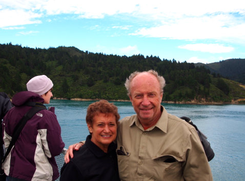
Wind-swept travelers. I look like a clown refugee from the circus!
Picton looked picturesque and calm as we docked. We’d had thrilling three hours of a sailing adventure, gorgeous scenery, challenging weather, and a dose of 18th century nautical history. That’s why we travel!
Crossing Cook Strait was our most adventurous experience in New Zealand so far. But we knew many more were ahead of us.
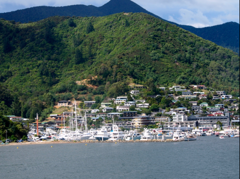
Approaching Picton
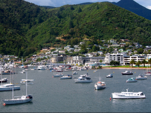
Picton harbor
* * * * *
Next; Blenheim and Marlborough wine country
We welcome your comments to our travels Down Under.
In addition to this travel blog, I also write mysteries and romantic suspense novels available on Kindle, Nook,
iTunes, and Smashwords which distributes to ereaders.
You can read a sample of my latest murder mystery, REX ROYALE, on your favorite reader or smart phone. I hope you’ll consider reading and
reviewing some of my stories.
jacklerickson@gmail.com


July 10, 2012
Cook Strait
Cook Strait
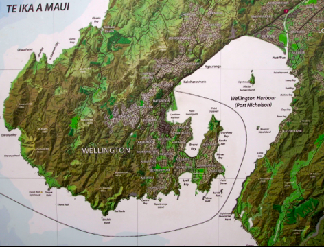
Map of Wellington harbor
Our first of many New Zealand adventures began when we boarded an 8:15 AM Interislander ferry in Wellington harbor for a three-hour, 100 km voyage across Cook Strait named for explorer James Cook who discovered it January 22, 1770. Our destination was the port of Picton in a protected harbor on the south island at the end of the Marlborough channel.
The day presented us with spectacular scenery, turbulent weather, and a brush with 18th century navigation history. We would sail where Cook navigated his tiny Endeavour in 1770 from the southern Pacific Ocean to the Tasman Sea in the northwest. On this voyage, Cook mapped the New Zealand coastline and sailed west where he explored the east coast of Australia.
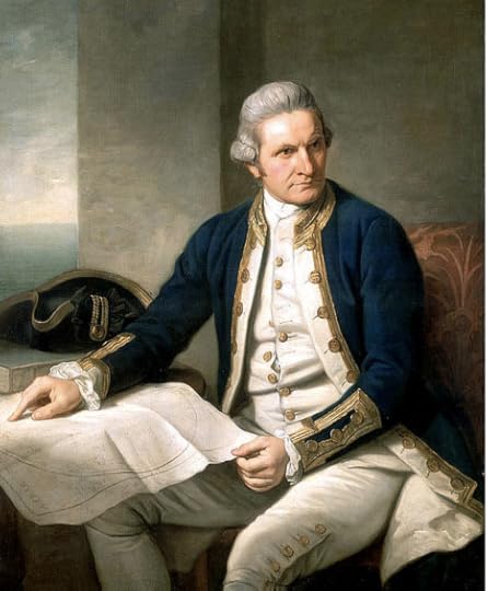
James Cook – explorer and navigator
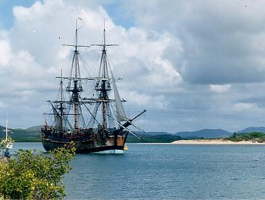
Replica of James Cook’s Endeavor
Cook Strait is one of the world’s most treacherous nautical passages with blustery winds, heavy rain, fog, and strong currents that reverse every six hours. During inclement weather, currents may surge for nine hours, enfeebling the reverse current so that strong currents can surge for three cycles making navigation difficult and dangerous. The orientation of New Zealand’s landmass also present challenges for sailors; its islands are not aligned in a pure north-south orientation. The south island is actually west of the north island. The narrowest point in Cook Strait is only 22 km across where tiny rocky islands and outcropping can be treacherous for ships passing too close.
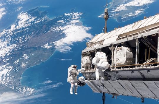
Cook Strait from International Space Station
Wellington Harbor
The ship had four decks, a lower deck for cars and trucks, two passenger decks with cafes and lounges, and an open upper deck. When we boarded, the south island was visible across the strait. We waited anxiously until tenders tossed off lines and we began our journey
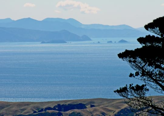
Southern island across Cook Strait from Wellington
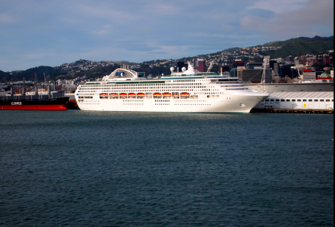
Cruise ship in Wellington harbor
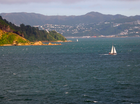
Sailing from Wellington harbor
We stood on the upper deck when we depart Wellington. For the next 45 minutes, we sailed around a hook of land that shelter Wellington harbor from strong winds and currents. We passed barren, windswept mountains that surround Wellington like a bowl.
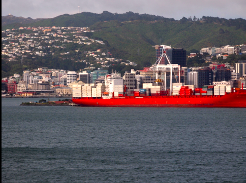
Container ship in Wellington harbor
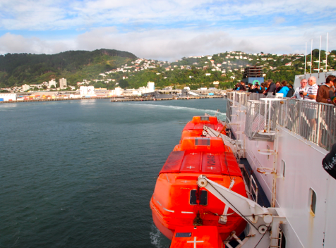
Wellington harbor from upper deck
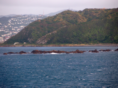
Navigating through rocky channel out of Wellington harbor
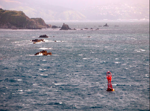
Narrow, windy, rocky ship channel
North island
The southern points of the north island looked forbidding — wind-swept, barren and cloud covered We snapped a few photos of the rocky extremities as we sailed out of the harbor, passing small islands toward the rough currents of the Cook Strait.
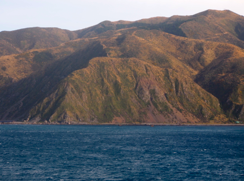
Barren hillside en route to Cook Strait
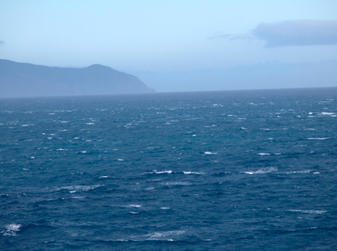
Chilly, blustery, and overcast
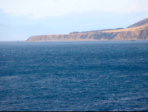
Barren and windy southern tip of New Zealand’s north island
Navigating Cooke Straits
Once in the strait, we looked across at islands and the southern mainland through heavy fog, grey and misty in the distance. Winds in Cook Straits can reach 150 mph near Wellington Head. For the next hour, we gripped the railing, our faces splashed with spray as our ferry crashed through the strong currents. Taking photos was challenging. After a few minutes on the exposed upper deck, we’d retreat to a lower deck to warm up and dry off.
Remote islands
Approaching the south island, we passed rocky islands offshore which looked treacherous for navigators. After an hour on the strait, we sailed into Marlborough channel formed by barren and rocky hillsides. Winds subsided but the air was still cold. Seas were calmer and we saw sailboats and fishing boats heading to the strait. The southern landscape began looking more inviting, become green with vegetation and a few trees. In sheltered coves sheep grazed on steep hillsides. Small farms were nestled along the shore but we couldn’t see any of the hardy farmers. A little further we saw remote fishing villages.
Cook Strait map
On the upper deck, wall maps showed the numerous islands and channels between the north and south island. I studied the map, intrigued by the complexity of navigating the narrow straits, islands and passages, imagining how challenging it was the first sailors and navigators who crossed the strait.
I liked the map so much that I bought a copy in the gift shop and carried it for three weeks on the south island. When we returned, I framed it and it now hangs in our ‘map room’ alongside maps of Australia, St. Petersburg, and an 18th century geological map of Britain we’ve picked up on our travels.
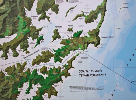
Navigation map of tip of north island
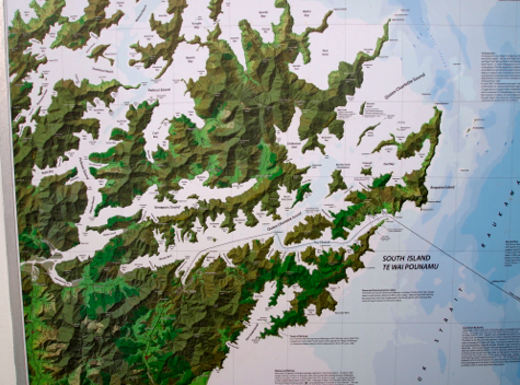
Expanded map of channels approaching south island
* * * * *
Next: Picton and the Marlborough channel
We welcome your comments to our trip Down Under.
In addition to this travel blog, I also write mysteries and romantic suspense novels available on Kindle, Nook,
iTunes, and Smashwords which distributes to ereader devices. I hope you’ll consider reading and reviewing them. I recently published a new
murder mystery, REX ROYALE. You can read opening chapters on your ereader or smartphone.
jacklerickson@gmail.com


June 28, 2012
Wellington Walkabout
Wellington

Wellington
After three nights in Rotorua, we took another Naked Bus for a four-hour trip from the center of the north island to the southern coast. The road took us through sheep country, villages, and the suburban hillsides surrounding Wellington. Most of Wellington’s suburbs look down on the city which is nestled into a cove with a scenic harbor.
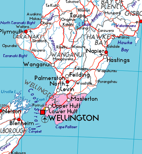
Wellington on southern tip of New Zealand’s north island
Wellington is the capital of New Zealand, one of the most charming capital cities we’d ever visited. Not overgrown and crowded like London, Washington, Moscow or Tokyo. More quant and a subdued like Ottawa. Lonely Planet considers it ‘one of the coolest capitals in the world.’ It’s an easy city to explore with quaint streets, concert halls, museums, galleries, government buildings, markets and shops all within a few minutes walk of the harbor.
Cuba Street
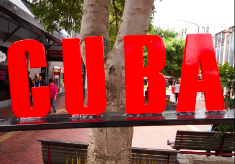
Cuba street – Wellington’s liveliest neighborhood
The busy retail and arts scene are along Cuba Street which was a five-minute walk from our center-city hotel. We strolled down Cuba street several times, enjoyed lunch and dinner, and were charmed with the funkiness.
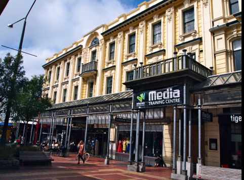
Shops along Cuba street
One attraction on Cuba Street was an artsy tower of ceramic, colored buckets. Water ran into the top buckets until they filled, then poured the overflow into the next lower bucket with a noisy clank then that bucket dumped water into the next lowest bucket. And so on until the pool below was filled and water was pumped to the top. It was fun to watch for a while, until a bucket splashed you if you stood too close. After passing it several times, we sidestepped it to prevent from getting drenched. It was noisy and damp.
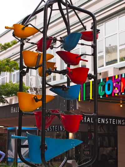
Kinetic ‘bucket’ street sculpture
One afternoon we heard a jazz band playing on Cuba street. Ahead of us a rag-tag jazz group of musicians dressed in loud, mismatched clothing were playing New Orleans jazz and parading down Cuba street, followed by passersby, children, and curious tourists like us. We followed, enthralled by the spirit of the group. We finally saw what the street performance was all about, stragglers were handing out flyers announcing a CD release party at a local saloon by the jazz group. It was a low-cost PR promotion, entertaining and fun. We liked the spirit of Cuba Street.
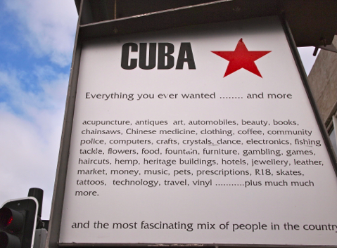
Welcome to Cuba !
Walkabout Wellington
We were restricted by stormy weather most our time in Wellington. Heavy rains and brisk winds kept us huddled in coffee shops and restaurants and spending afternoons at the Te Papa museum. I left my camera in our room most of the time, disappointed at dreary days and frequent rains. I managed to get a few photos when there was a lull in the rain, concentrating on the attractive architecture of the city.
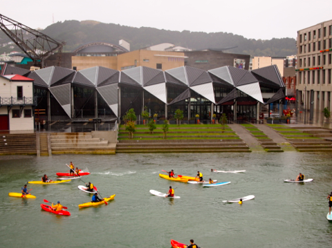
Kayakers in front of Maori canoe museum
Walking around the harbor we saw interesting modern designs. One of the most intriguing street sculpture was a metallic globe seemingly suspended in the air, but held aloft by thin wires attached to nearby buildings. We walked beneath it, admiring its trompe l’oeil features that made it look like a suspended planet.
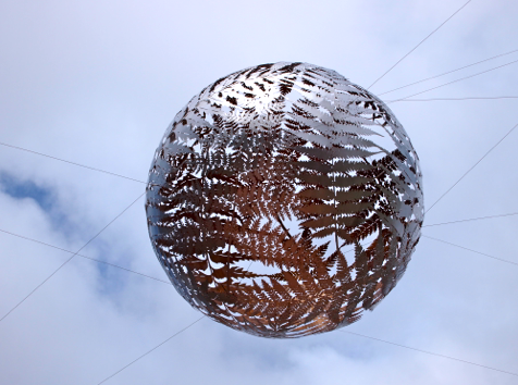
Suspended in mid air
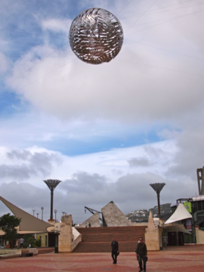
Modern designs near Wellington harbor
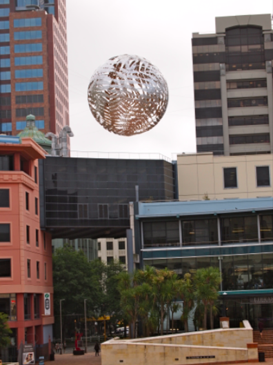
Trompe l’eoil art in downtown Wellington

Wellington street art
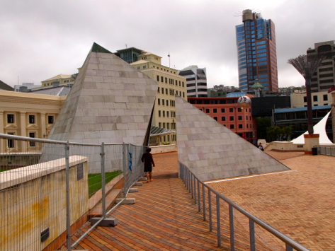
Modern street art on Wellington harbor
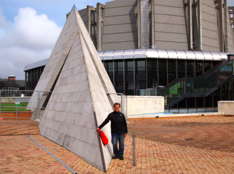
Lucy admiring Wellington’s street art
Te Papa Museum
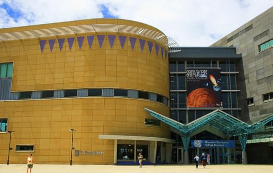
Te Papa
We spent an afternoon in the impressive Te Papa museum dedicated to all things New Zealand — history, culture, geology, and art. The building was impressive on its own, five stories high, with a very modern design, large windows facing downtown and Wellington Harbor. The cafe was also good — we had a couple delicious lunches waiting for the rain to break so we could get out and explore more of the city.

Te Papa Museum
We saw an exhibit of a giant squid captured in 2007 by a trawler fishing for Antarctic toothfish in frigid Antarctic waters. The trawler was being filmed for a documentary and video caught the crew hauling the 500 kilogram squid aboard, an Antarctic tooth fish still in it’s pincher beak. Fortunately the squid was put on ice and preserved for scientific study. It was later turned over to Te Papa where it’s on display in a large glass enclosure.
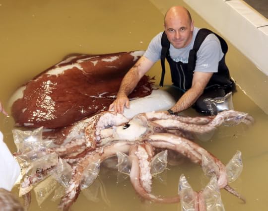
Giant squid at Te Papa
Wellington cable car

Wellington skyline from funicular
We took a funicular ride to a mountain looking over the city and harbor. One stop was at the university, the last stop at a museum and park with views of a homes perched on hillsides.
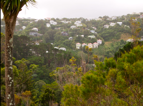
Hillside homes above Wellington in dreary weather
* * * * *
Next: Crossing Cooke Straits from Wellington to Picton
We welcome your comments to our travels Down Under.
In addition to this travel blog, I also write mysteries and romantic suspense novels available on Kindle, Nook,
and Smashwords which distributes to ereader devices. I hope you’ll consider reading and reviewing them. I recently published a new murder
mystery, REX ROYALE; you can read opening chapters on your ereader or smart phone. I hope you’ll like it!
jacklerickson@gmail.com


June 27, 2012
Rotorua Museum
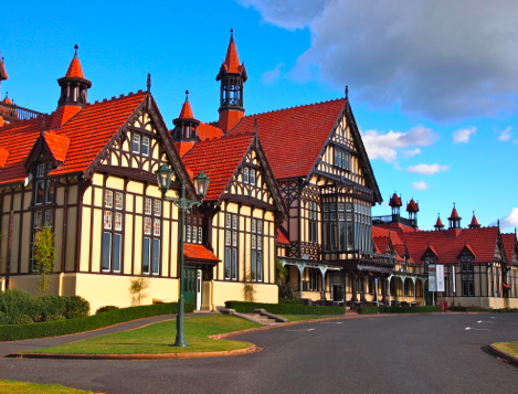
Museum of Rotorua
Museum of Rotorua
A ten minute walk from our hotel along Lake Rotorua was the landmark Rotorua Museum, an impressive 19th century structure with a fascinating history. We walked by the museum to a path along the lake, admiring the gardens, lawn bowling, and impressive classical architecture. Our last morning we booked a tour to see the exhibits promoted in local travel literature as one of the ‘must see’s in Rotorua. They were right.
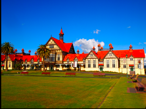
Rotorua Museum grounds
International spa
Shortly after Europeans began settling around Lake Rotorua, the New Zealand government recognized its potential for tourism. In the 1890′s, a railroad was laid from Auckland to Rotorua to attract international with a resort and spa, common in Europe during the Edwardian era before World War I. The government funded the expensive project, building a modern hotel with gardens, restaurants, and spa. The project attracted well-to-do Europeans and Americans who sailed to New Zealand then boarded an overland train to Rotorua to ‘take the cure’ and soak in mud baths. It was, after all, the Gilded Age.
But the resort had a brief life, opening in 1908 just a few years before calamities that shook the world — WW I, the 1929 stock market crash, the 1930′s worldwide depression, and WW II. The government was forced to take over the hotel when it failed as a business venture. It was leased as a jazz nightclub until the 1960′s when it was eventually shuttered. It was renovated and became the Rotorua Museum in 1969.
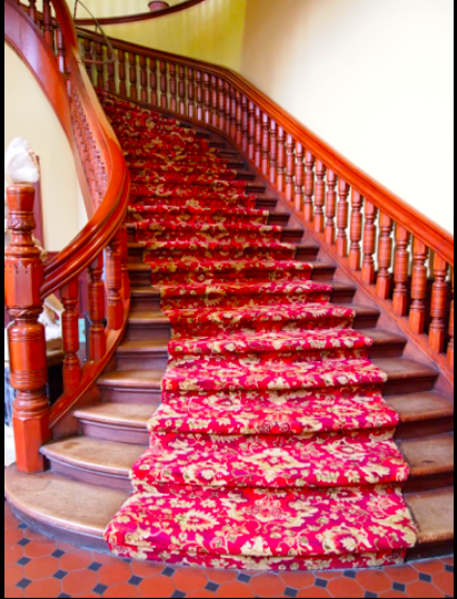
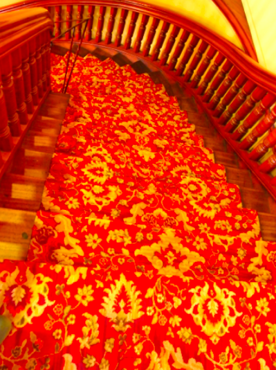
Elegant carpeted stairway to jazz club
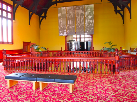
Second floor reception area
The museum has several exhibits about the history and natural wonders around Lake Rotorua. One is about the Arawa tribe of the Maori who first settled there about 600 years ago. The exhibit had photos, drawings, and recreations of Arawa life before the Europeans arrived.
Bath House exhibit
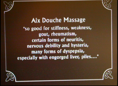
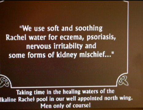
The Bath House tour told the early history of the hotel as an international spa with somewhat garish relics — old bathtubs, tiled ‘private’ rooms, and posters promoting the healthful benefits of mud baths. One exhibit was down a narrow stairwell into a dark basement where rusted pipes and tanks showed the ‘plumbing.’ Water in the Rotorua is contaminated with minerals and salts from the geothermal activity which stained and corroded the plumbing. Workmen had to replace it frequently adding to the cost.
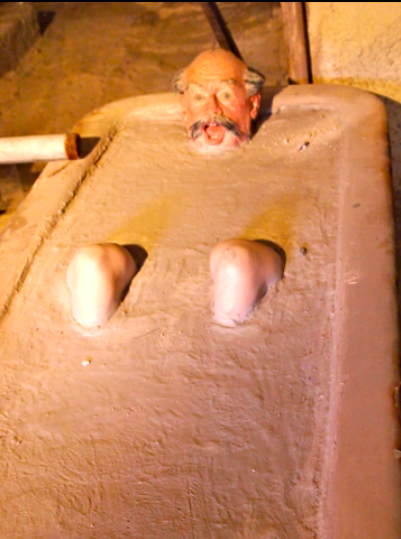
Bath House exhibit
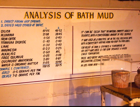
‘Therapeutic’ benefits of mud baths
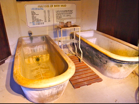
Original tubs for spa mud baths
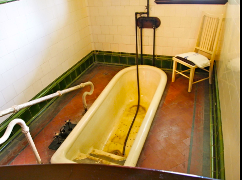
Private tub for ‘taking the cure’
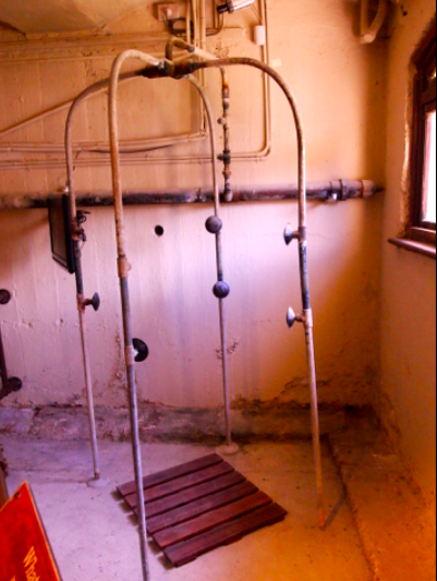
Antique spa shower
Mt. Tarawera eruption
Another exhibit featured a natural wonder, pink and white silica terraces in a remote area near Lake Rotorua destroyed by a volcanic eruption in 1886. The pink and white terraces were world-famous for their beauty and popular with international tourists for the spa in geothermal warmed pools.
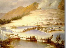
Pink and white silica terraces destroyed by Mt. Tarawera 1886 eruption
But nearby Mt. Tarawera erupted in 1886 and wiped out the terraces, nearby Maori villages, and killed 150 people. It was New Zealand’s largest natural disaster in the 19th century. The museum had a film about Mt. Tarawera with black and white photos of the pink and white before it was destroyed. The terraces looked beautiful and unique, like a smooth stone staircase leading down to a lake surrounded by rainforest.
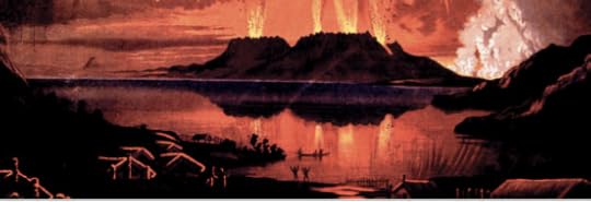
Mt. Tarawera erupting in 1886
Rooftop view platform
After touring the museum, we climbed stairs through the attic to a viewing platform overlooking the Museum grounds, gardens, lawn bowling fields, and a distant view of Lake Rotorua.
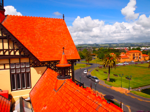
View from Museum rooftop
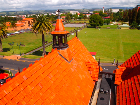
Rooftop view
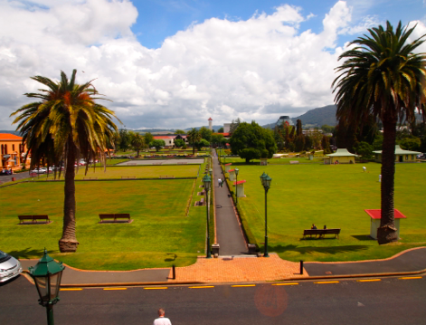
Lawn bowling fields from Museum rooftop

Lake Rotorua in the distance
Lawn bowling
Rotorua is a popular area for retired Kiwis. We watched them lawn bowling on neatly groomed fields, sporting in crisp white uniforms and bowler hats. So dignified — and English!
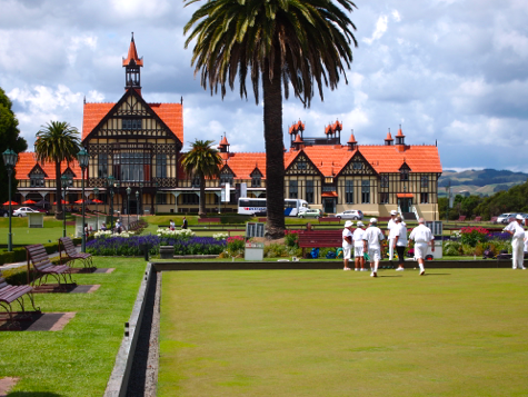
Lawn bowling on grounds of Rotorua Museum
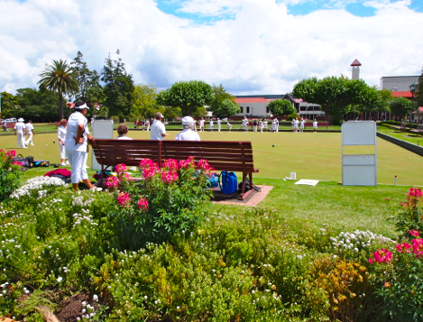
Lawn bowlers
We enjoyed walking through the grounds, admiring the gardens, and following a path through the woods along Lake Rotorua that led to a park with playgrounds, a marina, and steamboat for taking tourists around the lake. The park was filled with families and children enjoying the beautiful setting and recreational attractions. Kiwis live well in Rotorua!
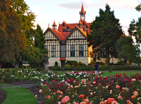
Museum gardens
* * * * *
Next: Wellington
We welcome your comments to our travels Down Under.


June 17, 2012
Maori Ceremony
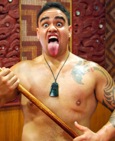
Maori ‘warrior’
The Maori people
The Maori are aboriginal people who arrived on New Zealand from various Polynesian Islands about 900 years ago. One theory about the reason for their migration was that many Pacific islands were small with limited means to produce food. Pacific islanders sailed between islands to trade and shared stories about navigation, canoe building, and other islands. One tale they shared was about a large. mountainous island in the south.
It’s not certain when and the future Maori people settled on New Zealand which they called Aotearoa which translated into ‘the land of the long white cloud.’ Archeologists believe they came from eastern Polynesia islands of Samoa, Tonga and Easter. Maori legend says their ancestors sailed from the Hawaiki (not Hawaii) islands on ocean-going canoes called waka. When they arrived, they found that Aotearoa offered almost unlimited land to grow crops and expand their population. More islanders arrived in waves from Polynesian and lived in isolation on New Zealand for centuries.
Maori mark their bodies with decorative tattoos that were noted by Captain Cook in his log.
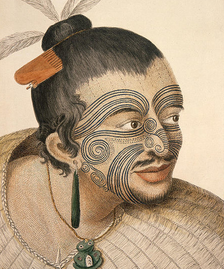
18th century Maori warrior
The most common markings are on the face, arms, and shoulders, often matching.
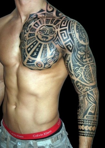
Maori tattoo
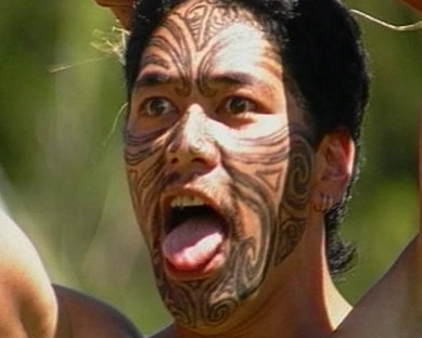
Maori facial tattoo
Our introduction to the Maori was attending a ceremony of singing, dancing, and story telling at Te Puia. After buying a ticket, we were directed to stand outside a fence enclosing the grounds of a Maori temple.
Our guide explained that we would enter the temple after going through a welcoming ceremony with one of our group being greeted by a Maori ‘warrior.’ While we waited, a group of Maori , barefoot and wearing in traditional clothing, emerged from the temple and greeted us with a traditional welcoming song. One of the Maori men came down the steps and made strides to us, making loud grunting noises, and thrusting a spear towards us.
It’s part of the ritual to frighten a foe, but also to greet a friend. In response, one of our group had been instructed to lay down a wreath of leaves, an expression of friendship.
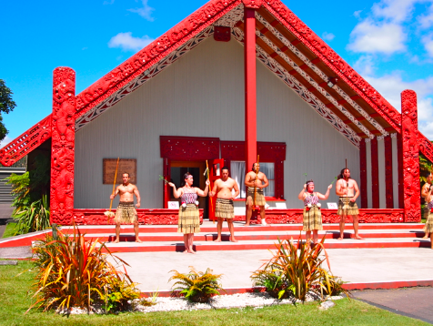
Maori ceremonial center
After a welcoming greeting between the ‘warrior’ and one of our group, the ‘warrior’ turned around and strutted back to the temple. We followed, removed our shoes, and entered the temple. The large central room was bare with wooden floors and chairs decorated with Maori designs. The roof was made of thatched covering and carvings decorated the walls.
Welcoming ceremony
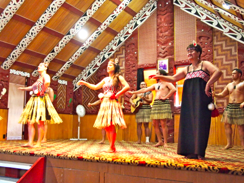
Maori ceremonial greeting
When all the Maori were on the small stage, a woman greeted us and introduced us to the ceremonies, a series of skits of dancing singing, and telling stories. One skits involved Maori seated in a circle and tossing ceremonial sticks to each other while chanting a Maori song Another featured women swinging fluffy balls tethered to cable ropes. Each skit was performed with the singing in Maori language and men playing guitars and beating drums.
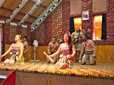
Maori women performing
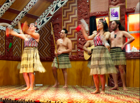
Maori women performing with fluffy balls tethered to cloth ropes
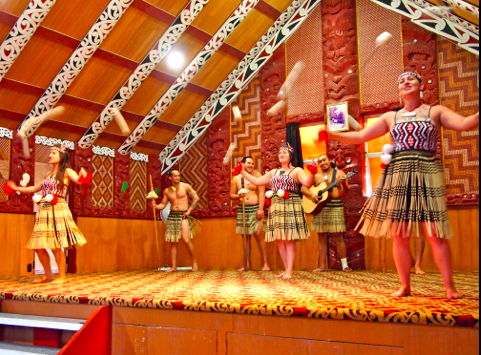
Singing and dancing with balled cables
Haka
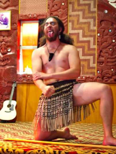
Maori ‘warrior’ doing the haka
The most dramatic event was the men doing the haka, an ancient ritual performed by Maori warriors. Haka gestures include loud grunting, chanting, stamping feet, and slapping fists on thighs, chest, and biceps. During the skit, they’d open their eyes wide, stuck out their tongues and flutter it in a threatening fashion.
The haka has become famous since the New Zealand All Black rugby team performed it before matches. We saw a video of it at the Auckland Museum and was impressed how the ceremony aroused the crowd.
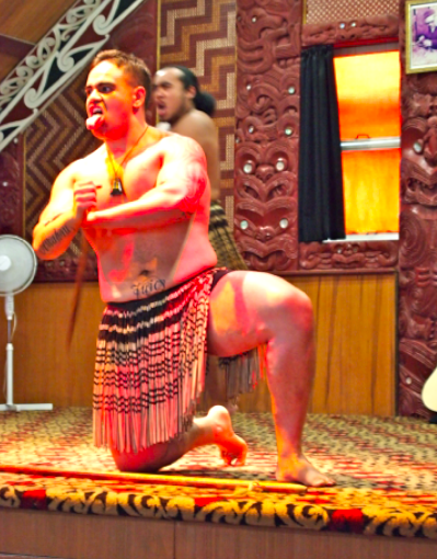
Haka
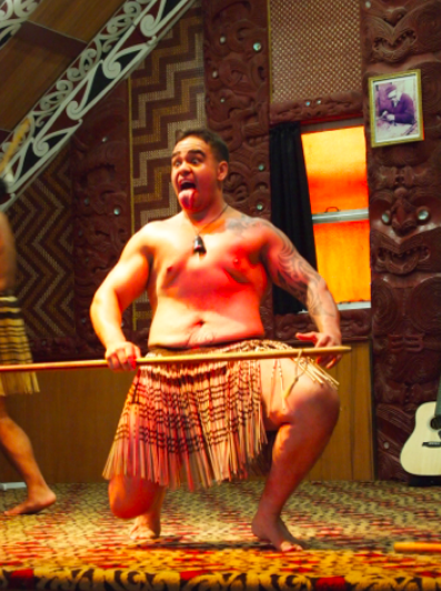
Haka
After the ceremony, we were invited on stage to talk to the performers and take pictures. Who could resist? Although some looked quite terrifying, they were friendly and eager to share their culture.
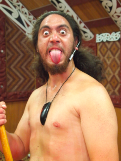
Scary?
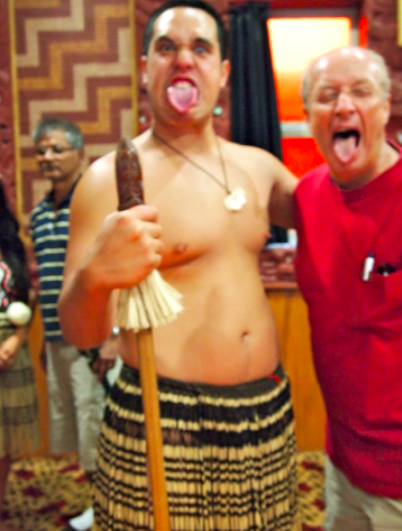
I flunked the audition
We attended another Maori ceremony at the Museum of Auckland after we returned. But it was not as robust and exciting as what we saw in Rotorua. We learned more about Maori history and culture as we traveled and will share more in future postings.
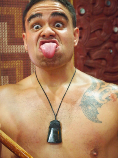
He was a nice guy. Really.
* * * *
Next: Rotorua Museum
We welcome your comments to our travels Down Under.
We have videos of the Maori welcoming ceremony and the haka which we’ll share in the future.


June 15, 2012
Rotorua
Rotorua
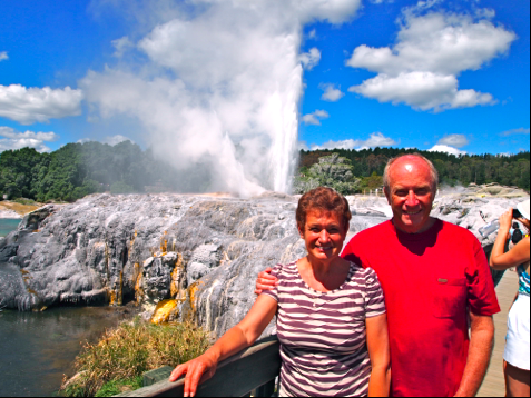
Pohutu geyser at Te Puia
Our first adventure out of Auckland was taking a Naked bus for a four-hour, 240 kilometer trip to the center of the north island. Our destination was the tourist town of Rotorua noted for its geothermal activity, center of Maori culture, and scenic mountains, lakes, and rivers
The area was settled by the Maori before Europeans arrived in the 18th century. Maori had been attracted to the area because of the rich volcanic solid and the many fish in the lakes and rivers. Two large lakes, Rotorua and Taupo, were formed from the caldera of extinct volcanos.
Our hotel was on the shore of Rotorua lake two blocks from main street. Along the shore sulphur mud pots bubbled out of the ground. Rotorua is nicknamed Sulphur City; when a breeze blows off the lake, there’s a main aroma of sulphur. It’s not offensive, more a hint that you’re in a center of geothermal activity.
The town is a Maori resort with many souvenir shops selling postcards, souvenirs, clothing, and knick knacks. The city had added benches, wide side walks, and green areas, but was nearly deserted with vacant and boarded up retail shops. The financial crisis hit the resort hard. It had probably grown too fast. When we walked from our hotel to Te Puia, we passed dozens of motels and hotels on both sides of the road, all with vacancy signs and few cars in parking lots even curing a busy summer tourist season.
Te Puia
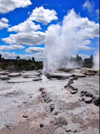
Pohutu geyser at Te Puia
One of the main attractions in Rotorua is Te Puia theme park which features geothermal mud pots and geysers and the recreation of a Maori village and crafts center. We spent half of our afternoon walking through the geothermal area over paths and wooden platforms through the more sensitive areas.
The central geothermal feature is Pohutu geyser which erupts about every thirty minutes. As it erupts, heated water splashes over a barren mound and spills into a stream and emerald-green pond. Tourists line up on a wooden bridge over the sulfurous stream to take pictures with Pohutu in the background. No one leaves without a few photos of Pohutu erupting.
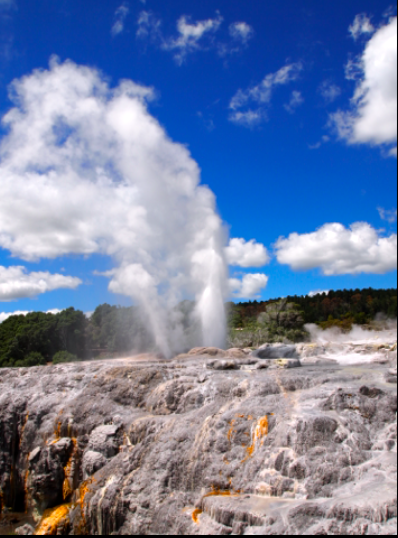
Pohutu geyser
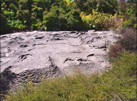
Bubbling mud pots
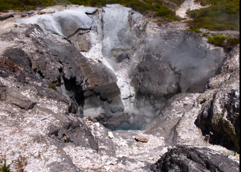
sulphur vents in mud pot
Maori crafts center
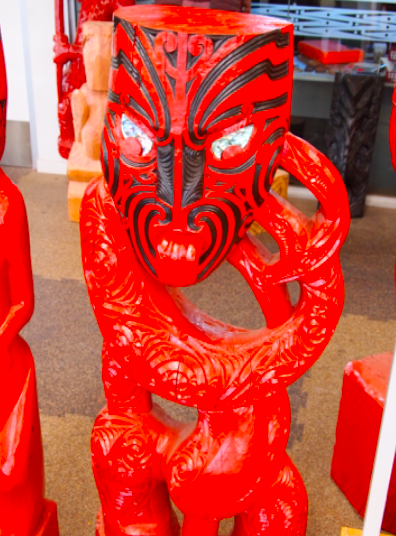
Maori ceremonial wood carving
After attending a Maori ceremonial dance, we walked through the crafts center where Maori artists were weaving and carving wooden ceremonial masks and statues. All during our travels throughout New Zealand, we saw Maori art displayed in parks, museums, and towns. Maori art is beautiful, almost haunting in depiction of their culture and legends.
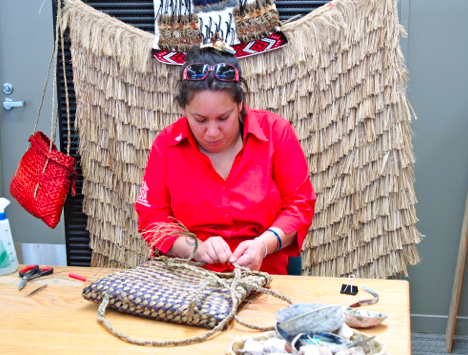
Maori weaver in crafts center
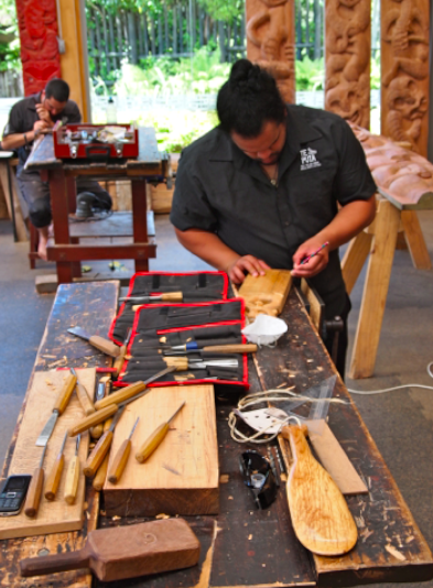
Maori wood carver in his studio
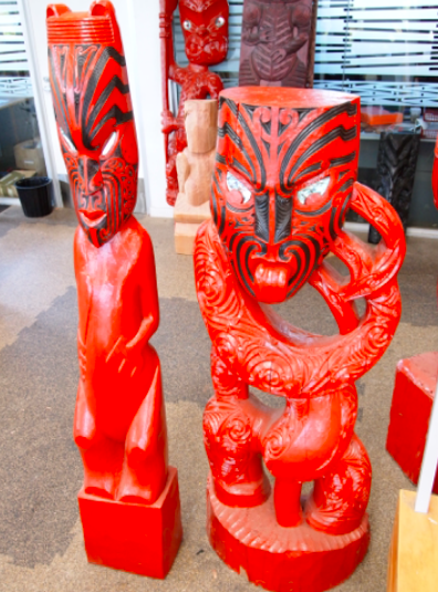
Maori ceremonial wooden sculpture
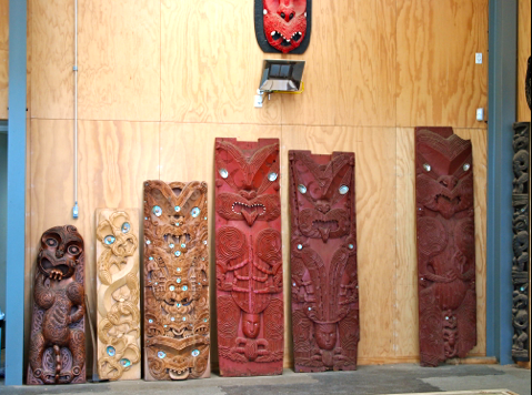
Maori ceremonial wood carvings
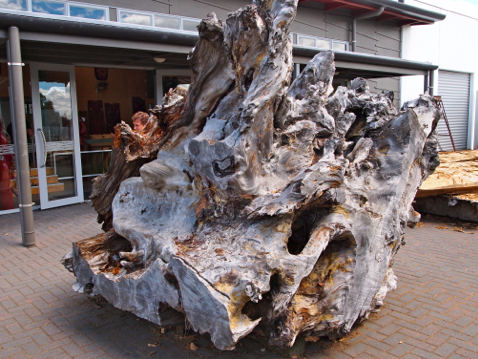
Weathered tree stump used in Maori carvings
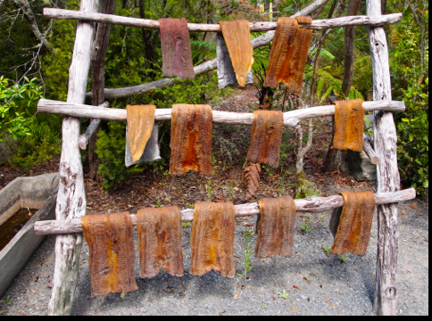
Display of dried fish in recreation of ancient Maori village at Te Puia
Rotorua and Te Puia were our introduction to the beauty of New Zealand and its rich Maori culture. Much more was ahead of us.
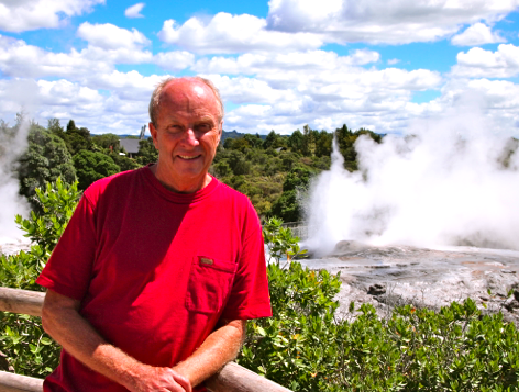
I like Te Puia
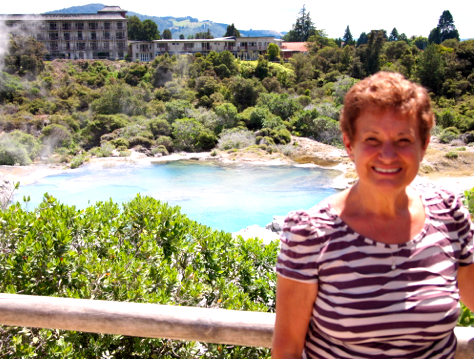
So do I !
* * * * *
Next: Maori ceremonial dance at Te Puia
We welcome your comments on our travels Down Under.


June 5, 2012
Traveling New Zealand
Traveling New Zealand
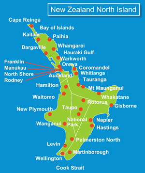
North Island
Traveling in New Zealand is a different experience than traveling in Europe, the U.S., and Australia. The country stretches across two narrow islands divided by the Cook Straits. More than 70% of the country’s 4.4 million population live on the smaller north island including the largest city, Auckland, with 1.3 million residents. The capital, Wellington, is on a southern harbor that leads to the Cook Straits and the southern Pacific Ocean.
The south island is sparsely populated with jagged mountain ranges running in a general northeast to southwest orientation. One of the most prominent features on the south islands are the Southern Alps and 12,000 ft. Mt. Cook, the highest mountain peak in the country. Between the mountain ranges are glaciers, picturesque valleys, rain forests, lakes, and rivers.
The largest national park in New Zealand is Fjordlands National Park on the far southwest corner bordering the Tasman Sea. Day and overnight cruises take adventure seeking tourists through the scenic, mountainous Milford Sound and Doubtful Sound in the fjordlands park. It’s an amazing experience.
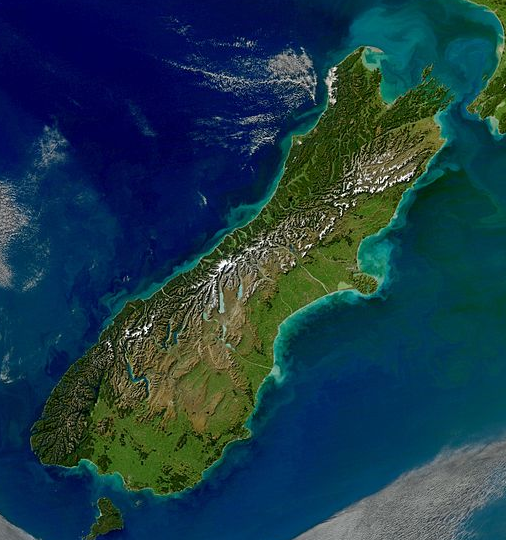
Satellite view of the south island
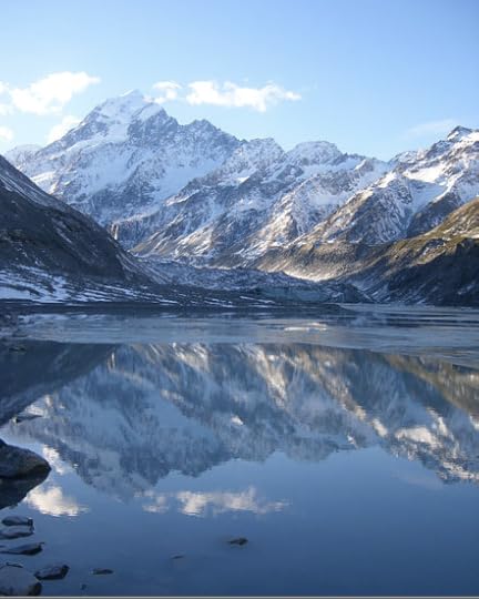
Mt. Cook in the Southern Alps
These natural wonders makes traveling in New Zealand an adventure in itself. The question becomes how best to visit the many stunning attractions traveling over rugged terrain. Travelers have choices: renting a car, taking buses, signing up for tours, or flying. We saw a few travelers on motorcycles and bicycles, but wouldn’t recommend either.
Before we arrived in Auckland, we’d researched travel in New Zealand on Web sites, in travel books, and by talking to travelers who were eager to share their experiences. Their recommendations proved to be very useful; we’d already changed itineraries in Australia based on what we’d learned from other travelers.
Travel options in New Zealand
We spent part of an afternoon at the Britomart information center on Auckland’s Queen Street to explore our options. This free service helps tourists plan itineraries, book bus and ferry tickets, and make hotel, motel, and B & B reservations. Within an hour, our experienced travel assistant booked hotel reservations in Wellington and Rotorua, bought bus and ferry tickets, and made suggestions about travel and lodging on the south island.
After explaining how we like to travel, she helped us book trips on two bus services. It was a good decision. Here are the choices for traveling around New Zealand.
Car Rental - New Zealand roads are well maintained, but narrow and hazardous. Shoulders are narrow, often dropping into a river, off a cliff, or into the woods. Road are winding with many blind curves, narrow one or two lane bridges, and congested bus and truck traffic. Arriving in towns can be confusing with intersections, roundabouts, and road signs. Many of the signs are in Maori, which were confusing. On every bus trip we took, our experienced driver negotiated through hazardous situations that made me nervous. We’d rather have trained drivers get us to our destination while we enjoy the scenery. We rented a car for two days in Queenstown, but only for short day trips. I’d never risk traveling by rental car for longer distances.
Bus Tours - tour companies offer packaged multi-day trips to main tourist destinations. They offer large, air-conditioned buses the size of railroad cars, but are expensive, between $250 – $350 a day. You also travel with the same group for several days, rarely meeting Kiwis or having time to explore on your own. Tours stick to a strict schedule with few options. Meals and lodging are pre-arranged in expensive hotels and restaurants. We prefer to travel where we have liberty to stay where we want, travel when we want, and linger and explore on our own.
Air travel - Expensive. We took one flight at the end of our trip, flying from Queenstown in the south to Auckland on the north island. Had we taken the bus, it would have taken three or four long days. Our two hours flight let us spend two more nights in Auckland before we flew to LA.
Private Bus – New Zealand has several bus touring companies that offered options on departure times, destinations, and competitive prices. We signed up with two bus companies, Naked Bus and Inter City line. They offer different pricing models, some by mileage, others by destinations. We liked the options and used both of them when they met our needs. We like options.
Topography of New Zealand
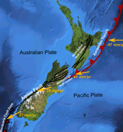
New Zealand rests on junction of Australia and Pacific tectonic plates
Gondwana
New Zealand was one of the most geologically unusual places we’d ever visited. Australia is a sprawling expanse of mostly of arid deserts and geological formations thrust up hundreds of millions of years ago. More than 90% of the population live a few miles from the coastline. Vast areas of the outback are uninhabitable due to extreme temperatures and lack of water. New Zealand’s topology is much different.
New Zealand and Australia were part of the ancient super continent Gondwana. They split off from Gondwana about 100 million years ago; New Zealand split from Australia about 90 million years ago.
New Zealand geology consists of parallel mountain ranges rising above a submerged continent that stretches to Australia. The country rests on the junction of the Pacific and Australian tectonic plates which means they are subject to earthquakes and volcanoes. North island has dormant volcanos around Auckland and the central valley which has many lakes, including Rotorua and Taupo, formed from caldera of extinct volcanos.
Most travel is on north to south roads in valleys and across high passes in the mountain ranges. One way to imagine traveling in New Zealand would be if the Rocky Mountains and Sierra Nevada were scrunched into California with the Sierra Nevada on the coastline. Travel over the mountains would be limited to mountain passes and through narrow valleys between them.
Naked Bus
Our introduction to traveling was via Naked Bus from Auckland to Rotorua where we spent three nights visiting one of the main tourist destination on the north island. Fellow passengers were international gap year students, backpackers, and adventure travelers like us. The bus stopped four or five times to pick up or drop off passengers in towns along the way. Although the distance was about hundred and fifty kilometers, it took about four hours with a fair amount of traffic.
The trip was scenic through small towns and villages, following along rivers and crossing several bridges. We drove through rural countryside where large herds of sheep grazed in pastures that ran up steep hillsides to the mountains. We were excited about the adventures ahead.
* * * * *
Next: Rotorua
We’ll post on our many adventures on the north and south islands including a ferry across the choppy Cook Straits, a wine country tour, bus trips through national parks, hiking in rain forests, along the rocky coastline, to a glacier, and cruising Doubtful Sound. Stay tuned!
We welcome your comments on our travels Down Under. Please share your thoughts.


May 19, 2012
Auckland Harbor
Auckland Harbor

Auckland Ferry building
Every day we spent in Auckland seemed better than the previous day. We enjoyed exploring the city, walking through the Auckland University campus, crossing a bridge, and discovering another park with a shade path that took us to the impressive Australian Museum. We spent an hour in a ‘winter garden’ with koi ponds and statues between grey stone buildings with skylights and exotic flowers from Asia and the Polynesian islands.
One morning, we had breakfast in Parnell, a charming neighborhood with restored late 19th century and early 20th century buildings and storefronts. Erstwhile banks and mercantile stores had been converted into sushi restaurants, flower shops, and wine stores. Parnell reminded us a bit of Georgetown, Carmel, and Kensington. We had two dinners in Parnell, one at an Italian restaurant and the other at a ‘fusion’ restaurant named Iguazu for the waterfall in Argentina.
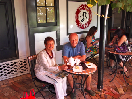
Morning tea and scones in Parnell
Our last day in town, we took an afternoon cruise of the scenic harbor. Auckland is an isthmus between two harbors, Waitemata harbor in the north and Manukau harbor in the south. Auckland international airport is on Manukau harbor which opens on the Tasman Sea.
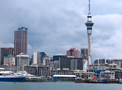
Sky Tower on Auckland’s skyline
Before our afternoon cruise, we walked down the embarcadero for lunch at an outdoor restaurant. The skies were cloudy, turning dark. As we were seated, there was a loud explosion like a sonic boom. Everyone jumped and looked around nervously. Our waitress said, ”Oh, don’t worry, we get lightning in the summer when dark clouds come from the west.”
By the time we finished lunch, the skies cleared a bit and we board our boat. Tour companies offer harbor cruises for a half day, full day, dinner and wine cruises, and visits to islands with vineyards, seaside villages, and a wildlife park.
Auckland harbor has abundant visual attractions; the amber-colored ferry building, outdoor restaurants, a maritime museum with a wave-like white roof, and sailboats, yachts, and small fishing boats.
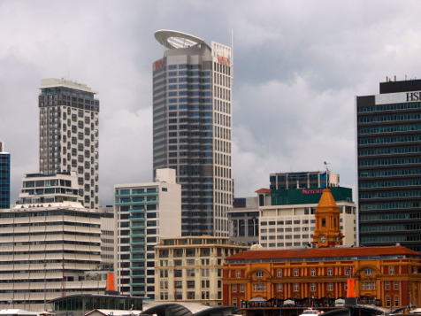
Auckland skyline
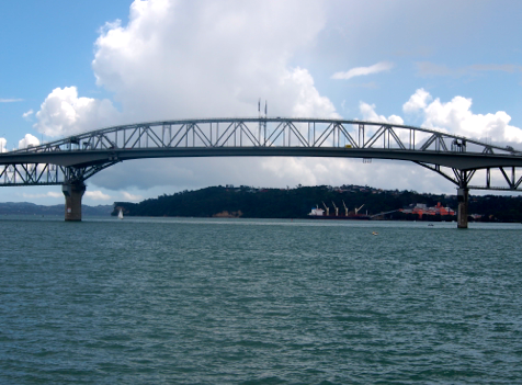
Auckland harbor bridge
We sailed from Auckland wharf and passed the harbor bridge which spans the narrowest point between Auckland and the North island. Residents on the north island can drive across the harbor bridge or take a ferry to work downtown. It reminded us of Tiburon and Sausalito on San Francisco Bay linked to the city by the Golden Gate Bridge. But they allow bungy jumping off the Auckland harbor bridge; not so on the Golden Gate.

North shore across from Auckland
Australian naval ships docked at Devenport Naval Base, mostly used for research. (I recently read in the Wall Street Journal that the Australian Navy held a memorial service off the Queensland Coast to commemorate the 70th anniversary of the Battle of the Coral Sea when a U.S. battleship Lexington was sunk by Japanese navy. More than American 600 sailors went down with the ship. Historians say the battle ended Japanese plans to occupy Australia and New Zealand in the early days of World War II.)

Devenport naval base across from Auckland
Our ferry stopped at islands to pick up day trippers who’d landed earlier to hike around the islands. At one dock, I snapped photos of seagulls resting on the dock. As hikers came out on the dock, the gulls flew up.
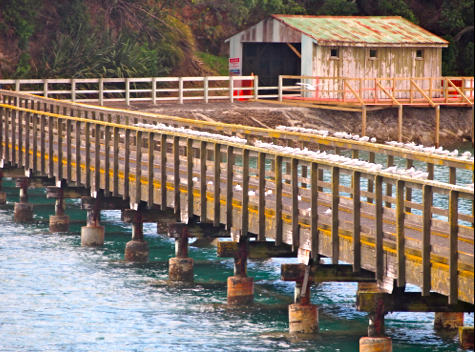
Gulls on dock
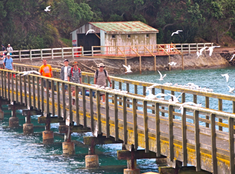
Gulls flying up as hikers return to board our ferry
We passed uninhabited islands, including one with a national park reached only by boat.
Sailing in Auckland harbor
The harbor was full of sailboats and yachts, lazily dancing over the waves. One group looked to be competing, sailing around buoys, then racing to a finish line in the distance.
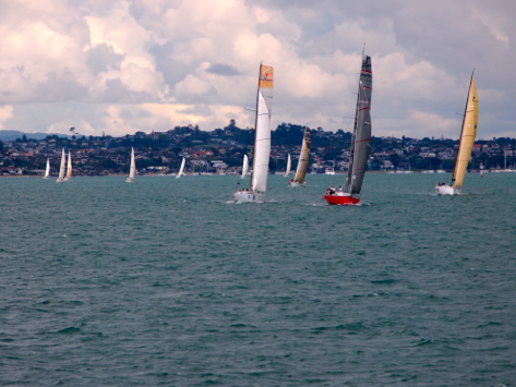
Sailboats racing in Auckland harbor
Auckland’s docks
Auckland is the largest commercial port in New Zealand. The federal government had recently legislated a layoff of dock workers and a cut in benefits. Dock workers retaliated by calling a strike. Newspapers and TV covered the controversy for days. It got pretty ugly. We could see the docks from our balcony, lit up at night as ships waited to be loaded and unloaded.
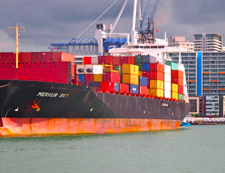
One of several container ships in port
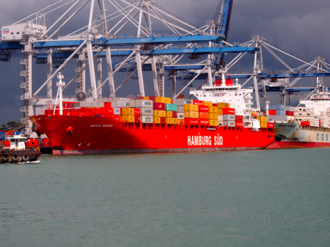
German container ship in port
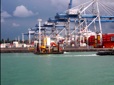
Shipping cranes for offloading container ships
Returning in Auckland, dark clouds were gathering again, making the skyline look ominous. But rain held off and we returned to Parnell for our last dinner in Auckland.
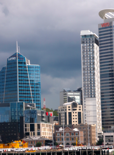
Storm clouds over Auckland skyline
Preparing to dock, we passed the city’s maritime museum with an interesting wave design. At night, the museum’s roof is lit and flashing blue lights ripple back and forth like waves coming ashore. Pretty spectacular to see.

Auckland’s ‘wave’ maritime museum
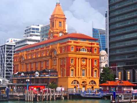
Docking near impressive ferry building
As we walked off the boat, we had another view of the Sky Tower sandwiched between an apartment and high-rise office buildings.
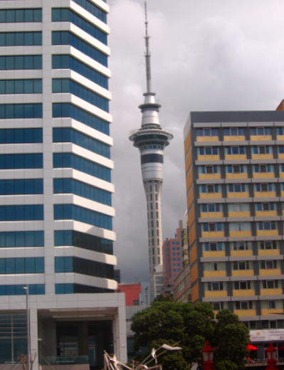
Sky Tower
* * * * *
Next: Rotorua where we saw a Maori ceremony dance, geysers, exotic birds, and a historic museum.
We returned to Auckland at the end of our month in New Zealand. We’ll post more photos and stories of our return.


May 16, 2012
Auckland
Auckland
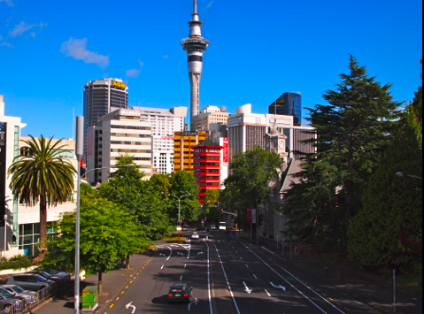
Auckland skyline
After our six-week adventure in Australia, we departed from Cairns on an Air New Zealand flight to Auckland on the north island. It was one of the most fascinating flights we’d even taken, following the Queensland coastline, flying over reefs and islands for more than an hour. We were lucky to have window seats and a clear sunny day to enjoy amazing views for hundreds of kilometers.
After about three hours, we passed over small islands off New Zealand’s north island. We flew from east to west, crossing the north island to the Auckland airport on a bay about 25 kilometers from downtown. A beautiful flight, best taken in the daytime.
New Zealand’s largest city
Auckland has the distinction of being rated one of the most livable cities in the world. The Economist Intelligence Unit rated four cities we visited Down Under in the top ten in 2011: Melbourne, Sydney, Adelaide, and Auckland. We’d experienced that more relaxed, efficient, and modern life style in many cities we visited, especially Cairns and destinations in New Zealand we’ll write about in future posts.
One feature of this high quality of life is transportation. New Zealand, like Australia, has excellent public transportation. A half hour after we landed, we were on an express bus headed downtown. It cost about 15 NZ dollar, a bargain considering what a taxi would cost to drive the distance. On the drive into the city with no traffic delays, we passed parks, neat middle class neighborhoods, and blocks of retail shops, especially Asian restaurants and markets. It was rush hour, but we didn’t encounter a single traffic jam.
We crossed a couple of bridges until we reached downtown and Auckland’s main thoroughfare, Queen Street. Our driver dropped us off on Queen Street and gave us directions to our hotel. We walked up a hill, passing Albert Park and the University of Auckland. We were checked in and took an elevator to our room. We were thrilled to have a nice view from our 12th floor balcony, of the harbor, shipyards, islands, and dormant volcanos in the distance. We were going to enjoy Auckland.
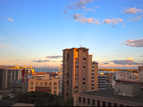
Evening view from our 12th story balcony
“I Left my Heart in . . . Auckland?”
After freshening up in our hotel, we walked down the hill to Queen street again then headed toward the harbor where night life was starting up. Along the way we commented how much Auckland resembled San Francisco where we lived for almost a dozen years. But Auckland has less traffic, urban pollution and noise. It’s also easier to walk around Auckland. The city bus system is fast, efficient, clean and affordable. And people were kind, helpful and pleasant. Tony Bennett should visit and compose a song to Auckland’s many charms of ‘the city by the bay.’
Auckland’s ferry building and the busy street running the length of the harbor are very reminiscent of San Francisco’s Ferry Building and the Embarcadero lined with tall palm trees. Notice the resemblance?
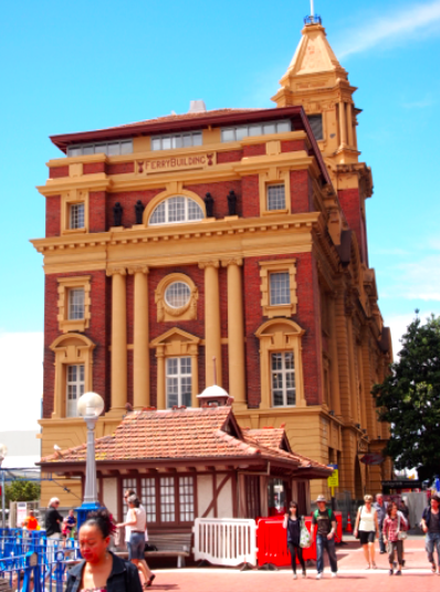
Auckland ferry building
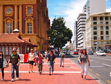
Auckland’s Embarcadero
University of Auckland
Our first full day in Auckland we wanted to explore neighborhoods near our hotel. we didn’t have far to go; five minutes from our hotel we were walking through Albert Park and the campus of the University of Auckland. The campus had spacious lawns, shaded walks, flower gardens, and indigenous trees like nothing we’d seen in the U.S. As we’ve noted before, gardens are one of the first sites we visit in a new city. Auckland did not disappoint us. We returned several times to enjoy the beauty and serenity of the campus gardens.
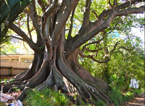
University of Auckland gardens
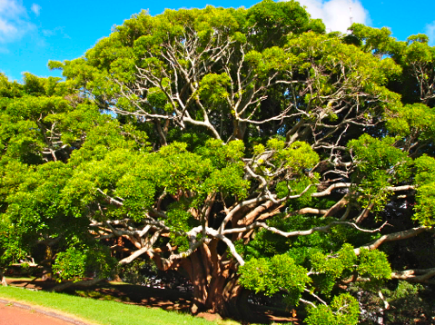
New Zealand gum tree
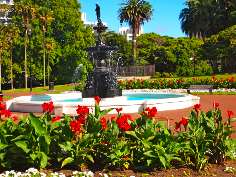
Fountain on University of Auckland campus
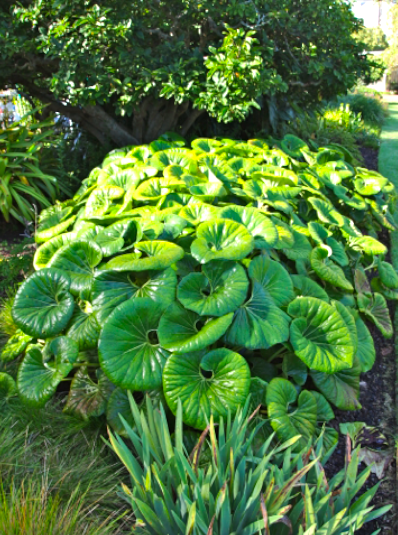
Indigenous plants in campus gardens
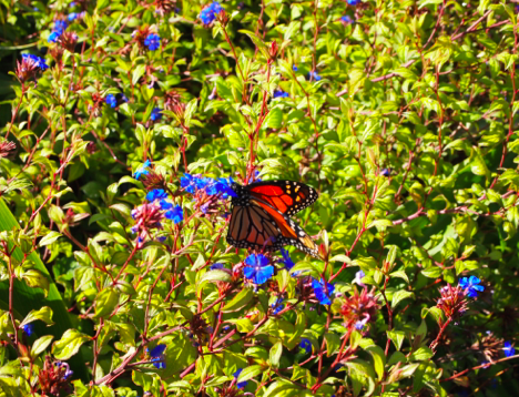
Butterfly sipping nectar on dewy morning
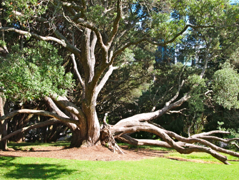
New Zealand gum tree
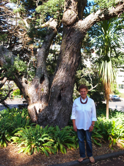
Native shade tree on campus
Auckland waterfront
Auckland has a vibrant and attractive waterfront where we enjoyed lunches and dinners. Fresh seafood was on every menu, sea bass, mahi mahi, barramundi, shark, tuna, and eel. We stuck with the white fish, shrimp, and calamari.
The Cowboy bar – restaurant displayed somewhat tacky mementos of the American West that reminded us of Montana saloons: stuffed moose and pheasant, deer antlers, rifles, and signs. It almost made us homesick.
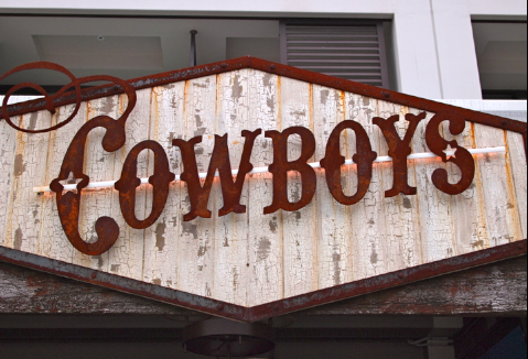
Only cowboys and cowgirls allowed
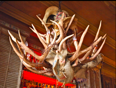
Rattlesnake skins wrapped in the deer antlers
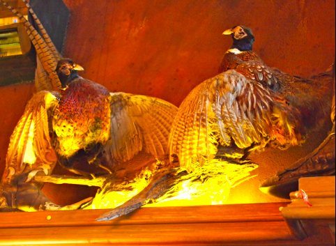
North Dakota pheasants?
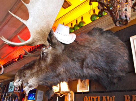
Like the cute cowboy hat?
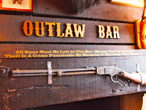
Check your guns at the bar
Every time we returned to our hotel, I’d hurry to open the curtain. I never tired of the view from our balcony. Our first impression of New Zealand proved to be a lasting one.
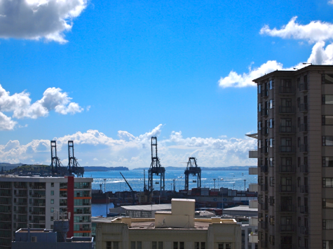
Morning view from our balcony
* * * * *
Next: Auckland Harbor
We welcome your comments to our travel Down Under


May 14, 2012
World of Digital Publishing
The World of ePublishing

Rex Royale
Publishing date: May 2012
I’d like to share with you plans to expand topics I write about in A Year and a Day. As I’ve mentioned at the tag ending of posts, I also write mysteries and romantic suspense novels published on ereaders like Amazon’s Kindle, Barnes & Noble’s Book, tablets like Apple’s iPad, Sony’s Reader, and smart phones. I have new books and short stories I’ll be releasing the next couple months.
To give you a little background, I was a speechwriter in the U.S. Senate and senior editor for a large trade association in Washington, D.C. in the 1980′s. During that time, I started free-lancing articles for newspapers and magazines like the Washington Post, Washington Star, Baltimore Sun, Washingtonian Magazine, and Campaigns and Elections.
RedBrick Press
I wrote a series of articles about the early microbreweries which were popping up mainly in Colorado, northern California, Oregon and Washington. I interviewed entrepreneurs recreating beer styles from earlier in American history: amber lagers, cloudy heifeweizen (wheat) beers, pale ales, hoppy India Pale Ales (IPAs), porters, stouts, and Holiday beers.
I started a publishing business, RedBrick Press, in 1987 and published my first book, “Star Spangled Beer: A Guide to America’s New Microbreweries and Brewpubs,” which won a national award as the best self published book of the year. I followed with a beer cookbook, “Great Cooking with Beer,” and three travel guides: “Brewery Adventures in the Wild West,” “California Brewin,’” and “Brewery Adventures in the Big East.”
When the micro brewing was experiencing explosive growth in the 1990′s, I began a monthly business newsletter, The Erickson Report. I left the publishing business in 1998 and changed careers and worked for a national brokerage firm in Silicon Valley. I retired last year and started writing A Year and a Day.
Mornings Without Zoe
Changing careers did not stem my desire to write. But when I did resume, it was to write fiction. My first novel, “Mornings With Zoe,” was a romantic suspense novel about a young woman who leaves lovers and husbands, travels to another city, and starts a new life with a new identity. Although I never interested an agent to sell my novel to publishers, I kept writing short mysteries and novels.
Smashwords
I was finishing a murder mystery, “Rex Royale,” in 2009 and discovered the emerging epublishing world. I decided to return to self publishing through a start-up company in Los Gatos, CA called Smashwords which distribute books to digital retailers. For free! Within a few days, Smashwords was distributing my novels and short stories to Barnes and Noble’s Nook, Apple’s iPad, Sony’s Reader, as well as my Smashwords Web Page and Amazon’s Kindle. Sales were initially meager, but they grew slowly and today are selling in the U.S., the UK, Europe, Canada, Australia, and New Zealand.
Loving the underdog
My fascination with epublishing is similar to what I found with craft brewing. Both new industries were started by entrepreneurs using new technology to enter the market with new products in industries dominated by major players. Craft brewers took on major brewers Anheuser-Busch, Coors and Millers. Digital publishing challenged the domination of the six largest New York publishers like Simon & Schuster, Harper & Row, and Random House.
I’m intrigued by visionaries who tilt at windmills. Most of us love to cheer the underdog and support them with our purchases.
Rex Royale
In the next couple weeks, I’ll be publishing Rex Royale, a mystery about a Las Vegas casino mogul whose body is recovered from a lake in northern California near Mt. Shasta. A San Francisco Chronicle reporter recruits a young woman who free lanced business articles about Royale and had a secret affair with him. While they investigate, the reporter and free lancer discover more crimes and dark secrets in a small town in Northern California. They dance around each other in middle chapters until they eventually get entangled. The novel has lots of local color, subplots, and a twist at the end. Murder, money, and sex in a beautiful setting. Good summer beach reading.
Digital publishing
I’ve been following the dramatic upheavals in conventional publishing and rapidly evolving world of digital publishing. What I’d like to do is to periodically report on writing and publishing topics, including what I’m reading and writing. I follow several blogs and Web sites and will share hyperlinks so you can read original sources.
I’d like this to be a place to share your experiences in reading. What are you reading and how — the conventional way or on mobile devices? If you have a table or ereader, has it changed your purchasing decisions and how you read books?
Physical books are not going away. Bookstores, however, are shrinking. Those who survive will be in specialize in genres (cookbooks, travel, mysteries) and offer special services, books signings, and events. These are dynamic changes brought to us by technology, entrepreneurship, and creativity. I hope you’ll support this evolution of A Year and a Day and want to learn more about digital publishing. I have a lot of information to share with you about digital publishing and how it is changing how people read. It’s pretty exciting.
I’ll resume posting travels from New Zealand shortly.
# # # # #
Next: Auckland


