Jack Erickson's Blog, page 3
January 29, 2014
Cape Tribulation
Cape Tribulation
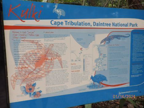
Daintree National Park
We crossed the Daintree River on a small ferry at a remote dock six kilometers from Mossman, the gateway to Mossman Gorge, a rocky canyon that follows the Daintree River into the hills.
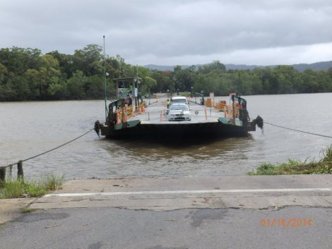
Ferrying cars across Daintree River on cables
The small river ferry crosses the 100 meter wide Daintree all during the day; miss it, the return from the other bank arrive in twenty minutes or so. You remain in your car as the pilot navigates with an underwater cable.
Daintree River meets the Coral Sea
We stopped at the first viewing area in Daintree National Park, a turnoff in the hills looking over dense jungle and the muddy Daintree River flowing into the Coral Sea. The currents at that spot are dangerous and boats steer clear of the area.
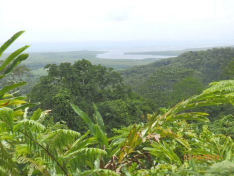
Daintree River flows into the Coral Sea
Once across the river, you enter Daintree National Park, a tropical jungle that extends north to the tip of York Peninsula, the highest point in Queensland. A narrow two lane road winds through the hilly dense jungle, crossing shallow creeks, a few cattle farms, and villages with the basic amenities; a general store, gas station, pub, cafe and maybe a small motel or eco lodge. Only about 400 people live in the national park.
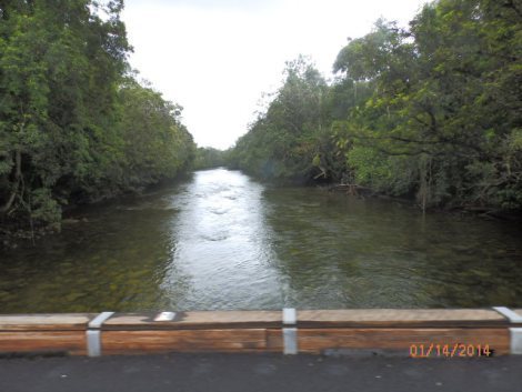
Small river flowing through Daintree National Park
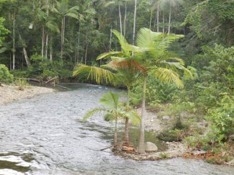
Crossing a smaller creek
Tropical fruit ice cream in a jungle oasis
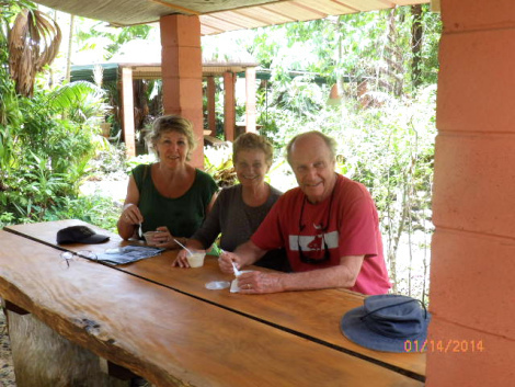
Let’s stop for tropical ice cream!
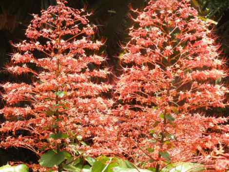
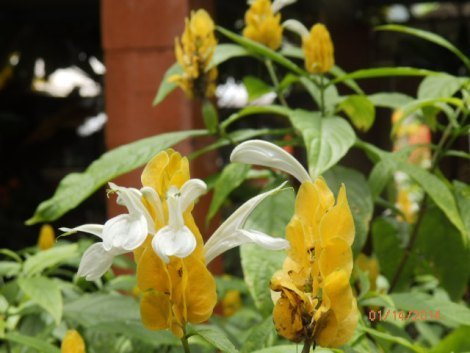
Tropical flowers at ice cream oasis
After the croc cruise, the ferry ride, and a half an hour driving through the jungle, we needed a little nourishment. We stopped at a little oasis selling tropical fruit ice cream: mango coconut, banana ginger, blackberry lemon, orange pineapple, strawberry coconut, and similar flavors. It was delicious; we took a half hour break to enjoy the crisp, fruity ice cream and to admire many beautiful blooming tropic flowers.
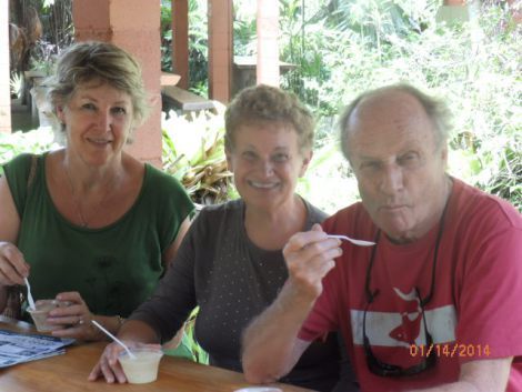
Yummy, loved the banana mango
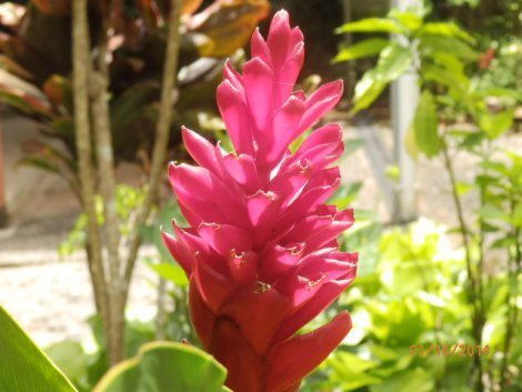
Radiant red tropical bloom
Cape Tribulation
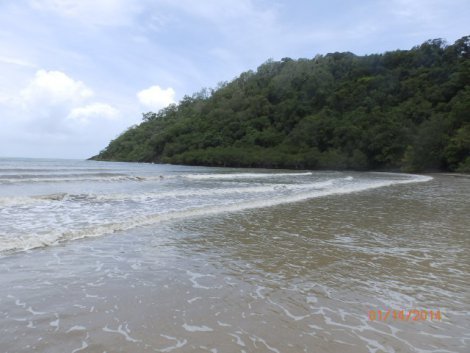
Cape Tribulation
Our destination was Cape Tribulation, a bay between two mountain ranges the descend into the Coral Sea. Captain James Cook’s Endaveour had stuck a coral reef just outside the cape in 1770 and his boat almost sank. But fortunately, the coral broke off and was lodged in the hull. He ordered sailers to go below and to wrap a sail around the coral, which minimized the water seeping into the hull.
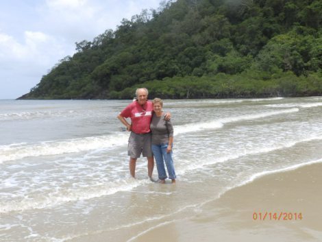
Dipping our toes in warm Coral Sea; not too far out though, crocs swim here
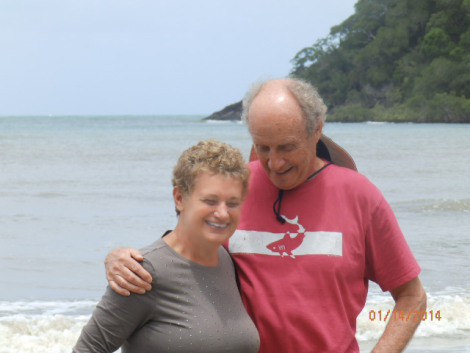
Did you feel that scaly thing slithering across your toes?
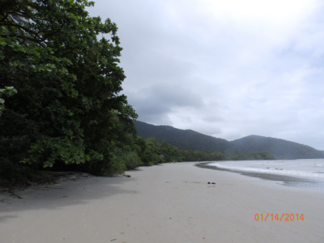
Beach on remote Cape Tribulation
Jungle Trail
Cape Tribulation is remote and uninhabited. Other than a parking lot and rest rooms, the only other sign of civilization is a narrow cement path that meanders through the jungle into the mountains. We followed the path, passing through dense foliage, crossing bogs, and dodging vines as thick as your wrist dangling down.
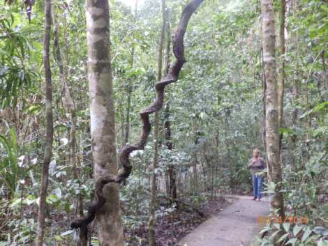
Twisting vines along the path, like giant wooden swizzle sticks
One log was infested with some kind of cup-shaped fungus that looked like mushrooms. The caps of the fungus were indented where rain water and jungle debris had collected. Maybe that’s how the fungus gets nourishment.
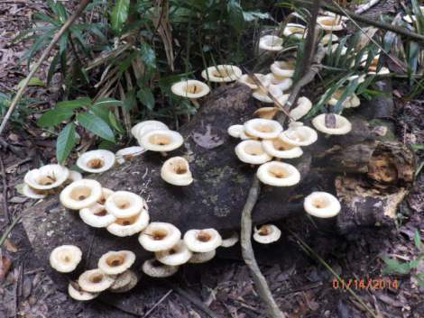
Mushroom-shaped fungus on rotting log
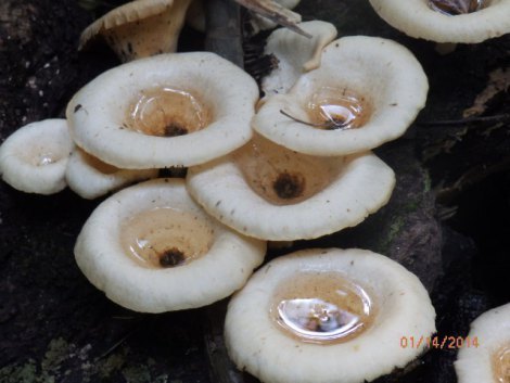
Rainwater and jungle debris leaching into fungus caps
The jungle trail has an eerie sense; you knew danger lurks nearby: a snake under a rotting log, a poisonous spider on a branch above your head, or a crocodile resting in a bog, well camoflaged with his brown, grey, and green skin.
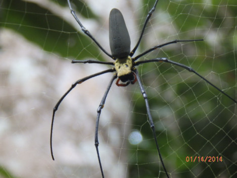
As big as a hand, hanging just over our heads
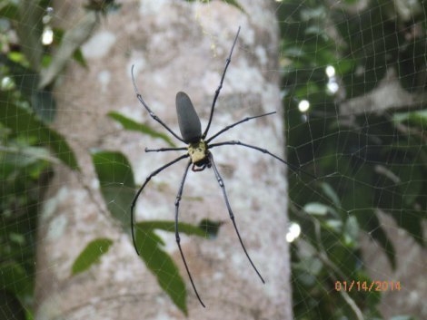
No petting allowed
Numerous signs in the area warned of the dangers of walking off the trail. You pay attention to those signs.
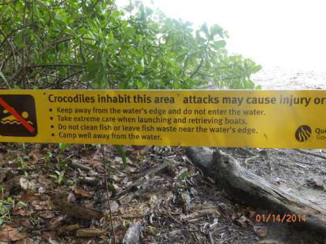
Watch where you walk!
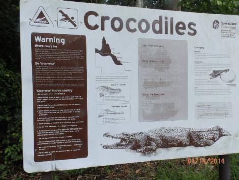
Is that a log you’re stepping over?
Carrowaries
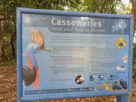
Exotic cassowaries, rare and endangered
One of Australia’s endangered species is the cassowary, a flightless bird with colorful plumage that can reach five feet in height, the size of another Australian flightless bird, the emu. There were several signs along the way about cassowaries in the area. There are only a few hundred remaining, mostly in the Daintree area.
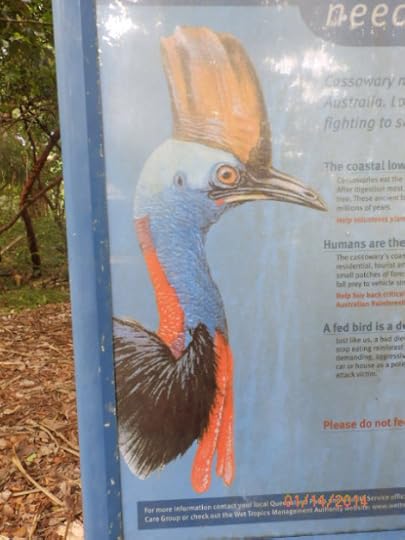
Wish we would have seen one of these colorful creatures
Heather said she had seen one on her last trip to Daintree, a mother walking with a small chick alongside. We searched with our eyes into the jungle as we drove, but didn’t spot any. Maybe next time.
James Cook Highway
After traveling up to Cape Tribulation, we began our return journey south, crossing on the ferry, and getting on the James Cook Highway for a three-hour drive back to Cairns. The drive was memorable, passing banana, tea, and sugar cane plantations.
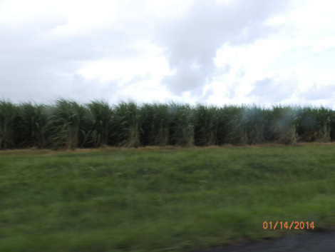
Sugar cane plantation along the James Cook Highway
The James Cook Highway is scenic offering spectacular views of the Coral Sea, offshore islands, and the Great Barrier Reef in the distance. We stopped at a viewing area called Rex, named after the government official who worked for years to get the highway through the Australian government authorities.
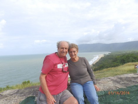
Returning to Cairns on the James Cook Highway
We enjoyed our time on the Daintree and in the national park. We had reached the most northeastern part of our Australian journey. In a couple of weeks, I’d travel thousands of kilometers across country to the most southwestern part of the continent, Perth in West Australia. What other adventures and beautiful scenery were awaiting me there?
* * * * *
Next: Diving on the Great Barrier Reef
We’re spending winter Down Under, returning to places we visited in ’12 and visiting new destinations. We look forward to your comments as we travel in Queensland, South Australia, and SW Australia on the Indian Ocean.
As many of you know, I also write mysteries and romantic suspense novels. I recently published my first international thriller, Thirteen Days in Milan, which is available on Kindle as well as other ereaders, tablets, and smartphones.
Please share links with writers or readers who might be interested.
http://www.jackerickson.com
Find my books in Apple’s iBookstore
At Barnes & Noble
At Amazon including # 1 Kindle best seller “Perfect Crime”
View my Smashwords profile:


January 28, 2014
Cruisin’ for ‘crocs’ on the Daintree
Cruising for ‘crocs on the Daintree
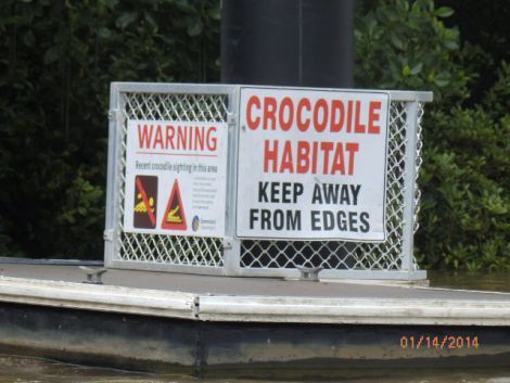
Don’t go near the water!
The Daintree River is one of Queensland’s most visited natural sites. It’s legendary for the ‘salties,’ salt-water crocodiles who cruise in the river and nest along the banks. Daintree crocs have been known to grab farm animals, wild animals, pets and even wandering tourists or boaters who make the fatal mistake of walking along the banks or wading in the river.
Dangerous salt water crocodiles
I read a story from a regional newspaper about a five-year old boy who was snatched by a croc on the Daintree in 2009 while his father and younger brother were nearby. His father jumped in theater immediately, but the croc had swum under water and disappeared. There were other stories I read in travel books and histories about other swimmers, waders, and hikers had also been victims of the wily creatures.
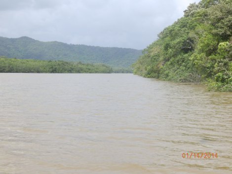
Rain-swollen Daintree River in Queensland wet tropics
Some of the crocodiles are huge, four meters even, and feed on everything within their reach including fish, snakes, shrimp, birds, sharks, mammals, and even smaller crocs in their territory. They’re cannibalistic and hunt where females nest. After croc eggs hatch, their mothers escort them down to the river bank into the water where they begin their treacherous existence. It’s estimated only one croc out of a nest of 50 eggs matures into an adult crocodile.
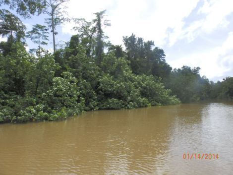
Mangroves along the Daintree
Taking a croc cruise on the Daintree entails a little bit of risk, especially in one of the smaller flat bottom boats that cruise the river from the dock near the car ferry which takes people and cars across to explore Daintree National Park, a lush tropical forest that extends all the way up York peninsula on the northern tip of Queensland across from New Guinea.
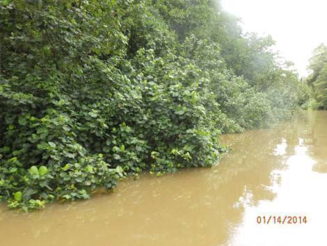
High water on the Daintree after heavy rains
Solar powered ‘croc’ boat
We boarded a small electric boat powered by solar panels operated by Solar Whisper near the town of Mossman. We were only about eight kilometers from the Coral Sea, the source of the salt water that flows up the estuary nearly the full length of the 120 kilometer long Daintree.
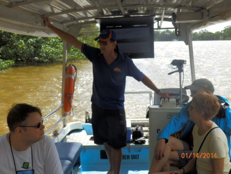
Jim, our knowledgeable guide and croc expert
Jim, our experienced guide, left an office job in Sydney to venture north and so he could work in one of Queensland’s natural treasures. After an introduction, Jim guided our small boat onto the Daintree, which was swollen from recent rains, three meters higher than normal. The water was muddy brown and the current fast, not the best conditions for spotting ‘crocs‘ on riverbanks or back in mangrove swamps.
Jim warned us of the dangers of being careless in this part of northern Queensland. Crocs nest in dense mangrove swamps, and cruise along the river almost invisible except for their beady eyes and tip of their snout. Is that a log floating by . . . or is it a hungry ‘salty?’
First Croc sighting
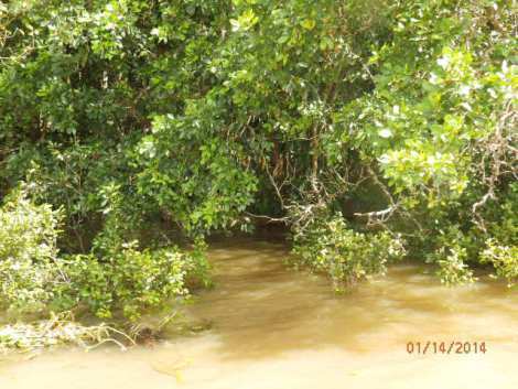
Approaching croc nest in mangrove swamp
After a half hour along the Daintree, Jim guided us into a narrow channel which circles a small mangrove island. He steered us into the mangroves, telling us a three meter long croc had been on the bank for the last few days, always in the same spot. We were in luck — we spotted him through heavy brush, but could only see his torso of brown and grey scales.
[image error]
January 16, 2014
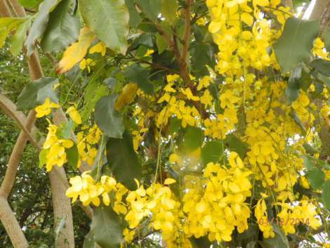
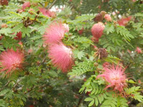
Kookaburra, kangaroo, cockatoo, and fur-headed flying foxes on Atherton tablelands
Kookaburra, kangaroo, cockatoo, and fur-headed flying foxes in Atherton Tablelands
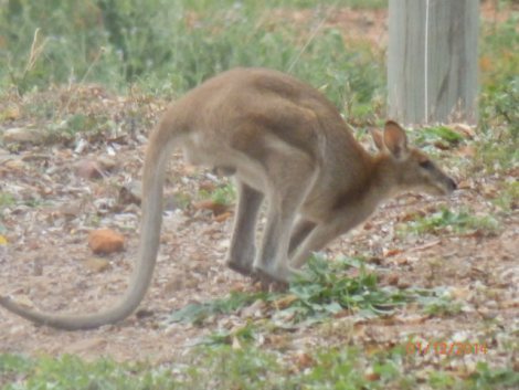
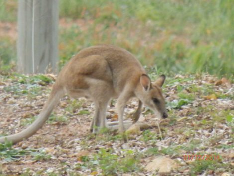
Mother kangaroo with joey in pouch
One of the main reasons we returned to Australia was to visit our friend, Heather, whom we first met in Scotland in 2011. While we were in Cairns with Heather in 2012, we had an adventurous two weeks diving, snorkeling, and beach combing on Fitzroy Island.
Cairns
Cairns is a charming town with four lane downtown streets divided by center islands of palm trees and tropical plants. We walked to the lagoons where the city has free public swimming pool on the bay. Every weekend in Cairns a farmers market in the center of town, merchants sell fresh produce grown in the Atherton tablelands — monkey bananas, mangos, papaya, tomatoes, passion fruit, dragon fruit, grapes, and lettuce.
Heather is a delightful, adventurous woman who loves to travel. She was in Berlin in August for her son, Warrick’s wedding. Her daughter, Shea, also lives in Berlin and was in the wedding.
Atherton tablelands
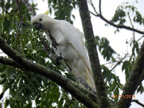
Cockatoo in Heather’s front yard
We only spent a day in Cairns so I could reserve a three-day diving trip on the Great Barrier Reef. Then we took off for Heather’s ‘miners cottage ‘ in Herberton in the ‘wet tropics’ Atherton tablelands. The tablelands is a lush tropical agricultural region with sugar cane, banana, mango and tea plantations.
Flora and fauna
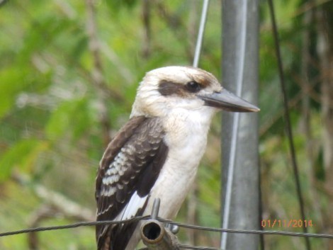
Laughing kookaburra on Heather’s clothes line
We love Heather’s tablelands retreat. Since our last visit, she had a new verandah built around the front and sides of her house with views of the mango, citrus, banana palms, and frangipani trees in her yard. frangipani produce the delicate, fragrant flowers used in Hawaiian leis.
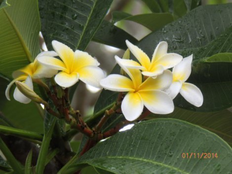
Fragrant frangipani blossoms
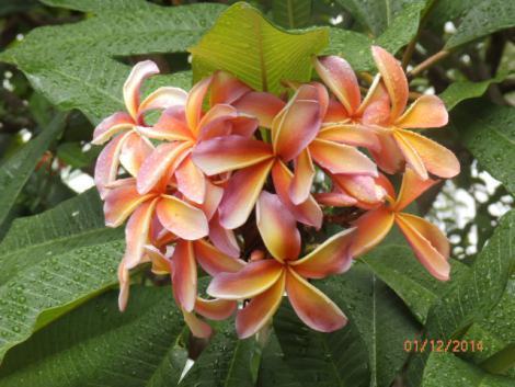
Rose-colored frangipani
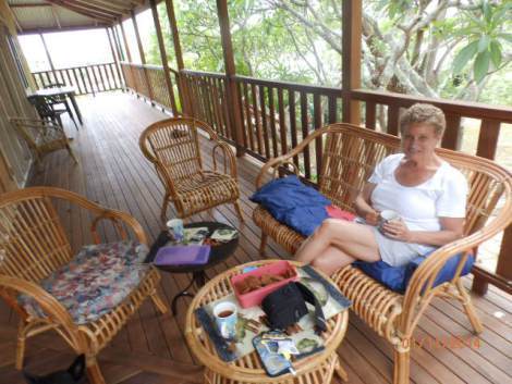
Lucy relaxing on Heather’s new verandah
One of the delights of the Atherton tablelands is the diverse and colorful flora and fauna. I spent three days photographing tropical trees, flowers, plants, birds, and even bats!
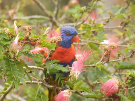
King parrots
On a morning walk into Herberton, I passed homes with beautiful flowering plants and trees in their yards. Sorry, I don’t know the plants’ names, but I’ll do a little research.
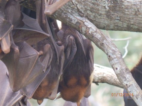
Fur-headed flying foxes
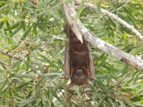
Roosting bats with pointed ears and beady yellow eyes
In November, a flock of fur-headed flying foxes, a species of bat, flew into Herberton settling on the Wild River riverbed on the edge of town. Within weeks, thousands showed up, roosting in trees, feeding on a flowery plant blooming in the area. The local newspaper reported that there are now hundreds of thousands of the nasty looking creatures screeching day and night, fouling the ground and river banks. Residents are upset and have appealed to shire officials demanding something be done. But the creatures are protected indigenous species.
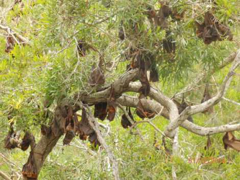
Roosting bats
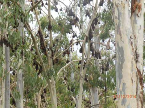
Roosting bats in stripped gum trees along Wild River
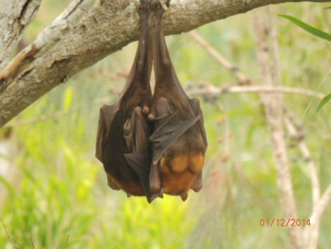
Menacing looking aren’t they?
After looking at those creatures, here’s are friendlier looking indigenous animals, a kangaroo and kookaburra we saw one afternoon visiting an old mining town, Irvinebank, near Herberton.
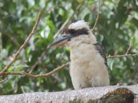
Kookaburra in Irvinebank
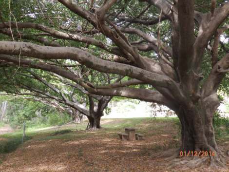
Grove of fig trees in Irvinebank park
Heather’s ‘miners cottage’
Much of our time in Herberton was spent walking around Heather’s yard and admiring her tropical trees, plants, and birds.
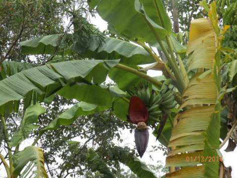
Banana palms
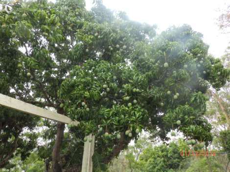
Mango trees in Heather’s yard
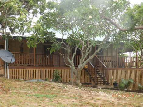
Verandah in shade of blooming frangipani trees
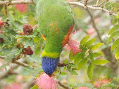
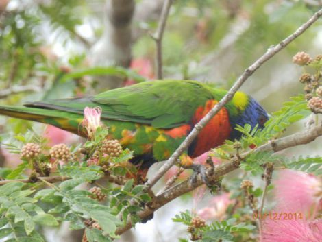
Parrot ‘diving’ to feed on pink flowers
* * * * *
Next: Croc cruising on Daintree River
We’re spending winter Down Under, returning to places we visited in ’12 and visiting new destinations. We look forward to your comments as we travel in Queensland, South Australia, and SW Australia on the Indian Ocean.
As many of you know, I also write mysteries and romantic suspense novels. I recently published my first international thriller, Thirteen Days in Milan, which is available on Kindle as well as other ereaders, tablets, and smartphones.
Please share links with writers or readers who might be interested.
http://www.jackerickson.com
Find my books in Apple’s iBookstore
At Barnes & Noble
At Amazon including # 1 Kindle best seller “Perfect Crime”
View my Smashwords profile:


January 15, 2014
Whitsundays
Whitsundays
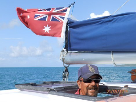
Skipper Joseph
The Whitsundays are a group of 74 islands and reefs on the Sunshine coast of Queensland, about 700 kilometers north of Brisbane. The Whitsundays are part of Great Barrier Reef which extends 1700 km north to the Torres Straits between York Peninsula and New Guinea.
We took the all-night Sunlander train from Maryborough north to Proserpine, a quaint little town which is a center for sugar cane processing. The area of the Sunshine coast is tropical with miles and miles of sugar cane fields and banana plantations, and a paddocks with Brahma beef cattle.The Sunlander is on old train that dates from the ’40’s, but Queensland Rail is inaugurating a new service Sunshine Coastal in October ’14 with modern trains and improved track beds. We took a commuter bus from the town of Proserpine to Airlie Beach, one of several picturesque towns and resorts along the coast with marinas for sailboats, catamarans, yachts, fishing vessels, and luxury party boats which cater to tourists who want to sail to the islands offshore.
Airlie Beach
A very helpful woman, Michelle, at the information center arranged a two night stay at a nice apartment in the hills looking over the Whitsunday Island about 5 kilometers from the beach.
Airlie Beach was a modest size tourist town with shops, bars, restaurants, hotels, and backpacker hostels. Traffic is very light through town making it a pleasant place to wander and stroll along the beach. Because of jellies offshore, the city built salt water lagoons for swimming and sunbathing.We had a day to explore Airlie Beach and I arrange a dive the next day. The weather was blistering hot, so we spent most of our day in the shade of gum trees along the lagoon.
Sunny Waters
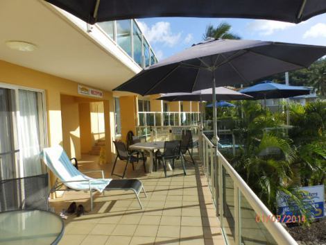
Sunlight Waters apartment
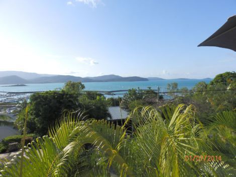
Whitsunday Island from our balcony
The Illusions
At the dive shop at the marina where I arranged a dive, the owner told a sad tale of how diving and boating had suffered the last few years with the economic downturn and doubling of gas prices. He sent me on the dock to meet the crew of the Illusions, captain Joseph, and first mate Naomi. The Illusions, a catamaran that caters to divers, snorkelers, and day trippers.
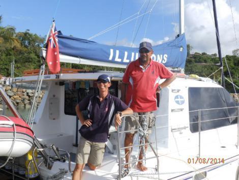
Skipper Joseph and first mate Naomi
Joseph is a Portugese-American from Woodland CA, who served two combat tours in Vietnam in 1967 – 1969. He took two R&R’s to Australia where he met his first wife. He left the Army after ten years and returned to Australia to become a dive instructor. He runs a modest operation without an office, but generates business from referrals from dive shops and the tourist centre which booked our apartment for two nights.
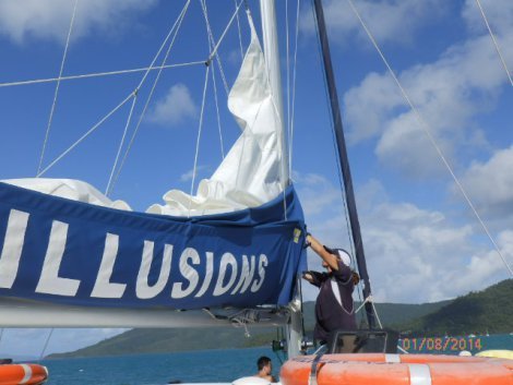
Naomi raising sail as we depart
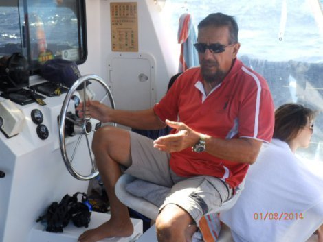
Skipper Joseph at the helm
I boarded the Illusions catamaran early the next morning and we launched at 8 AM for a two-hour trip to Blue Pearl Bay at Hayman Island. I was surprised that only one another certified diver was on the manifest, a young Dane, Rasmus, who had just finished a work/study semester at an Auckland hospital. Rasmus is a bright fellow, a bio-medical engineer, who served a combat tour in Afghanistan with Danish armed forces in 2007.
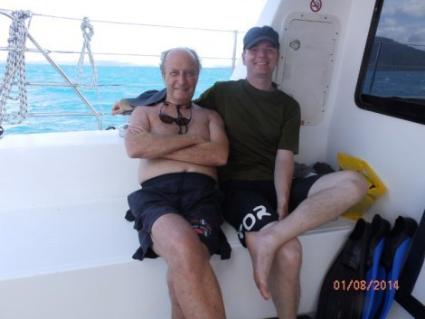
Danish Mate, Rasmus
Rasmus and I hit it off immediately and teamed up as dive ‘buddies’ which means when check out each other’s equipment and gear before diving and stay close under water.
Hayman Island
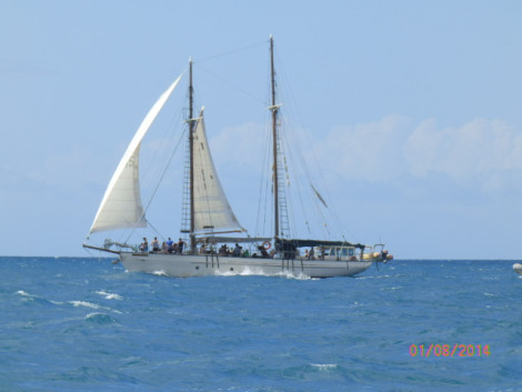
Luxury day sailer
When we anchored off Blue Pearl Bay, Naomi, Rasmus and I boarded a dingy and plunged backward into the water. Naomi had cautioned us that currents had created murky conditions. Our visibility was only about 5 meters through a faint greenish haze stirred up from the bottom. Nevertheless, we swam through narrow caverns and under coral shelves where the walls were only inches from us. We carefully navigated through the passages, occasionally hearing ‘pings’ when our tanks brushed the coral.
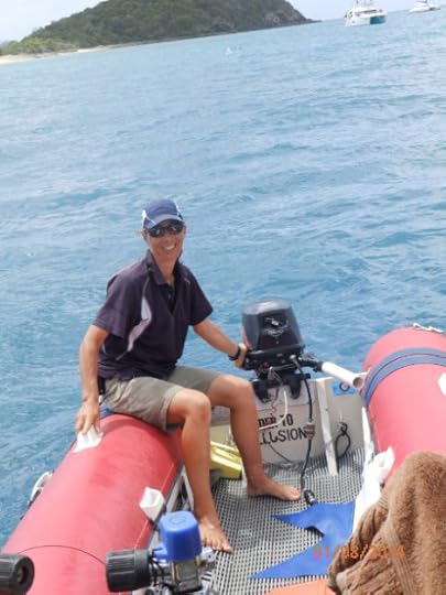
Naomi preparing dinghy for our dive
After our dive, we snorkeled near a Hayman beach while Naomi took first-time divers for their orientation dive. A squall came up, so I stayed in the water, snorkeling around coral and spotting colorful topical fish including green and blue parrot fish and schools of zebra fish.
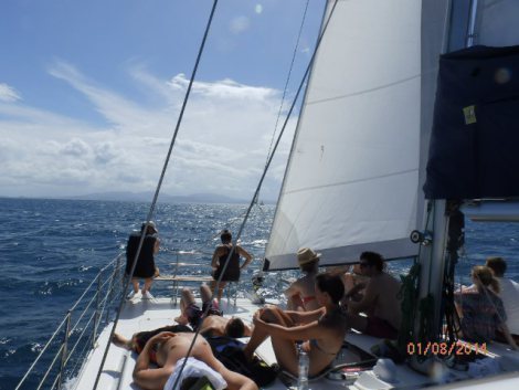
Sunbathers on Illusion’s deck
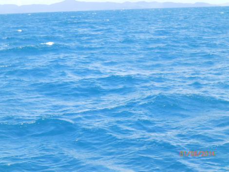
Emerald green Coral Sea
After a quick lunch onboard, we sailed to Langford Reef along a strip of sandy beach between two bays. Visibility was much clearer and we saw many colorful tropical fish and coral in shades of pink, bronze, yellow, and red. I dove down to brush my fingers over soft corral, anemones, and spongy tubular coral with delicate fronds.
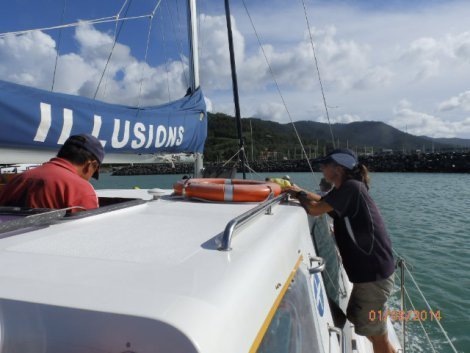
Naomi lowering sails as we return to Airline Beach
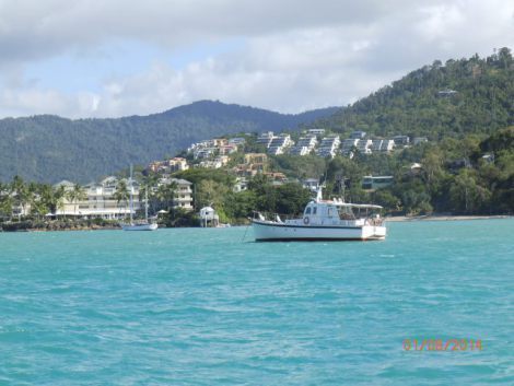
Returning to Airlie Beach
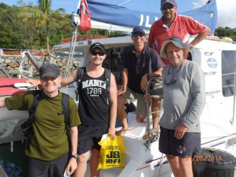
Crew and diving mates on the dock
Joseph, Rasmus and I bonded during out trip; we all had military service and had spirited discussions about politics and traveling. Rasmus and I agreed to stay in touch and exchanged email addresses. We might see each other again when we travel to Denmark this summer.
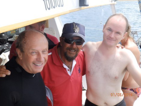
Mates on the Illusion
* * * * *
Next: Kookaburra, kangaroos, cockatoos, and fur-headed flying foxes on the Atherton tablelands
We’re spending winter Down Under, returning to places we visited in ’12 and visiting new destinations. We look forward to your comments as we travel in Queensland, South Australia, and SW Australia on the Indian Ocean.
As many of you know, I also write mysteries and romantic suspense novels. I recently published my first international thriller, Thirteen Days in Milan, which is available on Kindle as well as other ereaders, tablets, and smartphones.
Please share links with writers or readers who might be interested.
http://www.jackerickson.com
Find my books in Apple’s iBookstore
At Barnes & Noble
At Amazon including # 1 Kindle best seller “Perfect Crime”
View my Smashwords profile:


January 13, 2014
Fraser Island, Queensland
Fraser Island
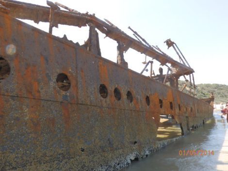
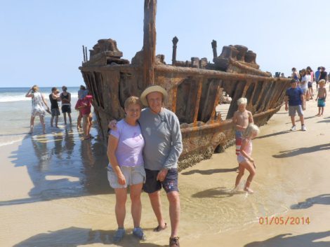
SS Maheno on Fraser Island
We began our four-day trek up the Sunshine Coast by taking a Queensland Rail Tilt train to Maryborough, 3 and a half hours north of Brisbane. Queensland’s Sunshine Coast is popular with tourists, divers, surfers, campers, and beach explorers. South of Brisbane is the flashier Gold Coast with high-rise condos, hotels, casinos, designer retail stores, and prices to match. We traveled 130 kilometers through bush, tropical gum forests, sugar cane fields, and paddocks. After arriving in Maryborough we transferred to a shuttle bus to Hervey Bay where we would begin a day tour of Fraser Island. The next morning, a bus picked us up at our beachfront apartment and drove us to a marina to boarded a ferry. There were about 200 tourists on the ferry as well as some 20 four-wheel drive tour buses and trucks. Four-wheel drive trucks are the only vehicles allowed on Fraser since all roads are deep sand. When we disembarked, we boarded a hybrid German-Australian tour bus, the largest 4 WD commercial vehicle in the world.
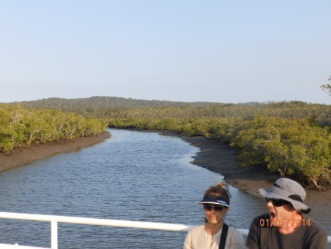
Mangrove swamp on Fraser Island west coast
Fraser Island is the largest sand island in the world, stretching 150 kilometers. Millions of years ago the island was connected to the Australian / Antarctica continent. When the oceans rose, the continents split apart and lowland between the island and mainland flooded. Mangrove swamps cover the entire west coast; the east coast is a 120 kilometer sandy beach. More than 100 fresh water lakes are located between high dunes created by winds. Heaths along the coast are composed of salt resistant species. Plant species survive from nutrients provided by a fungus. When the fungus dies, it leaches into the sand and provides food for the island’s tropical flora.
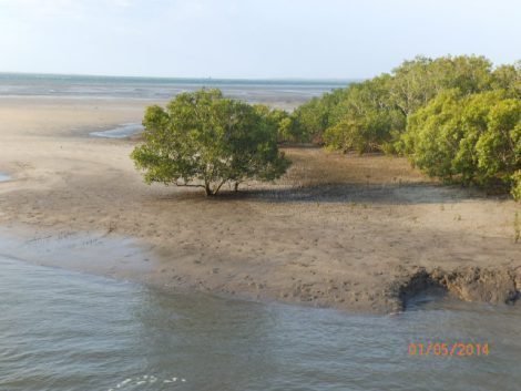
Low tide on west coast
Europeans discover Fraser Island
The first European to see Fraser Island was Captain James Cook who sailed along the coast in May, 1770. Cook spotted aboriginal natives watching them from a hill which was named Indian Hill. The first European to land on the island was Matthew Flinders who arrived in 1802. Flinders was the first European to circumnavigate Australia and to discover that Tasmania was an island. He also named Australia as a tribute to New Holland and New South Wales.
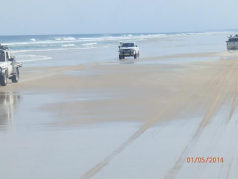
Beach highway on Fraser Island east coast
Eliza Fraser
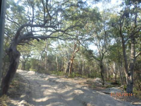
Sandy road through tropical scrub bush
Fraser Island was named after Captain James Frazer and his pregnant wife, Eliza Fraser. The Frasers’ ship, the Stirling Castle, was scuttled in 1836 on the Great Barrier Reef on a journey from Sidney to Singapore. The crew of 18 took lifeboats to try to reach Brisbane. Eliza Fraser gave birth on a leaking lifeboat, but her child died. The surviving lifeboat reached the island and next few months were harrowing; everyone except Eliza died of thirst, malnutrition, or disease. Eliza was a hostage of indigenous people until she was rescued by a convict who had seen her with the native people.
Arriving Fraser Island
We docked at a small marina, a cement ramp and sandy parking lot, on the west coast of Fraser Island. We boarded our tour bus and drove onto a sandy road through scrub brush and mangroves. The first few minutes on our bus were jolting, bouncing over the rough road while our driver and tour guide, Sean, began telling us about the history, geology, and habitat on the island. Our first destination was Central Station, the remains of an 19th century logging settlement when Fraser Island was first developed as a source of timber.
Logging and sand mining
The first logging of Fraser Island was begun in 1863 by an American Jack Piggott. The island was a source for rare species such as Kauri pine, blackbutt gum trees, and a hardy Satinay or Fraser Island Turpentine tree. The turpentine tree is fire-resistant and impervious to insects and were used in shipbuilding. Satinay logs were shipped to Egypt to line the Suez Canal and to England to build new docks in London after WW II. Logging was an active industry on the island until the Australian government canceled all export licenses in 1991.
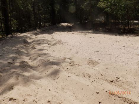
Fraser Island silica – miles and miles and miles of it
Fraser Island was also a source for silica used in construction. Several foreign and domestic companies mined silica from 1950 to 1977 until the government banned all mining for environmental reasons. Fraser Island was named a World Heritage Site in 1992; no trees or plants can now be taken off the island.
Central Station

Touring Central Station
Central Station is now just a few buildings and foundations of old settlement. Sean briefed us on the arduous history of loggers who cut down the trees, towed them over sand with mule trains to the coast, and bound them for towing to the mainland. Hard, dangerous work under strenuous conditions. Some workers didn’t return to the island after their first two weeks duty. Companies had to build homes for loggers and their families and provide basic amenities to maintain their industry. An interpretation display showed photos of rugged loggers doing the physically demanding chores of cutting the trees and transporting them to the mainland.
Kauri Pine
One of the trees is a Kauri pine, prized for its vertical grain. Shipping companies wanted Kauri pine to make masts for ocean going vessels. Other logs have a horizontal grain which can break in high winds and rough seas.
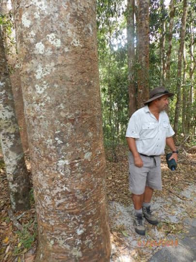
Guide and bus driver briefing us about the Kauri pine here
The Australian military chose the colors of the kauri pine to design camouflage uniforms for their troops stationed in Iraq and Afghanistan.
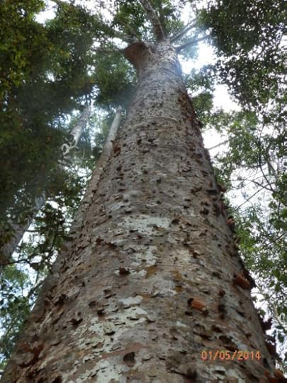
Kauri pine used in making ship masts
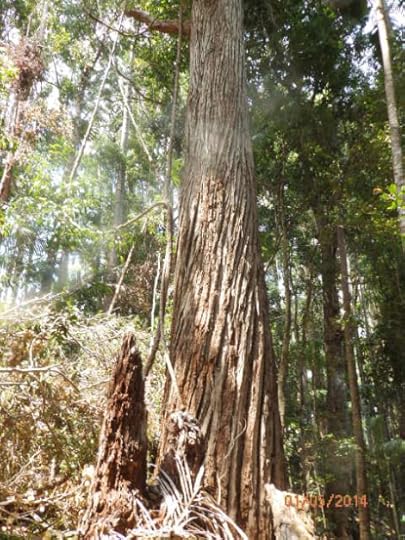
Satinay or turpentine tree
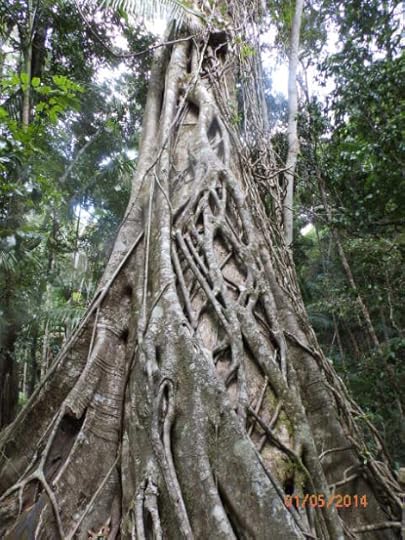
Curtain fig tree
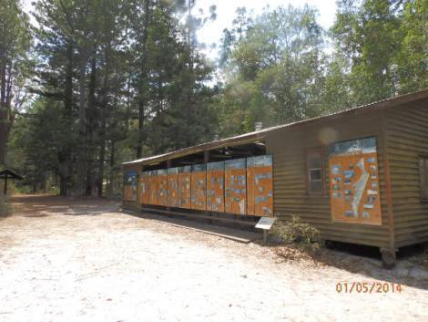
Historical display at Central station
Lake Mackenzie
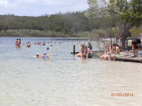
Fresh water perched Lake Mackenzie
Our next destination was Lake Mackenzie, a fresh water perched lake which means the bottom is sealed by rotting vegetation preventing water from draining into sand. We had a half hour to cool off in the sweltering heat.
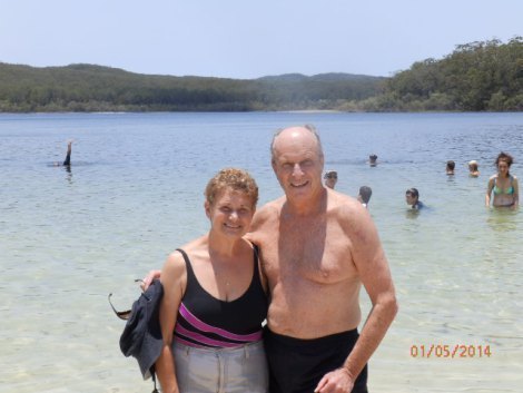
Still pale, but wearing sunscreen and wearing hats most of the time
Dingo Tails
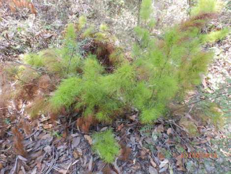
Dingo tails
Near Lake mackenzie, Sean pointed out an interesting plant, dingo tales, which are gathered and shipped to florists for making arrangements. The dingo tails were soft as I brushed my hand over them.
Urong
After three hours driving over rough sandy roads through thick tropical vegetation, we finally emerged from 24 kilometers of thick tropical vegetation, we finally reached the Pacific Ocean, stopping at a beach resort, Urong. After a buffet lunch and cold beer, we boarded our bus to drive on the first hard surface road on the island, the wide sandy beach. The 75 mile long beach ‘highway‘ consisted of tour buses and four-wheel drive trucks cruising at 80 KPH along the hard surface.
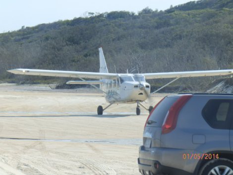
7-passenger planes offering aerial tours over Fraser Island
An airline company uses the beach as a landing strip to provide tourists with 15 minute flights over Fraser island. We saw two planes taking off, landing, and flying over the sandblow dunes, circling over the ocean providing aerial views of Fraser Island and the mainland.
Pinnacles
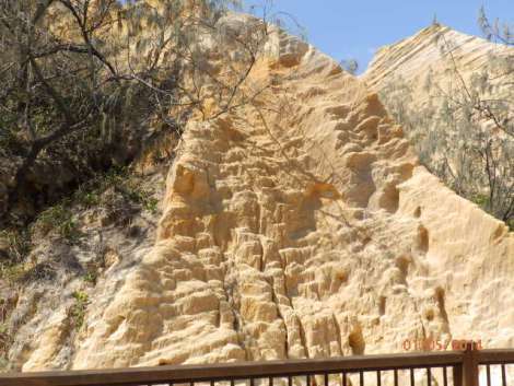
Pinnacles gorge
We made three stops driving north on the beach highway. The northern most point was Pinnacles, a narrow gorge with exposed ochre sandstone that indigenous Australians used to paint their bodies. 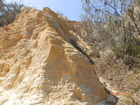 We had been warned numerous times about dingoes on Fraser Island. They are a pure breed with having any trace of wild dog in their DNA. Within the last few years, there have been a few reports of dingoes attacking tourists and campers. There are only about 200 dingoes left on Fraser Island but we didn’t see one. Nevertheless, signs warned not to approach them if spotted.
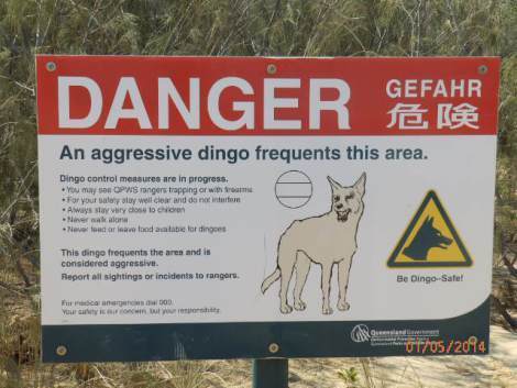
Dingo warning sign at Pinnacles
SS Maheno
We headed back south to view the rusted remains of a Scottish ship, the SS Maheno, firmly beached in the hard sand. The 5,000 ton, steel-hulled Maheno was built as a luxury passenger ship in 1905 and was commissioned into the Australian Navy as a hospital ship for transporting wounded Australian solders during WW I.
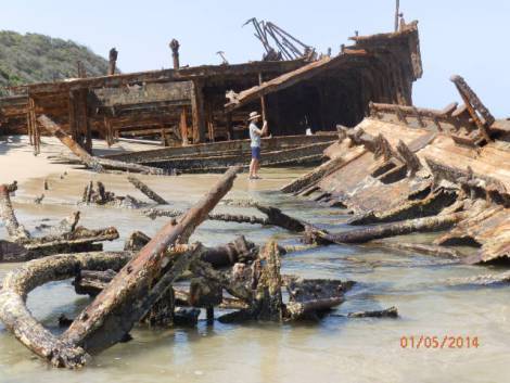
Wreck of the SS Maheno
After the war, the ship was sold to Japanese scrap metal merchant and was being towed to Osaka in 1934 when it was caught in a cyclone. The tow line broke 80 kilometers off the Queensland coast and drifted ashore at Fraser Island. Despite repeated attempts to return the Maheno to the sea, the Japanese striped equipment and brass, stranding it on the coast.
The Maheno was used as a bombing target by the Royal Australian Air Force during World War II and more recently was by Australian commandoes for planting mines.

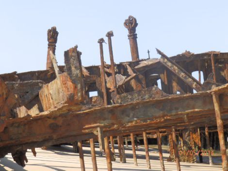
Rusty deck of the Maheno
More than three quarters of the SS Maheno is buried under sand.
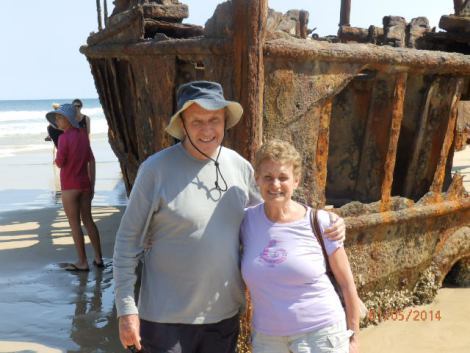
No sailing today on the Maheno
Long days journey back to the marina
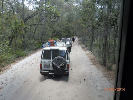
Caravan back to marina
After spending two hours cruising the beach ‘highway,’ we returned south to Urong to get on the road back to the marina. We’d already driven over the bone-jarring sandy roads, bouncing over steep holes and ruts, thankfully restrained by seat belts. We’d been jostled constantly when our sturdy bus slammed into holes or deep ruts.
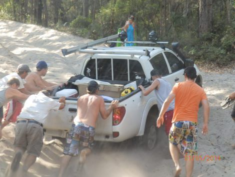
Pesky smaller 4WD bogged in the sand
The arduous return trip was made more frustrating by small Suzukis and Toyota 4WDs bogged down in the sand ahead of us. Our driver, Sean, and other drivers had to get out of their vehicles to push smaller trucks to the side so we could pass.
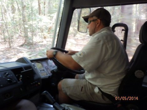
Sean, our seasoned, sturdy and all around good fellow guide.
But Sean kept us entertained, spinning tales of life on Fraser Island by loggers, explorers, tourists, scientists, and adventure travelers. After a twelve hour day, Sean would be back tomorrow to take another bus load of tourists for an action packed and bone-jarring visit to Fraser Island.
* * * * *
Next: Whitsundays
We’re spending winter Down Under, returning to places we visited in ’12 and visiting new destinations. We look forward to your comments as we travel in Queensland, South Australia, and SW Australia on the Indian Ocean.
As many of you know, I also write mysteries and romantic suspense novels. I recently published my first international thriller, Thirteen Days in Milan, which is available on Kindle as well as other ereaders, tablets, and smartphones.
Please share links with writers or readers who might be interested.
http://www.jackerickson.com
Find my books in Apple’s iBookstore
At Barnes & Noble
At Amazon including # 1 Kindle best seller “Perfect Crime”
View my Smashwords profile:


January 12, 2014
Brisbane Walkabout
Brisbane
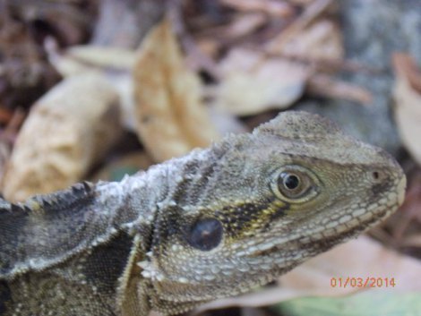
Goanna in Brisbane’s Botanical Garden
Brisbane is an attractive, stress free, and friendly city where we began our months long journey across Australia. The Brisbane River winds through the city, the capital of Queensland on Australia’s NE coast 14 miles from the Pacific Ocean. The city has a modern and classy appearance with high-rise office buildings in city center and modern suburban apartments and homes with impressive views of Brisbane’s skyline.
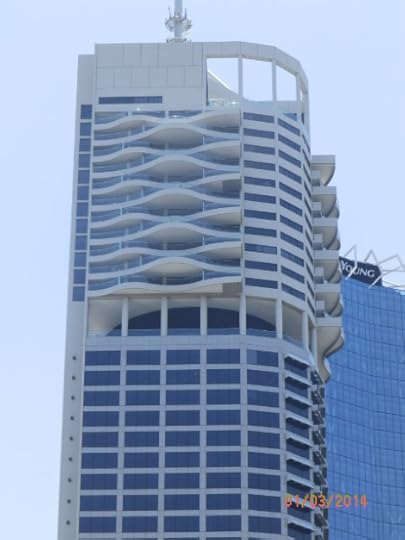
High-rise office building in Brisbane financial center
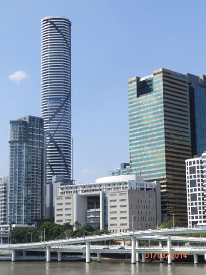
Brisbane skyline
We’d booked a quaint B&B, Annie’s Sheldon Inn, which proved to be ideal; located in center city, across from a bus stop with free service, and a ten minute walk to Queen Street Mall, a busy pedestrian mall that stretches from City Hall to the Victoria Bridge over the Brisbane River.
Bats falling from the sky
Australia was in the midst of a blistering heat wave when we arrived the first week in January. The papers and TV reported mid 40 C (110 F) temperatures across the nation, with the hottest locations in South Australia with temperature reaching 48.6 degrees C (128 F). The heat was so oppressive, bats were falling out of the sky. One town was left with the unenviable job of having city workers scoop dead bats into plastic bags and deposit in containers for disposal (burial? incineration?).
The kitten sized bats, which are protected indigenous animals, are Fur Headed Flying Foxes. They swoop through the air and roost in trees, hanging upside down, screeching like banshees, flapping their wings to keep cool. On earlier trips, we had seen flying foxes hanging from bare branches they’d stripped for food. They leave messes in parks, on sidewalks and cars and are generally considered pests. Quite nasty looking, actually.
Botanical Garden
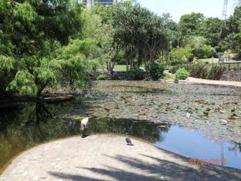
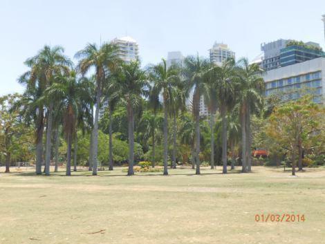
Brisbane Botanical Garden
After orienting on free inner city buses and ferry for a couple of days, we ventured out to explore the city. It was a sweltering 41 degrees C, and most people were huddled in air-conditioned buildings or sweating in the shade in parks. We walked 30 minutes in the stifling heat to the Botanical Garden along a bend in the Brisbane River.
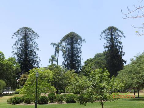
Bunya pines at Botanical Garden
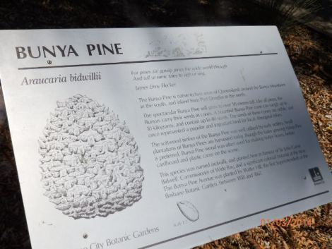
Bunya pine description
We leisurely strolled past lagoons, ponds, and groves of tropical plants, flowers, and trees.
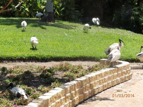
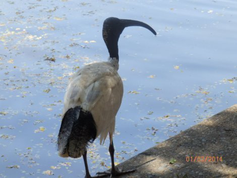
Ibis
The gardens are home to heron-like white ibis with black heads and tails and curved black bills. Ibis are interesting, ancient looking birds like something you’d see carved on Egyptian temples or tombs.
Goanna on the trail
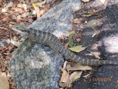
Don’t move or I’ll crawl up your leg
We came upon a goanna along a wooded path, who looked like he was deciding if he was going to dash into the bushes or let us pass. We tip toed around him; he didn’t move, but stared at us with steely eyes.
The Botanical Garden ends in a mangrove trees along the Brisbane River.
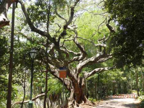
Edge of mangroves on Brisbane River
South Bank Parklands
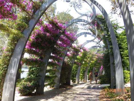
South Parklands gardens
We picked up the free ferry at Riverside Center near the financial center with outdoor cafes, bars and restaurants on the river bank. The ferry took us to the South Bank Parklands, a pleasant place to stroll and enjoy views of the city across the river. The parklands feature flowering gardens, ponds, sandy beached swimming lagoons, and winding walkways shaded with flowering bougainvillea.
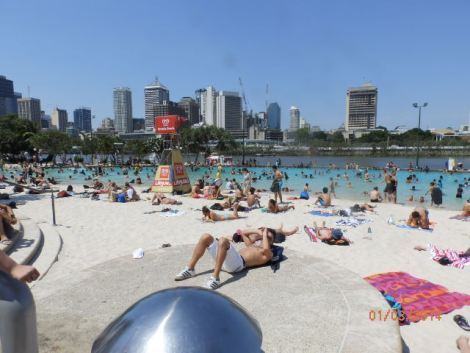
Swimming lagoon at South Bank Parklands
Nepalese Pagoda
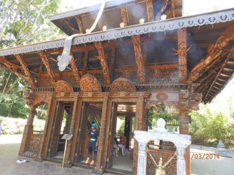
Nepalese Pagoda
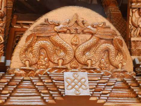
One of the most attractive sites at South Bank was the Nepalese garden with wooden walkways across ponds that led to a teak Nepalese Pagoda. The pagoda was a spiritual center with an open-air medication room, ceremonial bell and beautiful carvings on walls, doors, and pillars.
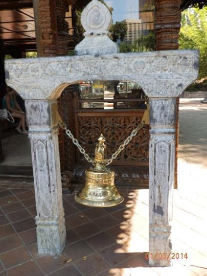
Ceremonial bell at Nepalese Pagoda
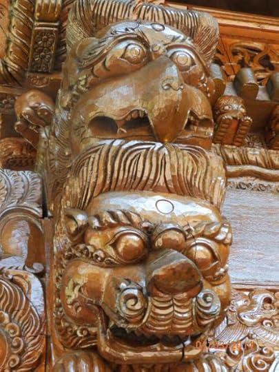
Carvings on Nepalese pagoda
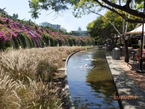
South Bank Parklands
A prominent landmark in the Parklands is the Brisbane Wheel, a giant ferris wheel near Victoria bridge and the city’s cultural center.

Brisbane Wheel
The complex has several attractive buildings with theaters for performing arts, a museum, art gallery, and state library. The cultural center was very impressive. Admission was free. We wandered through the museum which had interesting exhibits about Queensland history and culture, and most importantly, it was air conditioned!
Water Dragons
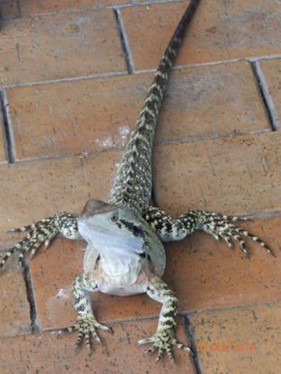
Water dragon
While we were enjoying lunch at an outdoor Italian cafe, water dragons lurked nearby to see if we would drop crumbs. Steely eyed like the goanna, they stared at us blankly, still, until I dropped bits of mushroom, onion, or green pepper from our pizza. They gobbled them up but didn’t blink at pizza crusts however, picky fellows.
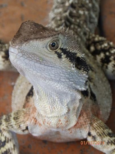
Steely-eyed fellow
Friendly blokes
People in Brisbane were friendly and helpful, from the bus driver who dropped us at the door of our B & B to the host and hostess, Ruben and Gloria, and a delightful British chap, Rod Crane, who charmed us with tales of his adventurous travels, biking and swaging (sleeping on a bedroll with no tent) all over Australia, including the remote Northern Territories and York peninsula in northern Queensland. Rod has taken a camel caravan across the Sahara with a band of Berbers, and sailed on freighters and fishing boats on the south Pacific. He travels very light, one small bag with a aluminum bike, and a backpack.
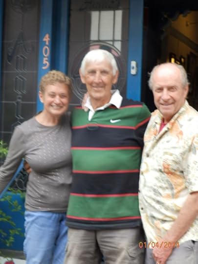
British friend, Rod Crane, adventure traveler
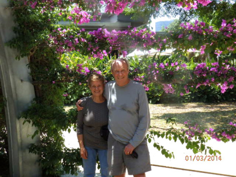
How hot is it, Lucy?
* * * * *
Next: Fraser Island on Queensland’s Sunshine Coast
We’re spending winter Down Under, returning to places we visited in ’12 and visiting new destinations. We look forward to your comments as we travel in Queensland, South Australia, and SW Australia on the Indian Ocean.
As many of you know, I also write mysteries and romantic suspense novels. I recently published my first international thriller, Thirteen Days in Milan, which is available on Kindle as well as other ereaders, tablets, and smartphones.
Please share links with writers or readers who might be interested.
http://www.jackerickson.com
Find my books in Apple’s iBookstore
At Barnes & Noble
At Amazon including # 1 Kindle best seller “Perfect Crime”
View my Smashwords profile:


October 19, 2013
Trento
Trento
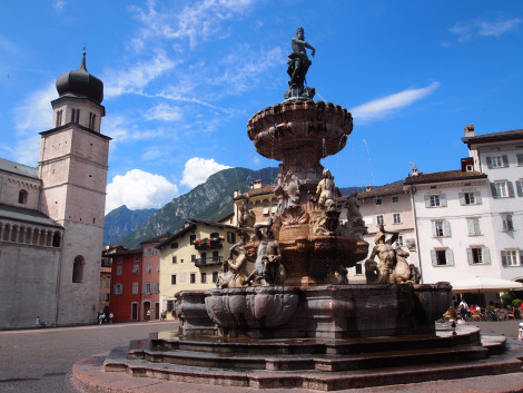
Fountain in Trentino Piazza
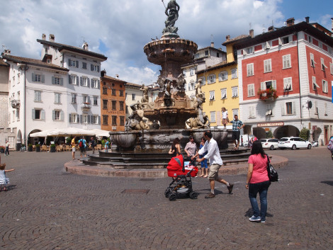
Piazza in Trento old city
We began our journey to Italy, taking a morning train from Friedrichshafen to Munich where we changed trains to travel through Austria, stopping in Innsbruck. Our journey took us through the historic Brenner Pass in the Alps known as the Dolomites. We crossed the border into Italy at Bolzano where the narrow valley widened into a landscape of lush pastures with grazing dairy cattle, small villages, farms, and vineyards. The pastoral settings were enhanced by sheer granite walls of Alpine mountains.
Brenner Pass
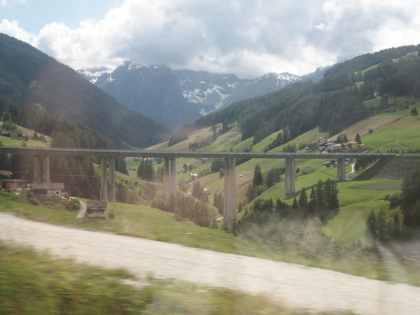
Europabrucke, (The European bridge), is an 820-meter long, six-lane concrete bridge 150 meters over the Sill River just north of the Brenner Pass
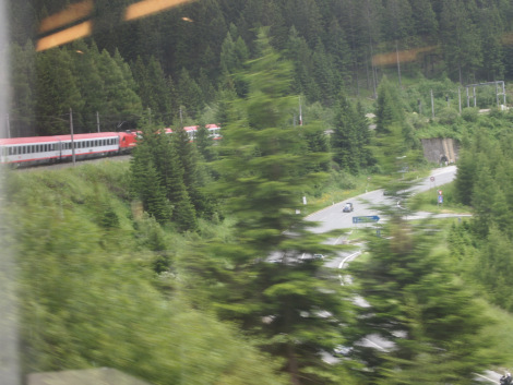
Train through Brenner Pass
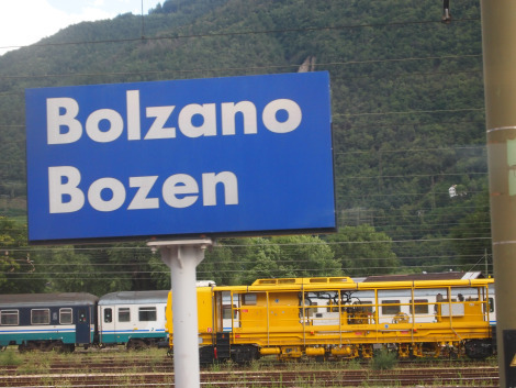
Bolzano at Austrian and Italian border
Early Romans began traveling along crude mule trails though the Alps to reach central Europe in the second Century AD. The route became known as the Brenner Pass named after a local farm.
The first carriage road through the Alps was built during the reign of Austrian Empress Maria Theresa in 1777. In 1867, the Brenner railway was laid. Adolf Hitler and Benito Mussolini met here in 1940 to sign the Pact of Steel uniting the two fascist dictatorships.
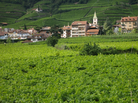
Italian vineyards and village in Alpine Brenner Pass
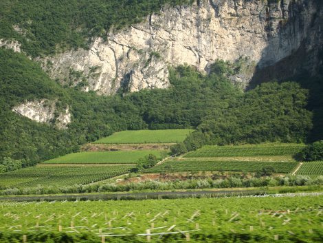
Brenner Pass in Italian Dolomites
Trento’s old city
We were fortunate to have booked a room at a hotel that was a short walk from the train station. The hotel was also a central location to explore the old city and walk along the Adige River. The old city was a network of winding cobblestone streets, many of which end at the central piazza with a fountain, the Duomo, and the Diocesan museum.
Diocesan Museum
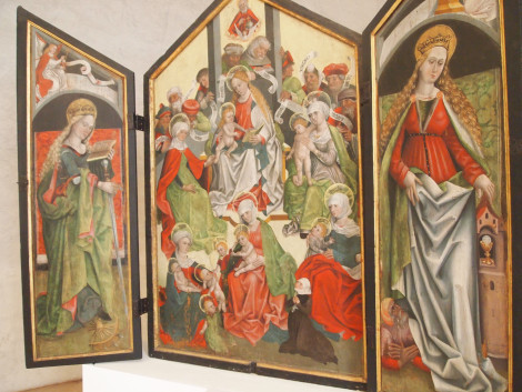
triptych from Diocesan Museum
We visited the Diocesan Museum attached to the Duomo where the Council of Trent convened. The Council was a series of meetings called by Pope Paul III from 1545-1563 to deal with religious issues arising from the Protestant Reformation. More than 700 bishops, mostly from Italy met in Trent for eighteen years. The museum was formerly known as Palazzo Pretorio where the bishops of Trent lived during the Middle Ages.
The museum has an impressive collection of religious paintings — many of the various Councils of Trent — altarpieces, religious manuscripts, relics, vestments, and art gathered from medieval Catholic churches in the region which have closed.

Altarpiece from Diocesan museum
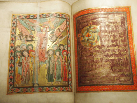
Religious manuscript from Diocesan archives
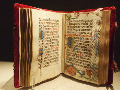
Medieval bible in Diocesan archive
Council of Trent
More than 25 sessions were called in the Council of Trent from 1545-1563. Political and religious disruptions interrupted the sessions as controversies plagued the ecumenical gatherings.
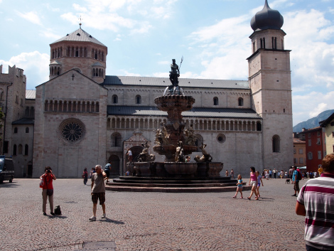
Trento Duomo where Councils of Trent was held in the 16th century
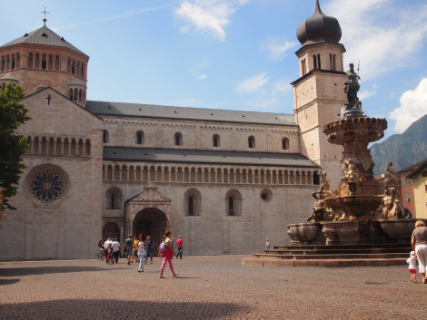
Trento Duomo

Painting of Council of Trent
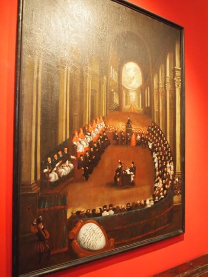
Council of Trent in 16th century
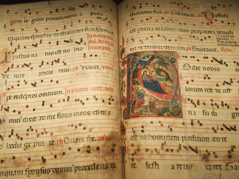
Religious manuscript in Diocesan archive
In the Diocesan museum basement were ruins of a first century BC Roman town, Tridentum. The ruins were discovered in 1920s when workers were repairing sewers. The ancient Roman stonework was impressive and durable, especially a burnished red flagstone that was likely a fragment of a centuries old street.
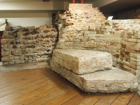
Recovered Roman ruins
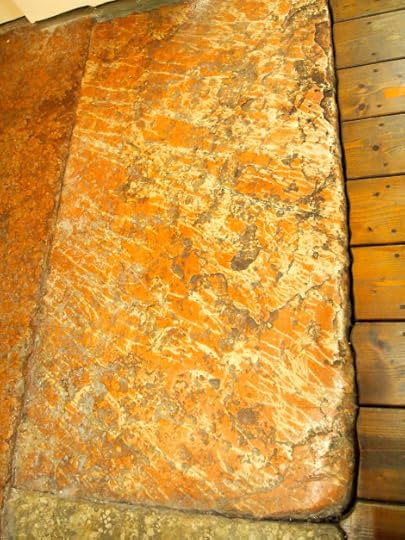
Red marble flagstone from Roman ruins

Background on ancient Roman village
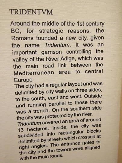
History of Tridentum
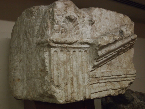
Partial ruins from Tridentum
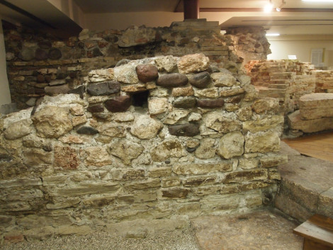
Tridentum ruins
We thoroughly enjoyed our introduction to Trento and wandering the narrow streets throughout the old city. But we were here to explore more of this region, especially villages and towns that look down on Trento from the Dolomite mountains.
* * * * * *
Next: Dolomites
I recently published my first international thriller, Thirteen Days in Milan, which is available on
October 17, 2013
Rhine Falls
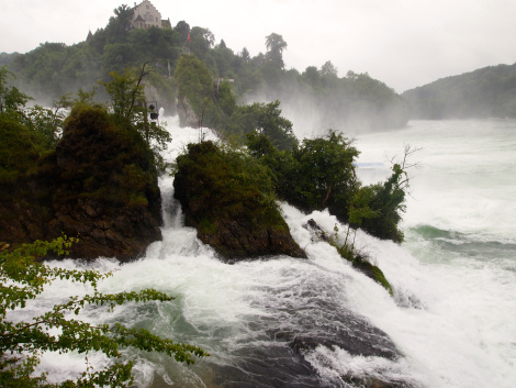
Rhein Falls
The weather was unsettling the first few days we were in Friedrichshafen. But we wanted a little adventure after a couple of days inside. We decided to take a day trip which meant spending most of the day on three local German and Swiss trains to Rhine Falls. We’d heard and read about the falls which we hadn’t visited on earlier trips to Friedrichshafen where our Germany family live.
It rained most of the hour and a half and two train changes to reach Schaffhausen, a northern Swiss town which is virtually surrounded by Germany on the north, east, and west. where the upper Rhine flows and spills over cascading rocks into a lagoon.
The weather was still challenging, but we got a break of an hour or so to walk down road to viewing point to the falls which is in a quiet neighborhood of shops, pubs, and apartments. We followed signs that took us down a steep, hilly road where we could hear the roar of the falls even before seeing the river. We turned a corner, and there it was, churning, foamy water rushing between rocky banks about a hundred meters across.
Three Tiers of Rhine Falls
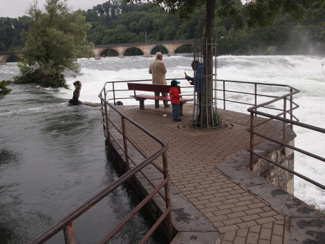
Upper level observation deck
We had seen the Rhine River before, where it is flows gently with a moderate current and is a principal means of transportation for travelers and shipping. But the Rhine becomes more dramatic at the falls, descending as it flowed under a railroad bridge then rushing toward the falls and plunging into a lagoon before resuming to it’s more placid pace.
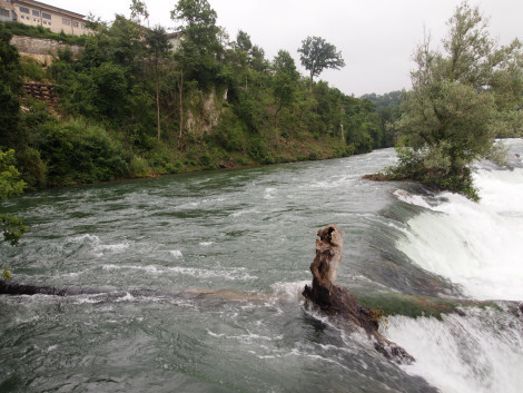
Gentle channel at upper tier
It seemed to have three tiers: upper slow-moving, rushing middle tier, then plunging dramatically to the lower tier into a lagoon.
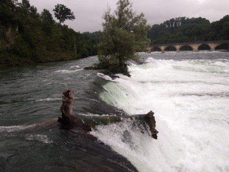
Gentle upper tier spills into rushing current before the falls
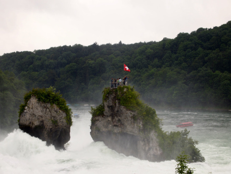
Twin rocky spires
Across the channel two rocky spires jutted up from the rain-swollen Rhine. No doubt created by centuries of erosion from rushing water which carved out sentinels from the rocky riverbank. Looking closer, we could see intrepid hikers who had somehow reached the pinnacle of the sentinels.
A Swiss flag was whipping in the wind, with a few hardy souls braving the weather and danger behind a fence. I have no idea how they got there, but it had to be from the opposite side of the Rhine where we were observing. On our side, the thundering currents were too dangerous to consider getting too close to the river. But I was curious, would I have climbed stairs to see the falls from a windy, raining precipice? There must have been a tunnel under the river on the other side that took the adventurous to stairs to the pinnacle. Even in the mists, there was no sign of a bridge from the river bank.
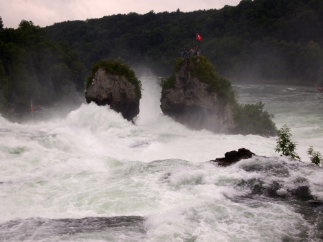
Rocky sentinels in the mists
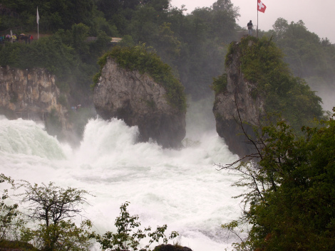
Lone hardy soul capturing a life-long memory

Middle tier

Lower tier
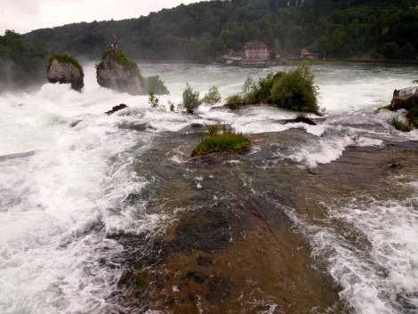
Turbulent falls plunge into lagoon
Tour boats in the mists
A tour boat service was taking tourists up the channel for an up-and-close experience. The boats slowly made their way until they cruised into the falls mists, disappearing from view from our vantage point. They remained a minute, then slowly reversed course and emerged from the falls.
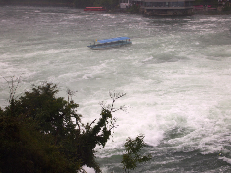
Covered tour boat in the mist
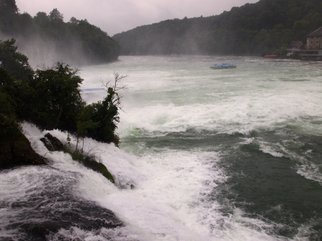
Tour boat approaching the falls
Rhine Falls Park
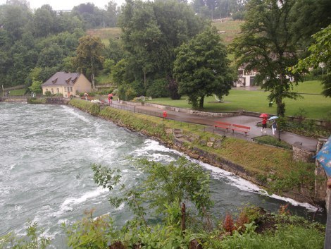
Peaceful cove and park below the falls
The backwash from the falls flowed into a cove with a small park and path to view the falls from ground level. Walkers were carrying umbrellas as the mists fell in a gentle rain.
Churning debris
The plunging falls created dangerous currents that rolled over each other in a whirlpool. Branches, debris and soccer balls were endlessly churning in the whirlpool, never breaking away and floating down the river.
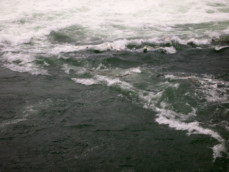
Soccer balls churning in the current
Damp, wind-blown tourists
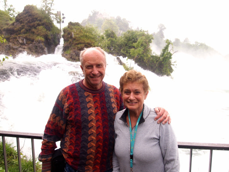
Braving Rhine Falls without an umbrella
* * * * *
Next: Trento
I recently published my first international thriller, Thirteen Days in Milan, which is available on
July 19, 2013
Murten
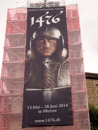
Banner promoting next year’s celebration of Swiss defeat of Charles the Bold in 1476 at the Battle of Murten
I love excursions to interesting places that have a history of restoration and preservation. After an educational trip to Spiez, I wanted to see more of Swiss medieval history.
Murten was recommended, a town near the French border where there had been a famous battle in 1476 against the French. I hopped a train in Bern to Murten just a few kilometers from Interlaken.
Murten is modern Swiss town which has done a marvelous job preserving the historic ‘aldstadt’ on a hill looking over Murtensee. Across the lake were the Vully hillside vineyards bordering France. In Murten, I heard more French spoken than Swiss German.
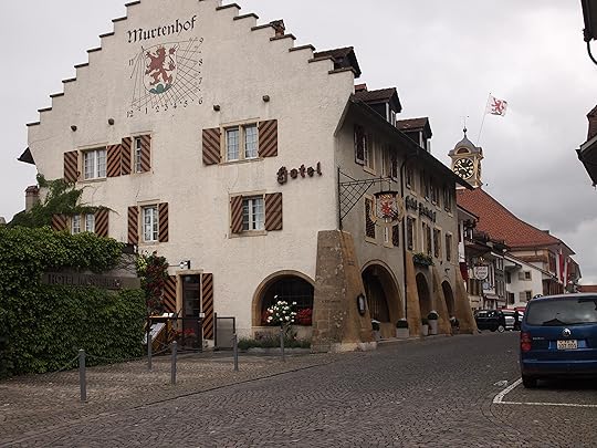
Rathausgasse leading into Murten aldstadt
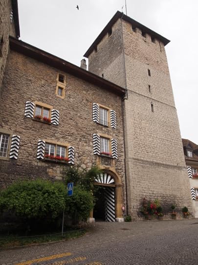
Murten castle, now offices for the canton of Fribourg prefecture

Hauptgasse with banners commemorating 1476 victory against Charles the Bold
Medieval Murten is a walled city, with towers, ramparts, cobblestone streets, arched gates, and moat preserved for tourists. Berntor was one of two entrances into the medieval town.

Berntor gate into aldstadt
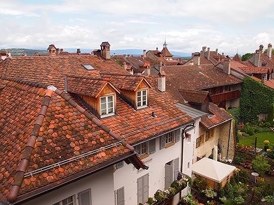
Rooftops of Murten

Murten roof tops
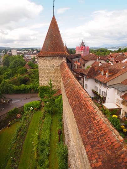
I saw Murten from various viewpoints, strolling along the three long gasses (streets) through the aldstadt, on the bluff overlooking Murtensee, and, my most favorite venue, from the ramparts and towers along the stone walls.
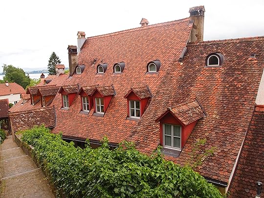
The rooftops of Murten were especially attractive, reddish tiles on slanted roofs, no doubt because of heavy snowfall during Swiss winters. It almost seemed that architects competed to design the most esthetically appealing rooftops. What do you think?
View from the ramparts
After walking the Rathausgasse, I followed a path along the walls to a narrow staircase that led to towers and ramparts overlooking the town and countryside . I climbed steep and winding stairs, reaching a narrow walkway along the ramparts. Every few feet, there were narrow openings to look over the countryside.
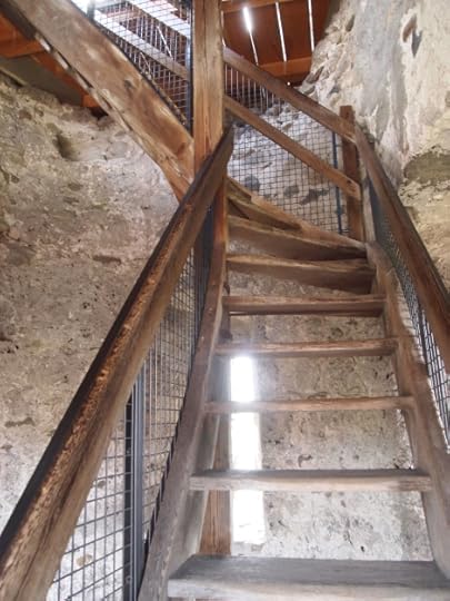
Wooden stairs leading to ramparts
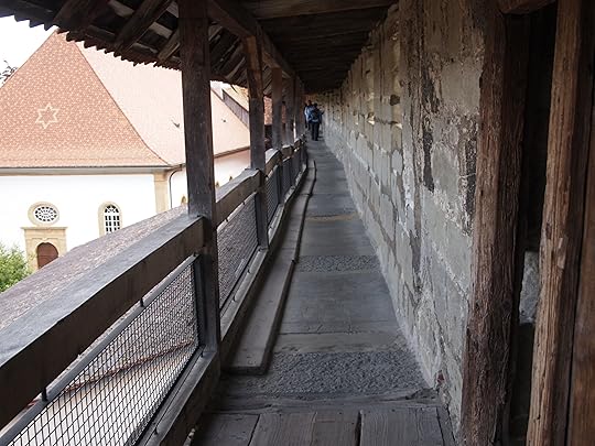
Narrow wooden walkway along Murten ramparts
Imagine in medieval days, sentries would stand guard at the ramparts to watch for possible invaders. Centuries later, tourists can peer through narrow keyhole gaps in the stone walls to admire the peaceful town of Murten and the lush landscape.

Keyhole view of catholic church from tower
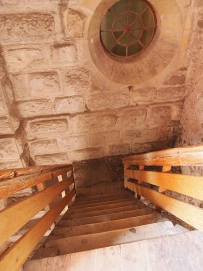
Descending wooden steps. Watch your step and both hands on the railing!
Battle of 1476
Murten’s most famous event in history was the Battle of Murten fought on June 22, 1476. On that day, Swiss Confederates defeated Charles the Bold of Burgundy who was trying to consolidate his holdings that stretched from the North Sea to the Mediterranean. The biggest obstacle to Charles’ army was Murten on the French border.
Today, memorials and plaques commemorate the Swiss victory over the French. I was in Murten days after the annual celebration and there were still banners, wilting floral bouquets, barricades, and signs from the recent celebration.
A banner announced the next anniversary. They even have a website with history of the battle and events planned for next years commemoration.
French, German, and Swiss churches
Switzerland was the crossroads during the Reformation and counter Reformation of the 16th & 17th centuries. Today, that religious struggle is evident in the presence of Swiss catholic, German protestant, and French catholic churches in Murten.

German Lutheran church in Murten

French catholic church on bluff overlooking Murtensee
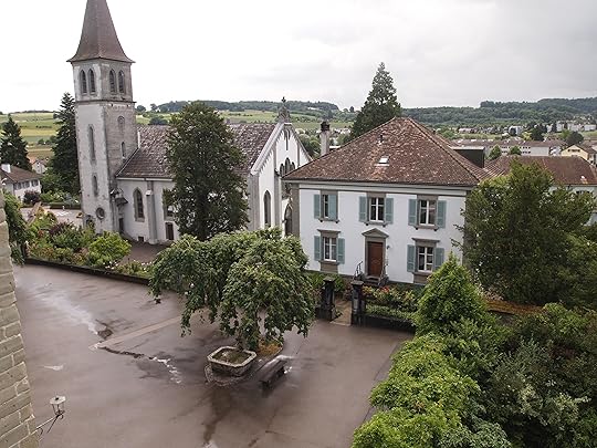
Swiss catholic church from ramparts
Murten’s Moat
Like most medieval castles, a moat around Murten provided a line of defense against invaders. A small section of that moat has been preserved.

Preserved moat along Murten wall and tower
The moat around Murten’s walled ‘aldstadt’ had been filled in over the centuries and replaced with small gardens, possibly given out by the city. Plots were planted in flowers, vegetables, fruit trees, grape vines, and lawns.
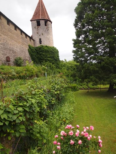
Moat turned into community gardens
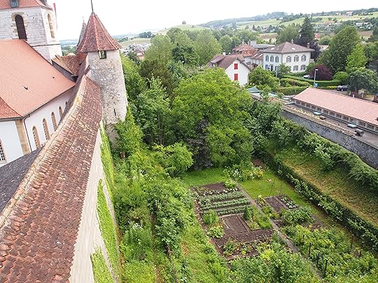
Community gardens replace moat
Crawling up from the lush area were vines that encircled tower ramparts. Modern day invaders in a way, but pleasant to see, like something you’d see in a book cover of a medieval fantasy novel.
A narrow asphalt path around the moat allowed one to peak between shrubs and fences to see the gardens. Anyone in Murten who has a plot seemed to put energy into their plot of medieval history. Wouldn’t you if you had a garden along the ramparts of a centuries old castle?
Favorite view
My fondest memories of Murten were views from the ramparts looking over the town, the countryside, lake, and the colorful rooftops.
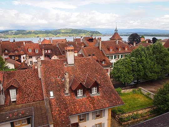
Favorite memory of Murten
* * * *
Next: Rhine Falls
We like to read your comments. Please share with us and other readers.
I recently published my first international thriller, Thirteen Days in Milan, which is available on Kindle as well as other ereaders, tablets, and smartphones.
I’m back in Europe for the summer to hire a translator and to research my next book which will also be a thriller based in Milan. I’ll be posting along the way from Italy, Germany, Austria, and Switzerland.
I have a few posts on another blog, Anatomy of a Thriller, where I write about the process of researching and writing an international thriller. I’ll add more posts there as well.
Please share these links with writers or readers who might be interested.
http://www.jackerickson.com
Find my books in Apple’s iBookstore
At Barnes & Noble
At Amazon including # 1 Kindle best seller “Perfect Crime”
View my Smashwords profile:


July 13, 2013
Schloss Spiez
Schloss Spiez

Spiez Castle (Schloss Spiez)
Medieval castles have their own mystery and intrigue. Stone walls, bridges across moats, peaked towers, openings for cannons or archers to defend against invading armies. The best castles are those where these features have been preserved to show their charm, function, and craftsmanship
Schloss Spiez was that kind. I discovered its wonders when a cold, drizzly morning made me think of an alternative to remaining in Bern. I was up for an excursion. The town of Thun had been recommended, only an hour train ride from the Bern bahnhopf. I enjoyed the hour gazing out at the Swiss countryside of farms with modern homes, green, hilly pastures, and a cattle grazing in paddocks.
When I reached Thun, I walked across the town square to a ferry dock. Spiez was a recommended destination, so I bought a ticket, boarded a paddle wheeler, and in minutes we were sailing out to Thunersee and Spiez.
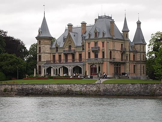
Lakeside villa on Thunersee

Villa along Thunersee
We stopped at several lake side villages along the Thunersee, and arrived at Spiez after an hour boat ride. A five-minute walk from the pier and you entered the schloss courtyard.
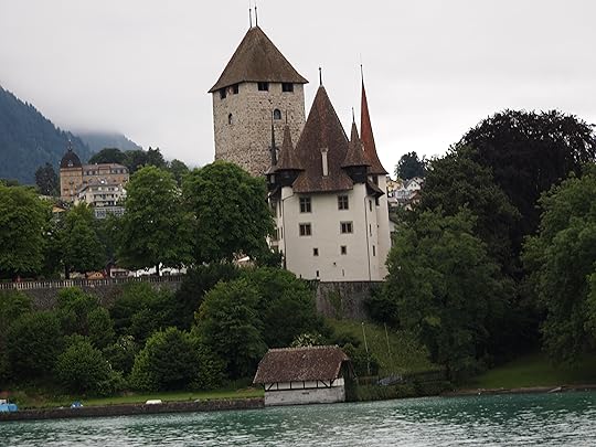
Schloss Spiez from the Thunersee
Schloss Spiez (Spiez Castle)
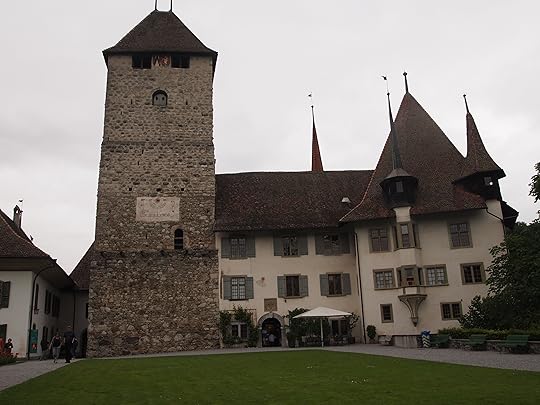
Schloss Spiez courtyard

Small openings and larger ‘window’s at the top of the tower offer views of Thunersee

Patriarch Adrian von Bubenberg
Inside Schloss Spiez
Schloss Spiez was a medieval fortress constructed in the 13th century which became a residence in the 17th & 18th century of the von Bubenberg and von Erlach noble families. Over time, they added living quarters, banquet room, kitchen, library, bedrooms, armory, and chapel for religious services.
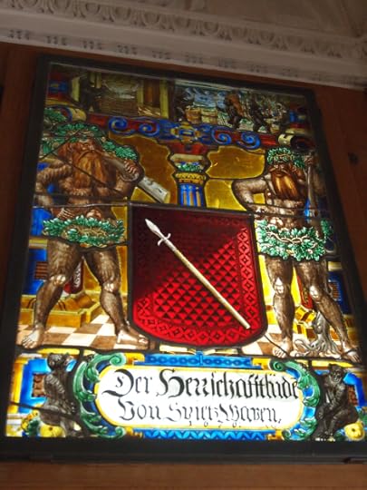
Schloss interiors were well designed with ceramic stoves, hand-crafted wooden furniture, family portraits, and stained-glass windows with medieval themes.
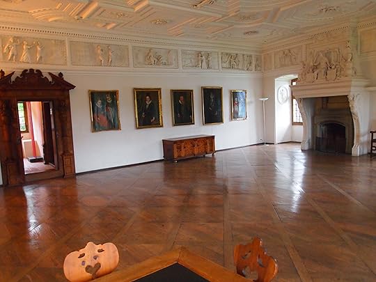
Banquet hall added in 1614, restored with polished wooden floors

Beautiful wooden doors in banquet hall
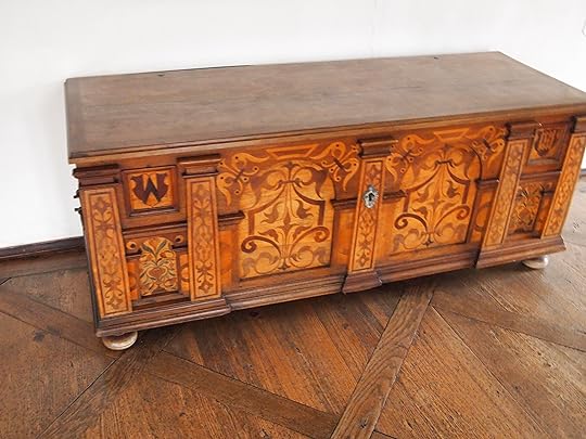
Hand-crafted wooden trunk in banquet hall

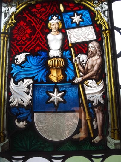
Medieval-themed stained glass windows in banquet hall
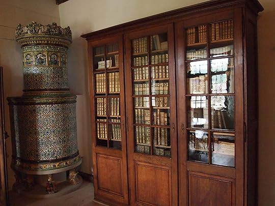
Family library; ceramic stove on left
Ceramic stoves
During medieval times in northern Europe, ceramic stoves provided heat in castles. Craftsmen designed them with colorful and attractive ceramics to camouflage their function. The stoves were built into walls, and, in adjoining rooms, openings at the back of the stoves allowed logs to be thrown on fires and smoke removed through a ‘tower’ at the top of the stove. Castle rooms were toasty warm and there was no smoke to deal with. Clever engineering and attractive designs.
Winters were long and brutally cold in medieval Europe. Stone castles were drafty and had no insulation. But rooms with ceramic stoves provided a measure of warmth and comfort for noble families. We saw many ceramic stoves in the Landesmuseum in Zurich. You know how cold and snowy Swiss winters are.
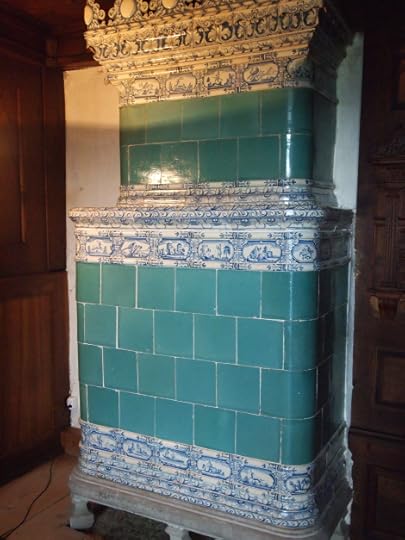
Ceramic stove
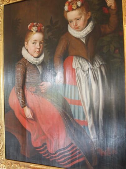
Family portraits
The banquet hall had a portrait gallery, presumably from the von Bubenberg and von Erlach families. They looked formal, stern and sour-faced; Swiss tend to be serious in manner and appearance. Their clothes appeared fashionable for the times and also layered for warmth. It’s Switzerland after all.

Portraits of noble family children
Schloss kitchen
The schloss kitchen had exhibits on the preparation and serving meals to noble families. One wall had a primitive but functional sink carved from stone. A small trough carved in stone drained water — and possible food wastes – out a window to spill to a garden below. Or maybe there was a chicken coop or pen for pigs under the kitchen spout.

Wild game provided fresh meat for noble families

Open fire cooking in the schloss kitchen
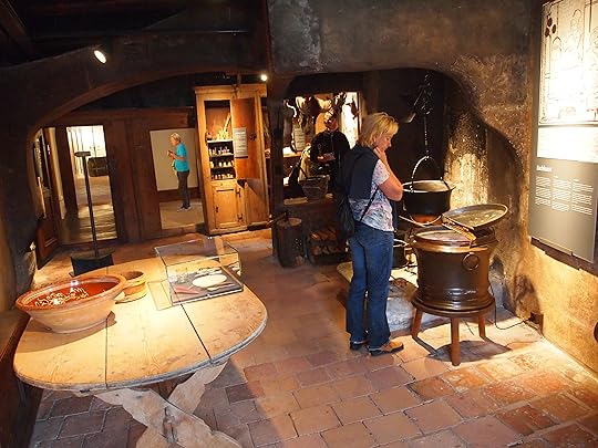
Schloss kitchen
Watch your step!
Six or seven levels of the tower could be reached by climbing stone steps and wooden staircases. At first glance, the reconstructed wooden stairs looked sturdy, but precarious. They were!
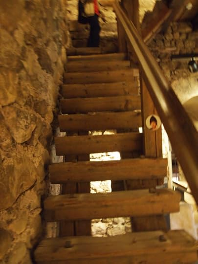
Hands on railing, steep and narrow stairs, not OSHA approved

Medieval castles had stone steps, wooden staircases, and even ropes to climb
Schloss Tower
At each level there were narrow openings in the tower to allow defenders to spot possible invaders sailing on Thunersee or approaching over land. But the openings were too small for arrows to penetrate or grappling hooks.

Narrow opening in tower
Schloss Tower Peak
We climbed several levels to the tower peak where there were wooden platforms to look over the Spiez landscape. The views were spectacular.
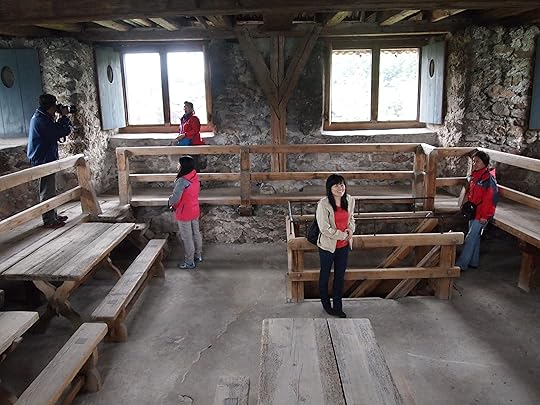
Top of schloss tower

Are we done climbing?
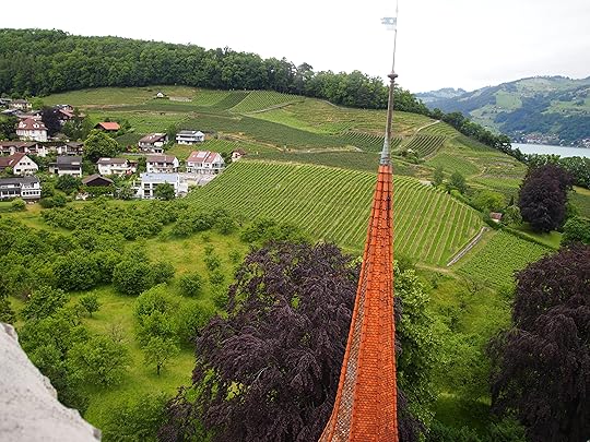
View from Schloss tower
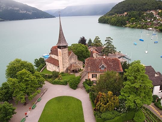
Schloss courtyard from the tower
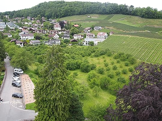
Spiez landscape
Spiez Castle Foundation
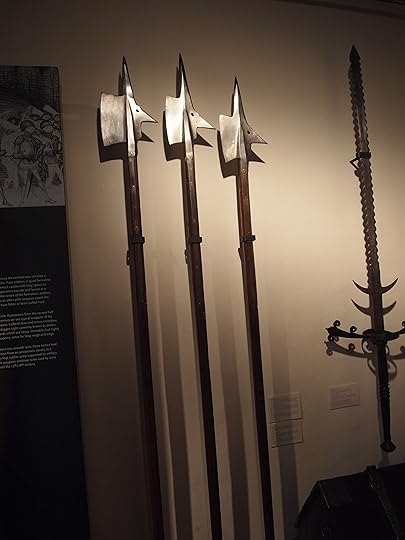
Schloss Spiez was privately owned in the early 20th century. In 1929, it was acquired by the Spiez Castle foundation which has managed restoration and included an armory with medieval weapons.
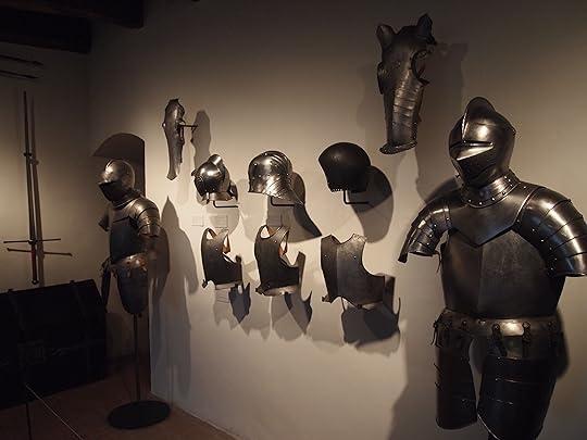
Schloss museum armory
* * * *
Next: Murten
Please share your comments, we love to hear from readers.
I recently published my first international thriller, Thirteen Days in Milan, which is available on Kindle as well as other ereaders, tablets, and smartphones.
I’m back in Europe for the summer to hire a translator and to research my next book which will also be a thriller based in Milan. I’ll be posting along the way from Milan, Stresa, Zurich and other locations.
I have a few posts on another blog, Anatomy of a Thriller, where I write about the process of researching and writing an international thriller. I’ll add more posts there as well.
Please share these links with writers or readers who might be interested.
http://www.jackerickson.com
Find my books in Apple’s iBookstore
At Barnes & Noble
At Amazon including # 1 Kindle best seller “Perfect Crime”
View my Smashwords profile:


