
Sea Monsters on Maps: Science & Whimsy
 By Chet Van Duzer (Guest Contributor)
+ Giveaway Below
Cartography and Fancy: Depicting Monsters
When we think about sea monsters on medieval and Renaissance maps, I think for many people an image comes to mind of fanciful sea monsters cavorting in the oceans. In researching my book Sea Monsters on Medieval and Renaissance Maps, I found that this perception is not very accurate. It turns out that the sea monsters on most medieval maps are less fanciful—at least in the eyes of the cartographers who painted them—than they seem to our eyes. Most of these monsters were taken from books such as medieval encyclopedias and bestiaries that the cartographers believed to be accurate scientific sources. But around the middle of the sixteenth century a fashion arose of purely fanciful sea monsters that were clearly invented by cartographers, rather than taken from scientific texts.
The Isolario & Creative Cartography
In 1572 Tomaso Porcacchi (ca. 1530-1585?) published an isolario, or island book, illustrated with maps. His L’Isole più famose del Mondo is the first isolario to include sea monsters on its maps. His monsters are remarkably varied and abundant, and so fantastic that in some cases it is difficult to describe them—many of them are certainly Porcacchi’s inventions. On Porcacchi’s map of Crete he has a curious sea monster with a bulbous, cactus-like body and a porcine nose; on his map of Cyprus there is a spectacular winged sea dragon with a hint of peacock; and on his map of the New World there is a sort of sea elephant with an impressive array of spikes jutting from its back (see the illustration). Porcacchi’s use of invented sea monsters rather than monsters derived from scientific books emphasizes their decorative aspect, and also suggests a desire to surprise and fascinate the viewers of his maps—and also perhaps increase the sales of his book. On the one hand, these invented sea monsters privilege the role of cartographer as artist and creator, but on the other, they represent an early step towards the disappearance of sea monsters from maps. The implicit recognition that the images of monsters were purely decorative, rather than conveying information about creatures believed to exist, made their decline inevitable in the course of the next two centuries as maps became more precise and practical. 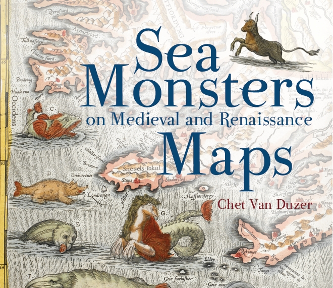 Chet Van Duzer has published extensively on medieval and Renaissance maps in journals such as Imago Mundi, Terrae Incognitae and Word & Image. He is also the author of Johann Schöner’s Globe of 1515: Transcription and Study, and Seeing the World Anew: The Radical Vision of Martin Waldseemüller’s 1507 & 1516 World Maps. His current book project will be published by the British Library. For more information on whimsical sea monsters of the sixteenth century, as well as of the cartographic sea monsters of earlier centuries, refer to Sea Monsters on Medieval and Renaissance Maps, which comes out in paperback in September of 2014.
Wonders & Marvels is excited to have three (3) copies of Sea Monsters on Medieval & Renaissance Maps to give away! To enter, simply sign up below for the giveaways of your choice by 11:59 pm EST on August 29. Your entry will also get you updates from our Monthly Features. (At this time, prizes can only be shipped within the US)
Subscribe to our Giveaways
* indicates required
Email Address *
First Name
August Book Giveaways
Beth Fowkes Tobin, “The Duchess’s Shells”
Miles Unger, “Michelangelo: A Life in Six Masterpieces”
Chet Van Duzer, “Sea Monsters on Medieval and Renaissance Maps”


