Photos from the sky in 1926
From my article on the survey of Southeast Alaska up at Alaska Dispatch News:
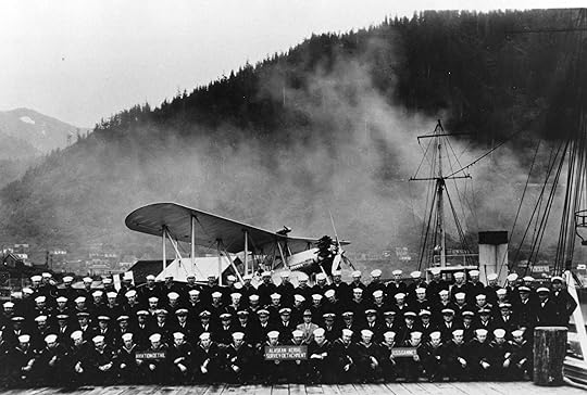
In 1926 Alaska's aviation industry had barely been born. Ben Eielson had flown and lost the first air mail contract in 1924. Russ Merrill and Roy Davis made the first flight over the Gulf of Alaska only one year before. And future famous pilots like Bob Reeve, Joe Crosson, Bob Ellis and Shel Simmons had yet to make their marks. But as reported in the 1929 publication "Aerial Photographic Surveys in Southeastern Alaska," using aircraft to survey the territory was a logical choice. Although topographic mapping of Alaska had been conducted by the Geological Survey for nearly 30 years, progress remained slow-going and extremely hazardous with some regions still stubbornly inaccessible. Photographing by aircraft presented endless possibilities; it just needed to be tested.
It's just amazing when you think of what they accomplished with such crude equipment and poor weather reporting information. I'm always so surprised when I come across stories like this--so much history just waiting to be discovered.
[Post pic courtesy US Forestry Service]